San Francisco Bay Region 3D Image Tours

A collection of anaglyphic images (3D)

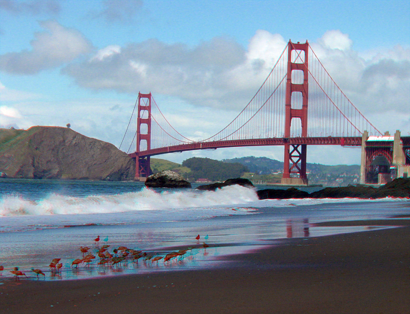
This website contains a collection of 3D "anaglyphic" images. You will need red-and-cyan 3D viewing glasses to get the 3D stereographic effects of the images.

This 3D view is of the Golden Gate Bridge with shore birds and a wave crashing on Baker Beach. Click on the image to get an enlarged view of the same image (this applies to all thumbnail images within this website).


Click on any dot on the map below to see selected 3D images of landscape features.
.
San Francisco Bay region, shaded-relief anaglyph, Ben Sleeter (USGS)
This map is a anaglyphic (3D) image generated from USGS digital elevation data (DEM) for the greater San Francisco Bay region (Ben Sleeter, USGS)


Websites showing images from San Francisco Bay regional parks and geologic areas are also accessible from the links below. Images range in size from 400KB to 999KB.

Anderson Park
Aņo Nuevo State Park
Anzar Road
Arroyo Seco Canyon
Bald Mountain (Sierra Azul Open Space Preserve)
Bean Hollow State Beach
Big Basin Redwoods State Park
Buena Vista Park
Calero Park
Castle Rock State Park
Chesbro Reservoir Park
Chitactac-Adams Park
Corona Heights
Coyote Creek Parkway
Coyote Hills Park
Coyote Lake Park
Crystal Springs Reservoir
Davenport Beach
Elkhorn Slough Preserve
Fremont Peak State Park
Gazos Creek State Beach
Greyhound Rock
Golden Gate National Cemetery
Golden Gate National Recreation Area
Golden Gate Park
Joseph D. Grant Park
Half Moon Bay
Henry Coe State Park
Henry Cowell State Park
Highland Way (landslide)
Hollister (Calaveras Fault)
Junipero Serra Monument
Lands End (Golden Gate Park)
Lexington Reservoir Park
Limekiln Trail (Sierra Azul Open Space Preserve)
Long Ridge Open Space Preserve
LomaPrieta (Sierra Azul Open Space Preserve)
Los Gatos Creek
Mission Peak
Montara State Beach
Monte Bello Open Space Preserve
Mt. Diablo State Park
Mt. Hamilton/Lick Observatory
Mt. Tamalpais State Park
Muir Woods National Monument
Mussel Rock Park
Napa Valley
New Brighton State Beach
Old La Honda Road
Panoche Hills (BLM)
Pebble Beach
Pescadero State Beach
Point Reyes National Seashore
Pinnacles National Park
San Andreas Lake
San Felipe Valley
San Juan Baptista
San Luis Reservoir
San Pablo Bay
Sanborn Park
Santa Cruz (West Cliff Drive)
Scotts Creek Beach
Silver Creek
Stanford Linear Accelerator
Sonoma volcanic field
Stevens Creek Canyon
Twin Peaks
UCSC Lime Kilns
Uvas Canyon Park
Uvas Reservoir
Waddell Creek (Big Basin State Park)
Wilder Ranch State Park


Click here for a large 3D map (anaglyph) of the San Francisco Bay Arroyo Seco Canyon Pinnacles National Park Panoche Hills San Luis Reservoir Calaveras Fault in Hollister San Juan Baptista Elkhorn Slough Preserve Anzar Road Coyote Lake Henry Coe State Park Anderson Park Fremont Peak State Park Coyote Creek Parkway Mt. Hamilton/Lick Observatory Joseph D. Grant Park San Felipe Valley Silver Creek Mission Peak Highland Way landslide Chitactac-Adams Park Uvas Canyon Park Chesbro Reservoir Calero Reservoir Loma Prieta Highland Way Bald Mountain Lexington Reservoir Davenport Uvas Reservoir Wilder Ranch State Park New Brighton State Beach Henry Cowell State Park UCSC lime kilns Stanford Linear Accelerator VC Coyote Hills Mussel Rock Park Mt. Diablo State Park Corona Heights Buena Vista Park Lands End Golden Gate Park Golden Gate National Recreation Area Mt. Tamalpais State Park Muir Woods National Monument Point Reyes National Seashore San Pablo Bay Sonoma volcanic field Napa Valley Greyhound Rock Waddell Creek Ano Nuevo State Park Gazos Creek Pigeon Point Bean Hollow State Beach Pebble Beach Pescadero State Beach Big Basin Redwoods State Park Castle Rock State Park Sanborn County Park Stevens Creek Canyon Russian Ridge Monte Bello Open Space Preserve Old La Honda Road Junipero Serra Monument Crystal Springs Reservoir San Andreas Lake Half Moon Bay Montara State Beach Golden Gate National Cemetary Scotts Creek /Monterey Bay region.

For more information about geologic time and ages mentioned within this website,
see a: Geologic Time Scale.

Click here for more information about this website and about anaglyphic photography.

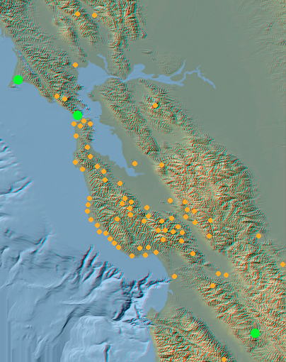
Chick here to learn more about San Francisco Bay Area geology.

Chick here to see 3D Geology of National Parks.

This page is <https://gotbooks.miracosta.edu/gonp/3Dbayarea/>
Last modified 11/24/2003