SantaCruz1.jpg
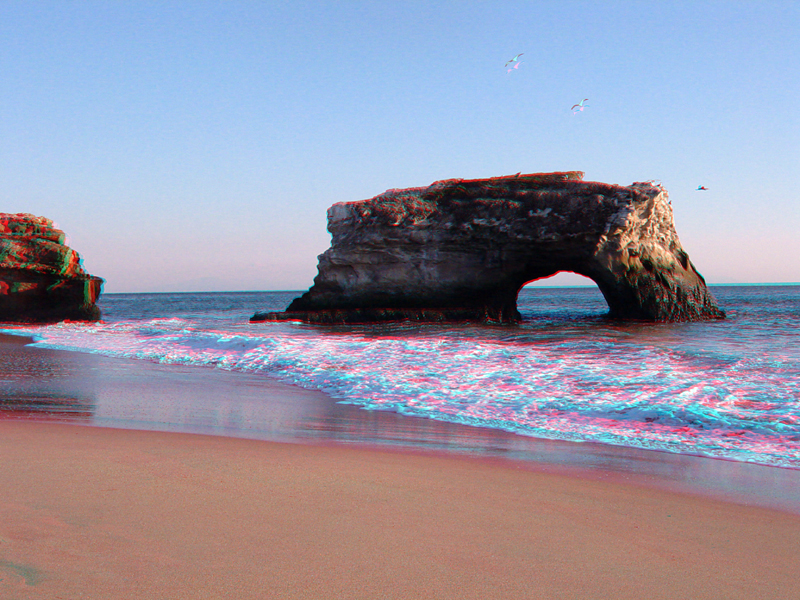
Natural Bridges State Park is located at the west end of West Cliff Drive in Santa Cruz. The park only has one natural bridge. Two of the three original natural bridges vanished due to coastal erosion. This sea stack was attached to the shore via the two other arches when the park was established.
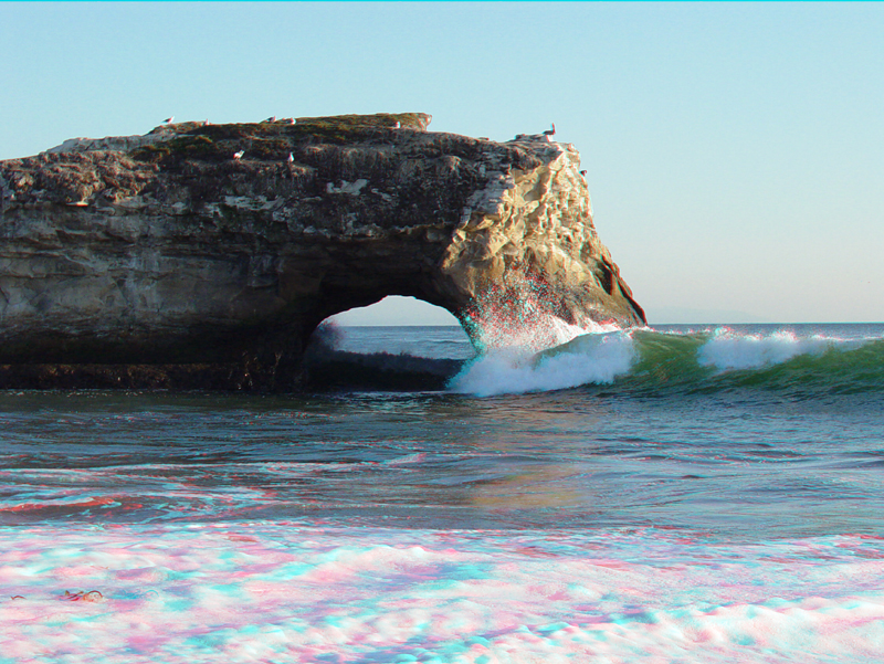
A wave crests next to the last remaining natural bridge.
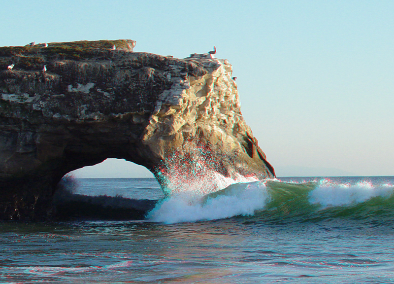
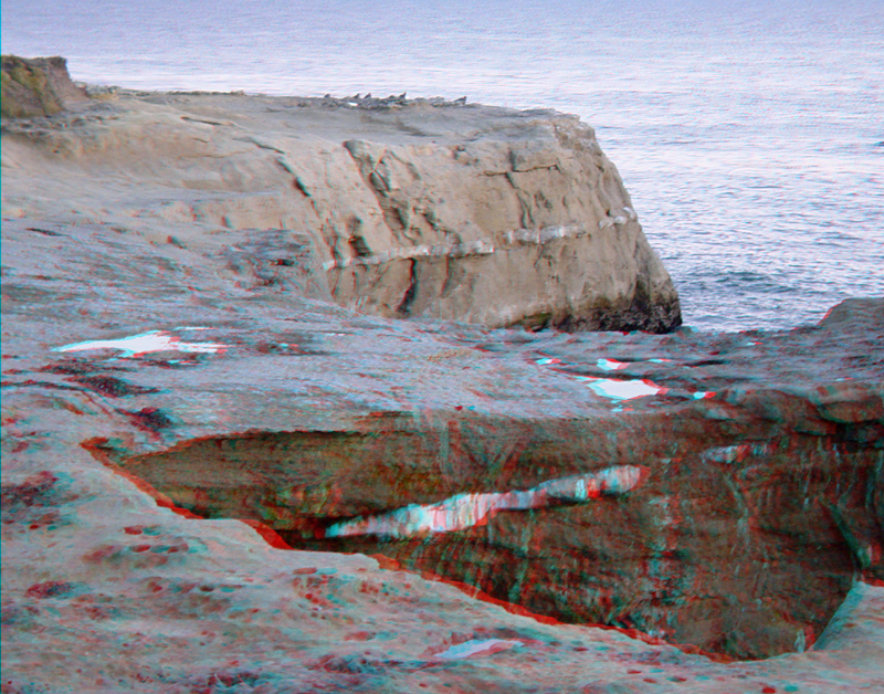
This is a more detailed portion of the previous image. The sea cliffs and sea stack at Natural Bridges State Park consist of Santa Cruz Mudstone, a late Miocene siliceous mudstone deposited in an outer shelf or upper slope environment. The Santa Cruz Mudstone has a high silica content derived from plankton (diatoms) with siliceous skeletons. As a result, the rock tends to be brittle and responds by a higher density of fracturing. The Santa Cruz Mudstone is about 7-9 million years.
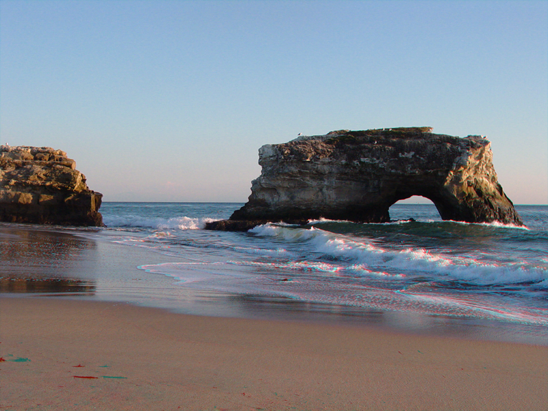
The last remaining natural bridge and sea stack at Natural Bridges State Park.
SantaCruz5.jpg
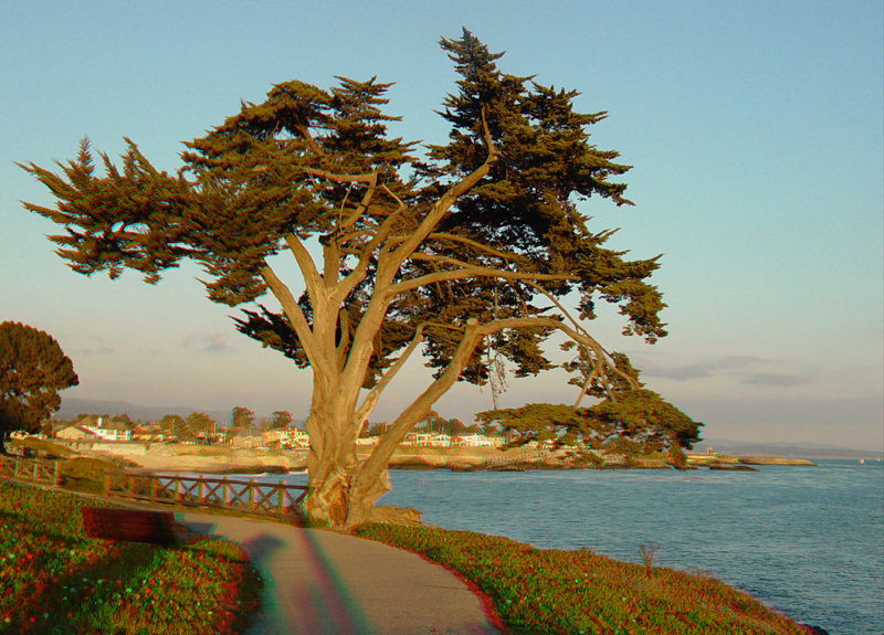
This Monterey cypress is growing along the sea cliff path along West Cliff Drive, lit by the setting sun.
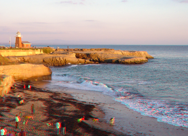
The Mark Abbott Lighthouse stands on the headlands at Santa Cruz Point (on the west side of Santa Cruz Harbor). The lighthouse was rebuilt as a memorial to Mark Abbott, a surfer who drowned nearby in 1965.The beach in the foreground is a popular dog run area.
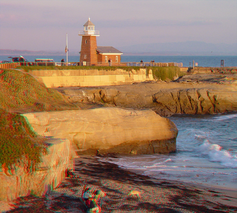
The Santa Cruz lighthouse.
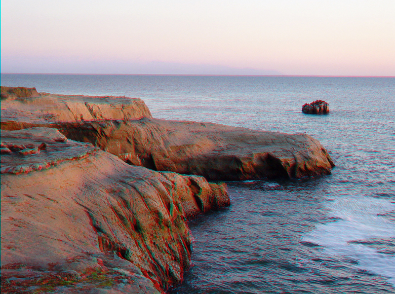
A sea stack offshore from the lighthouse is typically crowed with seals and other marine life.
The sea cliffs along the shore by the lighthouse are part of the Purisima Formation, a late Miocene to Pliocene marine mudstone that unconformably overlies the Santa Cruz Mudstone, an older Miocene marine formation. White discontinuous layers in this image are limestone concretionary beds part of the upper Santa Cruz Mudstone. It is currently thought that the carbonate precipitated when methane venting from the ancient (late Miocene) sea floor came into contact with sea water, changing water solubility.
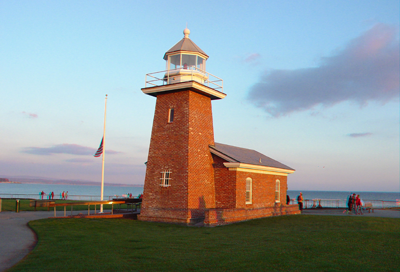
The first lighthouse on Point Santa Cruz was erected in 1869. It first displayed light from its fifth order lens on December 31. In 1878, the lighthouse was threatened by the gradual erosion of caves underneath Lighthouse Point and was moved about 300 feet inland. Today, most of the original lighthouse site is gone. Erosion made part of the original foundation and cistern visible in the 1990s. A fourth order lens was installed in the lighthouse in 1909, but was replaced by a minor light further seaward in 1941. Only seven years later, the lighthouse was torn down, and the new working brick lighthouse was built.
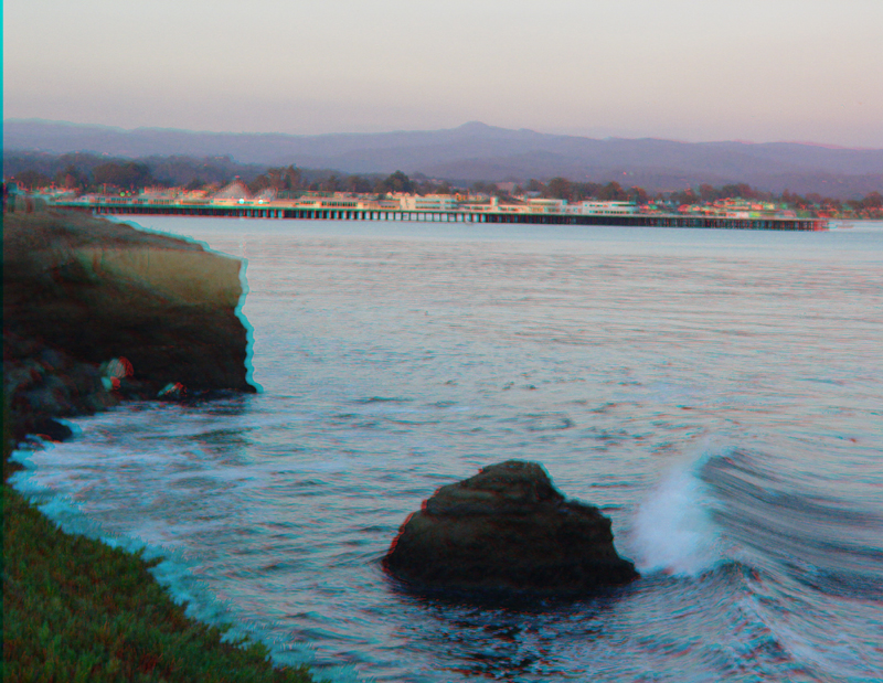
"Steamers Lane" is a very popular surfing area along the south site of Santa Cruz Point. Looking east from the lighthouse, on can see the Santa Cruz Wharf and downtown area, framed by the southern Santa Cruz Mountains in the distance.
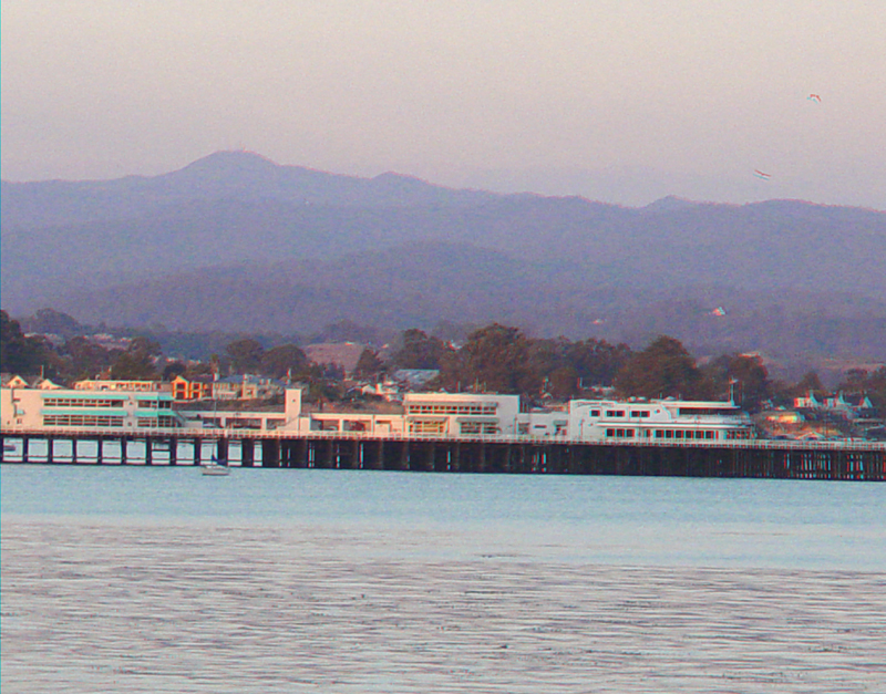
Loma Prieta Peak is the highest peak in the Santa Cruz Mountain. The epicenter of the 1989 Loma Prieta Earthquake (M6.9) was located in the foothills between Loma Prieta Peak and Santa Cruz (city) within the Forest of Nisene Marks.
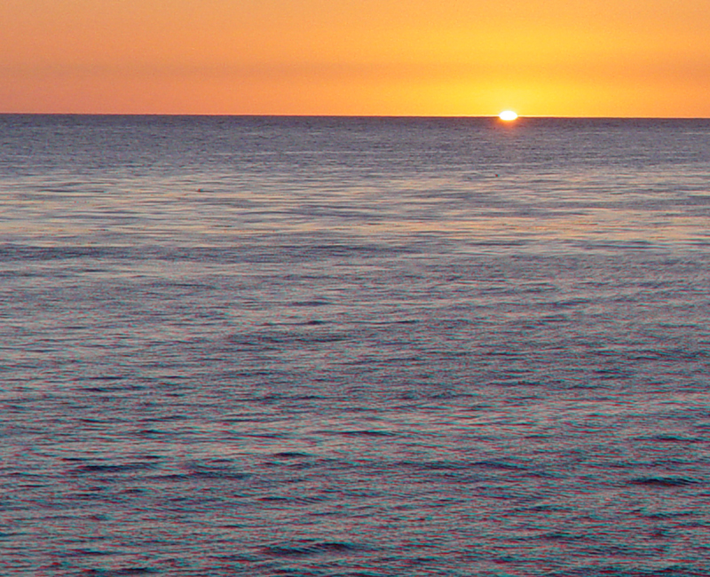
Sunset on November 1, 2003 in Santa Cruz.