
Field Trip Destinations in San Diego County |
Map of Selected Field Trip Destinations in the greater San Diego RegionThe map below shows selected destinations for class field trips or day trips to see geologic features, landscapes, and local ecology.Click on the map for a larger view. Additional site descriptions will be added as they become available. |
Coast DestinationsField trip destinations along the San Diego Coastline are described below starting in the south. |
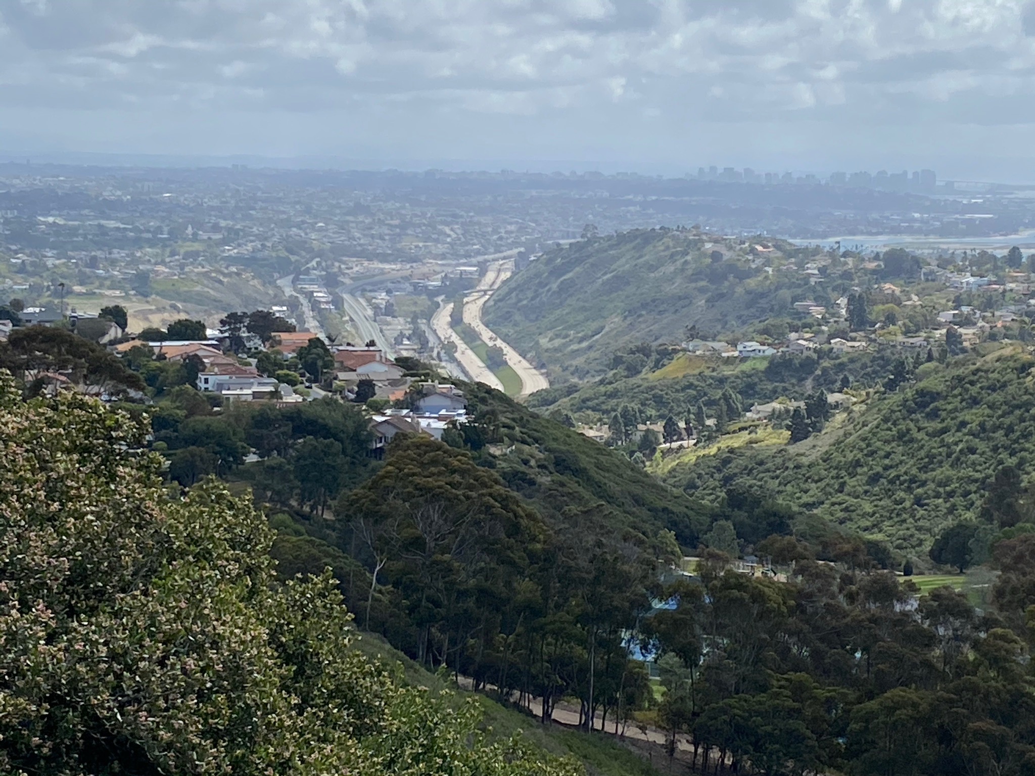
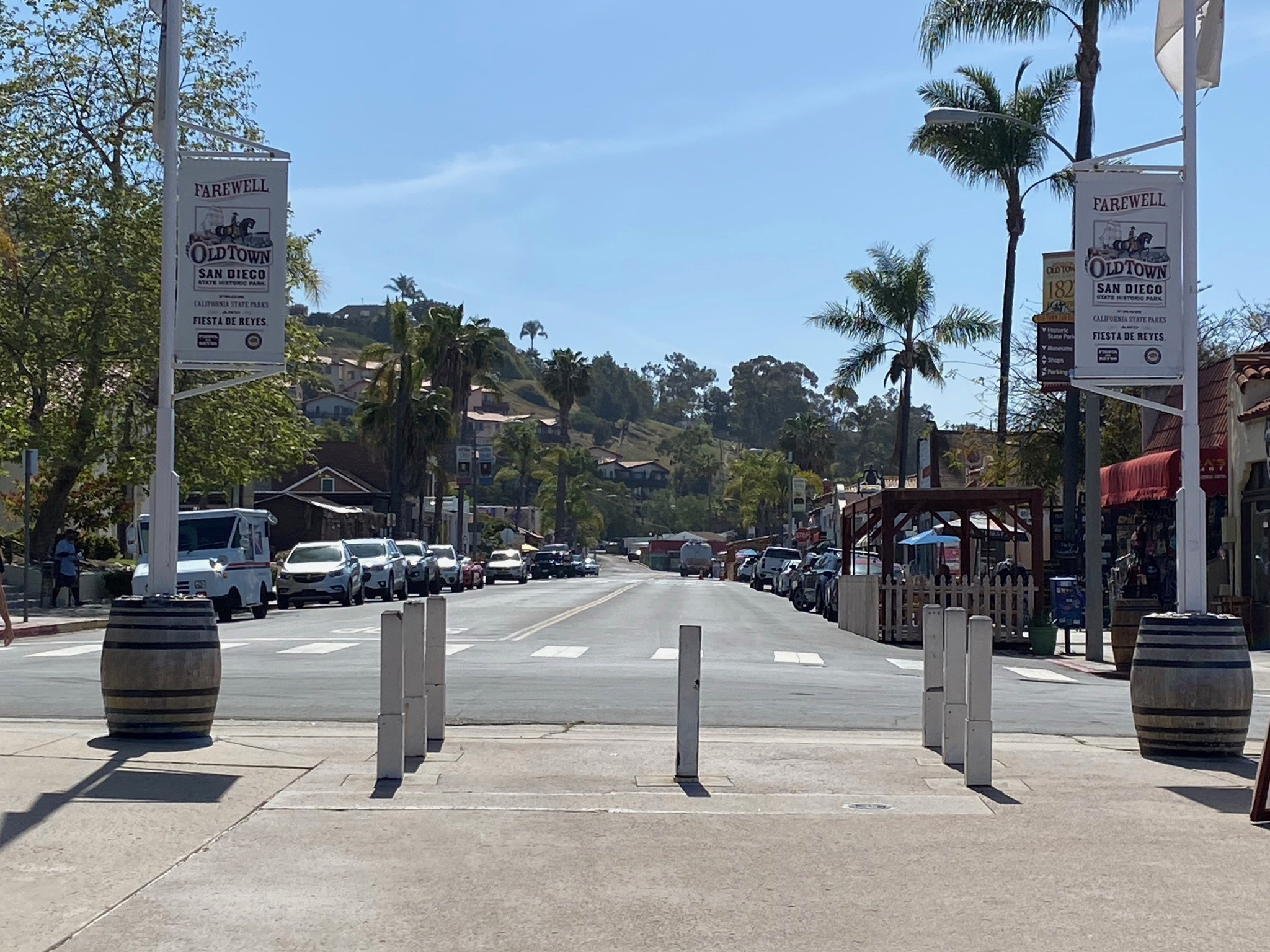
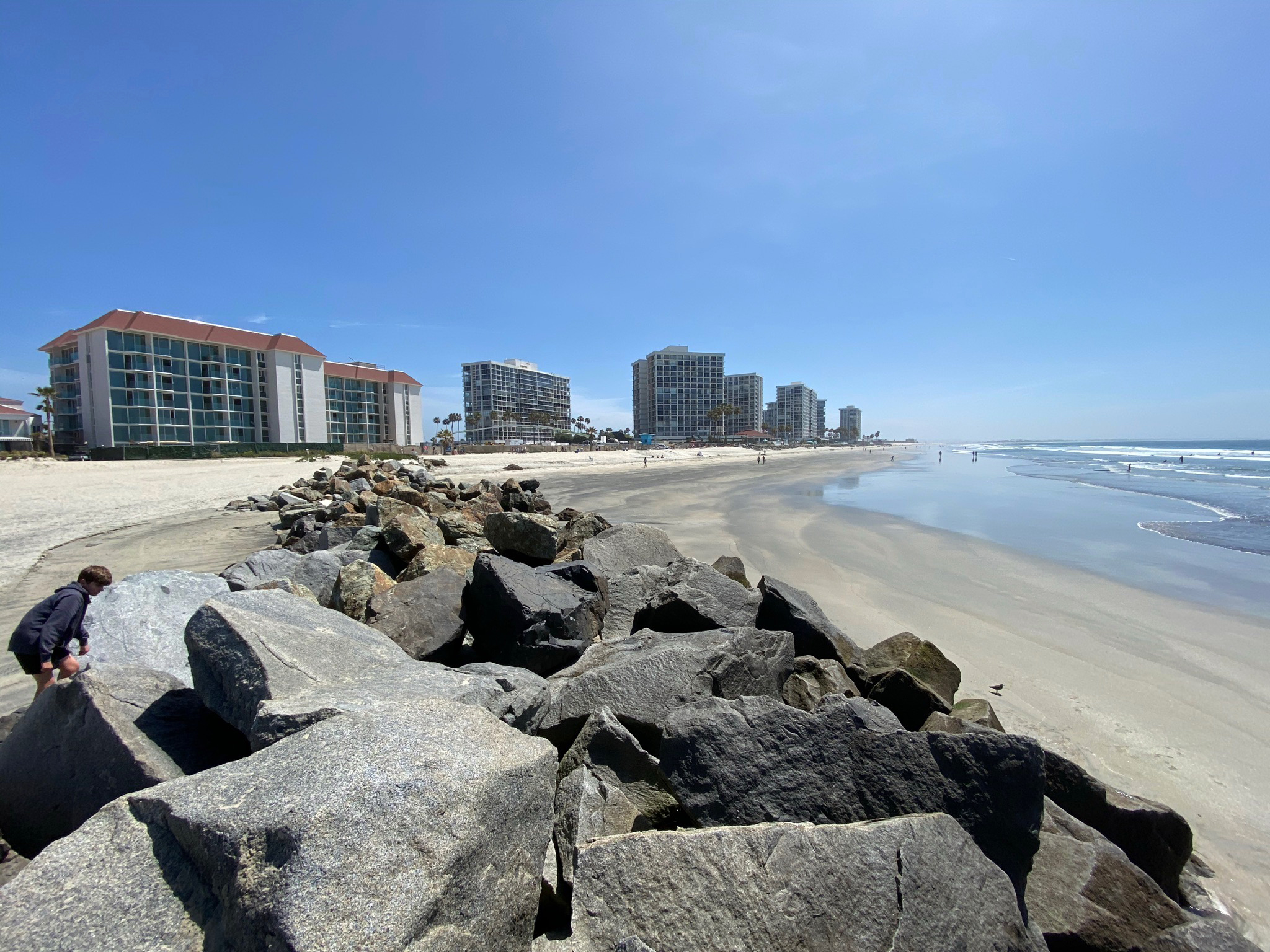
Field Guide To the Rose Canyon Fault Zone In San DiegoA Guide To Selected Locations and Features Along the Rose Canyon Fault Zone In The San Diego Area, CAEarthquake geologists and engineers have determined that Rose Canyon Fault has the potential to produce a major earthquake in the San Diego area. No one can predict when it might occur, but everyone should be take earthquake preparedness seriously. The Rose Canyon Fault Zone comes onshore in La Jolla Bay and follows Rose Canyon south into the Old Town area before crossing through Downtown San Diego, under San Diego Bay, and across Coronado Island and the Silver Strand. This guide shows maps and photography of the scenic landscape features associated with the fault zone including the sea cliffs and sea caves in La Jolla, views from Mount Soledad, Tecolote Community Park, the Old Town Area, Coronado Island locations, and more. (Also see Field Guide to the Elsinore Fault Zone.) |
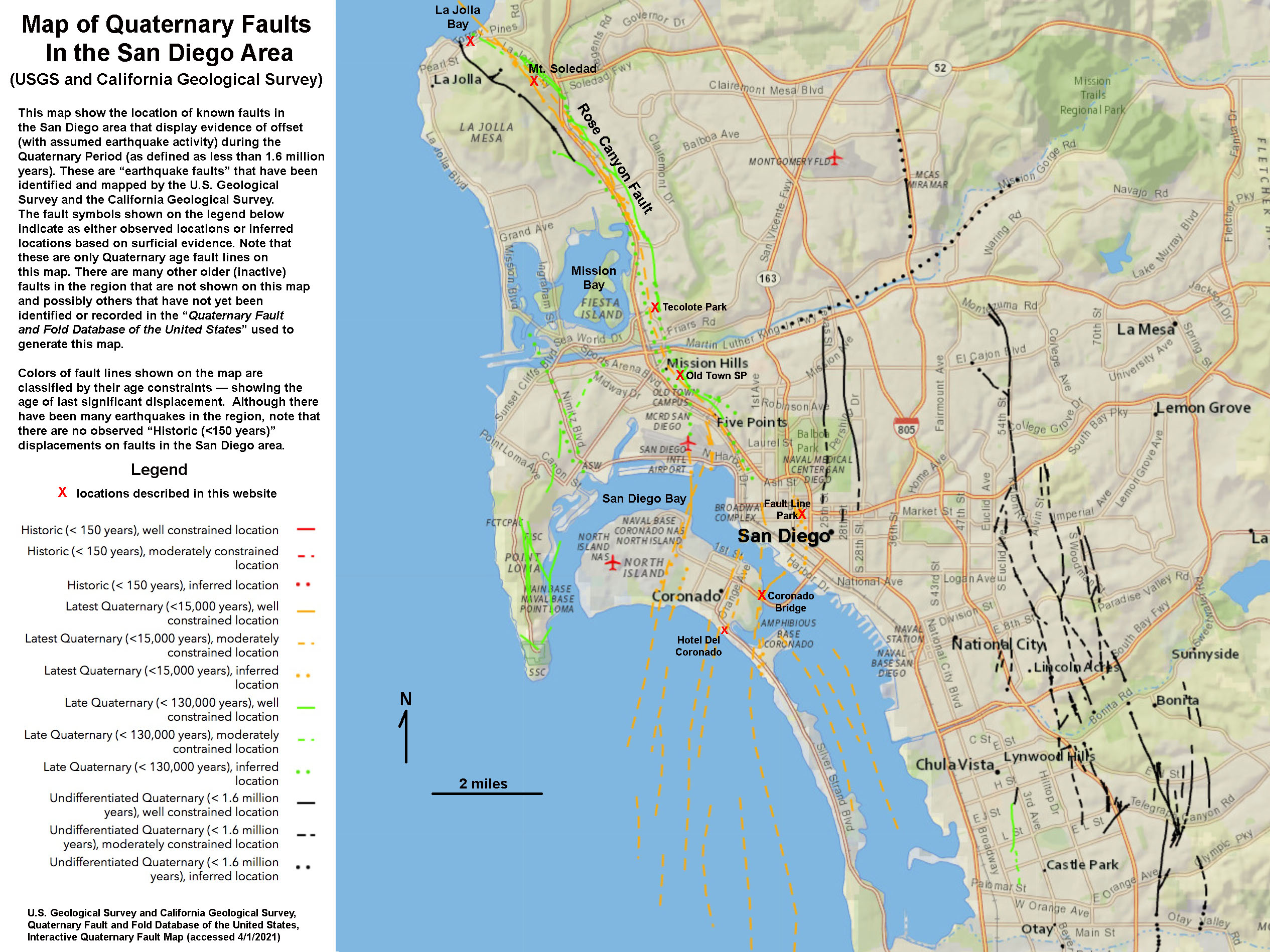 Map showing location to observe the Rose Canyon Fault Zone in the San Diego area. |
|

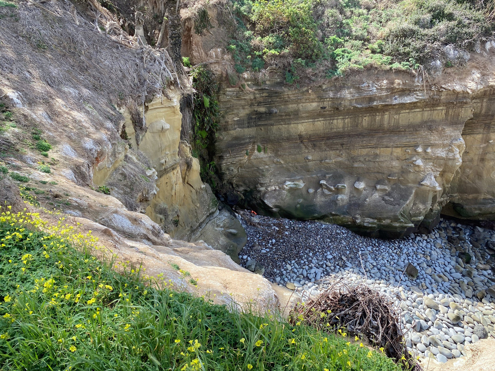


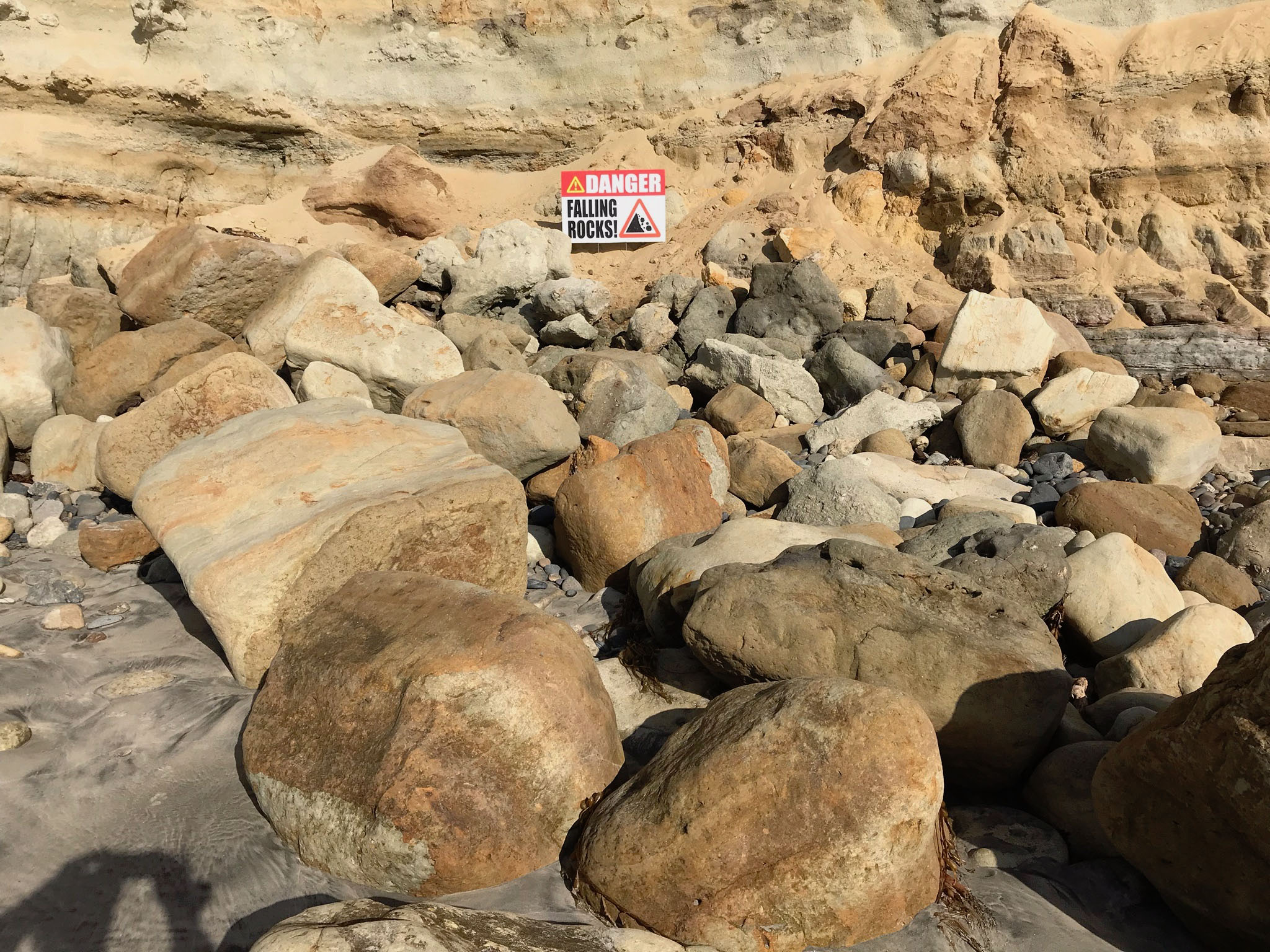
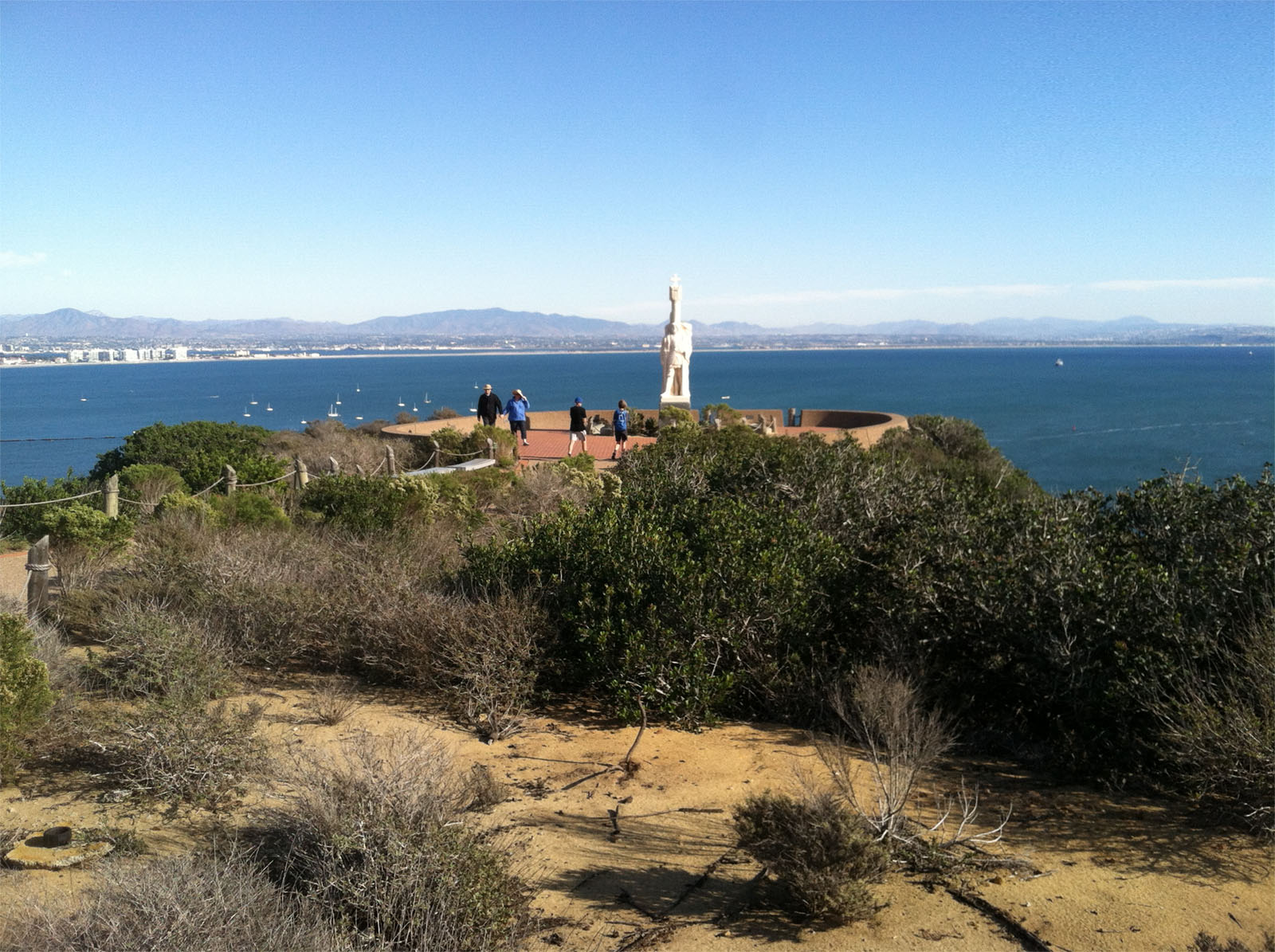
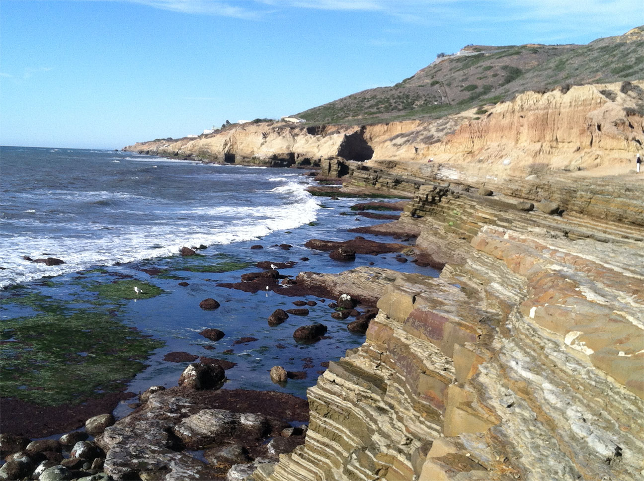
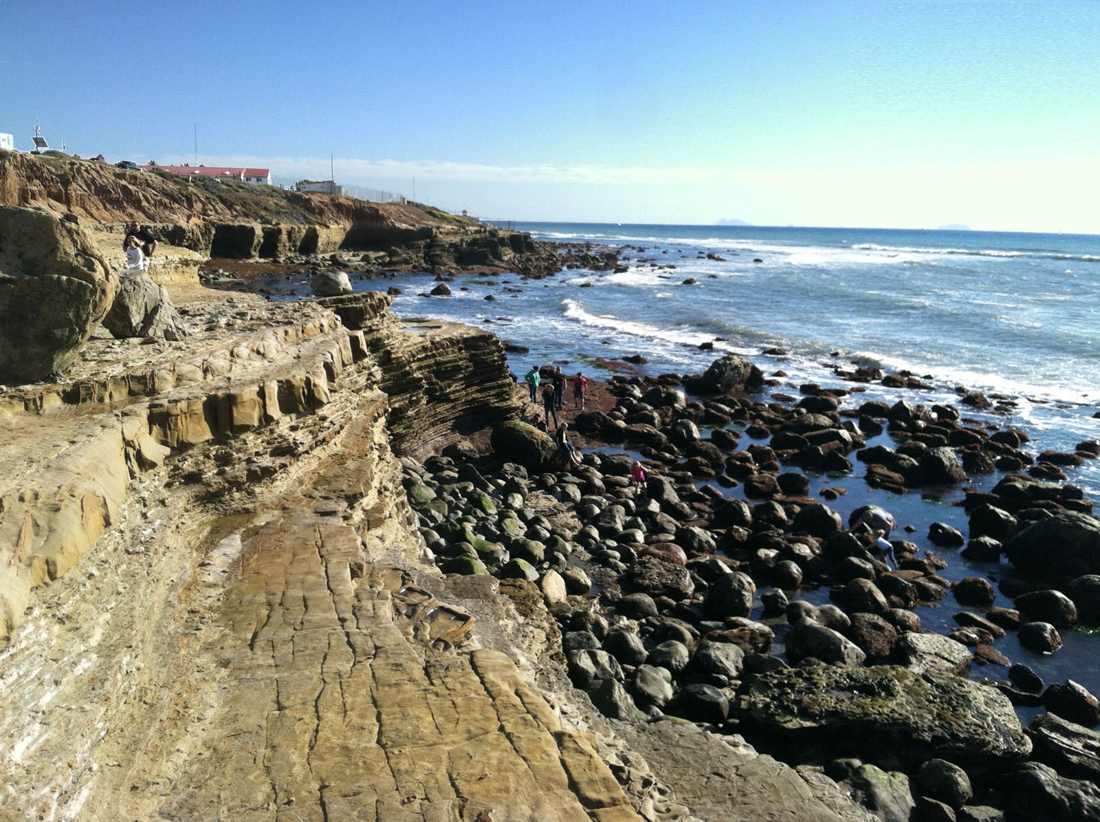
Cabrillo National MonumentCabrillo National Monument occupies the south end of the Point Loma Peninsula and provides a scenic view of San Diego Bay and downtown San Diego. The park has a visitor center and several trails. A popular destination is the Tide Pools area, not only for the exceptional marine life viewing, but also the spectacular geologic setting. Tilted rock layers of the Cretaceous-age Point Loma Formation are exposed in the lower sea cliffs near the tide pools area. These rocks from sediments deposited on deep-sea fans (originally thousands of feet below sea level). Tectonic forces pushed them up. These titled layers are unconformably overlain by younger Miocene age sedimentary deposit that locally contain large boulders of many kinds rocks (ancient river deposits).It is highly recommend to check the Cabrillo National Monument website before planning a trip to the park. A National Park Service brochure recommends not going here on weekends or holidays due to road closure and parking limitations. You might want to call in advance to see what conditions are like at the tide pool area. Life in the Rocky Intertidal Zone This brochure identifies many of the local benthic life forms found in the tide pools. |
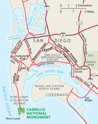 Map of Point Loma showing Cabrillo National Monument |
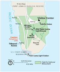 Park road and trail map of Cabrillo National Monument |
| To see a comprehensive guide to the geology of Point Loma and Cabrillo National Monument, check out: KellyLynn, K, 2018, Cabrillo National Monument, Geologic Resources Inventory Report: National Park Service, Natural Resources Report NPS/NRSS/GRD/NRR—2018/1666, 86 p. https://irma.nps.gov/DataStore/DownloadFile/607192 (large .pdf file). |
|

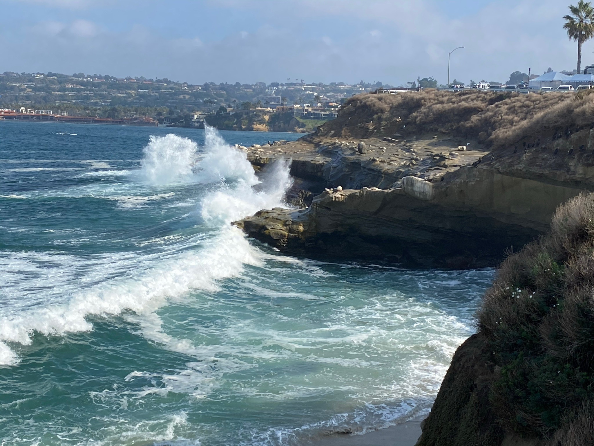
Point La Jolla and La Jolla BayThe urban area of La Jolla is at the north end of the La Jolla Peninsula. The seacliffs and small sandy bays along the La Jolla Coast are a scenic destination for tourists. La Jolla Cove, located just east of Point La Jolla, is host to a growing seal and sea lion population. La Jolla Cove is perhaps most famous for its sea caves. The caves are accessible by kayak, snorkeling, or wet hiking during low tide. It is important to check weather and tide conditions before attempting a visit. The La Jolla area is discussed in the Rose Canyon Fault section listed above. |
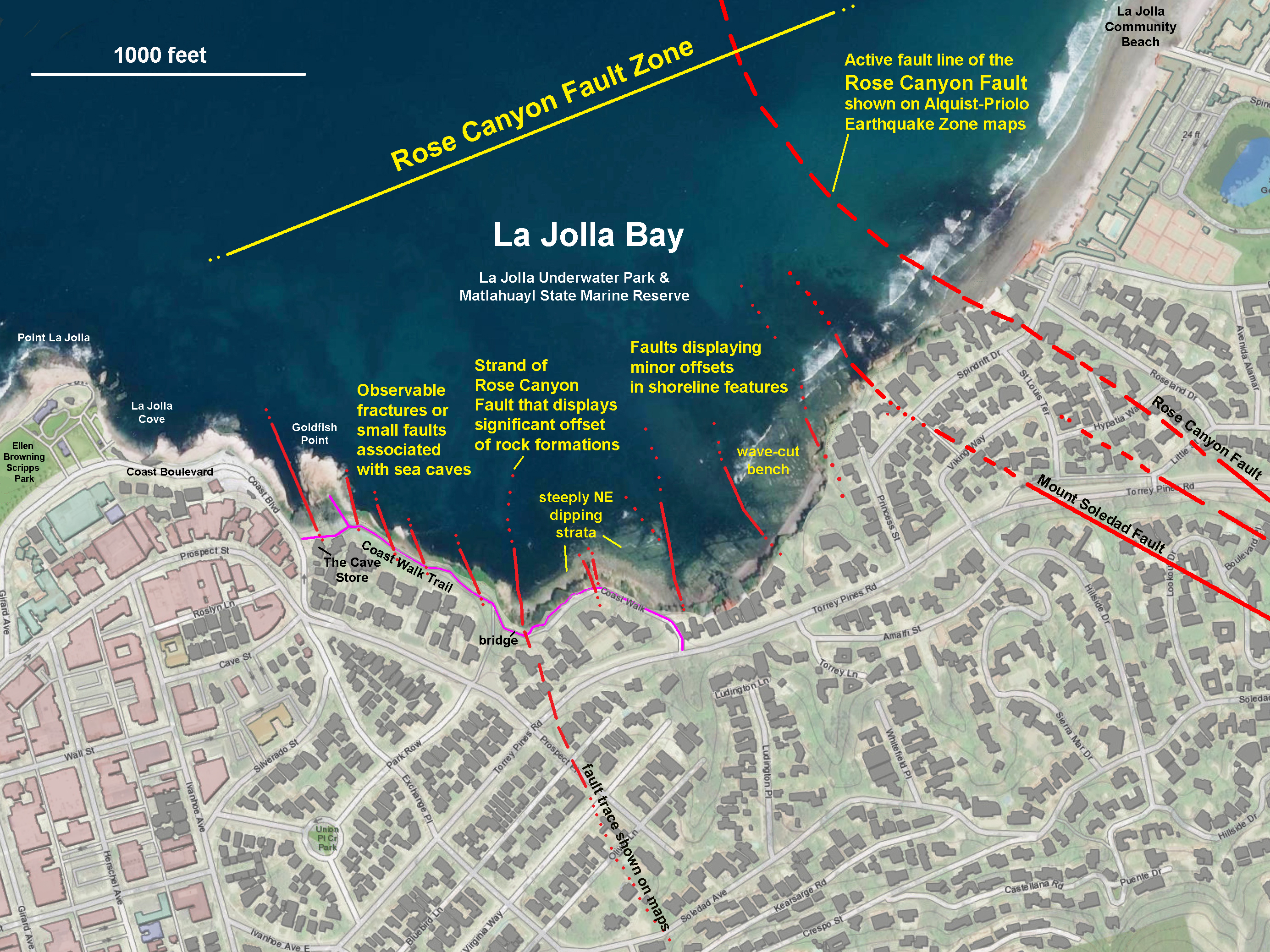 Map of La Jolla showing the locations of La Jolla Bay with geologic information included about faults and sea cliffs. |
 View looking south at La Jolla Bay as seen from the outdoor patio area at the Birch Aquarium. Marine terraces give a step-like appearance between the coast and the high point at Mt. Soledad in the La Jolla upland. |
Birch Aquarium - Scripps Institute of OceanographyThe Birch Aquarium and Museum is affiliated with the Scripps Institute and the University of California at San Diego in LaJolla. The aquarium houses a 70,000-gallon tank of sea life and interactive aquatic displays. The aquarium has dozens of aquariums representing sea life from around the world and locally. The aquarium staff are constantly revising special exhibits relating to the effect of human activity and climate change on the world's oceans. There is a large man-made tide pool full of "touchable" specimens on an outdoor patio. Note that the aquarium is very popular for school groups during daytime hours. Visit the Birch Aquarium website. Birch Aquarium may be offering discounts to college students for admission. You may want to search their website. |
 |
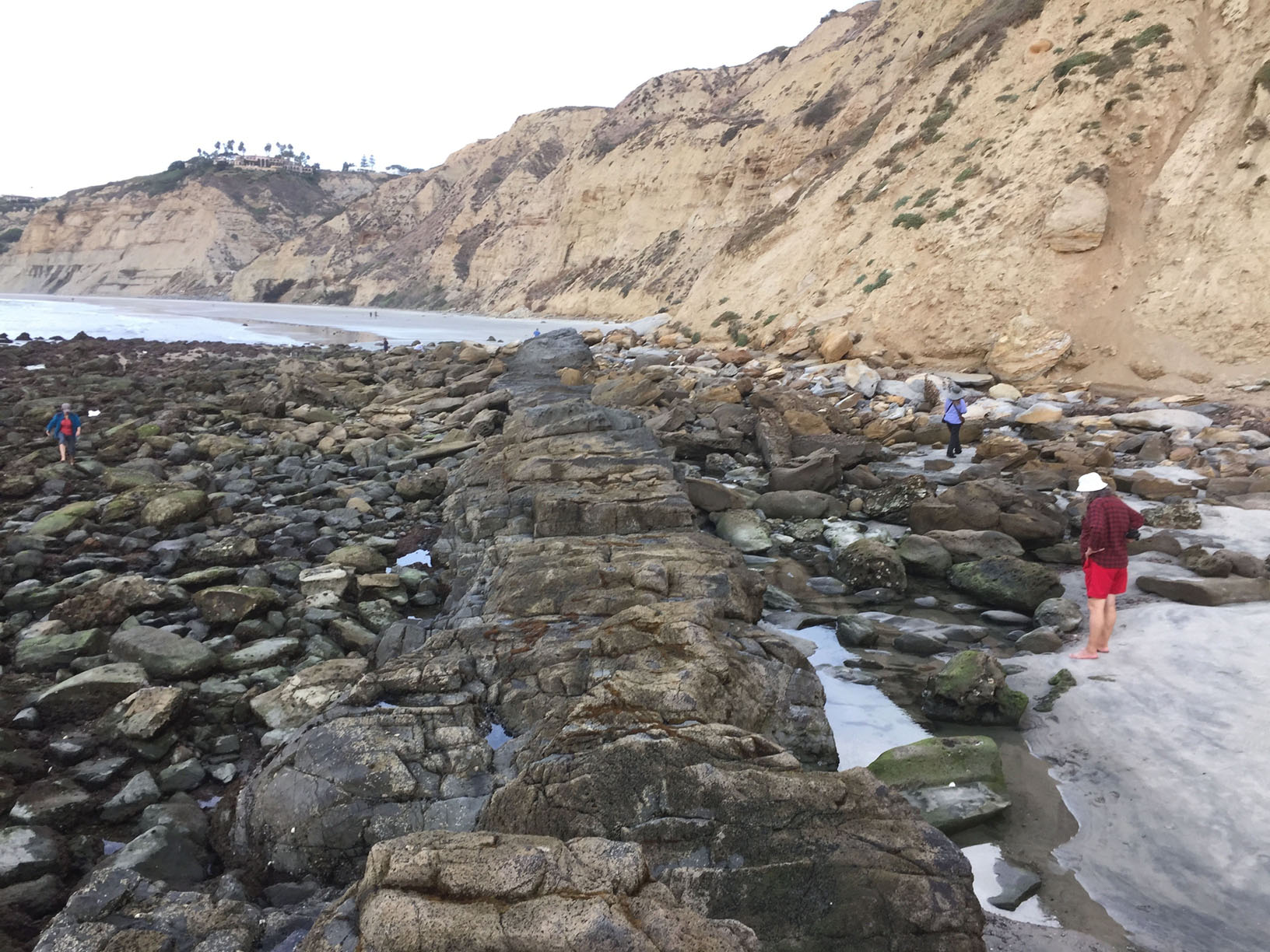
Dike Rock Volcanic Area and Tide PoolsDike Rock is a tide pool area located along Scripps Dike, a volcanic feature composed of a black, basaltic-andesite. The igneous dike formed about 13 million years ago when magma rose toward the surface along a fracture zone, cutting through in older Eocene-age sedimentary rocks. The dike, and associated tide pool area, is located about a half mile (600 meters) north of the Scripps Institution of Oceanography Pier. The massive sea cliffs between the pier and Dike Rock display very interesting sedimentary features in beds of sandstone and conglomerate of that grow increasingly coarser-grained to the south. |
 Dike Rock is a tide pool area between Blacks Beach and Scripps Beach. |
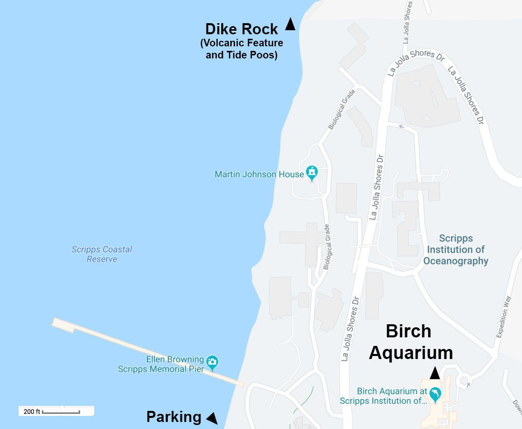 Map showing location of Dike Rock |
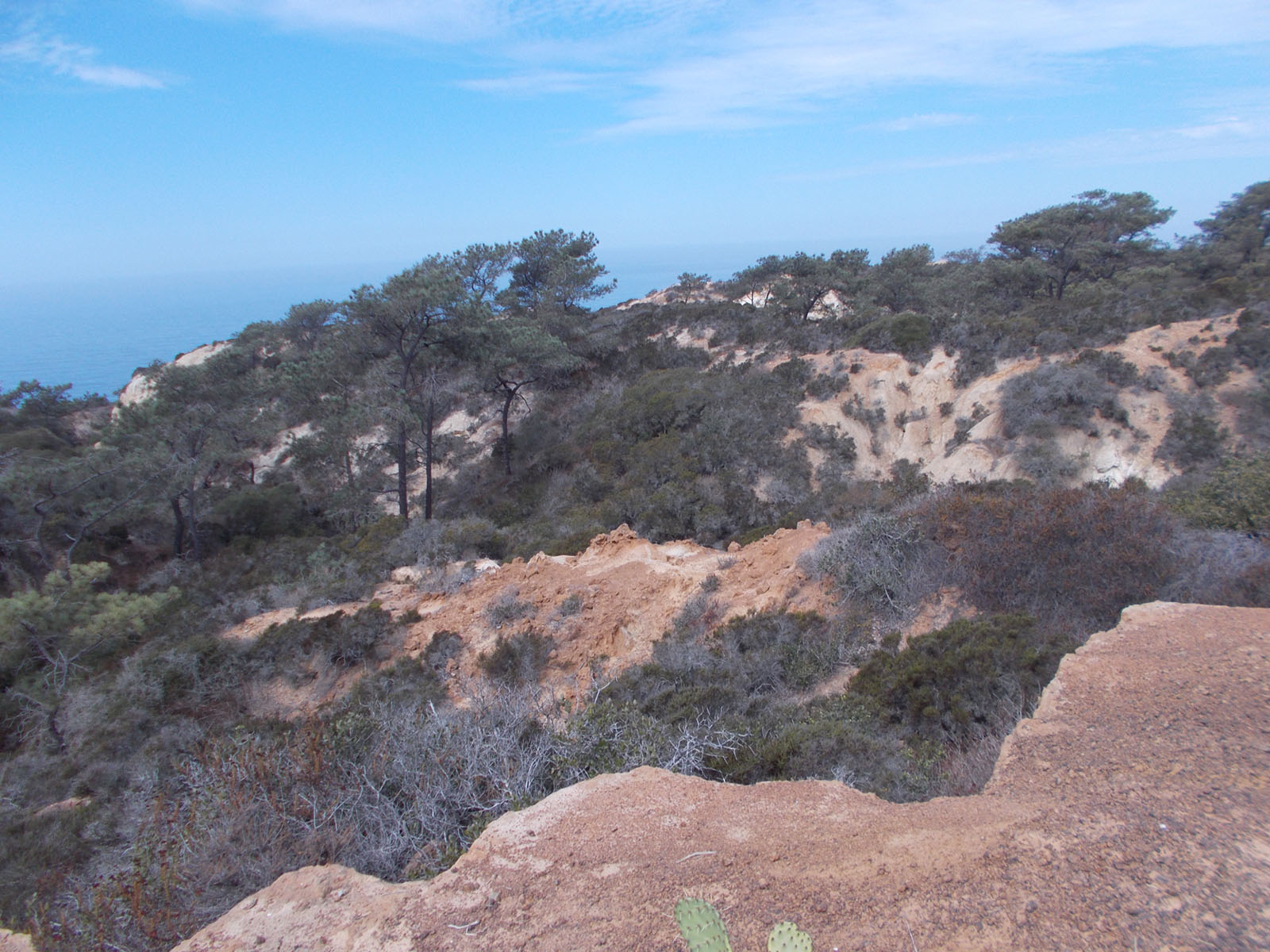
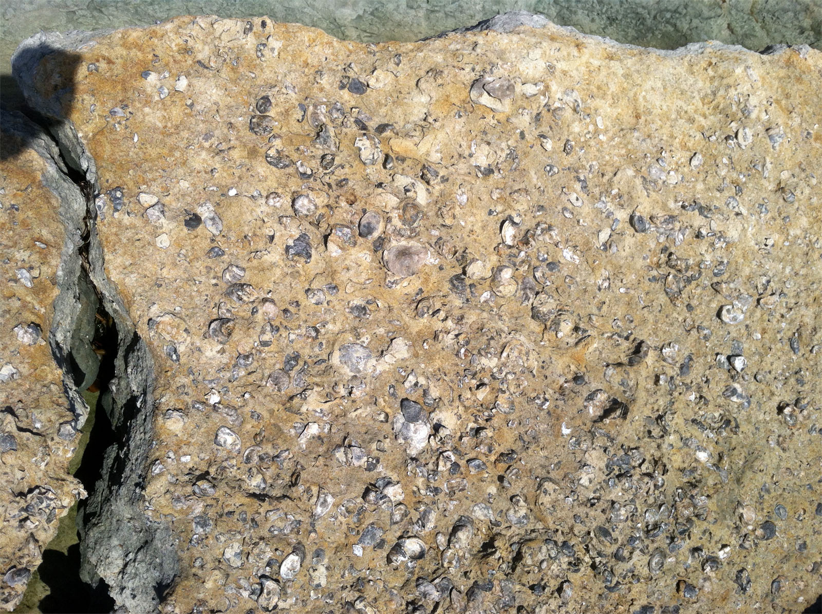
Torrey Pines State Nature ReserveCheck out: Geology Field Guide to the Torrey Pines Park AreaTorrey Pines is a wonderful place to spend a day hiking and checking out the sea cliffs and beaches. This 2,000 acre park is dedicated to preserving the rare Torrey Pine and coastal shrub habitat. The sea cliffs are a nesting area for peregrine falcons. Parking is free along the beach, but is usually packed early. Fee parking is available at the State Park lots. Torrey Pines is also famous for its well-exposed geology. The 372 foot elevation of the ridgeline is on the west side of the Rose Canyon Fault system (a regionally active earthquake fault) that runs offshore beneath the baymouth bar at the mouth of Los Peñasquitos Lagoon (north end of the preserve). Small faults can be seen in the road cut along N. Torrey Pines Road. Four rock formations are exposed in the sea cliffs and hill tops in the Torrey Pines area (oldest to youngest, respectively). The Del Mar Formation of Eocene age (about 45 to 49 million years old). The Delmar Formation consists mostly of sandstone and a greenish clay mineral called glauconite). The Del Mar Formation locally contains an abundance of marine fossils, mostly oyster, clams, and gastropods (snails). The sediment was deposited in a shallow continental-shelf setting. The Torrey Sandstone or Torrey Formation unconformably overlies the Del Mar Formation and is also of Eocene age (about 49 million years) and consists of massive sandstone, mostly of beach and offshore sand bar deposits. In the sea cliffs the Torrey Formation sands out as white or buff-colored cliffs. On the higher seacliffs, the Torrey Sandstone displays unusual tafoni-style weathering giving the rocks a pitted or cave-like appearance. The Bay Point Formation is the youngest rock formation exposed along the ridge at the top of the cliffs is possibly less than 800,000 years old. The older Lindavista Formation locally forms a caprock on the Torrey Pines Mesa and is slightly older in age. Both the Lindavista and The Bay Point formations are locally full of gravel, well-rounded beach cobbles. Visit the park's websites: TorreyPines.org. Plan to hike up to the Visitor Center and cliff bluff trails for exceptional views. |
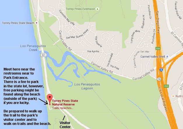 Map showing the location of Torrey Pines State Nature Preserve.
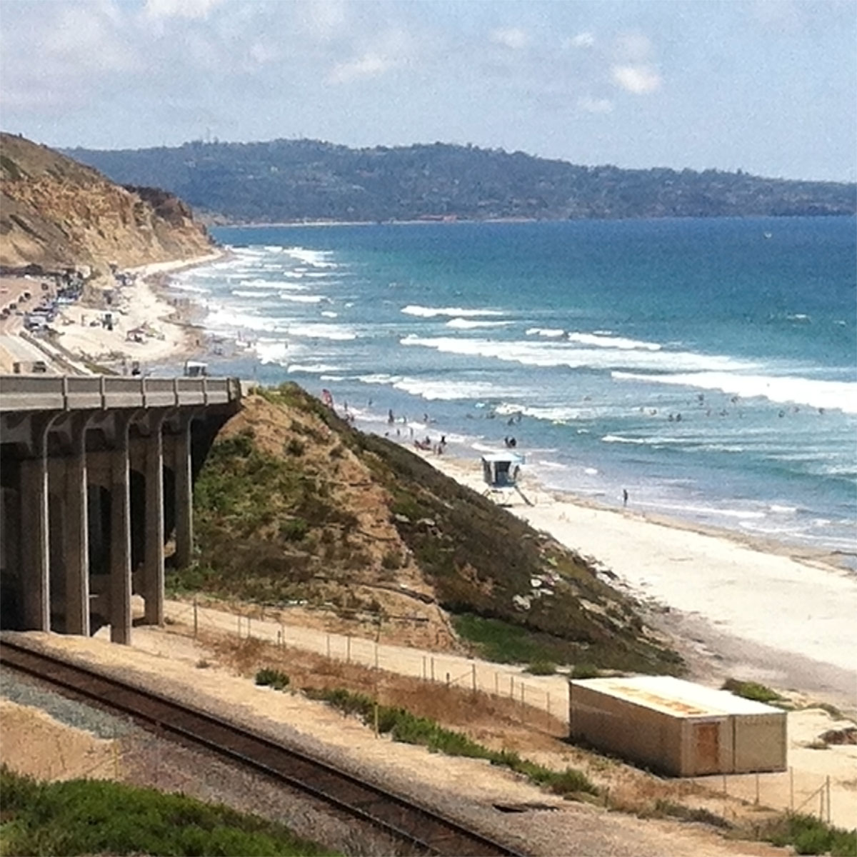 View looking south at Torrey Pines Beach from near the Amtrak Railroad Overpass Bridge on N. Torrey Pines Road. |
|


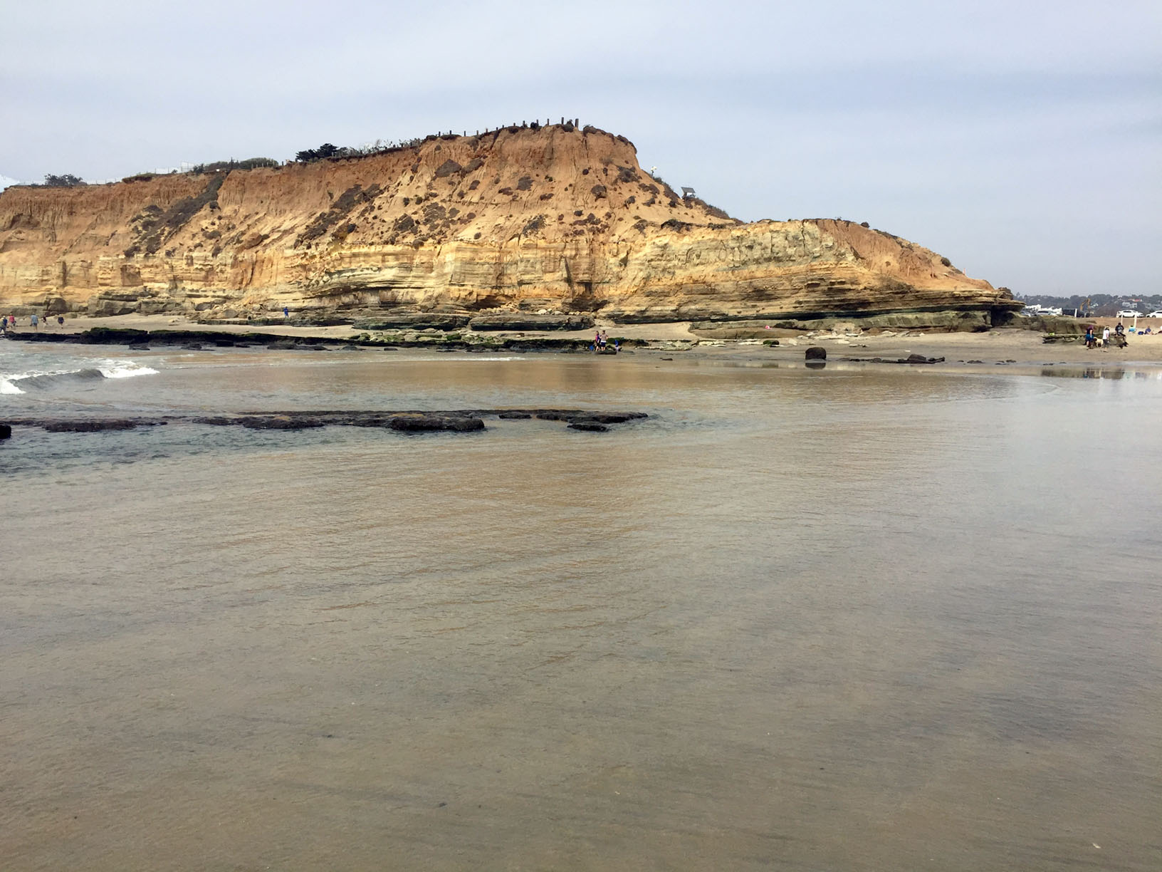
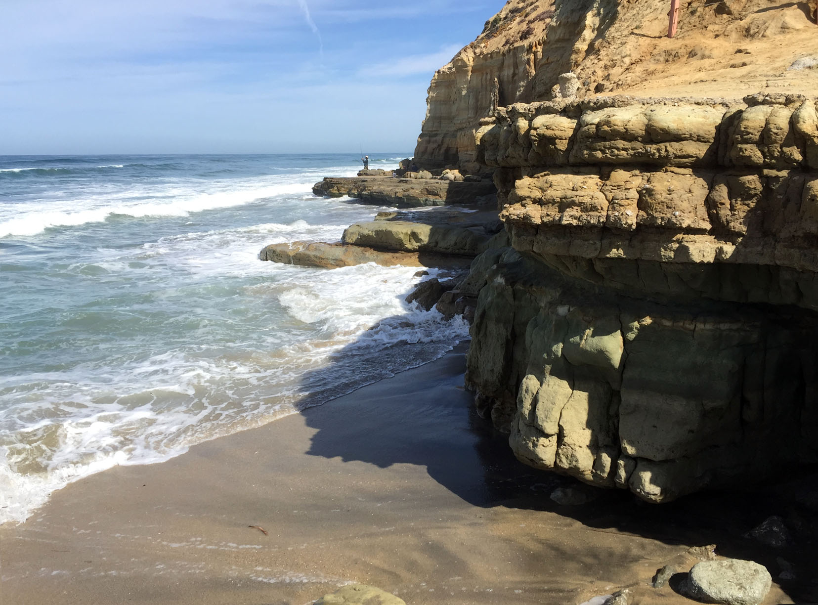
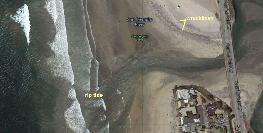
Del Mar Dog BeachDel Mar Dog Beach is an exceptional place to examine sea cliffs, coastal erosion, Eocene-age rock formations with fossils, and wave tidal processes shaping the entrance to San Dieguito Lagoon. There is hourly parking along the Coast Highway (101), but there is also free parking on Via de la Valle Road near the intersection with the Coast Highway near the park. This is an off-leash dog area, and is a lot of fun to watch the dogs (and people). However, running groups of dogs can crash into you. If you have a fear of dogs, don't attend this field trip. Plan to go at LOW TIDE only! The beach below the sea cliffs many be inaccessible during low tide. There may be strong rip tides near the mouth of the lagoon. See Del Mar Tides information to plan a trip. Yes you can bring your dog! Dogs can be off leash after Labor Day to Memorial Day. A trial leads up stairs to North Beach Overlook which provides an excellent view south to La Jolla's marine terraces.Rock formations exposed in the sea cliffs include the Del Mar Formation (Eocene), Torrey Sandstone (Eocene), and Bay Point Formation (Quaternary) - these formations are the same as those exposed in Torrey Pines State Nature Reserve (discussed above). |
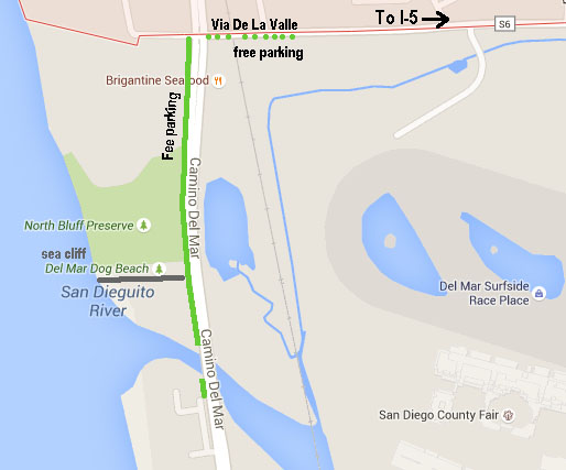 Map of North Point Park and Del Mar Dog Beach Map of North Point Park and Del Mar Dog Beach |
|
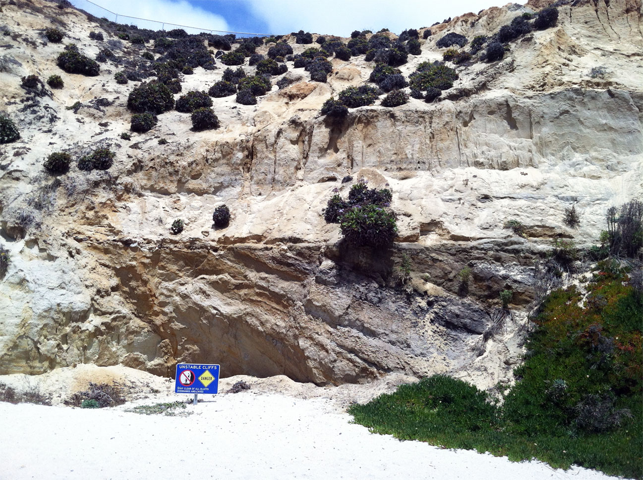
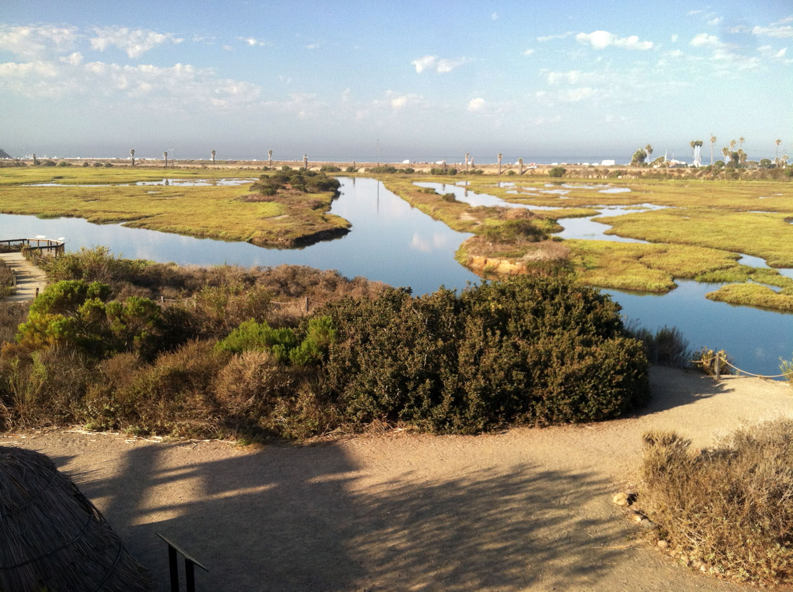
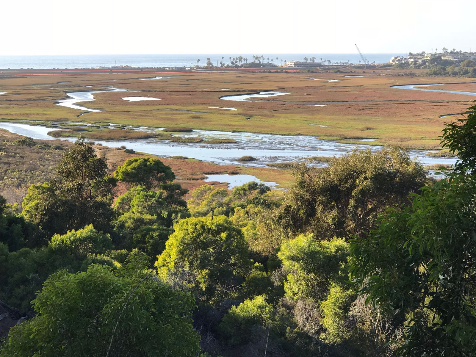
San Elijo State Beach and San Elijo LagoonSan Elijo State Beach is an excellent location to study beach processes and sea-cliff features. The famous surf location called the Cardiff Reef is located at the mouth of San Elijo Lagoon at the south end of the beach. The beach and mouth of the lagoon are excellent locations to study effects of tides and waves, and to study wildlife in the transitional environmental setting. To get there, take Manchester Avenue west (past I-5) and continue when it becomes San Elijo Avenue. There is ample free parking along the road where San Elijo Avenue crosses Chesterfield Drive. Park and walk across the bridge over the train railroad tracks and cross the Coast Highway at the stop light. Enter the park at the trail near the "Cardiff Kook" statue. Cross the campground at San Elijo State Beach and take the stairs down to the beach. The field trip is to examine the sea cliff, processes forming the beach, and the entrance (tidal delta) to the San Elijo Lagoon. Plan to go at LOW TIDE only! The beach below the sea cliffs many be inaccessible during high tide. There may be strong rip tides near the mouth of the lagoon. The sea cliff itself is unstable, so keep back. |
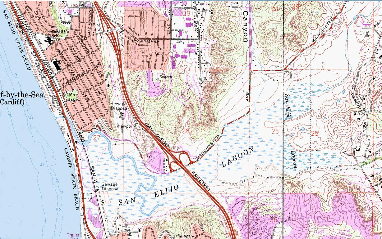
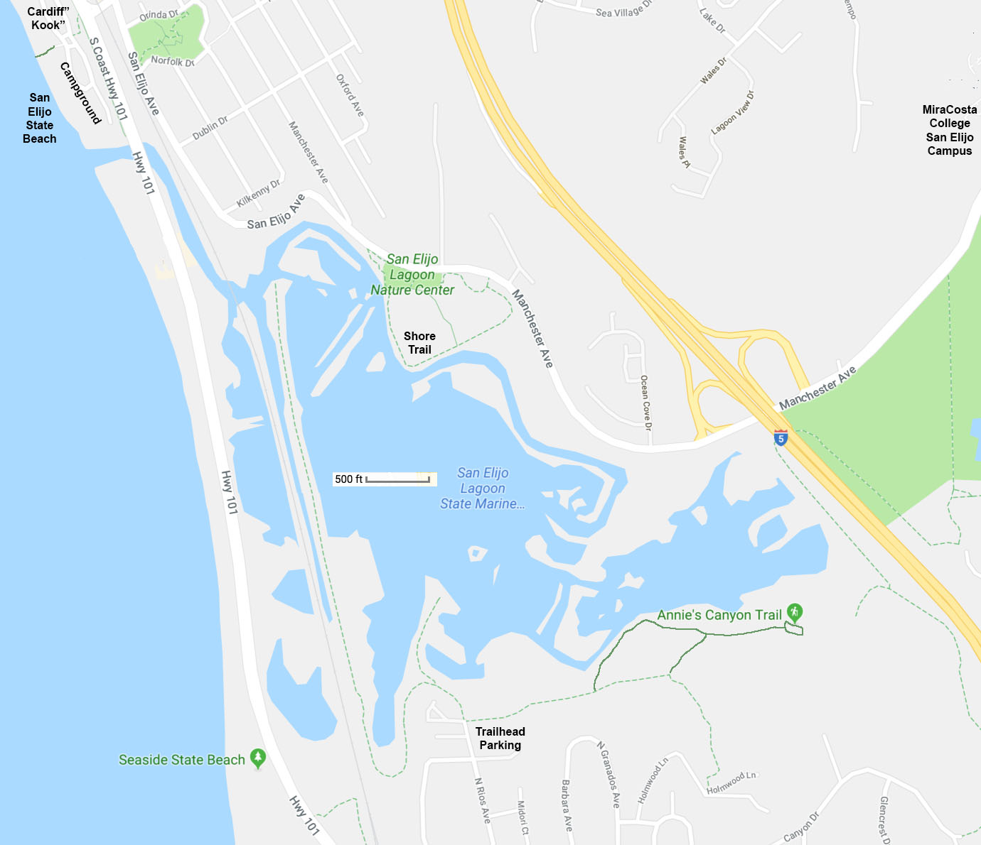 Map of San Elijo Lagoon and San Elijo State Beach (in Cardiff). The map show the trailhead on the south side of the lagoon, the location of the Nature Center, and San Elijo beach near the mouth of the lagoon. |
| San Elijo Lagoon Ecological Reserve and Nature Center is located on Manchester Avenue. New bridges and trails near the nature center provide access across the lagoon to trails on the south side. The theme of a field trip here is to study wildlife and habitats. and how lagoon valley formed over time, and how marine terrace formation are connected to sea level changes. Across the lagoon on the south side you can see several marine terraces, rising in elevation inland (now covered with homes)..The nature center has excellent exhibits and animals on display. A short walking trail from the nature center takes you out into the lagoon where both coastal plants and animal life are commonly accessible. Note that parking is limited at the Nature Center, particularly on weekends. There is limited parking along Manchester Drive. |
Field Trip To the San Elijo State Beach AreaThis is a field trip guide with 5 stops in the vicinity of the sea cliffs, beach, and mouth of the San Elijo Lagoon. |
|
|||||||

|
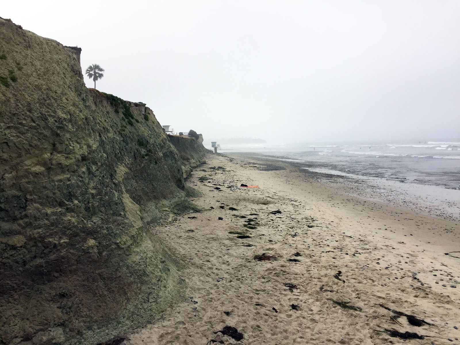
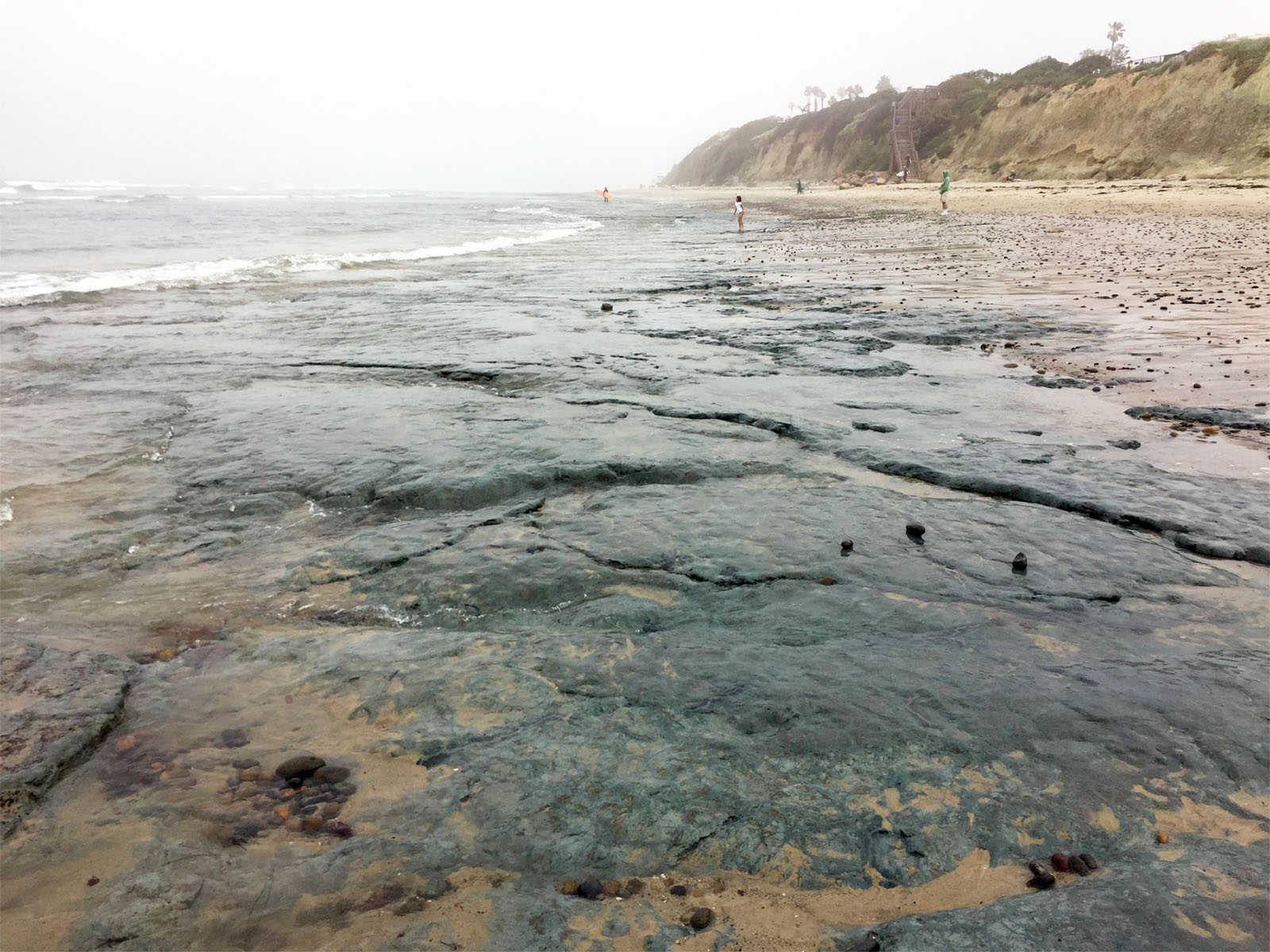
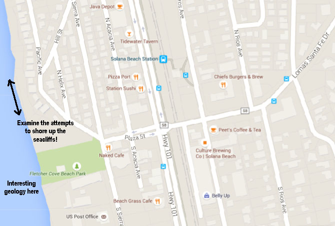
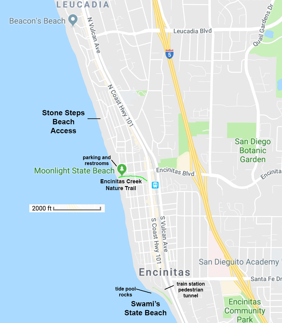
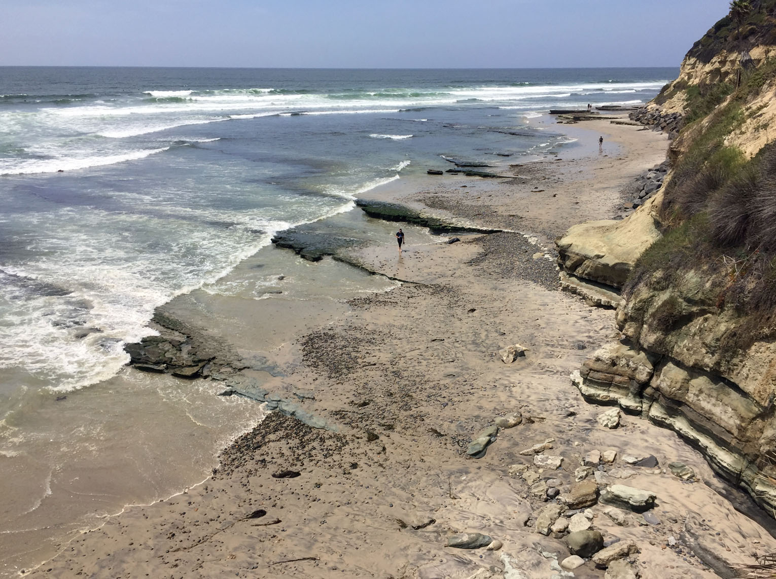
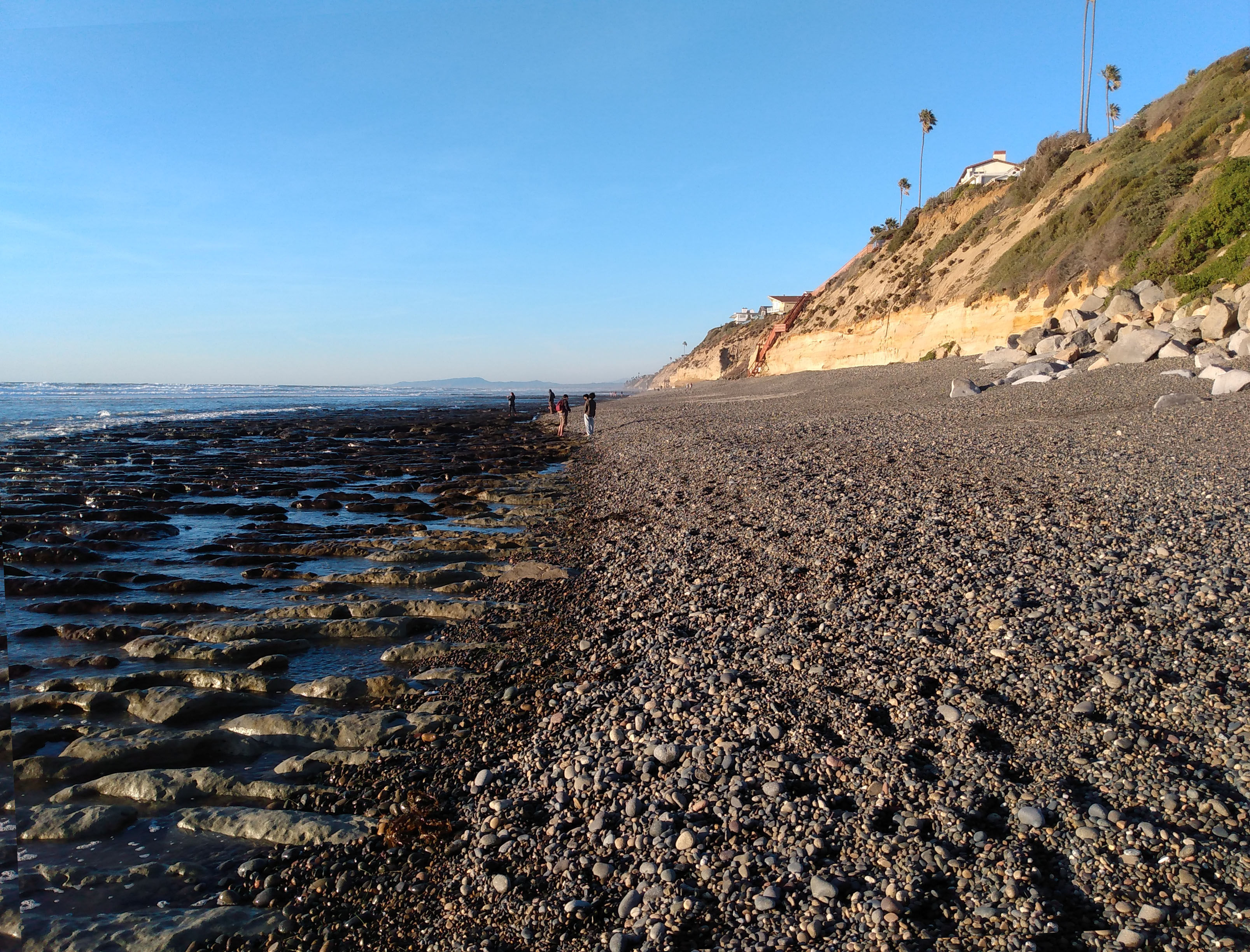
Encinitas Beaches and Sea CliffsEncinitas is famous for its beaches and seacliffs, somewhat notoriously. The coastal community in Encinitas has been experiencing a long-protracted battle fighting the effects of coastal erosion. The area is constantly loosing sand that was naturally provided by streamflow and sea cliff erosion in the past. Home build, often precariously close to the cliff end are under constant threat of slumping and sea cliff collapse due to the undercutting of the waves. In addition sand has to be replenished after winters with strong storm wave action that move sand offshore and down the coast. Many homeowners, at their own expense, have crafted sea walls in attempts to protect their homes. The California Coastal Commission has upgraded construction rules for seawalls in an attempt to maintain a scenic character to the seacliffs. A walk along the beach (at low tide only!) gives a visitor a view of the quality and success of their efforts to protect their valuable views and real estate. |
 |
|
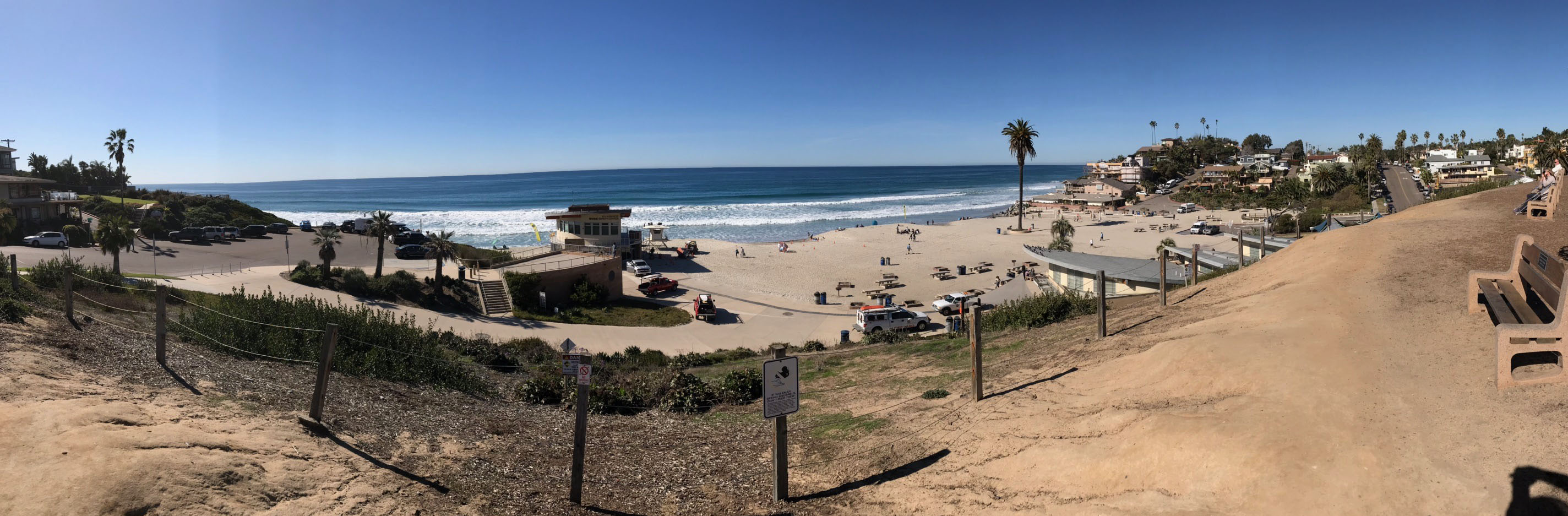
Panoramic view of Moonlight Beach located in a bay where Encinitas Creek enters the ocean.
Batiquitos Lagoon Nature Center and North Shore Nature TrailBatiquitos Lagoon is another drowned river valley along the San Diego coastline. The small Batiquitos Lagoon Visitor Center has exhibits and orientation information about the lagoon. It is located at the head of a nature trail that runs along the north shore of the lagoon. The eastern end of the lagoon trail is fairly quite (far from the highway) and typically supplies an abundance of wildlife viewing. There is a 20-stop guide to the trail available in the visitor center. It is an easy trail with lots of shade trees and is a popular place for hikers. |
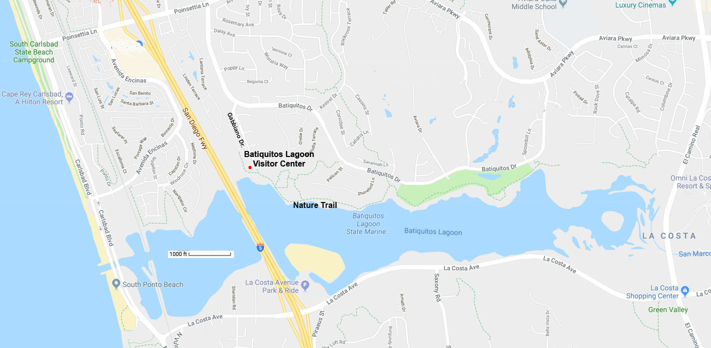 Map of Batiquitos Lagoon |
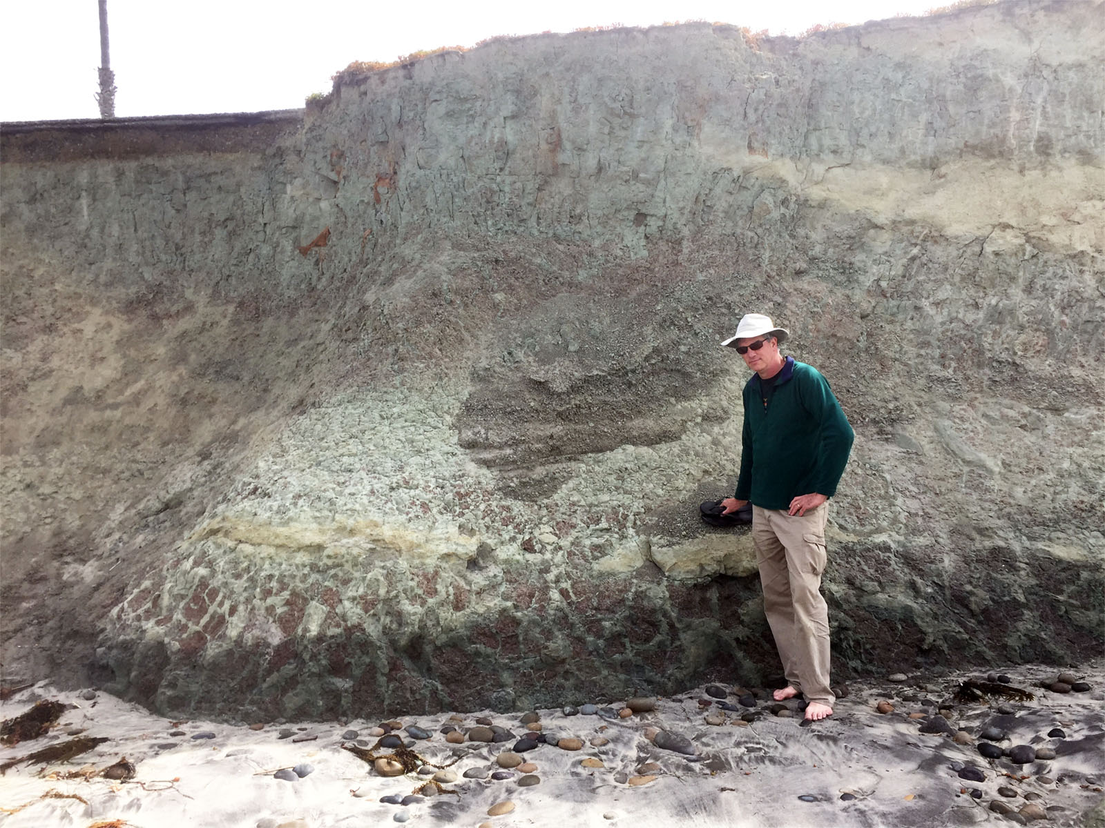
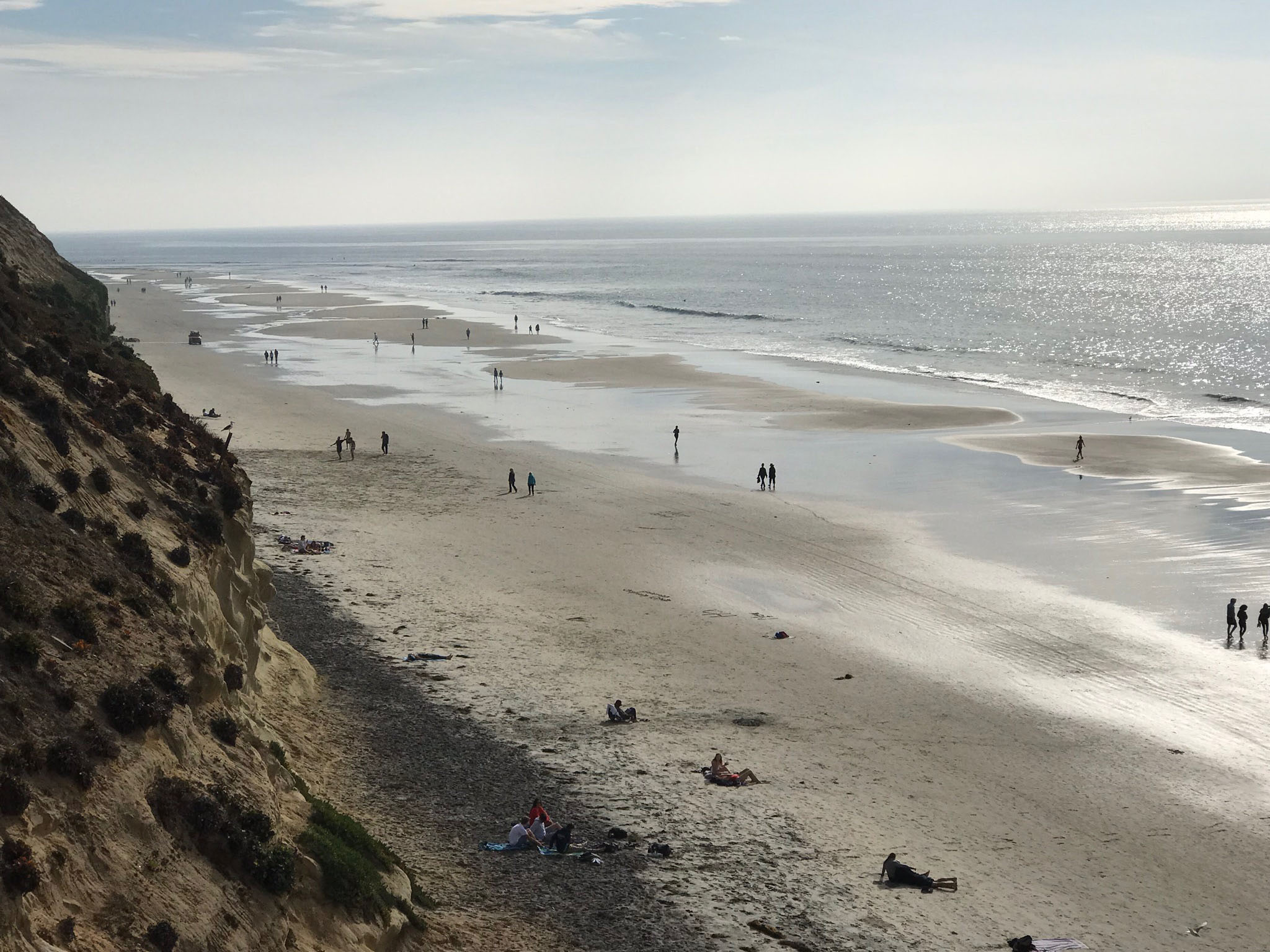
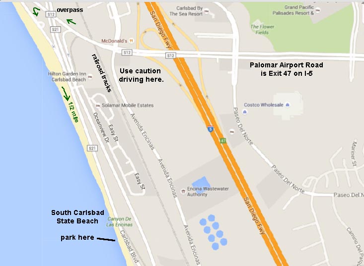
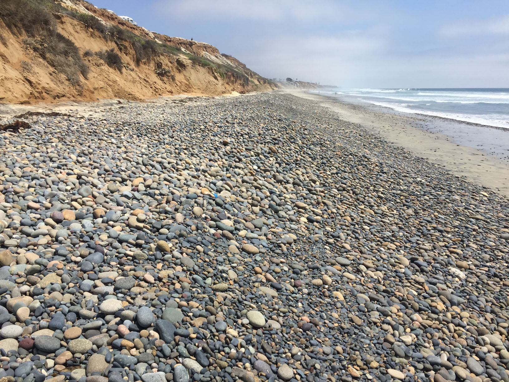
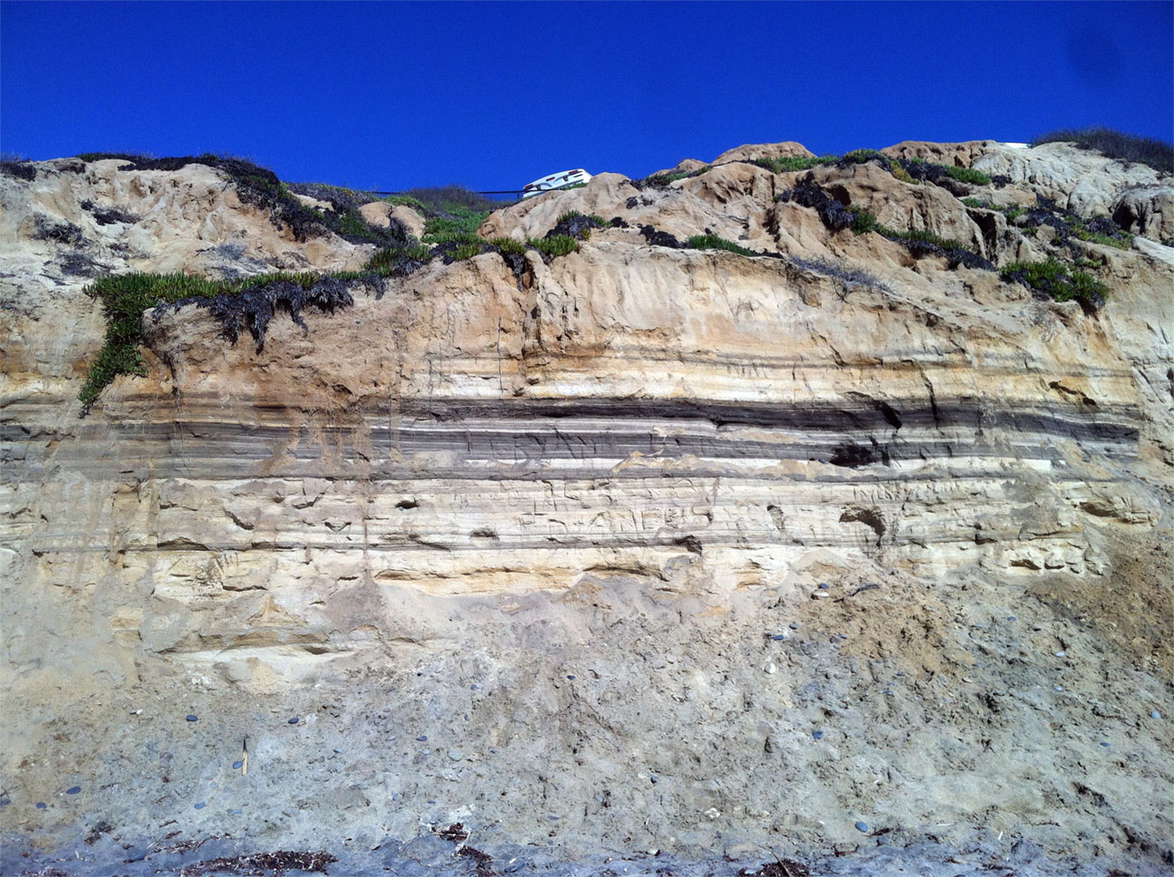
South Carlsbad State BeachThis is an excellent beach to study beach processes and sea cliff erosion. An erosional unconformity with a elevated marine terrace gravel on top is well exposed. Layered black sand beds are well exposed south of the parking area in the sea cliff. From MCC Oceanside Campus, the most direct route is the take Highway 78 west to I-5 South. Follow I-5 to the Palomar Airport Road Exit (Exit 47). Head west on Palomar Airport Road (careful to choose the correct lane to proceed toward Carlsbad Road South (you will be driving south with the seacliffs on your right). Proceed 1/2 mile to the parking area for South Carlsbad State Beach. |
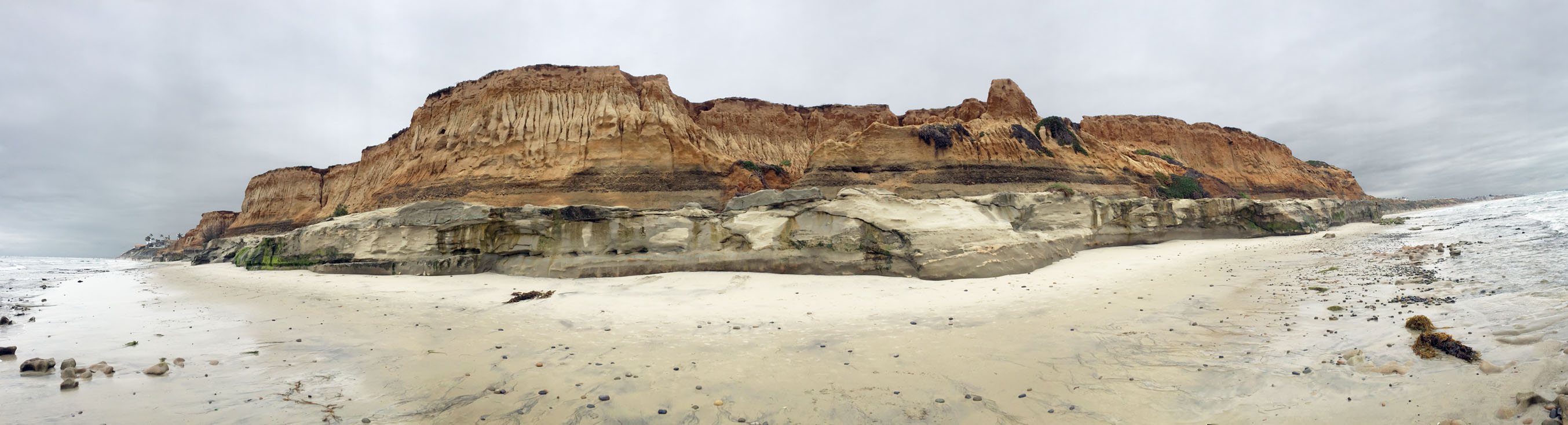 Panoramic view of seacliffs and beach of South Carlsbad State Beach. Lower gray rock is Torrey Sandstone (Eocene age). Upper red beds are marine terrace deposits of the Bay Point Formation of Quaternary age.. |
|

Tamarack Beach, CarlsbadThis is a field trip location for local oceanography lab classes. You have to approach by car from the north in order to park (along the beach side of Highway 101). The two pairs of jetties that bracket the beach illustrate the dominant southward longshore drift. The beaches are noticeably wider on the north sides of both jetties, and the beach between the jetties widens from north to south. The southward drift of sand regularly plugs the jetty entrances to Agua Hedionda Lagoon, requiring frequent dredging. This area is a good location for beach profiling excursions to measure seasonal changes in the beach. The outer bay of Agua Hedionda Lagoon is used for aquaculture (farm-raised oysters and mussels) and is the location of the Claude "Bud" Lewis Carlsbad Desalination Plant. |
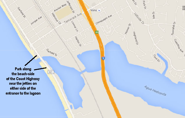 Map of Tamarack Beach and Agua Hedionda Lagoon.
|
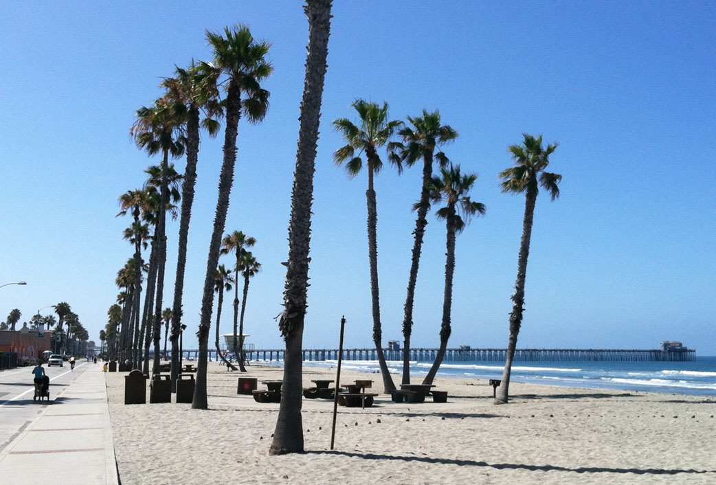
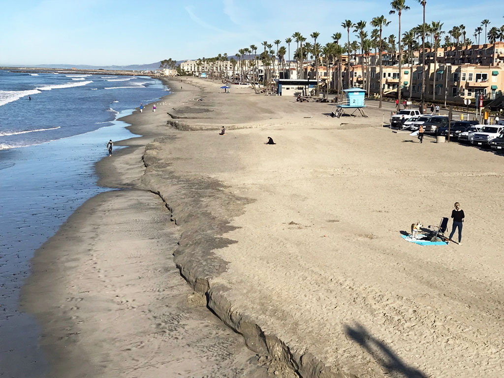
Oceanside Pier and Oceanside HarborOceanside Municipal Pier is one of the longest wooden piers on the West Coast, at 1,942-feet. Mostly a place for fishermen, tourists and residents, but is also a destination for local oceanography lab field trips. When conditions are right, the pier can be useful for studying wave periods, wave patterns, currents, beach erosion, local sea life, and shoreline management. There is plenty of parking but it's all pay. Watch how waves change as they slow and break. Looking down at the water within the surf zone often shows a longshore current, depending on swell direction. The Oceanside Jetty, visible in the distance to the north, is a major blocker of south-drifting sand, leading to sand depletion along North County beaches. A walk down the beach to the mouth of the San Luis Rey River and out and around Oceanside Harbor is a wonderful way to spend a day! |
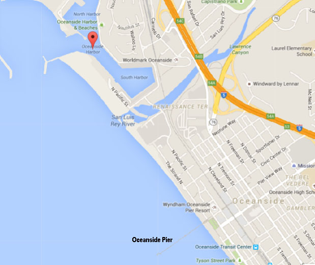 Map showing the locations of Oceanside Pier and Oceanside Harbor
 |
| Oceanside Harbor is a fully managed artificial harbor supporting the Camp Pendleton Marine Base and the boat storage and fishing community out of Oceanside. The harbor provides an interesting lesson in coastal dynamics and infrastructure. The harbor is subject to filling with sand from longshore drift, requiring occasional dredging to provide sand to the beach in Oceanside. The large rip-rap jetties are now host to hard-bottom marine communities (plants and animals). Seal, sea lions, and dolphins are a common sighting in and around the harbor. |
|
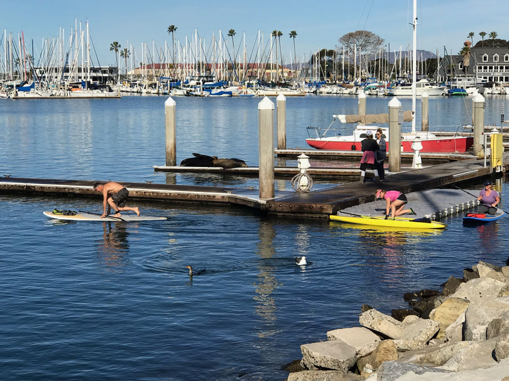

Dana Point Harbor - Oceans InstituteRichard Henry Dana Jr. (1815-1882) was a Harvard-trained lawyer, a seaman, and an author of the classic sea journal, Two Years Before the Mast (1840). In his journal, Dana documents his voyage from Boston around Cape Horn to California on the merchant ship, the Brig Pilgrim, and account of what life and landscapes in the San Diego region looked like before our modern era. Dana describes the area once known as Capistrano Bay, also known as Dana Point.The resistant rocky seacliffs at Dana Point consisted of the Early-Middle Miocene San Onofre Breccia. The breccia formation has been uplifted by faulting and forms the headland of Dana Point. The resistant headland at Dana Point, protects Capistrano Bay (now Dana Point Harbor). Dana Point is home to the Ocean Institute, an organization dedicated to education programs about marine life, maritime history, and outdoor education. The Ocean Institute maintains two historic sailing ships. The educational programs are ideal for getting students out to sea! |
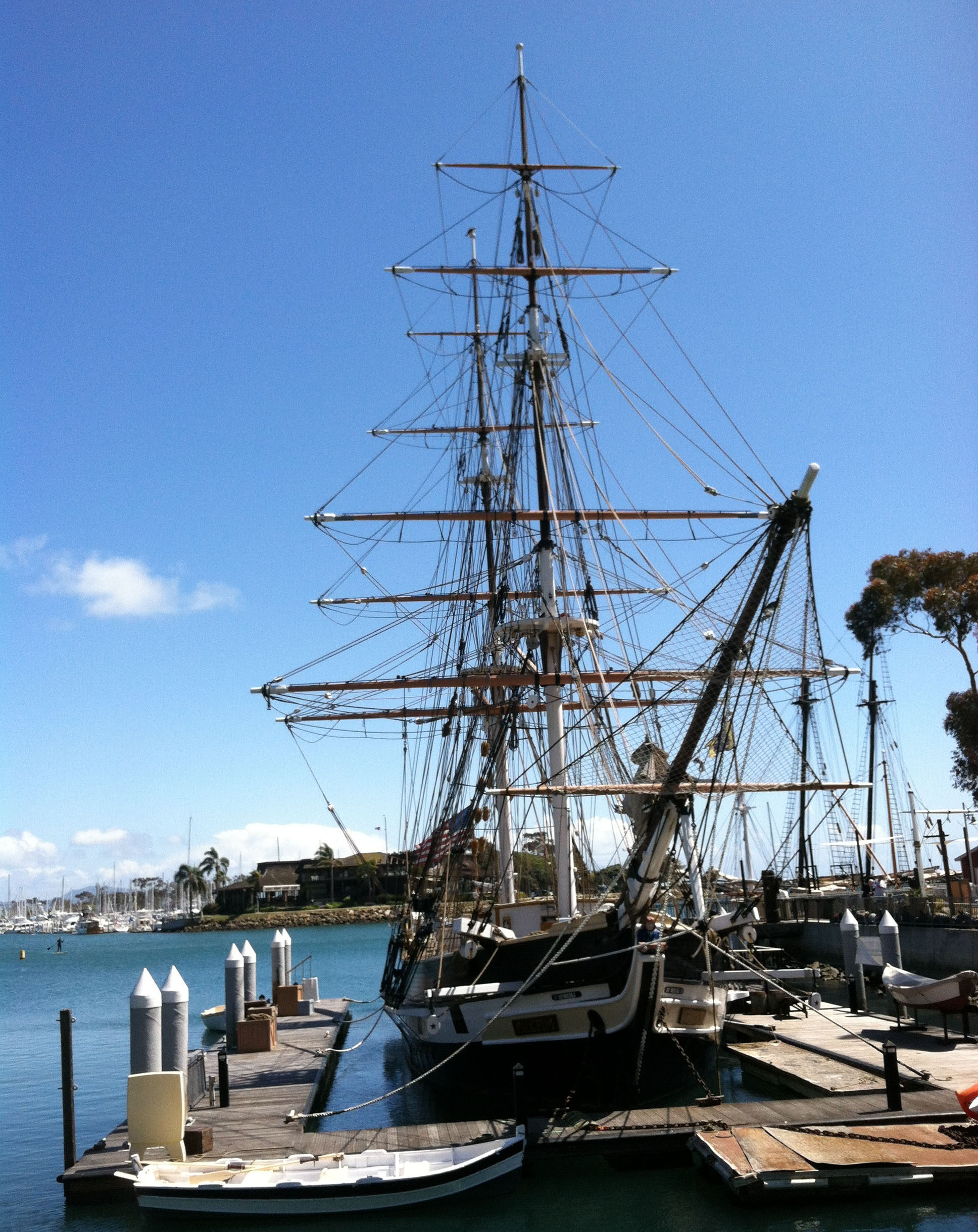 The restored version of Brig Pilgrim in Dana Point Harbor |
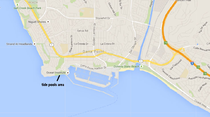 Map of Dana Point & Harbor  Dana Point Harbor & Jetty |
Inland Field Trip Destinations |
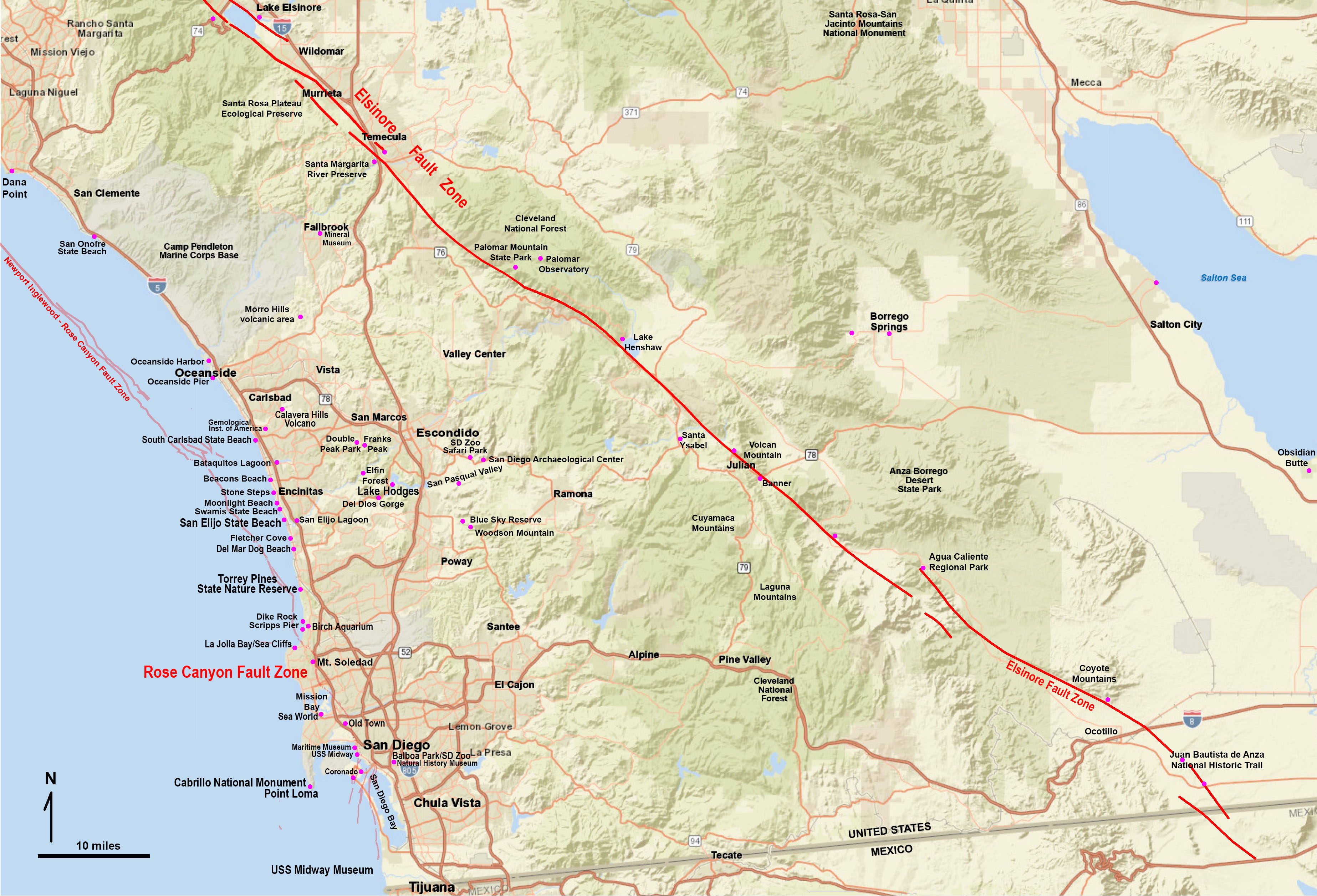
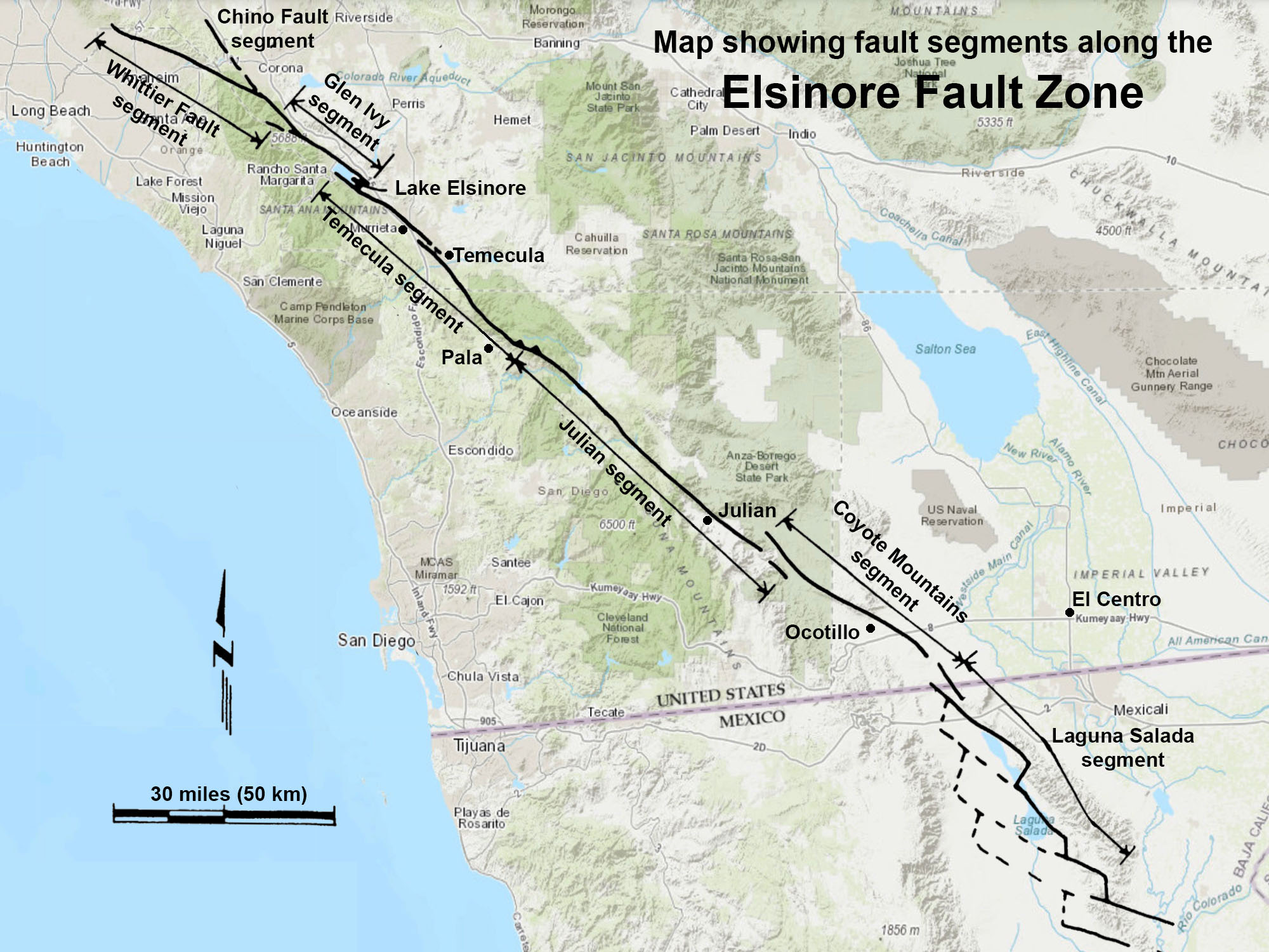
Field Guide to the Elsinore Fault ZoneThe Elsinore Fault Zone extends from the southern Los Angeles area to the U.S./Mexico border and is one of the largest and longest physiographic features in southern California, particularly in San Diego County. The fault zone cuts across the Peninsular Ranges into the Anza Borrego and Sonoran Desert and southward into the Laguna Salada region of Baja California. This active earthquake fault zone has a history of Late Quaternary, Holocene, to historic deformation with at least two magnitude +7.0 earthquakes in historic times, with a potential for more in the future. Although not considered as active as the nearby San Andreas and San Jacinto faults, it is closer to coastal cities in San Diego County.This web-based field guide describes fault-related landscape features and geology (with maps and photos) observable at 80 locations along the fault zone. The guide starts in the north with the Chino and Whittier fault sections near Corona, and proceeds south to Lake Elsinore, Murietta, Temecula, Mount Palomar, Lake Henshaw, Volcan Mountains near Julian, Anza Borrego, and the Juan Bautista De Anza National Historic Trail. The website also has a Guide to the Geomorphic Expression of Faults. |
 |
Calavera Hills Volcano in CarlsbadCalavera Hills Nature Preserve is an excellent field trip destination, located near the MiraCosta College Oceanside Campus. This open-space preserve park is host to an ancient volcano that erupted along the coast sometime between 13-18 million years ago. The internal features of the old volcano are exposed in a cut used to mine rock in the construction of Calavera Lake Dam.Follow College Avenue south for about 1 mile (south of Highway 78). Turn left on Tamarack Avenue and follow the road down through the neighborhood until you see the trailhead that leads to the dam. The volcano is on the opposite side of the dam. There is much to examine here! |
 The Calavera Hills volcano is the eroded remnant of a larger volcano. Its peak is the highest point in Carlsbad. The hard-rock core of the volcano was mined for construction of the Lake Calaveras dam. |
 Location map of the Calavera Hills volcano. |
Field Trip to the Ancient Shorelines and the Calavera Hills volcanoThis is an online guide for a 10 stop hiking field trip to the top of the volcano. |
||
San Marcos Mountains - San Elijo HillsField Trip Guide to Double Peak, San Marcos, CaliforniaDouble Peak (elevation 1,644 feet) is one of the highest mountains in northern coastal San Diego County. The park located in the summit area along the Cerro de las Posas ridge provides spectacular panoramic views in all directions. A short, easy walk (wheel-chair accessible) connects the parking lot to the summit overlook area. On a clear day it is possible to see distant snow-capped mountain ranges to the north (San Bernardino and San Jacinto Mountains), Palomar Mountain (ridge), and many other peaks and plateau regions of the Peninsular Ranges in San Diego County. The entire coastline from Dana Point to Mexico, and the islands offshore are visible on a clear day. Rocks exposed on Double Peak include ancient volcanic and metamorphic rocks of Mesozoic age. The field trip guide presented above provides maps for orientation and descriptions of the local and regional geology.Additional geology field trip discussions below describe the geology and ecology of this "urban wilderness" on the outskirts of San Marcos and Escondido, California. |
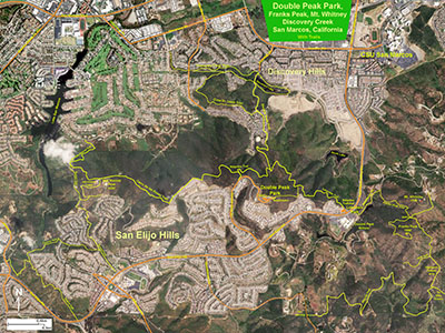 Map showing locations of Double Peak Park, Franks Peak, and Mt. Whitney with trails in San Marcos, CA Map showing locations of Double Peak Park, Franks Peak, and Mt. Whitney with trails in San Marcos, CA |

| Panoramic view looking west, north, and east from Double Peak Park, the high point in the San Marcos Mountains. The distant ridge on the right is Mount Palomar. The city of San Marcos occupies the valley. On a clear day it is possible to see the high peaks of the San Bernardo Mountains, San Jacinto Peak, and the crest of the high peaks of the San Diego Peninsular Range near Julian, offshore islands, and high peaks in Mexico. Mt. Whitney and Franks Peak are the two peaks to the right. |
Franks Peak, Mt. Whitney, and the Highlands TerracesThis is a hiking field trip guide to the geology of two coastal mountain peaks and a highland wilderness in the San Elijo Hills. Ancient volcanic and intrusive igneous rocks of Jurassic and Early Cretaceous age are exposed along fire-road trails that lead to the mountain peaks and to back-country highland terraces and overlooks with amazing views of the entire region of northern San Diego County. Total distance described in this hike is about 6 miles, but can be shorter. |
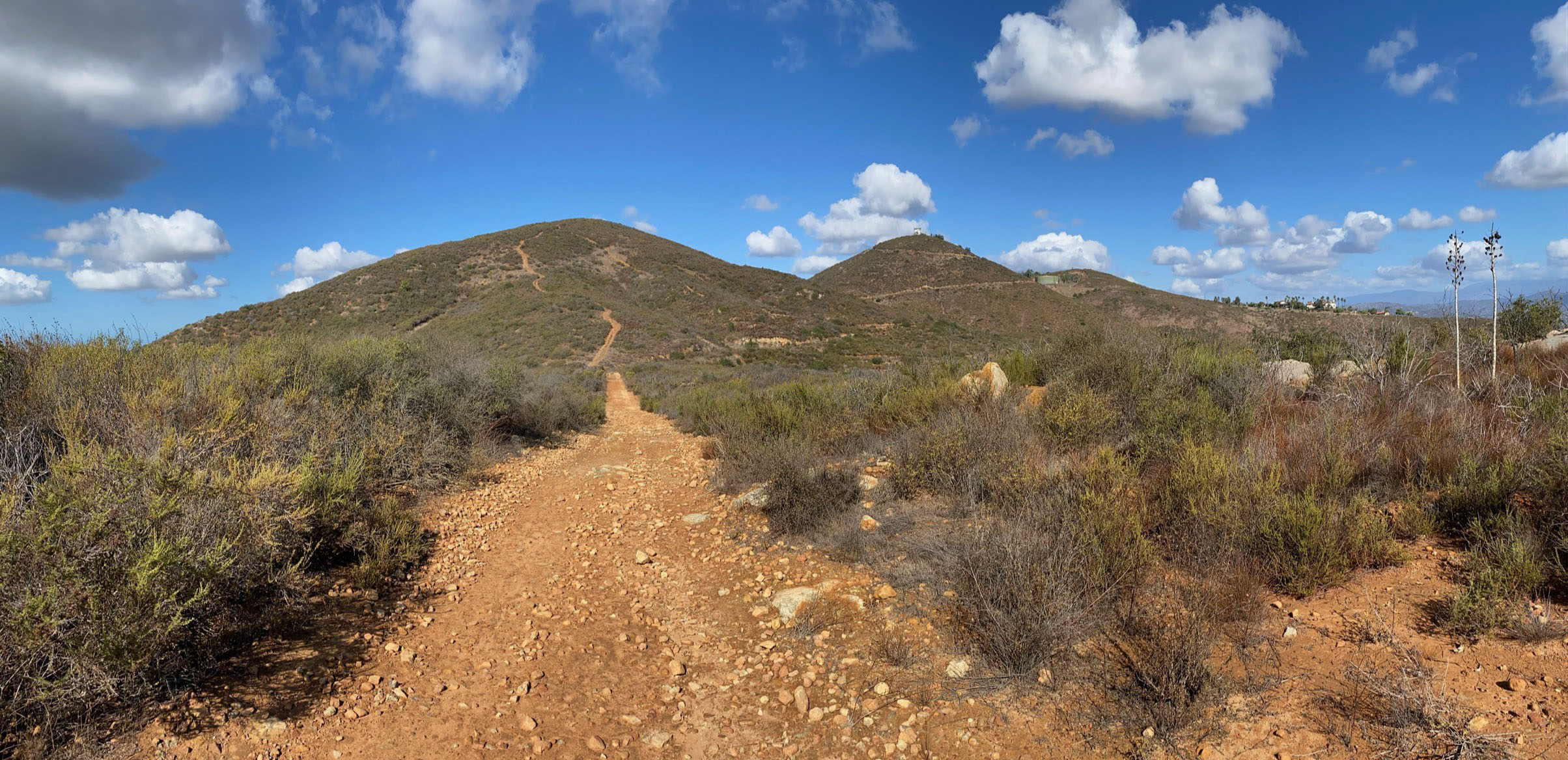 Franks Peak and Mt. Whitney back country |
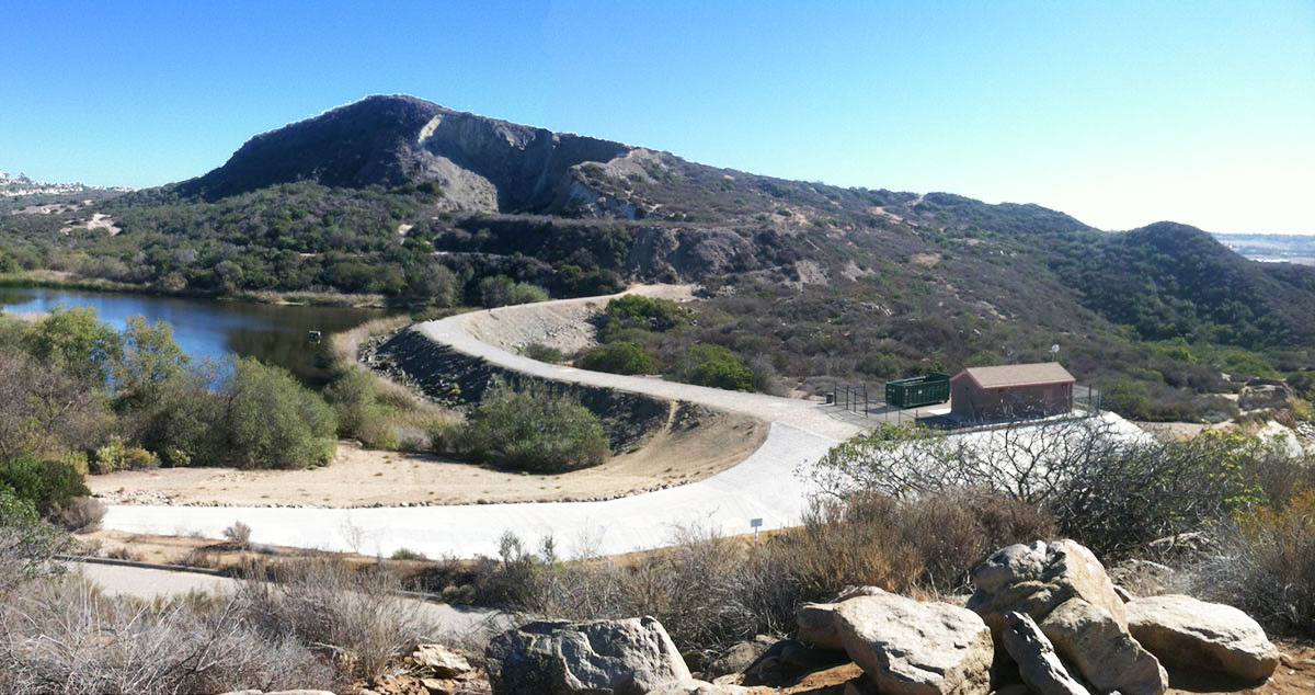
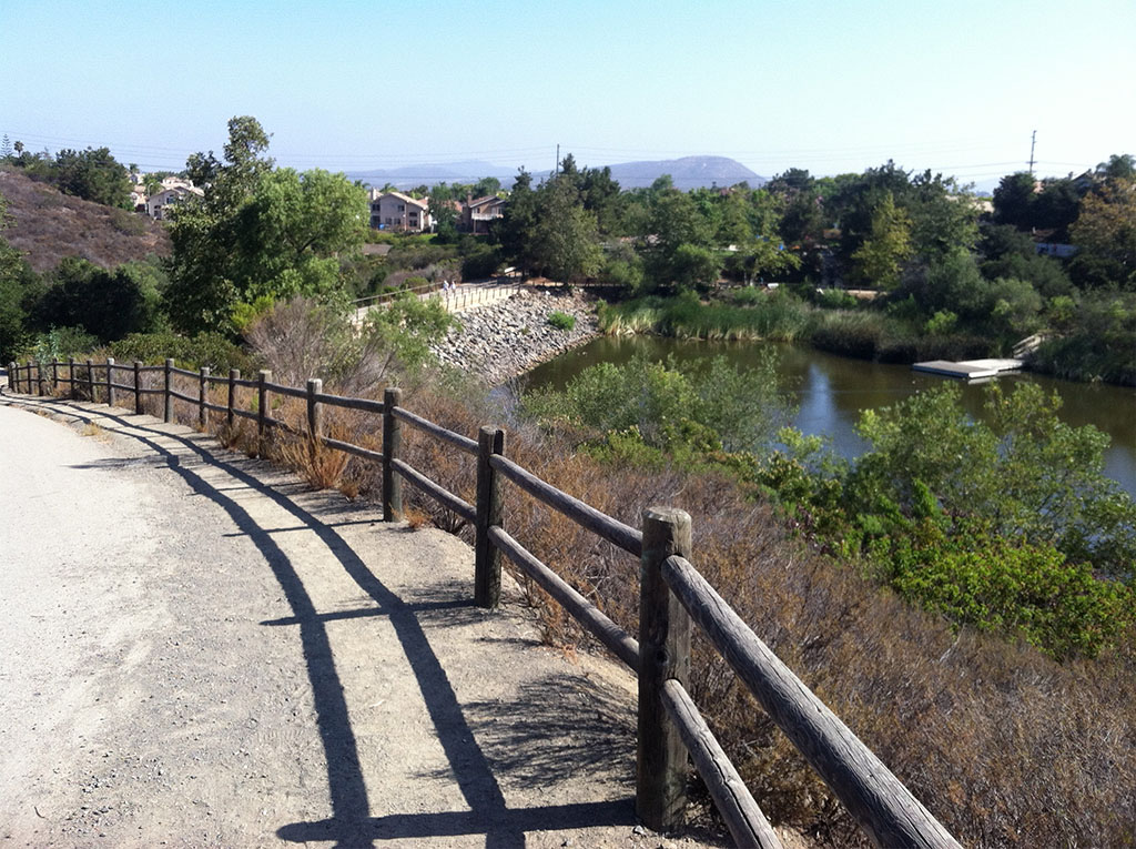
Field Trip To Discovery Creek Trails Area, San Marcos, CAThis is a field to examine igneous and metamorphic rock along the Discovery Creek Trail, and to examine riparian, coastal sage scrub, and chaparral plant communities, regional landscape feature, and the impact of the 2014 Cocos wildfire and recovery on the northern lower slopes of Double Peak in San Marcos. The first half of this field trip is wheel-chair accessible that leads to Discovery Lake, a scenic urban wildlife water resource. The second half involve hiking on the rocky trail path on the Cima Drive Loop Trail. |
 |
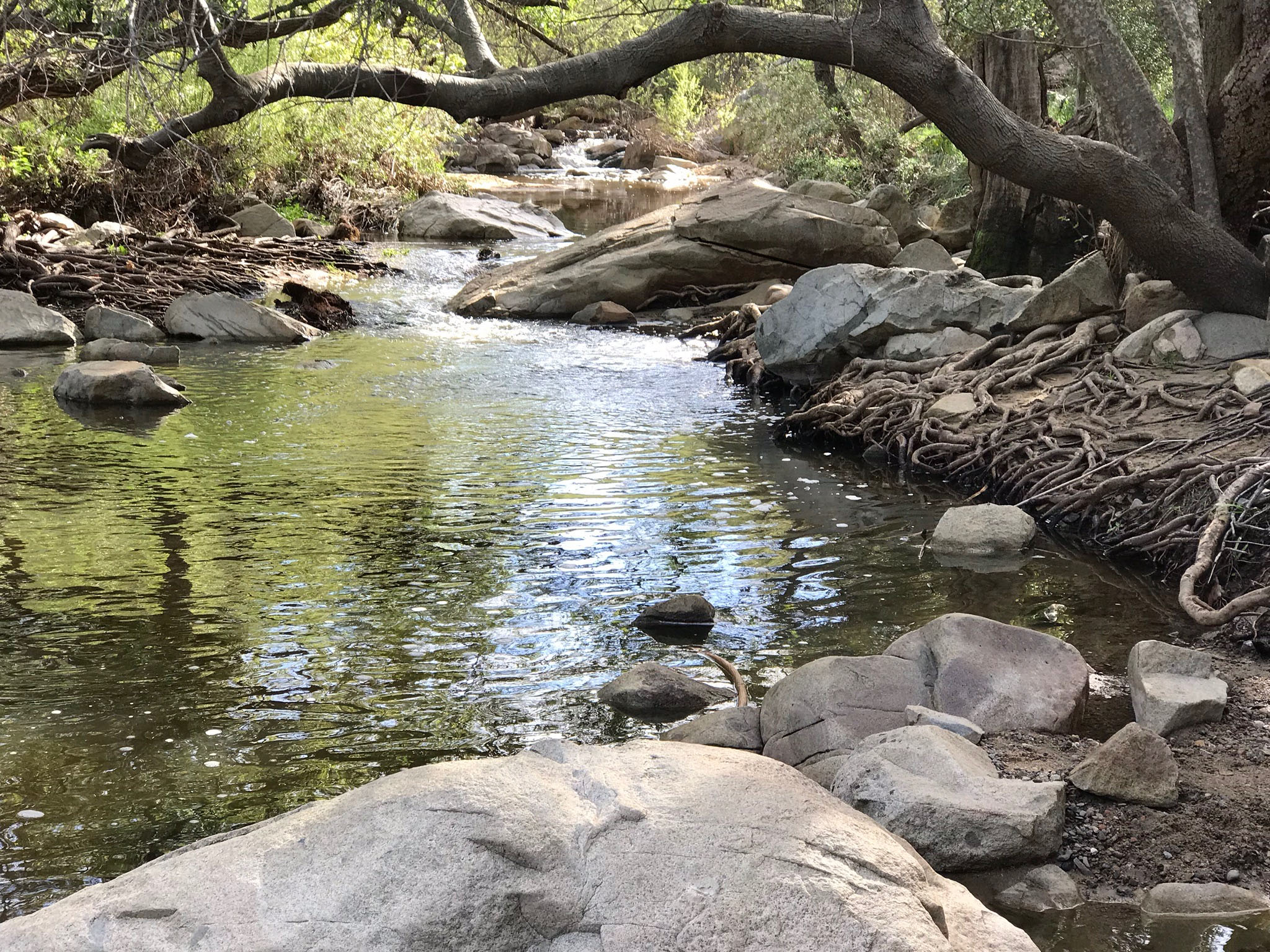
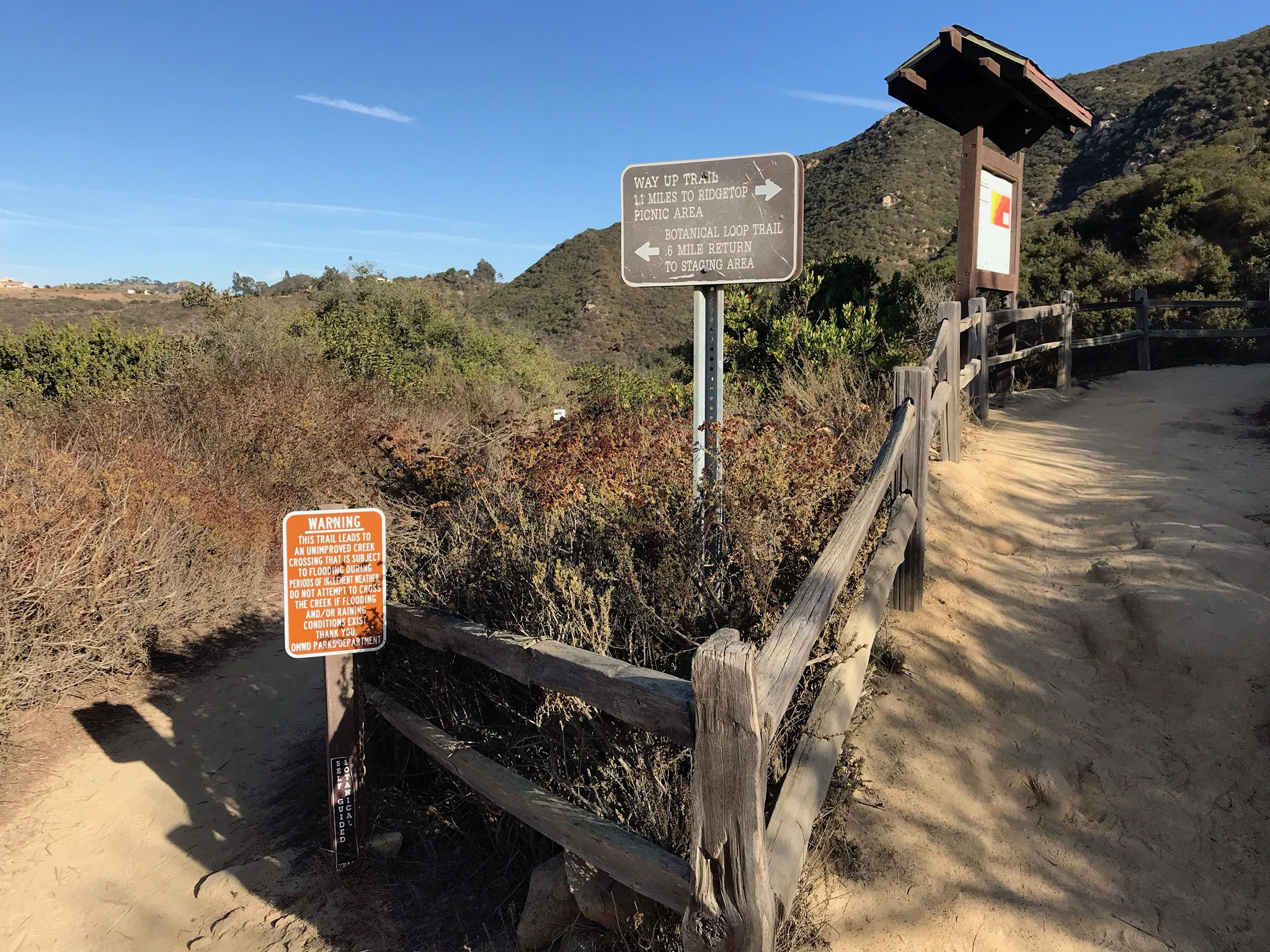
Elfin Forest Recreational Reserve and Vicinity (Field trip guide)The Elfin Forest Recreational Reserve covers 784 acres in the heart of the San Marcos Mountains. Olivenhain Reservoir was constructed in the middle of this mountainous upland to support the Olivenhain Municipal Water District in partnership with the San Diego County Water Authority and the US Bureau of Land Management. The Reserves offers approximately 11 miles of hiking, mountain biking, and equestrian trails, and exceptionally scenic mountain viewing points.See a trail map for the Elfin Forest Recreational Reserve (prepared by Olivenhain Municipal Water District). The Elfin Forest Visitor Center is located on Elfin Forest Road where parking for the primary trailhead to the upland areas is located. The Botanical Trail is a 1.1 mile loop trail that starts near the visitor center. The Reserve is host to oak riparian, oak woodland, coastal sage scrub, and chaparral plant communities. The Botanical Trail is an ideal location to learn about plant communities along Escondido Creek and the region. Botanical Trail Interactive Guide (includes interactive map providing information about stop location). Elfin Forest Botanical Trail Guide (take this printout with you when you do the trail). Most of the rocks exposed in the reserve are ancient volcanic and granitic rocks of late Mesozoic age (roughly 120 to 90 million years) associated with the formation of an ancient volcanic arc associated with a regional subduction zone offshore. The massive peaks throughout the San Marcos Mountains are remnants of large plutons and volcanoes (associated with a greater Peninsular Range Batholith). These rocks formed in association with a chain of volcanoes that have long since eroded away (possibly rock masses thousands of feet thick have eroded away in the area since the end that volcanic era). These ancient igneous plutons intruded older ancient ocean crustal rocks of undetermined age. These ancient rocks include seafloor crustal rocks (basalts and sediments) that have been heavily altered by regional metamorphism. The rocks on the high peaks of the San Marcos Mountains display an interesting history associated with climate history and weathering. The granite bedrock is deeply fractured and weathered by exposure to groundwater and air. Fire has also had a very significant role in the weathering of rocks. In many places the soil is deeply red or brown, and lacks organic remains after many generations of exposure to wildfire. Many of native plants are also adapted to wildfire and may even require it to reproduce. |
|
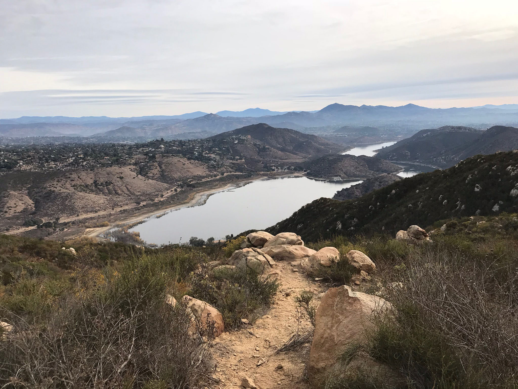

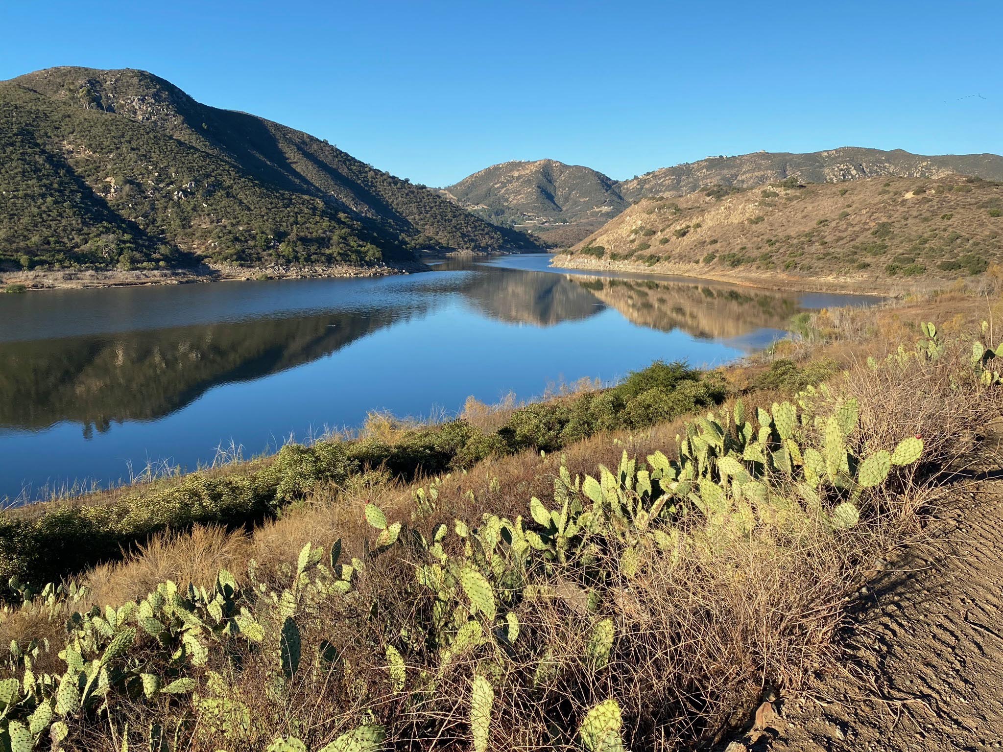
Lake Olivenhain is
 a reservoir constructed high in the San Marcos Mountains, accessible by the upland trails in the Elfin Forest Preserve and from a trailhead on the Del Dios Highway (see map above).
 Del Dios Highlands County Preserve (Field trip guide)The Del Dios Highlands County Preserve is part of a large open space/watershed protection region in the mountainous coastal highlands of northern San Diego County west of Escondido, California. The Del Dios Highlands preserve encompasses 774 acres adjacent to the Del Dios Highway between Escondido and Rancho Santa Fe. The preserve borders the Elfin Forest Recreational Reserve to the west, and the Lake Hodges Park is nearby to the east. |
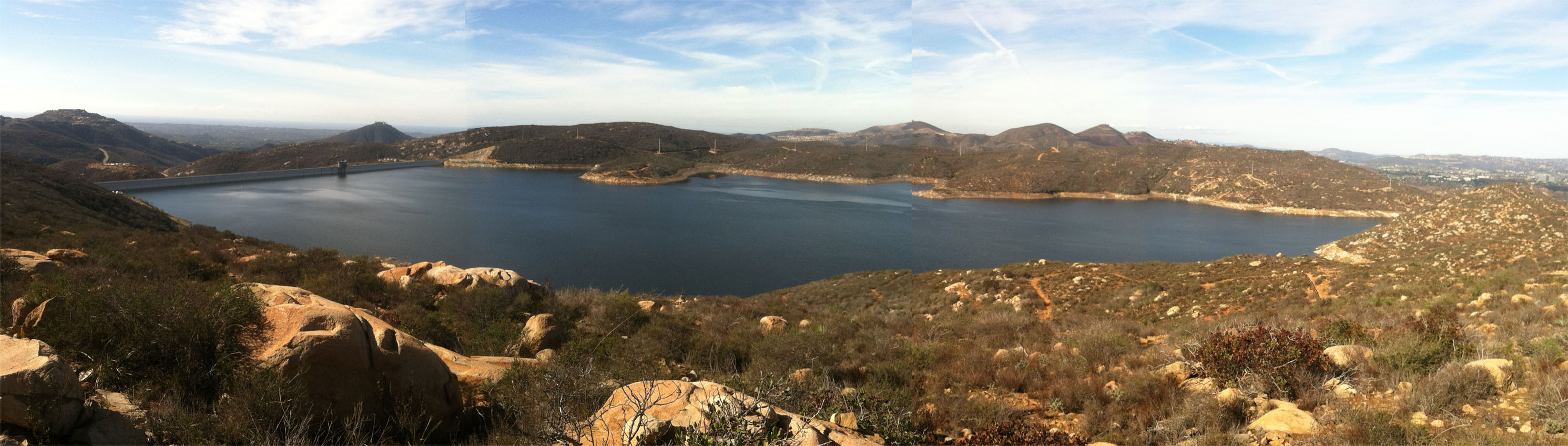
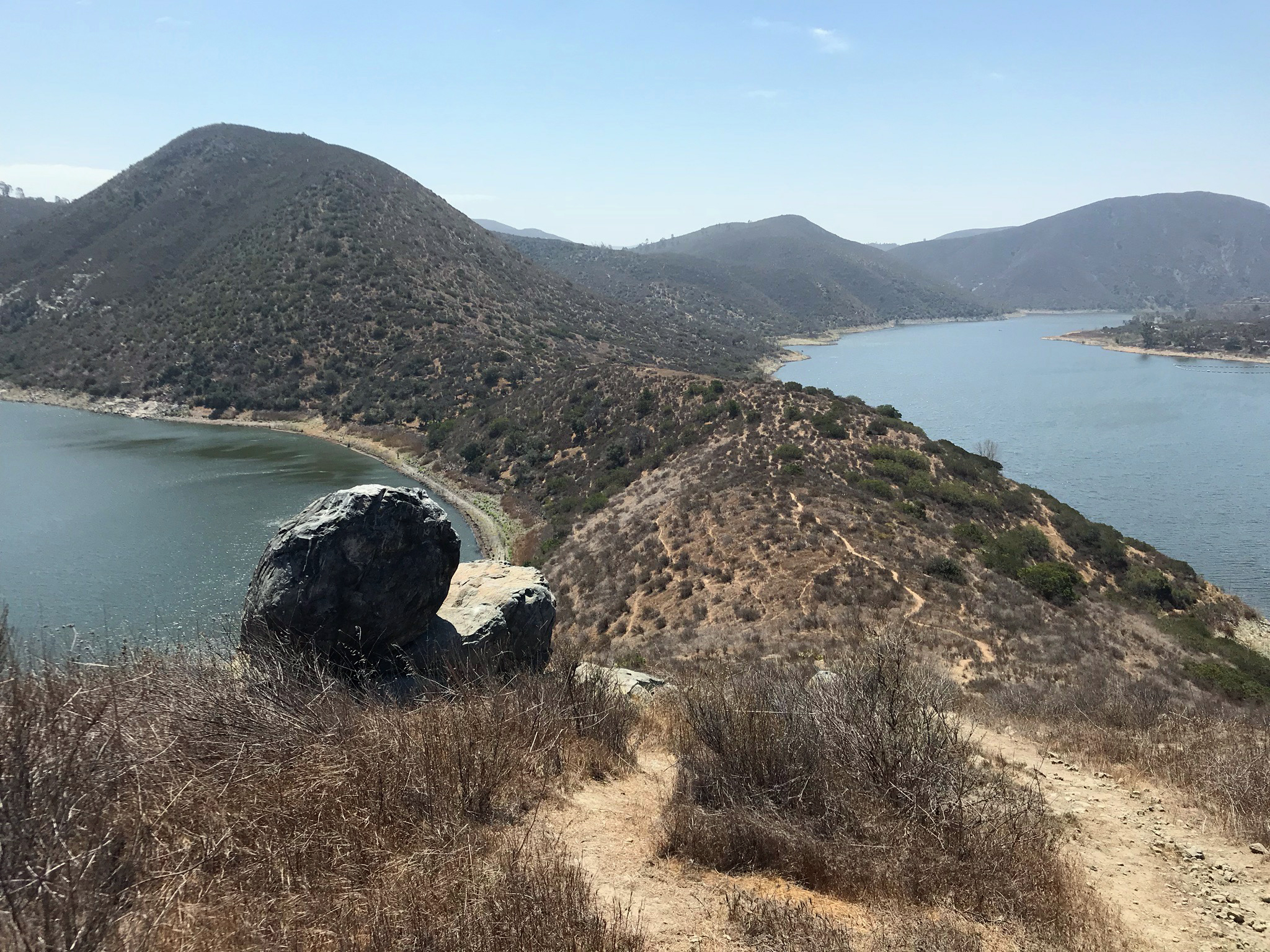
 Looking down the Del Dios Trail to Lake Hodges. |
| Panoramic view showing the Del Dios Trail climbing through a pass leading the the highlands of the Elfin Forest Recreation Reserve. |
San Dieguito Watershed and the Coast to Crest Trail SystemThe San Dieguito Watershed is host to the Coast-to-Crest Trail. The trail system is still under development but many sections of the trail are complete and go through some of the most scenic wilderness and geologically interesting parts of San Diego County. This link goes to the San Diego River Park official website that provides maps and information about all the completed sections of the Coast-to-Crest Trail and other public trails in the watershed. Visit the San Dieguito Watershed page on the Where Does San Diego Get Its Water? website. |
 Map of the San Dieguito River Watershed, host to the CCT system |
Lake Hodges (San Dieguito River Park)Lake Hodges and surrounding lands are part of the San Dieguito River Park system. The landscape around Lake Hodges provides interesting geology, archeology, and spectacular scenery of the highlands of the northern San Diego County coastal mountain country. Many miles of trails surround the lake and follow the river course. See the following field trip websites!The trail system is awesome for hiking or biking. Bring a walking stick because I frequently see rattlesnakes here (don't hurt them! They live here, you don't!). The walk along the West Shore Trail passes through a lot of shade, ideal for the summer. The trail passes Lake Hodges Dam and continues down Del Dios Gorge along the San Dieguito River. The other hiking trails around the Piedras Pintadas and North Shore areas are more open (exposed), and are better to hike in cool weather, especially during spring wild flower season. A hiking trail to the top of Bernardo Mountain provides spectacular views of the region. The North Shore Trail continues up the San Dieguito River Valley (San Pasqual Valley) as the Mule Hill Trail on the east side of Interstate 15 into San Pasqual Valley (see below). Lake Hodges is ideal for a kayak (or a boat) field trip - bring you own, or rent one. A fun destination is to kayak out to a wind vortex area created by a wind gap in a peninsula. It is an ideal location to study how wind influences wave and ripple patterns, how topography effects wind patterns, and how wildlife (particularly birds called Grebes) respond to wind patterns and upwelling. A Del Dios Trailhead on the nearby Del Dios Highway County Preserve joins trails in the Elfin Forest Recreational Reserve and leads up the Lake Hodges Overlook area. |
 Map of Lake Hodges and Lake Olivenhain in the San Marcos Mountains. This map shows the major trails throughout the area and the location of scenic overlooks on the trail system.  Western diamondback rattlesnakes are generally docile and will move away if unprovoked. Mountain bikers and dog owners need to be especially aware.
 |
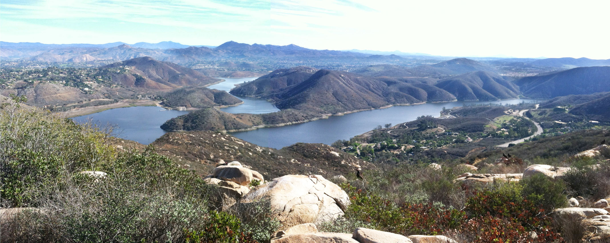
View of Lake Hodges from the Lake Hodges Overlook in the Elfin Forest Recreational Reserve.
|

Del Dios Gorge and Santa Fe Valley TrailsThe Del Dios Gore and Santa Fe Valley Trails area is an excellent location to see the transition between the coastal highlands (mountains) and the elevated coastal plain in northern San Diego County. It is also an excellent area to view the evolution of stream terraces and riparian habitats along the San Dieguito River canyon. It is also an excellent location to study the environmental impacts on the San Dieguito River floodplain caused by the construction of Lake Hodges Dam over a century ago. |
 |
|
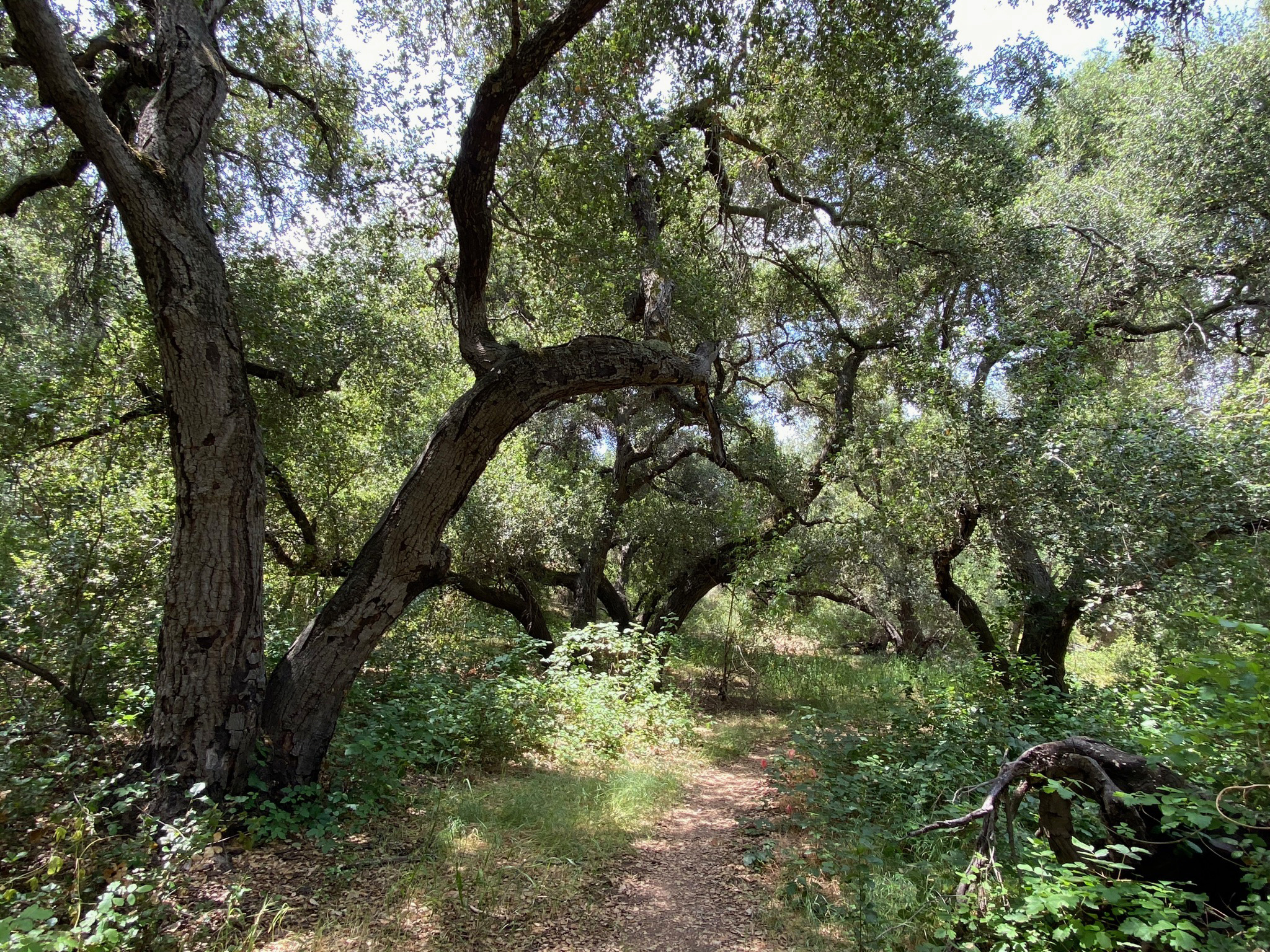
San Pasqual Valley DestinationsSan Pasqual Valley is located east of Interstate 15 between San Bernardo and Escondido, CA. The valley is host to trails that continue east from the Lake Hodges Area. Check out these websites about the region:
Geology and Natural History of San Pasqual Valley
The trails are part of the Coast To Crest Trail system maintained by the San Dieguito River Park. Much of the rural character of the valley is preserved within the SDRP Agricultural Preserve.
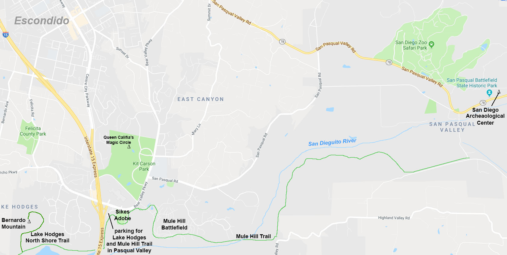
The San Pasqual Valley is also host to the San Diego Zoo Safari Park, Kit Carson Park, the San Diego Archeological Center, and San Pasqual Battlefield State Historic Park. |
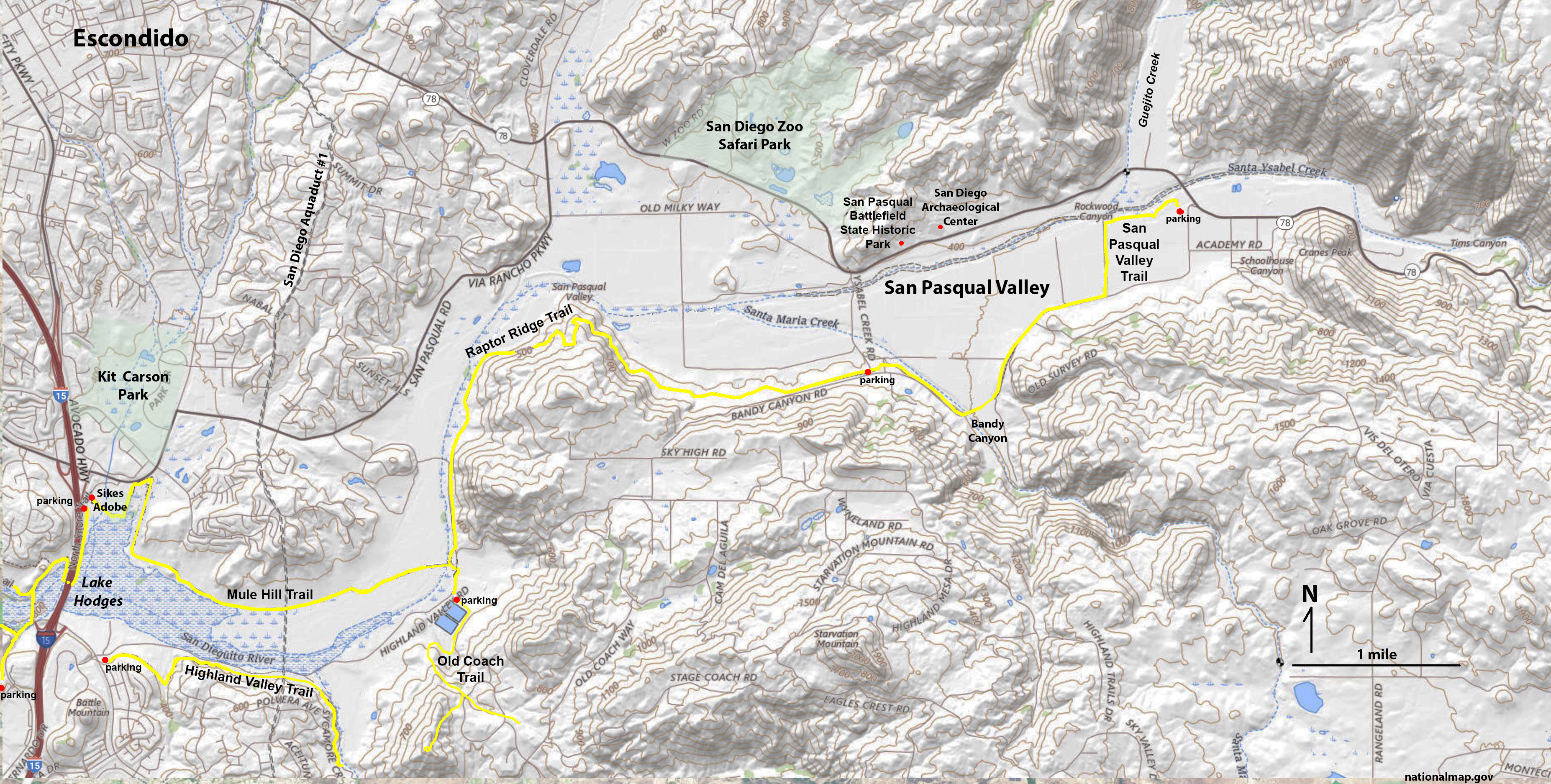 Map of the San Pasqual Valley showing the locations of the Mule Hill Trail, Highland Valley Trail, Old Coach Trail, Raptor Ridge Trail, San Pasqual Valley Trail. San Diego Archeological Center, Kit Carson Park, and San Diego Zoo Safari Park. |
|

Queen Califia's Magic Circle (in Kit Carson Park, Escondido, CA)Queen Califia's Magical Circle is the work of sculpture Niki de Saint Phalle (born France, 1930-2002). You can read about the history and inspiration of this amazing sculpture garden at a website: Niki de Saint Phalle's Queen Califia's Magical Circle. Her magic circle was inspired by California's mythic, historic and cultural roots. The sculpture garden consists of nine large-scale sculptures, a circular snake wall, and a maze entryway.Why is this an excellent geology field trip? What is amazing is the abundance of different minerals and semiprecious gemstones used in the construction of this amazing piece of art! If you go there, bring a guide to common minerals and gemstones with you and make a list of all the materials used in its construction. It rivals geology museum collections anywhere! It is also a delightful place to visit, especially with children! Queen Califia's Magical Circle is situated within a 12-acre natural habitat within the Iris Sankey Arboretum in Kit Carson Park. The park's entrance is located five minutes from I-15 (Via Rancho Parkway Exit) at the corner of Bear Valley Parkway and Mary Lane. |

San Diego Archaeological CenterThe San Diego Archaeological Center is a repository to preserve archaeological collections The organization's goal is to promote their educational, scientific and cultural use to benefit a diverse public. The Center was established in 1998 to help resolve a "curation crisis" - collections of artifacts that were distributed between multiple organization and collects that might be considered illegal under Federal Law (Antiquities Act).The center is located near the entrance to the San Diego Zoo Safari Park on Highway 78 east of Escondido. The small center has an excellent array of collections on display including artifacts going back nearly 10,000 years up to the present age. |
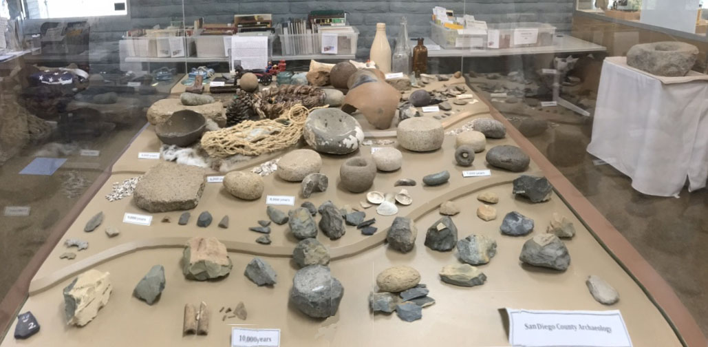 Example of a display of an artifact collection in the San Diego Archaeological Center. |
|
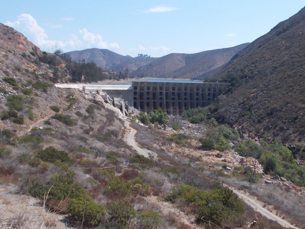
Blue Sky Ecological Reserve and Lake RamonaThe Blue Sky Ecological Reserve provides trails through oak forest, riparian, and coastal sage scrub habitats along trails that connect Lake Poway Park to Lake Ramona. The Reserve is located in Warren Canyon on the north side of Woodson Mountain. Bedrock exposures along the Green Valley Truck Trail (now a pedestrian trail) involves a scenic views and interesting geologic features from it trailhead in Poway for 2.5 miles and a 700 foot climb to the top of Lake Ramona Dam. |
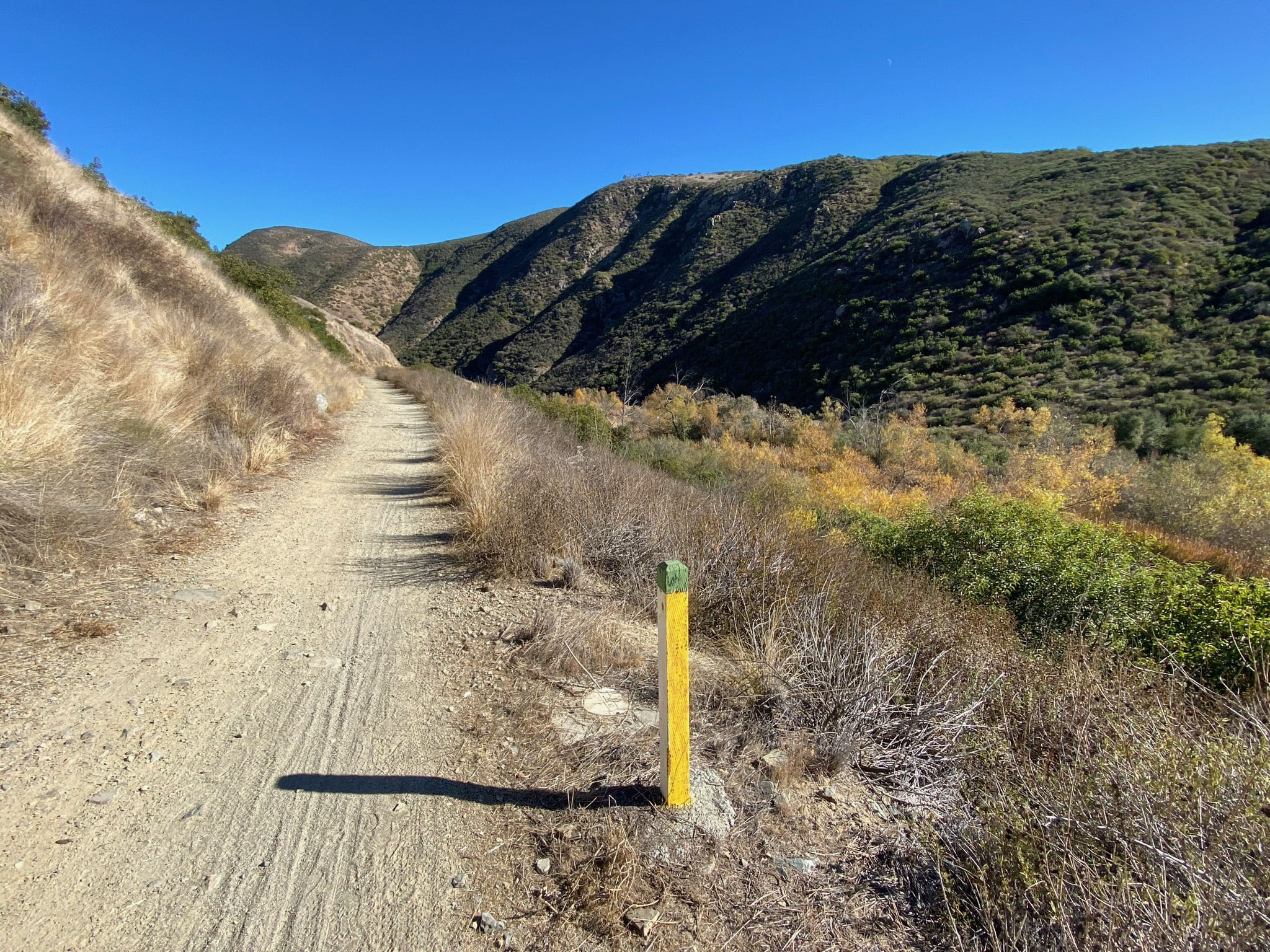
 Oak Grove Trail |
 Lake Ramona Dam |
Woodson MountainWoodson Mountain (elevation 2,881 feet) is a prominent landmark in the coastal San Diego region. The Mt. Woodson Trail is one of the most popular mountain hiking destinations in San Diego County. The trail starts in Lake Poway Park and ascends about 2,000 feet to the mountain summit. The destination for many hikers is to visit Potato Chip Rock, an unusual ledge composed of brittle granite that for some strange "death defying" reason, attracts people to climb out on, sometimes waiting in line for hours for their turn. |
 Woodson Mountain |
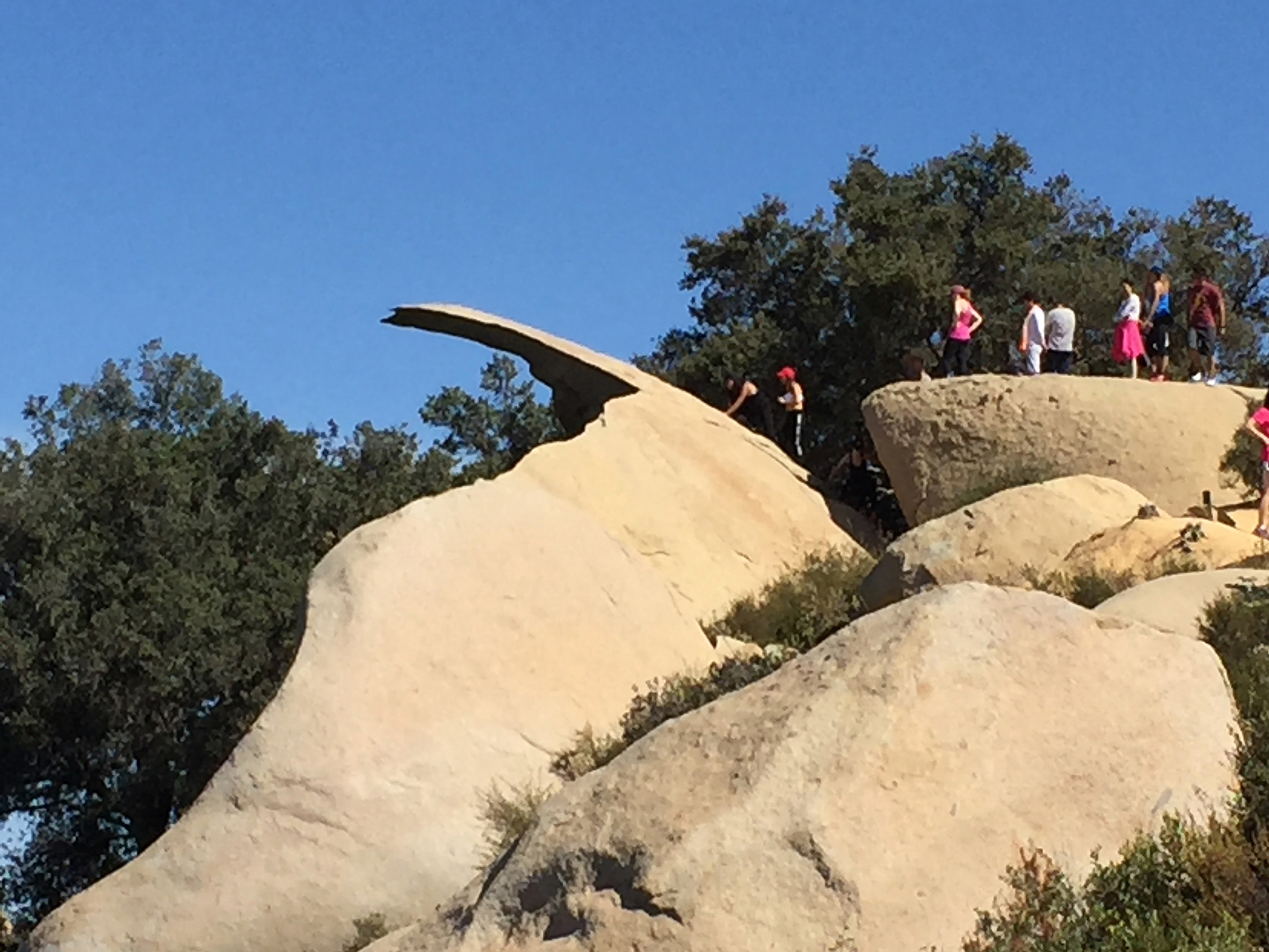 Potato Chip Rock |
San Diego High CountryThe high peaks of east-central San Diego County are visible from many locations in San Diego County. There are many places to visit in the high country. The town of Julian is close to many of the high peaks. Popular destinations include Cuyamaca State Park, Volcan Mountain Wilderness Preserve, and William Heise County Park. |
 High Peaks in San Diego Co. |
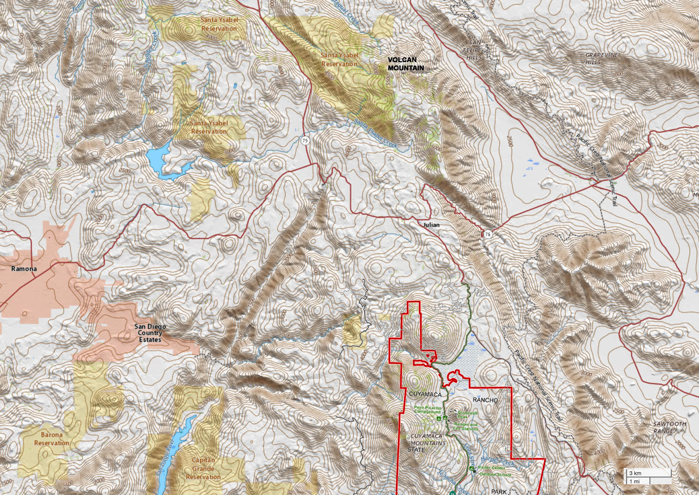 Map of the High Country in central-eastern San Diego Co. |
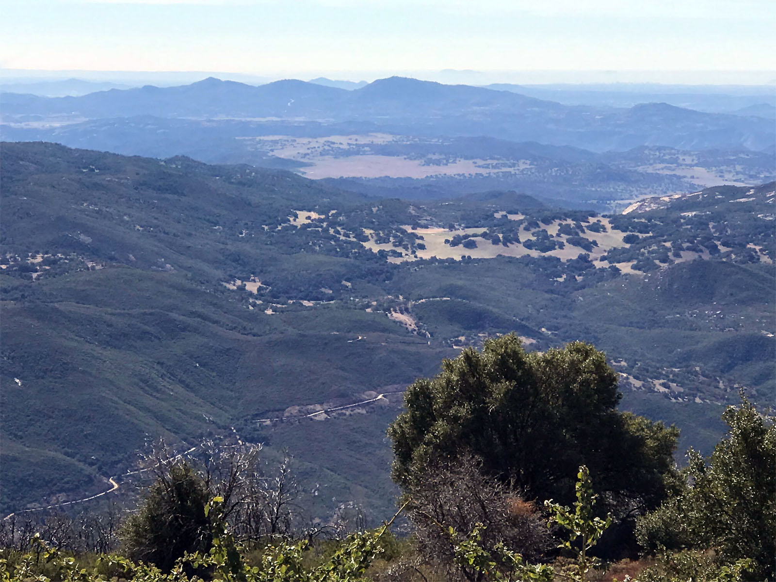
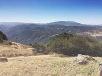 Cuyamaca Mountain view from Volcan Mountain Trail |
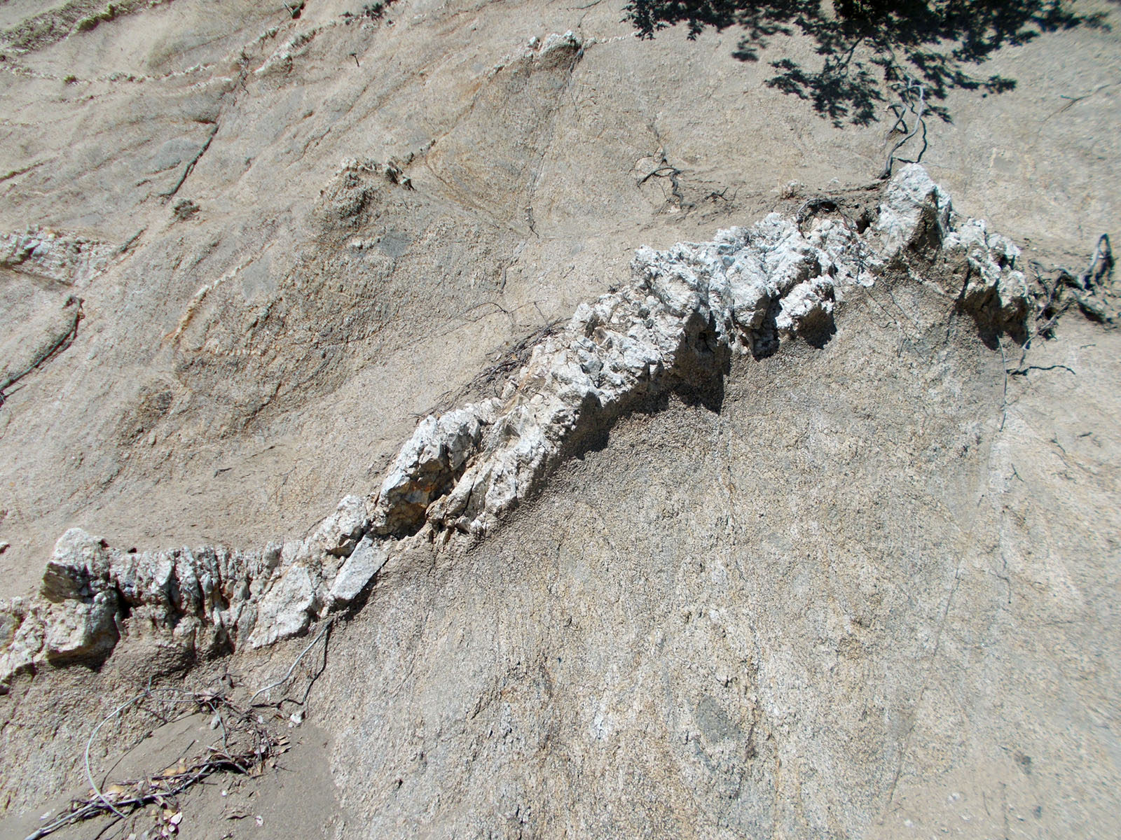
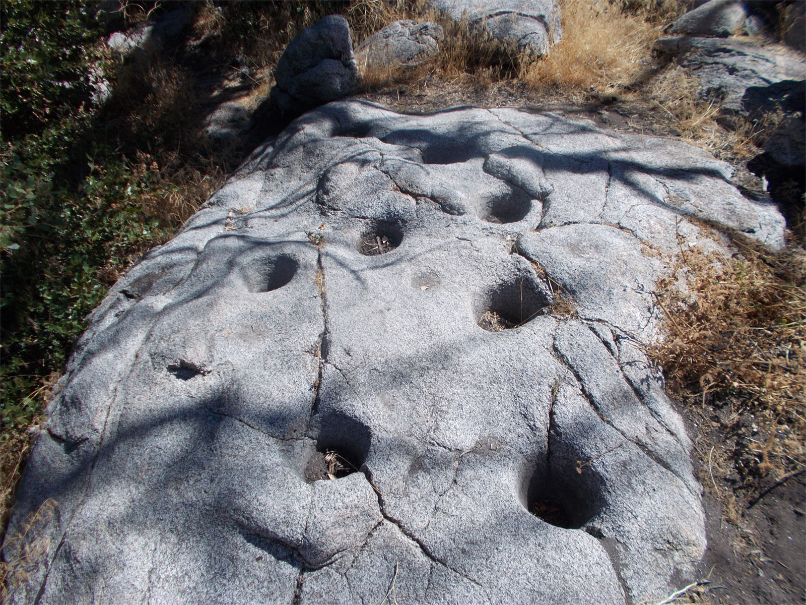
Palomar MountainPalomar Mountain is a high ridge of granite bedrock uplifted along a linear trend on the east site of the Elsinore Fault Zone (a major earthquake fault zone that runs north-to-south across central San Diego County. The high point of Palomar Mountain is 6,138 feet (1780 meters). Many pegmatite dikes are exposed in the road cuts in the granite bedrock along the road up to Palomar Mountain summit. Palomar Mountain State Park is host to many miles of hiking trails through upland forests. Mortar holes carve in granite outcrops reflect the heritage of prehistoric native populations using this mountain.The Palomar Observatory and Museum are essential destinations for regional fieldtrips! The Observatory ground are spectacular scenery with large redwoods and sequoia trees planted over 100 years ago. The Museum exhibits have been recently updated and describe many of the amazing aspects of what we now collectively know about the age, size, and features within the Observable Universe. |
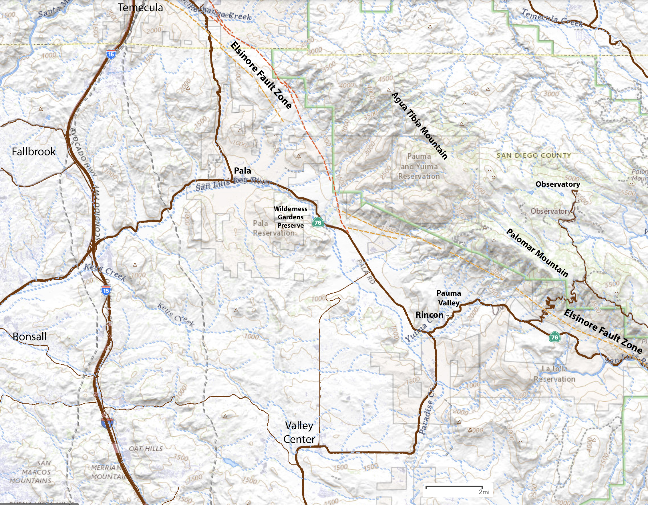
 View looking west from Palomar Mountain toward the San Marcos Mountains. The Elsinore Fault (a major regional earthquake fault) runs north-to-south in the valley west of Palomar Mountain. |
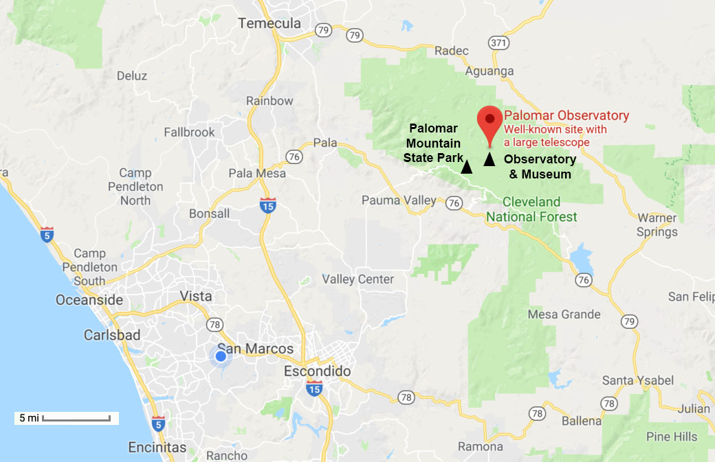 Map showing Palomar Mountain and Palomar Observatory. Palomar Mountain is about a 2 hour drive from anywhere in coastal San Diego, but it is well-worth-the-visit. Camping on Palomar Mountain is highly recommended! |
|


Wilderness Gardens County PreserveWilderness Gardens County Preserve was the first open space preserve in San Diego County (established in 1973). This preserve is a gem of a park that encompasses 773 acres of wildlands. It is located off Highway 76 near Pala, CA. It has 4 miles of hiking trails in the scenic valley in the headwaters region of the San Luis Rey River. The preserve is home to restored riparian, oak forest/grasslands, coastal sage, and chaparral plant communities, the rocky stream bed, and has a couple ponds that host frogs, migratory birds and waterfowl and other wildlife. Views from the trails encompass the scenic mountainsides of Agua Tibia Mountain and Palomar Mountain. The park is an idea destination on a day trip for a hike and a picnic, perhaps to also enjoy viewing wildflowers, wildlife, and mountain scenery. |
 Map showing the location of Wilderness Gardens County Preserve located about 12 miles east of Intertate 15 in the North County region. |
 View of the coastal sage habitat on the San Luis Rey River floodplain in the Wilderness Gardens Preserve. Palomar Mountain is in the distance. |
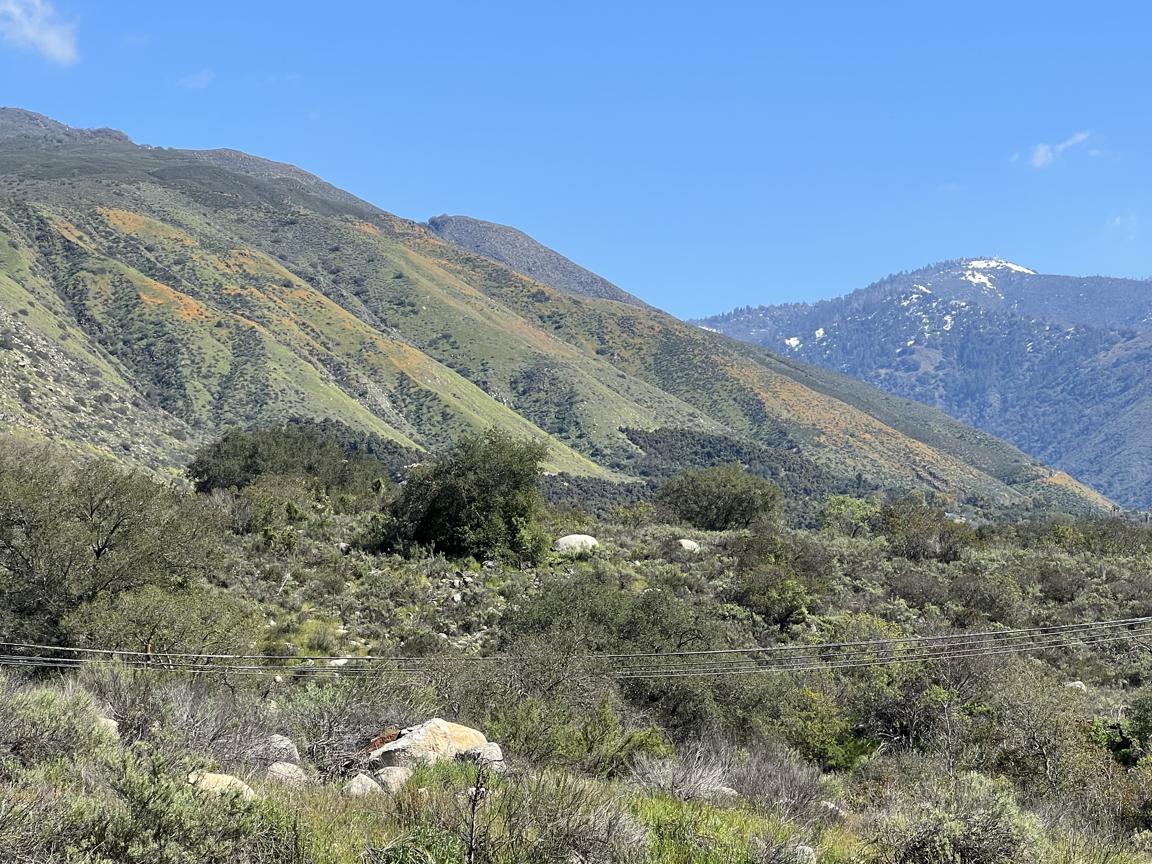
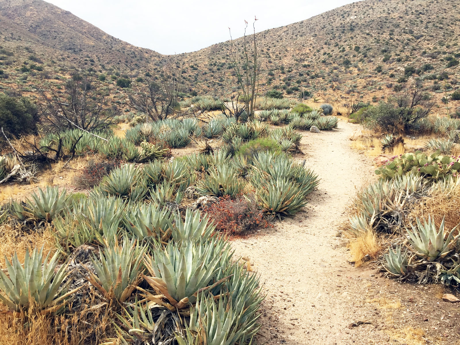
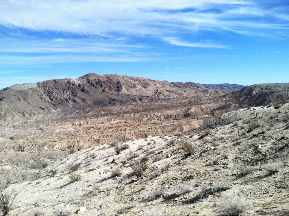
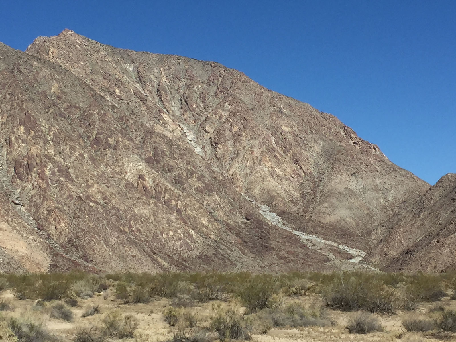
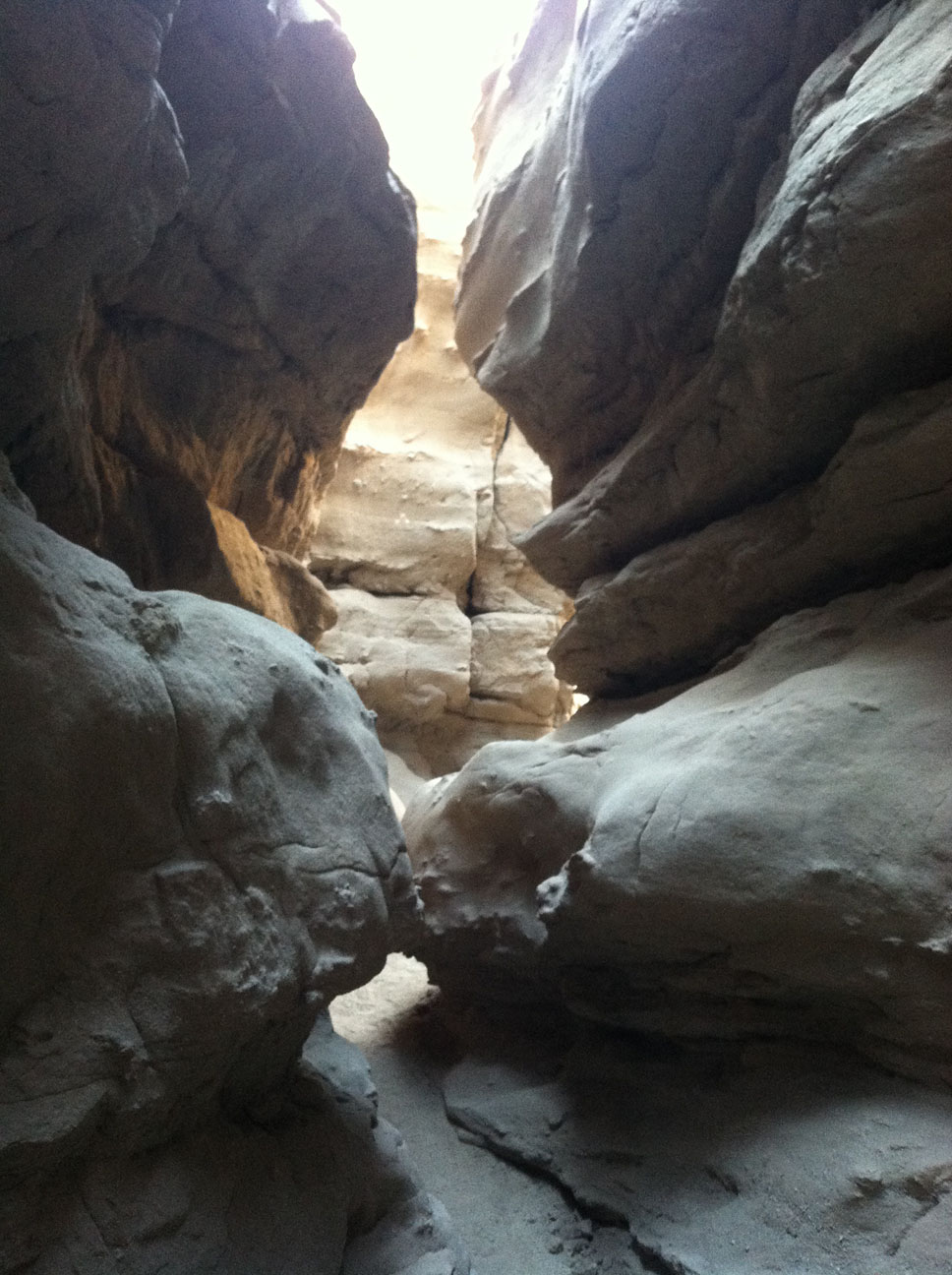
Anza Borrego State ParkAnza Borrego State Park is the largest state park in the United States! The park is an excellent fieldtrip destination, for a day or a week. There are so many places to see and go in the park. A visitor center in Borrego Springs is an excellent place to start. There are many places to camp and trails to hike. It is very important to check weather conditions before visiting, summer temperatures are frequently in the 100s. Spring wildflower season is perhaps the best time to go.Anza Borrego State Park website Anza Borrego State Park Map Agua Caliente County Park - this county park has camping and hot spring-filled pools. The park is closed in summer. See discussions about the Elsinore Fault Zone related to Agua Caliente's hot springs and portions of Anza Borrego State Park. |
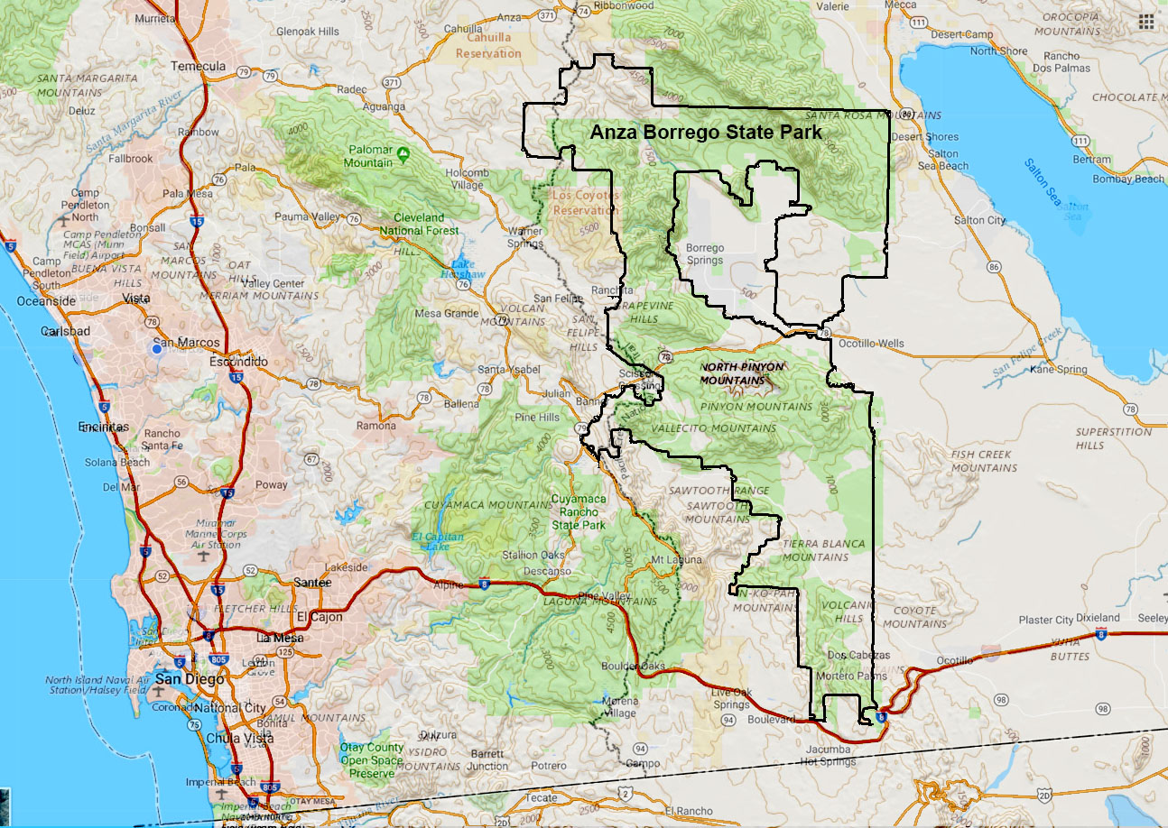 Map of Anza Borrego State Park |
|
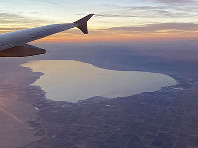
Salton Sea, Salton Buttes Volcanic Field, and the San Andreas Fault ZoneAlthough this field trip is not in San Diego County, it is a worthy field trip destination within a couple hour drive from most locations in urban San Diego County. The most interesting parts of the area are associated with the Sonny Bono Salton Sea National Wildlife Refuge. The Salton Buttes volcanic field and geothermal field are located near the southeast shore of the Salton Sea. Small rhyolite and obsidian bearing lava dome volcanoes and hot spring, mud pots, and mud volcanoes occur in and around the national wildlife refuge. Perhaps of greatest interest is the birdwatching of an abundance of migratory and endemic waterfowl. Nearly 400 species of birds have been observed in the surrounding area. The Salton Sea exist because of a man-made disaster associated with a flood on the Colorado River. The geologic and cultural history of the Salton Sea , and the ancient Lake Cahuilla that filled the basin in prehistoric times is an amazing story. |
|
Santa Catalina IslandSanta Catalina is a spectacular field trip/camping destination for those who have time and means to get there. The island is a massive mountain of exposed ocean crust (a piece of the ancient Farollon Plate). Stop at the Catalina Island Conservancy Nature Center during a hike up to the Wrigley Memorial & Botanical Garden, or better a hike up to the high ridgeline near the town of Avalon provides spectacular view. A shuttle runs between the two ferry ports in the towns of Avalon and Two Harbors. You can get there by taking the Catalina Express (ferry). |
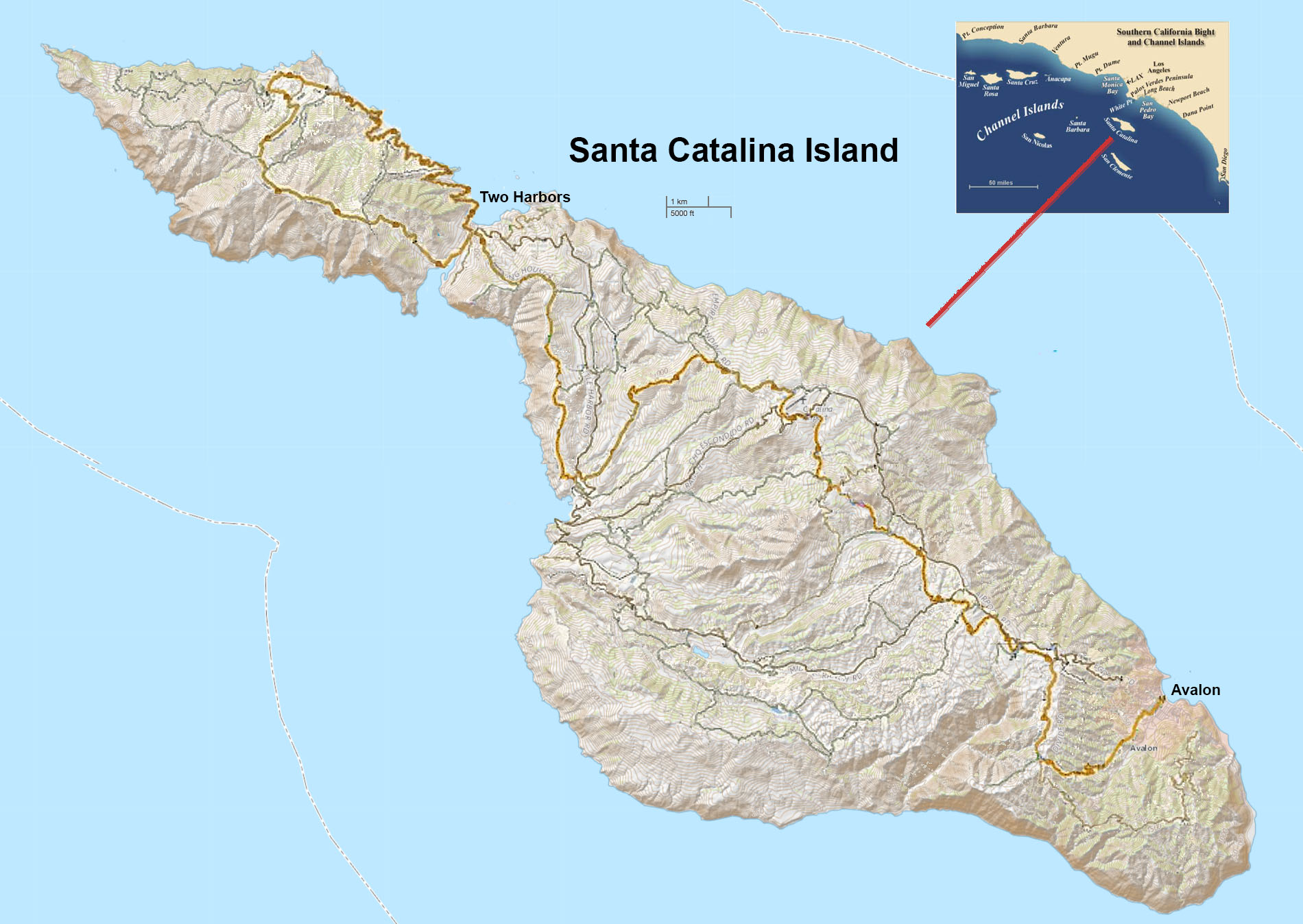 Map of Catalina Island |
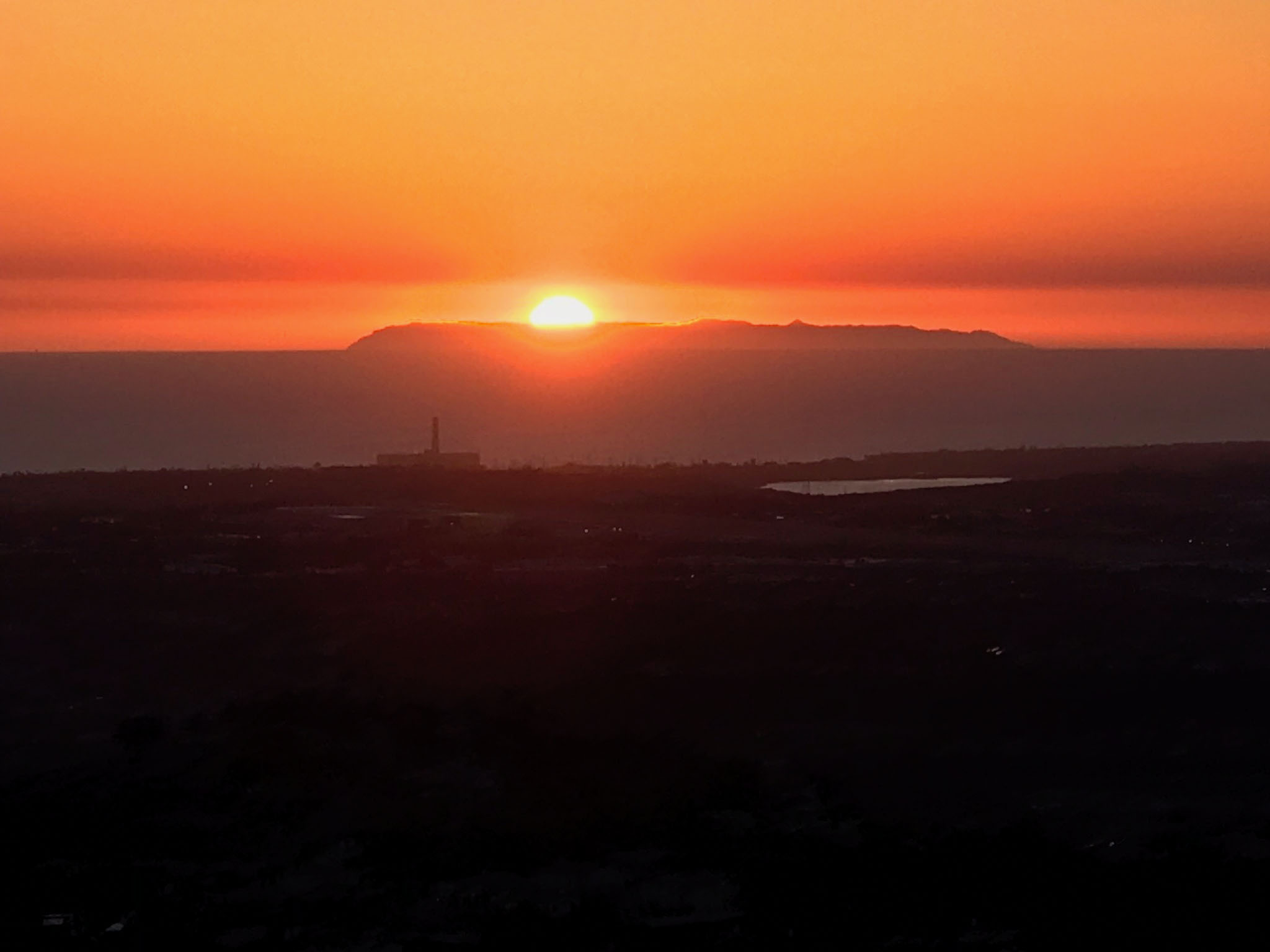 Sunset over Catalina Island. |

Panorama view of the crest of Catalina Island from about a 3 mile hike up from downtown Avalon.
Museum Destinations |
Balboa Park Museums and GardensBalboa Park is the premire recreation and education destination in San Diego. Plan to send a day (or many more) in Balboa Park! There are 18 museums, 7 performing arts centers, 10 gardens, and numerous other buildings and attractions.Explore the Balboa Park website!Students interested in the natural sciences will want to visit all the museums below:theNAT - San Diego Natural History Museum (see below) San Diego Mineral and Gem Society Museum (small but exceptional museum collection of minerals, gems, and fossils) Reuben H. Fleet Science Center (has exhibits about astronomy and technology) San Diego Air & Space Museum (exhibits about aircraft and spacecraft) San Diego Museum of Us (formerly called the Museum of Man, has exhibits about human evolution and anthropology) San Diego History Center Gardens in the park include: Australian Garden Botanical Building and Lily Pond California Native Plant Garden Desert Garden 1935 (Old) Cactus Garden Florida Canyon Native Plant Preserve Japanese Friendship Garden |
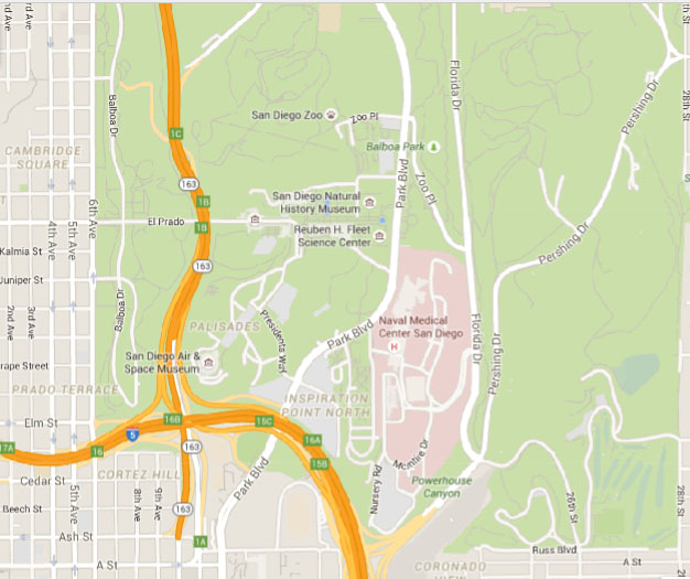 Location map of Balboa Park Here is a better website for:Map & DirectionsJust as important, see a:Parking mapPrint a copy of this map and take it with you! |
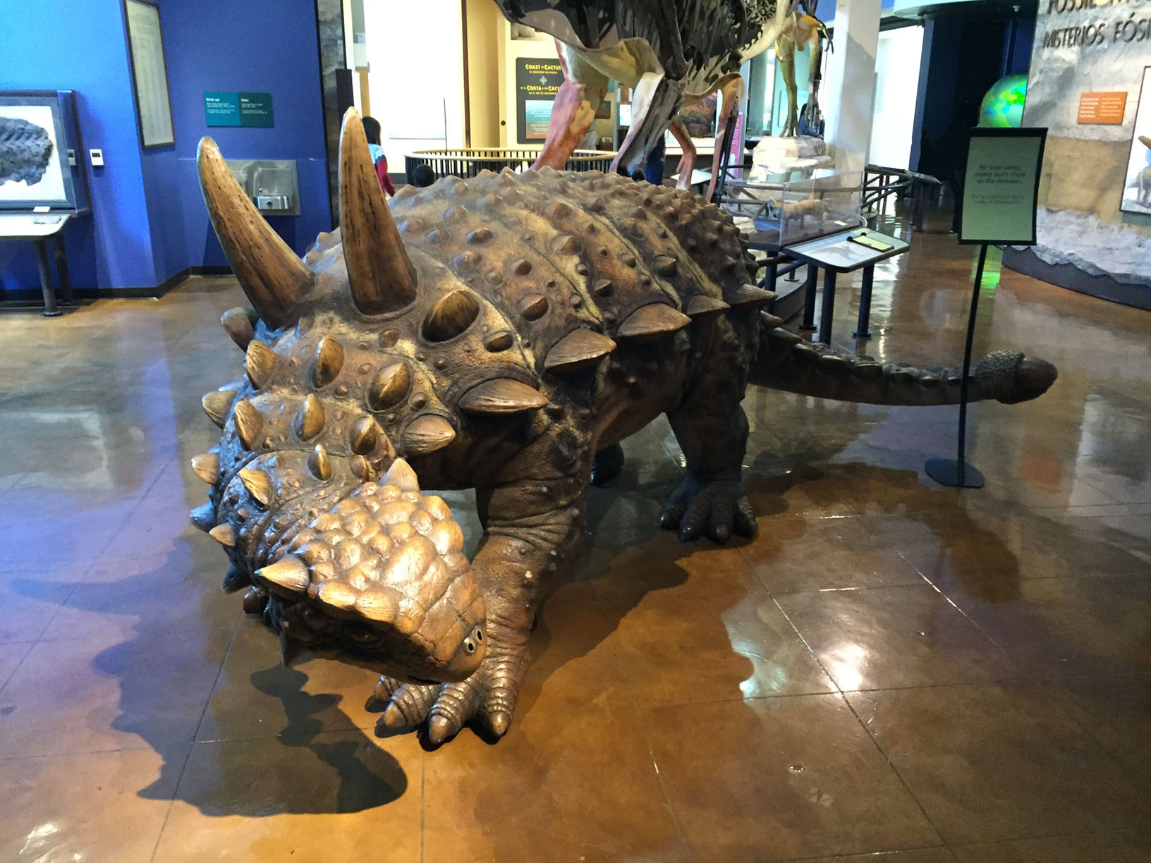
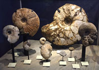
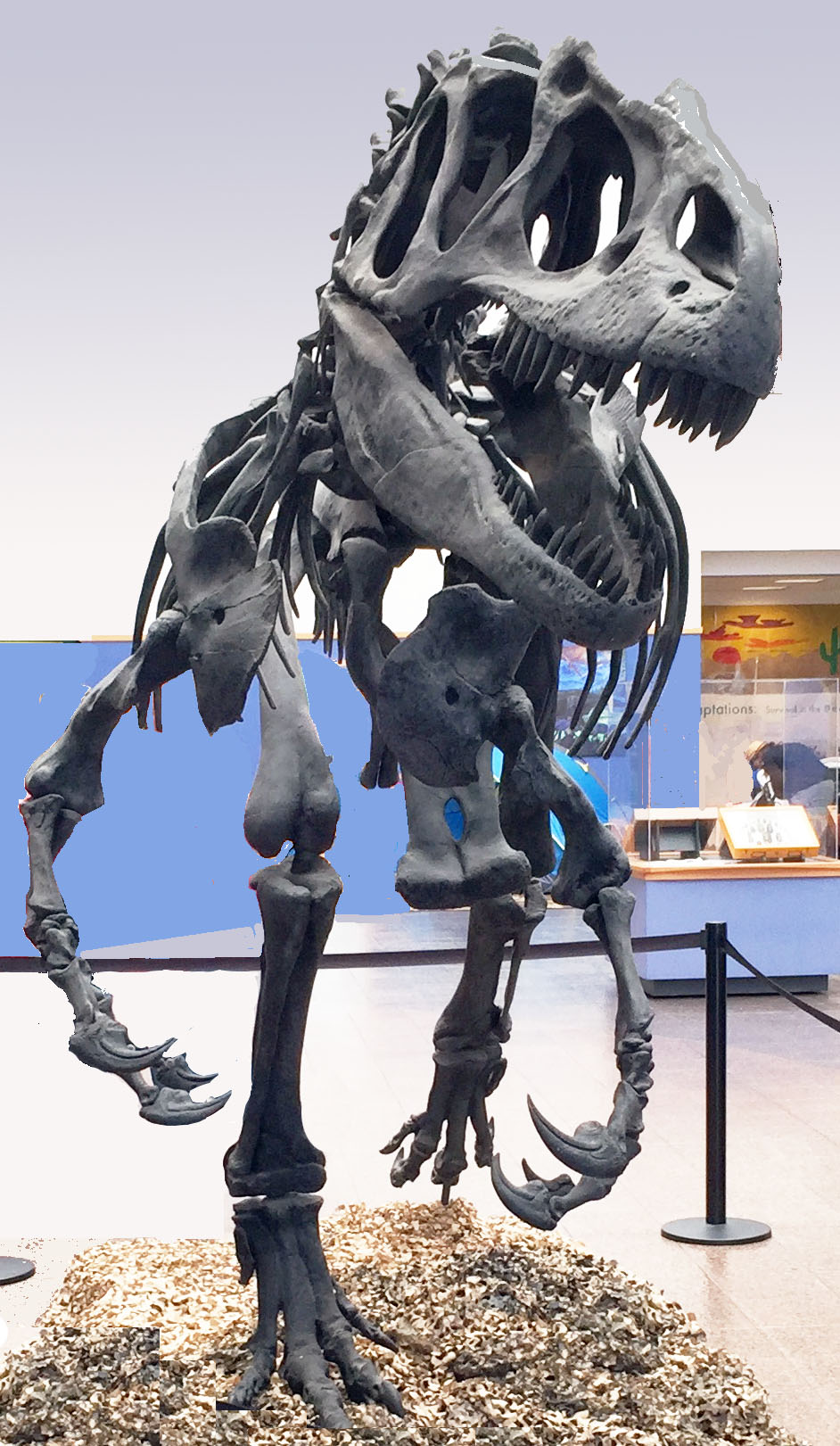
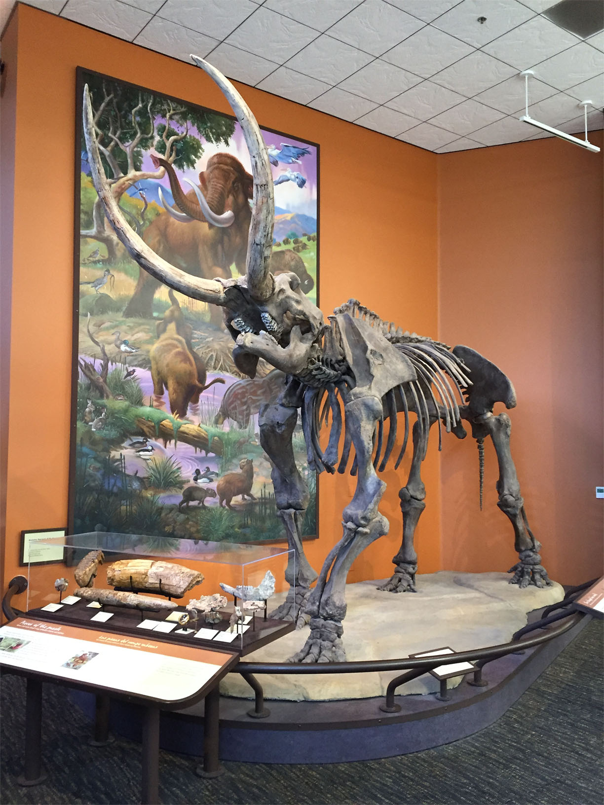
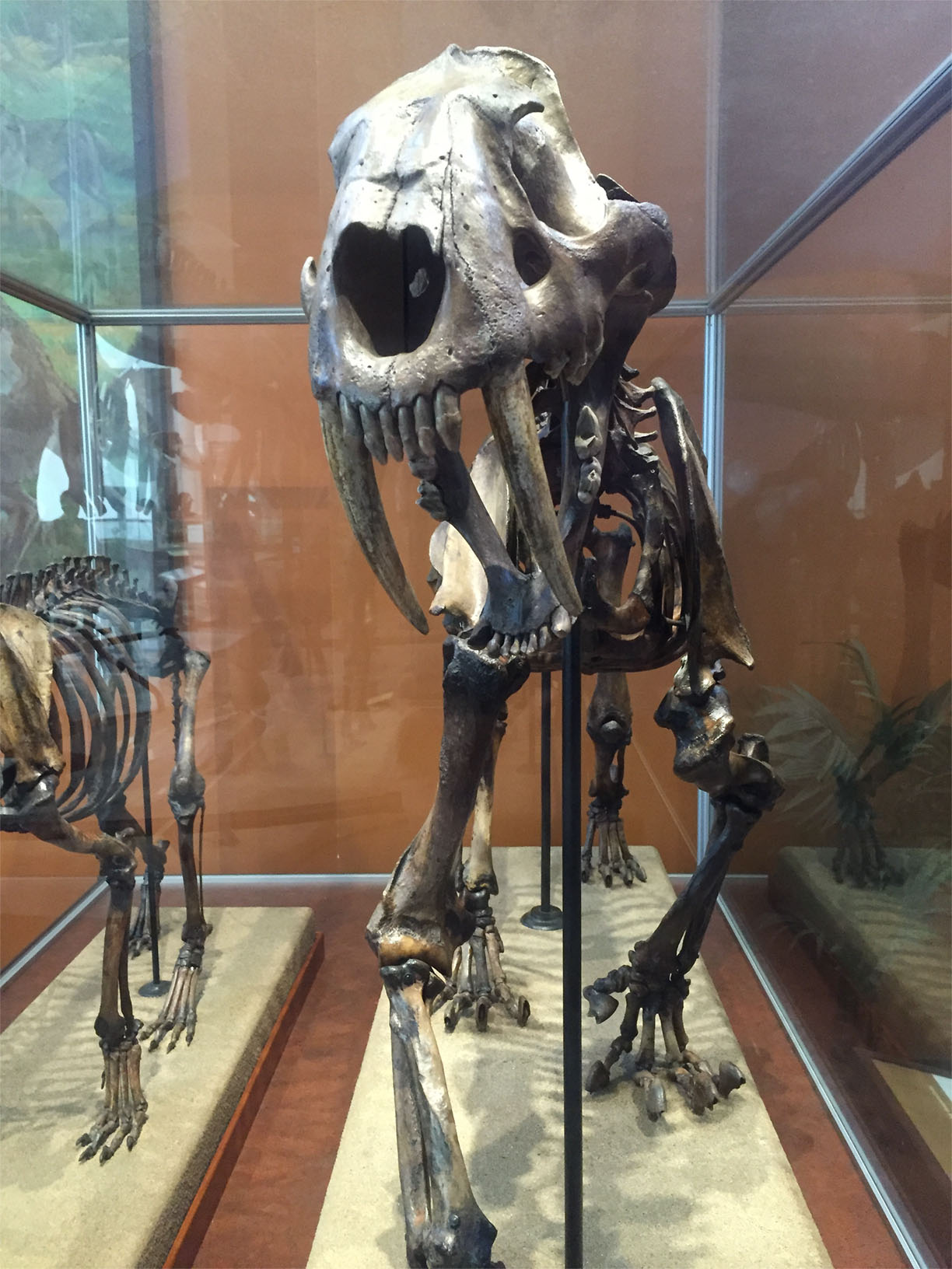
San Diego Natural History Museum (the NAT)San Diego Natural History Museum is featuring exhibits, lectures, classes and fieldtrips related to natural history for all ages. The museum has exceptional regional fossil displays, changing exhibits, and an Imax theatre. This museum is highly recommended for anyone interested in learning about the natural history of San Diego County. Be sure to walk through the Cactus Garden Trail next to the Rose Garden across the street from the Natural History Museum. |
|
San Diego Zoo"The San Diego Zoo is "the most highly recommended destination for a day trip in San Diego. Period!" The San Diego Zoo also located in Balboa Park. The Zoo is not only a world-class zoo, it is also one of the best and most impressive botanical gardens in the world. The park has numerous exhibits and information resources, not only about life on the planet, but paleontology as well. It will take an entire day to walk all the trails in the zoo. |
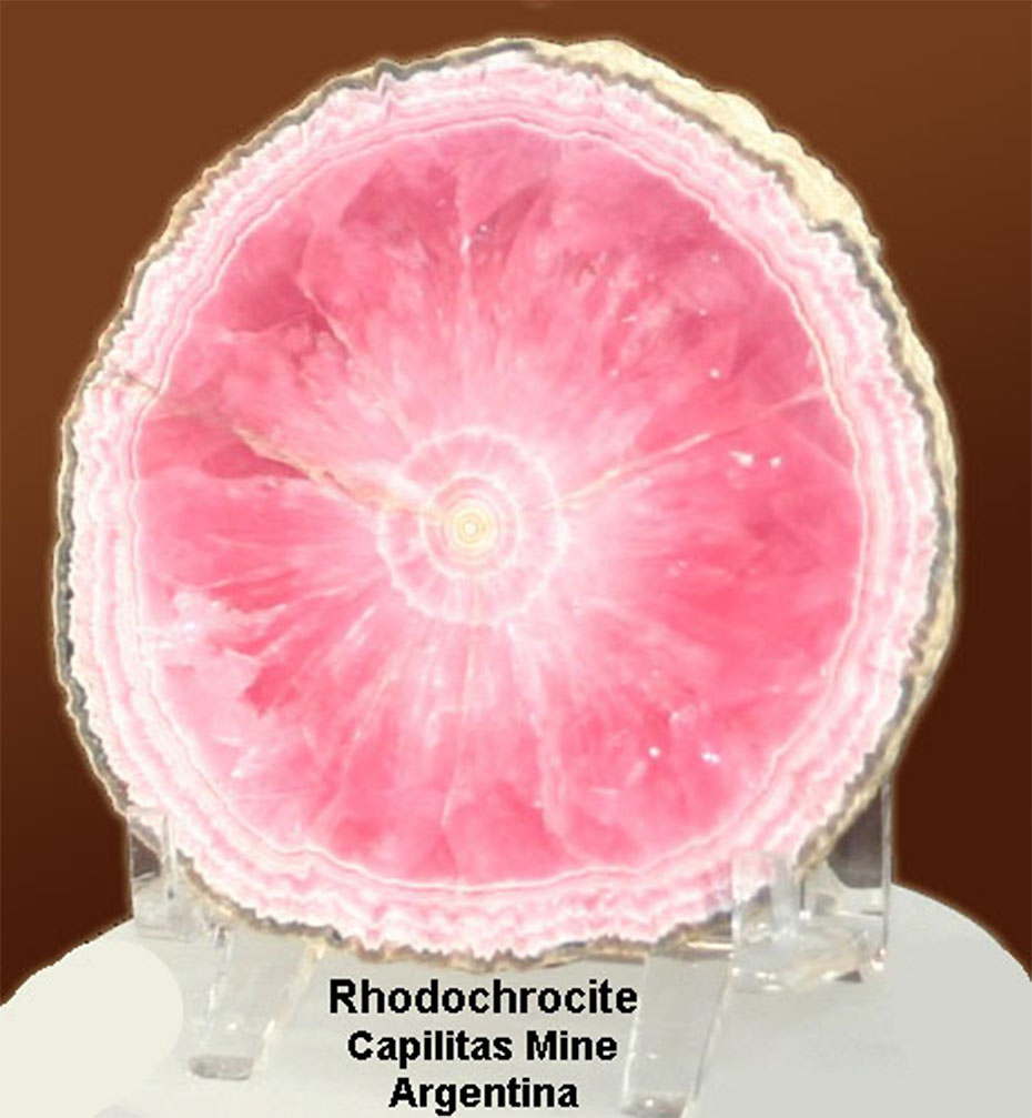
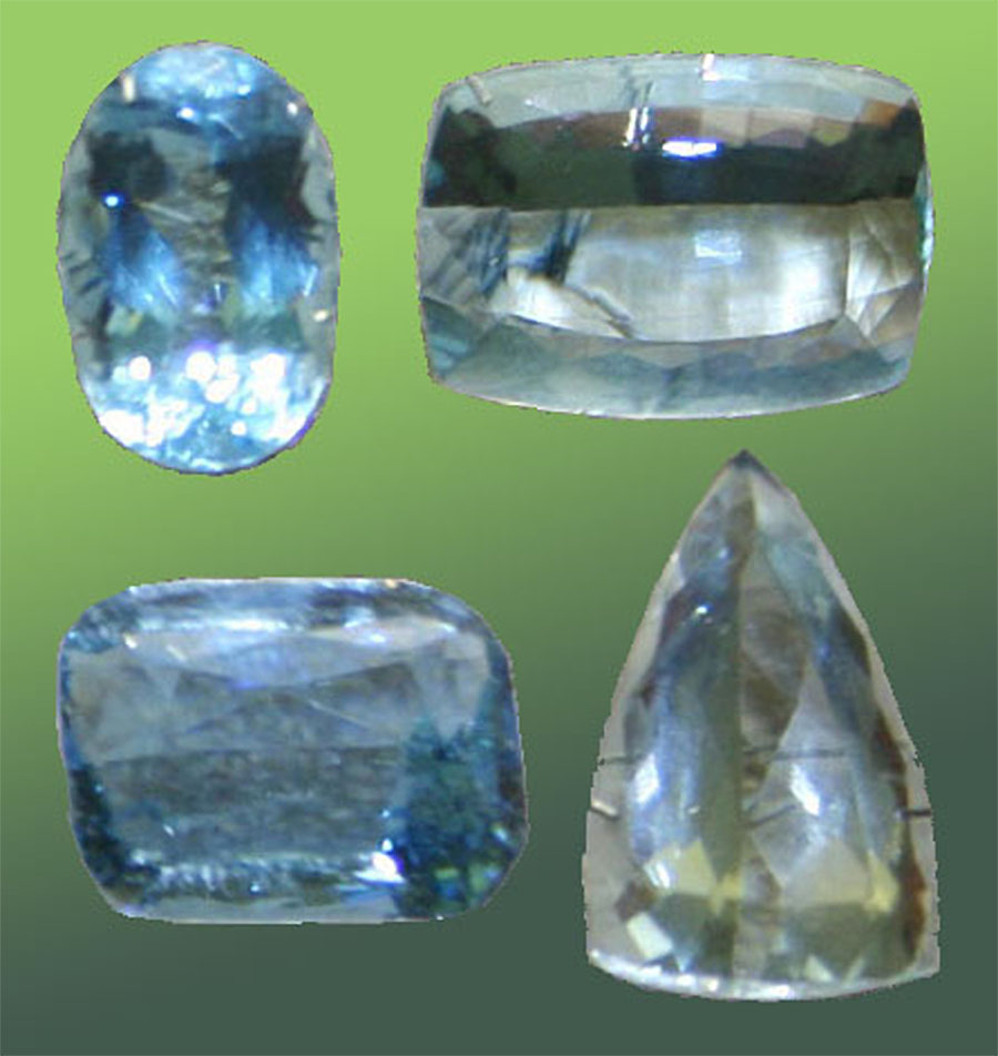
Gemological Institute of AmericaIf you live in the San Diego area, consider taking a guided tour at the Gemological Institute of America (GIA) in Carlsbad, CA. The GIA offers tours of their facilities where students and professionals are taught how to identify, evaluate, and work with gems and precious stones. The main building at GIA Headquarters has hallways lined with exhibits filled with exceptional examples of gems and provide discussions about their nature and occurrence. The GIA has a large hall with special exhibits, and a room with one of the best mineral and gem-bearing rock exhibits in the world. The tour is free, but must be scheduled by reservation in advance. GIA is an excellent place to learn more about gems and minerals. Note that San Diego County has a long history of gem mining, and GIA provides a lot of information about historic mining operations with spectacular examples of local tourmaline, morganite, and other gem minerals. |
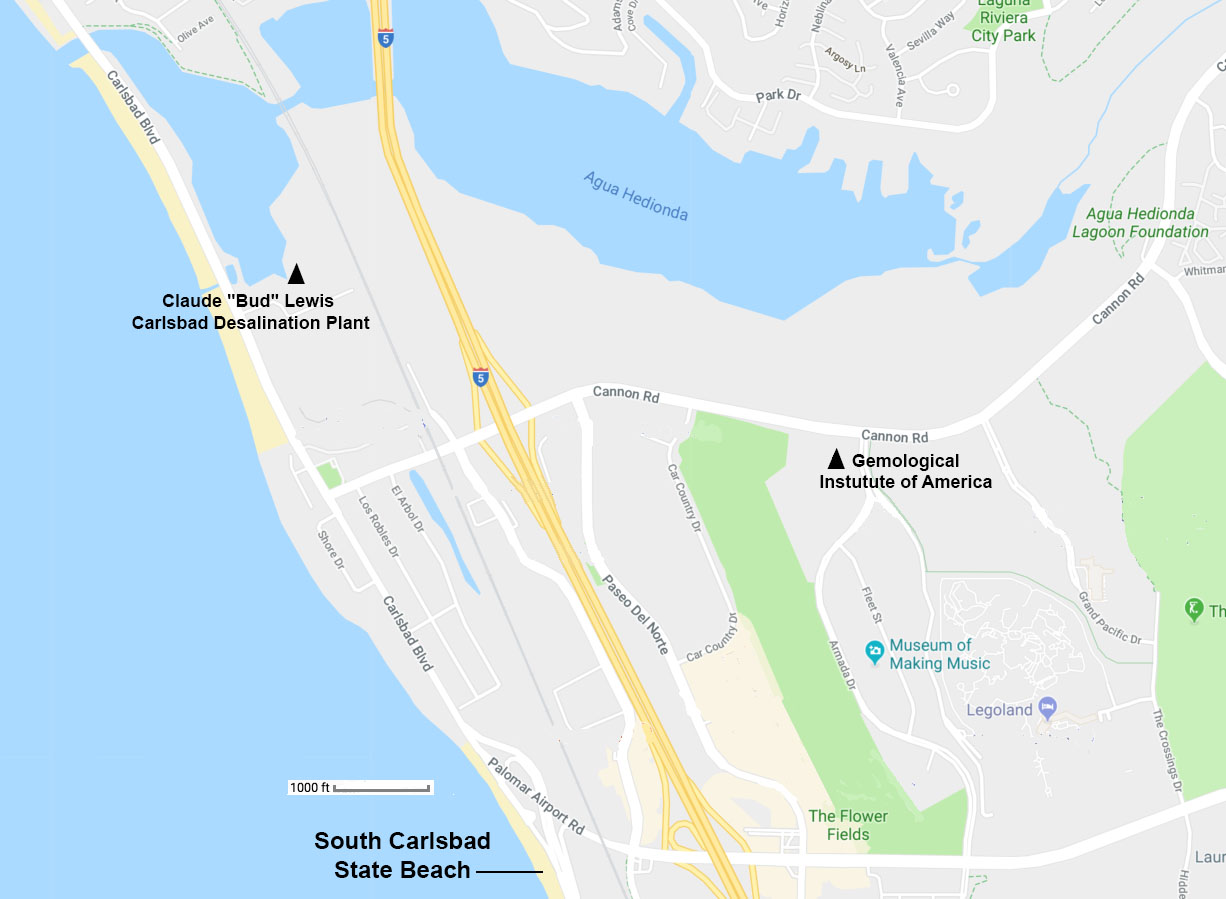 The GIS is located in Carlsbad and offers tours and classes. |
|

Learn about fluorescent minerals from southern California. |
| Sea World - This can be turned into an fieldtrip if participants examine all the displays about sea life and that examine the science behind Sea World. Although SeaWorld is a commercial venture focused on entertainment, there are many science and environmental exhibits. Sea World is a good destination for students with children. |
Useful Resources For Planning Field TripsBefore you head out, you will want to check out the weather and tide schedules, and look at geologic maps and information about where you are going. Here are resources that students in any of the natural sciences will want to know about. |
NOAA Tides & Currents - Scripps Pier Station in La Jolla, California.This website has a "tide calculator" for tides any time in the future. Be sure to explore the links for Station Information, Tides/Water Levels, Meteorological Observations, and Physical Oceanography.To see the NOAA Tides & Currents website for information other locations around the United States (Pacific, Atlantic, and Great Lakes) including local water levels, tide and current predictions, and other oceanographic and meteorological conditions. |
National Weather Service (website)Learn about San Diego Weather and weather-related resources of the NOAA and the National Weather Serivice.NowCOAST: NOAA's Web Mapping Portal to Real-Time Coastal Observations, Forecasts, and Warnings. Include a variety of base maps including satellite imagery. This is an extremely useful GIS website! |
Geologic Maps and Topographic Maps of San Diego CountyGeologic Map of California (California Geological Survey)Maps of the San Diego Region: This website provides useful regional maps showing geology, ocean bathymetry, physiography satellite imagery, land use and management. Oceanside 1:100,000 scale map and 1:24,000 scale maps (coastal northern San Diego County, modified from CGS/USGS geologic map) San Diego 1:100,000 scale map and 1:24,000 scale maps (coastal southern San Diego County, modified from CGS/USGS geologic map) These maps were modified from California state and federal geologic maps - very useful resources for studying regional geology! Use these maps to research information about where you live, and the locations of places you plan to hike or observe nature. |
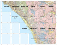 Oceanside geologic quadrangle map index (modified from CGS/USGS geologic map) |
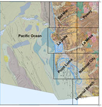 San Diego geologic quadrangle map index (modified from CGS/USGS geologic map) |
Finding Geologic and Geographic (Maps) information for lands and resources in the United States
|
| https://gotbooks.miracosta.edu/fieldtrips/index.html | 2/4/2024 |