|
San Elijo State Beach and Lagoon Environmental Reserve |
|
Field Trip To the San Elijo State Beach Area |
A1
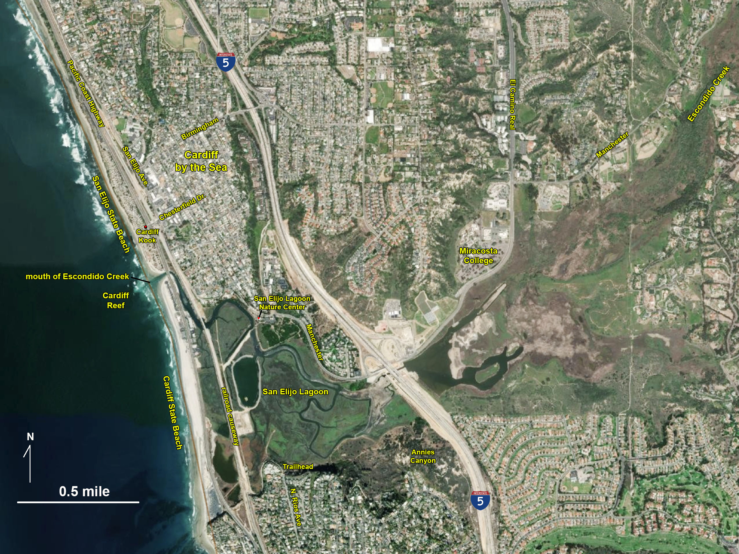
The San Elijo State Beach area is an excellent destination for a field trip to study the geology and ecology of the coastal environments of San Diego County. The park is located in the densely developed coastal community of Cardiff-by-the-Sea (a suburb of Encinitas, California). Fortunately, the beach and sea cliffs and beaches have been preserved as a state park, and the lagoon as a marine ecological reserver (Figure 1). This field trip focuses on the geology of the physical setting of the beach, sea cliffs, lagoon, and hillsides of the Escondido Creek valley. The first part the trip begins at San Elijo State Beach and involves a walk down to the Cardiff State Beach (to the south). The second part of the field trip is to the San Elijo Lagoon Ecological Reserve and Nature Center, and a third part involves a hike along the south side of the lagoon to a popular destination called Annie's Canyon. In practice, these three locations have served as three separate field trips for oceanography classes and labs at MiraCosta College (located on the north shore of the lagoon).
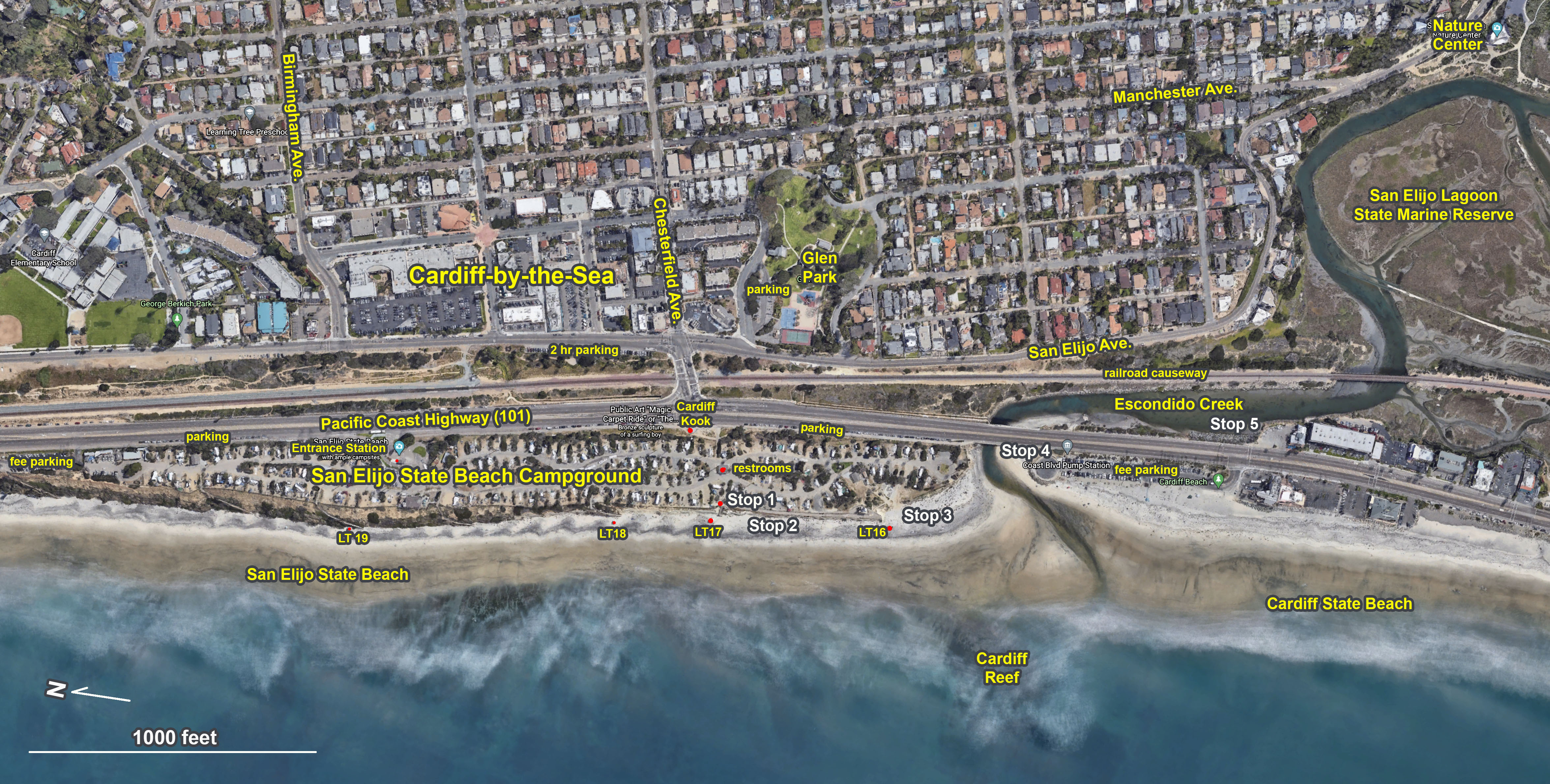
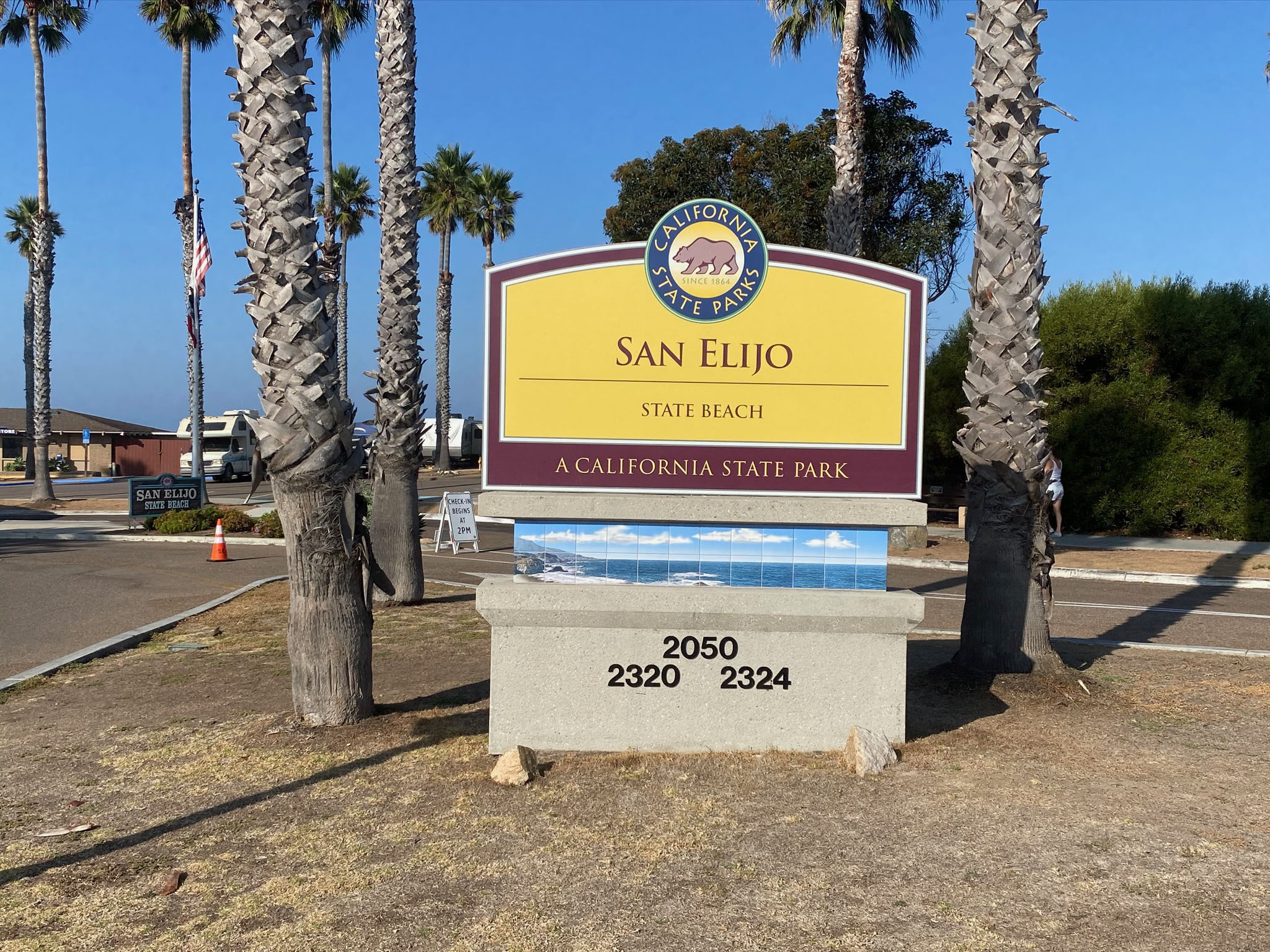
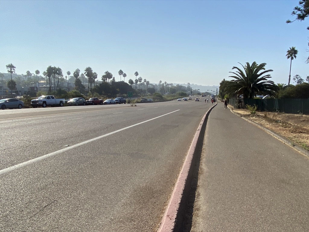
The first part of the field trip starts at San Elijo State Beach, located along the Pacific Coast Highway at the south end of Encinitas (Figure 2). Note that parking can be a challenge especially on afternoon and weekends (tips discussed below). The official website for San Elijo State Beach. Note that the state park campground and requires access fees, so don't go in there unless you intend to camp (Figures 3 and 4). There is the North Day-use Parking Lot with automated pay machines north of the campground. However, the best option for parking is to see if a free parking spot is available along the Pacific Coast Highway south of the Cardiff Kook (a local landmark statue; Figures 5 and 6). Also, there is 2-hour free parking on the east side of the railroad tracks on San Elijo Avenue, and if you are lucky, you can find a free spot in the nearby neighbors of Cardiff. There is also a fee lot at Cardiff State Beach. |
Click on images for a larger view. |

Fig. 1. Satellite Map of the San Elijo Beach area. This satellite view shows the major landscape features in coastal area of southern Encinitas, California. Major features on the landscape include the suburban neighborhoods surrounding the lagoon, I-5, the Pacific Coast Highway, and the railroad line.
|
A2
Beach Walk Field Trip on San Elijo State Beach
This field trip involve a walk south along the beach to examine the sea cliffs, beach, the tidal delta at the mouth of the lagoon, and the geometry of the Cardiff Reef (a local popular surf spot). Hopefully there will be opportunity to observe a variety of wildlife.
The best place for students to meet to start this field trip it to gather at the top of a staircase that leads to the beach that is directly west of the Cardiff Kook There is a walk-in entrance to the park near the Cardiff Kook and you walk past public restrooms on the way to top of the staircase for Stop 1.
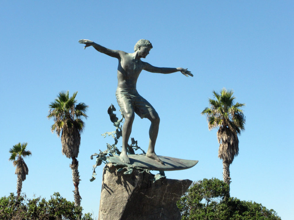
The statue's real name is "Magic Carpet Ride," but local residents who didn't approve of the expensive artwork started dressing up the statue with different costumes, and it has became legend. You can go online now and see perhaps thousands of outfits it has been given since the statue went up in 2007.
|
| Fig. 2. Map showing 5 stop field trip stop locations in the San Elijo State Beach, Cardiff Beach, and San Elijo Lagoon area. |
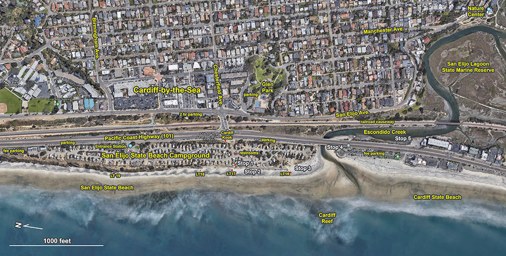

Fig. 3. San Elijo State Park sign along the Coast Highway |
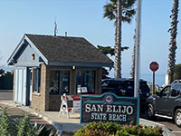
Fig. 4. Entrance station to the state park campground |
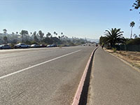
Fig. 5. View to the south along the Pacific Coast Highway. |

Fig. 6. The "Cardiff Kook" landmark statue along the PCH |
|
A3
San Elijo State Beach and Sea Cliff
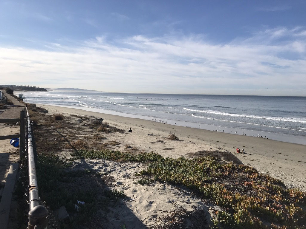
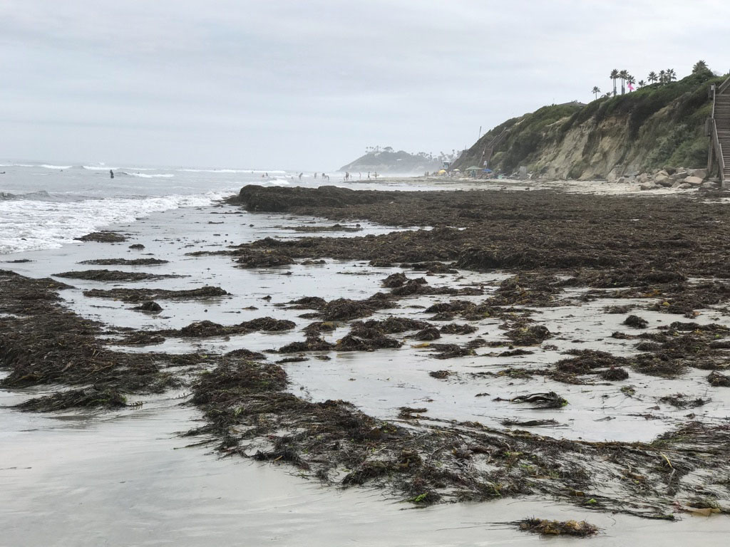
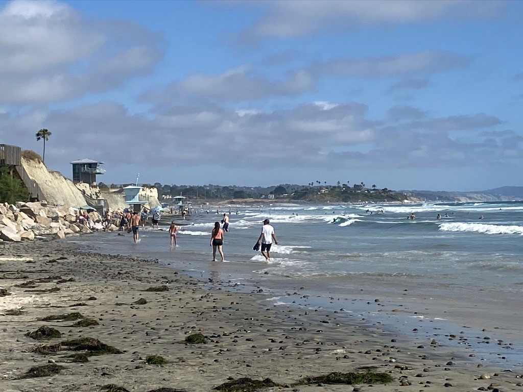
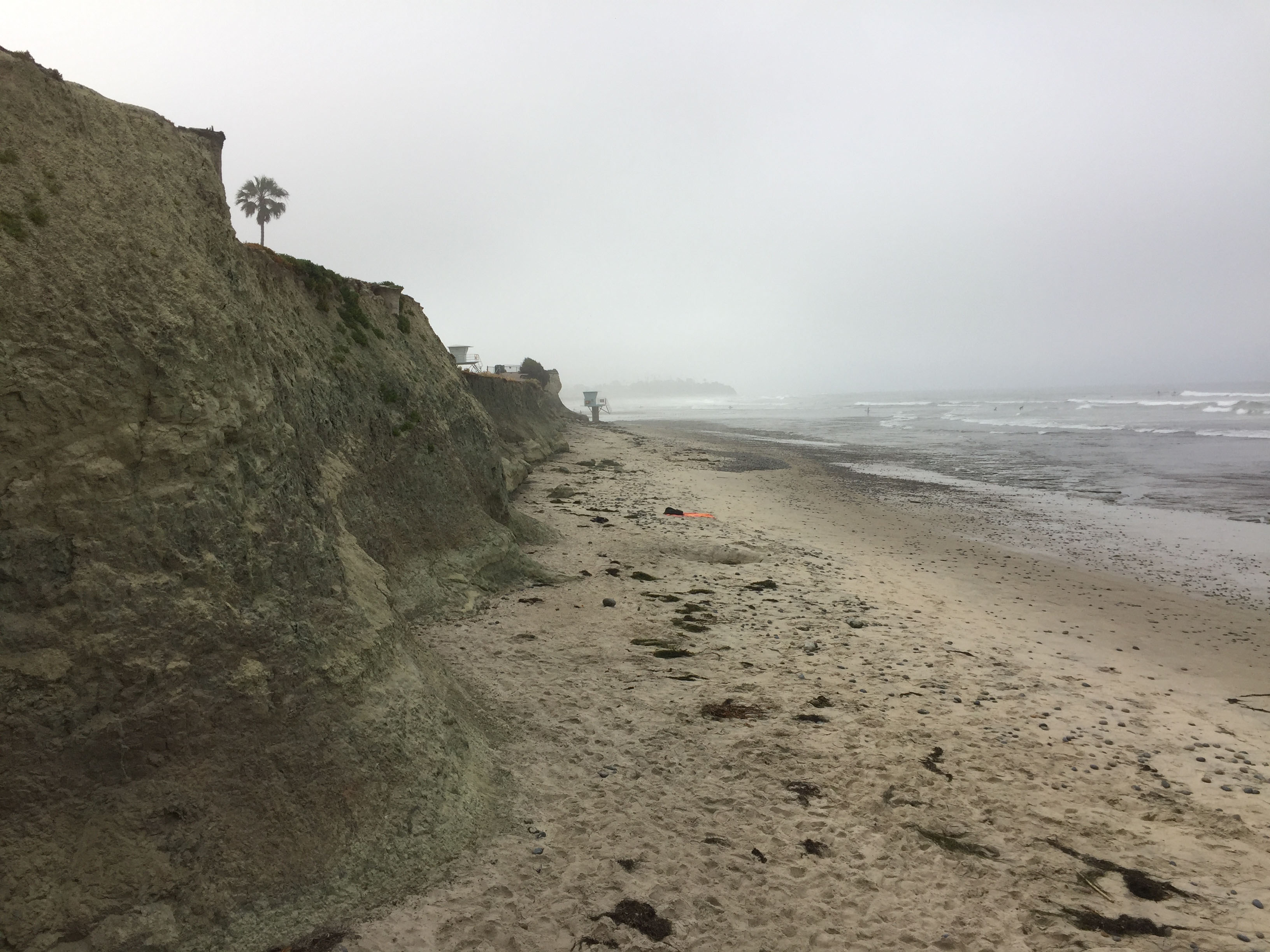
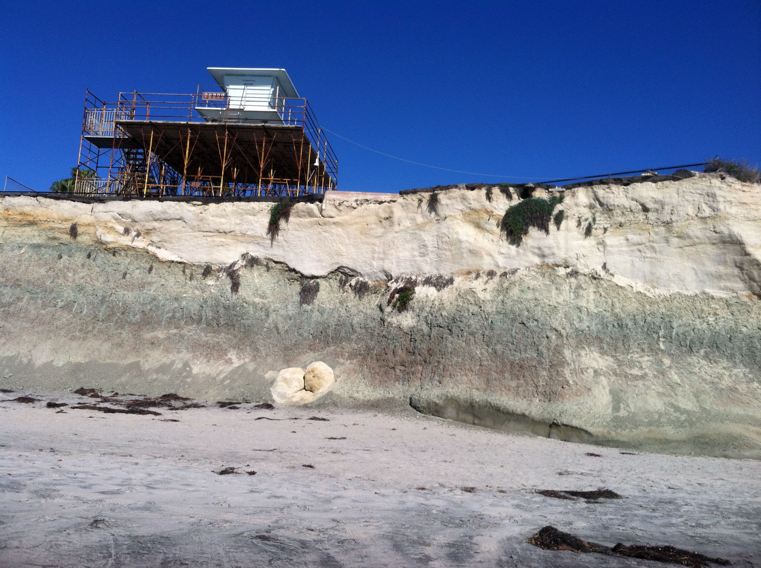
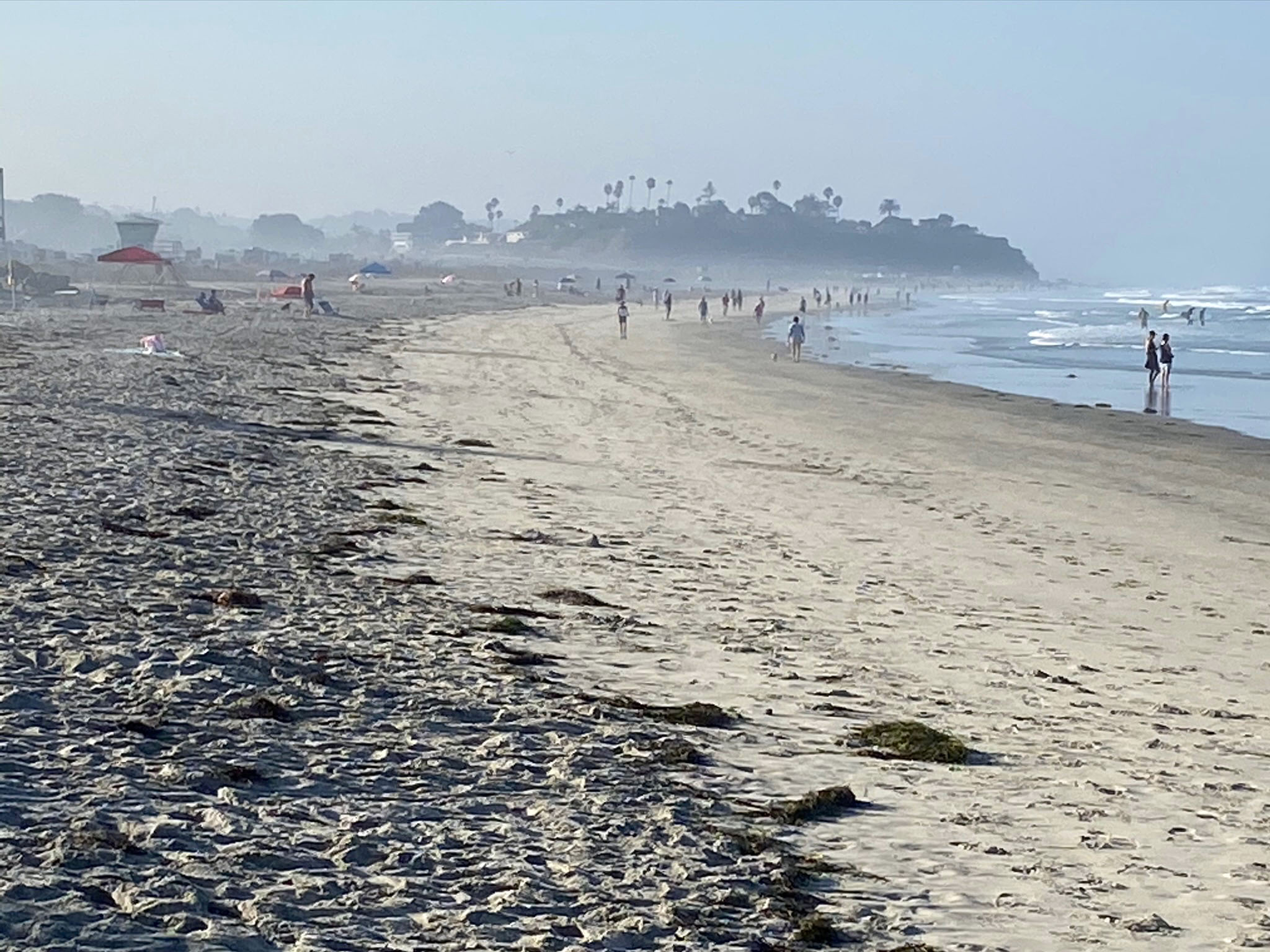
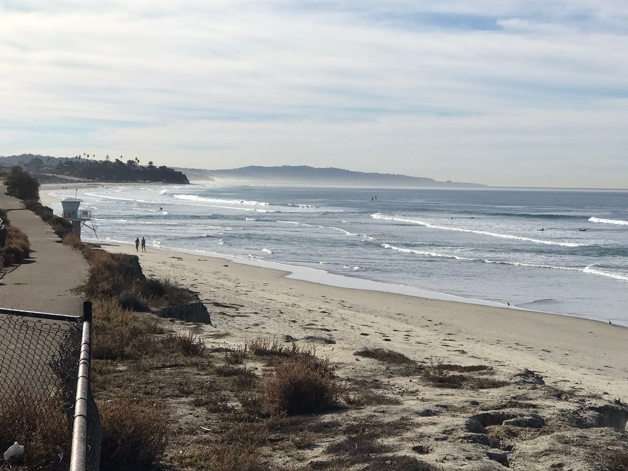
The area at the top of the staircase is a good place for a group to gather (STOP 1, see Figure 2). The view at the top of the stairs encompasses the entire coastline from La Jolla (to the south, Figure 7) the headlands at Swamis State Beach (to the north, Figure 8). The coast line and offshore area are part of Swami's State Marine Conservation Area. It is important to discuss park/beach rules and safety. Note that the beach area is constantly changing with the tides and seasons, and the impact of storms. Most of the time the beach fairly clear of debris and is well maintained and patrolled by park rangers. However, large storms combined with high tides can create hazardous conditions with rogue waves and debris in the water. Figure 8 shows large amounts of seaweed and material washed onto the beach. The rule is to stay out of the water for 3 days after a storm to avoid the risk of bacterial infection. Figure 9 shows the north end of San Elijo Beach when winter beach erosion has stripped most of the sand away from the beach and waves can batter the base of the sea cliff at high tide. In contrast, Figure 10 show the beach in late summer when calmer wave conditions allow sand to migrate back onto the beach. Like all the public beaches along the San Diego coastline there is a problem with beach-sand erosion, and expensive efforts to dredge sand and pump it onto the beaches is repeated frequently every few years. |
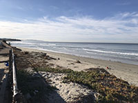
Fig. 7. View looking south at San Elijo State Beach from top of the stairs at Stop 1 located near Lifeguard Station 17. |
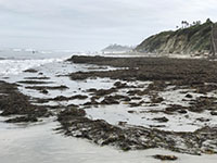
Fig. 8. San Elijo State Beach covered with massive amount of seaweed after an early winter storm. |

Fig. 9. View of San Elijo State Beach in the late winter after storm erosion stripped most of the sand away from the beach. |
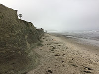
Fig. 10. San Elijo State Beach in the late summer when calm wave energy allowed sand to migrate back onto the beach. |
|
A4
Wildlife (Shorebirds, Invertebrates, and Other Sea Life)
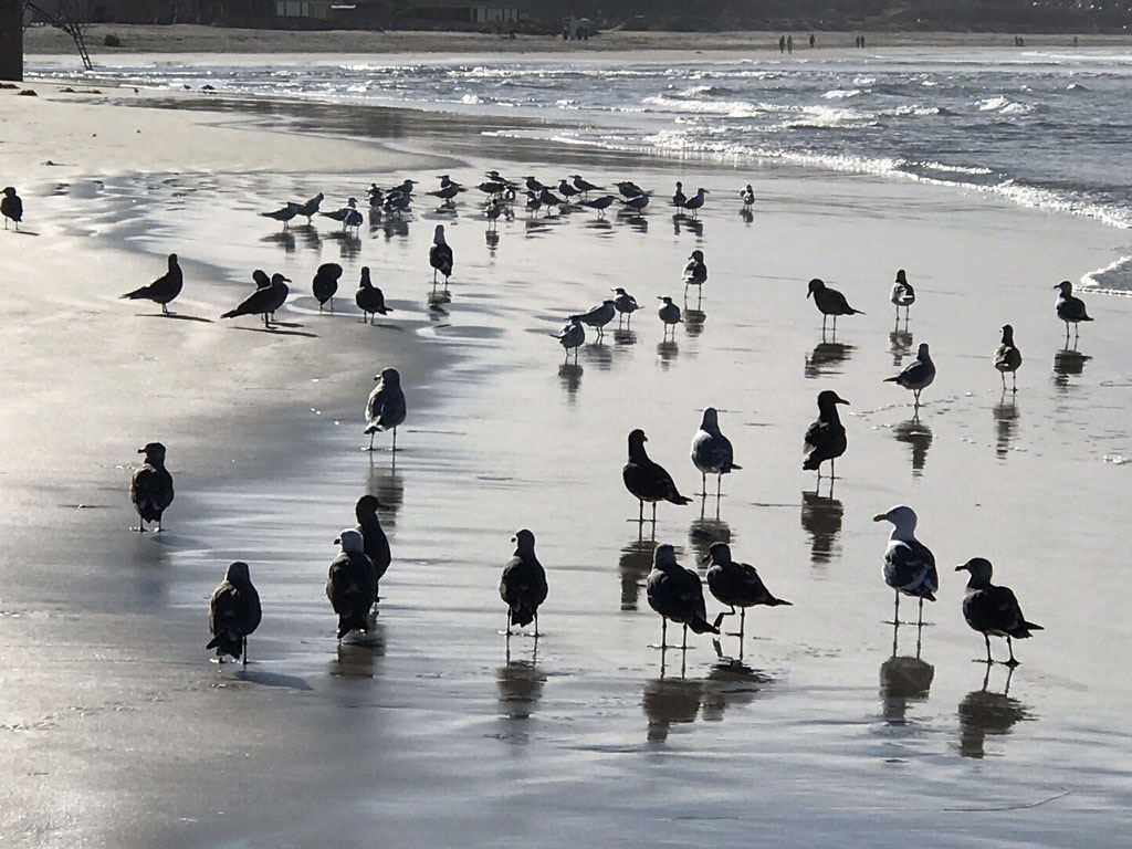
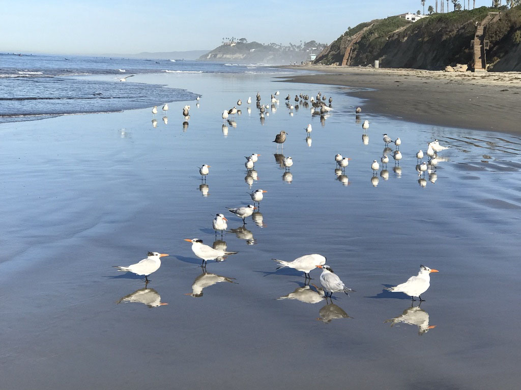
Despite crowds of beach-goers on warm afternoons, San Elijo State Beach is a good place to enjoy watching wildlife. The beach and nearby lagoon are host to an abundance of shorebirds, migratory waterfowl, and other wildlife. The best time to see them is in the morning before crowds arrive (Figures 11, 12, and 13). Depending on the season and weather condition, and the amount of sand on the beach, there can be an abundance of invertebrates on the beach (both living or their shells, Figure 14). Sea lions and dolphins are not an uncommon site just beyond the surf zone. The best place to learn about local wildlife is to visit the San Elijo Lagoon Ecological Reserve Nature Center (located at 2710 Manchester Avenue, Cardiff-by-the-Sea, CA 92007). |
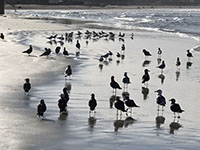
Fig. 11. A flock of seagulls and other shorebirds. |
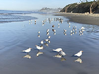
Fig. 12. Royal terns reflecting on the beach. |
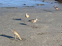
Fig. 13. Curlews feeding on the beach. |
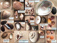
Fig. 14. Sea shells from the San Diego area. |
|
A5
Marine Terraces
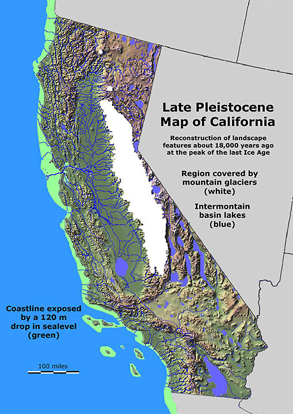
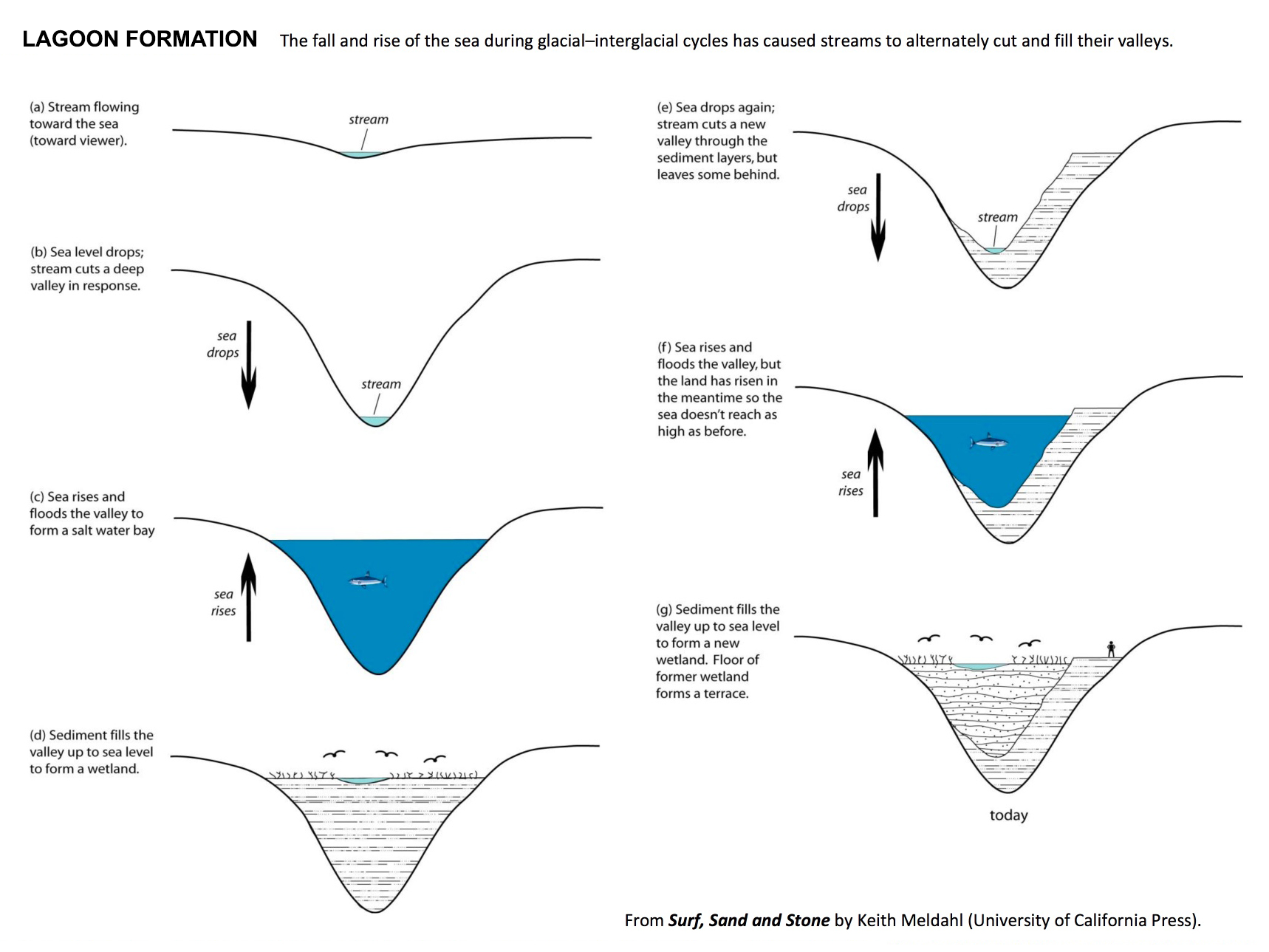
The prominent landscape features seen at Stop 1 is the modern beach, sea cliff, and the Nestor marine terrace. The San Elijo State Beach Campground is built on the flat surfaces that used to be the sea bed and beach roughly about 110,000 years ago, before the last ice age. During the last 3 million years large continental ice sheets formed covering much of northern North America, Europe, and Siberia. Because so much ice accumulated on land, sea level fell drastically, as much 400 feet. When the ice sheets melted (as they are continuing to do in Greenland and Antarctica) sea level rose as much as 60 feet or more higher than current sea level. Figure 15 is a map of California at the peak of the last Ice Age when an ice cap (glaciers) covered the Sierra Nevada Range and large lakes flooded the inland basins throughout the California region. What was also significant was that the current continental shelf was exposed as a coastal plain. At that time, the shoreline would appear several miles offshore from its current location.
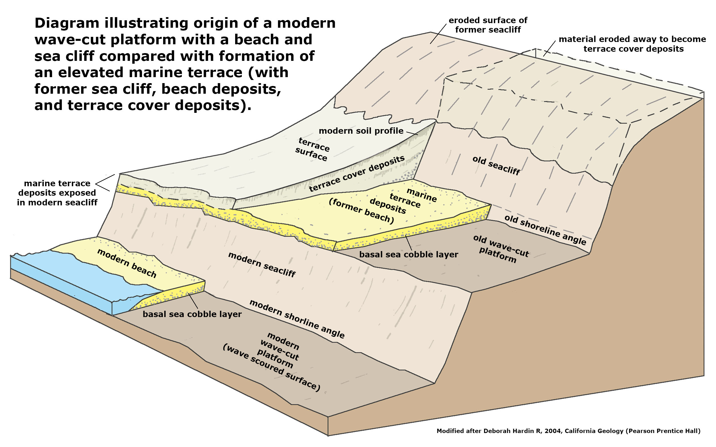
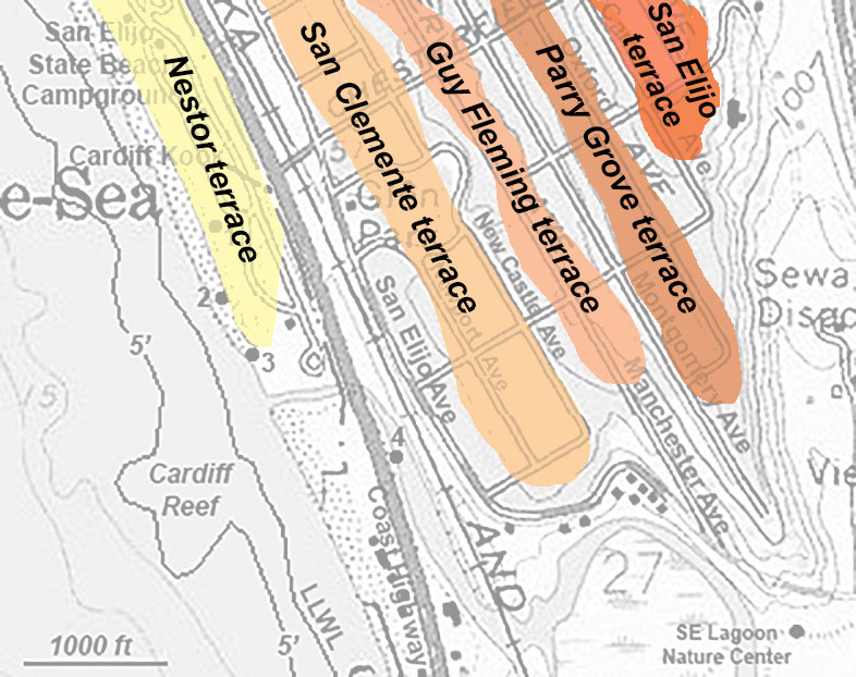
The combination of three major geologic forces are shaping the San Diego coastline. First, gradual tectonic uplift that is causing the coastal region to rise at a rate of about 1/2 inch per century. Some of this uplift is a result of earthquakes associated with the regional fault system. Second, sea level is falling and rising hundreds of feet with each passing ice age. And third, perhaps the most persistent force is wave and current action scouring the seabed, carving the sea cliffs, and moving sediments to the deep ocean basin. Figure 16 shows how that with each passing ice age, wave action carves a new wave-cut platform and sea cliff as sea level rises. Because the the land is rising, each glaciation cycle carves a new step—creating a series of elevated marine terraces (Figure 17). Figure 18 show a list of named marine terraces that have been linked to 20 glaciation cycles in the last 2 million years. This diagram shows the general age of the marine terrace and the elevation where it is generally interpreted to occur on the landscape along the San Diego coastline. Note, however, that the coastline is not rising at the same pace in all locations along the coastline, so the elevations of especially the older marine terraces are more difficult to interpret, and part of this is because after they form they are subject to erosion.
Perhaps the best way to see the marine terraces is from the distance. If you look south across the lagoon toward the hillsides along the valley you can see the step-like shape of each of the marine terraces preserved on the landscape (Figure 18). On a clear day, you can also see the same step-like appearance of the landscape extending from the coast up to the the high point (Mt. Soledad in La Jolla). Figure 19 illustrates the erosional features and sedimentary deposits comparing the modern landward transgression of the beach and formation of the sea cliff compared with the deposits and landform of a marine terrace. A trace of the Nestor marine terrace deposits can be seen along the edge of sea cliff in some location, but it is the naturally flat surface where the campground is built is on the wave-cut platform of the Nestor marine terrace. If you look east from the Stop 1 location, you can see the step-like nature of the route of Chesterfield Avenue going up to the hilltop (Figure 20). The flat areas my be marine terraces whereas the steep parts are associated with the old sea cliffs (Figure 21), but the step-like features where heavily modified by construction of the neighborhood.
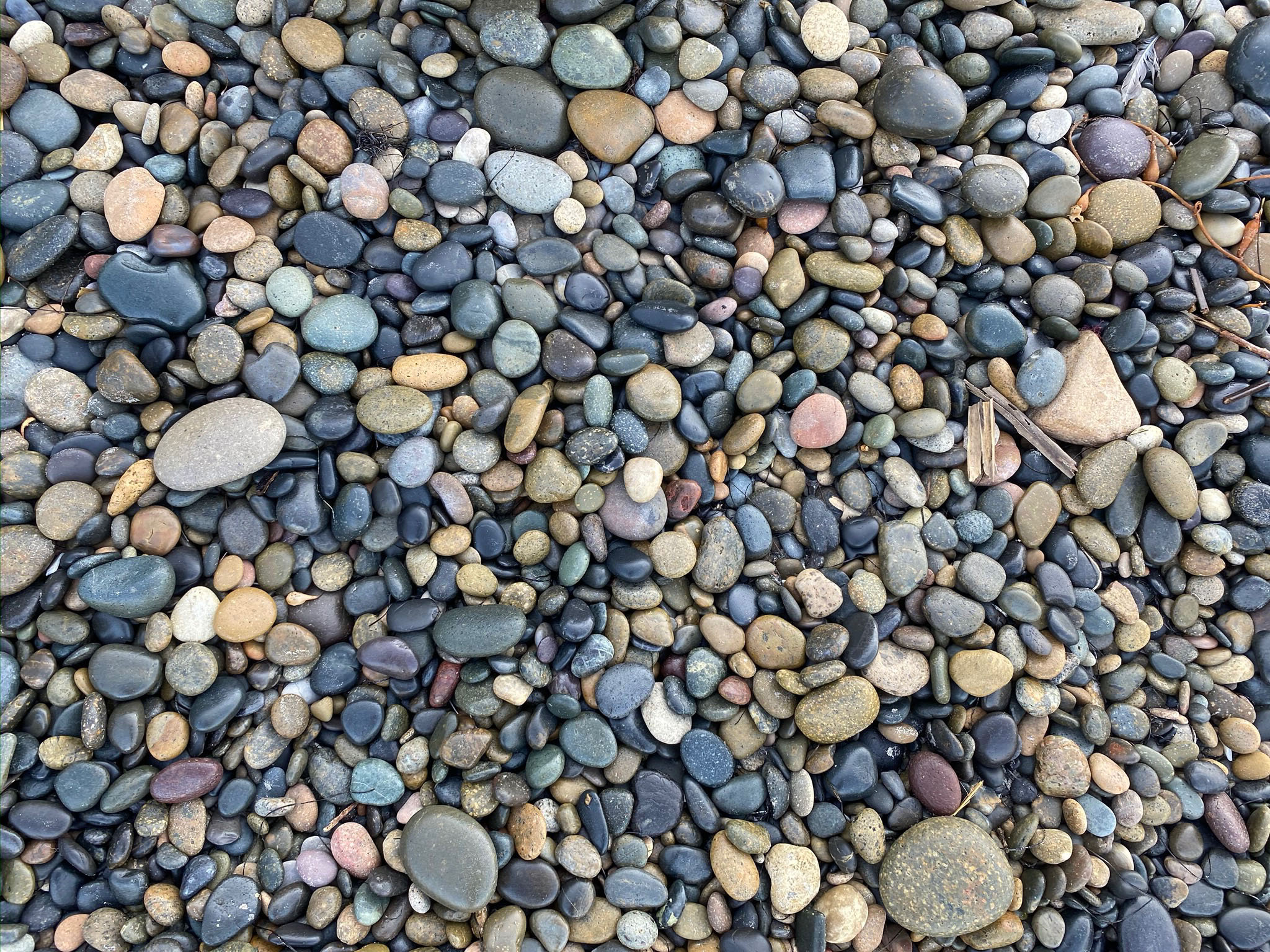
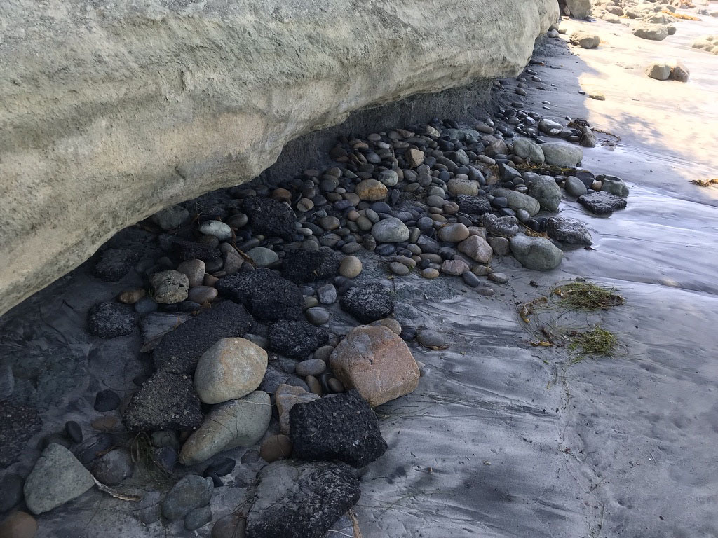
Another clue about the history of marine terraces is the abundance of wave-rounded cobbles and gravel that you can find preserved in beds or scattered on the surface of the marine terraces and in deposits on the beach (Figure 22). These hard, rounded clasts have an amazing history, having been recycled over and over on their long journey form ancient source areas. Most of the cobbles consist of dark volcanic rock (basalt and andesite) that formed in volcanoes long ago and far away. Some have been traced to volcanoes that erupted 70 to 100 million years ago in the Sonora region of Mexico, and were carried by ancient rivers to the coast before the San Andreas Fault system developed in association of the opening of the Gulf of California. Once they reached the coast they have been reworked over and over as the shoreline marine terrace continue to evolve. The gravel on the beach is derived from the erosion of the Bay Point Formation (that is the name of given to the marine terrace deposits along the coast in the vicinity). |
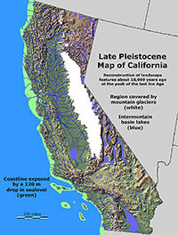
Fig. 15. Ice age map of CA. |
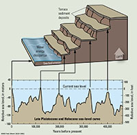
Fig. 16. Diagram illustrating the relationship of sea level rise and fall to the formation of marine terraces on a rising coastline (like San Diego). |
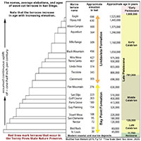
Fig. 17. A compilation of named marine terraces relative to their general elevation and inferred geologic ages for the San Diego region. |
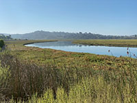
Fig. 18. This view is looking south across San Elijo Lagoon to the hillsides that display a profile of the step-like character of marine terraces. The youngest is lowest, and the oldest is at the top of the mesa. |
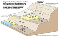
Fig. 19. Diagram comparing features of a modern beach/wave-cut platform and sea cliff to the characteristics of an elevated marine terrace. |
Fig. 20. View looking east from near the Cardiff Kook showing the step-like terraces along Chesterfield Avenue. |
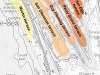
Fig. 21. Interpretation map of possible marine terraces (based on elevation) in the Cardiff neighborhoods. |
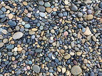
Fig. 22. Wave-rounded beach cobbles and gravel on the beach eroded from older marine terrace deposits. |
|
A6
Wave-Cut Platform and the Sea Cliff
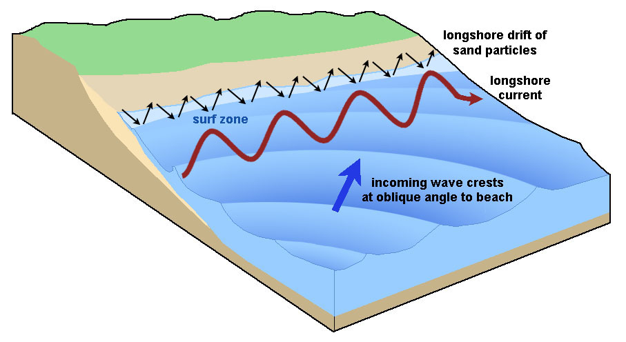
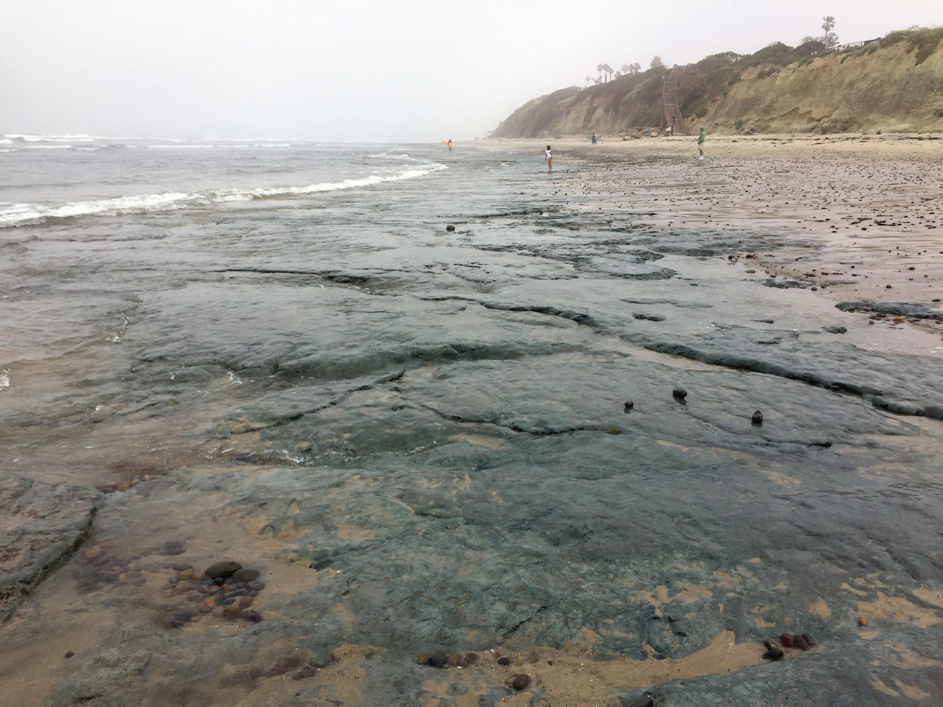
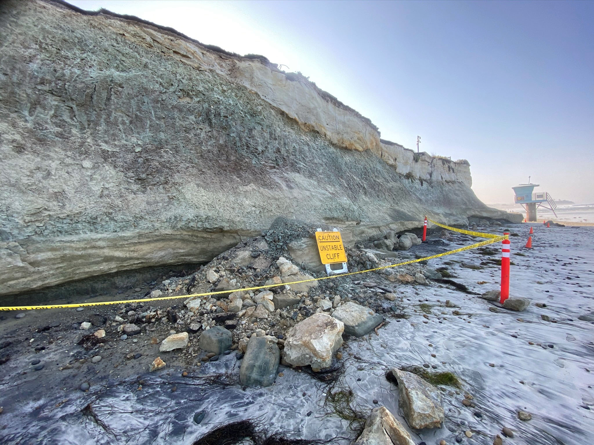
Wave action is continuous scouring the sea bed and beach. Each passing wave moves some sand and causes some abrasion (degrading sand into silt and clay). Waves approaching the beach at an angle creates longshore currents that move beach sediments with longshore drift (Figure 23). Wave action can move sand onto a beach or strip it a way. Stronger wave action scours beach sand way, exposing the bedrock on the seabed, carving a wave-cut platform (Figure 24). It is the combination of storm waves and high tide that allow wave action to reach the sea cliff. Figure 25 illustrates an undercut sea cliff that was cut by the battering action of sea cobbles, rocks, and other debris. This eventual leads to cliff failures (Figure 26). Cliff failure can happen at any time and is one of the reasons that going near them is risky. |

Fig. 23. This diagram illustrates how waves approaching a beach at an angle create longshore currents and drives longshore drift of sediments along a beach. |
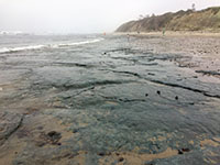
Fig. 24. The exposed wave-cut platform at low tide on San Elijo State Beach when the sand has been eroded away. |

Fig. 25. Wave action tosses cobbles, rocks and debris, undercutting the base of a sea cliff. |

Fig. 26. Example of a cliff failure in 2020 that illustrates the hazard risk of being too close to an unstable sea cliff. |
|
A7
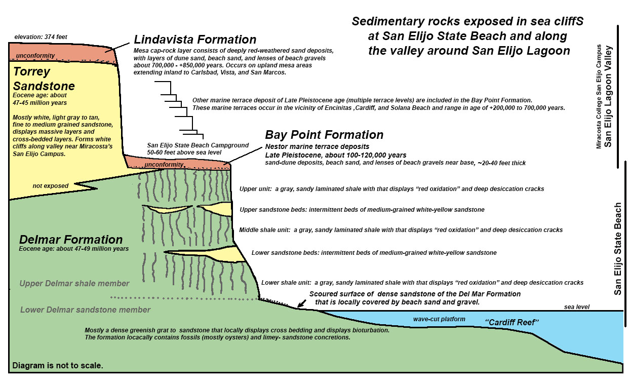
Stratigraphy of the San Elijo State Beach Area
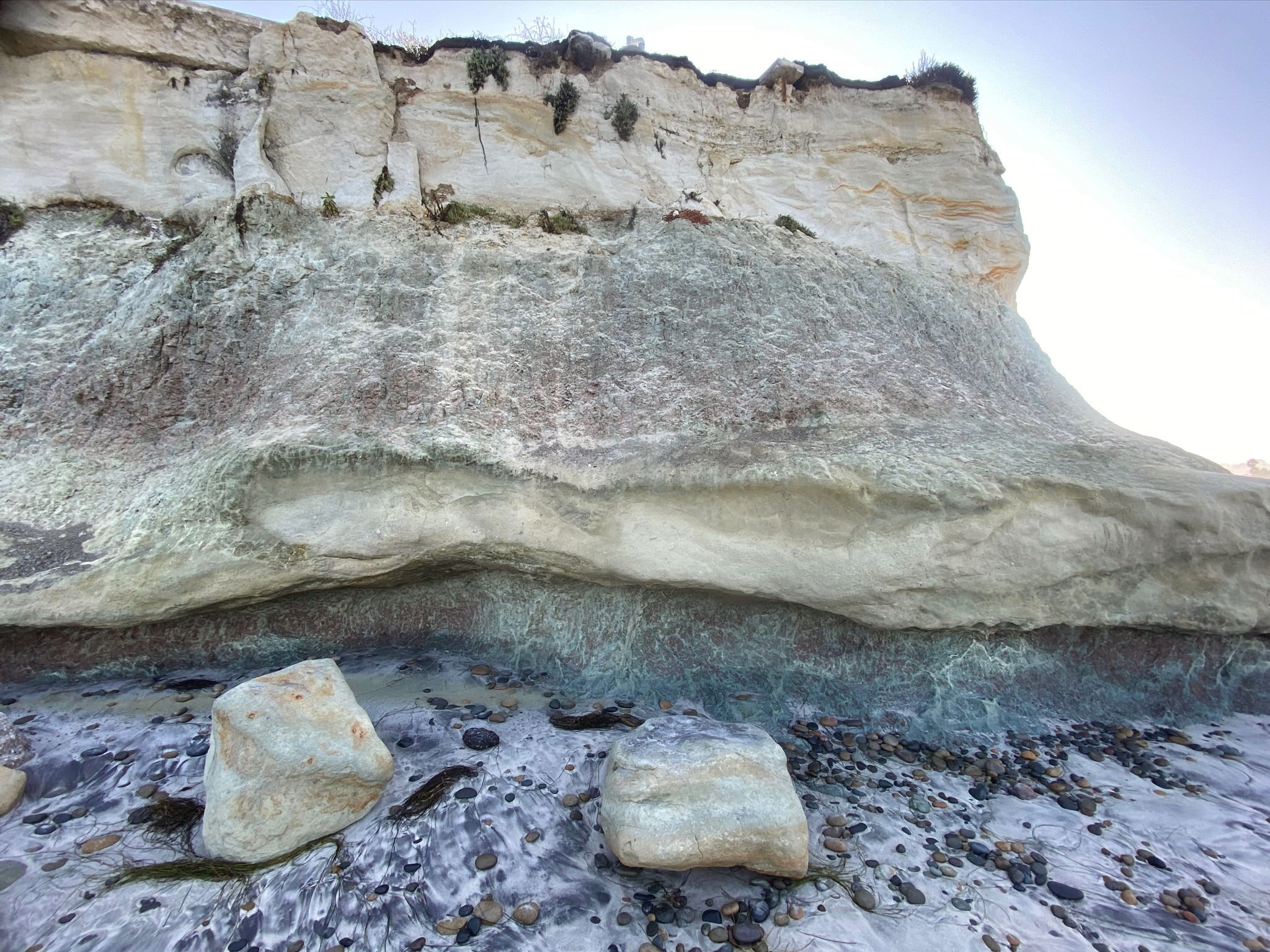
Figure 27 provides an generalized interpretation of the stratigraphy of the San Elijo Beach area and the valley of the lagoon extending east into the valley of San Elijo lagoon. The sea cliff at San Elijo State Beach provides exceptional geologic features to study the ancient sedimentary environments that existed in this area in the geologic past. The rocks exposed in the sea cliff at the north end of the state beach are part of Delmar Formation, a sedimentary rock formation of Middle Eocene age (about 47-49 million years old). Outcrops of the Delmar formation are exposed along the coastline between Encinitas and Carlsbad, California. Most of the famous surf spots along the coast are associated with underwater "reefs" of Delmar Formation. The Delmar Formation is named from exposures in the vicinity of the Del Mar Dog Beach (about 3 miles south of San Elijo State Beach).
Two other rock formations occur in the San Elijo State Beach area but they are very poorly exposed in the beach area. The base of the Torrey Sandstone crumbles into slope deposits at the north end of the beach (near Lifeguard Station 19) and it is locally overlain by a thin veneer of Bay Point Formation. Both of these formations are exposed in other areas outside of the park (discussed below). |
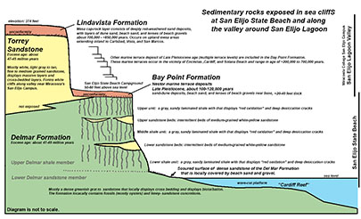
Fig. 27. Stratigraphy diagram illustrating the general character of named rock formations exposed along San Elijo State Beach and along the valley hillsides next to San Elijo Lagoon. Note that the diagram is not to scale. |
A8
Ancient Lagoon Deposits of the Delmar Formation
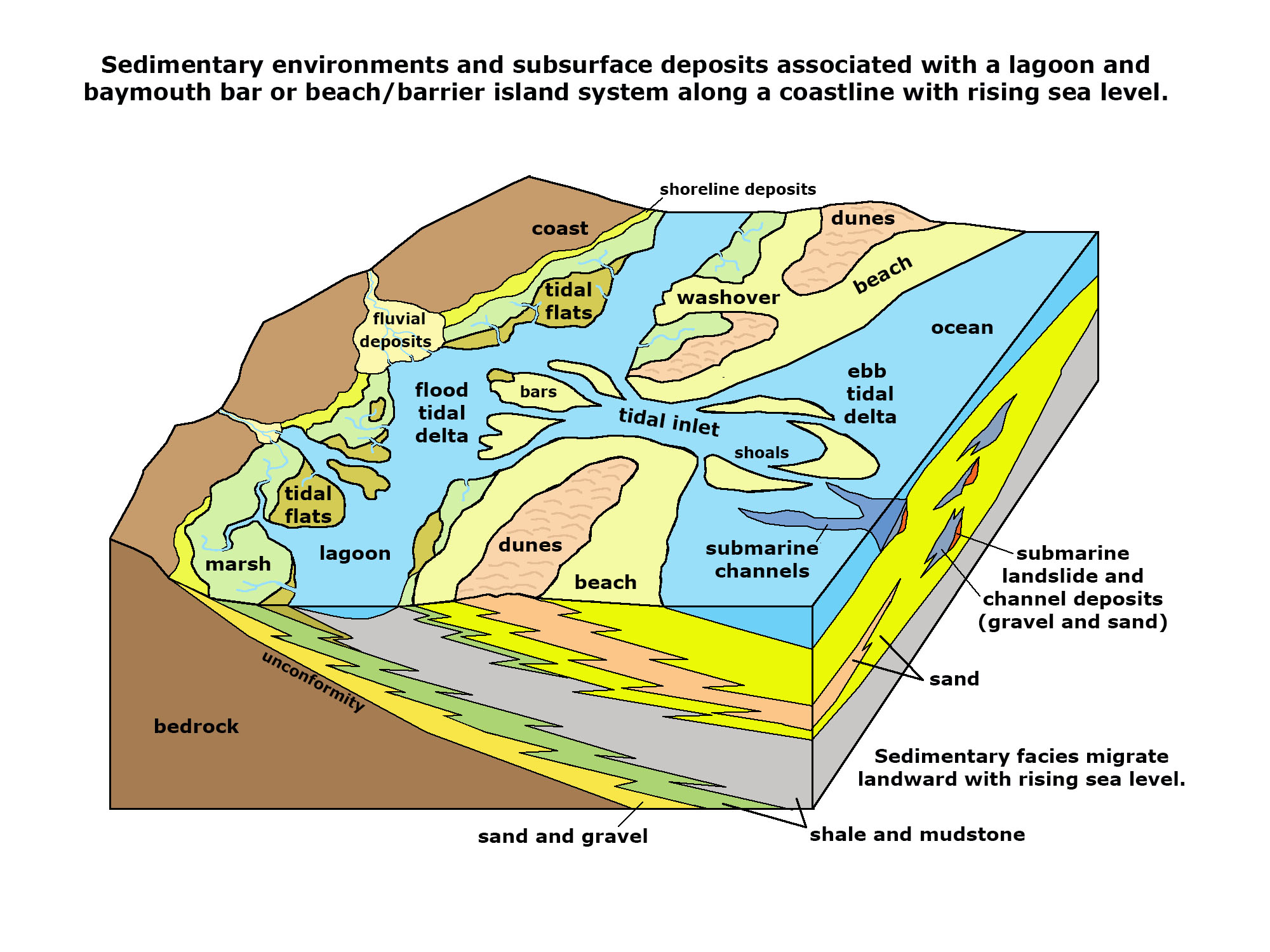
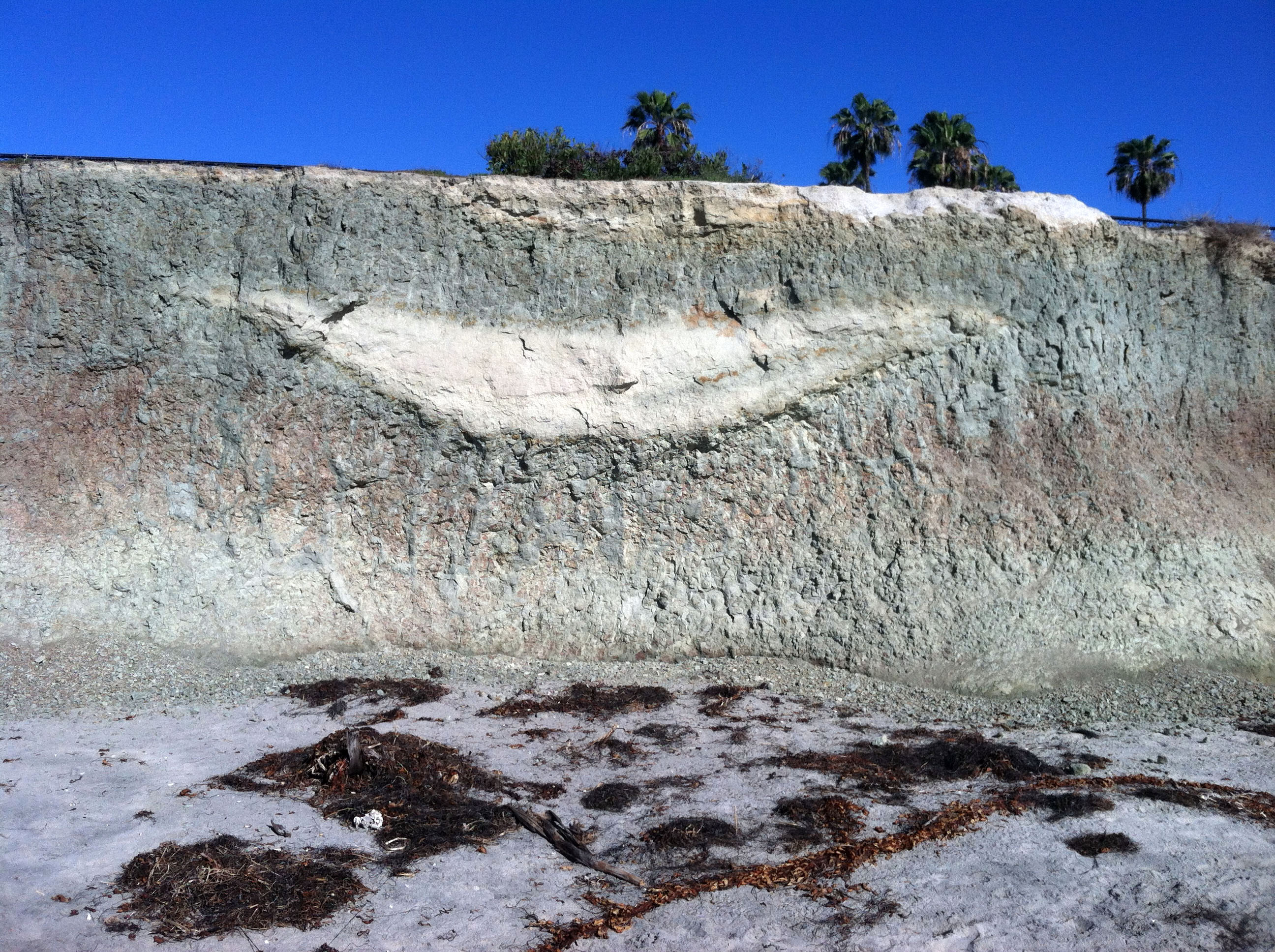
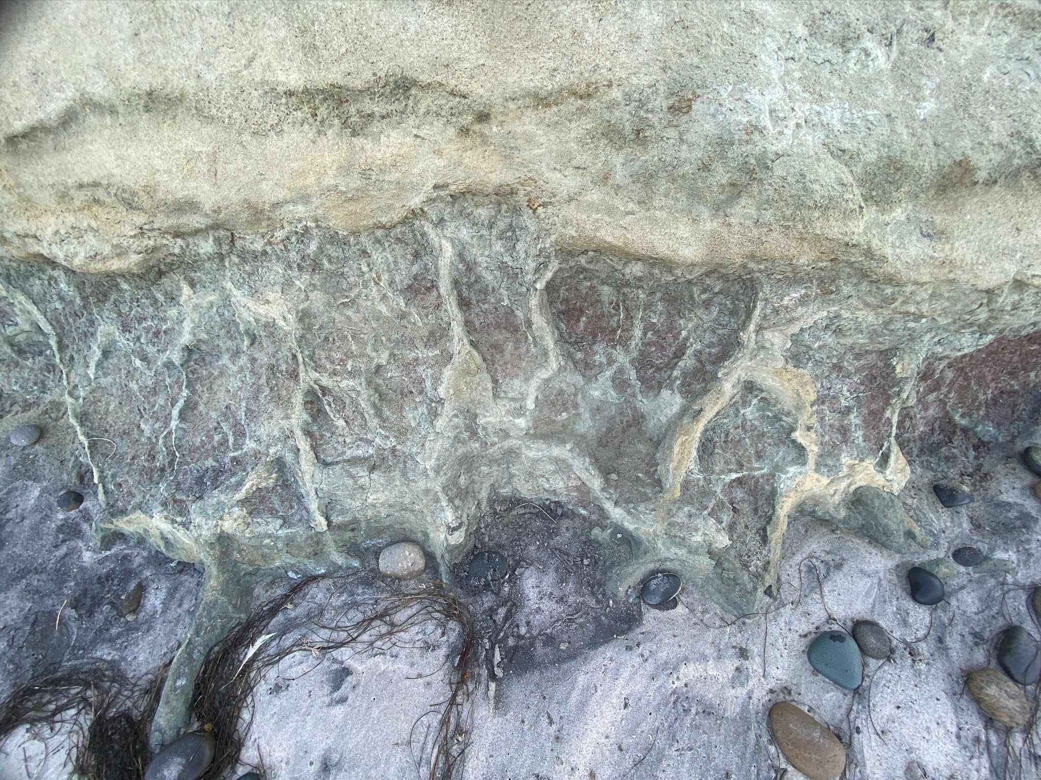
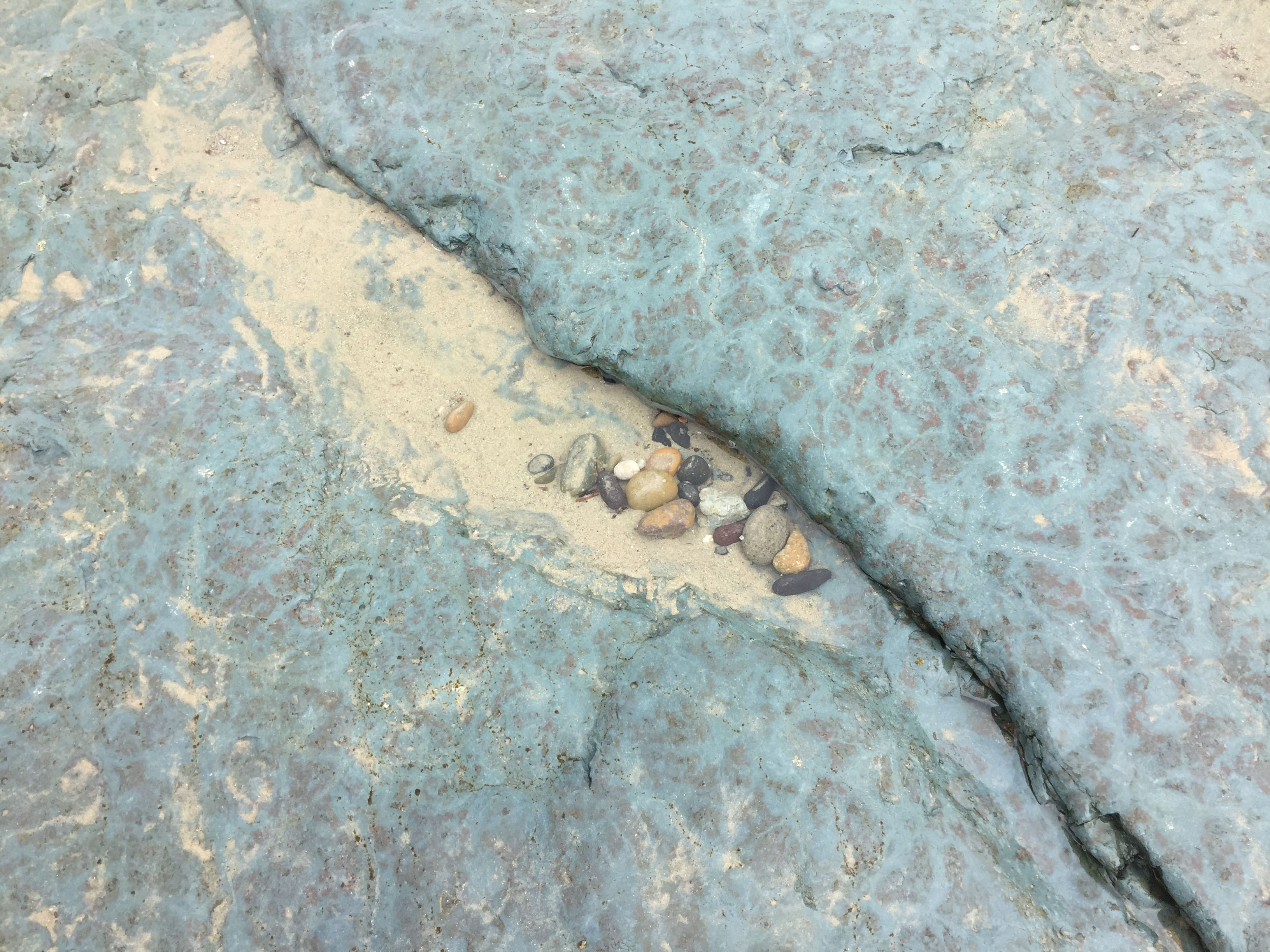
Stop 2 begins at the base of the stairs near Lifeguard Station 17 and continues to Stop 3 (see map Figure 2). Figure 28 shows the colorful section of the sea cliff between to two stops. The colors represent different sedimentary facies within the Delmar Formation that have distinctive characteristics that resulted from sedimentation processes different depositional environments. The Delmar Formation represents deposits that accumulated in a variety of coastal depositional environments, such as lagoonal settings illustrated in Figure 29. For instance, Figure 30 shows a smile-like cross-section feature (about 30 feet across) that formed as sand filling in a shallow tidewater channel that flowed across a lagoon environment, much like the winding lagoon tidal channels visible in Figure 1 and in the images in the lagoon discussion below. The sea cliff also displays thick beds of greenish and red silty-shale beds. The greenish color is common is sediments deposited is shallow marine settings that are depleted in oxygen (reducing conditions), such as the tidal marshes and tidal flats in modern lagoons. The reddish layer is the same kind of lagoonal sediments that have been oxidized (converting the iron-rich sediment to limonite and hematite) when sea level fell, allowing the sediments to be exposed to the air.
Figures 31 and 32 show a unique pattern of clastic dikes (green) surrounded by red (oxidized) fine-grained sediment beneath a thin tidal channel sand deposit. The clastic dikes formed as the result of deep desiccation of the ancient lagoonal marsh mud deposits when they became exposed when sea level fell. The deep dessication cracks filled in with fresh marine sediment when sea level rose again.
When mud (like on a tidal flats) dries out, the loss of water causes the mud to shrink, crack and harden. Those cracks fill in when flood waters return. Figure 33 shows the top of a red rock layer with green (sediment filled) desiccation cracks, similar to what you might see on a muddy field that has dried out over a long dry period.
Figures 34 shows a small fault that cuts through the sea cliff about midway between Stop 2 and Stop 3. The fault vertically offsets a channel sand bed by a couple feet. The amount of horizontal offset cannot be determined.
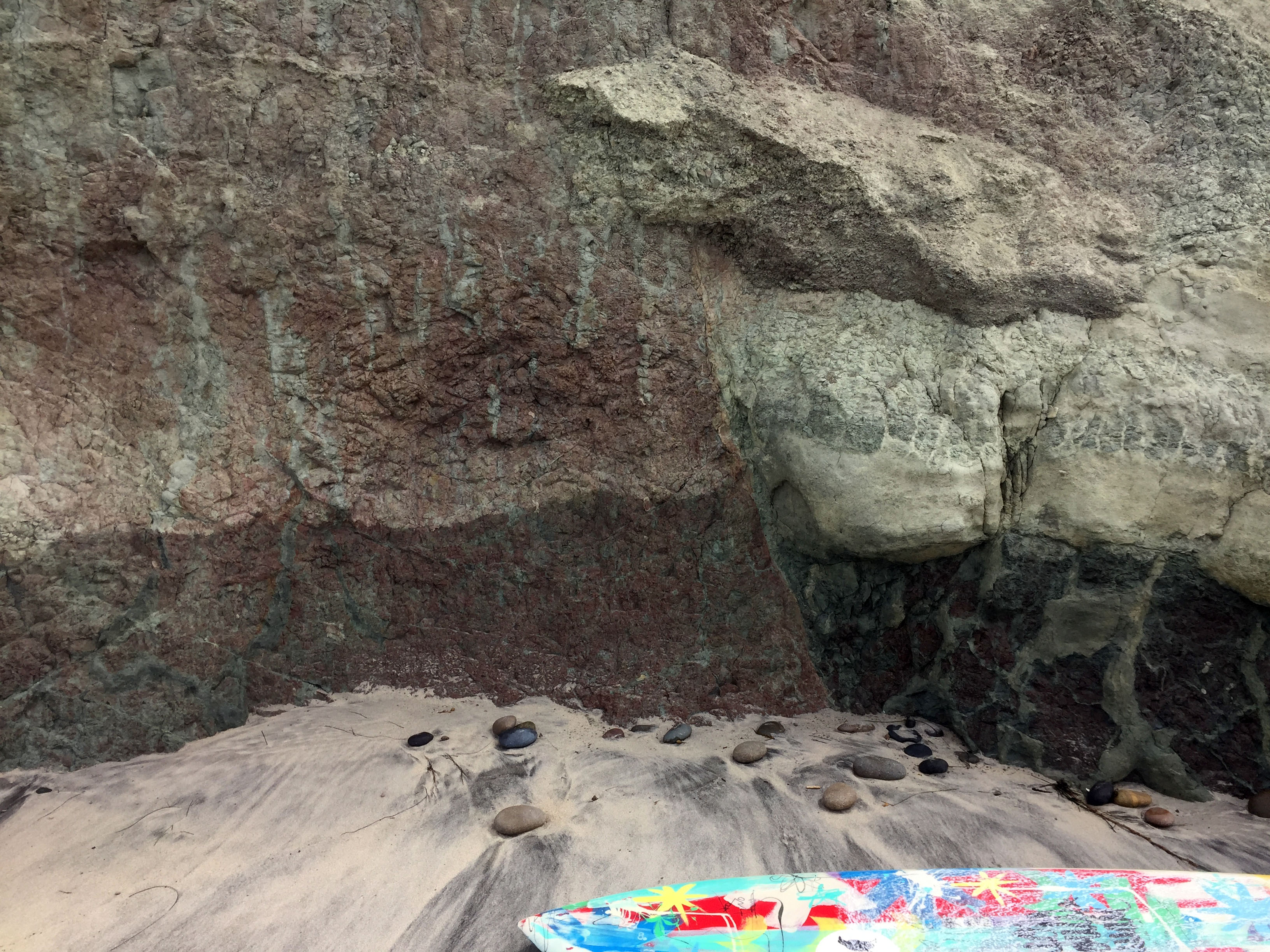
Figure 35 shows sandy channels deposit that form the resistant ledge of the headland at the south end of the sea cliff (at Stop 3). There are two sand beds, one is low, close to the beach. The more massive upper bed forms the caprock of the headland. Figures 36 show the same channel sandstone beds on the sea cliff of the headland. A close examination of the upper caprock layer reveals cross bedding in the sand, and an irregular scoured surface on the bottom of the ancient lagoon tidal channel. Figure 37 provides a better view of the lower sand bed that creates an overhanging ledges above the eroded shale bed along the beach.
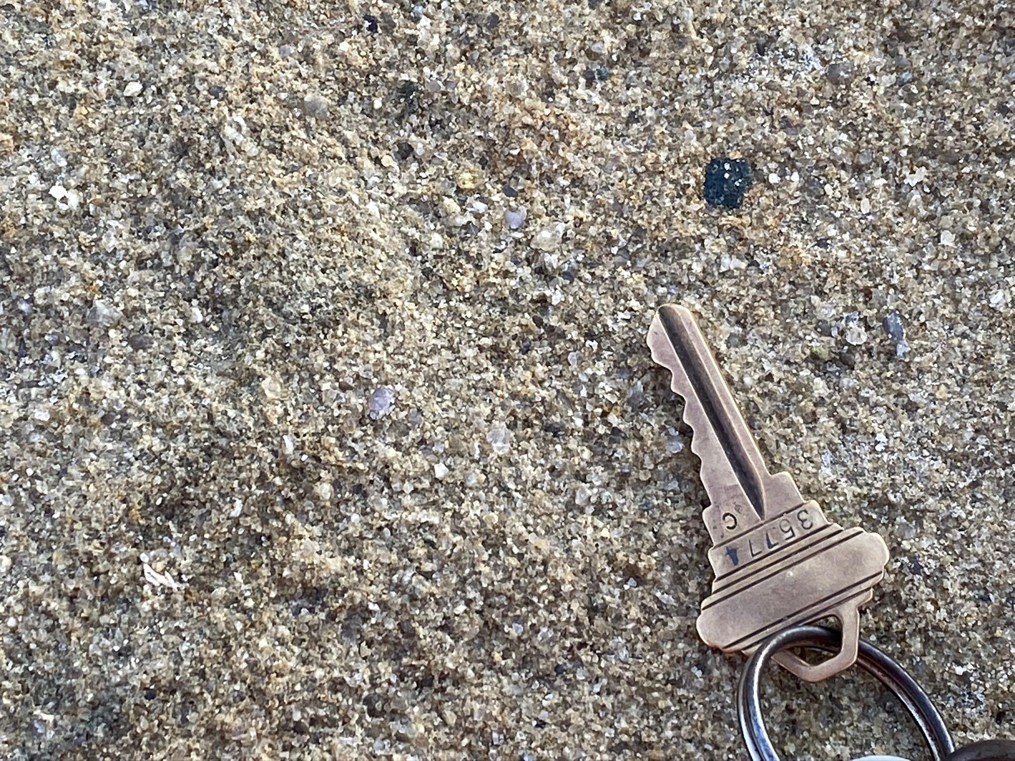
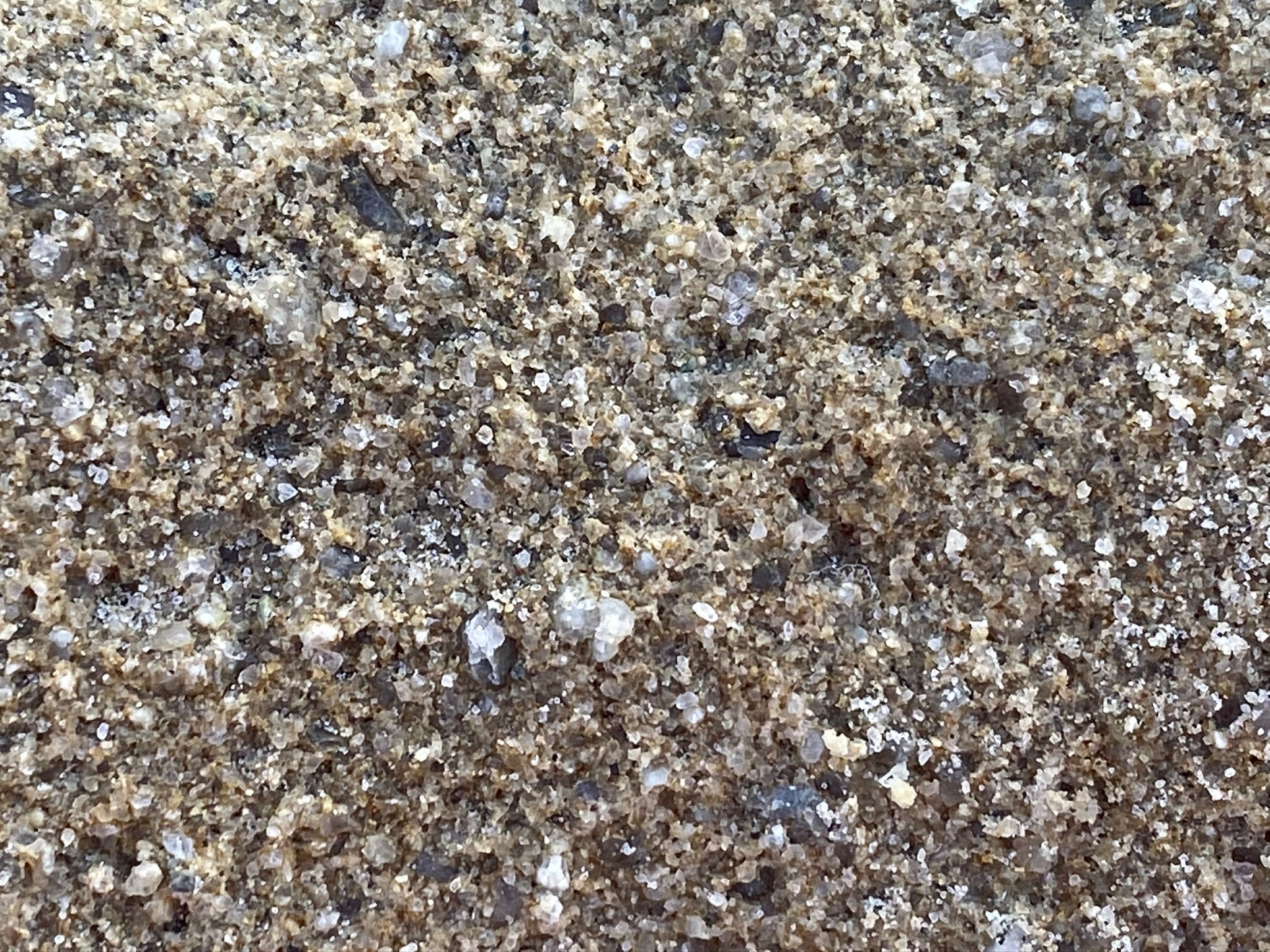
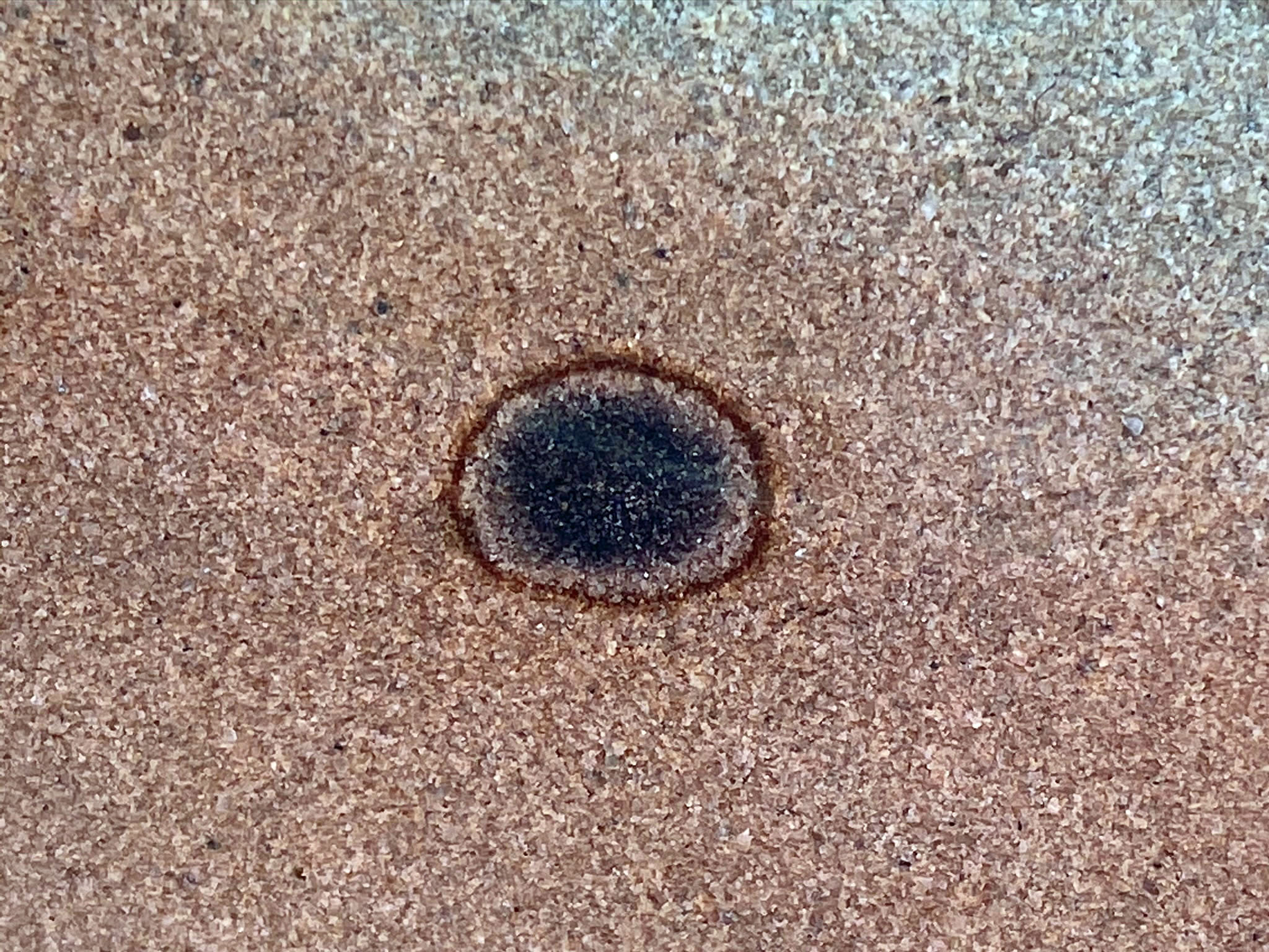
Figure 38 is close-up view of the coarse-grained sandstone exposed in the lower layer. Figure 39 is an even closer view that shows that the sandstone is composed of a mix of highly angular grains of quartz, feldspar, and dark rock fragments. This is river sand, similar to what is found in the streams draining from the local mountain ranges. It stands out in contrast to the much finer, more well-rounded grained beach sand of the modern beach. Figure 40 shows the cross section of a small ironstone concretion that was forming in the lower sandstone bed. The dark center is a mass of weathering pyrite (FeS2) crystals that are slowly recrystallizing (rusting), turning into concentric rings of limonite (FeOH ∙ nH2O).
Beach/Shoal Deposits of the Torrey Sandstone
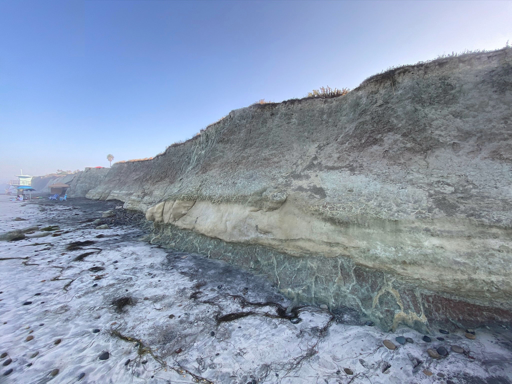
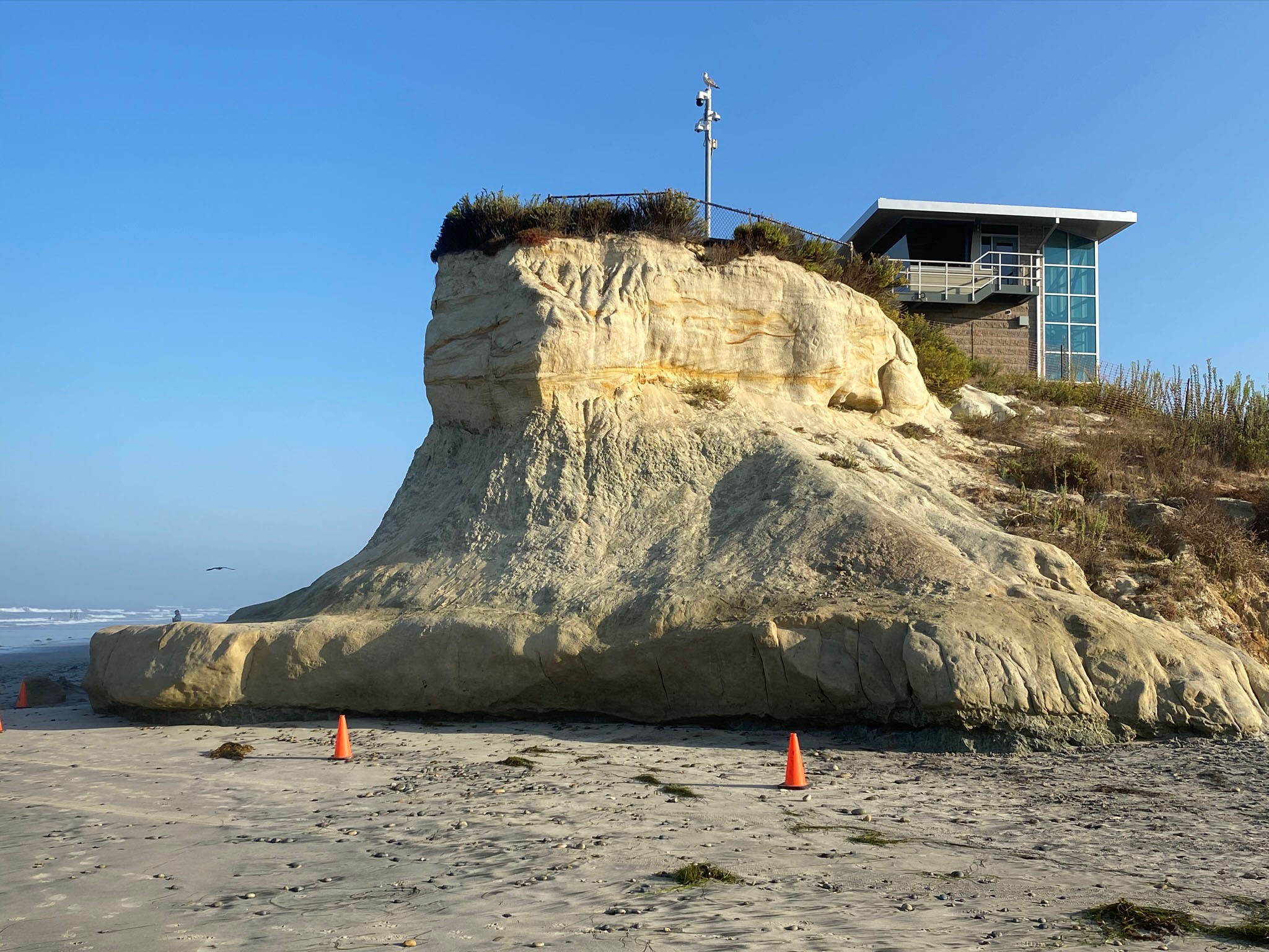
The Torrey sandstone is very poorly exposed in the San Elijo Beach area, but it is very well exposed in the 200-feet high escarpment behind MiraCosta Community College on Manchester Avenue (Figure 41, see campus location on map, Figure 1). The Torrey Sandstone consists of sand beds deposited in in shallow shoals, sand bars, coastal and offshore shelf environments. The Torrey Sandstone forms the prominent sea cliffs in Encinitas, but crops out along the coastline from Torrey Pines northward to Carlsbad, California.
Annie's Canyon:
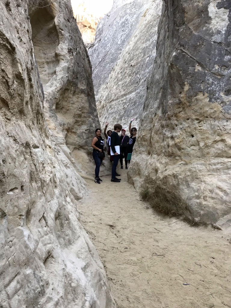
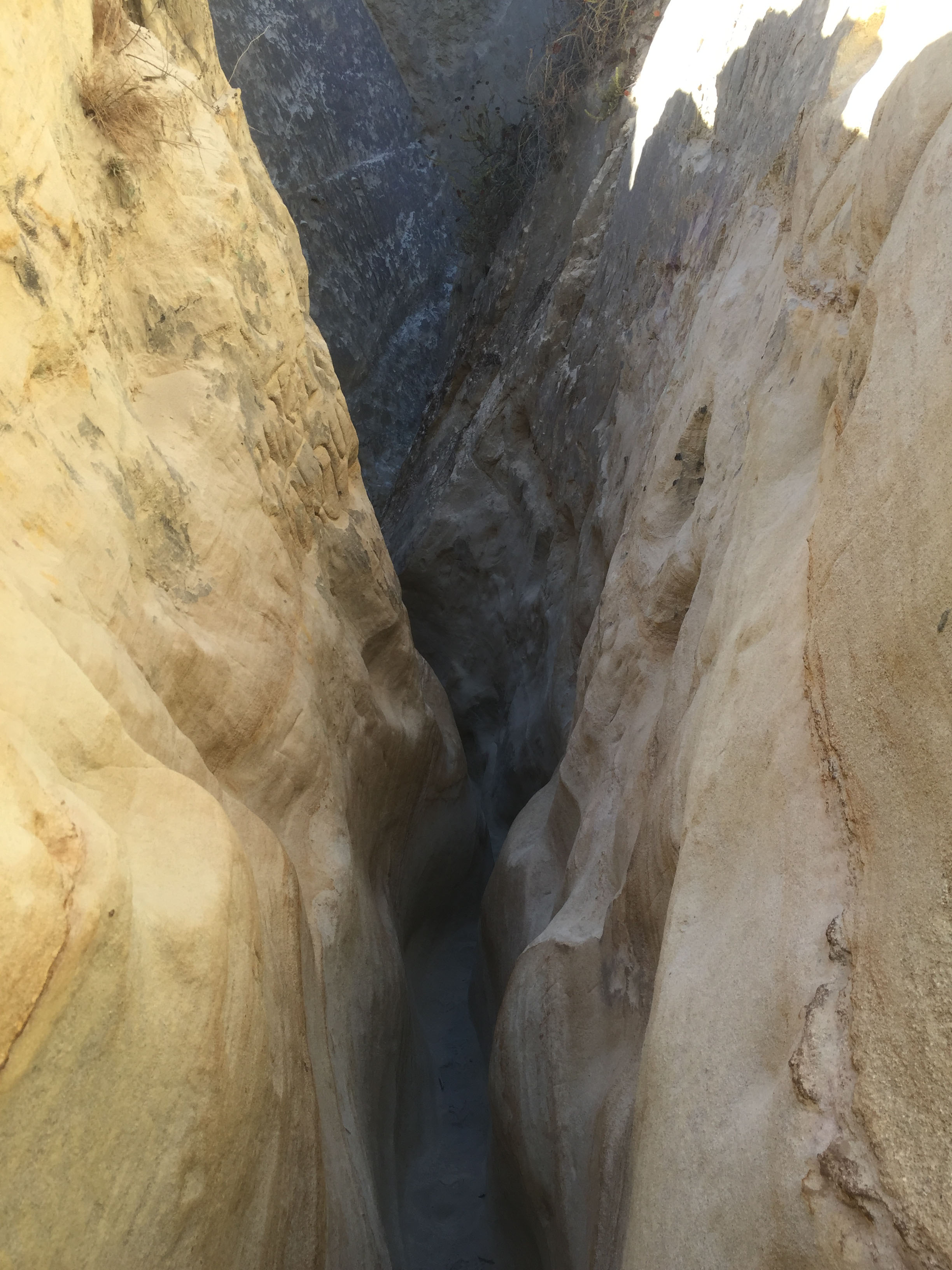
Perhaps one of the most popular places to examine the Torrey Sandstone is at Annie's Canyon, a remarkable slot canyon on the south side of San Elijo Lagoon valley (Figures 42 and 43). Annie's Canyon is a good destination for another field trip in the area in combination with hiking along the lagoon shoreline trails to observe saltwater marsh and coastal scrub plant and animal habitats and communities.
|

Fig. 28. View looking north along the sea cliff between Stops 2 and 3 on San Elijo State Beach. |
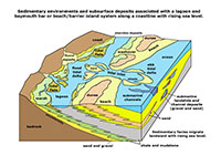
Fig. 29. Sedimentary environments and associated subsurface deposits along a rising coastline. |

Fig. 30. A smile-shaped sand bed of an ancient lagoon channel exposed in the Delmar Formation in the sea cliff. |
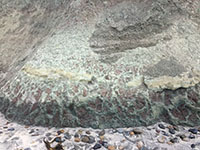
Fig. 31. Yellow sand bed and red-and-green shaly beds of an ancient lagoonal marsh deposit exposed in the se cliff. |

Fig. 32. Ancient desiccation cracks turned into clastic dikes are abundant in the Delmar Formation along the sea cliff. |
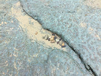
Fig. 33. The typically pattern of desiccation cracks on the surface of a bed exposed on the wave-cut platform. |
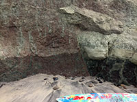
Fig. 34. This view shows offset of a sand stone bed and shale beds along a small fault exposed in the sea cliff. |
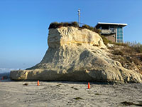
Fig. 35. View of the upper channel sandstone bed, a shale slope, and lower sandstone bed in the headland at Stop 3. |

Fig. 36. View of the channel sandstone bed and underling shale and sandstone layers in the sea cliff at Stop 3. |

Fig. 37. View of the channel sandstone bed and underling shale and sandstone layers in the headland at Stop 3. |
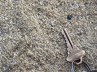
Fig. 38. Close-up view of the very-coarse sandstone of the lower sand unit exposed in the headland at Stop 3. |
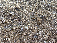
Fig. 39. An even closer view showing the angular grains of feldspar, quartz, and rock fragments in the sandstone. |
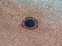
Fig. 40. View of the internal concentric layers an ironstone concretion (about an inch across) exposed in the lower sandstone bed in the headland near Stop 3. |
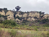
Fig. 41. This view shows the massive cliffs of Torrey Sandstone in the escarpment above the MiraCosta College San Elijo Campus. Bay Point Formation forms a cap rock. |
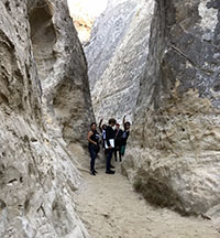
Fig. 42. Annie's Canyon in the Torrey Sandstone Formation. |
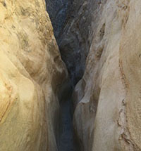
Fig. 43. The narrow slot portion of Annie's Canyon. |
|
A9
Cardiff State Beach and the Cardiff Reef
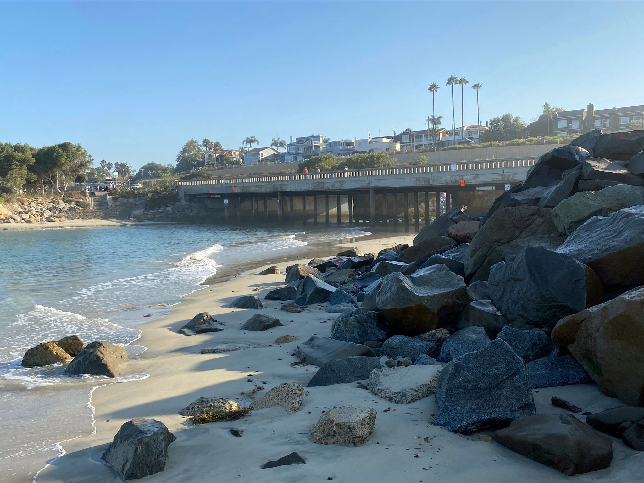
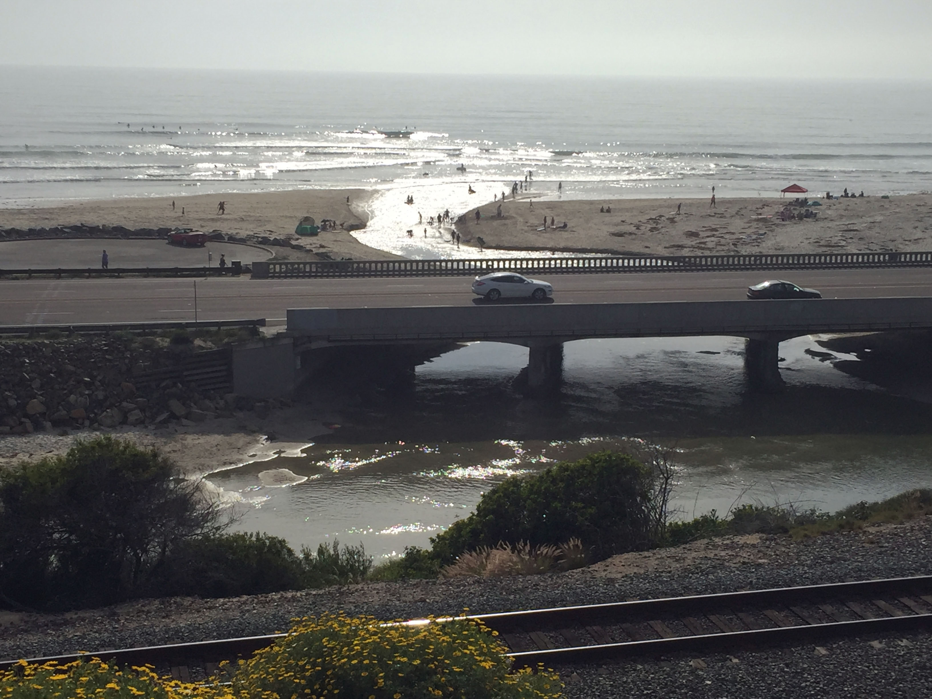
Stop 4 is on (or near) the Pacific Coast Highway Bridge over Escondido Creek (Figure 44). The creek is the boundary between San Elijo State Beach (to the north) and Cardiff State Beach (to the south)(Figure 45). The creek is also the tidal inlet to San Elijo Lagoon (discussed below). During low tide, for those brave enough, it is easy to wade across the tidal inlet, but at high tide, it could be dangerous because of strong currents. When the tide is coming in, the water beneath the bridge clears up and bat rays can commonly be seen in the water below the bridge.
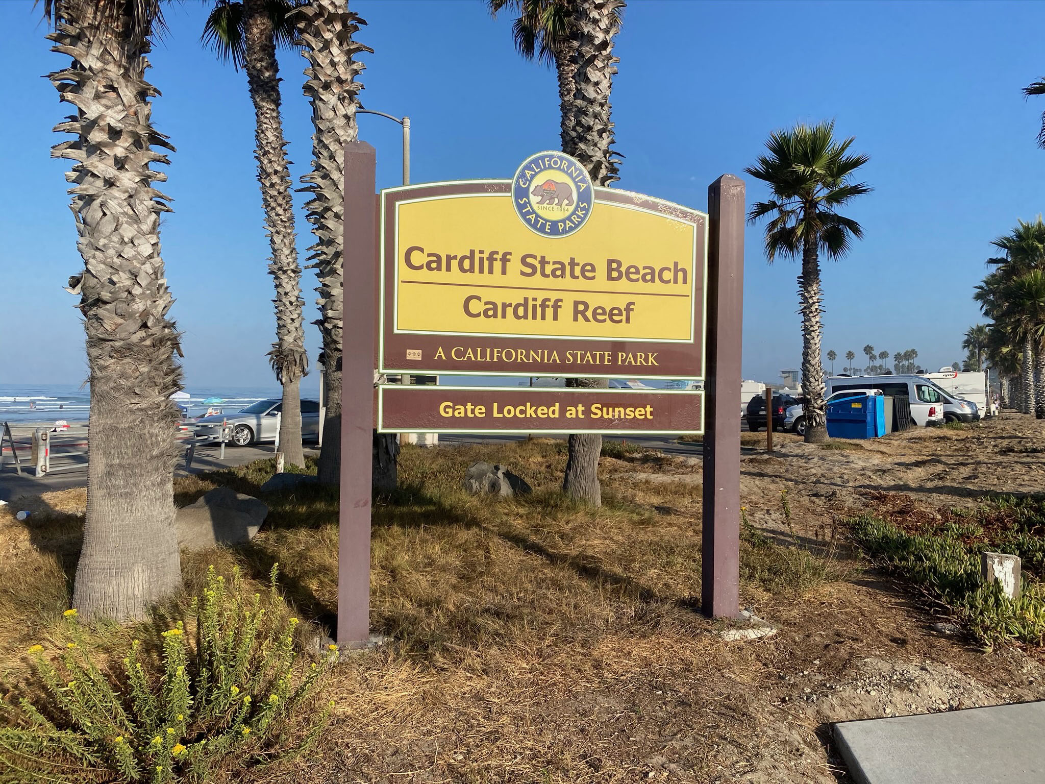
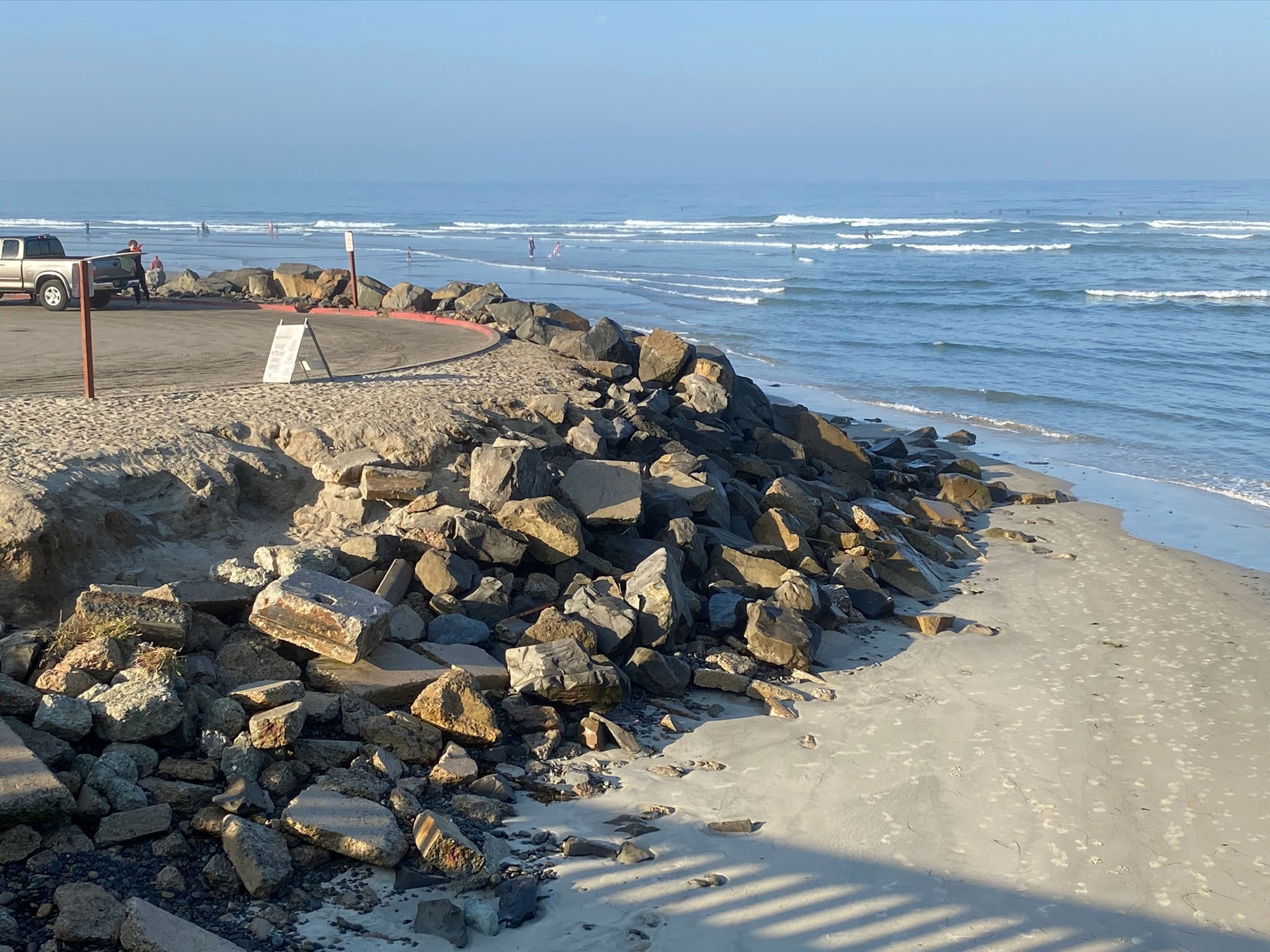
In contrast, Cardiff beach does not have sea cliffs (Figure 46). Before the construction and development of the Pacific Coast Highway, Cardiff State Beach was a bay-mouth bar with migrating inlets, beach, sand bar, sand coastal dunes that bordered the marshlands of the lagoon (see coastal environment illustrated in Figure 29). Because of the low elevation of the sandy beach, the area is subject to coastal erosion and flooding during strong winter storms and high tides. Figure 47 show a rip-rap (stone barrier) near the mouth of Escondido Creek (inlet) at the north end of Cardiff State Beach. In the distance in this view is the popular surfing destination called Cardiff Reef.
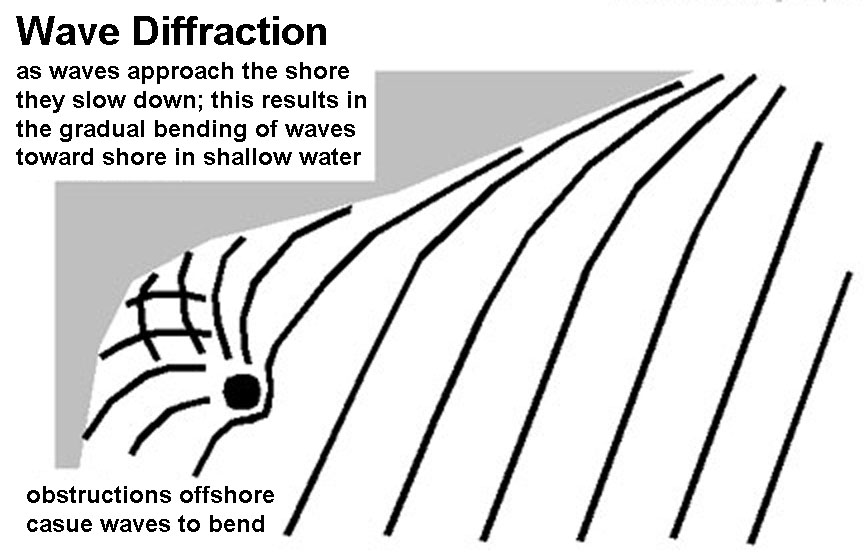
Cardiff Reef is a submerged rocky platform of erosionally resistant sandstone beds of the Delmar Formation and associated tidal delta sand bars that rises above the surrounding sea bed (wave-cut platform). The Figure 48 map illustrates the location of the Cardiff Reef with the 5 foot bathymetric contour line. The elevated nature of the reef causes wave diffraction and increases the height of the incoming swell waves (Figure 49). Figure 50 shows the Cardiff Reef wave activity glinting in afternoon sunlight beyond the mouth of the Escondido Creek. Figure 51 is a view looking south from Stop 1 toward the Cardiff Reef (with the La Jolla Highlands in the distance). |
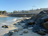
Fig. 44. Coast Highway bridge over Escondido Creek at the mouth of San Elijo Lagoon. |

Fig. 45. Sign for Cardiff State Beach and the Cardiff Reef surfing area. |
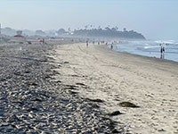
Fig. 46. This view is looking south along the broad sandy beach at Cardiff State Beach. |

Fig. 47.View of rip-rap used to control erosion on Cardiff Beach near the Cardiff Reef. |
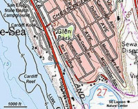
Fig. 48. A topographic and bathymetric map showing the location of the Cardiff Reef. |

Fig. 49. This diagram shows how and offshore obstruction creates wave diffraction that can amplify the height of incoming swell waves. |

Fig. 50. View looking west at the mouth of the lagoon and sunlight reflecting off the waves in the Cardiff Reef area. |

Fig. 51. View looking south from Stop 1 toward the Cardiff Reef area. The La Jolla highlands are in the distance. |
|
A10
San Elijo Lagoon
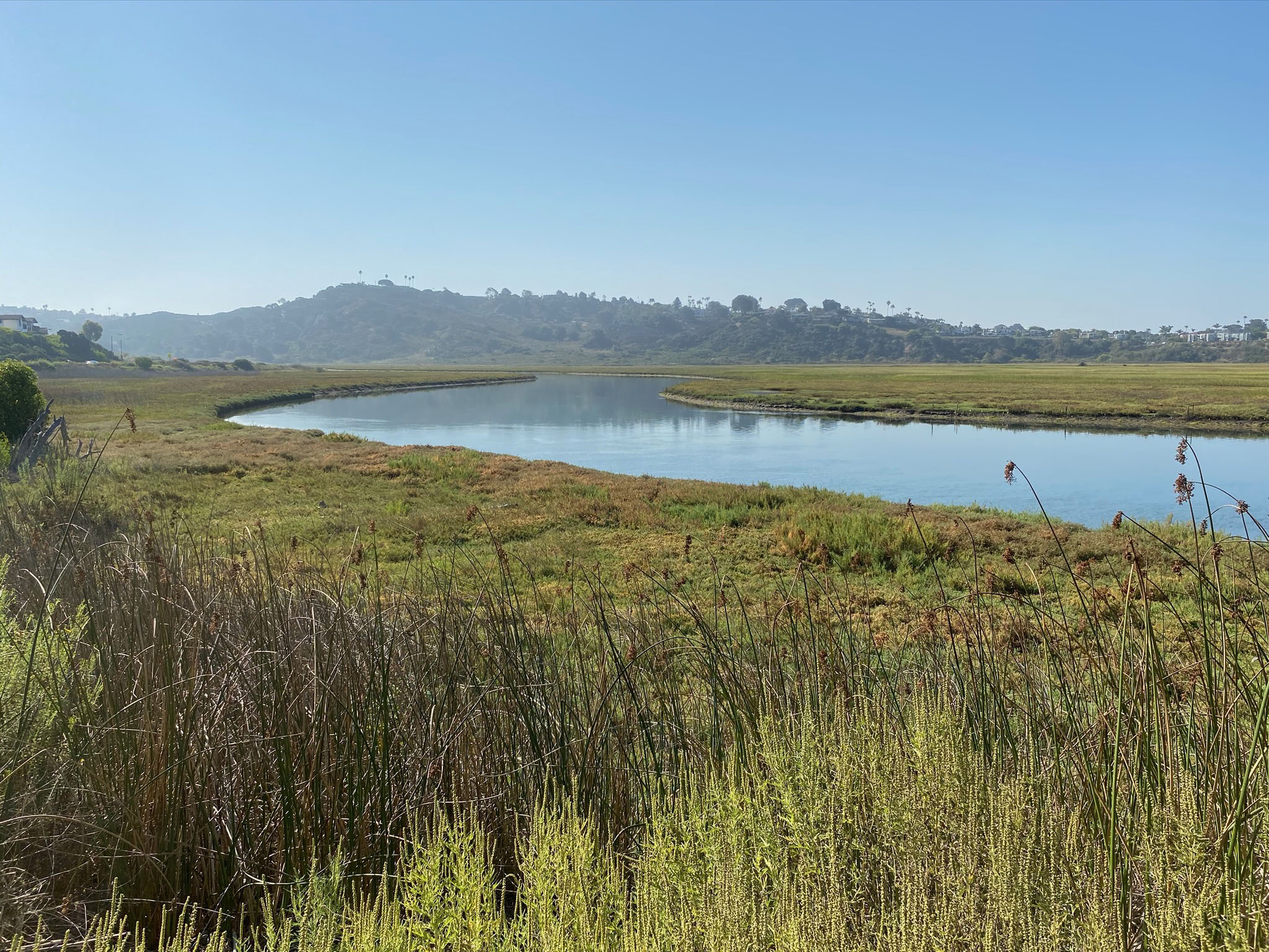
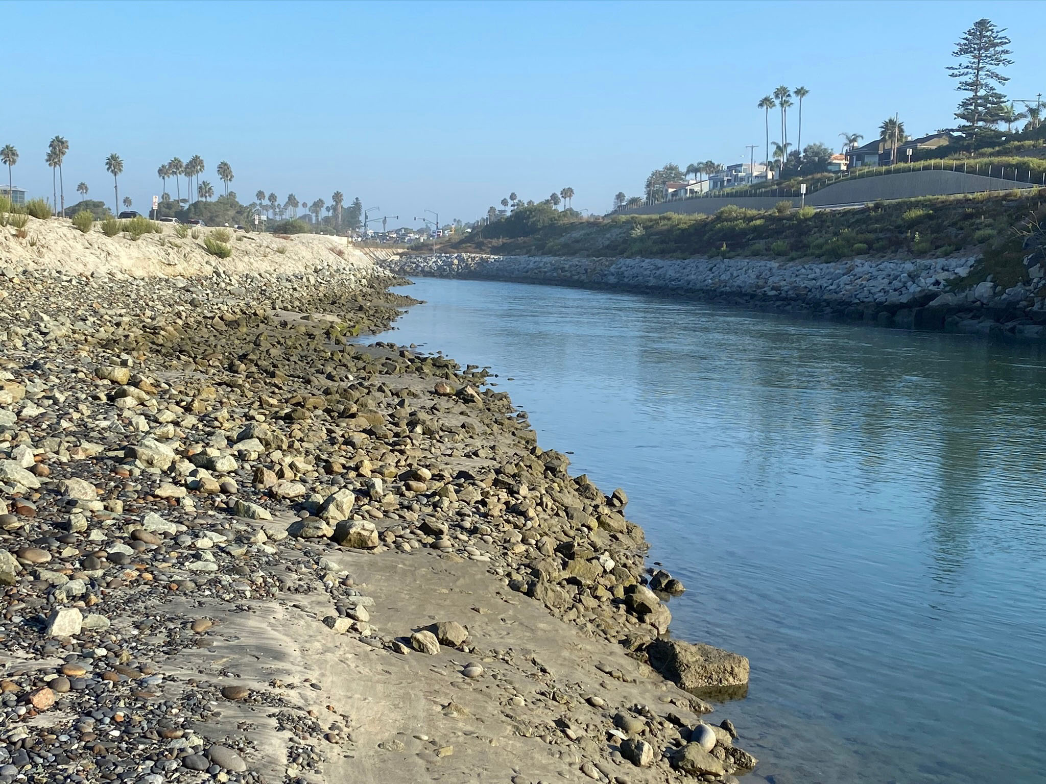
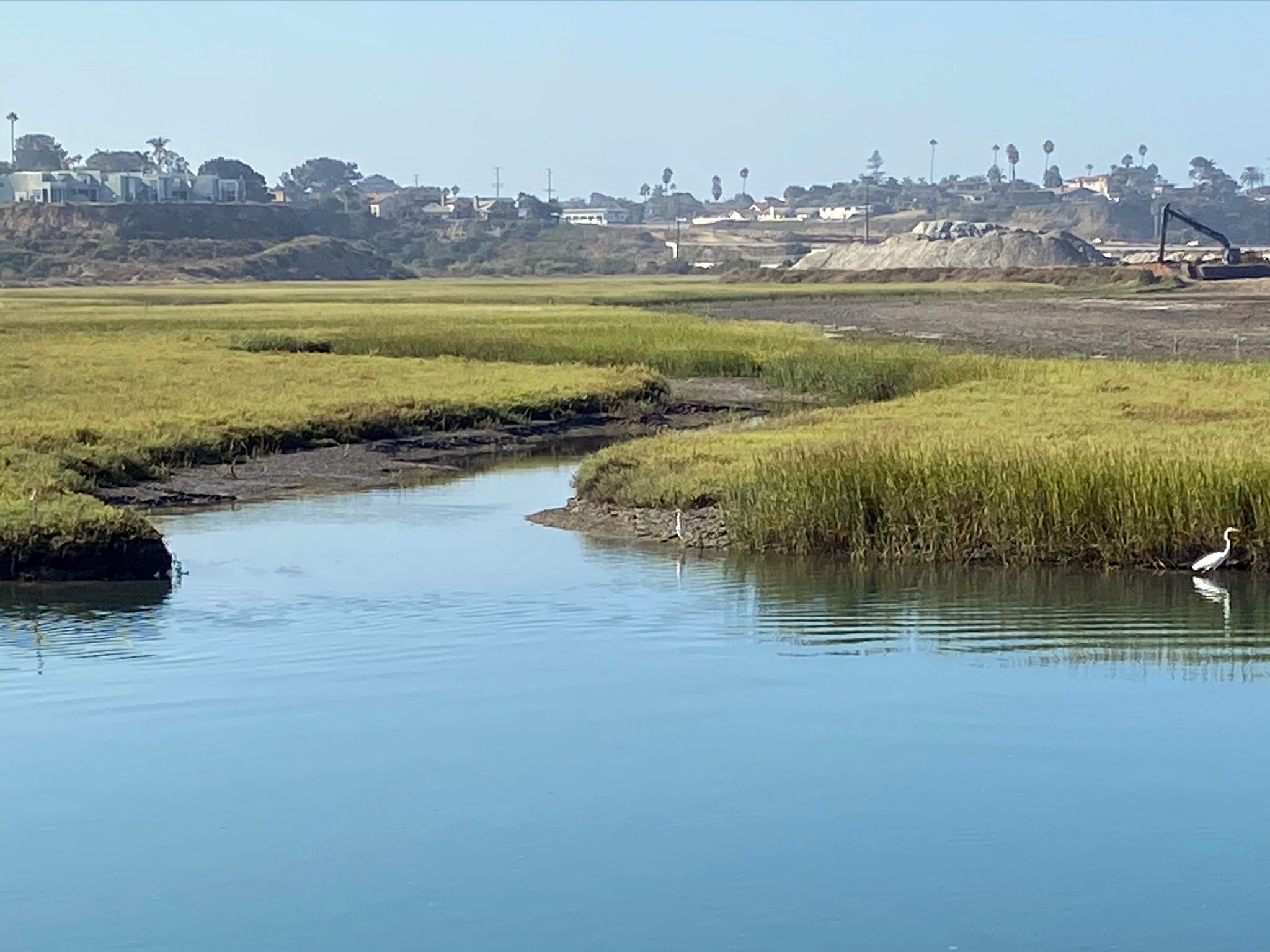
Stop 5 is a visit to the lagoon inlet channel (Escondido Creek) on the east side of the Pacific Coast Highway. It is best to cross the highway at the stop light at the entrance to the Cardiff State Beach parking area. Figure 52 shows the rocky shoreline of the tidal channel near low tide. Strong tidal current move in and out of the channel, particularly at high tide, strong enough to move beach cobbles and gravel. The waterway is part of the San Elijo Lagoon Ecological Reserve and therefore is off limits to human activities. As a result, despite being close to the highway and rail line it is a typical quiet setting and a good place to observe wildlife. It is common to see herons, snowy egrets, and occasional osprey waiting to catch fish along the shore.
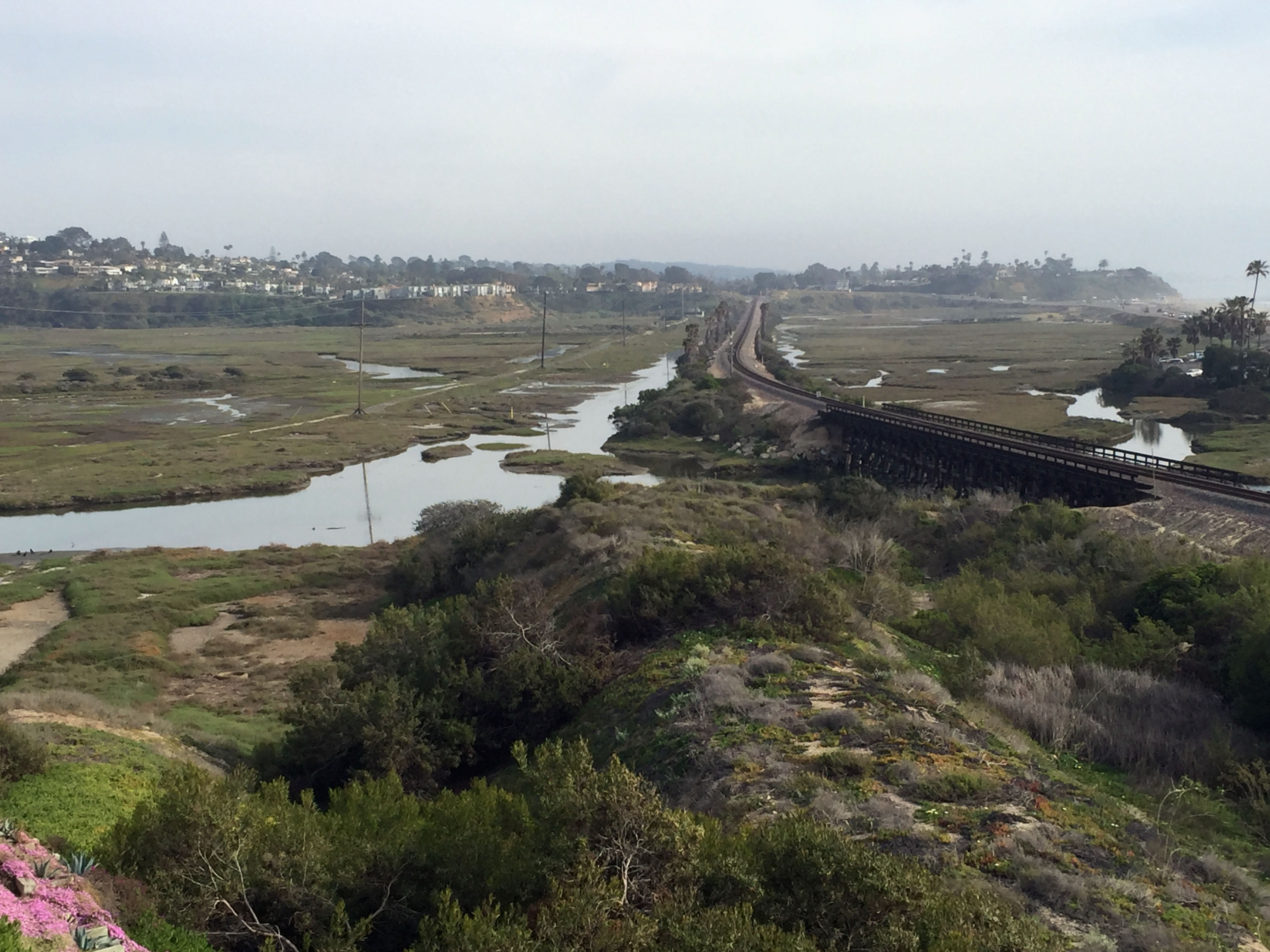
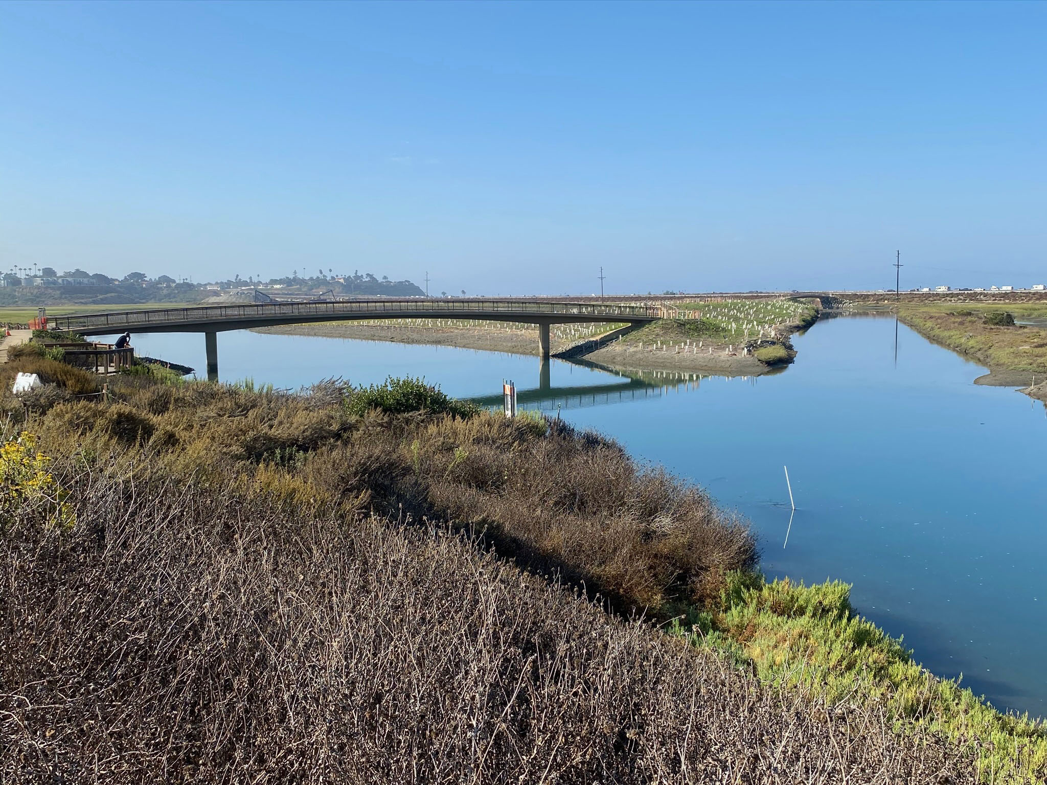
Construction the coast highway, I-5, and the railroad causeway and bridge severely altered the natural dynamics of sediment flow into and out of the lagoon (Figure 53). However, elaborate efforts are underway to restore some of the natural dynamics by the lagoon's circulation system. A large sand-borrow pit was dug to both resupply sand to the beach and to create a water retention pond to increase tidal flow into the lagoon.
San Elijo Lagoon Environmental Nature Center is an incredible resource for visitors to the lagoon (Figure 54). The visitor center is located at 2710 Manchester Avenue, Cardiff-by-the-Sea, CA 92007; it labeled as Nature Center on map Figure 2. The visitor center has displays and information highlighting the rich wildlife biology. The lagoon is host to nesting birds and migrating waterfowl,and provides nursery habitat for young fish, and diverse population of other plant and animal species. The coastal wetlands of the lagoon are surrounded by coastal sage scrub and riparian communities. The current restoration projects underway are intended to improve tidal circulation, enhance habitat while expanding access with an improved trail system (Figure 55). You can learn about the efforts of the conservation efforts and the reserve trails through the non-profit organization associated with the reserve: The Nature Collective.
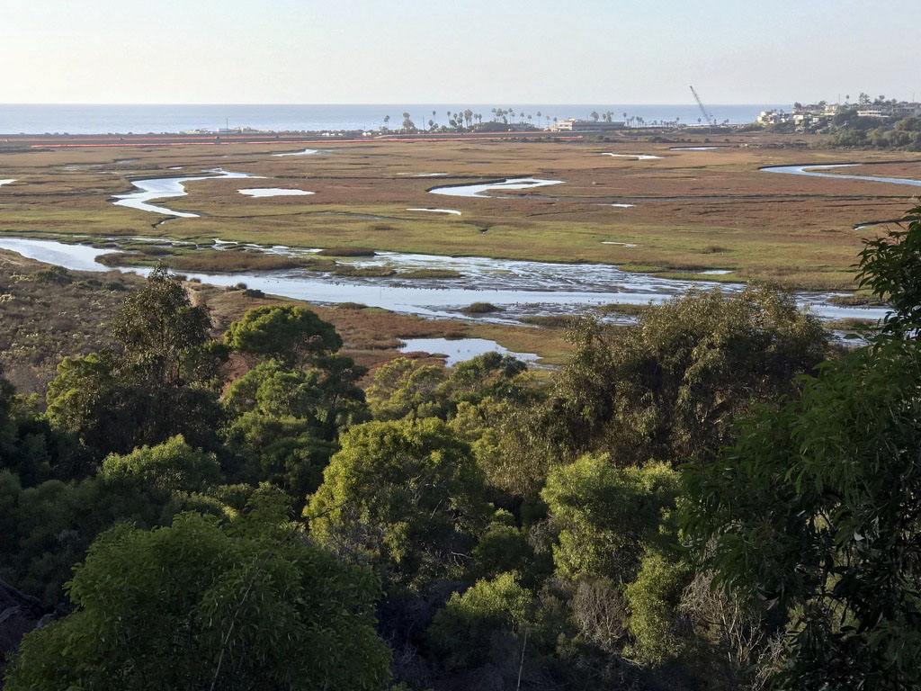
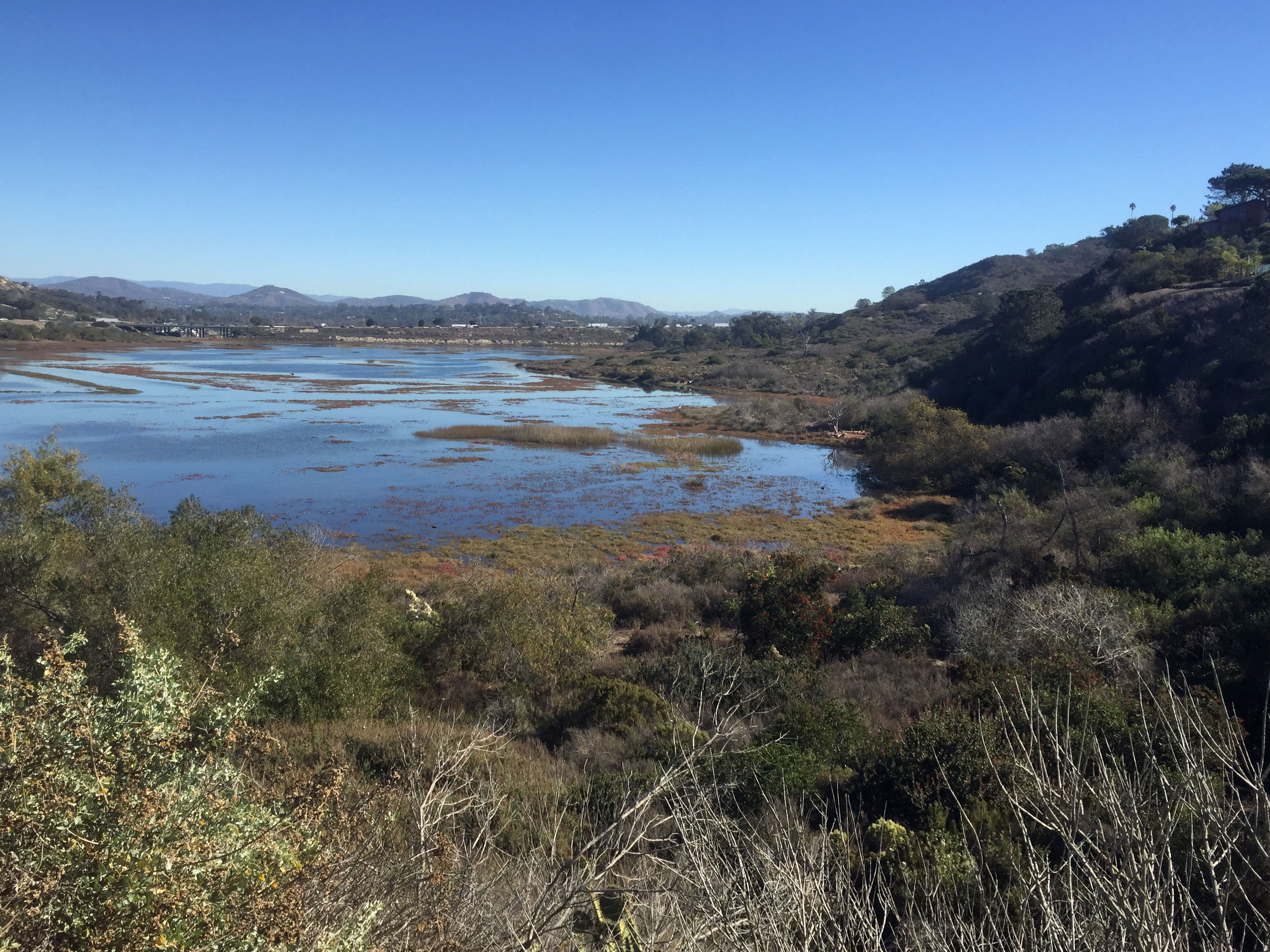
The daily tidal flushing is the greatest force shaping the lagoon. Without restrictions, the inflow and outflow gradually reshapes the shifting channels and supplies new nutrients and sediments to the wetlands (Figure 56). Figure 57 shows the lagoon at low tide, whereas Figure 58 shows the upper lagoon at high tide when most of the wetlands are submerged.
Geology History of the Lagoon: It is most important to emphasize how the rise and fall of sea level impacts the lagoon (Figure 59). The modern lagoon exists as we see it today because sea level is slowly rising. The current rate of rise is about 1 inch every 5 years. This slow rise creates accommodation space to trap more sediment over time. However, at the peak of the last ice age (about 18,000 years ago), sea level was nearly 400 feet lower than today because vast quantities of water was trapped in the polar ice sheets that covered most northern North America, Europe, and Siberia. If you were here back then (as the early migrant native populations may have seen it), Escondido Creek would have been actively carving a deep valley that extended to the coastline several miles to the west of the current shore. By about 10,000 years ago, sea level was rapidly rising and the current area occupied by the lagoon would have been a bay in the coastline. By about 3,000 years ago, the rate of sea level rise slowed significantly, a bay-mouth bar with coastal dunes and cut by natural inlets created the isolated wetlands of the lagoon probably very similar to what we see today.
During previous ice ages and the intervening interglacial warm periods the cycle of lagoon formation and destruction repeated itself many times. The deposits of previous lagoon deposits are locally preserved along the valley around the lagoon—in very similar step-like fashion as the marine terraces they are associated with.
|
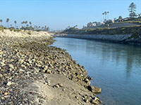
Fig. 52. View looking north along the Escondido Creek tidal section the links the lagoon to the ocean. |
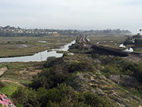
Fig. 53.View looking south from San Elijo Avenue towards the railroad causeway where it crosses the lagoon. |
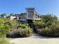
Fig. 54. The San Elijo Lagoon Environmental Nature Center is the best place to start a visit to the lagoon and trails. |
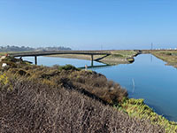
Fig. 55. View from near the Nature Center of the recently constructed trail bridge over the lagoon's main channel. |
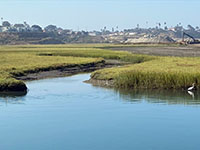
Fig. 56. View of one of the smaller tidal creeks entering the main channel of the lagoon (with a snowy egret). |
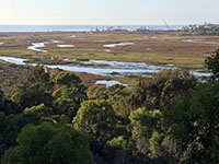
Fig. 57. View looking west across the San Elijo Lagoon during low tide when the salt marsh is well exposed. |
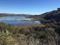
Fig. 58. View looking east at the lagoon during a high tide when most of the salt marsh is submerged. |

Fig. 59. A time-sequence diagram showing the stages of lagoon formation and destruction during ice ages. |
|
| https://gotbooks.miracosta.edu/fieldtrips/San_Elijo_State_Beach/index.html |
9/8/2020 |
|