Franks Peak, Mt. Whitney, and the Highlands Terraces |
|
A1
Although it is easy to drive up and park at Double Peak to gain access to amazing views, if you are looking to get out for excellent mountain hikes that get you away from crowds, then consider the hike to Franks Peak and the open space in the open-space wild lands beyond. Franks Peak provides exceptional views of the Highlands Terraces region of the northern San Diego County. This guide provides information about several stop locations on various trails. You may want to do them on separate hikes. These hikes involve walking on rocky back-country fire roads. There is also very little shade in this chaparral-covered landscape so early morning or winter/spring season hiking is recommended. Note that spring wildflower season can be exceptional in some of these upland areas.
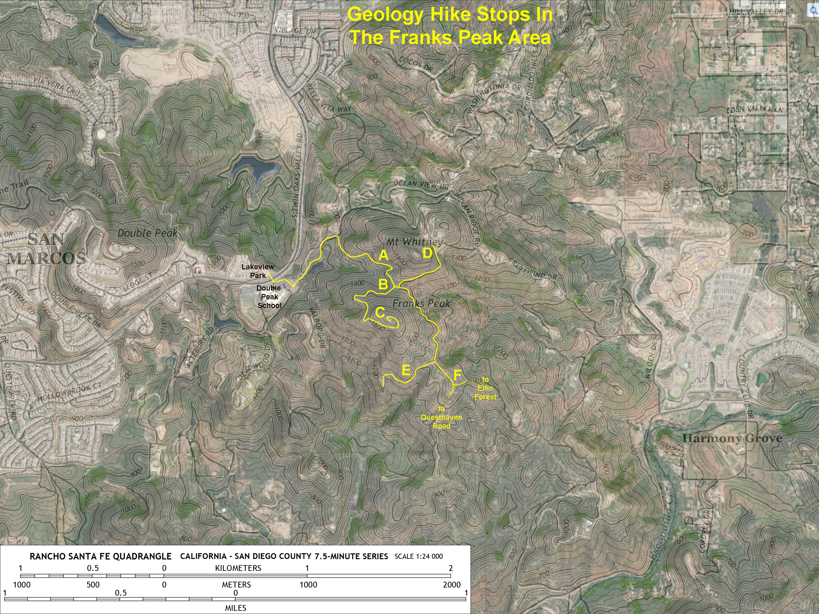
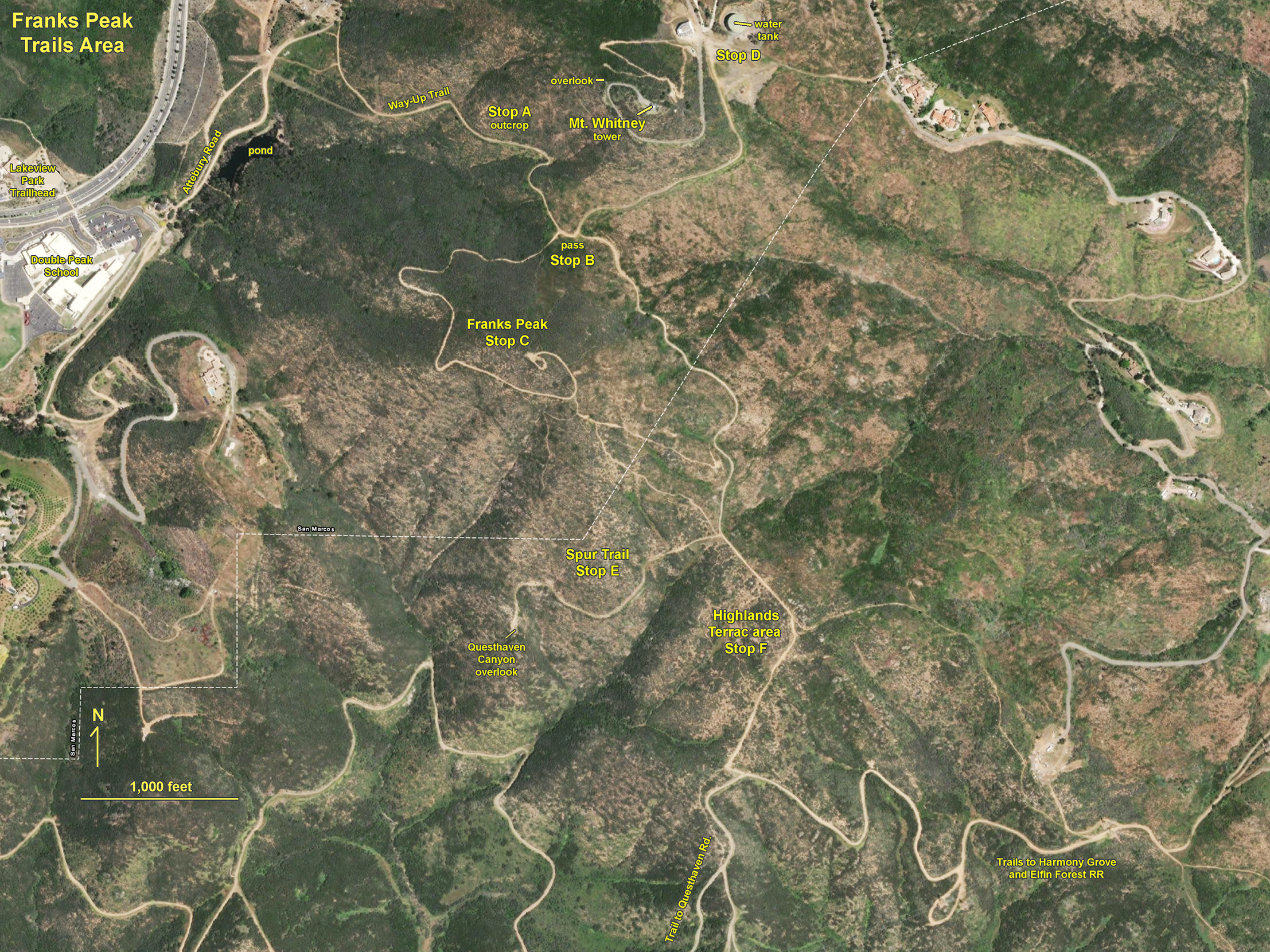
Figure 1 is a map of the trail system in the Franks Peak area of the San Elijo Hills region of San Marcos, California. Franks Peak is the most recommended destination. Although Mt. Whitney is slightly higher, the hike to the top is not recommended because of restrictions related the risk of exposure to radiation from the microwave tower at its summit. Note that the the views are just as good, if not better, from the top of Franks Peak.
The discussion below describes outcrop features in areas labeled as Stops A to F. These are locations where bedrock geology is exposed on or along the trail that are worth looking at. The image collection below also illustrates panoramic and zoomed in views of distant landscape features.
|
Click on images for a larger view. |
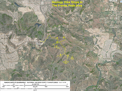
Fig. 1. Trail map of the Franks Peak area in the San Elijo Hills showing the location of geology stops (A-F) along back-country fire roads. Trails to Franks Peak, Mt. Whitney, and back-country trail locations are shown on the map.
|
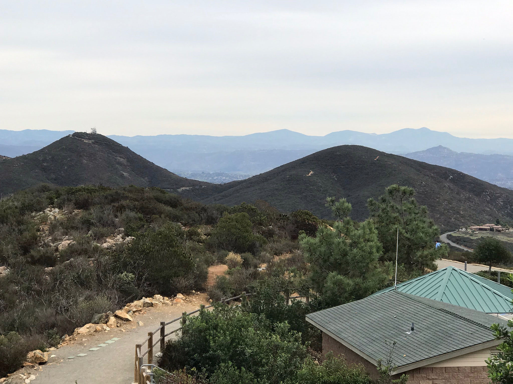
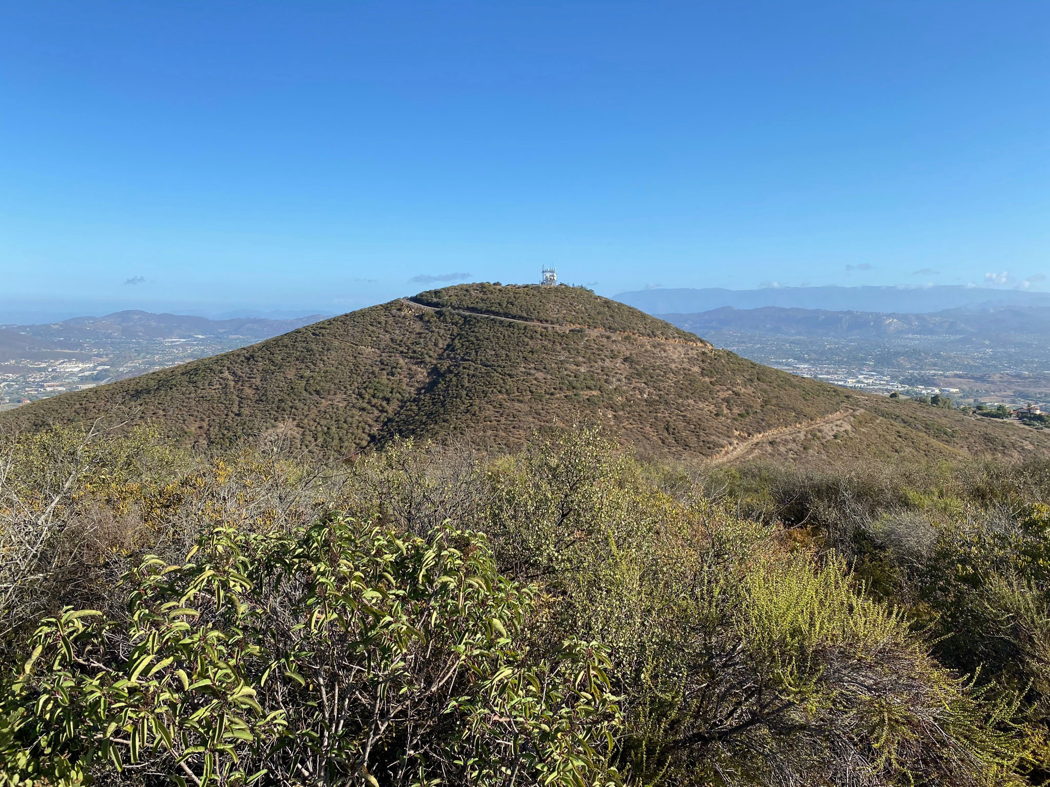
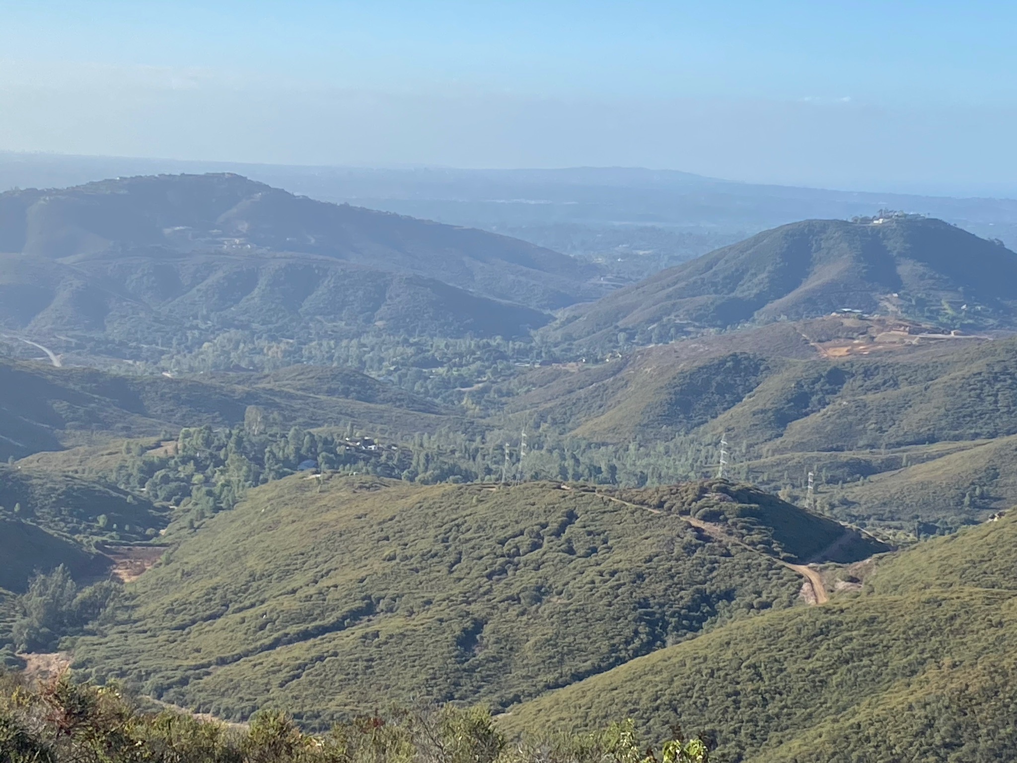
Figure 2 shows Mt. Whitney (left) and Franks Peak (right). This view is looking west from the top of Double Peak Park.
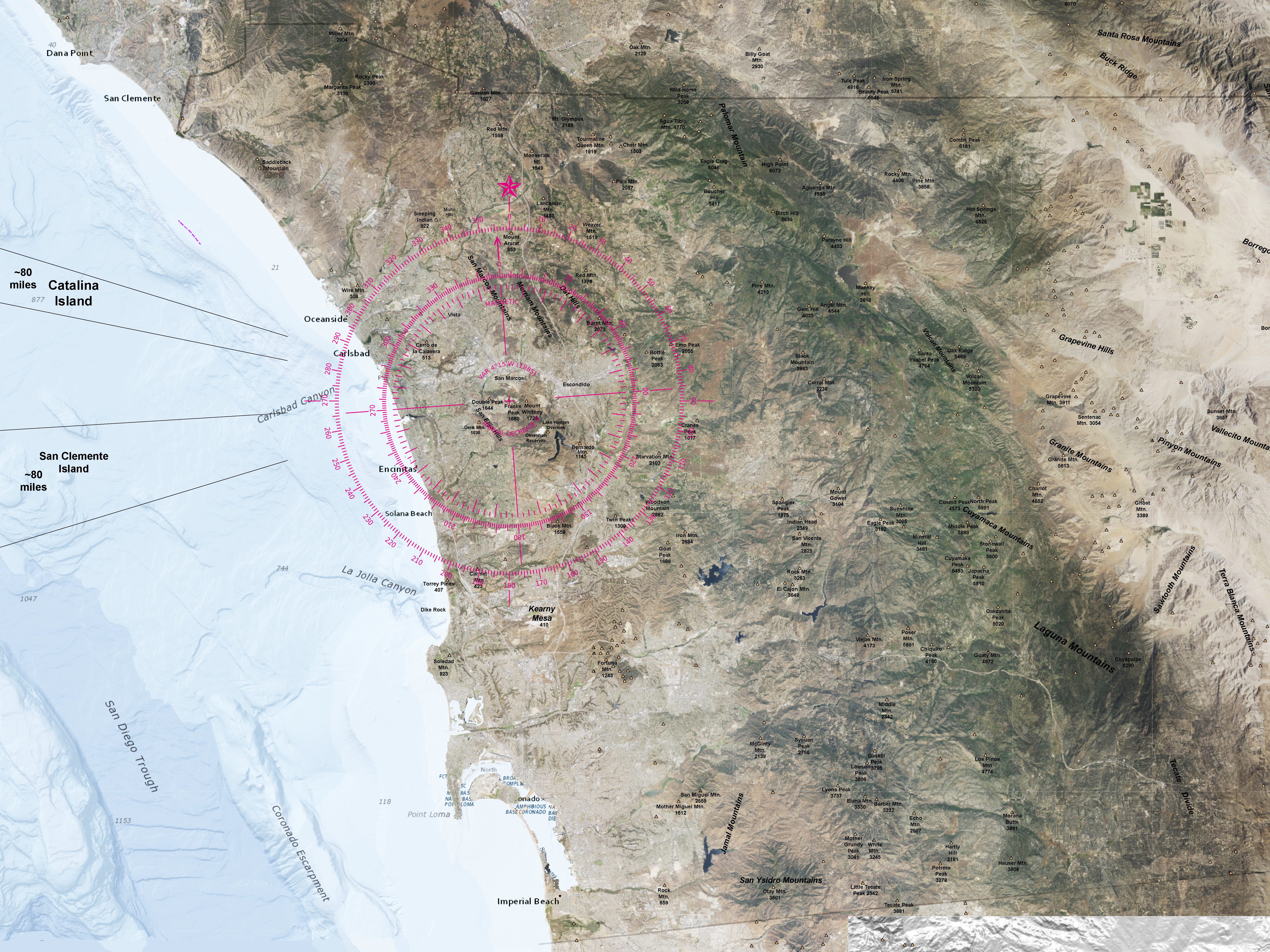
Figure 3 is a satellite map useful for orientation and identifying regional landscape features visible in the distance from the mountain peaks and overlooks.
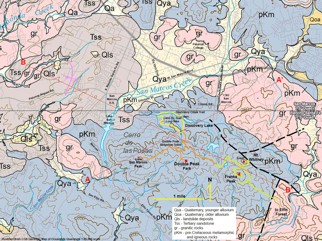
Figure 4 is a local geologic map of the San Marcos area with trails shown on the map.
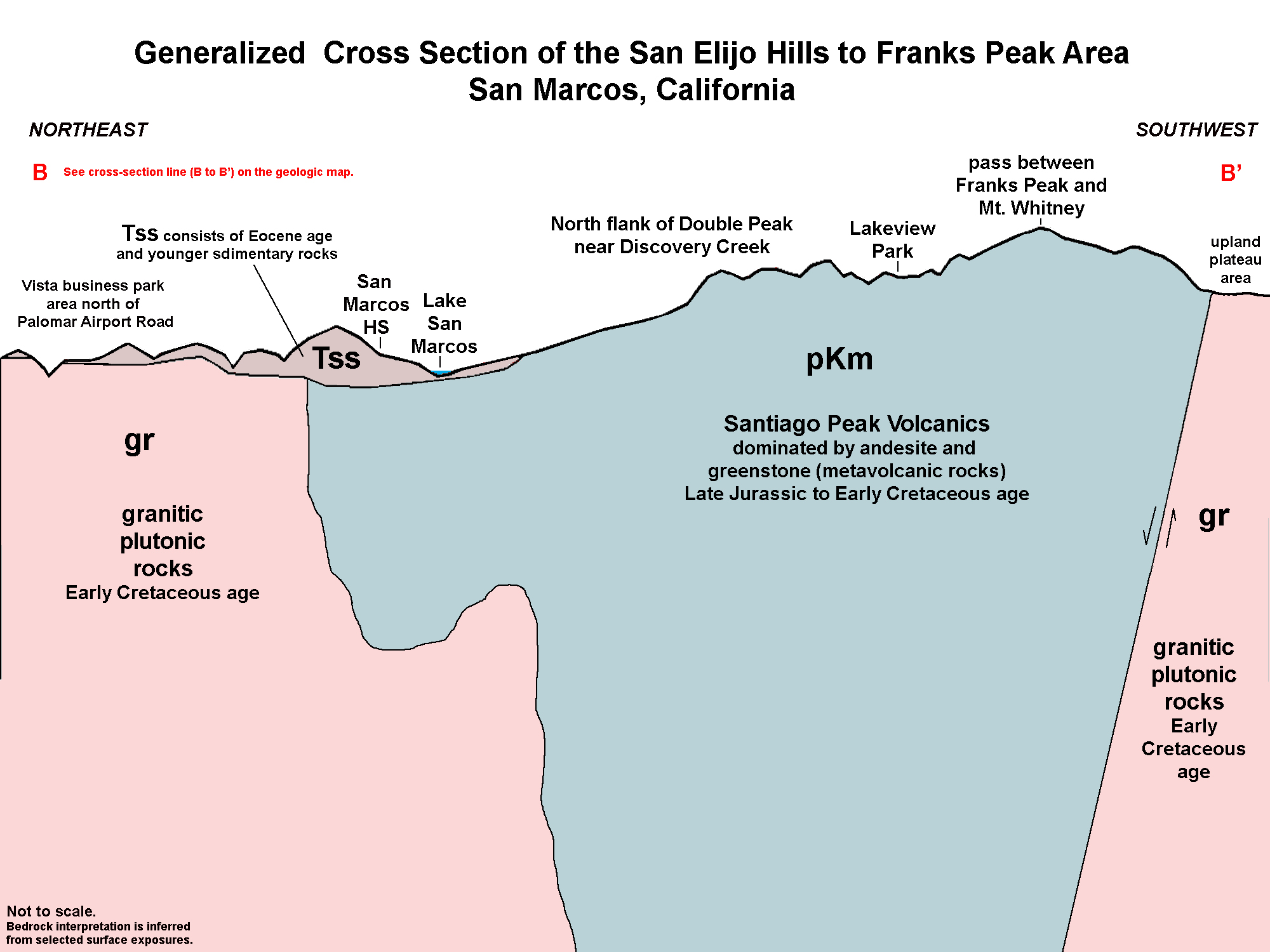
Figure 5 is a geologic cross-section shown as B-B' on the geologic map. These figures are used in the discussions below. |
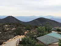
Fig. 2. Mt. Whitney and Franks Peak (left and right) as seen from Double Peak Park. |

Fig. 3. Regional satellite map with towns and landscape features including peaks. |
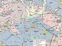
Fig. 4. Geologic map with legend of San Marcos and the Franks Peak fieldtrip area. |
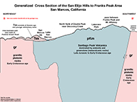
Fig. 5. Generalized cross section of the line B-B' on the geologic map. |
|
A2
Starting Point - Lakeview Park/Double Peak School
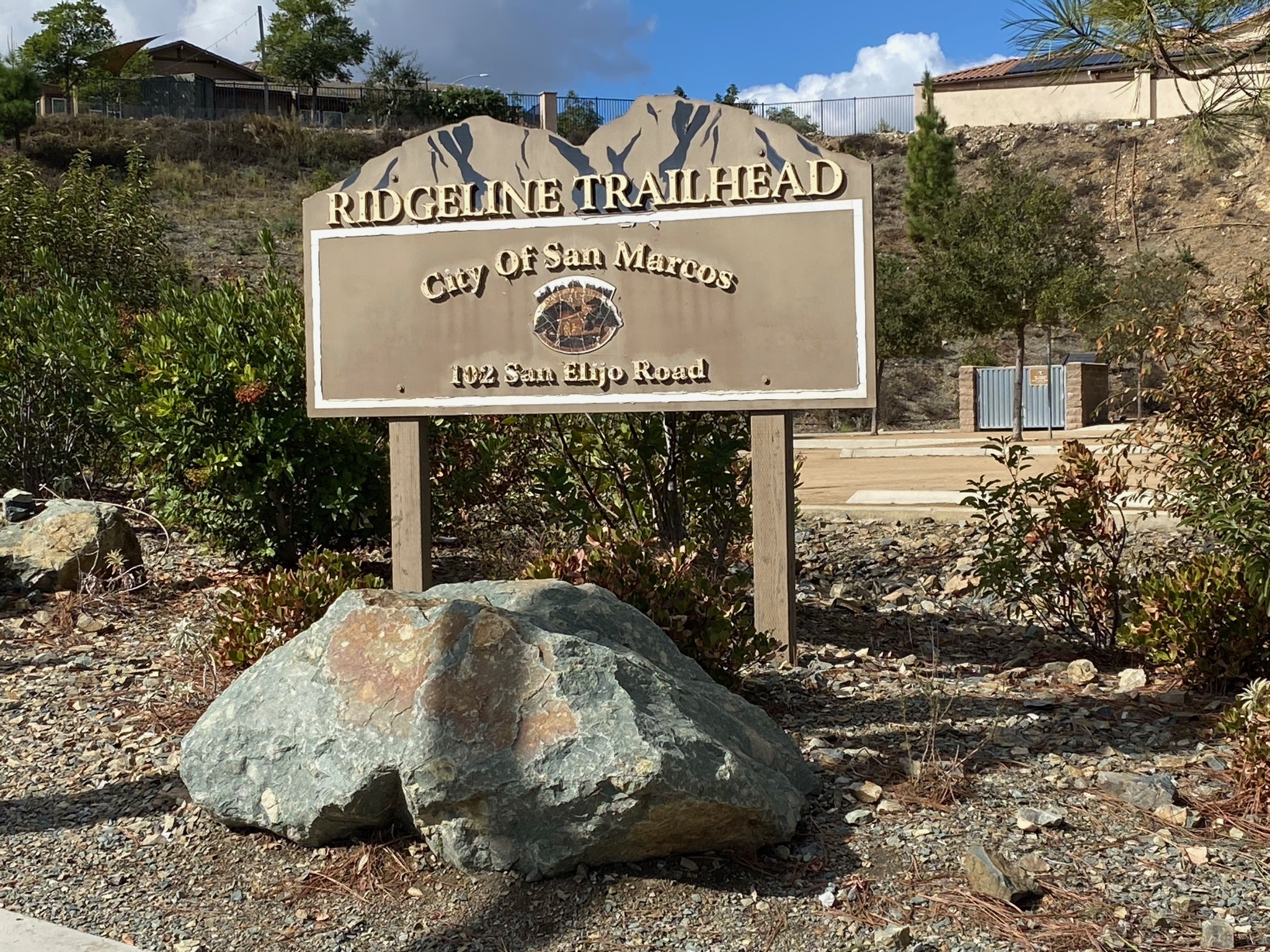
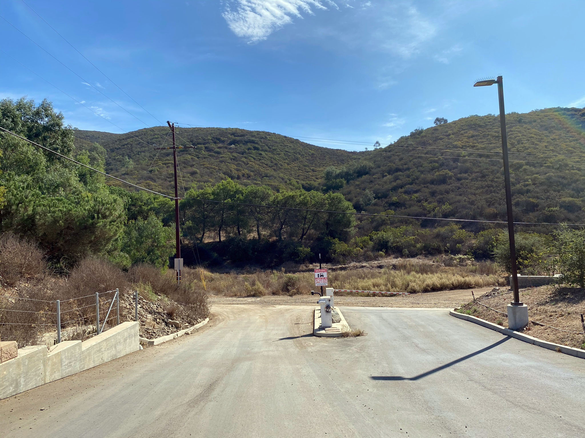
San Elijo Hills is the name of the community and the mountaintop area around Double Peak in San Marcos (Figure 6). The place to start is to park your vehicle at Lakeview Park (Figure 7). The park located at the intersection where S. Twin Oaks Valley Road become San Elijo Road (Figure 8). The park is located across the road at the stoplight for Double Peak School. To get to the trail, cut through the east side of the school parking lot and turn left on Attebury Road, an unpaved public-access road (Figure 9). Expect a modest workout if you plan to hike to Franks Peak. The elevation at Lakeview Park is at about 1,100 feet. The elevation at the top of Franks Peak is 1,688 feet—the elevation gain to Franks Peak is almost 600 feet over 2 miles. For comparison, the elevations of Mt. Whitney is 1,736 feet and Double Peak is 1,644 feet. To visit all the stop on this field trip at one time would involve a hike of about 6 miles and a couple thousand feet of elevation changes (a great cardio workout!).
|
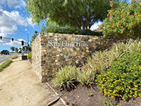
Fig. 6. San Elijo Hills sign on Twin Oaks Valley Road. |

Fig. 7. Sign for Lakeview Park trailhead parking area. |
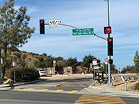
Fig. 8. Park entrance on Twin Oaks and San Elijo Roads. |

Fig. 9. School parking exit to Attebury Road (gravel). |
|
A3
Stop A - Bedrock Geology Along The Franks Peak Trail
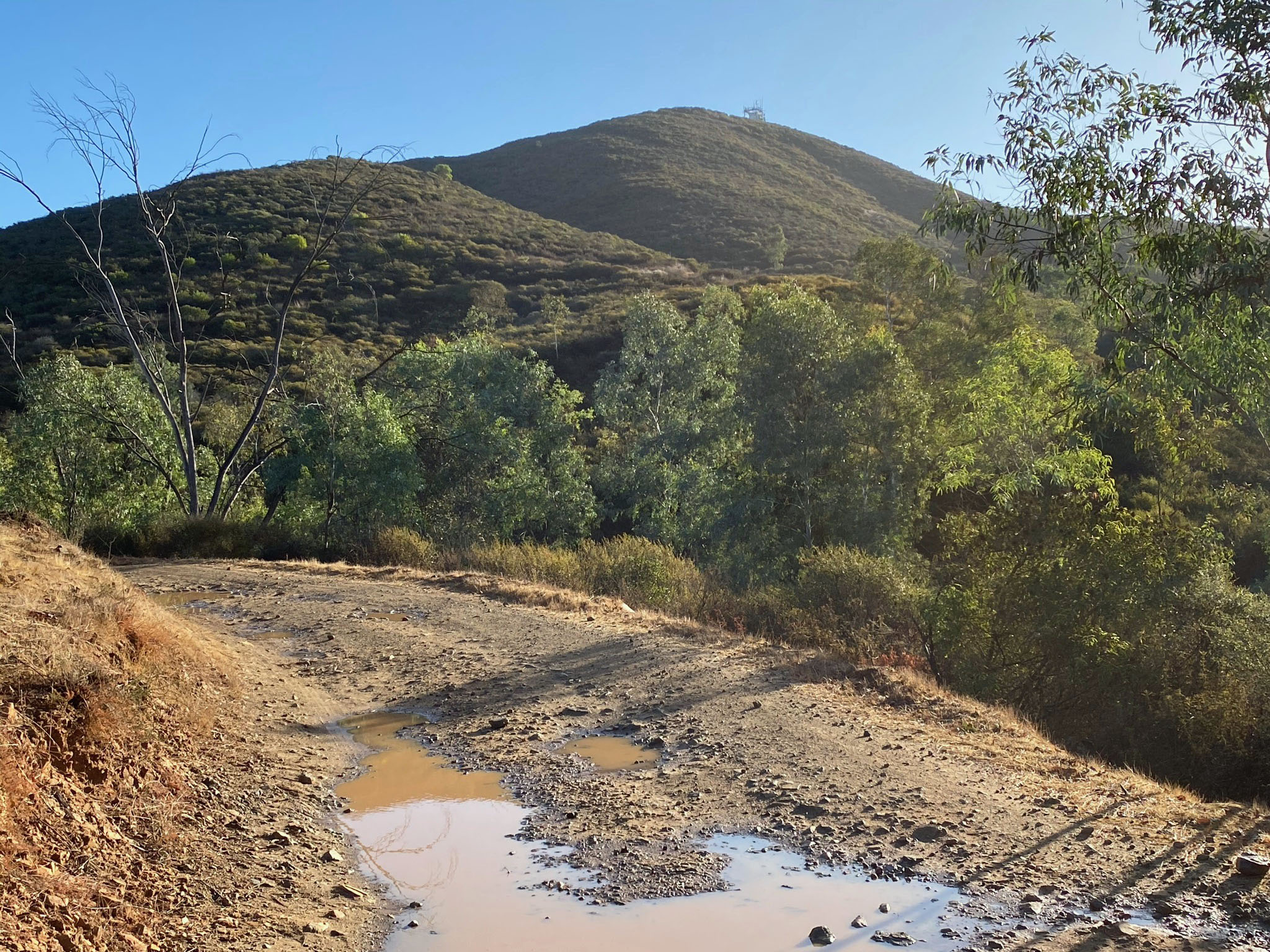
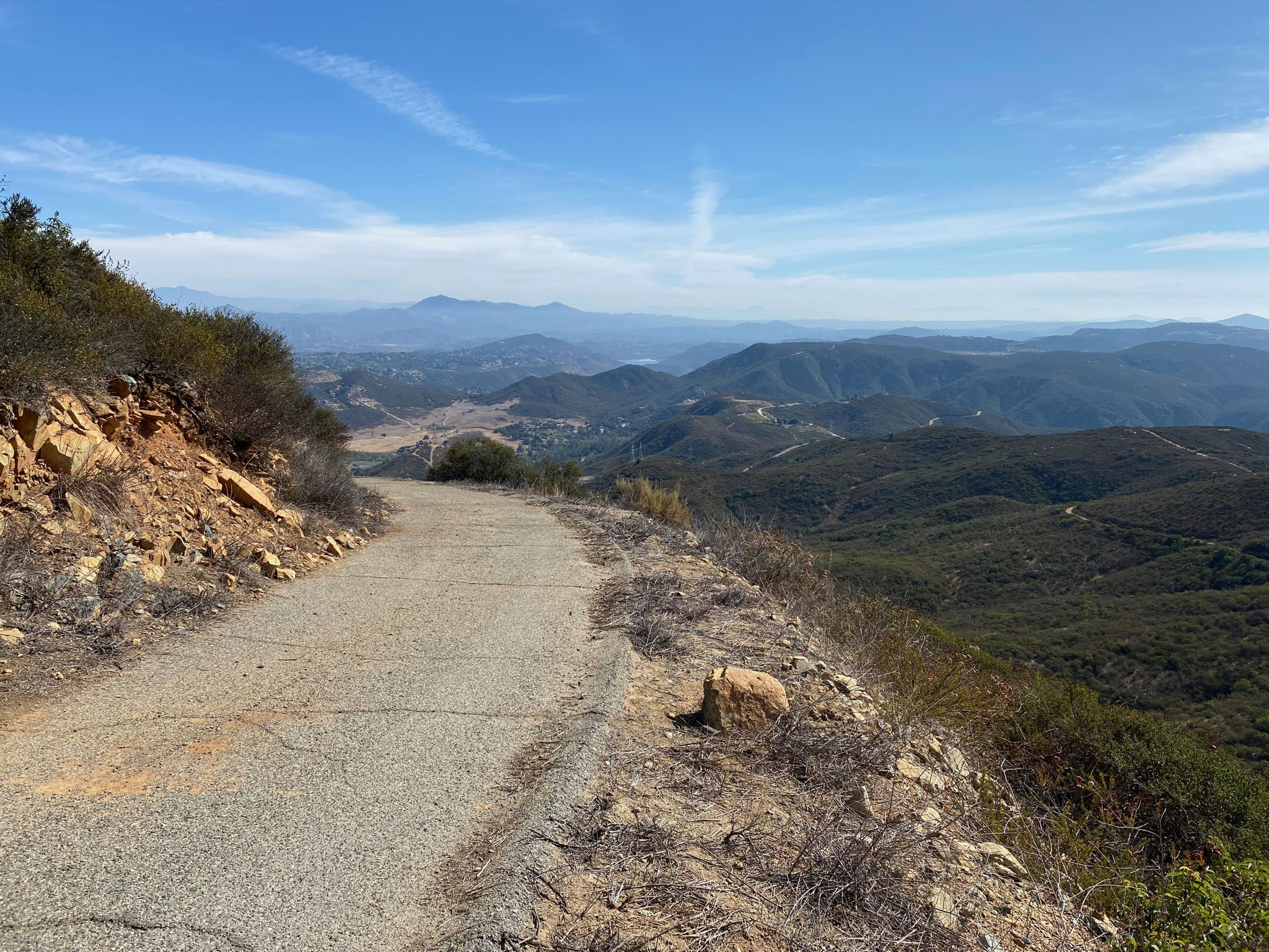
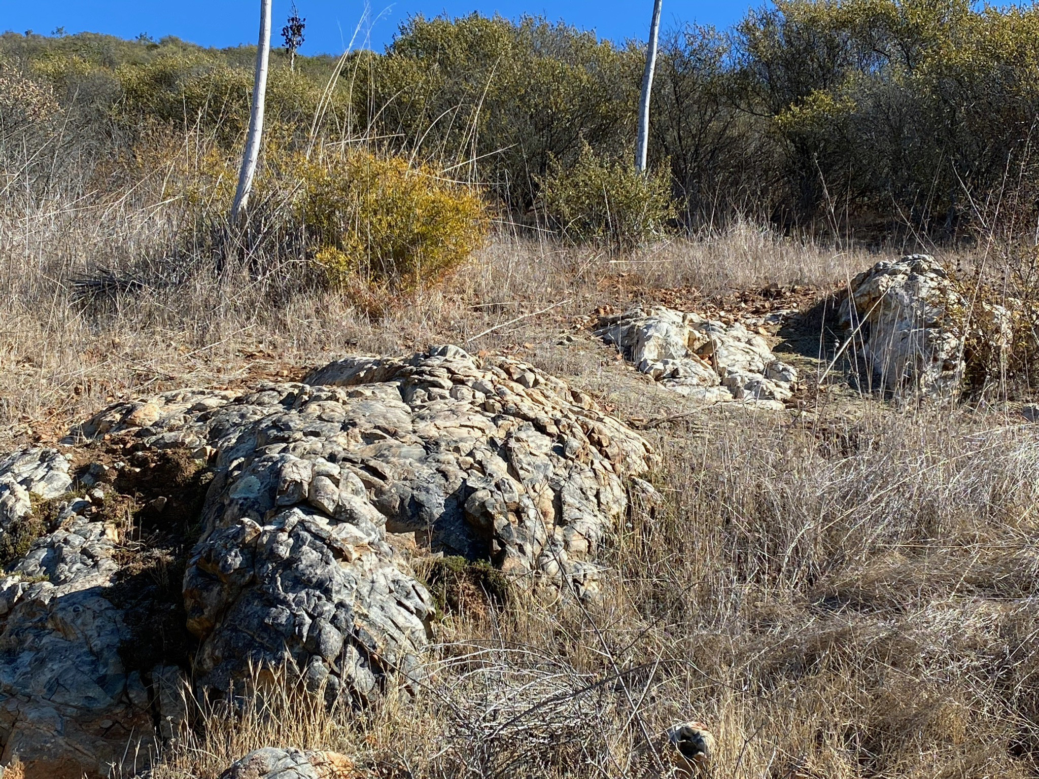
A fire road is the way up trail to access Franks Peak, Mt. Whitney, and the backcountry beyond (see Figure 1). There are many miles of trails, one leads on to the Elfin Forest Recreational Preserve parking area. The fire roads are used by mountain bikers, and they can appear suddenly, moving fast downhill. Riders on horseback also use these trails.
Please stay on the road; the land on either side is privately owned. You will walk past a pond surrounded by a eucalyptus tree grove (Figure 10). Eucalyptus are non-native plants introduced from Australian and New Zealand in the 19th century by the railroads and are harmfully invasive particularly to riparian habitats. Several hundred feet ahead you leave behind the eucalyptus trees and you will see the fire road going uphill on the right along the west flank of Mt. Whitney (the peak with a small radio tower on top). That fire road is the route for this field trip. Note that beyond the eucalyptus grove the route is entirely in chaparral and coastal sage scrub habitata, and there is very little shade along the trails except perhaps in the early morning and late afternoon.
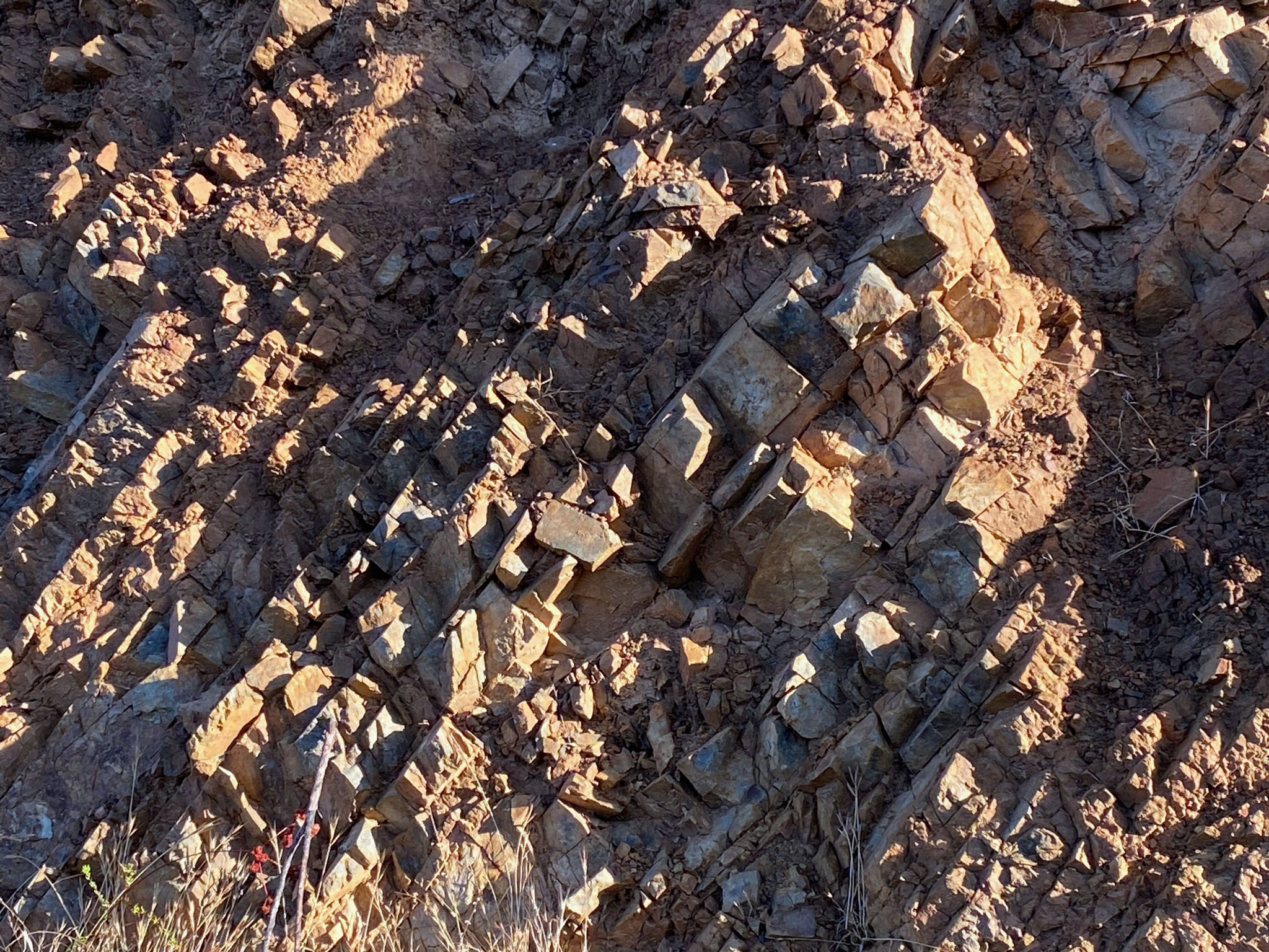
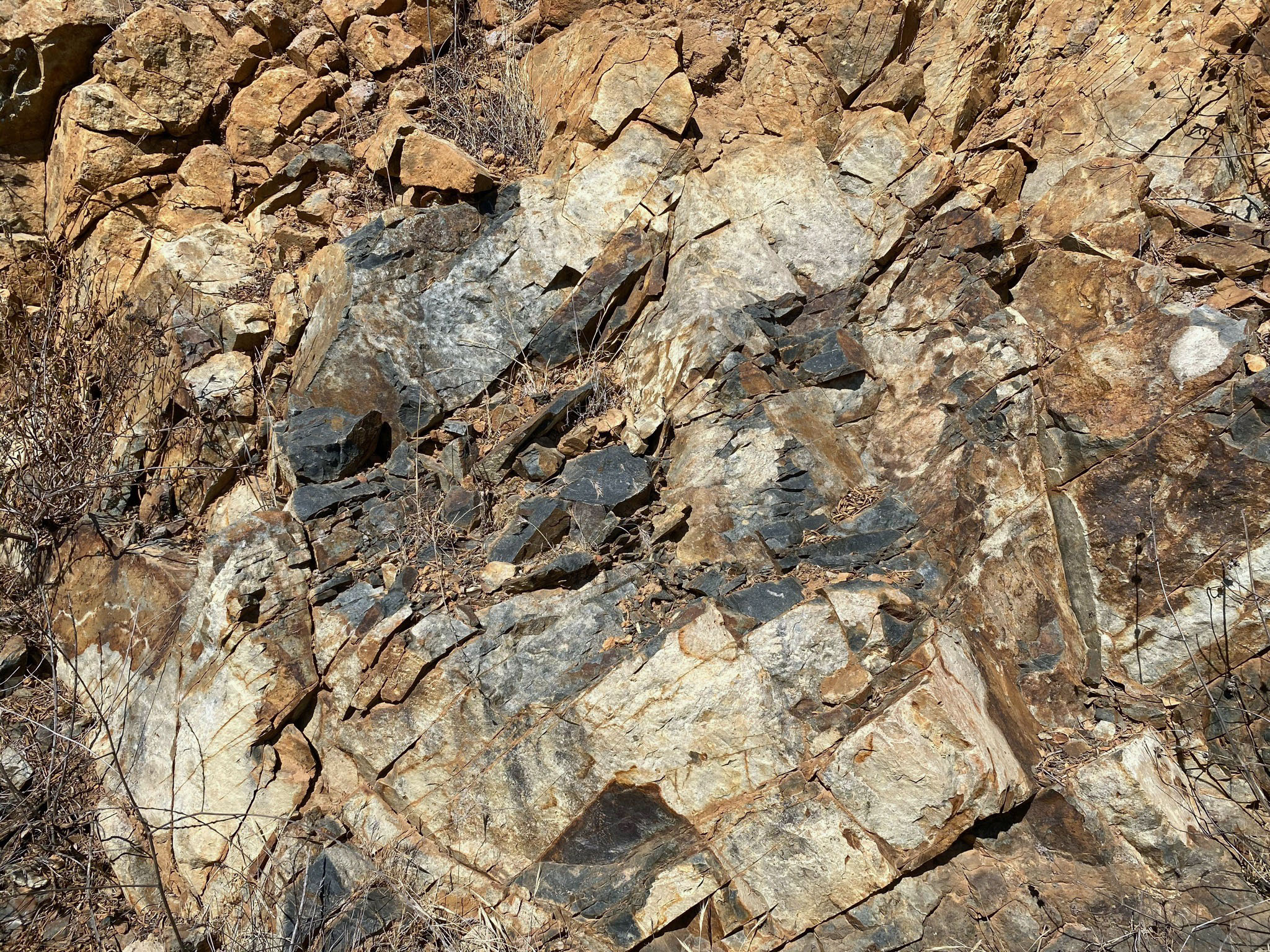
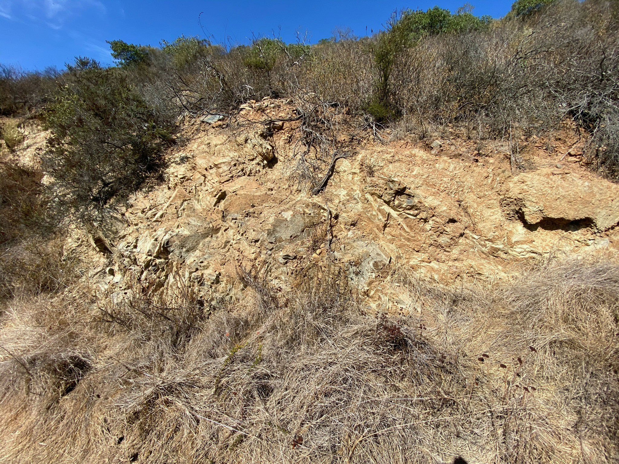
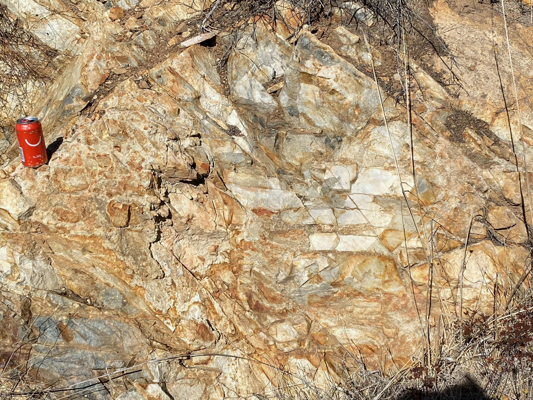
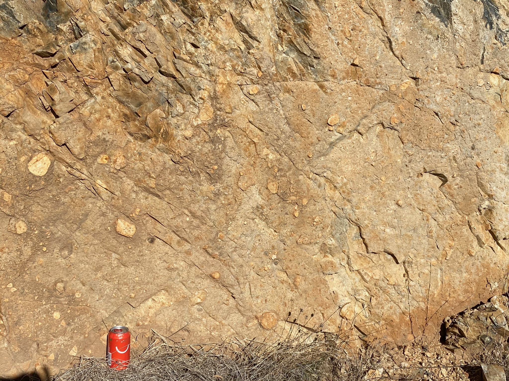
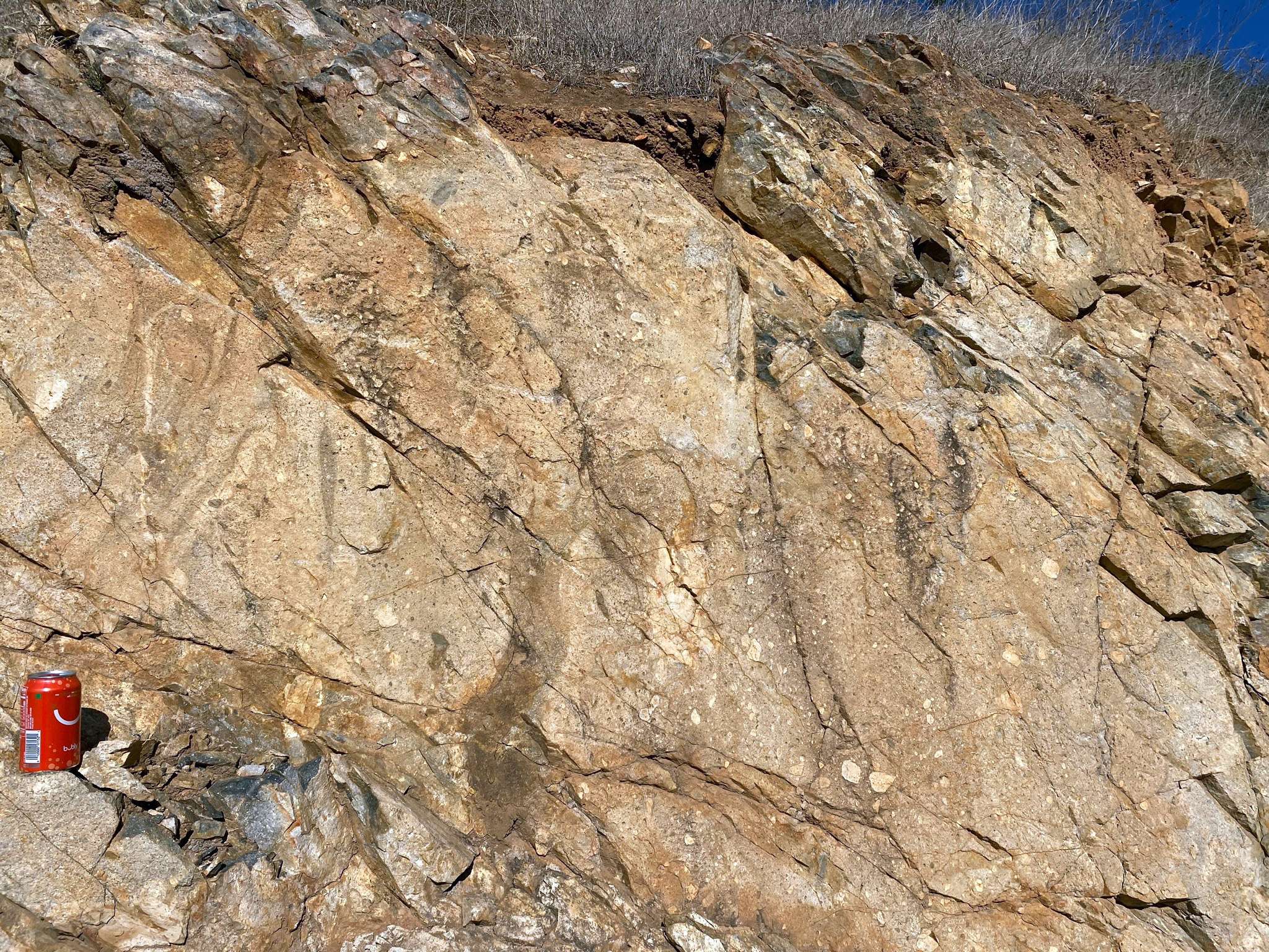
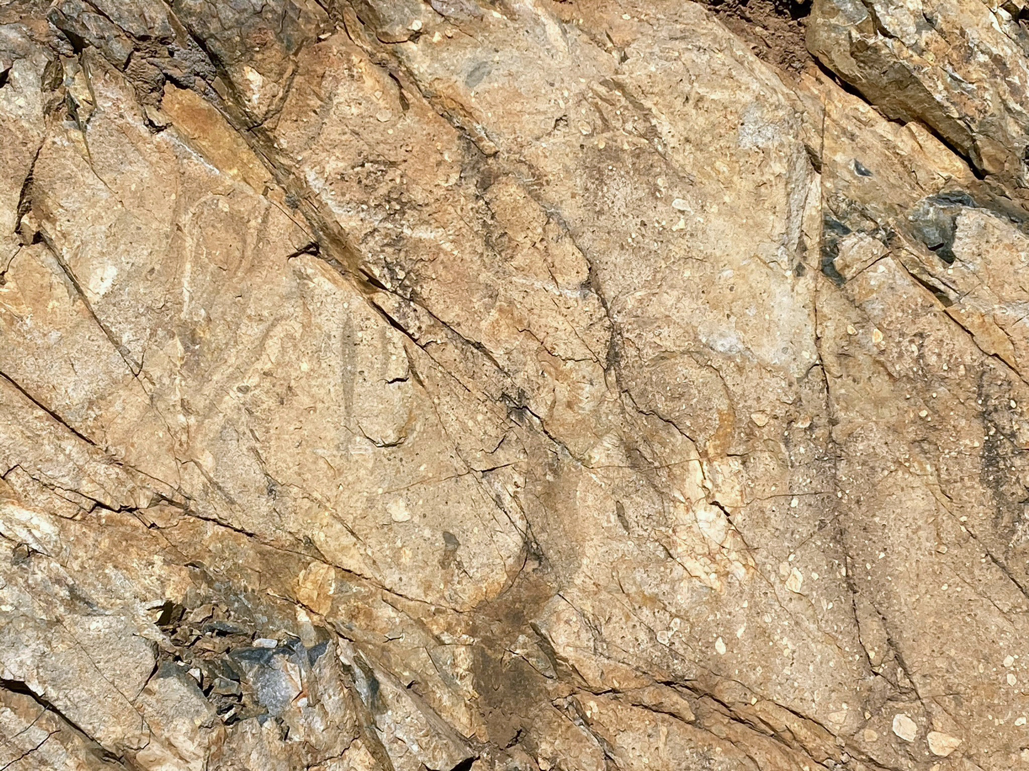
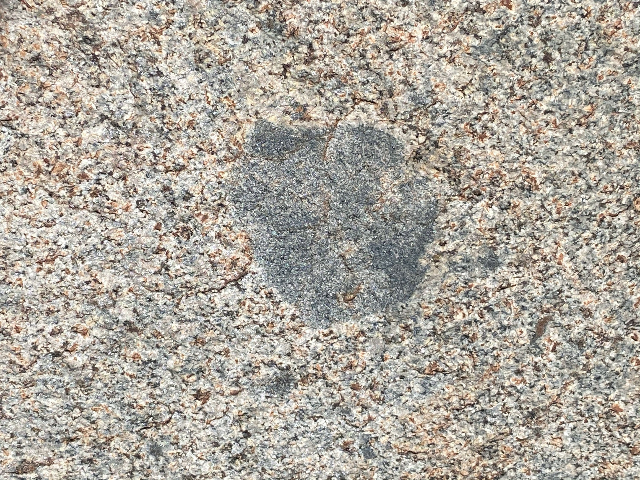
Figure 11 shows a road cut about quarter-mile way up the trail. The bedrock exposed along the trail, on Franks Peak, and on Mt. Whitney are all labeled as pKm on the geologic map (Figures 4 and 5); pKm stands for pre-Cretaceous metamorphic and igneous rocks. These rocks are collectively included in a regional belt of rock materials named the Santiago Peak volcanics. These rocks are exposed at fieldtrip Stops A to E.
Santiago Peak Volcanics
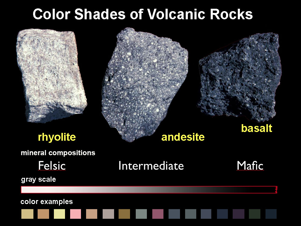
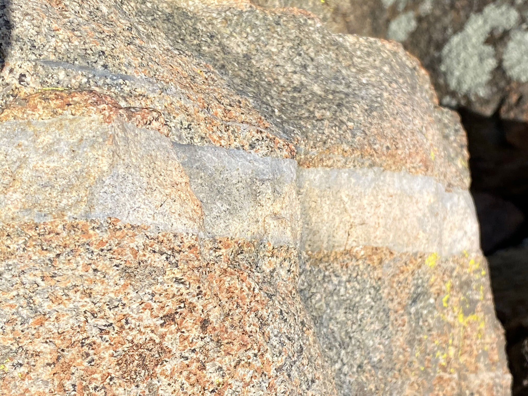
The Santiago Peak volcanics is a name applied to rocks of similar age and composition that crop out intermittently throughout the western Peninsular Ranges extending from Baja California northward to the Los Angeles region. The rocks are named after their type area on the flanks of Santiago Peak in the northern Santa Ana Mountains. The are considered part of an ancient magmatic arc along the western edge of the Peninsular Ranges batholith. The rocks consist of a mix of rocks of volcanic origin, including basalt, andesite, and rhyolite. The volcanic rock textures include massive (or nondescript) lava rock, flow-banded lava rocks, surface lava-flow features (a'a), pillow basalts, dikes, welded tuffs (volcanic breccia), and volcanoclastic sedimentary rocks. The variety of rock compositions and textures suggest that the Santiago Peak volcanics rocks formed from both explosive volcanic eruptions and outpouring of lava on the surface or injected near the surface environment. They also probably originally accumulated mostly in a sub-aerial environment (moderate to deep ocean depths) and are locally interbedded with sedimentary deep-water fan (turbidites) deposits of Middle Jurassic age. However, geochemical studies and radiometric ages on selected samples suggest that the majority of the Santiago Peak volcanic rocks formed in the Early Cretaceous Period (128 to 110 million years ago)(Herzig and Kimbrough, 2014). The rocks probably formed associated with the volcanic arc plumbing system in the early stages of the formation of the Peninsular Ranges batholith. In some places, older metamorphic rocks have been intruded by the Santiago Peak volcanics.
Figure 12 shows layered bedrock at the west end of the road cut at Stop A. It has the appearance of layers, but these rocks are volcanic in origin. The origin of the layers is unclear. They may be volcanic tephra (tuff) deposited on the sea floor, they may be thinly bedded lava flows or sheeted dikes (closely spaced intrusive injections), or, they may be completely secondary in origin as a result of tectonic shearing and fracturing. Figure 13 show a more massive blocky outcrop composed of basaltic lava at the east end of the outcrop. This blocky outcrop shows a distinct fracture pattern. These rocks have experience a light amount of metamorphic alteration. Their exposed surface also have a weathering patina that masks the dark gray and black color of the original unweathered bedrock. Figure 14 is a panoramic view showing the entire Stop A outcrop belt in the road cut. |

Fig. 10. Eucalyptus grove around pond with Mt. Whitney |
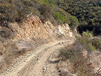
Fig. 11. Bedrock exposed in a cut along the Way Up fire road |
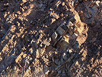
Fig. 12. Layered bedrock at the west end of the cut. |
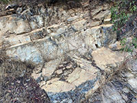
Fig. 13. Massive blocky basalt at the east end of the cut. |
|
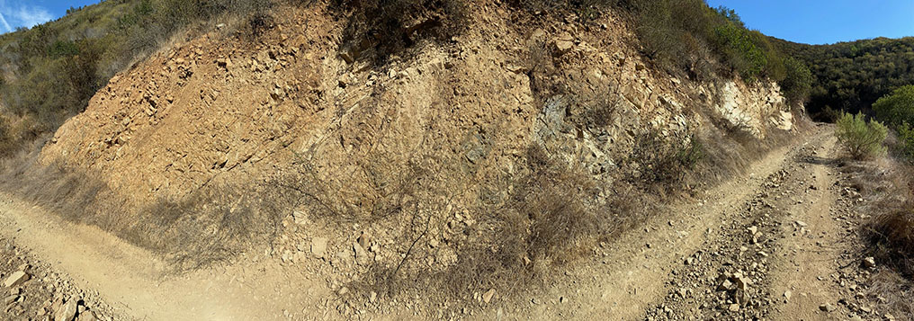
Fig. 14. Panoramic view of the outcrop along the fire road to Franks Peak. Layered volcanic rocks are to the left, more massive lava rocks on the right.
|
A4
Stop B - Ancient Erosion Surfaces and Highland Terraces
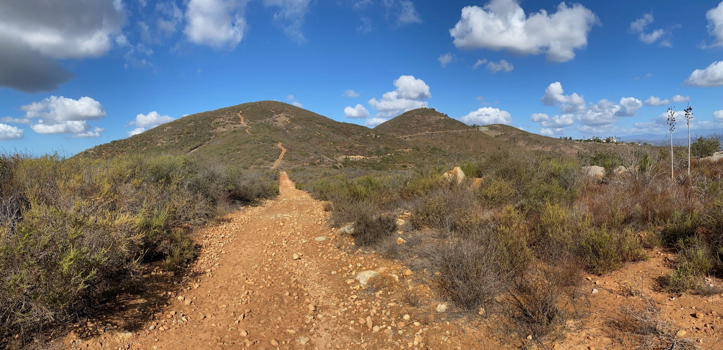
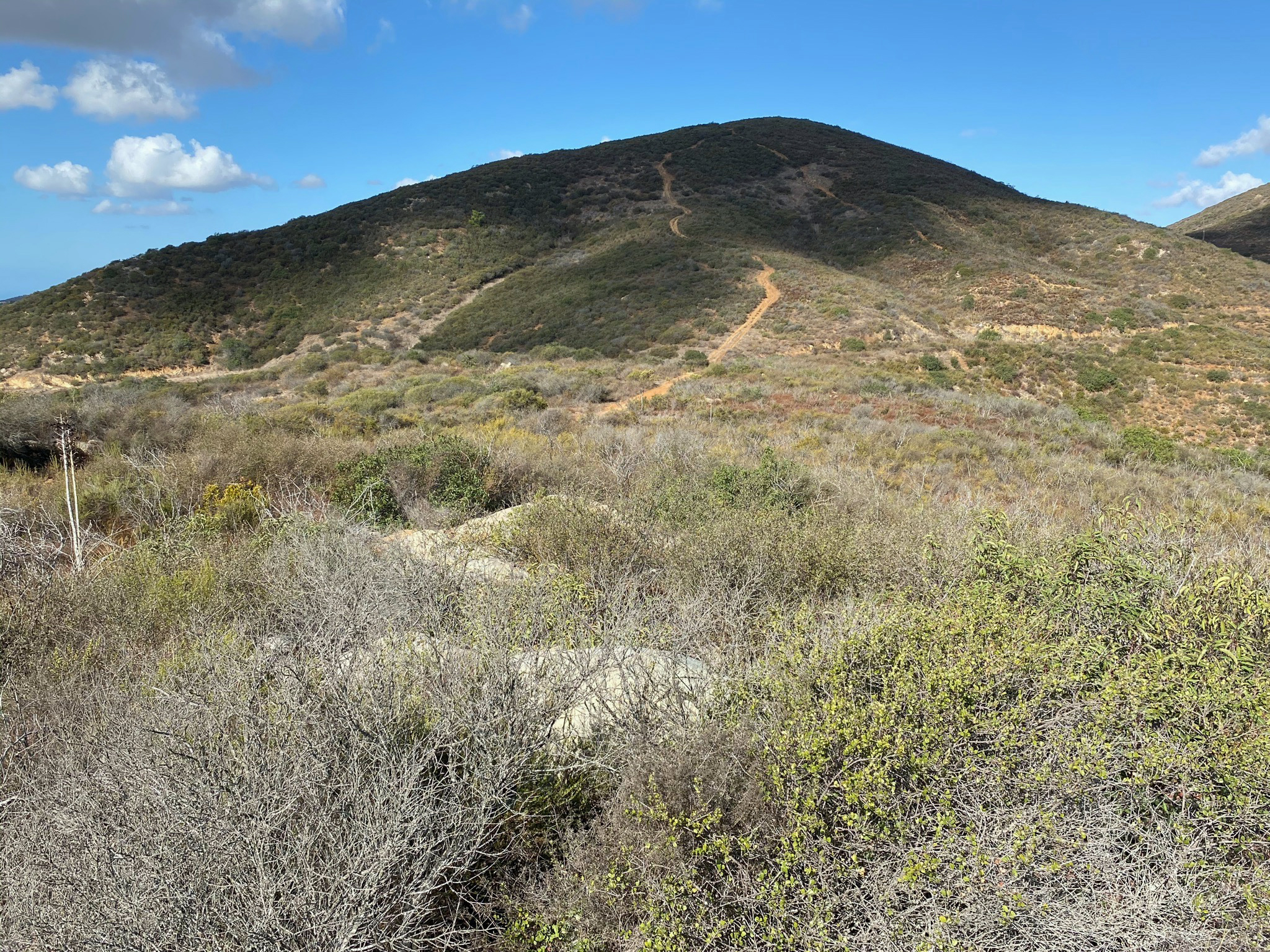
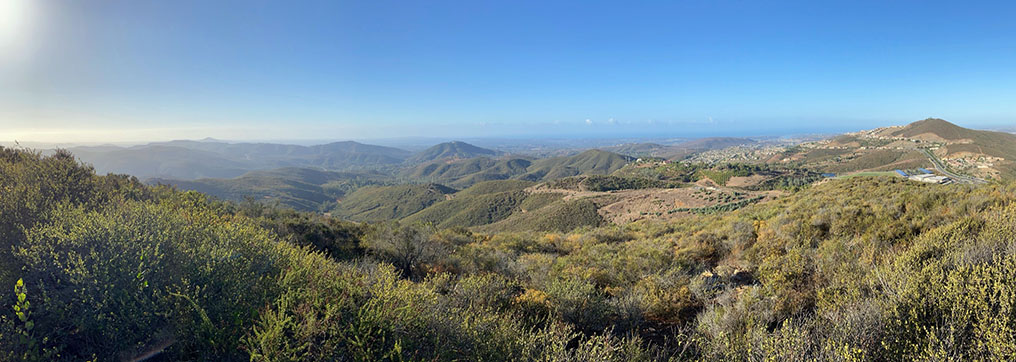
Stop B is in the vicinity of the pass between Franks Peak and Mt. Whitney (Figure 15). It is there where hikers have to decide where to go next. The pass is at an elevation of about 1,450 feet, about halfway to the top of either Franks Peak (elevation 1,680 feet) or Mt Whitney (elevation (1,729 feet). Trails leading to the both Franks Peak and Mt. Whitney intersect the fire road in the pass area.
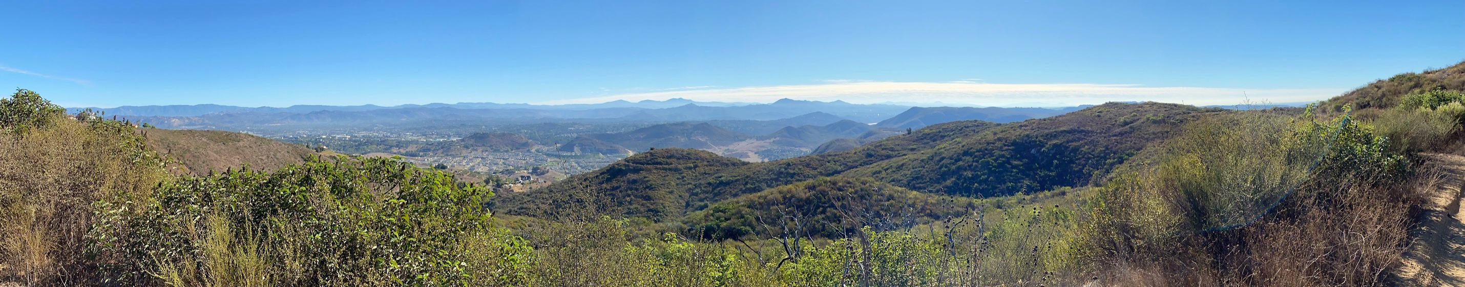
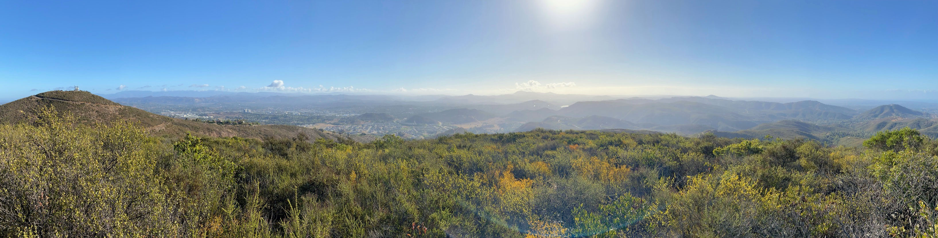
It is the pass area where you start to get the majestic viewsto the south and east of the distant mountains and plateaus of the Peninsular Ranges region (Figure 16) . From the pass area it is easy to see the remnants of ancient erosion surfaces and highland terraces in western San Diego County (discussed below).
Note: from this point the route to Franks Peak is most recommended first (Stop C). Most day hikers also tackle Mt. Whitney (Stop D). However, from a geologist perspective, to see more interesting geology and scenery is to continue south from the pass to Stops E and F. These stop areas are the most most remote, quiet, and wilderness areas of this field trip area. To visit all stops would take most of a day and involve hiking a total of about 6 miles. Bring water, snacks, hat, and sunscreen!
|
Fig. 15. The pass between Mt. Whitney and Franks Peak as seen from the Way Up Trail near Stop A. One lone eucalyptus tree is the only tree along the trail route.
|
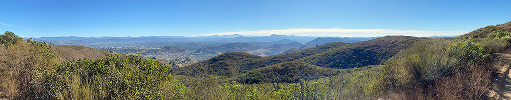
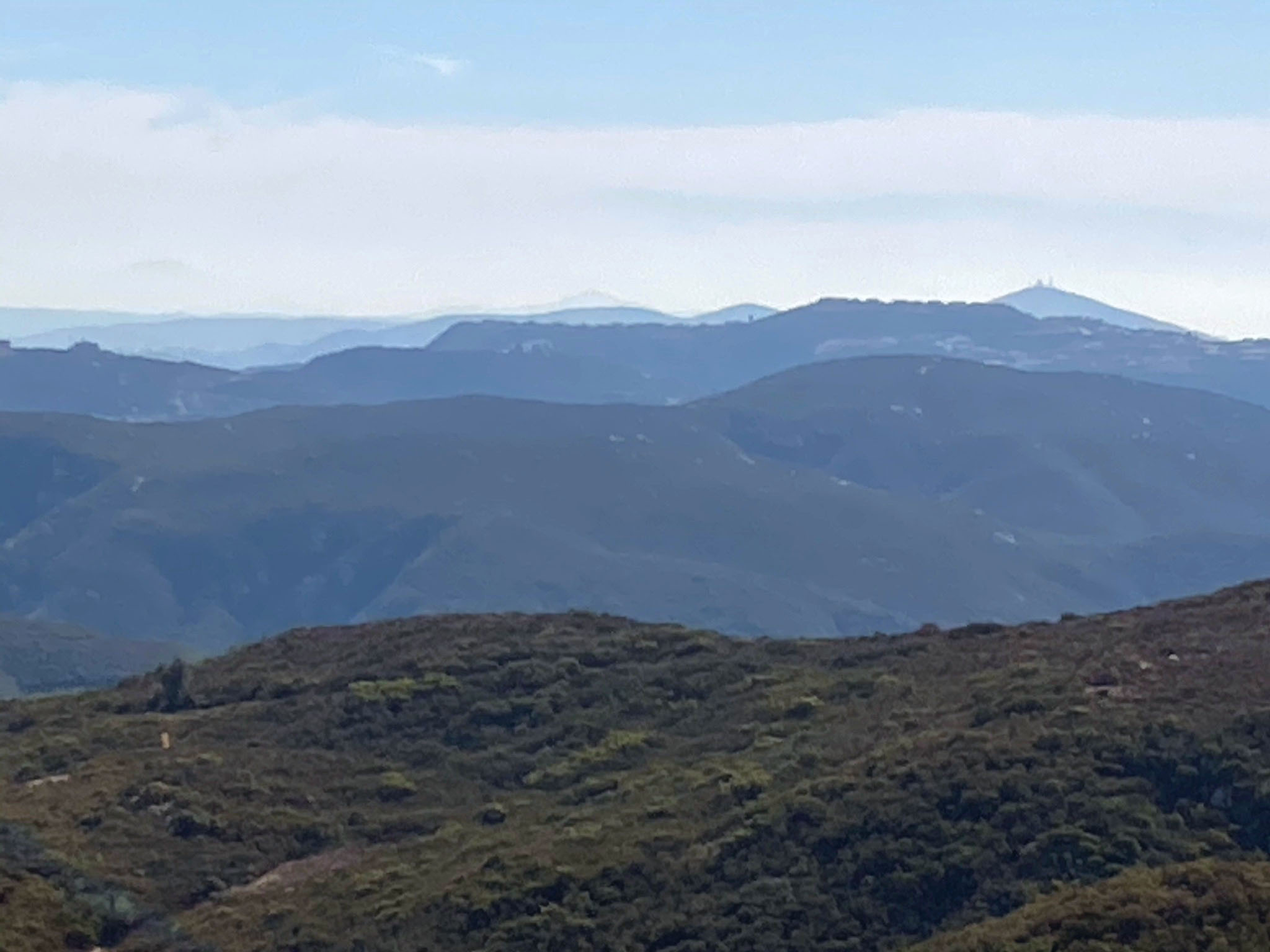
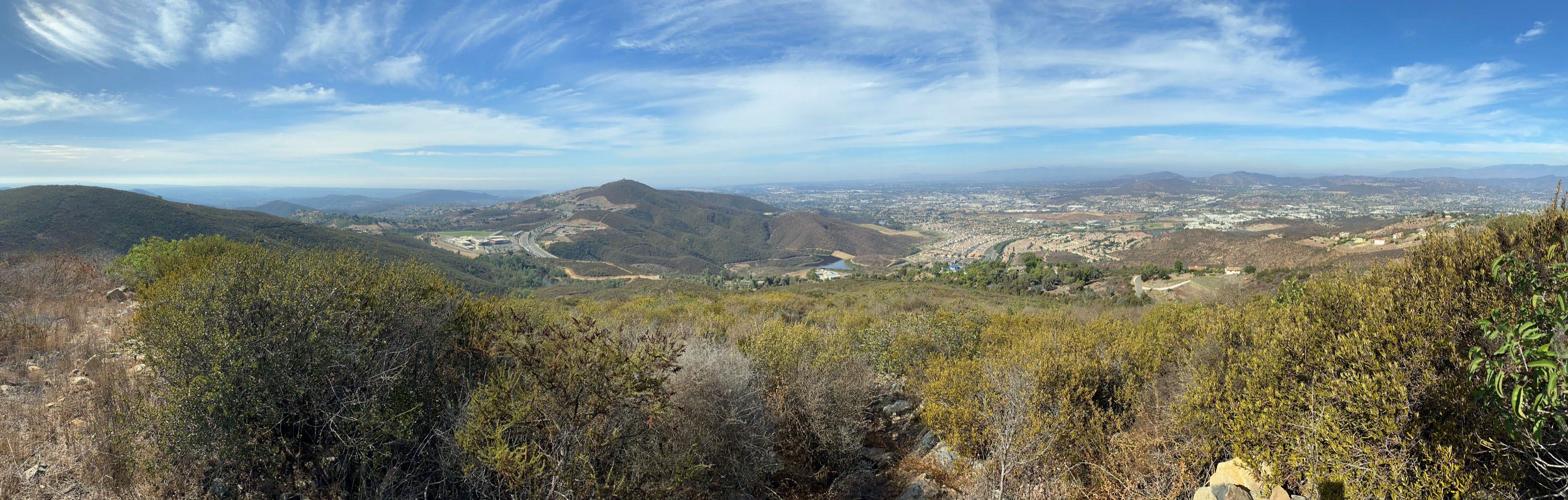
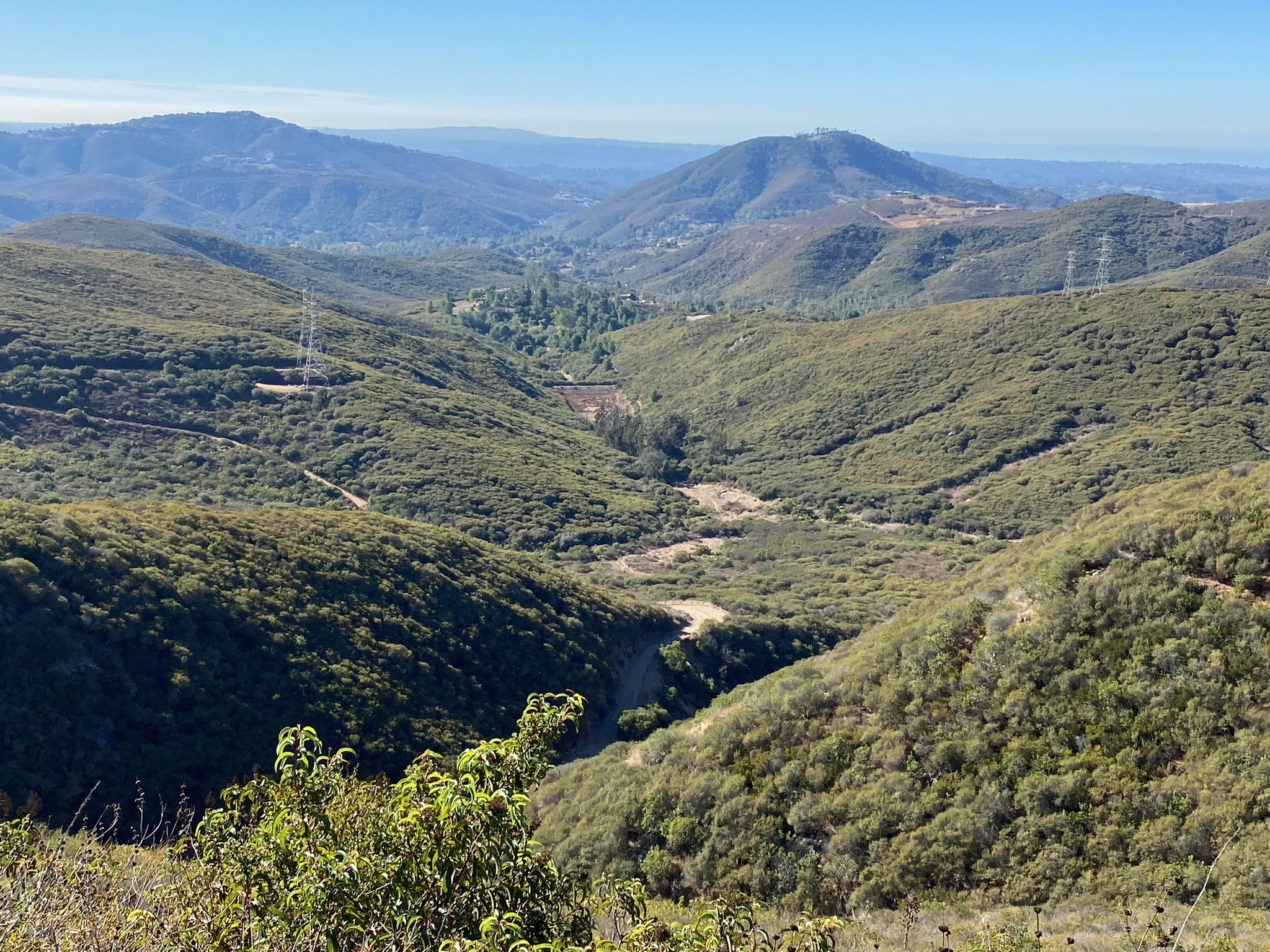
| Fig. 16. Panoramic view northeast-to-southwest from the pass area (Stop B). Mt. Whitney is to the left and Franks Peak is to the right. On the horizon (from left to right) are the rolling ridgelines and high peaks of Palomar Mountain (about 22 miles away) and Vulcan Mountains (about 39 miles away). Both mountain ranges have peaks and ridges with elevations over 5,000 feet; they are also on the east side of the rift valley of the Elsinore Fault). The high peaks near the center are the three highest peaks of the Cuyamaca Mountains. Starvation Mountain (peak, elevation 2,103) is just to the right in the foreground of Cuyamaca Peak (highest peak on the right with elevation 6,493 feet, about 35 miles distant). Cuyamaca Peak is the highest peak on the "Old Erosion Surface"(discussed below), and is on the east side of the Elsinore Fault. Just right of center is Woodson Mountain near Poway (elevation 2,882 feet and about 12 miles away). In the foreground of Woodson Mountain is Bernardo Mountain (elevation 1,145, about 5 miles away). The small blue dot in the valley to the right of Bernardo Peak is Lake Hodges (near I-15). The water level elevation in Lake Hodges is maintained at 295 feet (lowest point in this view). To the right of Lake Hodges (from this view) is the nearly level ridgeline in the Elfin Forest Recreational Reserve near the Lake Hodges Overlook (elevation about 1,200 feet and about 3 miles away). Note that similar High Terraces deposits (described in Stop F below) can be found near the Lake Hodges Overlook and along along a ridgeline in the Del Dios Highlands Preserve nearby. The valley in the foreground along Escondido Creek is host to Harmony Grove and new development in of western Escondido. |
A5
Physiographic Regions and Geologic History of San Diego County
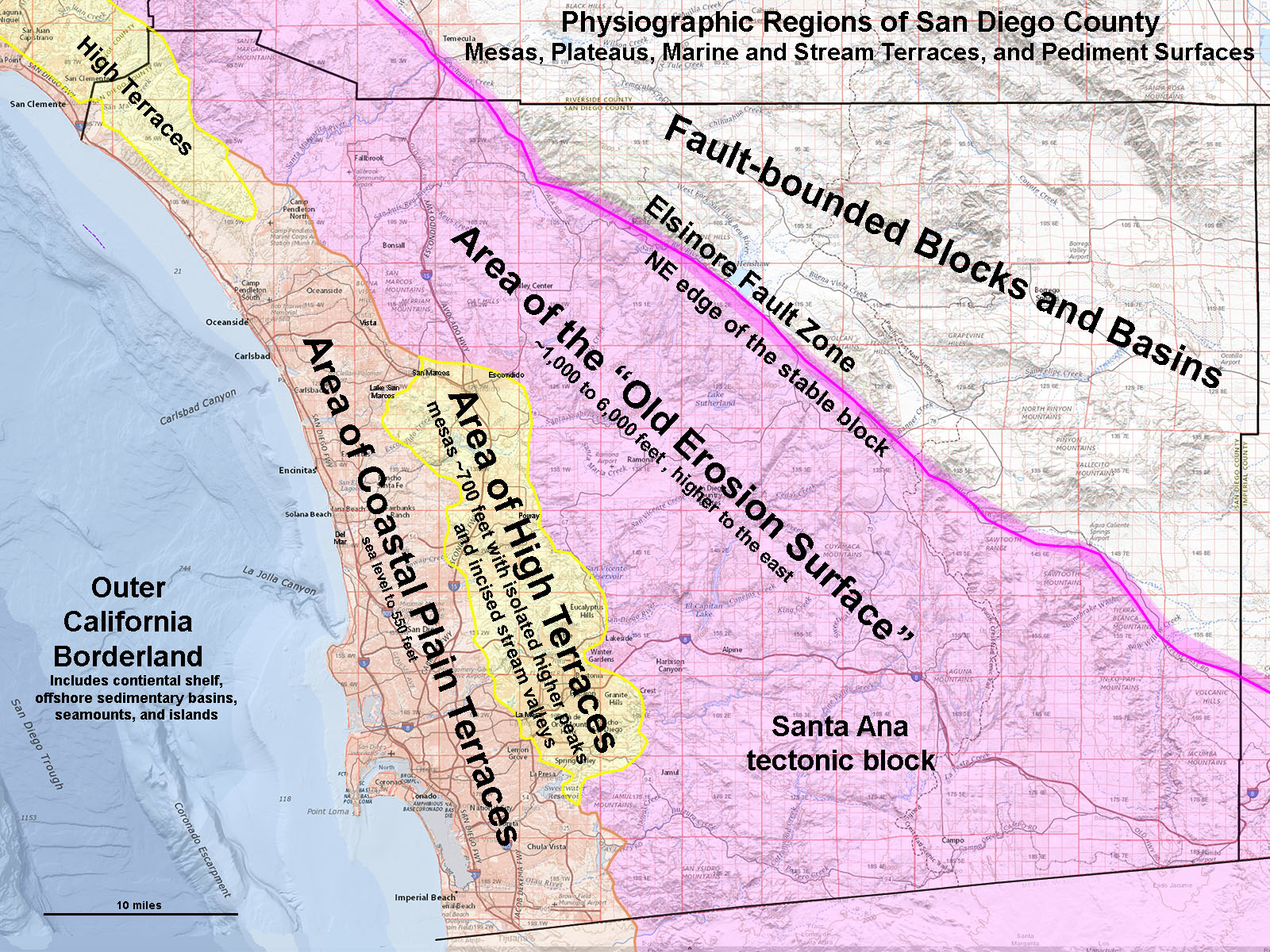
Figure 17 shows the physiographic regions in San Diego County. It is subdivided into four regions:
- Area of Coastal Plain Terraces—this region is host to a step-like sequence of marine terraces and associated deposits preserved in the coastal hills and mesas that extend landward (eastward) from the shoreline. Elevated marine terraces extend to elevations of roughly 550 feet along some parts of the mountain fronts and foothills to the Peninsular Ranges. The coastal plain consists of a series of wave-cut platforms carved onto the bedrock surface of mostly flat-lying sedimentary rocks of Eocene age (labeled "E" on map Figure 18). Sedimentary deposit on top of this surface consist of beach gravels and sand beneath layers of slope wash deposits. These deposits are part of the Lindavista Formation and younger Bay Point Formation, both of Pleistocene age (as described in detail on the Torrey Pines State Nature Reserve web page). These marine terrace deposits are elevated because the coastline has been slowly rising about 0.5 per century. The age of the surface that these two formations rest upon is older. This is indicated by the presence of the Calavera Hills volcano of Miocene age in the Carlsbad area (it erupted between 13 to 18 million years ago). The volcano rests on an ancient eroded surface at about 350 feet in elevation that is on top of Eocene-age coastal/marine sandstone deposits.
- Area of High Terraces—this region encompasses a region of higher ridges and mesas regions associated with a more ancient coastal plain that formed in Tertiary time (Eocene to Miocene), but was uplifted by regional tectonics. The high terraces are found at elevations ranging from mostly around 700 feet to 1,100 feet, but occur as high as 1,350 feet in the San Elijo Hills area, as illustrated in Stop F in this report. Ancient beach, stream, and pediment gravel and sand deposits occur in scattered location on ridges, plateaus, and moutainsides in this region. They are similar in character to the Coastal Plain Terraces deposits, only more degraded by longer-term weathering exposure. They contain rounded clasts that are similar in composition and appearance to clasts derived from Eocene-age rock formations that overlie (or lap onto) crystalline basement (igneous and metamorphic rocks) in many parts of western San Diego County. The highest point where Eocene rock formations are preserved in location is mapped on top of a peak southeast Poway area at around 1,100 feet. The original Eocene sedimentary sequence was probably thicker (and relatively higher), and more extensive than what remains today. The gravel-bearing sedimentary deposits on the High Terraces are probably of Eocene age origin, but they are highly degraded by post-depositional weathering and erosion. They occur on surfaces that were probably river flood plains or coastal beaches or bays.
- Area of the "Old Erosion Surface"—this region is located east of the Area of High Terraces. The Area of the Old Erosion Surface is the remnants of an uplifted peneplain. A peneplain is defined as a region that has a more or less level land surface produced by erosion over a long period, undisturbed by crustal movement. This ancient peneplain surface is reflected by the lay of the land throughout the core of the Peninsular Ranges east of the Elsinore Fault (see Figure 17). The old erosion surface is deeply dissected by numerous stream valleys and gorges. The region consists of a relatively stable crustal block that pretty much only experienced gradual uplift and warping since the formation of the Peninsular Ranges batholith in Cretaceous time. Until mid Tertiary time, the Peninsular Ranges region was still attached to the Mexican continent and erosion had basically worn down the landscape to a region of low relief. Today, the Area of the Old Erosion Surface is gently inclined, high to the east, and low to the west. To the south and east the old erosion surface is associated with high plateaus, mesas, and buttes mostly the range of 3,500 to 4,500 feet elevation. To the west along the mountain front the old erosion surface is in the range of about 1,400 feet. The gradient of this surface averages about 100 feet per mile. Only the core of some mountain peaks (granitic plutons and dense metamorphic rocks) remained behind as monadnocks rising above the peneplain. Monadnocks are isolated hills or ridges of erosion-resistant rock that rise above more or less level land surface scoured by erosion over a long period, undisturbed by crustal movement. The three high peaks of the Cuyamaca Mountains, Woodson Mountain, and Iron Mountain are all monadnocks. From a distance Franks Peak, Mt. Whitney, and Double Peak would also be considered monadnocks.
- Fault-bounded Blocks and Basins—The mountain east of the Elsinore Fault are fault-block mountains. This region is under the tectonic influence of numerous earthquake faults. (Earthquakes faults are faults with a history of earthquake activity or are considered to have potential of generating earthquakes). To the east of the crest of the Peninsular Range, the land drops steeply into the Anza Borrego Desert region into the vast rift valley of the greater San Andreas Fault System that underlies the Imperial Valley and the Salton Sea lowlands region. The faults border large crustal blocks that form a series of northwest-trending mountain ranges and uplifts. Sedimentary deposits of Miocene and younger age fill the basins between the uplifts. These deposits preserved evidence of the geologic history of the formation of the San Andreas Fault rift valley and the opening of the Gulf of California starting in early Miocene time. The old erosion surface probably extended across this region before tectonic upheaval tore it apart, creating the modern topography of the Fault-bounded Blocks and Basins region.
San Diego Landscape Evolution Illustrated
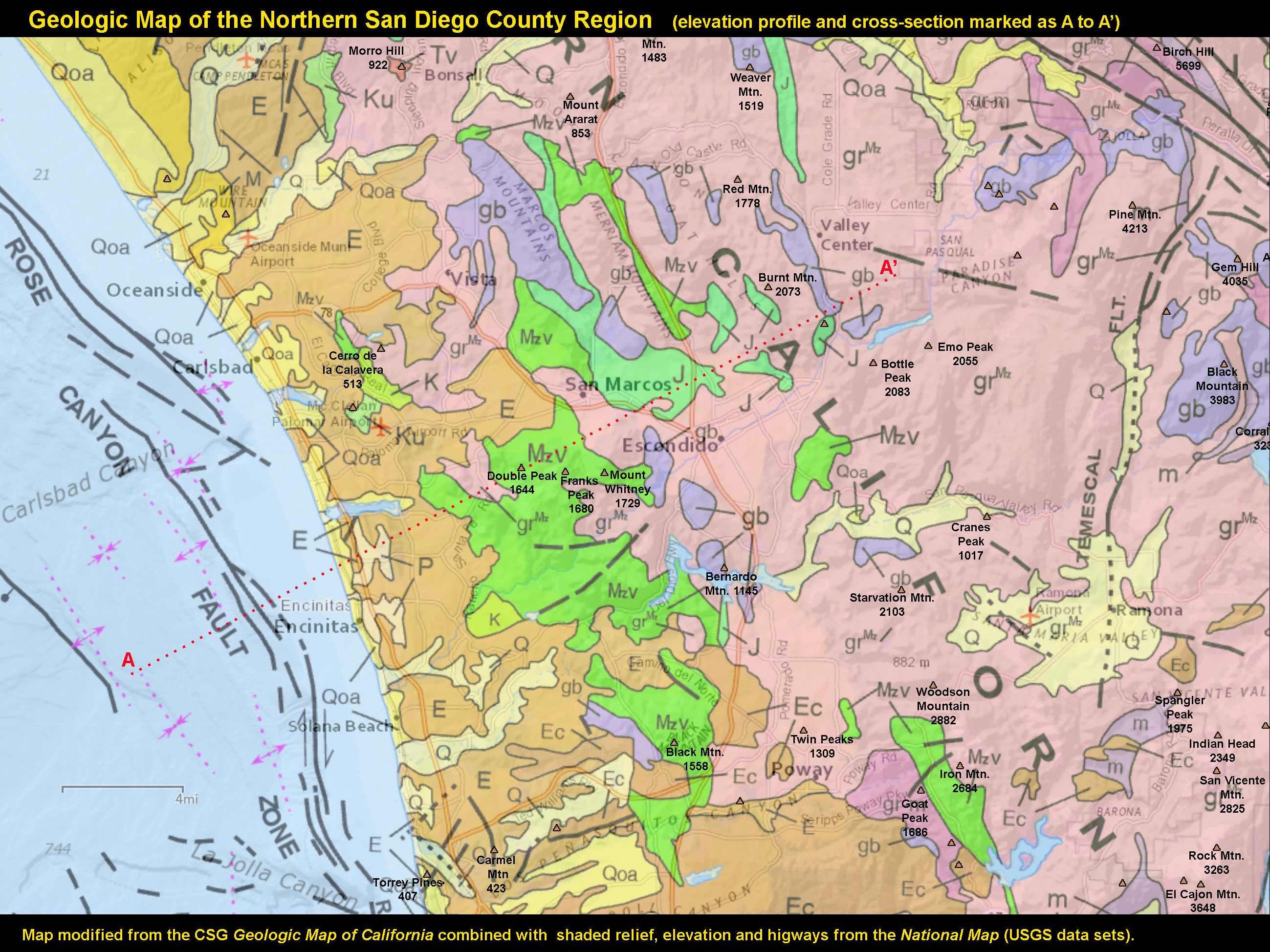
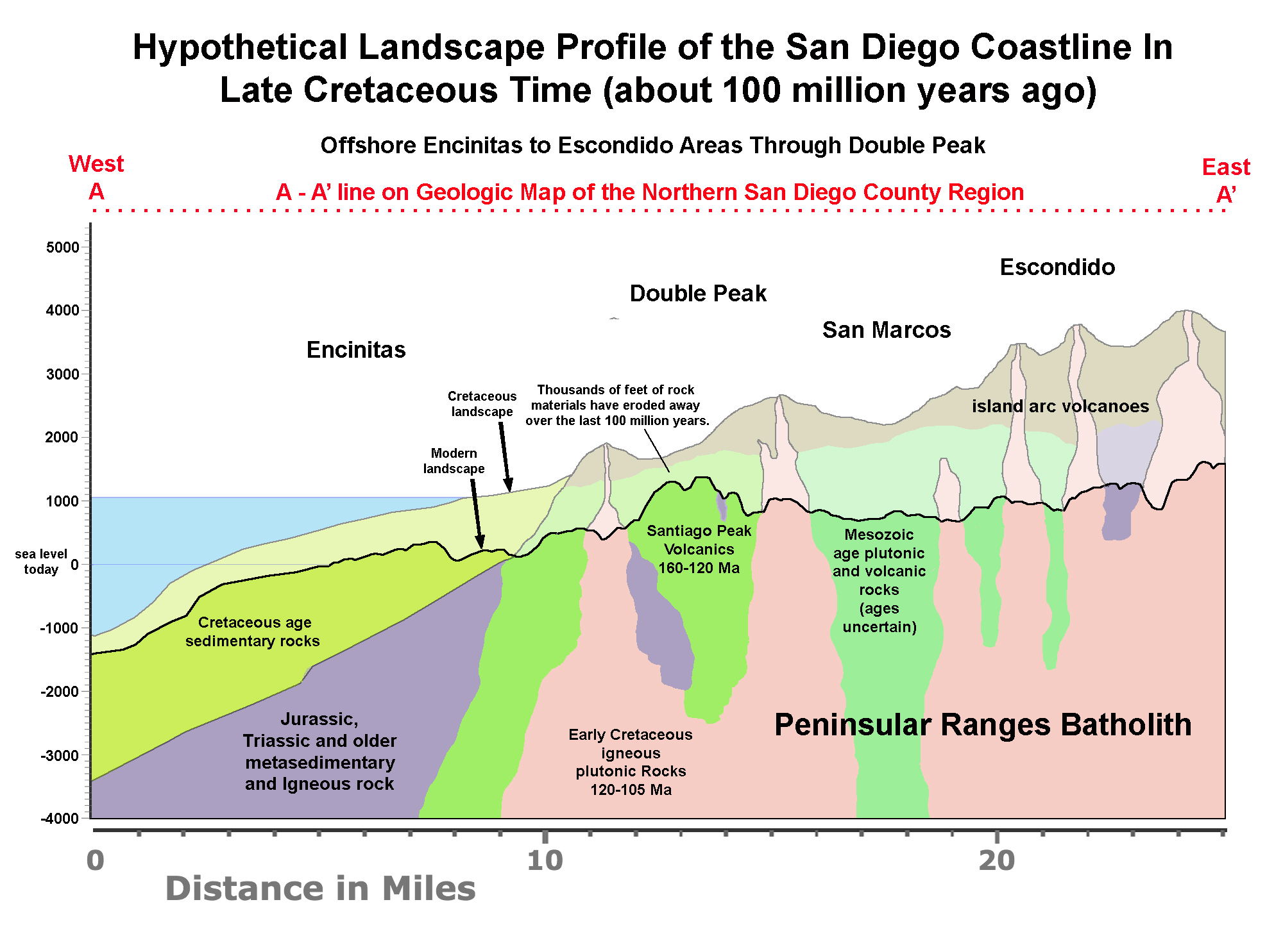
Figure 18 is a geologic map of northern San Diego County. On the map is a line marked A to A' that is used in the cross sections in Figures 19 to 21. Figure 19 shows what the regional profile may have been like near the end of the formation of the Peninsular Ranges batholith. Volcanoes, or remnant of volcanoes, probably still dominated the landscape profile in early Late Cretaceous time (about 100 million years ago). Figure 20 illustrates the landscape profile in Eocene time (about 45 million years ago). The landscape had already worn down to the peneplain associated with the old erosion surface, and relative sea level at the time was higher and had transgressed eastward creating coastal embayments extending onto the Area of High Terraces. Figure 21 shows the modern landscape profile as it exists today which includes the elevated marine terraces of the Coastal Plain and the erosionally dissected Area of High Terraces and Area of Old Erosion Surface. |
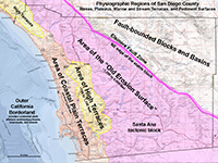
Fig. 17. Map of Coastal Plain Terraces, High Terraces, and Old Erosion Surface regions.
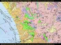
Fig. 18. Geologic map of the North County region with elevation profile line, A-A'.
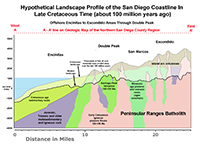
Fig. 19. Hypothetical coastal cross section of the North County in Cretaceous time.
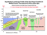
Fig. 20. Hypothetical coastal cross section of the North County in Eocene time.
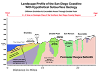
Fig. 21. Hypothetical coastal cross section of the North County with elevation profile. |
A6
Monadnocks and Mesas
The views illustrated below illustrate the character of the Area of the Old Erosion Surface and Area of High Terraces. These are zoomed-in views of the features also shown in the Figure 16 panorama.
Figure 22 portrays a step-like appearance of the old erosion surface from the distant plateau surrounding the three monadnocks (highest peaks) of the Cuyamaca Mountains. Starvation Mountain (peak) near Escondido is another monadnock on the the old erosion surface. The modern stream river valleys and canyons are incised into the old erosion surface.
Figure 23 shows that Woodson Mountain is also a monadnock that rises above the old erosion surface.
Figure 24 shows the level mesa-top like surface of Highlands Terrace level in the Elfin Forest Recreational Reserve.
Figure 25 is a zoomed in view of the western end of the mesa-top with Iron Mountain (a monadnock) in the distance. It is partly masked by the ridgeline of the Lake Hodges Overlook in the Elfin Forest Recreational Reserve. |
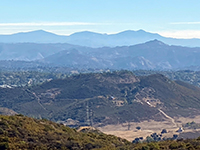
Fig. 22. Cuyamaca Mountains with Starvation Peak and valley of Escondido Creek |
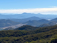
Fig. 23. Woodson Mountain and Bernardo Mountain near Lake Hodges. |
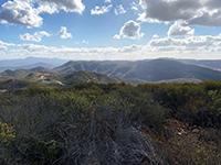
Fig. 24. Highlands Terrace (mesa top) at Elfin Forest Recreational Reserve. |
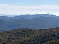
Fig. 25. Iron Mountain beyond the mesa tops in the Elfin Forest Rec. Reserve. |
|
A7
Stop C - Franks Peak
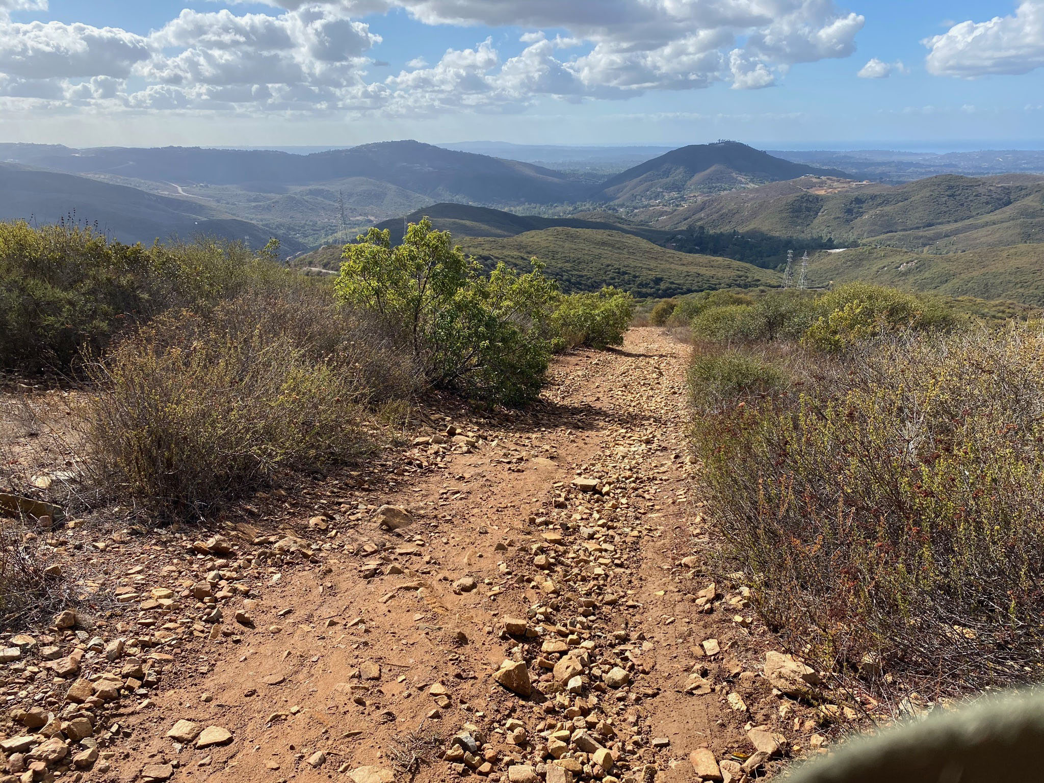
From the pass area, the trail to the top of Franks Peak is a gentle but rocky grade that spirals around the mountain. As you climb, the views of the region become more scenic and encompassing. You also get farther away from the city noise. The views from the top of Franks Peak are dominated by chaparral-covered mountain slopes (Figures 26 and 27).
At the top of Franks Peak you will find a flag waving in the breeze(Figure 28). Double Peak is in the distance to the west.
Figure 29 is a view of Mt. Whitney, about a half mile away to the north.
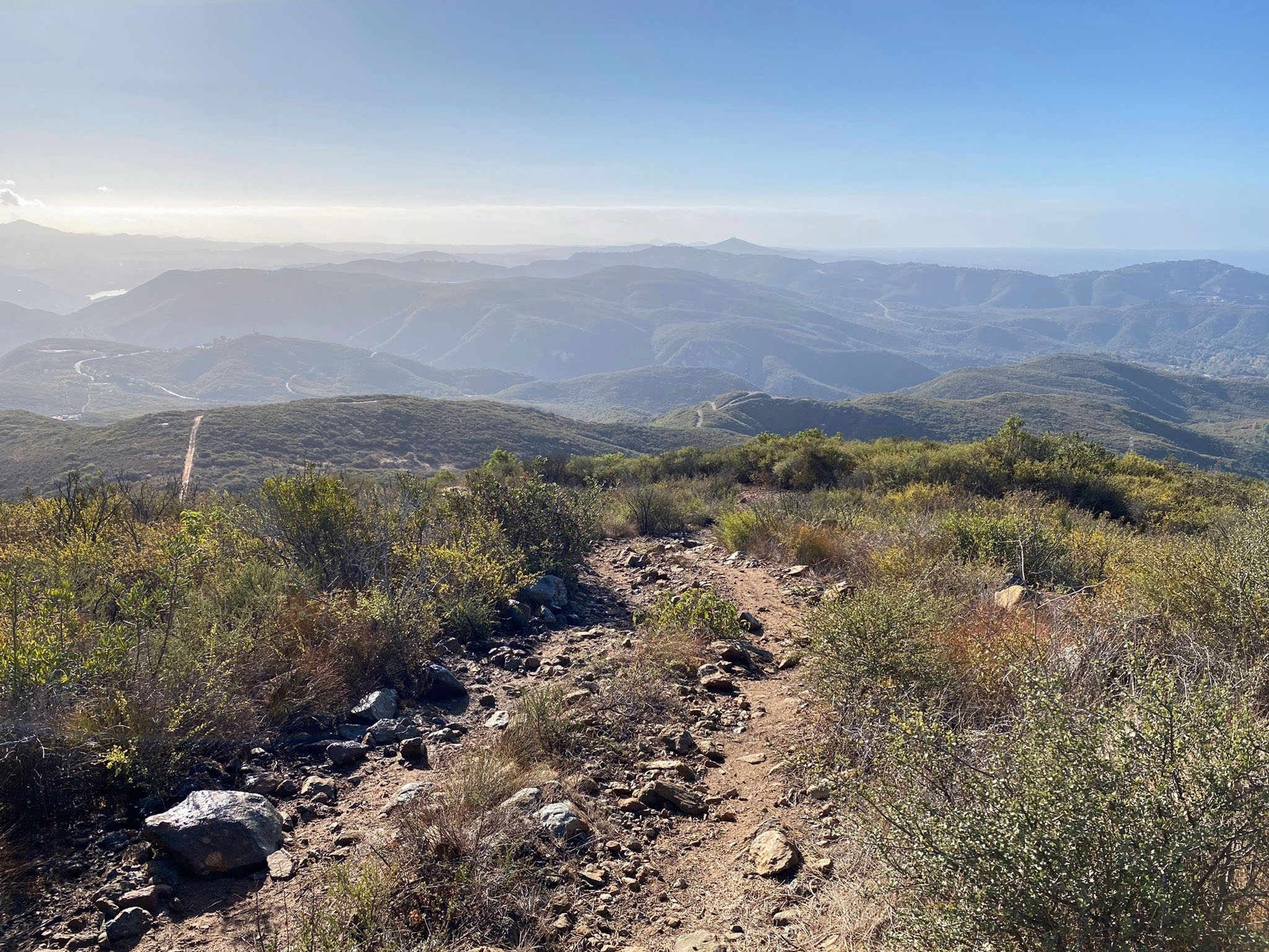
Figures 30 and 31 are panoramic views from the the top of Franks Peak.
|
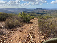
Fig. 26. View to the west along the Franks Peak Trail. |
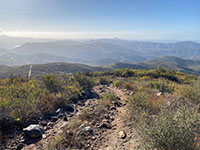
Fig. 27. View to the south along the Franks Peak Trail. |
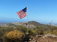
Fig. 28. Flag pole on the top of Franks Peak. |
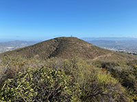
Fig. 29. Mt. Whitney as seen to the north of Franks Peak. |
|
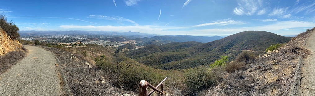
| Fig. 26. Panoramic view to the south and west from Franks Peak. This view encompasses the lower part of the Escondido River watershed. Clouds on the horizon are part of the marine layer beyond the coastline in Del Mar and Encinitas. The summit of Double Peak is on the right, about mile to the west of Franks Peak. Near the center of the image is a small, dark peak that borders the mountain front along the Coastal Plain Terraces region (see Figure 17). Escondido Creek flows through San Elijo Canyon. In this view the creek passes through a gorge to the left (south) of that small peak. The gorge is within part of the Los Cielos Preserve (managed by the Escondido Creek Conservancy). A variety of chaparral, riparian, and oak forest habitats dominate the stream valley in the vicinity locally known as Elfin Forest that encompasses the forested lower San Elijo Canyon including in the Questhaven Retreat area and Los Cielos Preserve. In the distant left beyond the ridgelines in the Elfin Forest Recreational Reserve is the lone peak (monadnock) of Iron Mountain. |
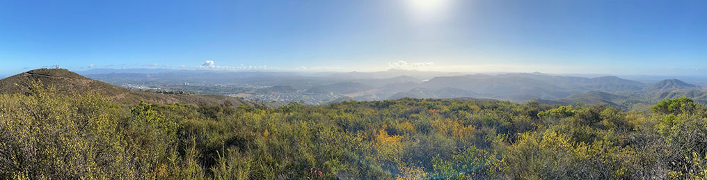
Fig. 31. Panoramic View east from Franks Peak. This view starts on the right with the same small, dark peak along Escondido Creek gorge shown in the image above. From this view, the ridgelines of the Elfin Forest Recreational Reserve extend eastward to a gap where a portion of Lake Hodges is visible (a small white dot, almost directly to the east). On the left side of the image are the upland valleys of Harmony Grove and parts of Escondido. On the left, the peak of Mt. Whitney is about half mile away to the north.
|
A8
Bedrock Features Along the Franks Peak Trail
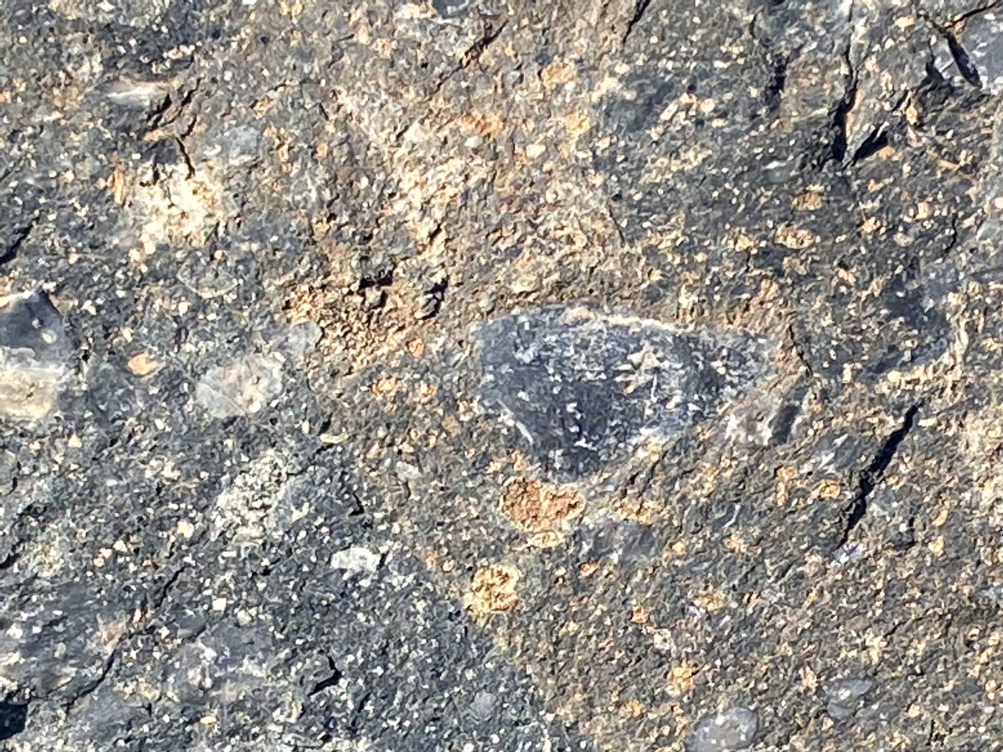
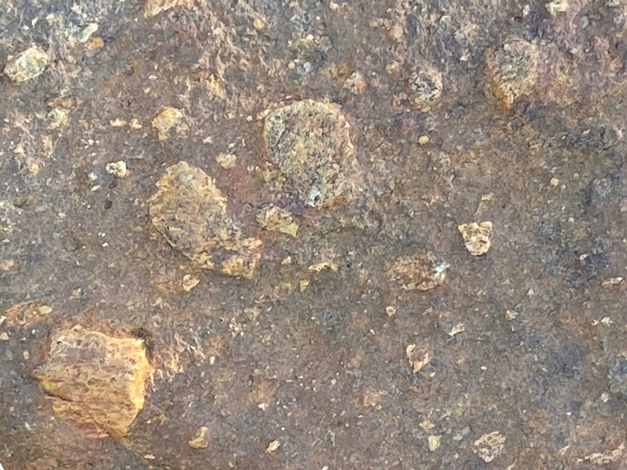
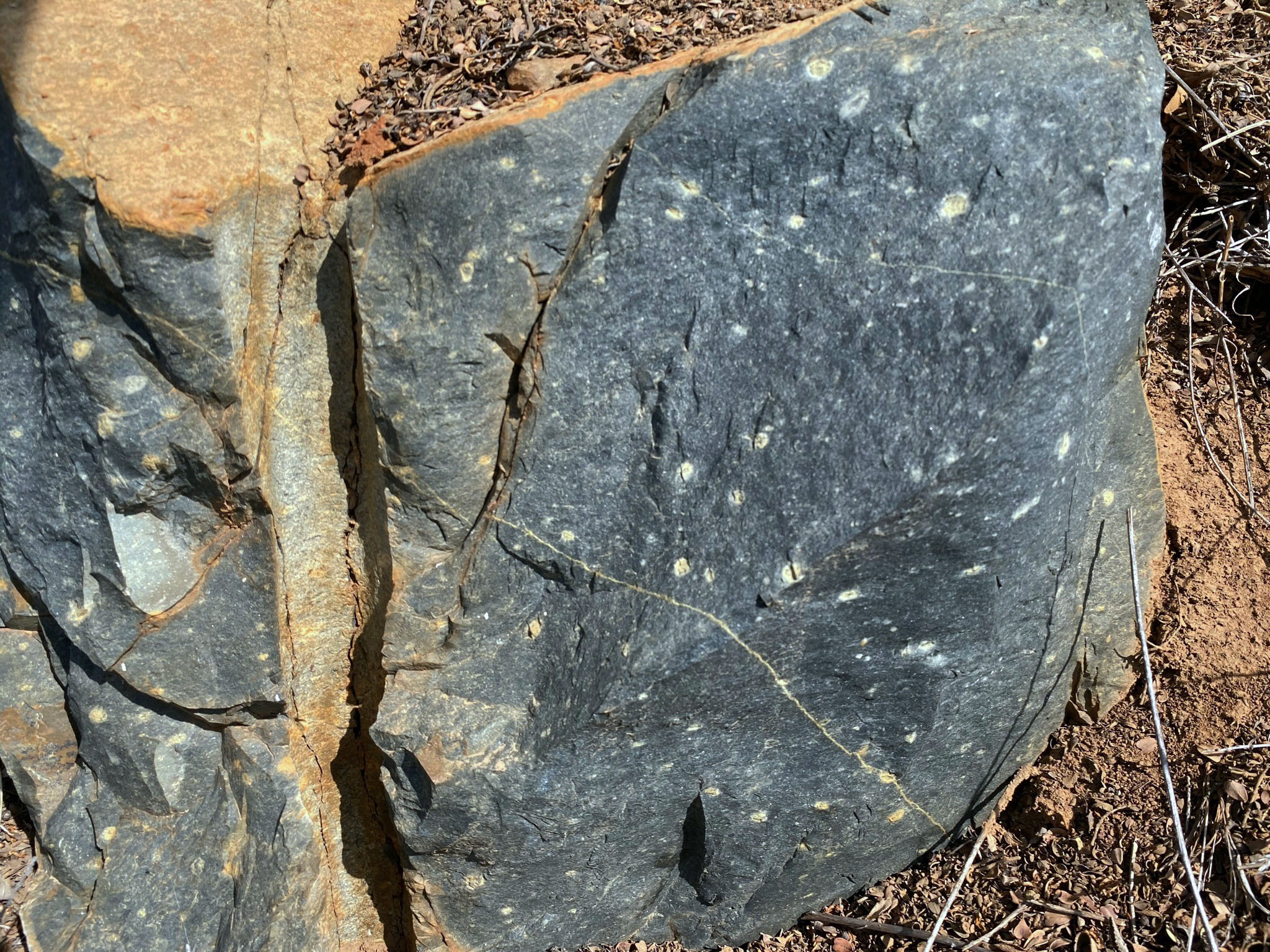
Rocks of the Santiago Peak volcanics are exposed in small bedrock exposures and loose boulders along the trail to the summit. Freshly exposed surfaces show that the bedrock is lava rock or volcanic breccia ranging in andesite to basalt in composition (Figure 33). Freshly exposed bedrock is mostly dark gray to nearly black, displaying an abundance of volcanic rock fragments (clasts) in a fine-grained volcanic porphyry matrix (Figure 33). The porphyry texture comes from tiny white feldspar crystals (phenocrysts) that are incorporated in the lava matrix. Exposure to weathering processes has altered the rock surfaces to brown and lighter colors (Figures 34). On weathered surfaces, lighter colored, possibly more quartz-rich (rhyolite) rock fragments resist erosion better than the finer, more mafic volcanic matrix between clasts (Figure 35). On some older surfaces a reddish-brown patina-like crust of limonite has accumulated (Figure 36).
|

Fig. 32. Classification of volcanic rocks by color. |
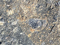
Fig. 33. Basaltic lava rock with breccia clasts. |
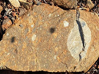
Fig. 34. Breccia clasts exposed on a weathered surface. |

Fig. 35. Breccia clasts exposed on a weathered surface. |
Fig. 36. Limonite surface coating on basalt breccia. |
|
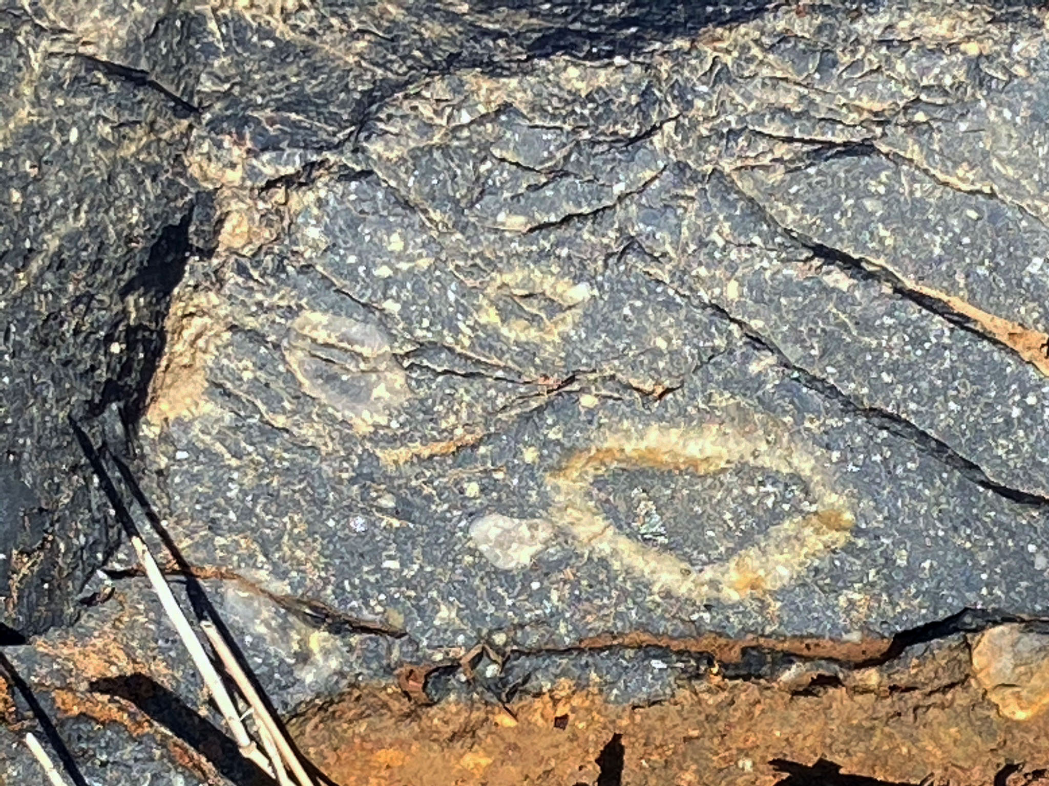
Near the summit of Franks Peak, many of the breccia clasts embedded in the lava rock display unusual halo-like rinds or zones of lighter colored minerals (Figures 37 and 38). These fragments may have been exposed to different physical environmental conditions before becoming incorporated back into their host lava. The fact that the lava does not contain vesicles (bubbles) suggest they cooled under high confining pressure, such as under deep water, or that the lava had lost its gaseous component before cooling into rock.
Figure 39 shows a relative fresh exposure of the bedrock displaying a rectangular fracture pattern. In contrast, Figure 40 shows a bedrock exposure displaying rounded, almost pillow-like surfaces, similar to other pillow basalt exposures in central California's Coast Ranges. |
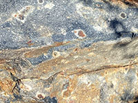
Fig. 37. Clasts surrounded with a white surface rind. |
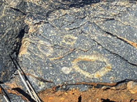
Fig. 38. Clasts surrounded with a white surface rind. |
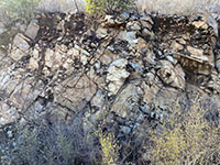
Fig. 39. Fractured basalt bedrock along trail cut. |

Fig. 40. Pillow-like forms on a basalt bedrock outcrop. |
|
A9
Stop D - Bedrock Features Along the Trail to Mt. Whitney
If you are trying to decide whether you plan only to hike one of the peaks, then Franks Peak is recommended over Mt. Whitney. Note that there are three Mt. Whitneys in California, including the state's highest peak at 14,478 feet at its summit in Tulare County, another at 3,688 feet is located in Inyo County. This one in San Diego County is easiest to climb at 1,736 feet. (This is for anyone who want to claim they've climbed Mt. Whitney and, like Mark Twain suggested, are willing to distort the facts.)
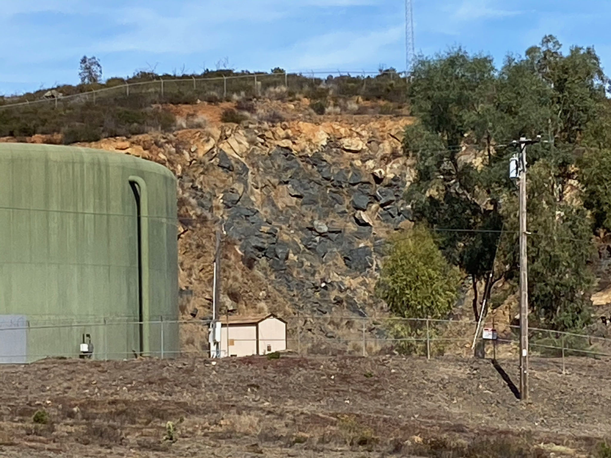
For the geologic discussion about this Mt. Whitney, the interesting part of the story is along the lower part of the mountain were bedrock is exposed along the unpaved fire road that connects to the pass area mentioned above. Cuts along this fire road leading to the Mt. Whitney display massive basaltic bedrock that is highly fractured (Figure 41). Stratified layers similar to at Stop A also appear in the road cuts. At one location the stratified layers appear folded in a small anticline structure (Figure 42). Perhaps the largest and best exposure of basalt in the field trip area is in a cut next to a large water tank near the end of the unpaved portion of the fire-road portion of the trail (Figure 43). Large blocks of basalt from the cut are dumped as fill nearby where it is easy to examine. Figure 44 illustrate the nearly black basalt that has small phenocrysts of white feldspar. |
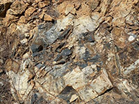
Fig. 41. Fractured basalt along the Mt. Whitney trail. |

Fig. 42. A small anticlinal fold in stratified layers along trail. |
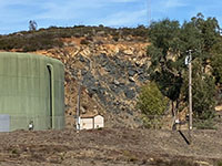
Fig. 43. Basalt exposed in a cut next to a water tank. |
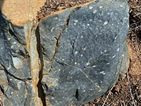
Fig. 44. Example of the basalt with plagioclase phenocrysts. |
|
A10
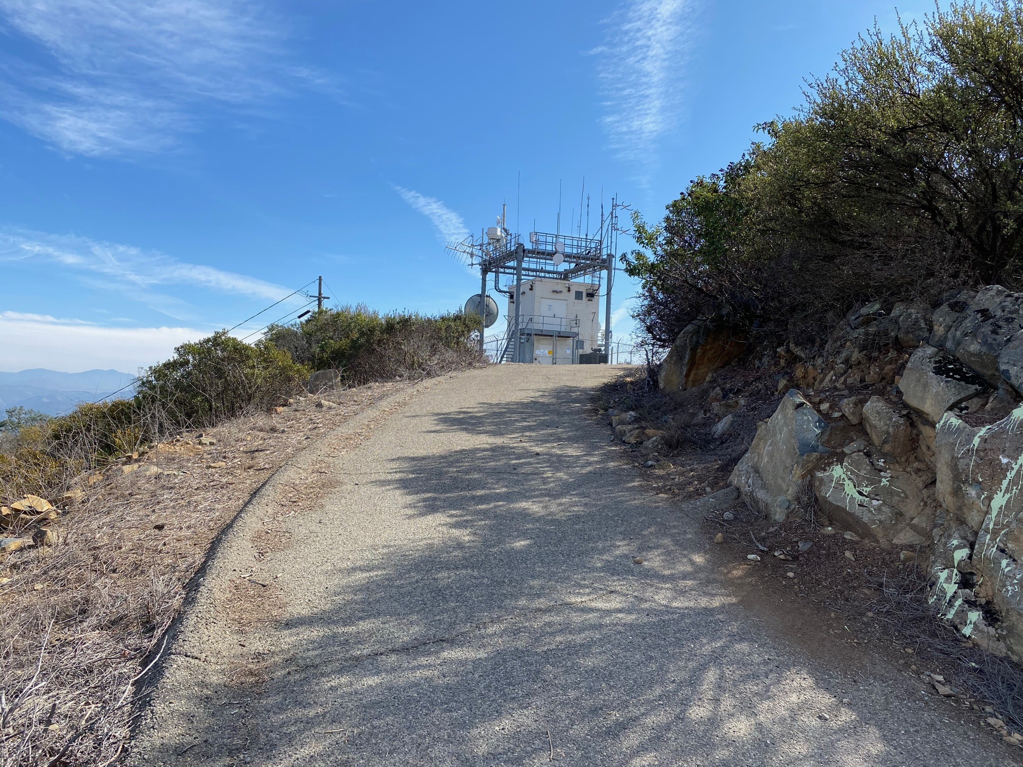
The hike to the top of San Diego's Mt. Whitney has limited access. It is unclear (depending who you ask) if the public should be attempting to climb to the top of Mt. Whitney because of the active microwave tower at its peak. A high fence barricades the access road to keep vehicles out, but there is a rugged path around the end of the fence that connects to a nrrow paved road that leads up to the microwave radio tower (Figure 45). A sign along the road warns of potential risk of high radio frequency radiation exposure. Based on information about similar antenna arrays, it is recommended not to approach within 50 meters of the station (Figure 46).
The distant views from the top of Mt. Whitney are similar to the views on Franks Peak and on Double Peak, however, the the views include more of urbanized areas of San Marcos and Escondido. Below the summit there is a small overlook area that provides access to views of the Double Peak summit area (Figure 47) and Franks Peak (Figures 48). Figure 49 and 50 are panoramic views taken along the Mt. Whitney Peak access road (from below the summit area). |
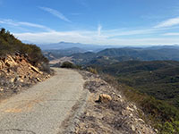
Fig. 45. Mt. Whitney Peak access road to radio tower. |

Fig. 46. Stay back at least 50 meters from the antenna array. |
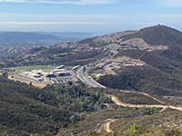
Fig. 47. View of Double Peak School and Double Peak. |
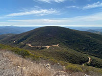
Fig. 48. View of Franks Peak from Mt. Whitney. |
|
| Fig. 49. Panoramic View to the south and east from Mt. Whitney Peak access road. Franks Peak is to the right, neighborhoods of Escondido are on the left. |

Fig. 50. Panoramic view to the west and north from an overlook area along the Mt. Whitney Peak access road. The ocean is visible beyond the summit of Franks Peak on the left. Double Peak is center-left, and the the urbanized landscape including San Marcos, Vista, Carlsbad to Oceanside (in the distance). Two lower peaks of the San Marcos Mountains are on the right.
|
A11
Stop E - Spur Trail to Questhaven Canyon Overlook
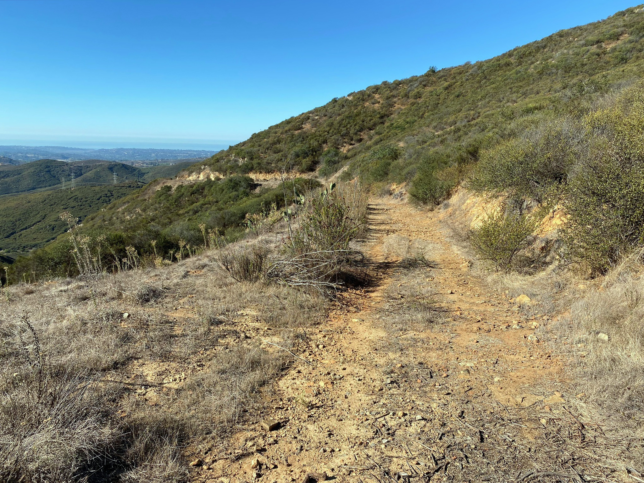
About 2,000 feet south of the trail junction for the Franks Peak and Mt. Whitney trails is a spur fire road that runs across the south flank of Franks Peak (Figure 51). This spur trail is a gentle grade for about a half mile that ends on a hilltop overlooking a canyon that is host to the Questhaven Retreat Center in the Elfin Forest area (Figure 52). Along the trail are severe large cuts that display some of the best bedrock exposures in the field trip area (Figure 53).
Although the bedrock exposed in these cut have endured significant weathering, the internal structure of the volcanic rock is still well preserved. Freshly broken pieces of unaltered bedrock is typically medium-to-dark gray, suggesting an andesite to near basalt composition. This is consistent with the composition of oceanic volcanic arcs—like the Aleutian, Mariana, Tonga, or Antilles island volcanic arcs we see around the world today. Figure 54 illustrates the complex character of the lava rock. In this exposure, blocks of lava rock are crushed and sheared together amongst layers that display folding and warping typical of a flow-banded lava. This suggests that solidified components were incorporated into a moving lava flow, similar to a'a lava flows you might see on Hawaii except there are no gas bubbles preserved. Either the lava was depleted in gases (which is unlikely), or it cooled under high confining pressure—such as on a volcano formed well below the ocean surface.
Figure 55 is an outcrop of a volcanic breccia or volcanic tuff. A volcanic breccia (or tuff) consists of angular fragments (with possibly some slightly rounded fragments). Some of the volcanic clasts range in size from blocks of several cubic meters to particles the size of grains of sand (volcanic ash). The rock is technically volcanogenic sedimentary rock that formed as a result of explosive volcanic eruptions. Again, these rocks do not show the presence of gas bubbles between grains or within fragments, suggesting they had formed under, or endured, confining pressure and compaction.
Figure 56 shows a lava rock where surface weathering highlights the rock's internal structure. The rock appears is a volcanic breccia that displays some stratification as well as some flow banding—suggesting it had not been completely solidified when the lava cooled into stone. Figure 57 is a closer view of the outcrop.
Figure 58 shows basaltic rock outcrops farther west along the Spur Trail. The pillow-like structure appearance of this outcrop is similar the one on Franks Peak illustrated in Figure 40. |

Fig. 51. Spur Trail on south flank of Franks Peak. |
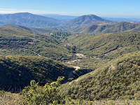
Fig. 52. Questhaven Canyon overlook at end of Spur Trail. |
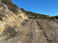
Fig. 53. Large rocky cut exposed along the Spur Trail |
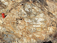
Fig. 54. Weathered basalt outcrop with fractures |
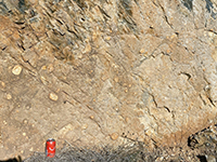
Fig. 55. Massive volcanic tuff bed along Spur Trail. |
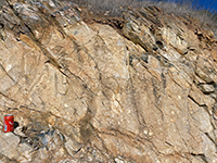
Fig. 56. Lava rock showing molten-flow structures |

Fig. 57. Close-up of lava rock with molten-flow structures. |
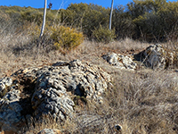
Fig. 58. Pillow-like basalt outcrops along the Spur Trail. |
|
A12
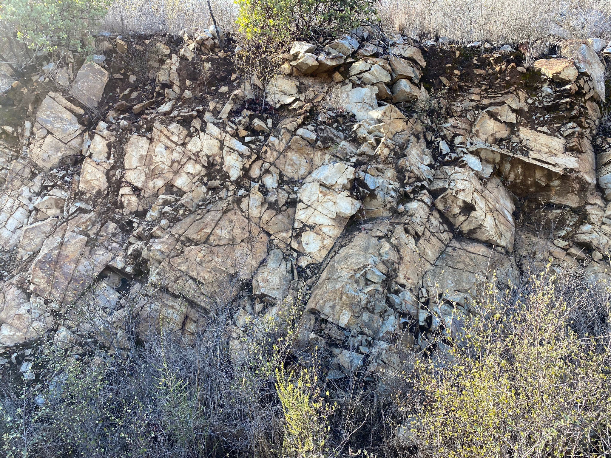
Stop F - Granitic Rocks and High Terraces
The fire road south of the pass continues beyond the Spur Trail. It continues for another half mile along a relatively level ridge line before coming to an intersection of two trails. The one to the right (to the west) winds a couple miles along the hillsides eventually connecting to Questhaven Road. The trail to the left (east) descends into the Escondido Creek valley with links to the Harmony Grove and Elfin Forest Recreational Reserve areas.
Figure 59 is a view looking north along the fire road on ridgeline toward Franks Peak (left) and Mt. Whitney (right). This ridgeline is host to different geologic features than the Stops A to E described above. This area is host to a different kind of bedrock and landscape. |

Fig. 59. View looking north along the fire road (trail) on the ridgeline on the south side of Franks Peak (left) and Mt. Whitney (right) in the vicinity of Stop F (shown on the satellite map below, Figure 60). The ridgeline is a relatively level surface at an elevation relative to the Highlands Terraces shown in map Figure 17. Both Franks Peak and Mt. Whitney are monadnocks that rise above this terrace surface level.
|
A13
Faults and Drainage Patterns
Figure 60 is a satellite image of the field-trip area which shows that the landscape has a rectangular drainage pattern (it also shows the trails and stops). Rectangular drainage patterns are common in faulted and fractured bedrock terrains typically with non-stratified bedrock (like granite). Erosion over time tends to force streams to develop along faults and fracture zones where weathering processes on the surface and underground tend to break down the rock down faster. As a result erosion carves linear stream valleys or canyons along these these zone of weakness in the crust. Likewise different rock types weather at different rates, and a harder, less fractured bedrock may be preserved as a ridge or upland relative to surrounding areas. A close look at the satellite map show a linear valley trend the along Cresthaven Canyon (on the south side of the trail between Stops E and F). This trend continues in the canyon on the north side of the trail. This trend is perpendicular to the ridgeline that is host to the trail leading to the Stop F. This linear trend probably follows a fault zone. Close inspection of the satellite image also shows a variety of linear trends associated with other ridges and stream canyon. Some or all may be associated with fault zones.
Another indication of a fault is that composition of the bedrock changes from volcanic rocks (pKm at Stop E) to granitic rocks (gr at Stop F). The geologic map (Figure 4) shows bedrock in the vicinity of Stop F mapped as gr—indicating granitic rocks of Cretaceous age. According to the map, the transition from pKm (Santiago Peak volcanics of Jurassic age) to the gr bedrock is inferred to be across faults (shown as black dashed lines near B' on the map and on the cross section [Figure 5]).
Figure 61 shows a nearly level top of the ridgeline in the Stop F area (with small granitic outcrops in the foreground and Franks Peak in the distance).
Figure 62 is looking in the opposite direction along the ridgeline along the trail to the south that is underlain by granitic rocks.
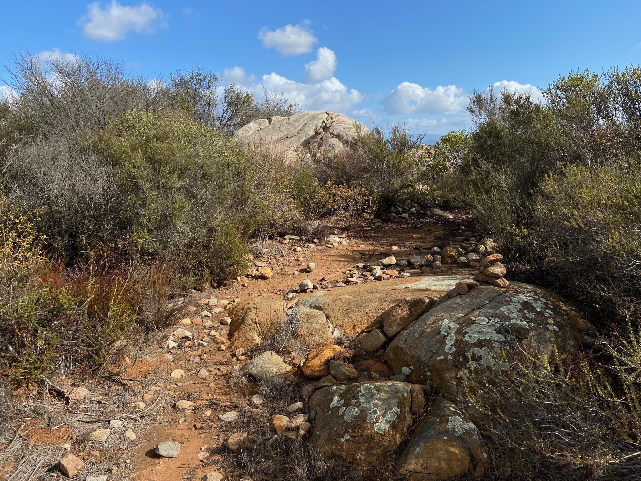
Figure 63 show examples of granitic boulders and outcrops along parts of the ridgeline in the Stop F area shown in Figure 62.
|
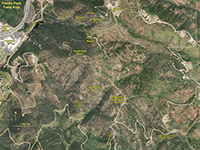
Fig. 60. Satellite view shows a rectangular drainage pattern. |

Fig. 61. Flat ridge top south of Franks Peak at Stop F. |
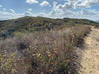
Fig. 62. View looking in other direction along Stop F trail. |
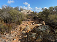
Fig. 63. Granitic boulders and outcrops in the Stop F area. |
|
A14
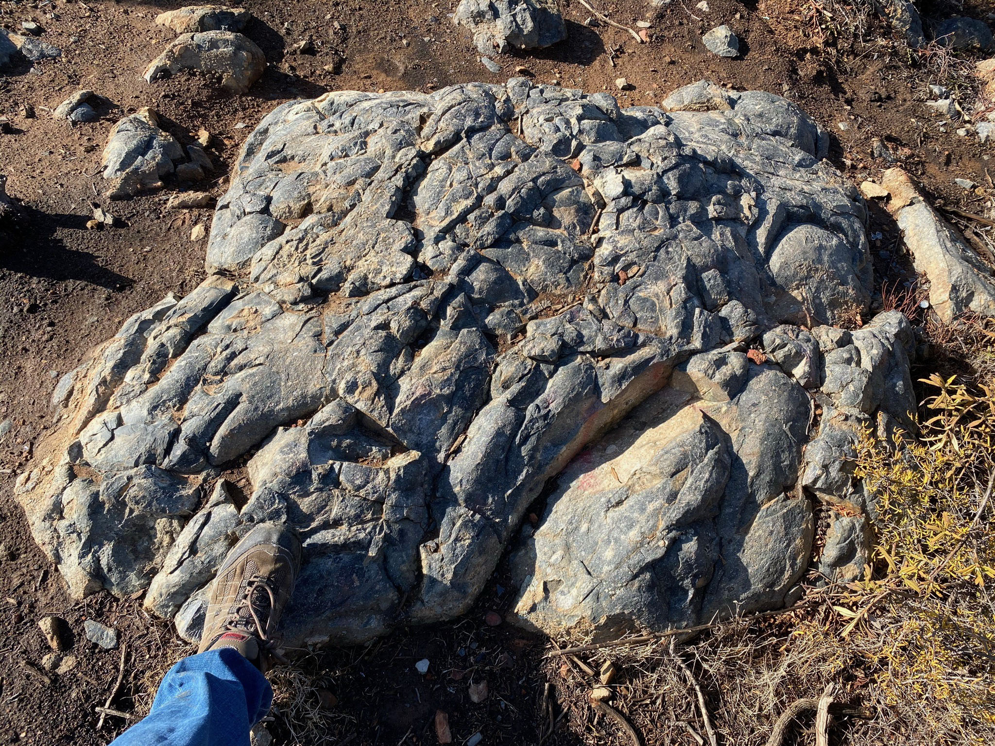
Granitic Rocks At Stop F
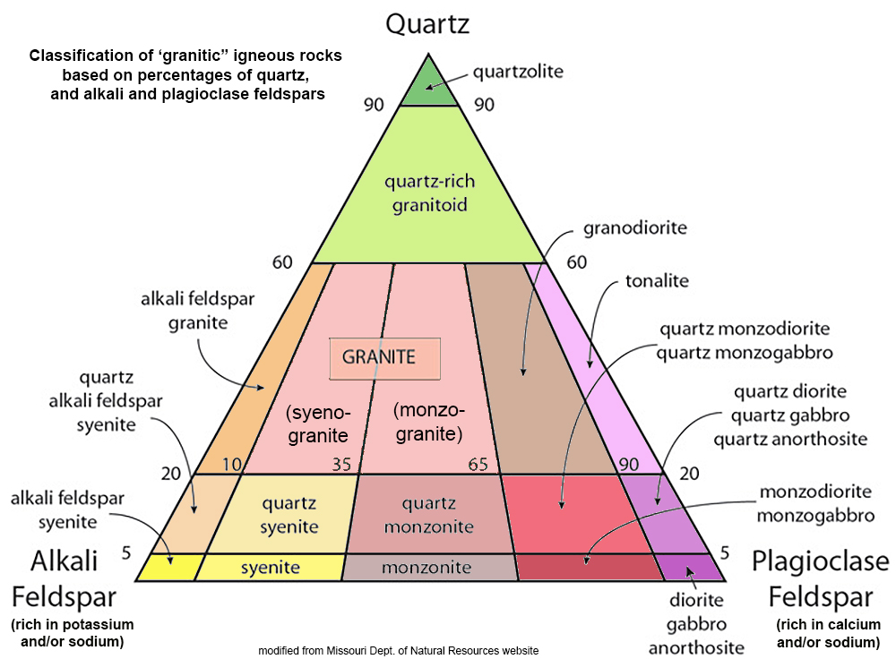
Figure 64 is a classification of granitic rocks. The granitic bedrock at Stop F ranges in mineralogical composition of tonalite (Figure 65) to diorite (Figure 66). Both of these examples displays inclusions of basalt that were likely derive from the older pKm (Santiago Peak volcanics).
Figure 67 shows an granitic rock outcrop in the Stop 6 area that has an igneous dike cutting diagonally across it.
Figure 68 is a close up of an aplite dike cutting across a granitic boulder. Aplite is a medium- or fine-grained granitic rock with a sugar-like texture, typically white, pinkish, yellowish, or gray in color. They composed composed almost wholly of alkalic feldspar (Na,K-rich feldspars) and quartz without other essential minerals (a quartz-rich granitoid as shown on the classification chart).
Aplite occur as veins or dikes in both igneous or metamorphic rocks. Aplites in granitic bedrock are inferred to be the last part of the magma body to crystallize within a cooling and shrinking pluton. They accumulate in the spaces and fractures between the early-formed minerals in the main body of a pluton. The rock forms with a cooling solutions of mineral salts in the remaining liquid magma until the excess of either of the final mineral components have separated out. Or, they form when the magma finally solidifies to stone when the proper proportions of the remaining mineral constituents has reach a suitable temperature for final crystallization to occur.
|
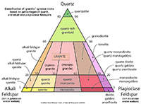
Fig. 64. Classification of granitic igneous rocks based on percentages of quartz, and alkali and plagioclase feldspars. |
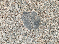
Fig. 65. Tonalite with a basalt inclusion. |
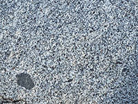
Fig. 66. Diorite with a basalt inclusion. |
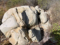
Fig. 67. Granitic boulder outcrop cut by an aplite dike. |
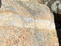
Fig. 68. An aplite dike cutting across a granitic boulder. |
|
A15
A Highlands Terrace Deposit
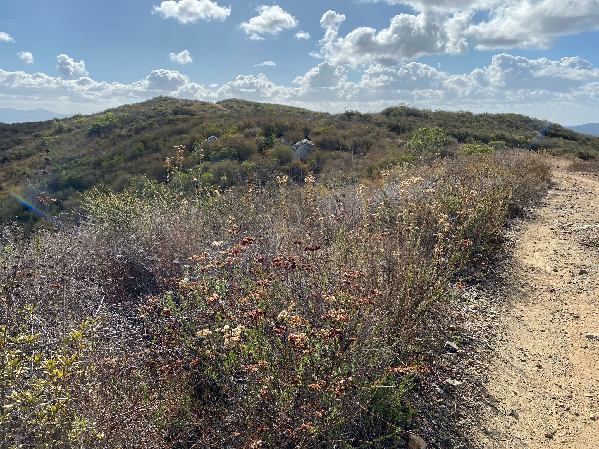
Between Stop E and F there is an example of a Highland Terraces deposit, although it may not be obvious to the casual observer. Most of the trail between Stops E and F is rocky, but along the way there is a relatively flat section where the soil in and along the trail consists of a medium to red, fine-grained sand (Figure 69). If you look around the area you can find well-rounded stream or beach cobbles that have light-colored (leached) surfaces (Figure 70). Also, there are clasts of durable coarse-crystalline rocks (quartz and feldspar) that are unlike the local bedrock. These cobbles and clasts were transported by stream from bedrock sources farther inland before the land was uplifted and streams carved downward to form the modern canyons and valleys. Also in parts of the sandy deposits are small ironstone concretions weathering from the soil and regolith (Figure 71). The elevation where these deposits occur is at about 1,300 feet. Figure 72 shows a collection of ironstone concretion from a similar deposit at a 1,250 elevation in the the Lake Hodges Overlook area (shown in Figure 25).
The combination of the red, fine-grained sand, rounded cobbles, with ironstone concretions on a mesa top bears resemblance to the Lindavista Formation deposits described in the Torrey Pines area. The Lindavista Formation crops out on the mesa top in the Torrey Pine State Nature Reserve. But here the terrace deposits are higher, older, and more degraded. |
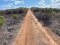
Fig. 69. Red, medium-grained sandy soil on stretch of trail. |
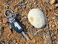
Fig. 70. Example or a rounded stream or beach cobble. |

Fig. 71. Ironstone concretions eroding from sandy soil. |
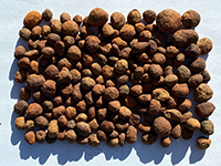
Fig. 72. A collection of marble -sized ironstone concretions. |
|
A16
Plant Communities in the Franks Peak Area
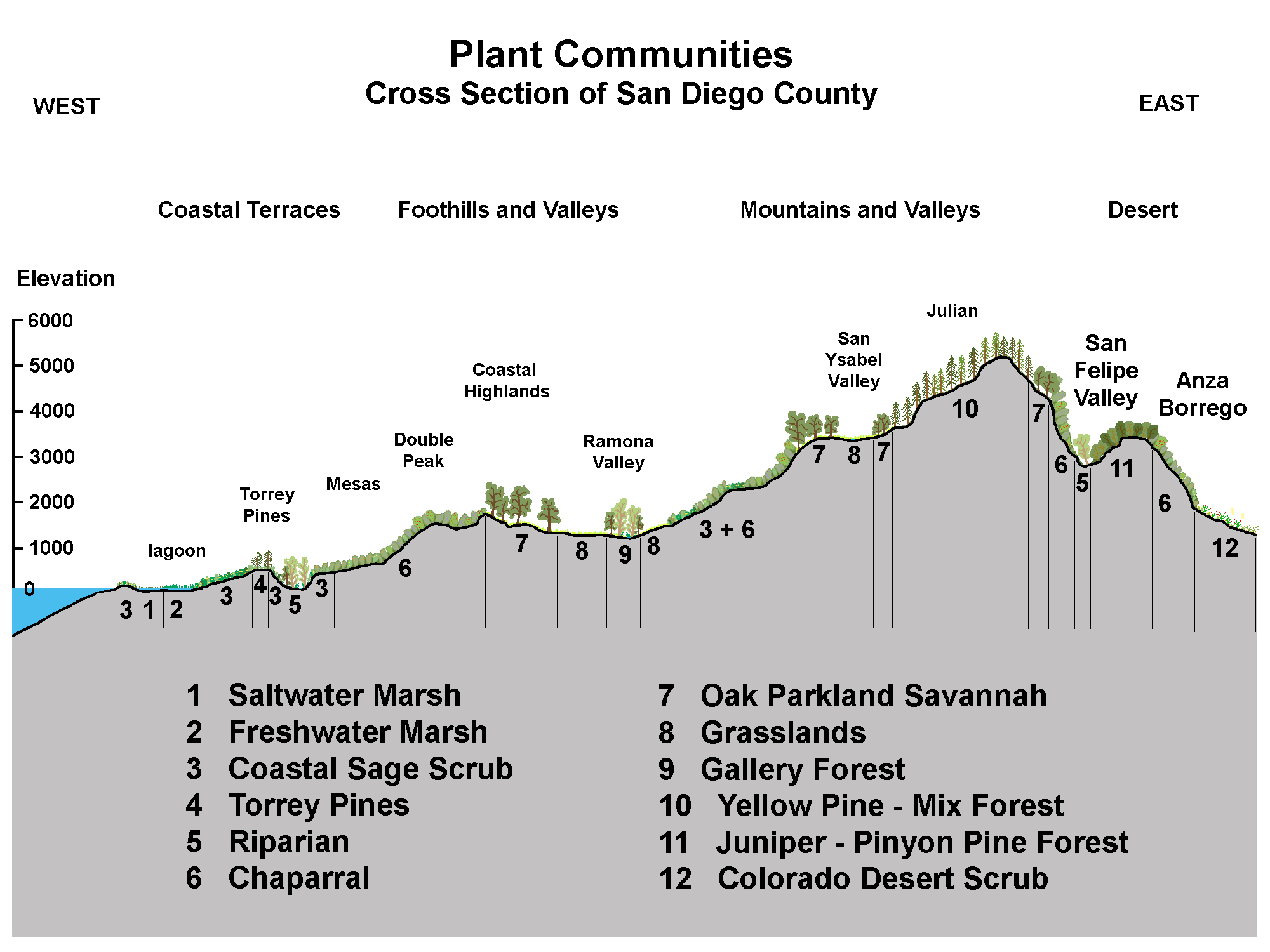
Because San Diego has a wide range of physical environments (coast, mountains, canyons, and desert). Likewise, the county has a wider range of plant communities than practically anywhere in the United States (Figure 73).
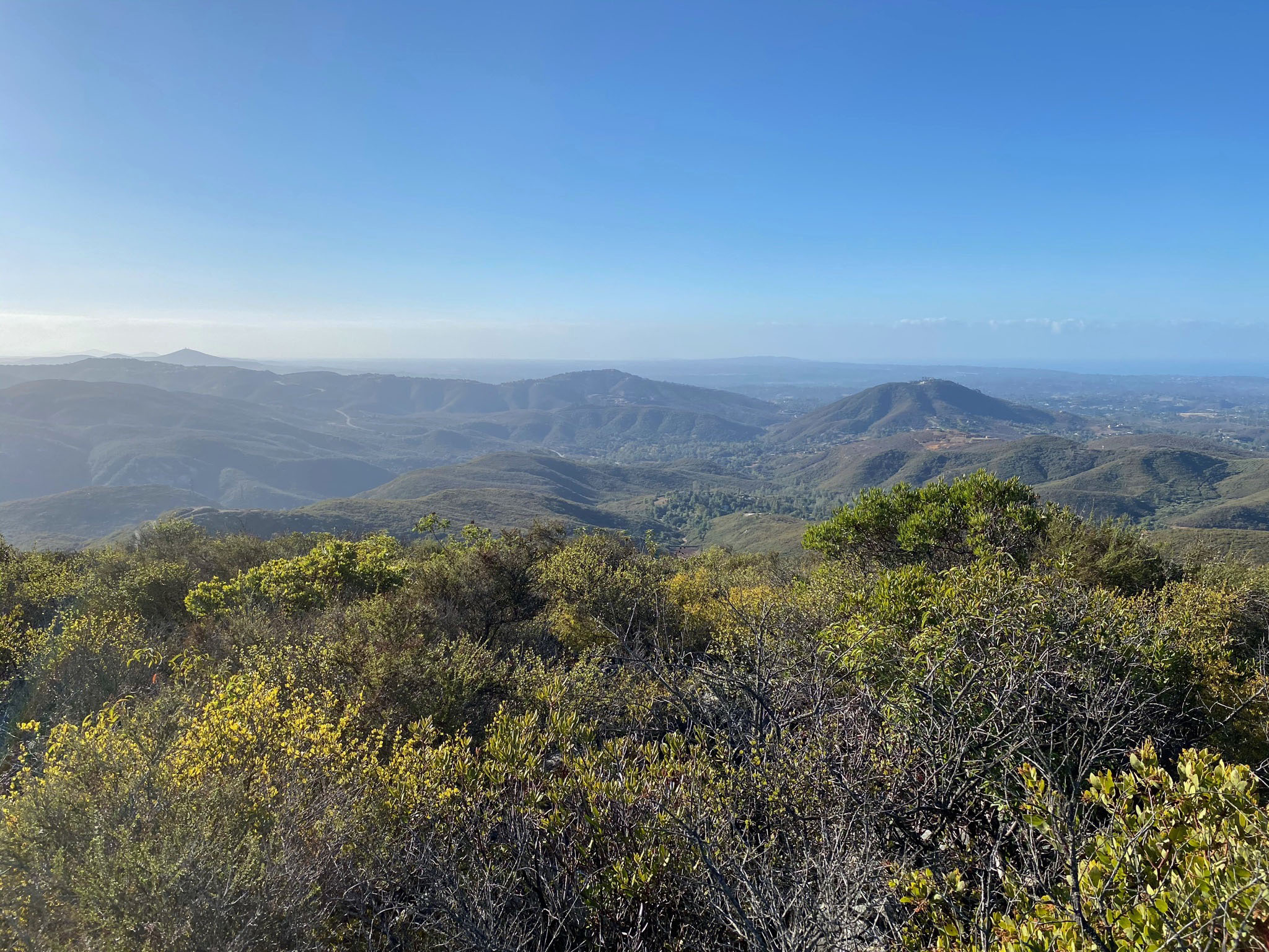
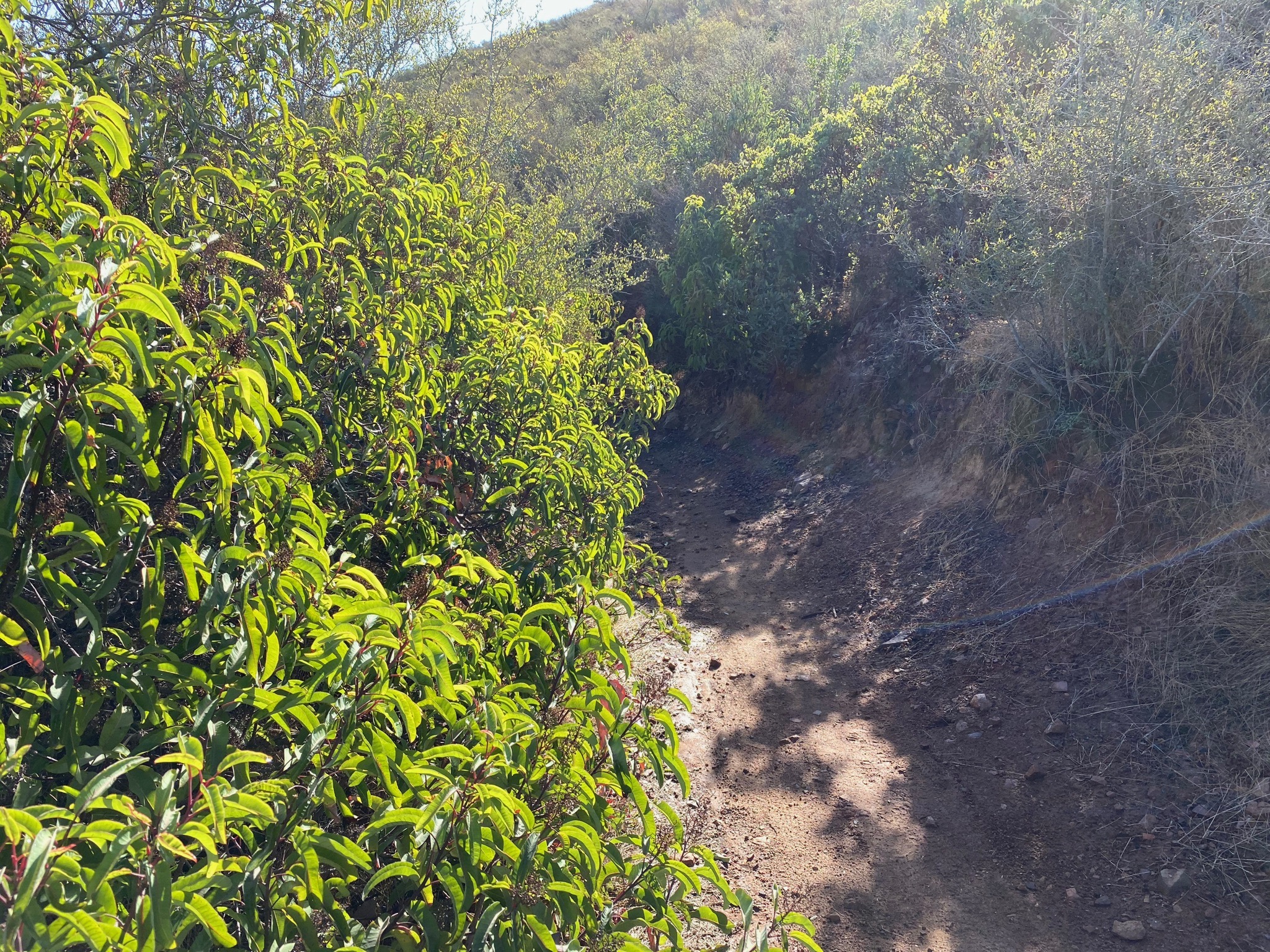
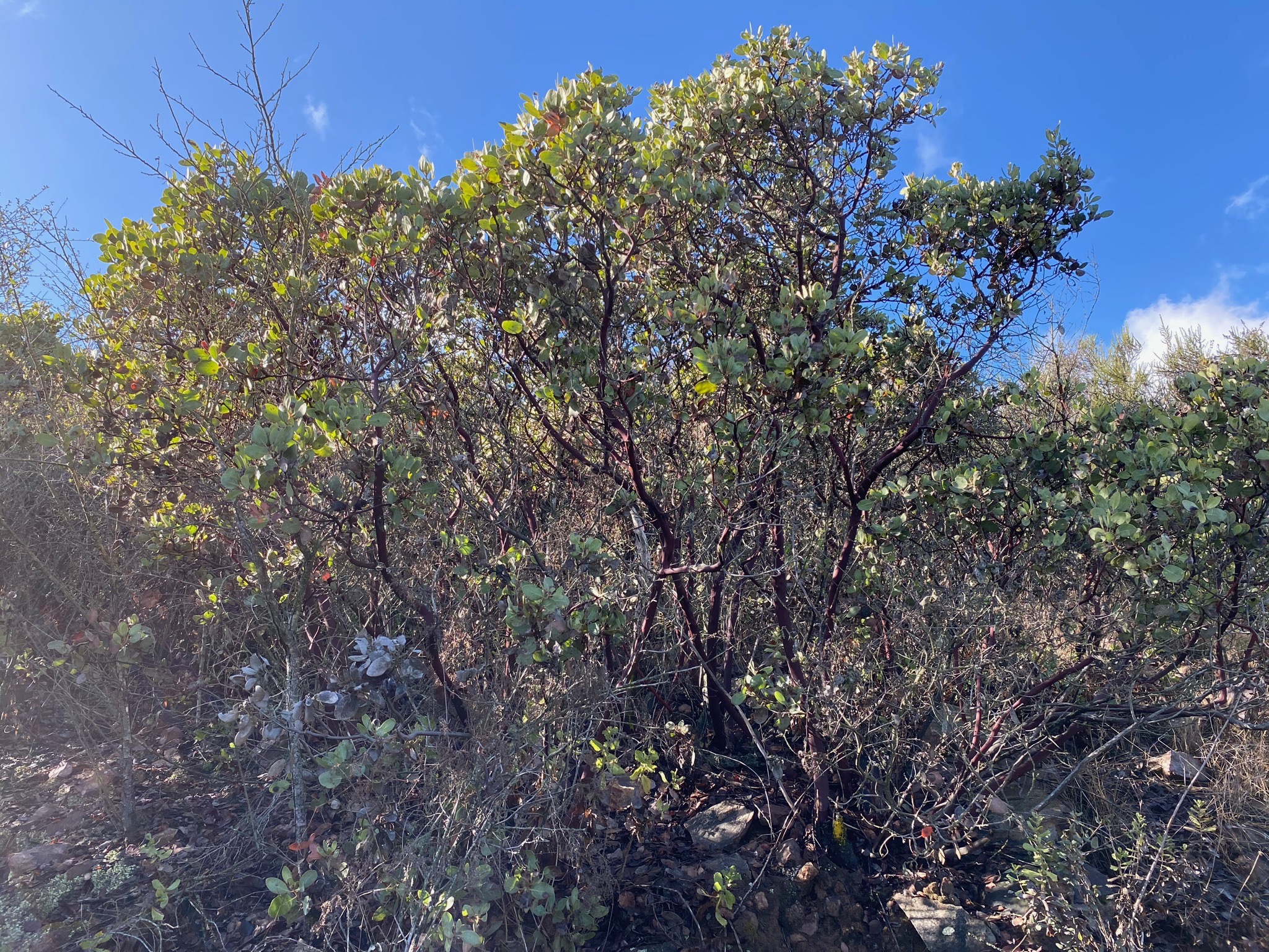
The high-and-dry coastal highlands in the Franks Peak, Mt. Whitney, and Double Peak area are dominated by a southern mixed chaparral and coastal sage scrub plant communities, although there is significant mix and variation throughout the field area (Figure 74). Indicator plants of a southern mixed chaparral community includes Chamise, Toyon, and Mission Manzanita (Figures 75 and 76). South facing slopes are drier and tend to have shorter and more widely spaced plants. Some areas have less Chamise and more sage (salvia species), particularly on the south- and west-facing slopes. North-facing slopes are cooler and retain moisture better, so plant growth tends to be both larger (taller), and denser with more Manzanita and Toyon.
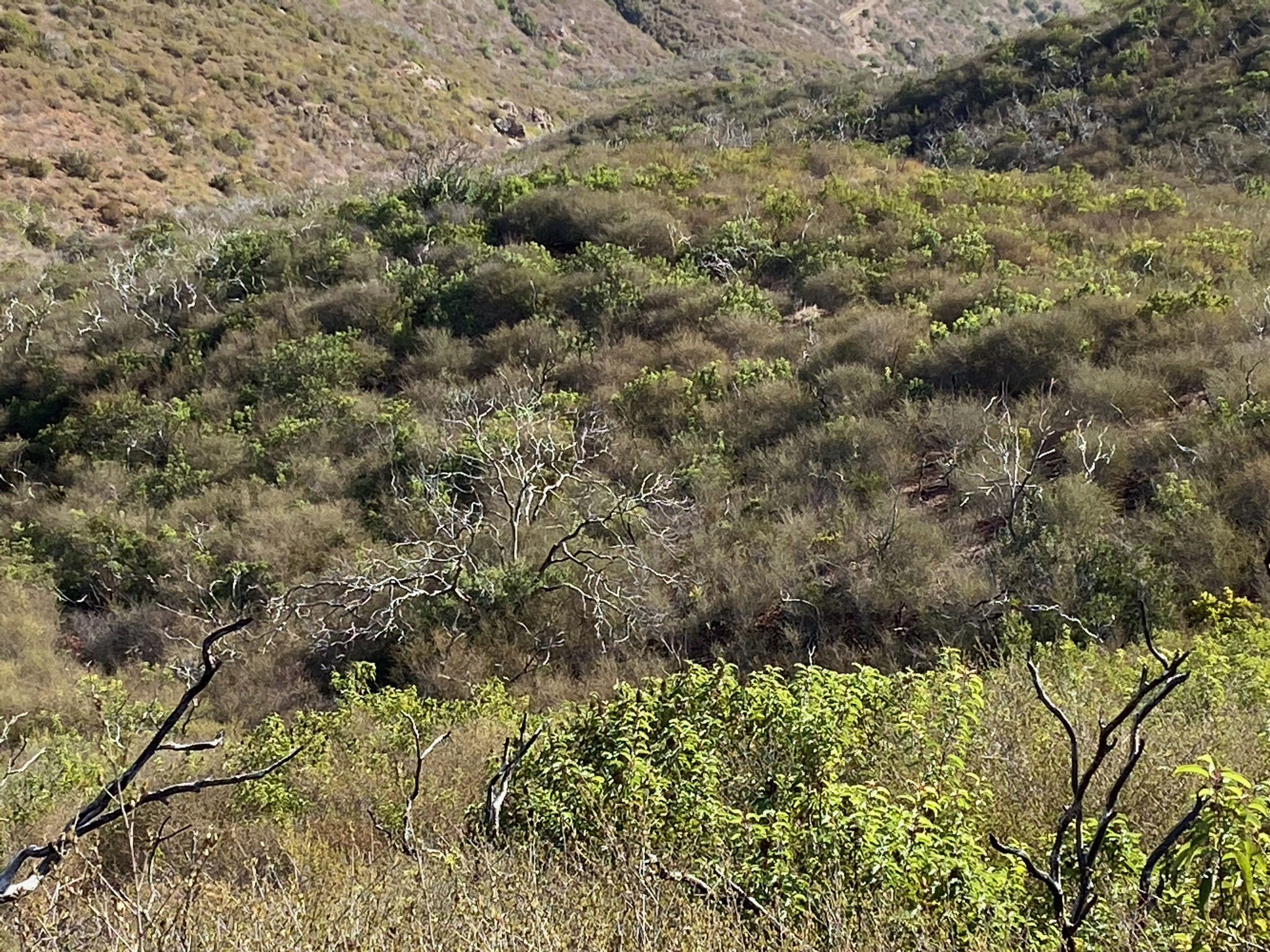
Figure 77 is a view of the canyon area southeast of the pass (Stop B). The area is slowly recovering from the 2014 Cocos Fire that burned much of the Mountainsides in the vicinity. This view shows slopes that still display the burned stumps and branches of Toyon and Manzanita. Chamise and coastal sage scrub plants are dominating the regrowth at this stage. Figure 78 shows a small patch of slope that is a refugia for a coastal live oak that escaped the fire. It is the only remaining oak tree in the field trip area.
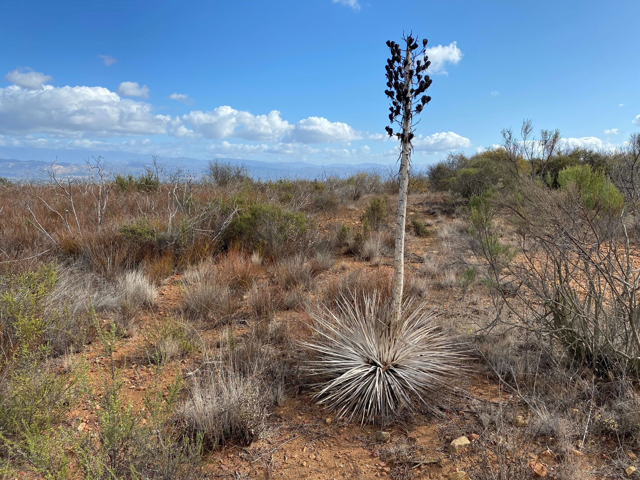
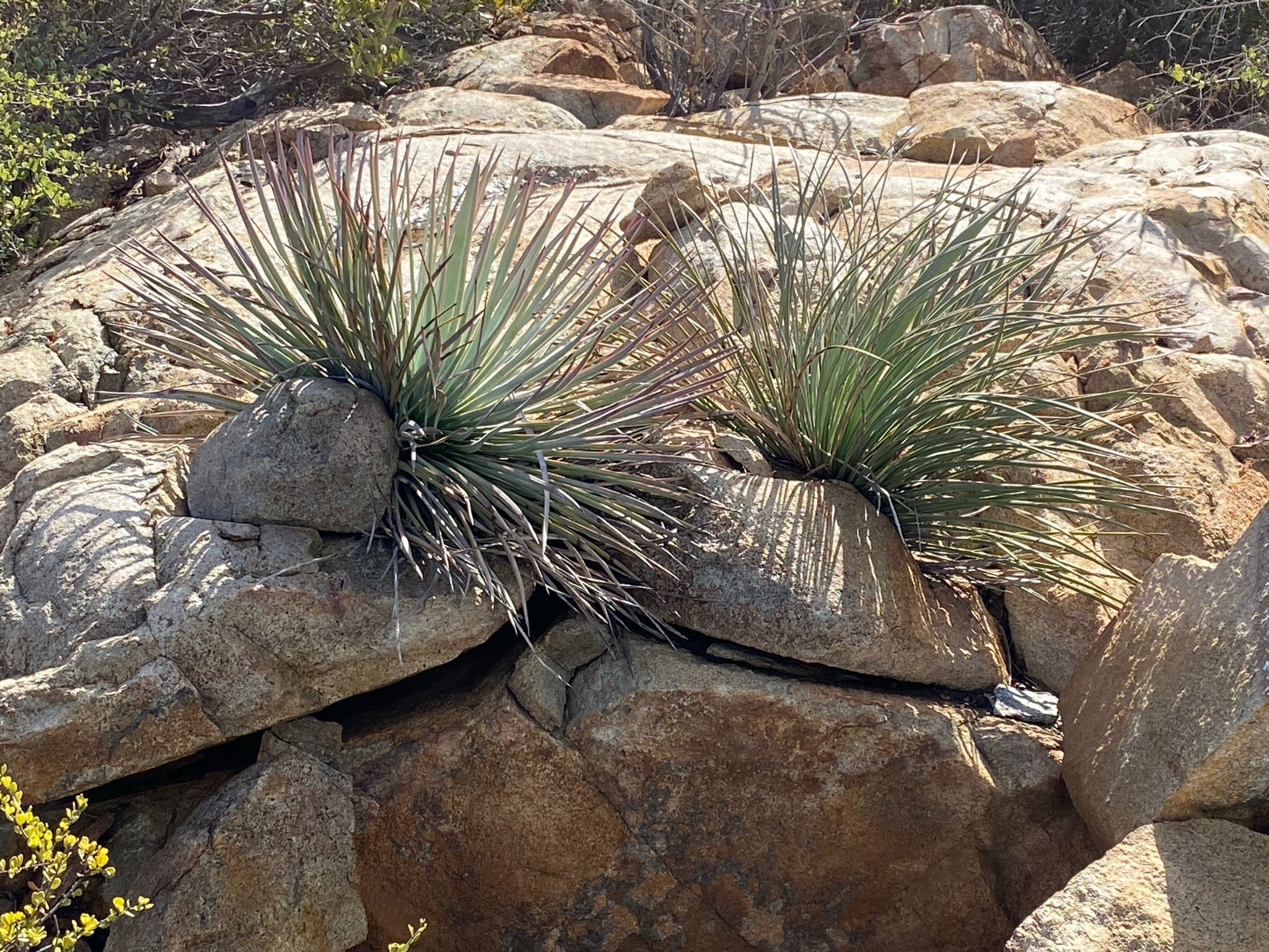
Figures 79 and 80 show examples of Mojave Yucca, commonly called Spanish Bayonet for its very sharp, pointed leaves. The plant's final act it to put of an asparagus-like shoot that produces a large cluster of cream-colored flowers before the go to seed and the plant dies.
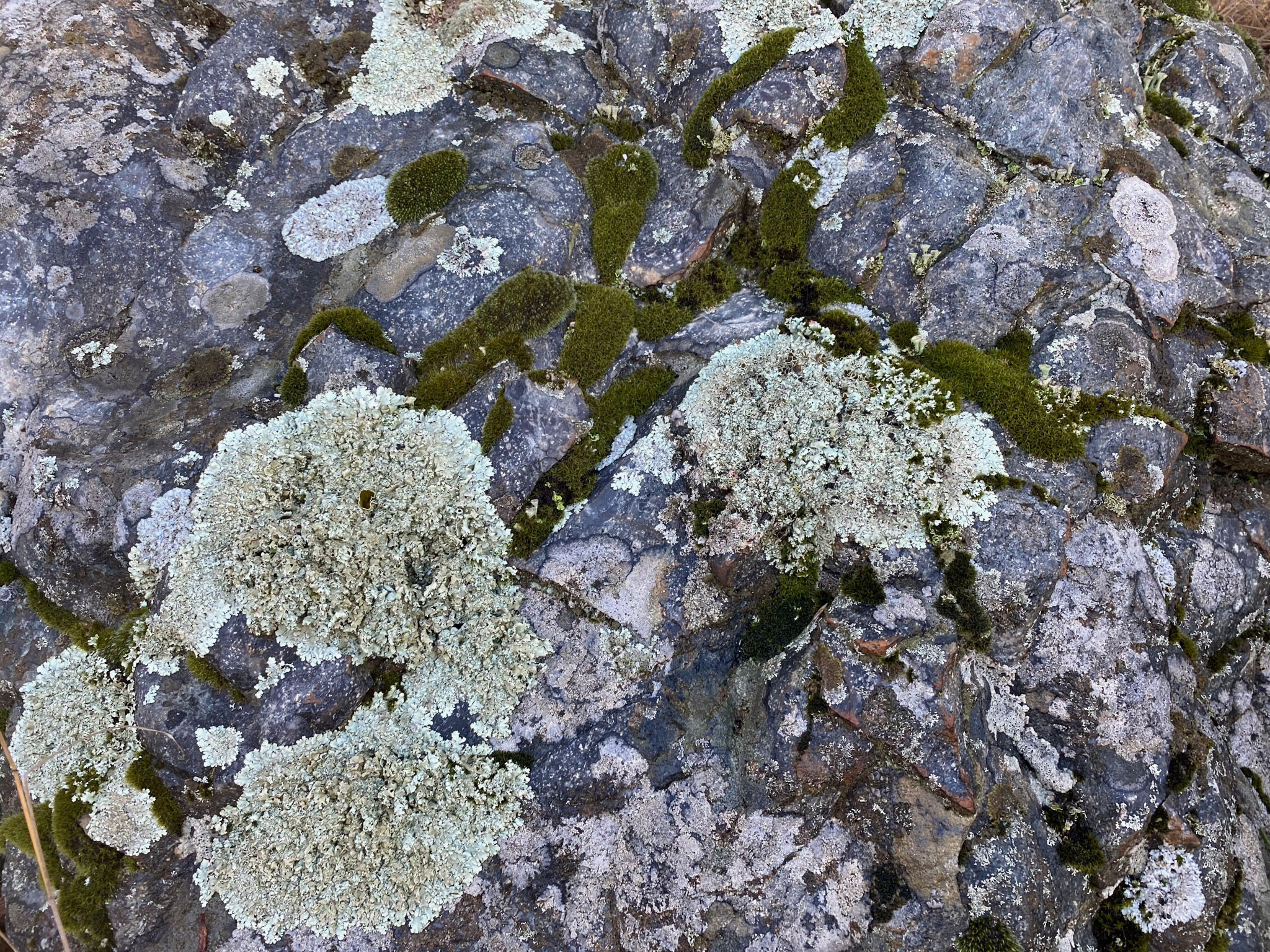
Figure 81 shows a boulder covered with lichen and mosses. This boulder is on a north-facing slope along the Franks Peak Trail.
Figure 82 is a view from Franks Peak that shows the area locally known as Elfin Forest. This shows the valley of the Questhaven Retreat nature trails and the Los Cielos Preserve adjacent to the Elfin Forest Recreation Reserve in the San Elijo Canyon area along Escondido Creek. This hillsides are covered with dense chaparral vegetation whereas the valley is host to riparian forest, oak forest, grassland meadows, and coastal sage scrub plant communities.
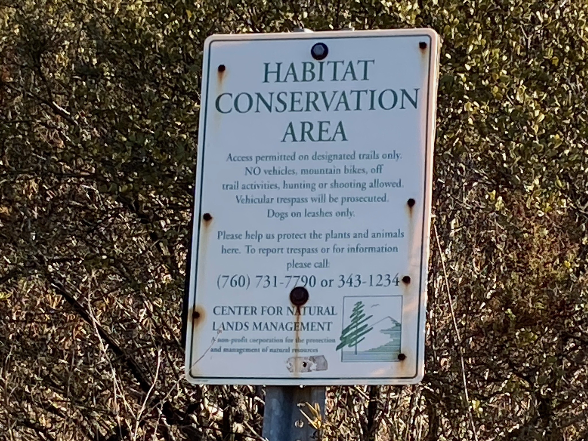
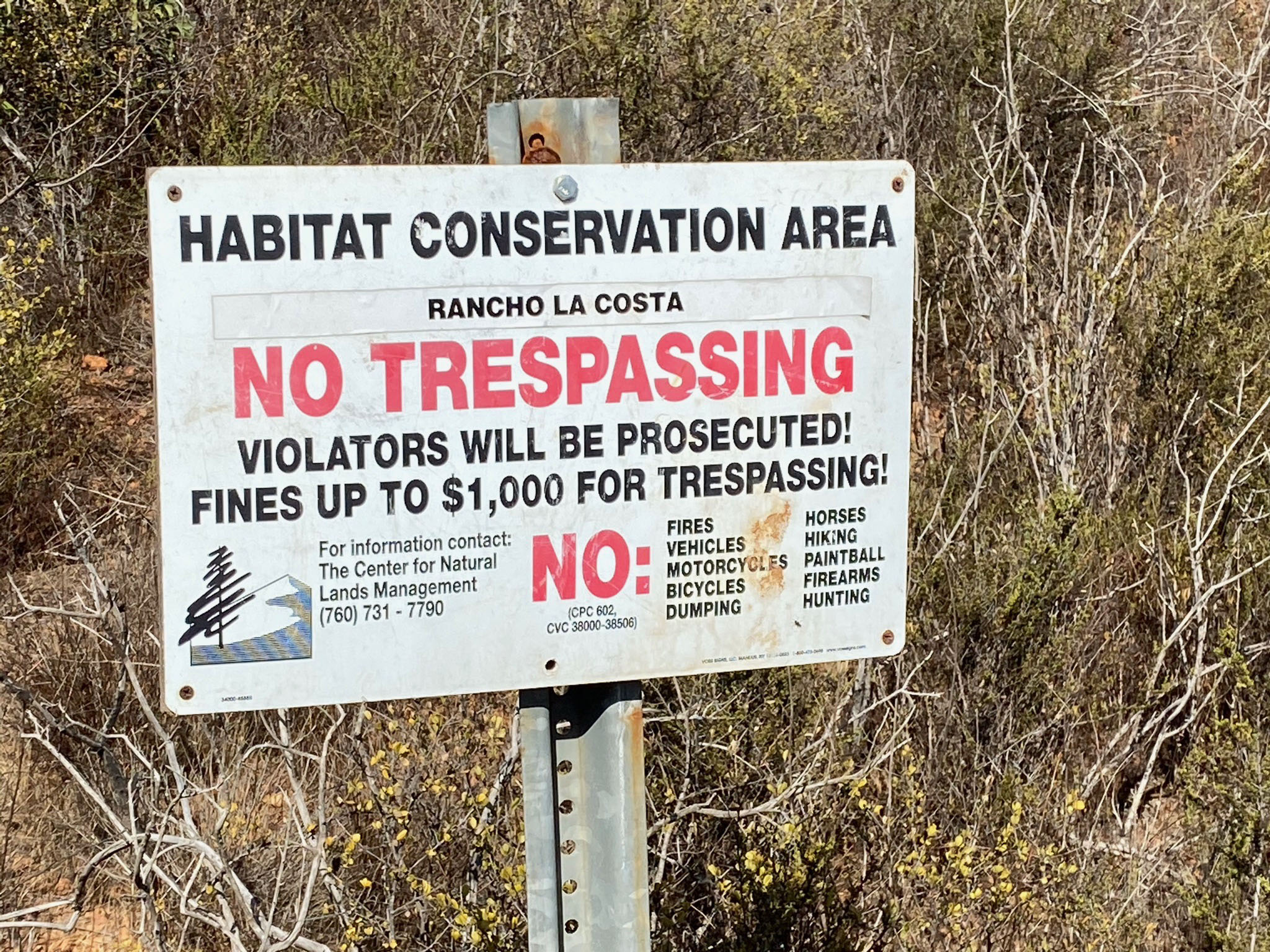
Figures 83 and 84 are signs describing the rules for this Habitat Conservation Area managed by the Center for Natural Lands Management (a non-profit corporation for the preservation and management of natural resources). All the undeveloped land around Franks Peak is open-space.
Learn More About Local Plant Communities and Ecology at nearby Elfin Forest Recreational Reserve
One of the best places to learn about local native plant communities is to walk the 1.1 mile Botanical Trail loop in the nearby Elfin Forest Recreational Reserve. The trail starts at the Elfin Forest Recreational Reserve parking area (8833 Harmony Grove Road, Escondido, CA 92029). Below are two resources about the Botanical Trail.
Botanical Trail Interactive Guide (includes interactive map providing information about stop location).
Elfin Forest Botanical Trail Guide (take this printout with you when you do the trail).
|
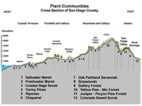
Fig. 73. Plant communities of San Diego County |
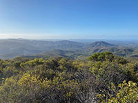
Fig. 74. Southern mixed chaparral & coastal sage scrub. |
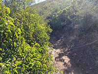
Fig. 75. Laural sumac and Chamise on Franks Peak Trail. |

Fig. 76. Mission Manzanita along the Franks Peak Trail
|
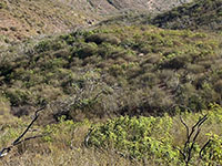
Fig. 77. Fire-burned chaparral from 2014 Cocos Fire. |
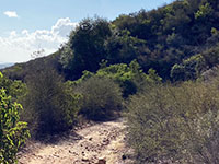
Fig. 78. A lone oak tree (refugia) along trail to Stop F. |
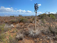
Fig. 79. Mojave Yucca along the trail at Stop F. |
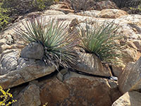
Fig. 80. Yucca on rock face along the trail at Stop F. |
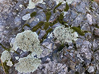
Fig. 81. Lichen and mosses along Franks Peak Trail. |
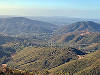
Fig. 82. Chaparral on hillsides, riparian oak forest in valleys. |
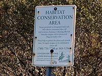
Fig. 83. Center For Natural Lands Managements rules. |
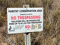
Fig. 84. Rules sign for the Habitat Conservation Area. |
|
A17
Selected References and Resources
Berger, W.H., 2013, On the Natural Geography of North San Diego County: Scripps Institution of Oceanography Technical Report, 31 p. (web link)
Anonymous,
(unknown date), Physical Geography of San Diego County: Declassified document from the Central Intelligence Agency (CIA) Reading Room, 23 p. (web link)
Herzig, C.T. and Kimbrough, D.L., 2014, Santiago Peak volcanics: Early Cretaceous arc volcanism of the western Peninsular Ranges batholith, southern California: in Peninsular Ranges Batholith, Baja California and Southern California; Morton, D. M. and Miller, F.K., editors, Geological Society of America Memoir v. 211. (web link)
Milow, E.D., and Ennis, D.B., Guide to geologic field trip of southwestern San Diego County:
Annual Meeting of the Cordilleran Section of the Geological Society of America, 57th, San Diego, CA, 1961, Guidebook.
Trail Guide to the San Elijo Hills (web link)
Walawender, M.J., Geologic history of San Diego County: modified from original San Diego Natural History Museum website. (web link)
|
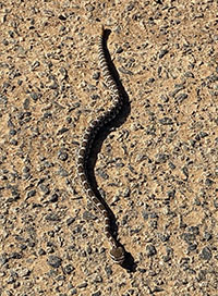
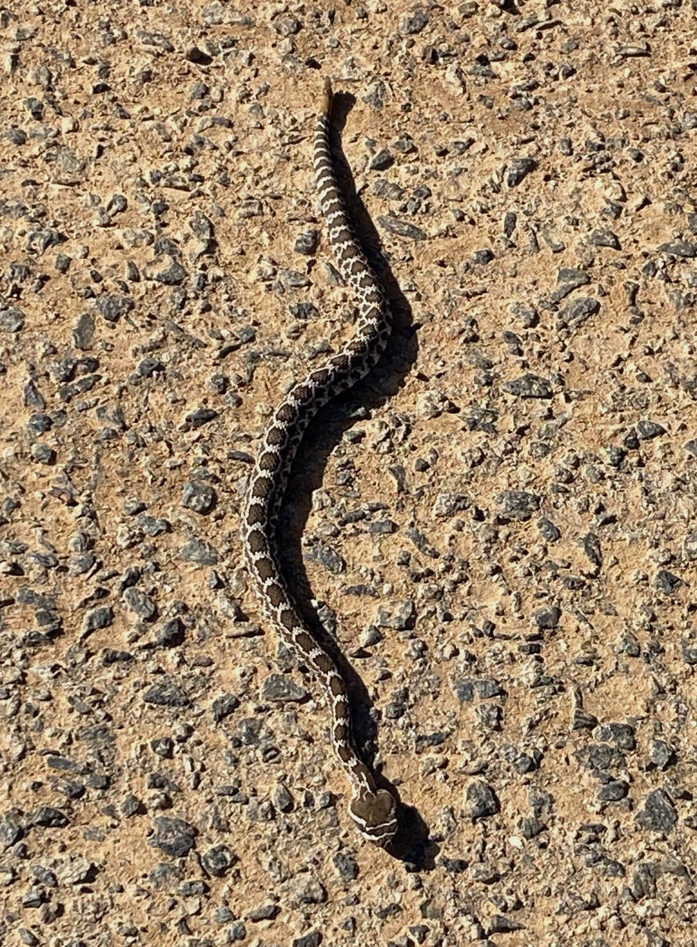
Fig. x. Western Diamondback Rattlesnake on Mt. Whitney trail. |
https://gotbooks.miracosta.edu/fieldtrips/Franks_Peak/index.html
|
11/30/2020 |
|