Double Peak Park, San Marcos, CA |
|
A1
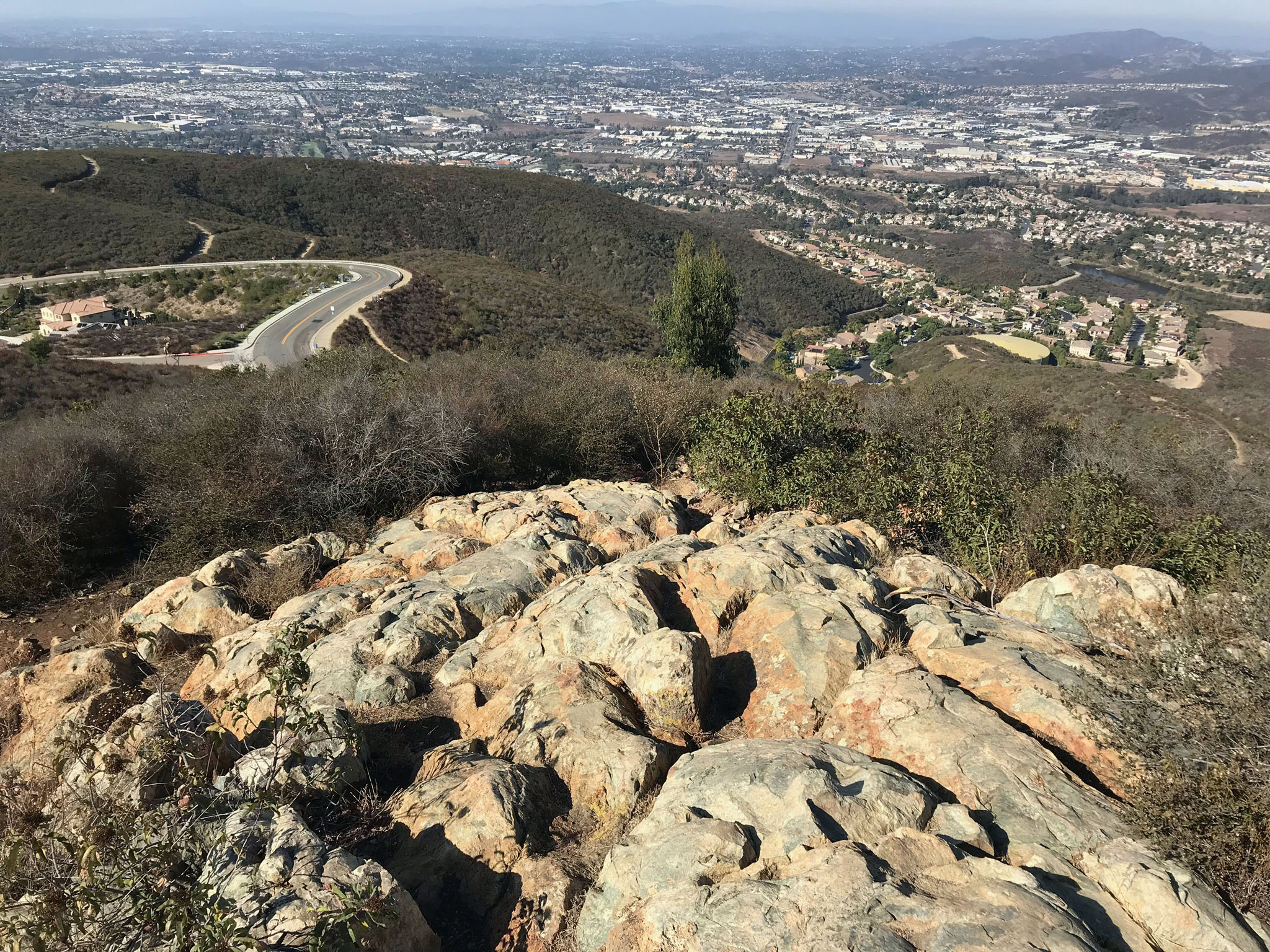
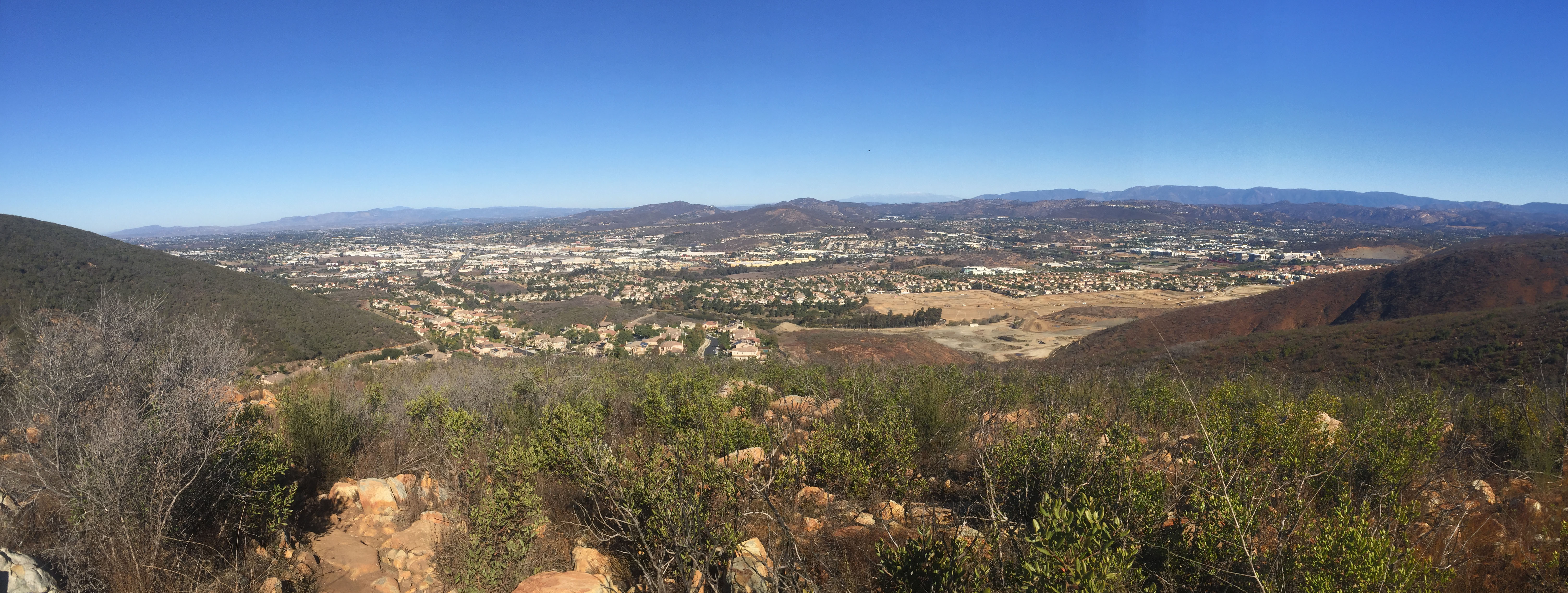
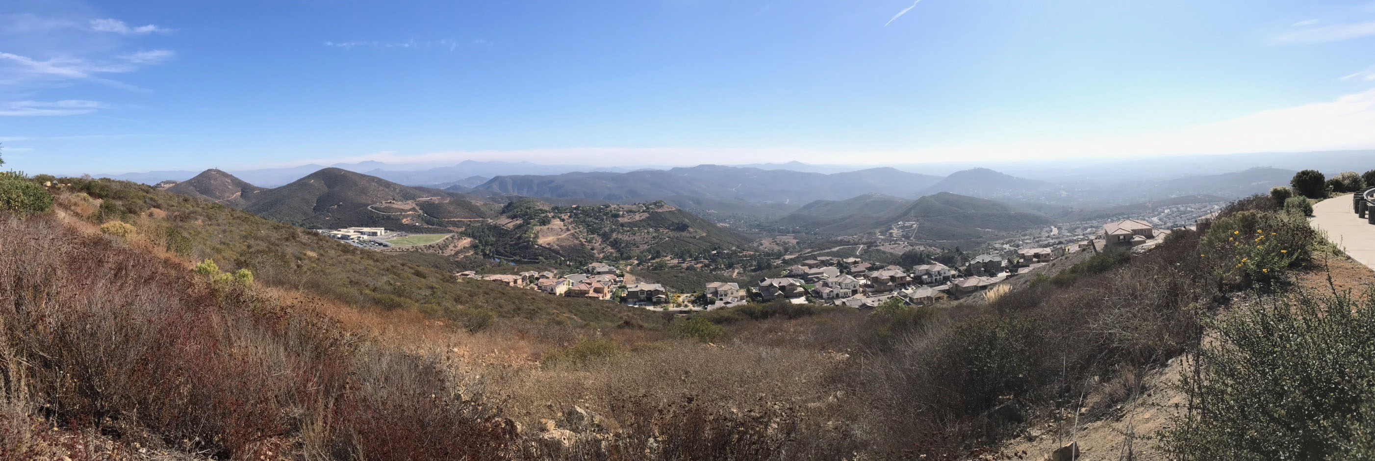
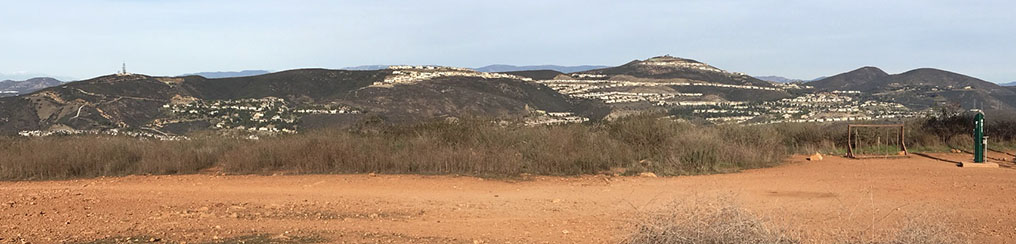
Double Peak Park is an excellent destination for a field trip for many reasons. The mountain-top park is easy to get to, has ample parking, and provides sweeping regional views in all directions. On a clear day it is possible to see as far south to the mountains and islands offshore of Mexico and northward along the coast to San Clemente. Distant high peaks in the San Bernardino Mountains and San Jacinto Peak are visible beyond the ridgelines of the local mountains Peninsular Ranges in central San Diego County.
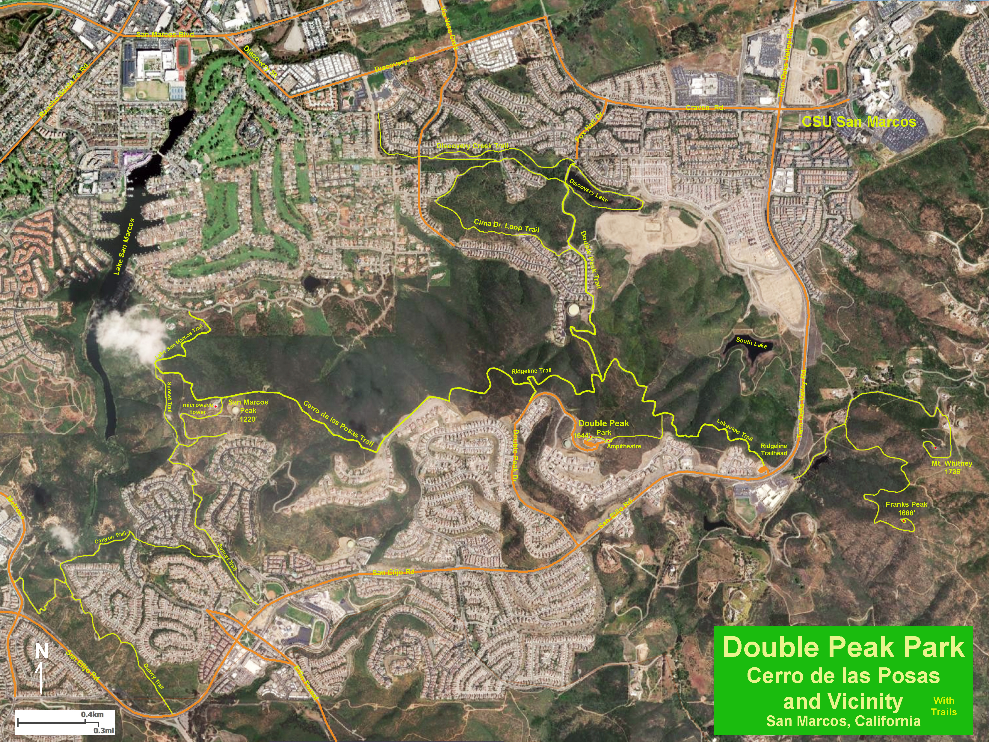
Figure 1 is a trail map of the Double Peak/Cerro de las Posas area. The satellite image shows open space surrounded by urban development (communities) of the San Elijo Hills on the south side and Lake San Marcos, Discovery Hills, and CSU San Marcos on the north side.
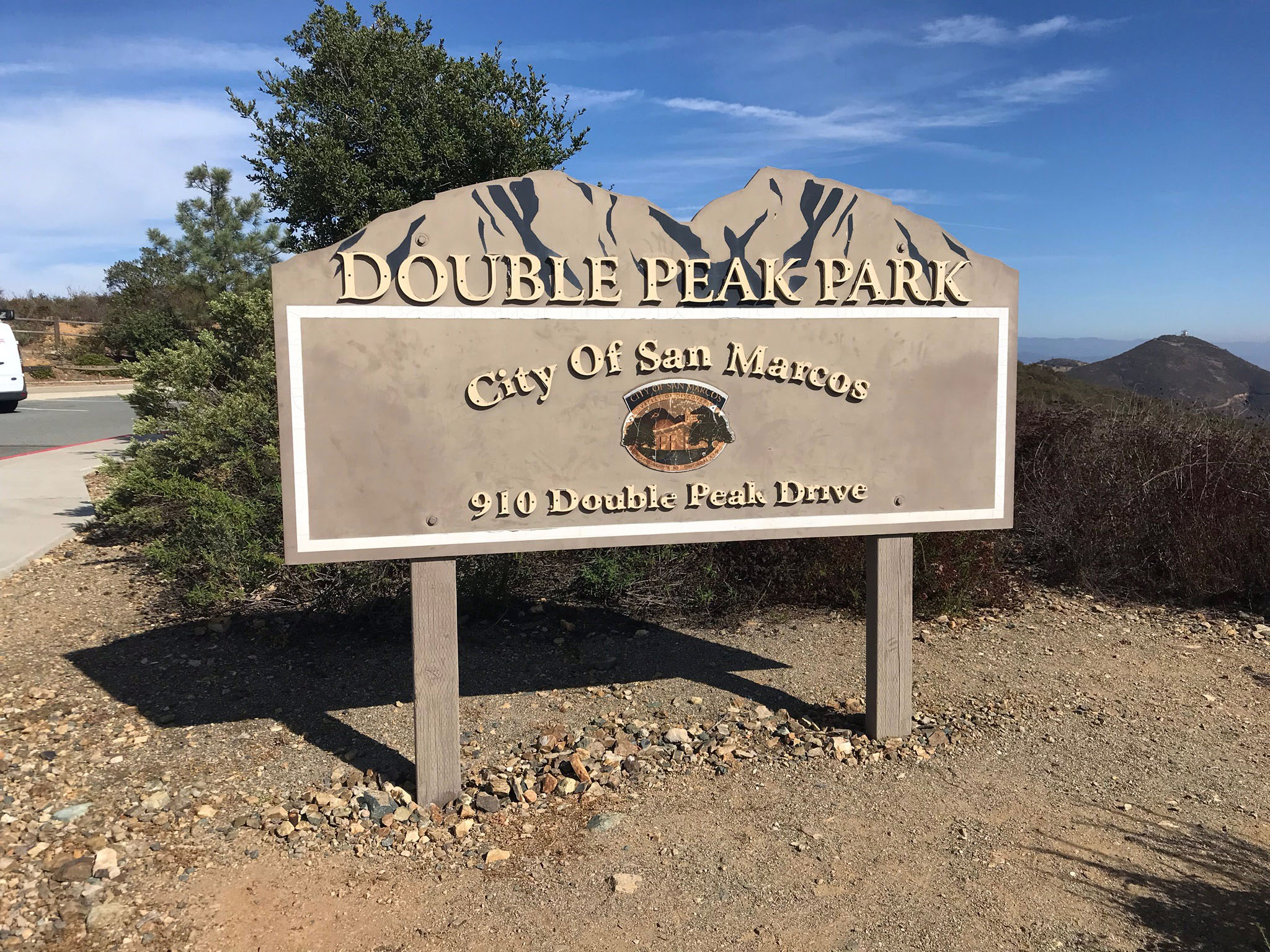
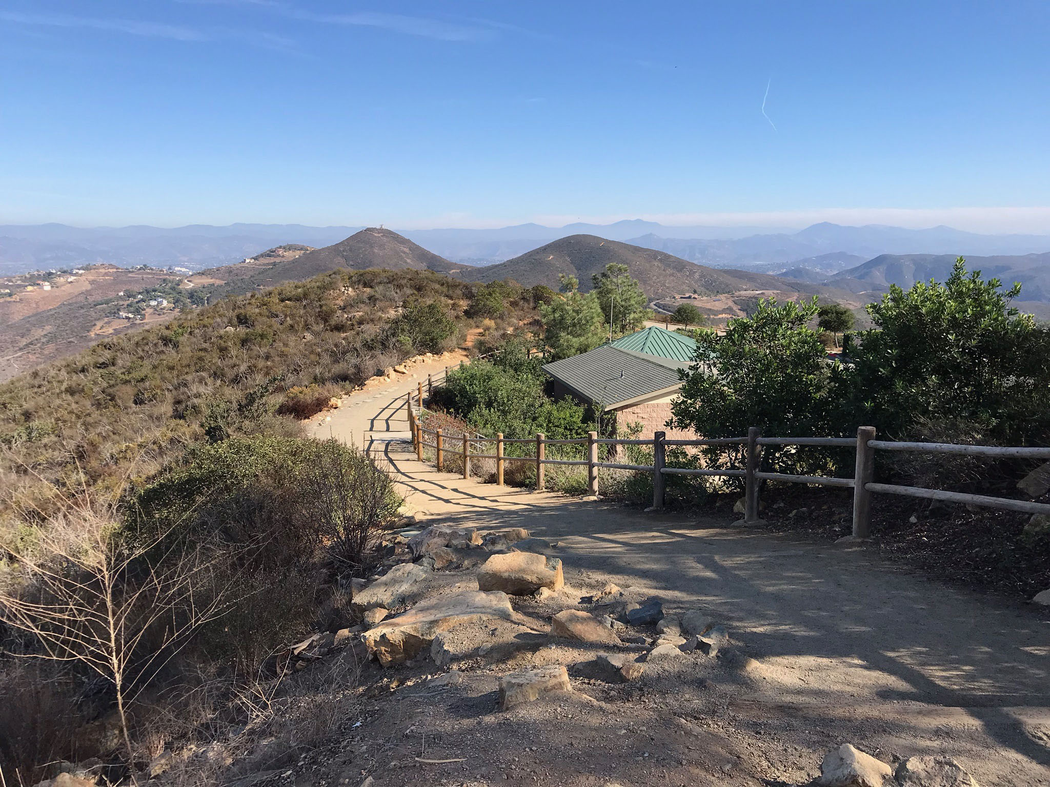
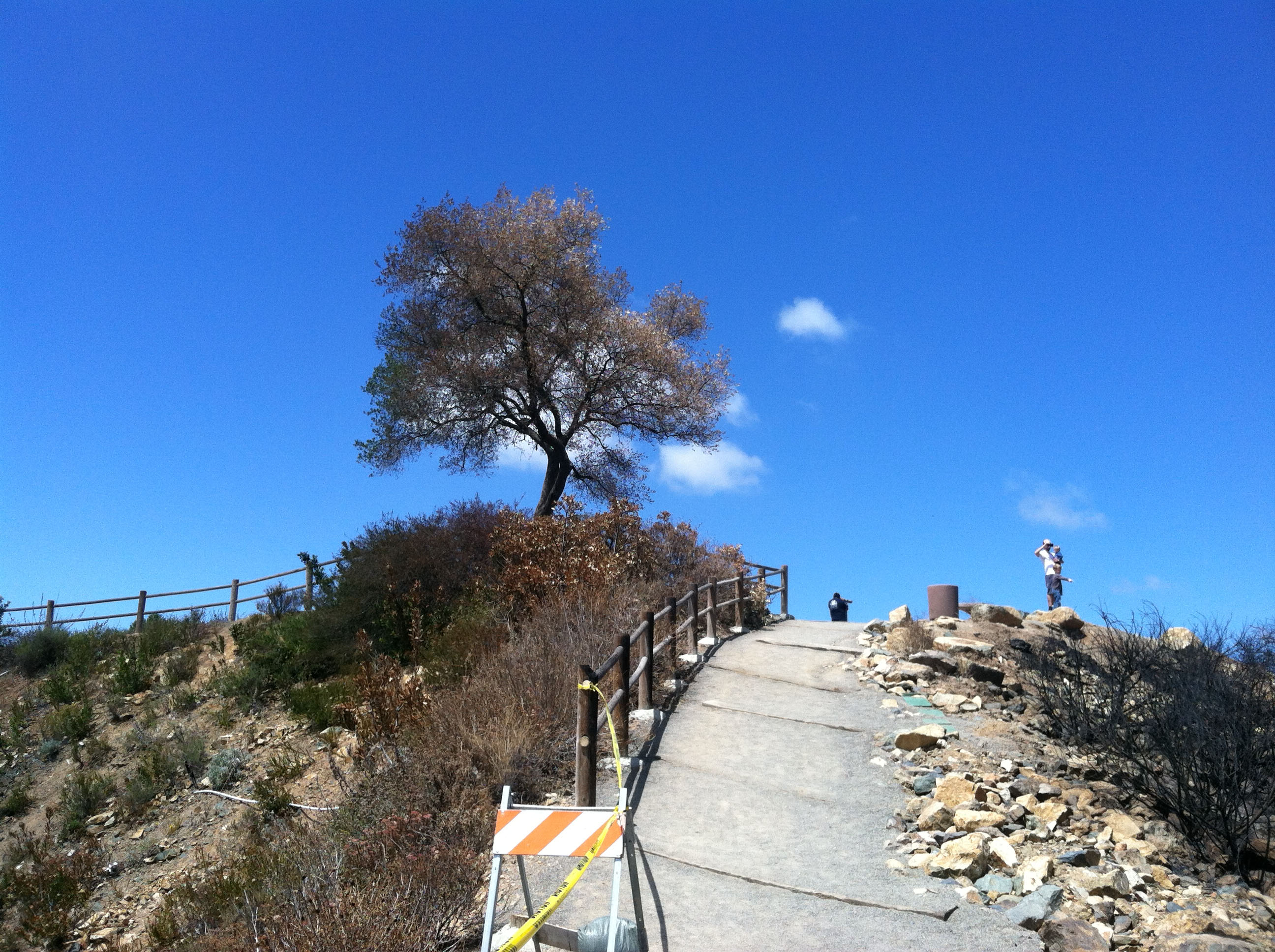
Double Peak Park is easy to get to. From Highway 78, take Twin Oaks Valley Road south (it becomes San Elijo Road). Just beyond the crest of the hill turn right onto Double Peak Drive. Continue until you enter the parking lot near the park sign (Figure 2). A short walk to the top of the mountain gives you a full 360 degree view of the region of northern San Diego and beyond (Figure 3 shows the summit area with a famous olive tree that survived the major Cocos fire in 2014). Figure 4 shows the small Double Peak Amphitheater on the mountaintop. The summit area of the park is wheel-chair accessible (Figure 5). |
Click on images for a larger view. |
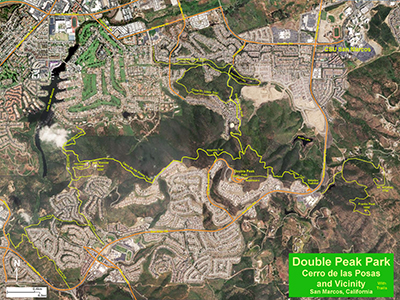
Fig. 1. Map of the Double Peak/San Elijo Hills area. |

Fig. 2.
Park sign for Double Peak Park in San Marcos, CA. |
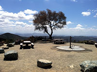
Fig. 3. Historic olive tree on top of Double Peak. |
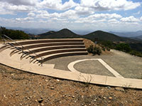
Fig. 4. Small amphitheater in Double Peak Park |

Fig. 5. Wheel-chair accessible trail at Double Peak Park. |
|
A2
Other Destinations in the Vicinity of Double Peak Park
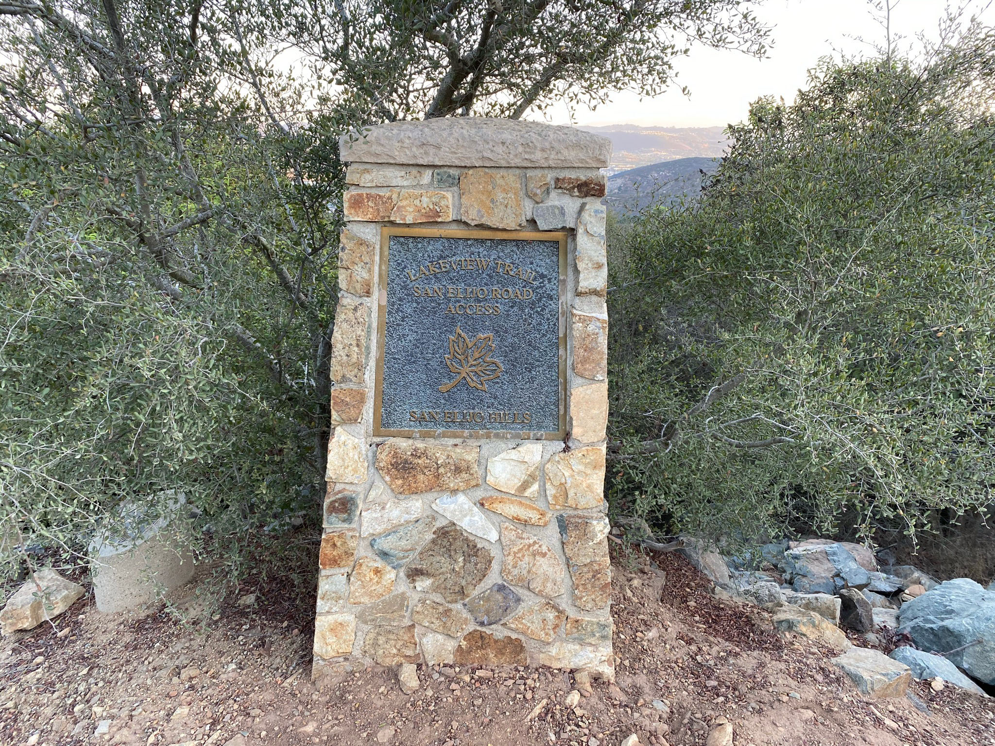
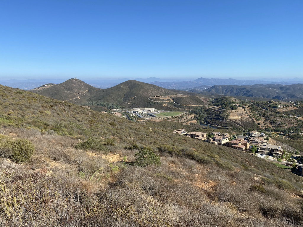
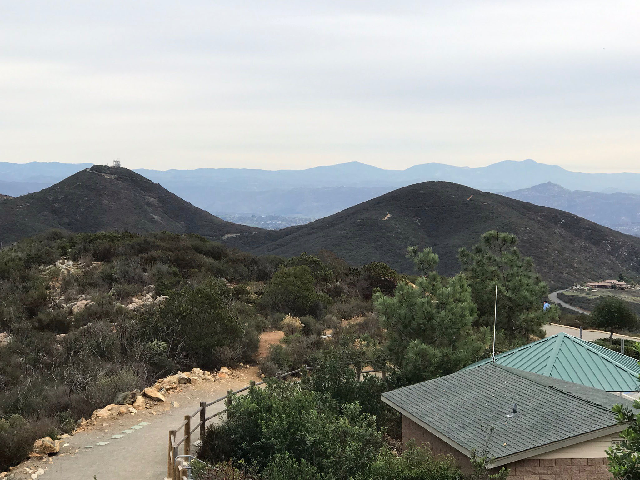
Double Peak Park is only part of the open space and parkland in the area. A companion to this website is the Discovery Creek Trail area on the lower northern flank of the Double Peak area. Figure 6 is a view of the Double Peak and ridgeline of Cerro de las Posas. The southern end of the ridge is San Marcos Peak that has a prominent landmark of a microwave tower at its apex (Figure 7). The Cerro de las Posas-Ridgeline Trail connects with the Double Peak Trail and the Lakeview Trail. The Lakeview Trailhead starts at a parking area across the street from Double Peak School (Figures 8 and 9). That parking area also serves as a starting point to hike to Franks Peak and Mount Whitney on the south side of Twin Oaks Valley Road. Learn more about the local geology and ecology from a companion guide to the Discovery Creek Trails Area in the valley on the north side Double Peak. |
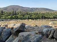
Fig. 6. View of the Double Peak and San Marcos Peak ridgeline (left to right) from CSUSM campus. |
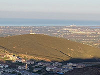
Fig. 7. The Lakeview Trail continues as the Cerro de las Posas Ridgeline Trail leading to San Marcos Peak. |
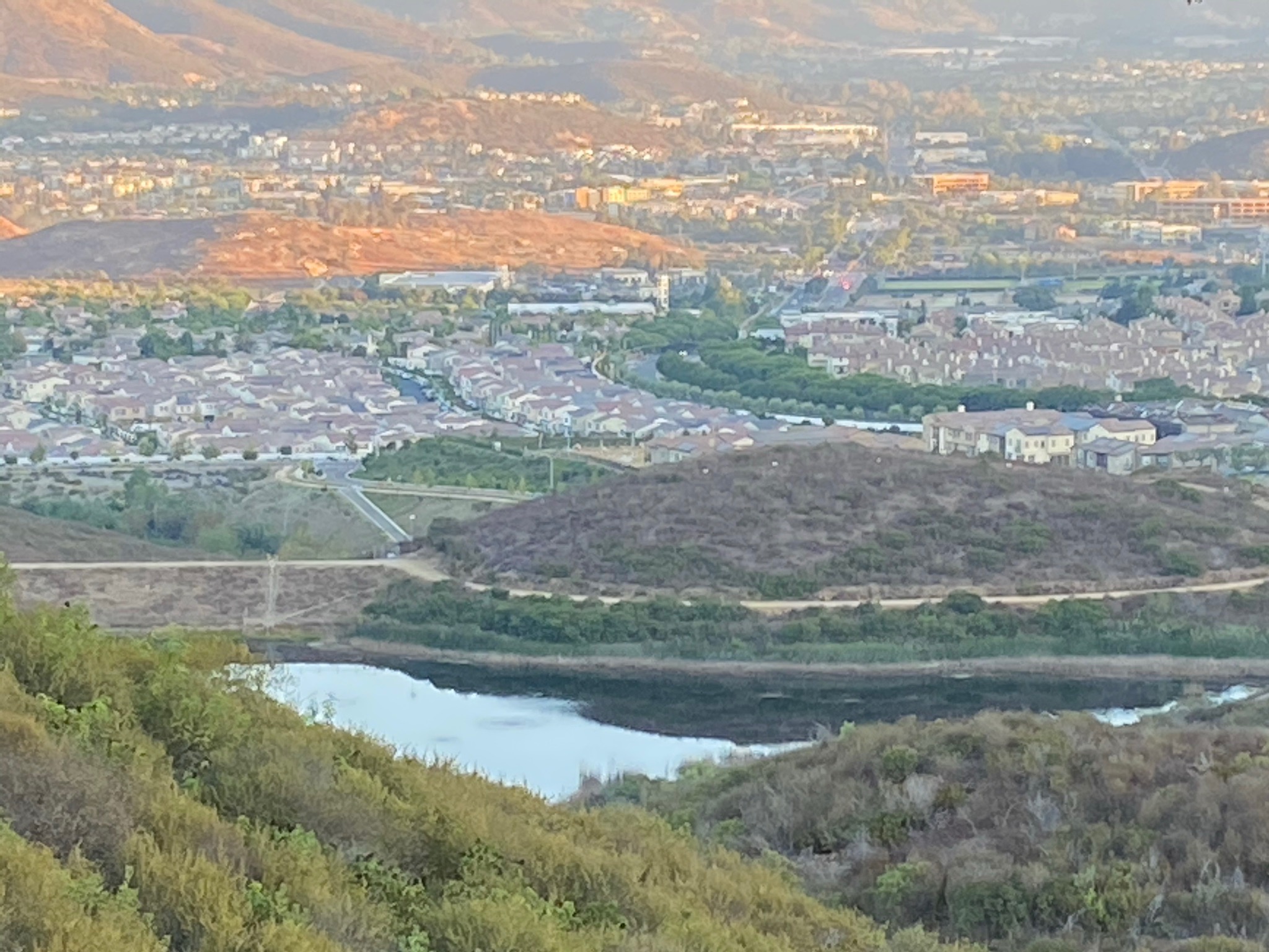
Fig. 8. Trail head marker for the Lakeview Trail parking near Double Peak School on Twin Oaks/San Elijo Road. |
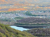
Fig. 9. View from the Lakeview Trail of South Lake and low granite hills in San Marcos Valley urban center. |
|
A3
Regional Geography
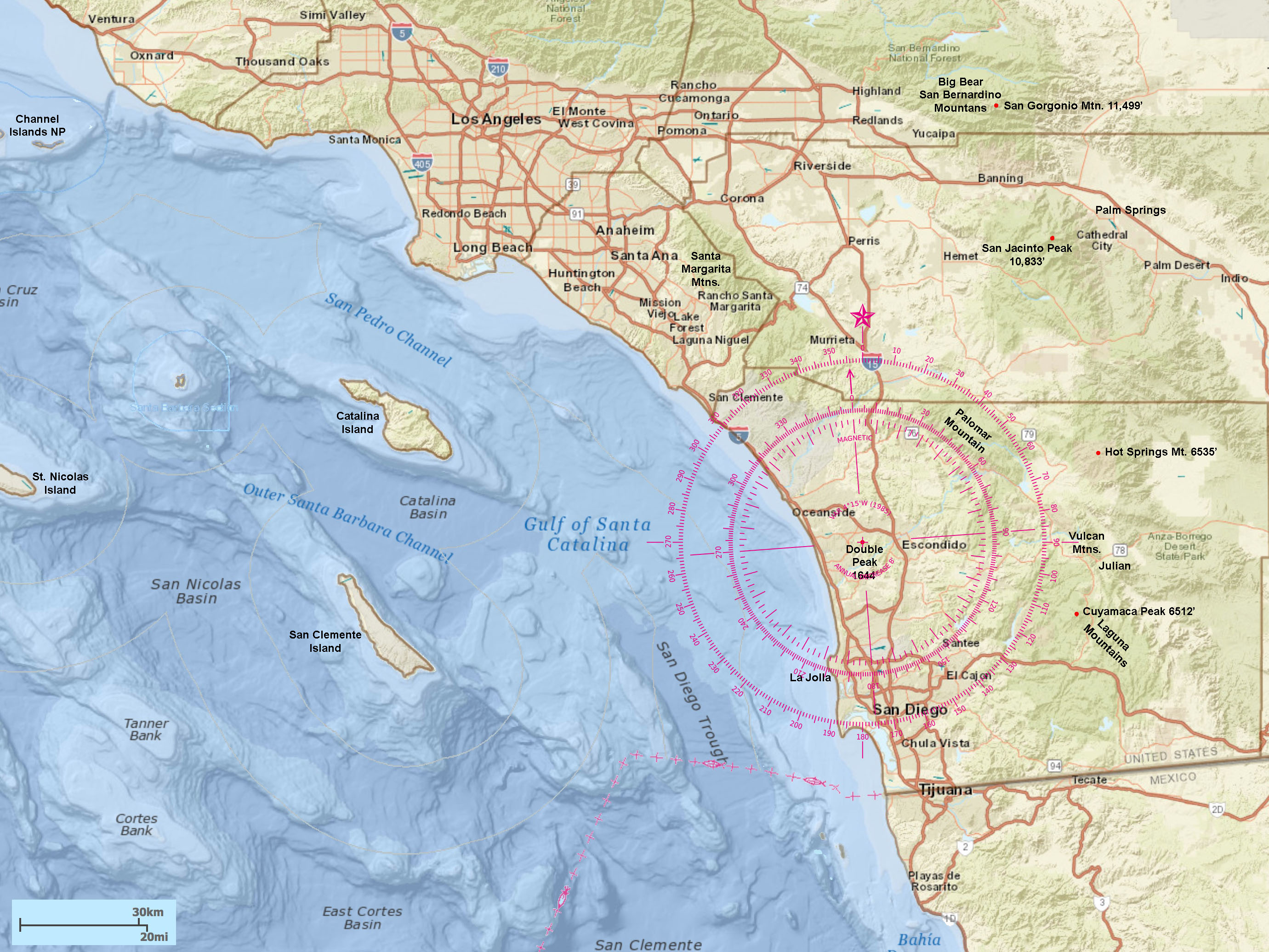
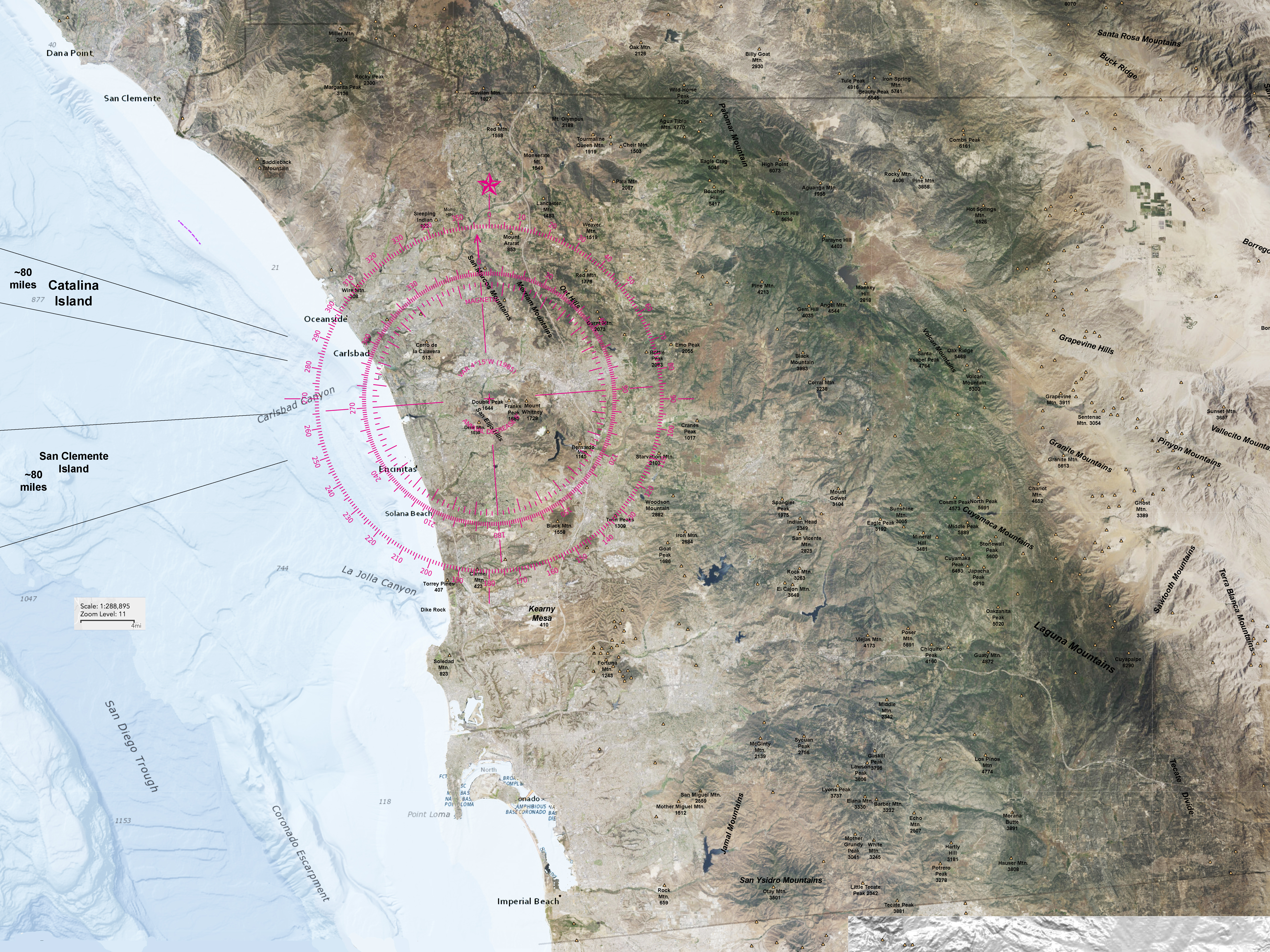
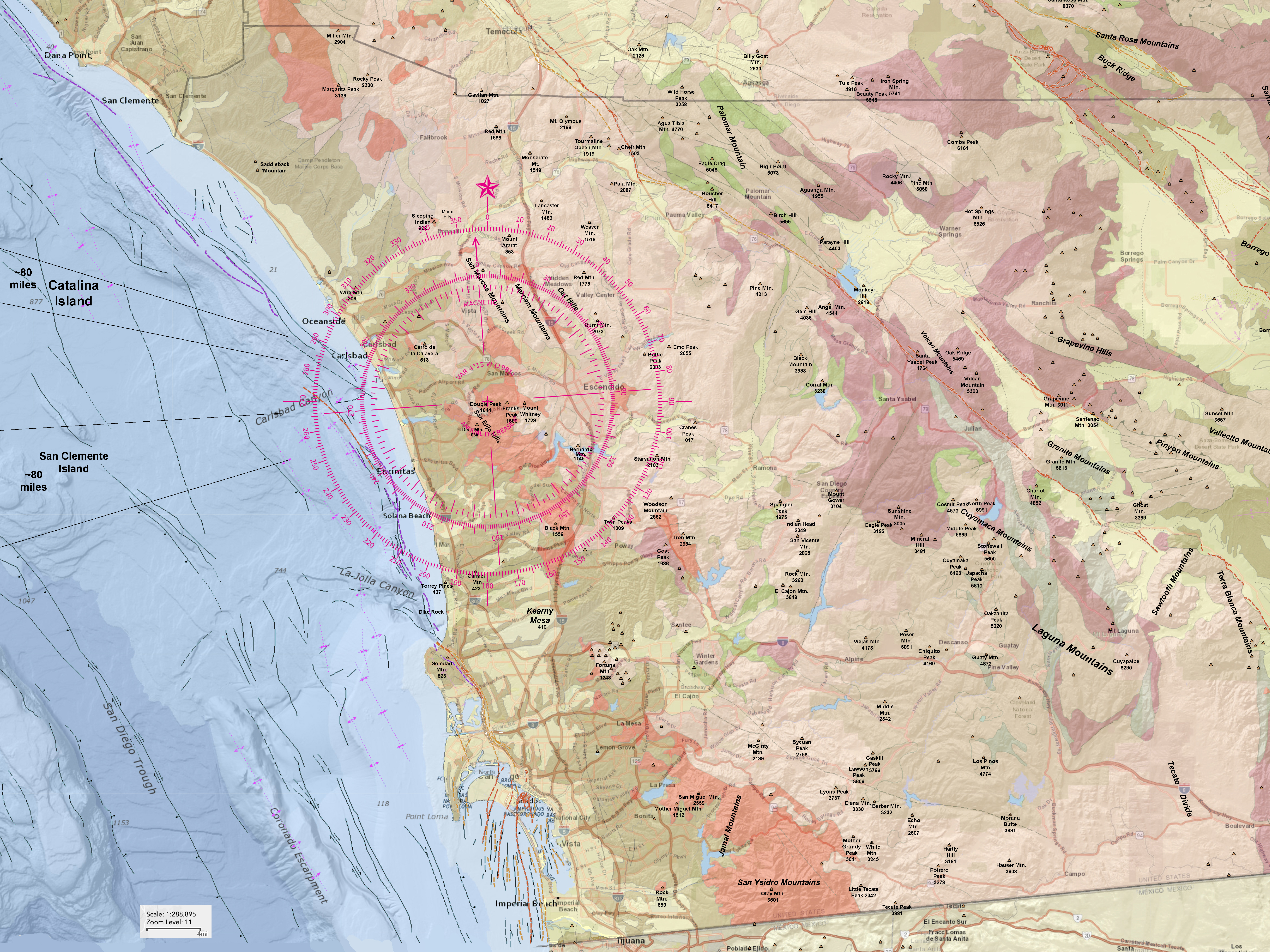
The maps below are useful for identifying distant landscape features while on the mountaintop at Double Peak Park. Clicking on the maps will provide a large image that may take a moment to load. They are very useful images to orient yourself to features near and distant. On a very clear day it is possible features that are nearly 90 miles away! Figure 10 is a regional map of Southern California showing the locations of islands offshore (with bathymetry for discussion purposes). Figure 11 is a satellite image that includes the names and elevations of prominent mountain peaks in San Diego County. Most of the high peaks in the Peninsular Ranges in San Diego County are visible from the top of Double Peak.
Both map have a standard compass rose imprinted on them. You can use the digital compass on most modern iPhones to get general compass directions. Modern iPhones get their compass direction from GPS data and can be off sightly if not held perfectly level. |
| Click on maps for a large view. Note that the maps are large images and may take a moment to load. |
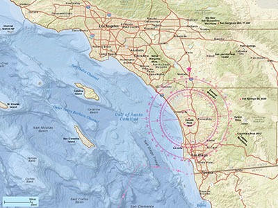
Fig. 10. Regional map of Southern California |

Fig. 11. Satellite map with mountain peaks of San Diego Co. |
|
A4
Regional Geology
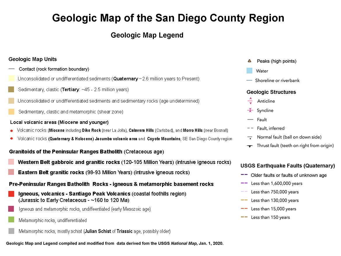
Figure 12 is a regional geologic map that covers the same area as Figure 11. Figure 13 is the geologic map legend that goes with the map.
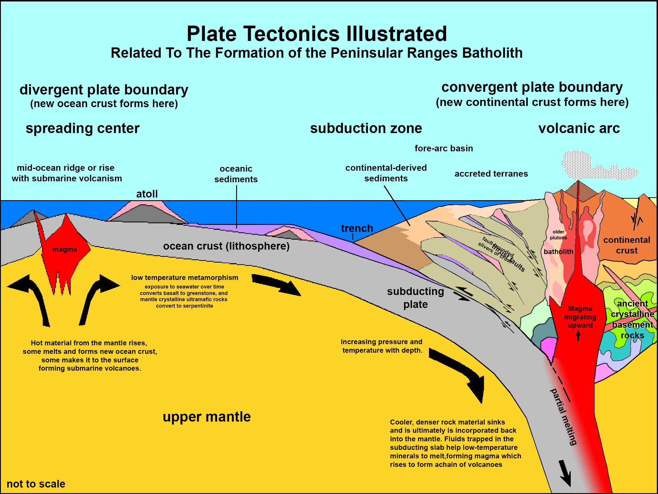
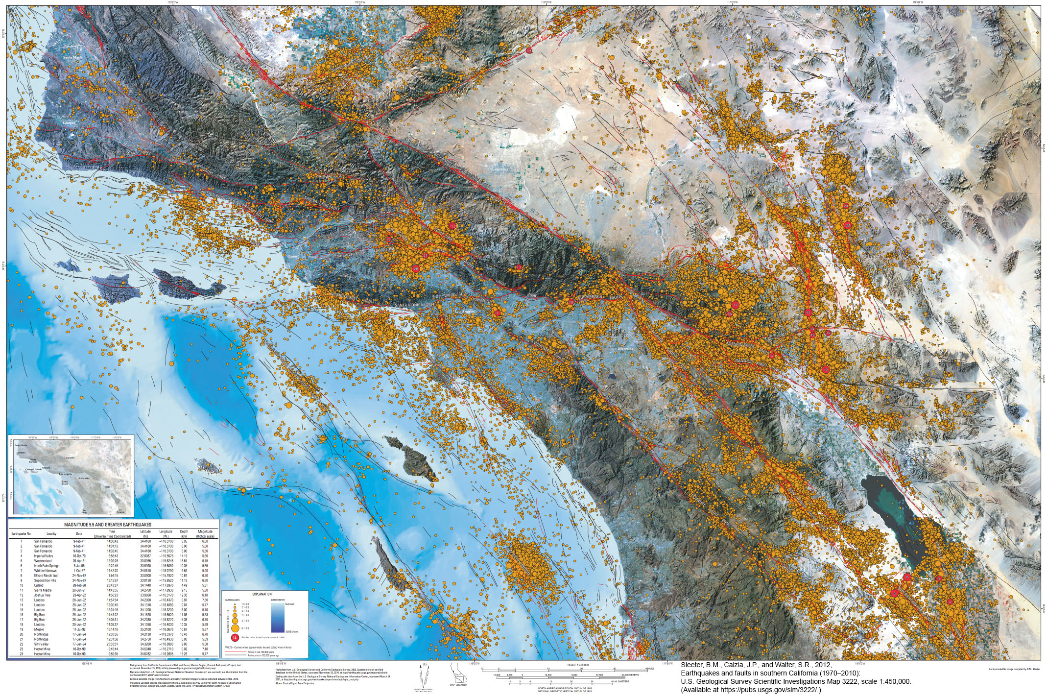
It seems somewhat hard to imagine that only about 200 million years ago the location where Double Peak Park currently resides was probably hundreds of miles from the continental coastline in a deep-ocean setting. The rocks we see today had not yet formed, and those that did exist then have moved elsewhere or were destroyed or altered into other forms. Figure 14is a generalize diagram showing a plate tectonics model for Southern California during the Mesozoic Era. It was in geologic setting like these that geologists interpret how the rocks we see today formed. Figure 15 is an earthquake map of Southern California showing the location of earthquake faults and the epicenters of earthquakes over a 40 year period (1970 to 2010). Note that Double Peak is not associated with any earthquake faults or significant earthquakes in close proximity.
|
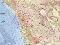
Fig. 12. Regional geologic map with mountain peaks. |
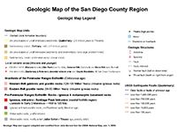
Fig. 13. Legend for the regional geologic map. |
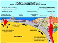
Fig. 14. Plate tectonics model for Mesozoic Era in California |
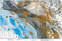 Fig. 15. Earthquake map of Southern California with major earthquake faults. Fig. 15. Earthquake map of Southern California with major earthquake faults. |
|
A5
Bedrock Geology In The Double Peak Area
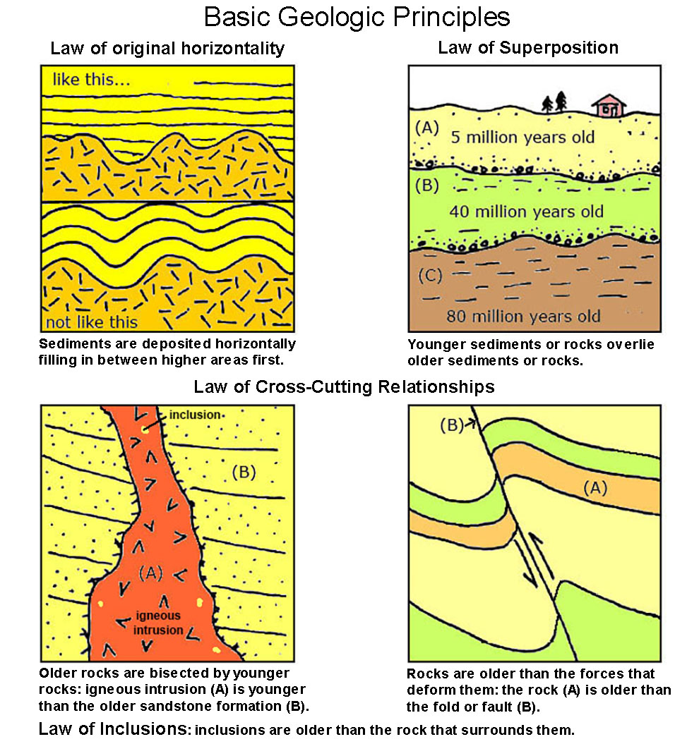
The exact age of the oldest rocks in San Diego is not clearly known in many locations—they are not exposed and/or have not been analyzed by absolute dating methods (such as analyzing the amount of decay the radioactive elements in minerals). We do know that that they vary in age considerably (based relative dating methods—using the basic geologic principles (laws) of superposition, original horizontality, cross-cutting relationships, and inclusions, Figure 16).
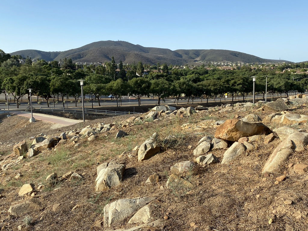
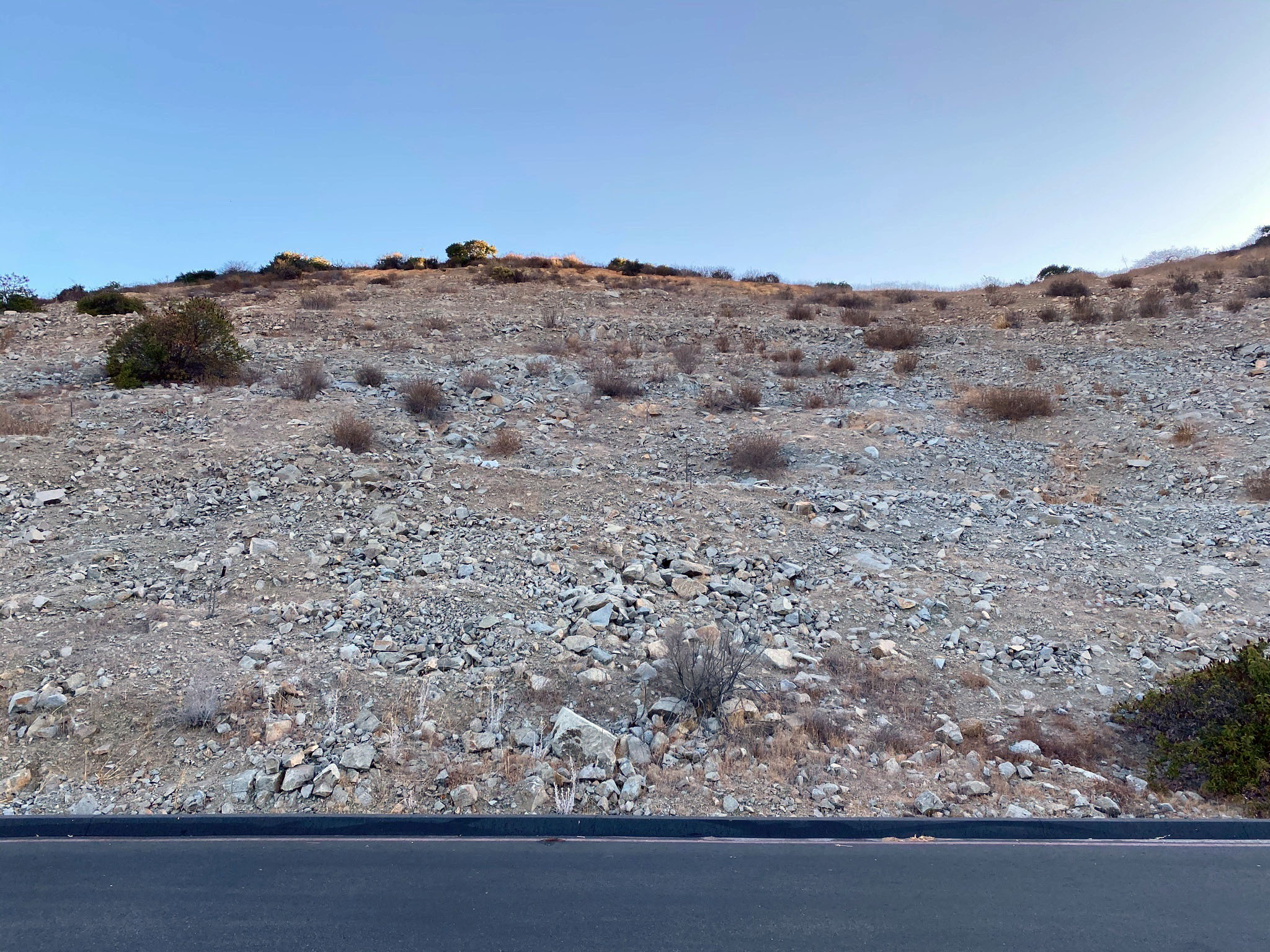
Unfortunately (for geology-minded folks) there are very few accessible exposures of bedrock on the chaparral-covered mountainsides on and around Double Peak (Figure 17). Figure 18 shows an area of exposed granitic bedrock on the CSU San Marcos campus with a view of the Double Peak and area—the Cerro de las Posas ridgeline extends from Double Peak (center left) to San Marcos Peak (on the right). The bedrock under the mountain is different than the rock on the campus, and this difference translates to how the landscape has developed over time (discussed below).
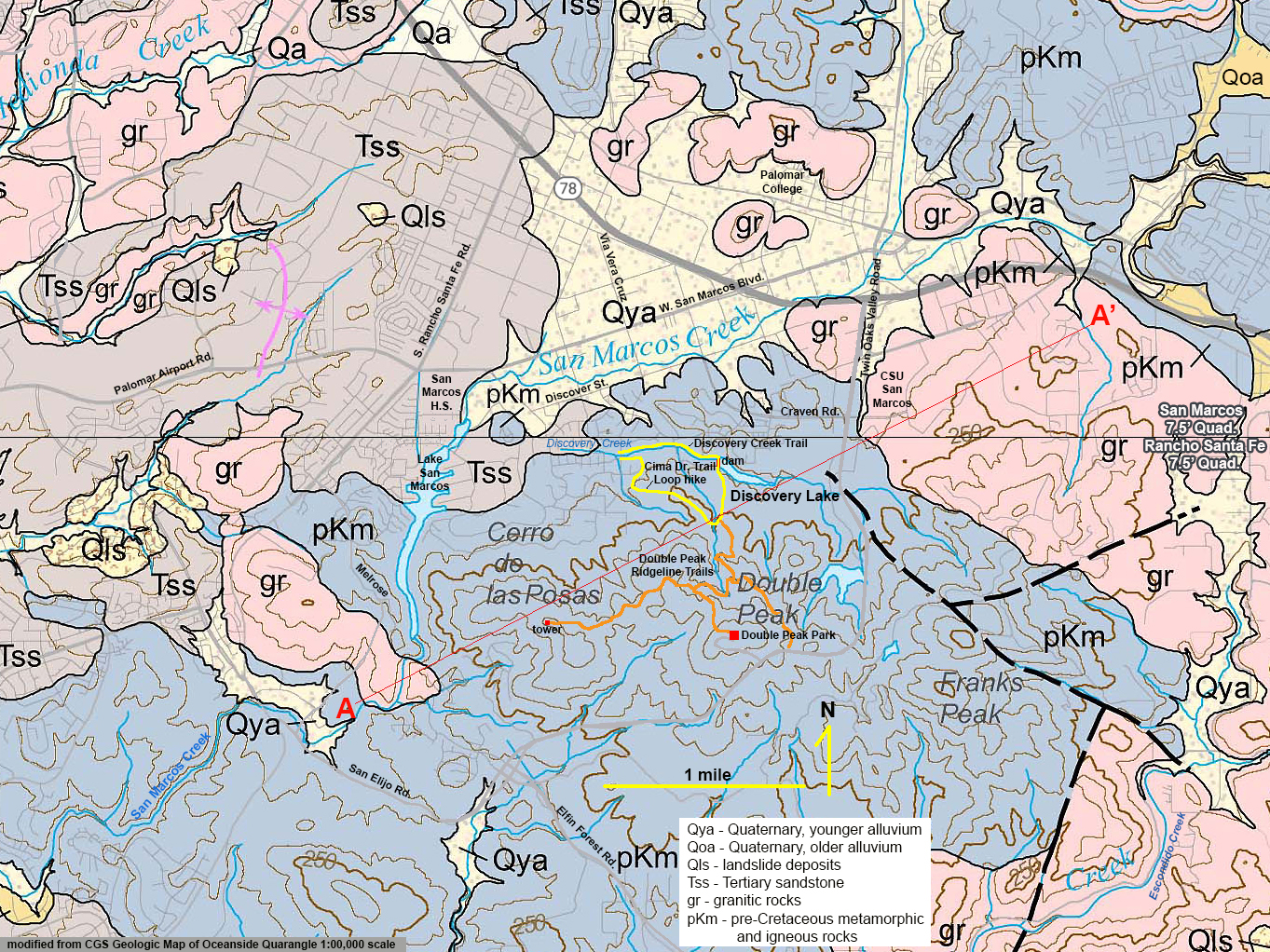
Figure 19 is a more detailed local geology map in the vicinity of San Marcos and the Double Peak/San Elijo Hills area. Figure 20 is a generalized east-to-west cross section of the Double Peak area (shown as A-A' on the geologic map). |
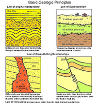
Fig. 16. Basic geologic principles used for relative dating. |
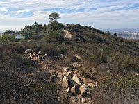
Fig. 17. Bedrock rubble amid chaparral on Double Peak. |
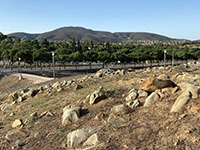
Fig. 18. Cerro de las Posas ridge and CSUSM granite |
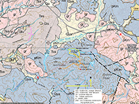
Fig. 19. Detailed geologic map with trails shown. |
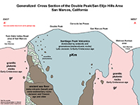
Fig. 20. Generalized cross-section (A-A') on Fig. 19. |
|
A6
Triassic Metamorphic Rocks
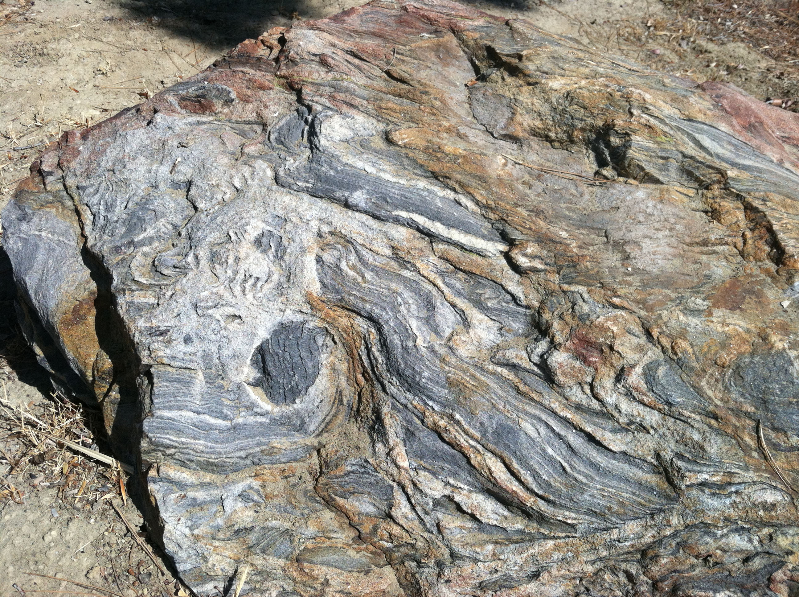
The oldest rocks in the are are exposed in a small area along the Double Peak Trail (roughly halfway up the mountain from Discovery Lake, Figure 21). This small outcrop area consists of highly contorted beds gneiss and schist. These rocks are similar in appearance to rocks of the Julian Schist—a massive rock formation exposed in the high peaks region near Julian and Cuyamaca Mountains region, and into the Box Canyon area of Anza Borrego State Park. The Julian Schist is interpreted to be Triassic age but may contain much older Paleozoic-age rocks. These have been interpreted as being mostly metamorphosed Triassic-age marine sediments that have experience deep burial (associated with subduction-zone-related tectonics, but they escaped being destroyed). Note they are lumped in with the pKm areas on Figure 19.
Jurassic Volcanic Rocks
According the the geologic maps (Figures 12 and 19) the area including Double Peak and the Cerro de las Posas ridgeline are mapped as a massive rock unit named the Santiago Peak volcanics. The geologic maps show regions where the Santiago Peak volcanics are exposed: the an orange-peach color on Figure 12, and the blue-gray color on the geologic map (Figures 19) and and cross section (Figure 20) where are areas where Santiago Peak volcanic rocks are exposed. These rocks are labeled pKm on both the map and cross section. These rocks are named after volcanic rocks of similar age and composition exposed in the Santiago Peak area of the Santa Ana Mountains in Orange County, CA. The Santiago Peak volcanics have been interpreted to be of Late Jurassic to Early Cretaceous in age (roughly between 160 to 120 million years). They are interpreted as volcanic rocks associated with an ancient island arc system. This island arc was probably not attached to the North American continent when it was actively forming.
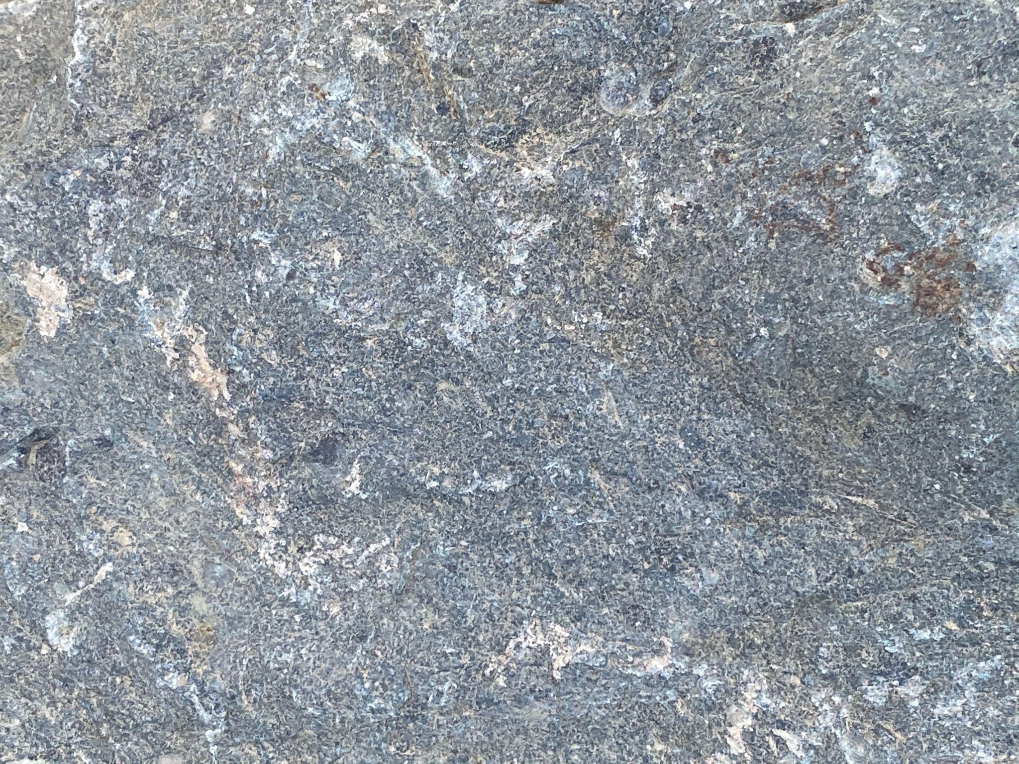
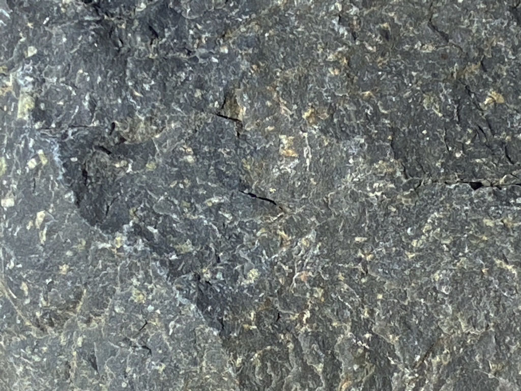
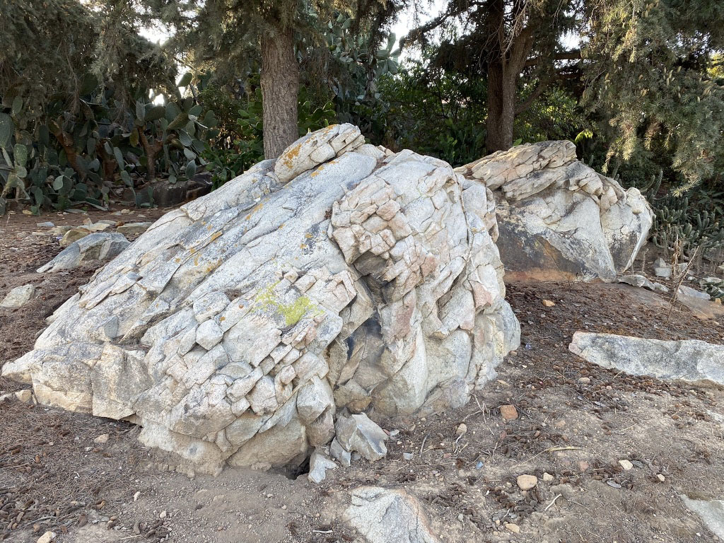
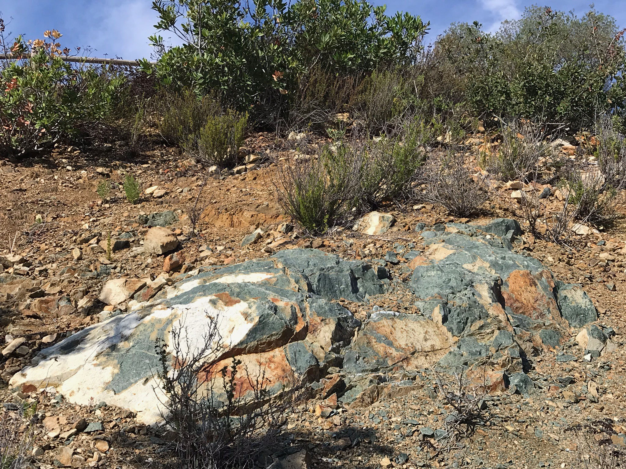
Figures 22 and 23 show the largest natural outcrop area near the top of Double Peak. The rock appears to be greenstone—a low-grade metamorphic rock formed from the alteration volcanic rocks—such as ancient seafloor volcanic rock that has exposed to seawater for a long time. Greenstone can form from the alteration of a variety of igneous rocks (illustrated below). The rocks in this outcrop display a pillow-like appearance. This might only be a weathering feature. However, is also has the physical appearance of a volcanic rock formed from lava that erupted onto the seafloor associated with submarine volcanoes Note that this is only an interpretation based on pillow lavas of similar age in other locations in California's Coast Ranges.
Figure 24 shows a large belt of exposed pKm bedrock on western flank of San Marcos Peak. Rocks of the Santiago Peak volcanics are illustrated below.
|

Fig. 21. Gneiss-schist along the Double Peak Trail. |
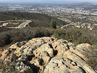
Fig. 22. Greenstone outcrop on west side of Double Peak. |
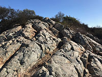
Fig. 23. Pillow-like greenstone weathering features. |
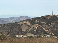
Fig. 24. Microwave tower on the top of San Marcos Peak. |
|
A7
Extrusive Igneous Rocks (Volcanic Rocks) on Double Peak
Ancient volcanic rocks make up the core of the Double Peak/San Marcos Peak ridgeline. The are part of the Santiago Peak volcanics (pKm).
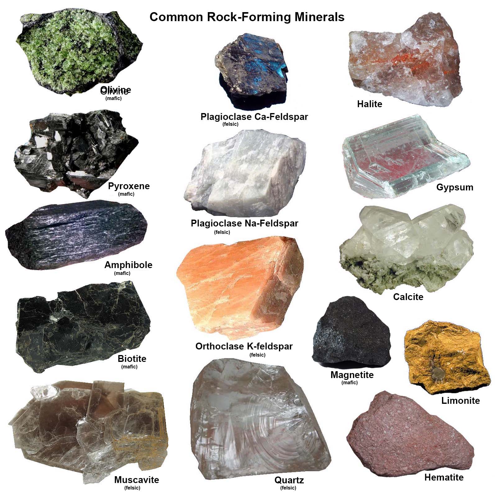
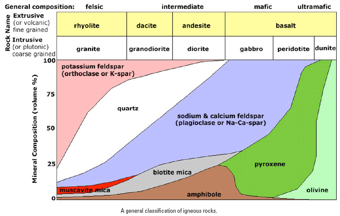
Figure 25 shows the common rock-forming minerals. Some of these are abundant in the local rocks. Figure 26 shows the mineral composition of various kinds of igneous rocks (both intrusive [plutonic] and extrusive [volcanic] varieties). Note that the basic difference between intrusive and extrusive igneous rocks is the size of the mineral grains. Volcanic rocks form when lava cools very quickly and doesn't have time for large crystals to form as they extrude at or near the surface (or on the bottom of the ocean). So, volcanic rocks are basically characterized by their color (Figure 27).
Figure 28 and 29 show examples of unaltered andesite and basalt exposed on Double Peak and along the Cerro de las Posas ridgeline. Andesite gets its name as the dominant rock found in the South American Andes volcanic chain. Basalt is the common rock you see on Hawaiian volcanoes. |
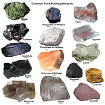
Fig. 25. Common rock-forming minerals. |
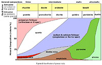
Fig. 26. Mineral composition of intrusive and extrusive igneous rocks. |
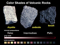
Fig. 27. Volcanic rocks classed by color and shade of gray. |
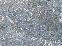
Fig. 28. Andesite from Double Peak (the most common rock). |
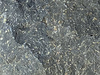
Fig. 29. Andesite bordering on basalt from Double Peak. |
|
A8
Inclusions in Volcanic Rocks
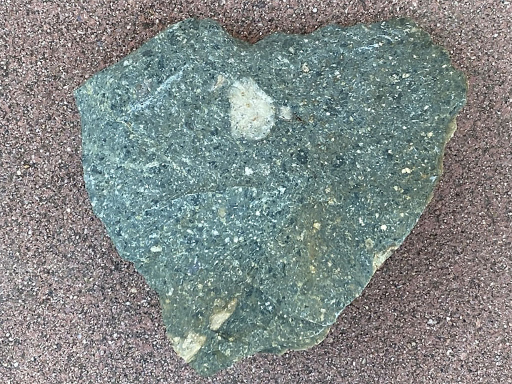
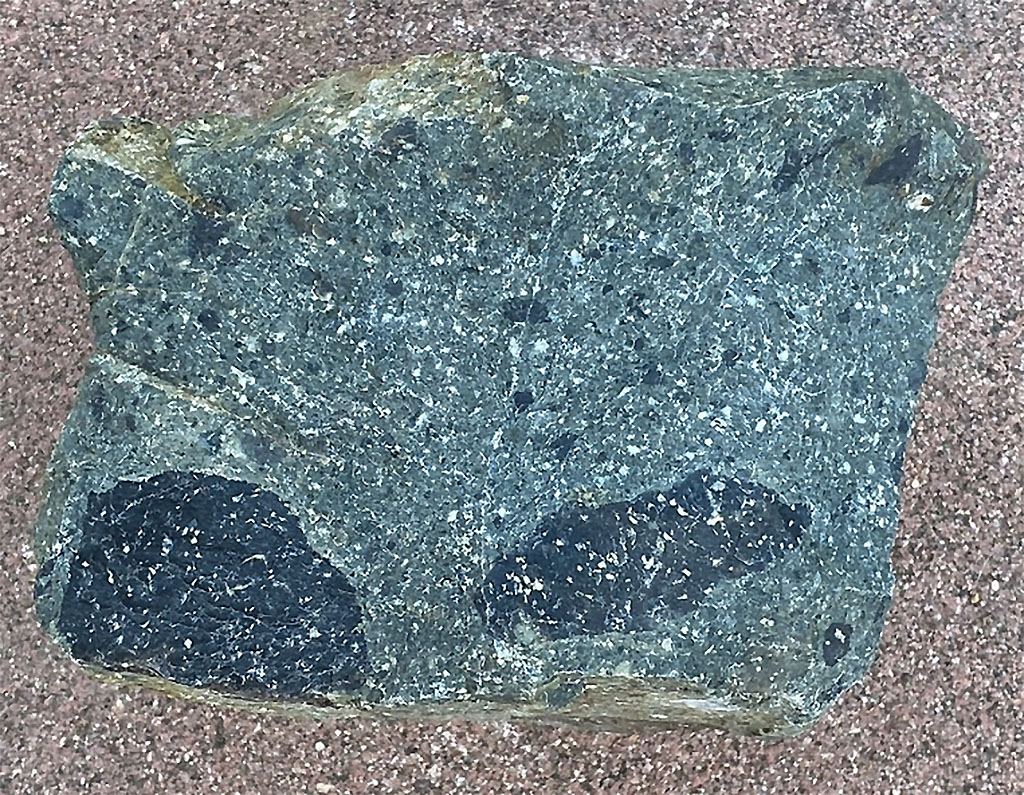
As magma rises to the surface it forces (or melts) its way through pre-existing rocks. Sometime pieces of those rocks break free and are carried along with the magma. Those fragments are called inclusions (or xenoliths, meaning foreign rocks). Inclusions can sink into magma from above or may be carried up from deep below, even from the mantle. Figures 30 and 31 show inclusions of different kind of rock found on Double Peak (including fragments of granite and basalt). Figure 32 shows a gray andesite inclusion that is surrounded by a white chill zone that affected the surrounding lava/magma as it cooled and crystallized. This light-colored volcanic rock might best be called dacite. Dacite is intermediate in composition and color between rhyolite and andesite. Andesite and dacite are the most common volcanic rocks found in the Cascades Range volcanic chain extending from northern California to British Columbia.
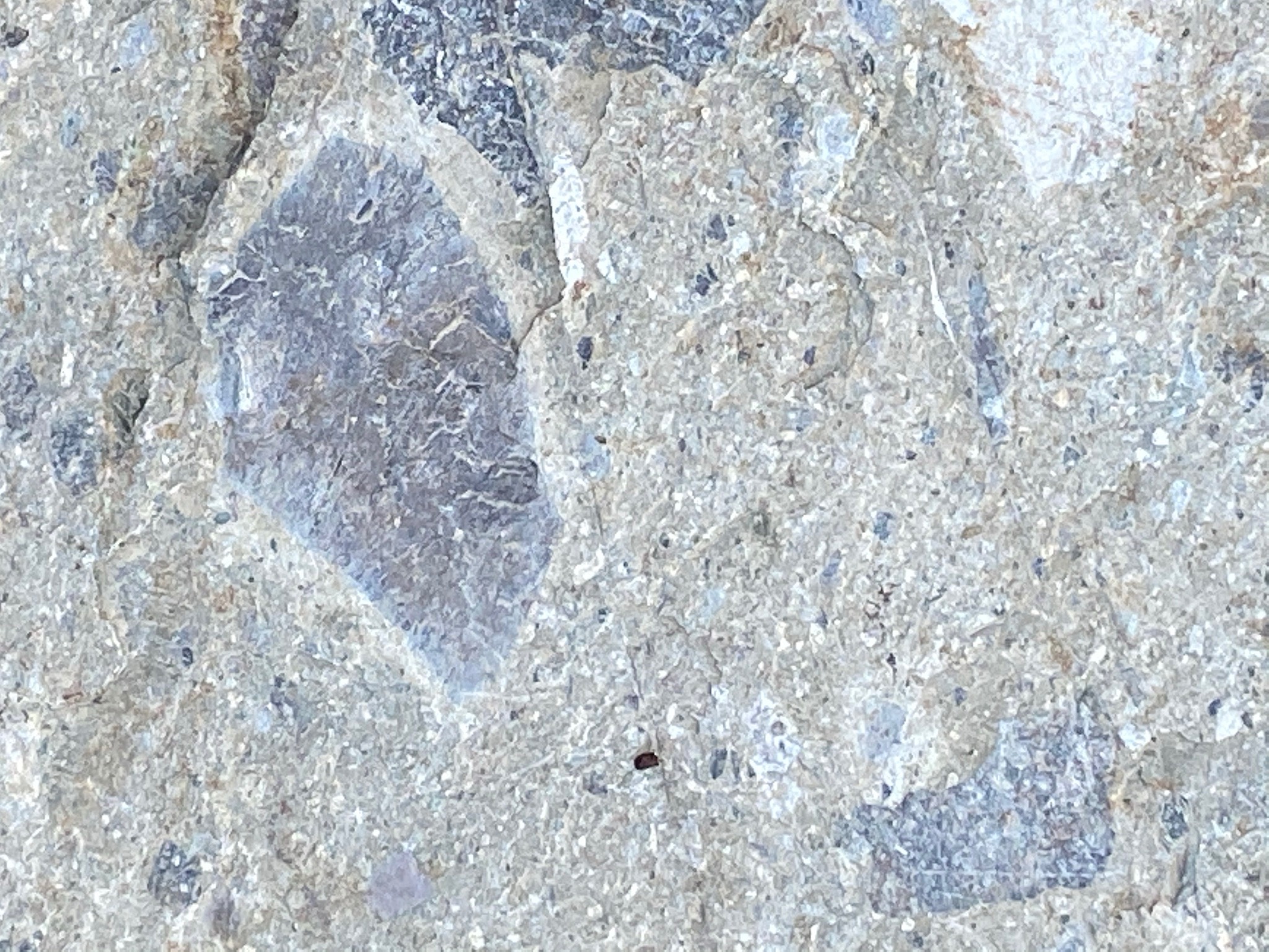
Some of the rock on Double Peak is volcanic breccia, a rock made up almost completely of broken-up volcanic rock fragments. These are rocks that may have been blasted out of a volcanic eruption, either on land or on the seabed. Figure 33 shows one of the more interesting examples of a volcanic breccia. In this image you can see an abundance of rock fragments cemented together. The largest fragment on the right has lots of tiny crystal-filled cavities lined up in rows. These are called amygdales, which generally occur in extrusive igneous rocks, that are filled with secondary minerals, most commonly quartz, calcite, and other minerals (some with crystals like tiny geodes). The small rounded features in the rock are lapilli that form when droplets of molten rock solidify in the air or in contact with water. Some appear hollow like tiny bubbles in glass. This rock appears white because it was silicified with dark minerals removed by secondary metamorphic processes. |
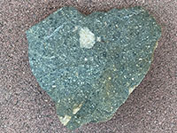
Fig. 30. Andesite (greenstone) with a granite inclusions.
|

Fig. 31. Andesite (greenstone) with basaltic inclusions.
|
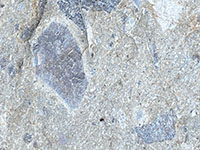
Fig. 32. Dacite with granitic inclusions. |
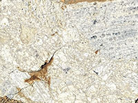
Fig. 33. Silicified lava/breccia with amygdales (tiny geodes). |
|
A9
Cretaceous Granitic Rocks
The peak of igneous activity in the western part of San Diego County region occurred in Early Cretaceous time, roughly 120 to 105 million years ago with the formation of the Western Belt of the Peninsular Ranges Batholith. A batholith consists of series of large igneous plutons that extend deep into the crust and have formed over time in association with an ancient volcanic arc. These granitic rocks are expressed as pink colors on the regional geologic map (Figure 12). These rocks occur along the margins of the Double Peak area (Figures 19 and 20, with gr symbol). They are illustrated below in the discussion on Intrusive Igneous Rocks (Plutonic Rocks) below.
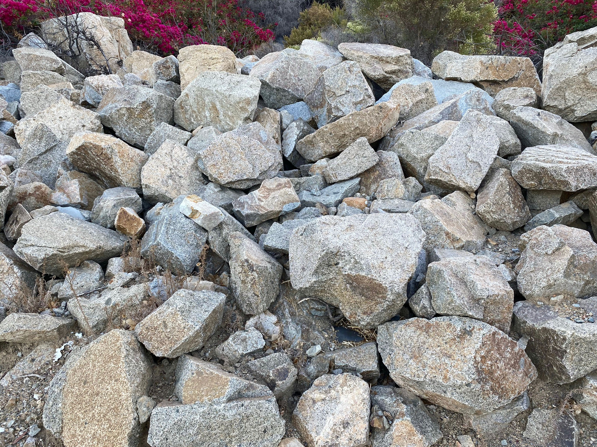
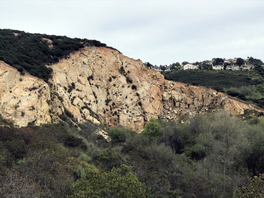
The easiest place in the area to see granitic rocks is on the CSU San Marcos campus (Figures 34, 35, and 36). An abundance of the granitic bedrock was quarried and used in the landscaping of the campus.
Another granitic rock exposure is along San Marcos Creek near Melrose Avenue (Figure 37). |

Fig. 34. Natural granitic outcrop on CSUSM campus. |
Fig. 35. CSUSM parking area in a quarry/cut on campus. |
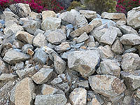
Fig. 36. Boulders used in landscaping of the campus. |

Fig. 37. Exposure of granitic rock along Melrose Avenue. |
|
A10
Intrusive Igneous Rocks (Plutonic Rocks) in the Double Peak Vicinity
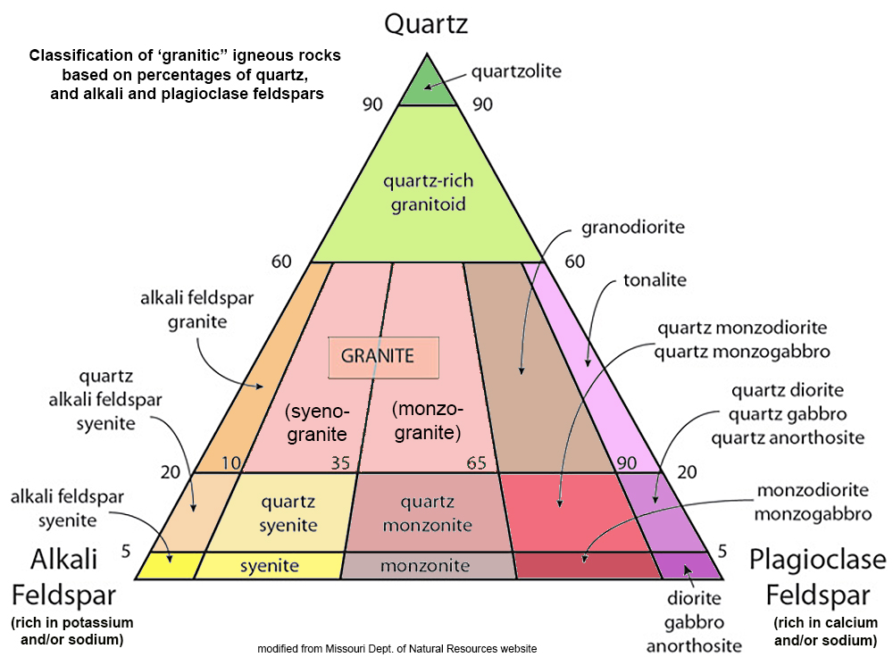
Ancient plutonic rocks are exposed along the margins of the Double Peak uplands (labeled as gr on Figures 19 and 20). These formed as large bodies of molten rock migrated upward from their sources deep in a subduction zone to where the eventually crystallized into rock, forming plutons (see Figure 15). A pluton is a body of intrusive igneous rock. Plutons cool deep below the surface where they are well insulated by the surrounding rocks. This give the material more time to crystallize slowly, allowing larger, visible crystals to form.
All the examples below are close-up images on rocks on CSU San Marcos campus. Figure 38 illustrates a commonly used classification diagram for granitic intrusive igneous rocks based on percentages of quartz and feldspars. In the examples below, note that the abundance of dark, mafic mineral grains also plays a roll in naming intrusive igneous rocks. Figure 26 (above) also shows the abundance of mafic minerals used in naming intrusive rocks.
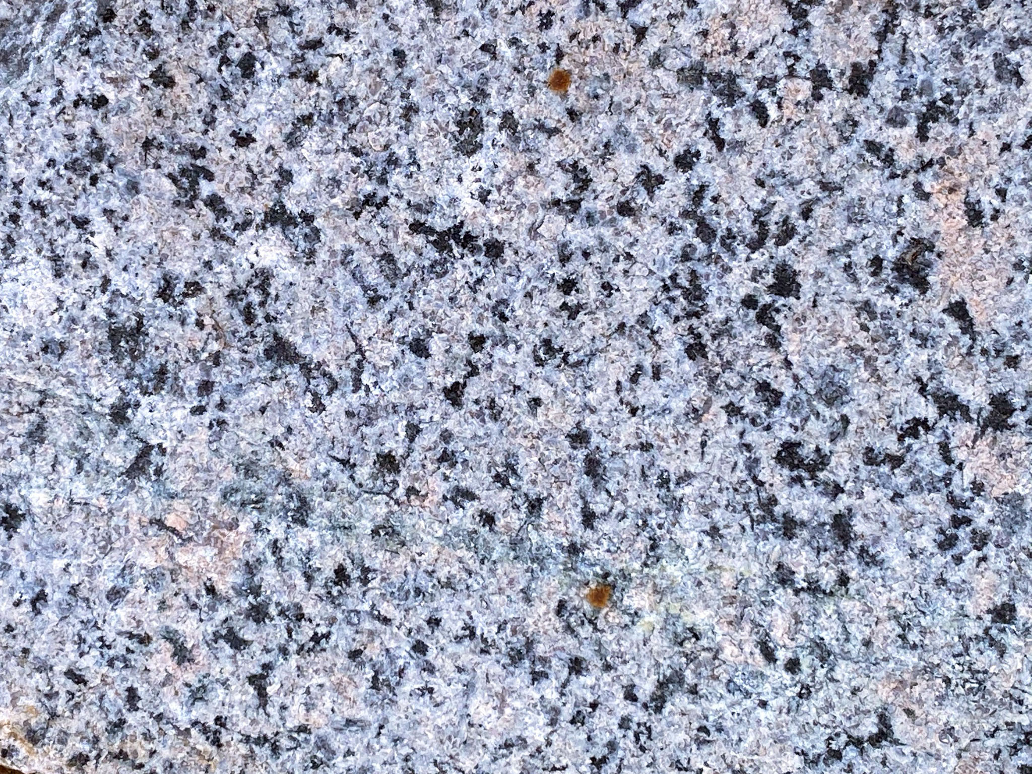
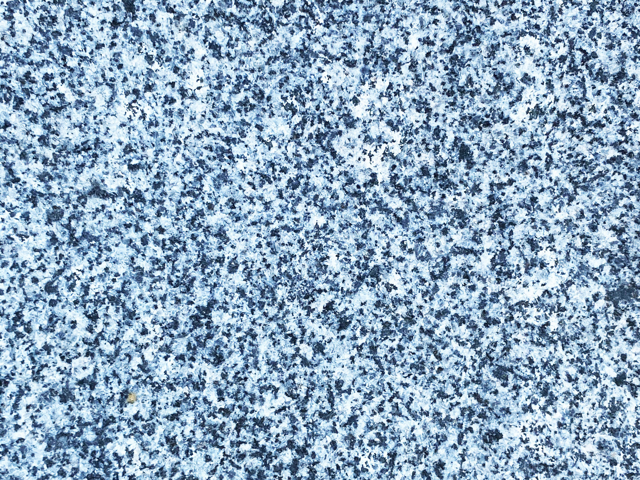
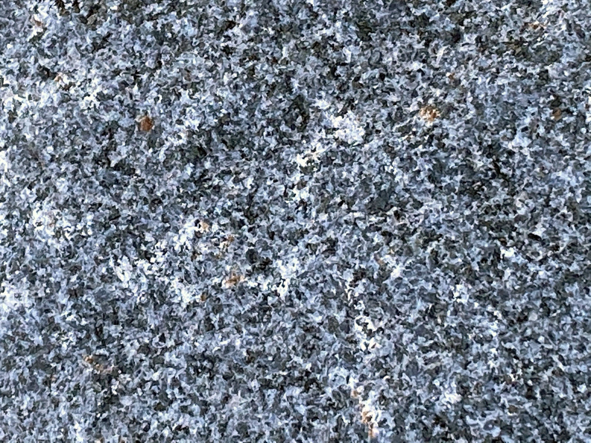
Figure 39 illustrates what is close to a true granite. It has about equal amounts of quartz and feldspars (both pink K-spar and white Na-Ca spars). Compare to the other varieties of granitic rocks—granitic, meaning it is crystalline and looks like granite). Perhaps the most common intrusive igneous rocks in San Diego's Peninsular Ranges is quartz diorite, or tonalite (Figure 40). Diorite is an intrusive igneous rock made up mostly of white feldspar, a trace of quartz, and an abundance of mafic minerals that give it a salt and pepper mix appearance. In some areas, gabbro is the most abundant granitic bedrock (Figure 41). It is generally much darker due to more mafic minerals; it also contains plagioclase feldspar, and generally lacks any quartz at all.
|
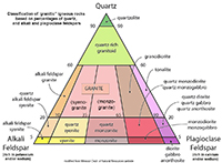
Fig. 38. Classification of granitic igneous rocks. |
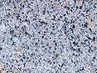
Fig. 39. Granite (with pink and white feldspars dominant). |

Fig. 40. Quartz diorite (with a salt and pepper appearance). |
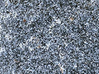
Fig. 41. Gabbro (dark because of abundant mafic minerals). |
|
A11
Inclusions and Intrusion in Grantitic Rocks
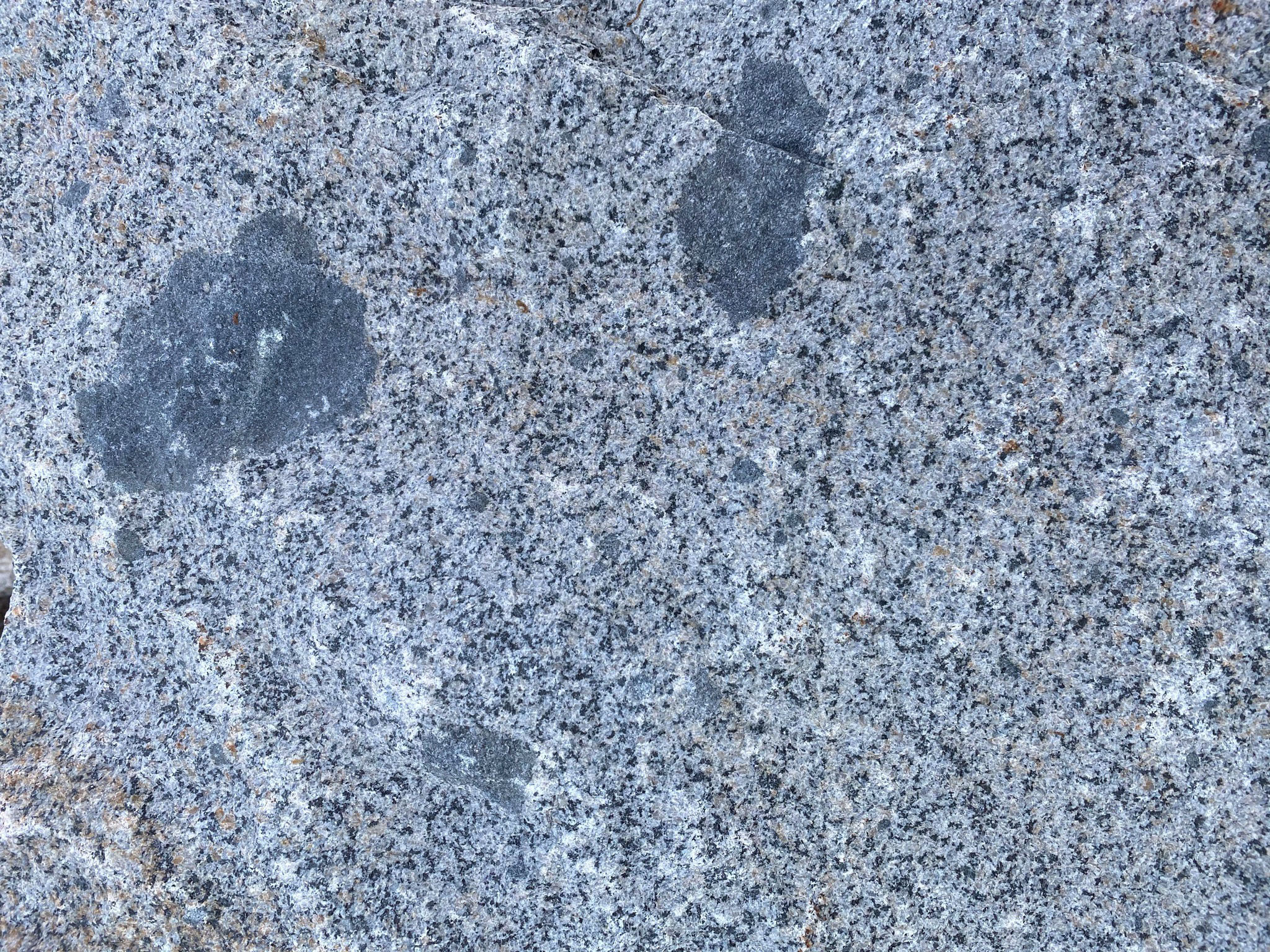
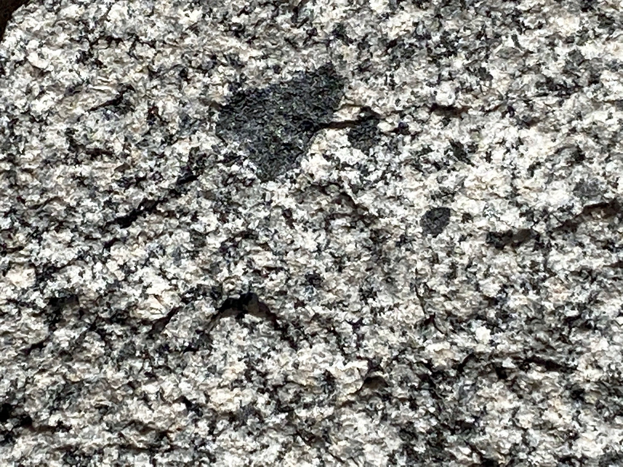
Just like the volcanic rocks above, the plutonic rocks often display inclusions. The inclusions typically consist of darker rock fragments made up of mafic minerals. The reason may be that they contain high-temperature minerals that would otherwise easily melt and become incorporated in the host magma. Figure 42 shows gray, fine-grained andesite inclusions in tonalite. Tonalite is one of the most common granitic crystalline igneous rocks in the Peninsular Ranges batholith rocks. Figures 43 shows basalt inclusions in granite.
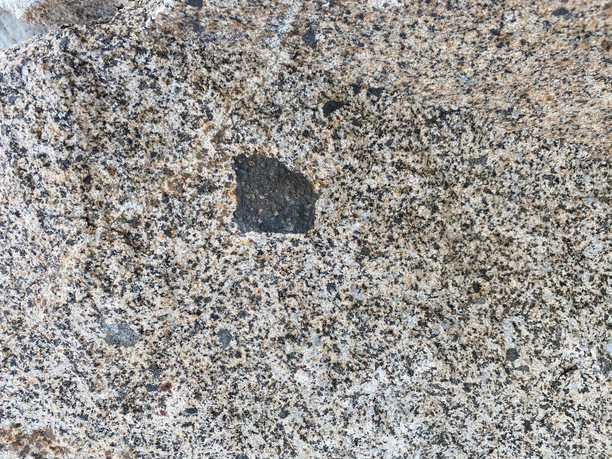
Figure 44 shows a crystalline black inclusion composed mostly of pyroxene, a mafic mineral that is commonly associated with some mantle rocks. Sometimes inclusions of high-temperature minerals are carried upward with migrating magma from very deep within the lithosphere.
Figure 45 shows a boulder light-colored fine-grained granitic intrusion cutting through a darker tonalite. The law of cross-cutting relationships shows that the granitic intrusion is younger than the surrounding tonalite. The intrusion probably formed in the late stages of a cooling pluton. As plutons cool, the rock shrinks and fissure form where late-stage magma may be injected. Low-temperature minerals include quartz and some feldspars tend to be light colored and are the last to crystallize as magma turns into stone. |
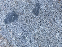
Fig. 42. Andesite inclusions in tonalite. |
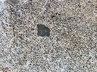
Fig. 43. Basalt inclusion in granite. |

Fig. 44. Pyroxene-rich gabbro inclusion in tonalite. |
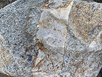
Fig. 45. A granite dike cutting through tonalite. |
|
A12
Post-Cretaceous History
The first evidence of major igneous activity preserved in the rocks of the Peninsular Ranges began in the Jurassic Period, starting about 160 million years ago. Over time, the igneous activity shifted eastward. By Late Cretaceous time (about 90 million years ago) all igneous activity associated with subduction and formation of a volcanic arc associated with the Peninsular Ranges batholith had ceased in the San Diego region. Subduction-zone-related igneous activity and had move much farther eastward into the Great Basin region.
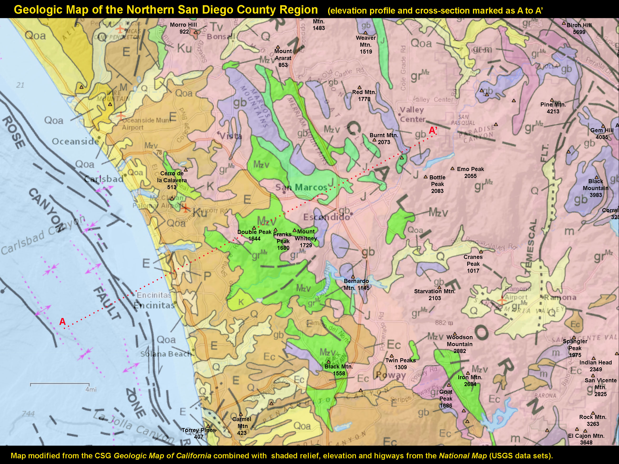
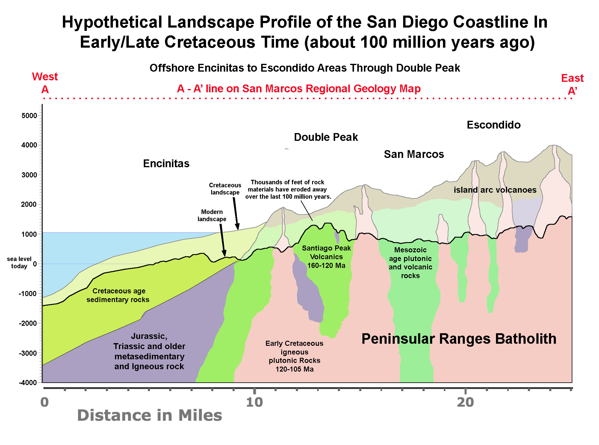
The large belt of volcanoes that probably still covered the landscape in early Late Cretaceous time all slowly eroded away, leaving behind the eroded surface of the batholith core rocks and some of the metamorphosed sedimentary and volcanic rocks that predated them. Figure 46 is a geologic map of the northern part of the coastal region of San Diego. Line A - A' on the geologic may shows the trace of a hypothetical series of cross-section showing how the landscape has changed over the last 100 million years. Figure 47 shows the landscape features that may have existed about 90 million years ago (in Late Cretaceous time) when the subduction zone and associated formation of the Peninsular Ranges batholith was winding down. Large volcanoes may have existed on the landscape with possibly thousands of feet of rock that existed above the level of the modern landscape profile.
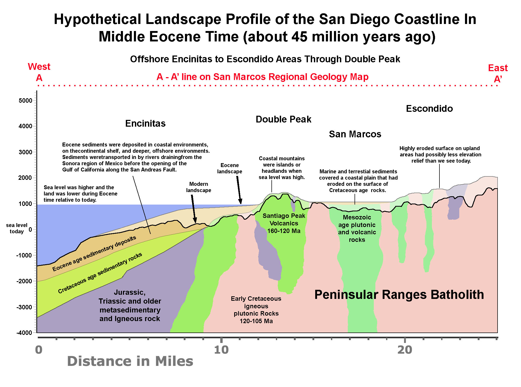
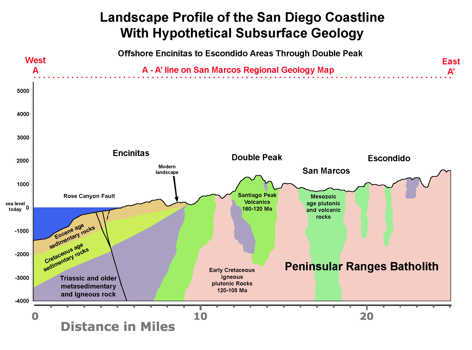
Figure 48 shows how the landscape had changed by about 45 million years ago (Middle Eocene time). By Middle Eocene, most of the volcanic landscape had been worn down by erosion. At the time, the region that would become San Diego County was still attached to the continental landmass in what is now the Sonora region of northwestern Mexico (the Gulf of California did not exist yet). Rivers carrying sediments from the Sonoran Highlands drained all the way to the San Diego coastline. Figure 49 shows how the landscape profile appears today.
|
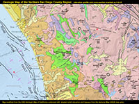
Fig. 46. Geologic map of the North County region with elevation profile line, A-A'. |
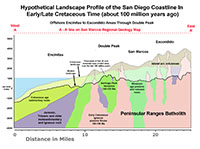
Fig. 47. Hypothetical coastal cross section of the North County in Cretaceous time.
|
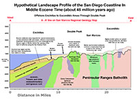
Fig. 48. Hypothetical coastal cross section of the North County in Eocene time.
|
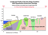
Fig. 49. Hypothetical coastal cross section of the North County with elevation profile.
|
|
A13
Tertiary Transgressions and Tectonics
By Eocene time, about 45 million years ago, most of the volcanoes had long since eroded away and wave action gradually carved away at the coastline (Figure 48). During periods of high-standing seas, ocean waves were carving away the bedrock creating headlands, islands, shorelines along the base of the coastal mountain ranges. The shallow continental shelf extended all the way eastward across what is now Vista into the San Marcos area.
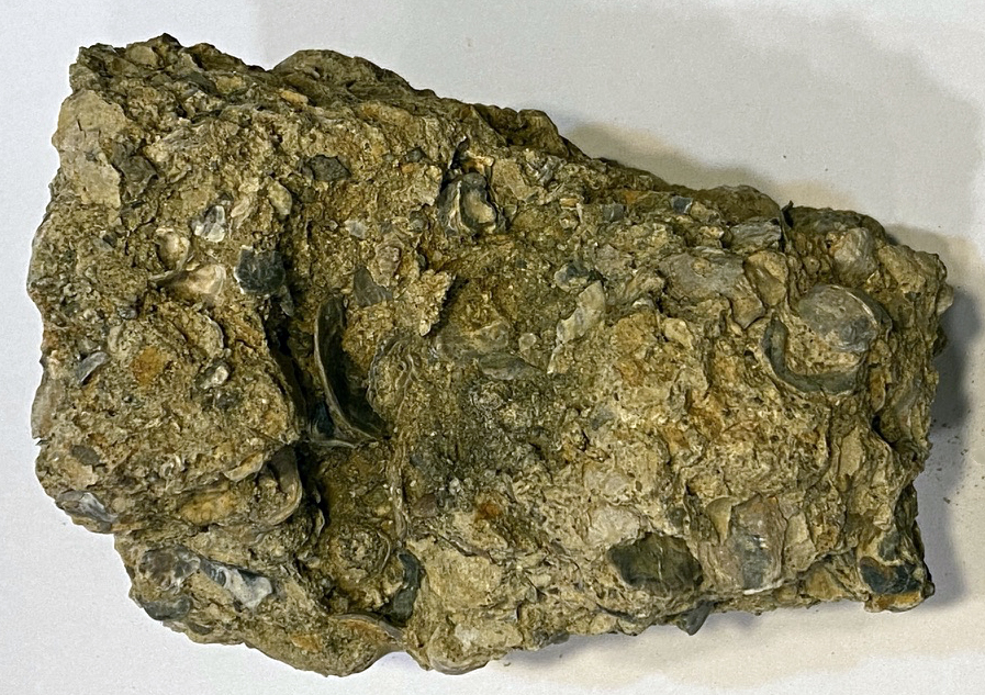
Figure 50 shows a sample of a very fossiliferous, clam-bearing conglomerate of Eocene age (about 45 million years old, or older) that came from bedrock layers in the vicinity of San Marcos High School. The sedimentary layers of Eocene age form a gentle escarpment roughly parallel to the west side of Rancho Santa Fe Road and are about 200 feet thick where exposed. They are shown labeled E (for Eocene sedimentary rocks) on the geologic map, Figure 46. These marine sedimentary beds filled in an embayment that wave action associated with relatively high-standing seas had carved eastward to the base of the San Marcos Mountains. Double Peak and other upland features were headlands and coastal islands when sea level was high. These sedimentary deposit underlie the elevated plateau region extending from San Marcos and Vista to the coastline. |
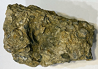
Fig. 50. Fossiliferous clam-bearing conglomerate of Eocene age (about 45 million years) from shallow marine sedimentary beds near San Marcos High School.
|
The San Andreas/SoCal Fault System, and The Opening of the Gulf of California
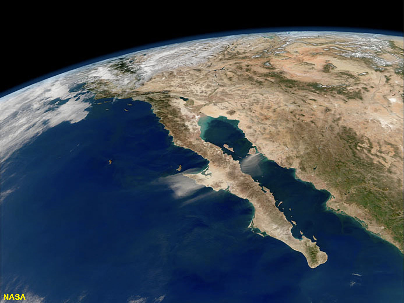
The plate tectonic setting of western North America completely changed as subduction ended roughly about 20 million years ago. At that time, western margin of North America began to split apart as the San Andreas Fault and other faults began to propagate through the region. This resulted in the formation of the Gulf of California and the Imperial Valley region as the great block of crust containing Peninsular Ranges batholith split away from Mexico becoming the Baja Peninsula (Figure 51). In addition, large portions of the west side of the peninsula coastline split away along major faults, resulting on the migration of islands and seamounts we see offshore today of Southern California, including Catalina and San Clemente Islands (see the complex bathymetry in Figure 10). The Rose Canyon Fault and Elsinore Fault are the two mosts active earthquake faults in the coastal region today, and they are responsible for many of the regional landscape features (including the coastline). All the major faults are interconnected.
Over time, tectonic forces and surface erosion continually slowly shape the landscape. Tectonic forces are what cause the land to rise or sink, or shift laterally, causing earthquakes that shatter rocks. Before the San Andreas Fault formed, the tip of Baja California (near Cabo San Lucas) was connected to the Mexican continent near Puerto Vallarta. The distance between those two locations is now over 300 miles (500 km). If you do the math, this means that in the last 20 million years the Peninsular Ranges have been moving northward at a rate averaging slightly more than one inch each year. This means that over a typical period of a million years there are perhaps tens of thousands of major earthquakes in the region.
|
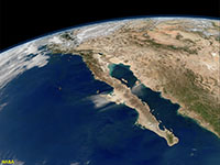
Fig. 51. Satellite view of the Gulf of California and the Peninsular Ranges (extending from the Los Angeles region to the southern tip of Baja California). The San Andreas Fault runs from the Salton Sea area northward through the Imperial Valley and on into coastal Northern California.
|
A14
Evolution of the Modern Landscape
Figure 49 shows the land profile through the Double Peak region as it exists today.
Occasional earthquakes and slow tectonic forces are slowly transforming the landscape. Studies of the marine terraces along the coastline provide evidence that the San Diego coastal region is slowly rising at an average rate of about 0.5 inches a century, probably with halts and starts associated with major earthquake activity. However, it is weathering and erosion associated with climate cycles that are the dominant processes shaping the modern landscape. Climate cycles associated with the glacial periods of the ice ages have been created the greatest changes.
The last high-standing sea levels probably occurred in Pliocene time, about 3 million years ago before the Pleistocene ice ages began. At that time, sea level may have been about 60-80 feet higher than today. Since then, there have been at least 16 major ice ages and interglacial warm periods, possibly more. The end of the last ice age has resulted in some of most dramatic changes that we can see evidence of today.
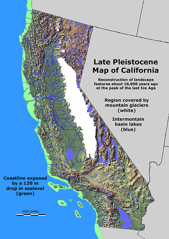
Figure 52 shows what California may have looked like at the peak of the last ice age, about 18,000 years ago. At that time, sea level was about 400 feet lower than it is currently is because massive quantities of water were trapped in the continental ice sheets and glaciers that covered much of North America, Europe, and elsewhere. Although there were no glaciers in the SoCal Peninsular Ranges, the region was much wetter, and dense coniferous forests must have covered the landscape extending all the way to the coastline. The shoreline was along what is now the edge of the continental shelf. The current continental shelf was a coastal plain. Deep canyons existed in the areas where we see lagoons today.
At the end of the last ice age about 11,000 years ago, the climate started to became significantly drier. The forests probably burned away as drought and fire-tolerant plants communities replaced them. Human were living here during this transition, and probably contributed to wildfires and the mass extinction of the many large Pleistocene mammal species that had previously lived in the region.
|
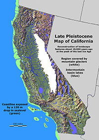
Fig. 52. Map of California as it map have appeared at the peak of the last ice age, about 18,000 years ago. An ice cap covered the Sierras, lakes filled what are now desert basins, sea level was lower, and forests covered most of the landscape.
|
A15
Weathering and Erosion
Rocks undergo weathering at or near the surface (Figure 53). Erosion strips away weathered material and deposits it elsewhere; eventually on the sea floor. However, the rates of weathering and erosion are highly variable from place to place, and results in the mixed topography we see in the region (Figure 54).
The climate cycles of wet, cool seasons versus dry, warm seasons impacts how the landscape changes. During the wet seasons, plant roots expand and water seeps into cracks. Water reacts with the rock surfaces, dissolving minerals and breaking down the rocks. During the dry season, wildfires may sweep through the vegetation leaving fire-scorched soil, rocks, and ash. Rains from infrequent storms after wildfires strip away the loose, soil, ash, and sediment, leaving behind a rocky surface.
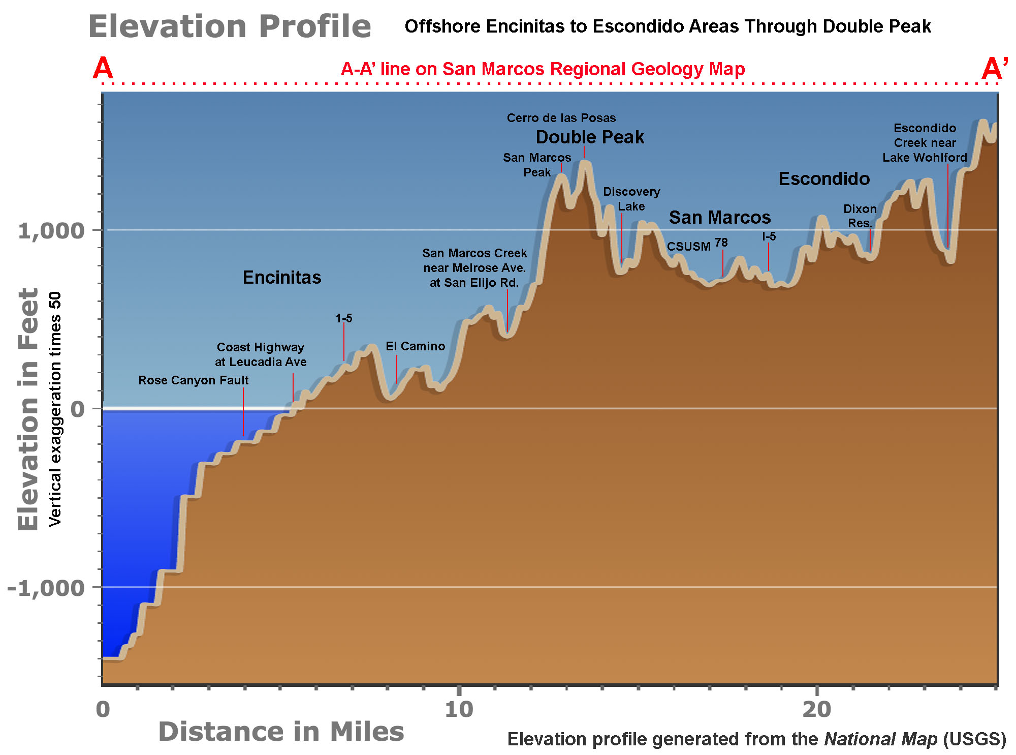
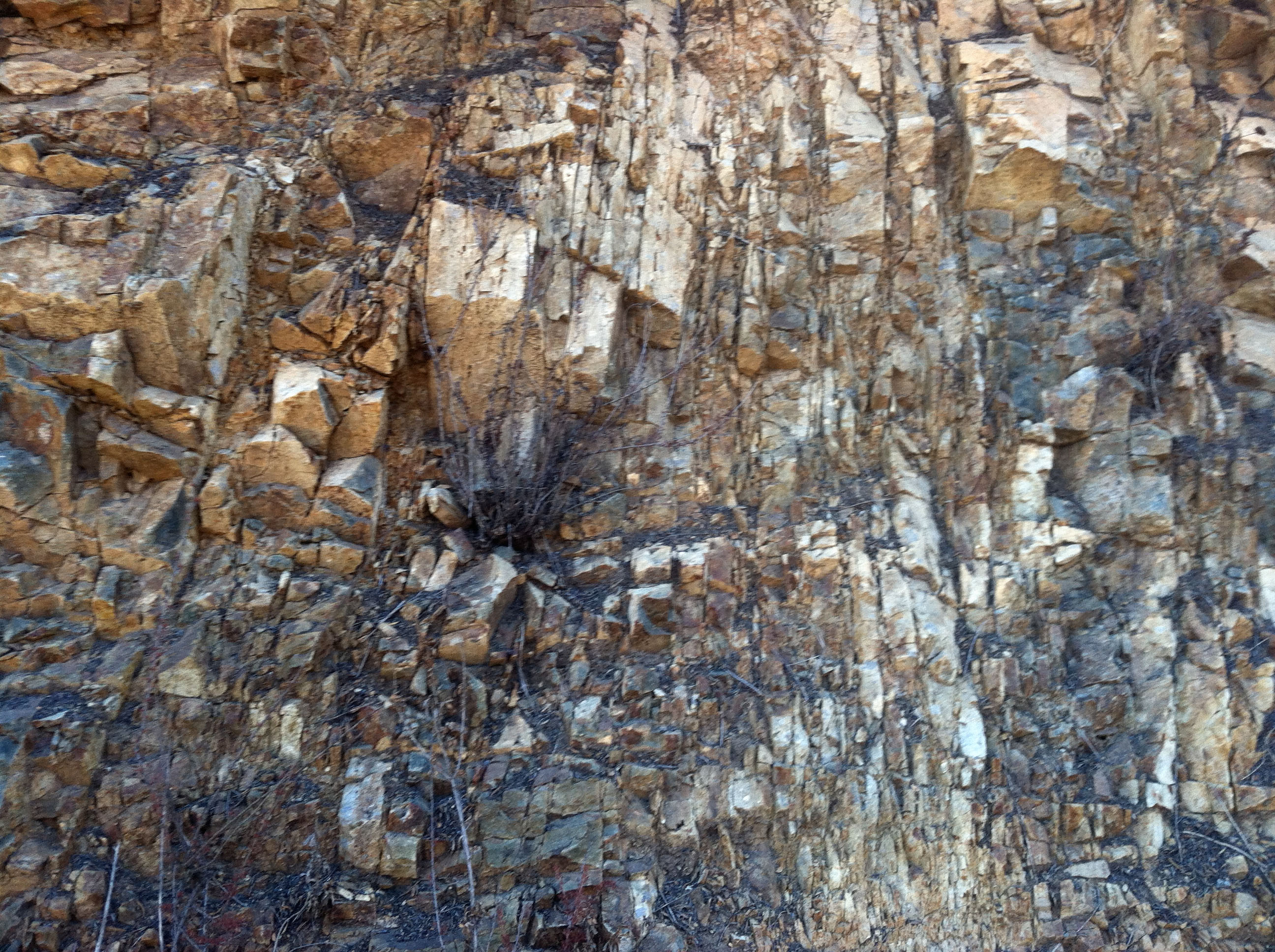
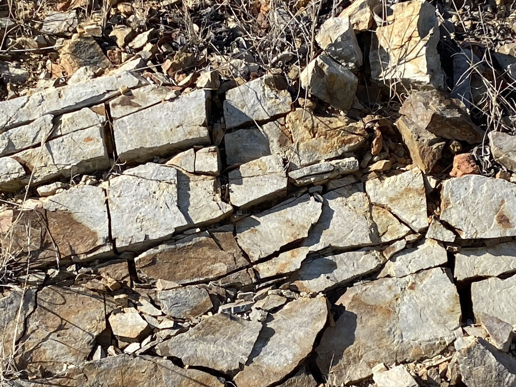
The shape of the landscape is also impacted by differential erosion of the different kinds of bedrock in different areas. Because granitic rocks are crystalline in nature, water can seep into the tiny cracks between mineral grains easier than into the finer-grained volcanic rocks. As a result, the coarser-grained granitic rocks tend to weather and erode faster than the harder, finer-grained volcanic rocks. As a result, the harder, more durable rocks tend to make up the mountainous areas in the coastal region, as illustrated by Double Peak (illustrated by Figure 20). Wherever the local bedrock is exposed you can see that the rocks have been heavily fractured from tectonic forces (stress fractures, faulting, and expansion caused by the release of internal pressure, Figures 55 and 56). Ground shaking during earthquakes push the fractures apart (part of the rumble you hear during an earthquake!).
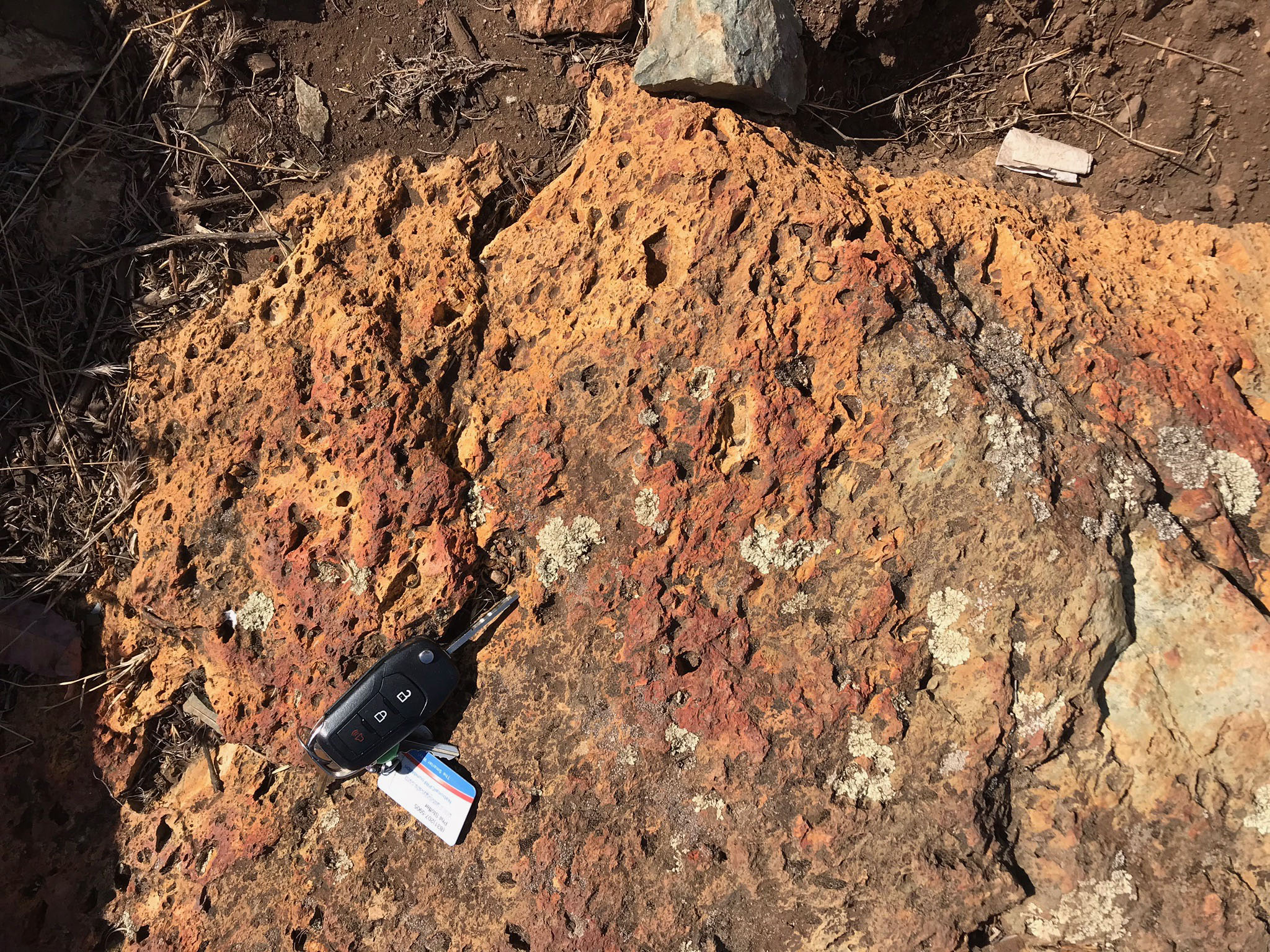
Figure 57 shows a surface of the volcanic rock coated with a hard crust of limonite (rusty-orange) and hematite (red). These mineral surface coatings have a scorched appearance from having been exposed to the intense heat of wildfires. When iron-bearing rocks weather, they can leave behind a residue enriched in the brown mineral limonite (chemical formula: FeO(OH) ∙ nH2O). Limonite coats weathered rock surfaces and contributes the brown color to most soils. Limonite is essentially the same as rust you would see forming on iron object—like an old rusty car. Note that limonite is essentially a combination of iron oxide and water. When you heat limonite it drives off the water, leaving behind the red mineral hematite (chemical formula: Fe2O3). Soil and rock in fire-burn areas often display this red coloration on some surfaces.
Some of the weathered surfaces of the greenstone outcrops have a white patina (a surface coating; Figure 58). This white mineral coating may simply be a crust of white silica (SiO2) or calcite (CaCO3). However, in some locations in San Diego County, white crusty material like this locally contains toxic compounds including arsenic—it was actually mined for sale as a pesticide ingredient on Black Mountain, west of Poway, CA. It might be a good idea not to touch or taste it! |
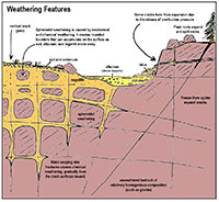
Fig. 53. Weathering features associated with a typical rocky landscape in the San Diego region, particularly in areas of granitic terrain.

Fig. 54. Exaggerated elevation profile for line shown as A-A' on Fig. 46. See also Fig. 49 for comparison to see how bedrock composition affect vertical relief of the landscape. |

Fig. 55. Vertical fractures along the Double Peak Trail. |
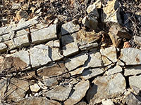
Fig. 56. Fractured bedrock along Double Peak Drive. |

Fig. 57. Limonite/hematite coating of greenstone. |

Fig. 58. A white weathering patina on greenstone outcrop. |
|
A16
Regional Landscape Views From Double Peak Summit Area
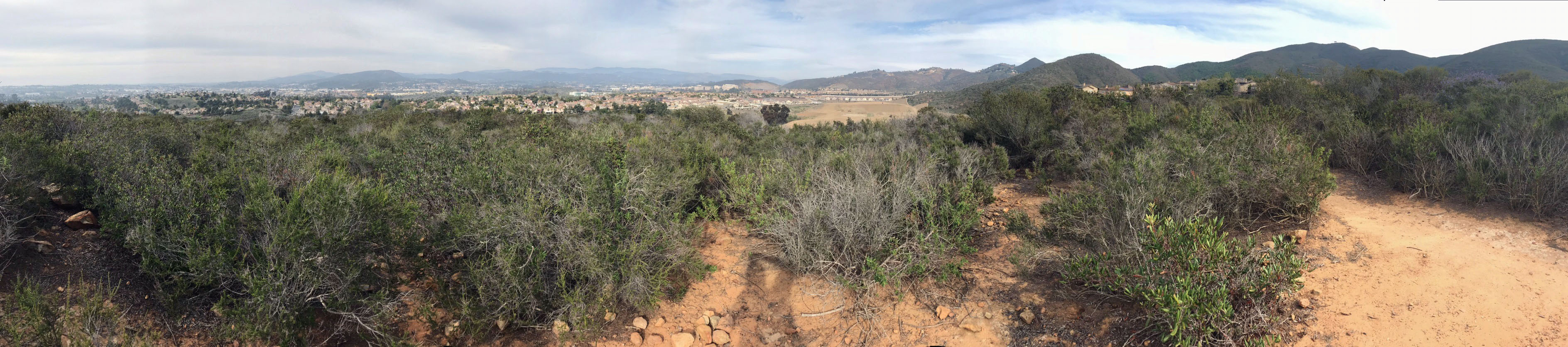
Double Peak Park provides one of the best landscape viewing areas in northern San Diego County. The discussions and images below review the near and distant landscape features visible from the summit area of Double Peak and along the Cerro de las Posas Ridgeline Trail. The three maps presented above are particularly useful for locating and identifying features across the region: (Note that these are large images).
The images and panoramic view presented below give a 360° tour of landscape features in the region.
|
A17
Views to the North and East
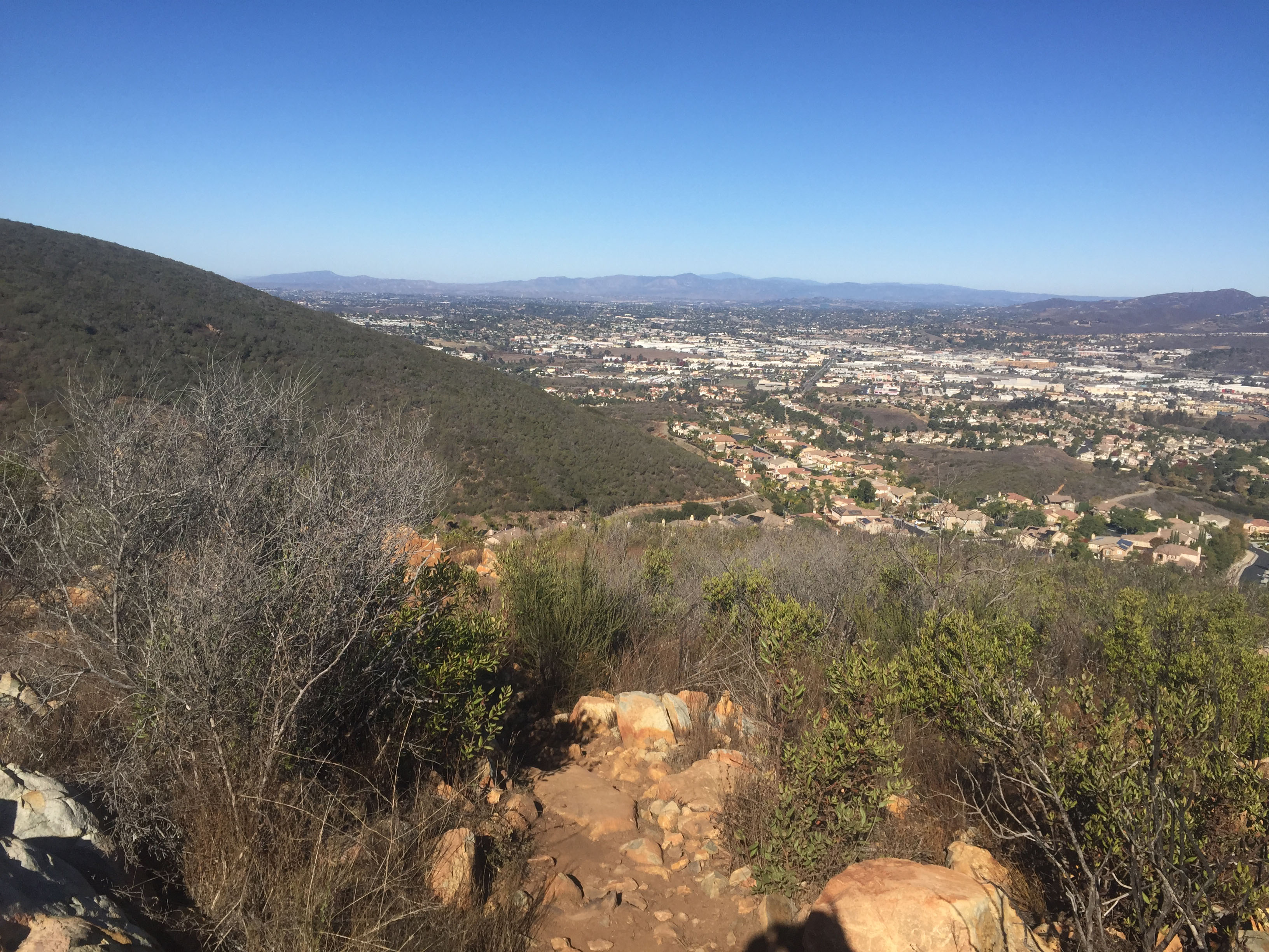
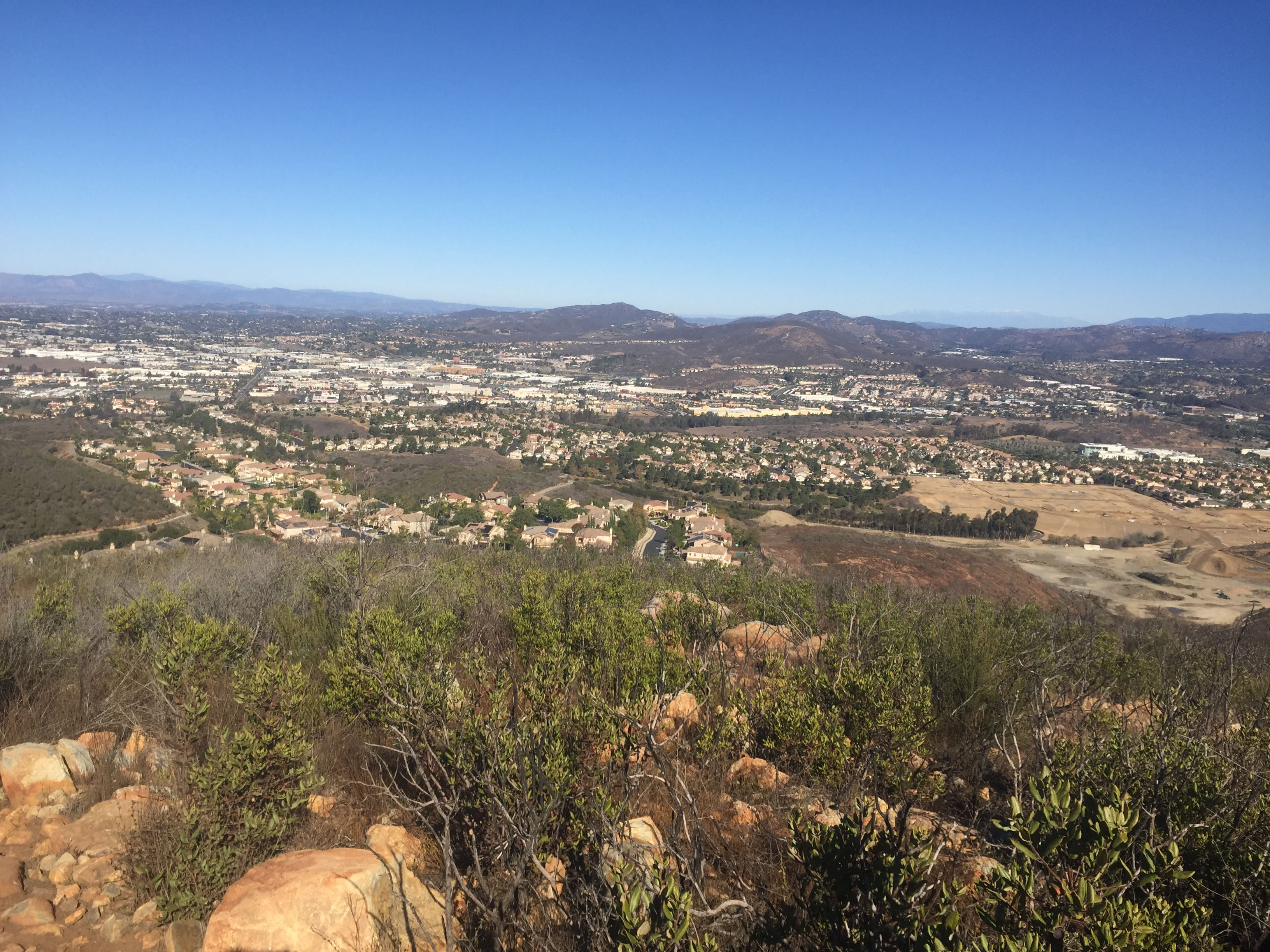
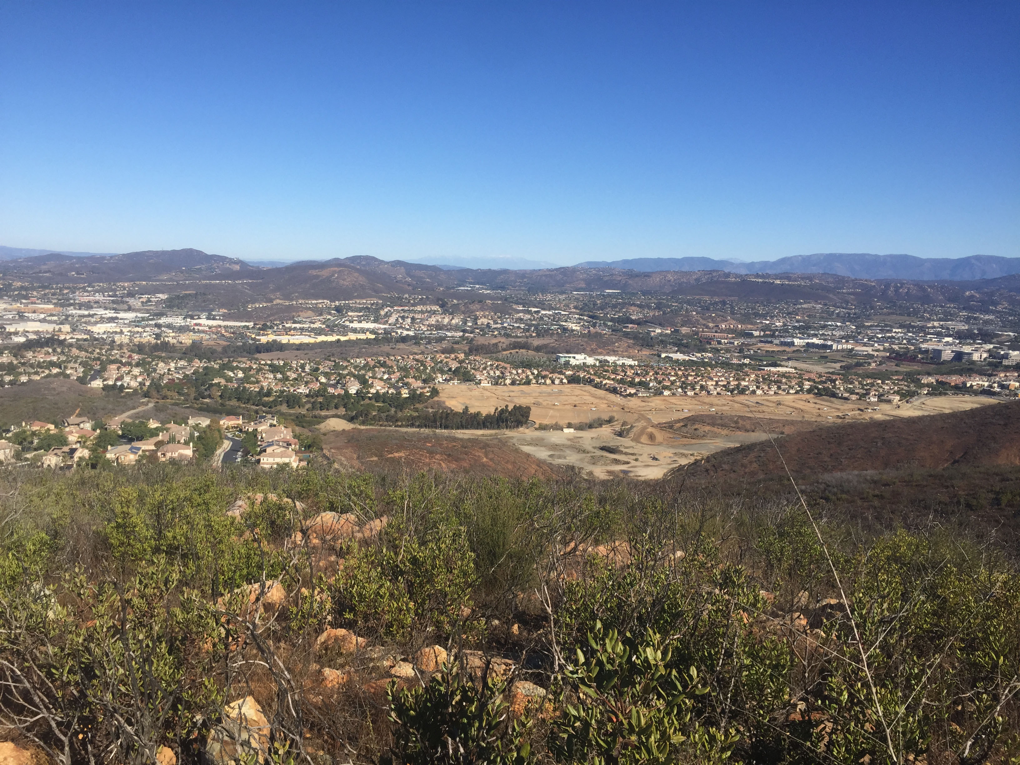
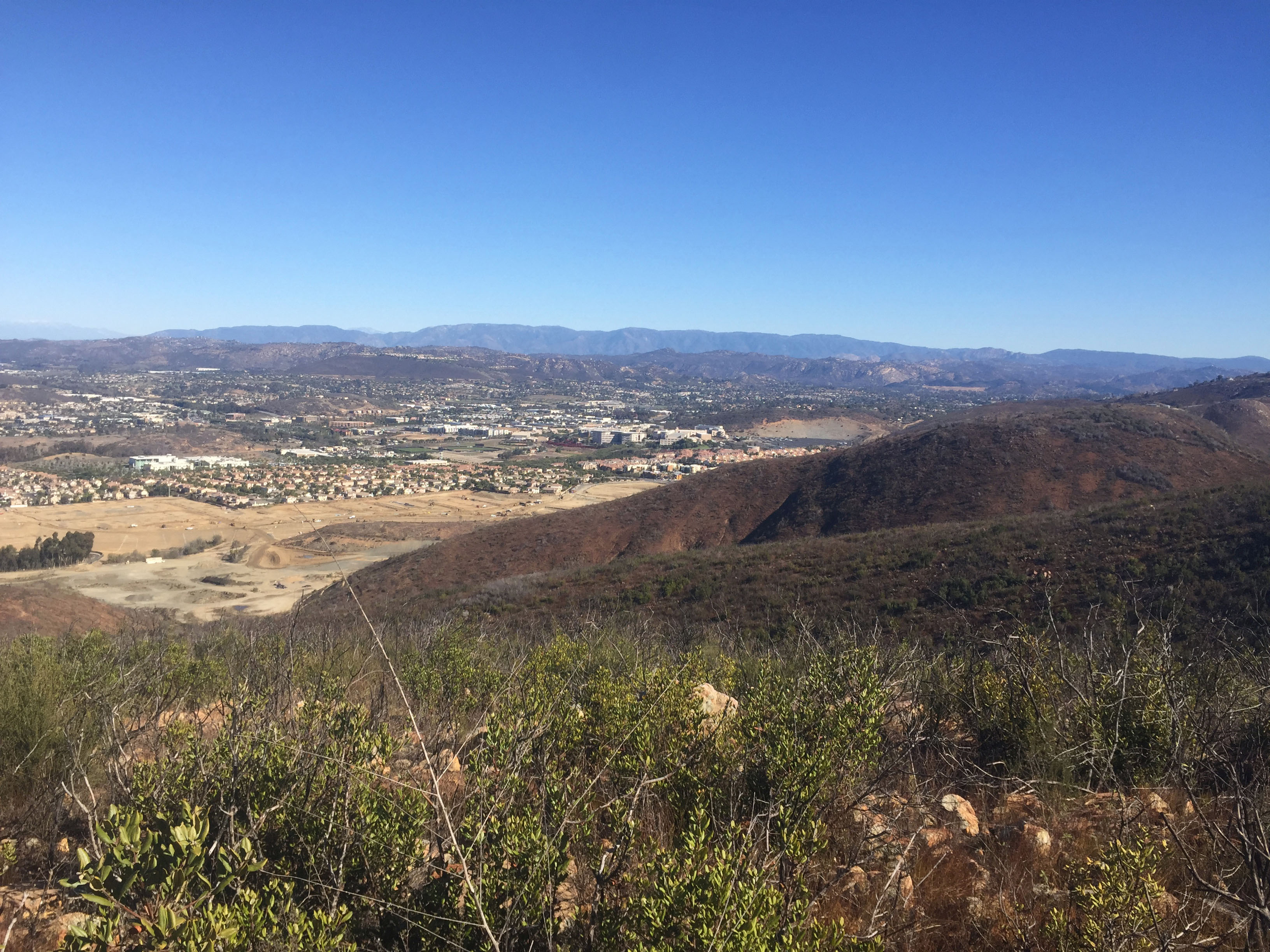
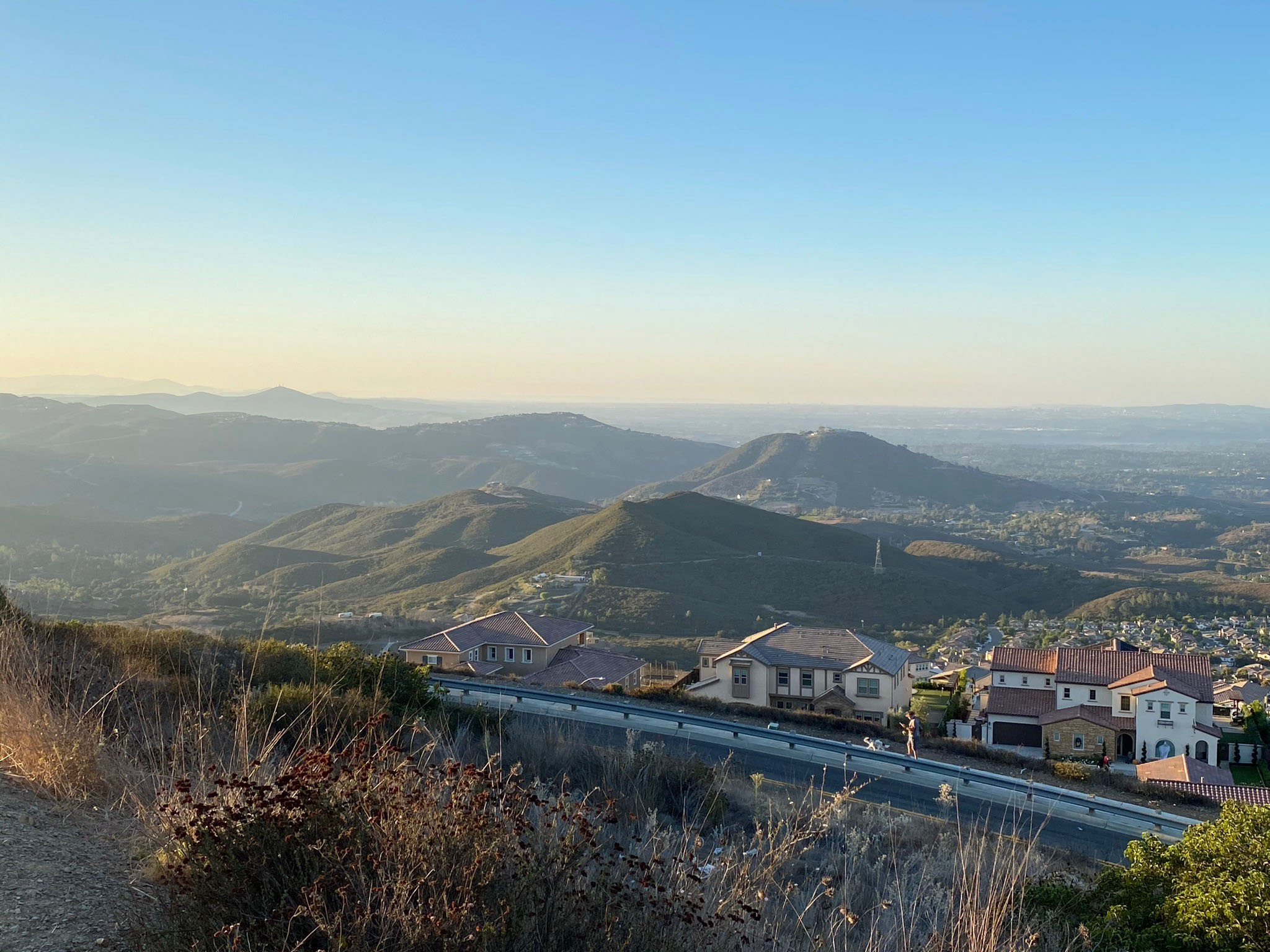
The view below is looking across the San Marcos valley the mountains of the northern Peninsular Ranges. |

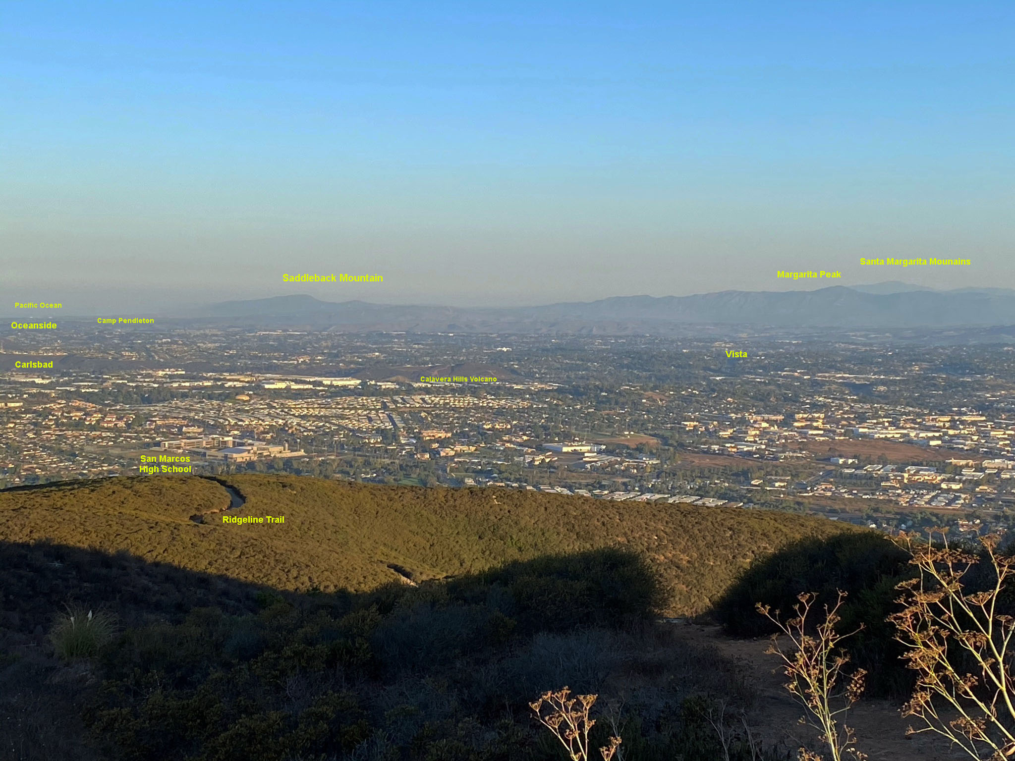
| Fig. 59. Looking north from the summit area of Double Peak it is possible to see Much of the San Marcos valley and plateau region in Vista.
Features from this view include the following: |
- The first peak in the distant right is Saddleback Mountain on Camp Pendleton at about 315° NW.
- The next distant ridgeline rises to Margarita Peak (elevation 3136 feet) in the Santa Margarita Mountains at about 335° NNW.
- The San Marcos Mountains are the closer peaks on the opposite side of the valley (due north, 0° is between the two peaks).
- The higher unnamed peak of the San Marcos Mountains at about 5° N has an elevation of 1671 feet.
- The high peaks of the very distant San Bernardino Mountains are just to the right of the highest peak of the San Marcos Mountains about 10°-20° NE.
- To the right of the Twin Oaks Valley (at about 25° NE) is the upland of the Merriam Mountains and Oat Hills.
- The long ridge in the distant right beyond the Merriam Mountains and Oat Hills is the long, high ridgeline of Palomar Mountain.
- Beyond a gap at the north end of the Palomar Mountain ridgeline is the high summit of San Jacinto Peak near Palm Springs, California at 33° NE.
Note that the landscape in the foreground shows signs of recovery from the 2014 Cocos Fire (discussed below).
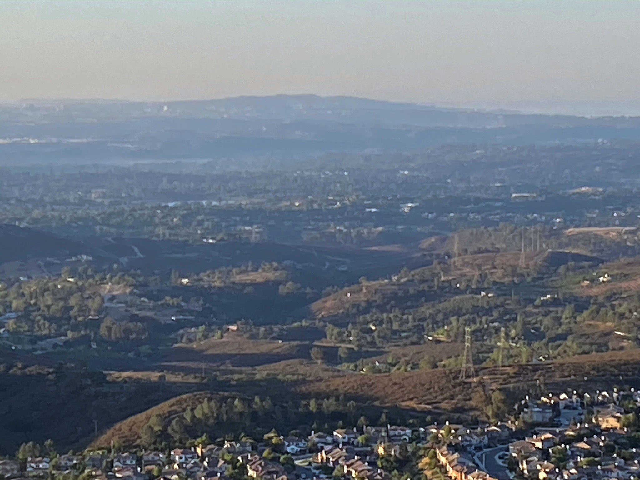
- The business district along the Highway 78 corridor is in the region with lots of white roof building in the valley, center left.
- Palomar College is near the center of the image in the valley below the right peak in the San Marcos Mountains.
- California State University - San Marcos (CSUSM) is in the far lower right of the valley.
|
| Larger format images below are parts of the panoramic view presented above (showing more detail). |
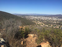
Fig. 60. Saddleback Mtn. and Santa Margarita Mountains. |

Fig. 61. San Marcos Mountains. |
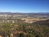
Fig. 62. Big Bear & San Jacinto in distance. |
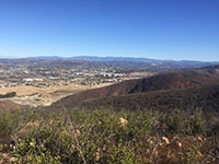
Fig. 63. Palomar Mountain beyond CSU San Marcos. |
|
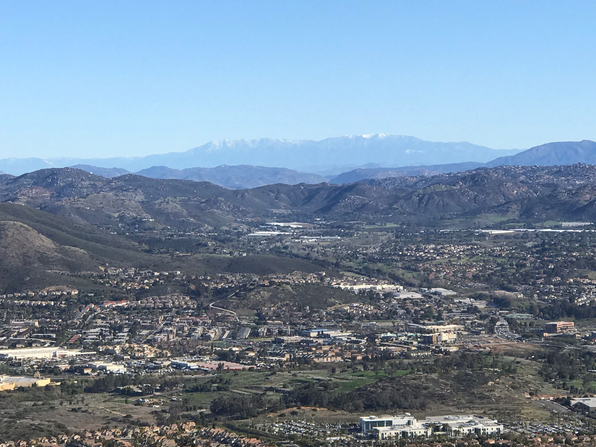
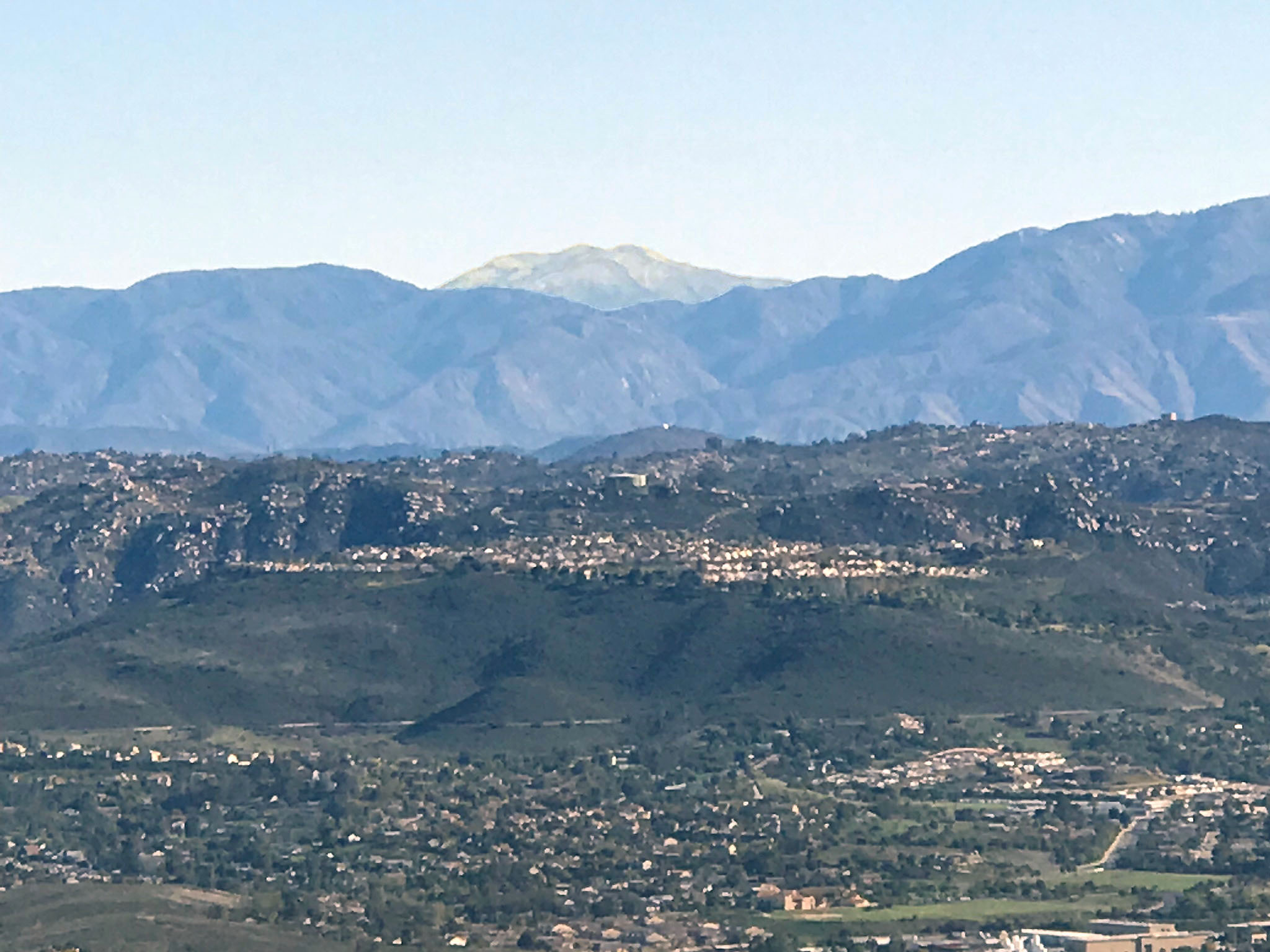
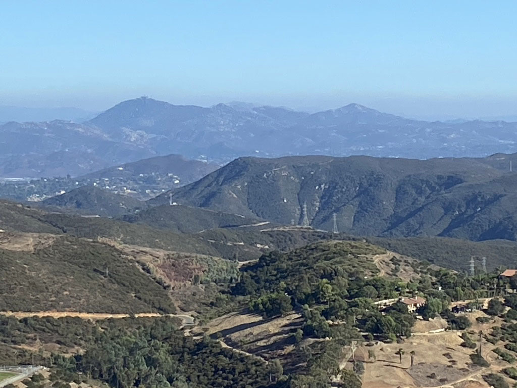
Below are zoomed-in views of distant peaks to the north of Double Peak. Some features are labeled. Note that features are labeled on Figures 64 and 65. Figure 64 includes the location of the Calavera Hills volcano in Carlsbad and Figure 65 shows the location of the Morro Hills volcanic field northeast of Vista. Both of these volcanic areas are younger, of Miocene age (sometime between about 17 and 13 million years). Their volcanic deposits cut through or rest on top of coastal and marine sedimentary rocks of Eocene age. These areas are described in a field trip guide to the Calavera Hills volcano.
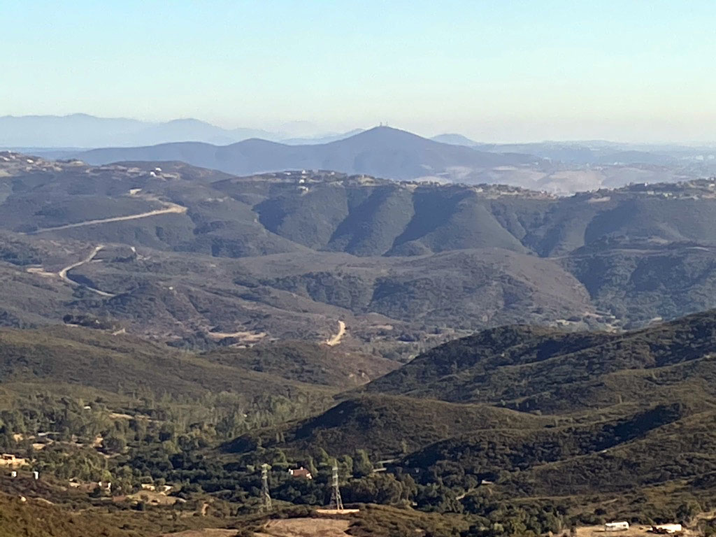
Figures 66 and 66 show zoomed-in views of two of the most distant mountain areas visible from the top of Double Peak. Figure 65 show the crest of the San Bernardino Mountains in the vicinity of Big Bear, California. The highest peak, San Gorgonio Peak, has an elevation of 11,503 feet and is located about 75 miles north of Double Peak. Figure 66 shows the top of San Jacinto Peak. elevation of 10,833 feet, and is located about 60 miles to the northeast of Double Peak. Both of these massive mountainous areas are associated with uplift along the San Andreas Fault. |
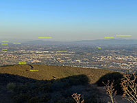
Fig. 64. Saddleback Mountain,
Margarita Peak, and Calavera Hills volcano. |
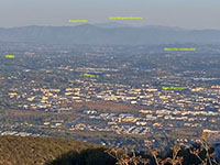
Fig. 65. Santa Margarita Mountains and the Morro Hills volcanic field. |

Fig. 66. Distant San Bernardo Mountains (Big Bear) in the distance (10-20° NNE). |
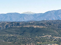
Fig. 67. San Jacinto Peak rises over the northern end of Palomar Mountain. |
|
A18
View to the North and East from Cerro de Las Posas - Double Peak to the Coast |

| Fig. 68. View looking north and east along the Cerro de Las Posas Ridgeline Trail in the vicinity of the microwave tower on San Marcos Peak. This view toward the mountain front along Double Peak and other peaks along the range. the plateau region underlain my Eocene-age marine sedimentary rocks extends from the mountain front (near the center) to the coastline (on the left). This panorama extends from about 300° NW to 60° E. |
A19
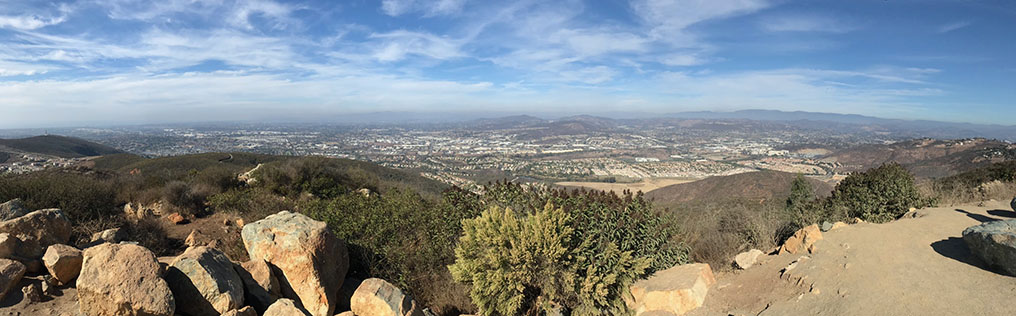
View to the South
The panoramic view below shows the western foothills of the Peninsular Ranges adjacent to the low plateau and mesas region that extent to the coast.
|

| Fig. 69. The panoramic view below is facing south in the vicinity of the Amphitheater parking area at Double Peak Park. Starting on the left side of the image is looking east (about 85° E). |
-
The first peak Mt. Whitney (elevation 1729 feet) east (95° E).
- The second is Franks Peak (elevation 1680 feet) at about 100° E.
- In the far distance beyond Franks Peak are the high peaks of the Cuyamaca Mountains with the highest peak being Cuyamaca Peak (elevation 6493 feet) at 105° E.
- Not as distant is the peak of Woodson Mountain (elevation 2882 feet) at 116° E.
- The top of Bernardo Mountain (elevation 1145 feet) is located near Lake Hodges and I-15 is just below the summit of Woodson Mountain.
- To the right of Bernardo Mountain begins the ridgeline of the Elfin Forest Recreational Reserve on the south side of the Escondido Creek valley.
- The Lake Hodges Overlook is at the highest point of ridge at about 140° SE. Lake Hodges is in the San Dieguito River valley beyond the ridgeline.
- Black Mountain (elevation 1558) rises above the ridgeline just to the right of the Lake Hodges Overlook at 150° SE.
- The last peak on the right of the ridgeline is Fortuna Del Este at 170° SSE (located between Elfin Forest and Rancho Santa Fe areas along the Los Cielos Preserve along the Escondido River valley.
- Downtown San Diego is lost in the haze at about due south (180° S).
- The last peak on the right is Denk Mountain at about 200° SSW.
|
| The images below are zoomed in view of select features shown in the panoramic view above. |
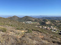
Fig. 70. Mt Whitney (left) and Franks Peak (right) |
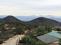
Fig. 71. Zoom in Mt Whitney (left) and Franks Peak (right) |
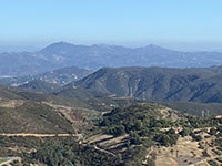
Fig. 72. Woodson peak in distance. |

Fig. 73. Black Mountain in distance. |
|
A20
Views To The West: Remnants Of An Ancient Coastal Plain
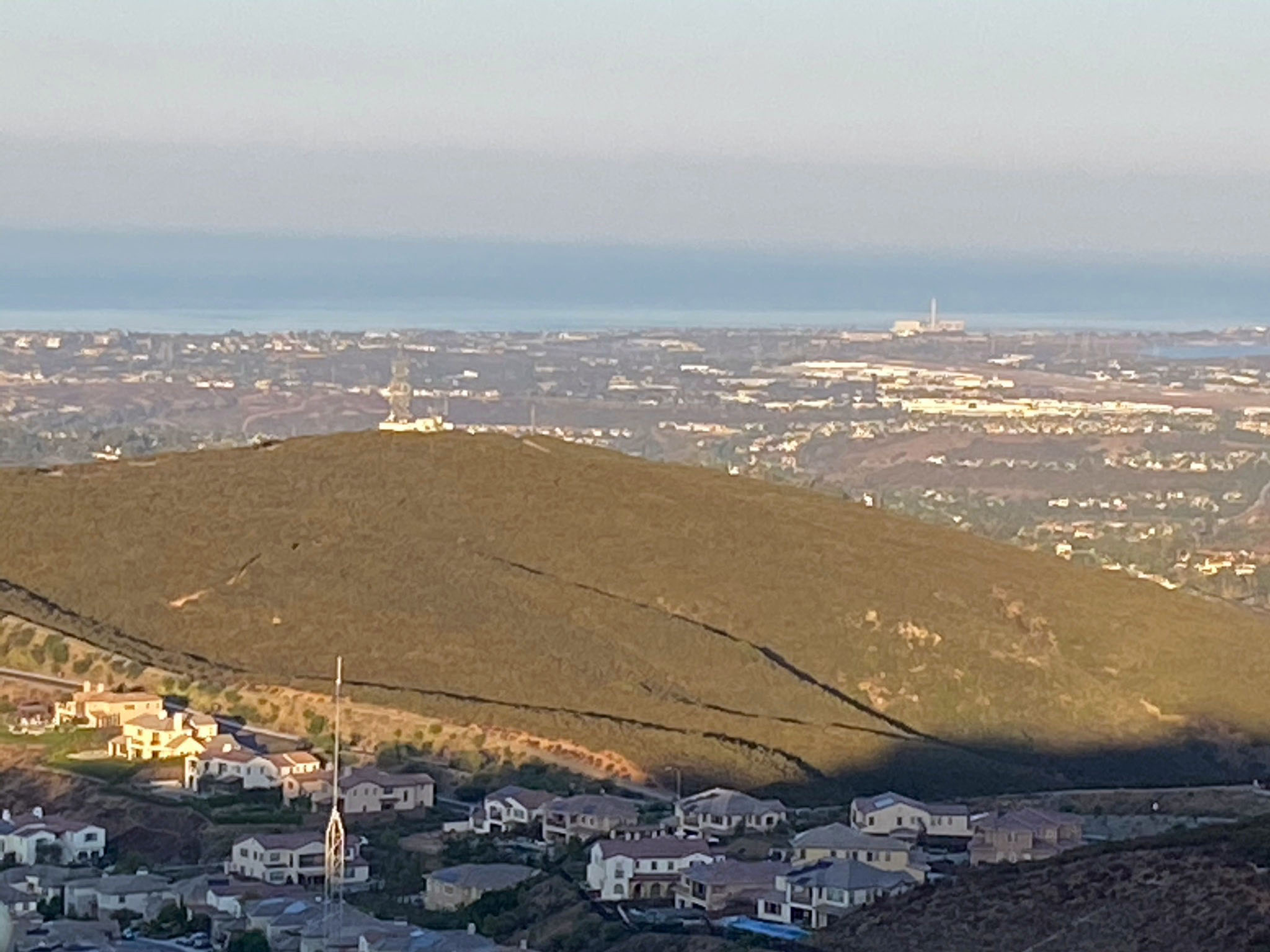
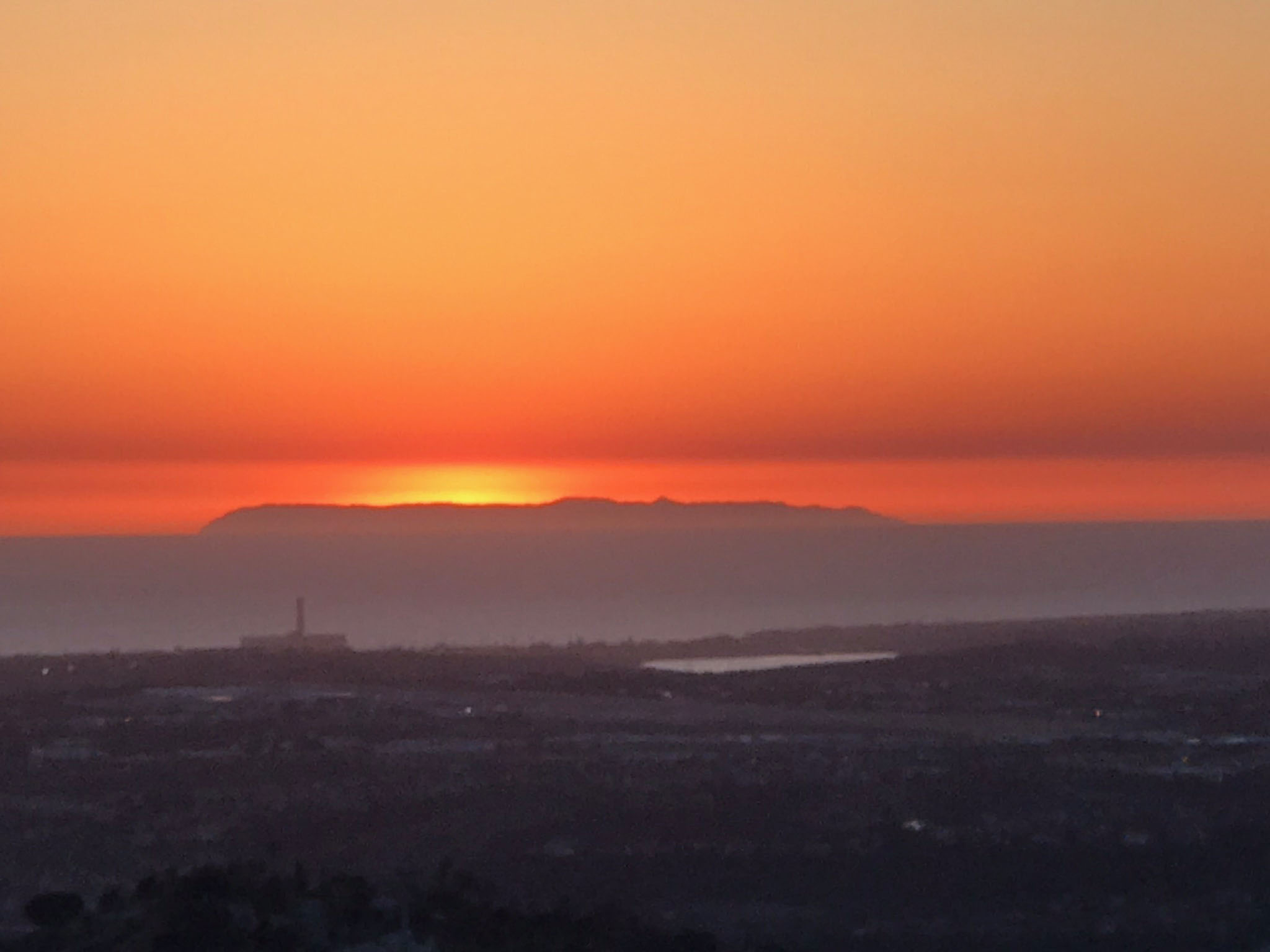
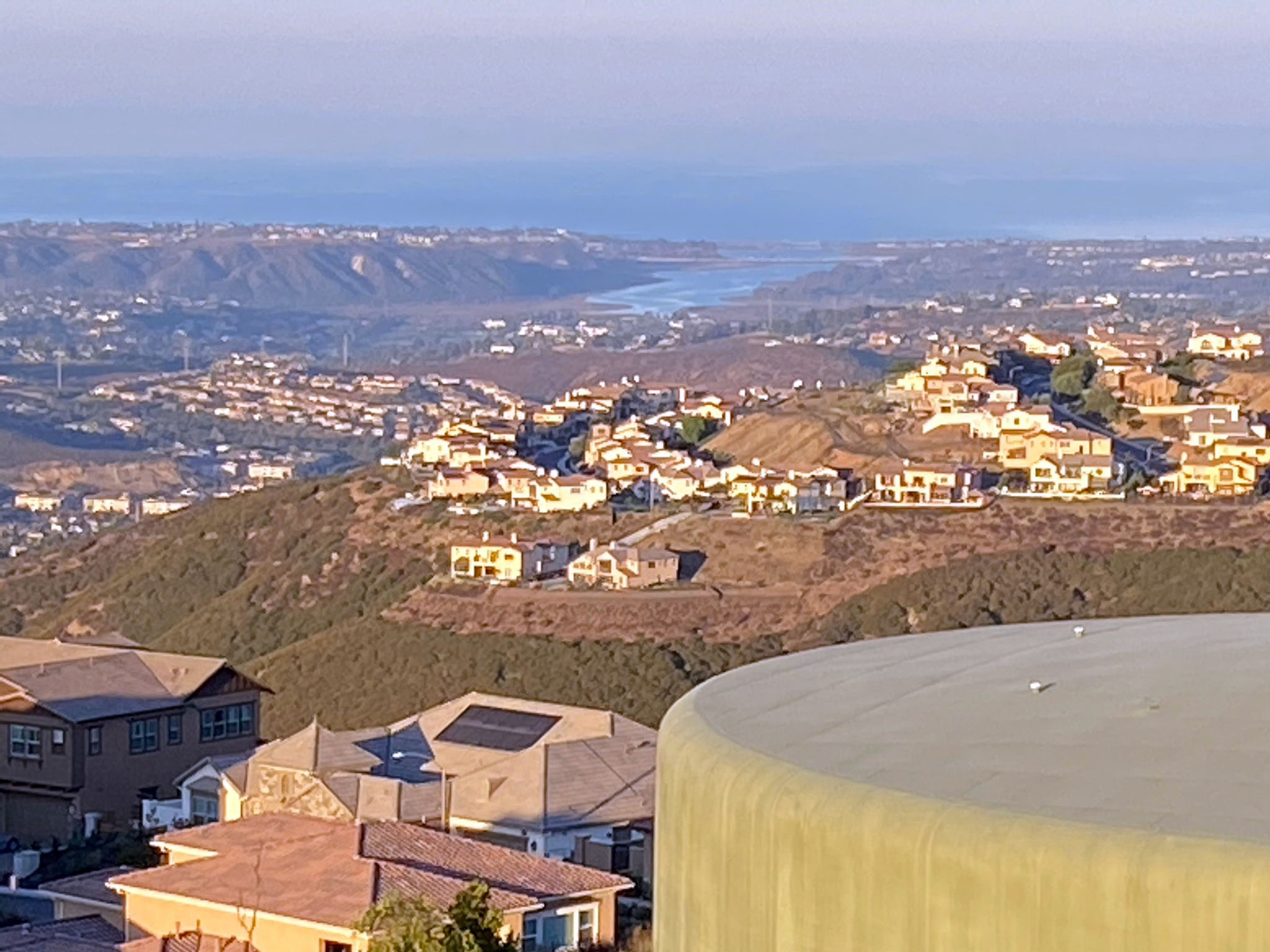
On a clear day, the entire coastline from the Mexican border northward to San Clement is visible. San Clemente and Catalina Islands are visible on the western horizon on the ocean nearly 80 miles distant. Figure 73 shows San Clemente Island outlined at sunset. Many days there is a marine layer (low stratus clouds) hang offshore, obscuring the view.
From Double Peak it easy to see the Oceanside embayment region that formed in the Eocene Epoch. The geologic map (Figure 46) shows the embayment region with Eocene sedimentary rock (in brown) filling in around the Double Peak and surrounding upland area. Double Peak would have been the high peak of a headlands region extending out into the ocean. |
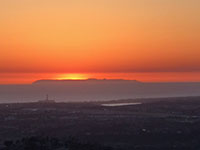
Fig. 74. Sunset over San Clemente Island. |
| The images below show selected view of the San Diego coastline starting from the south. Figure 75 shows the low mountain peaks that form the mountain front along the elevated plateau and mesas region northeast of downtown San Diego. Figure 76 shows the structural upwarp of Mt. Soledad in the La Jolla area associated with uplift on the south side of the Rose Canyon Fault and the Torrey Pines area north of the fault. Figure 77 shows a sweeping view of the coastline from Del Mar northward through Encinitas into Carlsbad. The Vallecitos Water District water tank is in the foreground, with Denk Mountain beyond and to the left. Figure 78 shows a zoomed-in view of Batiquitos Lagoon at the mouth of San Marcos Creek. You can learn about the geologic features and history of the rock formations exposed in the sea cliffs and marine terraces that define these areas on these field guides to Torrey Pines State Nature Reserve and San Elijo State Beach. |
Fig. 75. View of the mountain front south and coastal plateau southwest of Double Peak. |
Fig. 76. Zoomed-in view of Mt. Soledad up-warp along the coast in the La Jolla area |

Fig. 77. View to the coast from Del Mar, Encinitas, and Carlsbad with Denk Mountain. |

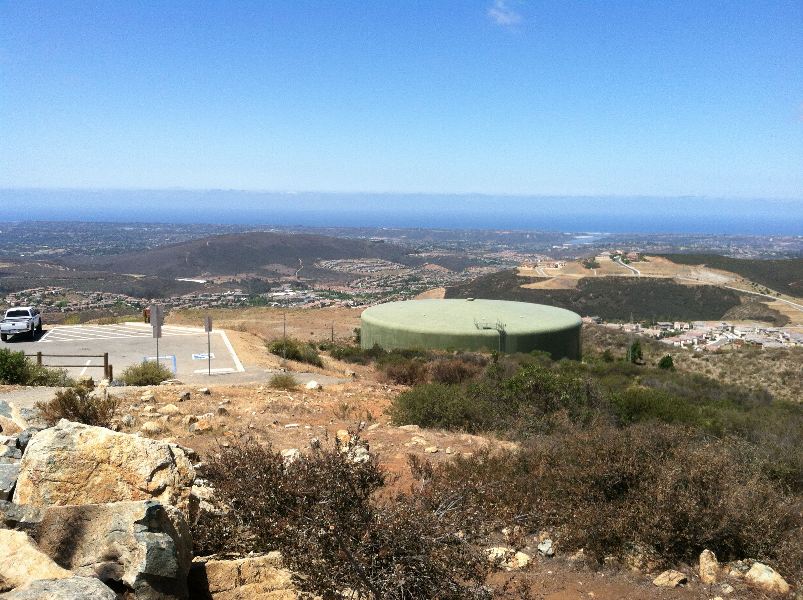
Fig. 78. Zoomed in view of Batiquitos Lagoon over the Double Peak water tank. |
|
|
Fig. 79. View over the Cerro de las Posas ridgeline extending to to San Marcos Peak (with microwave tower) on the left. The coastline from Carlsbad northward to Oceanside is partly obscured by low level clouds. This view takes in the entire erosionally dissected plateau (former coastal plain in Eocene time) that extends from the coast landward to the mountain front of the San Marcos Mountains. |
A21
| Fig. 80. This panoramic view is taken from the top of Denk Mountain looking east at the Cerro de las Posas ridgeline starting with the microwave tower on San Marcos Peak to the left, Double Peak (the high point to the center right), and Mt. Whitney and Franks Peak to the right. Denk Mountain is the low mountain visible in Figure 77 to the left and above the water tank. |
A22
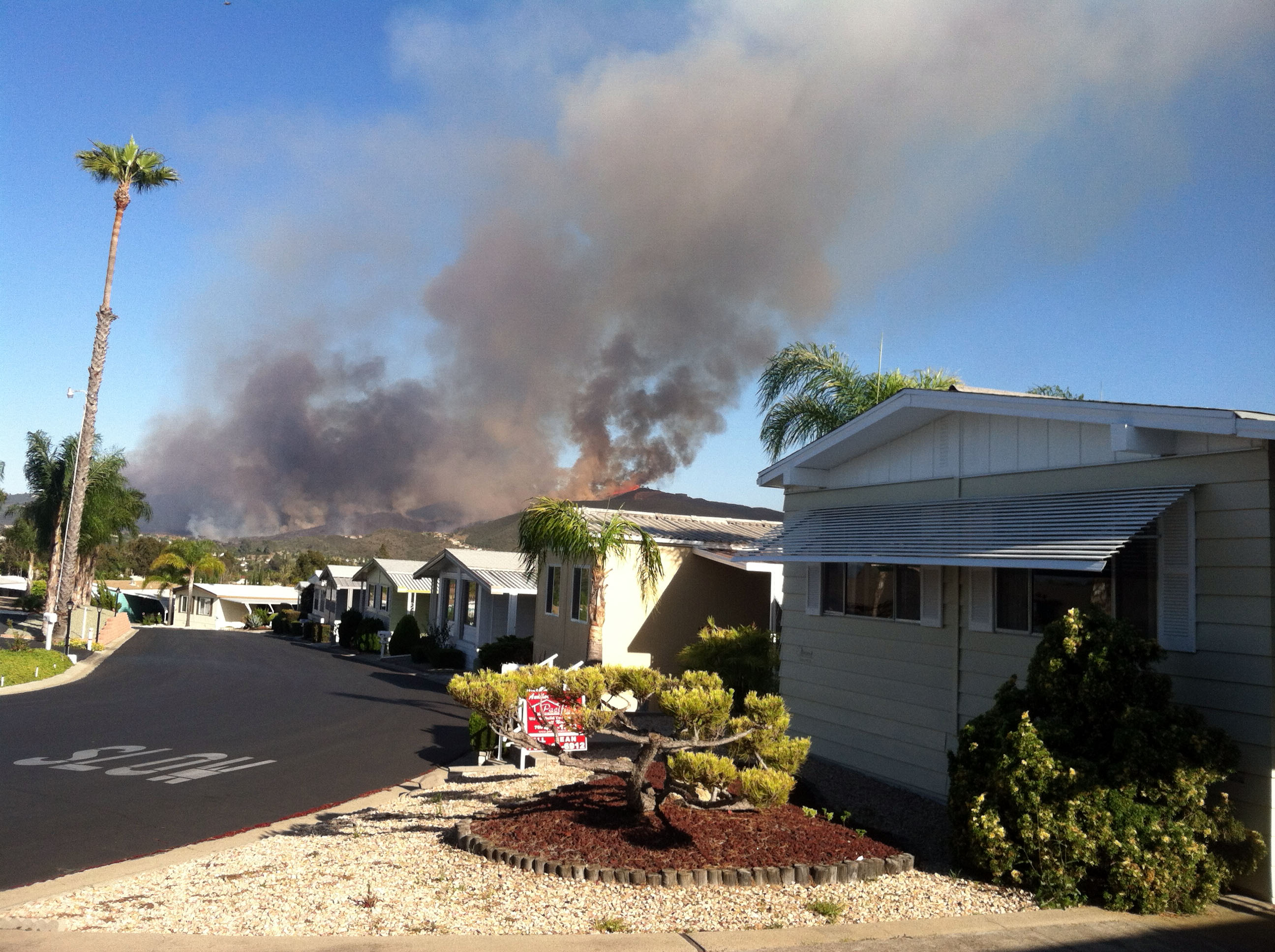
The Cocos Fire, 2014
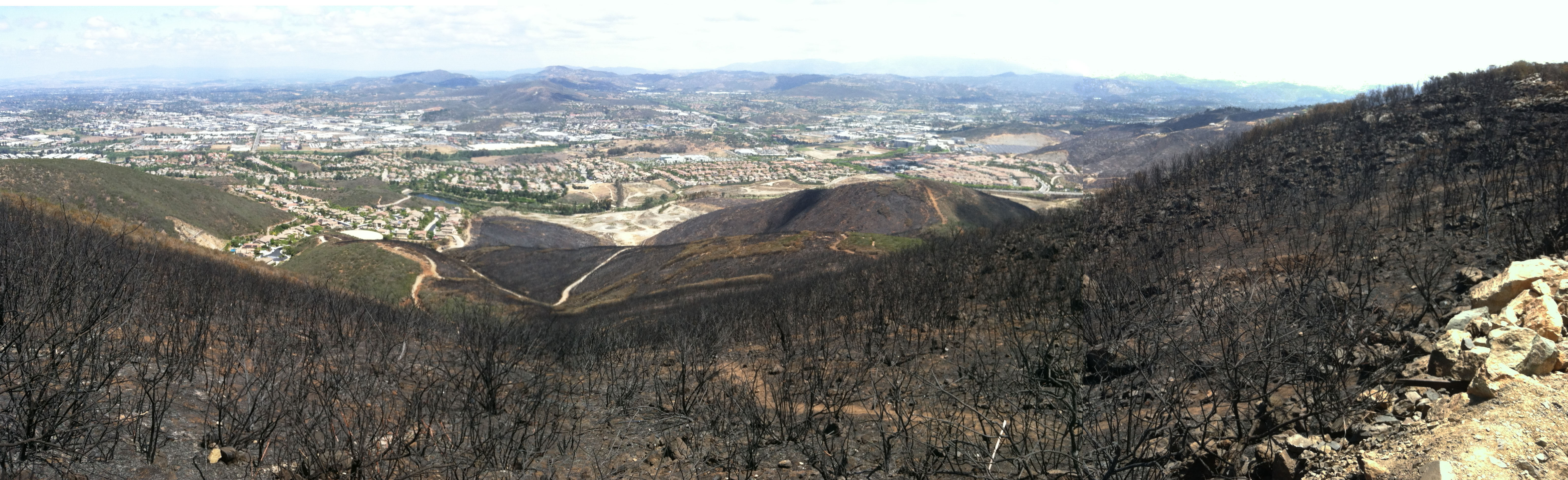
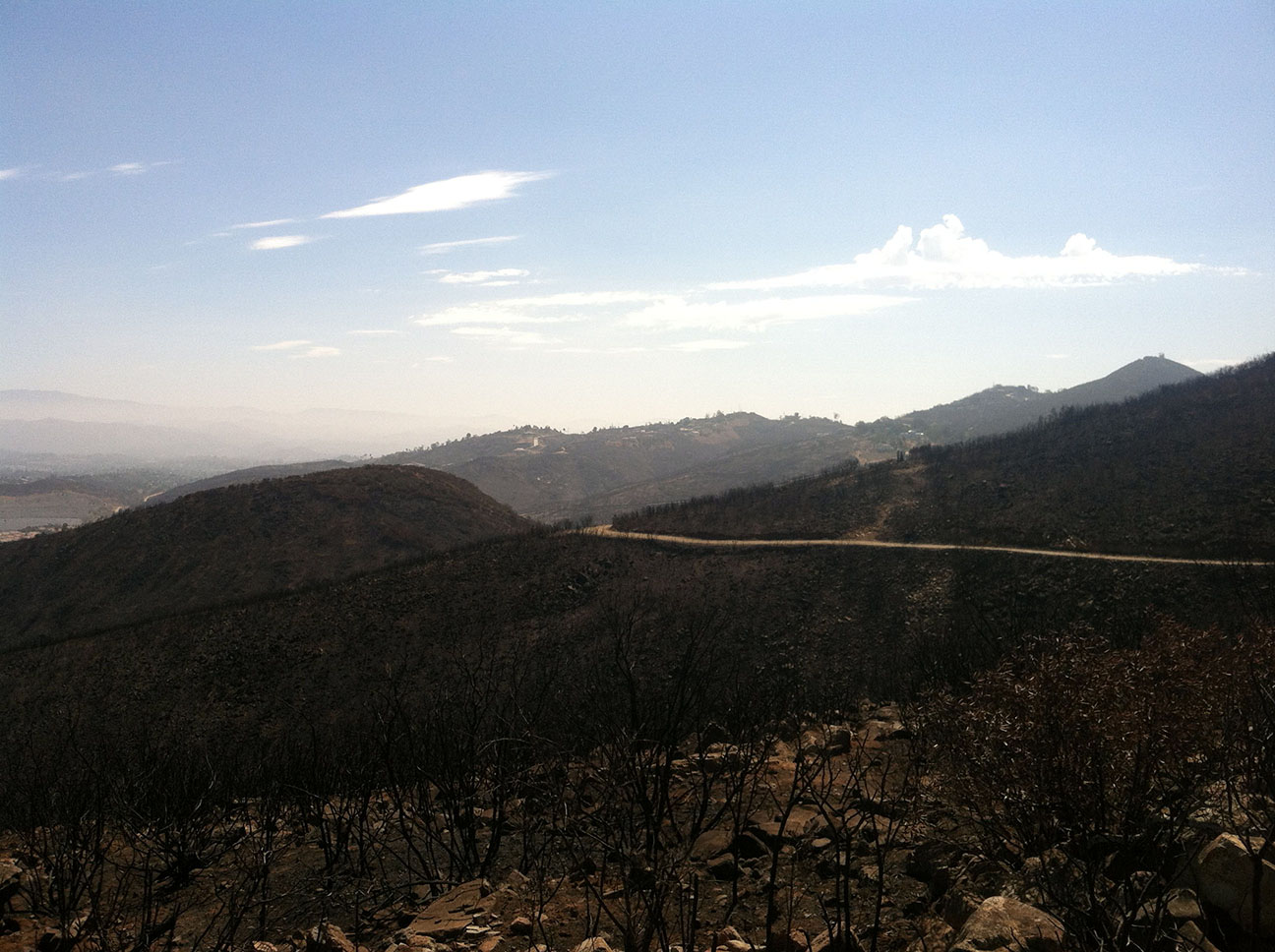
One of the worst wildfires in San Marcos's history occur starting on May 14, 2014. The fires stared in the hills south of CSU San Marcos from a teenager foolishly playing with a lighter. Nearly 2,000 acres burned before full containment was established on May, 22. The majority of the fire occurred on the first two days as hot, dry weather and Santa Ana winds combined to blow the fire completely out of control. Figure 81 shows the fire-scorched hillsides in basically the same view as Figure 59 above. It is interesting to compare the two images. Figure 59 was taken in 2019, and the fire-adapted plant species were well on their way to becoming re-established. |

| Fig. 81. View of the northern slope of the Double Peak area after the Coco Fire in 2014. |

Fig. 82. Fire-scorched olive tree on Double Peak. |

Fig. 83. View of active Cocos wildfire on Double Peak. |
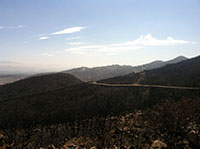
Fig. 84. Lakeview Trail stands out on fire-scorched hillside. |
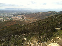
Fig. 85. Recovering vegetation on the slopes of Double Peak. |
|
A23
| Despite the massive fire, it seems that some species managed to survive the fire and have been able to repopulate the fire burn area. |

| Fig. 86. Western Diamondback Rattlesnake on the Double Peak Trail. (White line is 4 inches wide.) Please don't disturb the wildlife. |
A24
Selected Resources
Frost, B.R and Frost, C.D., 2008, A Geochmical Classification for Feldspathic Igneous Rocks: Journal of Petrology, v. 49, no. 11, p. 1955-1963.
Herzig, C.T. and Kimbrough, D.L., 2014, Santiago Peak volcanics: Early Cretaceous arc volcanism of the western Peninsular Ranges batholith, southern California: in Peninsular Ranges Batholith, Baja California and Southern California; Morton, D. M. and Miller, F.K., editors, Geological Society of America Memoir v. 211. (web link)
Kenedy, M.P., Tan, SS, Bovard, J.R., Alvarez, R.M, Watson, M.J., and Guiterrrez, C.I., 2007, Geologic map of theOceanside 30x60-minute quadrangle, California: California Geological Surve, Regional Geologic Map No. 2, map scale: 1:100,000.
Miller, F.S., 1957, Petrology of the San Marcos Gabbro, Southern California: Bulletin of the Geological Society of America, V. 48, p 1397-1425.
Le Bas, M.J. and Streckeisein, A.L, 1991, The IUGS ststematics of igneous rocks: Journal of the Geological Society, v. 148, no. 5, p. 825-833.
U.S. Geological Survey, U.S. Board on Geographic Names: Domestic Names [database search, 2020]:
https://www.usgs.gov/core-science-systems/ngp/board-on-geographic-names/domestic-names |
| https://gotbooks.miracosta.edu/fieldtrips/Double_Peak/index.html |
10/23/2020 |
|