Field Trip To Discovery Creek Trails Area, San Marcos, CA |
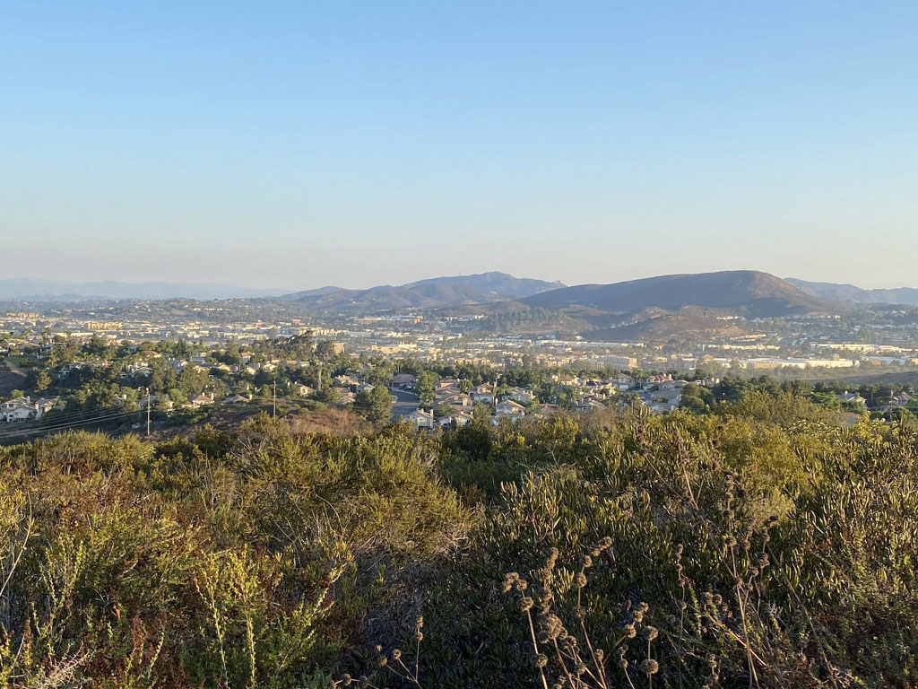
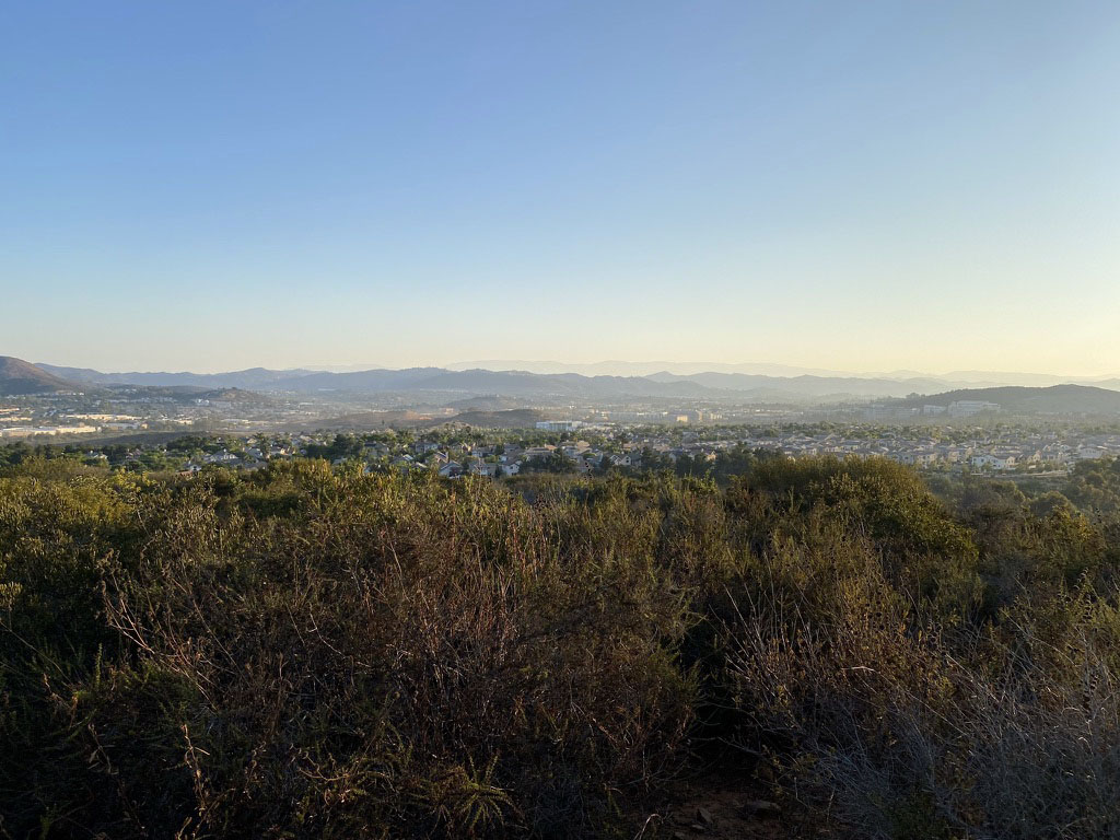
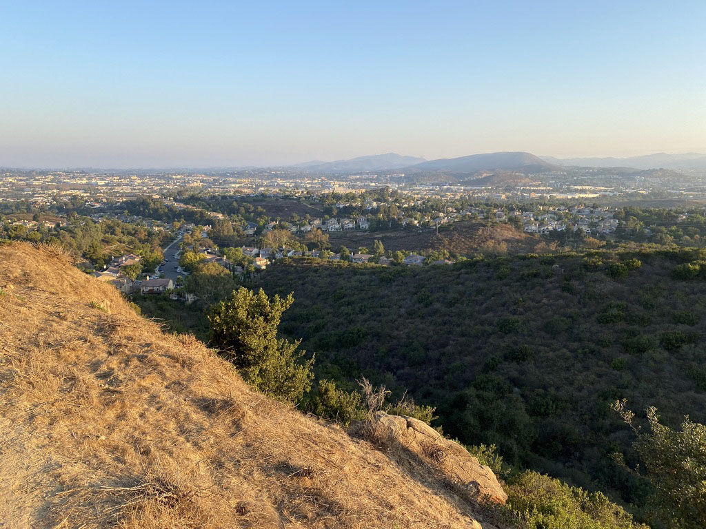
The Discovery Lake Trail area in San Marcos, California provides a unique setting to look at the ecology of the mountains in the San Marcos area and to learn about the rocks and geology along the mountain front of the San Marcos Mountains. The Discovery Creek valley is host to a native riparian habitat whereas the hillsides are covered with coastal sage and chaparral plant communities. Discovery Lake is a small man-made reservoir that now serves as a wildlife refuge for migratory waterfall and a variety of songbirds. Figure 1 is a map of the field trip area showing trails and stop locations (labeled as Stops A to G). The second part of this field trip (Stops E to G) involves hiking up the lower part of the Double Peak Trail and along two alternate trail routes to gain access to views overlooking the San Marcos Valley any beyond. This higher route is to examine the upland chaparral and coastal sagebrush plant communities and regional geology. These upland areas provide an opportunity to examine the impact of wildfires on wildlife habitats and landscape evolution. |
Click on images for a larger view. |
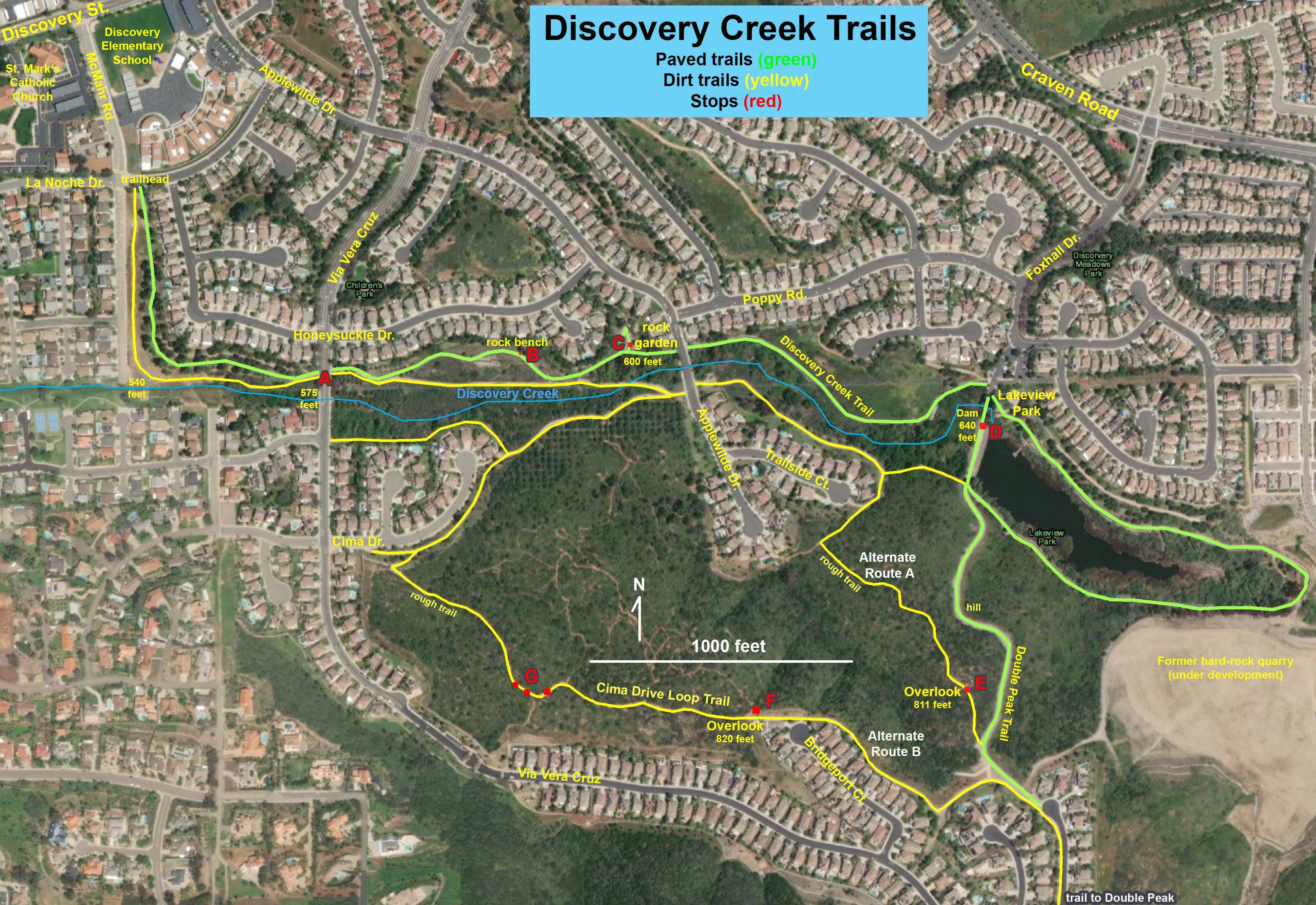 Fig. 1. Map of the Discovery Creek Trails in San Marcos, California. The Discovery Creek Trail area is located on the northern flank of Double Peak in San Marcos, California. Fig. 1. Map of the Discovery Creek Trails in San Marcos, California. The Discovery Creek Trail area is located on the northern flank of Double Peak in San Marcos, California. |
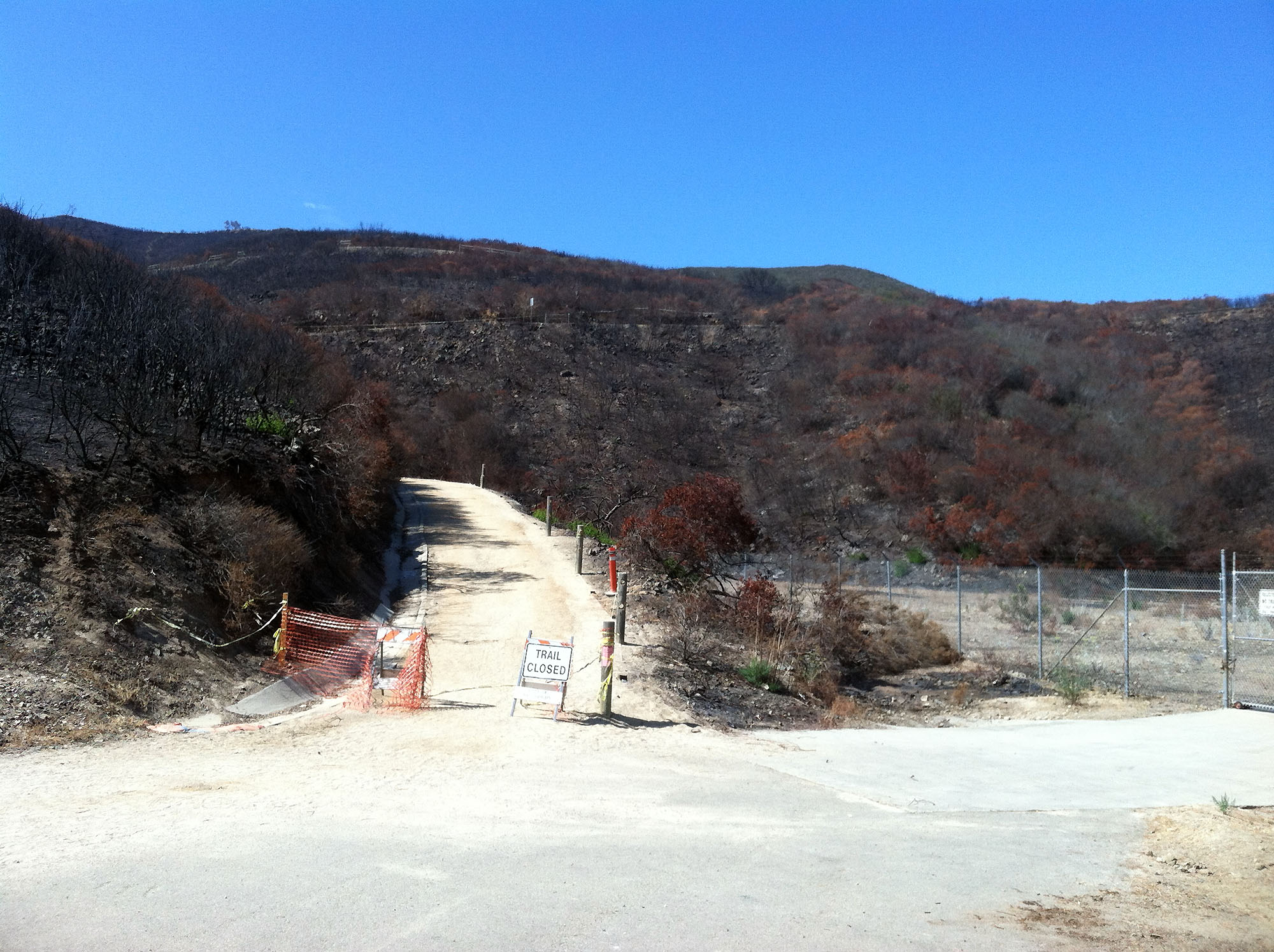
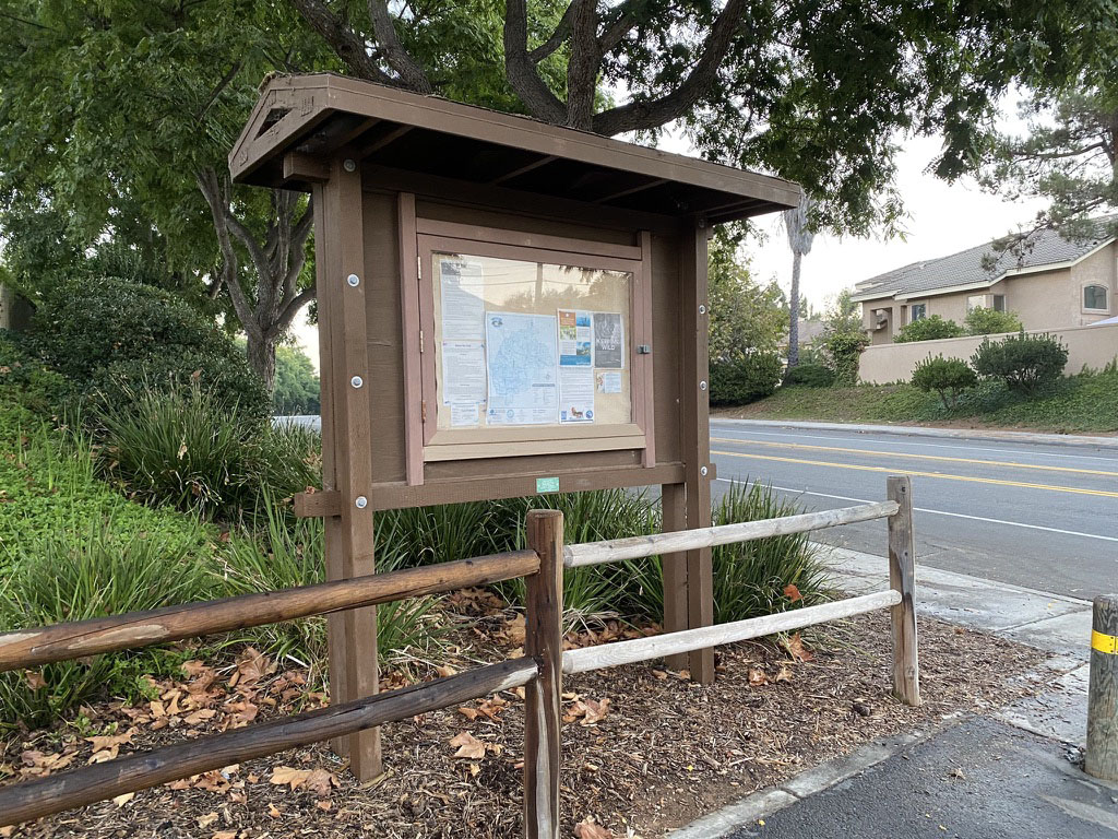
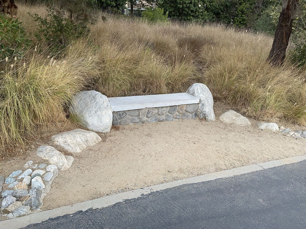
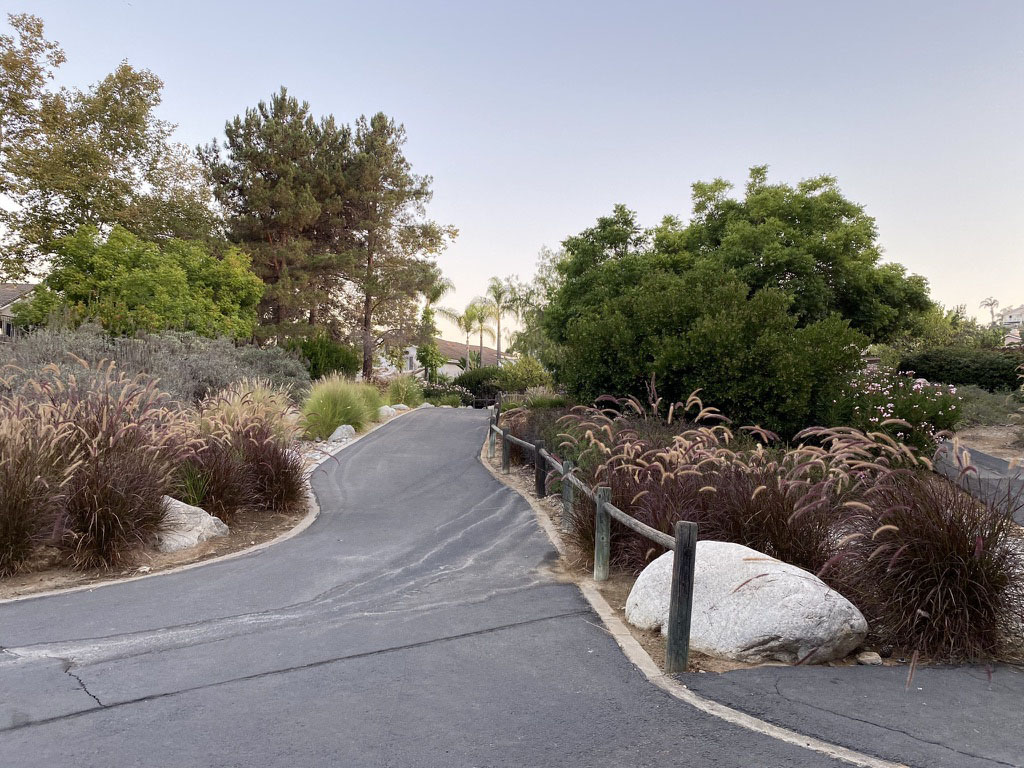
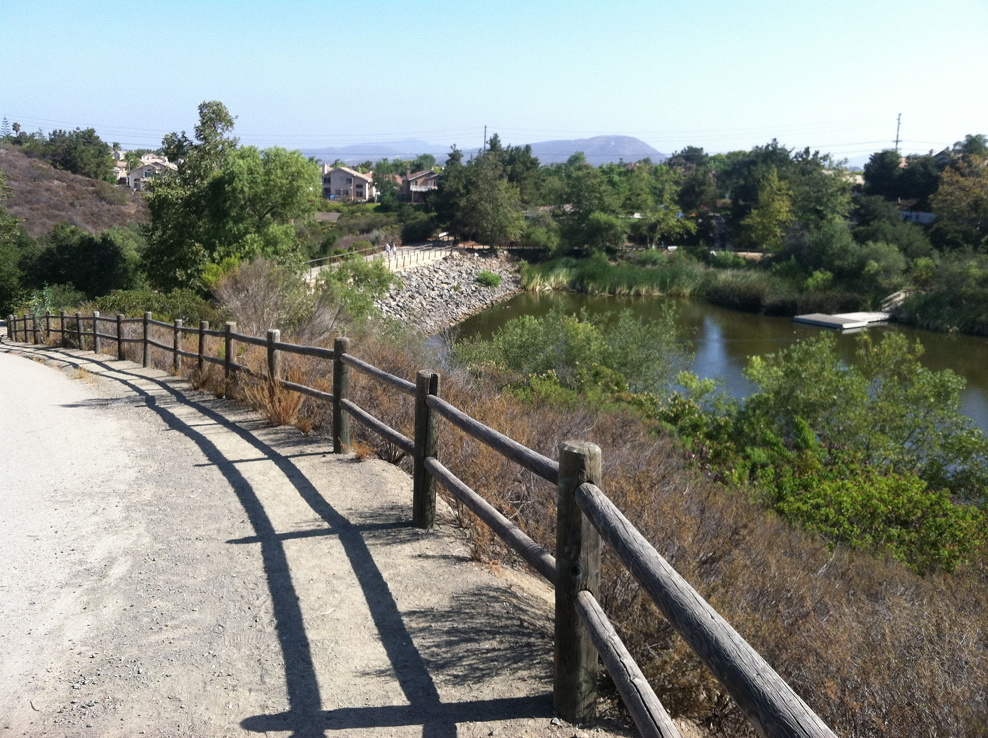
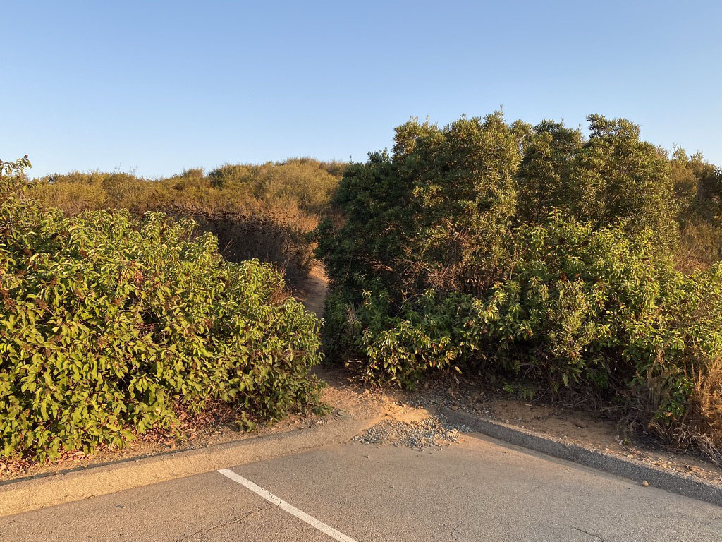
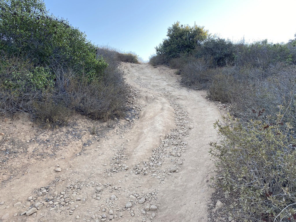
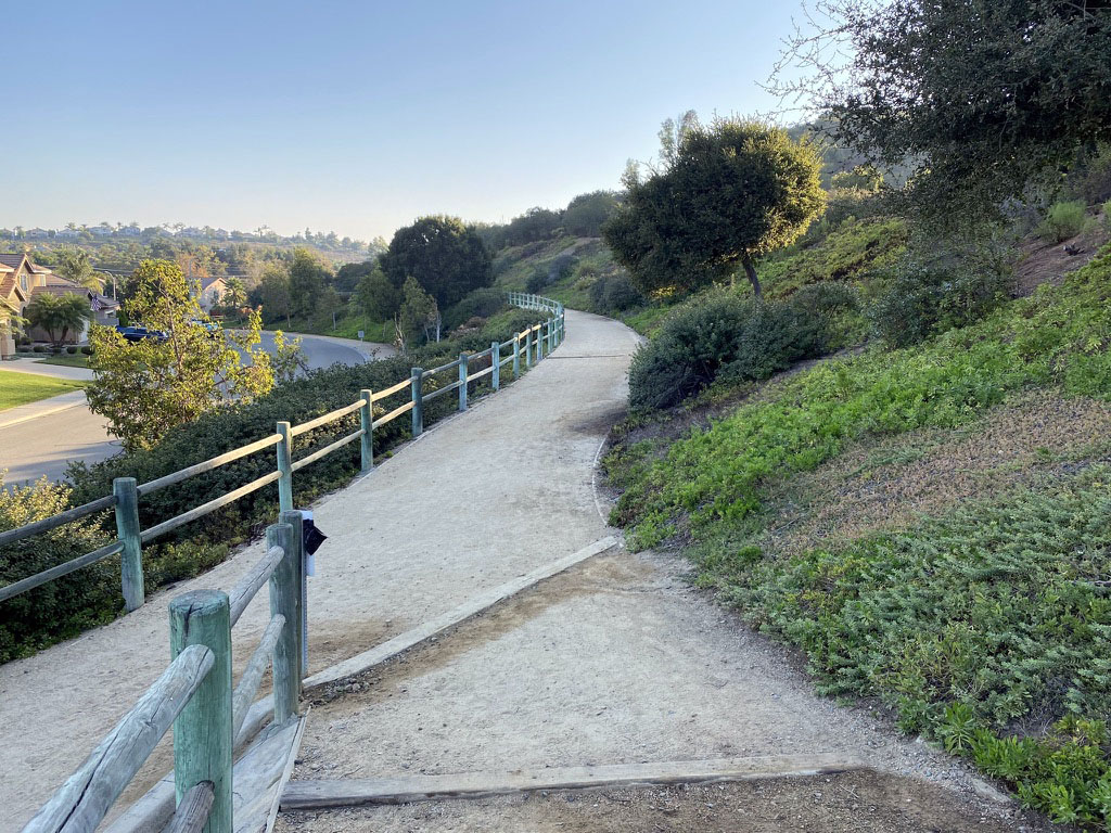
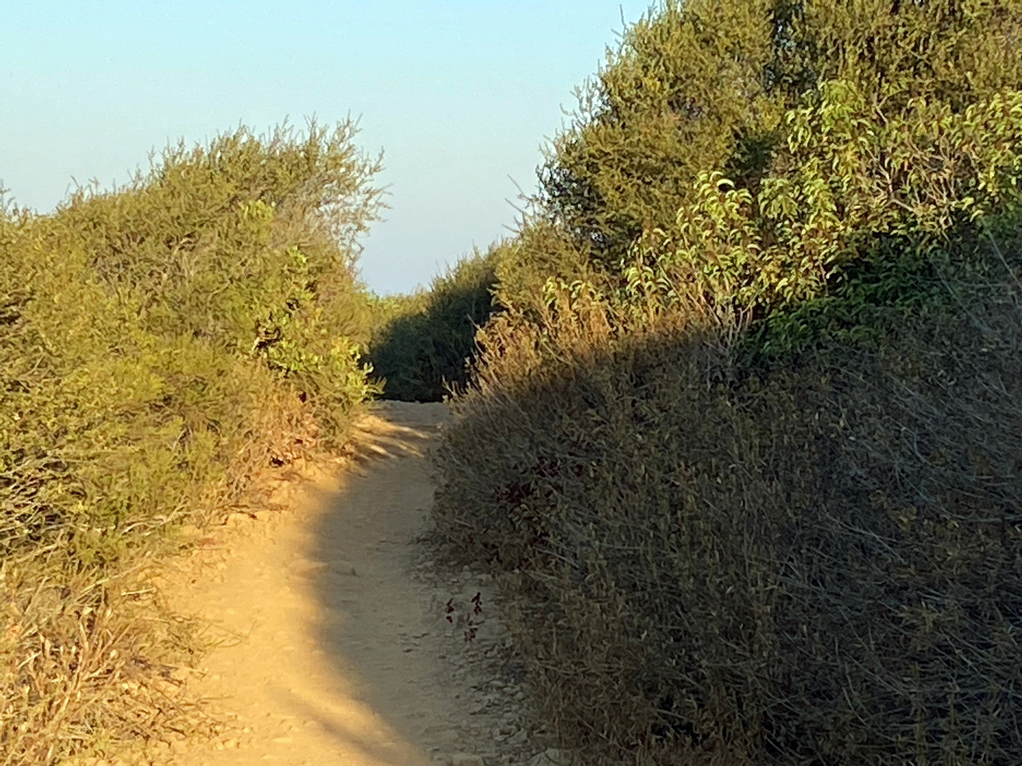
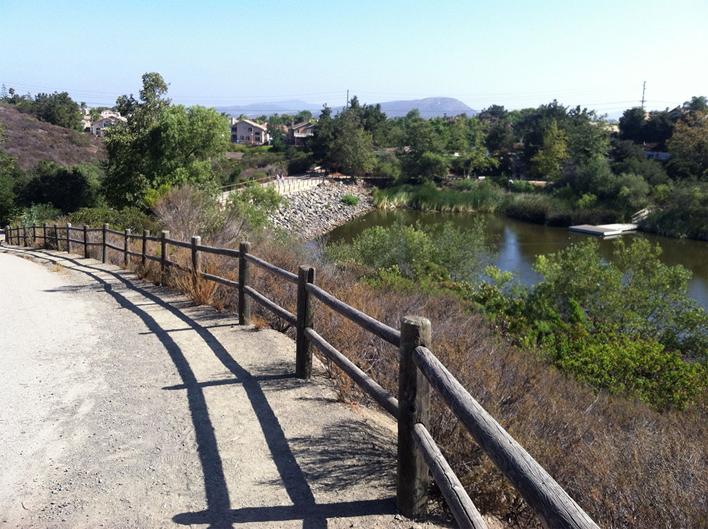
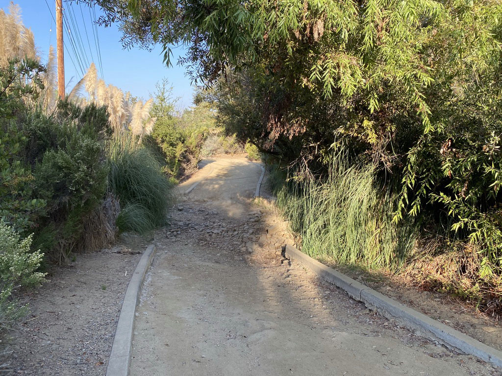
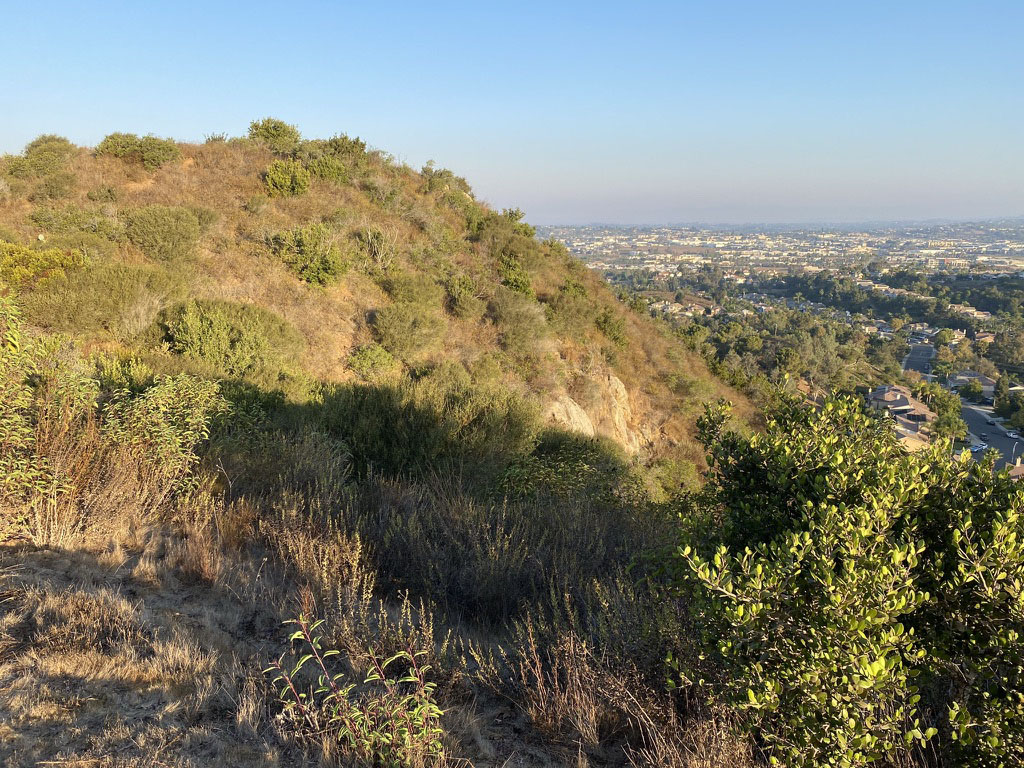
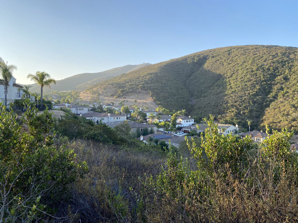
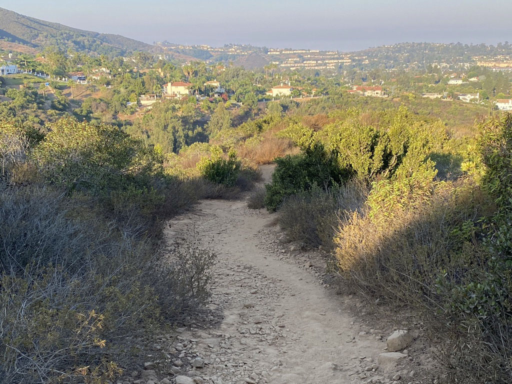
Field Trip DetailsThis field trip is divided into two parts: the first part (Stops A to D) are wheel-chair accessible; the second part is not (Stops E to G). The complete field-trip hike involves about a 2 mile walk with an elevation gain of about 200 feet. A good place to meet is near a park trail sign near where the paved Discovery Creek Trail crosses Via Vera Cruz (near Honeysuckle Drive) shown as Stop A on the map (Figure 1). There is ample street parking in the area.The Discovery Creek Trail, Stops A to D (Wheel-Chair Accessible)The figures below illustrate the different kind of trails used for this field trip. Figure 2 shows the kiosk next to the Discovery Creek Trail where it intersects Via Vera Cruz at Stop A. This is a good place to gather (trees can provide shade while you wait for others to join you). The Discovery Creek Trail is paved and is therefore wheel chair accessible (between the trailhead on La Noche Drive to Discovery Lake). Follow the trail east and examine the large boulders at the first of two stone benches (Stop B, Figure 3) and continue along the trail to what is named here the Boulder Garden loop trail area (stop C, Figure 4). Note that after Stop C there is a short section of a hill to get up to the top of Discovery Lake Dam (Stop D, Figure 5). There are public restrooms in Lakeview Park near the Discovery Lake dam. The trail around Discovery Lake is also both flat and paved and wheel-chair accessible. The path around Discovery Lake is flat and scenic, and a good place to observe wildlife (particularly birds and lizards). Note that this is a popular dog-walking route. Dogs are required to be on leash.Double Peak Trail and Alternate Loop Trail Routes (Not Wheel-Chair Accessible)After the dam, the rest of the field trip is not wheel-chair accessible, and requires hiking up and down about 200 feet in elevation. In addition, parts of the trail are narrow and require hiking on rocky and often steep sections of trail. Both routes involve walking uphill on Double Peak Trail that starts at the south side of the dam; this section is paved (Figure 6). Near the top of this hill section there are two alternate routes that loop back to the starting point.Alternate Route A (shown on map Figure 1) is a narrow, rocky trail that starts in a small parking area. The trailhead of this unpaved trail is shown in Figure 7. About 200 feet from the parking area the trail reaches the top of a hill that provides a very good view of the region (Stop E). This rugged trail is a shorter route than Alternate Route B. The complete field trip route is to return to the Double Peak Trail and continue on Alternate Route B. Alternate Route B (shown on map Figure 1) is to follow the Cima Drive Loop Trail). It is slightly longer and also has steep and rocky sections, but it provides excellent views of the region and the summit ridge of Double Peak and Sierra de las Posas (Stops F and G) (Figure 8). The trail continues down to well maintained trails that back to the the starting point (Stop A)(Figure 9). |
Local Fauna and FloraThe Discovery Creek Trails are maintained by the San Marcos Department of Parks and Recreation. Some of the land around the trails part of the city park system. Much of the rest of the undeveloped land around the park and suburban neighborhoods is open space that is managed by The Environmental Trust, Inc.,a 501-C non-profit community of organization dedicated to the preservation of native habitats.The Discovery Creek Lake area is a popular bird-watching destination (best in the early morning hours). Common mammals sighted in the area include rabbits and ground squirrels, and occasionally raccoons, skunks, opossums, deer, and coyotes. Fence lizards and western whip-tail lizards are common. Rattlesnakes are not uncommon and are generally harmless if not provoked, but are a risk, particularly to dogs, along park trails (Figure 10). The San Diego Museum of Natural History has an online field guide to regional wildlife (birds, mammals, reptiles, amphibians, insects, spiders,plants, and more). Also, the iNaturalist website for San Diego County has an exhaustive photo collection of San Diego wildlife. |
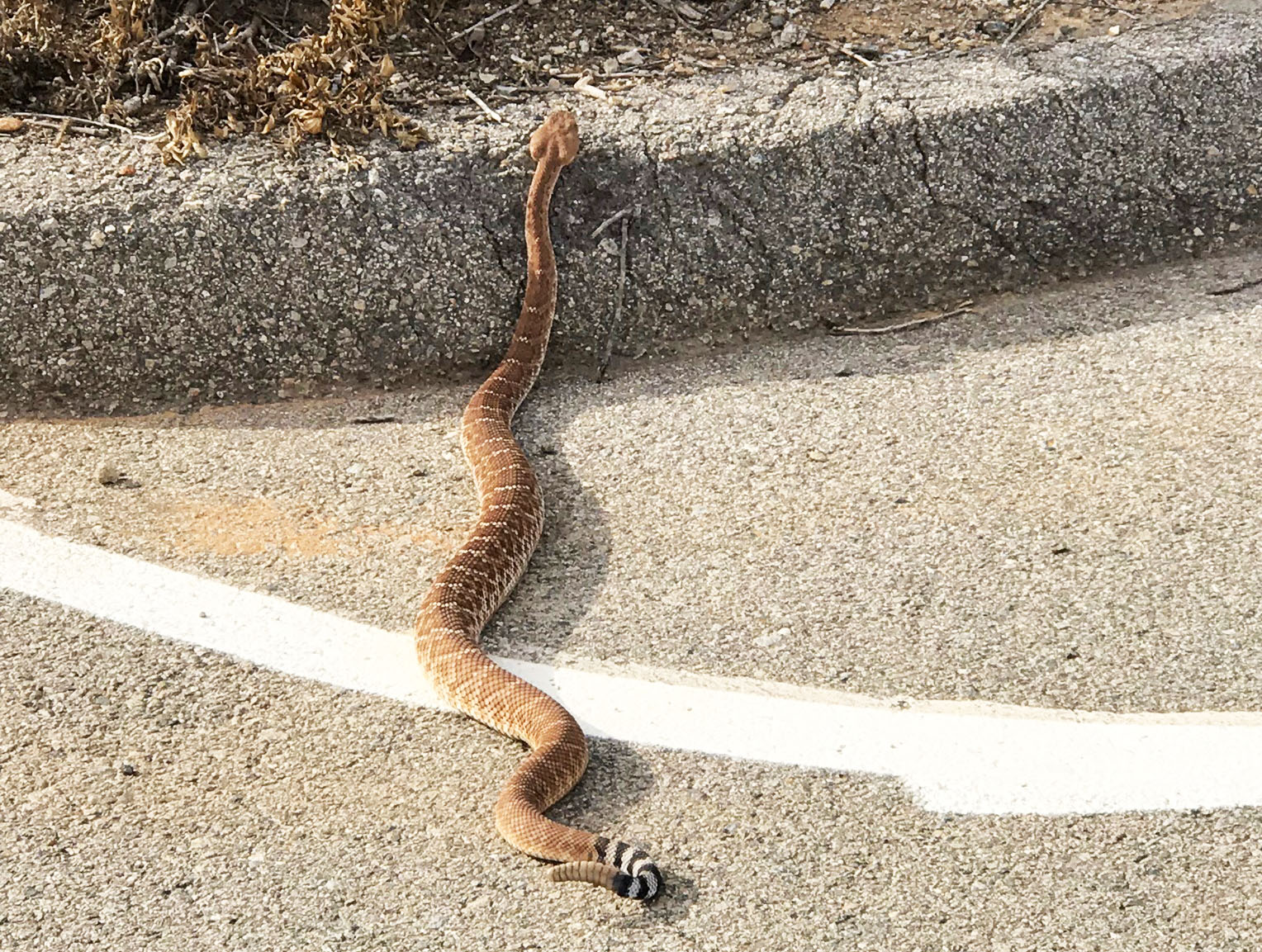 Fig. 10. Western Diamondback Rattlesnake resting along the curb along the trail near Discovery Lake. They are generally docile and will move away slowly if not provoked. Fig. 10. Western Diamondback Rattlesnake resting along the curb along the trail near Discovery Lake. They are generally docile and will move away slowly if not provoked. |
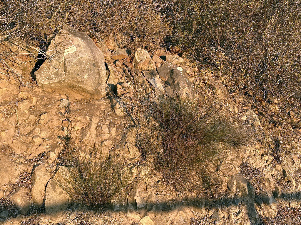
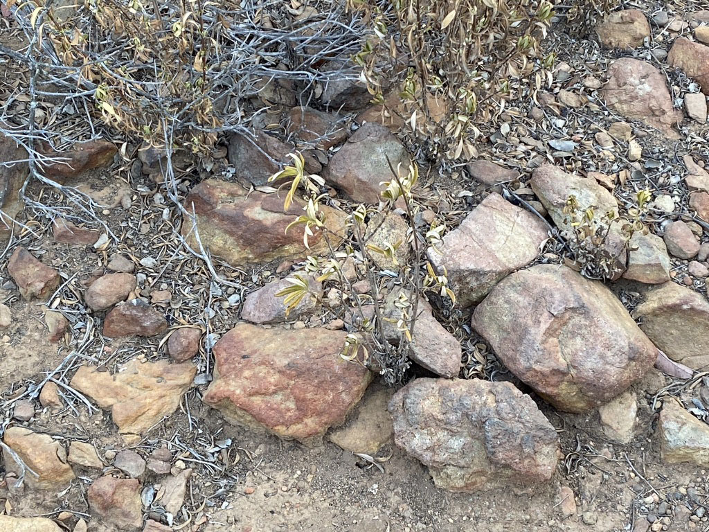
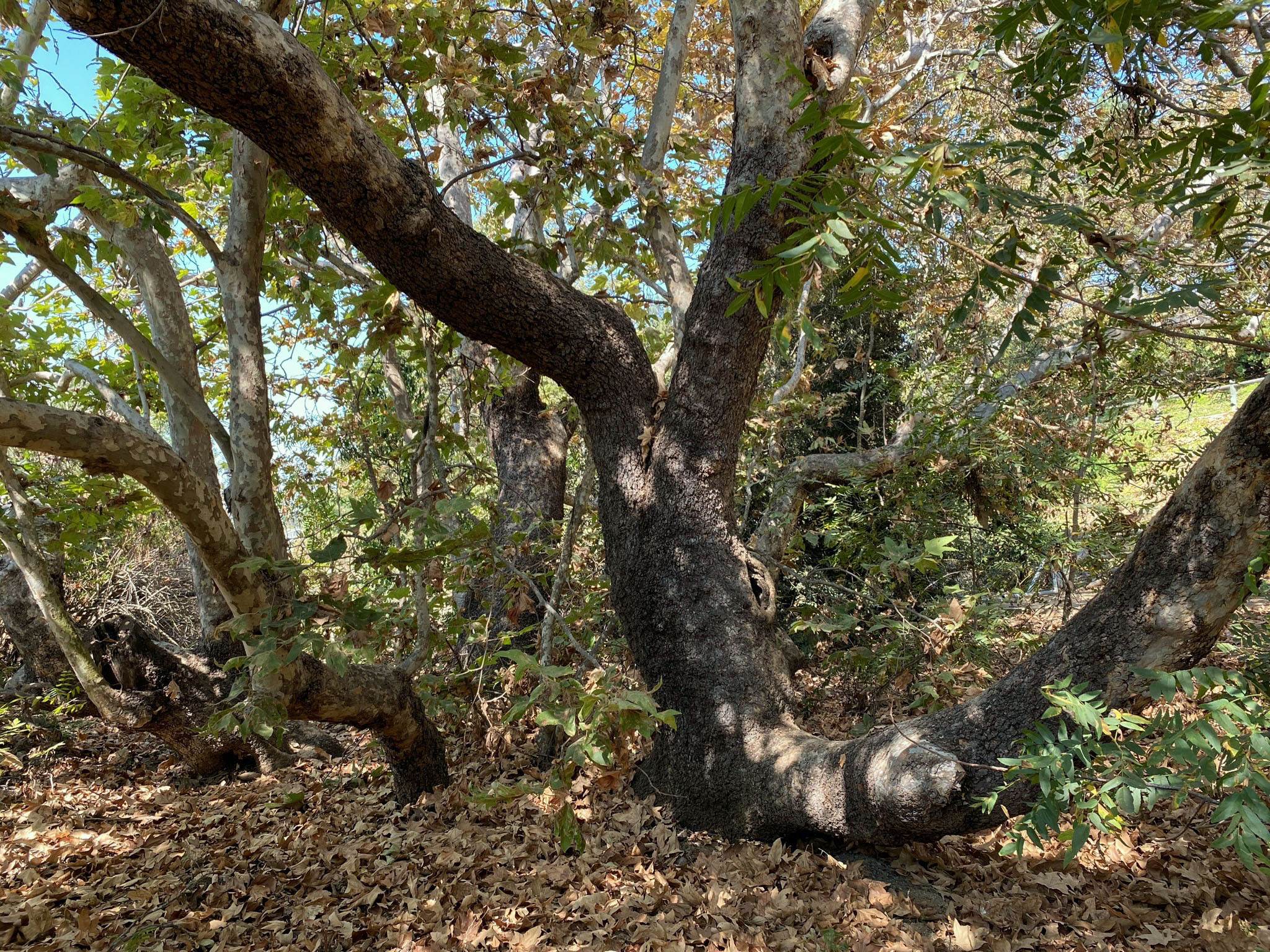
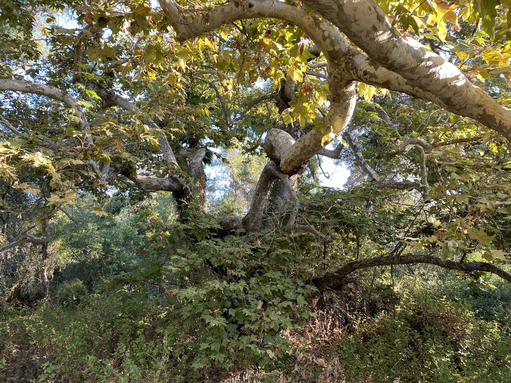
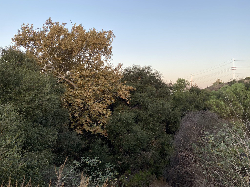
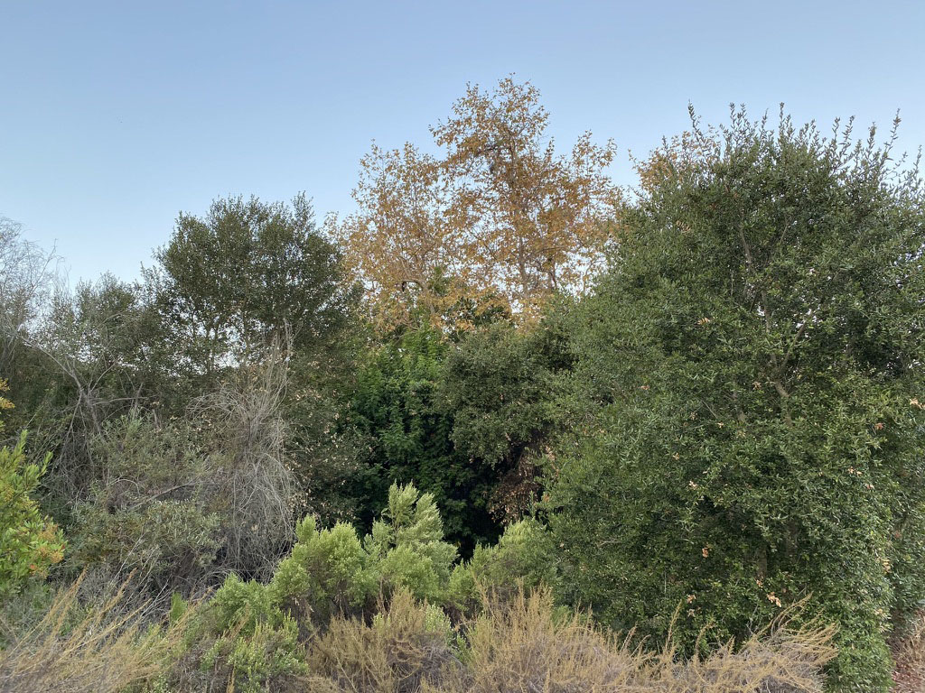
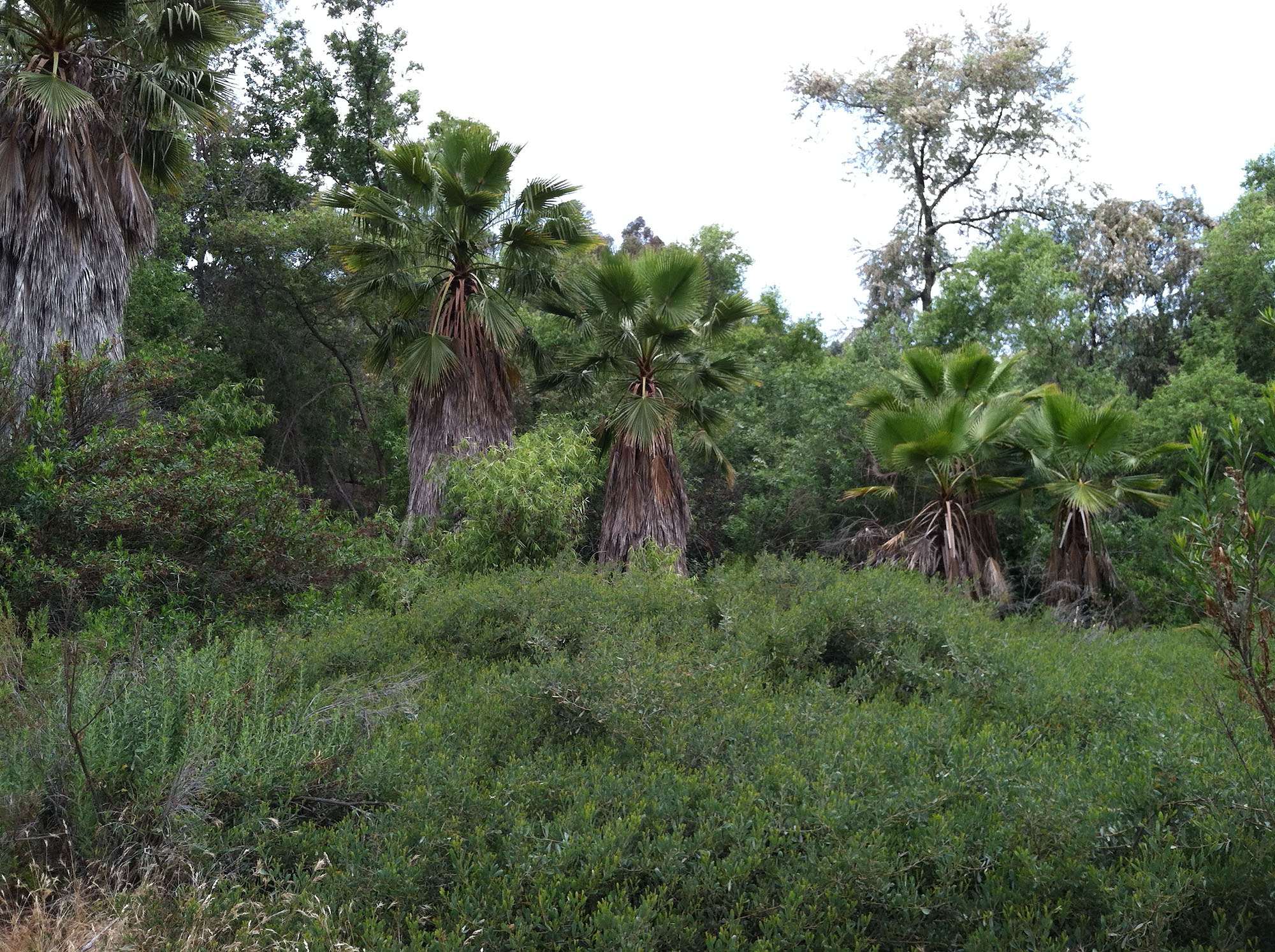
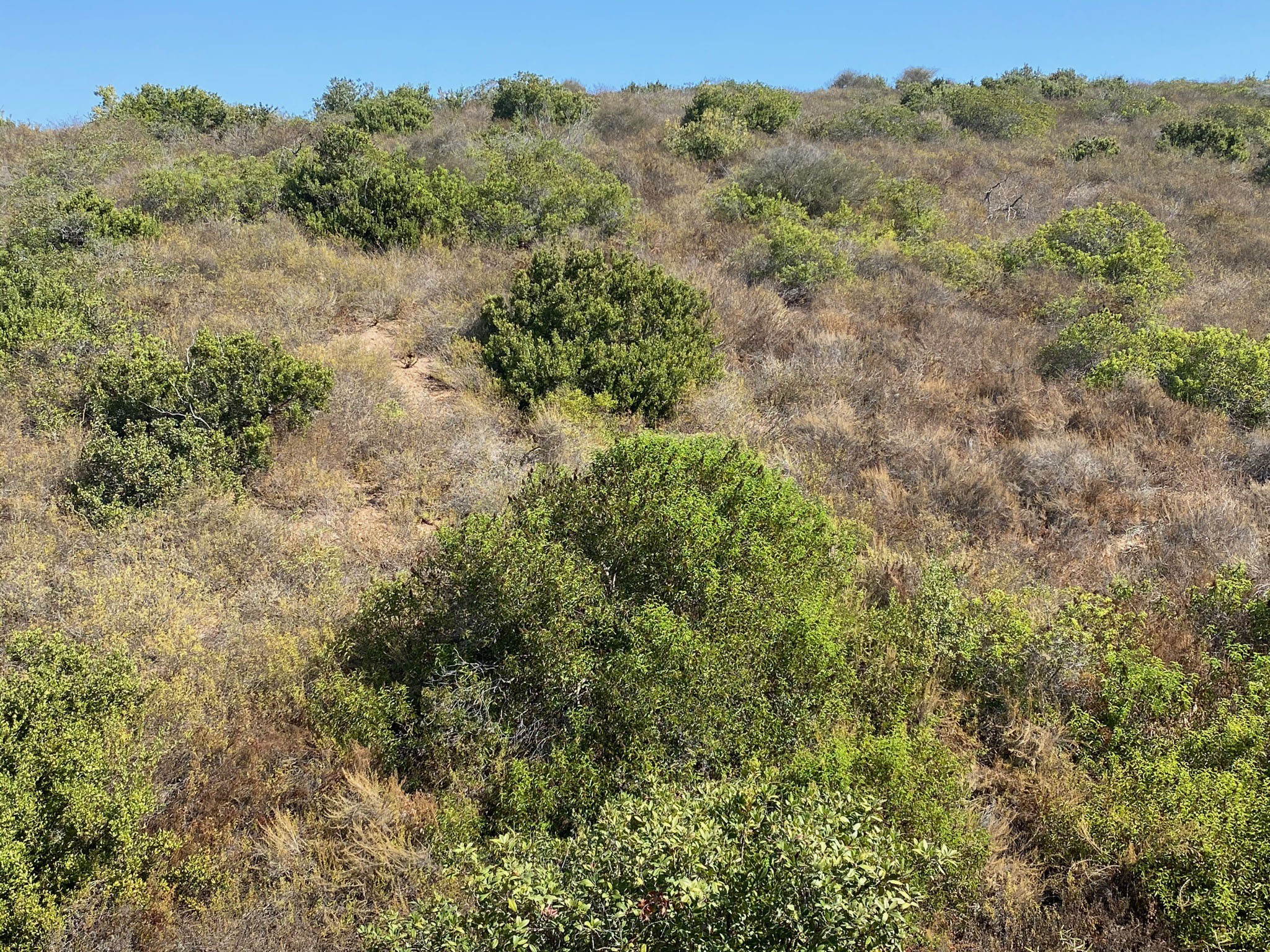
Plant Communities (Wildlife Habitats)The walk along the Discovery Creek Trail is an excellent place to observe the relationship of the landscape with the local plant communities. This is an environment that has a variety of species that are adapted to infrequent wildfires. Discovery Creek is a part of the watershed of the Vallecitos Water District. Note that some areas along the paved trail are manicured park landscape with both native and non-native plant species, but along the stream valley of Discovery Creek remains host to a riparian forest with dense undergrowth.The riparian forest is dominated by large sycamores, coast live oaks, willow, and a variety of introduced species (including a small olive orchard). Sycamore trees are the largest; they are phreatophytes and loose their colorful leaves in the fall (Figures 11 and 12). The coast live oak trees also live along the stream valley and stay green year round (Figures 13 and 14), Eucalyptus and Mexican fan palms are introduced species. The eucalyptus were introduced from Australia in the 1850s as an experiment-gone-bad by the railroads. Palms were introduced in the 1800s, but some have argued that California fan palms may have been introduced by native peoples before the Spanish arrived (Figure 15). Above on the drier hillsides (not in developed housing areas) is a mix of chaparral and coastal sage scrub plant communities. Coastal sage scrub is dominated with California sage/sagebrush (several species), buckwheat, monkeyflowers, gooseberry, and others(Figures 16 and 17). The chaparral plant community is dominated by chamise, and to a lesser degree, black sage, toyon, manzanita, scrub oak, wild lilac, and many other plants (Figure 18). There are literally hundreds of different native plant species in the San Diego region, but only certain plant dominate the different habitats (plant communities). The different plant communities transition into each other. In very general terms, the chaparral plants are mostly taller than a adult human, whereas the coastal sage communities are mostly shorter. Selected information sources about local plant communities include: Habitat Types (U.S. Fish & Wildlife Service website) for descriptions of the various plant communities in the San Diego region. Plant Communities of California (Las Pilitas Nursery website). Checklist of the Vascular Plants of San Diego County of San Diego County (San Diego Natural History Museum). |
|
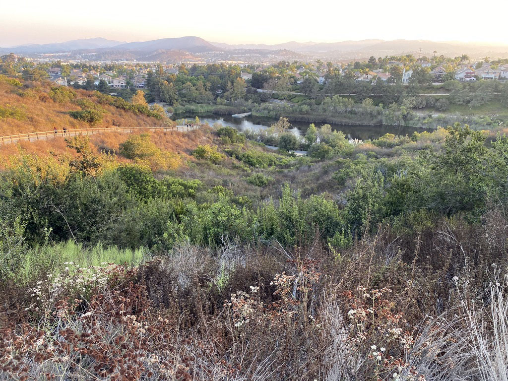
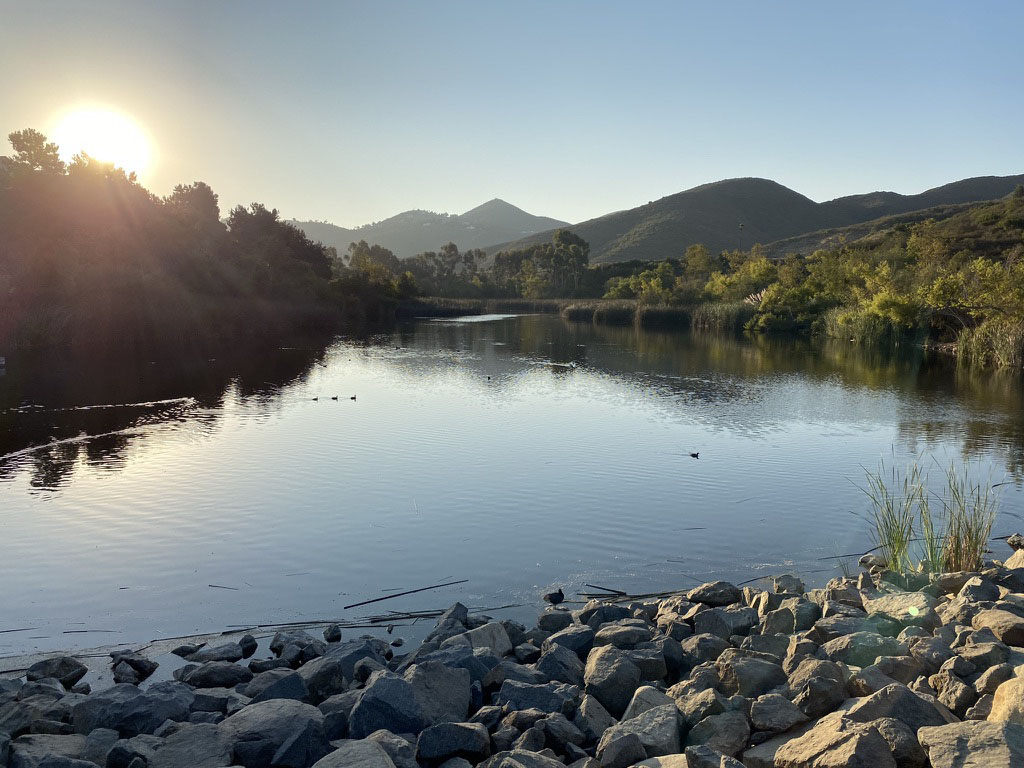
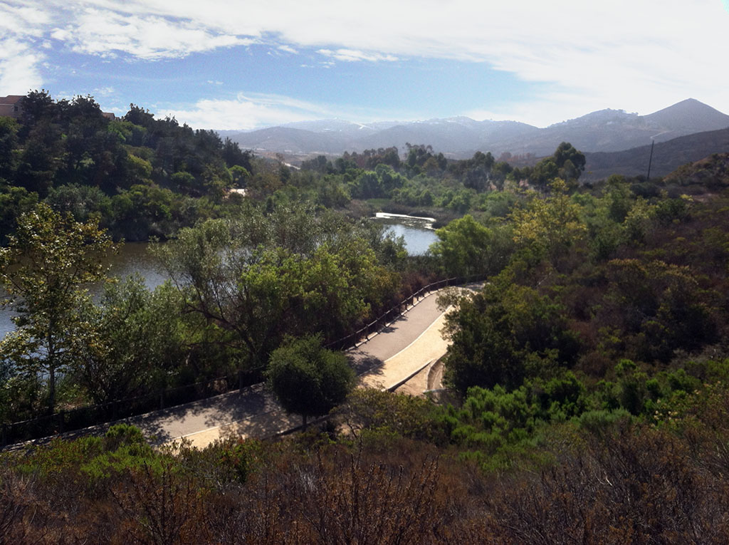
History of Discovery Lake and Discovery CreekAccording to the San Marcos Historical Society, in 1797, a group of Spaniards discovered the valley while pursuing a small band of local natives. They name it "Los Vallecitos de San Marcos" ("Little Valleys of Saint Mark") in honor of Saint Marks Day (April 25), the day on which it was discovered. Prior to the construction of the dam on Discovery Creek there were probably perennial springs along Discovery Creek that were utilized by the native population for millennia before the Spanish rancheros arrived.Figure 19 is the oldest USGS topographic map available that shows Discovery Lake already existed, as shown on the Rancho Santa Fe 15' Quadrangle mapped in 1947 (printed in 1949). The reservoir probably served as the water supply for the small community of San Marcos that consisted of only several dozen homes and businesses near the intersection of several roads, a highway, and a train stop on the Santa Fe Railroad. Today Discovery Lake is aquatic wildlife refuge, although fishing is permitted (Figures 20and 21). The stream still flows in the winter season after rains but is typically dry in the summer/fall season (Figures 22and 23). |
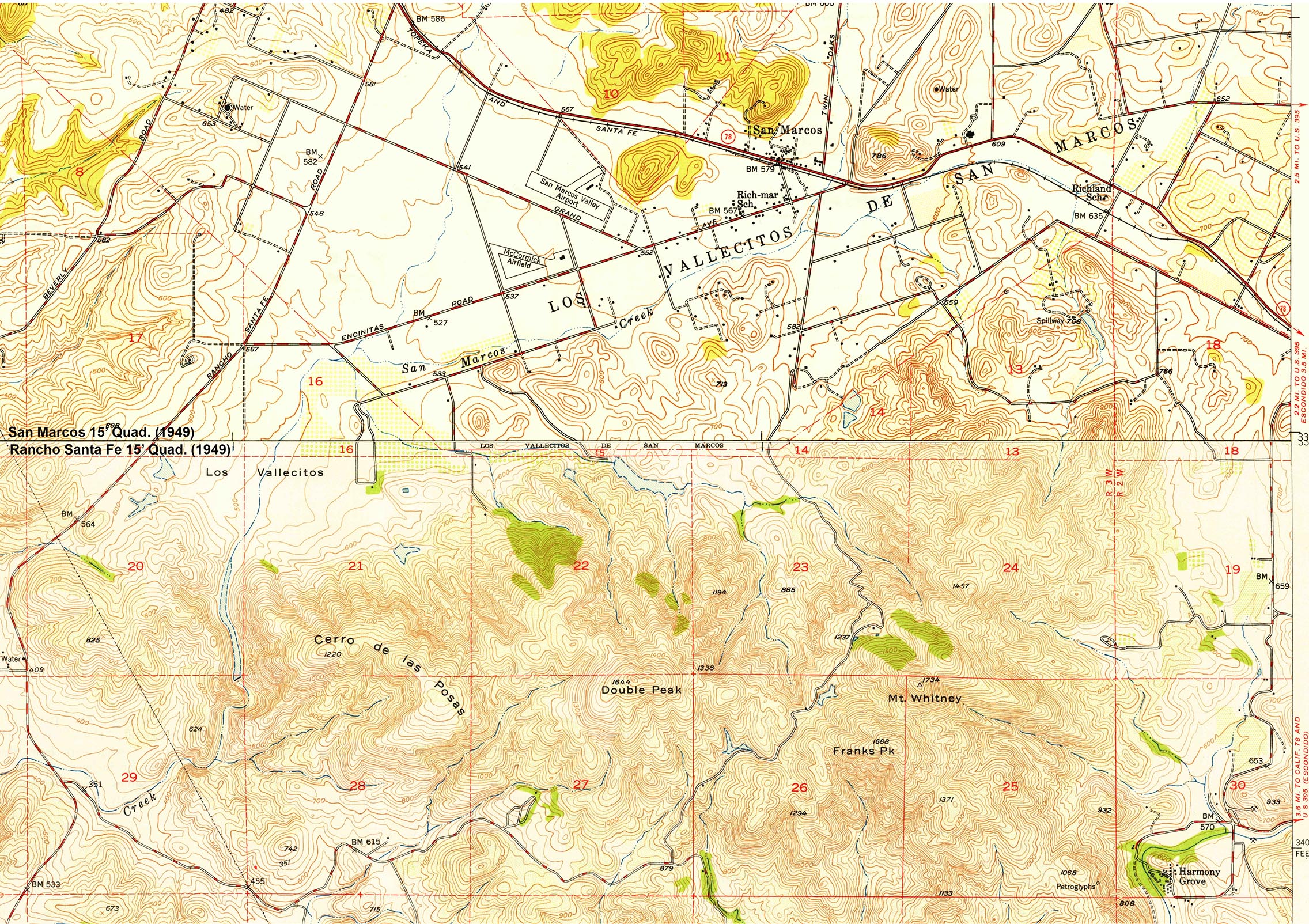 Fig. 19. Topographic map of Los Vallecitos de San Marcos showing how rural the region was when it was first mapped in 1947 (San Marcos and Rancho Santa Fe 15' Quads., 1949). |
Geology of the Discovery Creek and San Marcos Area |
Time's Influence On Geologic ProcessesPerhaps the two most fundamental concepts of geology are the geologic time scale and the rock cycle. Over the past 3 centuries, the scientific community has resolved many of the key finding related to earth history and the chronology of the evolution of life including some major geologic events that have transformed the planet. Figure 24 is a generalize summary of earth history linked to a geologic time scale. Figure 25 illustrates the rock cycle—an idealize cycle of processes that transform rocks and materials in the earth's crust involving melting, movement, and cooling of molten material, uplift, erosion, transport, and deposition of sedimentary materials, and the metamorphic transformation of one rock type into another over time. |
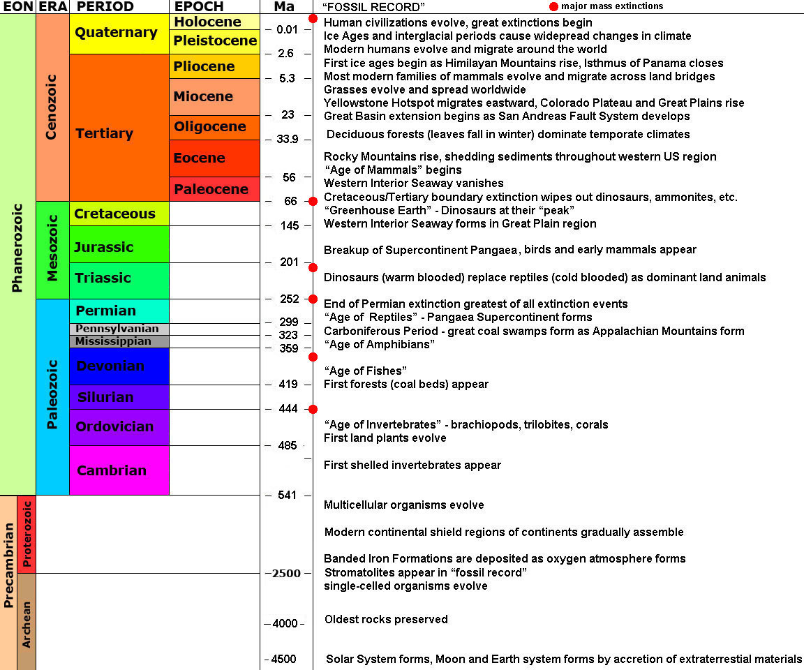 Fig. 24. The Geologic Time Scale summary of major earth events (in millions of years). |
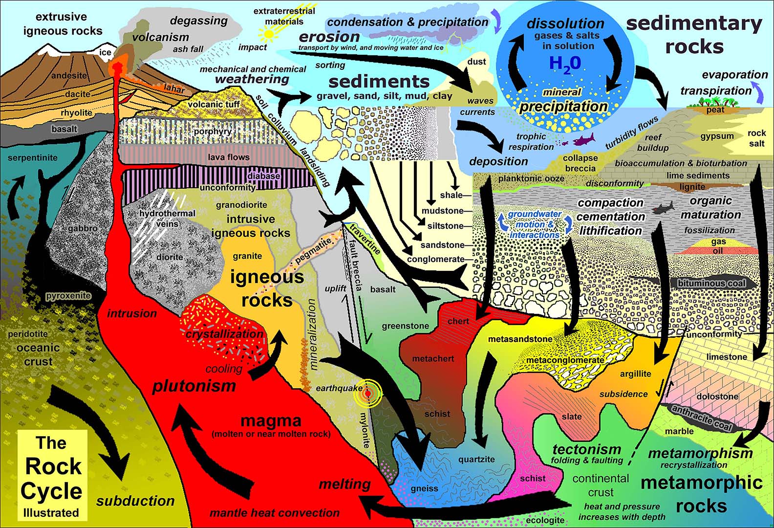 Fig. 25. The rock cycle illustrated showing how geologic processes transform rocks and earth material over time. |
Plate Tectonics Of the SoCal RegionFigure 26 is a generalized illustration of how plate tectonics shaped the coastal margin of North America. The Peninsular Ranges of southern California originally formed along a convergent plate boundary (involving a subduction zone and volcanic arc complex) analogous to Japan, Indonesia, or Aleutian volcanic island chains we see in the world today. The bedrock in the San Marcos area formed in association with this convergent plate boundary that was active during the Mesozoic Era (Jurassic and Cretaceous Periods). The rocks we see exposed in the mountains around San Marcos are mostly granitic plutons that had intruded into older igneous and metamorphic rocks. The older rocks consisted of a mix of rock formed during older oceanic crust and island arc settings that had be rafted in by crustal migration forces from other locations of origin offshore and/or farther south. Collectively, all the igneous plutons of Mesozoic age that make up the core of the mountain in the San Diego region are part of the Peninsular Ranges Batholith. |
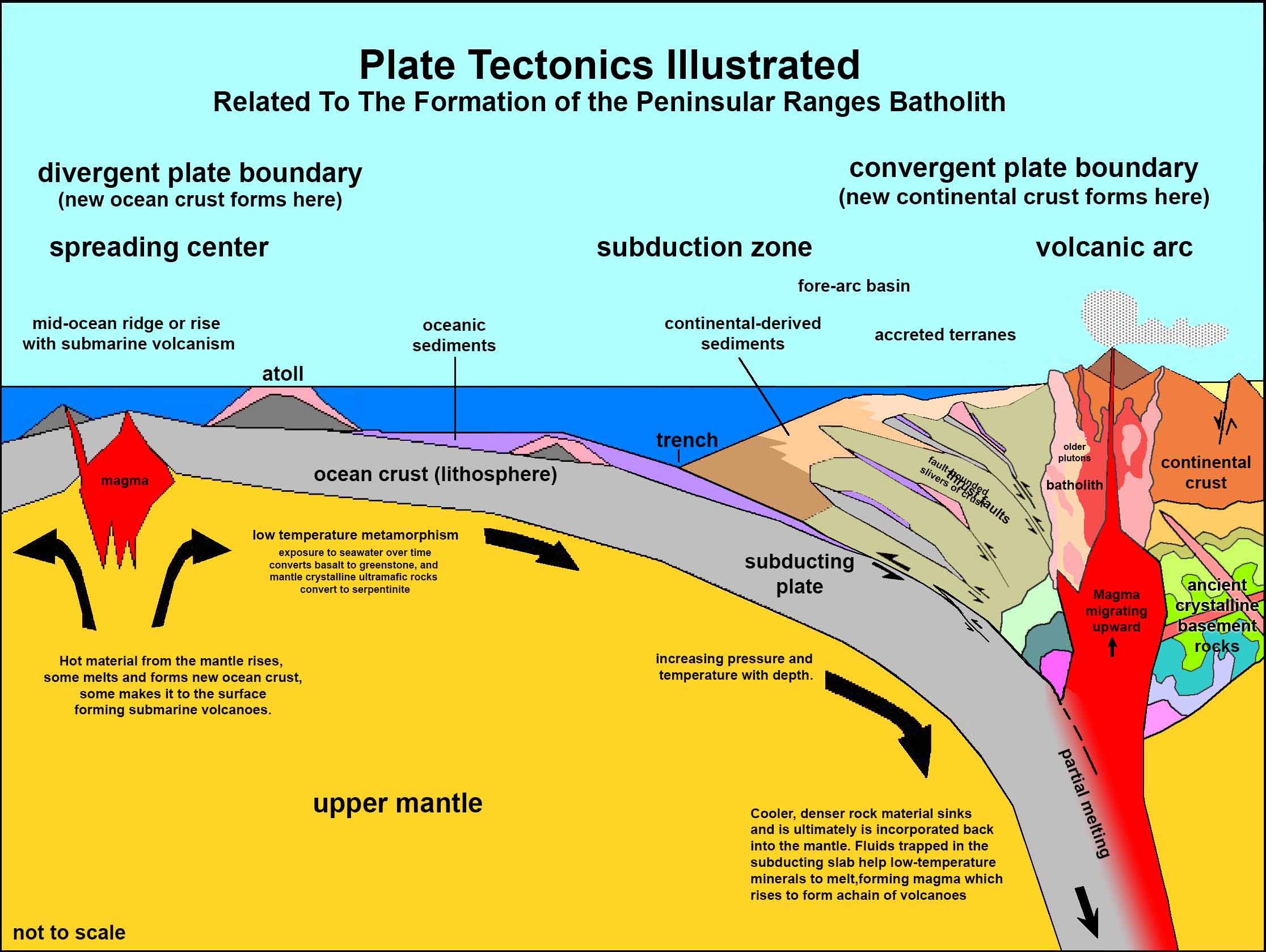 Fig. 26. Plate tectonics illustrated showing both divergent and convergent plate boundaries. The Sierra Nevada and Peninsular ranges of California formed along a convergent plate boundary. Fig. 26. Plate tectonics illustrated showing both divergent and convergent plate boundaries. The Sierra Nevada and Peninsular ranges of California formed along a convergent plate boundary. |
Here are what the geologic map color symbols mean:pKm means "pre-Cretacous metamorphic rocks." This simplified designation isn't entirely correct. These rocks have been named Santiago Peak Volcanics which includes a mix of metamorphic rocks (altered sedimentary, volcanic, and intrusive igneous rocks) of Jurassic to early Cretaceous age (140 to 120 million years ago, with some possibly older rocks (See a descriptive summary of the Santiago Peak Volcanics listed in the USGS Geolex). |
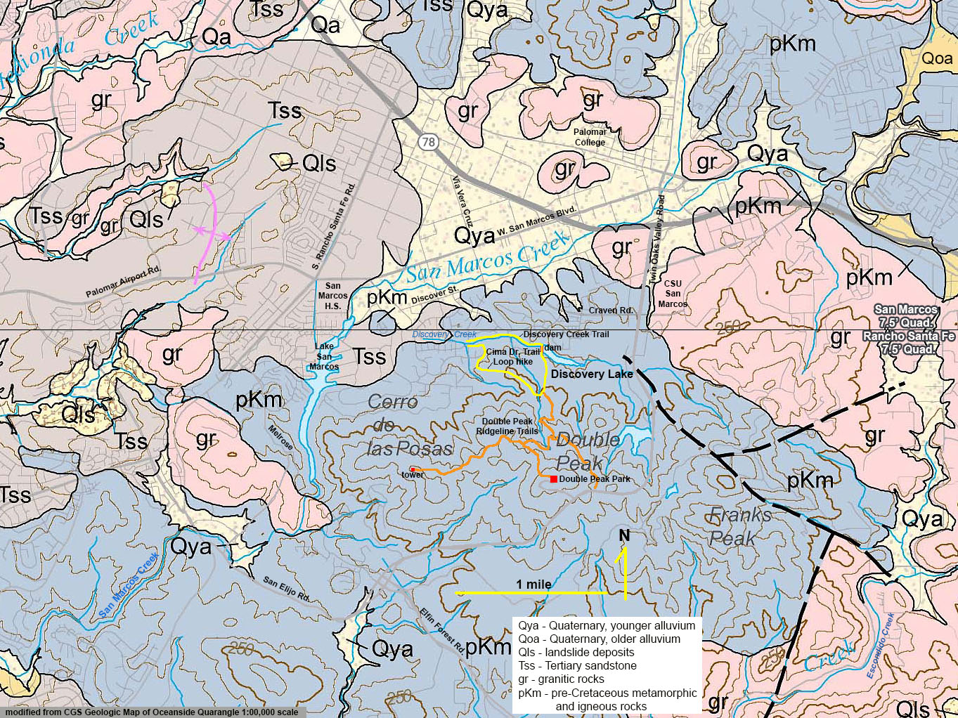 Fig. 27. Geologic Map of the San Marcos area including the Discovery Creek and Double Peak mountainous areas. |
| Learn more about the regional plate tectonics from this classic report: Geologic History of San Diego County (by Michael J. Walawender, SDNHM). Also see Maps of the San Diego County Region for maps of regional geology, landscape features, land use, and satellite imagery. |
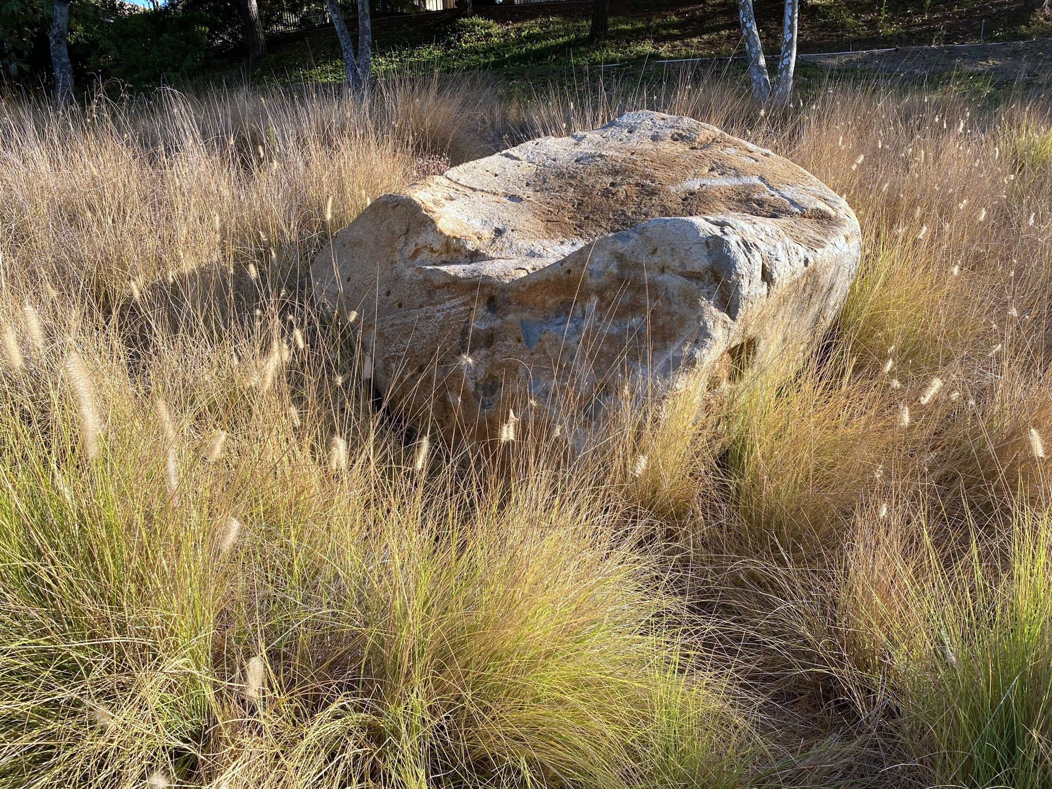
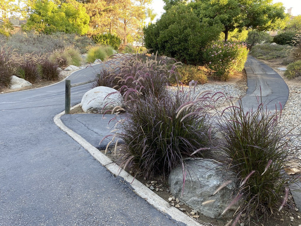
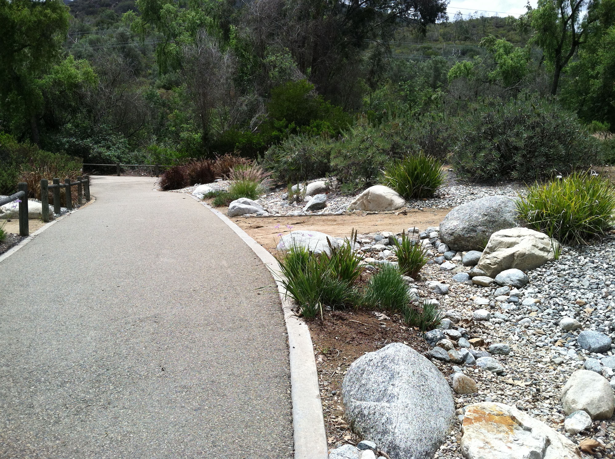
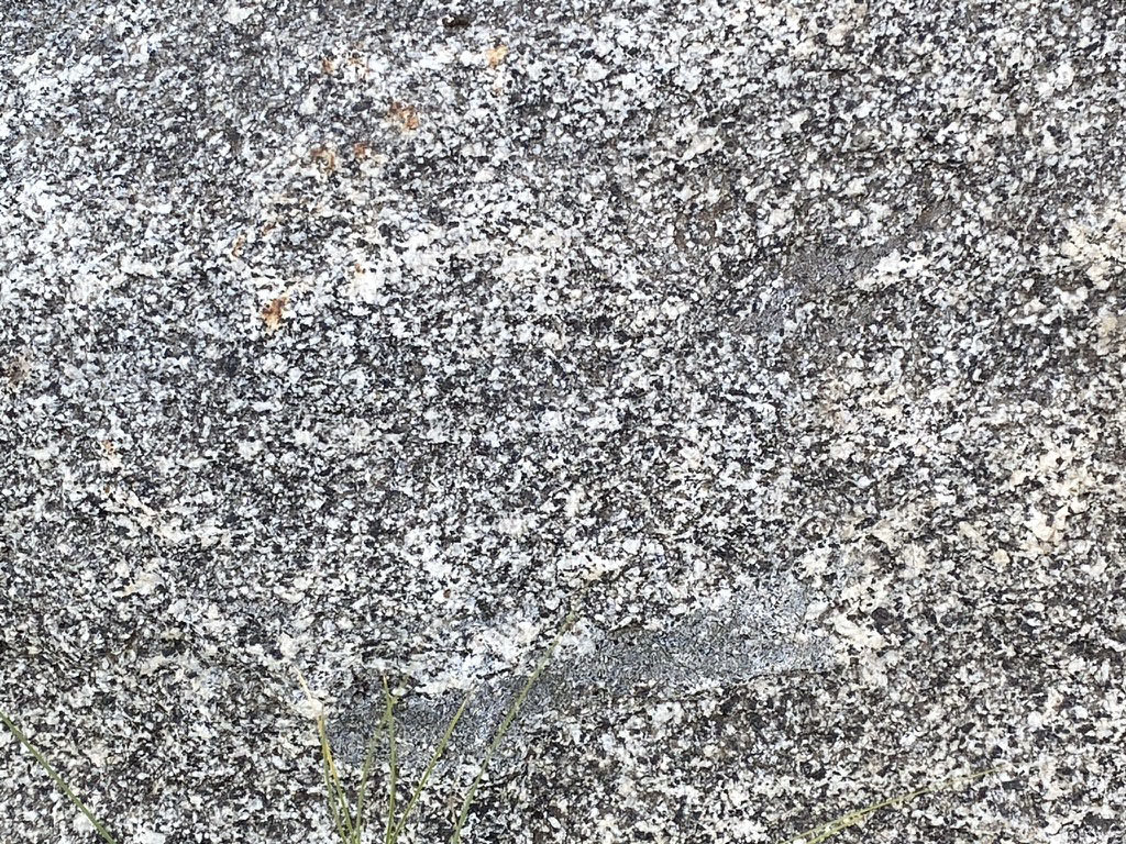
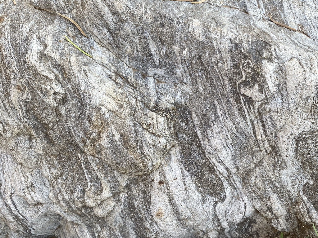
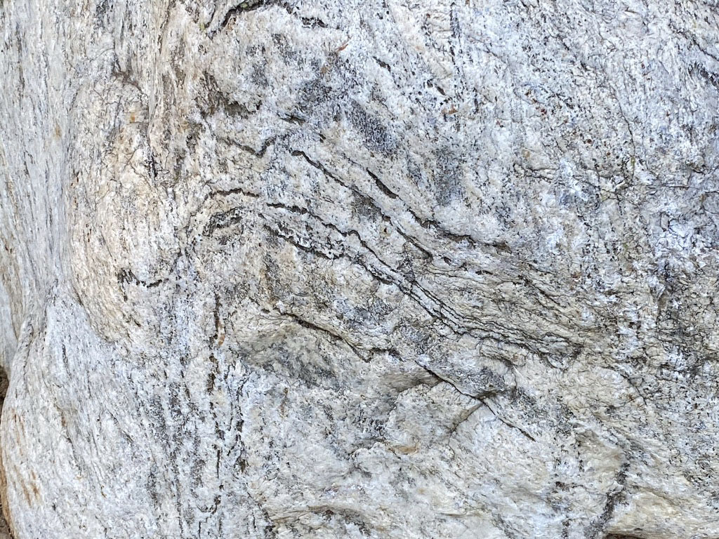
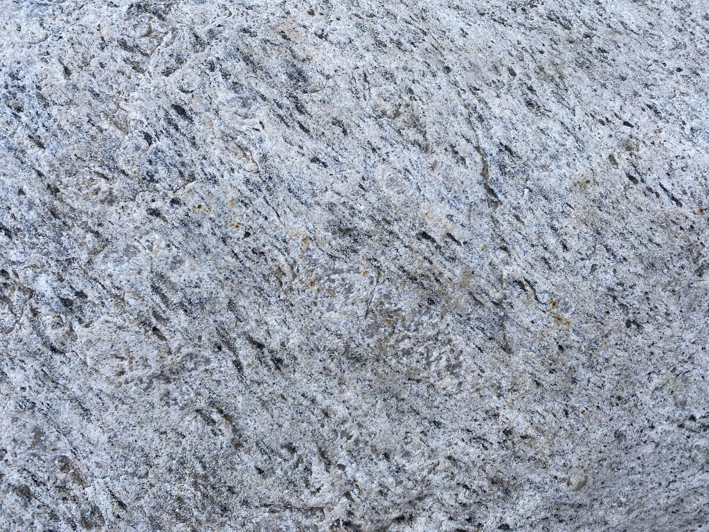
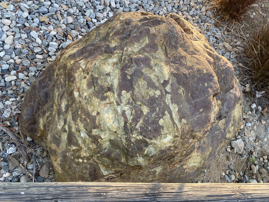
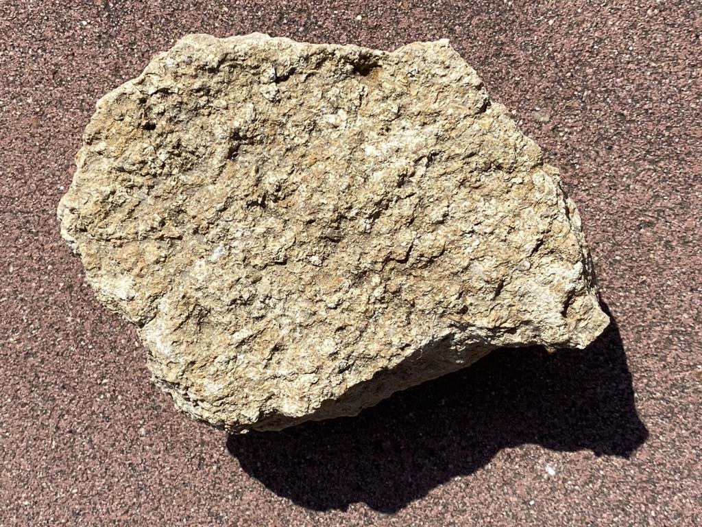
Stops B (Rock Bench) to Stop C (Boulder Garden)Stops B and C are good locations to examine a variety boulders used as ornamental landscaping along the Discovery Creek Trail. The exact source of these large boulders is unknown, but they are typical of some of the bedrock exposed in the mountainsides of San Marcos and surrounding region. These are excellent large specimens ideal for studying the composition, textures, and origin of a variety of igneous and metamorphic rocks and associated features.Stop B is a stone bench, and the first opportunity to see one of the amazing boulders along the trail (Figure 28). As you walk along the trail examine each of the large boulders. Figure 29 shows one of the largest boulders along the trail. it is a fine-grained "granitic" rock that is most common variety in the local bedrock. Granitic is a general term used to describe light-colored igneous intrusive rocks that have a crystalline texture. True granite is one variety of granitic rock. More appropriate or technical names for granitic rocks is discussed below. "Granite"—like you see in counter tops or walls—can be any number of varieties of granitic rocks. Stop C is a scenic "Boulder Garden" spread out along a short side trail loop that intersects the Discovery Creek Trail (Figures 30 and 31). Along the paths there are dozens of large boulders have been placed among patches of cobbles and gravel amid water-tolerant plants. Although it is uncertain exactly where these boulders came from, they are very similar in composition to rocks exposed in the local mountains. In any case, they are ideal rocks to study and learn about some varieties of igneous and metamorphic rocks. |
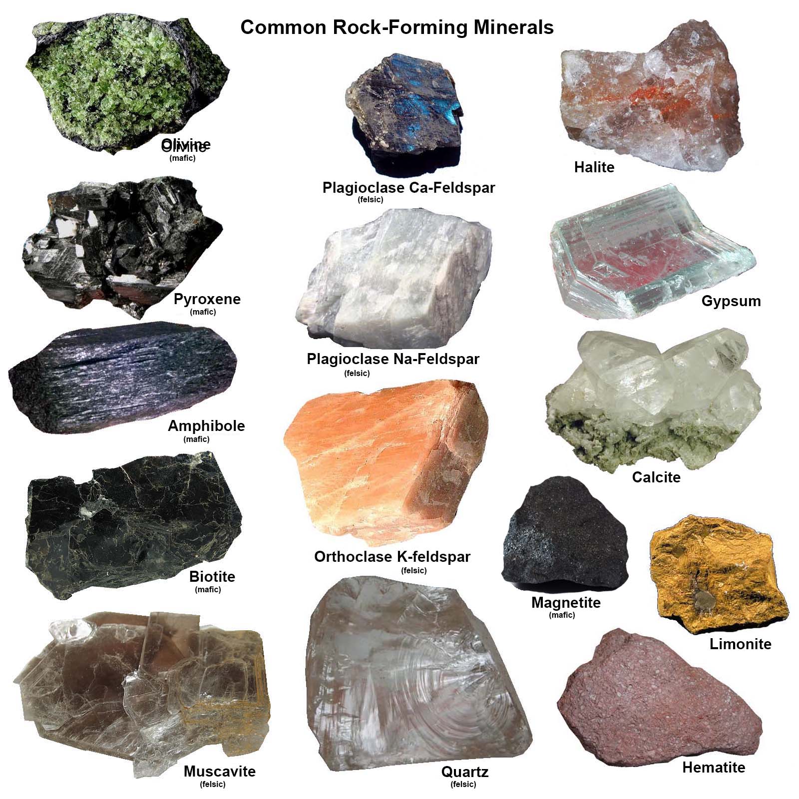
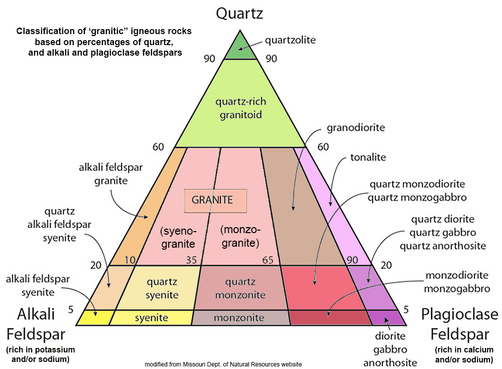
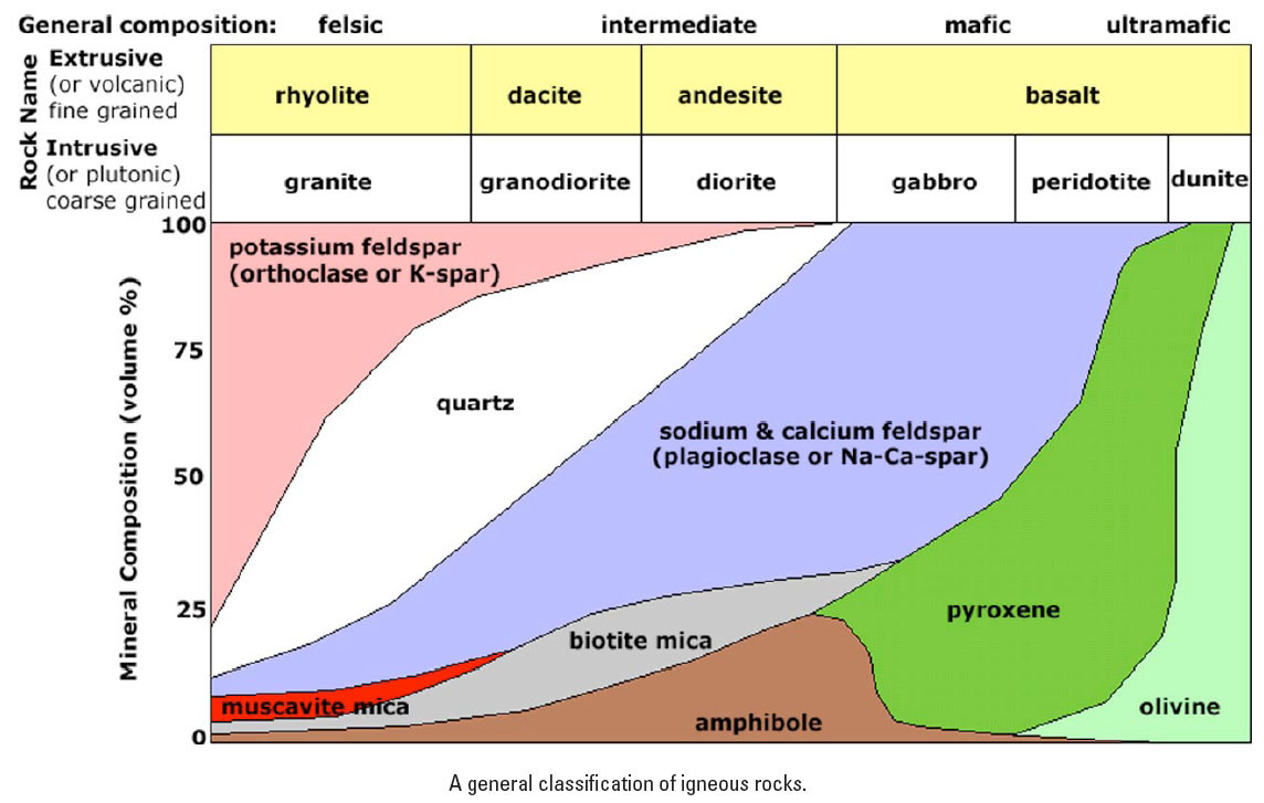
Igneous Rocks and FeaturesThis website isn't a replacement for college courses in igneous and metamorphic petrology, but hopefully it might spark some interest in the topics. The boulders in the area are excellent teaching samples. Please down collect rock samples, break, mark on, or move the rocks!Basic Igneous Rock IdentificationNearly all rocks are made of made of common rock-forming minerals (Figure 32). The bedrock throughout the Double Peak and San Marcos Mountains consist of rocks that are dominantly composed of light-colored felsic minerals (feldspars and quartz), and dark mafic minerals (biotite, and amphibole, and pyroxene). Felsic minerals are enriched in silica and aluminum and tend to be light colored. Mafic minerals are enriched in iron and magnesium and tend to be dark colored.Most of the rocks on this field trip have a hard, crystalline texture, meaning that it is possible to see the interlocking mineral crystal grains without magnification. Figure 33 is a commonly used classification system of granitic rocks based on percentages of quartz and feldspars alkali-feldspar and plagioclase. Most of the crystalline igneous bedrock in the San Diego region can be classified using this diagram. Figure 34 is another classification diagram that also includes mafic minerals. This diagram also shows the different name of igneous rocks in two categories: coarse grained (intrusive or plutonic) or fine-grained (extrusive or volcanic). Coarse-grained igneous rocks form when magma crystallizes slowly, allowing mineral grains to grow into large (visible crystals). This only happened deep underground where surrounding rocks insulate the cooling magma. Magma flows under pressure and can force its way along fractures or melting pre-existing rocks as it migrates. The bodies of magma underground are called intrusions or form tear-dropped shaped magma chambers the cool to form plutons. The fine-grained igneous rocks form when magma (or lava erupted on the surface) cools quickly, such as where it is extruded onto the surface as a volcanic eruption. For instance, note that on diagram, coarse-grained granite has the same mineral composition as fine-grained rhyolite. Also, coarse-grained gabbro also has the same mineral composition of fine-grained basalt (see Figure 35). |
|
In simplest terms, volcanic rocks are generally classified by color (because the mineral grains are too small to see).
|
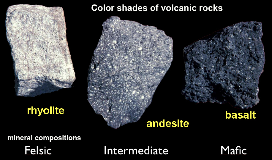 Fig. 35. Volcanic rocks. |
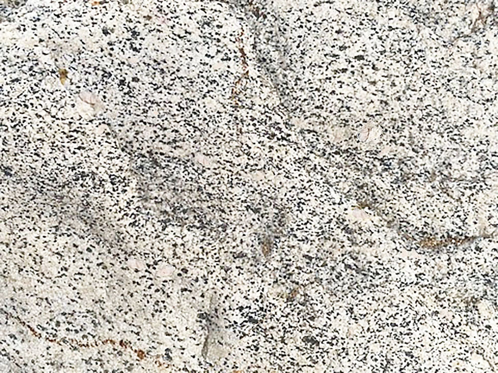
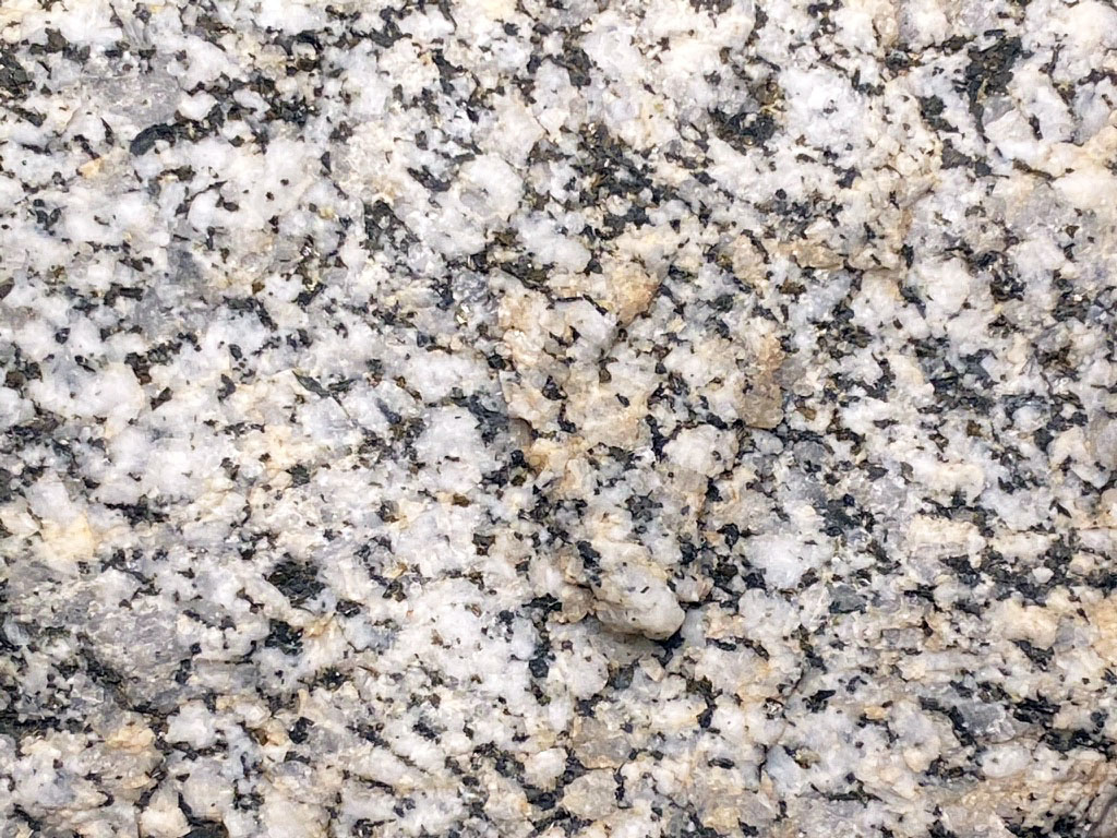
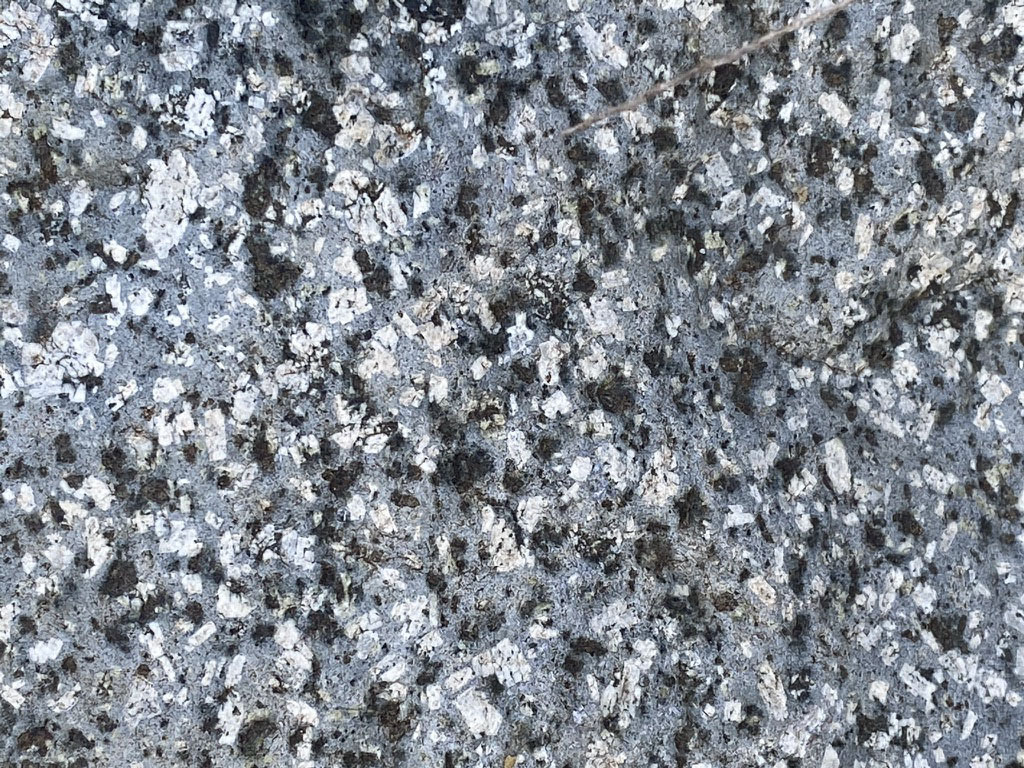
Learning to name rocks isn't always fast and easy — the following statement definitely applies:"One rock, 2 geologists, 3 opinions."Below are examples of granitic rocks from the Stop C (the Boulder Garden area). Figure 34 basically qualifies a granite bordering on tonalite. If you look closely it mostly contains white plagioclase (Na- and/or Ca-feldspar) and some larger pinkish-colored crystals of orthoclase (or K-spar). The smaller gray crystals are quartz, and the dark grains are mostly biotite (mica). True granite is not really common or abundant in the region. Figure 35 is tonalite—perhaps the most common variety of granitic rock in the San Diego region. It tends to be more enriched in ca-feldspar (plagioclase) than true granite. This sample has more quartz (gray), and the tiny black crystals are magnetite and biotite. The brownish color is a weathering stain of limonite. Figure 36 is an example of gabbro. Gabbro tends to be darker in color (having more mafic minerals), and less quartz than either granite or tonalite. Figure 37 is perhaps the most unusual granitic rock in the Boulder Garden area. It has an abundance of coarse grains of feldspar and dark mafic minerals embedded in a fine-grained matrix (to fine to see without magnification). Although it looks similar to the gabbro, it might best be called an andesite porphyry. Andesite is a medium gray volcanic rock (named after the Andes volcanic range in South America where it is abundant). A porphyry is a volcanic rock that formed where a magma body already began to crystallize deep below the surface, but not completely. Something occurred that allowed the partially molten rock to migrate upward and cool quickly forming the fine-grained mineral matrix. The large crystals that had already formed were carried along as the magma flowed. |
Granitic Rocks at Stops B and C |
|
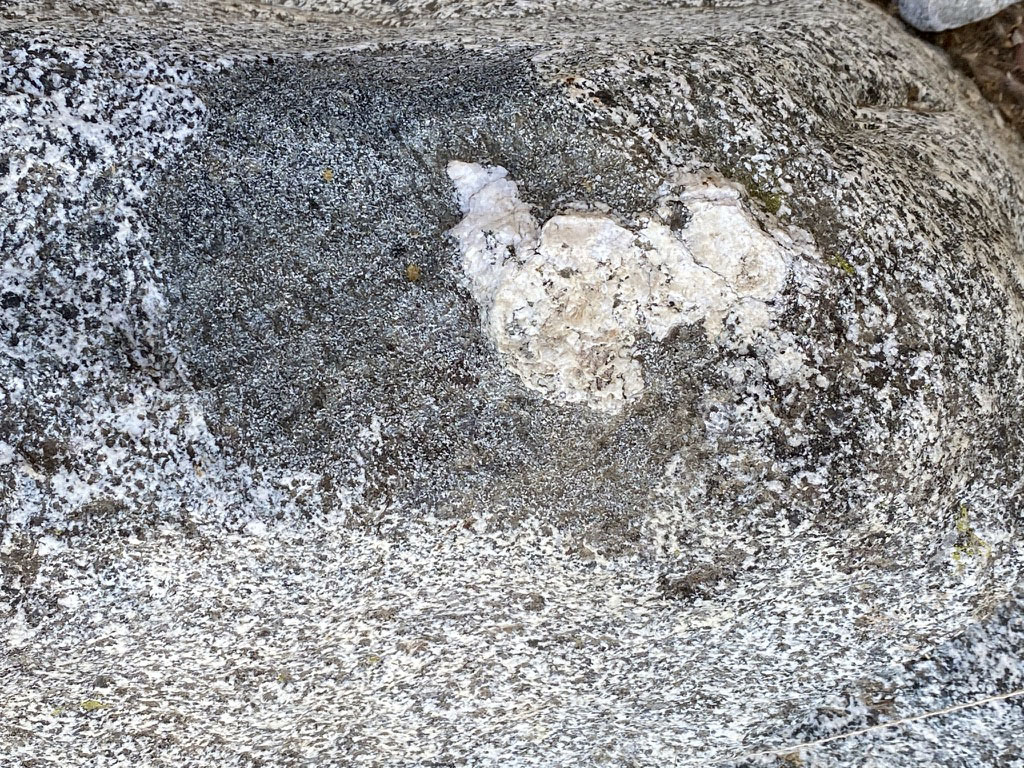
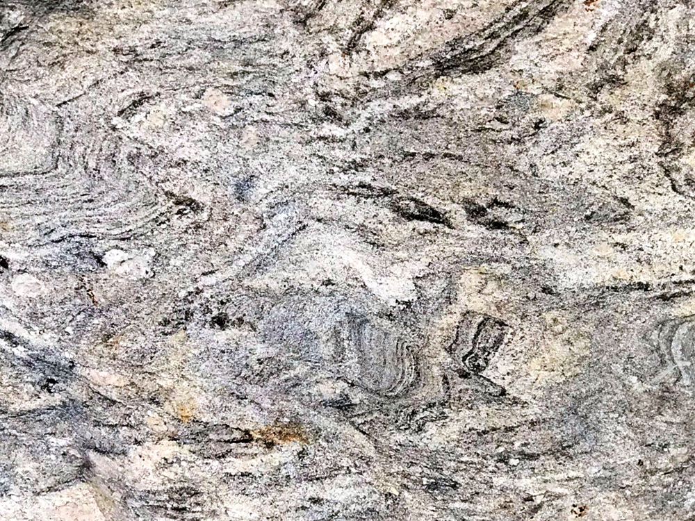
Xenoliths: Inclusions In Igneous RocksSome of the rocks in the Boulder Garden area display unique geologic features that help tell the story of how and where the rocks formed. "Xeno" mean foreign, and "lith" means rock. A xenolith is a foreign piece of rock or trapped within an igneous rock. Xenoliths are not derived from the original magma but has been introduced from elsewhere, typically from the surrounding country rock (the rock being intruded by a magma body). As a magma body migrates through the crust, it can pluck off rocks from the side of the magma passage. Some may come from the top and sides of a magma chamber whereas some are carried up from below. Xenoliths are typically darker (mafic in composition) because they are made up of high-temperature minerals that can resist melting and being incorporated into the magma body. Xenoliths are commonly small, but can range up to car- or building-size blocks. Xenoliths are inclusions. According to Hutton's Law of Inclusions, rock fragments included in a host rock (such as granite) are older than the host rock itself.Xenoliths help tell the story of how magma forms igneous bodies (plutons). They can also how the magma changed in composition over time as new rocks crystallized from the melt. Also as magma forms and migrates upward, it melts some of the surrounding rock, changing the composition of the magma. Figure 38 is granitic boulder with an xenolith of gneiss embedded in it. Figure 39 is a tonalite boulder with a large gabbro xenolith. Figure 40 is a granitic boulder with a large xenolith of dark biotite schist. Figure 41 is somewhat unusual tonalite boulder with basalt xenoliths. Tonalite is a plutonic rock, basalt is a volcanic rock. |
|
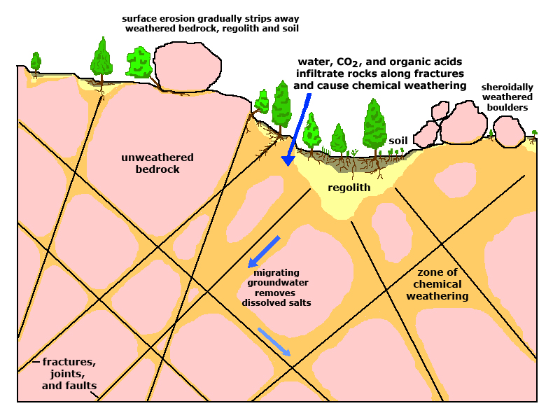
Metamorphic Rock And FeaturesMany of the boulders in the Boulder Garden area are metamorphic rocks. Most are granitic in composition but display metamorphic textures including foliation and recrystallization features, stretching, fracturing, and partial melting, all under the extreme heat and pressure conditions deep within the crust.Figure 42 shows how sediments and rocks turn into other rocks with increasing heat and pressure until they reach temperatures where they actually melt (forming magma). It is often difficult to decipher what the original rock (protolith) may have been. For instance, it may be difficult to distinguish if a high-grade metamorphic rock like gneiss had a protolith starting as marine sediments or a protolith that was originally a volcanic rock or a granite. However, some metamorphic rocks do preserve evidence of the geologic voyage over time. Many of the rocks in the San Marcos area started off as marine sediments or oceanic volcanic rocks that moved deep into the crust along a subduction zone. However, they either escaped melting or vanishing into the mantle before being pushed by tectonic forces back toward the surface. Over millions of years erosion gradually strips away overlying materials, exposing rocks that may have once been deep in the core of a mountain range or volcanic arc, miles below the surface. |
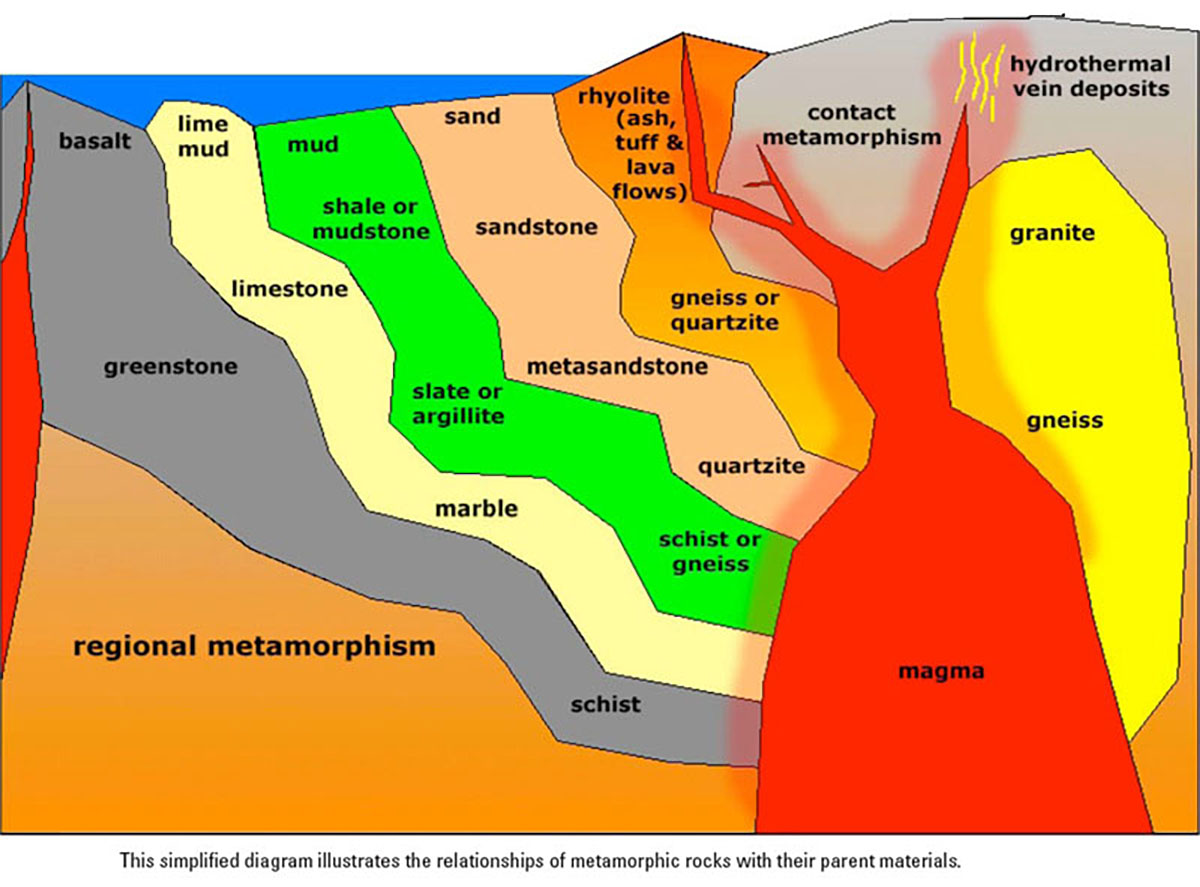 Fig. 42. Generalized diagram about how different rocks change with increasing metamorphism. |
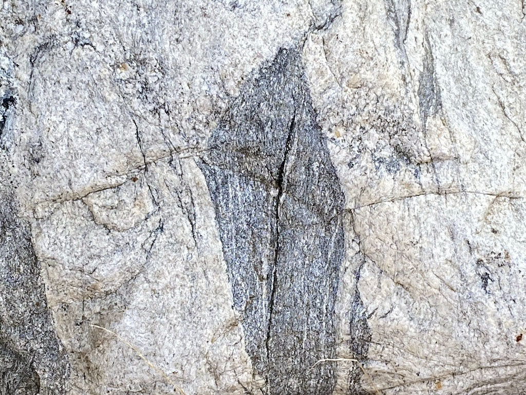
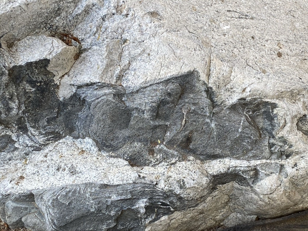
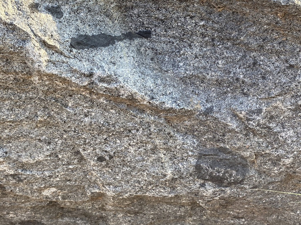
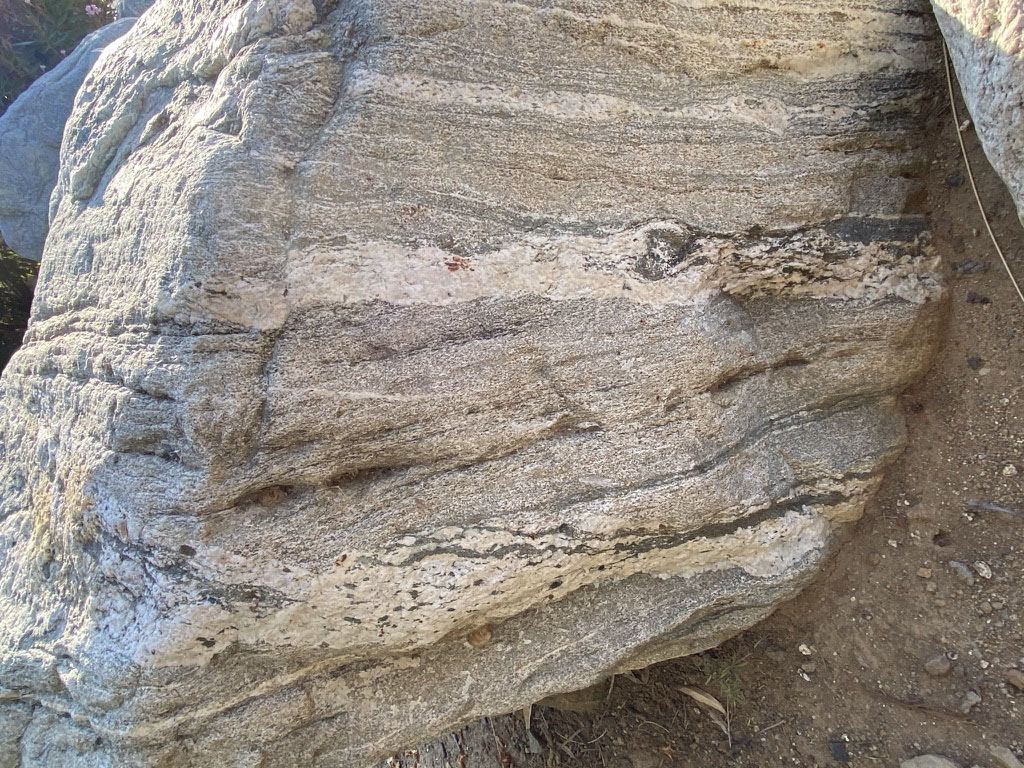
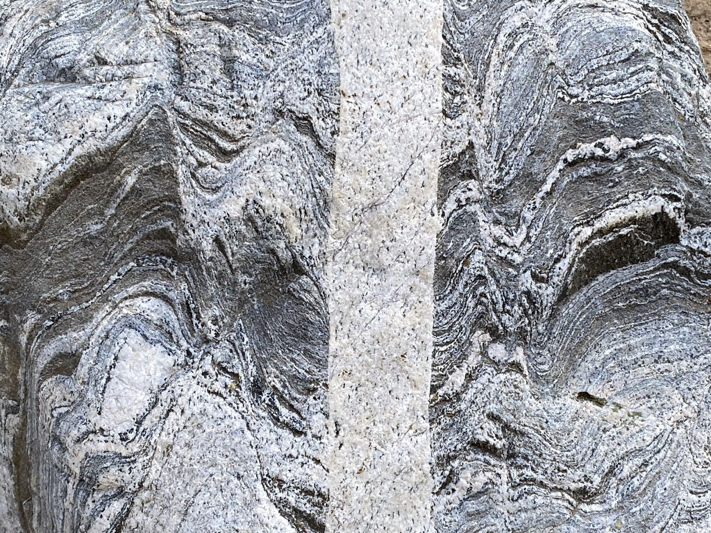
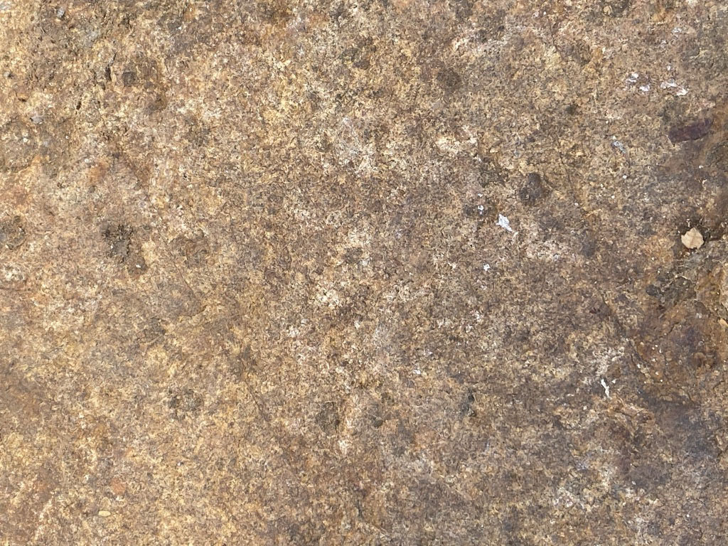
Metamorphic Rocks in the Boulder Garden AreaAlthough there are many kinds of metamorphic rocks, only a few types are represented in the Stone Garden area. However, these examples are among the common varieties found in crystalline basement bedrock of the San Marcos area. As Hutton's law of inclusions demonstrates, these rocks are older that the granitic rocks described above. Although is unknown exactly where these rocks came from, they are typical of rock assemblage called the Santiago Peak Volcanics and pre-Peninsular Ranges batholith. These rocks are of Jurassic to Early Cretaceous age (they formed roughly between 160 to 120 million years ago in a volcanic arc setting. The mineral composition and metamorphic features suggest they may have experience heat and pressures in mid-crustal depths, many miles below the surface.Figure 43 is a typical sample of gneiss. It displays foliation, a rock texture that displays repetitive layering in metamorphic rock. Gneissic texture forms when high heat and pressure causes minerals to gradually recrystallize and separate into banded layers, commonly separating into bands of dark-colored (mafic) and light-colored (felsic) minerals. As Figure 42 illustrates, gneiss can form from a variety of protoliths including sedimentary rocks, volcanic rocks, granitic rocks, and other metamorphic rocks. Trying to identify the original protolith of a gneiss can be difficult. Figure 44 is a sample of some gneiss-schist (about 50-50% dark bands of biotite schist and light bands of feldspar-quartz gneiss). The foliation in this rock displays thin layers that locally are tightly folded, even rolled up, suggesting the rock experienced shearing somewhere along its deep, long journey. Black schist is commonly associated with protoliths of ancient oceanic sediments and/or mafic volcanic materials. Figure 45 shows a pressure-fold structure in gneiss. At great depths rocks under great heat and pressure will tend to flow rather than fracture (like plastic or wax). Along the rock's geologic journey, it may be subjected to more that one period of metamorphic deformation with directed pressure coming from different directions over time. Figure 46 is an example of an augen gneiss. Augen is from the German meaning "eyes." When rocks undergo metamorphic recrystallization, sometime some of the mineral grains will grow larger and even develop surrounding zones of other minerals, such as different feldspars, quartz, biotite, and magnetite. Zoom on the image and you can see the augens. Augens are porphyroblasts—a larger recrystallized mineral grain occurring in a finer groundmass of metamorphic rock. Figure 47 is a highly deformed gneiss with complex structures (at top B). This boulder display a rock that has undergone fracturing (brecciation), shearing, folding, and annealing. It may have been associated with a fault zone before undergoing additional metamorphism. Figure 48 is perhaps the most revealing rock in the Boulder Garden area. It is a rock called a migmatite. It is a foliated gneiss and schist with a cross-cutting granitic intrusion. A migmatite is a rock composed of two or more intermingled but distinguishable components—typically a granitic rock within a metamorphic host rock. They form in or along the transition zone were metamorphic rocks are near magma bodies exist or within the zone where rocks are melting. Hutton's Law of Cross-cutting Relationships states that a geologic feature, like a fault or intrusion, must be younger that the rock through which it cuts and displaces. Figure 49 is a weathered boulder of greenschist. Greenschist is a metamorphic rock formed under lower pressures and temperatures than the darker biotite schist in the other rocks shown here. The green color comes from green metamorphic minerals chlorite, Actinolite, and epidote that dominate the rock. The dark patina on the rock is a product of weathering of the rock surface. Figure 50 shows the weathered surface of a schist boulder. The brown spots are garnet porphyroblasts. The brownish garnet, pyrope, is a common mineral that rocks formed in moderate to high-grade metamorphic metamorphic environments. The garnet is highly fractured (not gem grade) due to the release of tremendous pressure under which the garnet crystals originally formed. |
|
Regional Landscape FeaturesThe second part of this field trip is a hike up the mountainside to overlooks with scenic views of the San Marcos area and beyond. From the dam (Stop D) the hike to Stops E, F, and G involve an elevation gain of about 200 feet (see map Figure 1). The San Marcos Mountains are the eroded remnants of ancient igneous plutons. These plutons may have been magma chambers that may have fed lava to volcanoes of the ancient Peninsular Ranges volcanic arc. Over millions of years the ancient volcanoes and perhaps many miles of country rock were stripped away by erosion, and the mountainous landscape feature we see today are the remnants of the core of the ancient volcanic arc. Double Peak itself is an erosional remnant of this ancient volcanic arc (Figure 55). |
|

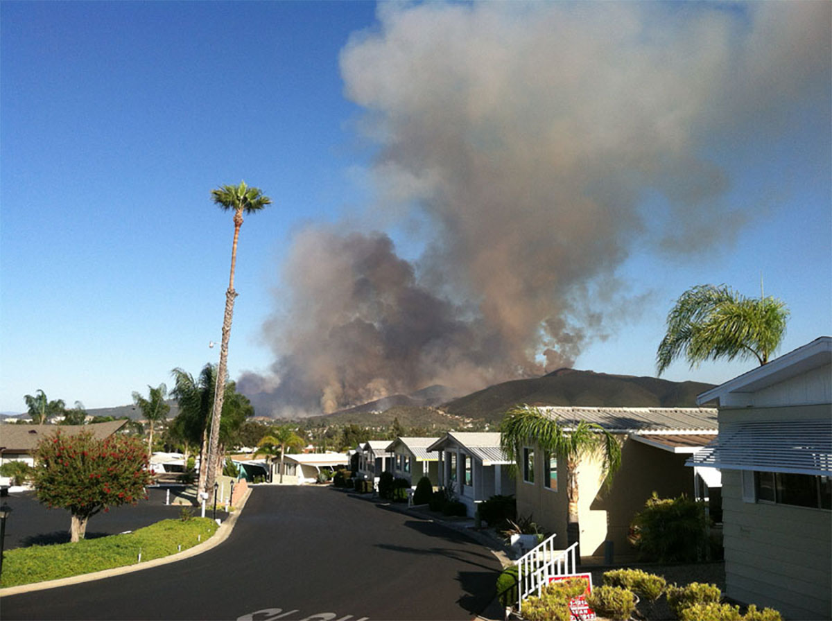
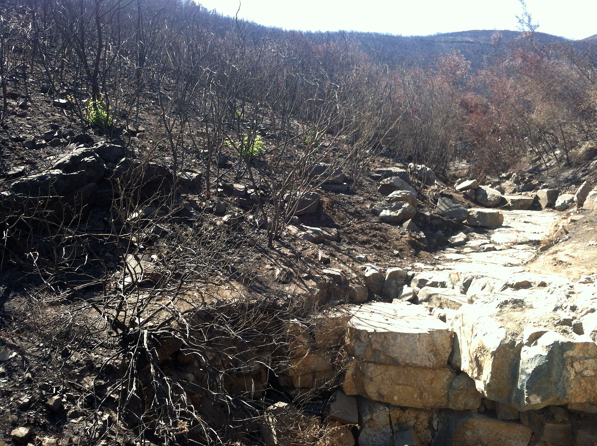
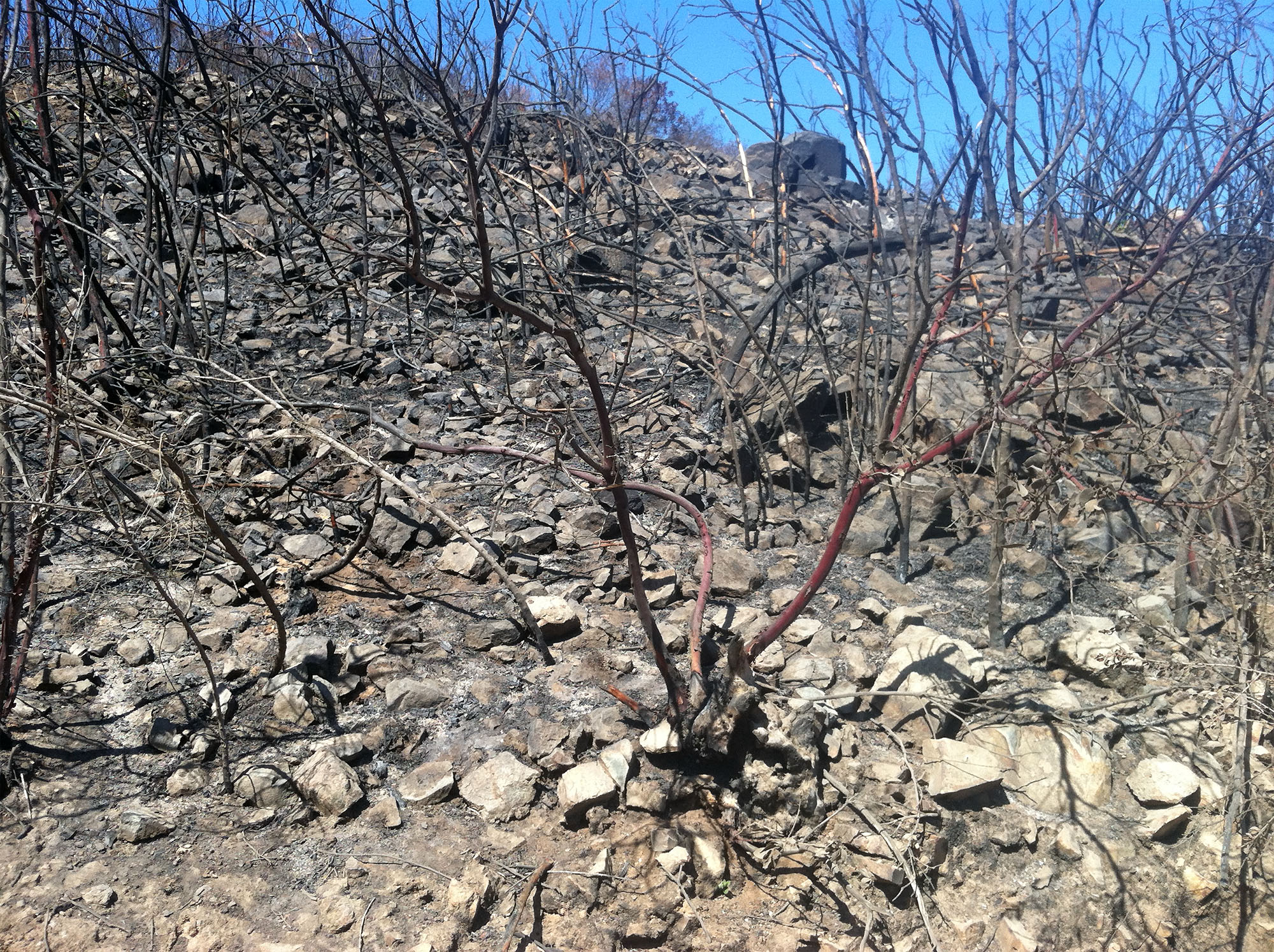
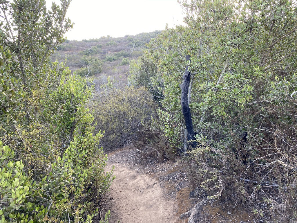
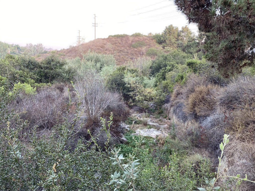
Weathering and Erosion Processes On A SoCal Mountain LandscapeAccording to National Weather Service data, San Marcos has a semi-arid climate. The area receives an average of 16 inches of precipitation a year (this amount is highly variable). Most of the rain falls in mid to late winter season and remains mostly bone-dry the rest of the year. These conditions result in the regional wildfire season in the summer and fall, and the episodic intense rainstorms and associated floods, soil erosion, and debris flows during wet periods. These climate factors influence the character of weathering of bedrock and formation of soil which, in turn, influence the plant communities that are adapted to the local soil and climate conditions. Significance of Wildfire On Landscape DevelopmentAccording to a report by the California Coastal Commission, natural wildfires occur about once every 65 years along coastal drainages and once every 30 to 35 years in inland regions. These numbers are highly variable due to human factors: fire suppression, landscape modification, arson, and other factors. But realistically, wildfires have always been a part of the natural landscape in California. In prehistoric times, native peoples set fires to clear landscapes for a variety of purposes including agriculture, hunting, and keeping predators (such as grizzly bears) away from their communities. California's native plant communities are adapted to coexist with occasional wildfires.When you walk along hiking the trails it is easy to see some evidence of past wildfires. Figure 61 shows orange and red rocks that are common in fire-prone landscapes. When granitic rocks weather, the iron-bearing minerals in the rock (mafic minerals, mostly biotite amphibole, and magnetite) break down and leave behind a residue enriched in the brown mineral limonite (chemical formula: FeO(OH) ∙ nH2O, see Figure 32). Limonite coats weathered rock surfaces and contributes the brown color to most soils. Limonite is essentially the same as rust you would see forming on iron object—like an old rusty abandoned car in the desert. Note that limonite is essentially a combination of iron oxide and water. When limonite is exposed to heat, the water is driven off and the residue turns into the red mineral hematite (chemical formula: Fe2O3, see Figure 32). After intense wildfires, the scorched surface of rock and the soil can turn red as water is driven off from the limonite. After a wildfire, scorched boulders can display freshly broken surfaces where the heat cause surfaces to chip off or expanding water vapor and gases literally can cause rocks to fracture, even explode from the intense heat. Fire will drive off the organic content of the soil leaving behind a residue of ash and dry, silty sediment. The Cocos fire of May 14-22, 2014The combination of triple-digit temperature, arid conditions, strong Santa Ana winds—and a 14 year old with a lighter—set the stage for one of the worst wildfires in San Marcos' history (Figure 62). By the time the fire had been contained it had burned nearly 2,000 acres and destroyed more than 40 buildings and homes. Most of the mountainside between CSU San Marcos to the top of Double Peak burned on the first day of the fire (Figure 63). The chaparral and coastal sage habitats on the mountainsides were completely scorched in the burn area. Figure 64 shows the barren creek bed of Stone Creek that drained along the Double Peak Trail (above this field-trip area). Debris floods are a major concern when heavy rains return to fire-burned areas. However, no significant debris floods resulted from these fires. However, a lot of fire-loosened sediment and ash eventually found its way into Lake San Marcos. Figure 65 shows how barren and rocky the slopes on Double Peak became after the fire. Fortunately most of the native plants, including the red-bark manzanita shown in this image are adapted to regrow from their roots. Figure 66 show how part the burn area in the Stop G area looks 6 years after the fire. The dense chaparral plant community has nearly grown back to nearly the same as before the fire. Only the few remaining blackened stump and the fire-scorched rocks serve as a reminder of previous wildfires. |
|