Between San Pasqual Valley and Poway, California |
|
A1
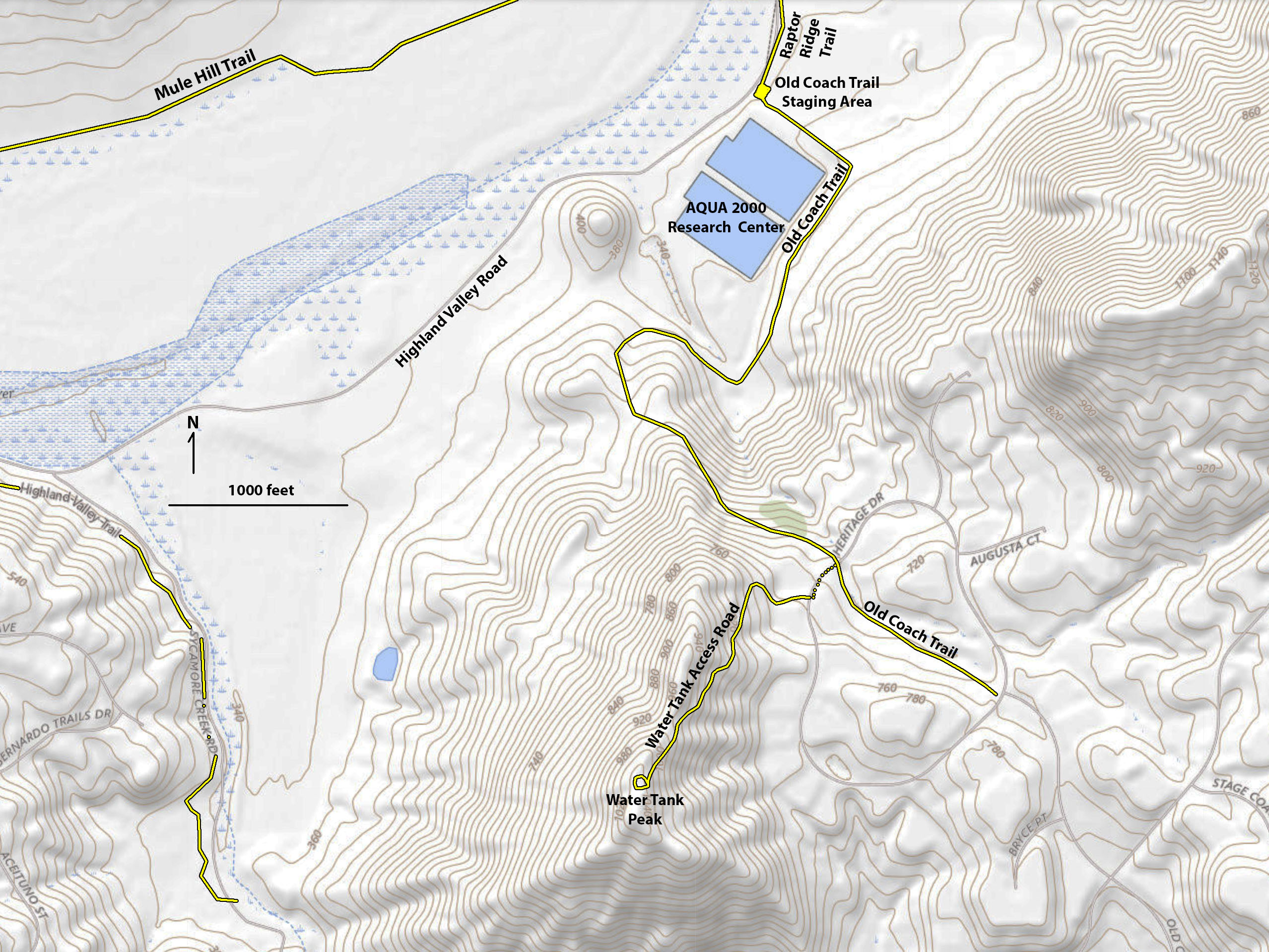
Old Coach Trail
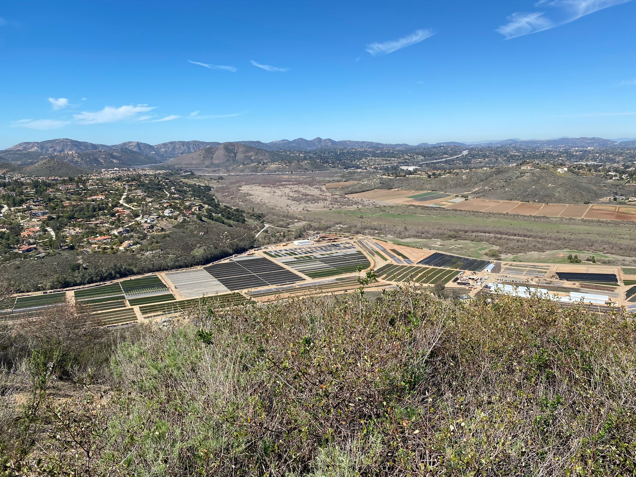
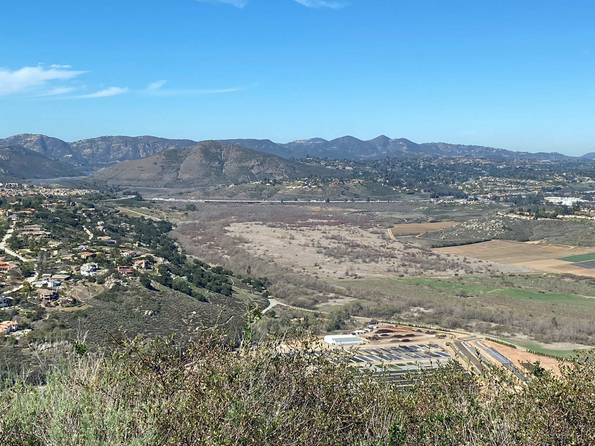
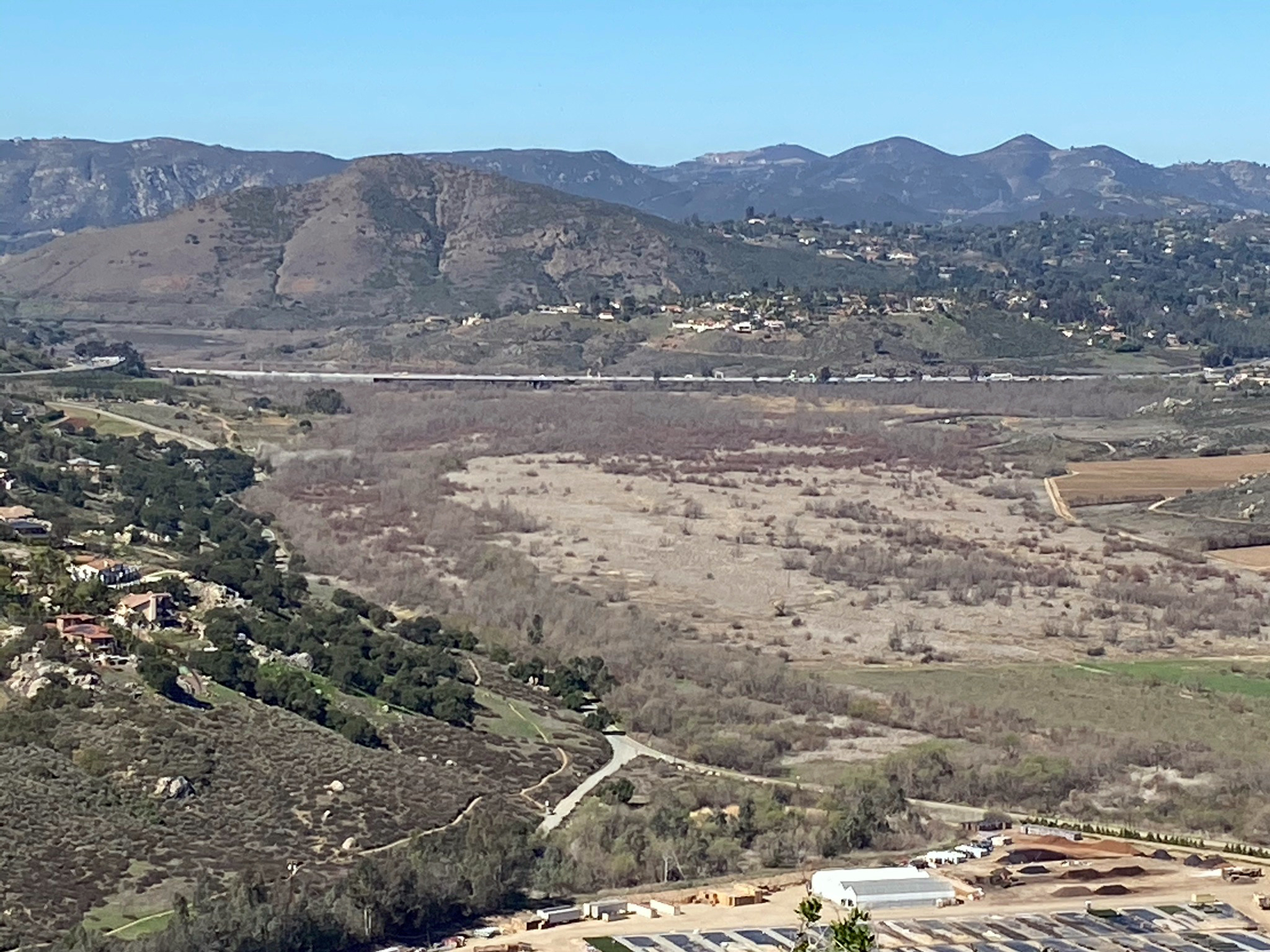
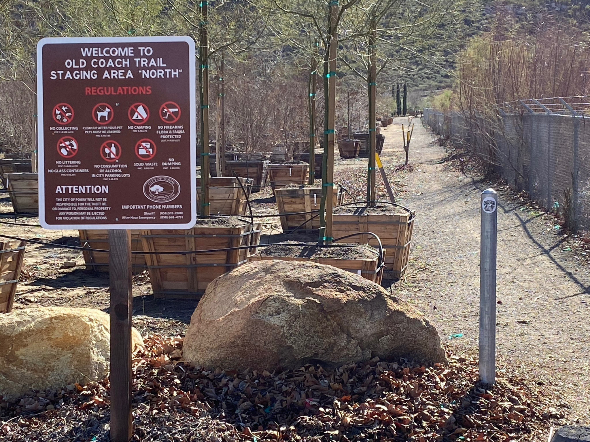
The Old Coach Staging Area on Highland Valley Road is a parking area that serves both the Old Coach Trail (that leads to over a pass to trails in the Poway area) and the Raptor Ridge and Mule Hill Trails in the San Pasqual Valley area. The Old Coach Trail served as the route for Butterfield Stage service between Poway, Escondido, and San Diego in the late 19th Century before being replaced by the coastal railroad. The route described here follows the Old Coach Trail route through a plant nursery area before ascending the mountainside to where it intersects Heritage Road. The Old Coach continues for south for several miles. The lower part of the trail passes around the border of the AQUA 2000 Research Facility that involve an experimental aquaculture water treatment facility that is currently inactive.
An alternative
hike route presented here follows a paved access road that climbs to the to of a nearby unnamed mountain (with a water tank on top). View from the top of this "Water Tank Peak" are spectacular in all directions. The hike provides an opportunity to view regional landscape features including the high peaks of the coastal highlands and peaks and ridge lines of the core of the Peninsular Ranges, as well as San Pasqual Valley and surrounding highland mesas in the Rancho Bernardo and Escondido area. |
Click on images for a larger view. |
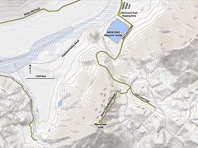
Fig. 1. Map showing a hike route up the Old Coach Trail to the top of "Water Tank Peak." |
A2
Old Coach Trail - Staging Area Trailhead to Heritage Road
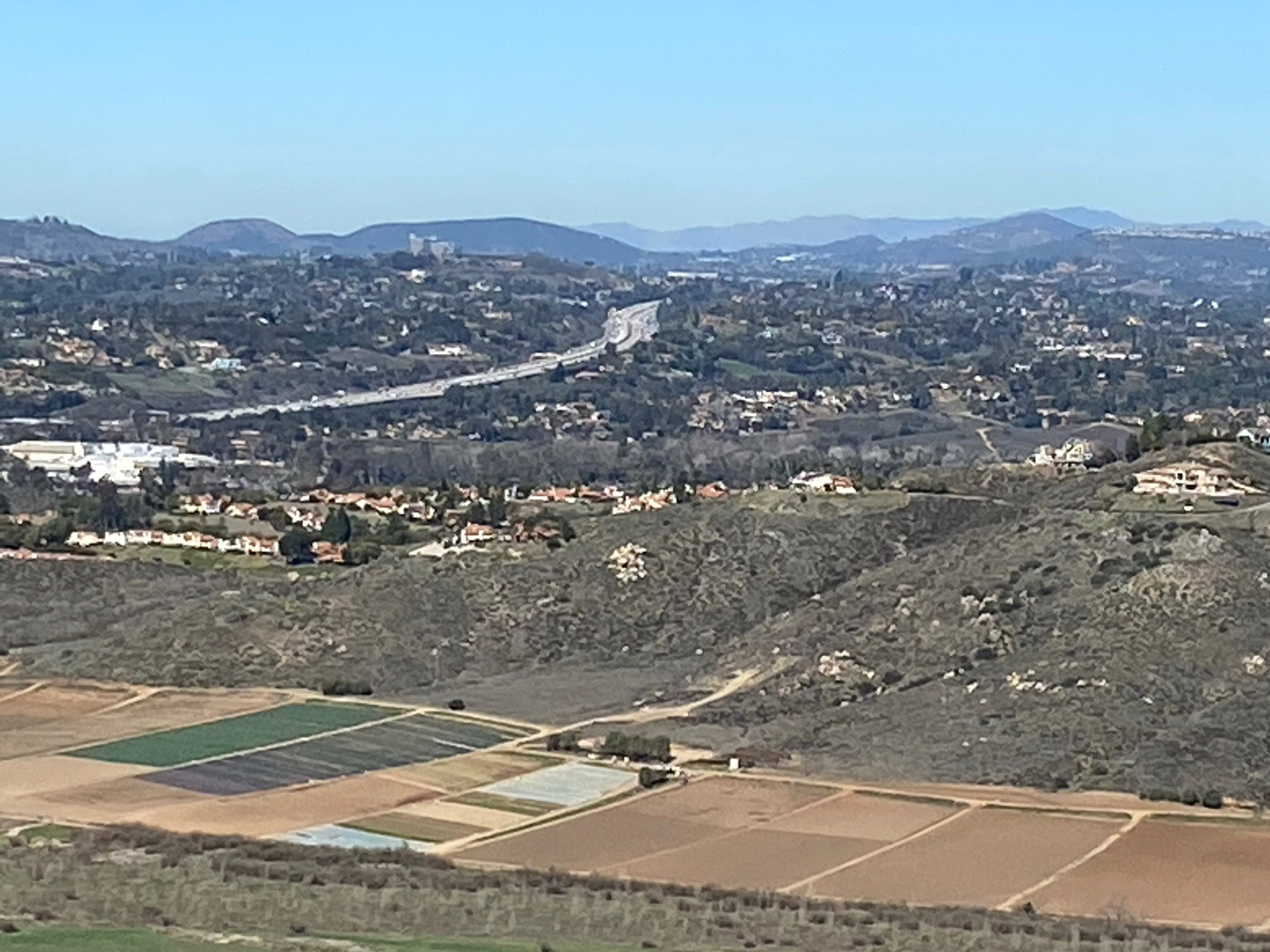
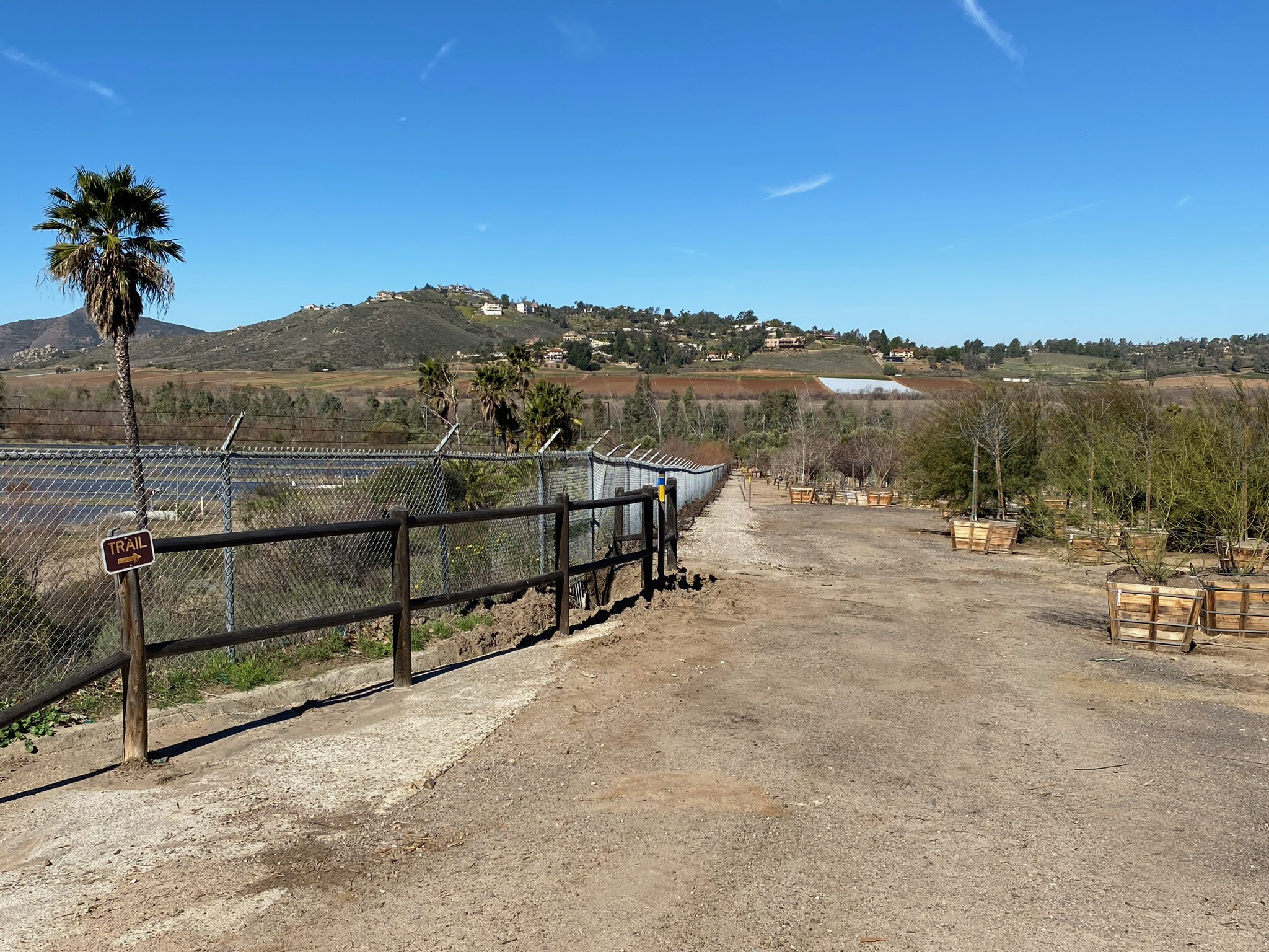
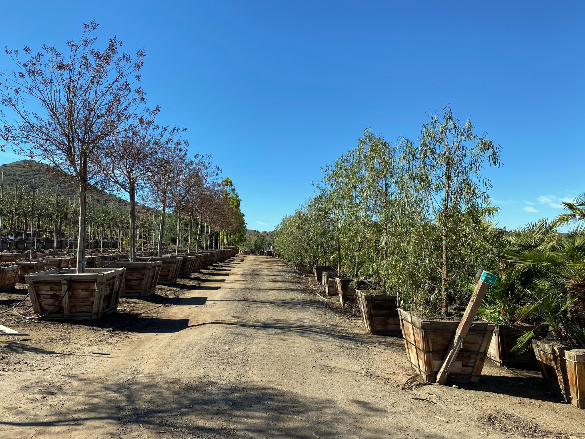
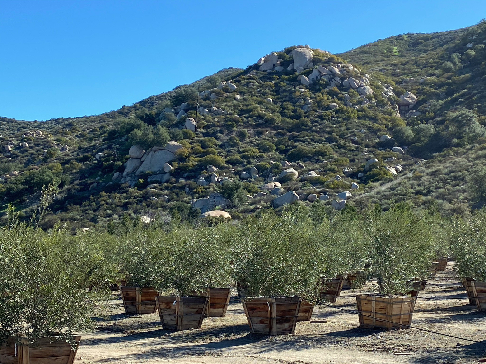
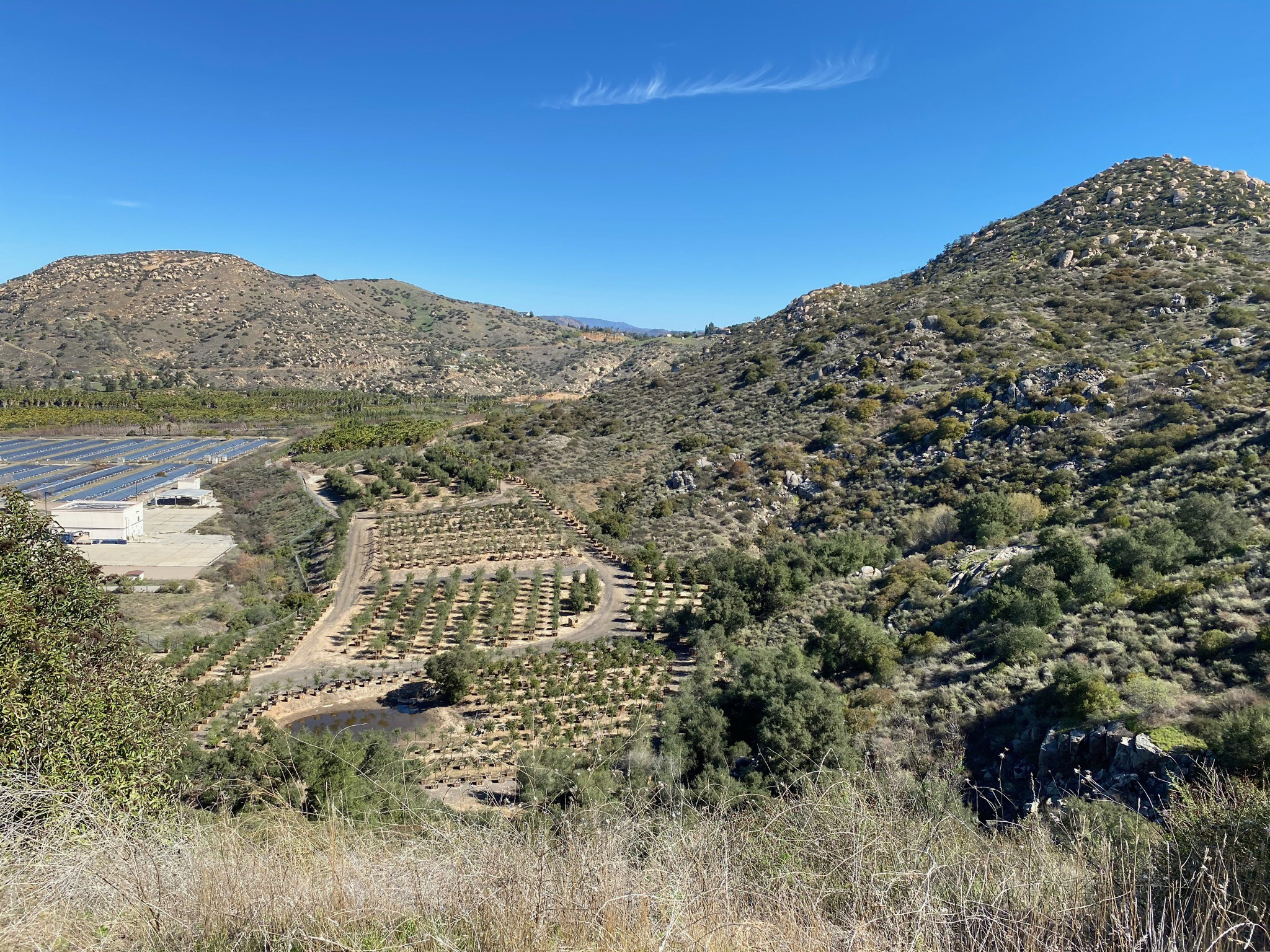
Figures 2 to 17 are a selection of images that highlight features along the trail between the trailhead parking area (Old Coach Staging Area) on Highland Valley Road in San Pasqual Valley to the trail intersection with Heritage Road at the top of the ridgeline on the south side of the valley. The lower first half-mile of the hike cuts through a nursery of a variety of trees planted in large boxes (Figures 2 to 6). The trail passes around the border of the inactive AQUA 2000 Water Treatment Research Facility that was developed in the 1990s as an attempt funded by the City of San Diego to use aquaculture as a means of treating water high in total dissolved solids content. The large project was unsuccessful in establishing economic sustainability and was deactivated in 2001.
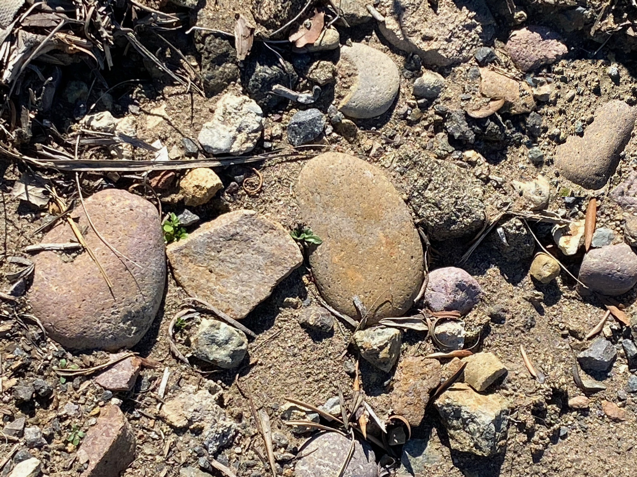
Figure 7 illustrates an exposed patch of gravel of an elevated stream terrace deposit in the plant nursery area. Some of the cobbles in the gravel deposits are unique in that they are extremely polished and a composed of rock not derived from local mountain sources. These smooth cobbles have reworked from deposit of beach and stream cobbles from ancient rock formations that once blanketed the region millions of years ago. Gravel deposits of Eocene age exposed along San Diego coastline contain similar cobbles in shape and composition.
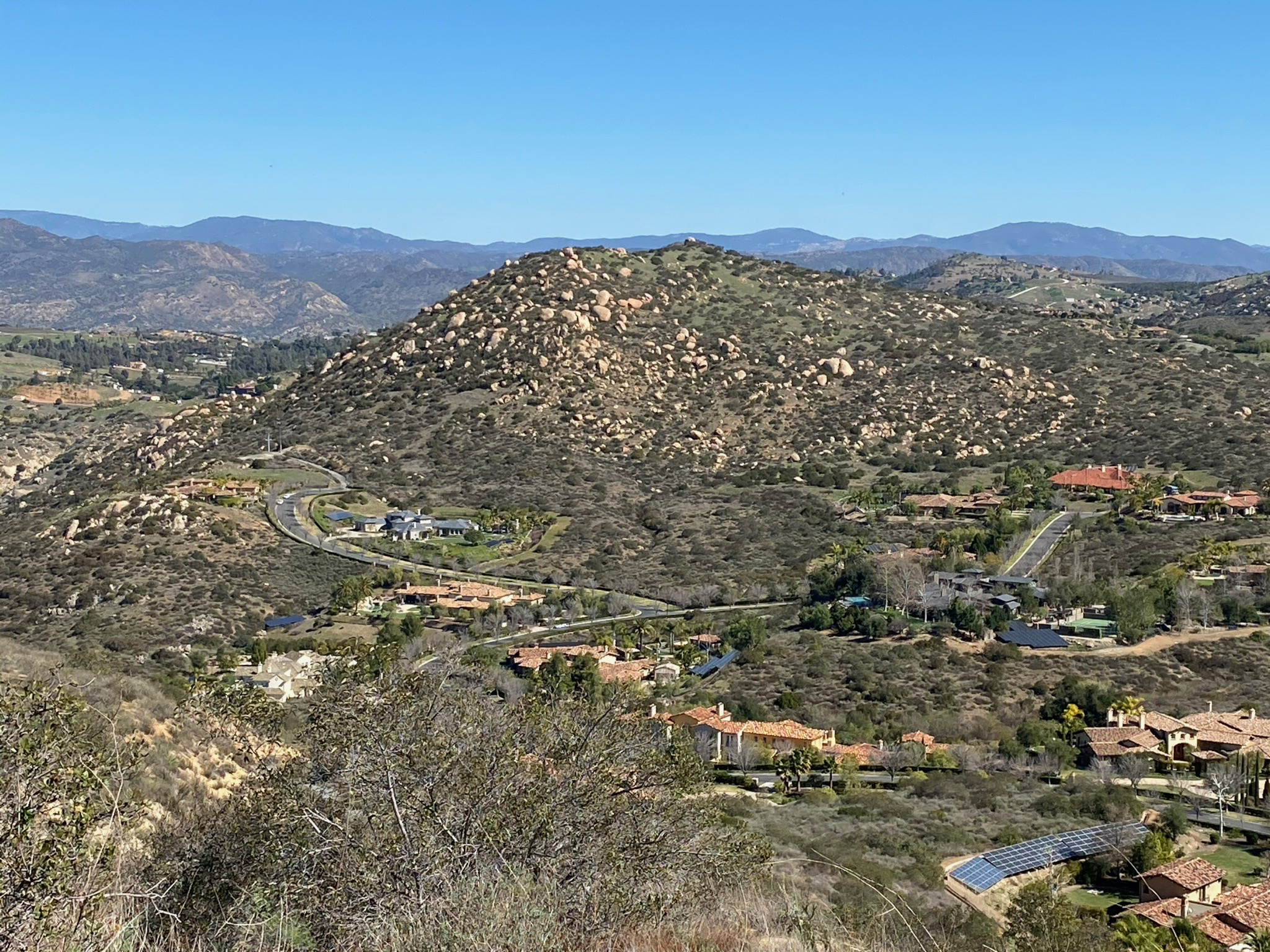
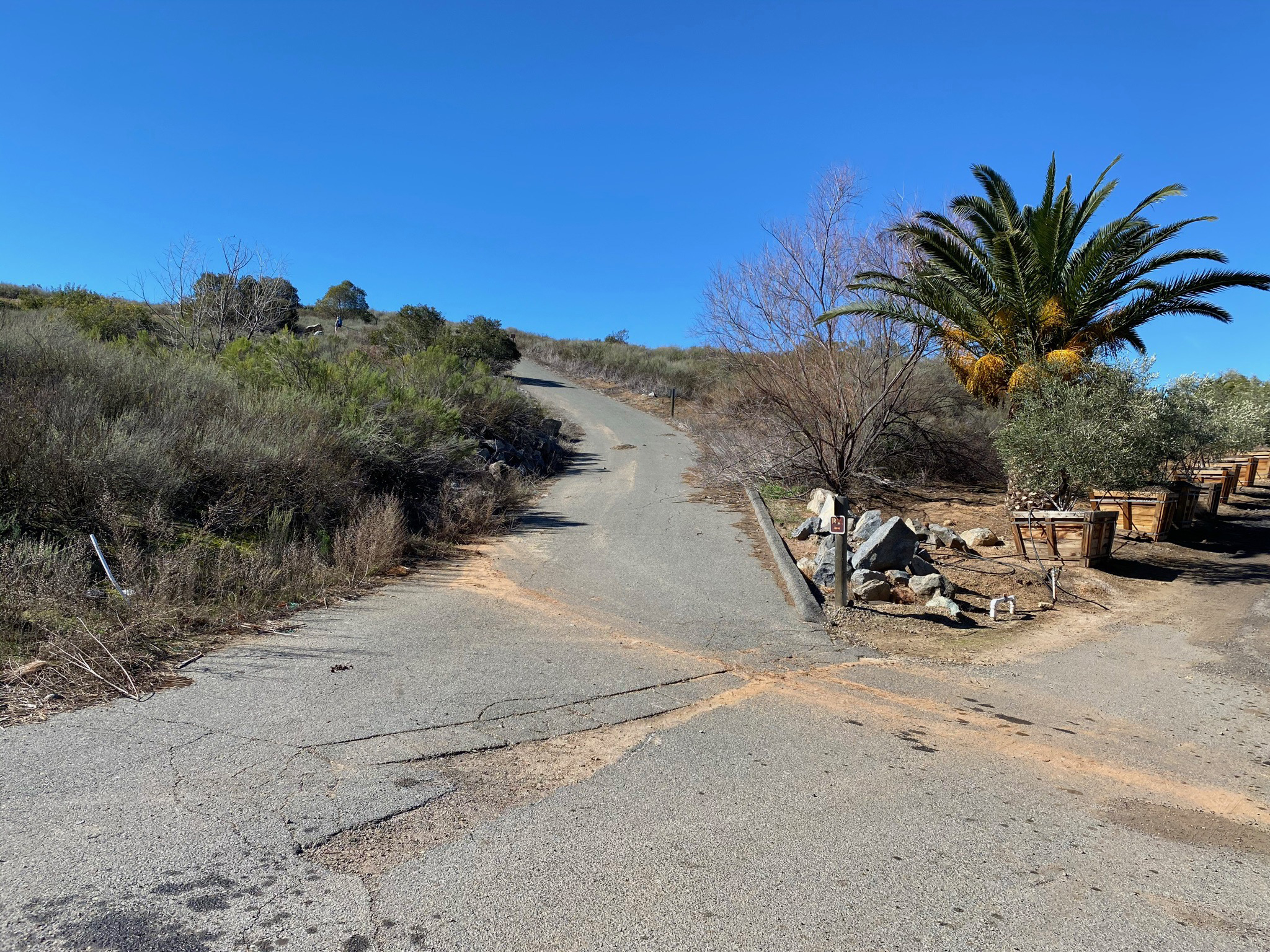
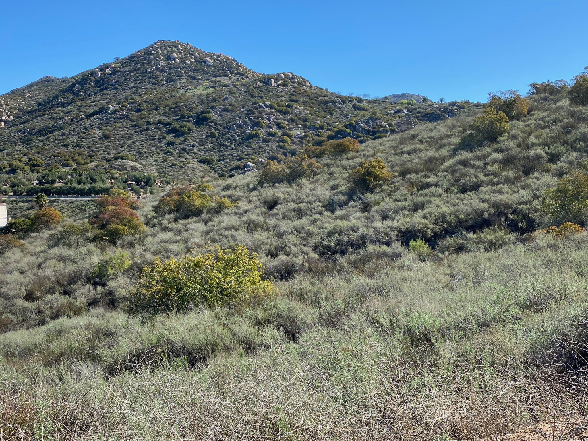
The unpaved trail through the plant nursery joins a paved section of trail that climbs fairly steeply up the mountain (Figures 8 to 10). The mountain sides are covered with a mixed coastal sage scrub and oak forest plant communities (Figures 11 to 13). By the time your reach the intersection with Heritage Road, the elevation gain to the ridgeline is about 300 feet in less than a mile from the Staging Area. |
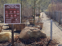
Fig. 2. Old Coach Staging Area trailhead. |
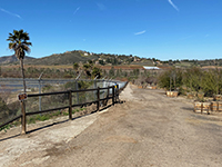
Fig. 3.View looking down trail to trail head. |
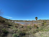
Fig. 4. AQUA 2000 plant aquaculture filter ponds. |

Fig. 5. Trail route through plant nursery. |

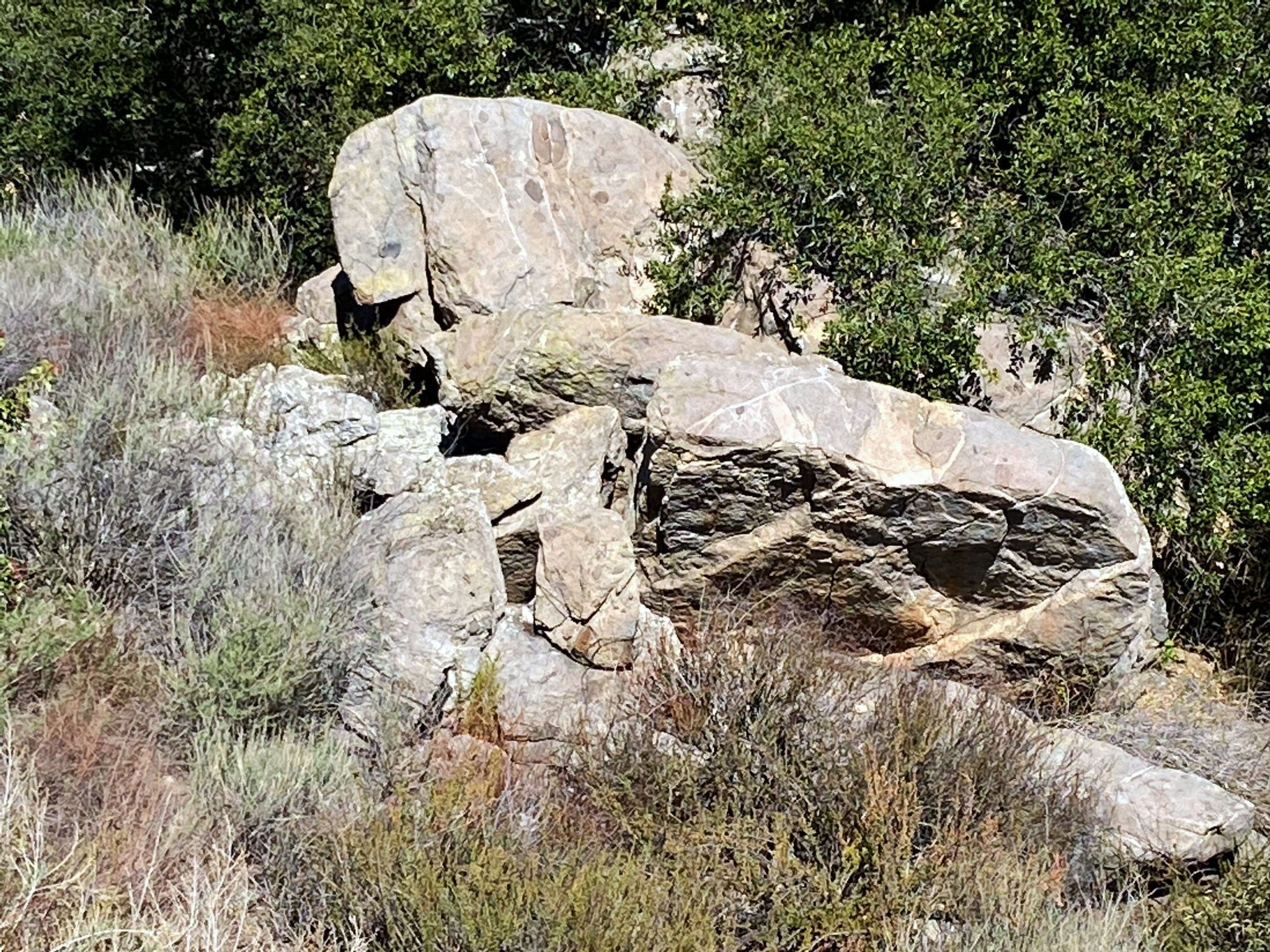
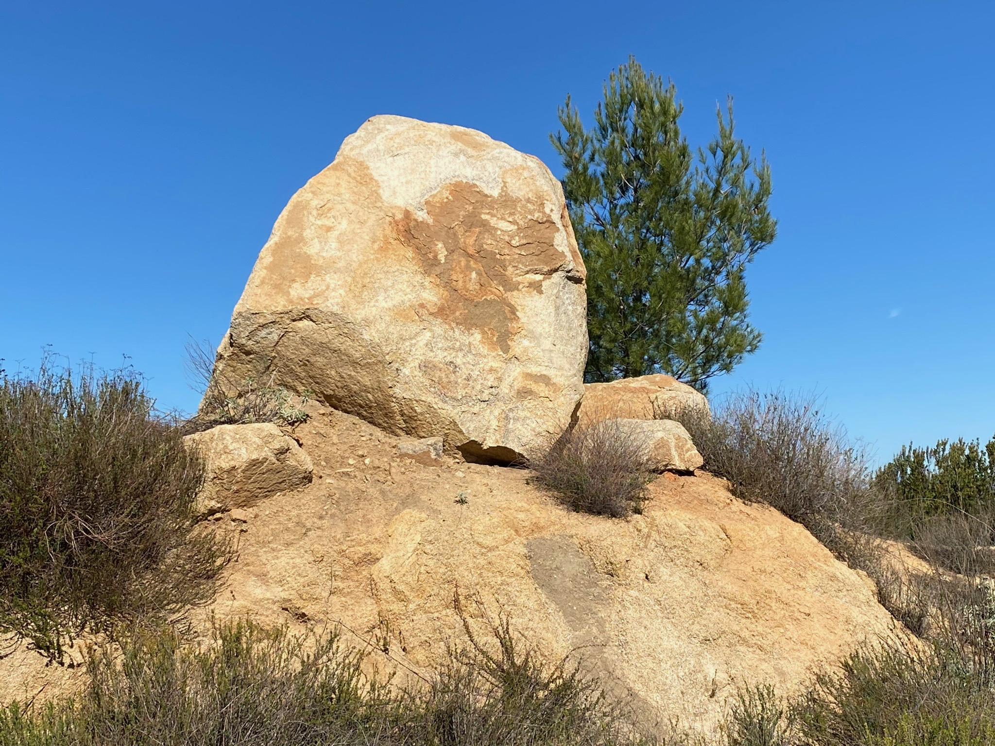
Fig. 6. Boulder covered mountain slope near nursery. |
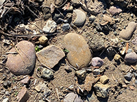
Fig. 7. Elevated stream terrace gravel deposits on trail. |
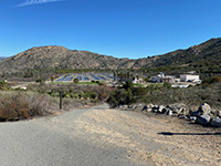
Fig. 8. View looking west at AQUA 2000 research plant. |
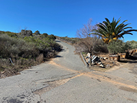
Fig. 9. Bottom of asphalt hill section of the Old Coach Trail. |
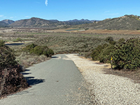
Fig. 10. View looking down hill on Old Coach Trail. |

Fig. 11. Coastal sage scrub plant community on hillside. |
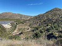
Fig. 12. View of plant nursery and mountain slope. |
CT_AQUA_Plant3.jpg)
Fig. 13.View looking east toward Raptor Ridge area. |
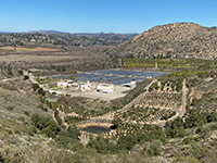
Fig. 14. AQUA 2000 facility with Raptor Ridge (to right). |
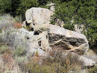
Fig. 15. Granite boulders along the trail near the divide. |

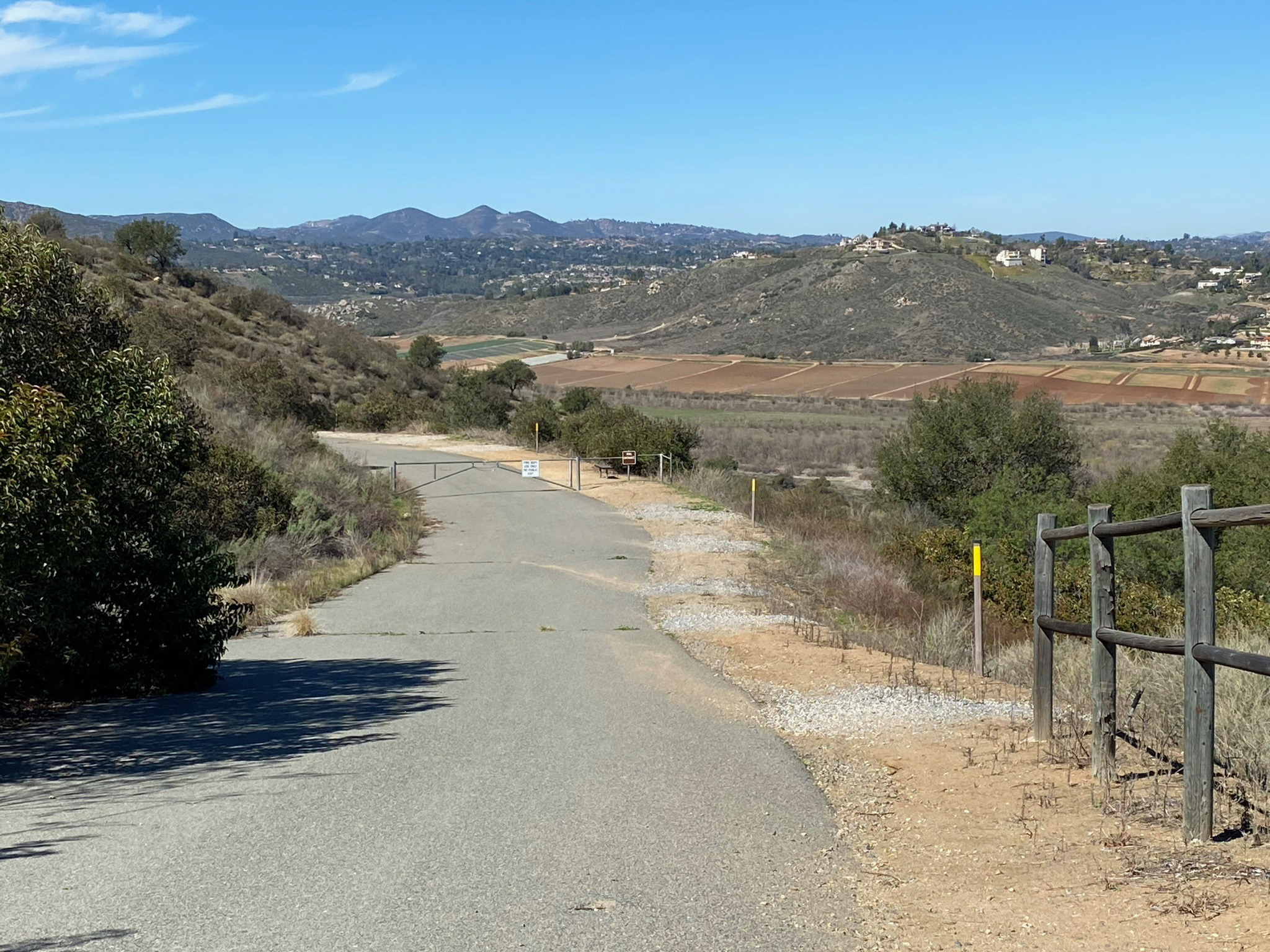
Fig. 16. View down the Old Coach Trail at the upper gate. |
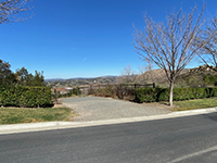
Fig. 17. Intersection of trail with Heritage Road. |
|
A3
Trail to "Water Tank Peak" (Alternative Trail Route to a viewpoint on Sycamore Ridge)
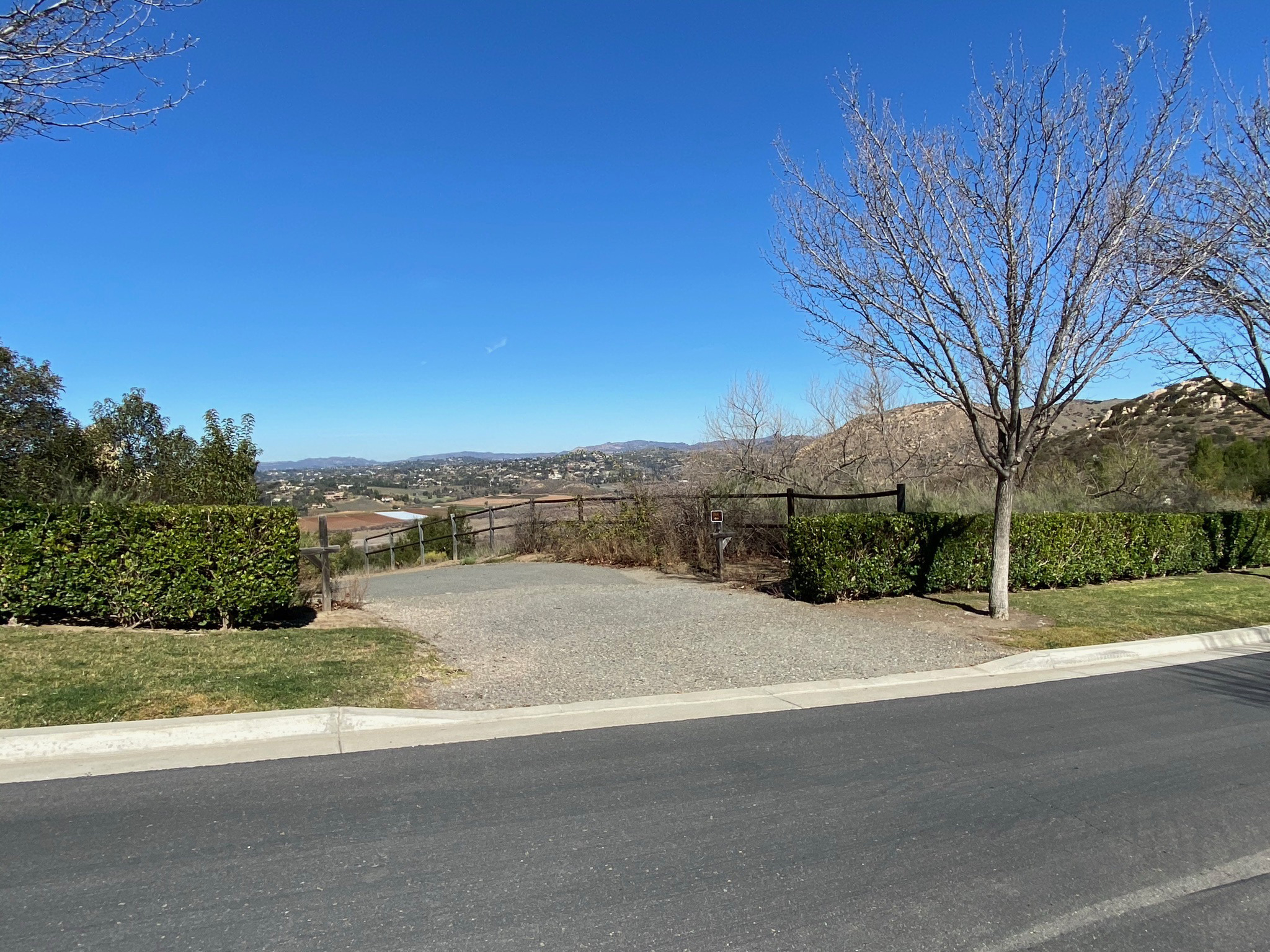
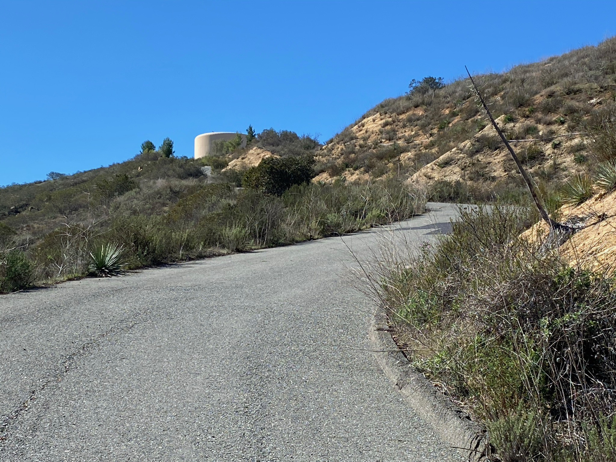
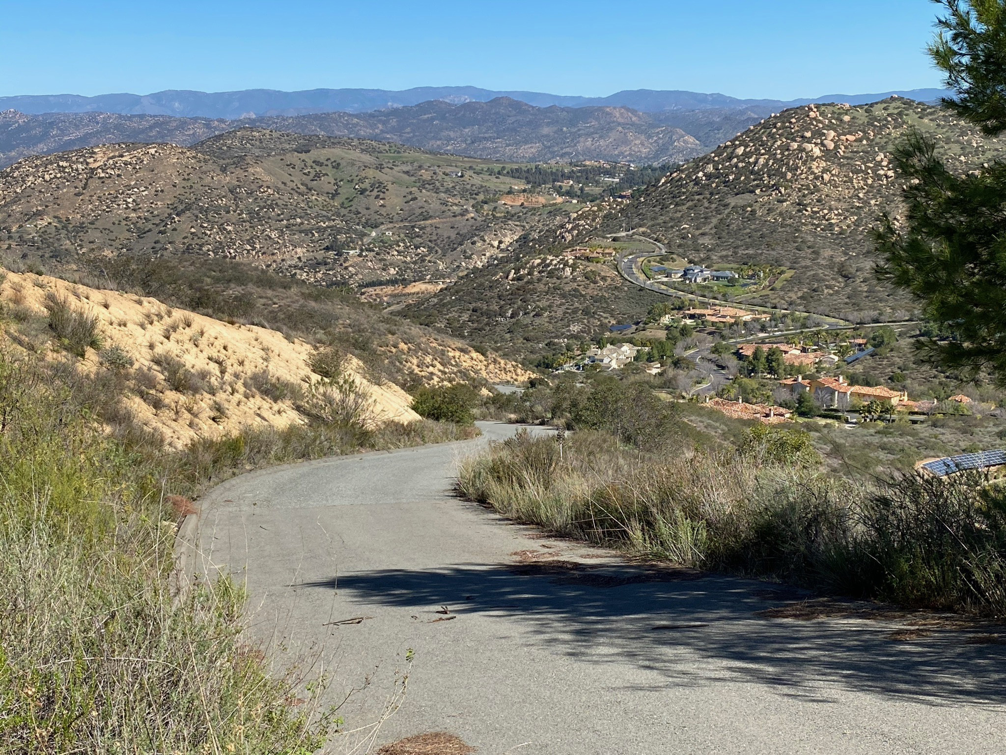
The Old Coach Trail continues south through neighborhoods in the outskirts of Poway and eventually connect to other trails in the Sycamore Canyon. An alternate hike route is presented here to that leads to the top of an unnamed mountain peak locally known as Sycamore Ridge. An access road leads to a water tank near its summit (named here "Water Tank Peak" for this discussion about the regional geology and geography). At the intersection of Heritage Road, turn right (west) an proceed a short walk to the paved access road on the right. The road is closed to vehicular traffic, is accessible for hiking. It leads uphill to the water tank area.
The Water Tank Access Road is even steeper than the Old Coach Trail with an additional elevation gain of 300 feet in less than a half mile (Figures 18 to 21). However, the hike for the views at the top are worth it! |
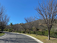
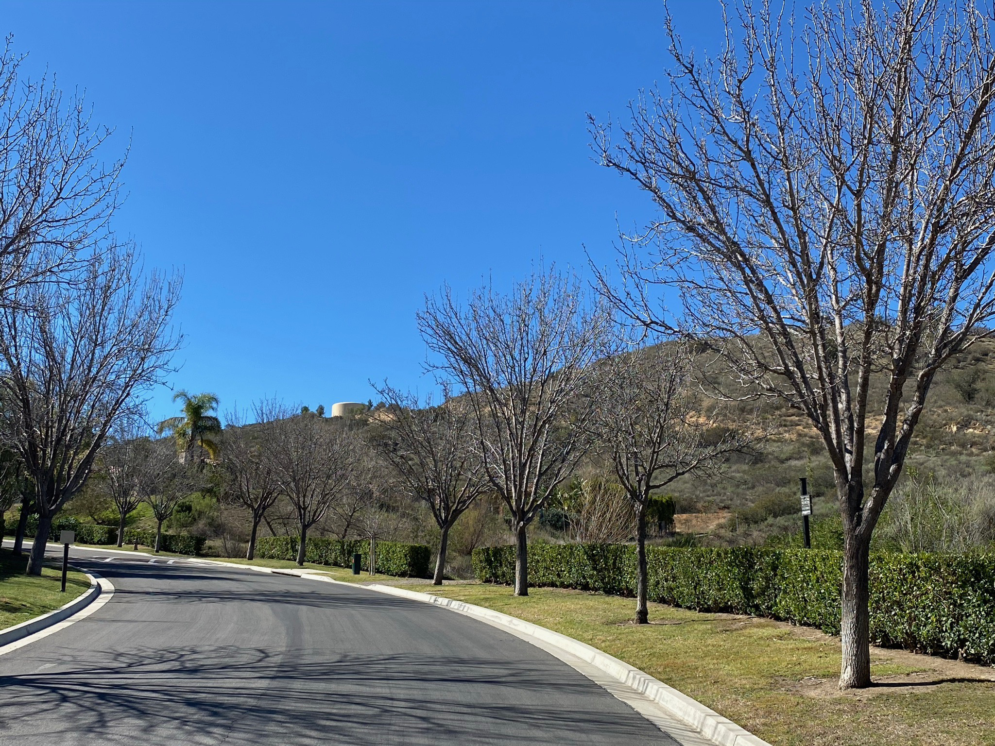
Fig. 18. Heritage Road with water tank in the distance. |

Fig. 19. Looking up the steep Water Tank Access Road. |
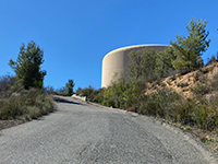
Fig. 20. Water tank near the top of the unnamed peak. |
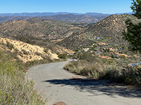
Fig. 21. Looking down the Water Tank Access Road. |
|
A4
Regional Physiography From the Top Of Water Tank Peak (Sycamore Ridge)
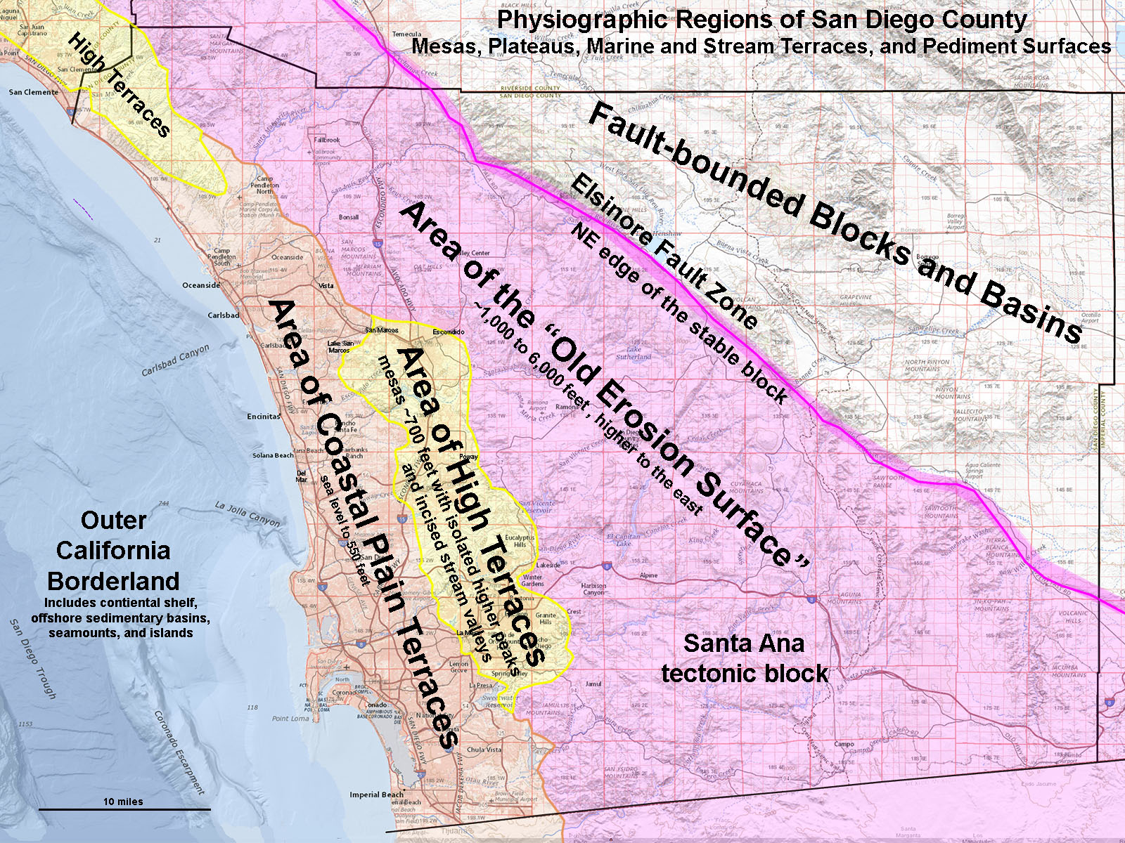
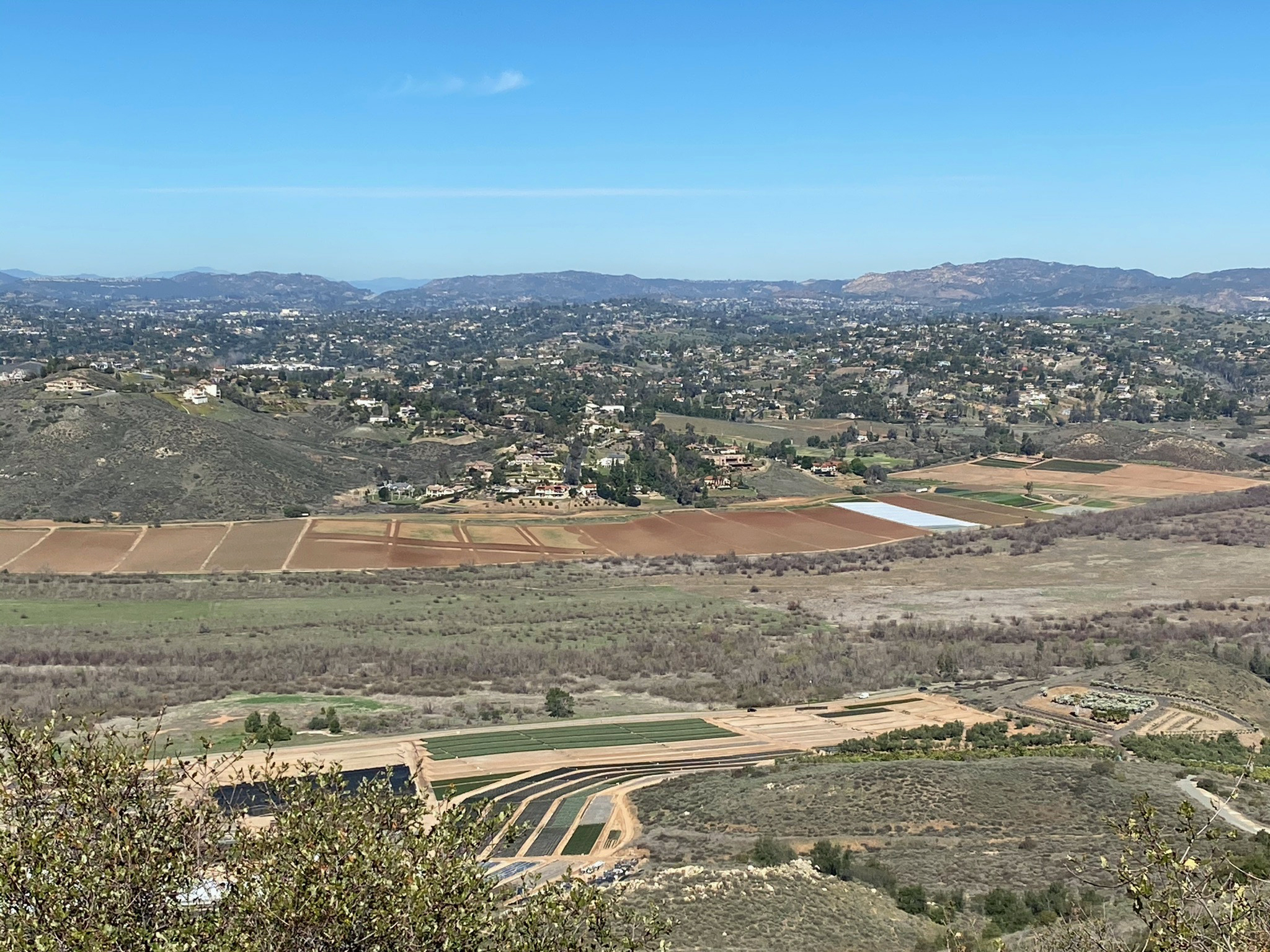
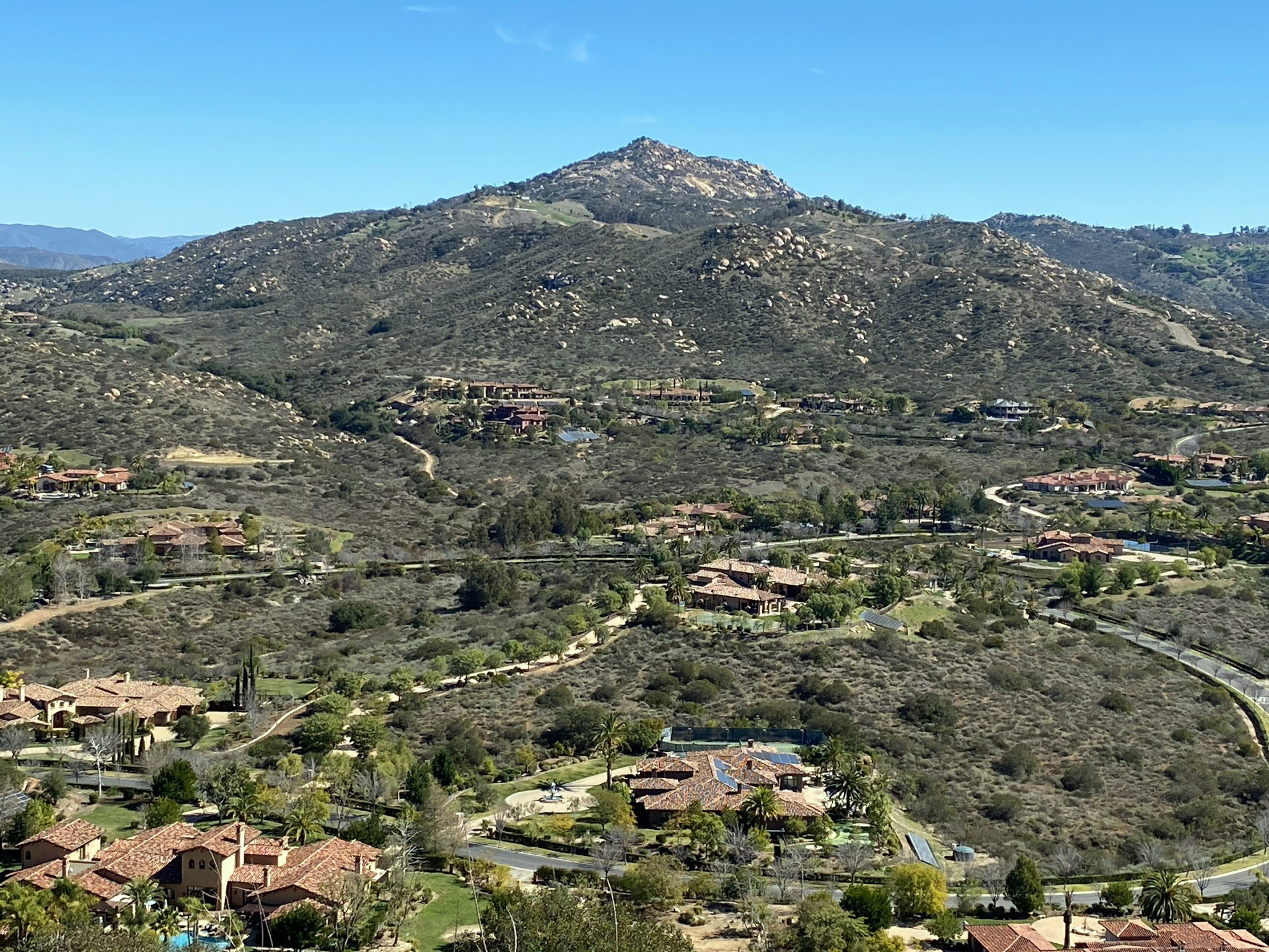
The top of " Water Tank Peak" on Sycamore Ridge is about 1,050 feet in elevation. It is a good elevation and location to get of the view of the "Area of High Terraces" (Figure 22). The Area of High Terraces encompass most of Poway, Rancho Bernardo, and Escondido. The high terraces are the nearly mid-level mesas visible in all directions to the north and west that generally range in elevation roughly about 700 feet. The relatively consistent elevations of the upper surfaces of High Terraces (or mesas) reflect that they were probably at one time a level when they were scoured down by wave action. That was when the area was an embayment along the coastline in Eocene time. Since Eocene time, the land has slowly risen. Sedimentary formations that were once deposited on this surface level have long since eroded. Sedimentary rocks formations of Eocene age still preserved on this surface to the south in the Poway area and to the north in the San Marcos area. |
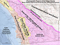
Fig. 22. Physiographic regions of San Diego County showing the Area of High Terraces. |

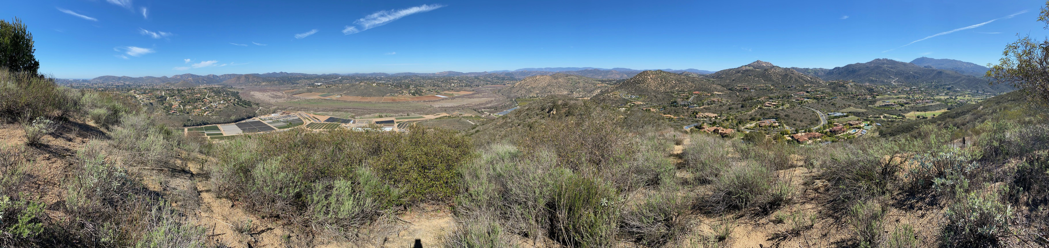
Fig. 23. This panoramic view is from near the top of "Water Tank Peak" with north near the center of the image. The Pacific Ocean near Del Mar is barely visible to the left (southwest). Woodson Mountain is the high peak to the right (southeast). Click here to see this view with the landscape features labeled.
This location is on one of the best places to see the regional contrasts of the "Old Erosion Surface" (about the 1,000 feet elevation level and higher) and the High Terraces (about the 700 feet elevation level). All the higher peaks of the coastal mountains east of I-15 and the inland peaks (including Starvation Mountain and Woodson Mountain) are monadnocks, the erosional remnants of mountains rising above the level of the Old Erosion Surface on the stable Santa Ana tectonic block (Figure 38). The fairly even surface level of the Area of High Terraces was probably scoured by wave erosion as part of a coastal embayment Eocene time when both sea level was higher and the surface of the tectonic block was lower. After that time, the lands has slowly risen. Erosion stripped away sediments that may have once covered the High Terraces level. Since then, the modern stream valleys (including San Pasqual Valley) have incised into the High Terraces level, with valley incision (down-cutting) and sediment back-filling occurring with the rise and fall of sea level during the ice ages of the Pleistocene Epoch. |
A5
|
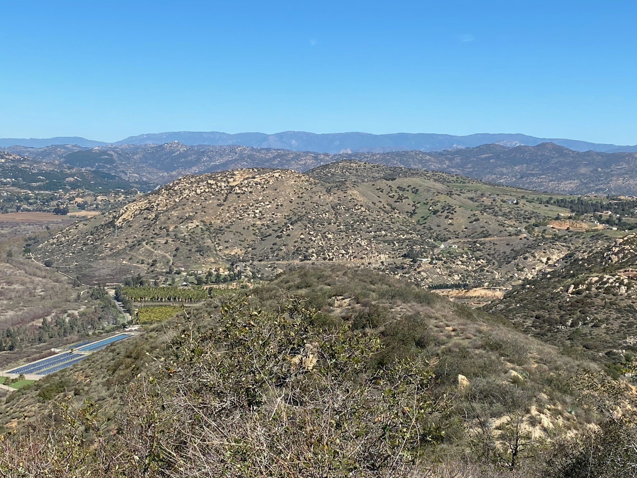
The bedrock on top of "Water Tank Peak" is a deeply, weathered granite (Figure 24). This rock is what you see in most upland areas of the Area of High Terraces. The higher peaks of the coastal mountains and highlands east of Escondido and Poway stand out in contrast to the Area of High Terraces. During Eocene time (about 45 million years ago) these peaks and highlands were islands and headlands at the time a large embayment formed. An analog might be the Farallon Islands or Santa Monica Mountains we see today.
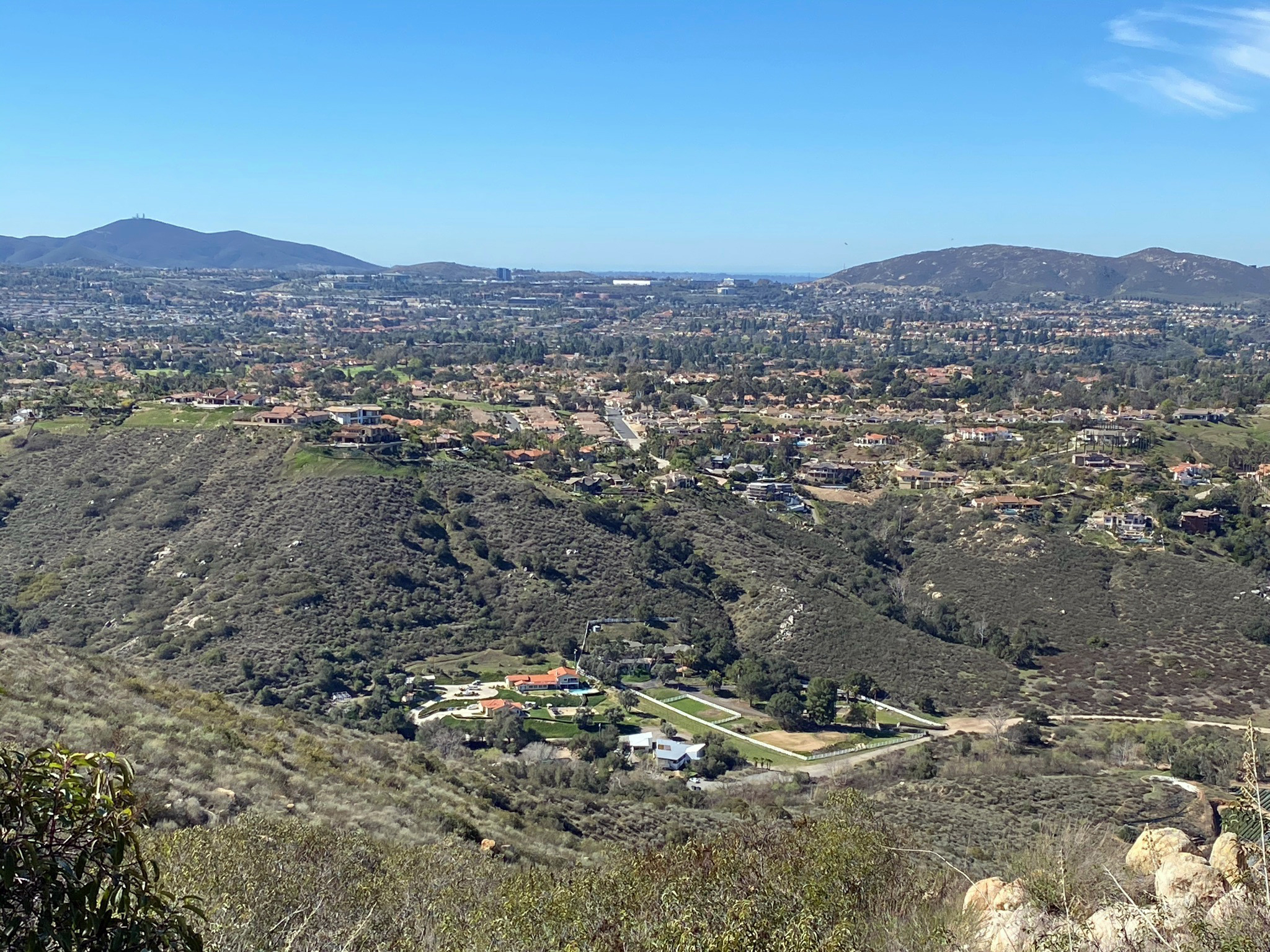
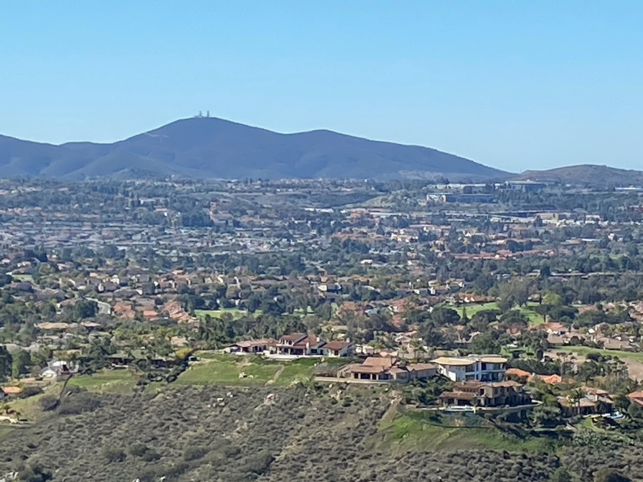
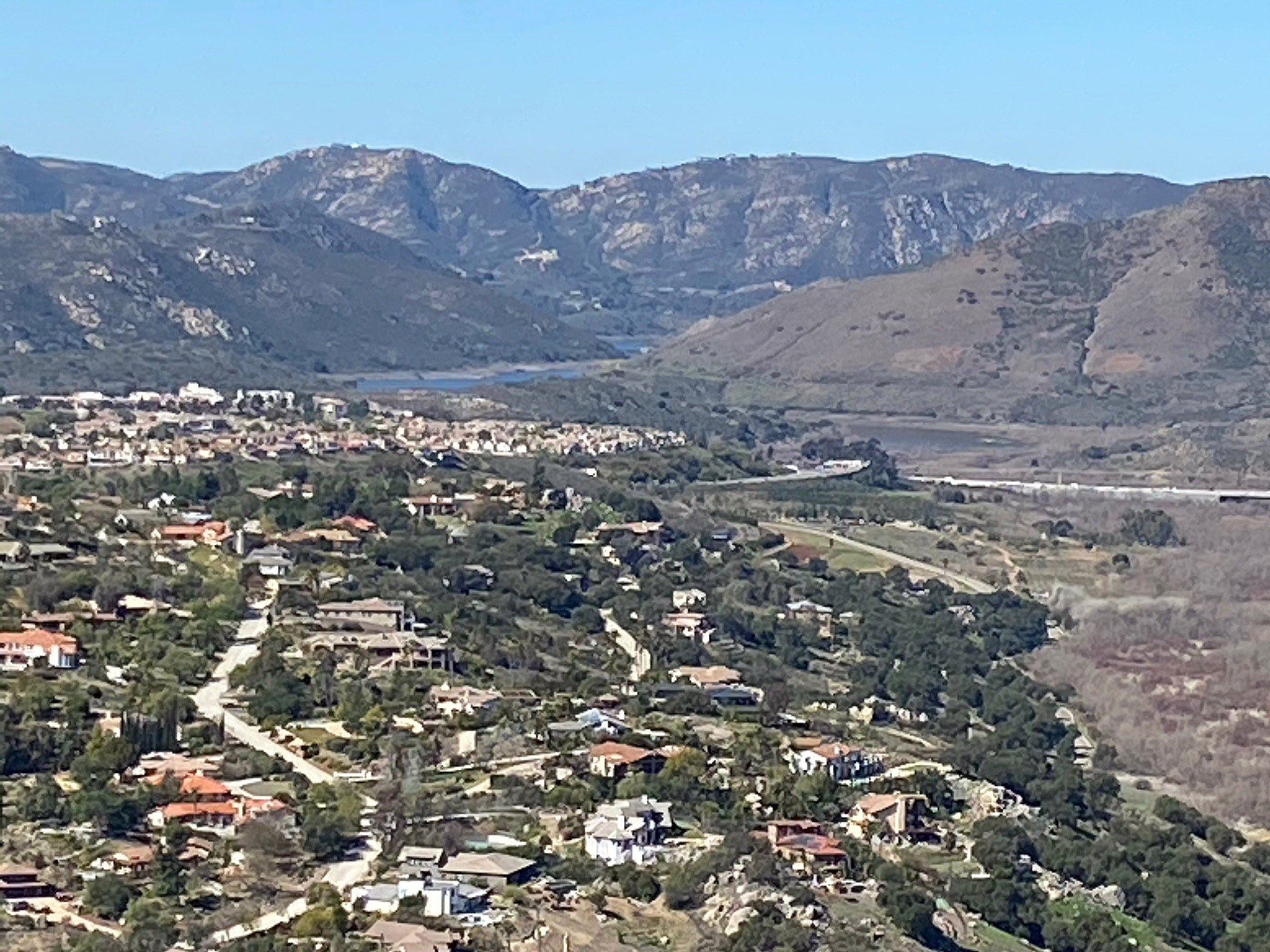
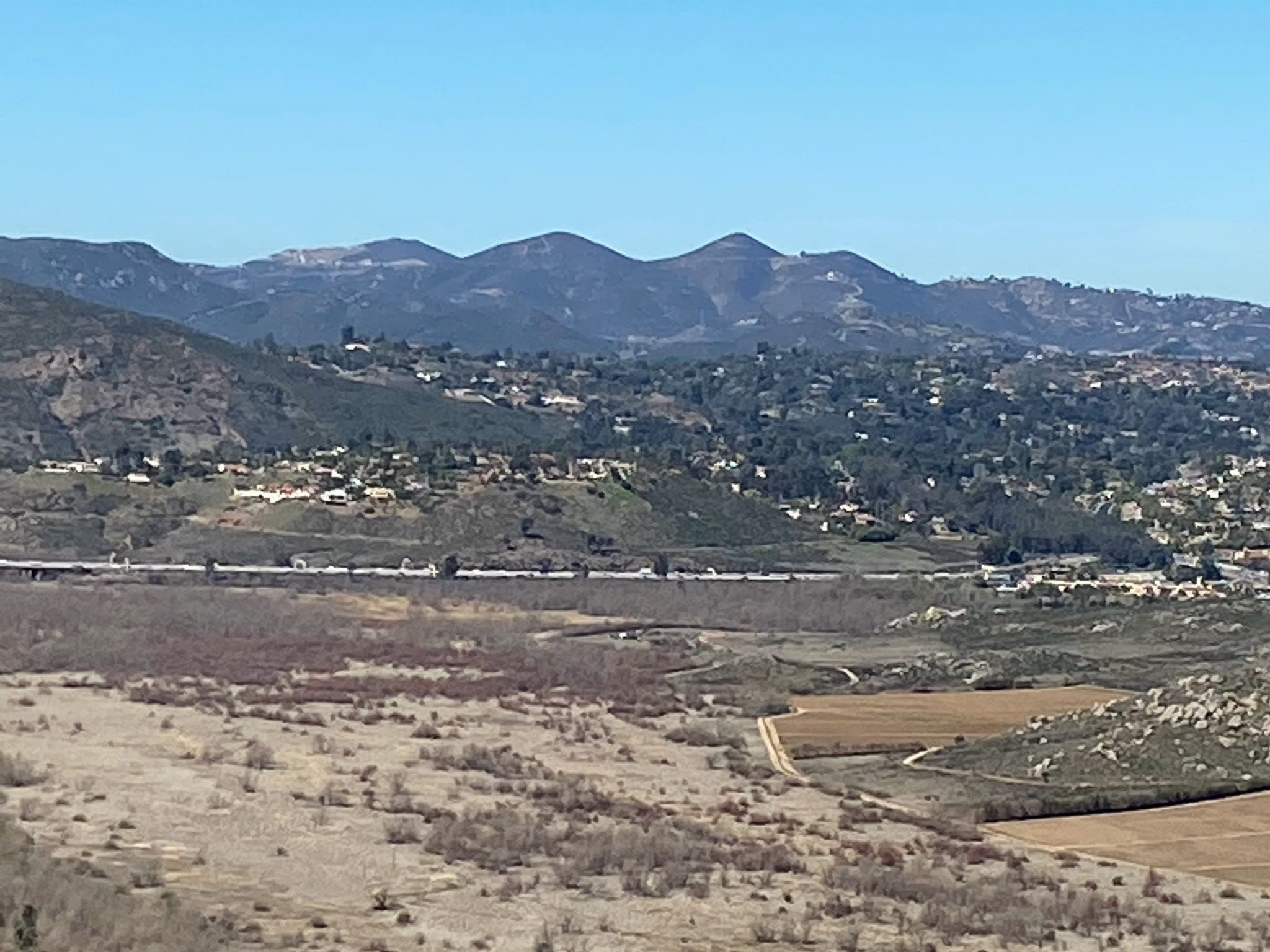
The coastal mountain area to the west of San Pasqual Valley include the higher peaks of Bernardo Mountain, Bernardo Highlands, Del Dios Highlands, and the high peaks near San Marcos, including Double Peak, Franks Peak, and Mt. Whitney. Black Mountain rises above the mesas to the southwest (Figures 25and 26). These higher peaks and mesas rise above the High Terraces level (visible in Figures 25 to 32). Figures 32 to 34 shows the neighborhoods of Escondido spread across the High Terraces level on the north side of San Pasqual Valley.
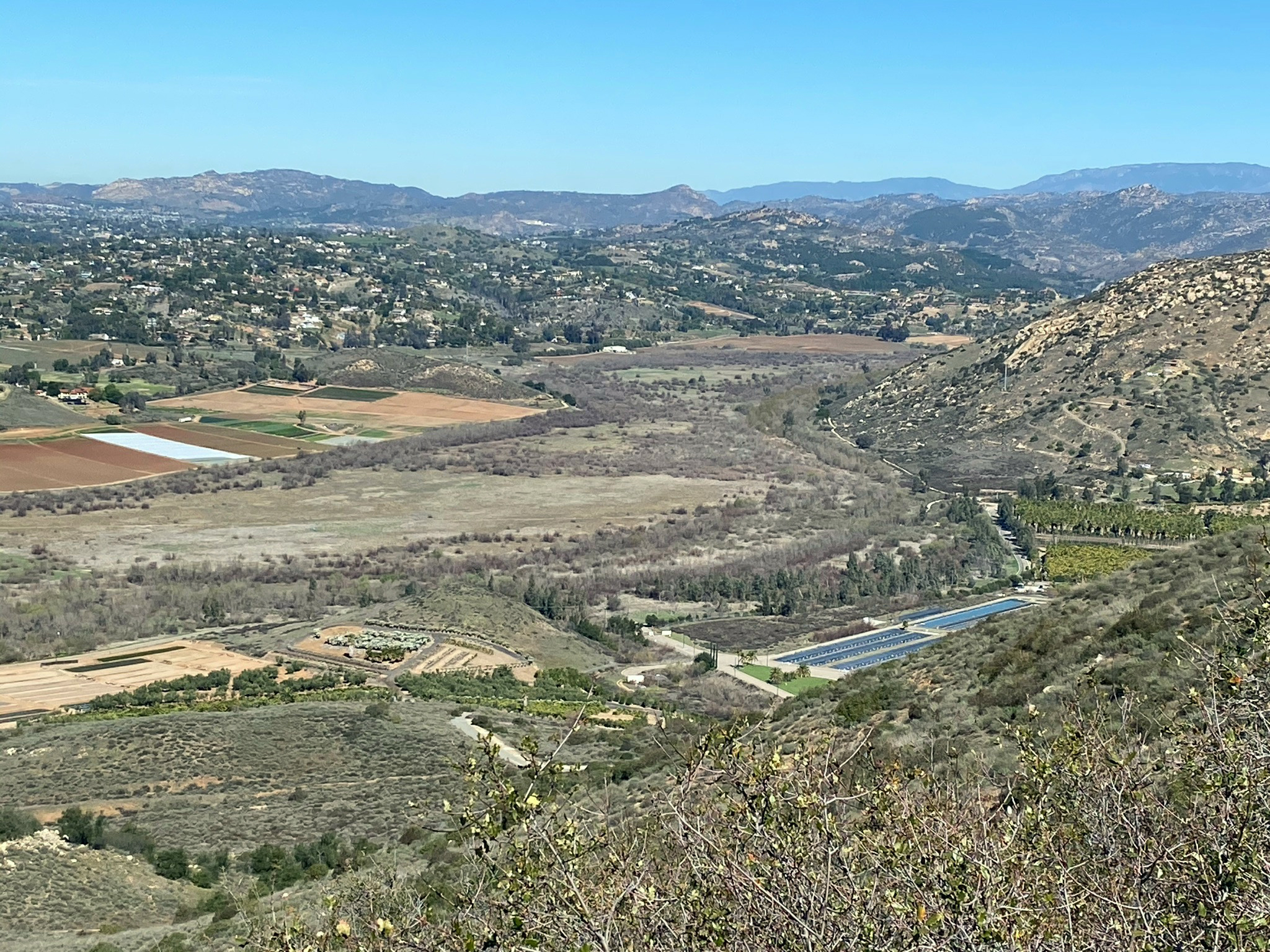
Figures 34 to 39 show the higher peaks and uplands to the east and south of the San Pasqual Valley area. These views show the relatively even character of the ancient peneplain "Old Erosion Surface" on the Santa Rosa tectonic toward the highlands of the core of the Peninsular Ranges. The distant ridgeline of Palomar Mountain (visible in Figures 35 and 36) is on the east side of the Elsinore Fault rift valley.
Starvation Mountain has an elevation of 2,140 feet (Figure 38). It got its name after the 1846 battle in San Pasqual Valley when the soldiers ran out of food and had to kill some of their mules in order to eat. Woodson Mountain (or Mount Woodson) has an elevation of 2,881 feet (Figure 39). These mountains are erosional remnants (monadnocks) that rose above the levels of the Old Erosion Surface. |

Fig. 24. Weathered granite outcrop near the water tank on "Water Tank Peak." |
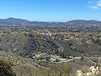
Fig. 25. Black Mountain rises above the mesa region in the Rancho Bernardo area. |
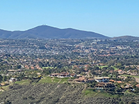
Fig. 26. Zoom view of Black Mountain rising beyond the Rancho Bernardo mesa. |
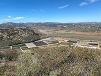
Fig. 27. High terrace (mesa) in the Escondido area north of San Pasqual Valley. |
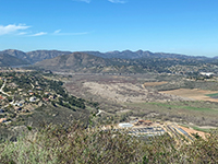
Fig. 28. View looking west toward the higher peaks of the Coastal Highlands region. |

Fig. 29. Zoom view showing Lake Hodges and the Del Dios Highlands in the distance. |
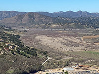
Fig. 30. Bernardo Mountain rises above I-15 with high peaks near San Marcos. |
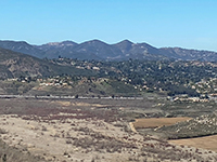
Fig. 31. Double Peak, Franks Peak, and Mt. Whitney rise above Felicita Mesa.
|

Fig. 32. I-15 crosses Escondido Mesa into San Marcos Valley. |
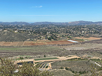
Fig. 33. Escondido sprawls over the high terrace to the north of San Pasqual Valley. |
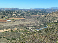
Fig. 34. The High Terrace between San Pasqual Valley and Valley Center. |
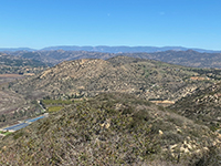
Fig. 35. Raptor Ridge, Pine Mountain ridge, and distant Palomar Mountain ridge. |
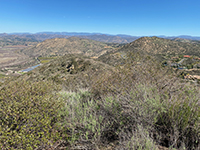 Fig. 36. The "Old Erosion Surface" is revealed by the uniform elevation of high peaks of the Peninsula Ranges.
 |
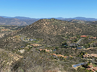
Fig. 37. Homes along Heritage Road are located at the level of the Highlands Terrace (mesa surface level). |
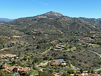
Fig. 38. Starvation Mountain, a monadnock, rises above the "Old Erosion Surface" level to the east of "Water Tank Peak." |
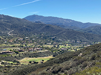
Fig. 39. Woodson Mountain (2,881 feet) is a monadnock. A valley at the Highlands Terrace level in the foreground. |
|
| https://gotbooks.miracosta.edu/fieldtrips/San Pasqual_Valley/Old_Coach_Trail.html |
3/19/2021 |
|


CT_AQUA_Plant3.jpg)