 |
|
Geology and Natural History of the Salton Sea Area |
|
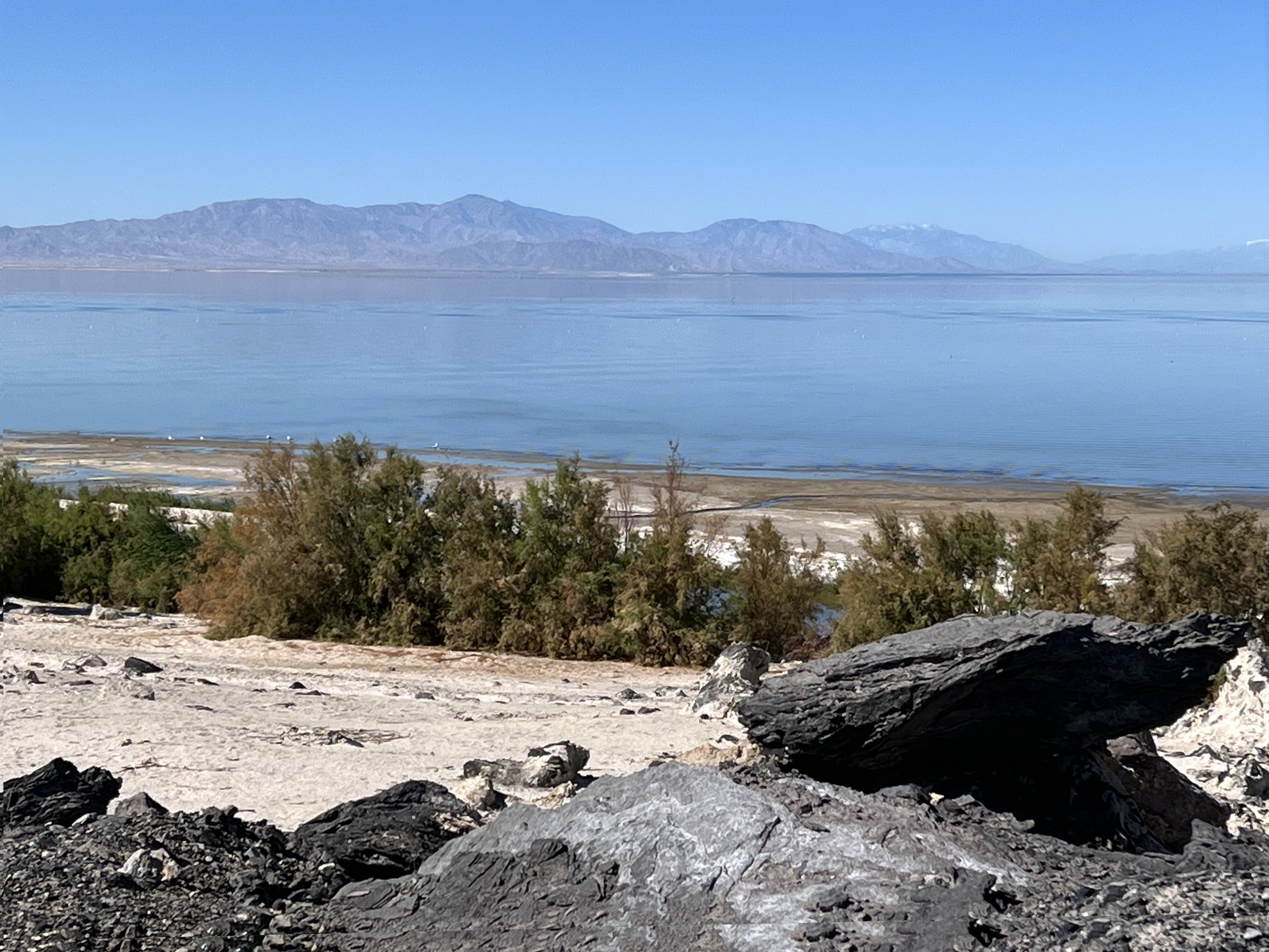
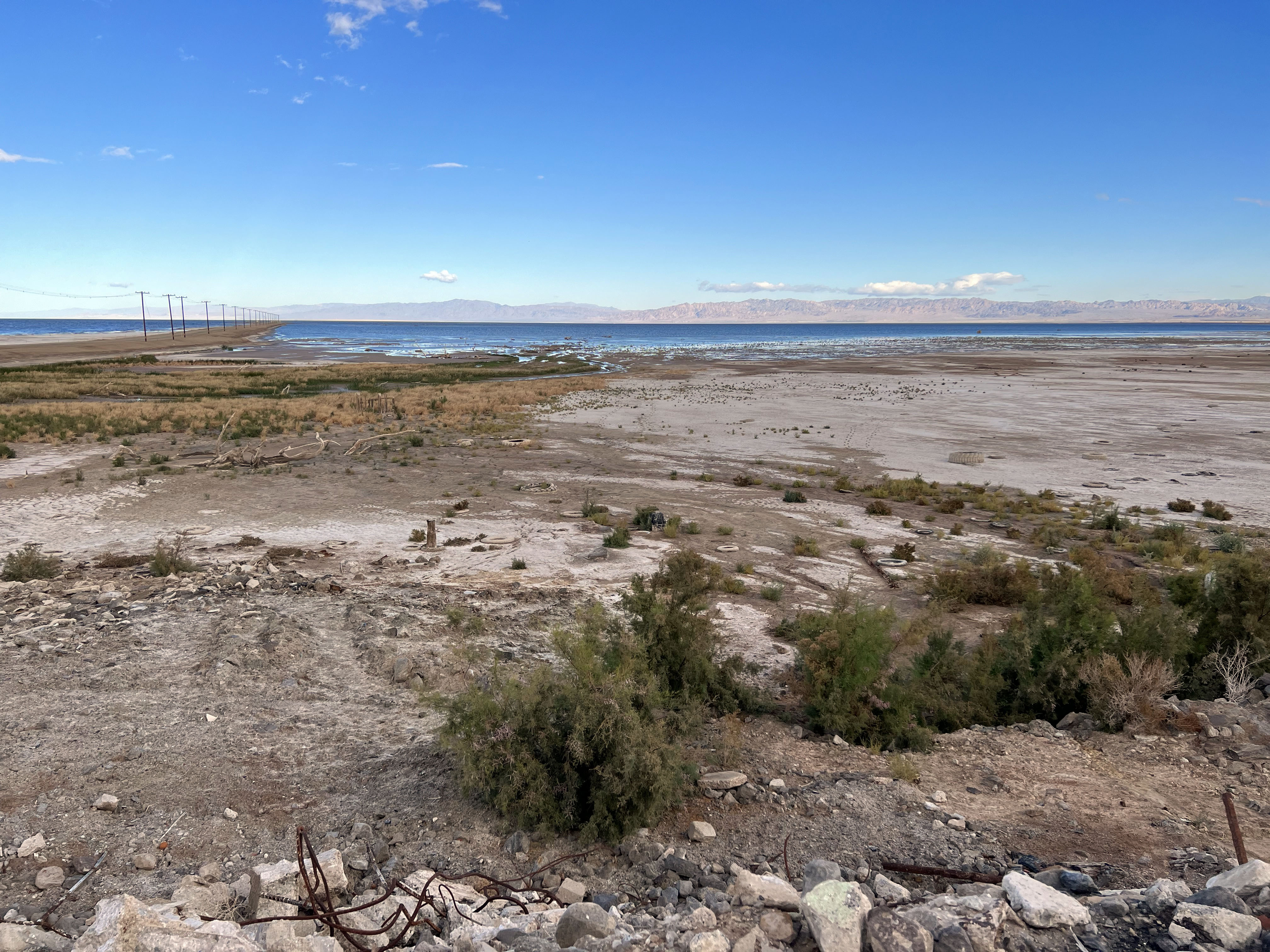
| The Salton Sea is an enigma - its existence is a result of both natural processes (geology and climate) and human activity (both planned and unplanned). The Salton Sea lies within the Salton Sink, a geological basin structure influenced by crustal extension associated with the greater San Andreas Fault System and downwarping within the Salton Trough, a structural basin filled with sediments derived surrounding mountain ranges and from the shifting lower Colorado River delta and ancestral shorelines of the Gulf of California and ancient Lake Cahuilla (a much larger lake system that filled and vanished many times in prehistory). The modern Salton Sea formed from an unplanned breach of an irrigation levee system failed in 1905 along the U.S./Mexico border and diverted the flow of the Colorado River into what was the isolated salt pan/playa what now hosts the Salton Sea. By the time the floods ended and the levee breaches were repaired, billons of gallons of water had flooded the basin, creating the "artificial" lake that was about 45 miles long, 17 miles wide, and 83 feet at its deepest extent. The lake became an artificial wonderland that supported and introduced fish population and a thriving tourist destination. However, the growing demand for water for agricultural irrigation in the Imperial Valley and expanding urban areas shut down the water replenishment to the lake. Evaporation concentrated salts and toxic agricultural runnoff, resulting in toxic algal blooms that eventually wiped out the once-thriving commercial and recreational fishing, and the resulting incredible odor problem pretty much drove away tourism. Currently the remaining water is currently slightly higher than seawater (+40 ppt), and the lake is currently about 28 feet deep. Creation of the Sonny Bono Salton Sea National Wildlife Refuge has helped to preserve portions of the receding shoreline and restored wetlands to support the threatened local and migratory bird and wildlife populations. However, an extension of the story is the ongoing development of geothermal energy and lithium-bearing brine extraction in the region encompassing the Salton Buttes Volcanic Area at the the southeast shore, and the ongoing battle over water resources. | Click on images for a larger view. |
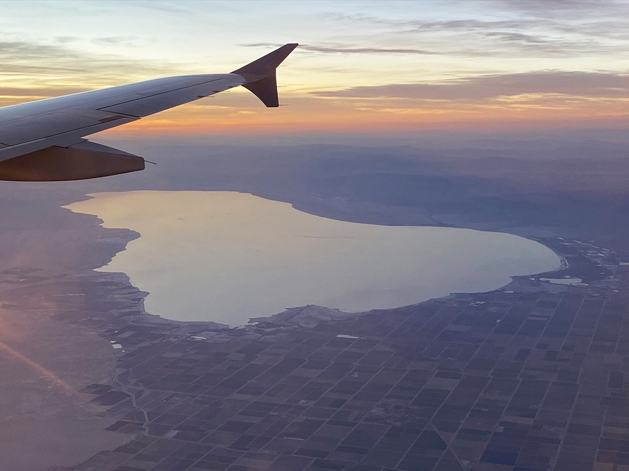 Fig. 1. Airliner view looking north at the Salton Sea. |
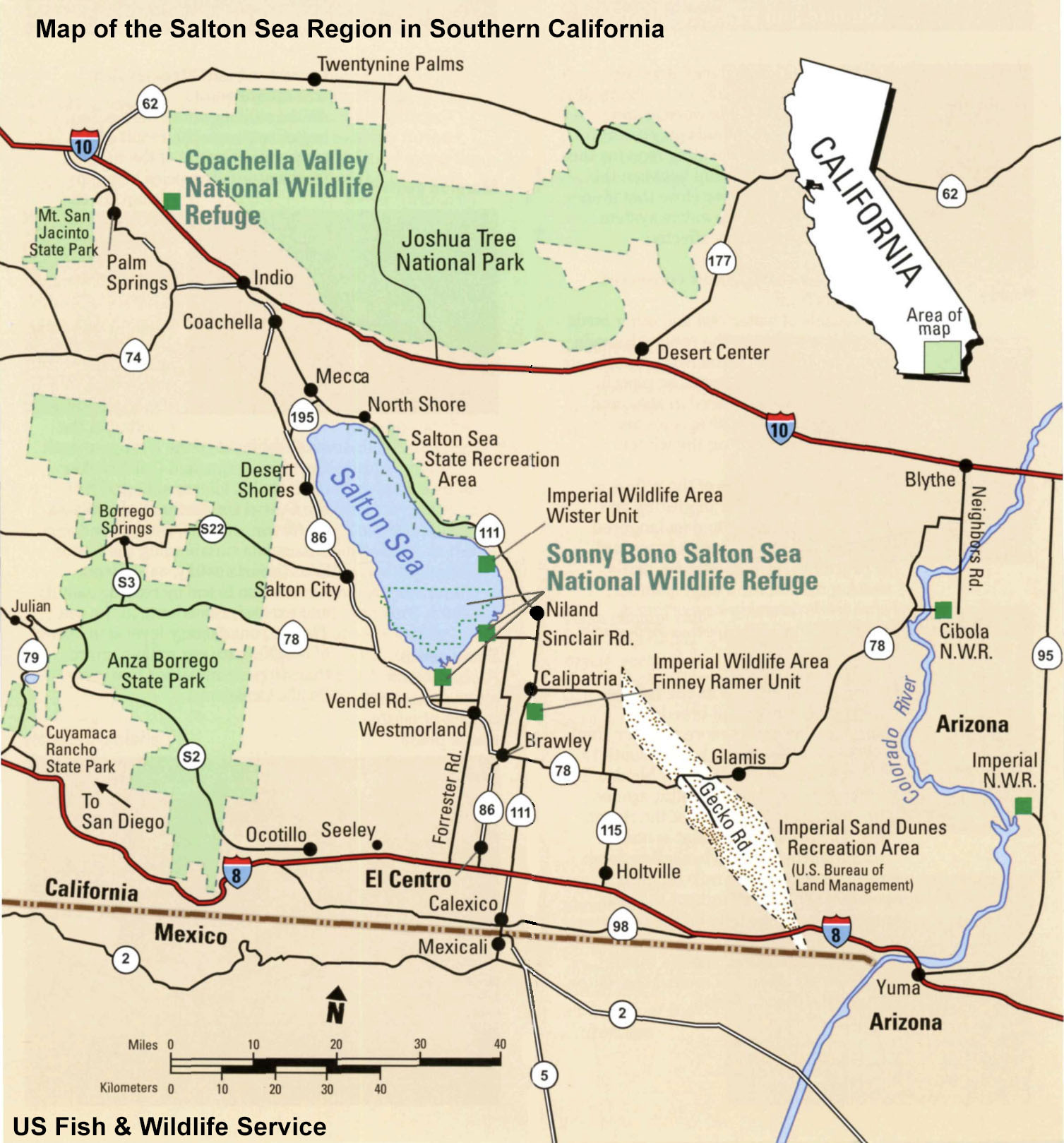
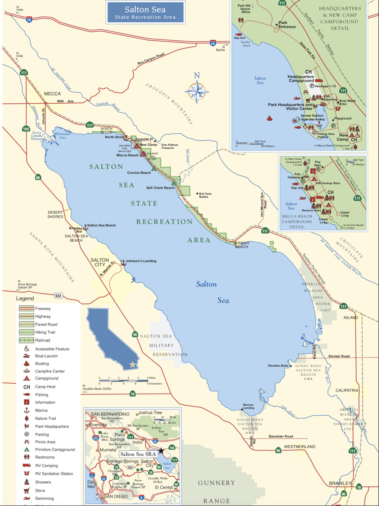
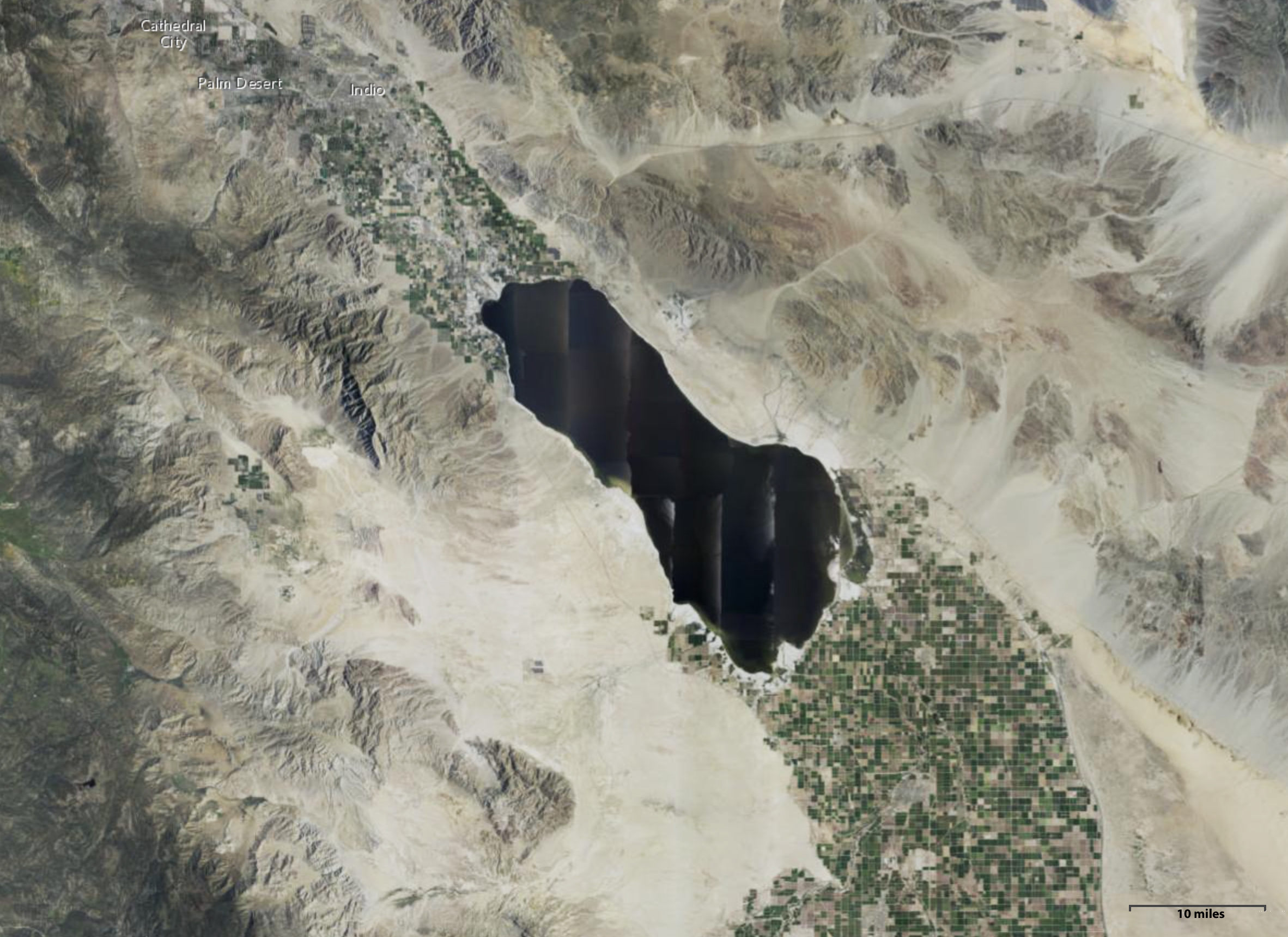
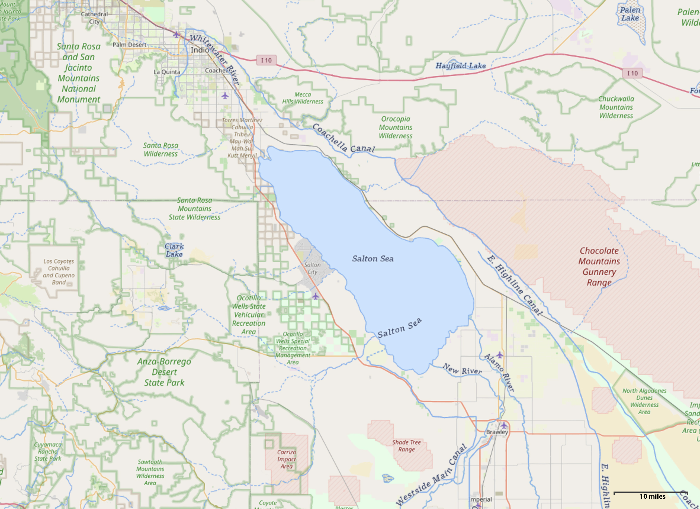
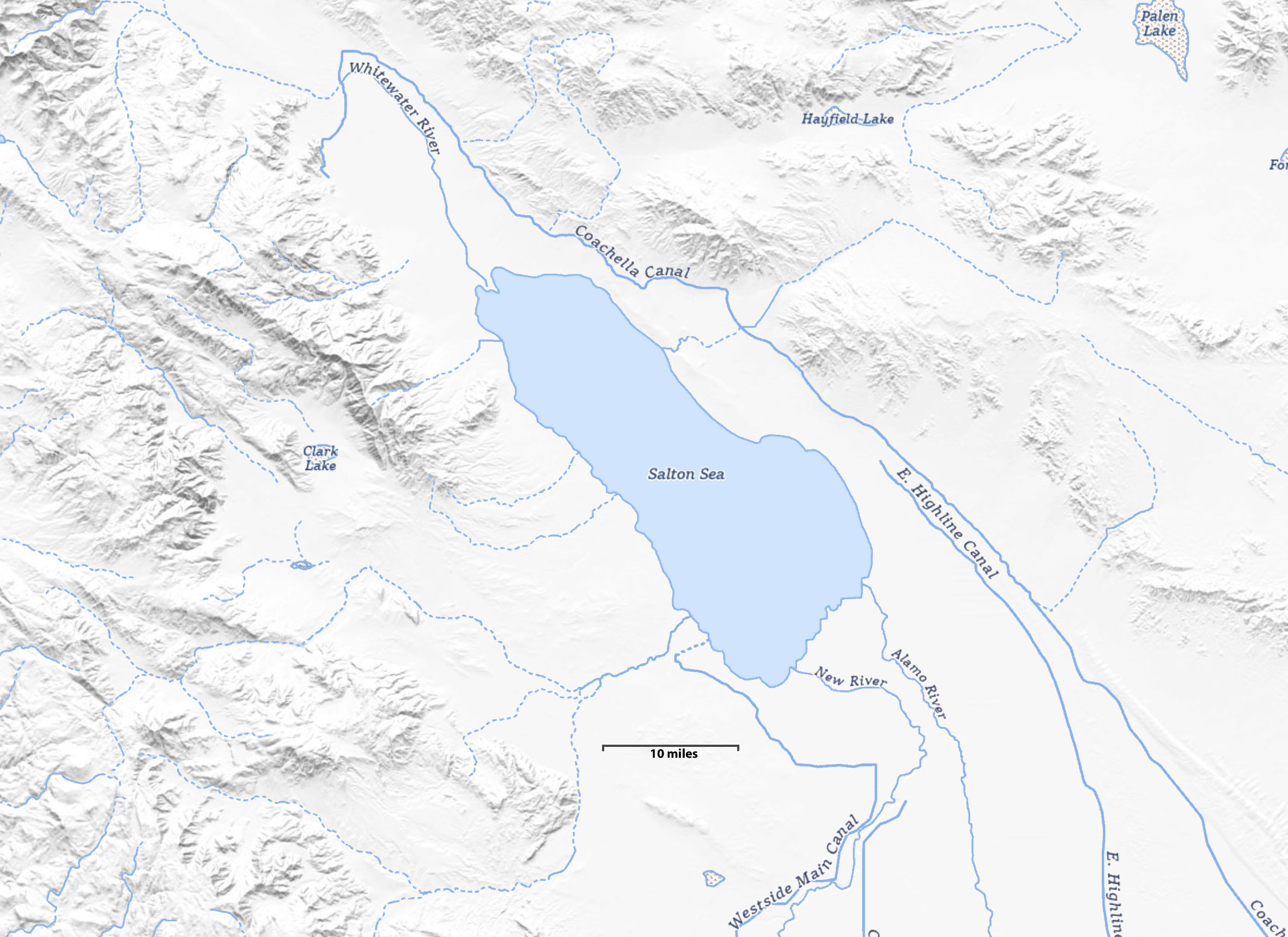
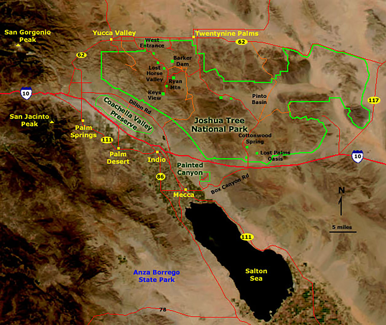
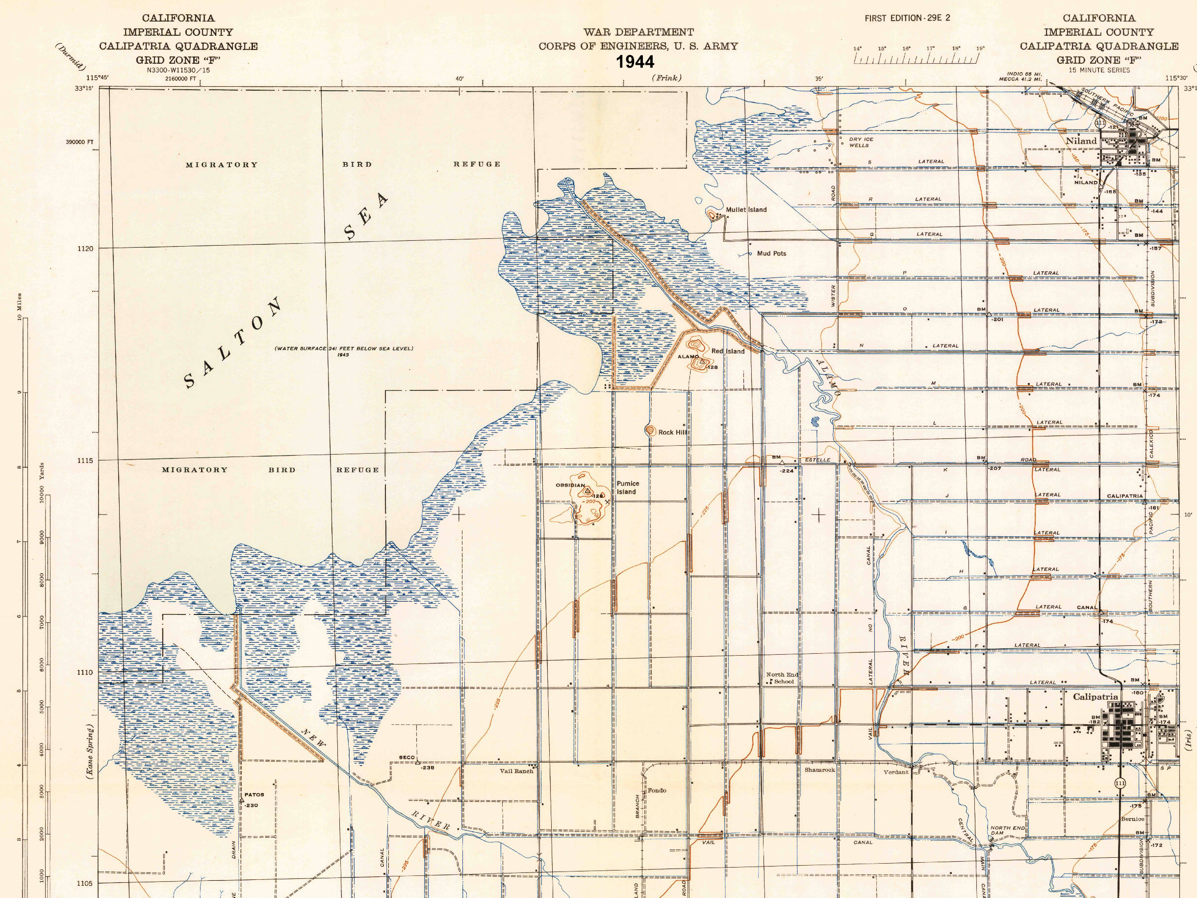
Regional SettingFigures 2 and 3 show the maps of the Salton Sea and vicinity. Much has been written about the history and natural history of the Salton Sea within the greater Imperial Valley. Prior to the 20th century, the region was largely uninhabited desert (referred to as a "wasteland"), a true desert with high seasonal temperatures and receiving an average of about 3 inches of rain a year. Starting about 1901 ranching and agricultural development lead to the construction of irrigation diversion of Colorado River waters into what became one of the most agriculturally productive regions in the world. Imperial County separated from San Diego County in 1907. The formation of the modern Salton Sea is only part of that story. Prior to the formation of the lake, the playa was a barren barren playa, locally mined for salts, and a contributor of great clouds of dust during windy periods. Figure 4 is a high-altitude aerial photo of the Salton Sea and surrounding desert landscape and agricultural activity in the Imperial Valley. Despite all the agriculture and commerce, Imperial County is among the least populated and most culturally diverse counties in California. Figure 5 is a land use map of the region. Outside of the private agricultural lands and urban areas in the Imperial Valley, most of the land is managed by the Federal government via the U.S. Bureau of Land Management, U.S. military; some as wildlife refuge, water resource areas, commercial mining interests, and some as state park and recreational lands. |
|
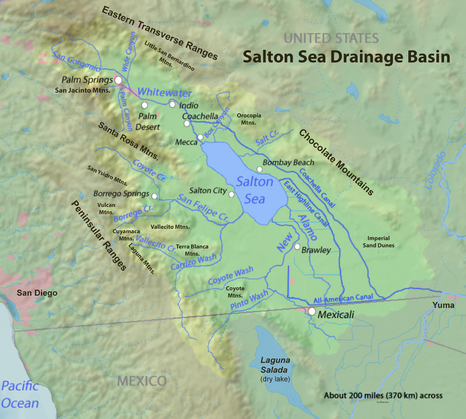
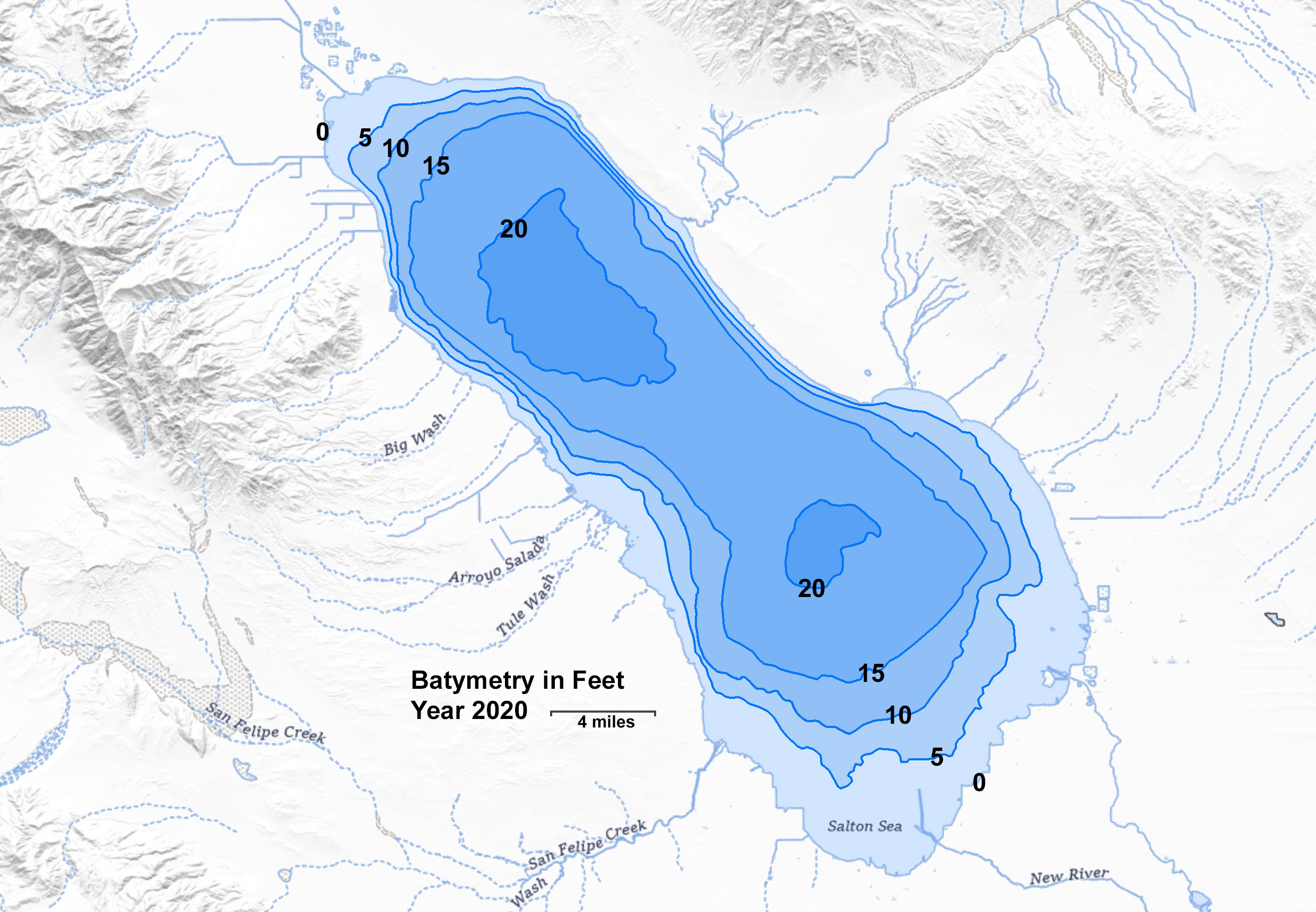
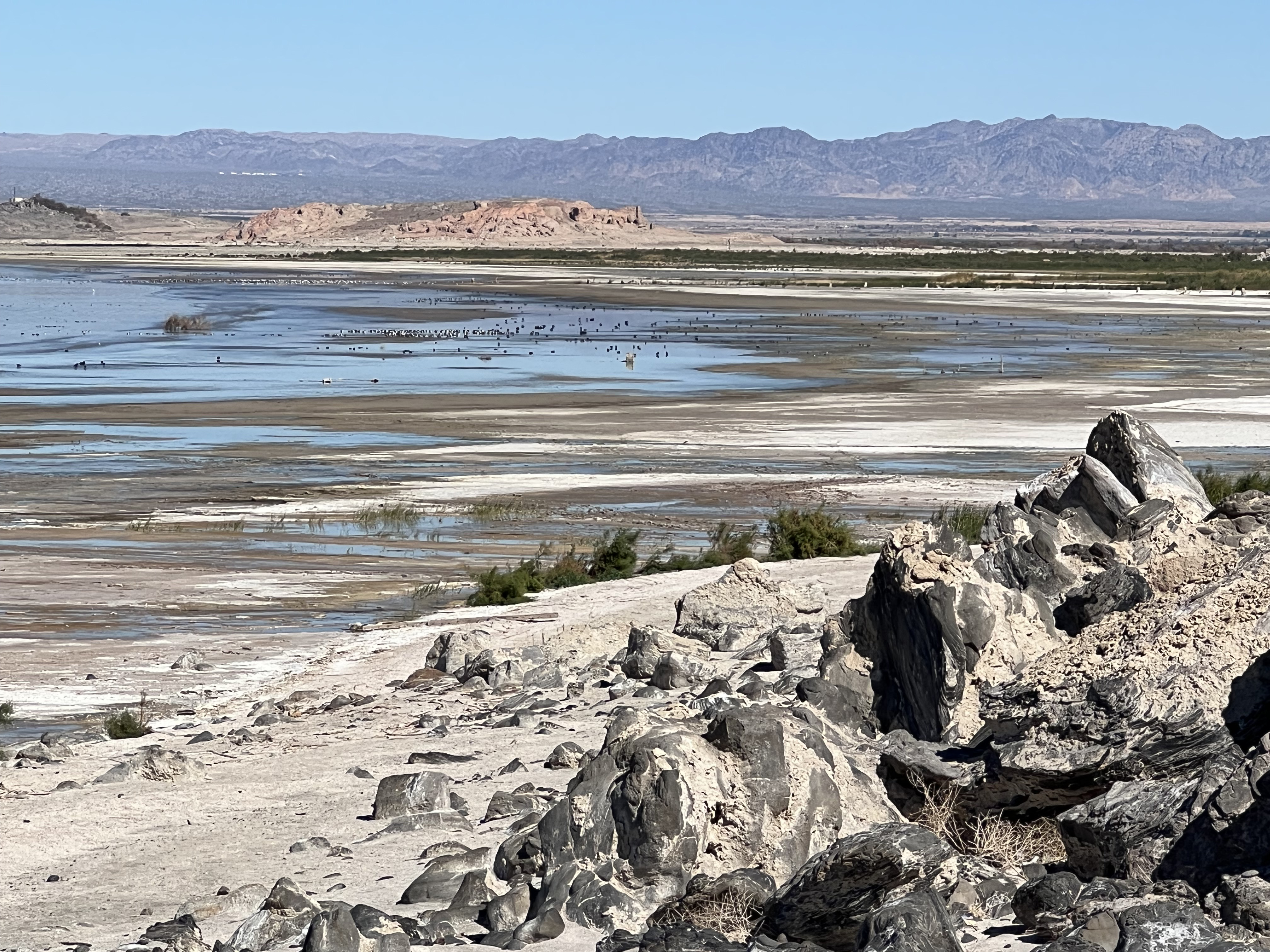
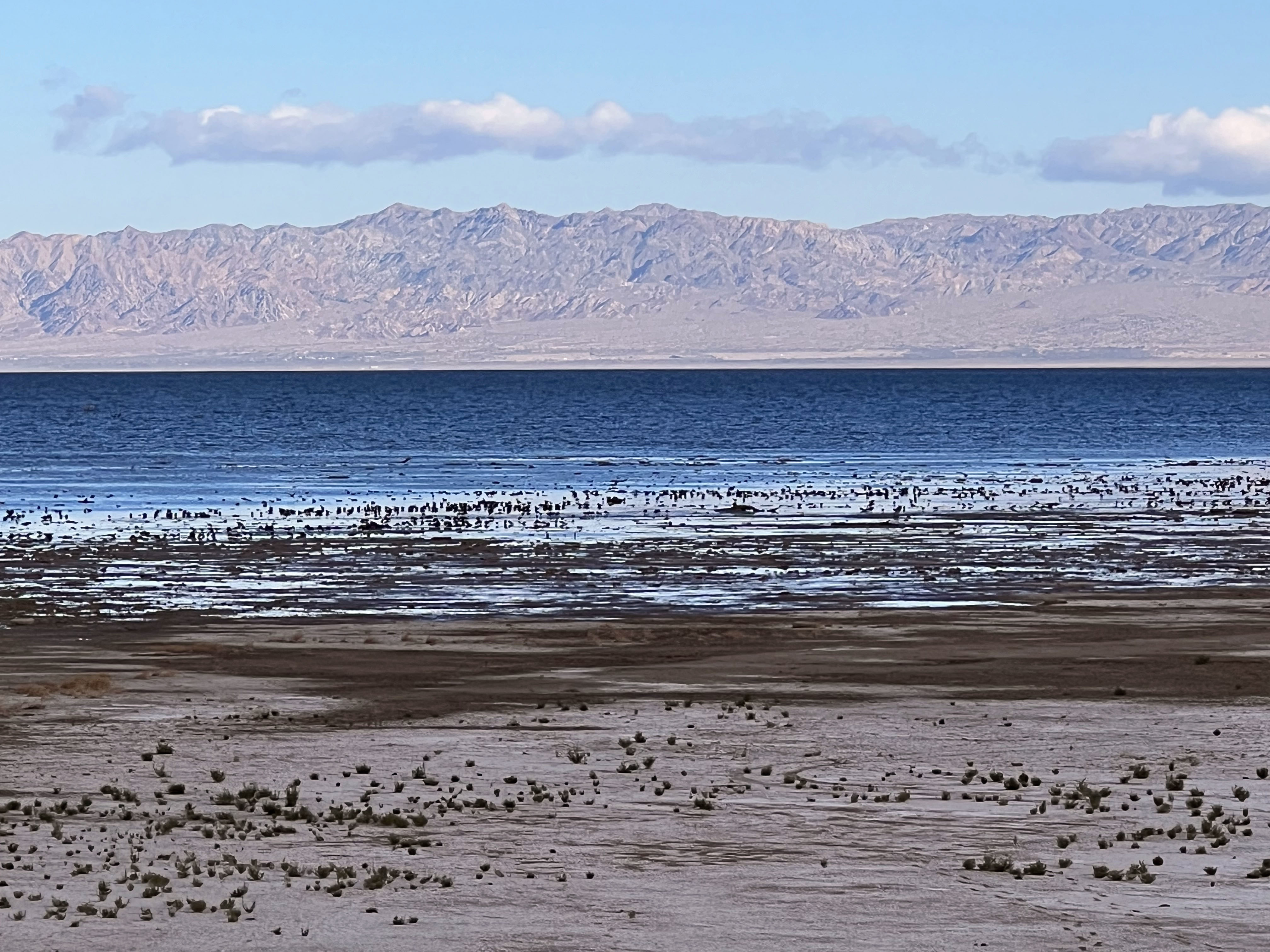
Hydrology of the Salton Sea BasinThe Salton Sea occupies the low point within Salton Sink, a closed drainage basin within the larger Salton Trough (Figure 7). The Salton Sea (lake) separates the Imperial Valley (to the south) and the Coachella Valley (to the north). The Salton Sink currently has no outflows to other bodies of water (Figure 8). The lowest part of the sink is about 269 feet (82 m) below sea level. The lake surface is currently about 240.5 ft below sea level (as of January, 2024), and falling roughly 6 inches a year due to evaporation and reduced inflow. The deepest part of the lake currently about 28 feet (Figure 9). The Salton Sink has flooded and dried out numerous times since first being observed and reported. Don Juan de Baptista reported the basin was dry in 1774. Since then, the Colorado River has spilled over it embankments resulting in floods that inundated portions of Salton Sink. Larger "natural" floods occurred in 1840, 862, 1884 and 1891. Prior to the flooding that formed the lake in 1905. In between, the lake bed dried out. The last and largest 1905 Colorado River is what formed the modern Salton Sea. Flood waters breached diversion canal levees in Imperial Valley near the Mexican Border, creating the Alamo and New Rivers that drained northward. For 2 years the Colorado River flowed into the Salton Sink until a new dam was completed in 1907 to prevent further flooding. However, leakage still occurs including canal seepage and agricultural discharge, no perenial streams currently flow into the Salton Sea. A small amount of Colorado River water is discharged into wetland habitat areas along the south shore of the Salton Sea The Salton Sea floods part Salton Trough previously occupied by ancient Lake Cahuilla (Figure 10). The large lake flooded the valley and dried up numerous times in the past +20,000 years. The lake formed from the shifting outflow of the Colorado River Delta. The lake formed when sediments blocked the flow of the river into the Gulf of California and the river channel shifted over the low divide and flooded into the Salton Sink, most recently along the "New River." At its peaks, the lake filled the trough to an elevation of about 39 feet (12-13 meters) above sea level. This is the level of the divide near the US/Mexico border between the Salton Sink and the Gulf of California. Wave-cut benches and shoreline features associated with the high-standing lake levels can be found throughout the region. At its peak, the lake was about 105 mi (169 km) long, 35 miles (56 km) wide and nearly 300 ft (91 m) deep. Archaeological sites associated with ancestral Native American Indian communities occur in many locations along the ancient lake shorelines. |
|
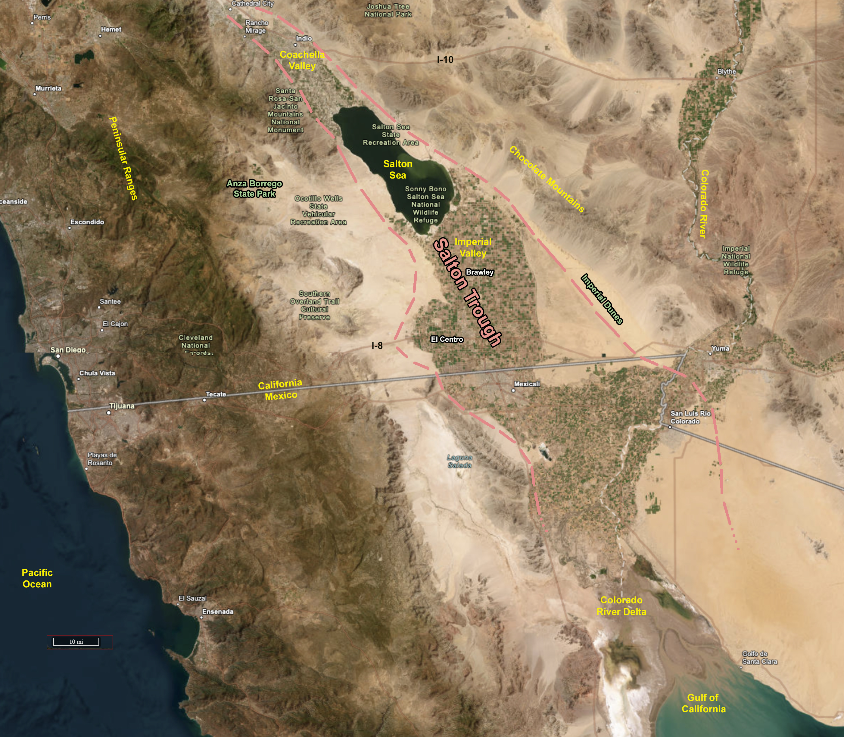
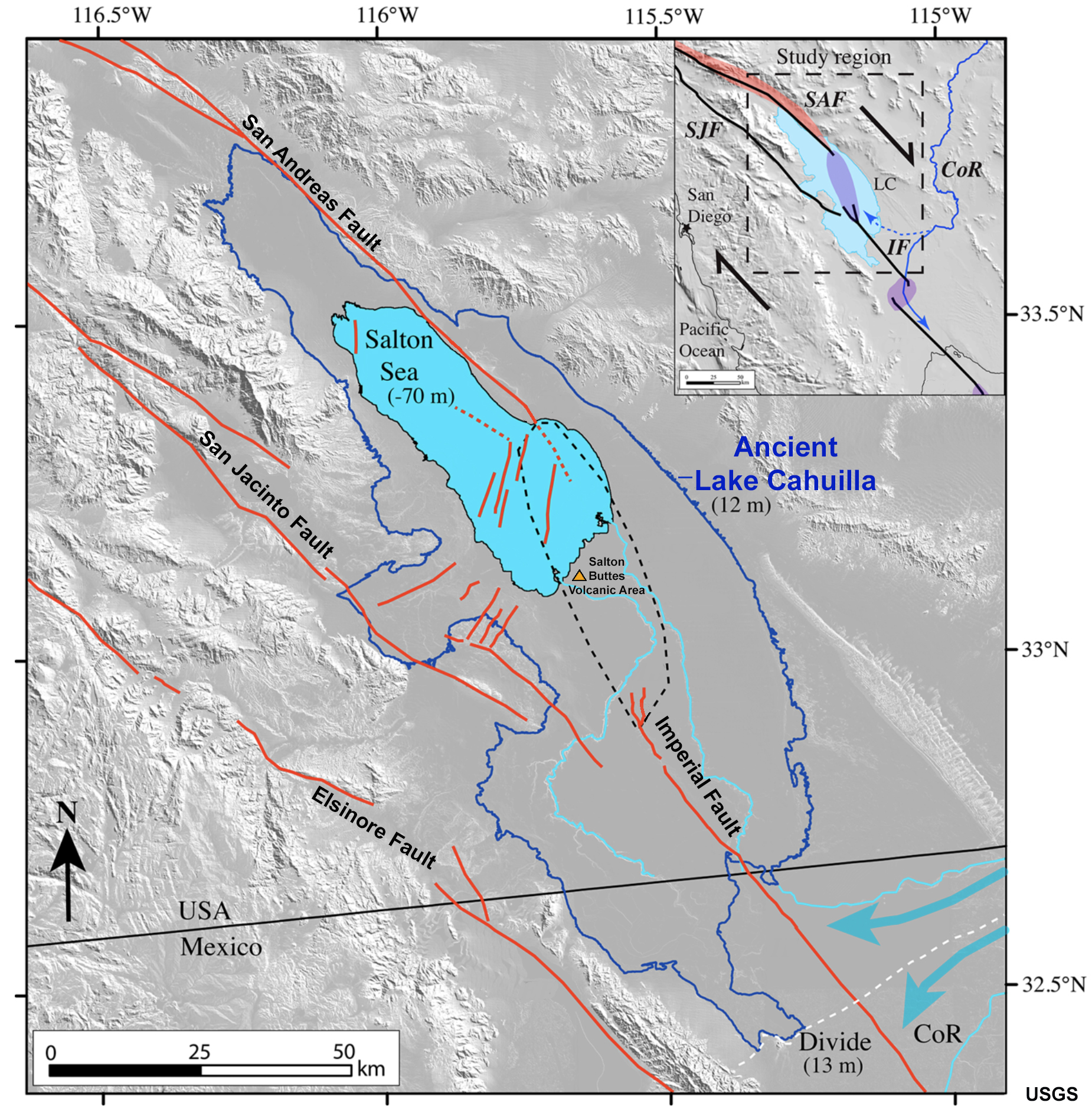
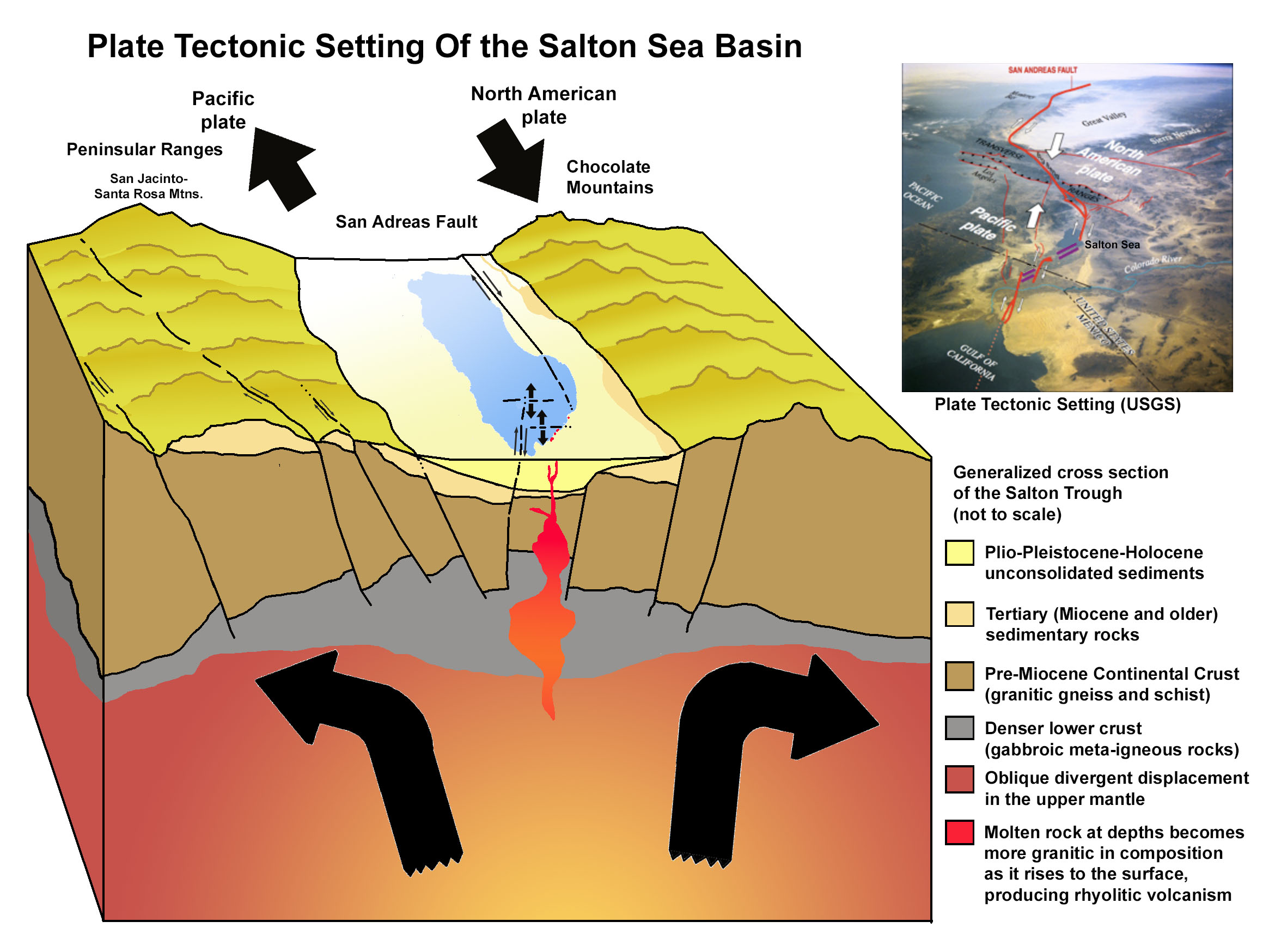
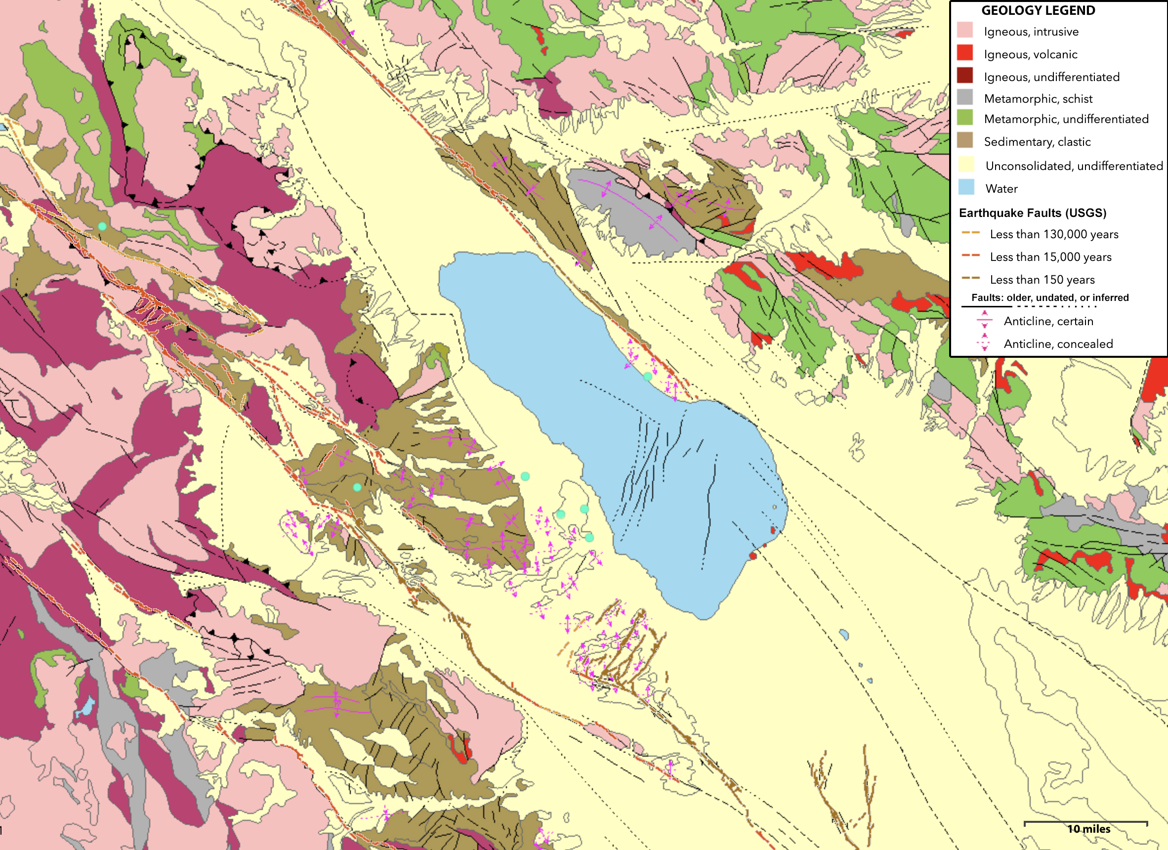
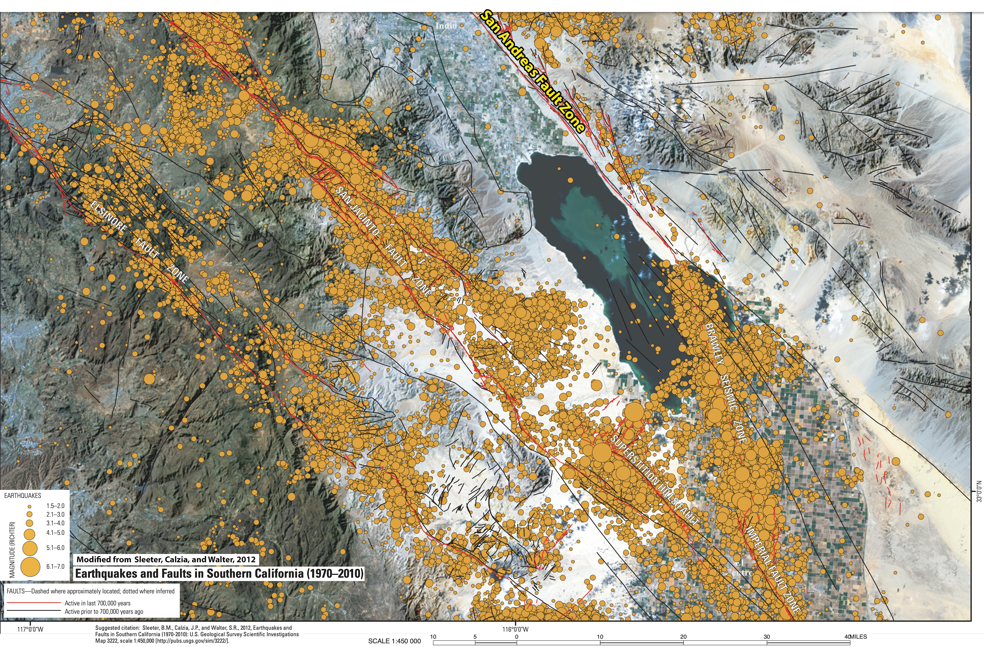
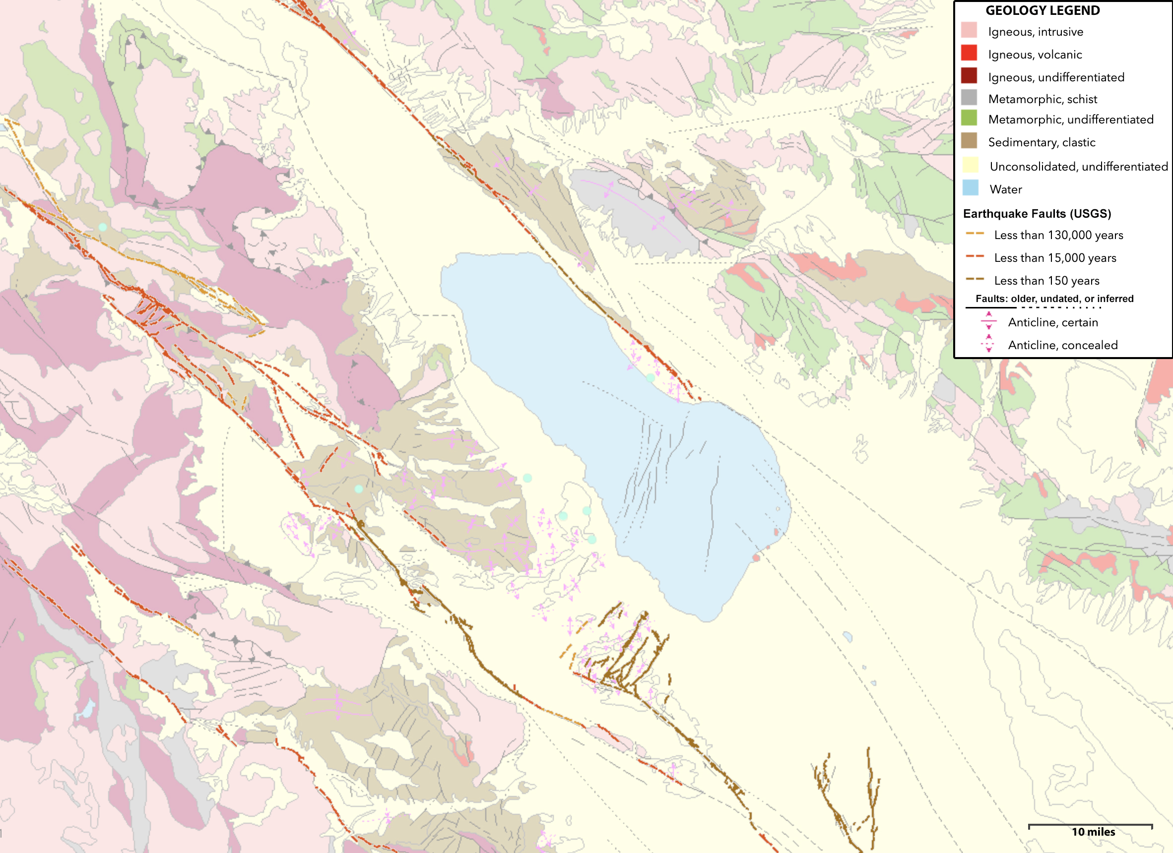
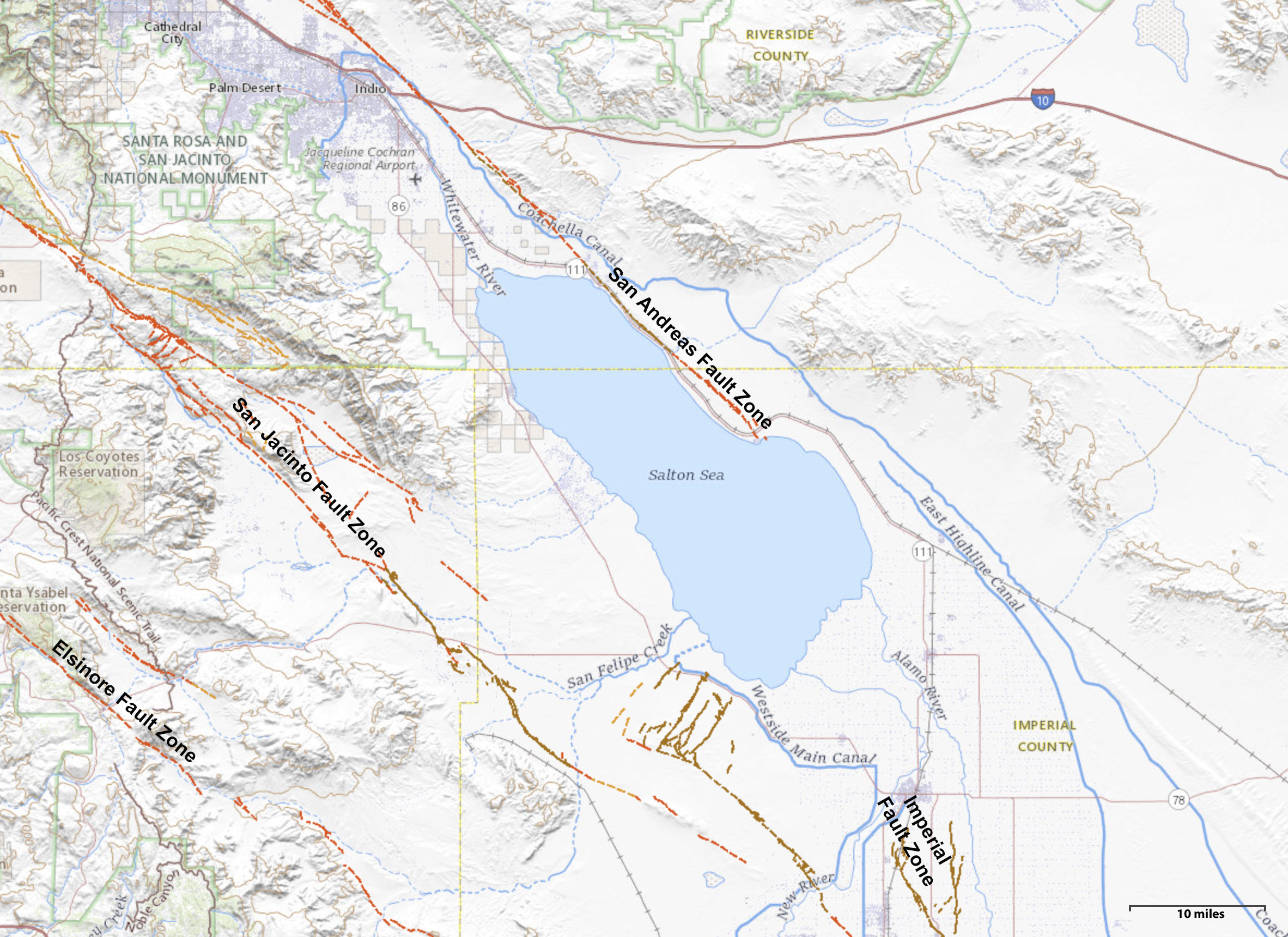
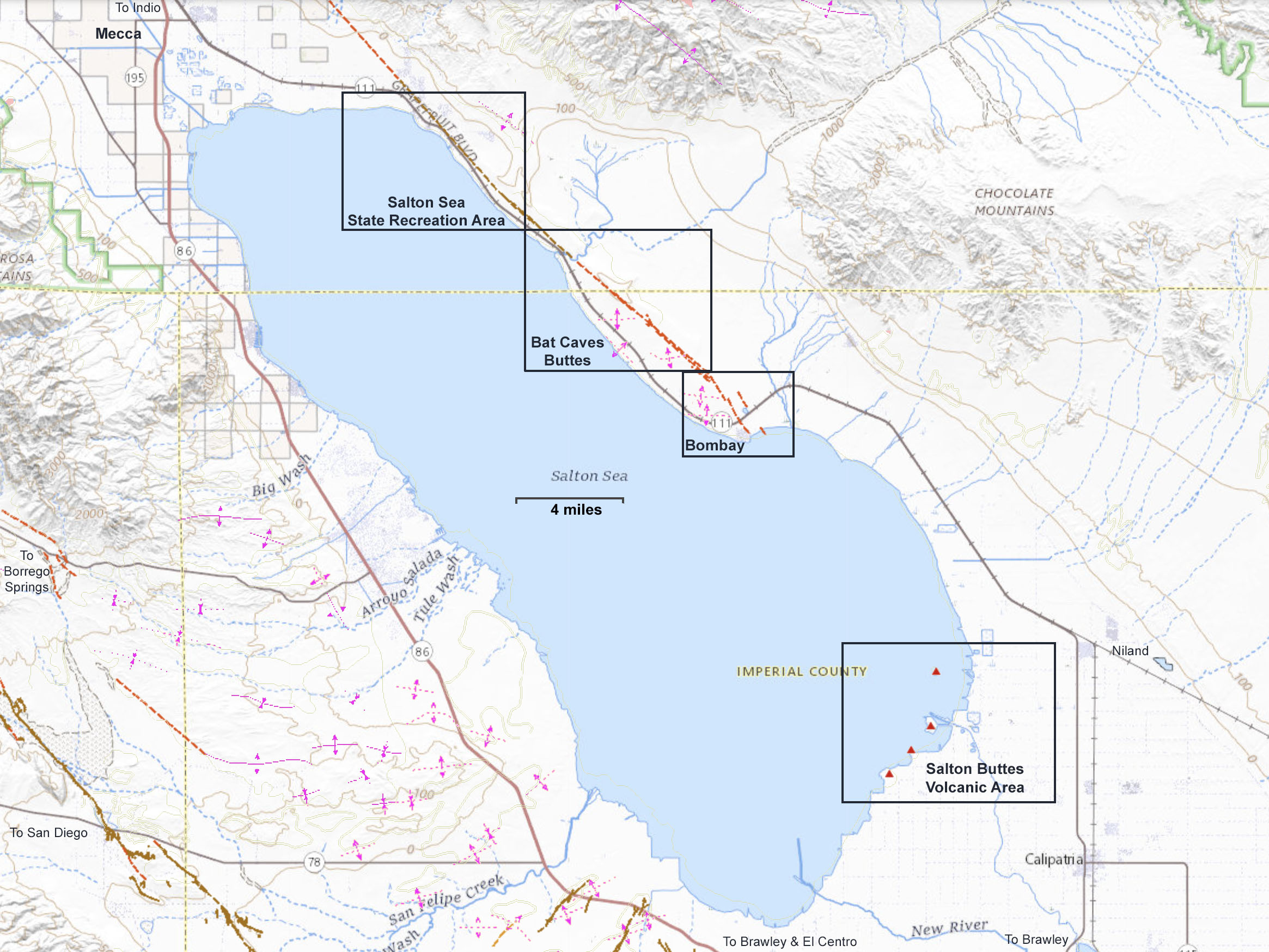
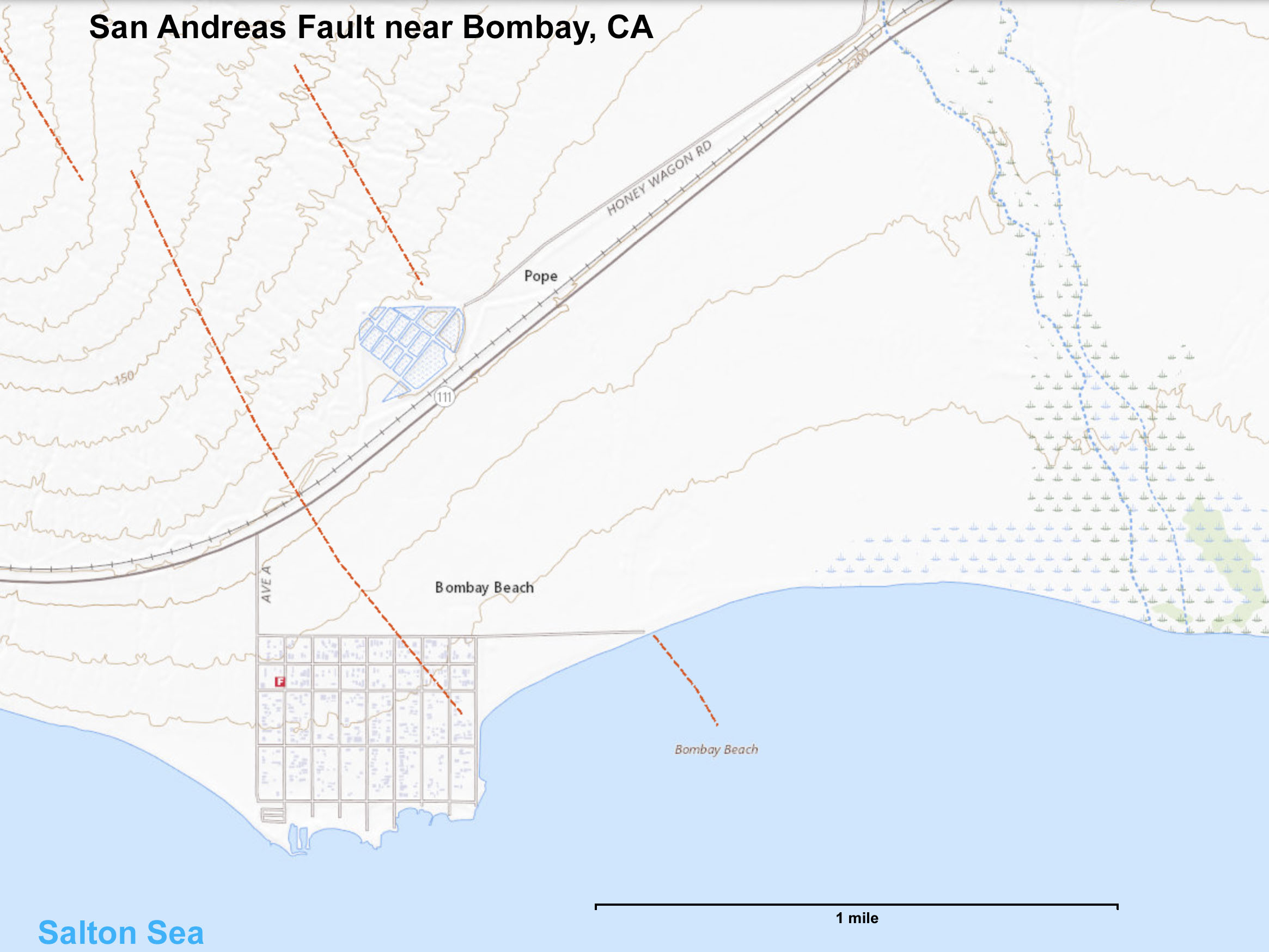
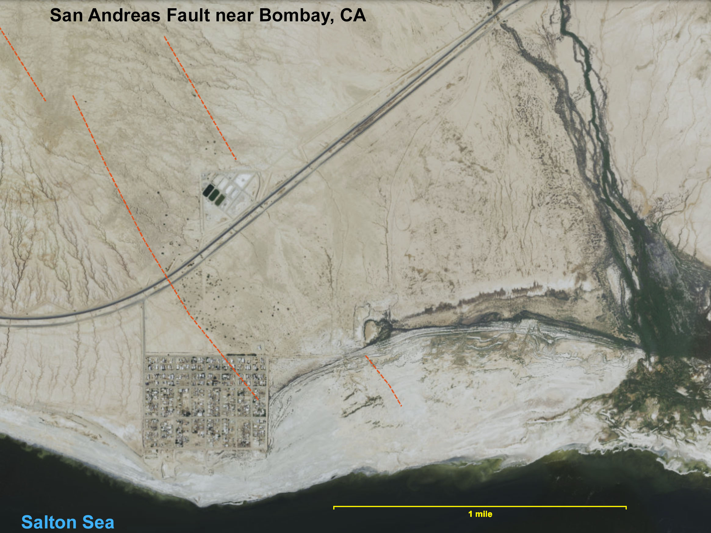
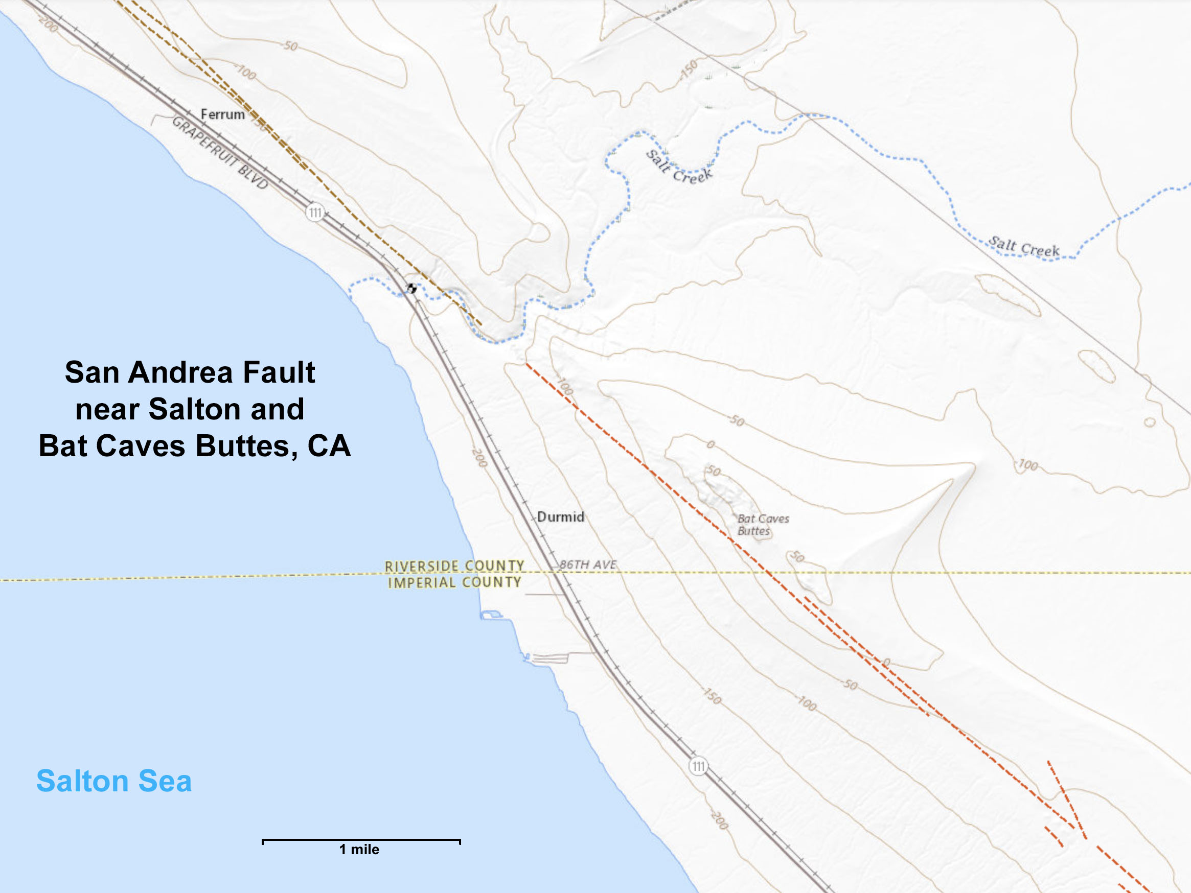
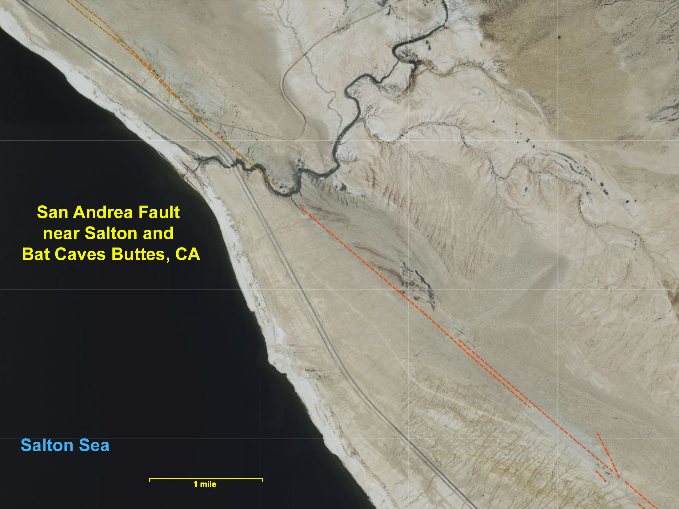
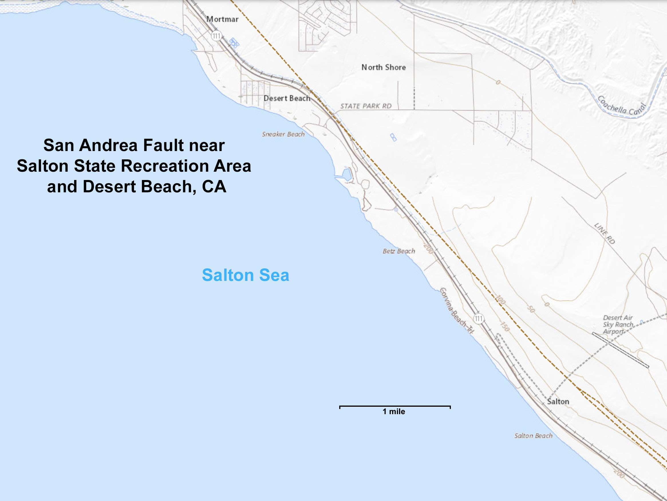
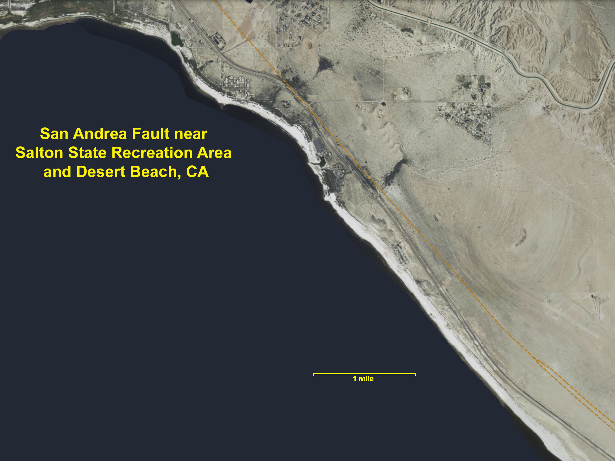
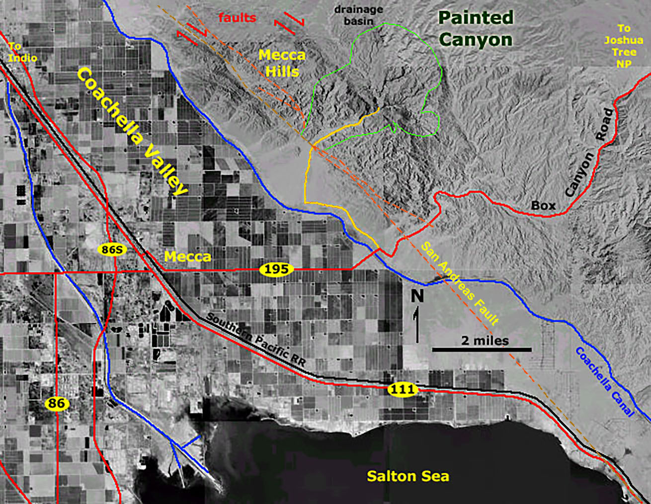
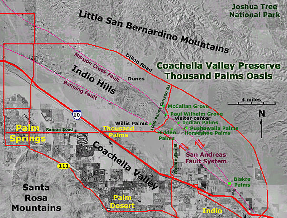
Geology, Faults, and Earthquakes of the Salton Sea RegionThe Salton Sea resides in a topographic low area within the Salton Trough. The trough is a triangular-shaped sediment-filled basin that extends northward from the Gulf of California through Imperial Valley and on northward from the Salton Sea into the Coachella Valley up to near Palm Springs (see Figure 7). The deepest part of the sediment filled basin is estimated to by about 21,000 feet thick near the Mexican Border. The Salton Trough gradually formed as a result of crustal stretching and sinking by the combined plate-tectonics actions involving both the San Andreas Fault system (right-lateral, transform faulting) and extension of the East Pacific Rise (divergent/spreading center tectonics) moving northward through the Gulf of California into SoCal over time (Figure 12). The trough began to form and fill in early Neogene (Miocene) time, and has gradually filled beginning in Miocene time. Much of the sediment came from to fill the trough was carried by the Colorado River, which eventually built up and intermittently blocked the river's flow to the Gulf of California. The older Miocene sedimentary rocks rest unconformably on older meta-igneous crustal basement rocks ranging in age of late Paleozoic, Mesozoic, and possibly younger age. These rock are locally exposed in the mountain ranges east and west of the trough (Figure 13). The older Miocene-age sedimentary rocks are locally unconformably overlain by younger Pliocene, Pleistocene, and Holocene unconsolidated sediments. The region is tectonically active with an abundance of faults and folds cutting through displacing, and exposing sediments of Neogene age (Miocene up to the Recent). The Salton Trough is one of the most seismically active regions in the United States (Figure 14). Some of the faults are considered earthquake faults, showing evidence of displacement in the last 15,000 years (Figures 15 and 16), locally some surface displacement has been observed from historic earthquakes, particular associated with the southern end of the nearby Elsinore Fault Zone. The southern end of the San Andreas Fault is under the Salton Sea. It's trace is barely visible impacting unconsolidated Holocene and Late Pleistocene age in the vicinity of Bombay on the eastern shore of the Salton sea (Figure 17 to 19). From there it extends northward along the east side of the Salton Sea (Figures 20 to 23). Significant displacement of the fault zone can be seen along the margin of the Mecca Hills and Indio Hills north of the Salton Sea (Figures 24 to 26). South of the Salton Sea, the San Andreas Fault System continues southward as the Brawley seismic zone where the fault zone steps over to continue south with the Imperial Fault Zone to the south. Near the Mexico border the fault zone merges with other faults including the south end of the Elsinore Fault Zone before moving offshore beneath the Gulf of California where it merges with the Eastern Pacific Rise system. |
|
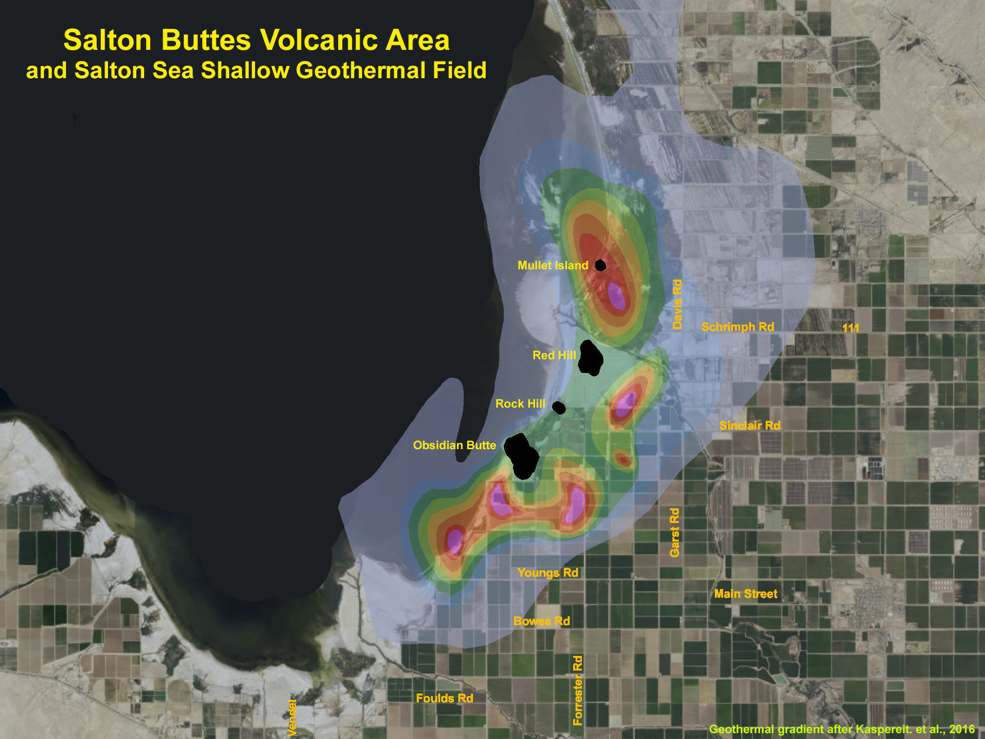
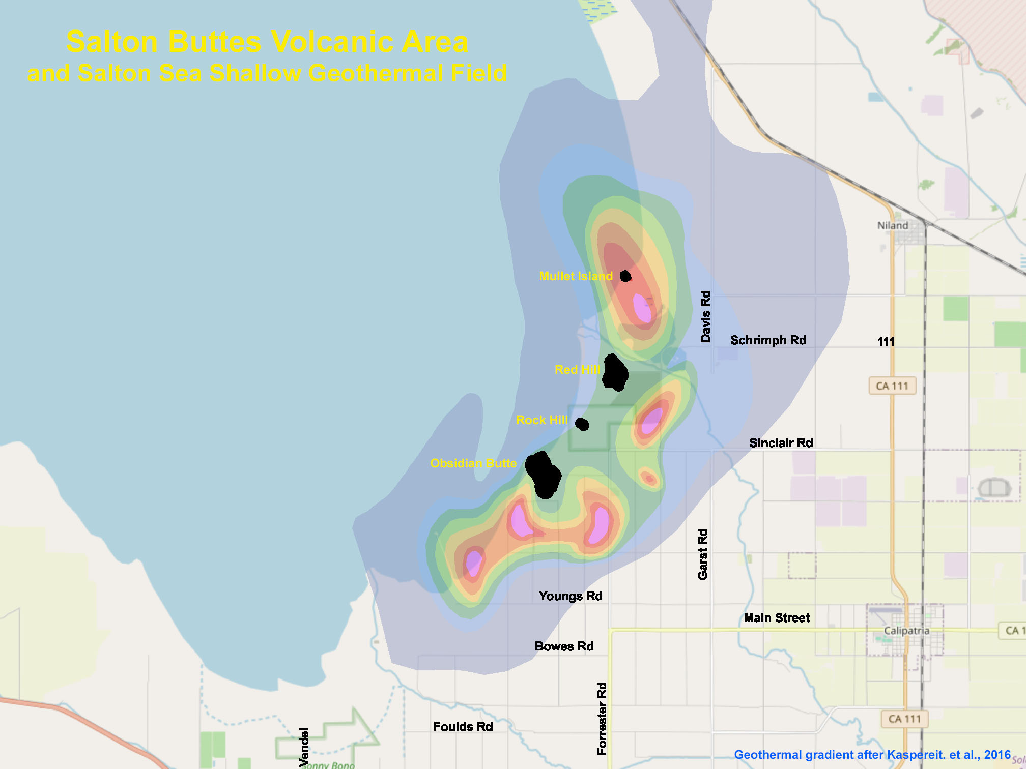
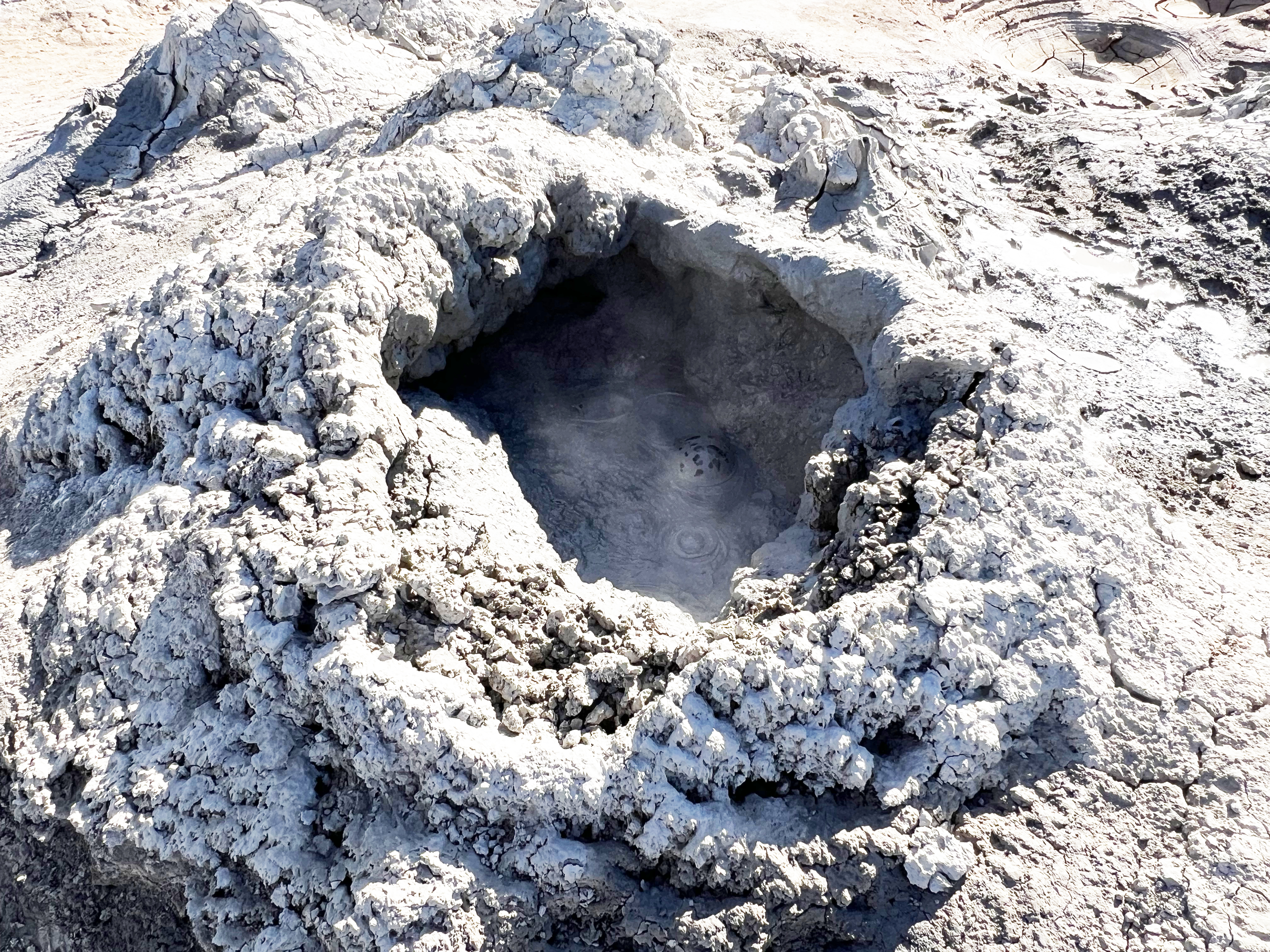
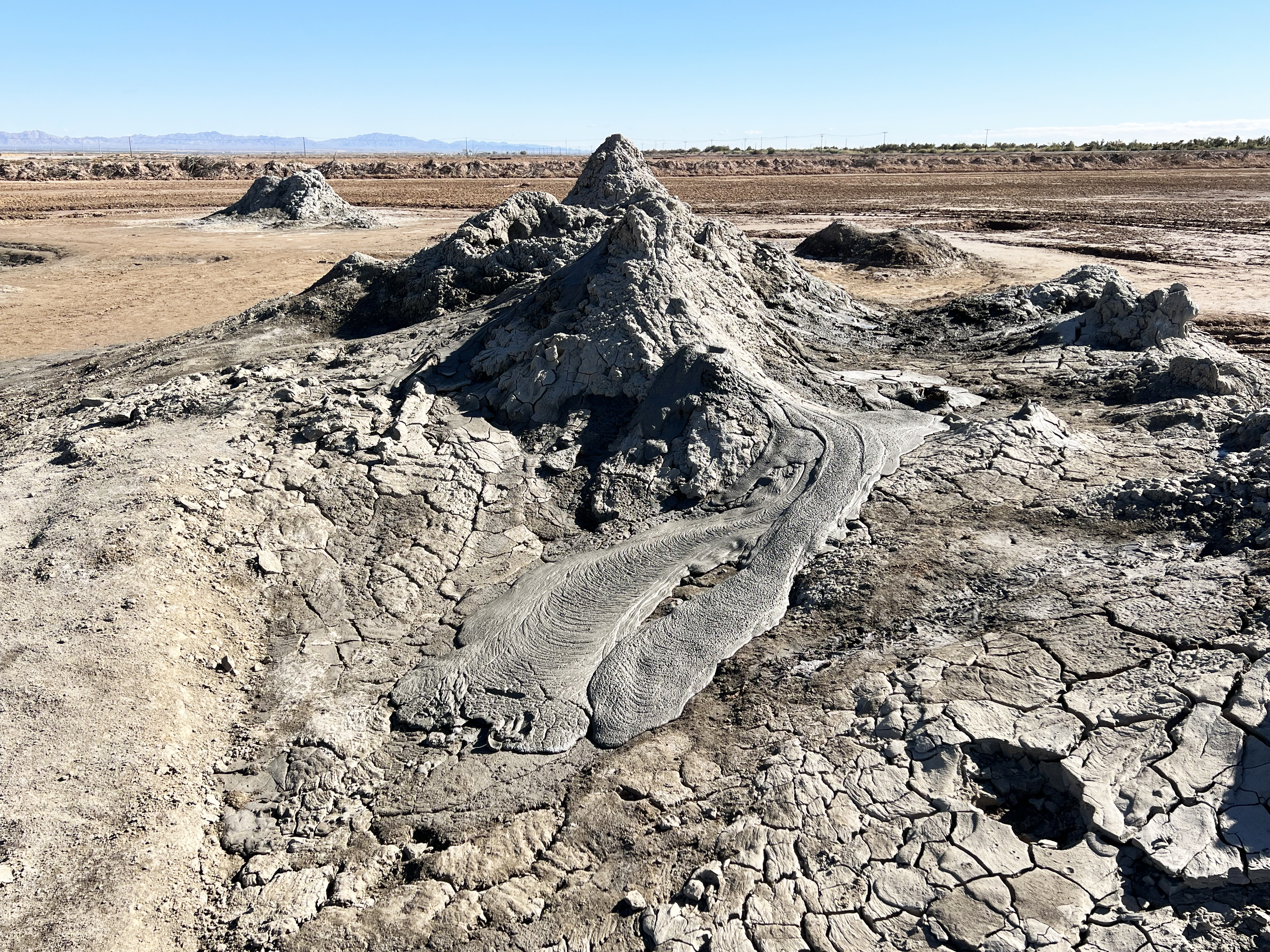
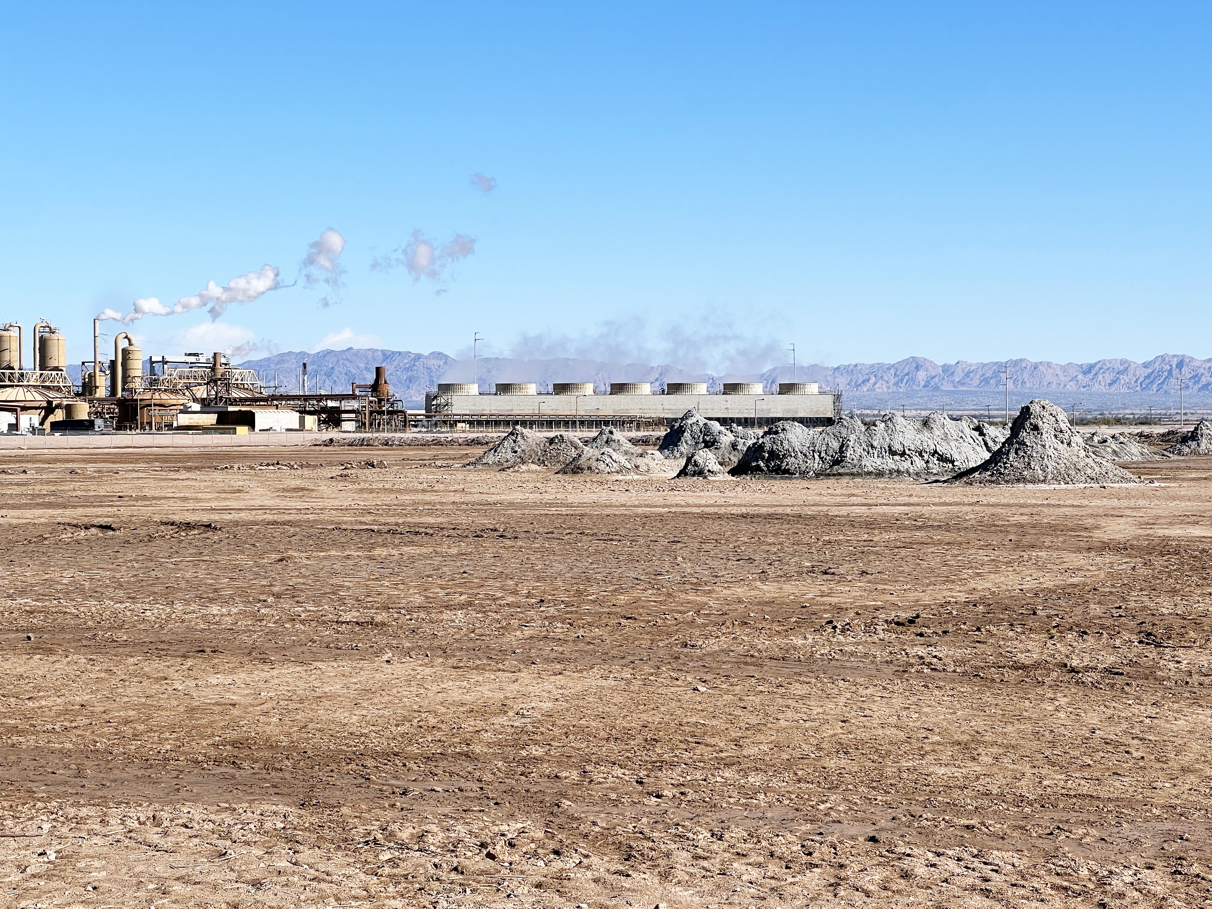
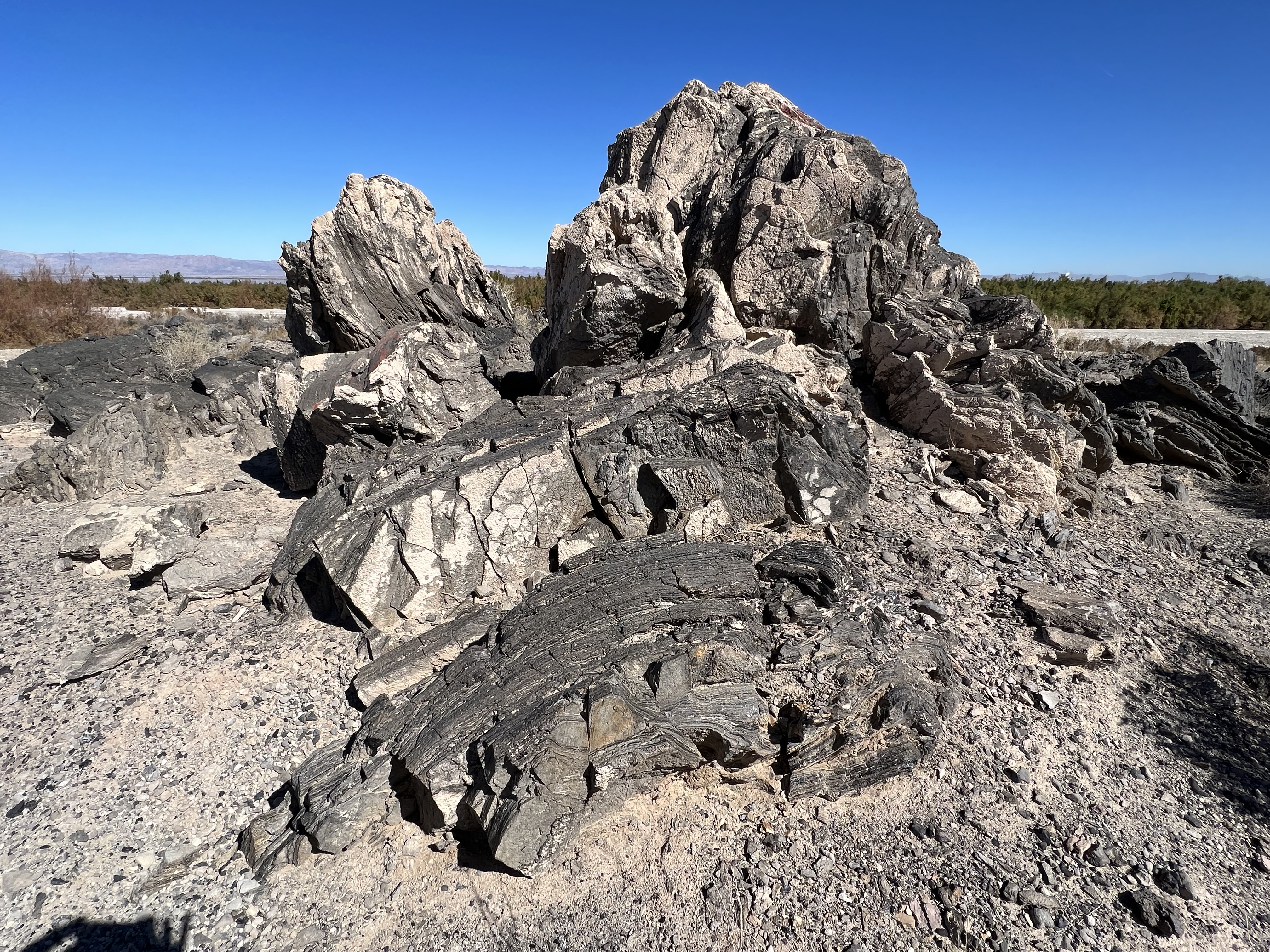
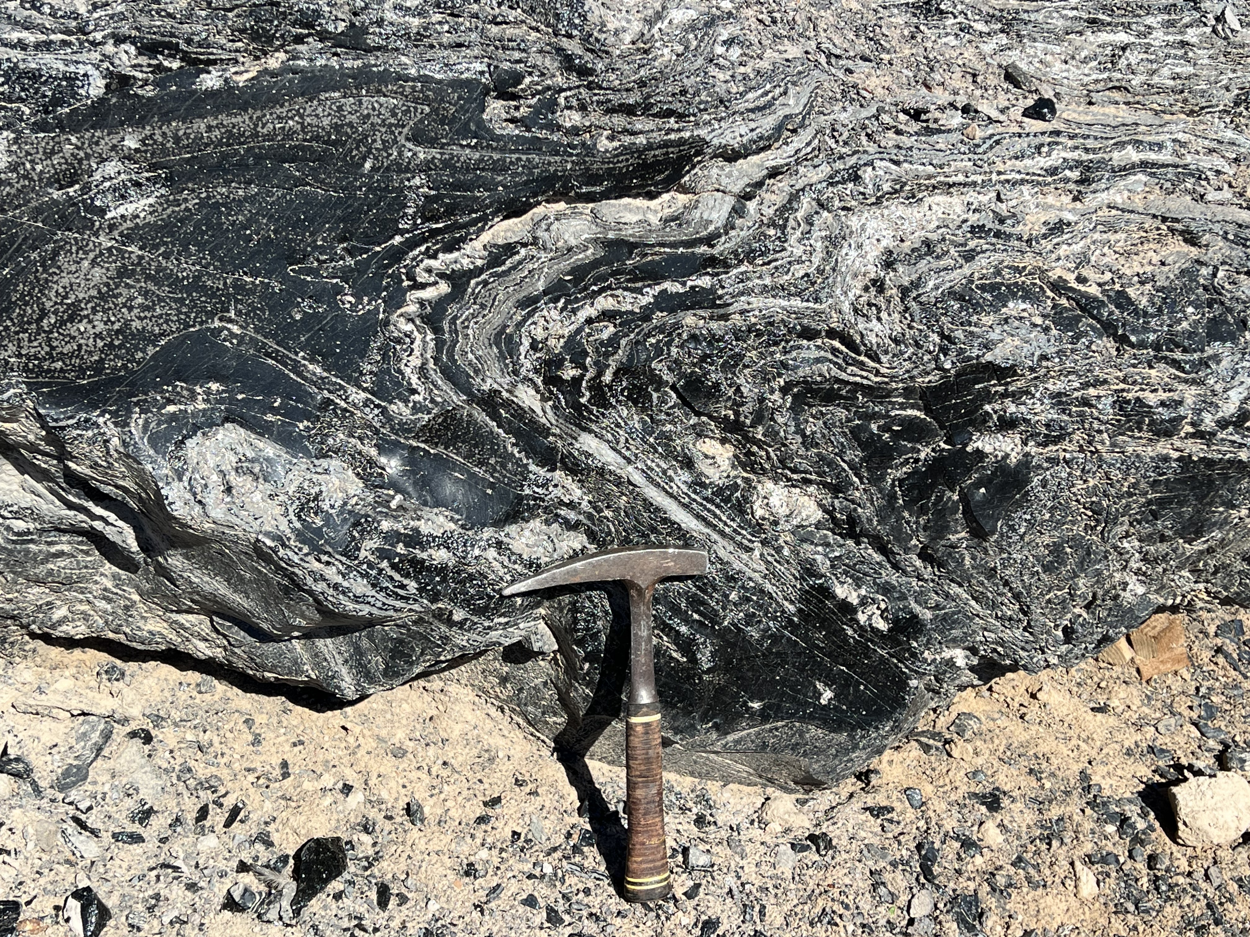
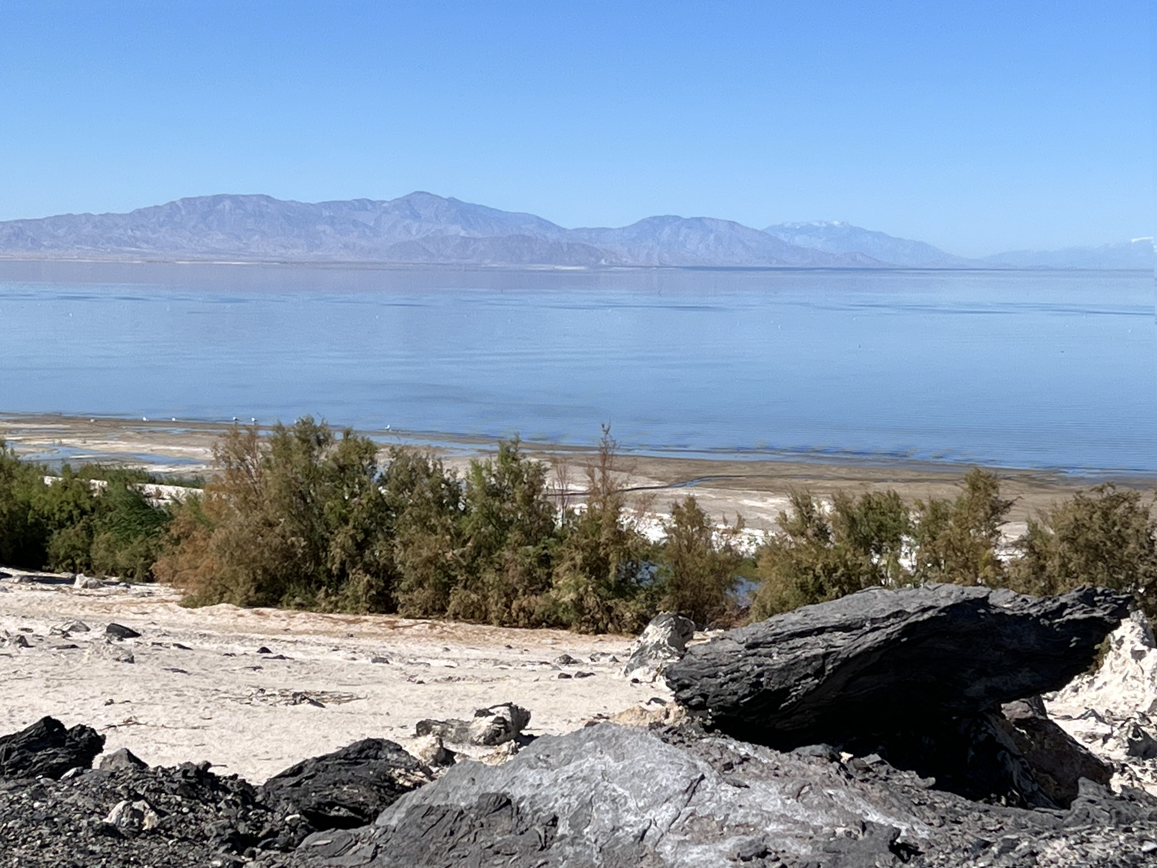
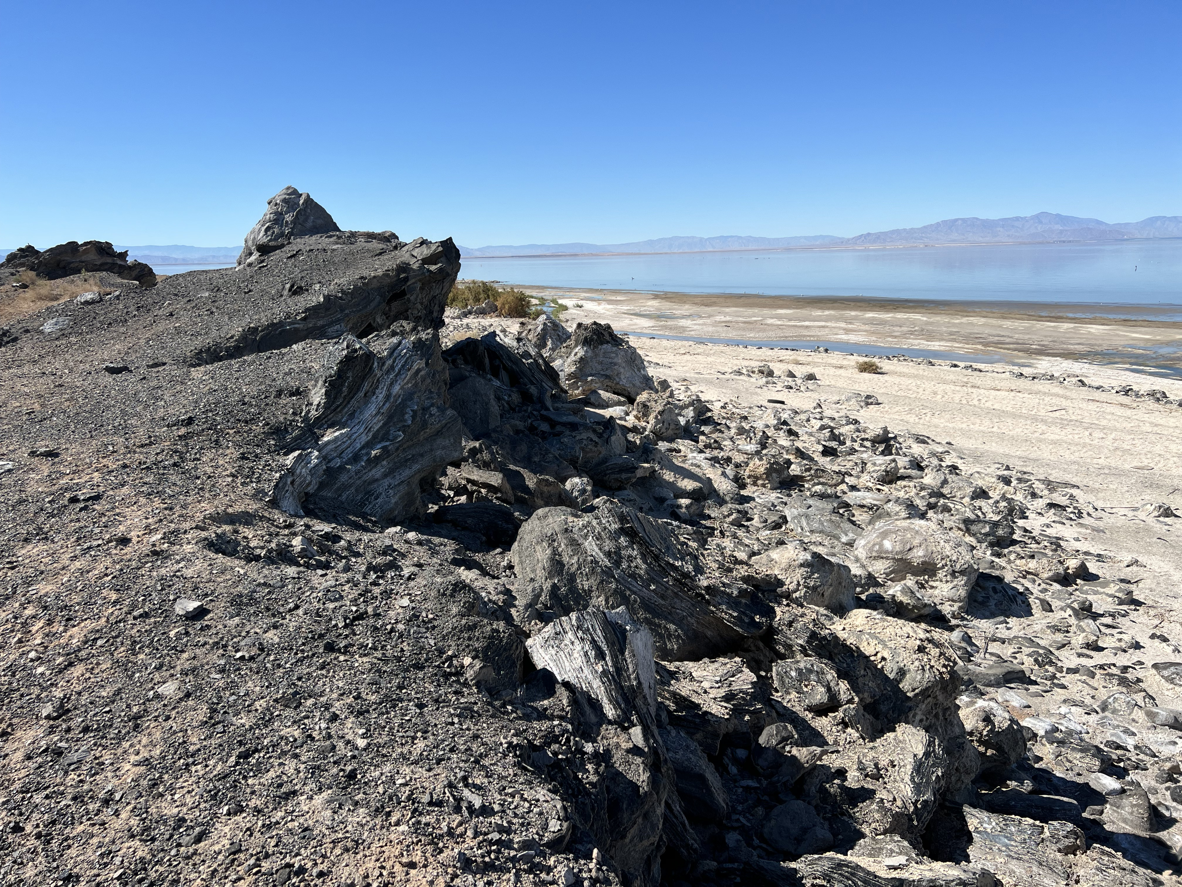
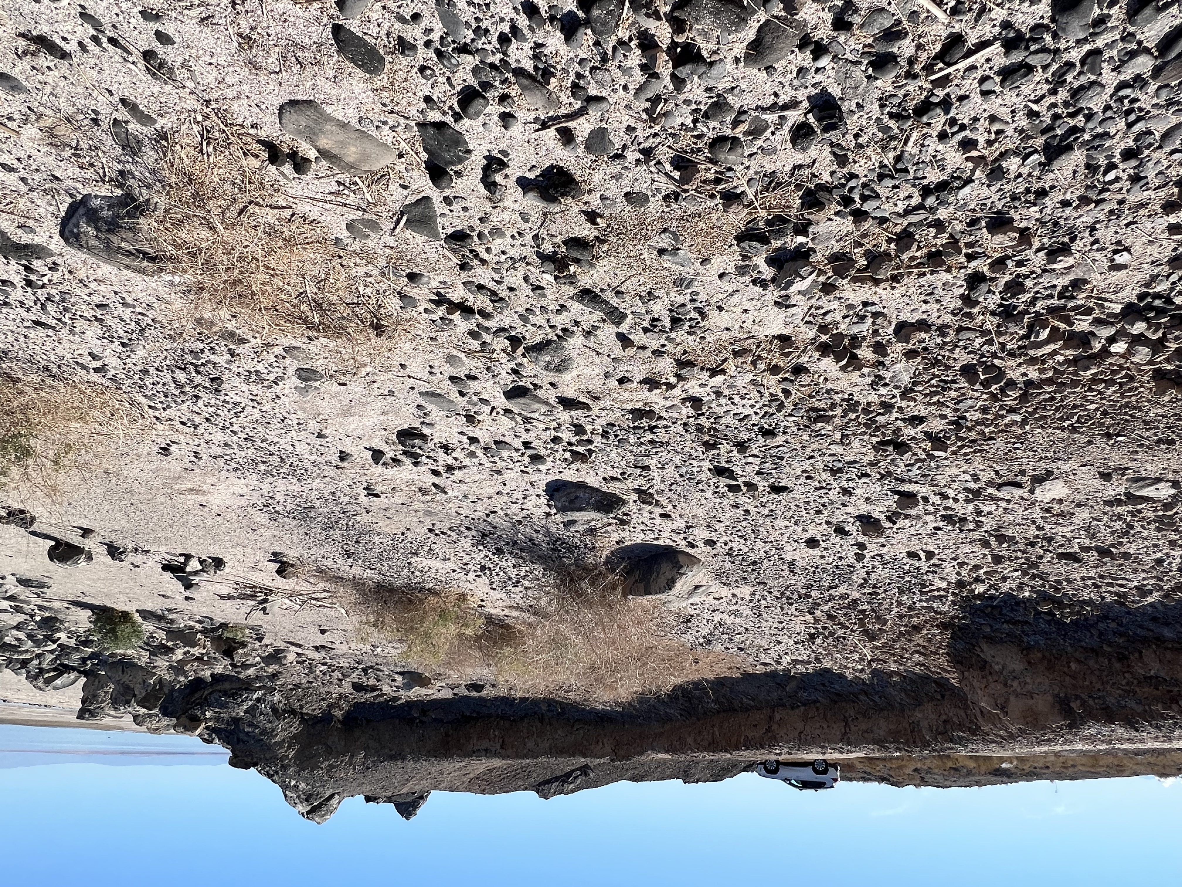
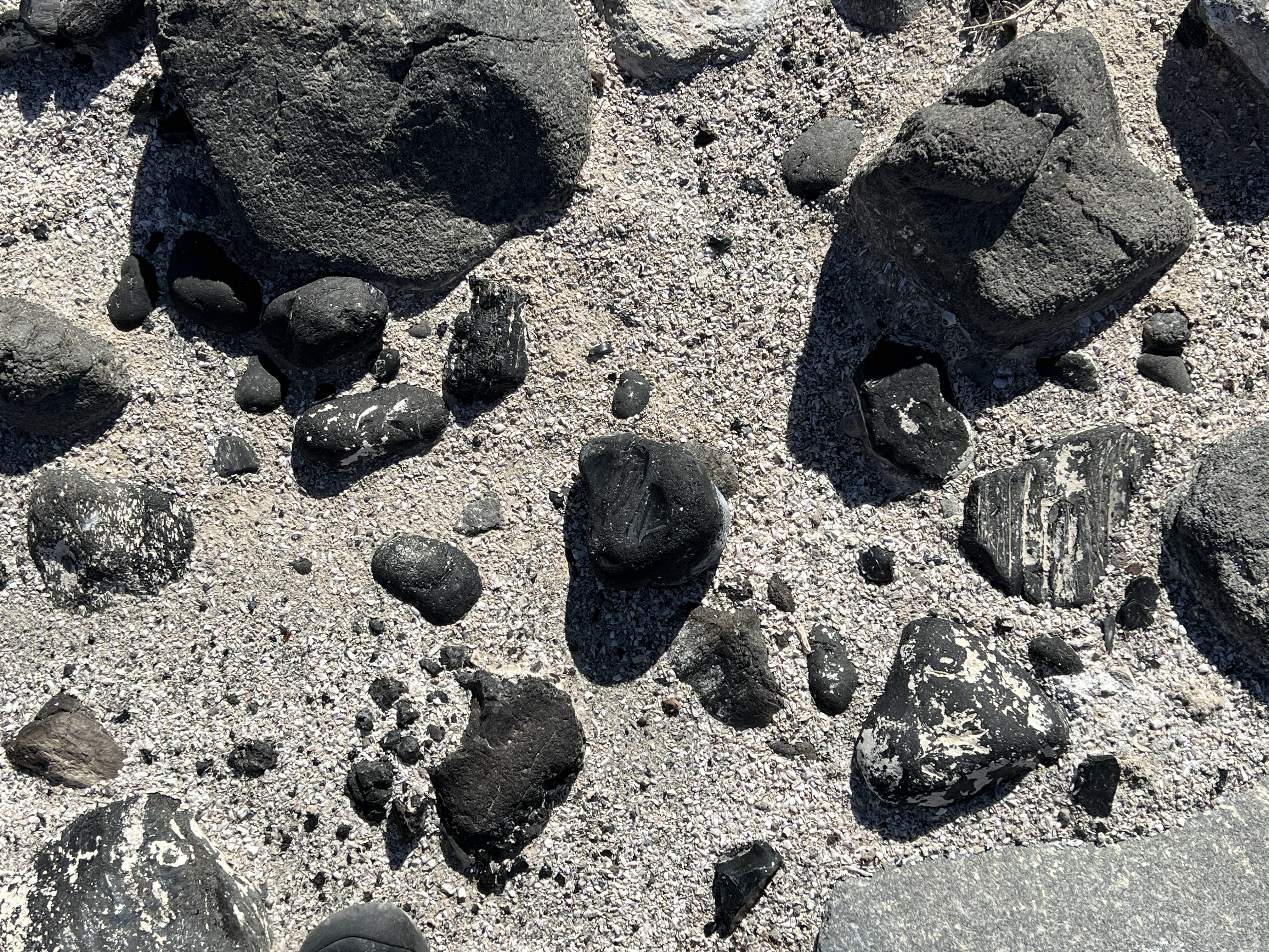
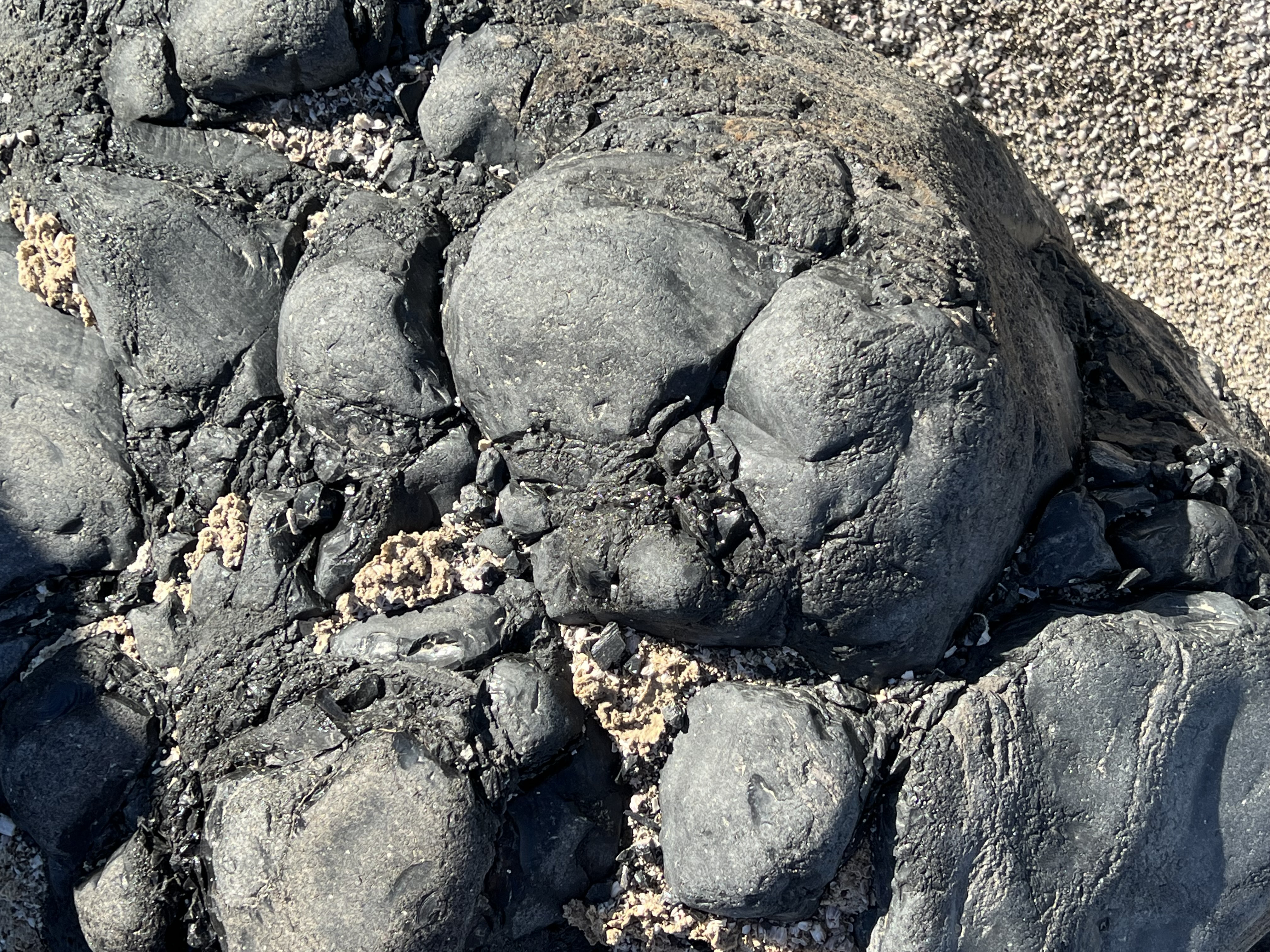
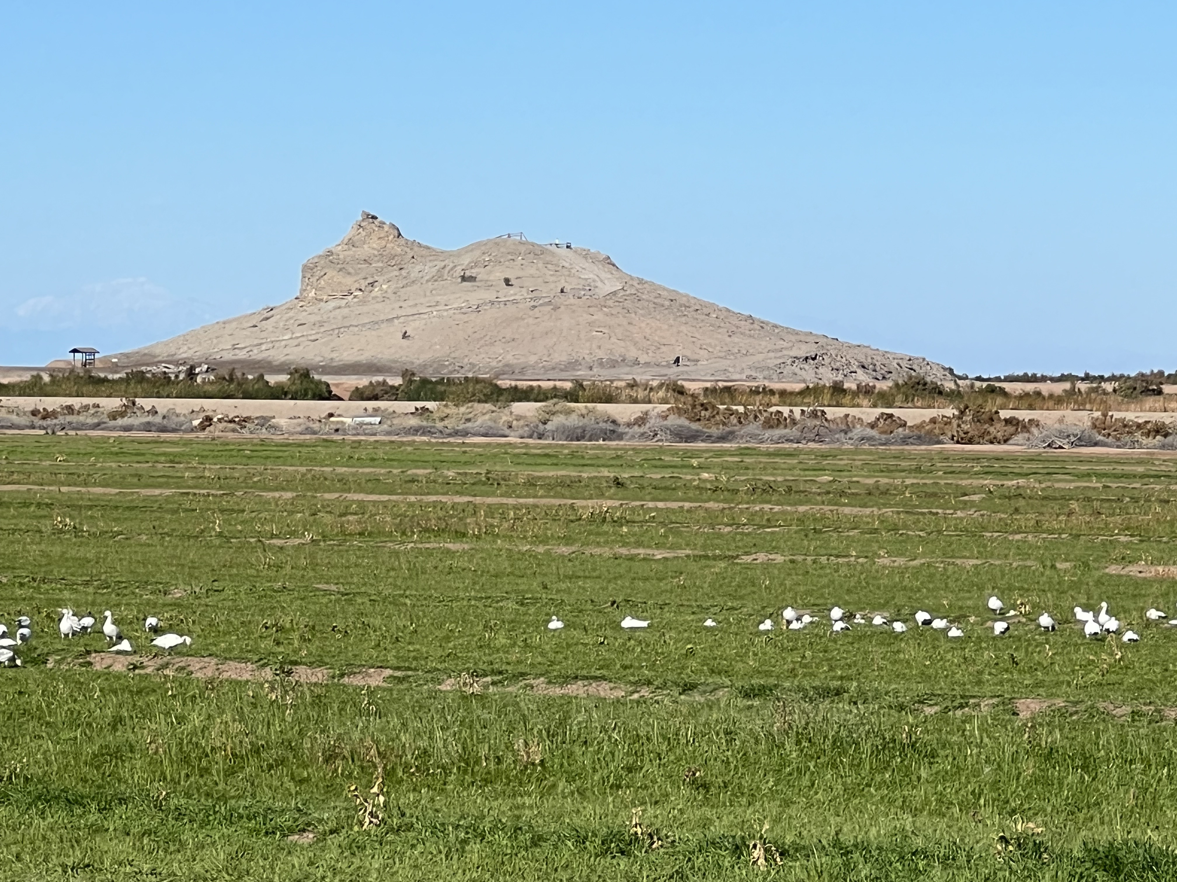
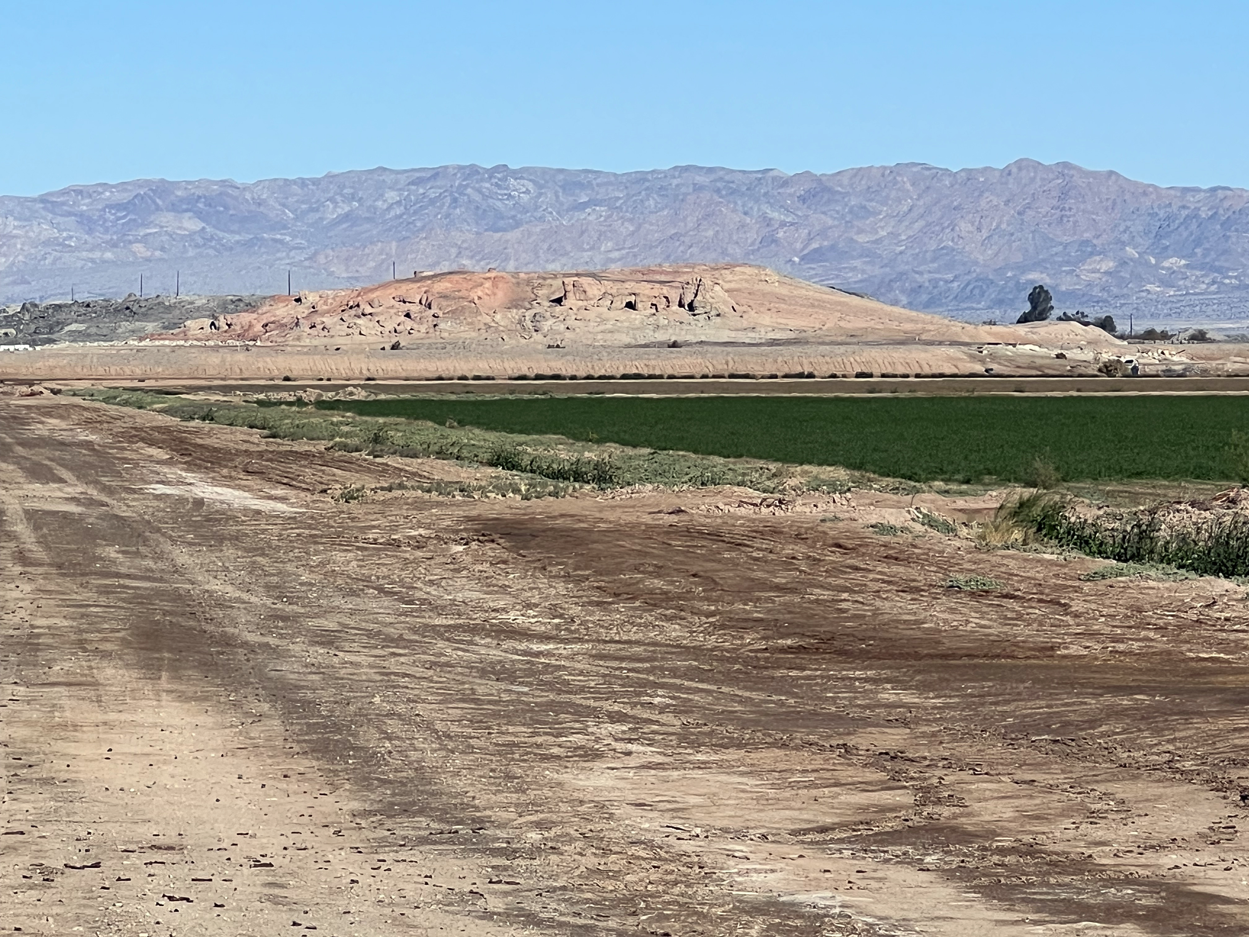
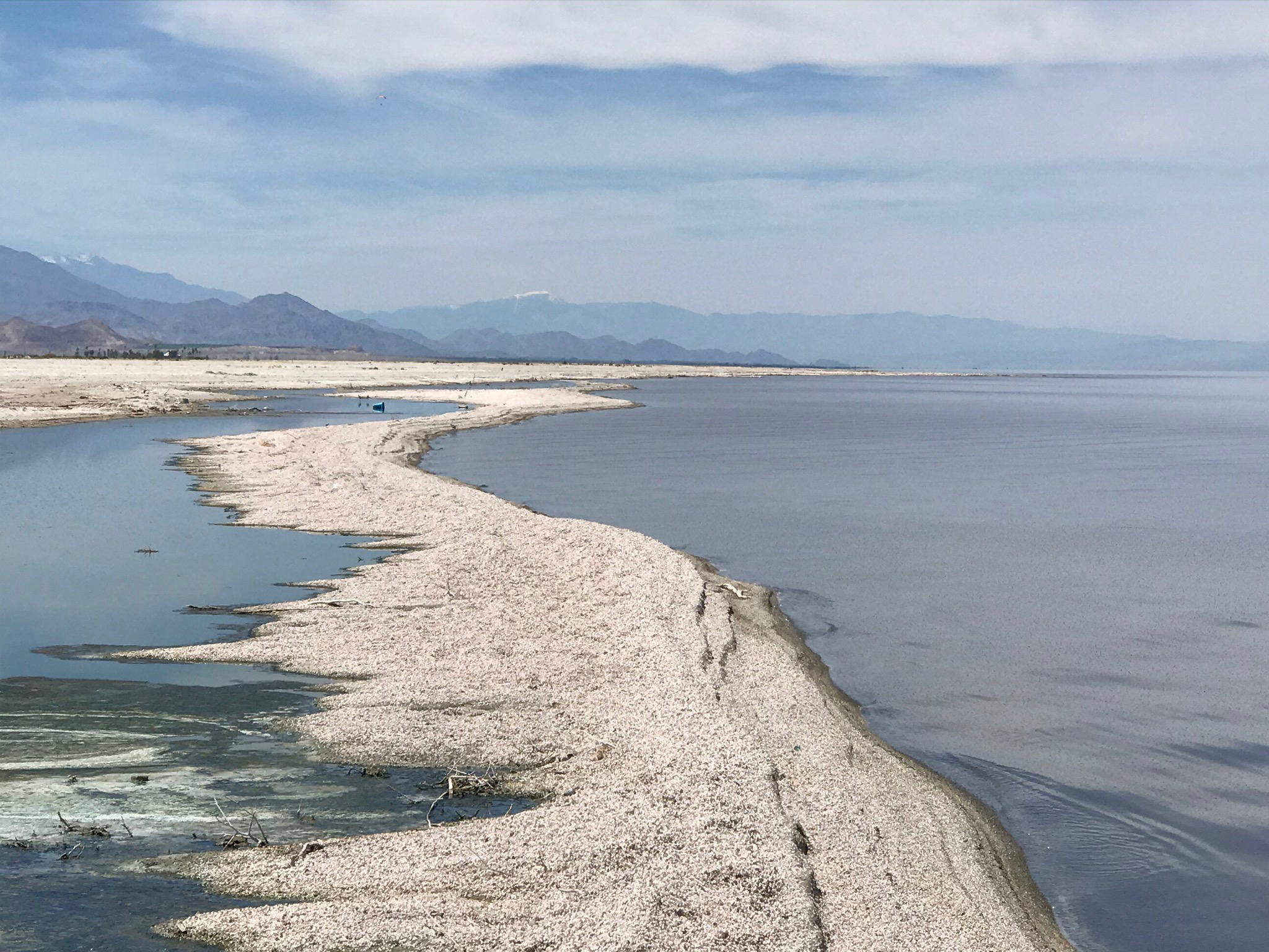
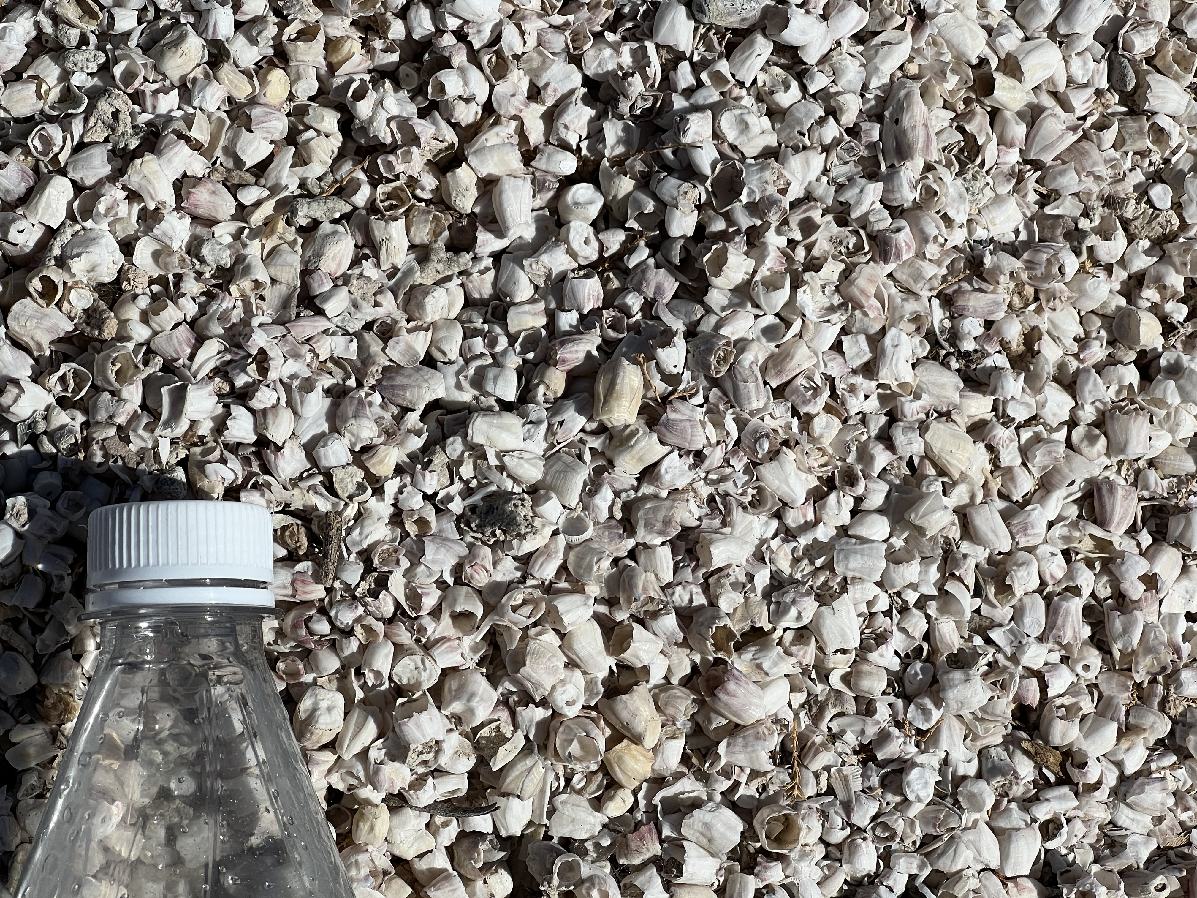
Salton Buttes Volcanic Field and Salton Butte Geothermal FieldThe Salton Butes Volcanic Field is considered by the USGS as one of the potential volcanically active regions in California. The Salton Buttes consist of a collection of five late Pleistocene-age rhyolitic volcanic necks that are located within the greater Salton Buttes Geothermal Field (Figures 27 to 29). The area experiences and abundance of earthquakes and has a high geothermal heat flow. The area displays evidence of geologically recent volcanism⎯the last eruptions occurred about 1,300 years ago. There is active shallow geothermal heat flow, enough to have boiling springs, mud pots, and mud volcanoes in the eastern shoreline region (Figures 30 to 32). The high heat flow from the area, the earthquake activity, and relatively young age of Salton Buttes suggests the potential for future eruptions. According to the California State Land Commission, in 2024 the Salton Sea Geothermal Field are 10 power plants located on private lands in this area, with 437 megawatts of installed capacity. There are about 28 production wells in the field producing over 265 billion pounds of brine annually, and 41 injection wells reinjecting just over 220 billion pounds of produced brine. Efforts are underway to develop lithium and other metals from the geothermal brine." According to a reports by the USGS, "the Salton Buttes geothermal system is fueled by the heat emanating from zones of partially molten rock (magma) deep below the Earth's surface. Eruptions occurring about 400,000 years ago were followed by a long lull in volcanic activity until about 18,000 years ago." USGS data constrain the duration of Salton Buttes volcanism to between about 5900 and 500 years before present. An eruption that took place about "1,800 years ago, started explosively, then progressed to a relatively gentle effusion of dense, glassy-looking (obsidian) lava domes." Today there are 5 lava domes exposed above the surface of the Salton Sea and shoreline sediment covered areas. From south to north they include Obsidian Butte, Rock Hill, Red Hill (north and south domes), and Mullet Island. These domes were all islands in the past when water levels in the Salton Sea and ancient Lake Cahuilla were higher. Some of the "freshest-appearing" lava flows appears on Obsidian Butte (Figures 33 to 39). Black obsidian and gray rhyolite occurs throughout the Obsidian Butte lava dome area. There are an abundance of rounded cobbles of obsidian along the beach area next to Obsidian Butte (Figure 38). Cobbles of obsidian are locally embedded is a lava flow (Figure 39). An abundance of light gray pumice along the shoreline of the Salton Sea suggest there eruptive cycles occurred, but evidence of volcanic cone features eroded way by high standing water levels in the ancient Lake Cahuilla, or have been stripped away by mining activity over the past century. Figure 40 shows Rock Hill. It is accessible via a half hiking trail that starts at the Visitor Center for the Sonny Bono Salton Sea National Wildlife Refuge. Figures 41 to 43 show views of Red Hill which consists of two lava domes, a red dome to the south, and gray dome to the north. Figure 44 is an aerial view of Mullet Island. Mullet Island has a white appearance due to a splattering cover of bird guano. During the high-standing water levels of the Salton Sea, these hills were islands sanctuaries for nesting birds. Figure 45 shows a narrow barrier island of the western shore of the Salton Sea near Salton City. The white coarse sand along many stretches of the shoreline consists of small barnacles and locally reworked pumice from the volcanic field (Figure 46). In most areas where the water level is retreating the sediment consists of organic-rich mud. |
|
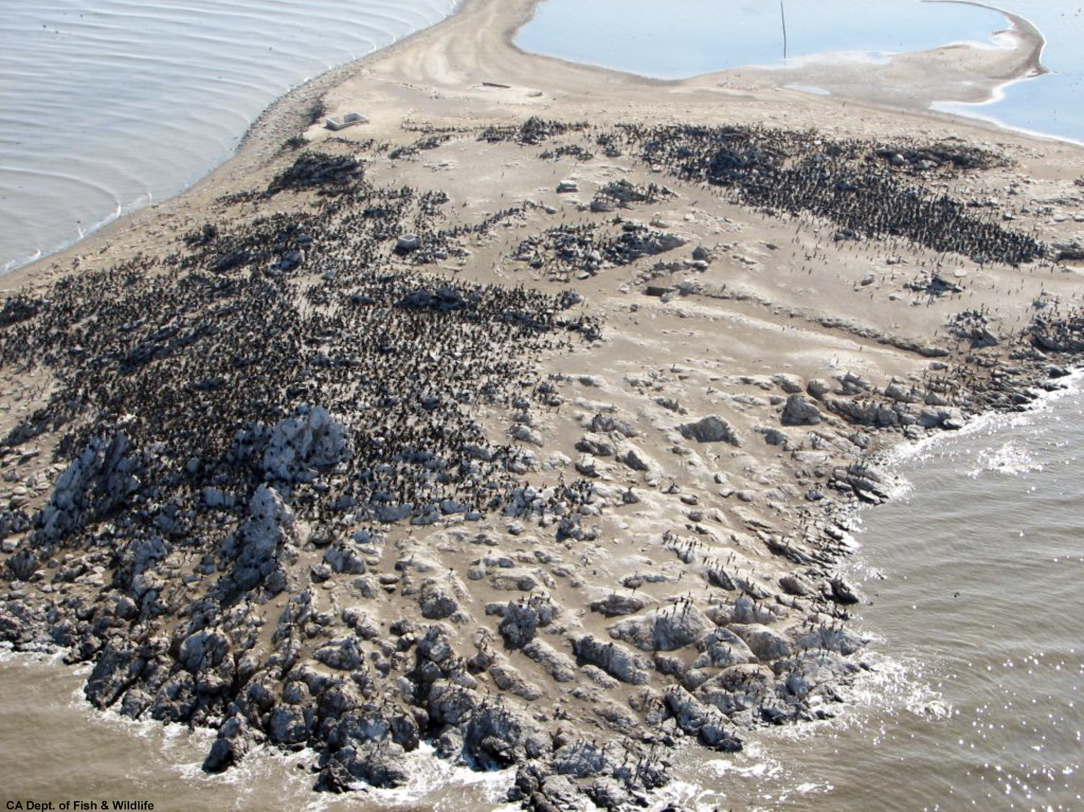
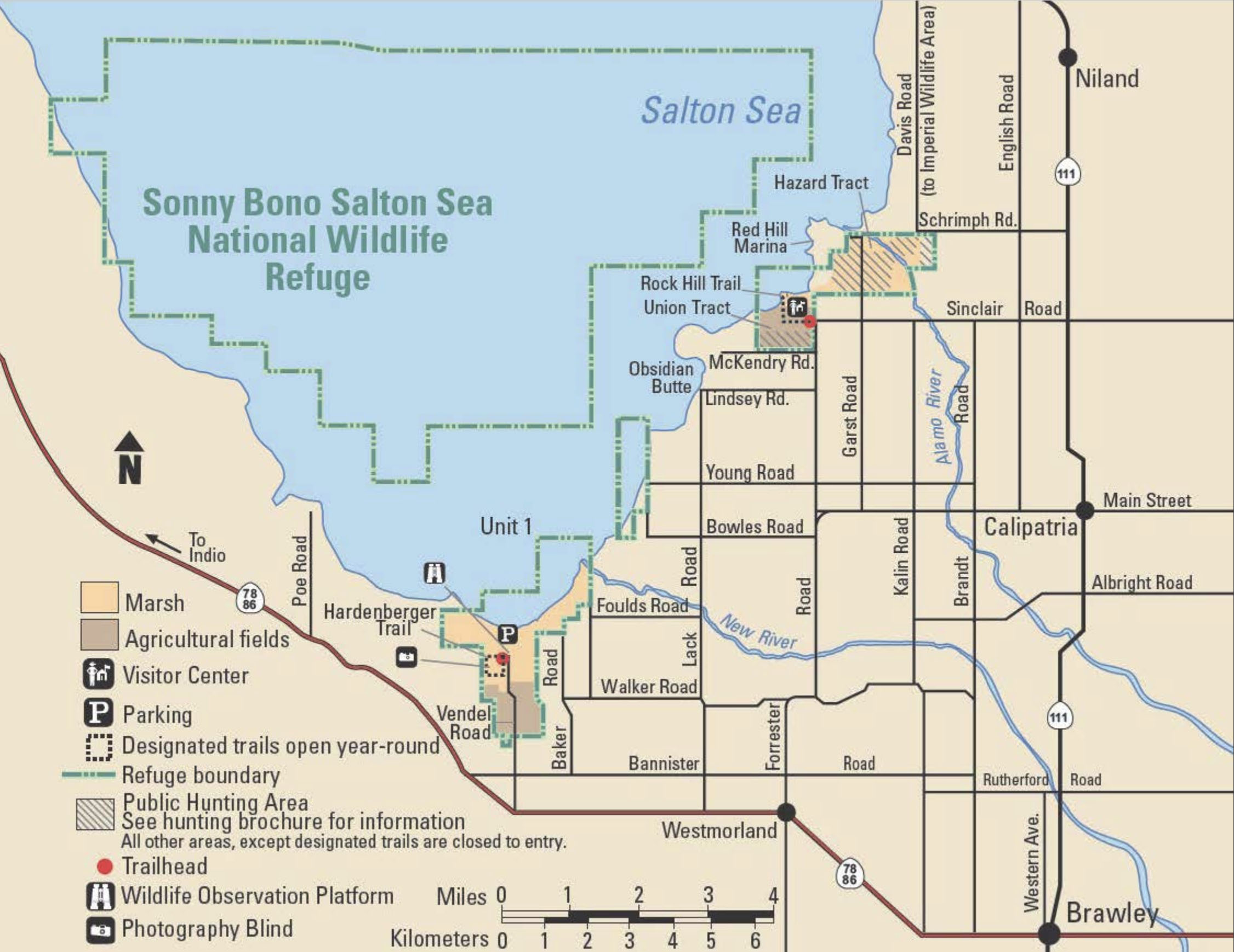
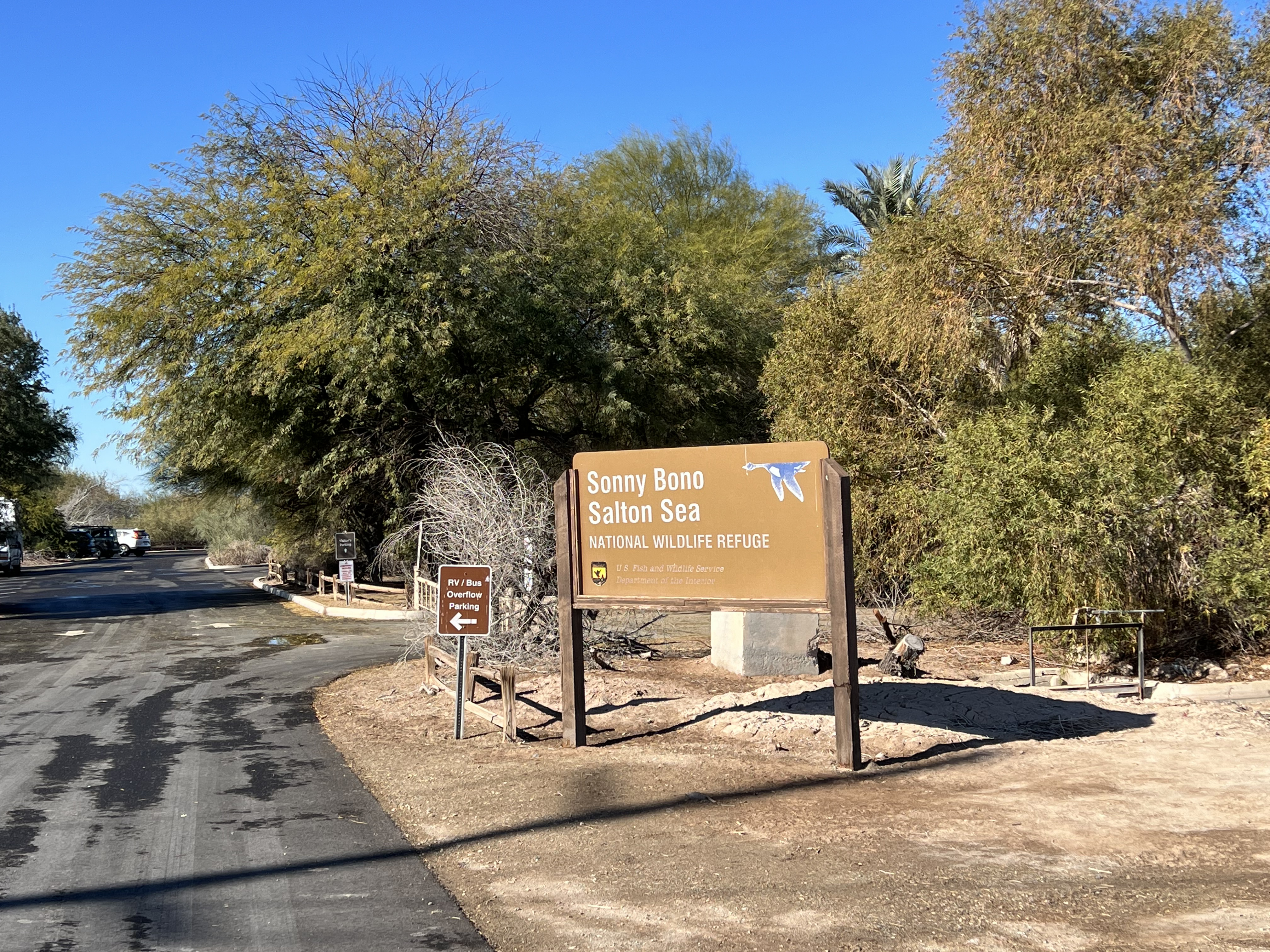
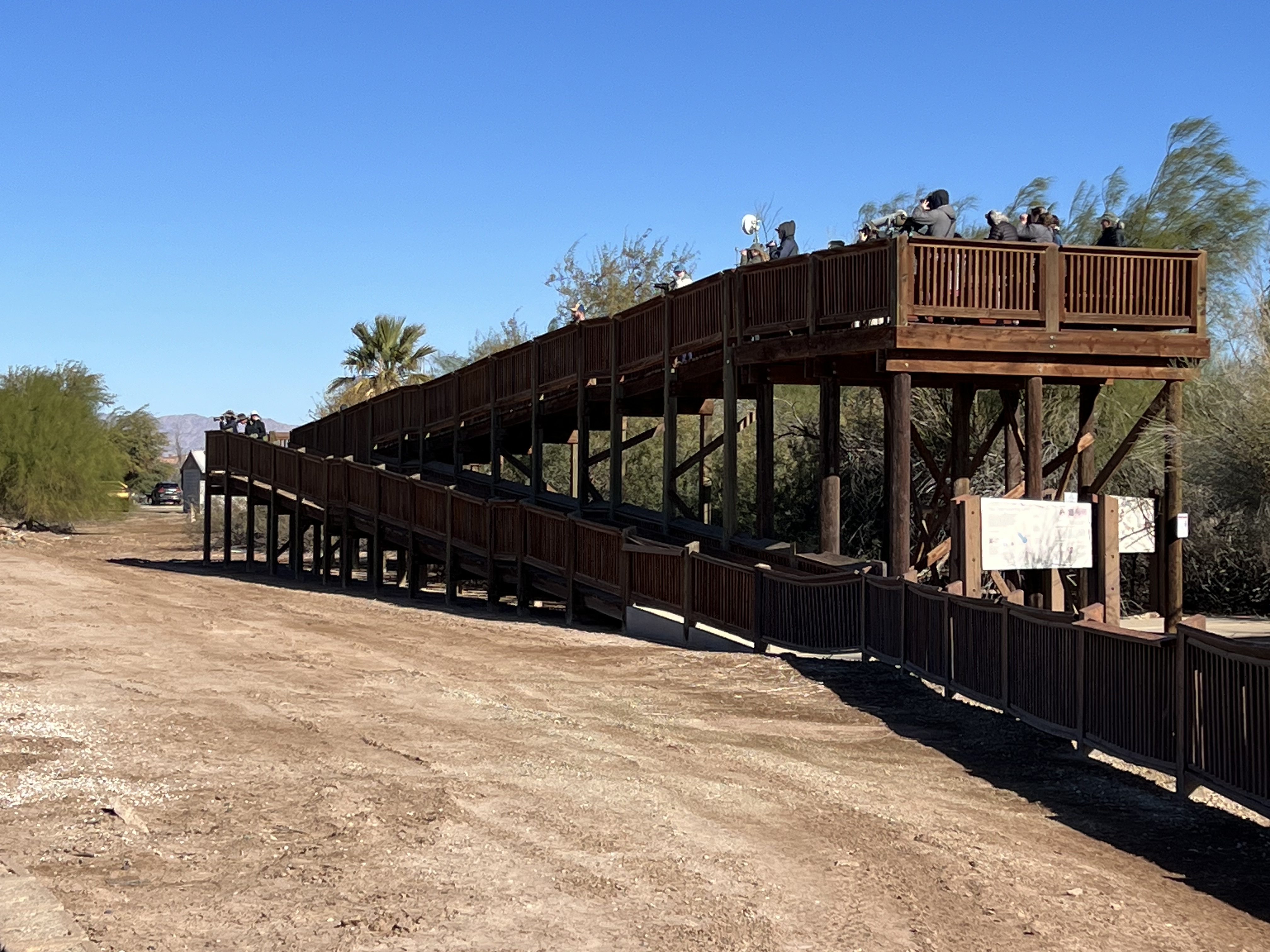
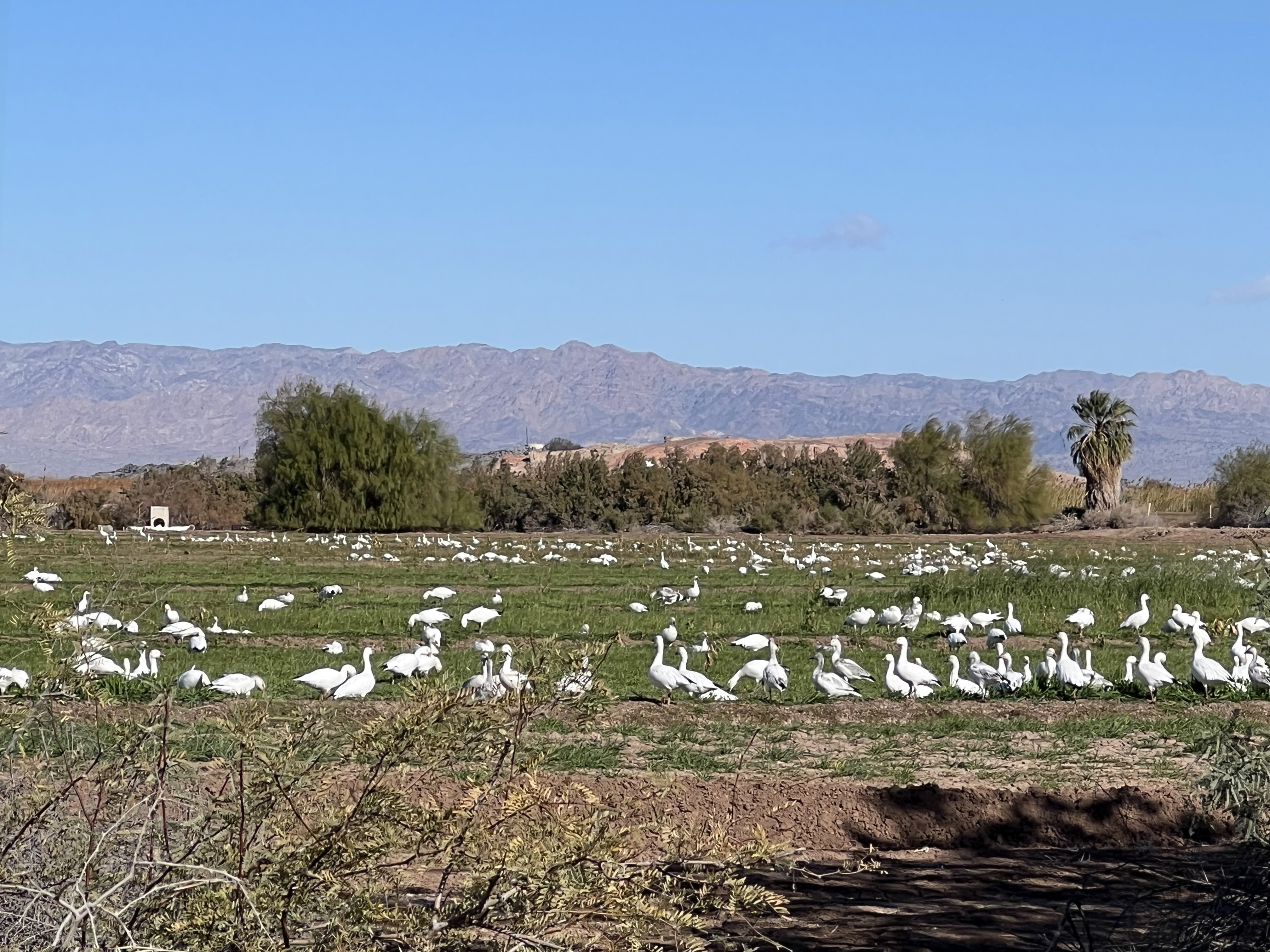
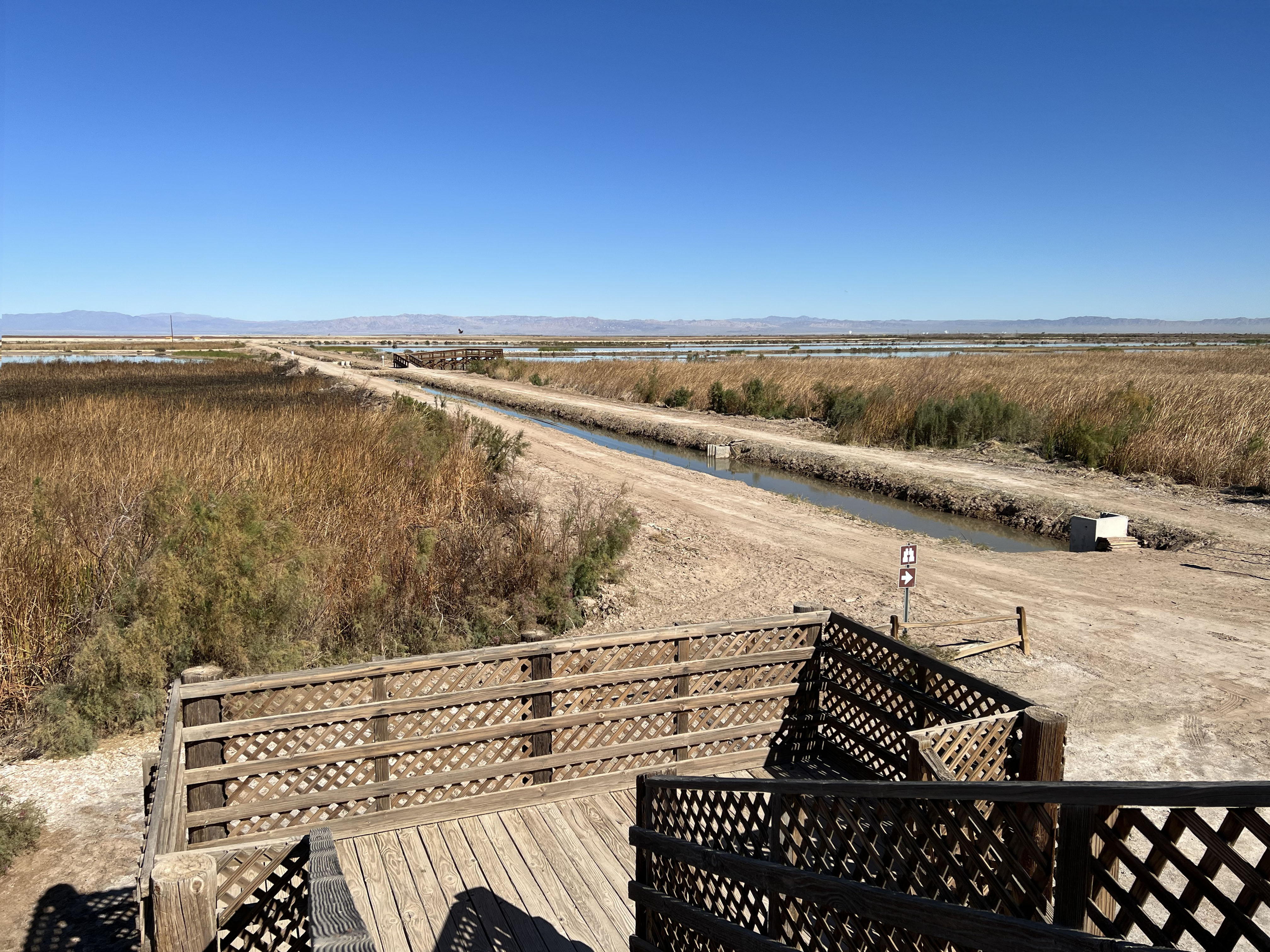
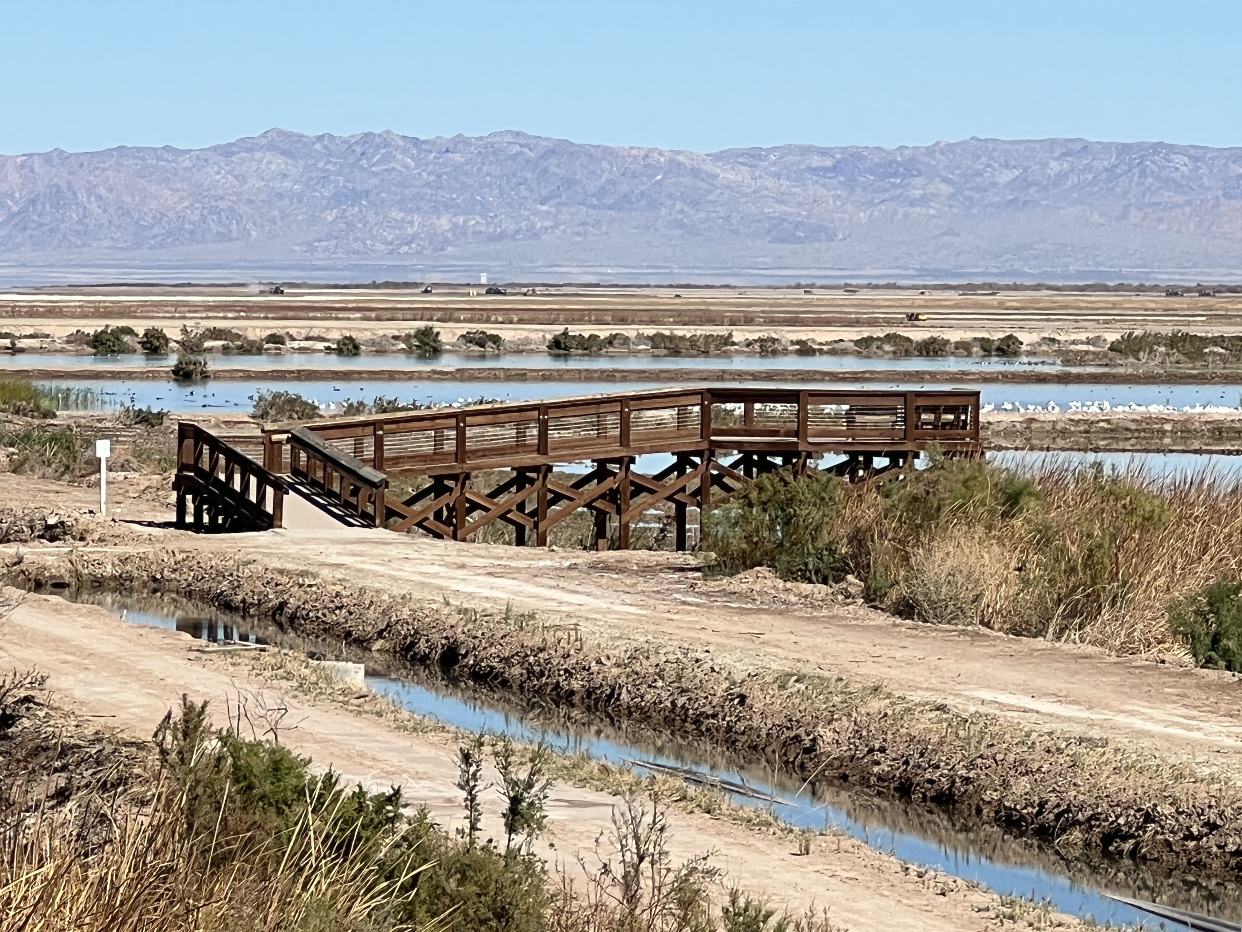
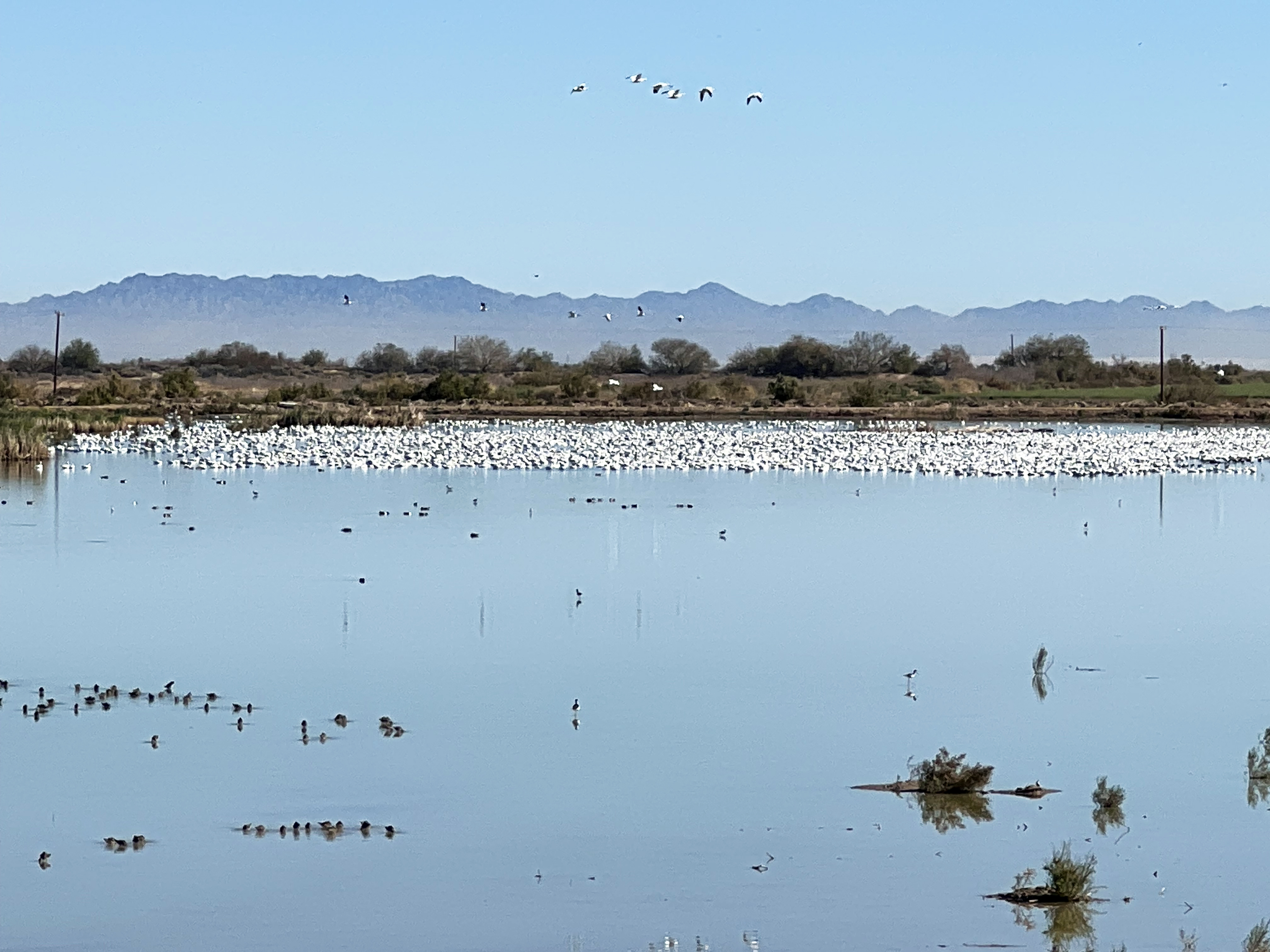
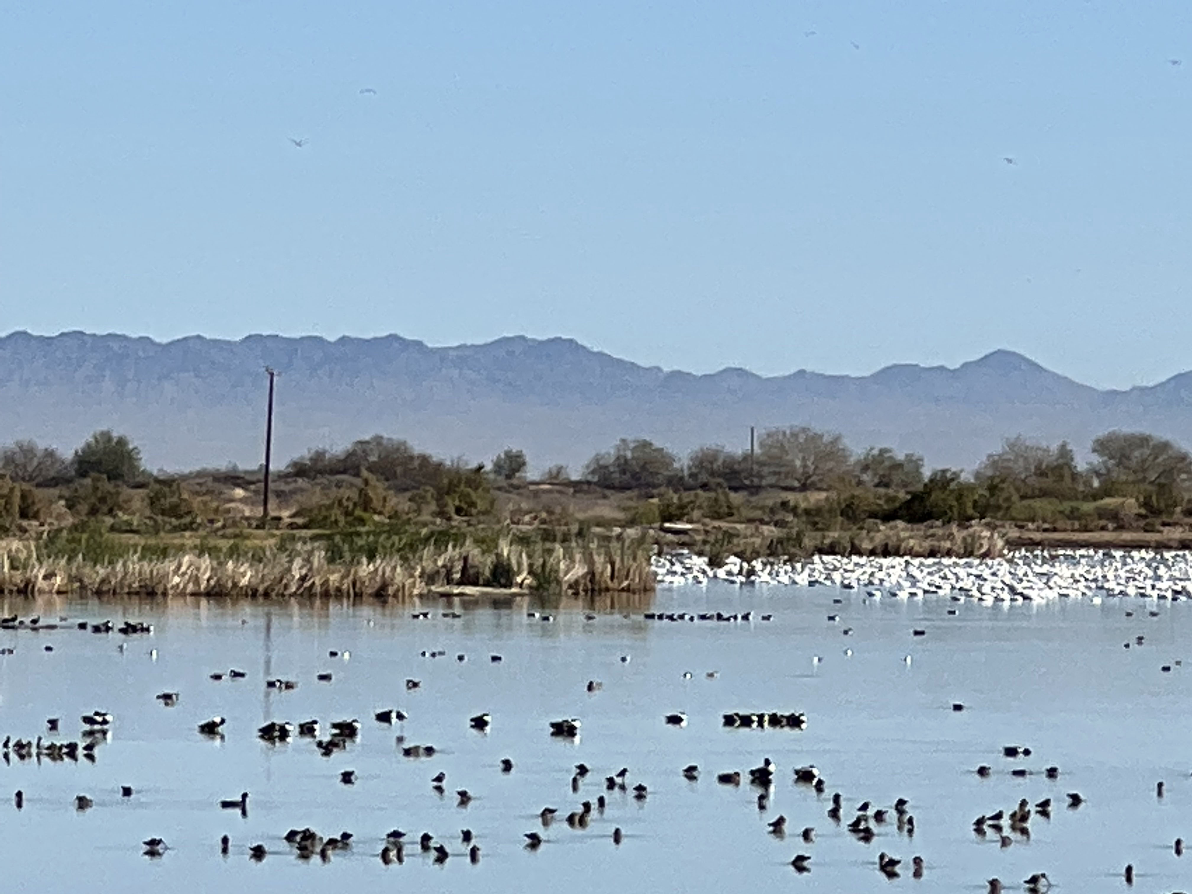
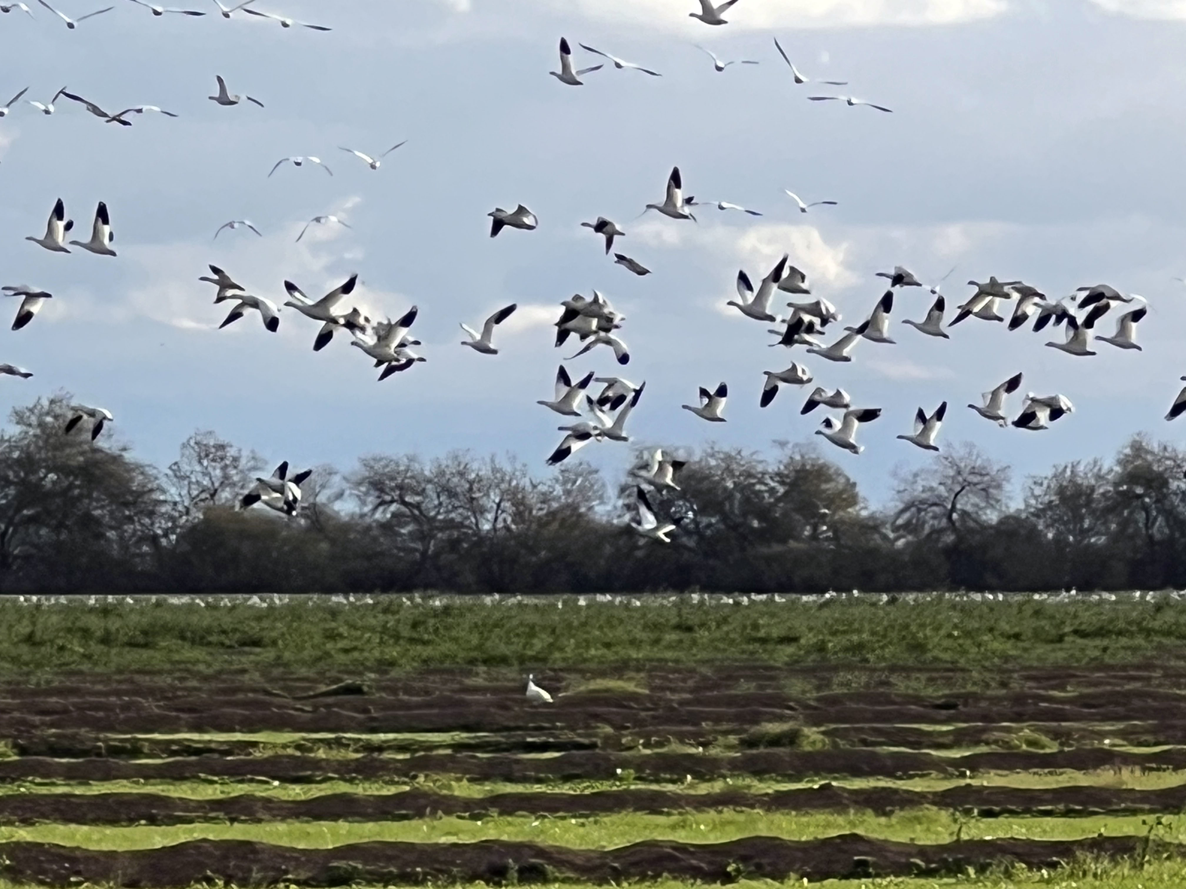
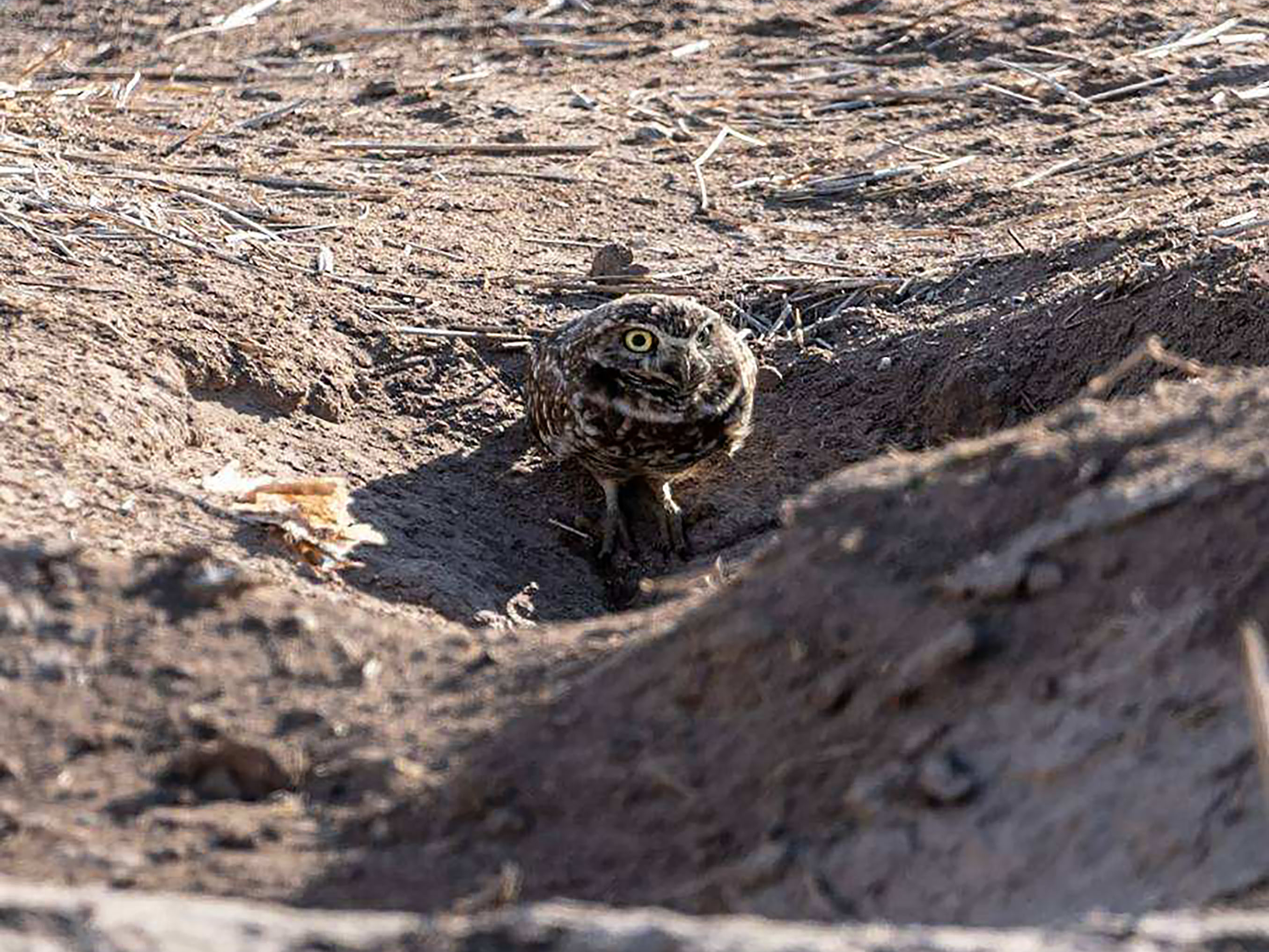
Sonny Bono Salton Sea National Wildlife RefugeThe Sonny Bono Salton Sea National Wildlife Refuge was established in 1930 and dedicated and renamed after Congressman Sonny Bono in 1998 to honor his massive conservation efforts at the Salton Sea. The refuge encompasses almost 40,000 acres of habitats including open water, wetlands, shorelines, desert scrub, and farmland. The refuge hosts an abundance of endemic and migratory birds along the Pacific flyway. More than 400 bird species documented along the southern shore of Salton Sea and surrounding habitats. Figure 47 is a copy of the official map for the Sonny Bono Salton Sea National Wildlife Refuge. The refuge's Visitor Center is located near the southeast shore and offers a wildlife viewing platform. Grassy fields are preserved around many parts of the refuge as a location for birds to feed (Figures 50 and 51). Another access point with viewing platform near and adjacent to marshlands and maintained grassy fields is at the north end of Vendel Road (Figures 52 to 59). |
|
Selected ResourcesThere have been perhaps hundreds of articles and reports written about the history, natural resources, wildlife, and economic development of the Salton Sea region. The region will no doubt continue to be a target of special interests and controversy into the future. Below is a list of selected resources used for the compilation of this website. Alles, David L., 2011, Geology of the Salton Trough. Western Washington University report. (link) Barker, Charles E., The Salton Trough Province (16): U.S. Geological Survey website (link) Bennett, R.A., Friedrich, A.M., and Furlong, K.P., 2004, Codependent histories of the San Andreas and San Jacinto fault zones from inversion of fault displacement rate: Geology, v. 32, p. 961-964. (link) California Department of Conservation, California Geological Survey, 2019, EQ Zapp: California Earthquake Hazards Zone Application (EQ Zapp) [Maps of Alquist-Priolo Act - Earthquake Fault Zones used for construction zoning]. (link) California State Lands Commission, 2024, The Salton Sea geothermal field [website]. (Link) Dorsey, Rebecca J. ; Housen, Bernard A.; Janecke, Susanne U.; Fanning, C. Mark; and Spears, Amy L.F., 2011, Stratigraphic record of basin development within the San Andreas fault system: Geological Society of America Bulletin, v. 123, no. 5-6, p. 771-793. (link) Han, Liang, Hole, John A., Stock, Joann M., Fuis, Gary S., Kell, Annie, Driscoll, Neal W., Kent, Graham M., Harding, Alistair J., Rymer, Michael J., González-Fernández, Antonio, Lázaro-Mancilla, Octavio, 2016, Continental rupture and the creation of new crust in the Salton Trough rift, Southern California and northern Mexico: Results from the Salton Seismic Imaging Project: Journal of Geophysical Research: Solid Earth, Volume 121, Issue 10 p. 7469-7489. (link) iNaturalist -- Sonny Bono Salton Sea National Wildlife Refuge Check List (link) Kaspereit, Dennis; Mann, Mary; Sanya, Subir; Richard, Bill; Osborn, William; and Hulen, Jeff, 2016, Updated Conceptual Model and Reserve Estimate for the Salton Sea Geothermal Field, Imperial Valley, California: GRC Transactions, Vol. 40, p. 57-66. (link) Fuis, Cary S. and Mooney, Walter D., 1990, Salton Trough Lithospheric Structure and Tectonics from Seismic-Refraction and Other Data: In, The San Andreas Fault System, California: Wallace, Robert E., ed., USGS Professional Paper 1515, [block diagrapm of Salton Sea region, p. 224]. (link) Musa Hussein, Aaron Velasco, Laura Serpa, 2011, Crustal Structure of the Salton Trough: Incorporation of Receiver Function, Gravity and Magnetic Data: International Journal of Geosciences, 2011, 2, 502-512. (link) Raoul Rañoa, 2017, Drawdowns and death of the Salton Sea: Los Angeles Times. [Shows bathymetry and projected future drawdown of the lake by evaporation] (link) Salton Sea Authority, F.A.Q. [website provides answers to many questions about the Salton Sea including water quality, history, biology, and more. ] (link) Salton Sea Tectonic Research: UCSD research summary website. (link) Singer, Eugene, Geology of the Imperial Valley, California: (Link)
Sleeter, B.M., Calzia, J.P., and Walter, S.R., 2012, Earthquakes and faults in southern California (1970–2010): U.S. Geological Survey Scientific Investigations Map 3222, scale 1:450,000. (link) Smithsonian Institution, National Museum of Natural History, Global Volcanism Program, 2013, Salton Buttes [website]. (link) Stoffer, Phil, 2010, Painted Canyon Geologic Area Mecca Hills County Park, Riverside County, California: Geology of National Parks: Miracosta College Geology and Oceanography Textbooks website. [Link].
U.S. Fish & Wildlife Service, Sonny Bono Salton Sea National Wildlife Refuge [official website, 2024]: (link) U.S. Fish & Wildlife Service, Sonny Bono Salton Sea National Wildlife Refuge, Species [website, 2024; the park also produces a "Wildlife List" brochure]: (link) U.S. Geological Survey, [2024], Salton Buttes: California Volcano Observatory: (link) U.S. Geological Survey, 2022, Assembling a seismic history of the southern San Andreas Fault Zone beneath Salton Sea [News, includes "Fault Map of the Salton Sea Area:"]: U.S. Geological Survey, Pacific Coastal and Marine Science Center. (link)
U.S. Geological Survey and California Geological Survey, Quaternary Fault and Fold Database of the United States, Interactive Quaternary Fault Map (accessed 4/1/2021). (link) Wright, Heather M.; Vazquez, Jorge A. ; Champion, Duane E., Calvert, Andrew T.; Mangan, Margaret T., Stelten, Mark; Cooper, Kari M.; Herzig, Charles; Schriener Jr., Alexander, 2015, Episodic Holocene eruption of the Salton Buttes rhyolites, California, from paleomagnetic, U-Th, and Ar/Ar dating: Geochemistry, Geophysics, Geosystems, V. 16, no. 4, p. 1198-1210. (https://gotbooks.miracosta.edu/fieldtrips/xx/index.html |