The Elsinore Fault is a major strand of the complex fault system in Southern California that also includes the San Andreas, San Jacinto, Inglewood-Newport-Rose Canyon, and numerous other faults (Figure 1).
This website is intended for educational exploration of the landscape features associated with the Elsinore Fault. More recent and technical reports related to the fault systems may be found at found via websites operated by the US Geological Survey Earthquake Hazards Program and the Southern California Earthquake Center (SCEC at CalTech). Much of the information presented below was selected from the USGS Quaternary Fault and Fold Database of the United States (QFFDUS).
On any given day the Index Map of Recent Earthquakes in California-Nevada shows dozens of earthquake in the region, almost all are magnitude 2 or less, which can hardly be felt in most cases. However, the pattern of earthquakes reveal activity along the major earthquake faults in southern California. By comparison, the Elsinore Fault is not as active as the nearby San Jacinto and San Andreas faults, but never-the-less it does show earthquake activity, and it has potential for producing major earthquakes.
|
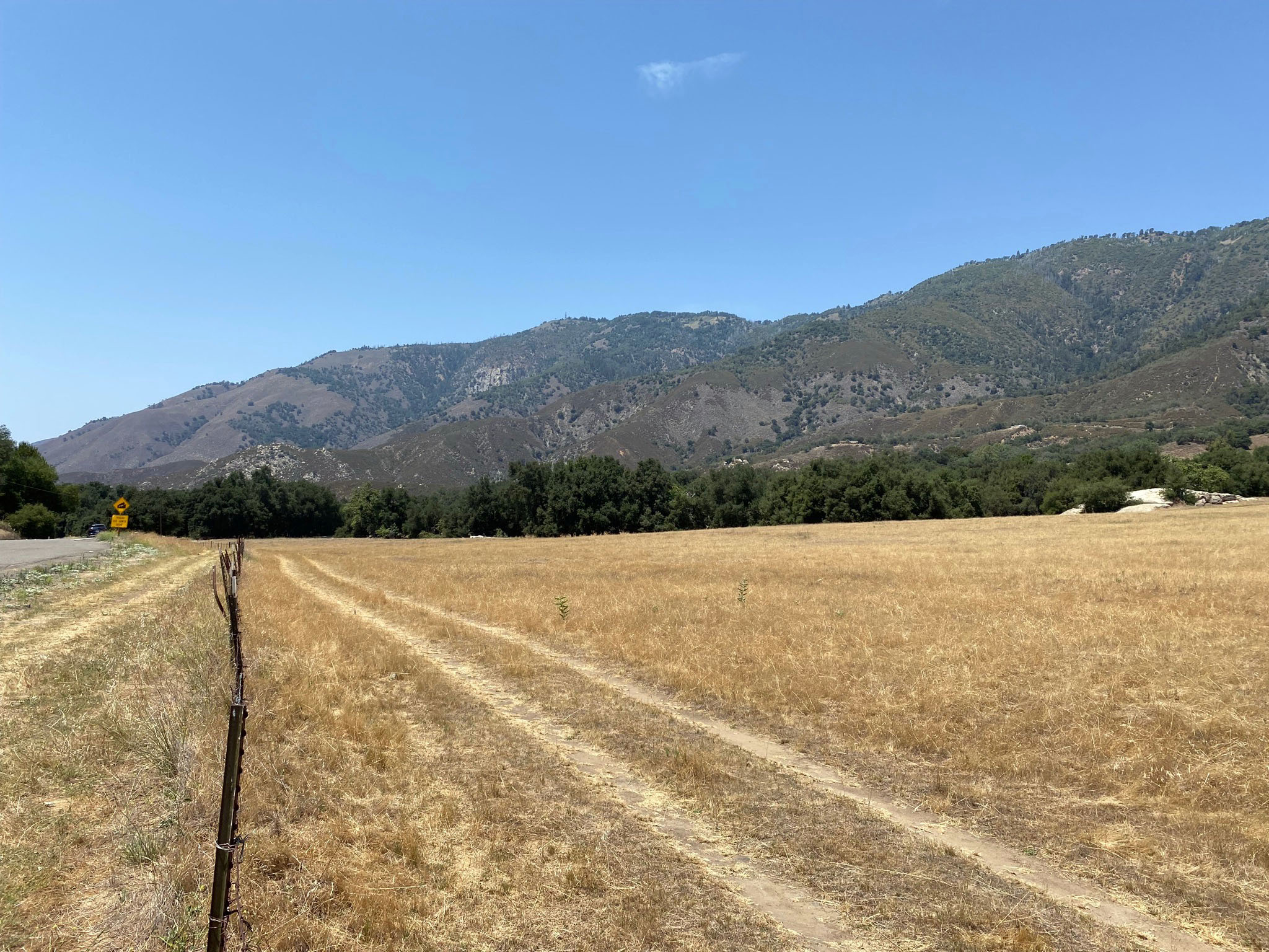
Click on images for a larger view. |
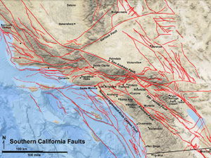
Fig. 1. Southern California's fault system.
|
Overview of the Elsinore Fault Zone
The northwest-trending Elsinore Fault Zone extends a distance of about 190 miles (306 km) from near Mexican border to the northern end of the Santa Ana Mountains near Los Angeles (Figure 2). The fault zone consists of a series of parallel and interconnected splay faults that extend in a northwest direction across the Peninsular Ranges of Southern California. There are seven named sections of the Elsinore Fault Zone identified by the Working Group on California Earthquake Probabilities (1995). listed here starting in the north in the greater Los Angeles area. Each section is discussed below.
- The Chino Fault section and Whittier Fault section are two northern fault strands that merge into the Elsinore Fault zone near Corona, CA.
- The Glen Ivy Fault section extends about 29 miles (46 km) between Corona and Lake Elsinore.
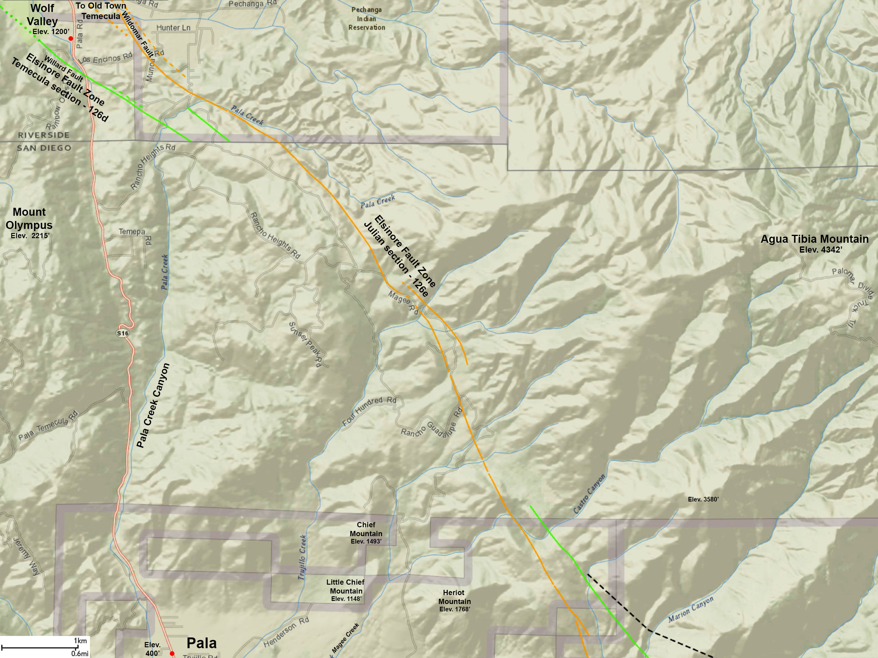
- The Temecula section extends about 39 miles (62 km) from Lake Elsinore southward through Temecula to Pauma (near the northern San Diego County line).
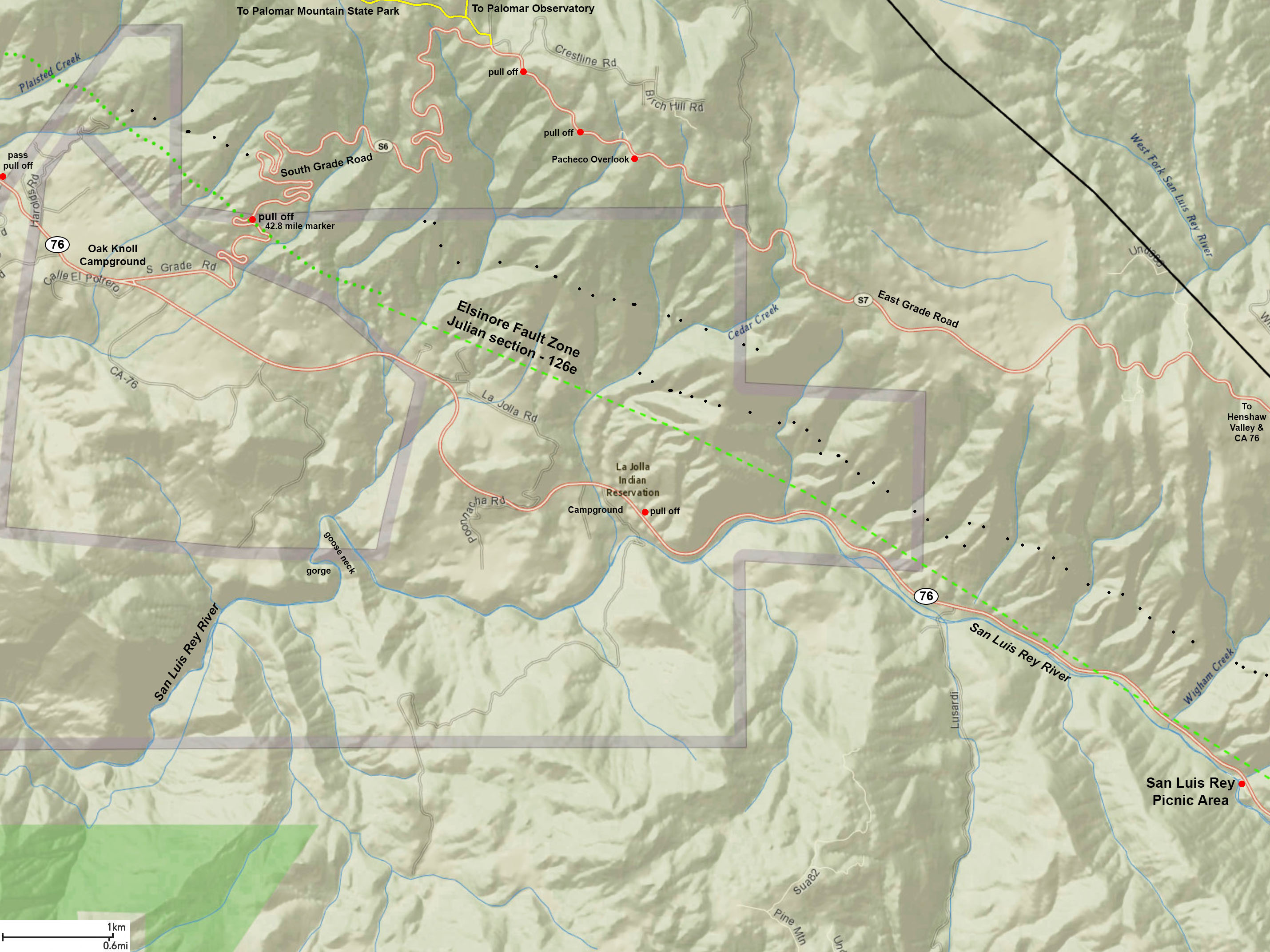
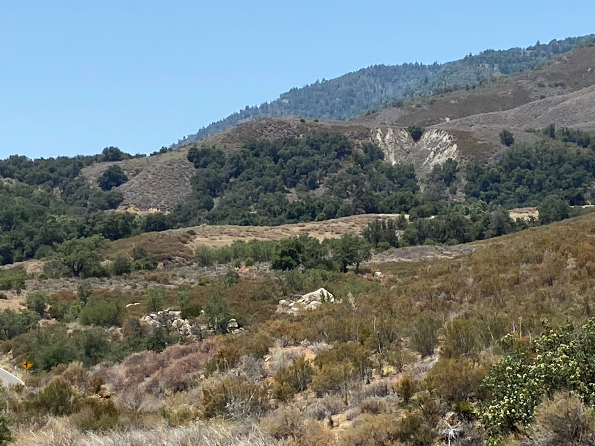
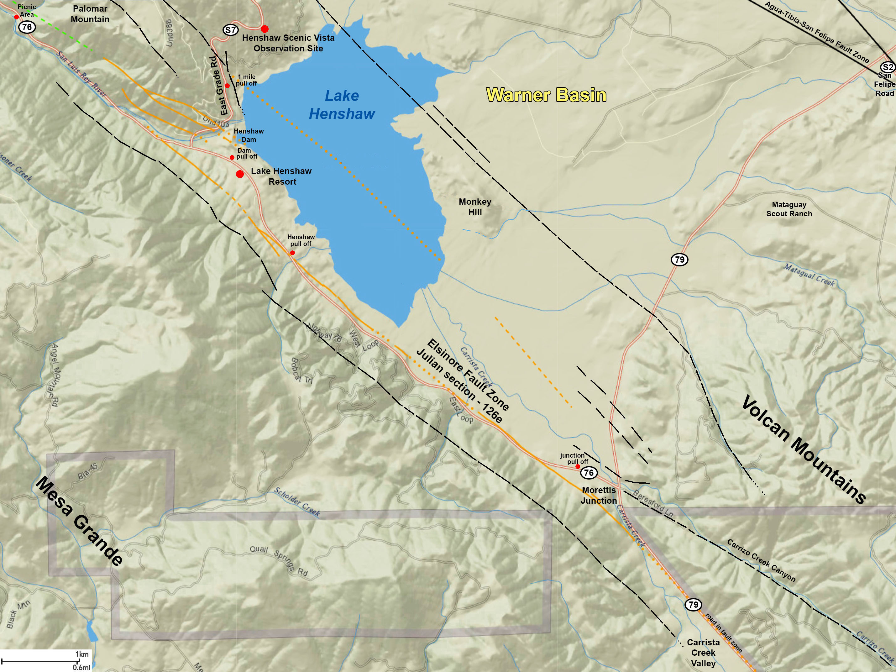
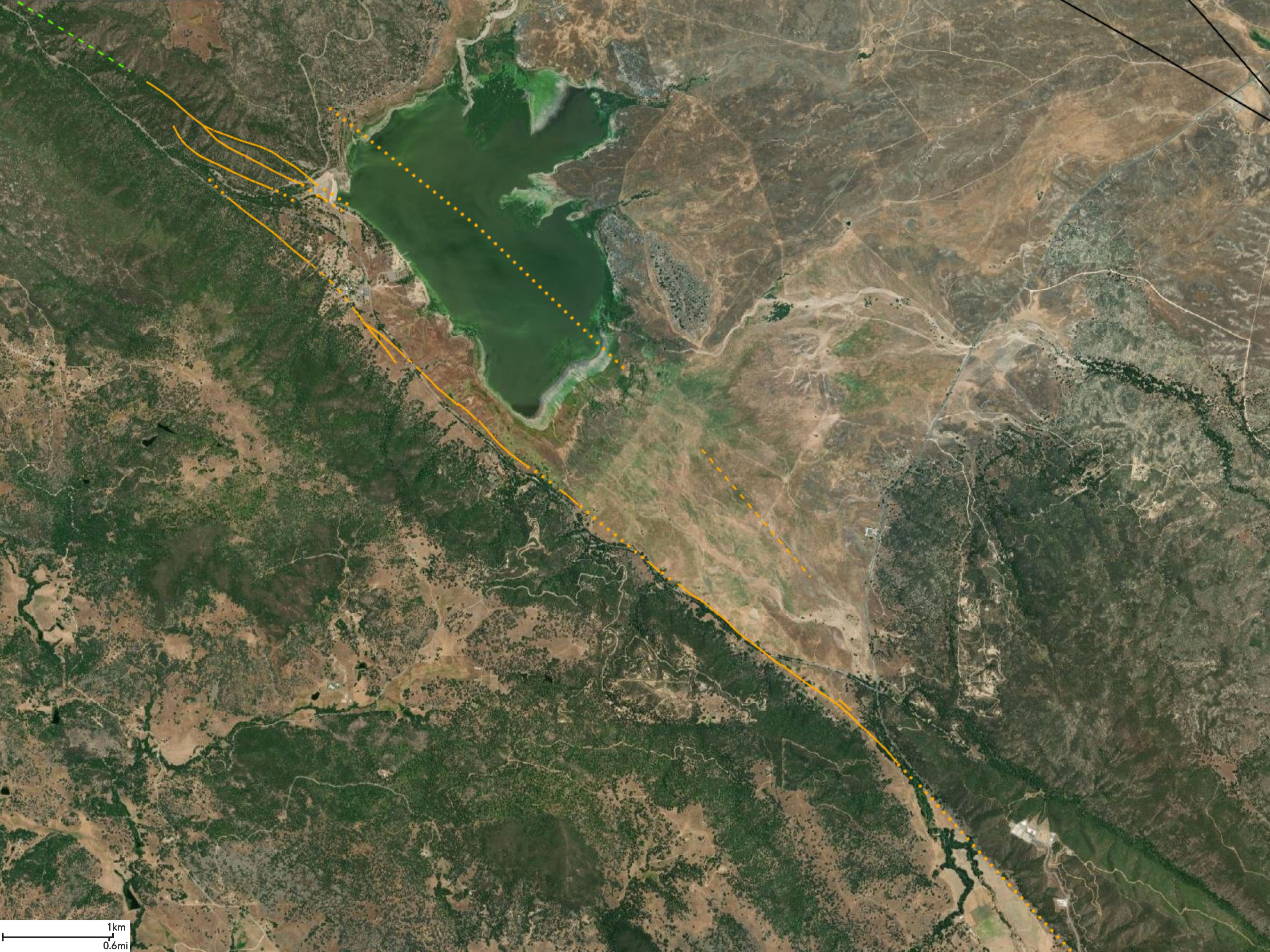
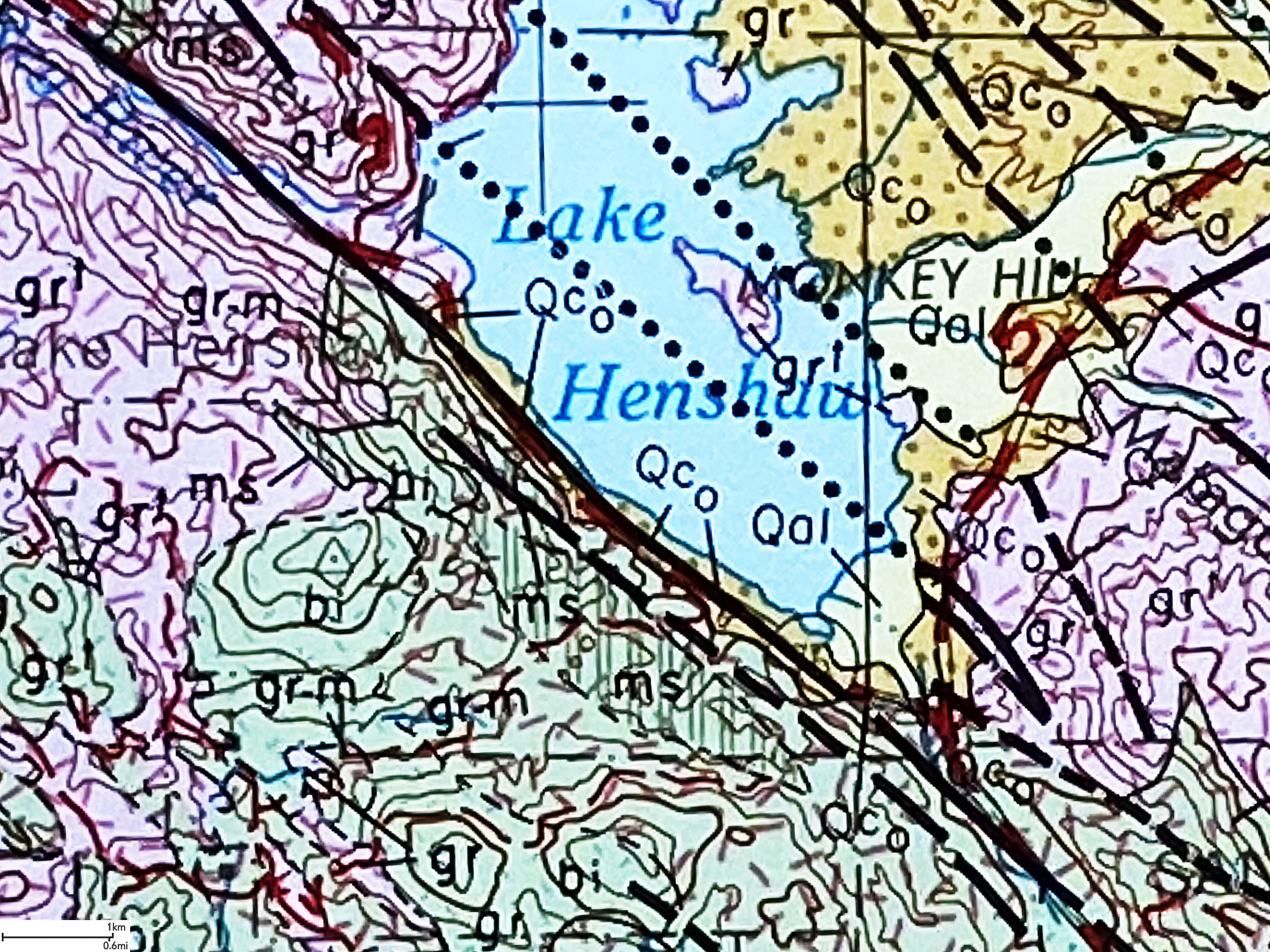
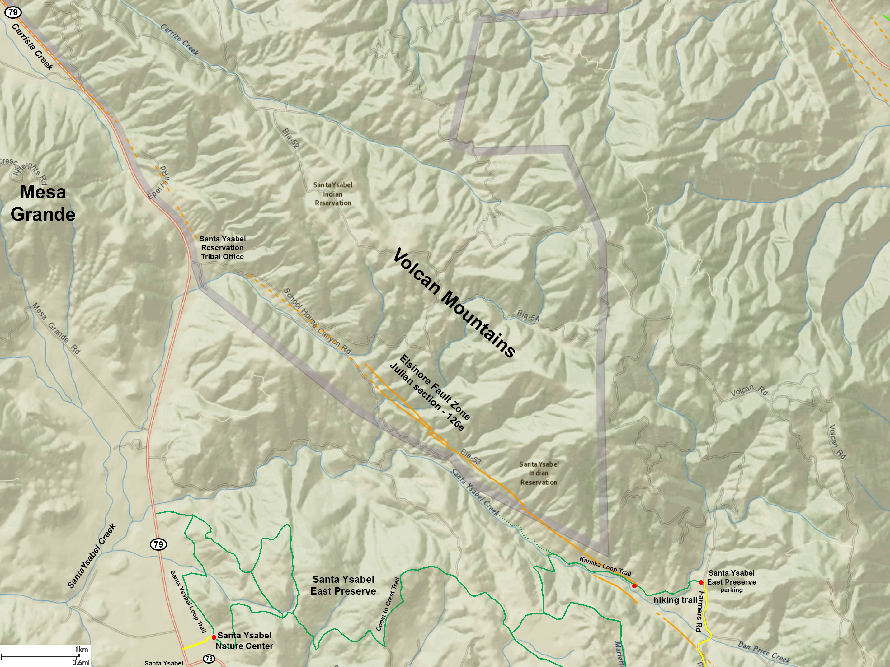
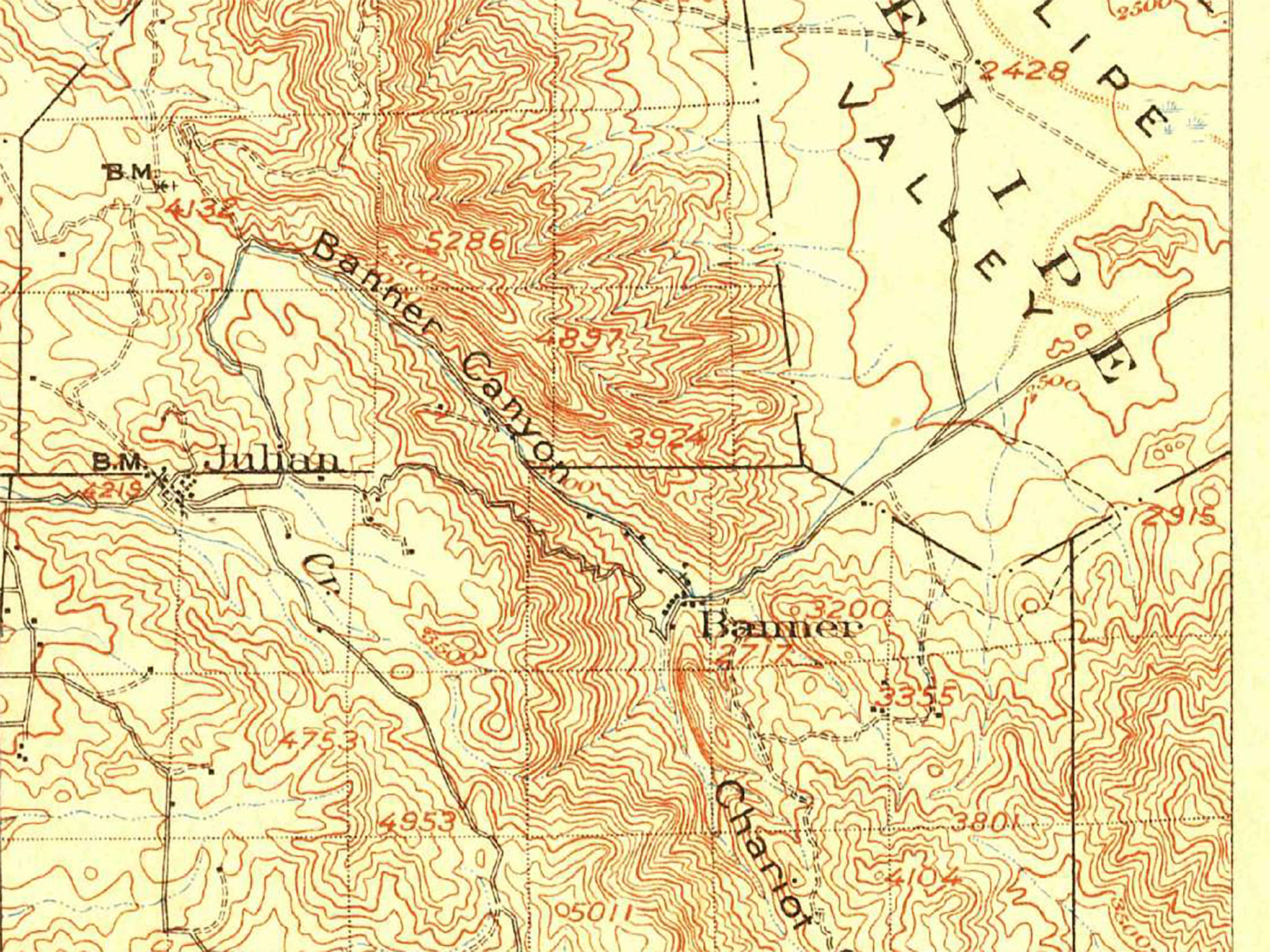
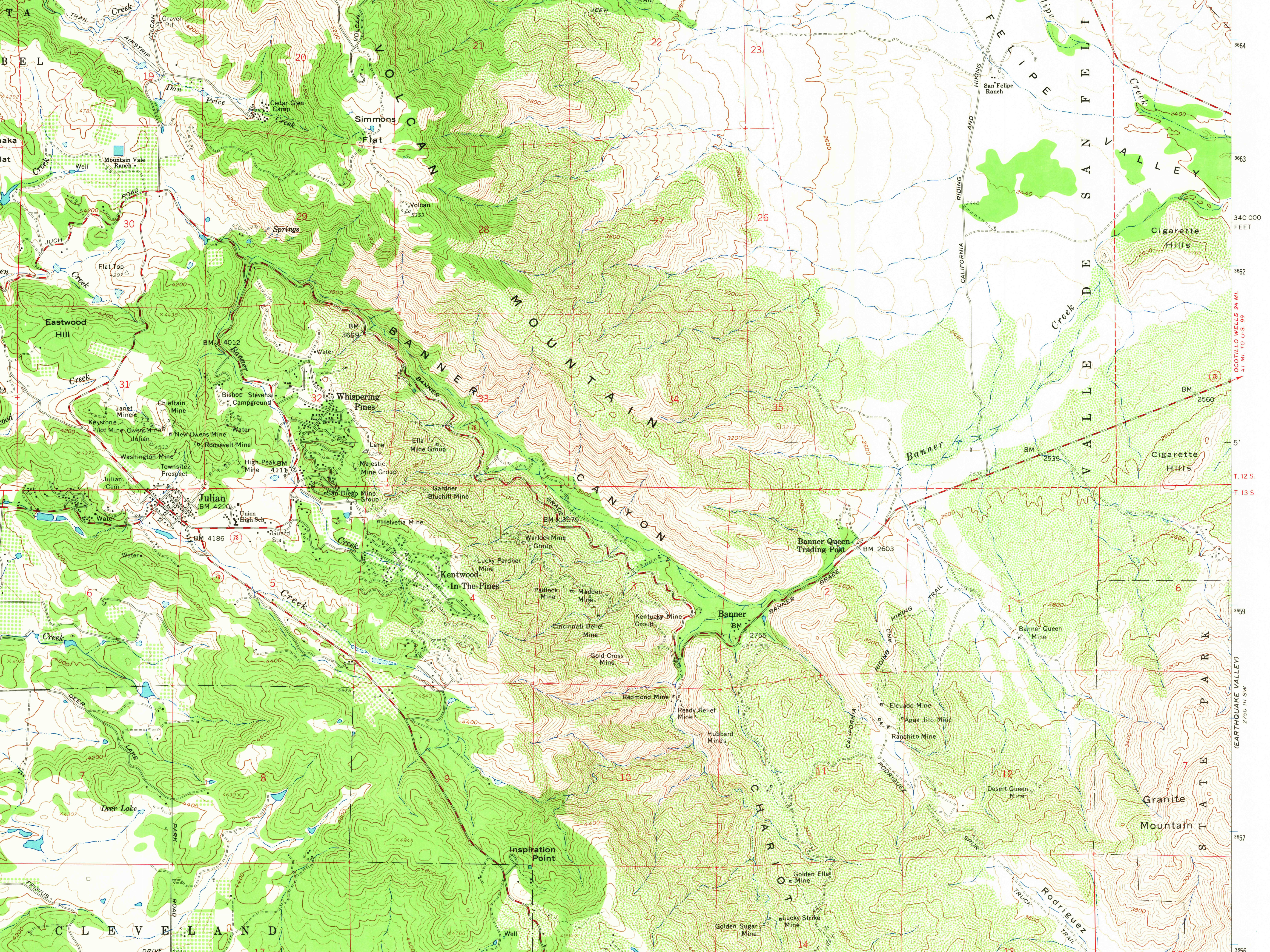
- The Julian section extends about 49 miles (79 km) from Pauma (near Palomar Mountain) past Lake Henshaw, Julian, and into the Anza Borrego State Park area.
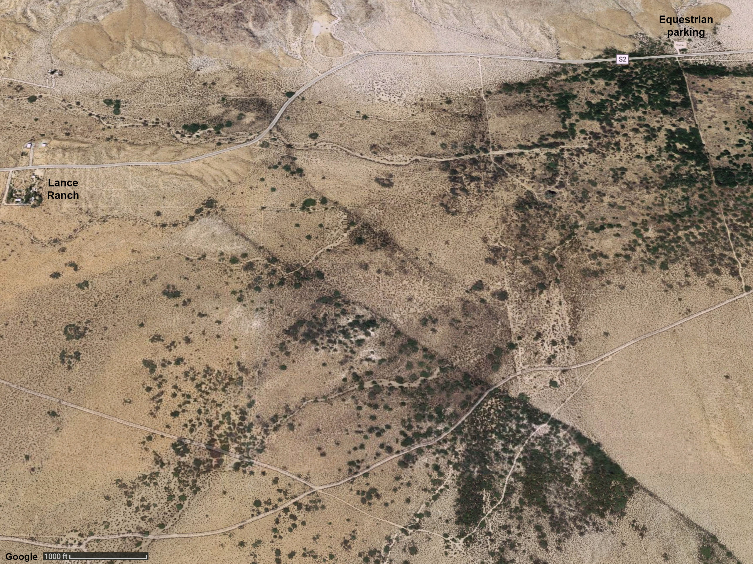
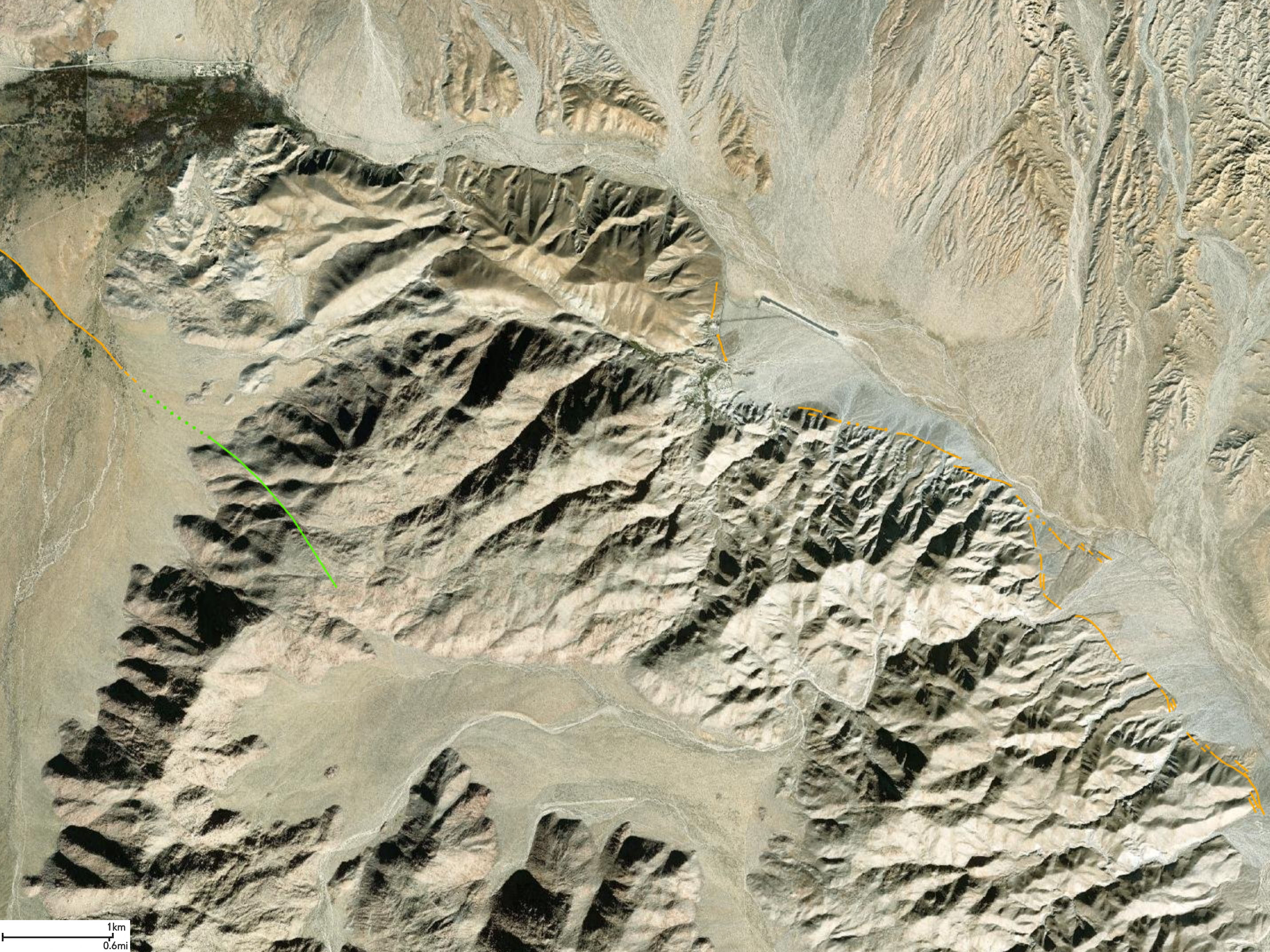
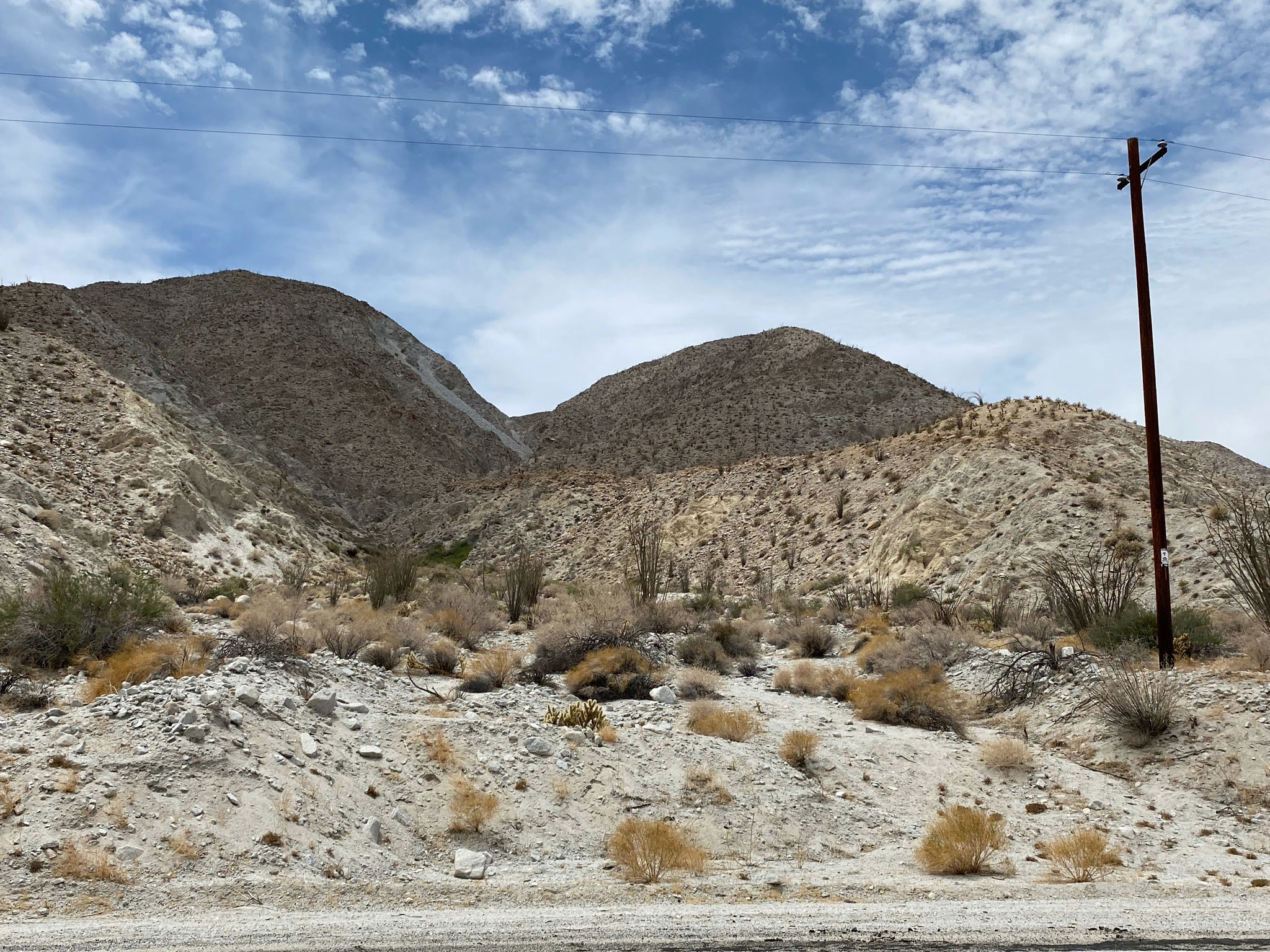
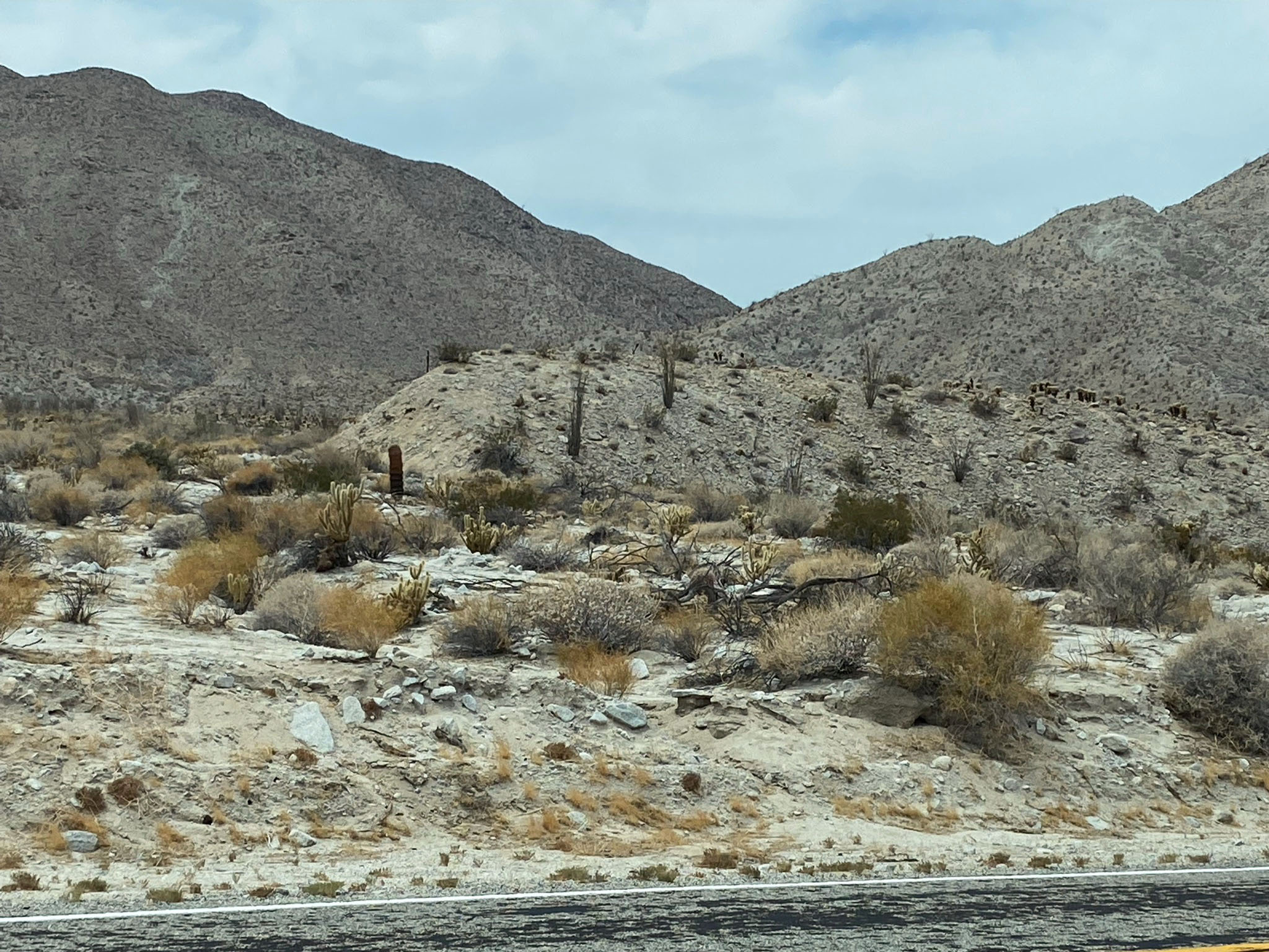
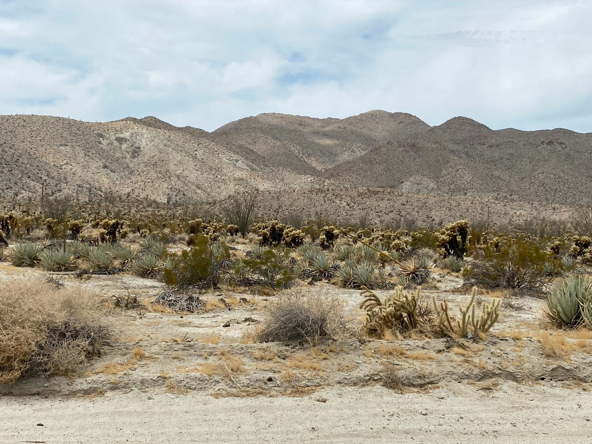
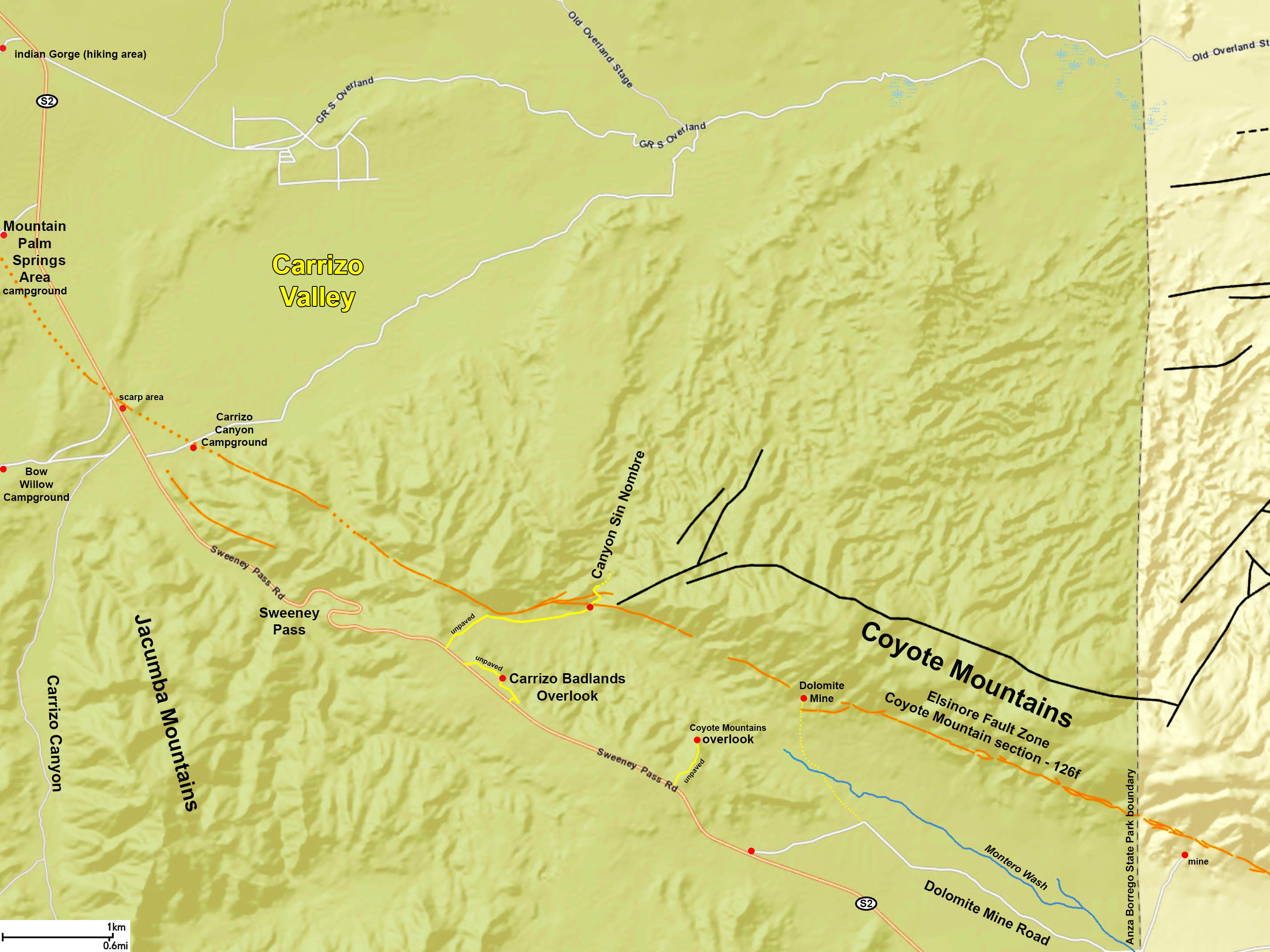
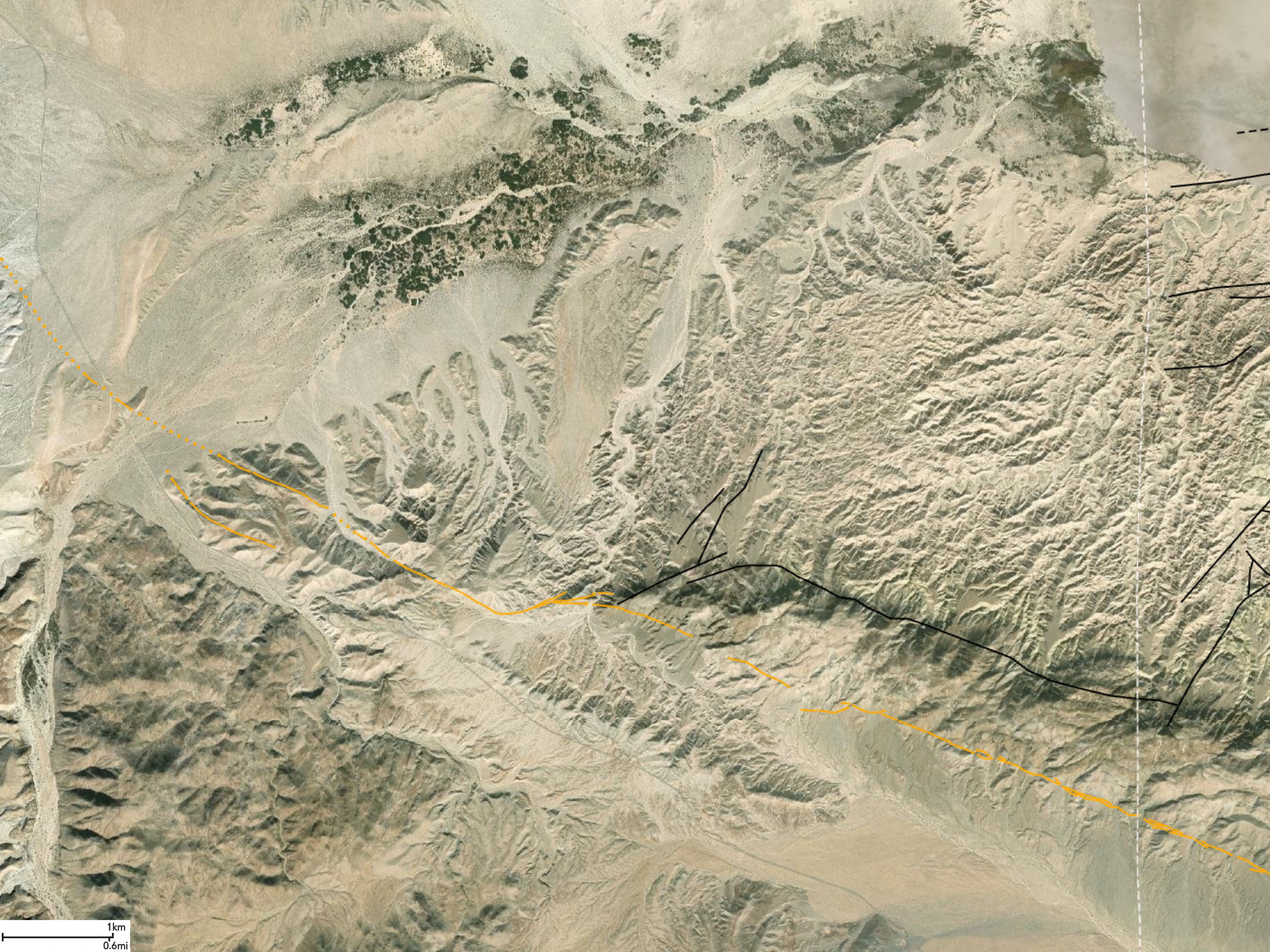
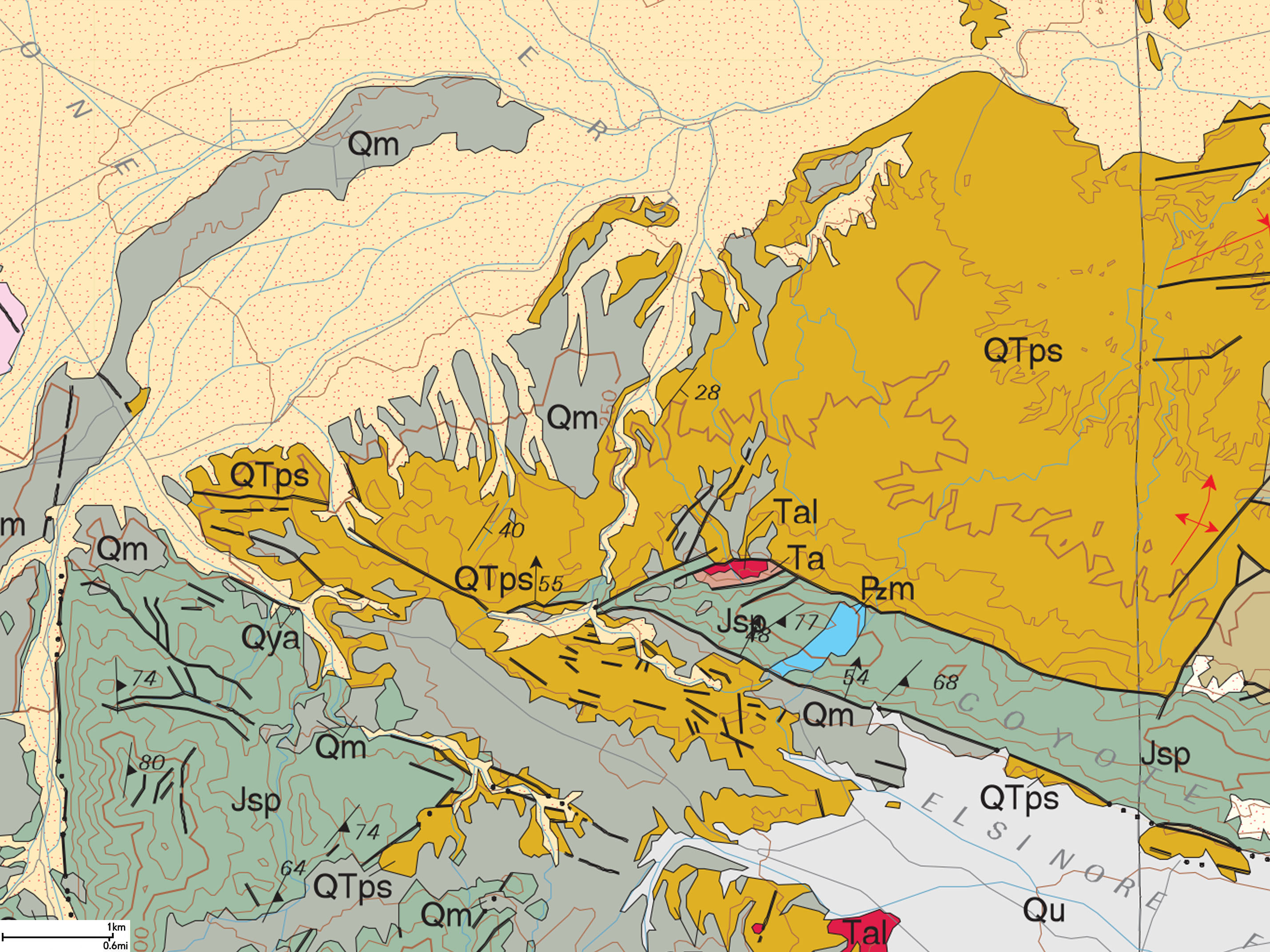
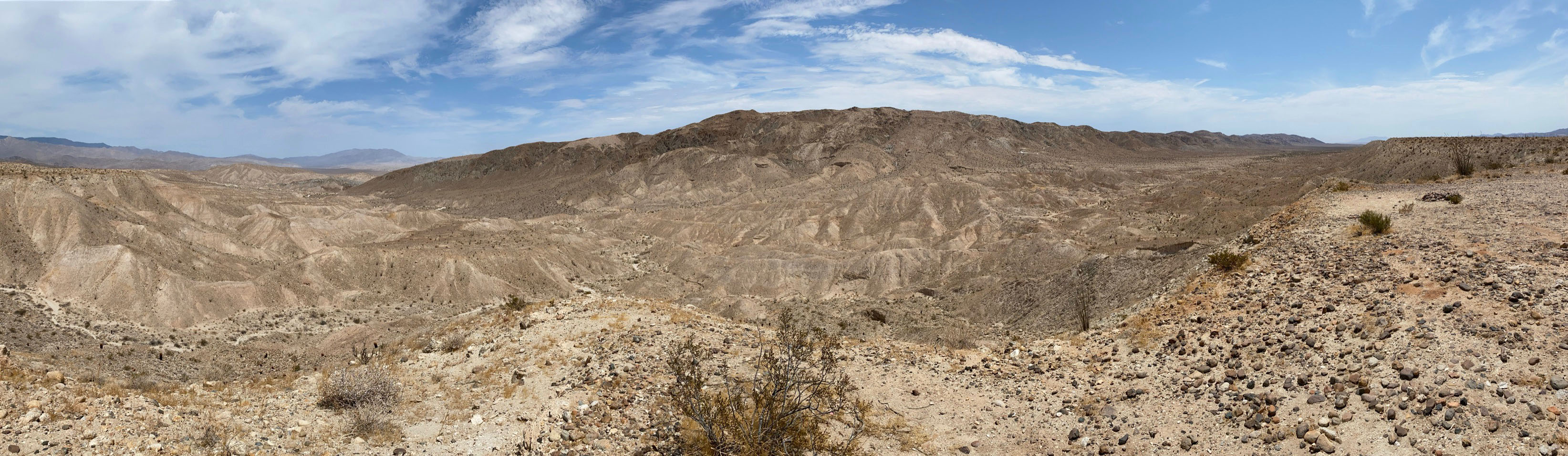
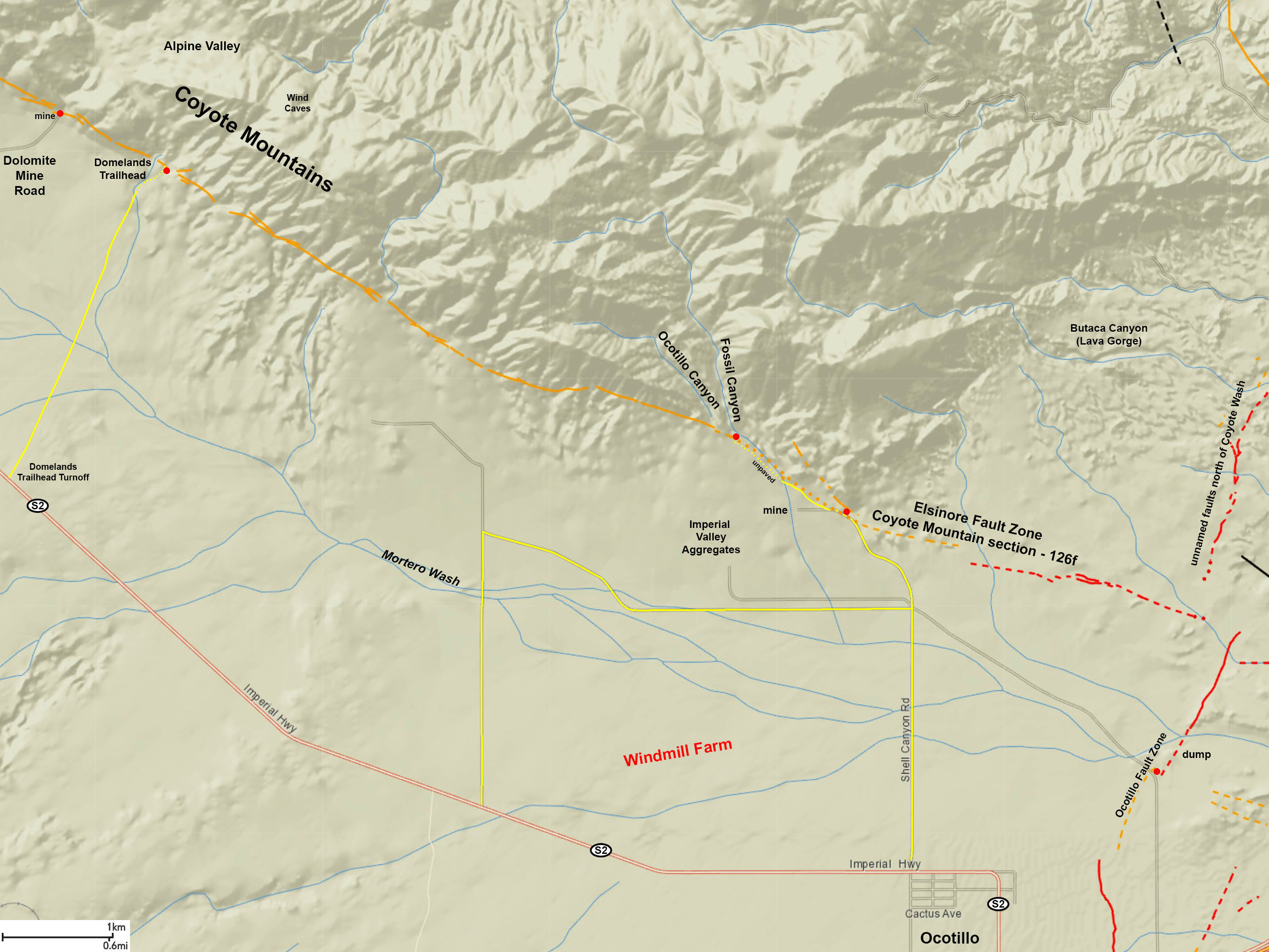
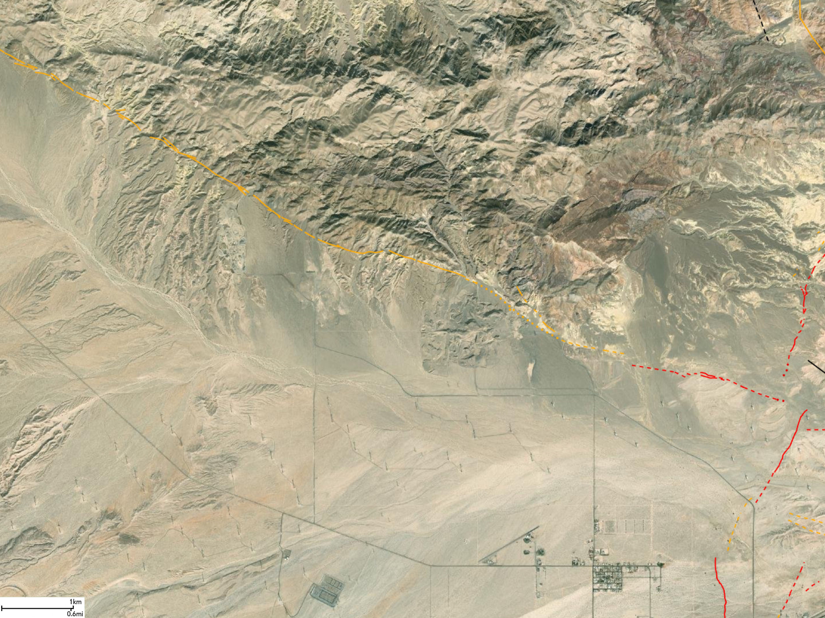
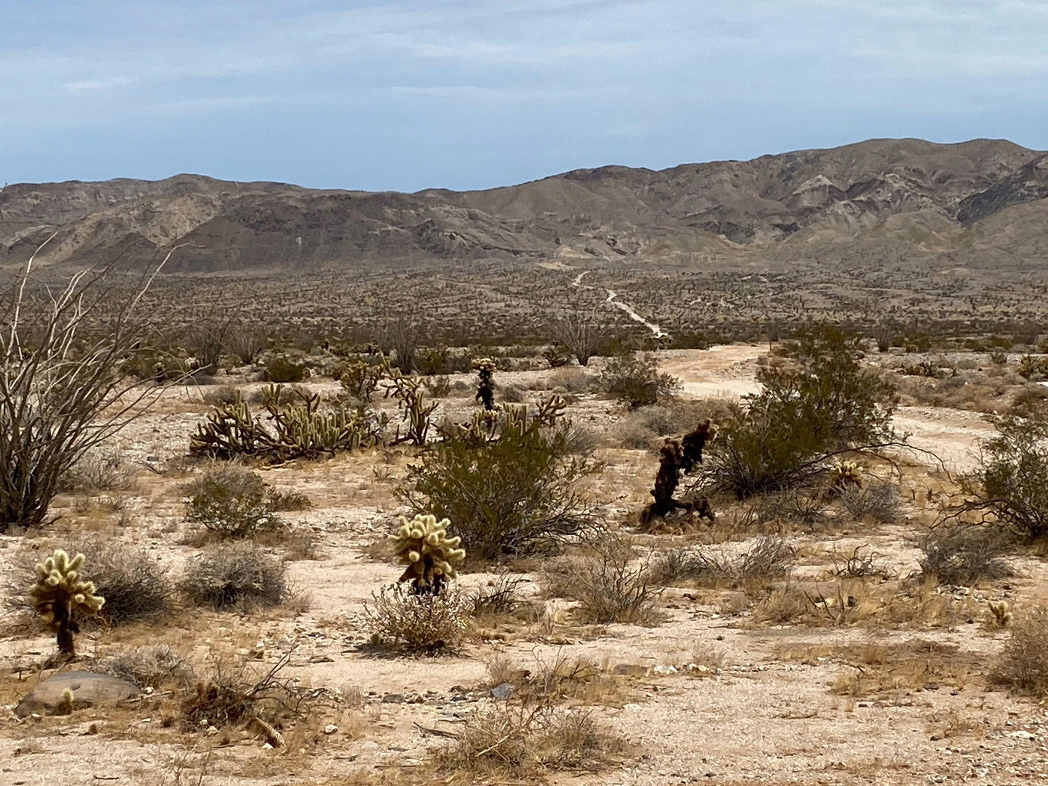
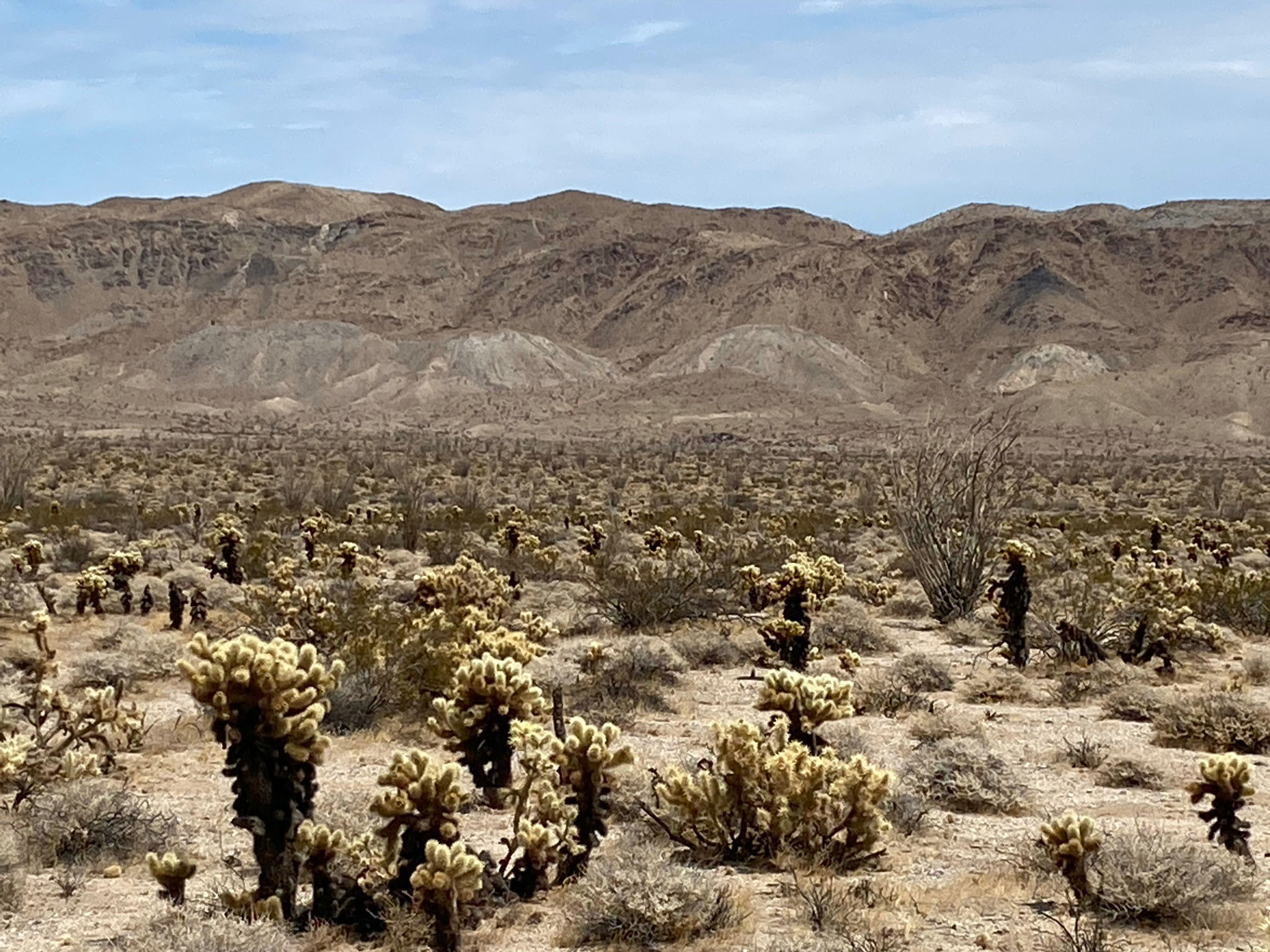
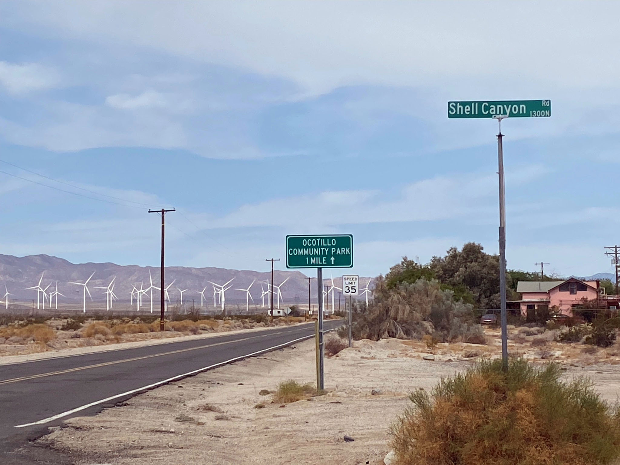
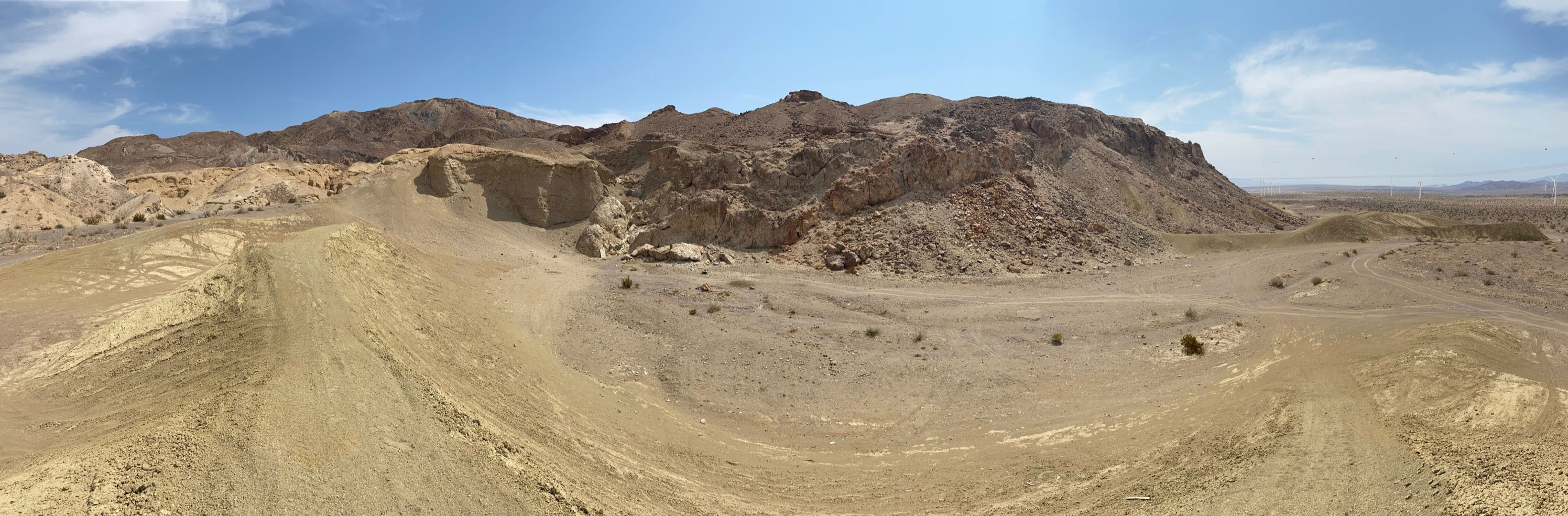
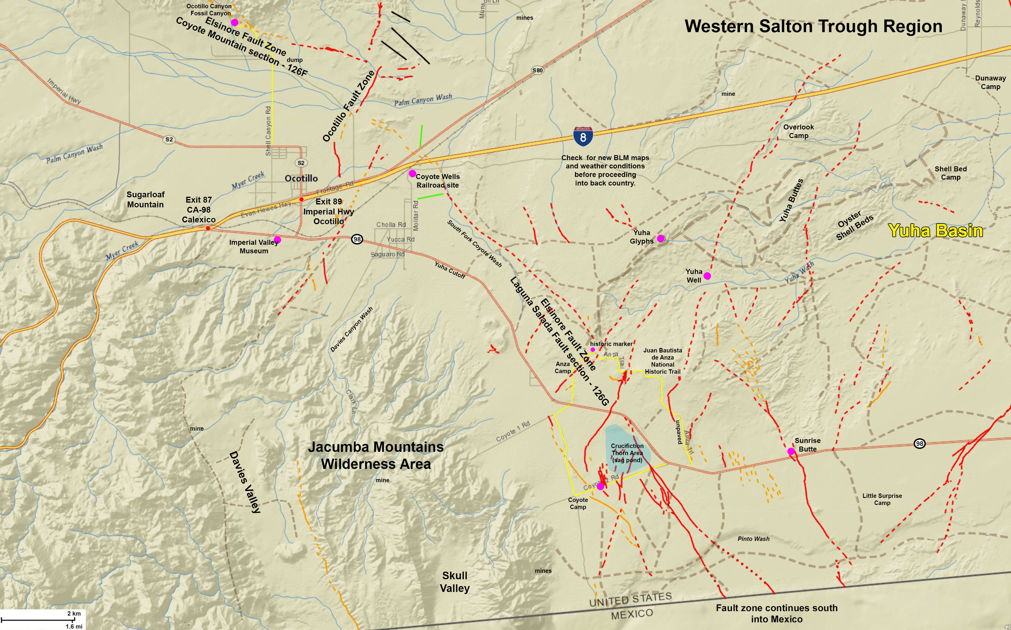
- The Coyote Mountain section starts near Agua Caliente State Park and extends south about 20 miles (33 km) to the vicinity of Ocotillo, CA near Interstate 8.
- Laguna Salada Fault is a southern extension of the Elsinore Fault Zone that extends south 38 miles (61 km) into northern Baja California.
|

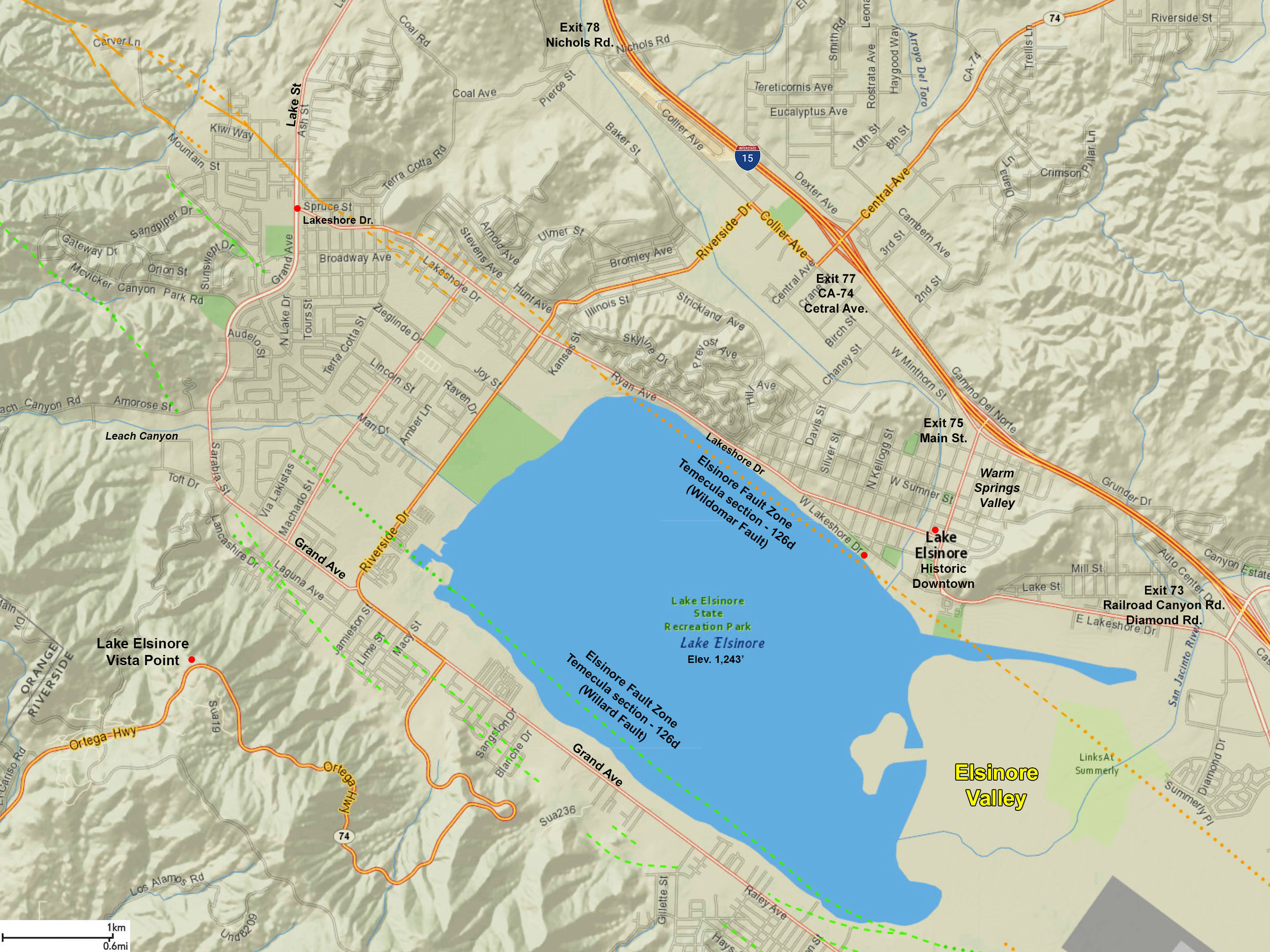
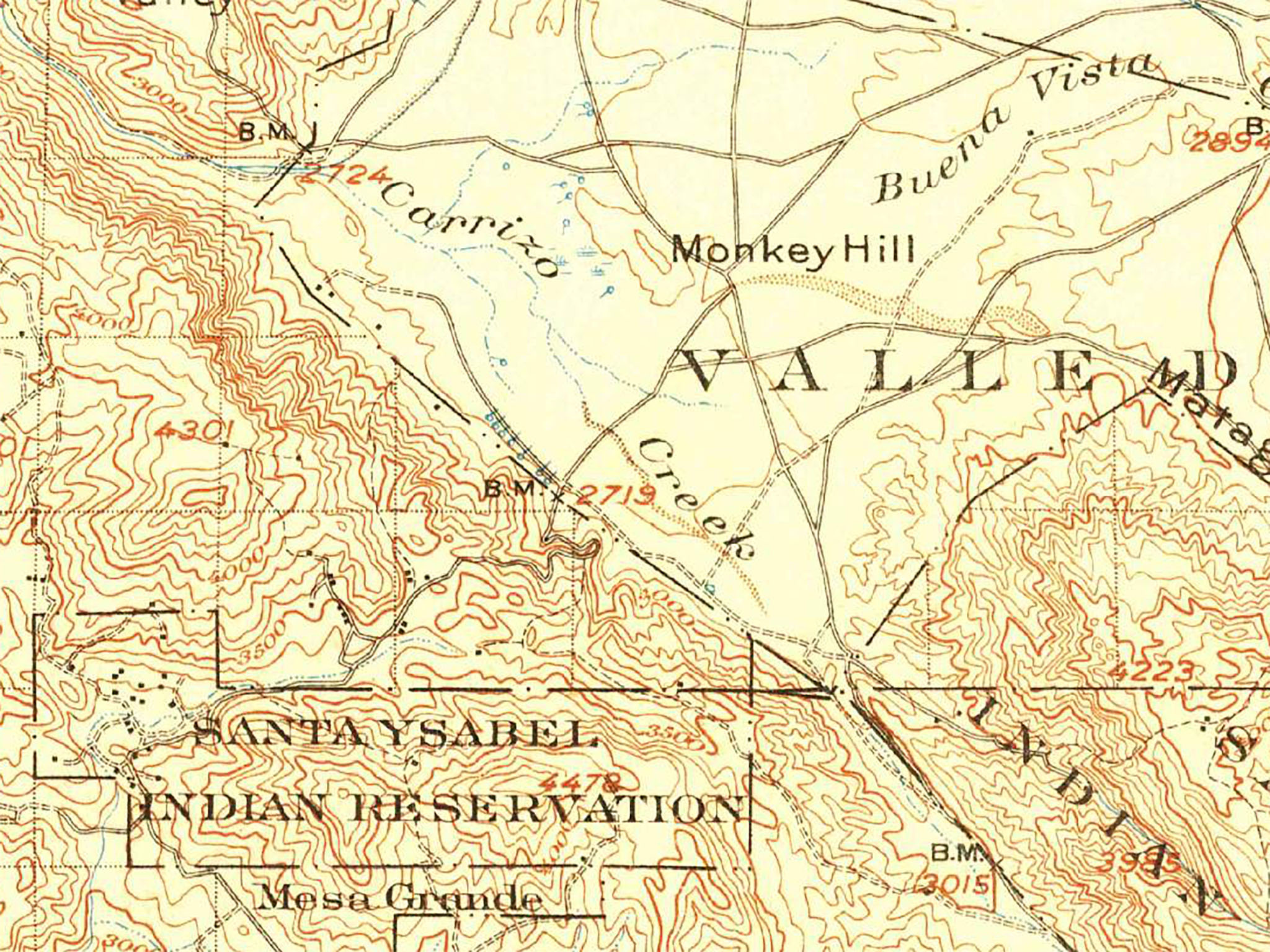
Fig. 2. Map showing the seven named segments (or sections) of the Elsinore Fault Zone. The fault zone extends southward from the Los Angeles Basin area. It follows a northwest-to-south east trend, mostly through mountainous country of the SoCal Peninsular Ranges. At its southern end the Elsinore Fault Zone transitions into the complex Laguna Salada Fault system that extends into northern Baja California, Mexico. |
Earthquake History and Information
It was the Great San Francisco Earthquake of 1906 that brought the study of California earthquake faults to the world's attention. The name Elsinore Fault is used in 1908 Lawson Report for the CA State Earthquake Investigation Commission. The fault zone was known before then as oil was discovered and produces along the Whittier Fault section starting in the 1880s.
The Elsinore Fault Zone is one of the largest/longest fault zones in Southern California. By comparison to other fault in the region, the Elsinore Fault gives the impression of being a relatively quiet fault in historic times. The first known significant earthquake attributed to the Elsinore Fault in historic times occurred on 15 May, 1910, reported as a Magnitude 6 earthquake near Temescal Valley. One of California's strongest historic earthquakes with an estimated magnitude 7.2 occurred on the Laguna Salada area in Baja California on February 23, 1982. This earthquake has has been attributed to the Laguna Salada section of the Elsinore Fault that extends south across the Mexico border (Hough and Elliot, 2004). Likewise, the 4 February, 2010 Baja California earthquake (magnitude 7.3) was also attributed to the the Laguna Salada Fault (and associated faults) that produced surface ruptures throughout the region (Rymer and others, 2010). Other than a comparatively minor magnitude 5.1 earthquake of 4 June 1940 there have been no other major earthquakes along the Elsinore Fault Zone. However, seismological data released by the Southern California Earthquake Data Center (SCEDC, 2021) suggests:
- The probable magnitude of a major earthquake along the Elsinore fault zone could be in the range of magnitude 6.5 to 7.5 (Mw).
- The estimates slip rate for the fault is reported as roughly 4.0 mm/year.
- The probable recurrence interval between major ruptures along the fault zone is roughly estimated between 250 and 600 years. These estimates vary from studies along different fault strands and location along the fault zone).
- The most recent surface rupture in the northern and central sections occur in the 18th century, surface rupture occur at the southern end in 2010.
- The recurrence interval given above suggests slip of 1.25 to 1.5 meters per surface-rupturing event.
|
Map For Studying the Elsinore Fault Zone
Figure 3 is an index map to 21 study areas discussed below. Figures 4 to 7 are a variety of reference maps that show the location of earthquake faults relative to landscape features including mountains, lakes, rivers, and streams, roads and urban area, and land use areas (national forest, parks, reservations, etc.).
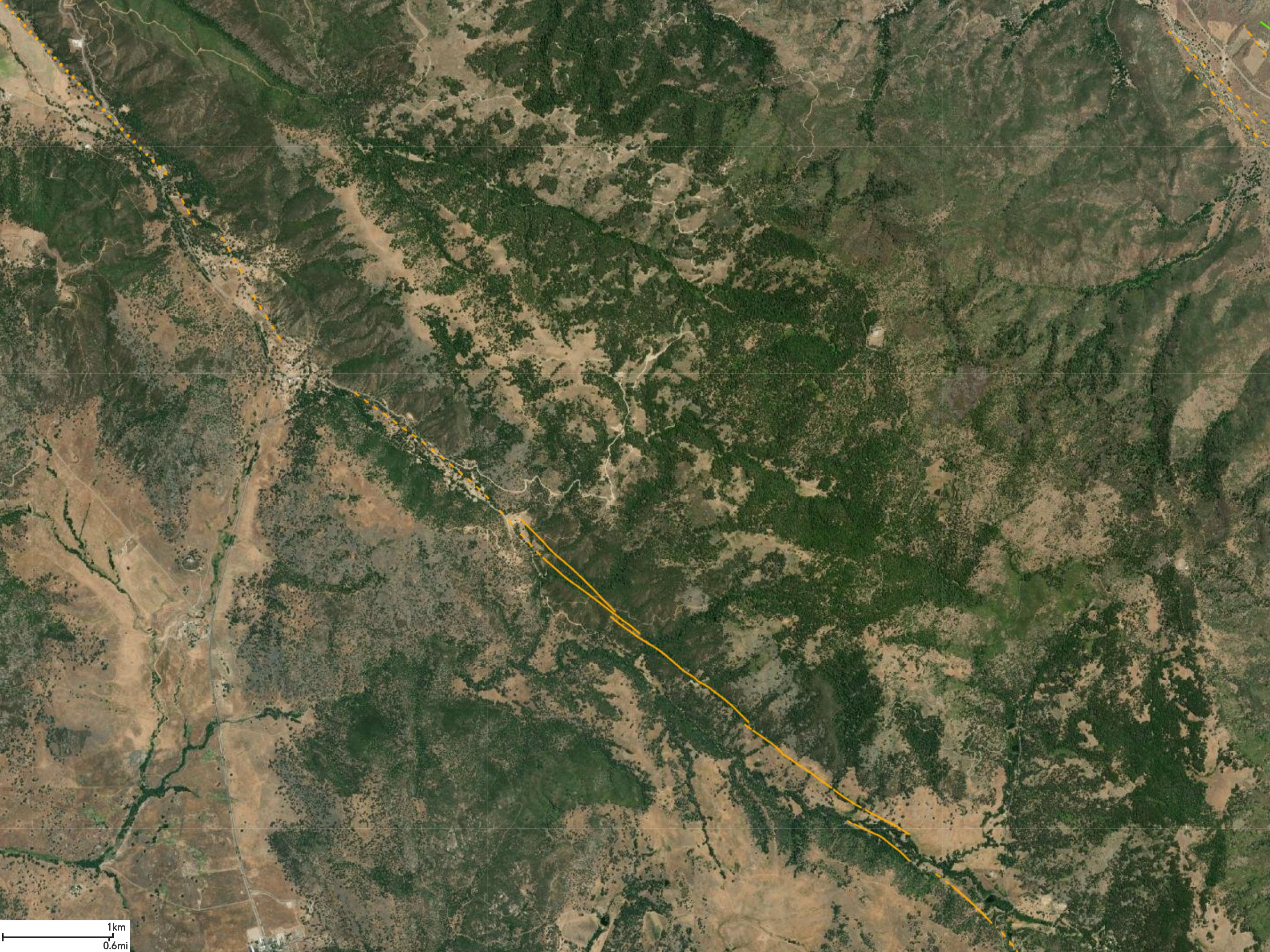
Figure 8 shows the index maps along the Elsinore Fault Zone overlain on a satellite map of Southern California that shows the location of faults and earthquakes epicenters recorded in the region from 1970 to 2010 (Sleeter, Calzia, and Walter, 2012). The location of earthquake epicenters in relation to faults reveal the possible dip angle of fault planes below the surface. The fault dip direction for different fault strands varies significantly from nearly vertical to southwest to northeast dip direction. A near-vertical to steep NE dip is indicated by seismicity to about 8 miles (13 km) depth (Hull and Nicholson, 1992).
Figures 9 is a satellite image map with Quaternary to recent faults shown. and without earthquake data for reference.
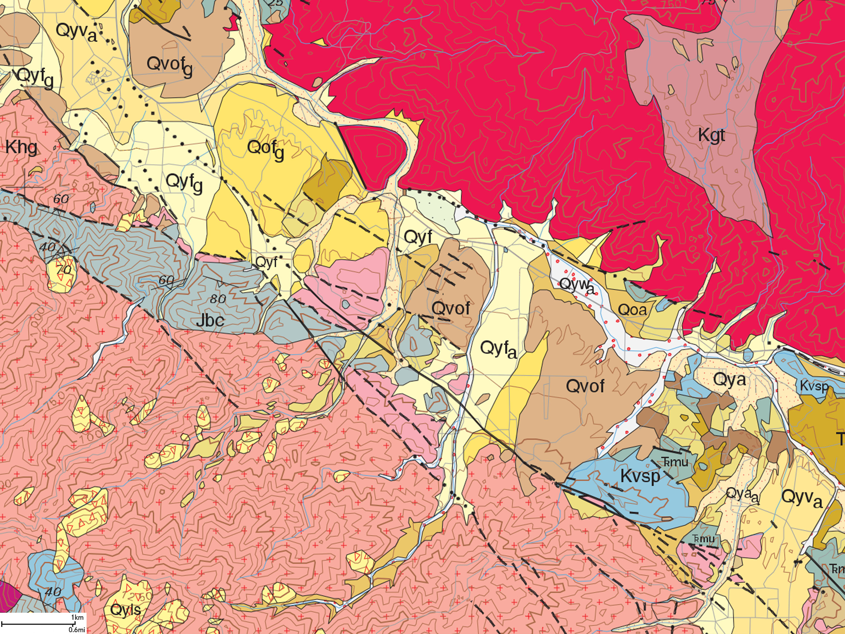
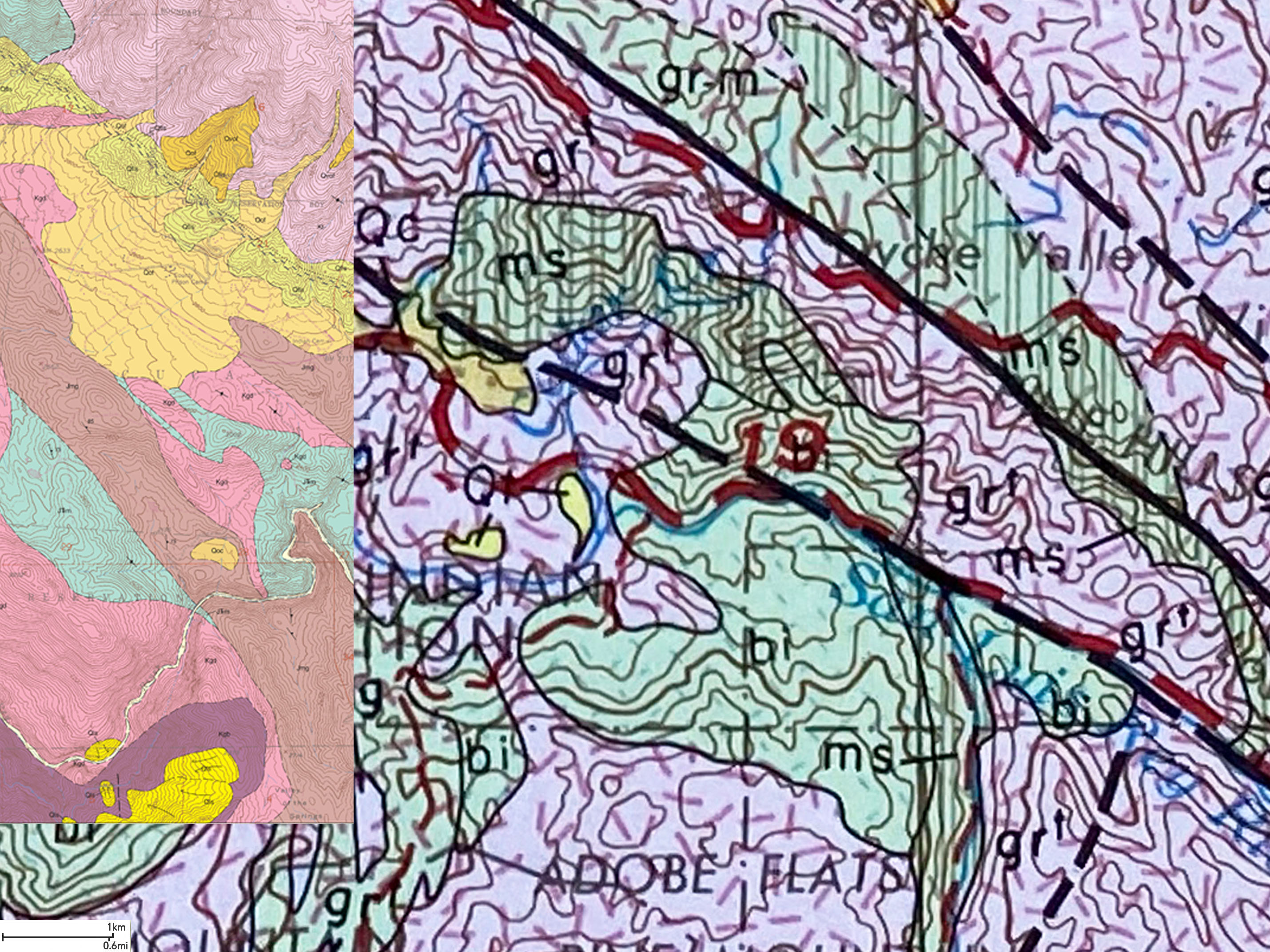
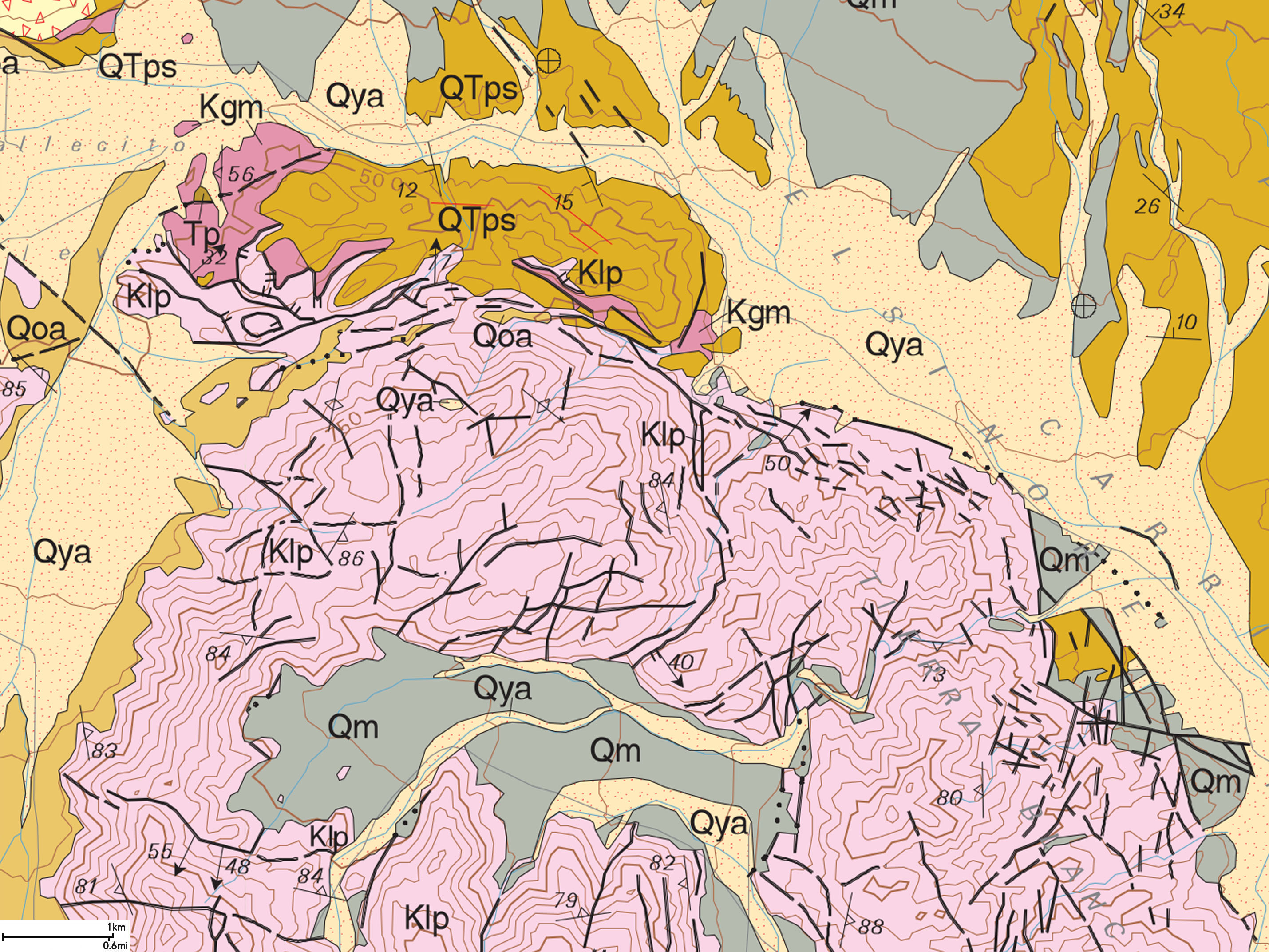
Figure 10 is a generalized geologic map with map index boxes and faults shown. More detailed geologic maps are presented below for each index box.
Figure 11 is a legend for the geologic map and the Quaternary faults shown on the all the maps below. |
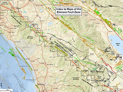
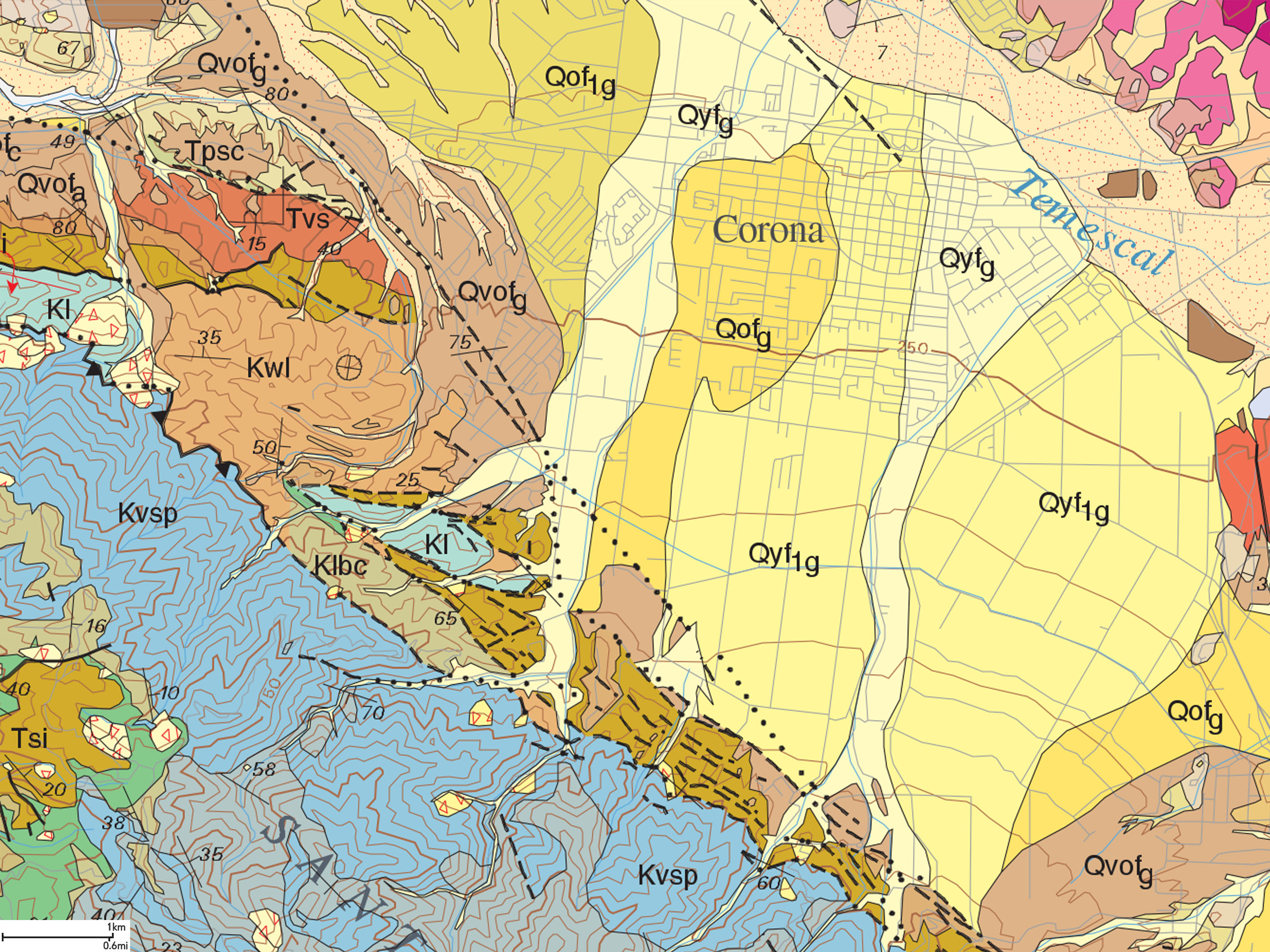
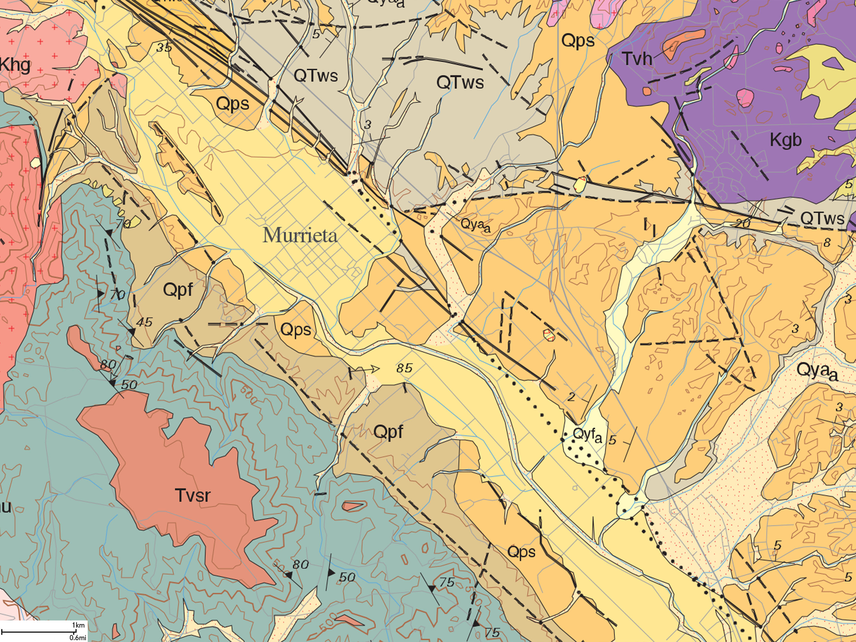
Fig. 3. Location map for "study areas" along the Elsinore Fault Zone encompassing the seven named sections along the fault zone. The boxes on the map are an index map to study areas 1-21 presented below. Additional fault names are discussed below. Fault locations derived from the Quaternary Fault and Fold Database of the United States (QFFDUS). |
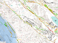
Fig. 4. Feature locations map |
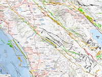
Fig. 5. Urban areas |
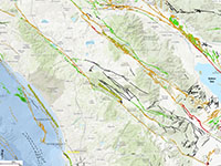
Fig. 6. Land Use Map |
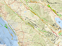
Fig. 7. National Geographic |
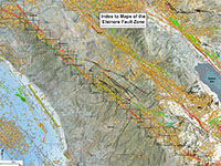
Fig. 8. Index map earthquakes with study area location boxes. |
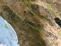
Fig. 9. Satellite map with Quaternary faults shown. |
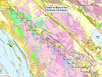
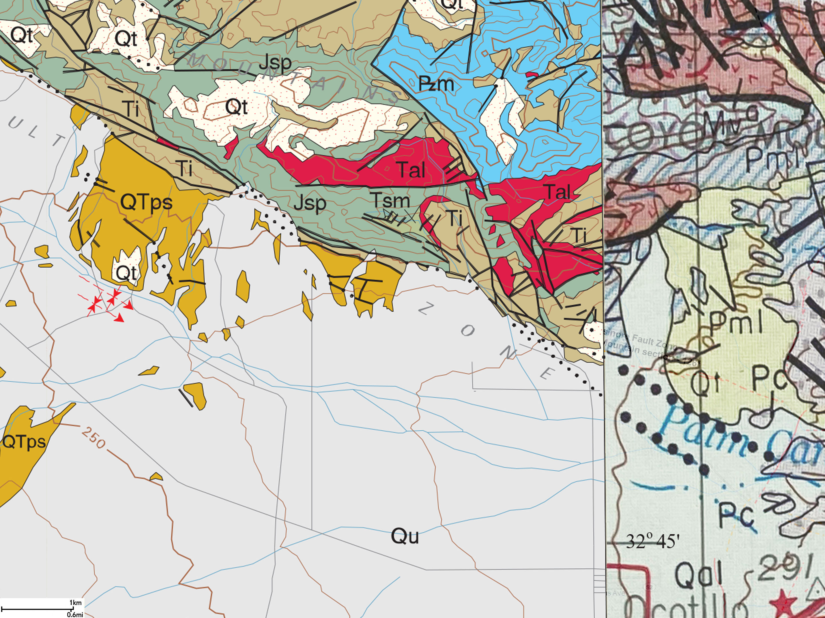
Fig. 10. Geologic Map with study area boxes |
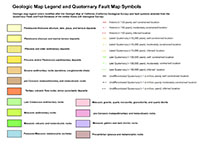
Fig. 11. Geologic maps and earthquake faults legend. |
|
USGS Quaternary Faults Data in Google Earth (Virtual Elsinore Fault Field Trip)
It is easy to upload a USGS database of Quaternary Faults & Folds in the U.S. as a layer file into Google Earth. You can easily zoom along the landscape along faults in California and other states, such as along the Elsinore Fault Zone. This is a good alternative for "stay at home and take the field trip online alternative. Google Earth provides spectacular areal views and 3D roadside views in all directions and you can follow fault lines in the Google imagery. Instructions for downloading and importing the data on Google Earth/KML Files. Instruction on "How to import KMZ into Google Earth, Google Maps or Bing Maps." |
Geologic Setting
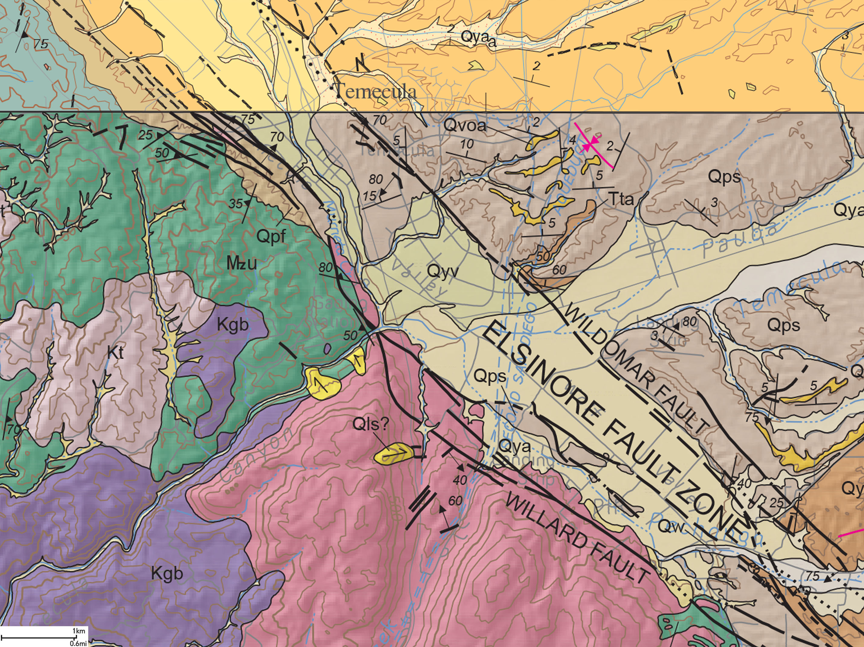
The Elsinore Fault Zone is a dextral shear system—it is a right-lateral strike-slip fault with some vertical offset. It runs basically parallel to the southern San Andreas and San Jacinto fault zones. The fault zone is associated with associated with prominent landscape features (linear ridges and valleys) that can be easily seen from above on satellite imagery. The total length of the Elsinore Fault Zone is about 190 miles (306 km), or 112 miles (180 km), not including the Whittier, Chino, and Laguna Salada fault sections.
Studies suggest that Elsinore Fault accommodates about 4-5 mm/yr of the Pacific-North American Plate boundary slip (compared to 20-25 mm/yr for the southern San Andreas Fault, 12-15 mm/yr for the San Jacinto Fault, and about 2 mm/yr for the Rose Canyon Fault).
Total strike-slip displacement is reported to be as much as 40 km but is more likely only 10–15 km, and total vertical separation is about 660 feet (200 m). The northern Elsinore Fault Zone is geologically relatively young, estimated to have originated about 2.5 million years ago (Hull and Nicholson, 1992). The total amount of displacement is distributed on multiple strands of faults in some sections. Measured displacement along Elsinore Fault Zone is about 10 miles (14 km) near Lake Elsinore (Figure 11)(Kennedy and Morton, 2003). This displacement measurement is based on studies of absolute ages of Mesozoic-age granitic basement rocks of the Peninsular Ranges batholith.
Northern Sections of the Elsinore Fault Zone
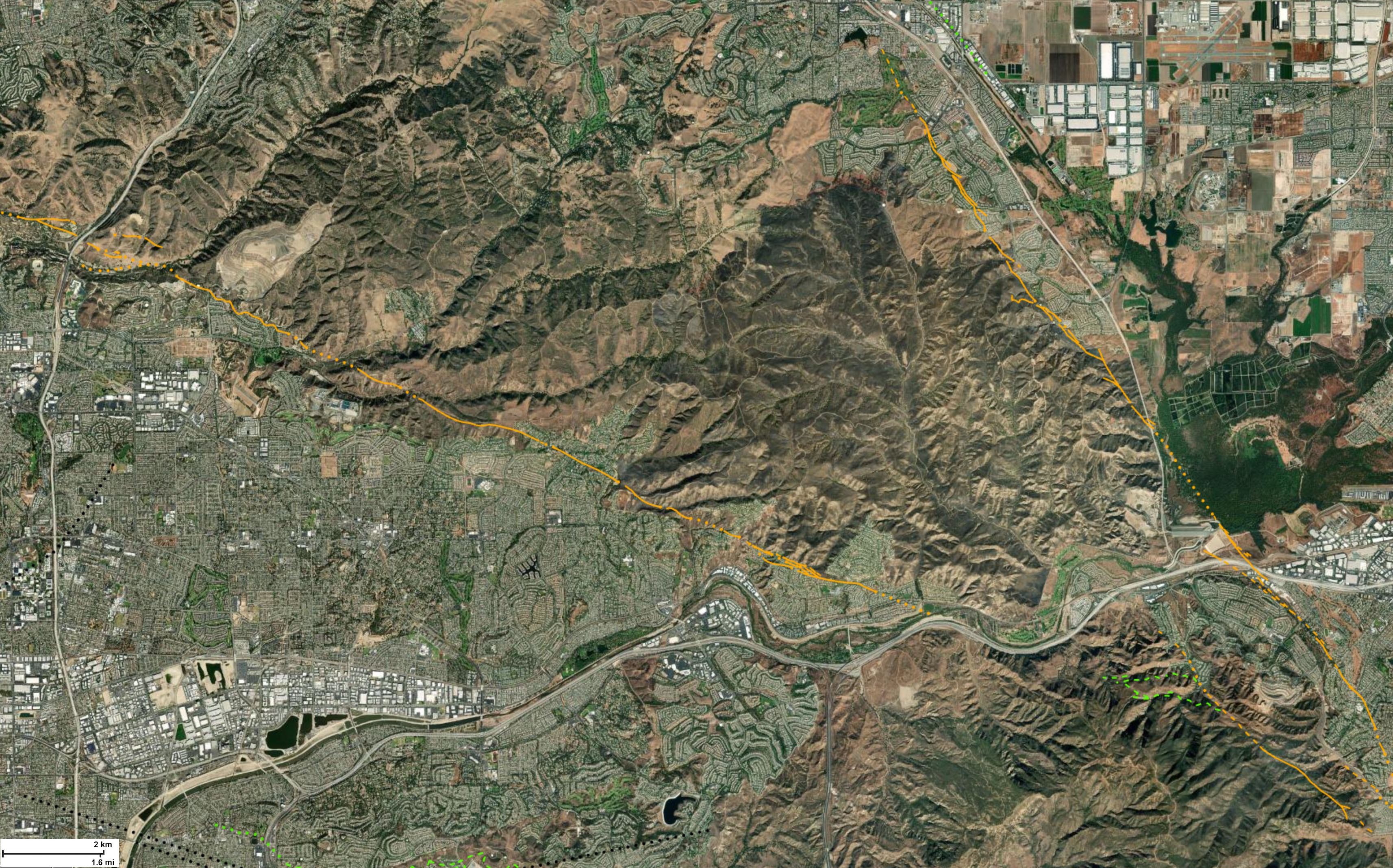
The northern elements of the Elsinore Fault Zone consists of the Whittier Fault and Chino Fault sections converge to form the Elsinore Fault Zone in the vicinity of Corona, California. These faults border border the Puente Hills/Chino Hills, an uplifted block (horst) of Tertiary sediments pushed up between the Whittier and Chino Faults (Figure 13). The Whittier Fault is a right-lateral strike slip fault with a low-angle to steeply dipping fault plane that dips to the northwest. The Chino Fault is a high-angle reverse fault with some strike-slip displacement. The Brea-Olinda Oil Field is one of California's oldest and largest oil fields located roughly along the Whittier Fault Zone with oil production coming from Miocene and Pliocene petroleum-bearing sandstone formations. This uplifted block is host to Chino Hills State Park in the mesa region west of the Chino Fault (see the Whittier Fault section and Chino Fault section discussion with Study Area 1 below).
Central Sections of the Elsinore Fault Zone
The Glen Ivy section of the Elsinore Fault Zone forms the northeast boundary of the Santa Ana Mountains, and, together with the Temecula section, forms the Elsinore Trough—a complex series graben structures between the stable Santa Ana tectonic block (to the west) and the Perris tectonic block (to the east) (Figure 14). Between Corona and Temescal Valley, the Elsinore Tough is bounded by the Glen Ivy North and Glen Ivy South faults. The Glen Ivy Faults section is discussed below in Study Areas 2 to 4). South of Lake Elsinore the trough is bounded by two parallel fault strands—the Wildomar Fault (the more easterly) and the Willard Fault. Lake Elsinore is a sag pond in the graben between these two faults. These faults also bound grabens that show geomorphic expression of Temecula Valley and Wolf Valley (discussed below). The Temecula section of the Elsinore Fault Zone are discussed below with Study Areas 5 to 8 below.
Southern Sections of the Elsinore Fault Zone
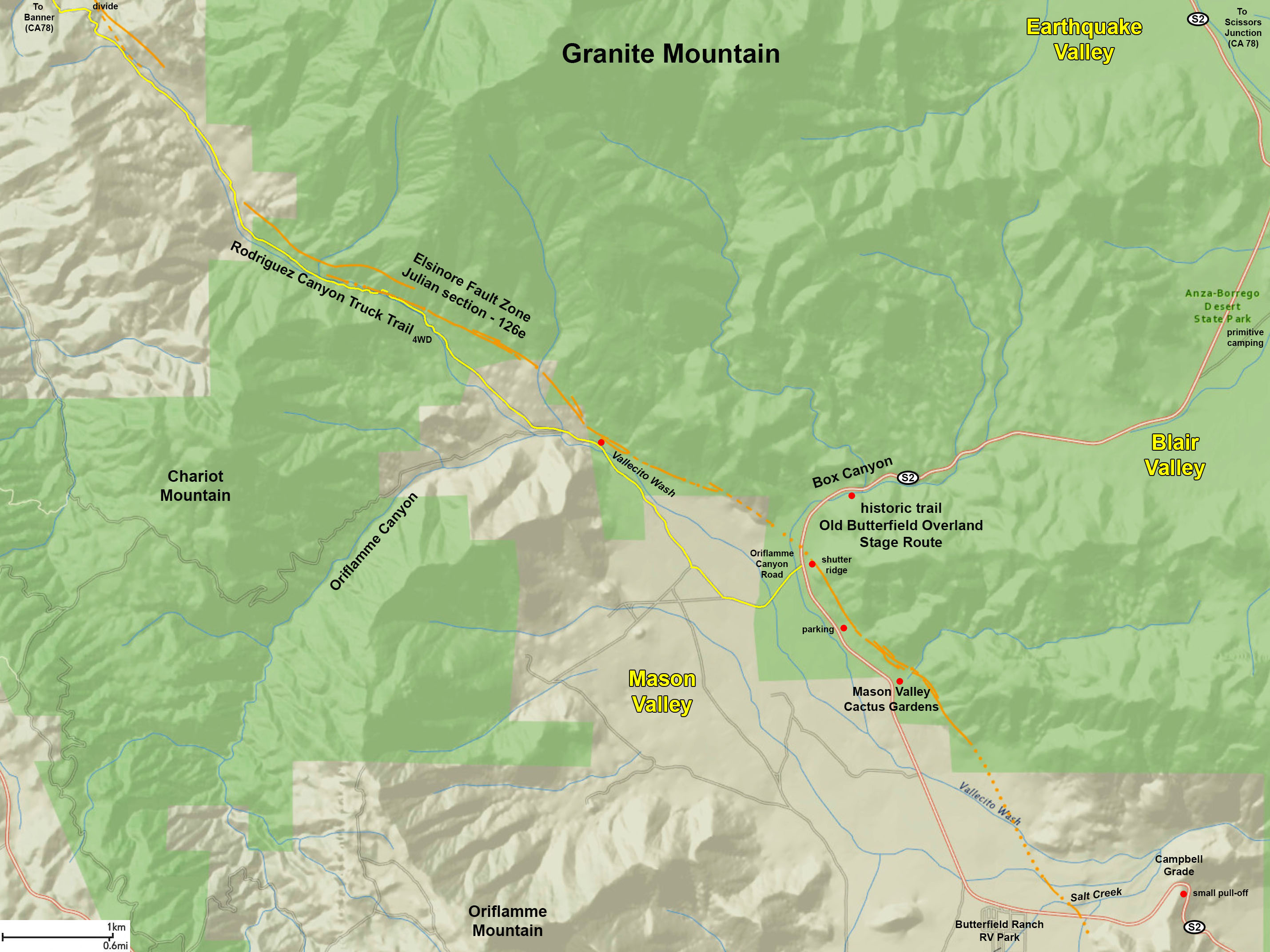
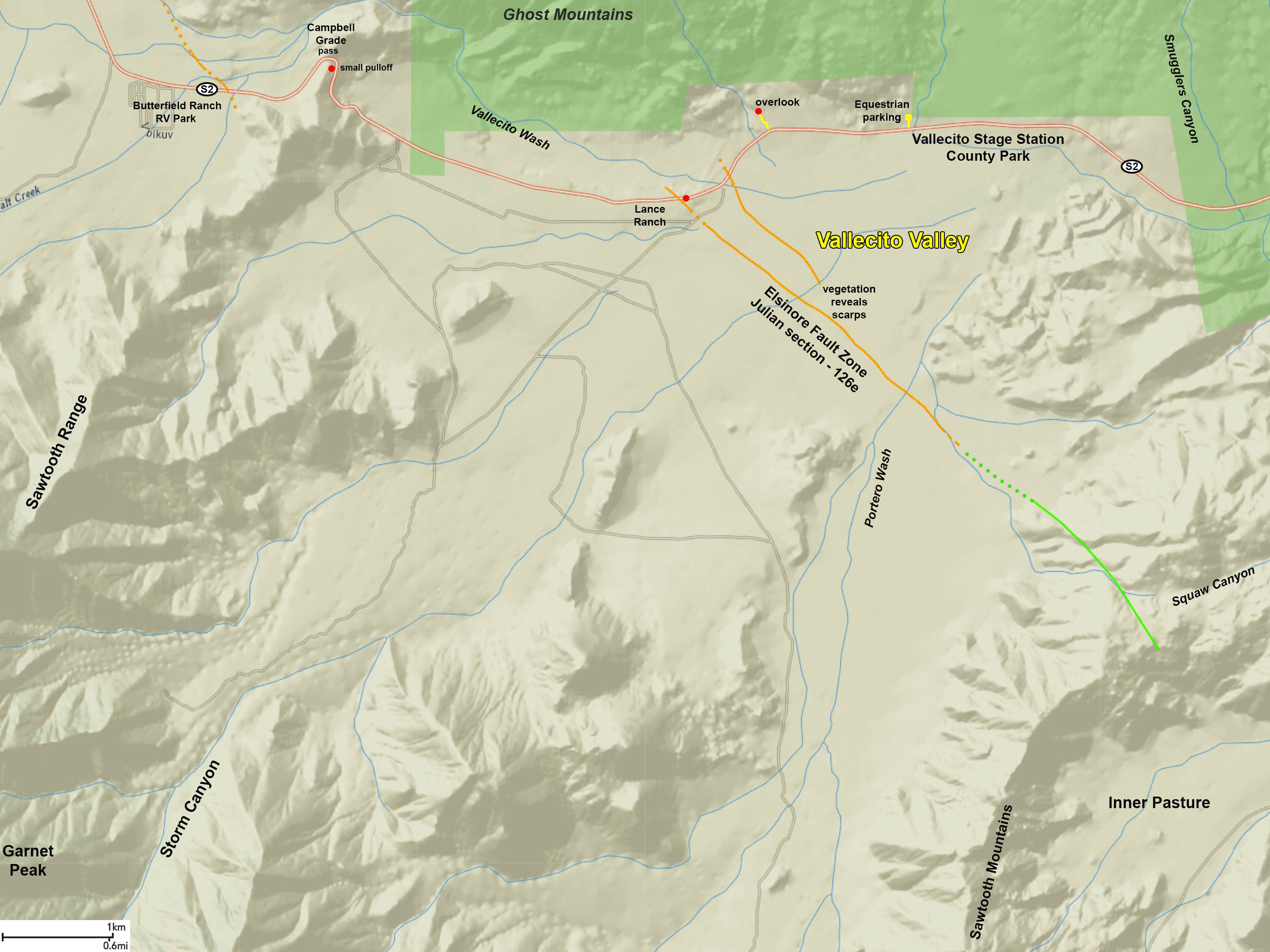
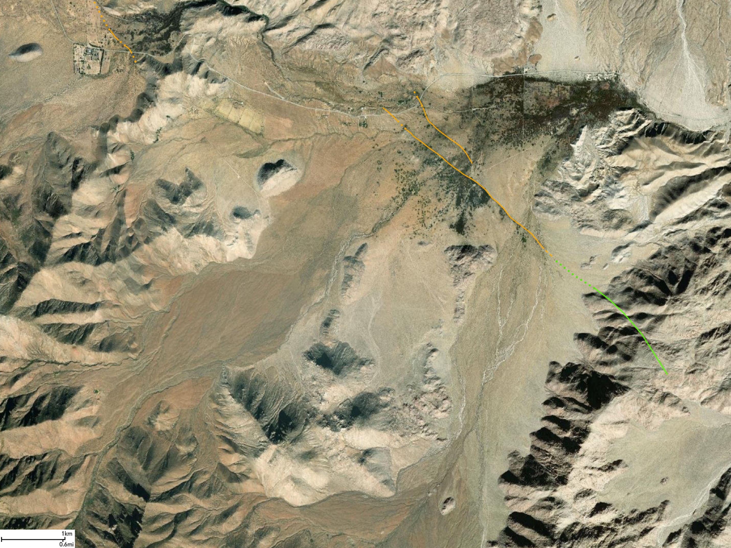
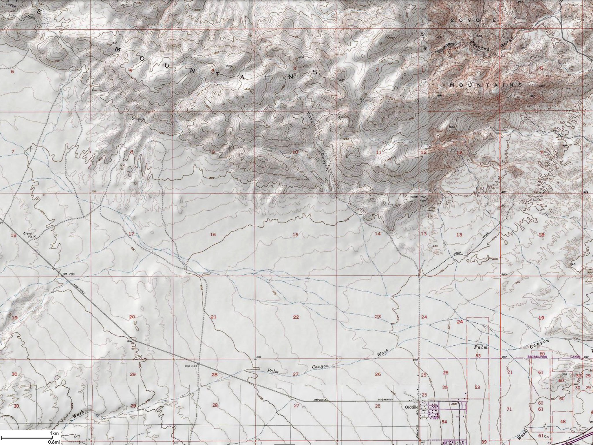
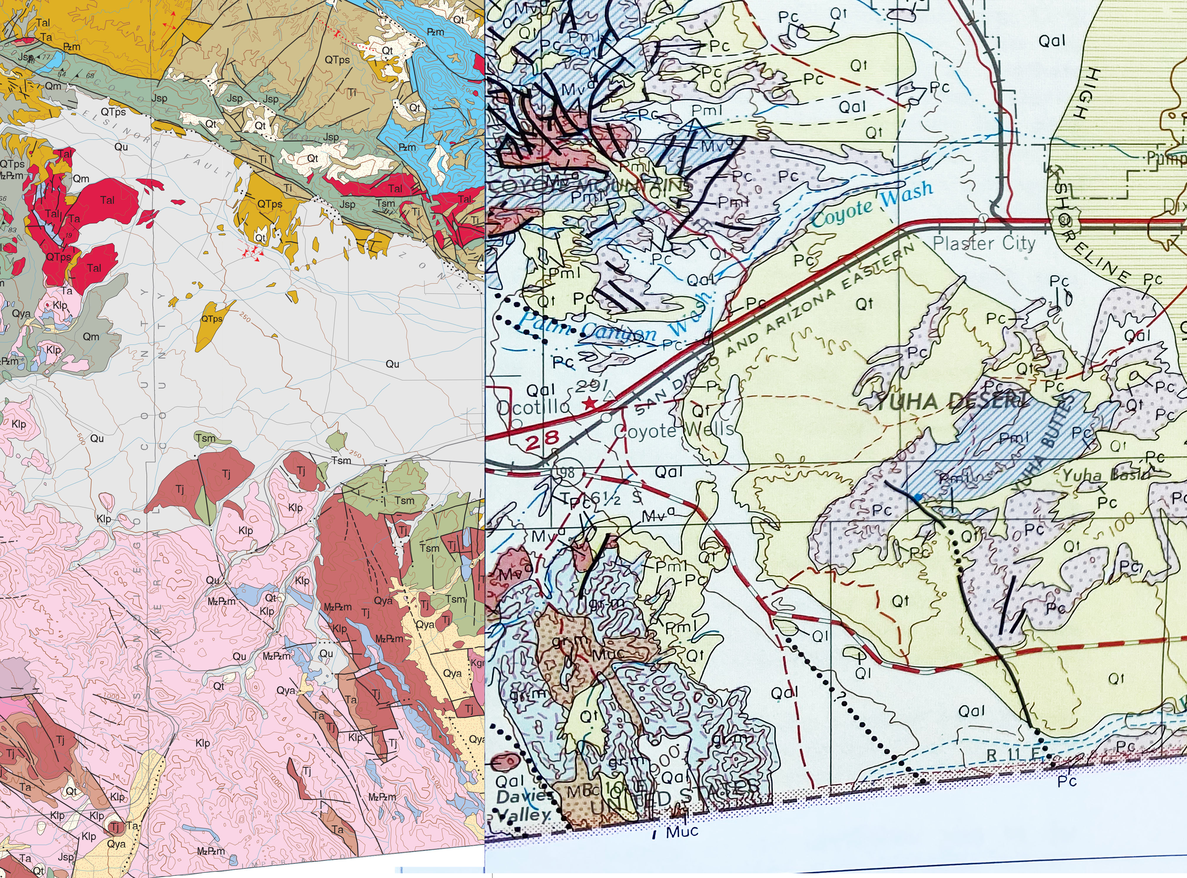
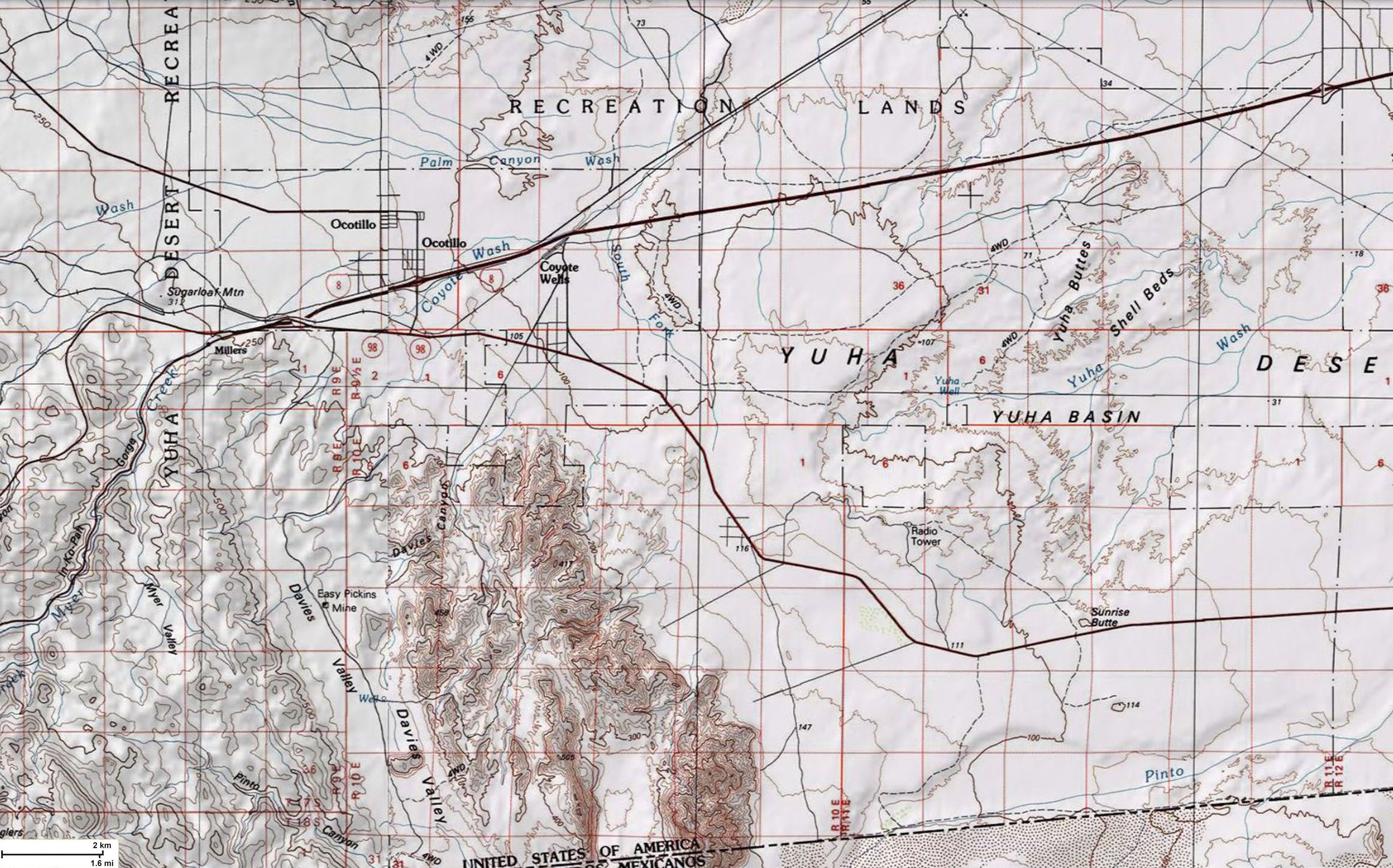
To the southeast, the Julian section of the Elsinore Fault Zone cuts diagonally across various Peninsular Range batholithic and pre-batholithic metamorphic terrains. It crosses the San Diego watershed divide near Julian and where the fault line descends into the Anza Borrego desert region (see the Julian section discussion and Study Areas 9 to 17 below).The Coyote Mountain Section begins near Caliente Hot Springs County Park and continues southward the until it reaches the southwestern margin of the Salton Trough where it intersects or is cut perpendicular by the Yuha Wells Fault near the settlement of Ocotillo, California. From there the fault zone continues south into Baja California (Mexico) as the Laguna Salada Fault section. See the Coyote Mountain section discussion and Study Areas 18 to 20 below. The Laguna Salada Fault section is discussed with Study Area 21 below. |
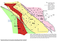
Fig. 12. Measurable displacement of faults along the borders between the Santa Ana, Ferris, and San Jacinto tectonic blocks in the vicinity of the northern part of the Elsinore Fault Zone.
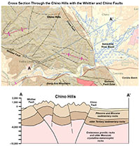
Fig. 13. Hypothetical cross section through the Chino Hills showing the Whittier and Chino Faults.
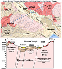 Fig. 14. Hypothetical cross section through the Elsinore Trough showing the faults of the Elsinore Fault Zone. Fig. 14. Hypothetical cross section through the Elsinore Trough showing the faults of the Elsinore Fault Zone.
|
A1
Geomorphic Expression Of Faults
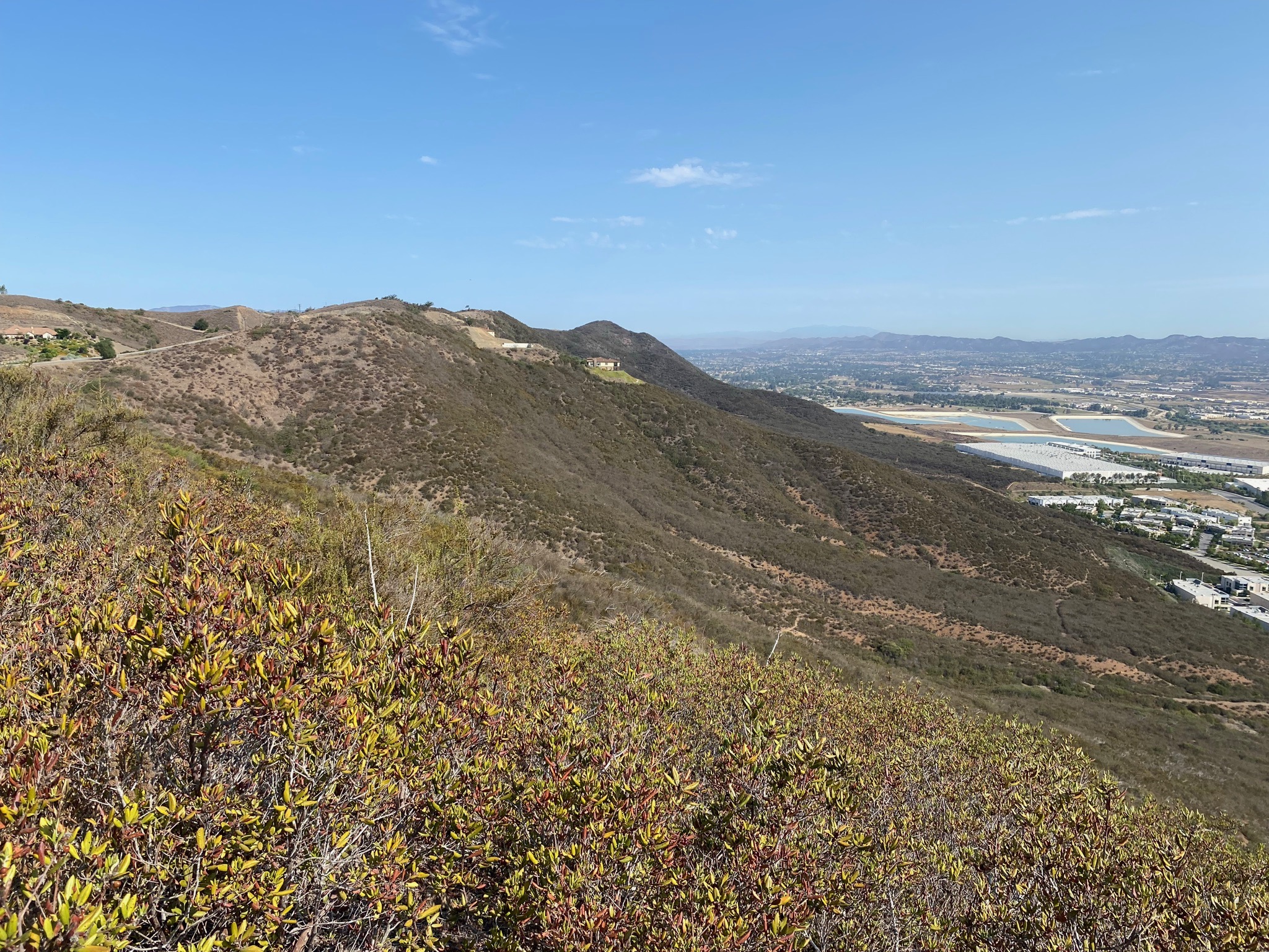
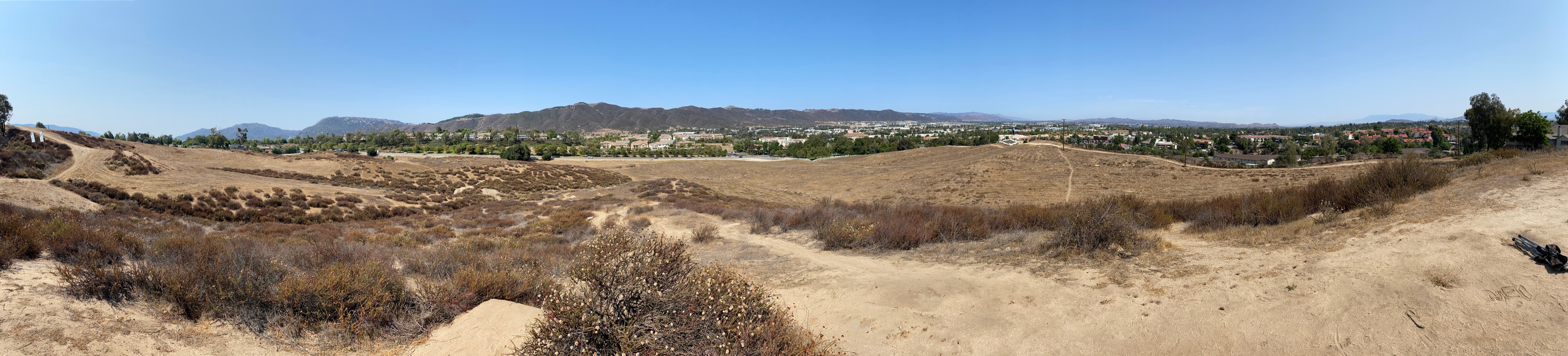
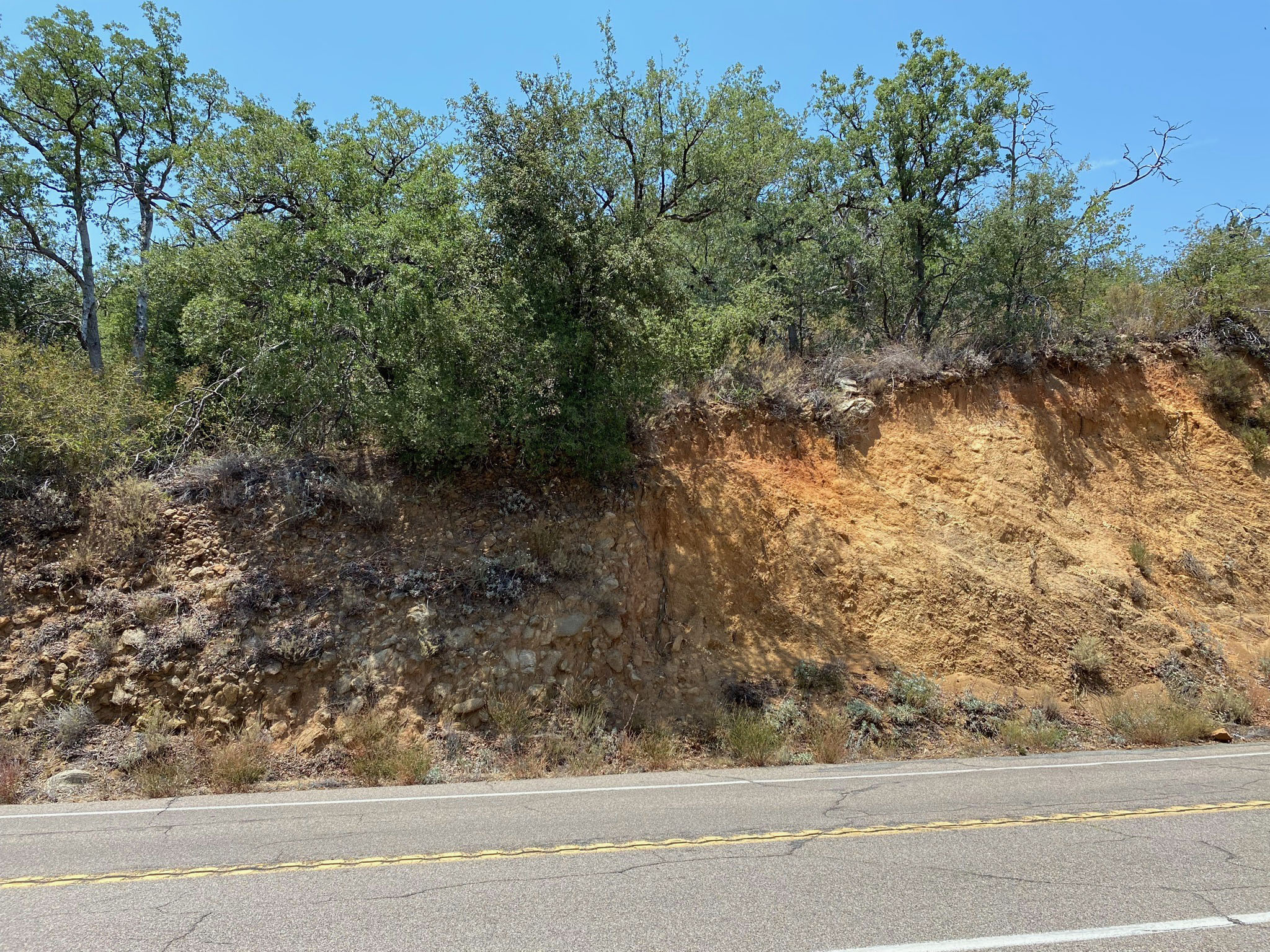
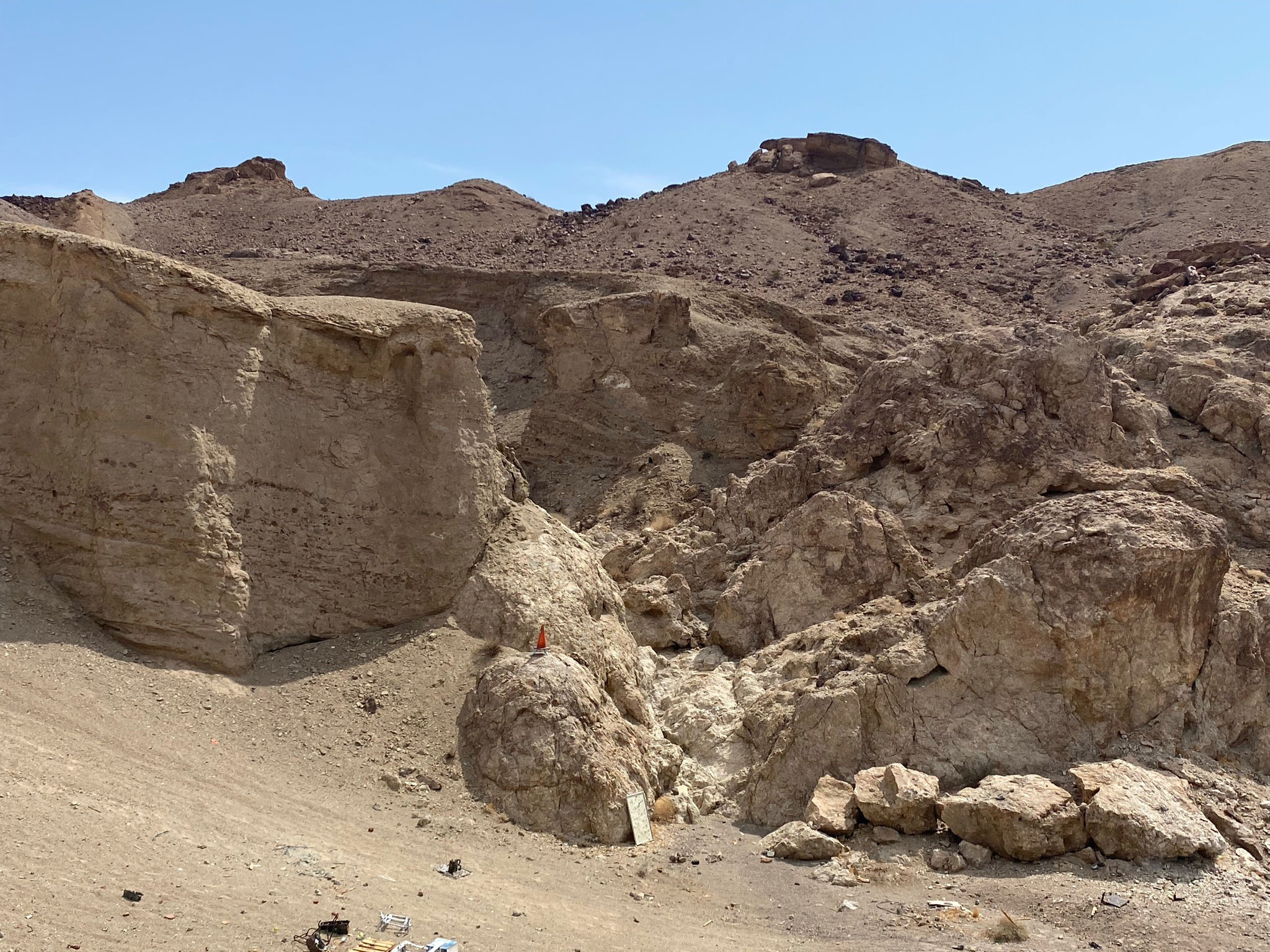
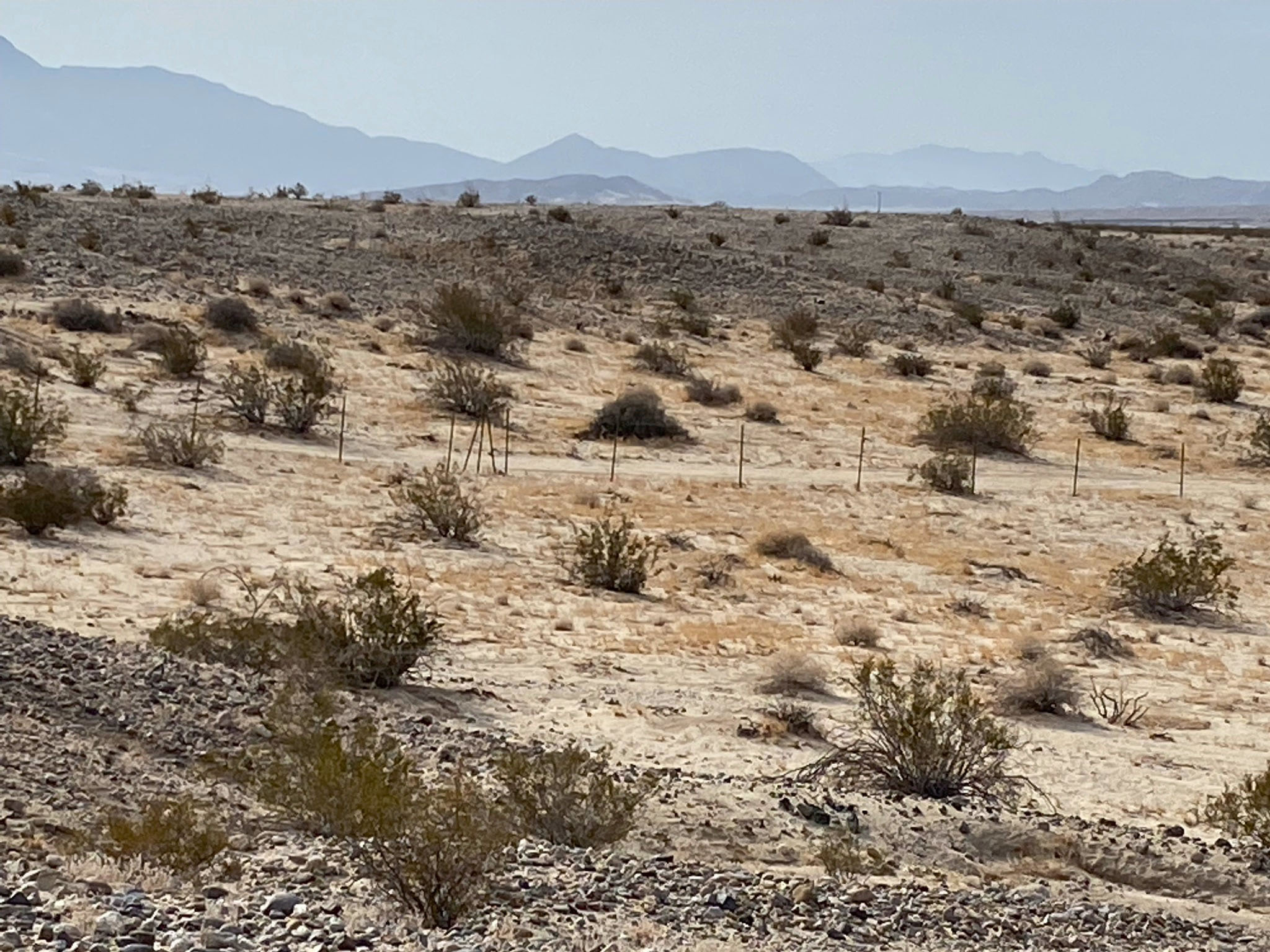
Grand-Scale Landscape Feature: The size and age of the Elsinore Fault has left a wide variety of landscape features on many scales ranging for large scale (such as mountain fronts, linear troughs, horsts and grabens) to small scale, local features (including low scarps in alluvium, sag ponds, offset streams, beheaded drainages, and shutter ridges)(Figure 15).
See
Geomorphic Expression Of Faults: Landscape Features Associated With Strike-Slip and Oblique-Slip Fault Zones: Fault-Related Terminology With Illustrations.
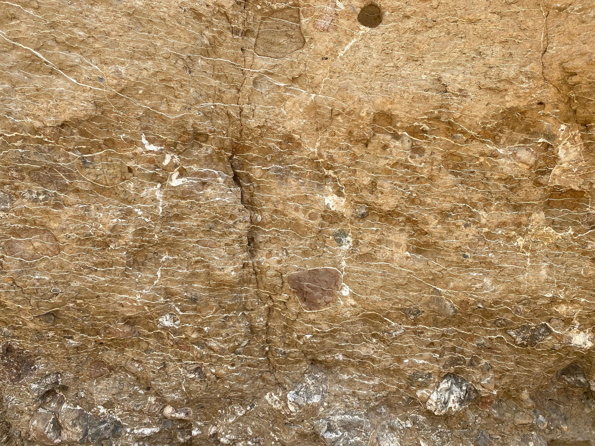
In many places, the large faults are hidden by a cover of Holocene and Pleistocene sediments, typically alluvium and fan deposits. Surface rupture can open cracks and create fault scarps. However, is unconsolidated sediments these feature tend to erode, fill in, or degrade over time. However, seismologists target such deposits to dig trenches because they often preserve materials that can be radiometrically dated and preserve characteristics that can be used to determine past earthquake frequency and intensity.
|
Fig. 14. Geomorphic features associated with geologically active strike-slip faults (from Wallace and Veddar, 1970). |
Elsinore Fault Zone - Study Areas & Maps
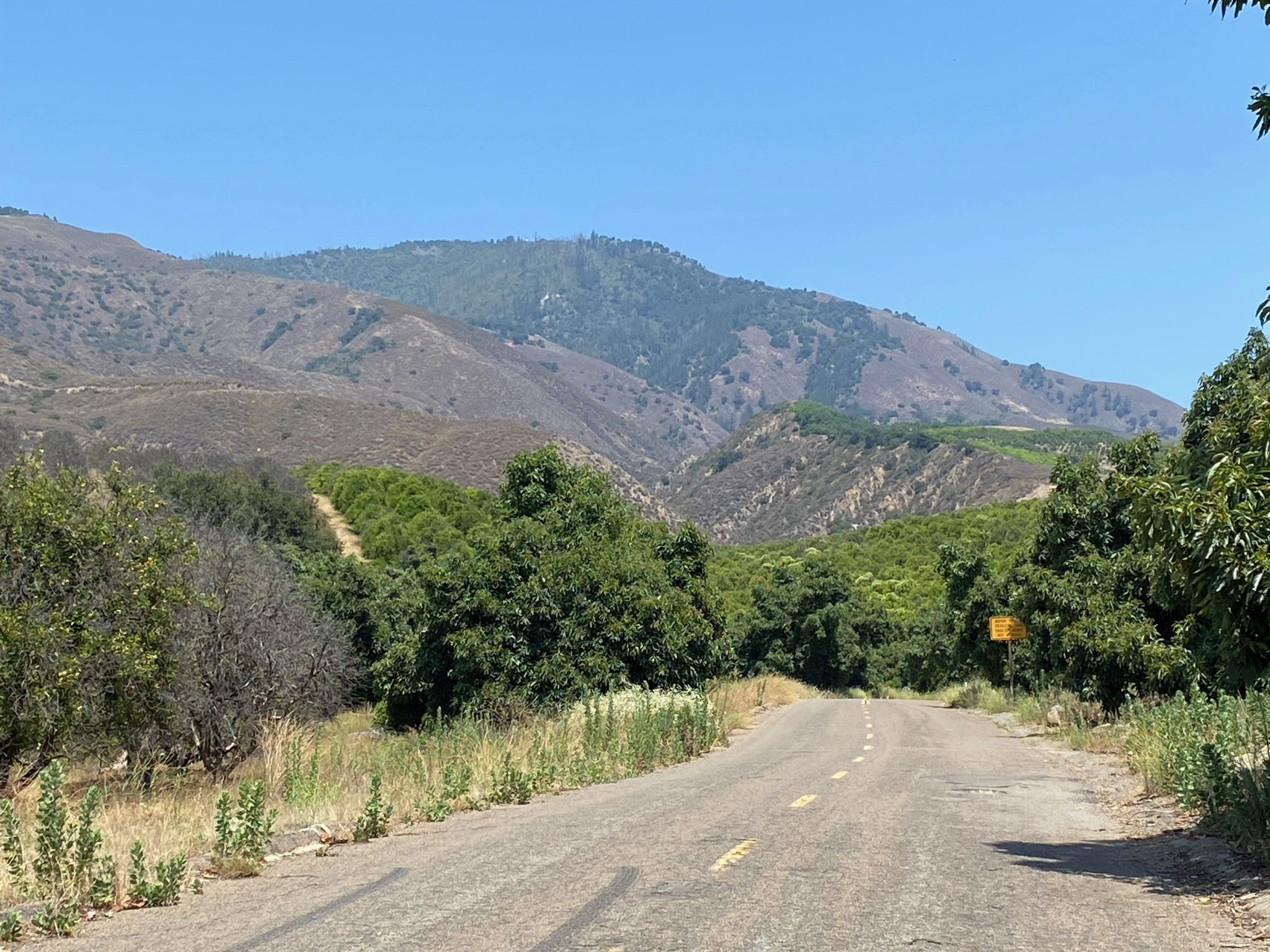
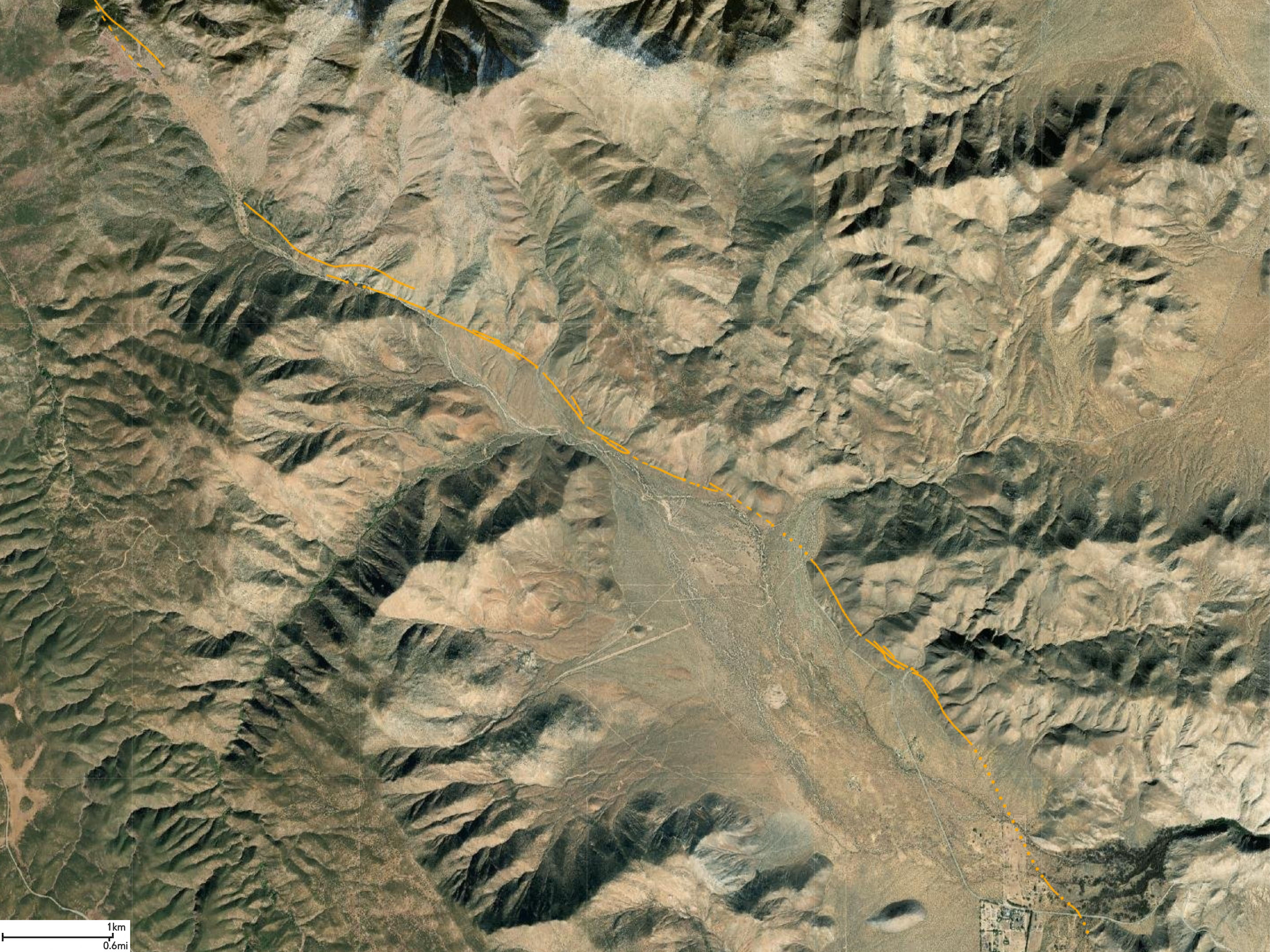
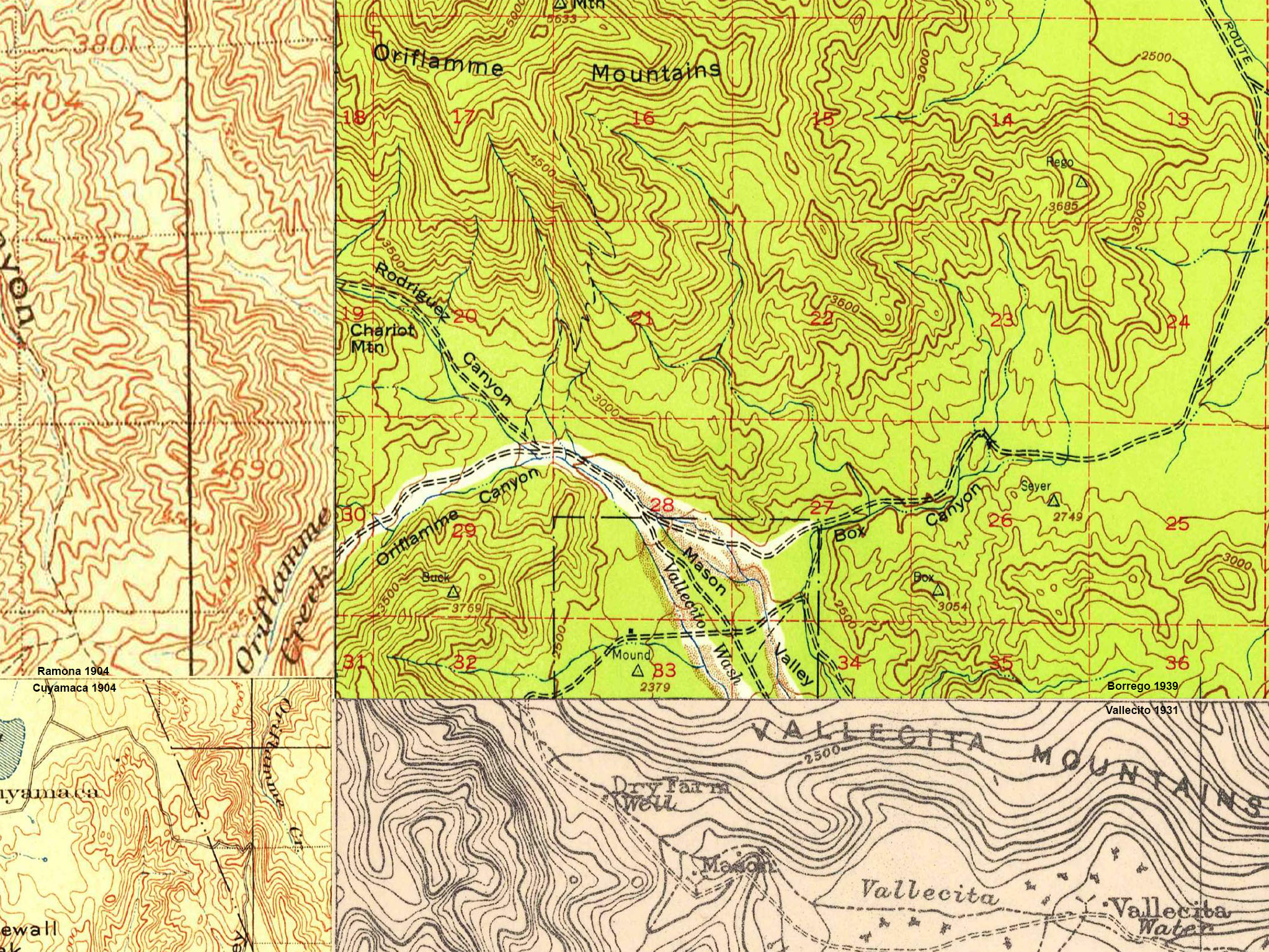
There are 21 study areas along the Elsinore Fault Zone presented below. Each section includes a geographic map (with stop localities shown as red dots), a satellite map (with fault lines added), and a geologic map (various sources listed in the Resources Section below). The fault lines shown on the maps and satellite images presented below were derive from the Quaternary Folds and Faults Database of the United States (QFFDUS). The original images derived from the database have been slightly modified and enhanced to bring out clarity of relief and landscape features, and identifying labels have been added to help navigate to features and locations to be potentially investigated. QFFDUS IDs are added to provide access to more detailed technical reports listed for each of the seven sections of the Elsinore Fault Zone being investigated here. Note that names of faults and features may have changed over time in the literature going back over a century.
The purpose of this investigation/website: This website is being prepared in anticipation of camping field trips for students in classes at Miracosta Community College (and elsewhere). Students will be using this website to learn to recognize fault-related landscape features, to learn to navigate using maps and imagery to potential investigation sites. To cover the entire fault zone adequately would take several days on field trips, but it can easily be followed "virtually" using Google Earth (discussed below). |
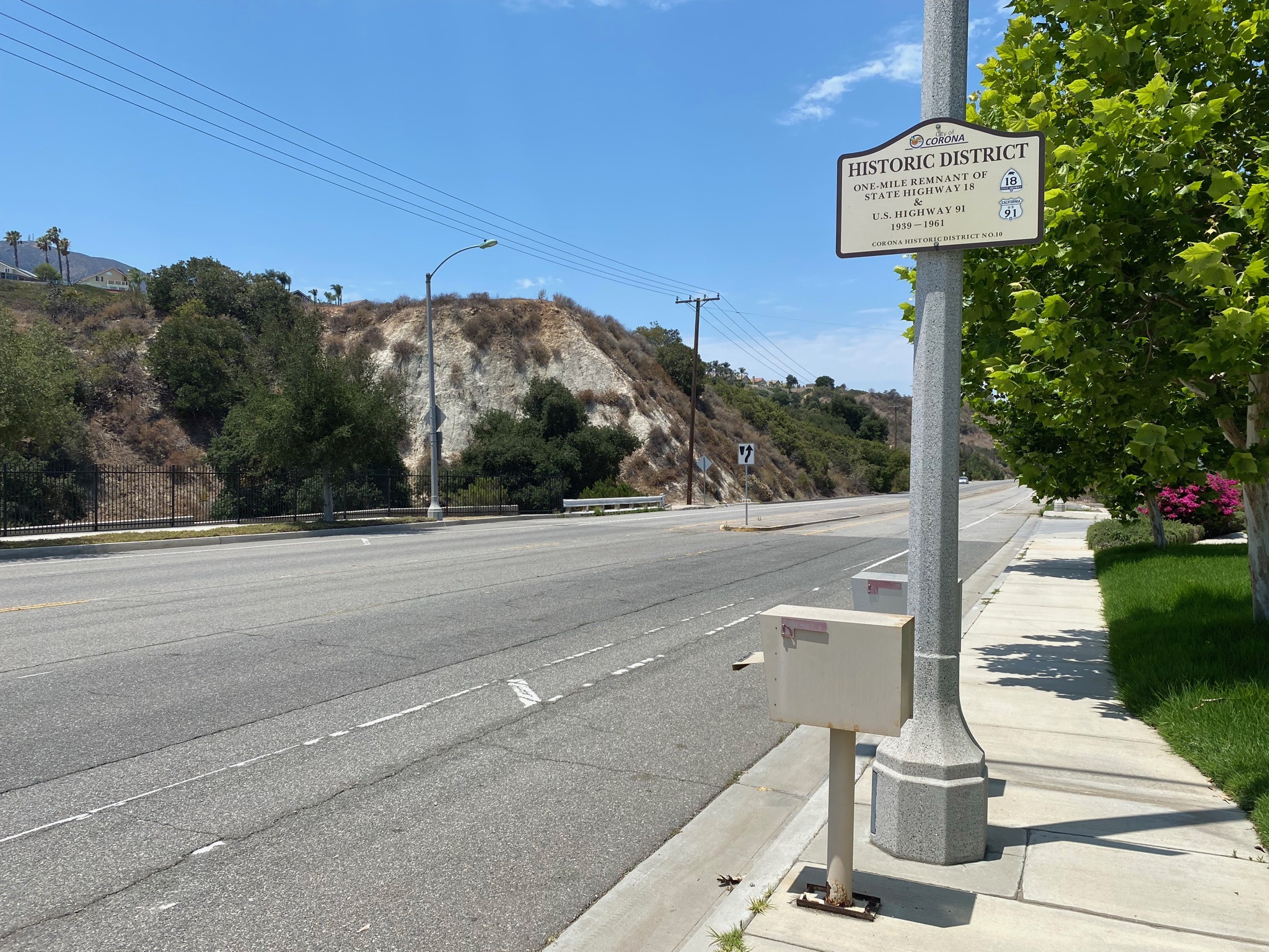
Corona CA: Where the Whittier Fault, Chino Fault, and Glen Ivy Fault Sections Converge
In the vicinity of CA Highway 91 in Corona, CA, the Elsinore Fault Zone splits into three sections in a left-tilted "Y" fashion.
To the northwest is the Whittier section (also known as the Whittier Fault) runs along the southwest-facing mountain front of the Puenta Hills (or Chino Hills). It continues northwest from the Corona area to the Whittier region of Los Angeles (a distance of about 20 miles). At the northwest end of the Puente Hills, the Workman Hill and Whittier Heights faults appear to split from the Whittier Fault and disappear under alluvial cover in the LA basin region.
To the north is the Chino section (also known as the Chino Fault) that runs along the southwest-facing mountain front of the Puenta Hills (or Chino Hills). The Chino section follows CA Highway 71 north about 5 miles before petering out in the Los Serenos Country Club area. To the north the fault probably continues as the Central Avenue Fault northward into the Chino/Pomona region of Los Angeles (a distance of about 12 miles). (Older reports call the Chino Fault the Central Avenue Fault.)
South of CA Highway 91 in Corona, the Chino Fault and Whittier Faults converge and continues south as the Glen Ivy section of the Elsinore Fault Zone. The fault zone follows the mountain front along the southwest side of Corona, CA. The Glen Iva section runs along the Interstate 15 corridor between Corona and Lake Elsinore (a distance of about 18 miles). |
Study Area 1 - Whittier Fault and Chino Fault Sections
The Whittier and Chino faults are bounding faults on either side of the Puenta Hills/Chino Hills uplift (a large horst block or plateaus/mesa with exposed Tertiary-age riddled with canyons; Figure 1-5). The Santa Ana River flows through a canyon carved between the Chino Hills and the Santa Ana Mountains to the south. The gap of this canyon is located in the vicinity where the the Whittier and Chino faults converge to become part of the Glen Ivy section of the larger Elsinore Fault Zone that continues toward the south. There eroded landscape of the Chino Hills and southern stand out on the satellite map. Note that the alluvium-fill basins are largely covered with urban development. The faults in the region are relatively younger than the late Tertiary sedimentary exposed in the hillsides, suggesting that the fault began to form in late Pliocene to Early Pleistocene time (between about 2-3 million years ago). |
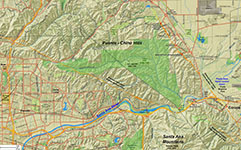
Fig. 1-1. Faults/location map |

Fig. 1-2. Faults/satellite map |
Fig. 1-3. Geologic map |
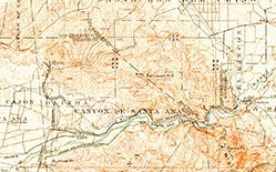
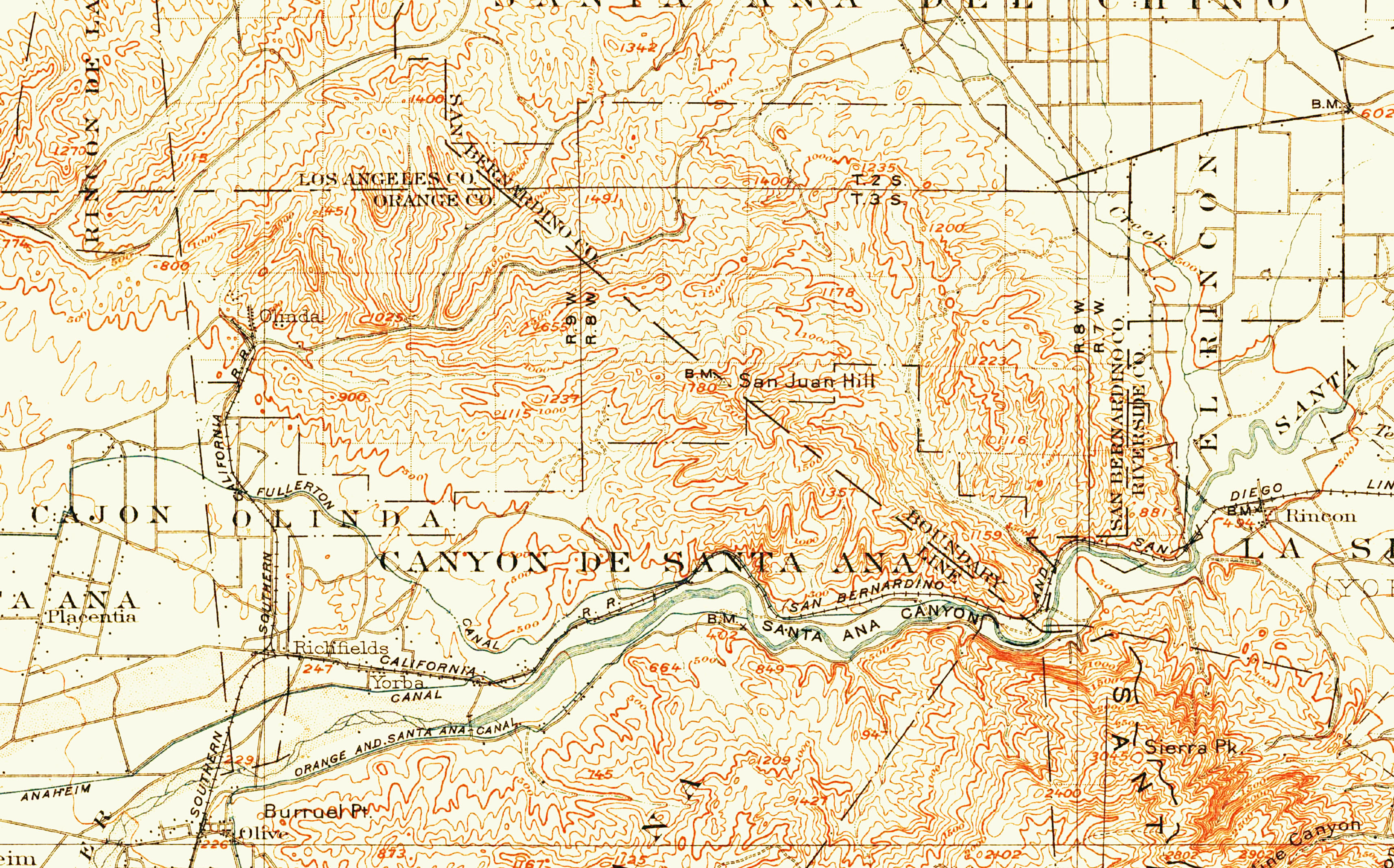
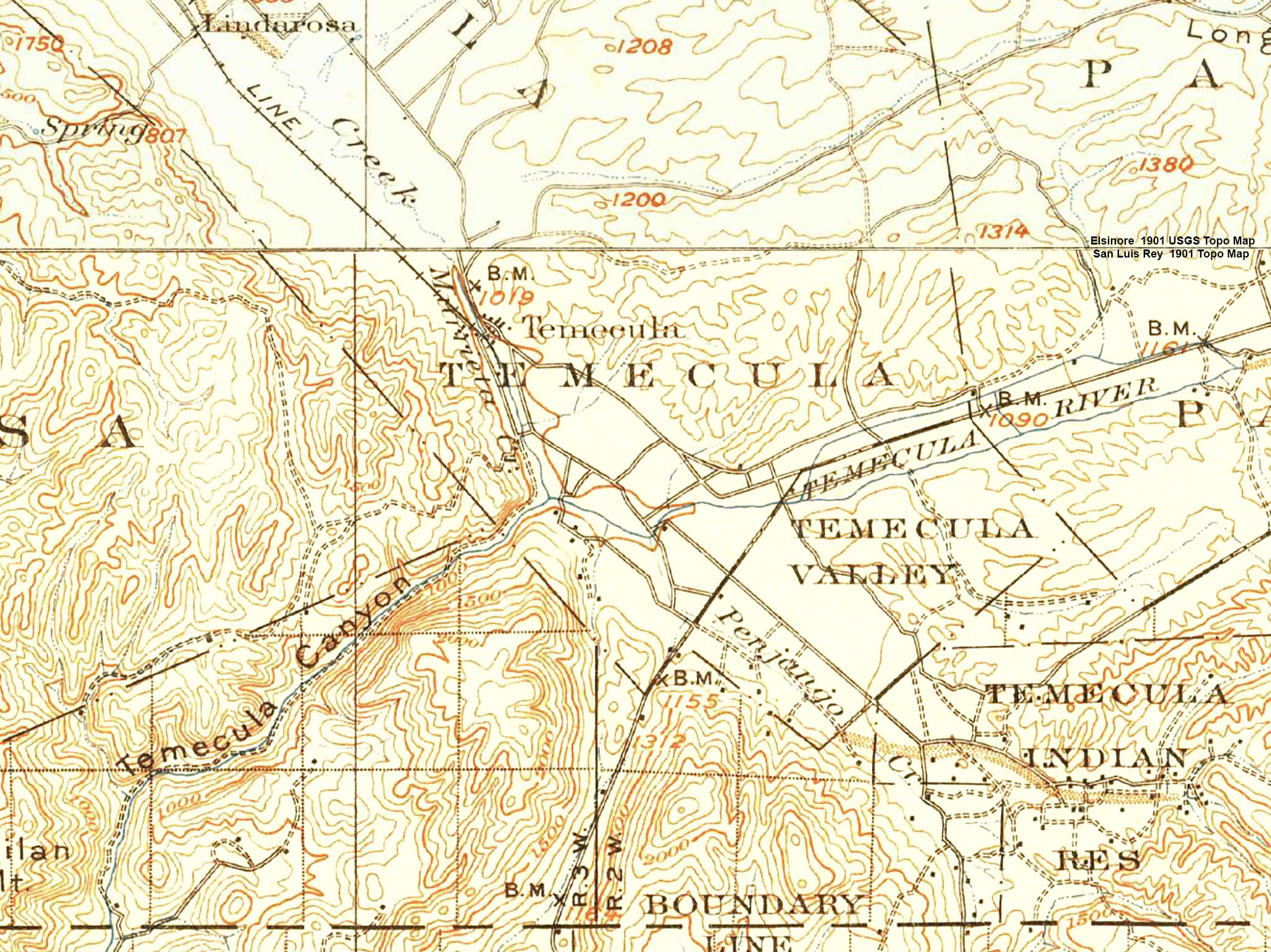
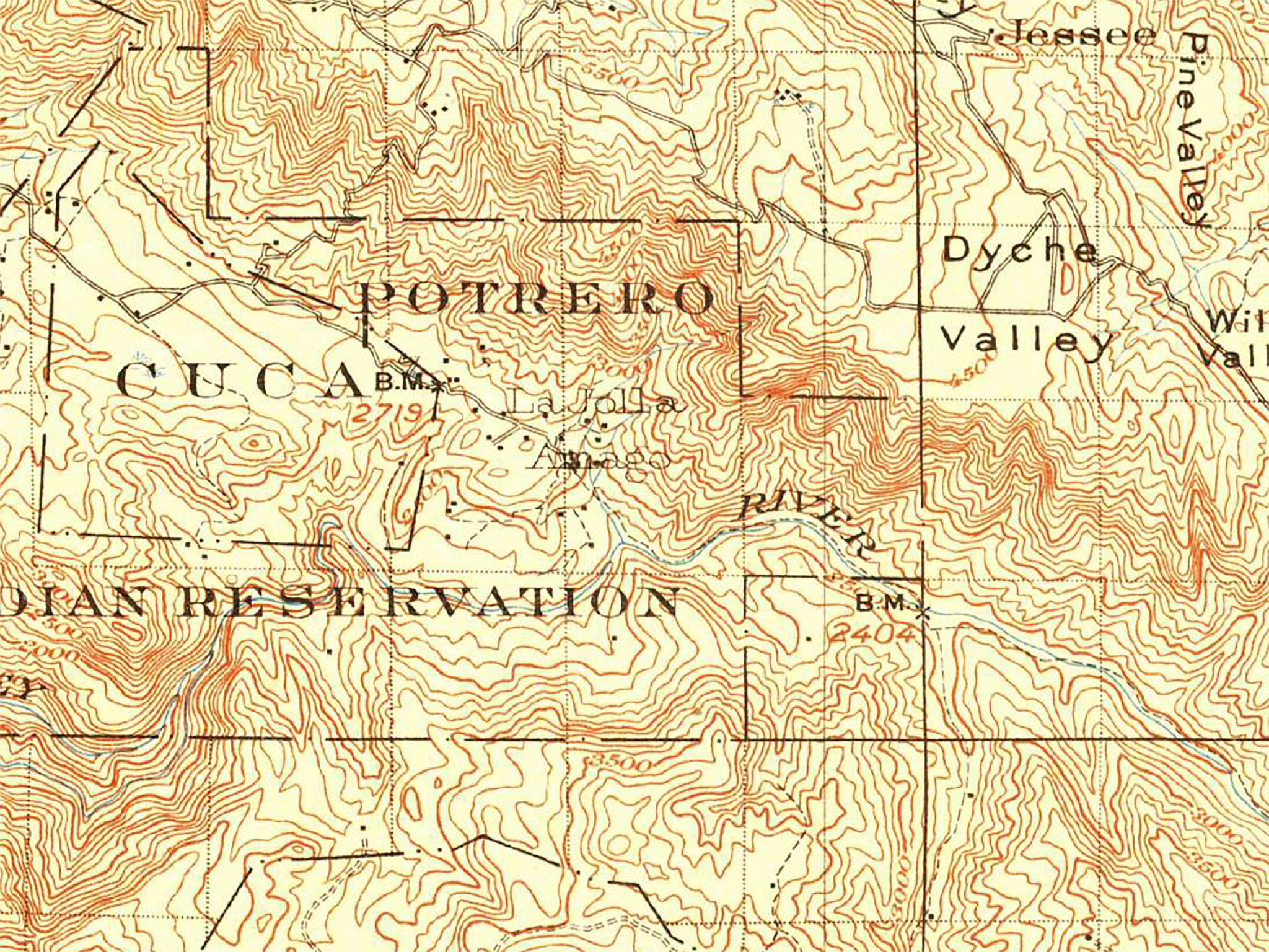
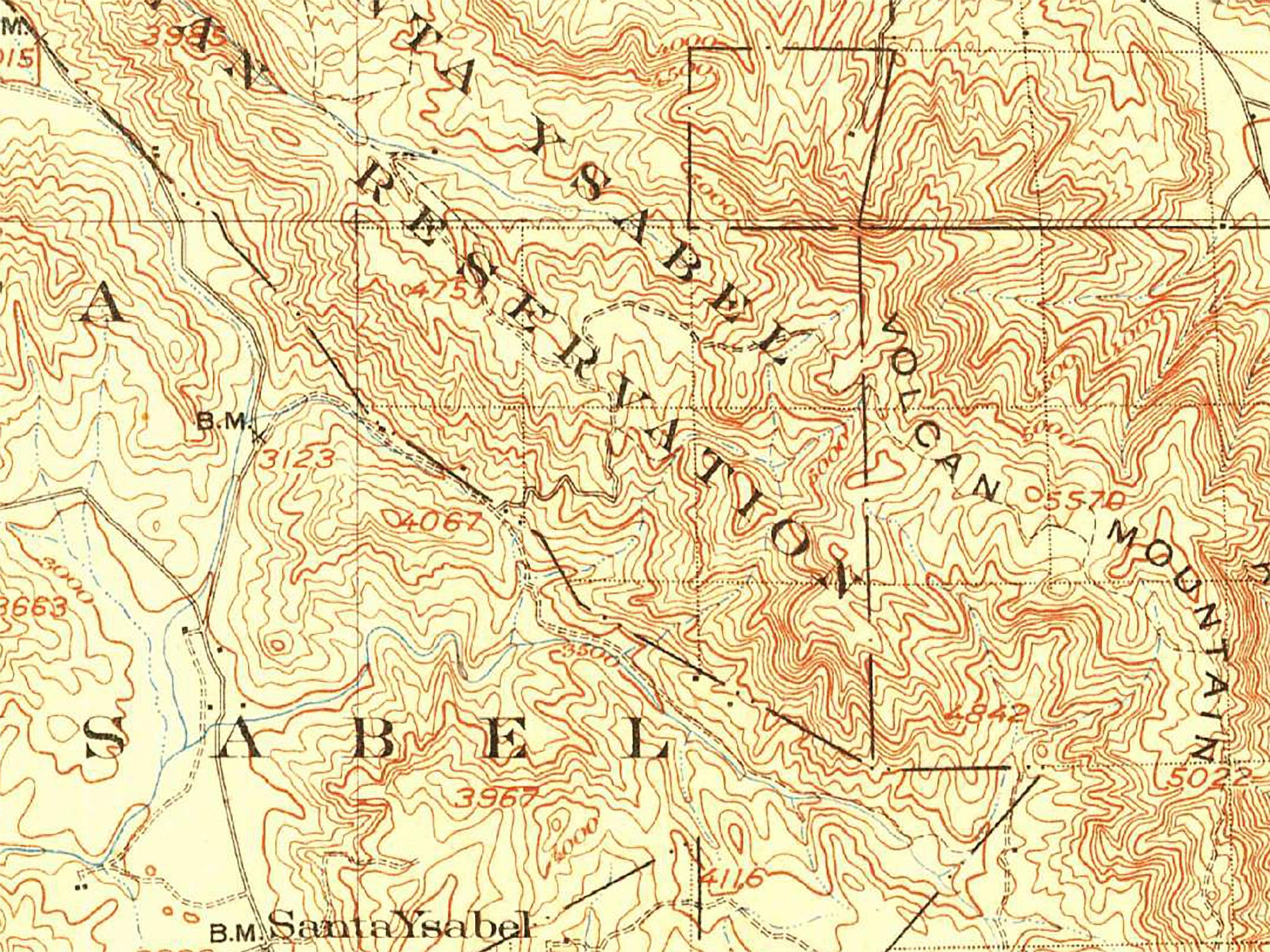
Fig. 1-4. 1902 USGS topo map |
|
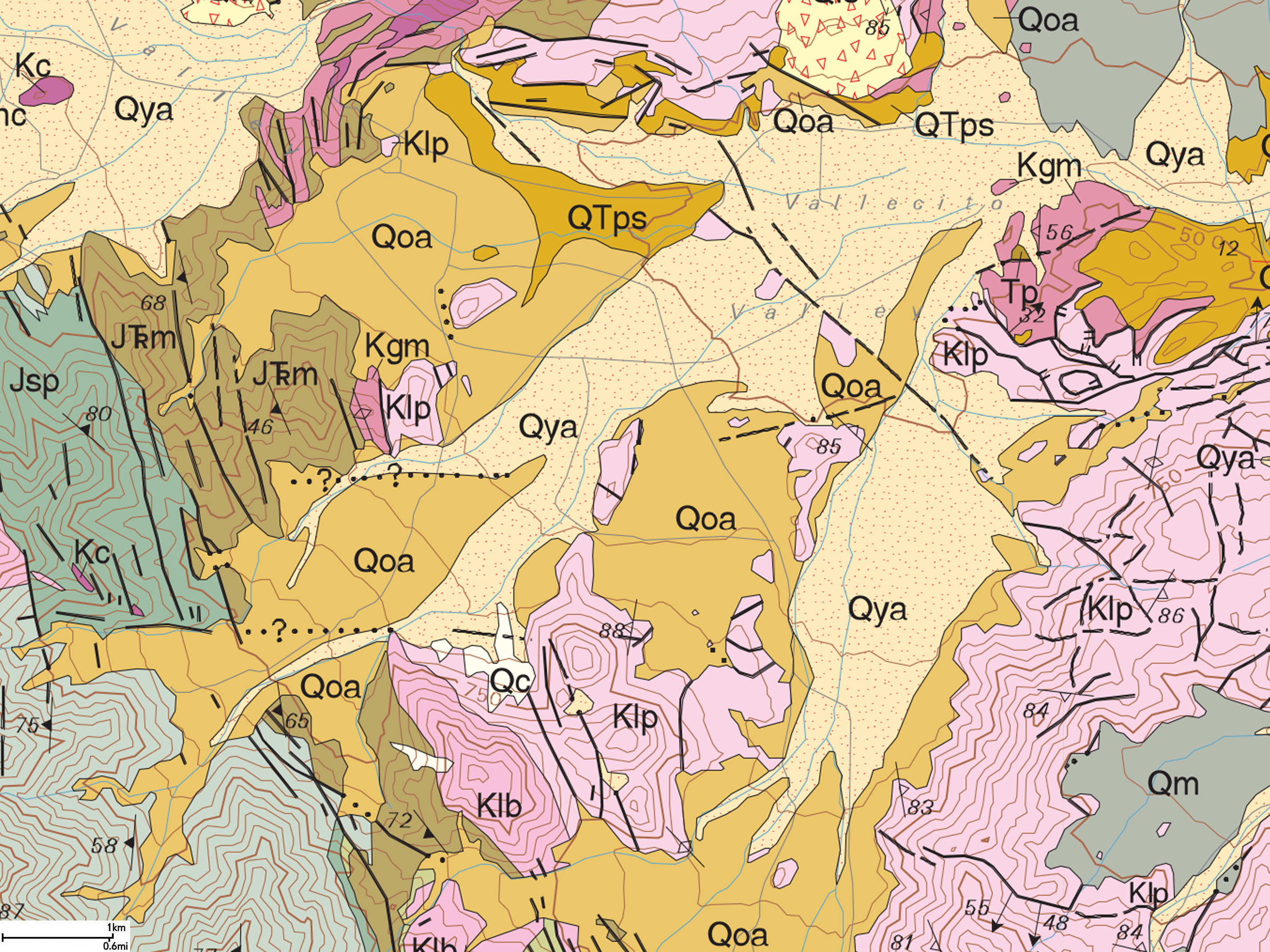
| Note on the geologic maps symbols and colors: "Q" - Quaternary alluvium and very old floodplain deposits shown on the geologic map), "T" symbols are for Tertiary sedimentary rocks, and "K" stands for Cretaceous rocks (mostly crystalline granitic and metamorphic rocks). See Morton and Miller (2006) for more detailed information about map symbols from which this and following maps were partly derived. |
Whittier Fault (Modified from SCEDC summary)
- TYPE OF FAULT MOTION: The Whittier Fault displays right-lateral strike-slip with some reverse slip.
- FAULT ORIENTATION:
The average strike is N70°W; the fault plane dips to northeast at low-angle to near vertical (90°). The right-lateral displacement of about 40:1 ratio (D:R) as indicated by Rockwell, Gath and Gonzalez (1992).
- LENGTH: about 16 miles (36 km)
- LOCATION: Orange County and Los Angeles County; It extends along the west side of the Puente Hills (Chino Hills), from Whittier in the northwest to the Santa Ana River on the southeast.
- NEAREST COMMUNITIES: Yorba Linda, Hacienda Heights, Whittier
- MOST RECENT SURFACE RUPTURE: Holocene. Last event occurred between 1400 and 2200 yr BP with a minimum of 1.9 m of dextral offset (Patterson and Rockwell, 1993; Working Group on California Earthquake Probabilities, 1995).
- SLIP RATE: between 2.5 and 3.0 mm/yr
- INTERVAL BETWEEN MAJOR RUPTURES: unknown
- PROBABLE MAGNITUDES: Mw6.0 - 7.2
- GEOMORPHIC EXPRESSION:
Large dextral stream deflections (>1 km) document Quaternary displacement; smaller stream offsets, side-hill benches, linear drainages express Holocene activity.
- OTHER NOTES: The Whittier Fault was named by English (1926). QFFDUS ID: Elsinore Fault Zone, Whittier section 126a.
|
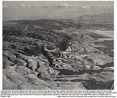 |
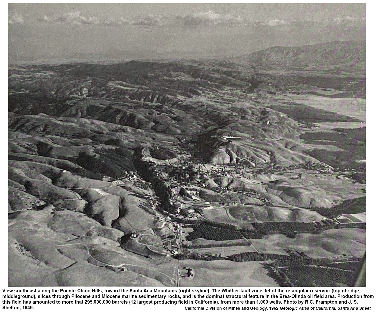
Fig. 1-5. Historic aerial photograph, caption states:
"View southeast along the Puente-Chino Hills, toward the Santa Ana Mountains (right skyline). The Whittier fault zone, left of the rectangular reservoir (top of ridge, middle ground), slices through Pliocene and Miocene marine sedimentary rocks, and is the dominate structural feature in the Brea-Olinda oil field area. Production from this field has amounted to more that 295,000,000 barrels (12 largest producing field in California), from more than 1,000 wells. Photo by R.C. Frampton and J. S. Shelton, 1949."
From California Atlas of Geology, California Division of Mines and Geology, 1964. |
|
Chino Fault (Modified from SCEDC summary)
- TYPE OF FAULT MOTION: right-reverse (oblique slip)
- ORIENTATION: Average strike: N42°W; the dip of this fault plane is to the southwest (50–67° W).
- LENGTH: 13 miles (21 km)
- LOCATION: Riverside and San Bernardino Counties; the fault runs along the southwest flank of the the Chino/Puente Hills and merges with other faults in the northern end of Glen Ivy section of the Elsinore Fault Zone near Corona.
- NEAREST COMMUNITIES: Corona, Chino
- MOST RECENT SURFACE RUPTURE: Late Quaternary to early Holocene.
- INTERVAL BETWEEN MAJOR RUPTURES: unknown
- PROBABLE MAGNITUDES: Mw6.0 - 7.0
- RECENT EARTHQUAKE: The Mw 5.4 Chino Hills earthquake occurred in the area on 29 July, 2008.
- SLIP RATE: between 1 and 5 mm/yr
- GEOMORPHIC EXPRESSION: Saddles, deflected drainages, linear drainage, modified scarps.
- OTHER NOTES: The Chino Fault was named by English (1926). QFFDUS ID: Elsinore Fault Zone, Chino section 126b.
|
Places to Check Out On A Field Trip:
Chino Fault Section (northern part)
If you plan to check out the Chino Hill Fault it would be easiest to start the field trip by going first to the Chino Hills State Park area, then work your way south before going to the Whittier Hills area on Green Valley Road (discussed below). The problem with accessing the Chino Hills and Whittier Fault sections is that most of the associated is inaccessible (on fenced-off or private land with "no trespassing" signs).
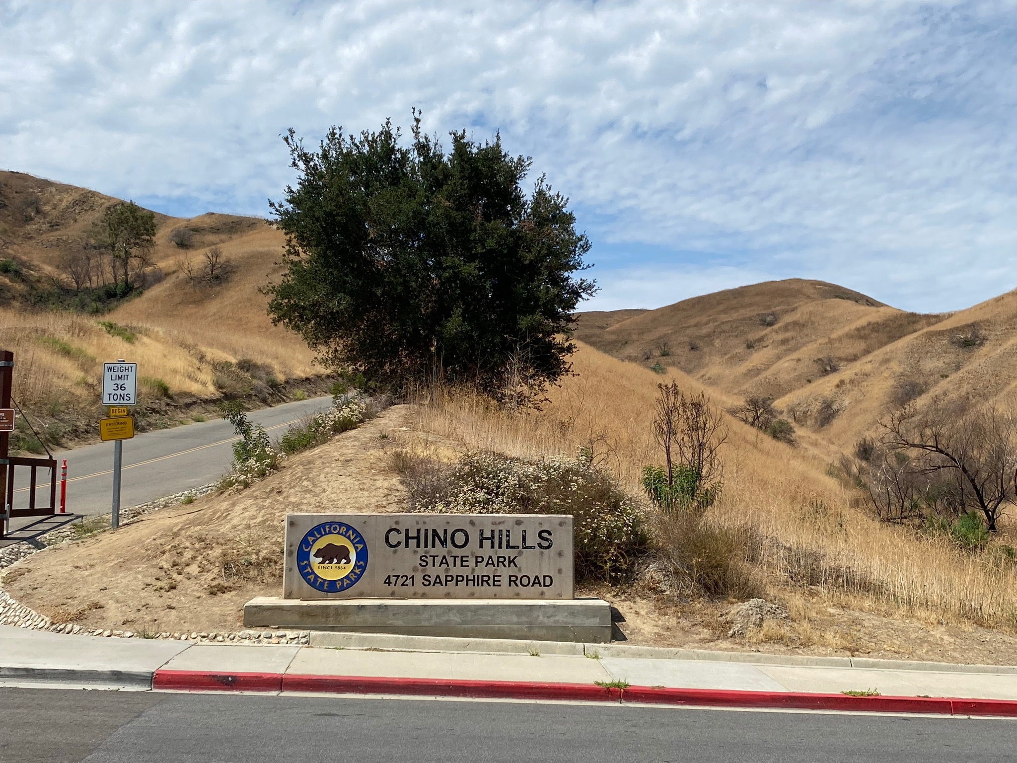
Chino Hills State Park: To get to the Chino Hills SP, take Highway 71 to Exit 7 (Central Ave./Soquel Canyon Rd). Follow Soquel Canyon Road west about 1 mile and turn left on Elinvar Drive. In less than 1/4 mile the road curves to the right (becoming Sapphire Rd). The North Entrance of Chino Hills State Park is on the right (Figure 1-6). The park requires an entrance fee and there are campground facilities available (make reservations online). The park road follows Bane Canyon, a straight canyon that probably formed along a subsidiary parallel fault strand of the Chino Fault (Figure 1-7). Note that the grassy hills cover the soft, easily eroding hills of soft Pliocene-age sediments that underlie the Chino Hills area. Note that the Bane Canyon Road that goes into the park is one lane (with pull offs with "no parking" signs) until you get to the park entrance pay station. Watch out for bikes on this narrow road.
Note that you don't have to go into the park to see the trace of the Chino Fault. Park on Sapphire Road just east of the Chino Hills State Park entrance sign. The mapped trace of the Chino Fault crosses Sapphire Road a couple hundred feet east of the sign. You can look north across the valley and follow the trace of the fault where it disappears into the distant Los Angeles Basin area between Pasadena and San Bernardino with the San Gabriel Mountains in the distance to the north (Figure 1-8). In the foreground you can see the escarpment of the Chino Fault in the vicinity of nearby Alterra Park.
Alterra Park: This small community park is an easy place to get a view of the Chino Fault. Return back down Elvinar Drive and turn right on Soquel Canyon Road. The entrance to Alterra Park is 800 feet downhill on the right. There is a nice parking lot with public restrooms. The Chino Fault (with scarps) passes through the canyon just east of the park playground (Figure 1-9). A small deflected stream drainage reveals the location of the fault on the north side of Soquel Canyon Road.
Butterfield Ranch Road: Continue downhill on Soquel Canyon Road and turn right on Butterfield Ranch Road. Butterfield Ranch Road roughly parallels the Chino Fault as it cuts across the eastern mountain front along the Chino Hills. Note that there is no parking along the road, and it is a bit difficult to pick out fault scarps and associated fault-related features because erosion of the soft sediments quickly modifies landscape features over time.
It is important to note that the historic Butterfield Overland Stagecoach Route basically follow the Elsinore Fault Zone along many parts of its path (Stibbe, 2018). The stage route was active through the Chino area between 1858 to 1861.
Butterfield Ranch Road at Park Crest Drive: An open field area along Butterfield Ranch Road is located on the east side of the road across from the intersection with Park Crest Drive. This grass-covered slopes in this area displays landscape features that hint of the local fault zone including offset streams, side-hill benches, and scarp, although they are heavily eroded (Figure 1-10). Signs say "keep out" and there is no parking on the road, but you can see local folks walking their dogs on the uphill old road grade of Park Crest Drive (closed to traffic). The road crosses the fault about 1000 feet up the old road.
Butterfield Ranch Elementary School: Continue south on Butterfield Ranch Road and turn right on Mystic Canyon Drive. The parking area for Butterfield Ranch Elementary School is on the left about a half-mile up the road. The Chino Fault is mapped crossing through the parking lot (not visible because is was scraped during construction). However. the fault scarp associated with a pressure ridge is behind an just north of the school building (Figure 11). The fault crosses Mystic Drive and trend northward across the steep and eroded hillside north of the school. A lone oil well can be seen on the hillside above the fault zone (Figure 1-12).
Whittier Fault Section
From this location it make sense to get back on Highway 71 south at the Euclid Ave./Butterfield Ranch Road exit and drive south. You can get good views of the steep east-facing slopes of the Chino Hills as you drive south, but there is no place to stop along the highways. Take the exit to Highway 91 East (toward "Beach Cities"). Stay in the right lane and take Exit 44 for Green River Road.
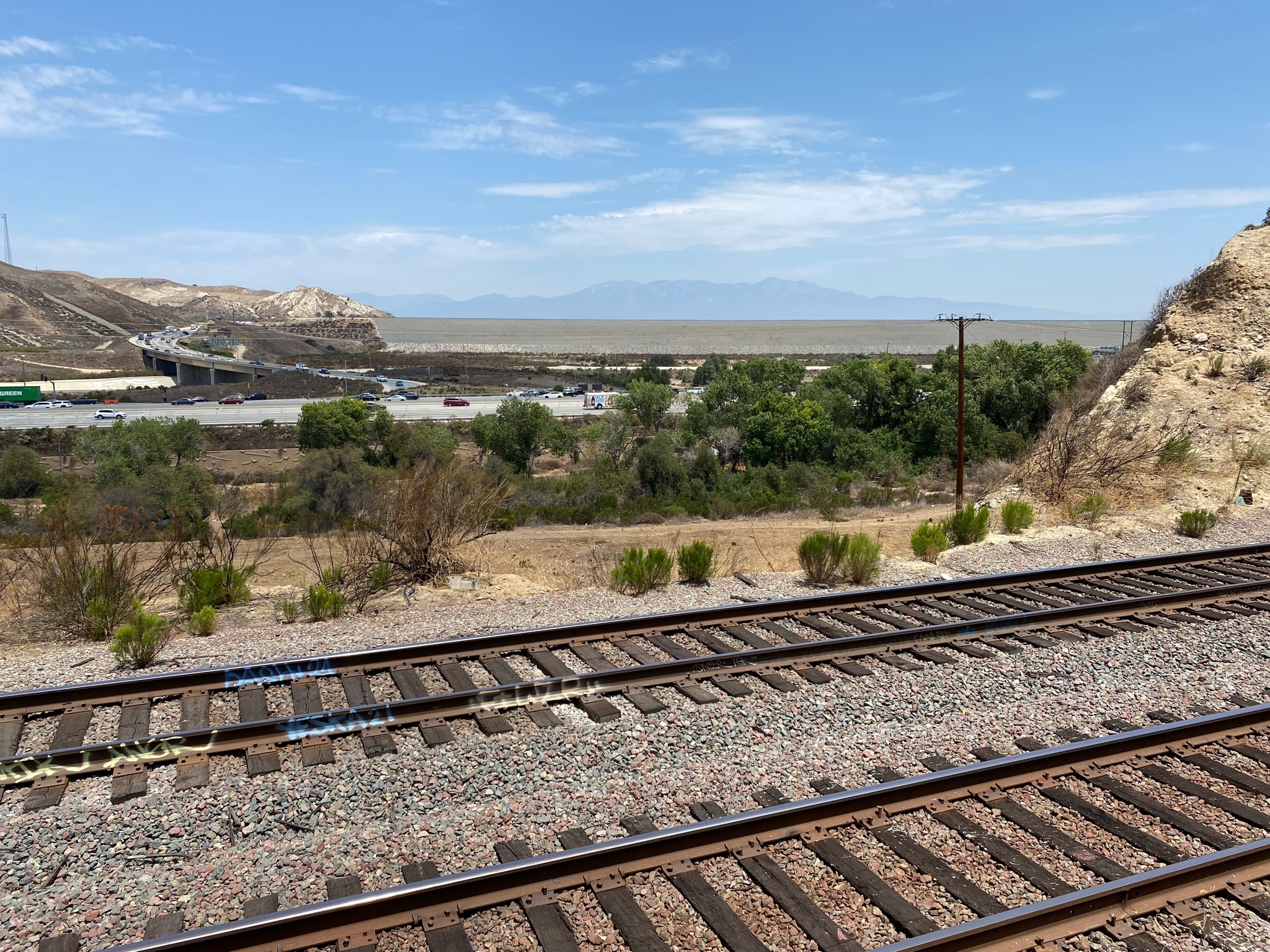
Fairview - Green River Golf Course: : To get to the Green River Golf Course, take Exit 44 (Green River Rd) on Highway 91 (west of Corona, CA). Take Green River Road north and follow it as it become the frontage road along west-bound Highway 91. Cross the Santa Ana River bridge then bear right up the hill and park in the Fairview Golf Clubhouse parking lot. This is easy location to park, have a meal, and even hit some golf balls while you contemplate the local geology. The Santa Ana River Trail passes through the golf course and runs along the southern flank of the Chino Hills upstream to Prado Dam. The Whittier Fault is masked by alluvial deposits along the Santa Ana River in the vicinity of the golf course (Figure 1-13).
The golf course is located on bluffs along the south side of the Santa Ana River. It is in the vicinity just west of the golf course where the Whittier Fault section crosses the canyon from along the mountain front of the Chino Hills (Figure 1-14). Whittier Fault is obscured or buried beneath alluvial sediments and plant cover along the river where it basically peters out. However, the fault zone continues as the Glen Ivy Fault section on the mountainside the south of Highway 91 (on the northeastern flank of the Santa Ana Mountains). Features of the fault zone are visible high on the mountainside as a side-hill bench . Figure 1-15 shows where the a narrow stream canyon cuts through a gap in a shutter ridge (associated with the side-hill bench).
Chino Fault (southern part)
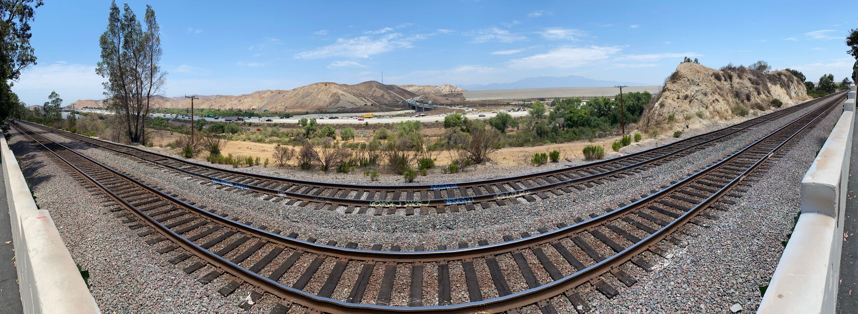
Santa Ana River Trail to Prado Dam: The Santa Ana River Canyon follows the boundary between soft, Pliocene-age sedimentary rocks that dominate the Chino Hills region, and the older, mostly Cretaceous age crystalline rocks of the Santa Ana Mountains to the south. The steeply dipping Pliocene sedimentary beds crop out along the north side of the canyon (Figures 1-16). The mapped trace of the Chino Fault crosses the area at the west side of the Prado Dam (a Corp of Engineers earthen dam completed in the 1941). The Santa Ana River Trail runs along the north side of the canyon to the dam area. This partially pave bike path connects with the the parking area at the Green River Golf Course (mention above)—a bike-ride distance of about 2.5 miles to get from the golf course to Prado Dam spillway crossing.
Another park trail starts Prado Road next to the Highway 91 overpass leads down to the spillway area on the south side of the dam. This trail provides a view of mouth of canyon near the dam (Figure 1-17). To get there from the golf course, follow the Green River Road back to the stoplight and turn left on Crestridge Drive. Cross the railroad tracks bridge and turn right on Prado Road. The trailhead is on the left just before you go under the Highway 91 overpass.
Palisades Drive Stops (Between Green River Road and Serfas Club Drive): Follow Green River Road over the Highway 91 overpass and in about 1/2 mile turn left on Palisades Drive. Palisades Drive roughly follows Wardlow Wash, the railroad line, and Highway 91 for a bit. A good view across the mouth of the canyon and Prado Dam is optional in this area near the CubeSmart self-storage facility at the intersection, but you will have to park down the road and walk back (Figures 1-18 and 1-19).
Chino Fault at Wardlow Wash on Palisades Drive: About 3/4 mile from the intersection of with Green River Road, Palisades Drive crosses a bridge over Wardlow Creek (Figure 1-20 and 1-21). One of the mapped strands of the Chino Fault basically follow the linear creek drainage from the bridge southward. To continue, follow Palisades Drive to the stoplight and turn right on Serfas Club Drive. Serfas Club Drive crosses the Chino Fault in the vicinity an narrow greens pace corridor a couple hundred feet south of the intersection (Figure 1-22). You can see the linear escarpment (or pressure ridge) along the fault zone in this area.
Continue to the Glen Ivy Section of the Elsinore Fault Zone below (Study Area 2). |

Fig. 1-6. Chino Hills State Park north entrance is just a couple hundred feet west of the Chino Fault trace.
|
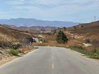
Fig. 1-7. Chino Hills SP --straight valley south of the park entrance with Santa Ana Mountains in the distance.
|

Fig. 1-8. View looking north along Chino Fault valley above Alterra Park with distant San Bernardino Mountains. |
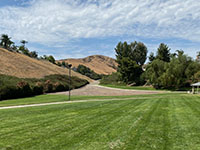
Fig. 1-9. View looking south at Chino Fault scarp in Alterra Park with Chino Hills State Park in distance. |
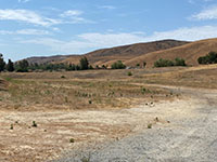
Fig. 1-10. Faulted landscape (eroded scarps and benches) of the Chino Hills along Butterfield Ranch Road across from Park Crest Drive. |
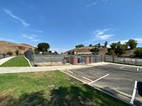
Fig. 1-11. Butterfield Ranch Elementary School with fault scarp of a strand of the Chino Fault behind building and north end of the parking lot. |
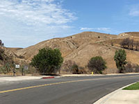
Fig. 1-12. View of Chino Hills near Chino Fault trace across the street from Butterfield Ranch Elementary School with an oil well on the hillside. |
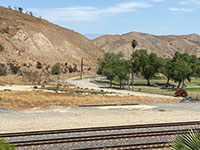
Fig. 1-13. Chino Hills on the north side Green River Golf Course near the Santa Ana River where the Whittier Fault peters out at its eastern end. |
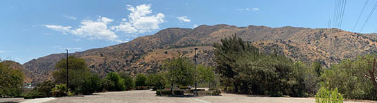
Fig. 1-14. Panoramic view of where the Whittier Fault crosses Highway 91 into the northern end of the Santa Ana Mountains (it transitions into the Glen Ivy section of the Elsinore Fault Zone). This view is looking south from the parking lot of the Fairview - Green River Golf Course on the north side of the Santa Ana River. A side-hill bench runs along the mountain front about half-way up the mountainside. |

Fig. 1-15. The fault zone cuts through a canyon gap across northeast end of Santa Ana Mountains and continues south along the mountain front. |
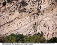
Fig. 1-16. Outcrop of Late Tertiary sandstone beds exposed along the Santa Ana River Canyon near Corona. |
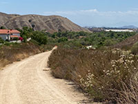
Fig. 1-17. Prado Road park trail leads to Prado Dam where Chino Fault crosses at the mouth of Santa Ana Canyon. |

Fig. 1-18. Panoramic view looking north at the mountain front of the Chino Hills on south side of Santa Ana River near Prado Dam from near intersection of Green River Road and Palisades Avenue. (No easy parking at this location.) |
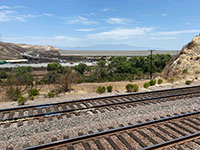
Fig. 1-19. Zoom view of Prado Dam from near intersection of Green River Road and Palisades Avenue. |
Fig. 1-20. Chino Fault crosses Palisades Avenue at Wardlow Wash. The stream channel follows the fault line. |
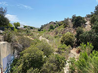
Fig. 1-21. View looking south along the fault zone straight canyon of Wardlow Wash from Palisades Avenue Bridge. |

Fig. 1-22. Chino Fault zone in green space area along Serfas Club Drive. This view is on the north side of the road. |
|
Glen Ivy Section (Elsinore Fault Zone)
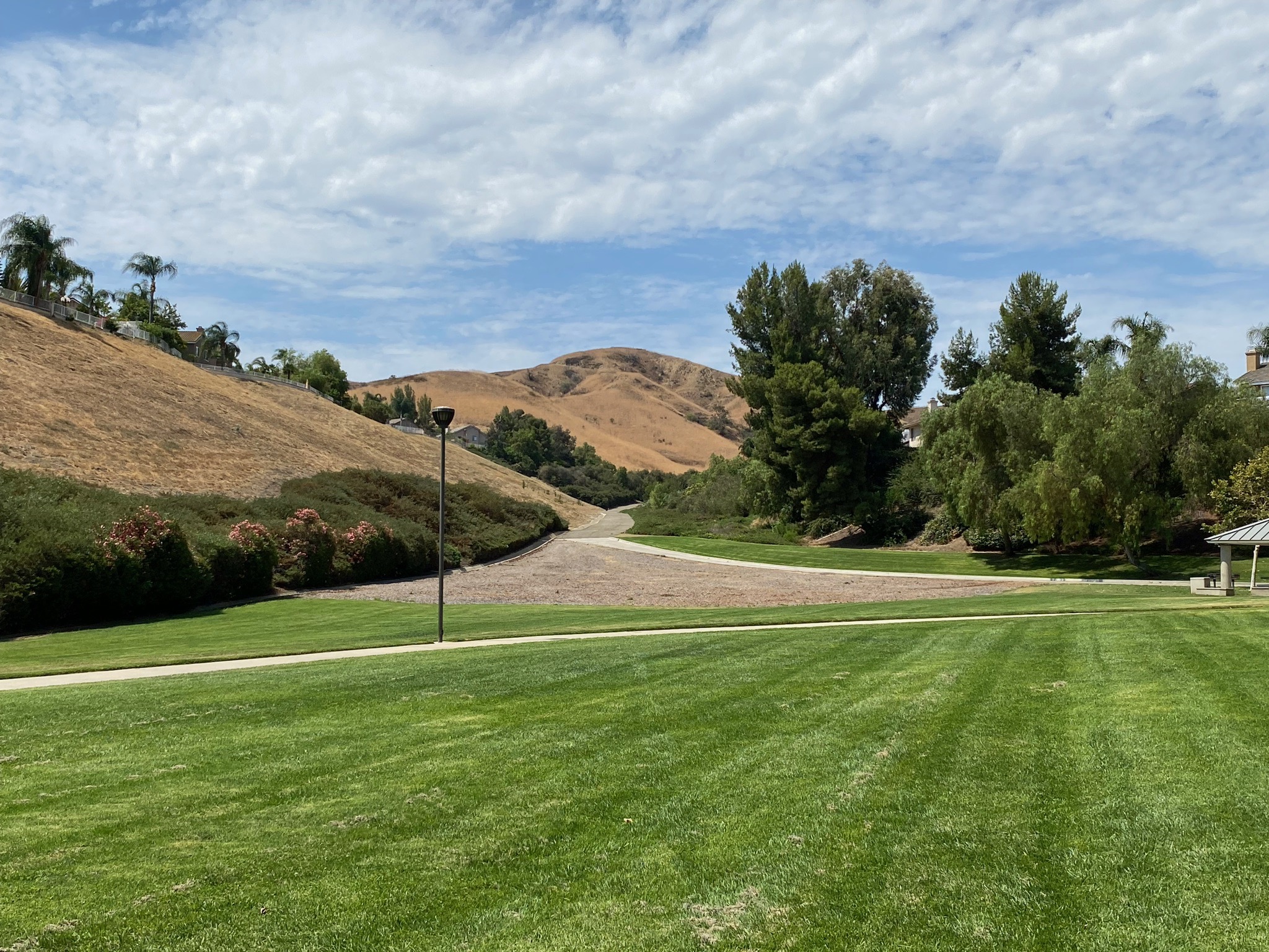
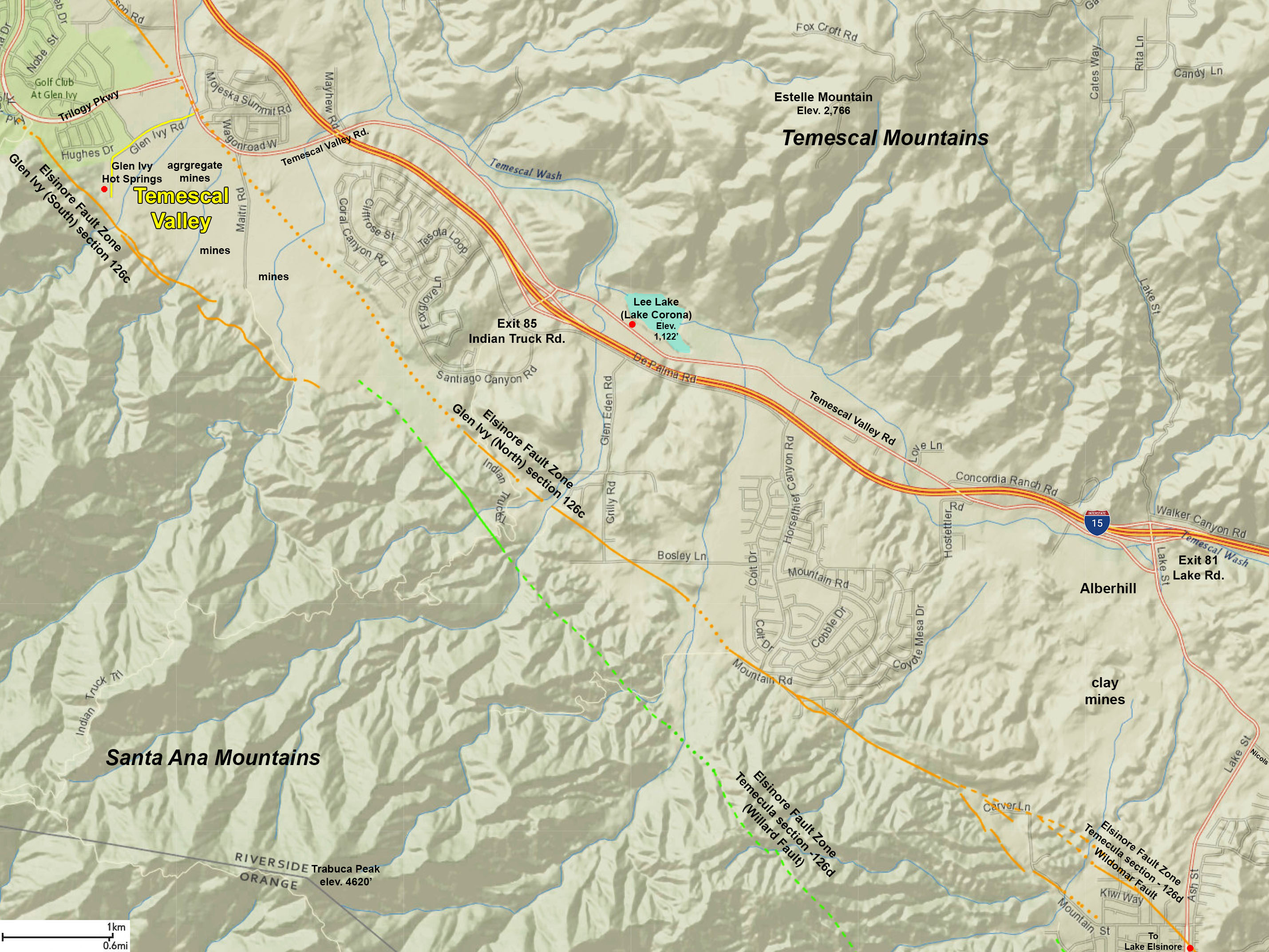
The Glen Ivy section of the Elsinore Fault Zone extend southward from where the Whittier and Chino faults merge near the western side of Corona, California in the vicinity of the Skyline Trail area (discussed below). In the Corona area the fault zone follows the base of the eastern mountain front of the Santa Ana Mountains (discussed in Study Areas 2 and 3 below). From the Corona area the Elsinore Fault Zone is associated with a structurally complex graben called the Elsinore Trough. At its northern end the Elsinore Trough is bounded by Glen Ivy section along the the Santa Ana Mountains (part of the stable Santa Ana tectonic block on the southwest side of the trough). The Temescal Mountains and Elsinore Mountains are on the east side of the Elsinore Trough (part of the Perris tectonic block on the northeast side of the trough; see Figure 14).
This Elsinore Trough is also subdivided into smaller basins that are filled with alluvial sediments. The Temescal Valley is a sediment-filled basin in the at the northern end of the Elsinore Trough. In that area the basin is bounded on both sides by the Glen Ivy North and Glen Ivy South faults (see Study Area 4). South of Temescal Valley the Elsinore Trough in the vicinity of Lake Elsinore, the trough is bounded by the Wildomar Fault (on the north side) and the Willard Fault (on the south side). These two fault parallel each other on opposite sides of the the trough from Lake Elsinore southward into the Temecula Valley and Wolf Valley areas (Study Areas 5 to 8). The Glen Ivy section ends at the southern end of Wolf Valley (the southern end of the Elsinore Trough) where the fault zone continues south into mountainous country as the Julian section, south of the Riverside-San Diego Counties border. |
Glen Ivy Section (Modified from SCEDC summary)
- TYPE OF FAULT MOTION: Right-lateral (dextral) strike-slip with some reverse or oblique displacement (resulting in development of the trough); most of the dextral slip occurred on the Glen Ivy North strand. Both horizontal and vertical displacement is observable in the Temescal Valley.
- ORIENTATION: There are multiple fault strands within this section. Average strike is N54°W (for section); Dip: 15° SW. to 90°; variable vertical (oblique slip) components for each of the faults. The Glen Ivy North and South faults are more steeply inclined, and seismicity suggests a southwest dip to about 12 km depth (Hull and Nicholson, 1992).
- LENGTH: about 29 miles (46 km)
- LOCATION: Riverside County, California.
- NEAREST COMMUNITIES: Corona, El Cerrita, and Elsinore, CA
- MOST RECENT SURFACE RUPTURE: Historic surface rupture occurred on 15 May, 1910; Holocene activity has been reported for the length of the fault zone.
- INTERVAL BETWEEN MAJOR RUPTURES: Estimates from different locations along the faults range between 200 yr to <960 yr.
- PROBABLE MAGNITUDES:
- SLIP RATE: about 5 mm/yr
- GEOMORPHIC EXPRESSION: Graben (including Temescal Valley),scarps, saddles, swales, depressions, deflected drainages, faceted spurs, displaced Holocene and Pleistocene alluvium and alluvial fan, marsh, and landslide deposits.
- QFFDUS ID: Glen Ivy section (126c); named by Engle, 1933; other names used for fault strands within the area include Eagle, Fresno, Tin Mine, Gypsum, and Main Street faults.
|
Study Area 2 - Chino and Glen Ivy Sections
Corona is an area of urban sprawl across a shallow alluvium-filled basin on the northeast side of the Elsinore Fault Zone. The broad Corona basin area developed on the floodplain of Temescal Wash and the Santa Ana River before it drains westward into Santa Ana Canyon. In this area Glen Ivy Fault section of the Elsinore Fault Zone starts basically where the Whittier Fault ends in the northeast end of the Santa Ana Mountains. The Chino Fault merges with the Glen Ivy Fault section a little farther south near Hagador Canyon. Stream drainages that are deflected by strike-slip displacement across the fault zone include Wardlow Wash, Mabey Canyon Wash, Hagador Canyon Wash, Main Street Wash, and Eagle Canyon Wash. The satellite image shows the contrast of the northwest-facing slope of the Santa Ana Mountains with its faceted spurs (mountain ridges or spurs that ends in a triangular face) and deflected drainages where the fault zone runs along the linear mountain front. |
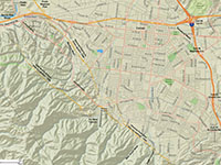
Fig. 2-1. Faults/location map |
Fig. 2-2. Faults/satellite map |
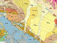
Fig. 2-3. Geologic map |
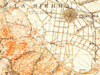
Fig. 2-4. 1902 USGS topo |
|
Places to check out (north to south):
Continue south on Serfas Club Road and turn left on Green River Drive.
Faulted Mountain Front along Green River Drive/Foothill Parkway: The Glen Ivy Fault section roughly parallels the mountain front in the vicinity of Green River Drive (near the apex of alluvial fans draining from the canyons). The trace of the fault is with associated landscape features including deflected stream drainages degraded fault scarps (the soft underlying sediment in the area result in result in the worn-down appearance of older fault scarp features). Some of these features can be seen along the road, but unfortunately, there is no easy place to stop or park along the busy road. Green River Drive becomes Foothill Parkway at Paseo Grande. The fault zone runs near Foothill Parkway at Wardlow Canyon and Mabey Canyon, but again, there is no place to stop or park near those canyons. The only good place to stop to examine the fault zone is near the mouth of Hagador Canyon.
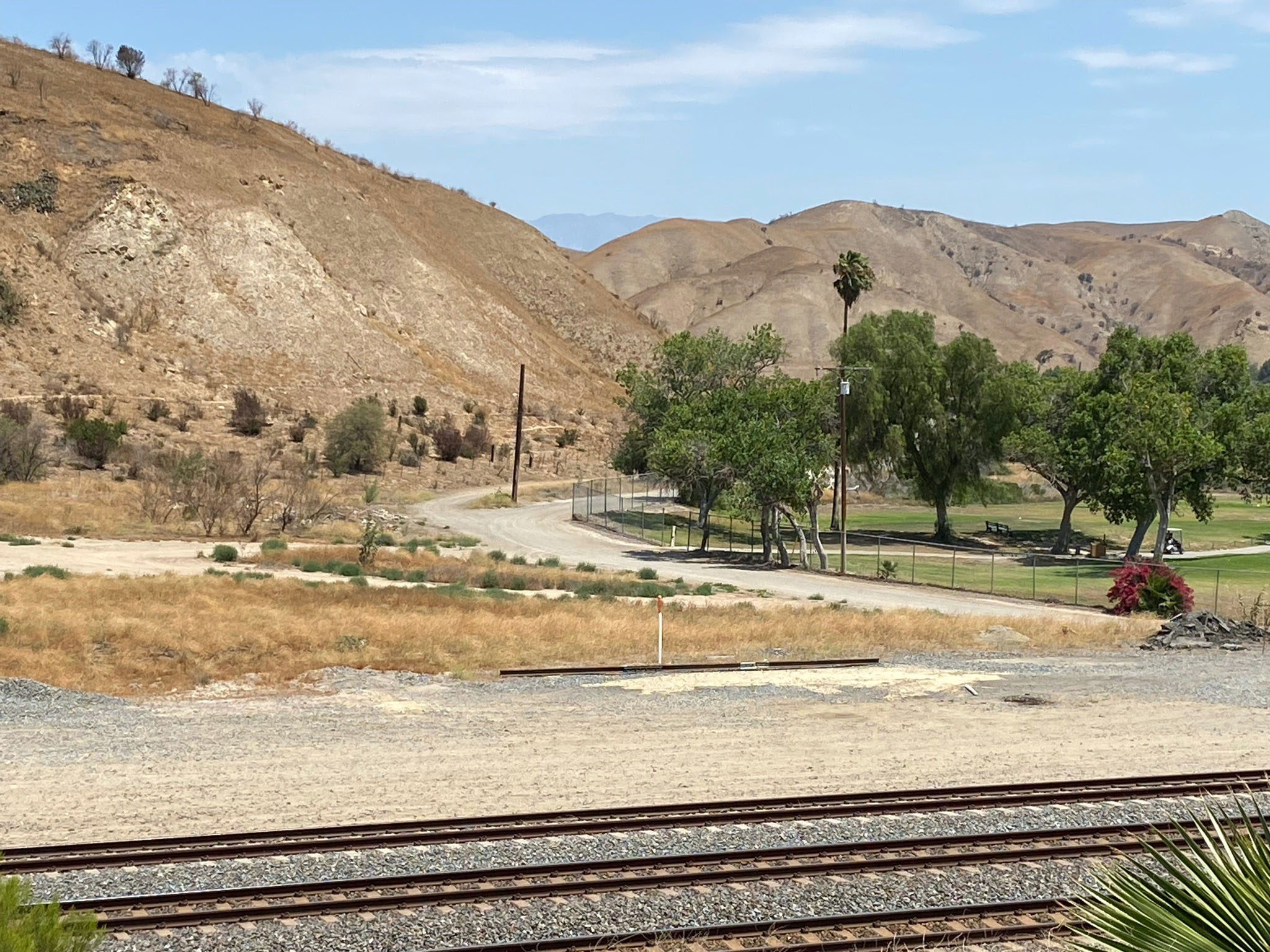
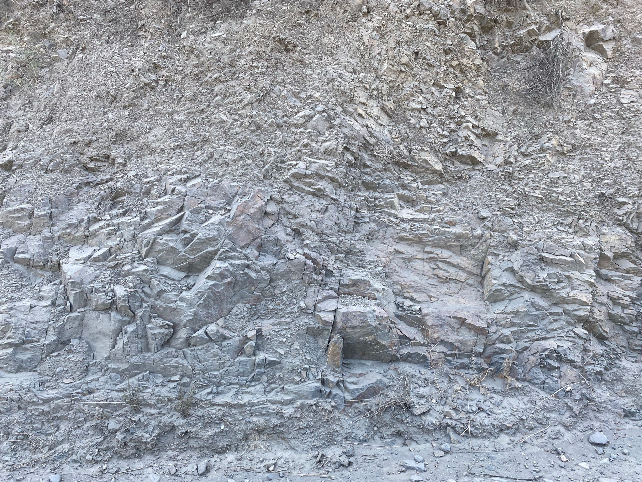
Fault Zone along the Skyline Drive Trail (Hagador Canyon): The trailhead for the Skyline Drive Trail is located near the Foothill Parkway bridge over Hagador Creek (Figure 2-5). It is fairly easy to park along Foothill Parkway near the trailhead. This well-maintained trail follows Hagador Creek uphill (westward) into the Santa Ana Mountains. Within the first 1/4 mile along the trail it is easy to see fault fractures, disrupted sedimentary bedding, and offset surficial deposits exposed along the canyon wall where the fault zone crosses the creek (Figures 2-6 to 2-8). This area is worthy of a hike! The trail continues for miles up Tin Mine Canyon into the core of the Santa Ana Mountains (Figures 2-9 and 2-10).
Continue south of Foothill Parkway to stops in Study Area 3.
|
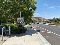
Fig. 2-5. Skyline Drive Trail starts on Foothill Parkway. |

Fig. 2-6. Eroded vertical fractures in the fault zone. |
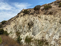
Fig. 2-7. Fractured sandstone in cliffs along Hagador Creek. |
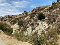
Fig. 2-8. Side-hill bench along fault zone in Hagador Canyon. |

Fig. 2-9. Grassy field on the alluvial fan in Hagador Canyon west of the fault zone and the ridgeline of the northern Santa Ana Mountains. |
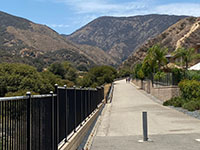
Fig. 2-10. The well maintained Skyline Drive Trail. |
|
Study Area 3 - Glen Ivy section
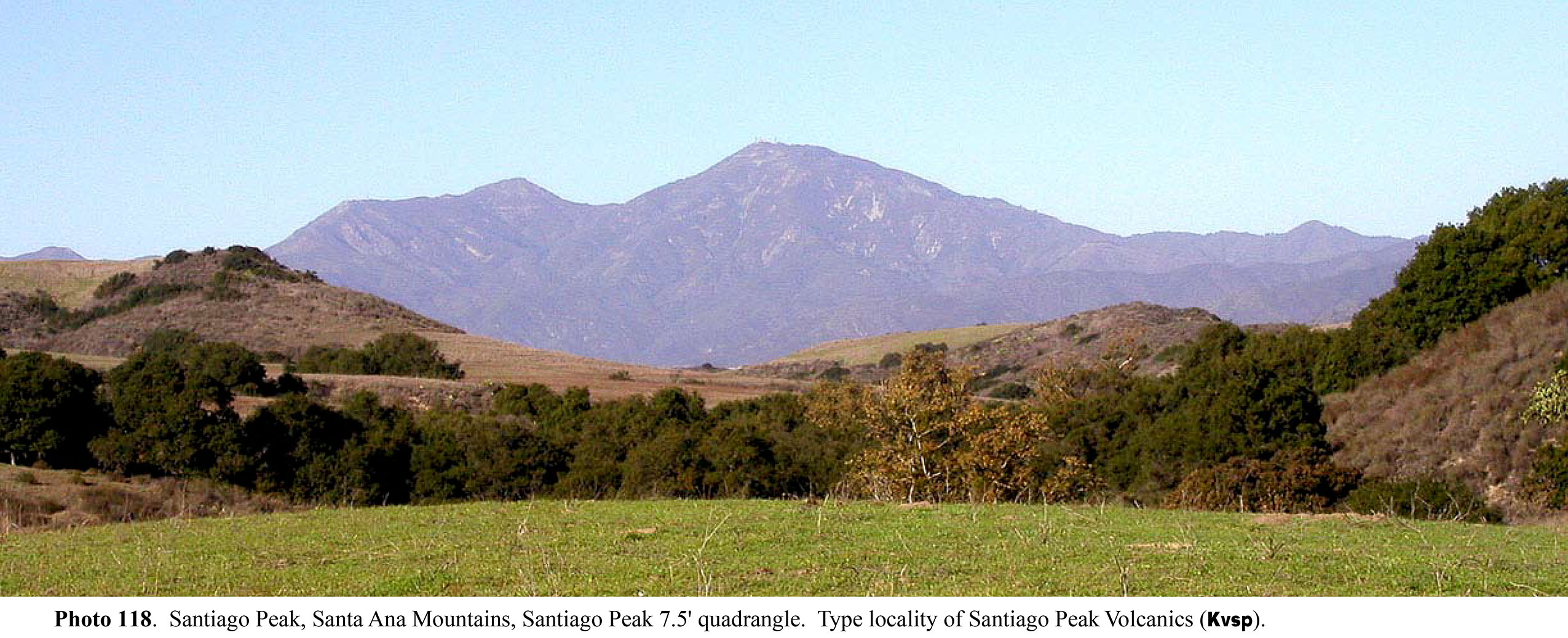
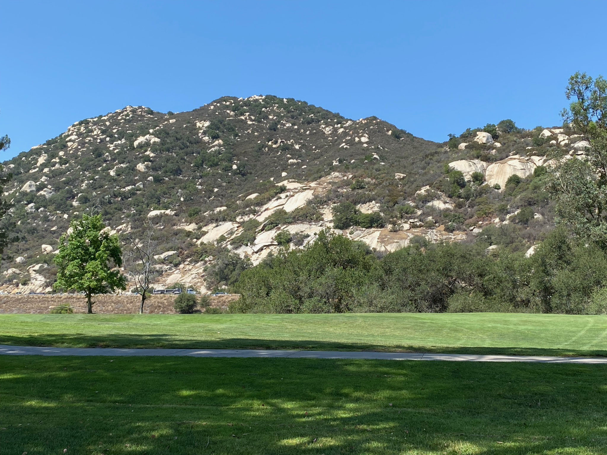
In this map area, the Elsinore Fault leaves the Corona Basin to the north and enters the Temescal Trough to the south. The Temescal Trough is part of the larger system of horst-and-graben features (expressed as low hills and basins) associated with the larger fault-bounded Elsinore Trough between the Santa Ana tectonic block (to the west) and the Perris tectonic block (to the east).The higher peaks of the Santa Ana Mountains are to the southwest with Santiago Peak, elevation 5,688 feet, is the highest peak. The mountains east of Interstate 15 are not as high, the highest point is Estell Mountain (2,766 feet). This region to the east is part of the erosionally-dissected Gavilan Plateau of the Ferris tectonic block. |
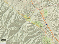
Fig. 3-1. Faults/location map
|
Fig. 3-2. Faults/satellite map
|

Fig. 3-3. Geologic map.
|
Fig. 3-4. 1902 USGS topo |
|
Places to check out (north to south):
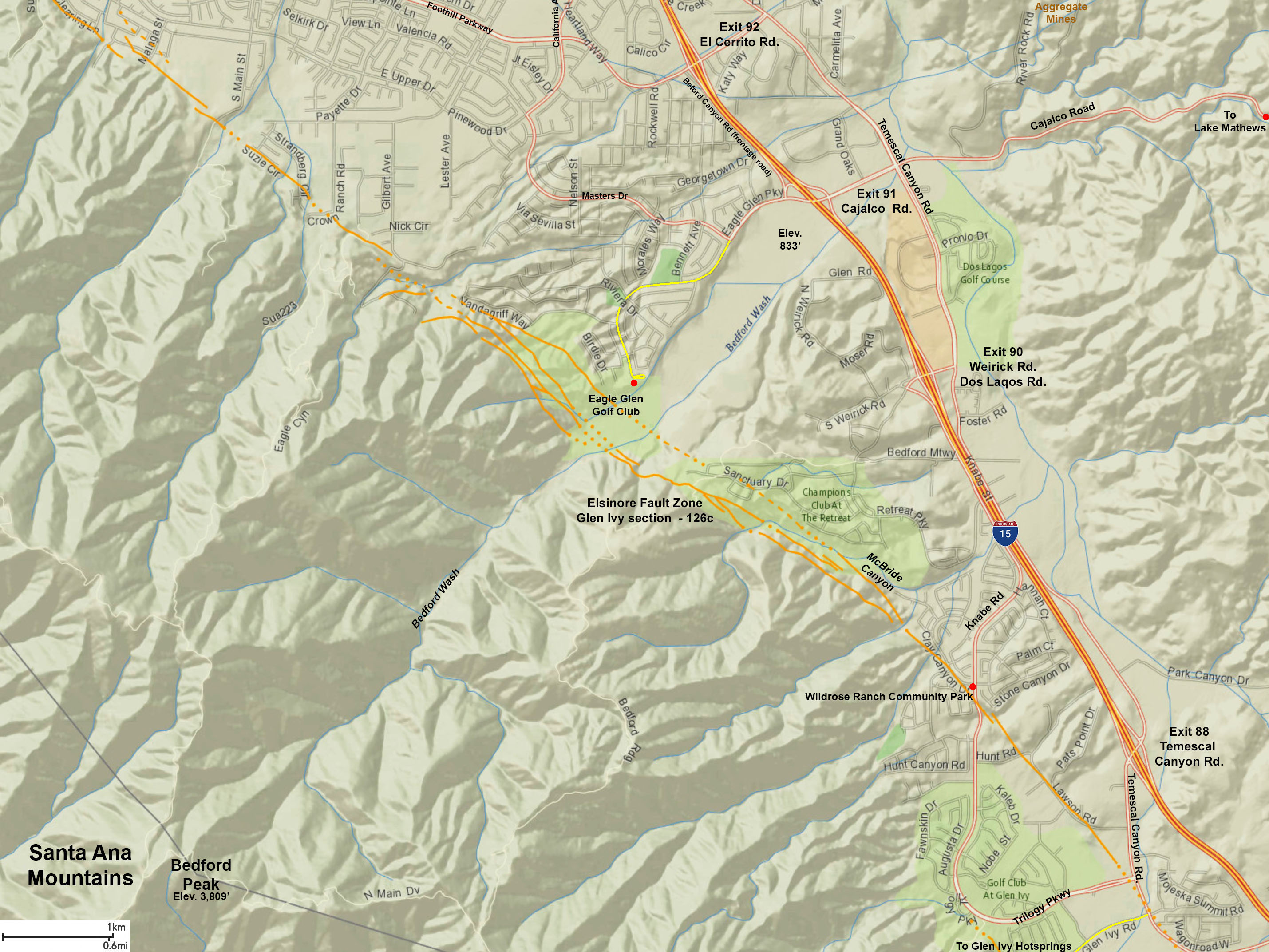
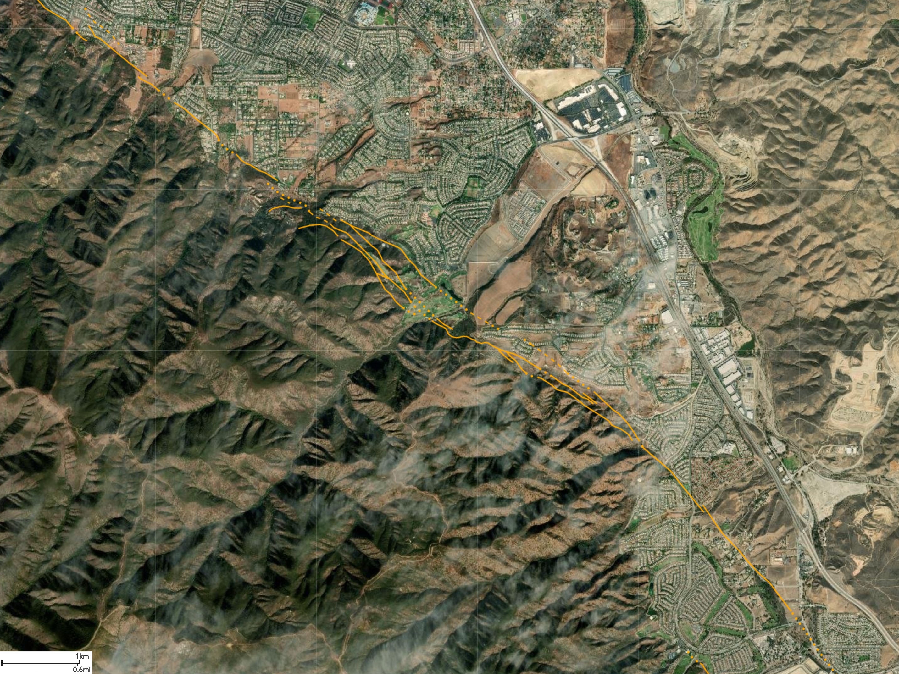
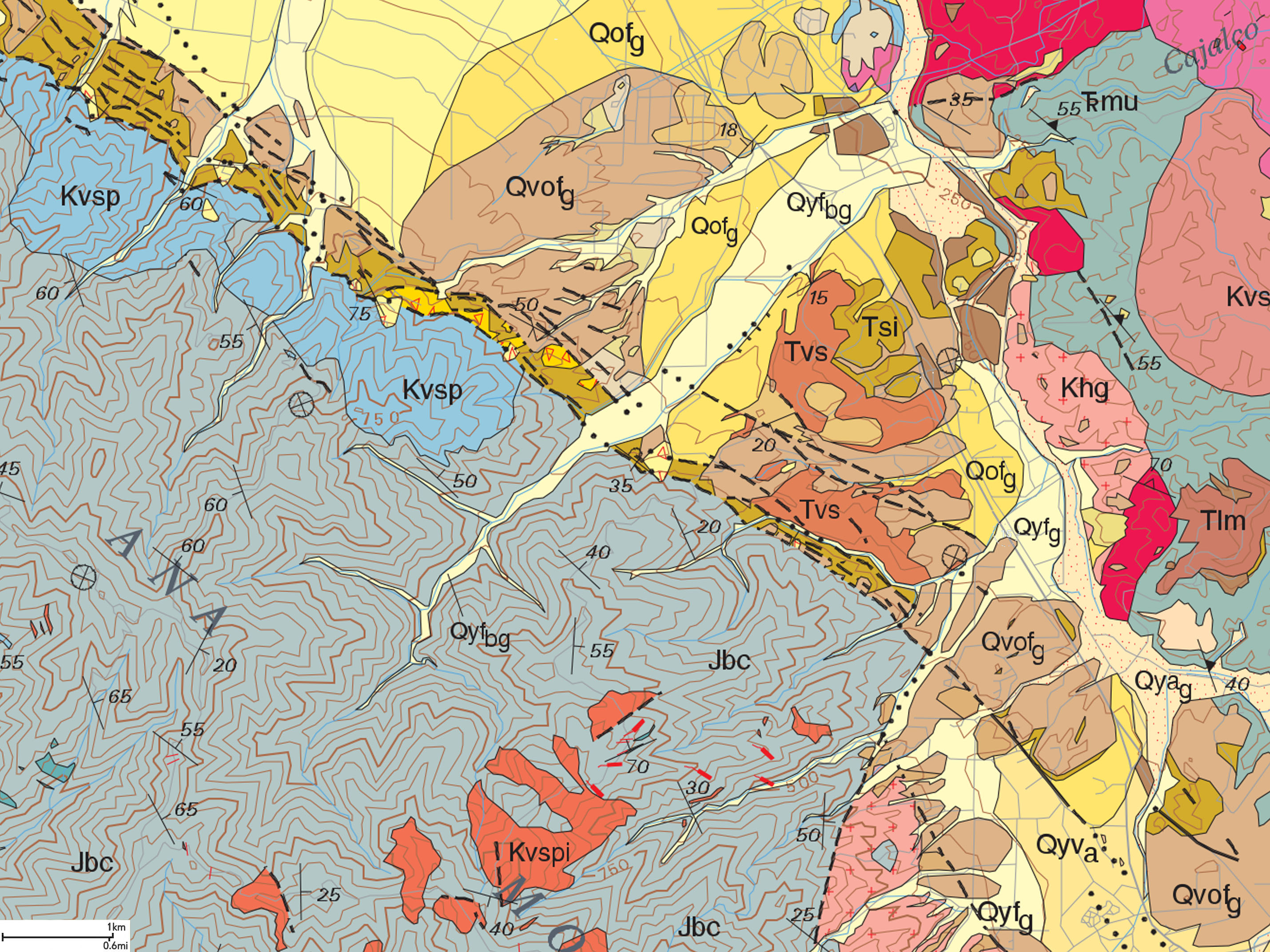
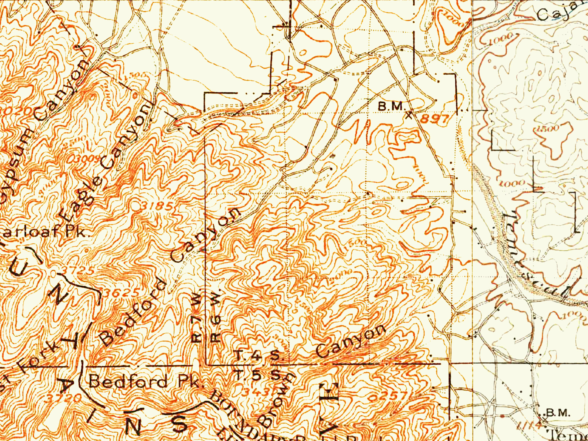
To continue on the tour south from the Skyline Drive stop, follow Foothill Parkway about 4.5 miles south to Interstate 15. Turn right on Bedford Canyon Road (the frontage road on the west side of the interstate). Take Bedford Canyon Road one mile and turn right on Eagle Glen Parkway. Follow Eagle Glen Parkway to where it dead-ends at the Eagle Glen Golf Club.
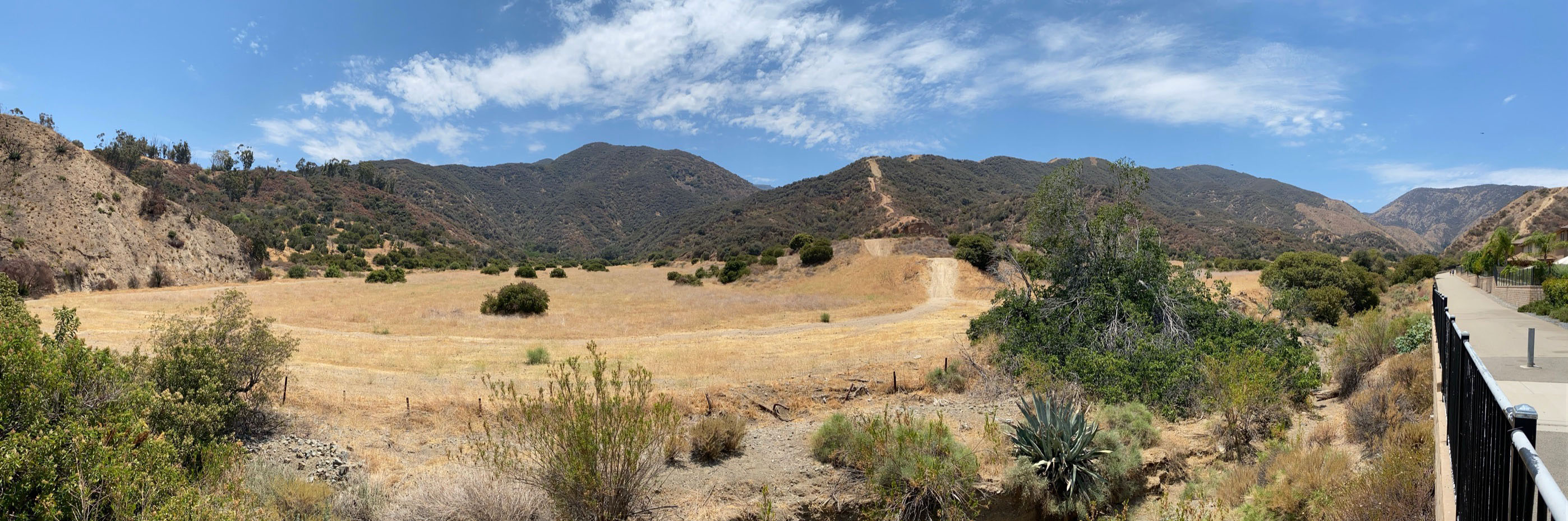
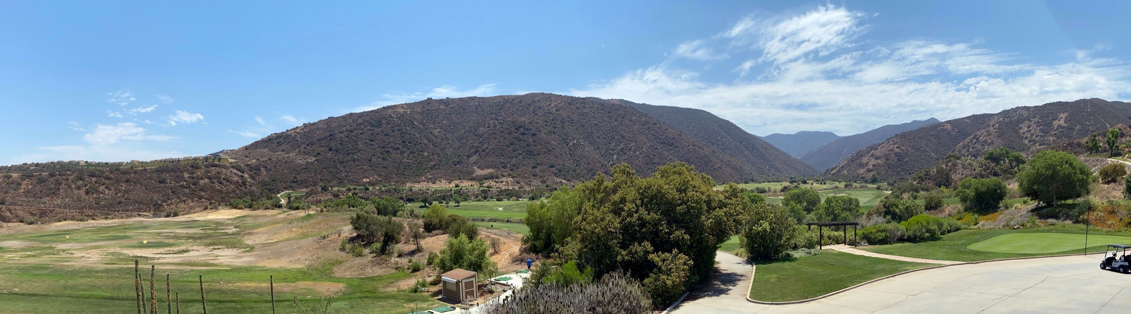
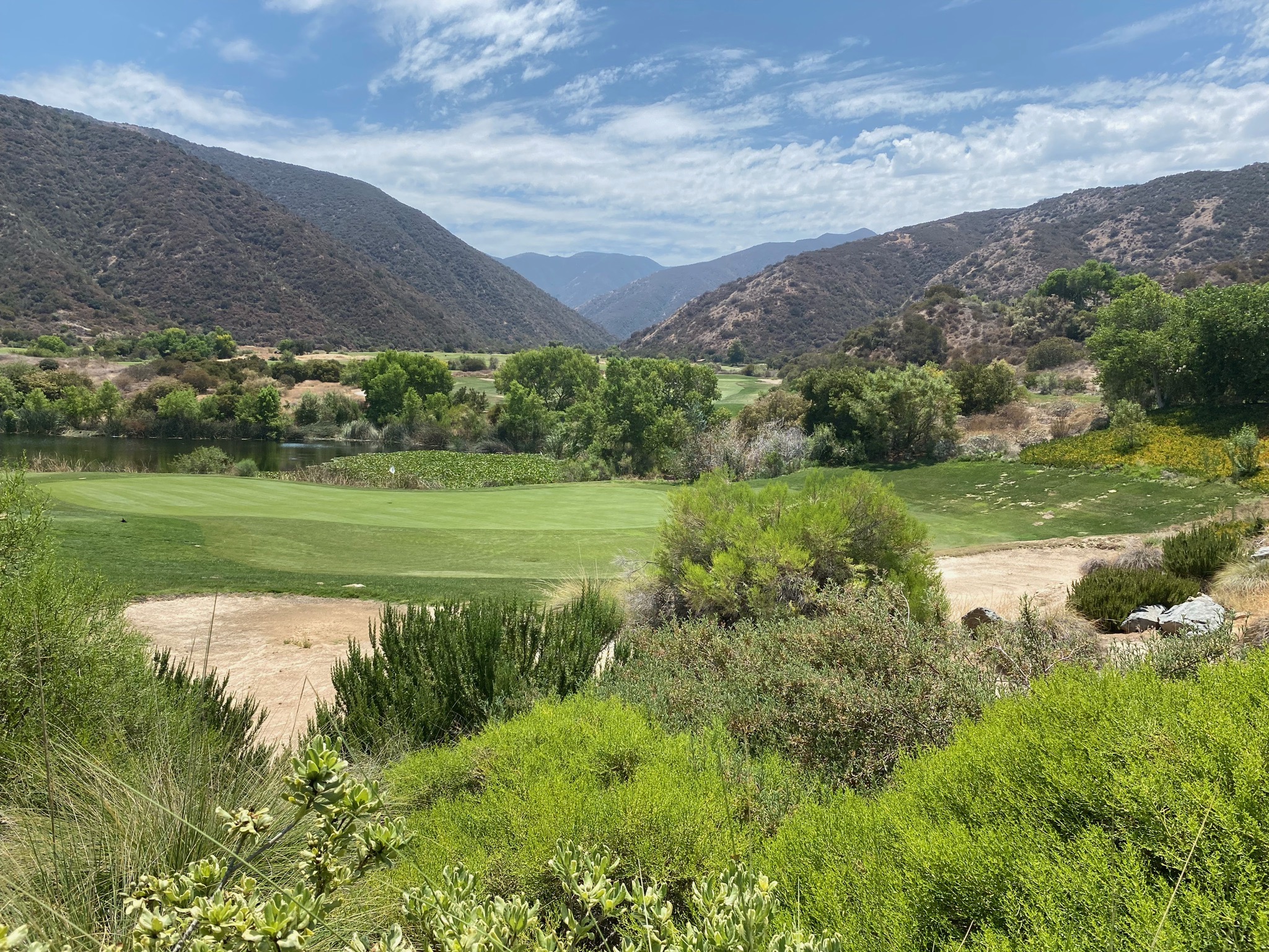
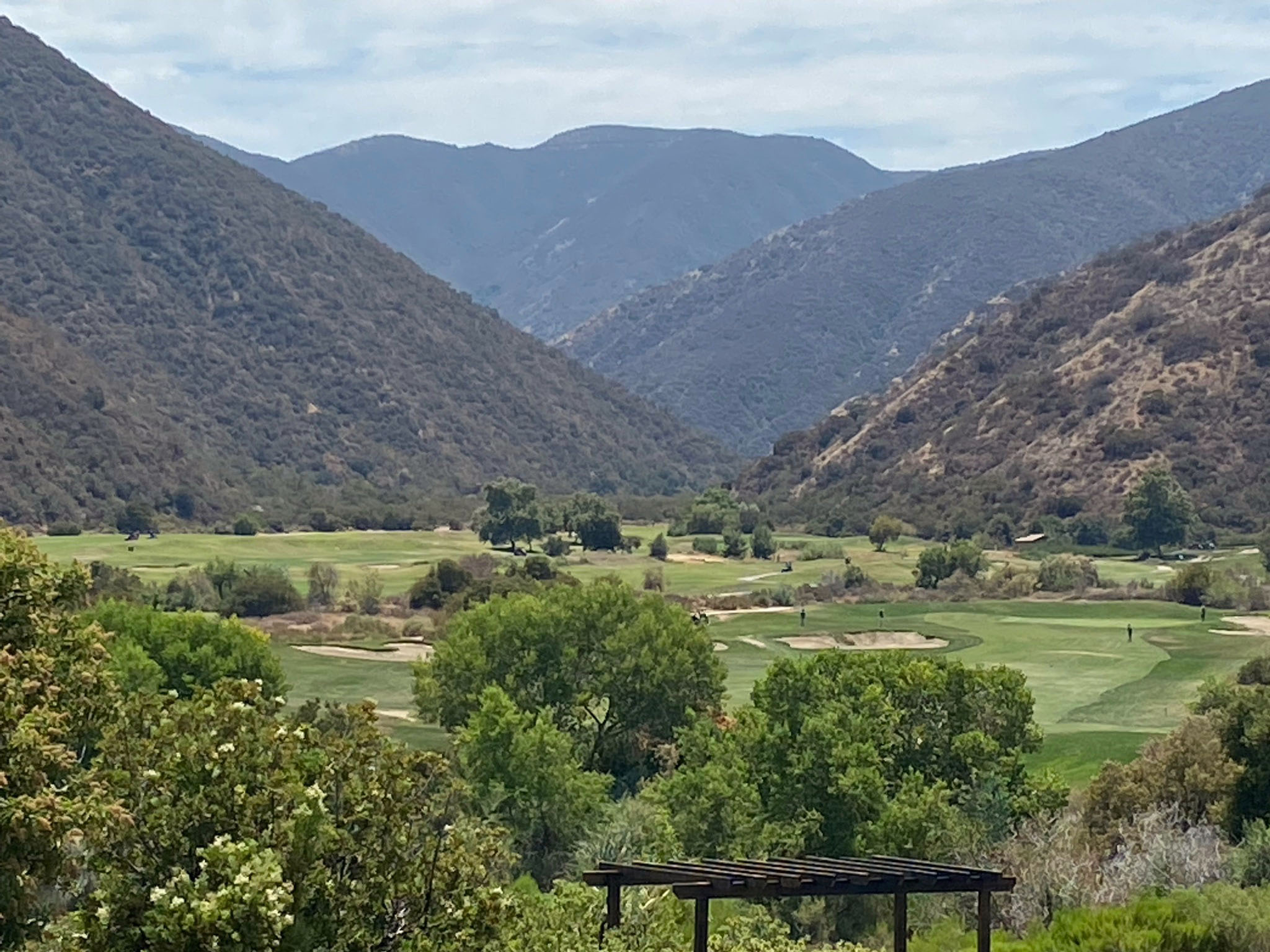
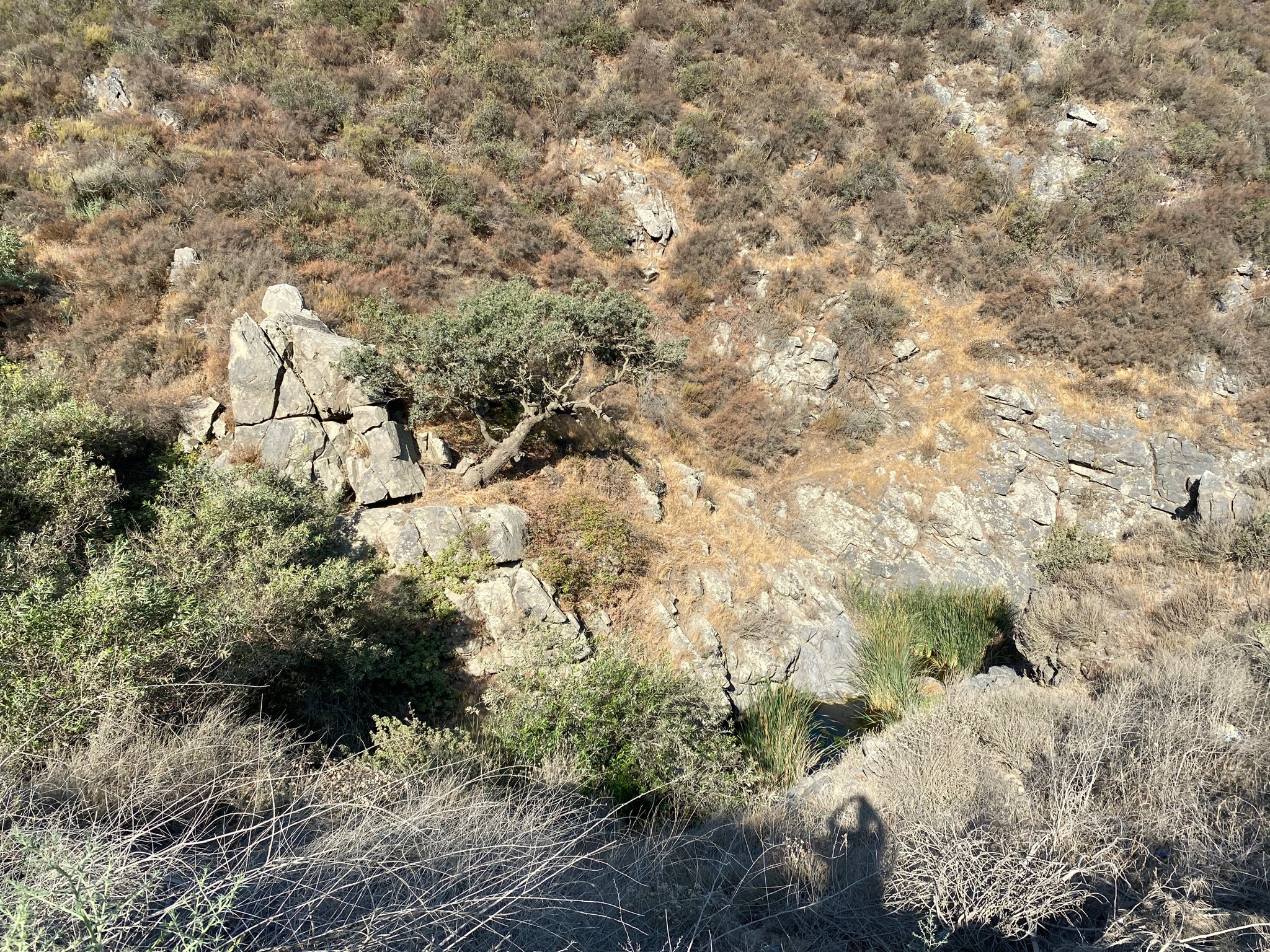
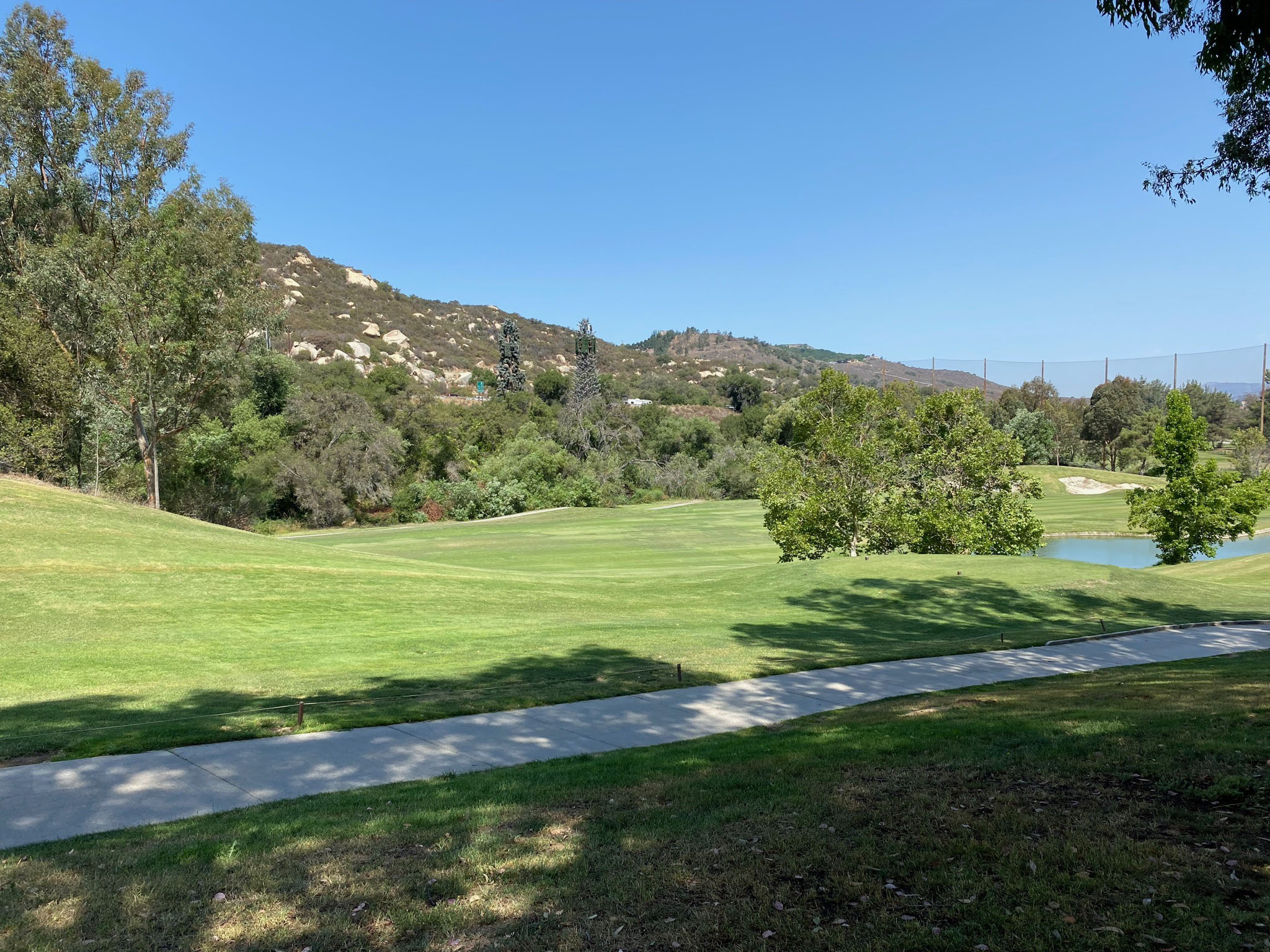
Eagle Glen Golf Club: The Eagle Glen Golf Club is a good place to get an appreciation of the Elsinore Fault (Glen Ivy section) and take in the scenic view of Bedford Wash Canyon cutting into the Santa Ana Mountains (Figures 3-5 to 3-10). The fault runs across the valley of Bedford Wash just west of the clubhouse. From the restaurant balcony overlooking the golf course in the broad wash valley it is easy to see a linear pressure ridge and sag ponds lined up cutting across the valley (although they were modified somewhat during the construction of the golf course). The clubhouse might be a good place for lunch and take some scenic photographs of the faulted landscape around the golf course (or even hit some golf balls!). Several fault strands of the Glen Ivy Fault Zone cut across the golf course in the wash valley.
Mathews Dam View off of Cajalco Road: Return back down Eagle Glen Parkway to Interstate 15. If you continue straight on Cajalco Road east of the Interstate, it is about 4.5 miles to drive up to Lake Mathews Dam (Figure 3-11). At the top of the mountain turn left on La Sierra Avenue. You can take in the scenic view to the west of the flat mesa top of the area (the old erosion surface on top of the Perris tectonic block; Figure 3-12). From this location is is also easy to see the relative even erosion surface that defines the skyline of the Santa Ana tectonic block on the west side of the Elsinore Fault Zone (rift valley).
Clay Canyon Drive/Wildrose Ranch Community Park: If you choose to skip driving up to Lake Mathews, get on Interstate 5 at the Cajalco Road (Exit 91) and head south one mile to the next exit (Weirick Rd./Dos Laqos Rd., Exit 90). Turn right, and then left on Knabe Street. Knabe Street parallels the interstate south for about a mile before it curves to the west. In 1/4 mile turn right on Clay Canyon Drive. Clay Canyon Drive loops back around to Knabe Street at Wildrose Ranch Community Park (park anywhere it is safe). The Glen Ivy section of the fault runs along the mountain front next to Clay Canyon Drive. A trail in this small park follow a scarp/shutter ridge through the park to Knabe Street. On the opposite side of Knabe Street from the park, the fault crosses the deflected stream drainage of Stone Canyon Creek.
Continue south as Knabe Street turns into Trilogy Parkway. Trilogy Parkway dead-ends on Temescal Canyon Road. Turn right on Temescal Canyon Road and proceed to the next intersection and turn right on Glen Ivy Road. Glen Ivy Road leads to the parking area for Glen Ivy Hot Springs (a historic spa resort) (continued below with Study Area 4). |
Fig. 3-5. Eagle Glen Golf Club clubhouse. |

Fig. 3-6. Panoramic view from the balcony of the Eagle Glen Golf Club restaurant of Bedford Wash valley near where the Glen Ivy Fault section crosses the valley. |
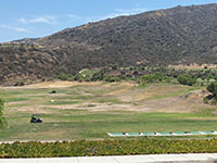
Fig. 3-7. View looking north along shutter ridges following the along the fault crossing Bedford Wash valley. |
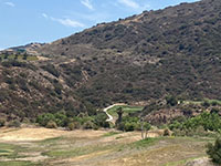
Fig. 3-8. Zoom view of the side-hill bench on the south side of the mountain front above Bedford Wash. |

Fig. 3-9. View looking west up Bedford Canyon with a modified sag pond area beyond the golf green. |

Fig. 3-10. Zoom view up Bedford Wash to Bedford Peak (elev. 3,809 feet) in the core of the Santa Ana Mountains. |
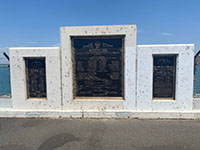
Fig. 3-11. Monument for Lake Mathews on the dam. |
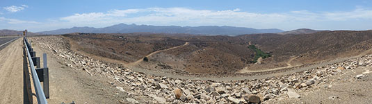
Fig. 3-12. View looking west from Lake Mathews Dam across the erosion surface level on top of the Perris tectonic block. Santa Ana Mountains are in the distance. |
|
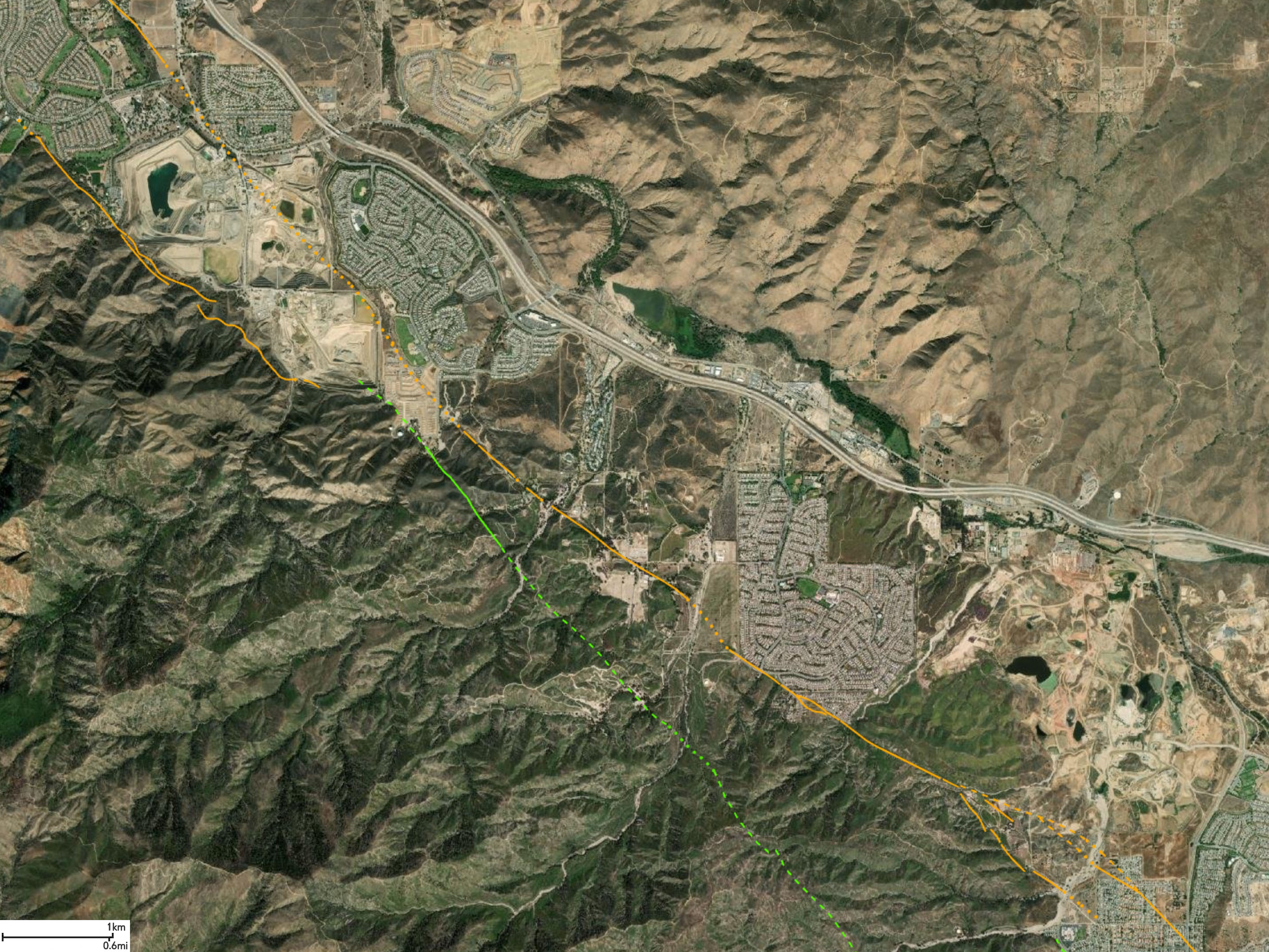
Area 4 - Glen Ivy section
This map area covers the Temescal Vally area and encompasses a smaller trough, host to a modified sag pond now known as Lee Lake on the north side of the valley. The area is host to the historic Glen Ivy Hotsprings (now a resort) and massive aggregate mining operations within the Elsinore Trough that have significantly modified the Temescal Valley. |
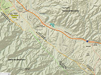
Fig. 4-1. Faults/location map |
Fig. 4-2. Faults/satellite map |
Fig. 4-3. Geologic map |
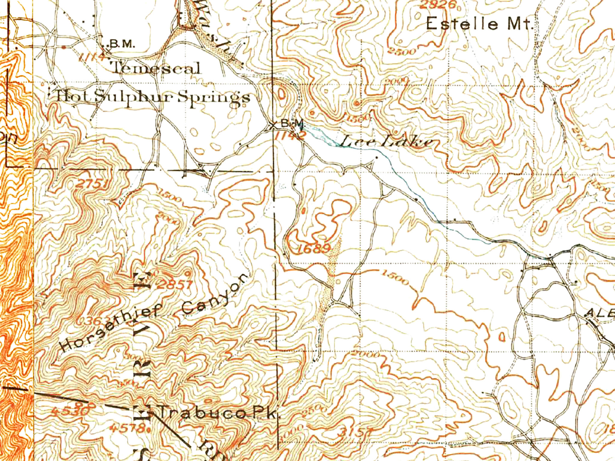
Fig. 4-4. 1901-2 USGS topo |
|
Places to check out (north to south):
Follow Glen Ivy Road to where it dead-ends in the parking lot for Glen Ivy Hot Springs (Resort).
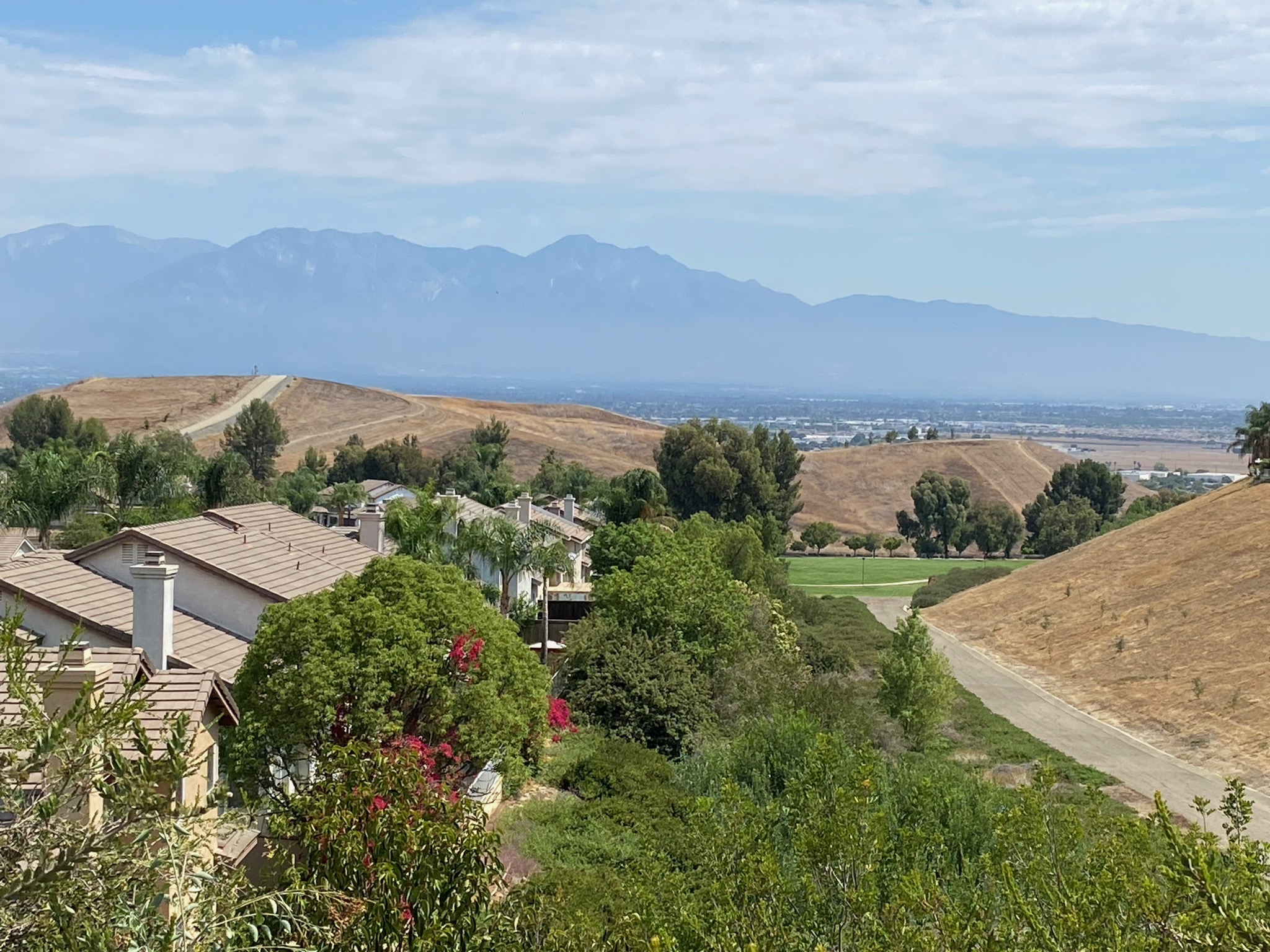
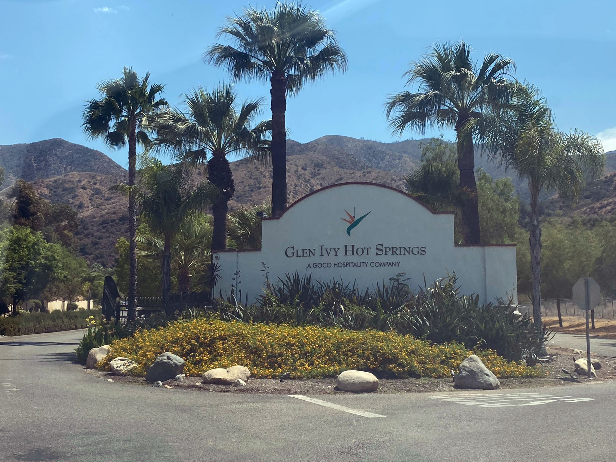
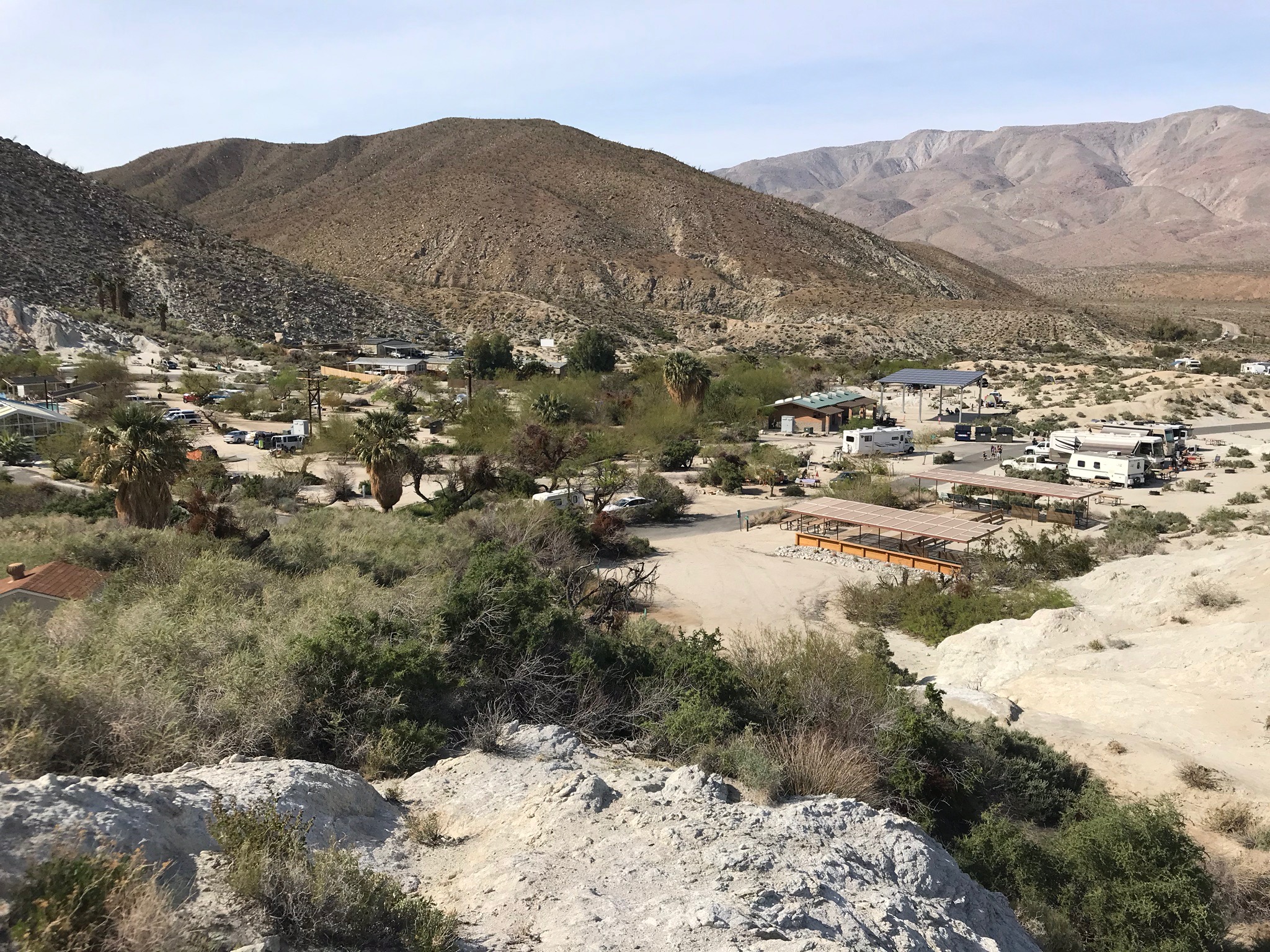
Glen Ivy Hot Spring (Resort): There were several natural hot springs in the area. The largest, most northern spring was originally known to early settlers as Temescal Hot Springs. Before then, ancestral American Indians utilized the springs far back into prehistoric times. In 1860 the springs went into private hands, but then was opened as a public resort in 1908 (Waring, 1915). The modern Glen Ivy Hot Springs is a 17-acre spa resort is located at 25000 Glen Ivy Road (Figures 4-5 and 4-6). The resort is located on the western side of the Temescal Trough on the northern flank of the Santa Ana Mountains at Coldwater Canyon Creek. In 1915, a USGS report on Springs of California states that the naturally sulfur-smelling springs had a temperature of 102°. Today, the hot mineral water is currently provided to the resort from a deep geothermal well (at 104°) and from a well in a shallower aquifer.
Massive Portland-Cement Grade Aggregate Mines in Temescal Valley Trough: The massive aggregate mining operations in Temescal Valley are not easy to see from the ground (due to visual barriers), however their size and scope are easy to see from above. Figure 4-7 is a satellite view of one of the massive aggregate mine pits in the Temescal Valley located next to the Glen Ivy Hot Springs Resort. There is a long history of mining in the Temescal Valley going back to the late 19th century, but the massive operations in the valley today are a huge part of the local economy - supplying nearly 200 million tons of Portland cement-grade aggregate annually to the surrounding region (Miller and others, 1991).
Return down Glen Ivy Road and turn right on Temescal Canyon Road. The road crosses Interstate 15 and then follows the Temescal Creek canyon south into Lake Elsinore (town). Large cliffs are exposed on the mountainsides on the south side of the valley. A good place to stop is near Lee Lake Dam.
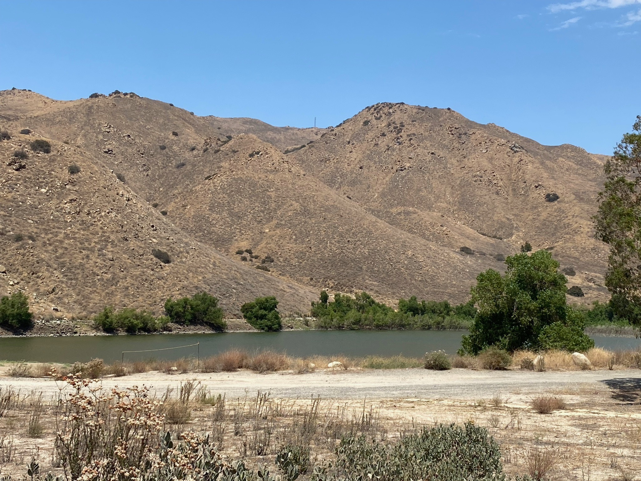
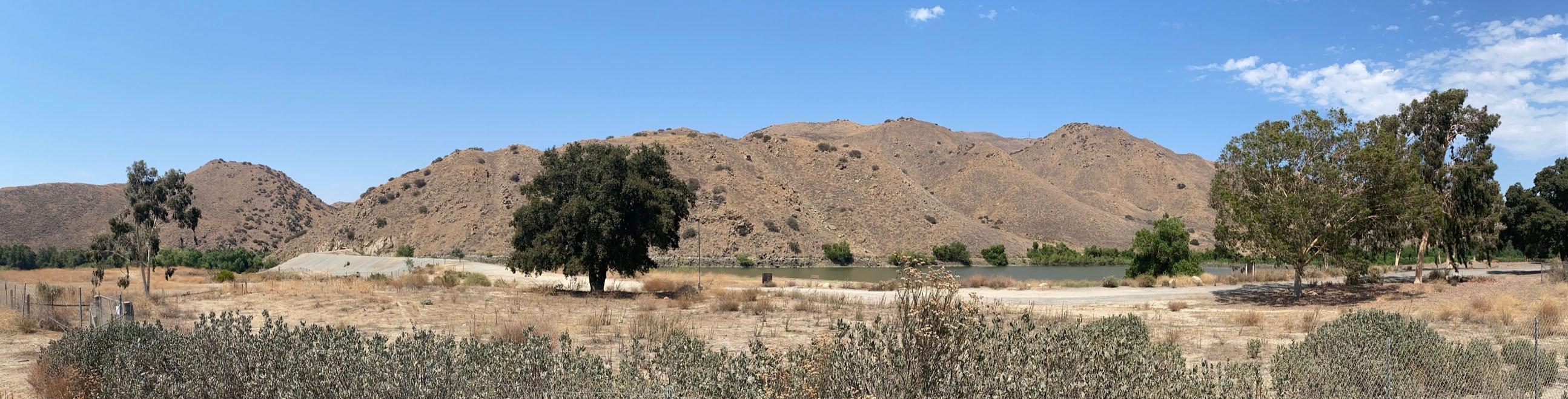
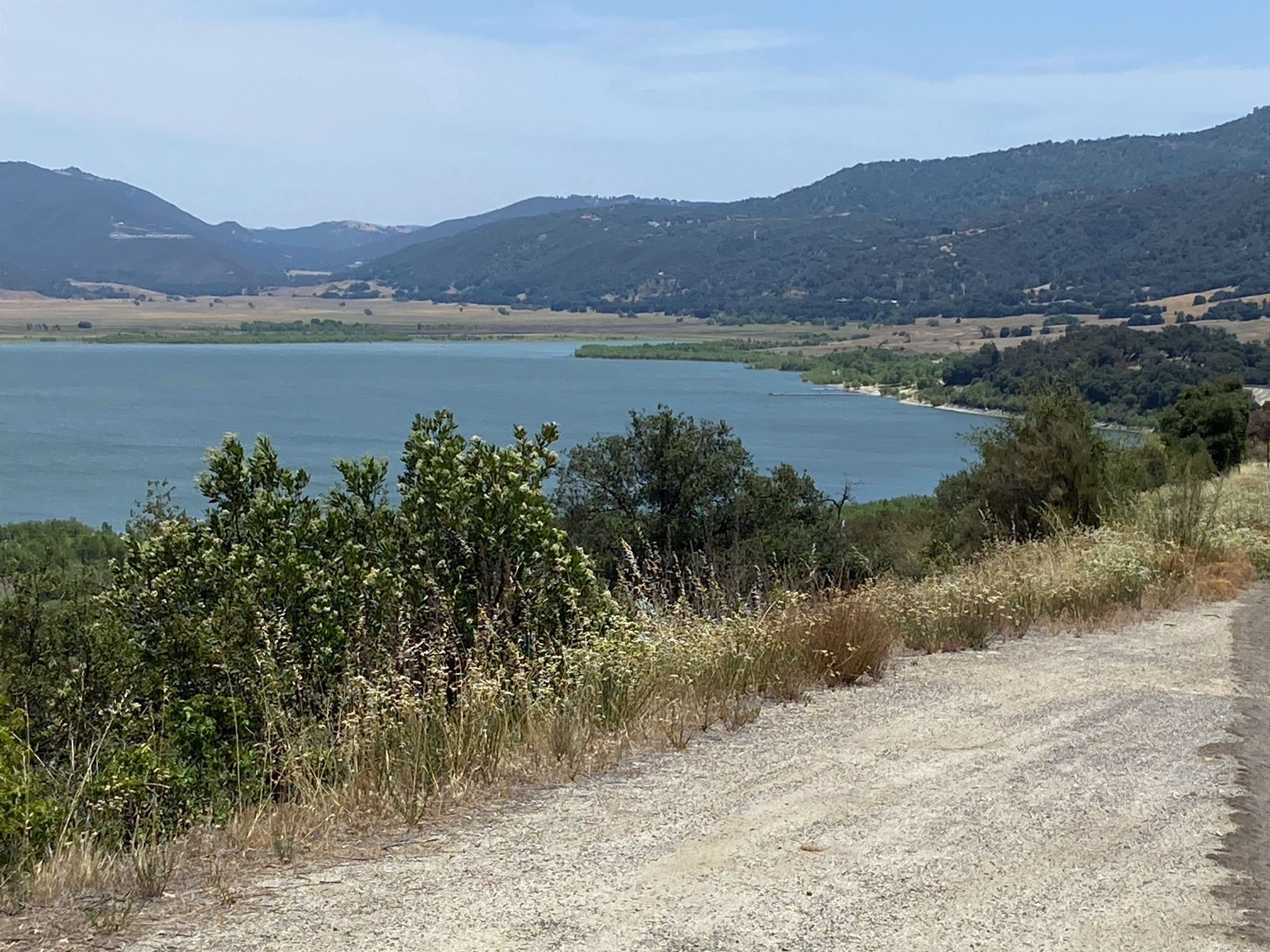
Lee Lake (the official USGS name), now Corona Lake (a name applied for commercial reasons); and historically Lagunita: The original small natural lake was probably a fault-related sag pond and marsh that used to exist in the Temescal Creek valley (Figures 4-8 to 4-10). The Geologic Map of California shows faults in the vicinity, but they are not mapped as Quaternary faults (of the Elsinore Fault Zone). The location of the natural lake was noted on an 1860 Temescal Survey Map. As the population grew, a dam was constructed to further impound Lee Lake; the dam appears on the USGS 1901 Elsinore quadrangle 30' map (surveyed in 1897-1898). The lake was known as Corona Lake was opened to the public in 2003, and was a popular local fishing destination. At its peak, the lake covered 40 acres. However with current drought conditions, the lake has shrunk to about 5 acres and is no longer stocked with fish.
Figure 4-11 is a view looking west from a hilltop on the west side of Temescal Valley toward Santiago Peak, elevation 5,689 feet—the highest mountain peak in the core of the Santa Ana Mountains.
Alberhill Clay Mining District: As you continue south along Temescal Canyon Road cross over Interstate 15 and you come to the community of Alberhill. Temescal Canyon Road dead-ends on Lake Road near Exit 81 in I-15. If you turn right (south) on Lake Street (or road) and travel south for a mile you pass through the sprawling Alberhill Mining District (Figure 4-12). Both historic and active mining of refractory clays used for making bricks aggregate (Daviess and Bramlett, 1953). The clay is (was) mined from Tertiary-age strata beneath Quaternary alluvial fan sediments deposited in the Elsinore Trough (between the Temescal Valley trough area to the north and the Lake Elsinore trough are to the south). Alberhill Ranch Community Park is at the intersection of Lake Street and Nicols Road. Nicols Road connects back with Interstate 15 (Exit). South of Alberhill the Glen Ivy (North) Fault peters out and steps over to continue south as the Wildomar Fault (of the Temecula section of the Elsinore Fault Zone).
Continue south on Lake Street and turn left on Lakeshore Drive that leads to Lake Elsinore (continued on Study Area 5).
|

Fig. 4-5. Glen Ivy Hotsprings (Resort) entrance sign.
|
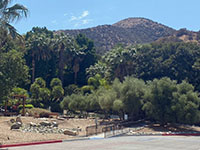
Fig. 4-6. Glen Ivy Hotsprings (Resort) with mountain front of the Santa Ana Mountains. |
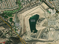
Fig. 4-7. Temescal Valley aggregate mine next to Glen Ivy Hotsprings Resort. |

Fig. 4-8. Lee Lake (or Corona Lake), a modified sag pond on east side of Elsinore Trough.
|

Fig. 4-9. Panoramic view of Lee Lake, a modified sag pond area in the Temescal Wash canyon. Lee Lake is the official USGS name; the name Corona Lake was added later. |
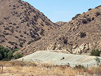
Fig. 4-10. Temescal Canyon beyond Lee Lake Dam. |

Fig. 4-11. Santiago Peak (elevation 5,689 ft) is the highest peak in the Santa Ana Mountains to the southwest of Temescal Valley (Elsinore Trough). |
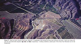
Fig. 4-12. Areal photograph of the of the Elsinore Fault (Wildomar Fault strand area) south of Alberhill (pre-2005 photo). |
|
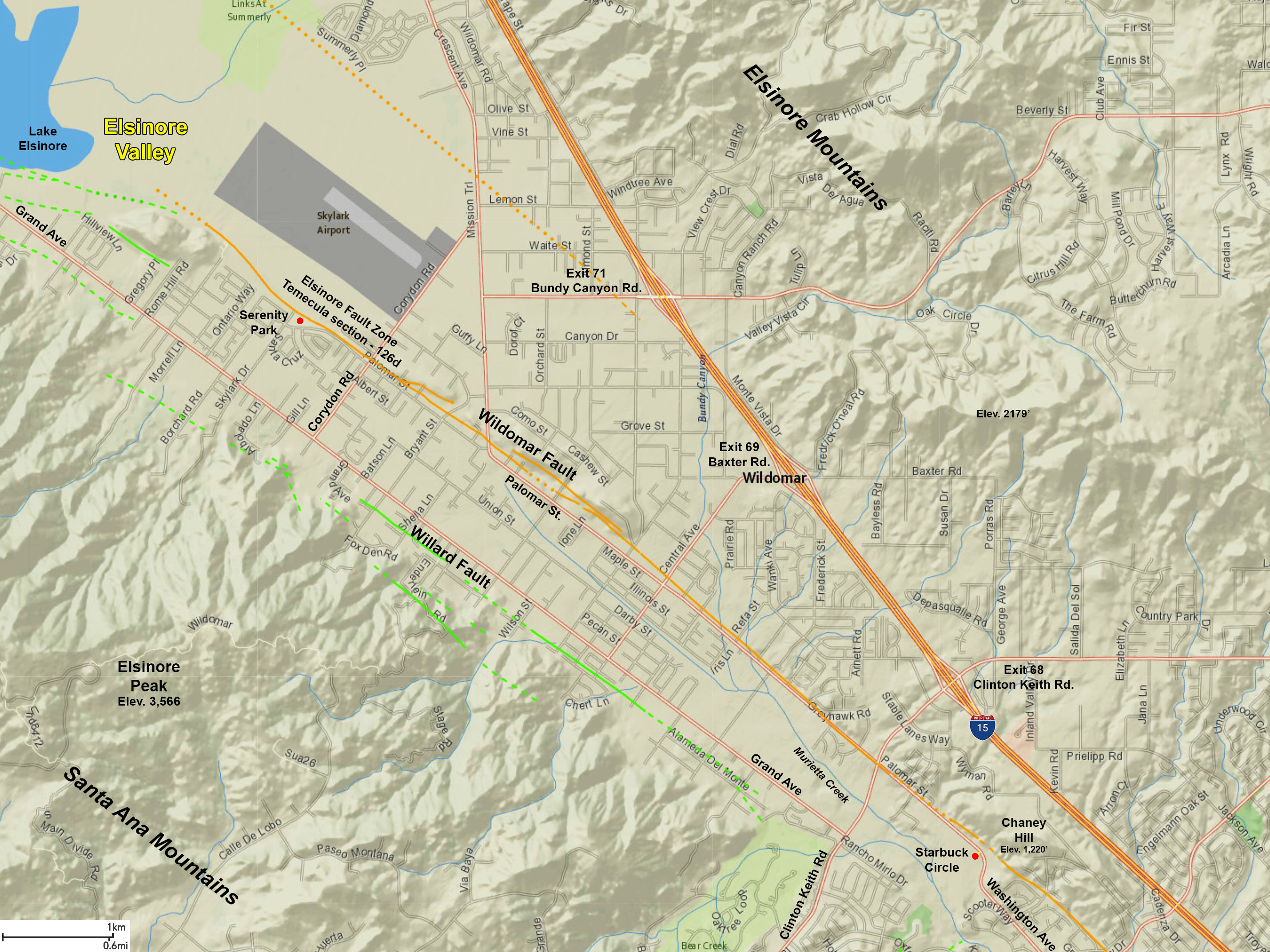
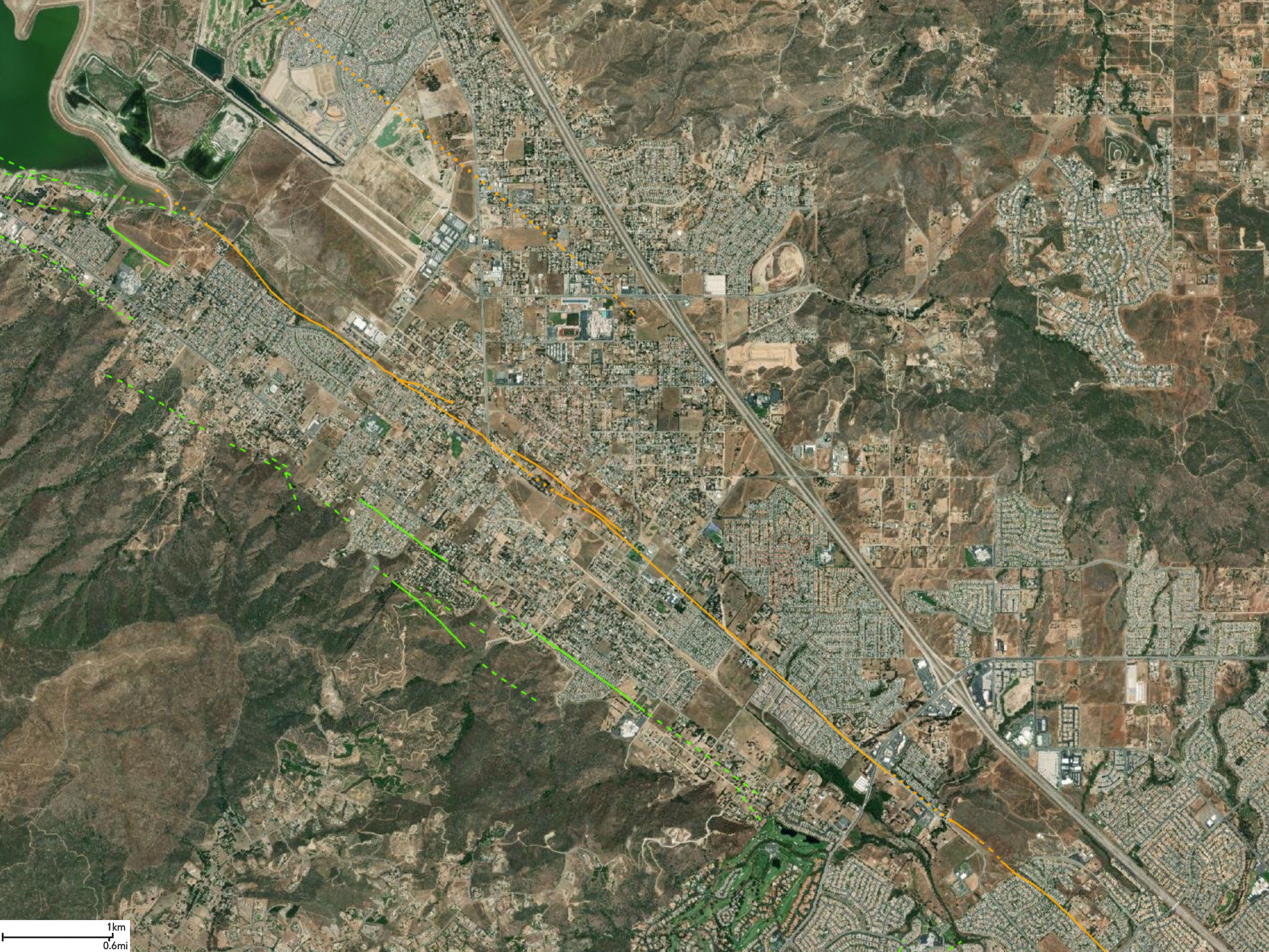
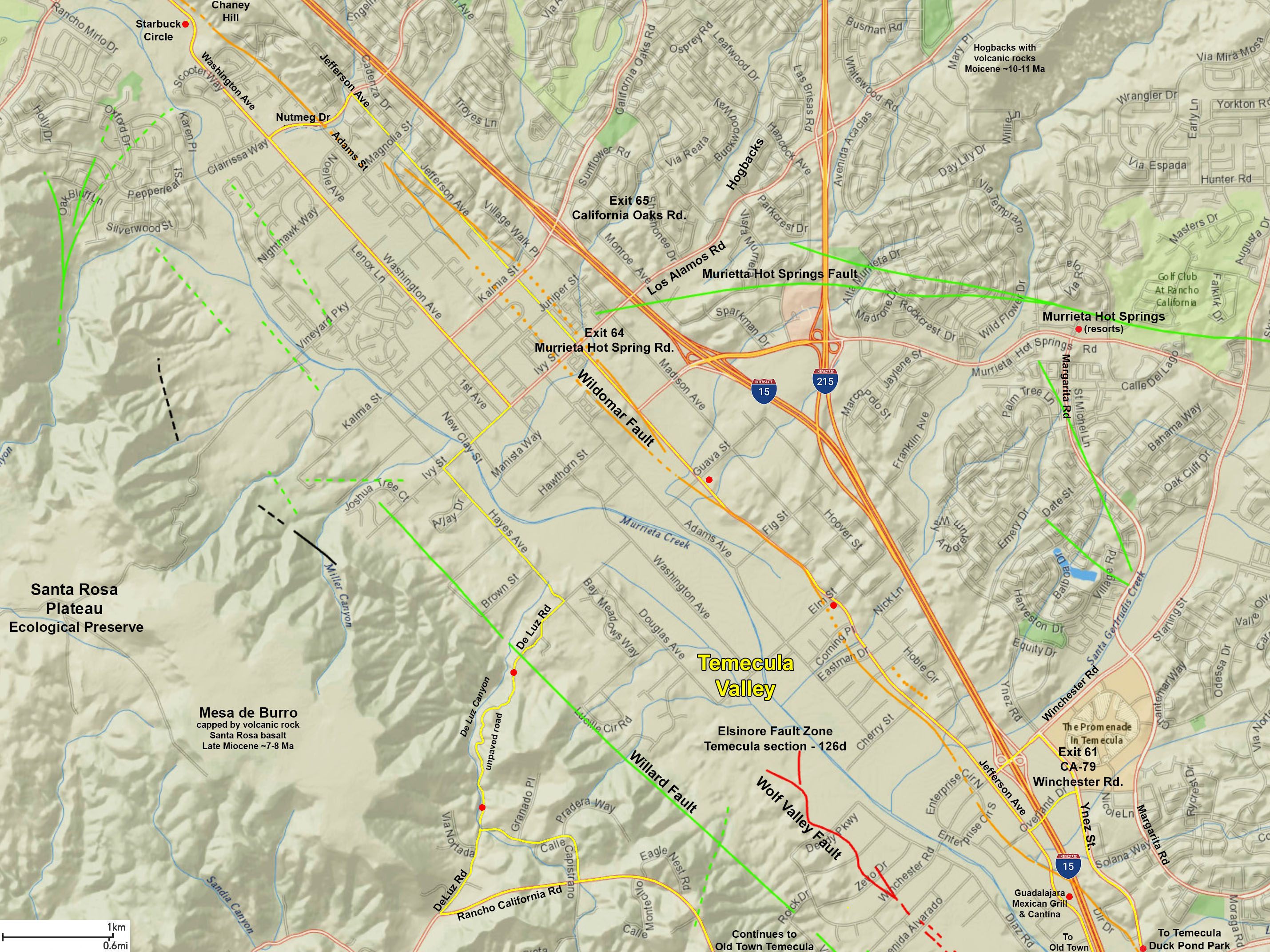
Temecula Section (Elsinore Fault Zone)
Northwest of Lake Elsinore are the Glen Ivy North and Glen Ivy South faults. Heading southeast from Lake Elsinore, the two parallel fault strands are the Wildomar Fault (the more easterly) and the Willard Fault (west side of the Elsinore Trough). Lake Elsinore is a sag pond within the Elsinore Trough.
The Temecula sections cuts diagonally across various Peninsular Range batholithic and pre-batholithic metamorphic terrains exposed along the mountain flanks that border of the Elsinore Trough. A dissected basalt flow caps the Hogbacks northeast of Temecula, and represents remnants of a channel filling flow. Beneath the basalt is a thin deposit of stream gravel. Having an age of about 10Ma, this basalt is about 2-3Ma older than the basalt flows in the Santa Ana Mountains. The Elsinore fault zone forms a complex of pull-apart basins. The west edge of the fault zone, the Willard Fault, is marked by the high, steep eastern face of the Santa Ana Mountains. The east side of the zone, the Wildomar Fault, forms a less pronounced physiographic step. In the center of the quadrangle a major splay of the fault zone, the Murrieta Hot Springs Fault, strikes east. Branching of the fault zone causes the development of a broad alluvial valley between the Willard Fault and the Murrieta Hot Springs Fault. All but the axial part of the zone between the Willard and Wildomar Faults consist of dissected Pleistocene sedimentary units. The axial part of the zone is underlain by Holocene and latest Pleistocene sedimentary units. |
Temecula Section (Modified from SCEDC summary)
- TYPE OF FAULT MOTION: Right-lateral slip on parallel fault strands, displaying oblique slip at a ration of about 1:10.
- ORIENTATION: Strike of faults is roughly N48°W; dip angles are steep to the SW and NE. Seismic data suggests a near-vertical to steep NE dip to about 13 km depth.
- LENGTH: 39 miles (62 km)
- LOCATION: Riverside and San Diego Counties
- NEAREST COMMUNITIES: Lake Elsinore, Wildomar, Temecula, Murietta, and Pala, California
- MOST RECENT SURFACE RUPTURE: unknown.
- INTERVAL BETWEEN MAJOR RUPTURES: 250–600 yr. (or more)
- PROBABLE MAGNITUDES:
- SLIP RATE: Between 1.0 and 5.0 mm/yr
- GEOMORPHIC EXPRESSION: Northern end of Temecula section is comprised of the Willard and Wildomar faults along south side of Lake Elsinore. Features along the Wildomar Fault include horst, scarps, sag ponds. Fault features along the Willard Fault include linear mountain front, faceted spurs, low scarps in alluvium. Where the Elsinore Fault crosses Agua Tibia Mountain near the southern end of the Temecula section it produces offset streams, beheaded drainages, shutter ridges, and a graben.
- AGE OF FAULTED SURFACE DEPOSITS: Holocene alluvium and fan deposits; late Pleistocene Pauba Formation (Wildomar, Murrieta Creek and Wolf Valley faults); late Pleistocene Pauba Formation (Willard fault) (Kennedy, 1977).
- QFFDUS ID: Temecula section (126d)
|
Study Area 5 - Glen Ivy and Temecula Sections
Lake Elsinore is the dominant landscape feature in the Elsinore Trough. West of Lake Elsinore (and the fault zone) the rugged landscape of the Santa Ana Mountains transitions southward to a high plateau region of the Santa Margarita Mountains (south of the Ortega Highway). |

Fig. 5-1. Faults/location map |
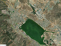
Fig. 5-2. Faults/satellite map |
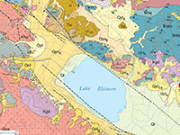
Fig. 5-3. Geologic map |
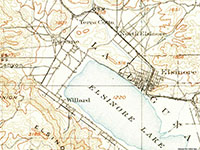
Fig. 5-4. 1901 USGS Topo |
|
Places to check out (north to south):
Wildomar Fault along Lakeshore Drive: Continue south on Lake Street, the turn left (east) on Lakeshore Drive. The Wildomar Fault crosses Lake Street just before the intersection with Lakeshore Drive. Lakeshore Drive basically follows the Wildomar Fault along the north shore of Lake Elsinore (Figures 5-6 and 5-7). The fault line is expressed as the break in slope between the alluvium-filled Lake Elsinore basin and the hillside neighborhoods of Lake Elsinore on the east side of Lakeshore Drive. With no recent surface rupture there are no fresh fault scarps, but the linear nature of the hillside is indicative of the fault in the area.
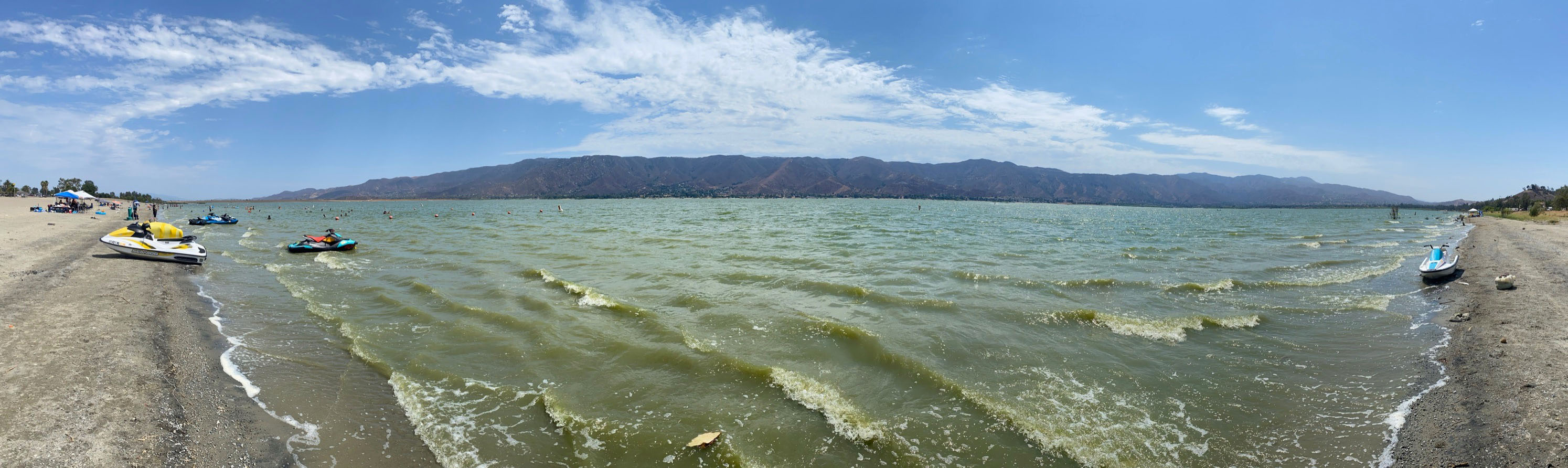
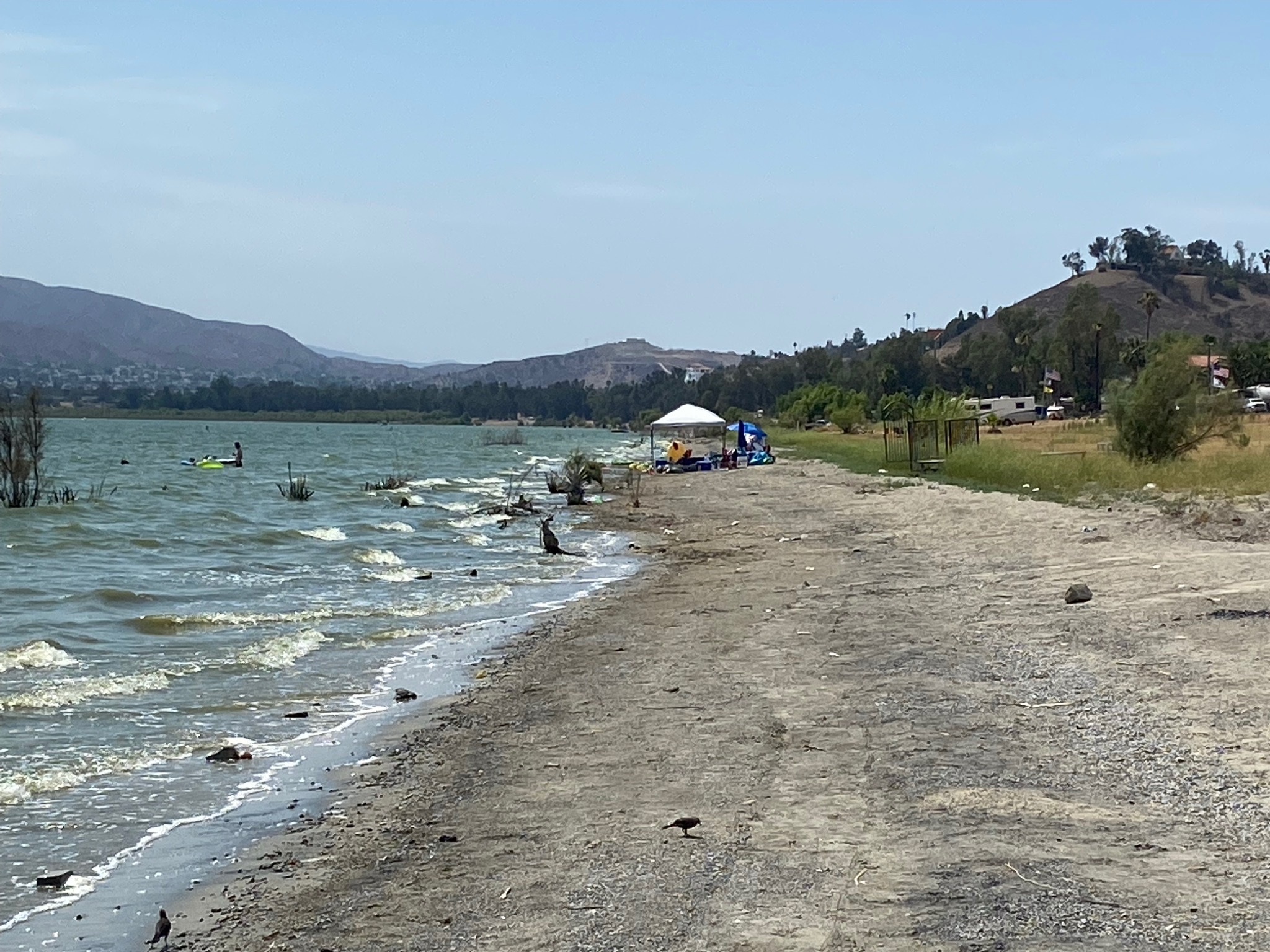
Lake Elsinore:
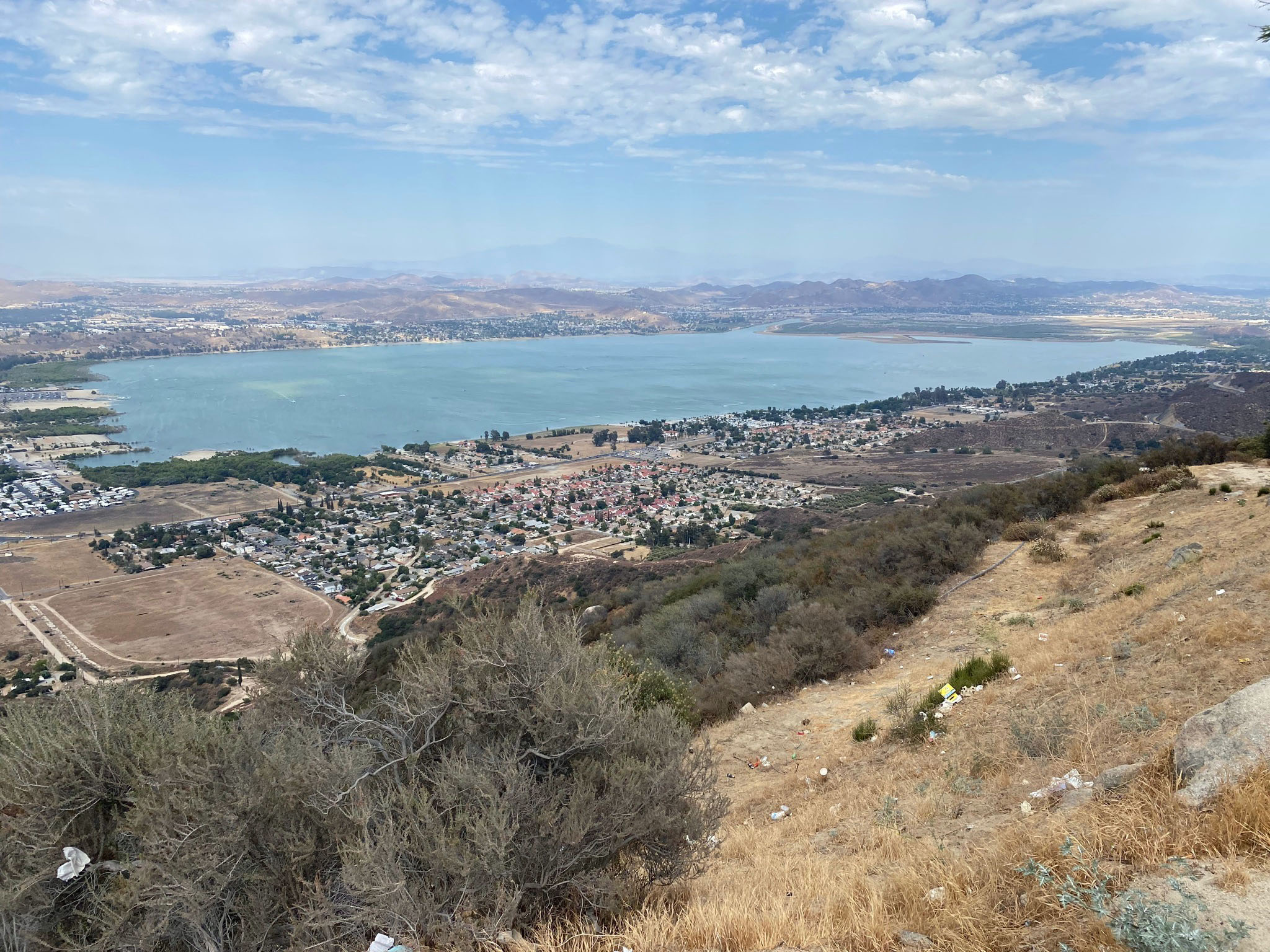
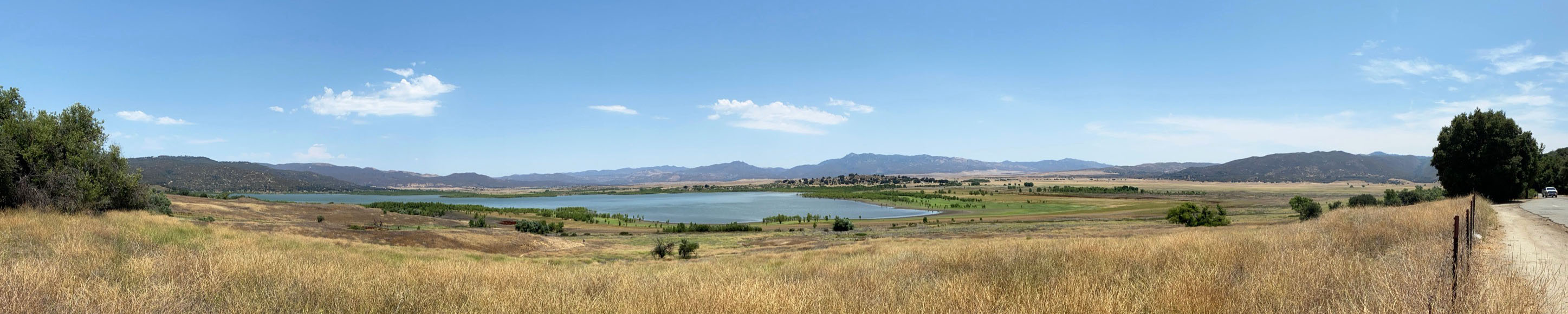
Lakeshore Drive dead ends at Lakepoint Park on the shore of Lake Elsinore near historic downtown Lake Elsinore (town). Lake Elsinore (lake) is a large natural sag pond in the Elsinore Trough. The lake basin is bounded by the Wildomar Fault on the northeast side the Willard Fault on its southwest side. These two faults are part of the Temecula section of the Elsinore Fault Zone.
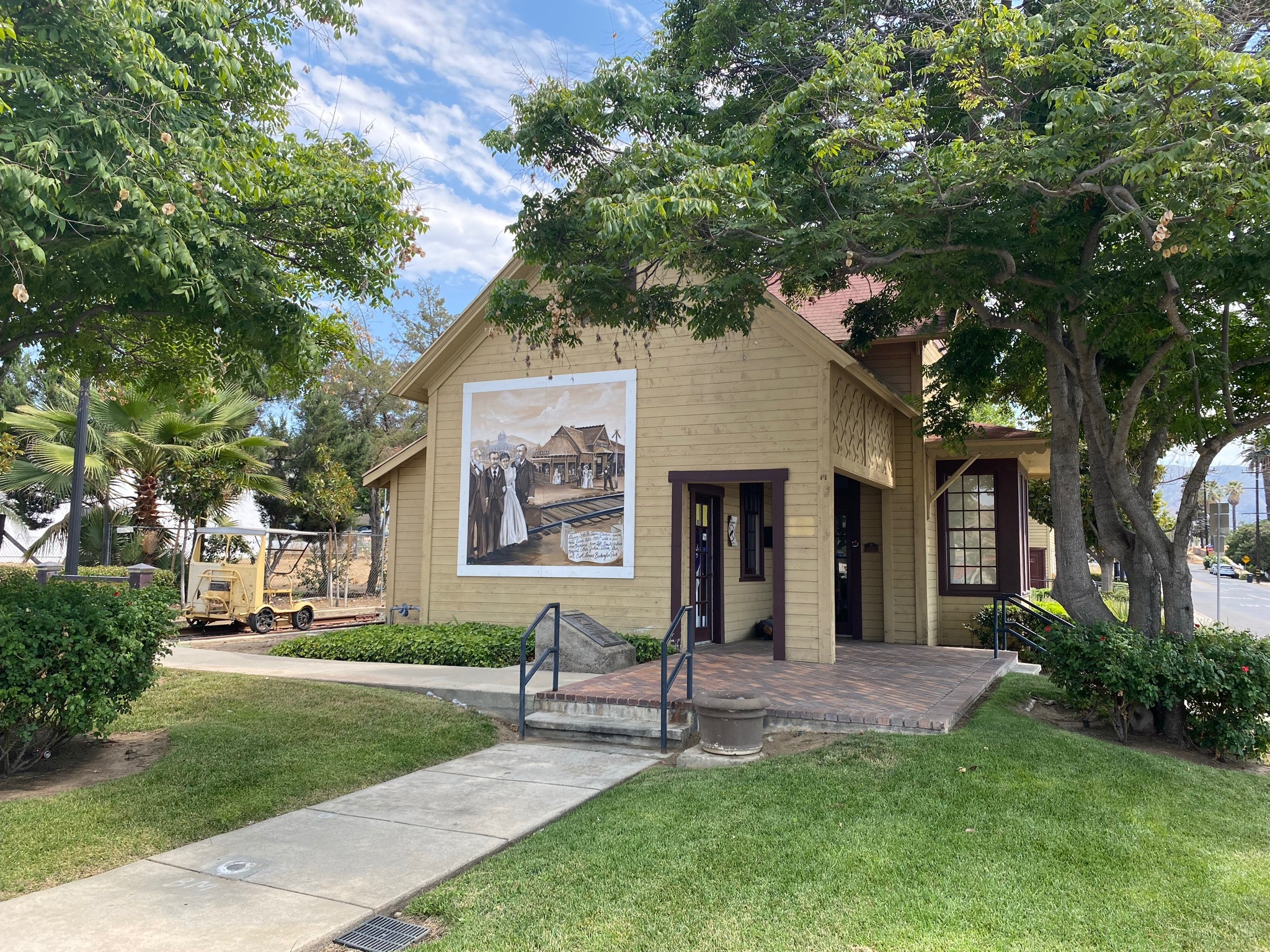
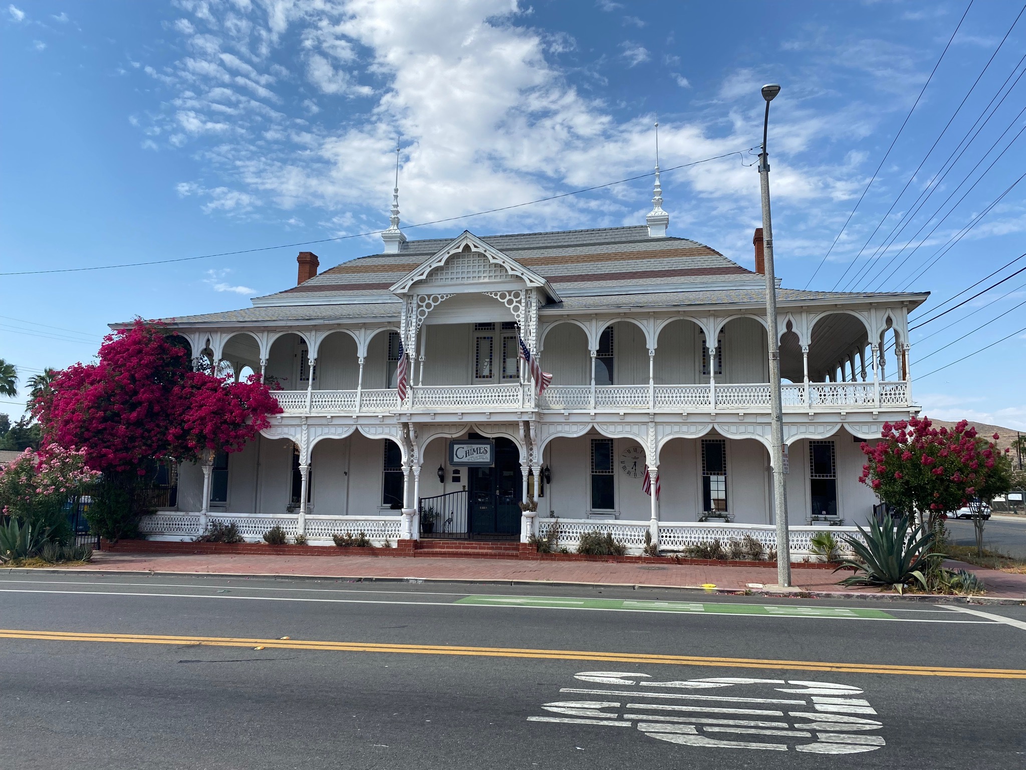
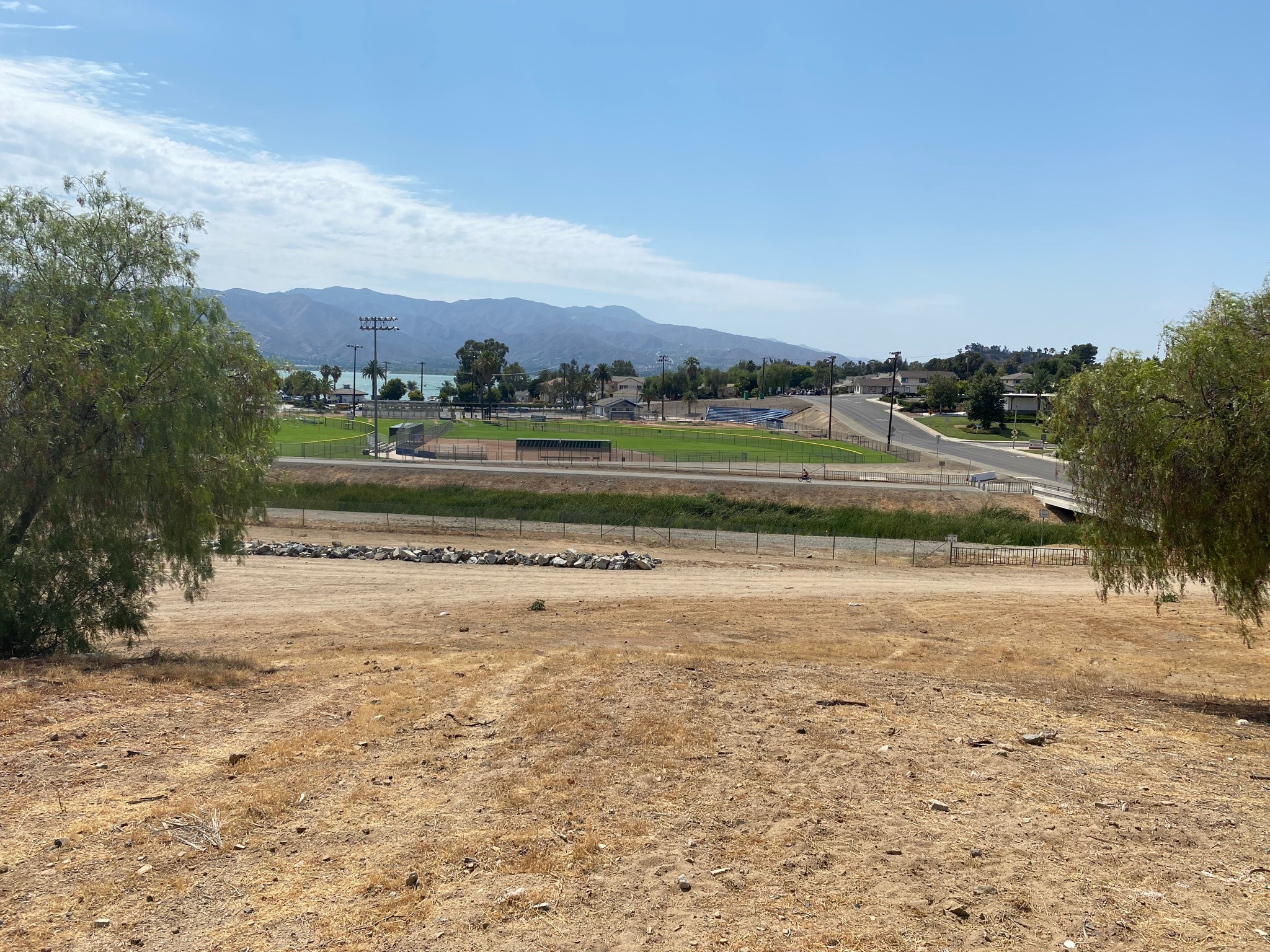
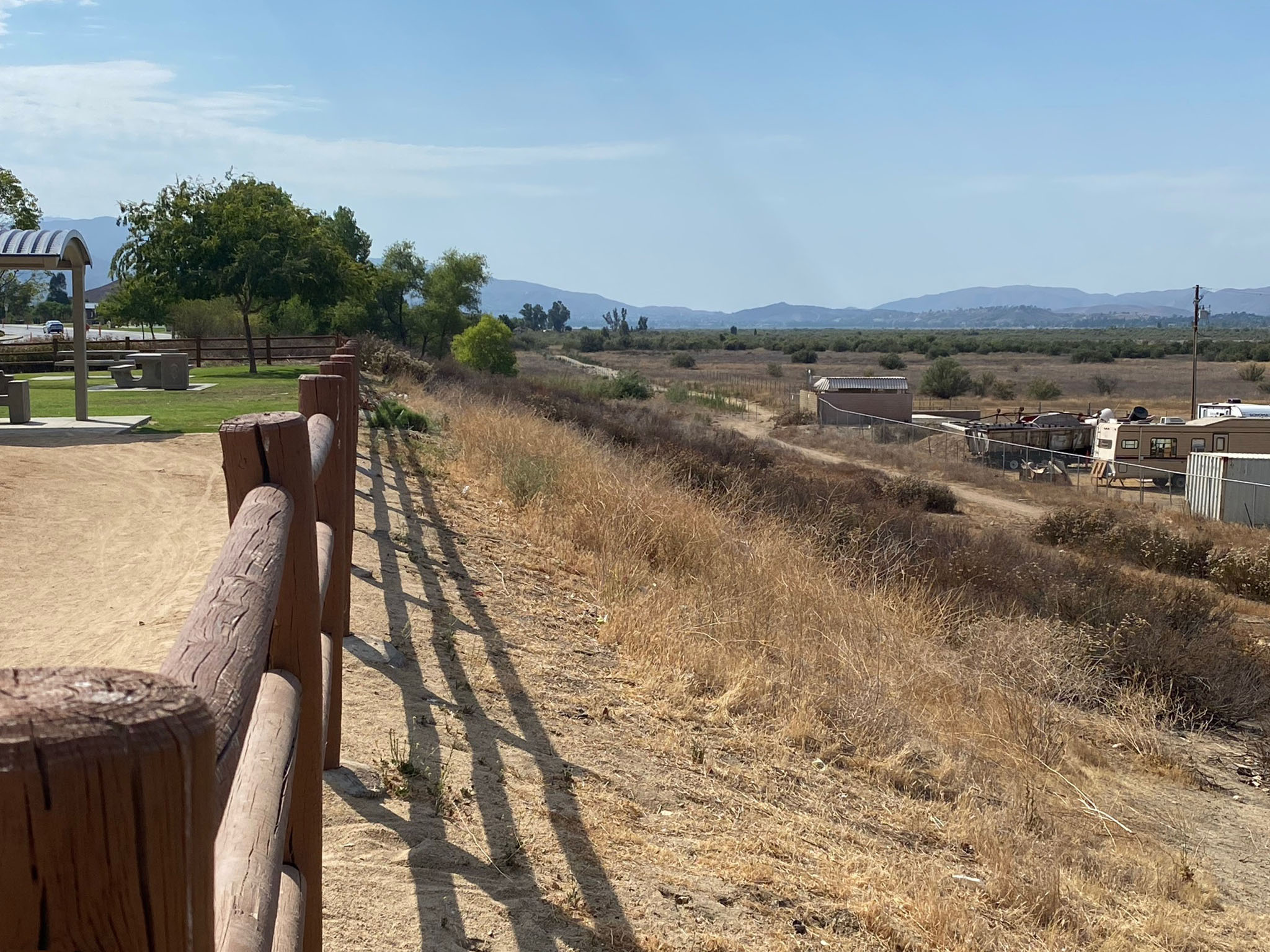
Hot Springs in Lake Elsinore (town): Early settlers noted that many small hot springs formerly issued along the northeast side of Elsinore Lake, but the natural flow of the springs ceased when a canal was cut in the 1890s to supply water for irrigation. However, hot sulfur-smelling water was obtained from shallow wells to support a large bathhouse built for the guests of the historic Lakeview Hotel near the nearby Elsinore Railroad Depot (Figure 5-8) (Waring, 1915). A motel with small hot pools. Another resort named Bundys Elsinore Hot Spring was located 250 yards north of the Elsinore depot (Figure 5-9). The historic Crescent Bath House (Chimes Building) built in 1887 and the Santa Fe Train Station was constructed in 1991 (now the town's Chamber of Commerce) are located in historic downtown Lake Elsinore. Historic Elsinore Hot Springs & Lodge located on 315 N Main Street. Evidence of the fault zone on the southwest side of the lake between the downtown area and the lakeshore is undeveloped parkland area that still preserves swales along the Wildomar Fault Zone (Figure 5-10).
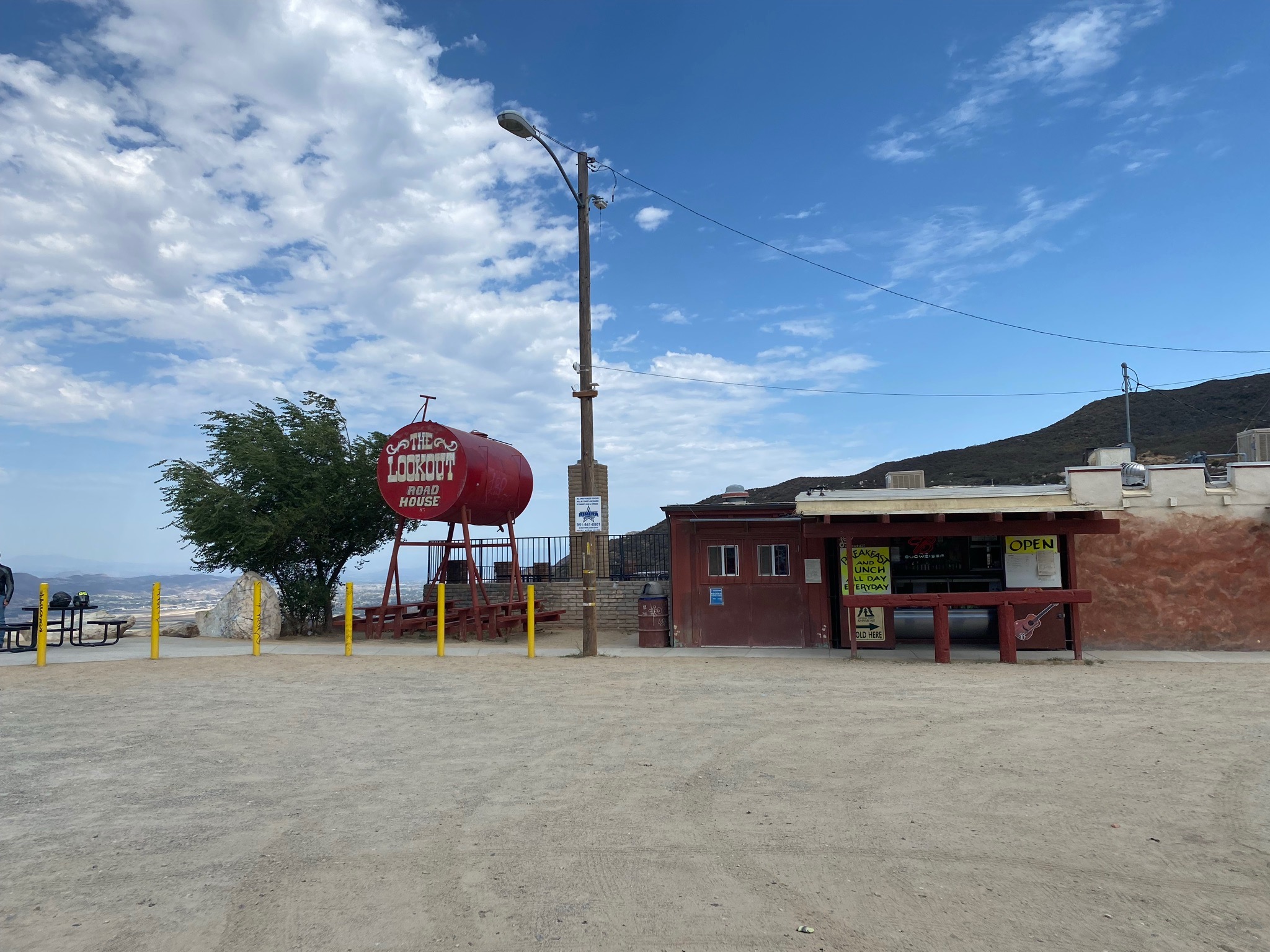
Lake Elsinore Vista Point on Ortega Highway CA 74: From the historic downtown, return northwest along the Lakeshore Drive and turn left on Riverside Drive (CA 74). Follow Riverside Drive around to the south side of Lake Elsinore. Lakeshore Drive becomes Grand Avenue. Turn right onto the Ortega Highway (CA 74) that winds up the mountainside into the Santa Ana Mountain. A little more than 4 miles from the intersection with Grand Avenue is the Lake Elsinore Vista Point (with The Lookout Road House)(Figures 5-11 to 5-13). This roadside parking area one of the easiest places to get sweeping views of the Elsinore Rift Valley. The Ortega Highway continues west into the Cleveland National Forest. The Ortega Highway roughly defines the boundary between the Santa Ana Mountains (to the north) and the Santa Margarita Mountains (to the south).
To continue, follow the Ortega Highway back down the mountain and turn right (south) on Grand Avenue. Grand Avenue roughly parallels the Willard Fault Zone along the base of the mountain front of the Santa Ana Mountains. (Continued is Study Area 6.) |
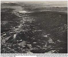 |
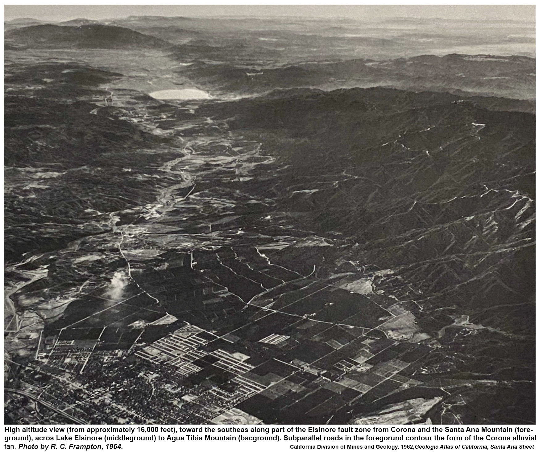
Fig. 5-5. Historic aerial photograph, caption states:
"High altitude view (from approximately 16,000 feet), toward the southeast along part of the Elsinore fault zone from Corona and the Santa Ana Mountain (fore-ground), across Lake Elsinore (middle ground) to Agua Tibia Mountain (background). Sub-parallel roads in the foreground contour the form of the Corona alluvial
fan. Photo by R. C. Frampton, 1964." [The Santa Margarita Mountains are beyond the Santa Ana Mountains to the right of Lake Elsinore.]
From California Atlas of Geology, California Division of Mines and Geology, 1964. |
|
Study Area 6 - Temecula Section
South of Lake Elsinore the Elsinore Trough is bounded on the south by the Willard Fault where crystalline granitic and metamorphic bedrock occur along the mountain front of the Santa Margarita Mountains. On the west side, the Wildomar Fault cuts through Pliocene and Quaternary age basin fill sediments and expresses itself with shutter ridges, swales, and hillside escarpments throughout this urban corridor. |
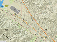
Fig. 6-1. Faults/location map |
Fig. 6-2. Faults/satellite map |
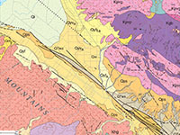
Fig. 6-3. Geologic map |
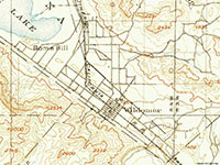
Fig. 6-4. 1901 USGS Topo |
|
Places to check out (north to south):
From the Lake Elsinore Vista Point, follow the Ortega Highway 74 back down to Grand Avenue and turn right (south).
Willard Fault near Grand Avenue: As you drive southeast along Grand Avenue you are basically following the Willard Fault on the southwest side of the Elsinore Trough. The Willard Fault is mapped as a series of smaller, parallel and interconnecting fault along the lower mountainside and as strands buried in the alluvial fan sediments along the trough margin. The expression of the fault includes the linear mountain front with faceted spurs, hour-glass canyons, and older (degraded) side-hill benches.
Wildomar Fault Scarp at Serenity Park: Follow Grand Avenue south about 5 miles and turn left on Corydon Road. Follow Corydon Road east about a half mile to Palomar Street. Turn left on Palomar Street and look for a parking spot. A well-developed linear fault scarp of the Wildomar Fault runs along the border of the park (Figure 6-5).The bedrock on the uplifted side of the fault is sedimentary deposits (Late Pliocene to Early Quaternary) whereas Late Quaternary lacustrine (lake, marsh, and alluvial deposit) underly the lower area below the escarpment. During wet periods during the Ice Ages the larger ancient Lake Elsinore extended into this basin area.
Wildomar Fault along Palomar Street: Continue south on Palomar Street for 5 miles to the next stop. Along the drive you can see a lot of features associated with the trace of the Wildomar Fault (it is mapped as part of the Temecula section of the Elsinore Fault Zone; this section of the fault is named for the community of Wildomar in this area). The fault basically parallels Palomar Street on along the slopes its northeast side of the street . The fault trace appears a series of low hills (or knolls) that are pressure ridges, shutter ridges, swales, and a low linear scarps (a small swales occur on the south side of the street as well). The bedrock of the uplifted area is soft sedimentary deposits (Late Pliocene to Early Quaternary) so fault-line features are degraded. Murietta Creek flows through the valley parallel to the fault.
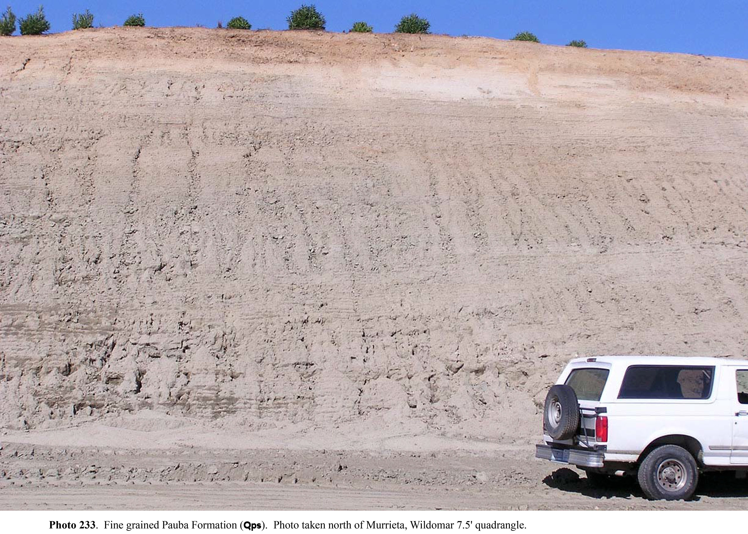
Wildomar Fault at Chaney Hill: Palomar Street make a sweeping "S" bend and becomes Washington Avenue into Murietta. However, just before the "S" bend, turn right on Starbuck Circle and park. It is an easy place to park and get out and look at the linear escarpment for the Wildomar Fault at a historic location called Chaney Hill (Figures 6-6 and 6-7). Chaney Hill is an uplifted block on the east side of the Wildomar Fault that consists older basin fill deposits of the Pauba Formation (Pleistocene). This is a famous fossil locality. Vertebrate fauna from the Pauba Formation are of late Irvingtonian and early Rancholabrean ages (2-3 million years). At Chaney Hill in Murrieta area, the unit contains the 700,000 year old Bishop ash (deposits from a massive eruption in the Mammoth Lakes volcanic area on the eastern side of the Sierra Range). Estimated maximum thickness of the Pauba Formation is 75 meters (Kennedy & Morton, 2003).
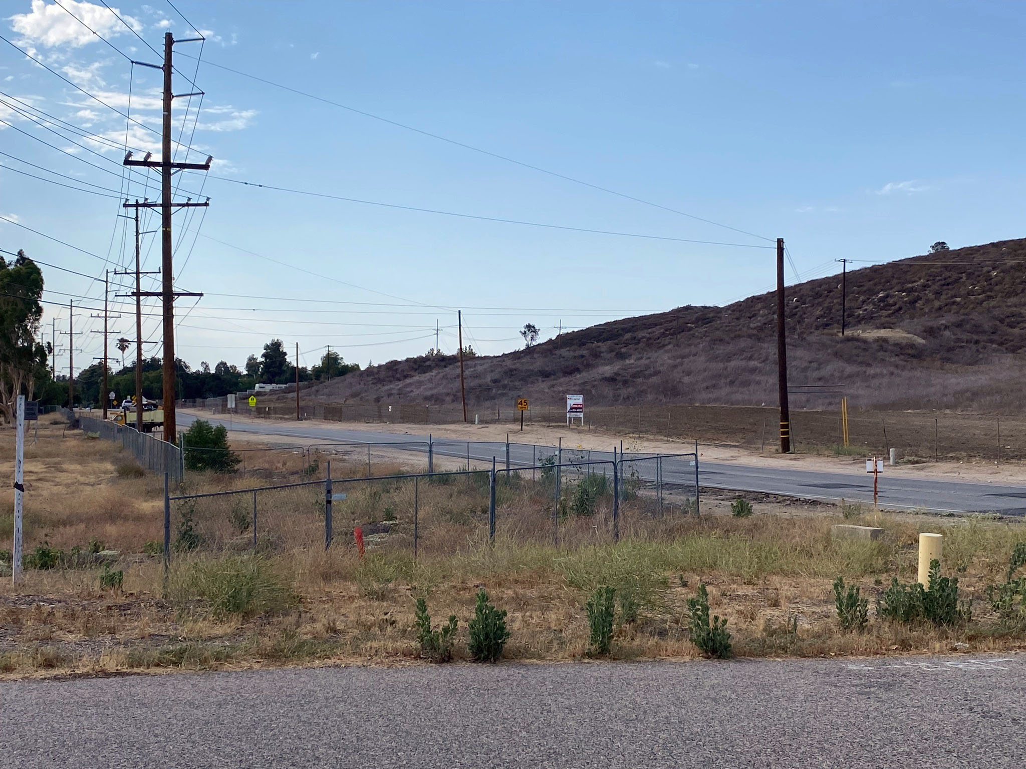
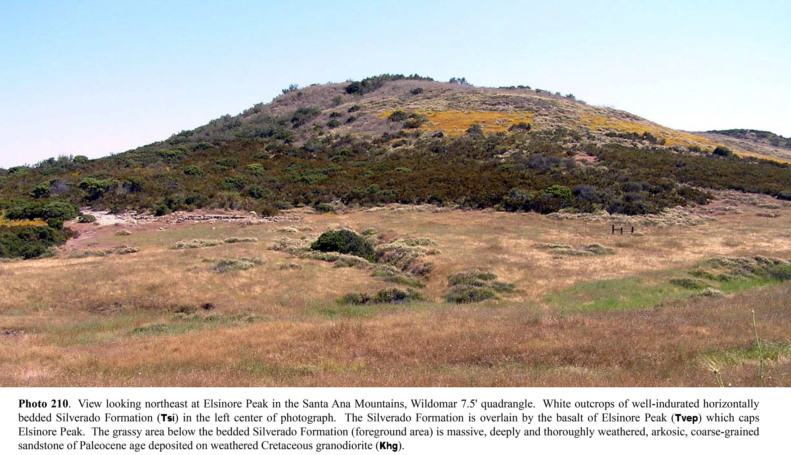
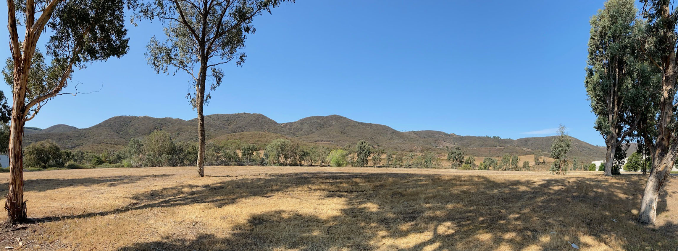
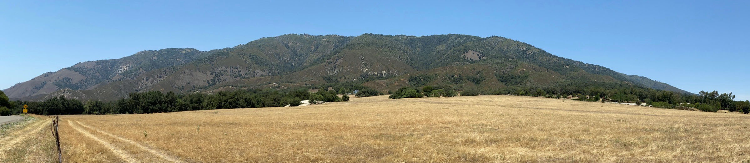
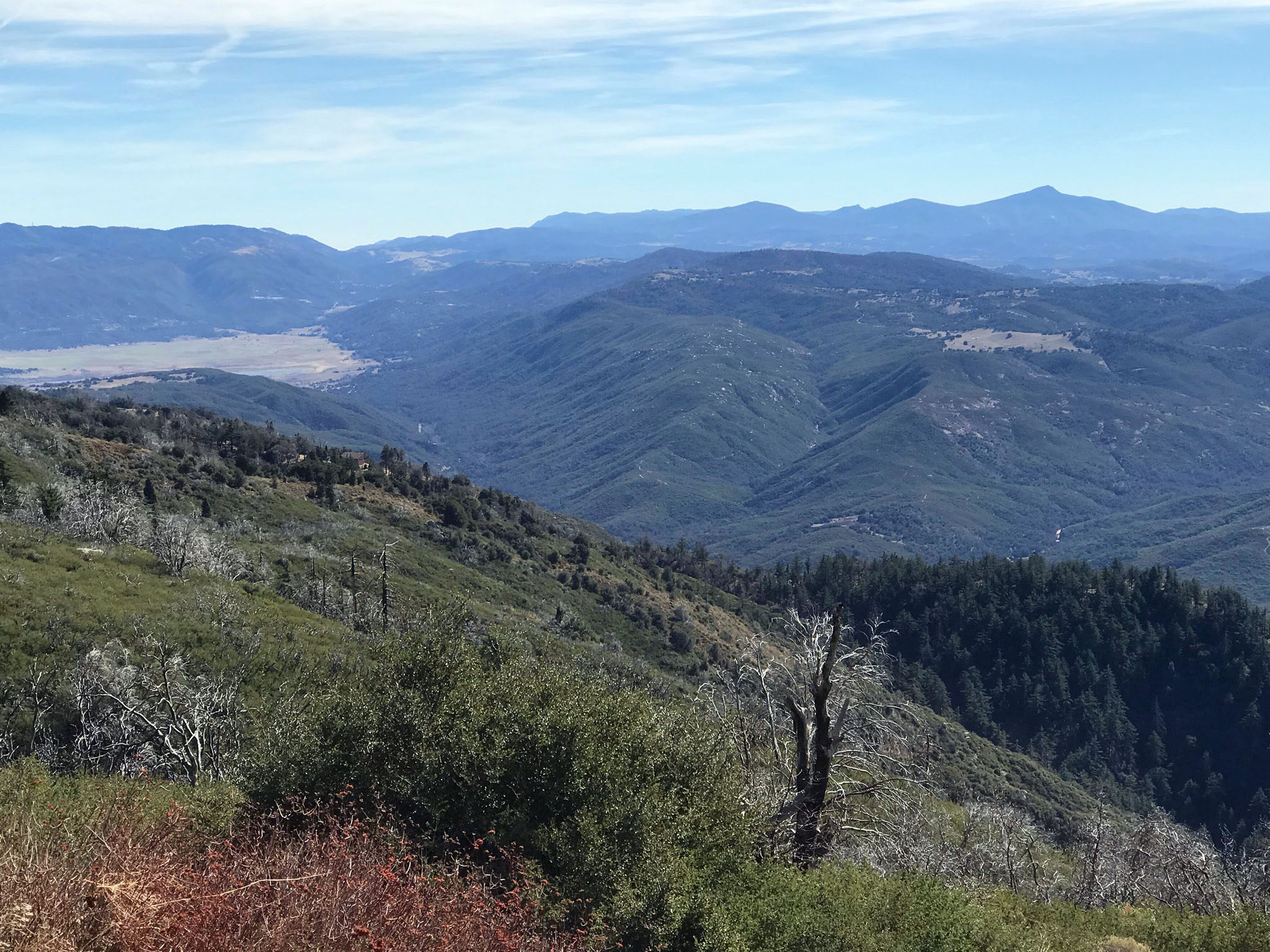
View of Elsinore Peak: If you look west from the Wildomar area you can see Elsinore Peak (elevation 3,566 feet), the highest peak in this part of the Santa Ana Mountains (Figure 6-8). The interesting geologic story is that Elsinore Peak is capped by basalt flow deposits that probably flooded a valley that existed along a very different regional coastal landscape before the Elsinore Fault/Elsinore Trough formed. The Basalt of Elsinore Peak is a remnant of black vesicular basalt capping Elsinore Peak. The basalt has been radiometrically dated to be 11.2 to 11.6 million years old (Morton, 2004).
Continue south into Murrieta. At the "S"bend near Chaney Hill Palomar Street becomes Washington Avenue. (Continued is Study Area 7.) |
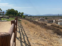
Fig. 6-5. Wildomar Fault scarp at Serenity Park on Palomar Street. |
Fig. 6-6. Wildomar Fault escarpment on Palomar St. at Chaney Hill (looking north). |
Fig. 6-7. Chaney Hill is an uplifted block of early Quaternary sedimentary rocks. |
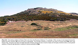
Fig. 6-8. Elsinore Peak consists of a remnant of Miocene-age basalt resting on top of an ancient erosion surface. |
|
Study Area 7 - Temecula Section
On a larger scale, In this region around Murietta and Temecula the Wildomar, Wolf Valley, and Willard faults and associated fault strands within the Elsinore Fault Zone and are responsible for the graben structure of Temecula Valley (trough), a southern continuation of the greater Elsinore Trough. |
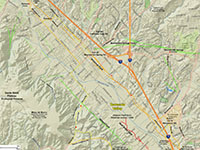
Fig. 7-1. Faults/location map |
Fig. 7-2. Faults/satellite map |
Fig. 7-3. Geologic map |
Fig. 7-4. 1901 USGS topo |
|
Places to check out (north to south):
There are two alternative routes to consider driving from the Chaney Hill to the Old Town Temecula area (involving both Study Areas 8 and 9).
Option A: The Wildomar Fault urban route is a more direct route that passes along the fault zone through Murietta into Temecula.
Option B: The Willard Fault scenic route involves driving into the foothills of the southern Santa Ana Mountains, crossing the fault zone on the way up and down again. Some sections of the route are unpaved on winding, narrow mountain road.
Option A: The Wildomar Fault (urban route)
From the Chaney Hill stop follow Washington Avenue south for about 1.2 miles and turn left (east) on Nutmeg Street.
In 1/4 mile, Nutmeg Street crosses the Wildomar Fault at Adam Street (you can see a bit of the hill-slope escarpment in the area along Adams Street).
Continue east another 1/4 mile and turn right (south) on Jefferson Avenue.
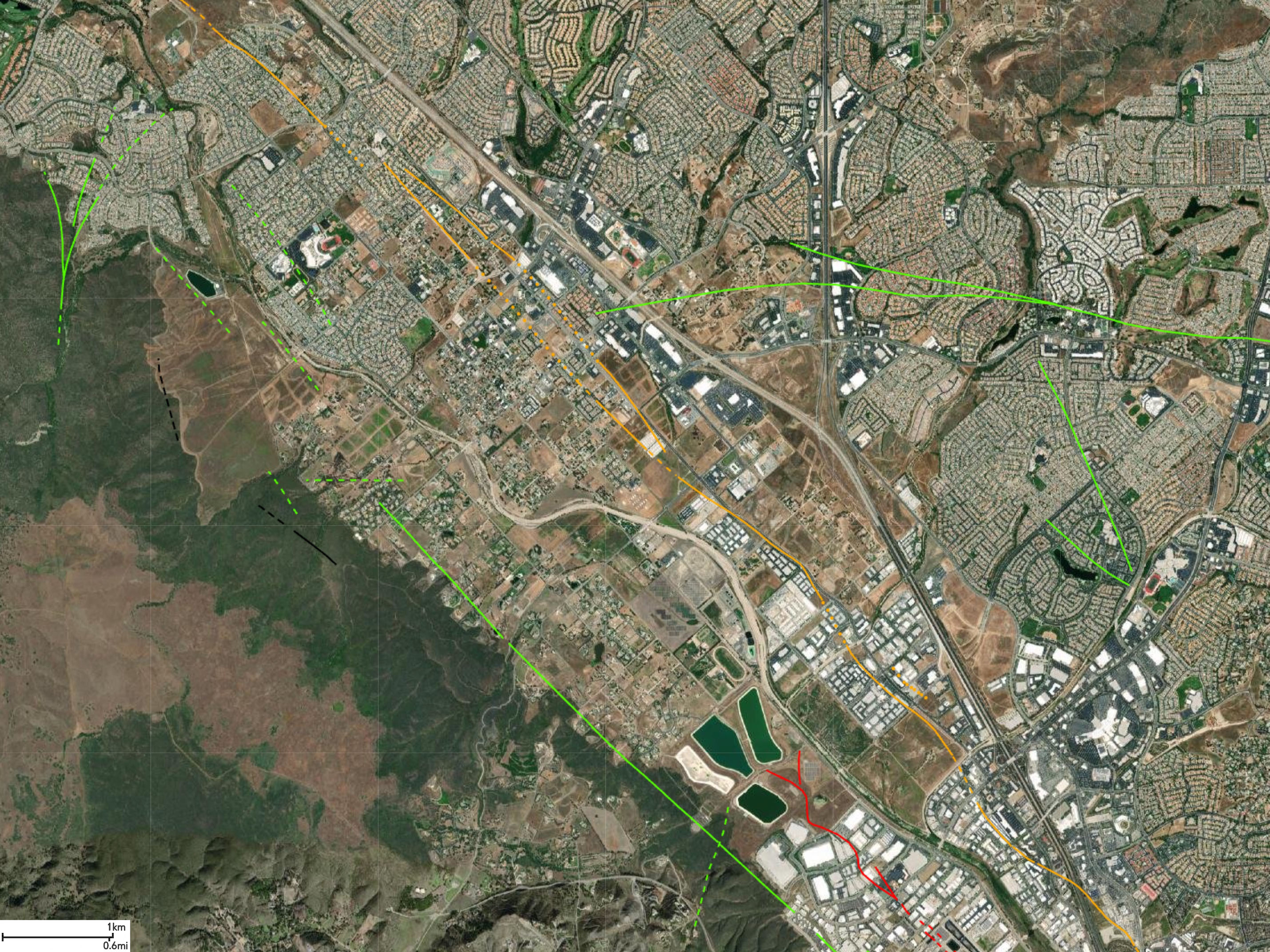
Wildomar Fault Features along Jefferson Avenue: Jefferson Avenue basically follows the Wildomar Fault south for about 7 miles through downtown Murietta into Temecula (near Old Town). The route passes through both residential and commercial/industrial areas. Although construction has modified the landscape in most areas it is possible to still see low shutter ridges and fault-related swales along a linear trend next to Jefferson Avenue. A particular hilly section along the Wildomar Fault scarp is on the east side of Jefferson Avenue between Guava Street and Elm Street. The fault zone features are visible but degraded, suggesting past (prehistoric) displacements and surface ruptures along the fault zone.
The fault offsets very old alluvial deposits of Pleistocene Pauba Formation, a formation consisting of poorly consolidated sandstone, siltstone, and conglomerate (Figure 7-5).
Murrieta Hot Springs Fault: From Nutmeg Street proceed south on Jefferson Avenue for 2.3 miles to Ivy Street. The Murrieta Hot Spring Fault crosses Ivy Street near the Interstate 15 overpass. The Murrieta Hot Springs Fault runs roughly perpendicular to trace of the Wildomar Fault, and it is known to have Quaternary displacement. Murrieta Hot Springs: Early settlers in the Temecula/Murrieta area utilized natural hot water springs that came to the surface in the vicinity of the Murrieta Hot Springs Fault. Murrieta Hot Springs is another set of sulfurous springs located along the Elsinore Fault Zone. These springs had a maximum temperature of 136° that was supplied to a resort hotel that was established nearby in the late 19th century (Waring, 1915). Over the past century warm springs were developed into spa resorts (they are located east of I-15 on Murrieta Hit Springs Road at Margarita Road).
Continue south along Jefferson Avenue into the Old Town Temecula area. Note! You likely encounter heavy car and pedestrian traffic in the Old Town area. You can avoid the heavy tourist traffic by crossing I-5 at Winchester Road, and then take the first right on Ynez Street and proceed to Temecula Duck Pond Park to see the Wildomar Fault in that location (in Study Area 8).
Option B: Willard Fault (rural route)
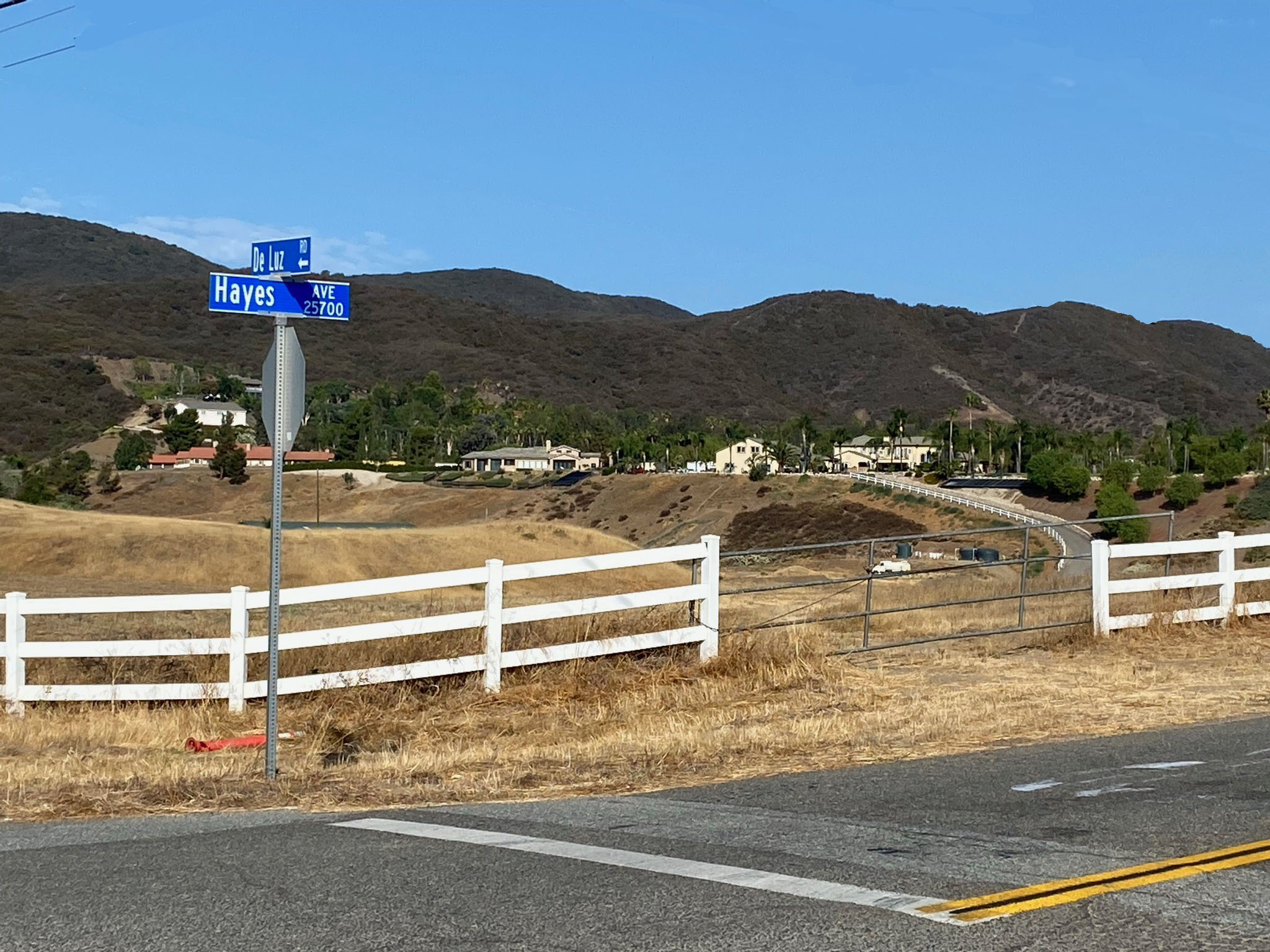
Willard Fault Zone on Deluz Road: From the Chaney Hills stop follow Washington Avenue south for 3 miles and turn right on Ivy St.
In 1/2 mile turn left on Hayes Avenue.
In 1 mile turn right on De Luz Road. (Figure 7-6).
Follow De Luz Road where ascends a canyon to the top of the Santa Rosa Plateau (located in the southern end of the Santa Ana Mountains).
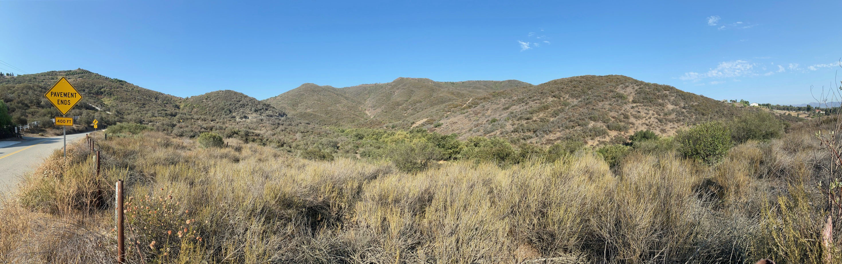
De Luz Canyon: Along the way, DeLuz Road crosses the Willard Fault about a mile west of Hayes Avenue near where the road begins to ascend steeply up the mountain front. The the land on the north side of De Luz Road is part of the Santa Rosa Plateau Ecological Reserve and Riverside County Parks lands (Figure 7-7). A trailhead parking area is on the left near the mouth of the canyon on De Luz Road. Shortly beyond the parking area the pavement ends and the road becomes packed gravel for the way up the canyon. Along the way you can see linear stream drainages that descend down the side of the canyon north of DeLuz Road. These ravines probably follow follow fault strands that parallel the Willard Fault. Cuts along the road in the lower part of the canyon display highly fracture and contorted bedrock in the vicinity of faulted areas (Figure 7-8). In contrast, near the top of the unpaved road grade west of the fault zone the bedrock is more massive and less fractured (Figure 7-9).
The road comes out of the canyon onto the rolling upland of the Santa Rosa Plateau and Mesa de Burro. Volcanic lava flows (basalt) cap the Mesa de Burro and other parts of the plateau (Figure 7-10). The lava flows have been dated to be about 7-8 million years old. Layers of volcanic rock of similar age occur on the northeast side of Elsinore Trough exposed in the Hogbacks along Los Alamos Road (these were dated to be about 10-11 million years old)(Morton and others, 2006). . How these volcanic areas relate to the possible early stages of the formation of the Elsinore Fault is uncertain. The magma probably found its way to the surface along faults that predate the Elsinore Fault Zone.
The pavement on De Luz Road starts again at the top of the canyon. Continue on for several hundred feet and turn left of Calle Capistrano.
In about 1 mile, turn left on Rancho California Road toward Temecula.
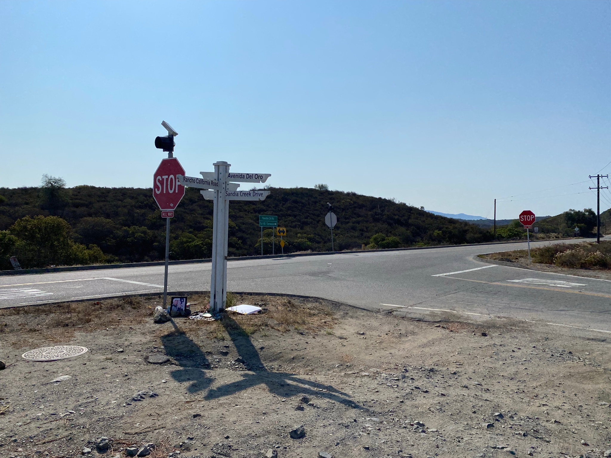
In two miles you will come to the intersection of
Avenida del Oro/Sandia Creek Drive (or the right). A small parking area is on the right at the intersection (Figure 7-11).
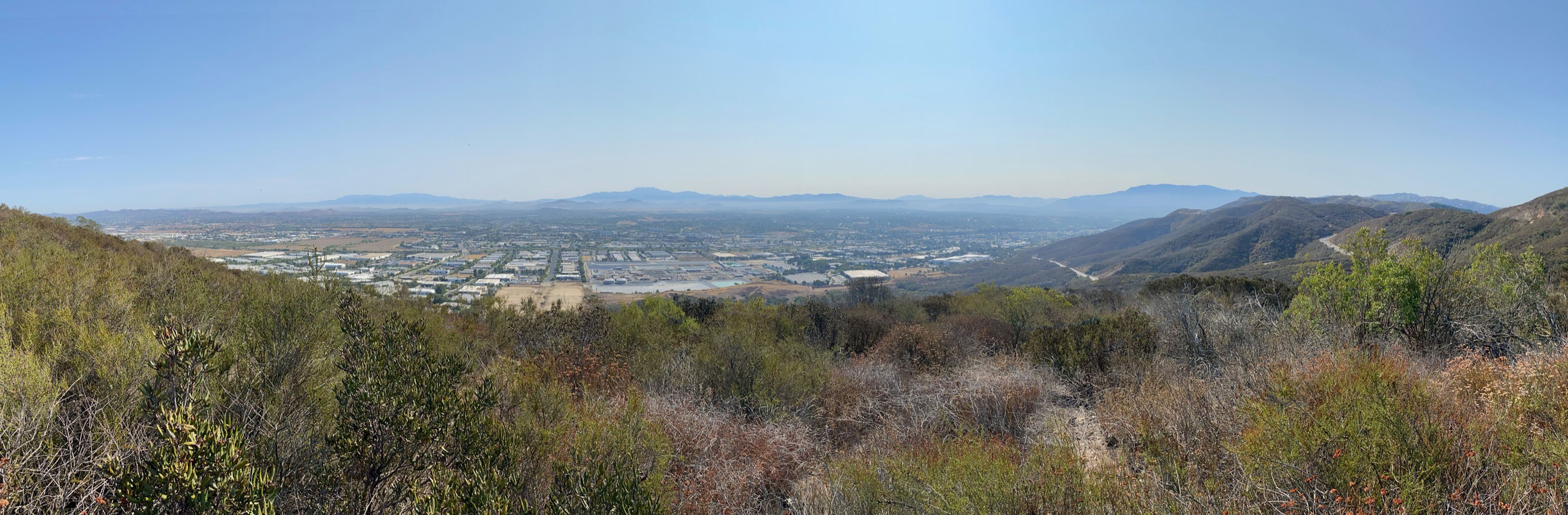
Temecula Valley Overlook: There is an undeveloped overlook area on Rancho California Road at the intersection with Avenida del Oro/Sandia Creek Drive (or the right). A deeply rutted dirt road (not recommended for driving) is on the north side of the intersection that leads about 1000 feet up to the top of the ridgeline overlooking the Temecula Valley (the location shown on the map on Study Area 8 below). The view is impressive, and it is possible to see the fault trace features for the Willard Fault running along the base of the mountain front including escarpments with faceted spurs, side-hill benches, linear and deflected stream drainages and vegetation contrasts (Figures 7-12 to 7-14).
Along the way down the mountain the road crosses several strands of the Willard Fault near the base of the mountain front. Linear ravines and side-hill benches hint at the location of fault lines. At 5 miles, Rancho California Rd intersects Jefferson Avenue in Old Town Temecula. (See the map for Study Area.8.) |
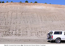
Fig. 7-5. Outcrop of the fine-grained Quaternary basin fill deposits (Pauba Formation) north of Murietta. |

Fig. 7-6. Rural landscape near Hayes Avenue and De Luz Road along eastern flank of Santa Rosa Plateau. |
Fig. 7-7. Santa Rosa Plateau mountain front along De Luz Road near where pavement ends at a trailhead parking area. The mountain front in this area is cut by multiple strands of the Willard Fault on the western side of the Elsinore Trough.
|
Fig. 7-8. Heavily fractured basalt along De Luz Road in the vicinity of the fault zone. |
Fig. 7-9. Santa Rosa basalt in upper canyon along De Luz Road (west of the fault zone). |
Fig. 7-10. Level surface of the top of the Santa Rosa Plateau near Rancho California Road. |
Fig. 7-11. Parking area for Temecula valley overlook on Rancho California Road. |
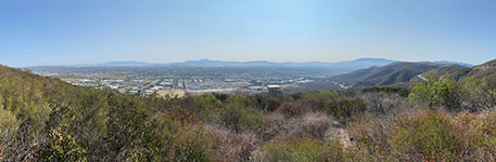
Fig. 7-12. Panoramic view looking east toward Temecula Valley from an overlook area near the intersection of Rancho California Road and Avenida del Oro/Sandia Creek Drive.
|
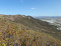
Fig. 7-13. View of the mountain front north of the Temecula Valley overlook. |
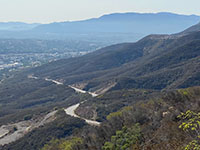
Fig. 7-14. Zoom view of the mountain front south of the Temecula Valley overlook. |
|
Study Area 8 - Temecula Section
This area is at the southern end of the Elsinore Trough encompassing the Temecula and Wolf Valleys. |
Fig. 8-1. Faults/location map |
Fig. 8-2. Faults/satellite map |
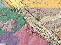
Fig. 8-3. Geologic map |
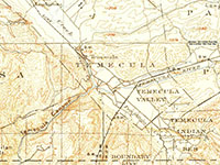
Fig. 8-4. 1901 USGS topo |
|
The local landscape in influenced by Quaternary uplift of the mountain front on the west side of the Willard Fault. North of Temecula Canyon is the Santa Rosa Plateau, part of the the southern end of the Santa Ana Mountains. South of Temecula Canyon is Pueska Mountain.
Temecula is spread out into three alluvium-filled valleys:
- to the northeast is Temecula Valley (along Murrieta Creek),
- to the southeast is Wolf Valley (along Pechanga Creek),
- to the northeast is Pauba Valley (along Temecula Creek), and;
- to the south is the smaller Rainbow Valley (a canyon along Rainbow Creek).
The confluence of these four streams is near the mouth of Temecula Canyon where the merged stream to become the Santa Margarita River that drains westward through mountainous country and eventually to the coast on Camp Pendleton north of Oceanside, CA.
Geologic map: Tan and Kennedy, 2000 (top); Kennedy 2000 (bottom).
|
Places to check out (north to south):
Temecula Valley Overlook to Business Park Road: From the Temecula Valley Overlook continue down Rancho California Road down the mountain front. Unfortunately there are no places to safely stop on the way down the busy mountain road. At 3 miles, turn left at the stoplight on Business Park Drive. This is an industrial/business park district. Along the way down the mountain the road crosses several strands of the Willard Fault near the base of the mountain front. Linear ravines and side-hill benches hint at the location of fault lines along the lower mountain front (Figures 8-5 and 8-6).
Return to Rancho California Road, and turn left and proceed a half mile to Jefferson Avenue in Old Town Temecula. Turn left on Jefferson Avenue. If you turn right note that you may be stuck driving through Old Town Temecula. Warning! This area can be a traffic nightmare, especially on weekends.
Three options are presented below:
Option A: Turn left from Rancho California Road onto Jefferson Avenue and head to the Guadalajara Mexican Grill & Cantina (I-15 overlook).
Option B: Go straight on Rancho California Drive for 0.6 mile, cross over I-15 and proceed to the Temecula Duck Pond Park on Ynez Drive.
Option C: Turn right from Rancho California Road onto Old Town Front Street and and head through Old Town Temecula. There are places to see the Willard Fault near the Temecula Canyon area (before proceeding to the Duck Pond).
Optional Route A
- Wildomar Fault Crossing 1-15 (and avoiding Old Town Temecula)
Wildomar Fault crosses 1-15 next to the Guadalajara Mexican Grill & Cantina: The Wildomar Fault crosses Interstate 15 in the Temecula Town Center area, about midway between Exit 59 (Rancho California Rd) and Exit 61 (CA-79/Winchester Rd). To get there from the intersection of Rancho California Road and Jefferson Road, follow Jefferson Avenue north 1 mile and turn into the parking lot for Guadalajara Mexican Grill & Cantina. The back of the parking lot borders I-15 southbound. If you look across the interstate you can see the fault scarp along the northbound side of the freeway (Figure 8-7).
Continue north on Jefferson Avenue for a half mile and turn right on Overland Dr. Cross over the interstate and take a right in quarter mile on Ynez Drive. Take Ynez Drive south for 1.3 miles. Just past Rancho California Road turn left at the light to enter Temecula Duck Pond Park.
Optional Route B - Head straight to Temecula Duck Pond Park
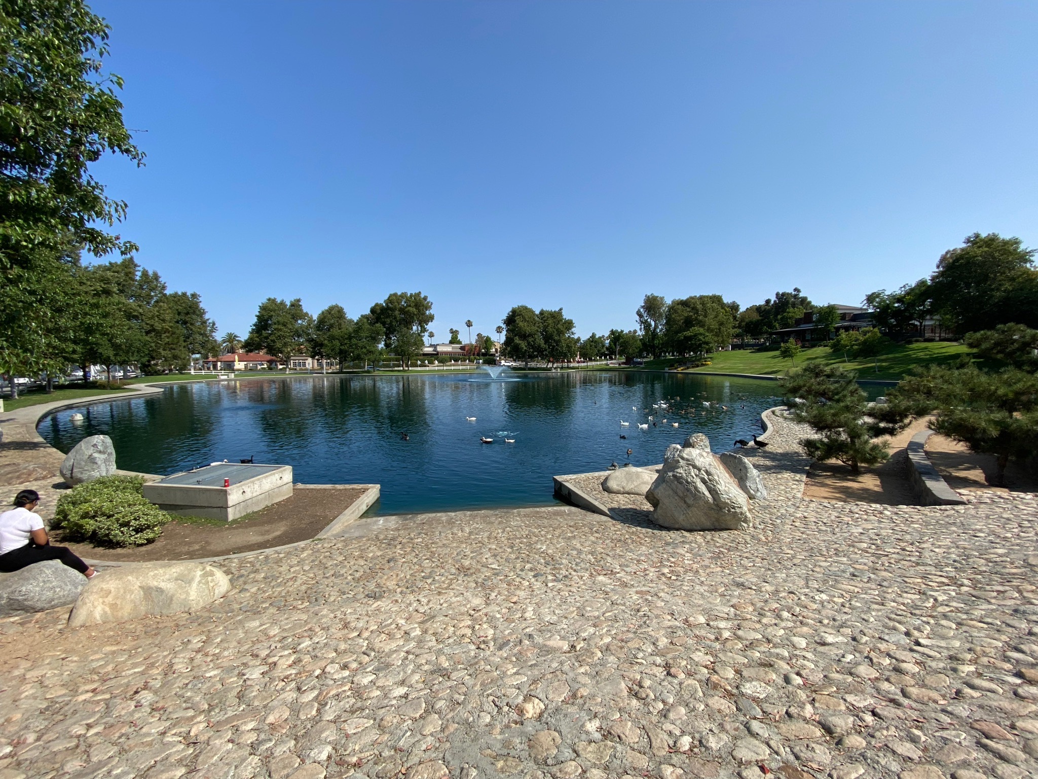
Temecula Duck Pond Park: From Old Town-Front Street, you can cross over Interstate 15 on Rancho California Road, proceed one block and turn right on Ynez Drive. Proceed a couple hundred feet and turn left into the parking area for the Temecula Duck Pond Park. The Duck Pond is a very popular destination in the the Temecula area (Figure 8-8). It also is well situated on the Wildomar Fault. The "Duck Pond" may be a modified sag pond. There is a 0.2 mile trail around the pond. Another trail that goes around open park hilly fields southeast of the pond area. In this relatively undisturbed park land you can see the eroded fault escarpments that preserves some deflected stream drainages (Figures 8-9 and 8-10). If you continue driving south on Ynez Drive you are basically following the escarpment of the Wildomar fault for the next half mile until you reach the intersection of Pauba Lane.
Optional Route C - Proceed through Old Town Temecula to the Temecula Canyon area
Old Town Temecula: South of the intersection with Rancho California Road, Jefferson Avenue become Old Town Road-Front Street in Old Town Temecula. Old Town Temecula is a tourist destination with an abundance of restaurants, shops, and other attractions crowded into a half-mile section of Front Street. Historically, the area had been the site of Indian villages for thousands of years before the Spanish arrive. A village began to be settled as early as the 1820s along the bluffs of Murrieta Creek near the mouth of Temecula Canyon (at the confluence of several stream). In 1847 the Mormon Battalion joined forces with with American General Kearney's army and fought one of the bloodiest battles of the Mexican War in California (the Temecula Massacre). In the 1859's Temecula became a stop on the Butterfield Overland stagecoach line, with a post office established in 1859, followed by a population boom after the Civil War. The 2020 Census determined 115,055 people currently live in the city of Temecula.
Willard Fault on 1st Street: As the south end of the Old Town Temecula area, turn right on 1st Street and Murrieta Creek to where the street dead ends basically at the linear mountain front defined by the Willard Fault.
Willard Fault along Pujol Street: From 1st Street, turn south on Pujol Street. Follow Pujol St. south for several blocks where it becomes Cam Estribo (posted as a private road). You can park near the end of the pavement and look up at the hillsides and see step-like benches that are a combination of elevated stream terraces and hill-side benches associated with the fault zone (Figure 8-11).
Willard Fault at Temecula Canyon: The area around the mouth of Temecula Canyon is part of the Santa Margarita Ecological Reserve and is considered a sensitive habitat area with restricted access. If you get permission in advance, or join a docent-led tour. A trail posted with "no trespassing" signs starts at the end of the pavement on Pujol Street. The trail follows the west side Murrieta Creek down to the confluence with Temecula Creek (this is where the Santa Margarita River begin its journey to the coast via Temecula Canyon, see Figures 8-12 to 8-16). Pechanga Creek and Rainbow Canyon Creek merge with Temecula Creek nearby on the east side of I-15. The Santa Margarita River in Temecula Canyon is an antecedent stream. The ancestral Santa Margarita River flowed westward across the landscape before the formation of the Elsinore Fault and associated basins of the Elsinore Trough in Pliocene time (starting about 3 million years ago). The canyon predates the uplift of the Santa Ana tectonic block (with associated mountains) on the west side of the fault zone. The canyon is now over 2,000 feet deep about a mile southwest of the confluence with Murrieta Creek at the mouth of the canyon.
There are large plunge pools in the stream bed near the mouth of the canyon with low falls and rapids downstream in this flood-prone canyon. The landscape around the mouth of Temecula Canyon is relatively undisturbed by human activity, and the local landscape preserves an abundance of natural landscape features associated with the Willard Fault including scarps, shutter ridges, and side-hill benches. Large fracture can be seen in the bedrock at the mouth of the canyon (they are easiest to see with Google Earth). The bedrock on the north side of the canyon is metamorphic rocks (mostly schist and gneiss of Jurassic-and-older age, Figure 8-17). The boulder-covered landscape on the south side of the canyon is granite bedrock of Late Cretaceous-age. The river canyon roughly follows the boundary between these two two types of rock for several miles downstream. In Temecula, the stream bed of Murrieta Creek basically follows the trace of the Wildomar Fault. The steep hillside (on the west of the valley) is the linear mountain front defined by the Willard Fault. A USGS Stream Gage is located near the mouth of the canyon that has been used to record stream discharge data since 1927 (Figure 8-18). Extremes for Period of Record: Maximum discharge, 31,000 ft³/s, Jan. 16, 1993 (gage height [flow depth], 22.5 ft); minimum daily, 0.16 ft³/s, Mar. 31, 1988.
Wolf Valley - Temecula to Pechanga
Wildomar Fault at Temecula Creek Inn - Golf Resort: Return to 1st Street, then turn right (south) Old Town Road-Front Street. Cross Interstate 15 where CA Highway 79 begins (at Exit 58, Indio on I-15). In about a half mile turn right on Pechanga Parkway (S16). After crossing Temecula Creek in several hundred feet turn right on Rainbow Canyon Road. In a half mile the entrance to the Temecula Creek Inn - Golf Resort is on your right. (You can also hit some golf balls!) On the golf course you can see degraded (and modified) fault scarps, swales, and pressure ridges starting at the intersection and along the drive to the clubhouse parking area (Figures 8-19 and 8-20). You can look northwest across the golf course to see the faulted mountain front on the west side of I-15 near the mouth of Temecula Canyon (Figure 8-21). Pueska Mountain on the south side of Temecula Canyon and on the west side of I-15 is a massive granite pluton on the west side of the Willard Fault (Figures 8-22 and 8-23).
Wolf Valley Trough: Pechanga Parkway basically runs down the middle of Wolf Valley with the Wildomar Fault to the east and the Willard Fault to the west along the sides of the valley. Pechanga Parkway ends and become Pala-Temecula Road after it crosses Pechanga Creek at the intersection of Los Encinos Road. The steep hill on the right side of the road near the intersection is a pressure ridge pushed along the Wildomar Fault (discussed below).
Continue south on Pala-Temecula Road into Study Area 9.
|
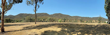
Fig. 8-5. This view shows the mountain front along the eastern side of the Santa Rosa Plateau from Business Park Drive. The Willard Fault splits into parallel and interconnected fault strands along the mountain front west of Temecula, CA. |
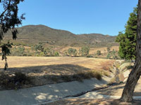
Fig. 8-6. Deflected stream can be seen along the Willard Fault the mountain front west of Business Park Drive.
|
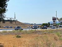
Fig. 8-7. Wildomar Fault crosses I-15 (with scarp). View from parking at Guadalajara Mexican Grill & Cantina. |

Fig. 8-8. Temecula Duck Pond Park. Prior to development the pond was a natural sag pond area along Temecula Creek. |
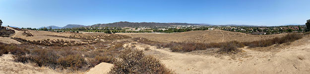
Fig. 8-9. Panoramic view looking south-west-north (left to right) from a hilltop overlooking the Wildomar Fault zone from a hilltop overlooking fields next to Temecula Duck Pond Park. Stream drainages appear to be deflected along fault zone that runs parallel to Ynez Drive to the southeast of the Duck Pond area.
|
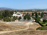
Fig. 8-10. View north toward distant valley of the Elsinore Trough from hilltop near Duck Pond Park. |
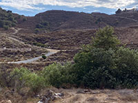
Fig. 8-11. Mountain front with hillside-bench along scarp of the Willard Fault 1/4 mile north of Temecula Canyon. |
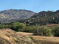
Fig. 8-12. View south from CA79 Exit of Temecula Canyon with boulder-covered Pueska Mountain in distance. |
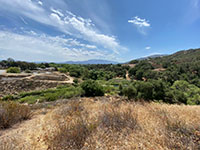
Fig. 8-13. Confluence of Temecula, Pechanga, Murietta, and Rainbow Creeks at the mouth of Temecula Canyon. |
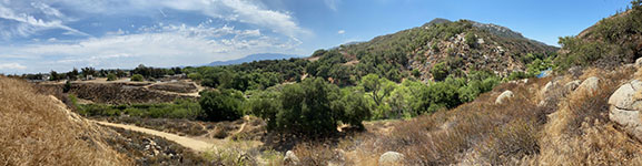
Fig. 8-14. Panoramic view looking east to south from the top of a side-hill bench on the north side of the mouth of Temecula Canyon. The Willard Fault cuts across the canyon and then runs the mountain front near the break in slope south of the canyon. Temecula Creek drains from Pauba Valley and Pechanga Creek drains from Wolf Valley (both valleys are to the east of I-15). |
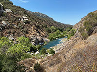
Fig. 8-15. Santa Margarita River starts at the confluence at the mouth of Temecula Canyon. The river drains to the coast on Camp Pendleton. |

Fig. 8-16. View upstream at the mouth of Temecula Canyon. Granite boulders in river in the foreground. |

Fig. 8-17. Foliated schist with granitic dikes in Temecula Canyon exposed along the river bed. |
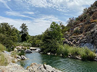
Fig. 8-18. USGS stream gaging station (cement dam and antenna box) at mouth of canyon. |
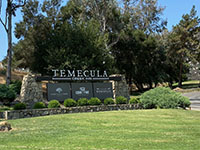
Fig. 8-19. Entrance sign to the Temecula Golf Course where the Willard Fault intersects Rainbow Canyon Road. |

Fig. 8-20. Low shutter ridge along the Willard Fault along the Temecula Golf Course access road. |
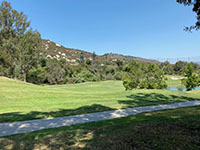
Fig. 8-21. A strand of the Willard Fault cuts across the golf course. Temescal Canyon is on the other side of I-15. |
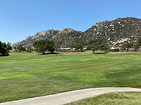
Fig. 8-22. View south across the Temecula Golf Course to where I-15 runs along the base of Pueska Mountain. |

Fig. 8-23. Zoom view of the granite boulders and outcrops on Pueska Mountain on the west side of I-15. |
|
Julian Section
(Elsinore Fault Zone)
The Julian section of the Elsinore Fault is the longest section. Julian cuts diagonally across various Peninsular Range batholithic and pre-batholithic metamorphic terrains. The northwest end of the Julian section begins near the northern San Diego County line near Pala, CA. From there it passes along a linear valley along the southwestern flank of Palomar Mountain. There is nearly a 2000 elevation difference on opposite sides of the valley suggesting a significant vertical component on the north (Palomar Mountain) side of the fault. In contrast, Lake Henshaw is with of a massive subsiding basin that is host to both the Elsinore Fault and the Earthquake Valley Fault—another earthquake fault with Holocene earthquake activity less than 5 miles to the north, and runs roughly parallel to the Elsinore Fault. Southeast of Lake Henshaw, the Elsinore Fault Zone continues along the northeast side of a linear valley along the southeastern flank of the Volcan Mountains in the core of the Peninsular Ranges (highest peaks). The fault zone crosses a divide on the north side of Julian and descends along Banner Canyon into the Basin and Range landscape of the Anza Borrego Desert (State Park). |
Julian Section
(Modified from SCEDC summary)
- TYPE OF FAULT MOTION: Right-lateral and reverse (oblique slip)
- ORIENTATION: Strike: N56°W, Dip: near-vertical to 45°, NE
- LENGTH: 49 miles (79 km)
- LOCATION: San Diego County, across the high peaks region of the Peninsular Ranges into the Anza Borrego Desert region (State Park)
- NEAREST COMMUNITIES: Pala, San Felipe, Julian, CA
- MOST RECENT SURFACE RUPTURE: Latest Quaternary (<15 ka); no large earthquakes in this section in historic time
- INTERVAL BETWEEN MAJOR RUPTURES: unknown, possibly 340 years
- PROBABLE MAGNITUDES: Mw 6.0-7.0
- SLIP RATE: between 1.0 and 5.0 mm/yr
- GEOMORPHIC EXPRESSION: dextral deflected drainages, shutter ridges, hillside benches and scarps in alluvium, offset and beheaded drainages, benches and scarps along both the main Elsinore Fault and the the nearby Earthquake Valley Fault. Displacements are observable in Holocene alluvium and Quaternary alluvial deposits.
- QFFDUS ID:
Julian section (126e)
|
Study Area 9 - Temecula Section and Julian section
Near the border of between San Bernardino County and San Diego County the Temecula section of the Elsinore Fault Zone ends. From there on south the fault zone continues as the Julian section. This is area encompasses rugged mountain country associated mostly with the Agua Tibia Wilderness (BLM and reservation lands). |
Fig. 9-1. Faults/location map |
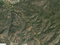
Fig. 9-2. Faults/satellite map |
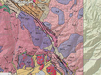
Fig. 9-3. Geologic map |
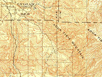
Fig. 9-4. 1903 USGS topo |
|
Places to check out (north to south):
The Willard Fault crosses S16 (Pala Road) just north of Rainbow Oaks Drive at the southern end of Wolf Valley (the southern end of the Elsinore Trough). A fault scarp associated with the Willard Fault can be seen just south of the parking area for the Pechanga Indian Health Clinic Figure 9-5).
Elsinore Fault in the Agua Tibia Mountain wilderness area:
South of Wolf Valley the Elsinore Fault crosses into inaccessible mountainous country in the vicinity of Agua Tibia Mountain (Figure 9-6).
Highway S16 (Pala-Temecula Road) continues south, crosses a divide between Mount Olympus (to the west) and Agua Tibia Mountain (to the east). For several miles, Highway S15 follows a linear canyon that merges with Pala Creek Canyon southward into the town of Pala. The Elsinore Fault crosses along the mountain front northeast of Pala in rugged mountainous country (Figure 9-7).
Turn left on Pala Mission Road, then turn left (south) on CA Highway 76.
Continue south on CA Highway 76 for 7 miles into Pauma (into Study Area 10).
|
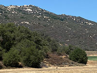
Fig. 9-5. Willard Fault scarp on the west of Pala Road, south of Pechanga in the south end of Wolf Valley in field near Pechanga Health Clinic. |
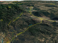
Fig. 9-6. Elsinore Fault near Pala (view to south between Pechanga and Rincon, CA (Google Earth with USGS faults). |
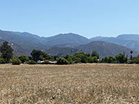
Fig. 9-7. View southeast toward Agua Tibia Mountain area from Pala (S16). The Julian section of the fault cuts across the mountain front. |
|
Study Area 10 - Julian section
Both Pala Valley and Pauma Valley are an alluvium-filled valleys along the San Luis Rey River. The Elsinore Fault Zone runs across the mountain front on the east side of Highway 76 (Pala Road) on the flanks of Agua Tibia Mountain, Eagle Crage, and Boucher Hill on Palomar Mountain. |
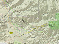
Fig. 10-1. Faults/location map |
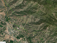
Fig. 10-2. Faults/satellite map |
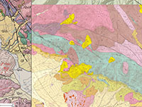 Fig. 10-3. Geologic map Fig. 10-3. Geologic map |
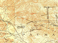
Fig. 10-4. 1903 USGS topo |
|
Geologic map: Kennedy, 2000 (left side); Kennedy, 2014 (right side).
Places to check out (north to south):
At the intersection of Highway 76 in Pala, turn left (south). The highway follows the valley of the San Luis Rey River into Pauma Valley.
Elsinore Fault scarps on Adams Drive: About 5 miles south of Pala, Adams Drive is on the left (east) side of the road. A strand of the fault crosses of the fault about 1,000 feet up the road at the intersection of El Sendero Dr. The change in slope in this area basically reveals the location of the fault cutting across the old alluvial surface (somewhat hidden in the local orchards). If you continue up the road to the next intersection at Paseo Lindo, on the left is a dirt road called the Gomez Trail that heads up the mountains. Here you can get above the orchards and get a view of the valley with the faceted spurs along the mountain front. You can continue for about a mile as Adams Drive winds along the mountain front before it descends back in the valley, connecting with Pauma Reservation Road before intersecting back with Highway 76.
From the stoplight at Pauma Reservation Road, turn left (east) onto Highway 76. In 1.2 miles Nate Harrison Grade (road) is on the left.
Nate Harrison Grade: The Nate Harrison Grade is a historic trail, now an unpaved 4WD Road that connects Pauma Vally to the park road in Palomar Mountain State Park. Note that this is a relatively narrow, often single lane, mountain road, without guardrails on steep mountainsides. It is not recommended for passenger cars, and most vehicles drive the route coming down the mountain from Boucher Hill in the state park. The lower part of the road is paved up the alluvial fan to the base of the mountain front (Figures 10-5 and 10-6). The trace of the Elsinore Fault crosses the road somewhere in the vicinity of 2,800 ft overlook (Figure 10-7). The fault is not obvious along the road, but strands of the fault can be seen at notch on Eagle Crage Mountain to the north (Figure 10-7), and along the mountain front along Pauma Valley in the Adams Drive area discussed above (Figure 10-8).
Harrison Canyon is the deep gorge on the south side of the Nate Harrison Grade. Erosion along the fault line is expresses a a notch in the ridgeline on the south side of the canyon (Figure 10-9 and 10-10). The fault trace continues south along the mountain front on Palomar Mountain. Palomar Mountain (see website) is part of a great uplifted block of basement rocks (metamorphic and granitic rocks of Mesozoic age) on the northeast side of the Elsinore Fault Zone. The linear mountain front stretches near 17 miles from near Pauma to Lake Henshaw (to the south).
Witch Creek Fire Burn Area: Witch Creek Fire (or Witch Fire) occurred in October of 2007 after and merged with the Poomacha Fire (Figure 10-11). It was the most widespread and destructive wildfire in the San Diego region in modern history. Much of the mountainous country east of Palomar Mountain burned in the fire, and evidence in the form of burned stumps still can be seen across the region today. Note there have been numerous other small (and destructive) fires in the area since then.
Continue south of Highway 76 to Study Area 11.
|
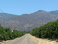
Fig. 10-5. Nate Harrison Grade at Highway 77 climbs the alluvial fan to the faulted mountain front. |
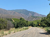
Fig. 10-6. View from the Nate Harrison Grade of the side-hill bench next to the fault cutting across the mountain front. |

Fig. 10-7. A notch on the distant slope is a side-hill bench and fault scarp north of the Nate Harrison Grade. |
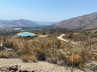
Fig. 10-8. View looking west along the faulted mountain front of Agua Tibia Mountain from the Nate Harrison Grade. |
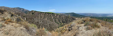
Fig. 10-9. Panoramic view looking south from near where the fault crosses the the unpaved part of Nate Harrison Grade. The unpaved 4WD road connects to Boucher Hill in Palomar Mountain State Park but is not recommended for regular 2WD cars. |
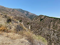
Fig. 10-10. A strand of the Elsinore Fault cuts across the head of Harrison Canyon south of the Nate Harrison Grade. |

Fig. 10-11. Index map that shows the extent of the Witch Fire 2007 that burned a large region west of the fault zone. |
|
Study Area 11 - Julian section |
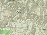
Fig. 11-1. Faults/location map |
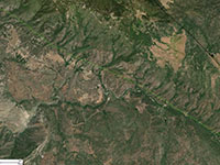
Fig. 11-2. Faults/satellite map |
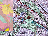
Fig. 11-3. Geologic map |
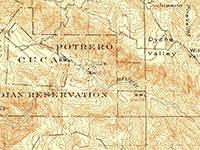
Fig. 11-4. 1903 USGS topo |
|
Places to check out (north to south):
Pass area on Highway 76 south of Rincon: Continue east several miles on Highway 76 into Rincon. Continue on Highway 76 East past the traffic circle where it intersects Valley Center Road (S6).
From there Highway 76 gradual ascended a couple miles where it crosses a divide and then the highway descends into the long linear valley associated with the Elsinore Fault Zone. Unfortunately parking for the pass area is only on the eastbound side of the highway. Figures 11-5 to 11-7 show the mountain front along Palomar Mountain in the vicinity of the divide. The trace of the fault is highlighted by a vegetation change where it runs across the mountainside.
South Grade Road (S6) intersects Highway 76 a little more than 2 miles west of the Rincon traffic circle. A strand of the Elsinore Fault crosses the South Grade Road in the vicinity of a pull off on the uphill side of the road on the 3rd switchback at about mile marked 42.8 (Figures 11-8 to 11-12). The fault expresses itself as highly fractured and weathered granite bedrock with local displacement surficial alluvial deposits.
The South Grade Road ascends the southeastern flank of Palomar Mountain and connect to road that lead to Palomar Mountain State Park and Palomar Observatory. Camping is available in the state park and in Cleveland National Forest Service's Fry Creek Campground and Observatory Campground along the route to Palomar Observatory. Overlooks in Palomar Mountain State Park provide exceptional views of the San Luis Rey River Valley in the Rincon area (Figures 11-13 and 11-14).
San Luis Rey River Canyon at La Jolla Village: Continuing east on Highway 76, about 2 miles east of the intersection with the South Grade Road the highway begins to follow the San Luis Rey River. The river drainage (canyon) basically marks the linear trace of the Elsinore Fault along this straight valley all the way to Henshaw Valley. In the vicinity of the La Jolla Village, the San Luis Rey River drainage turns south, leaving the linear fault valley and enters a canyon following incised meanders cut into older elevated stream terraces south of the fault zone area. Figures 11-15 and 11-16 are views taken from a pull-off area on the north side of Highway 76 near La Jolla Village where it is possible to see scarps and side-hill benches along the mountain front of Palomar Mountain.
San Luis Rey Picnic Area: The picnic area is a day use, fee area along the San Luis Rey River that is located within the Elsinore Fault Zone. The picnic area is heavily forested and the vegetation masks the linear nature of the stream valley that eroded along the fault zone. Some of the road cuts along the north side of Highway 76 displays heavily fractured and contorted bedrock. |

Fig. 11-5. This panoramic view is from a pull off on southbound CA 79 at the pass between Rincon and the turnoff to the South Grade Road to Palomar Mountain (shown here) The Elsinore Fault runs across the mountain front, basically following a series of scarps, side-hill benches. The fault trace basically follows the boundary shown as change in vegetation (lower is chaparral and upper is mostly pine forest). |

Fig. 11-6. View looking south from the CA 79 pass pull off toward the fault trace crossing the mountain front along Palomar Mountain and Eagle Crage Mountain. |
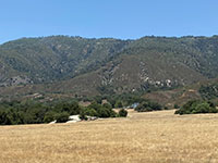
Fig. 11-7. Zoom view of the mountain front of Palomar Mountain from CA 79 pass pull off where a vegetation change roughly marks the trace of the Elsinore Fault. |
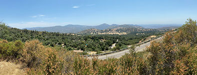
Fig. 11-8. Panoramic view to the south and east from the pull off on the switchbacks along South Grade Road. The view shows the valley of the San Luis Rey River in the La Jolla Reservation area with the highlands of the Grand Mesa area in the distance to the left.
|
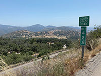
Fig. 11-9. 42.8 mile marker at a pull off on the switchbacks along the South Grade Road where it crosses a fault strand of the Elsinore Fault Zone. |
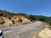
Fig. 11-10. Pull off on the uphill side of South Grade Road in the vicinity of where the Elsinore Fault crosses the road (be cautious of traffic!). |
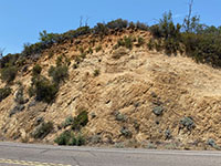
Fig. 11-11. Alluvial gravel deposits unconformably cap deeply fractured and weathered granite along South Grade Road. |
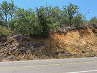
Fig. 11-12. A fault strand offsets alluvial gravel deposits next to deeply weathered and fractured bedrock exposed along South Grade Road. |
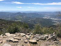
Fig. 11-13. View from Palomar Mountain State Park of the Elsinore Fault Valley with town of Rincon to right. Switchback on South Grade Road are in foreground. |
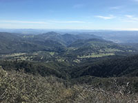
Fig. 11-14. View from Palomar Mountain of the the San Luis Rey River Gorge flows out of the Elsinore Fault Zone area on the La Jolla Reservation.
|
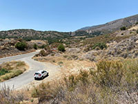
Fig. 11-15. View looking south from a pull off along Highway 76 La Jolla Reservation showing a fault-related bench on the mountain front in the distance.
|
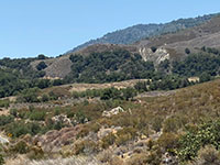
Fig. 11-16. Zoom view south at La Jolla Reservation pull off that shows side-hill benches where the Elsinore Fault crosses over spurs on the mountain front.
|
|
Study Area 12 - Julian section
Lake Henshaw is an enlarged sag pond within the even larger pull-apart Warner Basin. The Elsinore Fault defines the southwest wall of the basin. The mountainous upland on the south side of the fault near the lake is called Mesa Grande. The fault creates a linear mountain front easy to see from the Henshaw Scenic Vista Observation Site. |
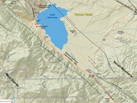
Fig. 12-1. Faults/location map |
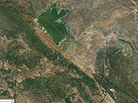
Fig. 12-2. Faults/satellite map |
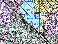
Fig. 12-3. Geologic map |
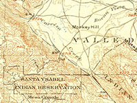
Fig. 12-4. 1903 USGS topo |
|
Geologic map: Santa Ana 1:250,000 (1965).
Places to check out (north to south):
East Grade Road (S7): The South Grade Road (S7) runs along the ridgeline of Palomar Mountain and offers spectacular views of the landscape impacted by the tectonics and erosion associated with the motion and evolution of the Elsinore Fault. The East Grade Road connects with the South Grade Roads and access roads to Palomar Mountain State Park and the Palomar Observatory. Figures 12-5 and 12-6 are views from overlooks at the southeast end of Palomar Mountain that show the trace of the Elsinore Fault Zone running through the core of the Peninsular Ranges. Warner Valley is downwarp (fault-bounded structural basin) between the upwarps of Palomar Mountain and the Volcan Mountains. Mesa Grande is an elevated plateau region on the south side of the Elsinore Fault that is part of the larger Santa Ana tectonic block (see Figure 14-7).
Henshaw Scenic Vista Observation Site: This scenic overlook is located on the East Grade Road (S7) at the northeast end of Palomar Mountain and provides sweeping views of the Warner Valley and Lake Henshaw (Figures 12-7 and 12-8). There are numerous faults that essentially parallel the main trace of the Elsinore Fault that cut the northern part of Palomar Mountain into Warner Basin. These faults cut across the lake and parts of the basin farther to the north (including the seismically active Agua Tibia and San Felipe Fault Zones). The Elsinore fault strikes along the west edge of Warner Valley, giving rise to such features as the linear Mesa Grande ridge and Lake Henshaw, a modified sag pond where water accumulated along the fault zone because drainage was impounded. Warner Springs Ranch (PM was a stop on the southern overland route into California. The first Butterfield stagecoach stopped here in 1858 on its 2,600 mile, twenty-four-day trip from Tipton, Missouri, to San Francisco.
Mile Marker 1 pull off on East Grade Road: This pull off is on the west side (going uphill) side of the road one mile west of the intersection of the East Grade Road (S7) and Highway 76. This overlook is lower on the mountain and closer to the Elsinore Fault Zone (Figures 12-9 and 12-10). From this location is is easy to see how the Elsinore Fault is responsible for linear mountain front along the northeast side of Mesa Grande as it extends along the valley to Morettis Junction and beyond (discussed below). Thick vegetation on the mountainside masks most of the geologic features along the East Grade Road, but as you drive along the route between the scenic overlooks and the intersection of Highway 76 you can see the increasingly fractured character of the bedrock (mostly granite and fault gouge) as you get closer to the fault zone that runs along the San Luis Rey river canyon.
Lake Henshaw Dam was constructed in 1923 on the San Luis Rey River near the mouth of the linear canyon that follows the Elsinore Fault Zone. Unfortunately, the dam area is inaccessible but you can see it from a pull off area along the north side of Highway 76 (Figure 12-11). The earthen dam is 123 feet (27 m) tall and 600 feet (200 m) long and has the capacity to hold 55,000 acre-feet of water. It was built to supply Vista with a reliable water source, primarily for agricultural irrigation (now about 70% goes for residential use). The Vista Irrigation District owns the reservoir and the surrounding land of Warner Springs Ranch. Lake Henshaw Resort provides access to fishing on Lake Henshaw and provides campsites, lodging, a store and restaurant.
Henshaw Pull Off: About a mile southeast of the Lake Henshaw Resort is a pull off area on the north side of Highway 76 that is a good place to get a look at the shoreline of the lake and the the mountain front of Mesa Grande . The mapped trace of the Elsinore Fault runs across the road in this area but it is not particularly obvious. However, you can see variety of swales and degraded scarps exposed in the grasslands between the lake and the highway (Figures 12-12 and 12-13),and between the highway and the steep break in slope on the forested mountain front of Mesa Grande (Figure 12-14). This pull off is a good place to observe Monkey Hill, a granitic inselberg (horst block) in the middle of Henshaw Valley along the east shore of Lake Henshaw.
Morettis Junction pull off: Highway 76 basically follows the trace of the fault along the south shore of Henshaw Lake and Warner Basin to Morettis Junction. Morettis Junction is the name of the intersection of Highways 76 and 79 at the southeast end of Warner Valley. Less than a quarter mile west of the intersection is a pull off area on the north side of Highway 76. This is a good location to observe the regional landscape features and structures associated with the local fault zones. To the west, the Elsinore Fault Zone follows the straight mountain front along the north side of Mesa Grande and continues into the canyon of the San Luis Rey River (Figure 12-15). The junction is located near the confluence of two faulted linear canyons of Carrizo Creek and Callisto Creek (Figure 12-16). Small swales, scarps and other fault related features can be seen in the grasslands near Morettis Junction (Figures 12-18 and 12-18). South of Morritis Junction, Highway 79 mostly follows the Elsinore Fault Zone along the linear Carrita Creek Valley between Mesa Grande and the Volcan Mountains.
From Morettis Junction continue south on Highway 79 to Study Area 13.
|

Fig. 12-5. Palomar Mountain view of Elsinore Fault Zone canyon with and Warner Basin (left), and Mesa Grande and
Cuyamaca Mountains (right and distant right). |
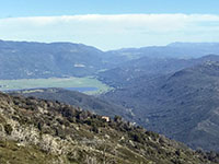
Fig. 12-6. Zoom view from Palomar Mountain with Lake Henshaw (in Warner Basin). Julian is near gap to right of Volcan Mountains (to left in the distance). |
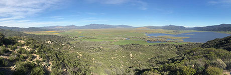 Fig. 12-7. Warner Valley view from the Henshaw Scenic Vista Observation Site. The Elsinore Fault Zone is beyond Lake Henshaw running along the linear mountain front of Mesa Grande. The linear stream canyon in the foreground follows one of several faults that parallel the trend of the Elsinore Fault into the lake area. The yellow areas are field of California poppies blooming.
 |
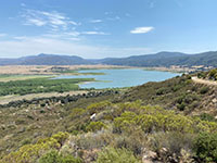
Fig. 12-8. View looking to the southeast from the Henshaw Scenic Vista Observation Site with Lake Henshaw and Volcan Mountains (in the distant right). |
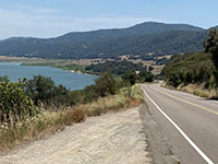
Fig. 12-9. View looking south from a pull off at mile marker 1 on the East Grade Road showing where the Elsinore Fault Zone runs along the front of Mesa Grande. |
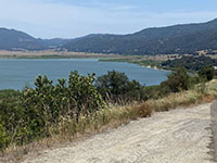
Fig. 12-10. View from the East Grade mile 1 pull off shows the Elsinore Fault Zone along the Mesa Grande mountain front leading to Morettis Junction. |
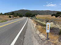
Fig. 12-11. View of Henshaw Dam from a pull off on Highway 76. Multiple strands of the Elsinore Fault pass through the valley in the vicinity of the dam. |

Fig. 12-12. Panoramic view from Henshaw pull off along Highway 76 (near Lake Henshaw Resort and Ranger Station). Strands of the Elsinore Fault cut across the alluvium-covered slopes between the lake and the north side of the highway. Monkey Hill is a small fault-bounded horst in the middle of Henshaw Valley on the east shore of the Lake Henshaw. |
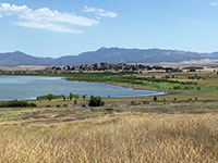
Fig. 12-13. Zoom view of Monkey Hill on the east shore of Lake Henshaw as seen from the Henshaw pull off on Highway 76). |
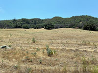
Fig. 12-14. View of the faulted and forested mountain front of Mesa Grande south of the Henshaw pull off on Highway 76. |
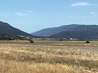
Fig. 12-15. View looking northeast from Morettis Junction to the fault valley between Mesa Grande (left) and Mount Palomar (right). |
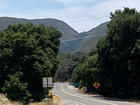
Fig. 12-16. View southwest Morettis Junction (Highways 76 and 79) with the straight faulted canyon of Carrizo Creek in the distance. |
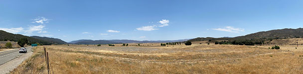
Fig. 12-17. Panoramic view of Henshaw Valley from near the intersection of Morettis Junction. Several fault strands emerge from the alluvium-filled Henshaw Valley in the vicinity of the confluence of Carrista Creek and Carrizo Creek near the intersection of Highways 76 and 79 at Morettis Junction. |
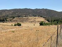
Fig. 12-18. View of an uplifted horst block capped with alluvium along Highway 79 north of Morettis Junction. |
|
Study Area 13 - Julian section
The valley/canyon along Elsinore Fault Zone is a dominant landscape feature cutting diagonally across the core of the Peninsular Ranges in San Diego. The stream and river canyons are hundreds to a couple thousand feet deep relative to the surrounding and uplands associated with the ancient erosion surfaces that existed in the region before the regional fault system developed. |
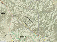
Fig. 13-1. Faults/location map |

Fig. 13-2. Faults/satellite map |
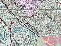
Fig. 13-3. Geologic map |
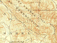
Fig. 4. 1903 USGS topo |
|
Geologic map: Santa Ana 1:250,000 (1965); SE corner: Todd (1994).
Places to check out (north to south):
Carrita Creek Valley: From Morritis Junction on CA Highway76 turn right (south) on CA Highway 79. Highway 79 follows the Elsinore Fault Zone through the Carrita Creek Valley along the linear mountain front along the east side of the highway. The highway follows the fault line for about 3 miles where the road crosses a low divide. South of the divide Highway 79 and bears to the right (east, away from the fault line) in the vicinity of the Santa Ysabel Tribal offices and community. However, the fault zone continues to the southeast passing through the private lands of Santa Ysabel Reservation along School House Canyon Road. Unfortunately, there are no places to easily stop along Highway 79 to see the fault.
Santa Ysabel East Preserve: From there Highway 79 descends into the Santa Ysabel Valley and in 4 miles intersects with Highway78 in Santa Ysabel (community). Just before you arrive in Santa Ysabel, a short road on the left (east) leads to the Santa Ysabel Nature Center, located at 22135 Highway 79, Santa Ysabel, CA 92070 (Figure 13-5). The Nature Center celebrated its grand opening in December 2019. It is well worth the visit. Trailheads near the Nature Center are for paths that lead up into the high country of the Santa Ysabel East Preserve. Figure 13-6 shows a view of the Santa Ysabel Creek Canyon that follows the trace of the Elsinore Fault into the high country of the Volcan Mountains. Views of the fault canyon are accessible from along the Coast to Crest Trail and the Santa Ysabel Loop Trail that passes through the preserve lands. Figure 13-7 is a view of the ridgelines on both sides of the Elsinore Fault Zone in the Volcan Mountains as seen looking east from along Highway 78 on the opposite side of the Santa Ysabel Valley.
The Coast to Crest Trail also connects with the Kanaka Loop Trail. At its eastern end the Kanaka Trail that follows along the Elsinore Fault that follows the drainage of Santa Ysabel Creek in the eastern part of the preserve. A parking area for that Kanaka Trailhead is located on Farmers Road, about 3 miles north of downtown Julian (see map Figure 14-1). To get to a Kanaka Trailhead parking area at the east end of the Santa Ysabel East Preserve from the Nature Center, take Highway 79 into Santa Ysabel (community) and turn left (east) onto Highway 78. . At the intersection with CA Highway 78 turn left and drive 7 miles into downtown Julian. At the main intersection in town turn left (north) on Farmers Road. The Kanaka Trailhead parking for the Santa Ysabel East Preserve is 3 miles north out of town and on the left. You will pass the Volcan Mountain Preserve Trailhead on the way (discussed below).
Continue to Study Area 14.
|
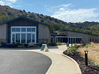
Fig. 13-5. Santa Ysabel Nature Center located off of CA79 just south of intersection with CA 78. The visitor center was completed in 2019. |
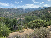
Fig. 13-6. Santa Ysabel Creek Canyon with Elsinore "rift valley" on this side of the more distant Volcan Mountains ridgeline. |
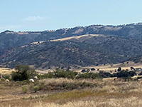
Fig. 13-7. View west across valley to Santa Ysabel East Preserve with high Volcan Mountains ridgeline beyond Elsinore Fault canyon. |
|
Study Area 14 - Julian section
Erosion along the Elsinore Fault Zone created the low divide where the town of Julian is located between the high peaks of the Volcan Mountains (to the north) and the Cuyamaca Mountains (to the south). Streams flowing to the east of Julian drain into to the Anza Borrego desert basins and the Salton Sea. Streams flowing to the west drain to the Pacific Ocean. |
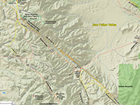
Fig. 14-1. Faults/location map |
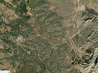
Fig. 14-2. Faults/satellite map |
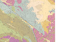
Fig. 14-3. Geologic map |
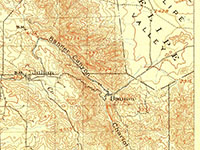
Fig. 14-4. 1903 USGS topo |
|
Geologic map: Todd (1994), see map legend (Figure 14-5). Figure 14-6 is a map of the physiographic provinces of San Diego County. The Elsinore Fault is the dividing line between the Santa Ana tectonic block to the west and the Fault-bounded Blocks and Basins region to the east (encompassing Anza Borrego Desert State Park). The contrast of these two regions can be seen can be seen within a few miles drive east or west of the town of Julian.
Julian, CA: The Julian area experienced a gold rush started in 1870 that lingered to about 1900. The area then prospered as an apple farming district and as a mountain recreation destination. Today, the town of Julian is a major tourist destination and can be extremely crowded on weekends practically any time of year. Julian is located along the crest of the Peninsular Ranges in a divide between the Volcan Mountains to the north and the Cuyamaca Mountains to the south (accessible along the scenic Skyline Highway (CA 79). Individuals interested in camping the the area may want to consider making reservations at the campground at nearby William Heise County Park. Figure 14-7 is a topographic map that highlights many of the landscape features in the Julian area.
Places to check out (north to south):
Santa Ysabel East Open Space Preserve: Continue north along Farmers Road to the parking ares for the Santa Ysabel East Open Space Preserve (continued from Study Area 13 above). Farmers Road crosses the Elsinore Fault Zone about a quarter mile north of the Volcan Mountain Trailhead. The Santa Ysabel East Preserve parking area is about a mile north of the Volcan Mountain trailhead area (Figure 14-8). From the parking area it is an easy hike along the Kanaka Trail that follows Santa Ysabel Creek westward for about 1.5 miles along the Elsinore Fault Zone. Along this stream valley is a prominent forest-covered fault scarp that runs south side of the valley. The forest-covered slope on the south side of fault stands out in contrast with the grassy pasture land on the north side of the stream (Figures 14-9 and 14-10). See trail map/ brochure: www.sdrp.org.
Volcan Mountain Wilderness Preserve Trailhead Area: From the main intersection in downtown Julian follow Farmers Road north about 2 miles and park along the road near the Volcan Mountain Trailhead near the intersection of Wynola Road (Figure 14-11). This is a popular day-use only hiking area. The Elsinore Fault Zone crosses the valley between the parking near the trailhead and where the trail start uphill at the Hubbell Gate. The fault zone is about a quarter-mile wide in this area and trail crosses a low shutter ridge near the trailhead. The hike to the top of Volcan Mountain is moderately strenuous—about 5.4 miles round trip starting at 4,100 feet at the trailhead and 5,353 feet at the summit (Figure 14-12). See trail maps/brochures: www.sdrp.org or sdparks.org.
Inspiration Point (Desert View Park): The scenic drive south from Julian on the Sunrise Highway (CA 79) follows the crests of the Peninsular Ranges through the Cuyamaca Mountains. A day trip or weekend camping trip in this forested region is ideal in the warm season. About 3 miles south of downtown Julian is Desert View Park (Inspiration Point), a small park with an sweeping view of Anza Borrego Desert region from the ridgeline above Banner Canyon (the linear stream valley that follow the Elsinore Fault Zone). This is a good location to take in the regional geographic and geologic setting (Figure 14-13).
Banner Canyon: Return south on Farmers Road and turn left (east) on Wynola Road. Wynola Road descends into Banner Canyon near the intersection of CA 78 (be cautious turning left onto the highway 78). Highway 78 through Banner Canyon is a very curvy road as it descend into the valley. Banner Canyon is a linear valley that follows the trace of the Elsinore Fault Zone (Figures 14-14 to 14-17). Unfortunately there are no stops along this highway on the downhill to stop and get out to look at the fault-related along the fault line until you get to the Banner Recreation Ranch area. There are a couple pull offs on the uphill direction (westbound) but be very cautious stopping at pullouts on this busy mountain highway.
Banner Recreation Ranch Area: The Elsinore Fault crosses CA 78 in the vicinity of Banner Recreation Ranch (a roadside stop on the north side of the with fee camping, cabins, and shuttle services for hikers accessing the Pacific Crest Trail. The fault zone follows straight canyon up the mountainside on the south side of the highway (just south of the Banner Recreation Ranch parking lot in front of the small store, Figures 14-18 and 14-19).
Rodriguez Truck Trail: The Rodriguez Truck Trail intersects CA 78 at the bend in the highway near the Banner Recreation Ranch. This is a rugged 4WD road that ascends the mountainside beginning with about a mile drive (or hike) along Chariot Canyon before turning back south to intersect the the Elsinore Fault Zone. From there the truck trail winds through rugged county where there are an abundance of fault-related landscape features, including shutter ridges, offset streams, beheaded streams, and scarps. The truck trail crosses a divine in the vicinity of the fault and continues southward along Vallecito Wash Canyon into the Anza Borrego Desert Park region (Figure 14-20).
|
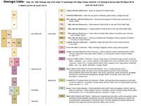
Fig. 14-5. Legend showing the age and description of geologic units shown on the geologic map of the Julian 7.5 minute geologic map area (shown in Fig. 14-3). |
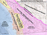 Fig. 14-6. Map showing the "Old Erosion Surface" in San Diego County associated with the stable Santa Ana tectonic block west of the Elsinore Fault Zone. Fig. 14-6. Map showing the "Old Erosion Surface" in San Diego County associated with the stable Santa Ana tectonic block west of the Elsinore Fault Zone.
|
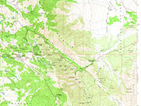
Fig. 14-7. Portion of the Julian 1:24,000 topographic map that shows more detail of landscape features in the Julian and Cuyamaca and Volcan Mountains area. |
Fig. 14-8. Trailhead sign for Santa Ysabel East Open Space Preserve (with map and information for this day-use hiking area).
|
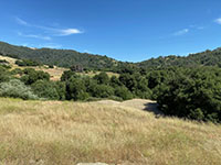
Fig. 14-9. View looking east from the trail in the Elsinore Fault Zone in the Santa Ysabel East Open Space. The fault scarp runs along the south side of the stream drainage.
|
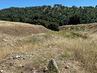
Fig. 14-10. View of vegetation contract across the Elsinore Fault Zone in Santa Ysabel East Open Space. The stream drainage shown here is deflected along the fault zone.
|
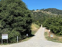
Fig. 14-11. The Volcan Mountain Trail crosses the Elsinore Fault Zone in the vicinity of the trailhead on Farmers Road near Julian.
|
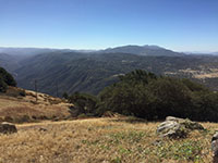
Fig. 14-12. Banner Canyon view from Volcan Mountain summit. Cuyamaca Mountains rise above the inclined Old Erosion Surface on the Santa Ana Tectonic Block. |
Fig. 14-13. View looking northeast toward Banner Canyon from near Inspiration Point along the Sunrise Highway (CA 79) south of Julian, CA. |
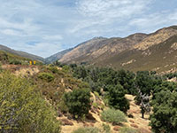
Fig. 14-14. View to northeast from pull off along Highway 78 in Banner Canyon. The Elsinore Fault runs along the lower slope near the stream in the upper part of the canyon. |
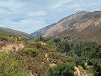
Fig. 14-15. Zoom view looking up Banner Canyon toward the divide near the Volcan Mountain Trailhead area where the Elsinore Fault crosses into into the canyon. |

Fig. 14-16. Elsinore Fault exposed along a side-hill bench in the lower wall of upper Banner Canyon in the area west (upstream) of the Banner Recreation Ranch. |
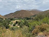
Fig. 14-17. View looking down Banner Canyon to where the Elsinore fault crosses a bend in the valley and continues up a side canyon. |
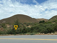
Fig. 14-18. View from the Banner Recreation Ranch showing the canyon along the Elsinore Fault used by the Rodriguez Truck Trail. |
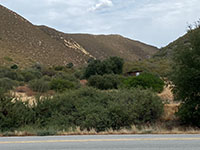
Fig. 14-19. The Rodriguez Truck Trail follows the Elsinore Fault Zone up the canyon on the south side of Banner. |
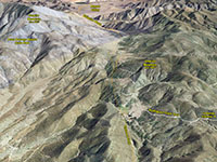
Fig. 14-20. Google Earth satellite view of the Elsinore Fault Zone along Rodriguez Truck Trail south of Banner.
|
|
Study Area 15 - Julian section
In this area the Elsinore Fault crosses a divide and descends into the Vallecito Wash Canyon of Mason Valley. The landscape is a transition into the Basin and Range topography of the Colorado Desert region.
|
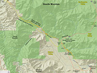
Fig. 15-1. Faults/location map |

Fig. 15-2. Faults/satellite map |
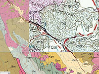
Fig. 15-3. Geologic map |
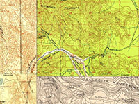
Fig. 15-4. Historic topo maps |
|
Geologic map: northeast corner: Todd (1994); southern part: Todd (2004), NE CGS Atlas sheet (1965).
Places to check out (north to south):
Note that much of the southern part of the Julian section of the Elsinore Fault Zone is within Anza Borrego Desert State Park. A good summary of regional geology of the park area is Stratigraphy, Tectonics, and Basin Evolution in the Anza Borrego Desert Region by Dorsey (2005).
Box Canyon: The Butterfield Overland State Route passed through Box Canyon (Figures 15-5 to 15-7). The stagecoach began operation in the area in 1858. A trace of the stage coach route and another path created by Mormon settlers pass through the canyon.
The bedrock in the Box Canyon area consists of brown and gray, striped Julian Schist (Triassic age?) that is locally cut by light-colored pegmatite dikes associated with intrusive plutons of early Late Cretaceous age .
Oriflamme Canyon Road turn off: Highway S2 descends southward out to Box Canyon and in about a half mile Oriflamme Canyon (dirt road) appears on the right. This is also the southern exit of the Rodriguez Canyon Truck Trail, a rugged 4WD roadthat connects to Banner on Highway 78 in Banner Canyon (west of Julian). Erosion of the fracture granitic bedrock along the Elsinore Fault Zone is responsible for the linear canyon carved by Vallecito Wash.
Fault zone between Oriflamme Canyon turn off and Mason Valley Cactus Gardens: This is an interesting section of the fault zone exposed along the base of the mountain linear front of Ghost Mountain (Figures 15-8 to 15-12). The fault zone runs southeast parallel for about a half mile along to Highway S2. In this are there are a variety of low scarps that reveal an in-echelon pattern of shearing in the fault zone. During wet years small springs flow form fractures along the fault zone. Look for behead and offset stream drainages in the fault zone. This area is also one of the most extensive communities of native cacti in the Anza Borrego Desert State Park. You can carefully walk though this stretch of desert or take advantage of the parking area farther down the road on the left.
Campbell Grade: Continue south on Highway S2. The Elsinore Fault is mapped crossing the highway between the Butterfield Ranch RV Park and where the road rises to cross a low divide at the Campbell Grade. The Elsinore Fault Zone becomes somewhat obscured in this area by a series of interconnecting faults mapped in the Campbell Grade area (no place easy to stop and get out; it is fenced private land). Just on the south side of the pass, however, is a small pull off on the right where it is possible to stop and get a picture view of the view to the south of Vallecito Valley (discussed below).
|
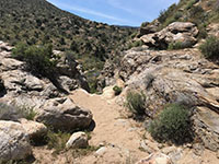
Fig. 15-5. Box Canyon falls area along Highway S2 is a famous location of the Butterfield stage route.
|
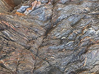
Fig. 15-6. The Julian Schist (Triassic) exposed in Box Canyon, a highly foliated gneiss/schist.
|
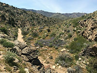
Fig. 15-7. Box Canyon drains into Mason Valley between the Ghost Range (south) and Granite Mountain (north).
|
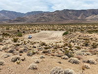
Fig. 15-8. Parking area for Mason Valley Cactus area looking down from top of scarp in southeast part of the Julian section. |

Fig. 15-9. View southeast along Ghost Mountain front with fault scarp and deflected drainage near parking area in Mason Valley Cactus Gardens. |

Fig. 15-10. View looking north along fault area to small shutter ridge on right. Rodriguez Canyon with fault zone is in the distant left. |
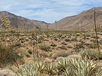
Fig. 15-11. View to northeast to upper Vallecito Wash where the Rodriguez Canyon Truck Trail crosses a divide along the Elsinore Fault Zone. |

Fig. 15-12. Zoom view up Vallecito Wash where the Elsinore Fault and Truck Trail crosses the divide between the mountains. |
|
Study Area 16 - Julian section
The fault lines of the Elsinore Fault Zone
appear discontinuous on the mountain slopes, masked somewhat by a cover of colluvium and the uniform nature of the fractured granitic bedrock. In contrast, geologically-young fault scarps crossing the alluvial fan surfaces in the mid-basin areas are well exposed by vegetation contrast along the fault zone. |
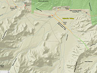
Fig. 16-1. Faults/location map |
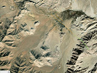
Fig. 16-2. Faults/satellite map |

Fig. 16-3. Geologic map |
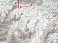
Fig. 16-4. Topo map |
|
Geologic map: Todd, 2004.
Places to check out (north to south):
Campbell Grade Pull off: The small pull-off on the south side of Highway S2 to only large enough for a couple cars to stop safely. However, it is a good location to stop for a quick look and photo of Vallecito Valley to the south and east (Figure 16-5). It is easy to see the trace of the Butterfield Overland Mail stagecoach route used in 1858 to 1861.The mapped Julian section of the Elsinore Fault steps over to the east from the Mason Valley area (to the west of Campbell Grade). Active earthquake faults are not mapped in the vicinity of the Campbell Grade, partly because colluvium and landslide materials cover most of the slopes. However faulting is probably responsible for the bench-like faceted spurs along the linear mountain front on the north side of Vallecitos Wash, north of Highway S2.
Fault scarps in Vallecito Valley: Two strand of the Elsinore Fault Zone that display Holocene displacement are mapped crossing the Vallecito Valley just east of Lance Ranch on Highway S2. Whereas the fault scarps do not appear obvious along the side of the highway, the down appear obvious as vegetation contrasts from the air (Figure 16-6). About a quarter mile beyond the bend in the highway where the fault crosses the road is a pull off to an area overlooking the valley where it is possible (with binoculars) to observe these vegetation contrasts from the distance.
Vallecito County Park: Vallecito County Park is a 71 acre county park is host to the historic Vallecito Stage Station along the Butterfield Overland Stage Route (1858-1861)(Figure 16-7). The county park hosts a developed campground and requires a small day-use fee. (The park website claims the campground is 10 degrees cooler than the Agua Caliente Campground described below.)
|
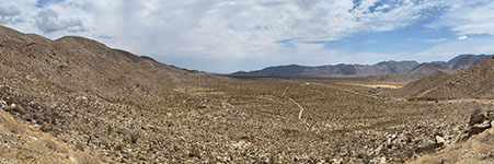
Fig. 16-5. View looking south at the Vallecito Valley from the Campbell Grade (pass) on Highway S2. In this area, the Julian section of the Elsinore Fault Zone ends and steps over to the east and continues south as the Coyote Mountains section of the fault. The historic Butterfield Stage route runs through the Vallecito Wash in the vicinity of old scarps on the flank of Ghost Mountains (on the left). |

Fig. 16-6. Fault scarps in Vallecito Valley near Lance Ranch revealed by vegetation. These features are not easy to see on the ground along Highway S2. |
Fig. 16-7. Entrance sign to Vallecito County Park, a camping area alternative, a little higher and cooler than nearby Agua Caliente County Park. |
|
Coyote Mountain section (Elsinore Fault Zone)
The Coyote Mountain section cuts diagonally across various batholithic and pre-batholithic metamorphic terrains in the Basin and Range physiographic landscape of the arid Anza Borrego Desert State Park region until it reaches the southwestern margin of the Salton Trough. From there it continues south as the Laguna Salada Fault section. The initial strike-slip faulting along the southern Elsinore Fault Zone began about ~1.2 million years ago (late Early Pleistocene), based on offsets of Cenozoic basin fill deposits exposed in the badlands area of the Fish Creek-Vallecito Basin area in the Anza Borrego Desert (Dorsey and others, 2012).
From the Agua Caliente County Park area to its southern end near Interstate 8, the Coyote Mountain section consists of a mix of sub-parallel fault strands within a roughly 200-foot wide fault zone. The Fault line runs along the base of linear mountain fronts where crystalline basement, Late Tertiary sedimentary formations, and Quaternary and younger alluvial fan and basin fill deposits. Landscape features along the fault zone include linear mountain fronts, scarps, side-hill benches, shutter ridges, offset and beheaded stream drainages, linear drainage valleys, springs and seeps, and vegetation alignments.
The Coyote Mountains have a core of granitic crystalline basement rocks overlain by early Miocene volcanic flows, mid-Miocene to Pliocene transitional marine deposits, and and Pliocene to Quaternary alluvial fan and basin fill deposits. Hourglass canyons between faceted spurs occur along the linear mountain front of the Terra Blanca Mountain between Agua Caliente and the northwest end of the Coyote Mountains. |
Coyote Mountains Section (Modified from SCEDC summary)
- TYPE OF FAULT MOTION: Right-lateral (dextral) strike slip with a vertical component (reverse and oblique slip).
- ORIENTATION: Average strike:
N58°W, NE with reversal to SE on southwestern portion of fault and "dips shallowly to steeply (Rockwell, 1990)
- LENGTH: 21 miles (33 km)
- LOCATION: San Diego County and Imperial County within the Lower Californian Basin and Range (Colorado Desert) region
- NEAREST COMMUNITIES: (none significant in size in area), Agua Caliente County Park
- MOST RECENT SURFACE RUPTURE: About last event 200–300 yr BP
- INTERVAL BETWEEN MAJOR RUPTURES: 600–1000 yr
- PROBABLE MAGNITUDES: Mw 6.0-7.2 (? (based on
- SLIP RATE: Between 2.0 and 4.0 mm/yr
- GEOMORPHIC EXPRESSION: Sags, shutter-ridges, pressure-ridges, deflected and offset drainages, side-hill benches, and scarps in alluvium and alluvial fans. (Rockwell, 1990). Age of faulted surficial deposits: Holocene alluvial and channel deposits; landslides and debris flows.
- QFFDUS ID: Coyote Mountain section (126f)
|
Study Area 17 - Julian and Coyote Mtns sections
In this area the Elsinore
Fault Zone "steps over" the Terra Blanca Mountains. The Julian section peters out over northern end of the Sawtooth Mountains and probably continues into the Inner Pasture part of Canebrake Valley. The Coyote Mountains section begins in the Squaw Canyon Area and cuts through Agua Caliente County Park. |
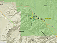
Fig. 17-1. Faults/location map |
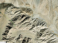
Fig. 17-2. Faults/satellite map |
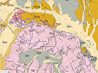
Fig. 17-3. Geologic map |
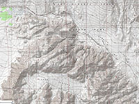
Fig. 17-4. Topo map |
|
Geologic map: Todd, 2004.
Places to check out (north to south):
Continuing southeast on Highway S2 for 4 miles east of the Vallecito County Park to Agua Caliente County Park.. The highway follows Vallecito Creek (wash) around the north end of the Terra Blanca Mountains. The mapped northern end of the Coyote Mountains section begins at along the eastern mountain front of the Terra Blanca Mountains.
Agua Caliente County Park: Agua Caliente County Park. The park is most noted for its geothermal heated springs and pools. Historically, hot springs have issued from the Elsinore Fault Zone in the lower canyon areas in in what is now the park area (Figures 17-5 to 17-7). Early recorded measurements placed the water temperature of of of the natural hot springs at 167° to 185°F, however, earthquakes and local wells have altered the natural underground plumbing system. Today the water supply for the pools averages about 102° F. Water from the springs (wells) are now used for heated pool in the park campground area. The 910 acre park is host to many landscape feature associated with the northeastern end of the Coyote Mountains section of the Elsinore Fault Zone. The fault zone is responsible for the rugged mountain front that surrounds the park's campground and facilities. The local white granite is heavily fracture and degraded into a weathered fault gouge (soft, friable, claystone and clay-rich breccia) (Figure 17-8). Two stream drainage provide warm water for seeps and springs that support a local plant and animal community (including bighorn sheep frequently seen in the campground area). There are about 3 miles of trails that are worth hiking in the park area where it is easy to view the unique geology and ecology of the park setting.
From Agua Caliente County Park continue south along Highway S2. The active trace of the Elsinore Fault runs along the base of the mountain front of the Terra Blanca Mountains on the west side of the highway southward into the vicinity of Canebrake Canyon (next study area).
|
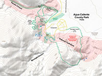
Fig. 17-5.Trails map in the Agua Caliente County Park showing seeps &marsh areas in the vicinity of faults and fractured rocks (pink areas). |

Fig. 17-6. View north at Agua Caliente County Park from mouth of Moonlight Canyon. Map strands of the fault follow the mountain front. |
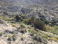
Fig. 17-7. Vegetation grows along the seeps and springs in the vicinity of the fault zone in lower Moonlight Canyon.
|
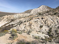
Fig. 17-8. View looking south at the sheared and altered granitic bedrock along lower Moonlight Canyon.
|
|
Study Area 18 - Julian section and Coyote Mountains section |
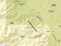
Fig. 18-1. Faults/location map |
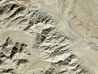
Fig. 18-2. Faults/satellite map |
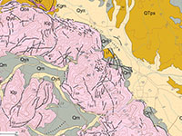
Fig. 18-3. Geologic map |
Fig. 18-4. Topo map |
|
Geologic map: Todd, V.R., 2004.
Places to check out (north to south):
Terra Blanca Mountains fault scarps: Driving south from Agua Caliente County Park, Highway S2 skirts the eastern mountain front of the Terra Blanca Mountains. In numerous places the Elsinore Fault display steeply visible scarps cutting across alluvial fan deposits at near the base of the mountain very close to the highway (Figures 18-5 to 18-8). The mountain front also displays faceted spurs with step scarps near the mouths of small hourglass canyons. The visible, relatively fresh fault scarps continue southward to the Canebrake Canyon area about seven miles to the south Agua Caliente County Park. Surface rupture along the fault in this area may have occurred during the 1892 Laguna Salada earthquake.
Canebreak Canyon: Canebrake is a small community below the mouth of Canebreak Canyon (Figure 18-9). The Elsinore Fault Zone skirt along the mouth of the Canyon.
From Canebrake Canyon extending south to the Well of Eight Echoes there are visible linear fault scarps with some defected drainages visible cutting the old alluvial fan deposit along the eastern mountain front of the Terra Blanca Mountains (Figure 18-10). In the vicinity of Canebrake the Carrizo Corridor Overlook is a popular destination to see a sweeping view of the Carrizo Badlands area. The fault scarps with faceted spurs and offset stream drainage along the Elsinore Fault are easy to see where the mountain front meets the alluvial fans west of Highway S2 between Canebrake Canyon and the Well of Eight Echoes. The Well of Eight Echoes is an abandoned and uncovered well that used to have unusual acoustic properties until tourists mostly filled it in with rocks and trash.
|
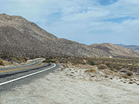
Fig. 18-5. Highway S2 south of Agua Caliente County Park passes close to the faulted mountain front of the Terra Blanca Mountains. |

Fig. 18-6. View of a shutter ridge/side-hill bench with a relatively young fault scarp along Highway S2 south of Agua Caliente County Park. |
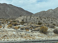
Fig. 18-7. Another shutter ridge with a relatively young (fresh) fault scarp along Highway S2 south of Agua Caliente County Park. |
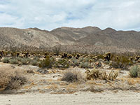
Fig. 18-8. Fault scarp with bench cutting across alluvial fan midway between Agua Caliente County Park and Canebrake Canyon area. |
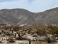
Fig. 18-9. View of the mountain front at Canebrake Canyon from Highway S2. |
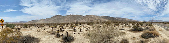
Fig. 18-10. Panoramic view of the faulted mountain front of the Terra Blanca Mountains and alluvial fans south of Canebrake, CA from along Highway S2. South is to the left, north is to the right. |
|
Study Area 19 - Coyote Mountain sections
The southwestern side of the Coyote Mountains is a linear mountain front along the Elsinore Fault Zone. From the satellite view there are many small hourglass canyons that show right-lateral deflection and fresh scarps as they cross the fault zone onto their alluvial fans. The Coyote Mountains section transitions to the Laguna Salada section near the south end of the Coyote Mountains.
|
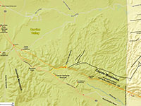
Fig. 19-1. Faults/location map |
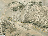
Fig. 19-2. Faults/satellite map |
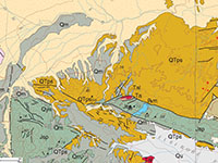
Fig. 19-3. Geologic map |
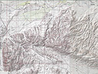
Fig. 19-4. Topo map |
|
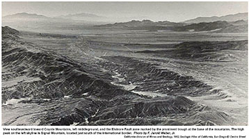 |
Fig. 19-5. Historic aerial photograph along the Coyote Mountain section. Caption states:
"View southeastward toward Coyote Mountains, left middle ground, and the Elsinore Fault zone marked by the prominent trough at the base of the mountains. The high peak on the left skyline is Signal Mountain, located just south of the international border. Photo by F. Jarold Weber, Jr."
From California Atlas of Geology, California Division of Mines and Geology, 1964. |
|
Geologic map (southern half): Todd, V.R., 2004.
Places to check out (north to south):
Indian Gorge (Torote Canyon hiking area): About 9 miles south of Agua Caliente County Park is a turn off to a parking area at the mouth of Indian Gorge (Torote Canyon), a canyon in the strikingly white granitic rocks of the southern Terra Blanca Mountains. The Elsinore Fault runs along the mountain front at the mouth of the canyon. A fault scarp cutting across alluvial fans and parallel to the mountain front can be seen north of Indian Gorge (Figure 19-6).
Mountain Palm Springs Campground: The turnoff to Mountain Palm Springs Campground is about a mile south of the Indian Gorge access road. The primitive campground located at the mouth of the Mountain Palm Springs Canyon is within the Elsinore Fault Zone along the mountain front (Figures 19-7 and 19-8). The Mountain Palm Springs Loop is a 4 mile hike that goes through several palm groves along seeks in the canyon (Figure 19-9).
Bow Willow Road: Continue south another mile to the turnoff to the Bow Willow Campground (a primitive campground at the mouth of a canyon about a mile west of Highway S2)(Figure 19-10). The Elsinore Fault crosses the highway in the vicinity of the turnoff to the Bow Willow Campground.. A fault scarp and pressure ridge is visible near the highway just southeast of the intersection. This is an interesting scarp area to examine the character of the sand and gravel beds exposed along the stream bed that show that deposition was impacted by the displacement (including uplift) along the fault (Figures 19-11 to 19-13).
Carrizo Canyon Campground: The turnoff to the Carrizo Canyon Campground is about 1,000 south of the Bow Willow turnoff, but is on the east side of Highway S2. The fault line Elsinore Fault crosses the Carrizo Canyon Campground Road and ascends into the northwestern end of the Coyote Mountains just south of the campground.
Sweeney Pass: About two miles south of the Bow Willow and Carrizo Campground access roads Highway S2 ascends a large switchback of a divide. Unfortunate there is really no good place to stop in scenic pass area. The northern end of the Jacumba Mountains are on the south side of the highway.
Sin Nombre Canyon: The turnoff to Sin Nombre Canyon hiking area is about 3/4 mile east of Sweeney Pass. The canyon is a popular destination for geology hiking trips to examine the variety of mix of sandstone cliffs and igneous and metamorphic rocks in the area with views of the Carrizo Badlands (Figure 19-14). The 4WD road to the parking area near the mouth of the canyon is about 1.5 miles, and the last mile of it roughly follows the trace of fault. The fault is responsible for displacement of the stream channel in the lower part of the canyon.
Carrizo Badlands Overlook: About 1.6 miles south of Sweeney Pass are turnoff to the Carrizo Badlands Overlook (Figures 19-15 and 19-16). This easy car-access overlook is on a north edge of an escarpment overlooking the headwaters of Sin Nombre Canyon. The Elsinore roughly follows the rugged southern mountain front of the Coyote Mountains.
Coyote Mountains Overlook: This (unofficially named) overlook area is about a mile south of the Carrizo Badlands Overlook on an unpaved track that leads about a quarter mile west to an escarpment over upper Montero Wash Canyon. The overlook provides exceptional views of the northeast end of the Coyote Mountains (Figures 19-17 to 19-21). The trace of the Elsinore Fault is well exposed along the base of the south-facing mountain front of Coyote Mountains.
Dolomite Mine Road: About a mile east of the Carrizo Badlands Overlook is the Dolomite Mine Road (and Dolomite Mine Trail)(Figure 19-22). This road leads to abandoned mine ruins where high magnesium calcite (dolomite marble) was mined back in the 1930s. The mines are located along the southern mountain front in the vicinity of the Elsinore Fault Zone.
|
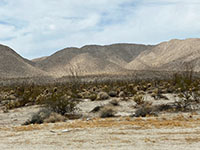
Fig. 19-6. View of a fault scarp cutting across alluvial fans along the base of the Terra Blanca Mountains. |
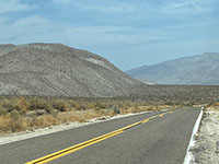
Fig. 19-7. View looking north at the mountain front with low fault scarps on the alluvial fans north of Palm Canyon. |
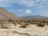
Fig. 19-8. The fault runs along the mountain front of the Terra Blanca Mountains in the vicinity of Palm Canyon. |
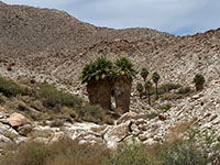
Fig. 19-9. Desert palms grow along seeps in the canyon west of the fault zone in Palm Canyon. |

Fig. 19-10. Sign showing the entrance to the access road to the Bow Willow Creek Campground area. |
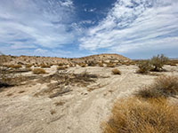
Fig. 19-11. Fault scarp along Bow Willow Creek east side of Highway S2 near the campground access road. |
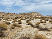
Fig. 19-12. Closer view of the uplifted block of alluvial sediments and fresh fault scarp along Bow Willow Creek. |
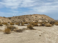
Fig. 19-13. A closer view that shows how fault activity has impacted deposition of alluvial sediments (beds) over time. |
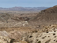
Fig. 19-14. Zoom view of the mouth of Canyon Sin Nombre where is crosses the Coyote section of the fault zone. |
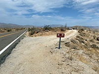
Fig. 19-15. No shooting or fires sign shows location of the Carrizo Badlands Overlook unpaved access road. |
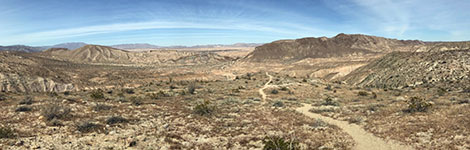
Fig. 19-16. View from the Carrizo Badlands Overlook area along Highway S2 showing the faulted dark mountain front at the north end of the Coyote Mountains (to the right of center). The badlands are north of Canyon Sin Nombre.
|
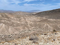
Fig. 19-17. View looking north from the unofficial Coyote Mountains overlook area south of Carrizo Badlands Overlook. |
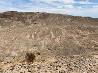
Fig. 19-18. View of badlands below the Coyote Mountain front from the unofficial overlook area. |
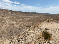
Fig. 19-19. View to the south along the Coyote Mountains mountain front along Montero Wash. |
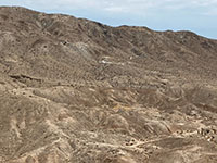
Fig. 19-20. Zoom view from the Coyote Mountains overlook of the dolomite mine in the Elsinore fault zone. |

Fig. 19-21. Panoramic view of the Coyote Mountains with Canyon Sin Nombre to the north (left) and Montero Wash to the south (right). This view is from an unnamed Coyote Mountains overlook area on an unpaved road about a mile south of the Carrizo Badlands Overlook area. The Elsinore Fault runs basically along the base of the south-facing mountain front. |
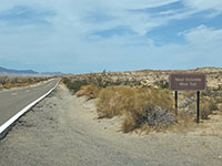
Fig. 19-22. Sign for the unpaved Dolomite Mine Road along Highway S2 south of the Carrizo Badlands and Coyote Mountains overlooks. |
|
Study Area 20 - Coyote Mountains section
This area includes the southern end of the Coyote Mountains. This is also where the Coyote Mountains section of the Elsinore Fault Zone ends where it intersects with a series of perpendicular faults associated with the Ocotillo Fault Zone. South of this fault intersection area the Elsinore Fault Zone continues as the Laguna Salada section as it passes through the Yuha Basin region of the Sonoran Desert.
|
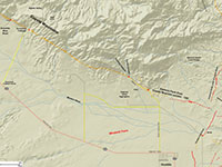
Fig. 20-1. Faults/features map. |

Fig. 20-2. Faults/satellite map |
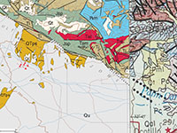
Fig. 20-3. Geologic map |
Fig. 20-4. Topo map |
|
Geologic map: western part: Todd (2004); eastern part: Rogers (1965).
Places to check out (north to south):
Central Coyote Mountains: Anza Borrego Desert State Park encompasses the northwest end of the Coyote Mountains (Figure 20-5); most of the southeast portion is within the BLM Coyote Mountains Wilderness Area. Continuing south of the park border on Highway S2 there are a couple dirt 4WD tracks that cut northward across the Mortero Wash and lead to small abandoned mining prospects in the vicinity of the Elsinore Fault Zone (be cautious as there may be deep, loose sand in the washes in these areas).
Domelands Trailhead. About 5.3 miles south of the Borrego Badlands Overlook is the turnoff for the Domelands Trailhead area (Figure 20-6). The dirt road cuts across Montero Wash and dead ends at the Domelands Trailhead (Figures 20-7 and 20-8). The dirt was crosses the Elsinore Fault in the vicinity of the stream crossing near the trailhead parking area. This is a popular hiking spot the the Domelands area, and are of large dome-shaped outcrops of weathered sandstone with "wind caves" and fossilized oyster reef beds (Imperial Formation, about 5 million years old). These shallow marine shoals with shell beds formed when this region was part of a northern embayment of the Gulf of California prior to the uplift of the Coyote Mountains along the Elsinore Fault.
Fossil Canyon and Ocotillo Canyon: These two stream canyons emerge from the southern end of the Coyote Mountains where they intersect the Elsinore Fault Zone. To get to the Fossil Canyon locality take Highway S2 south to Shell Canyon Road in Ocotillo, CA (Figure 20-9). Shell Canyon Road is paved for a mile north across Montero Wash valley. It then becomes unpaved as it approaches the mountain front. This area is heavily used for shooting, and sadly, the gun crowd has left behind a lot of shot-up trash. That said, it is still a very interesting place to study fault geology (Figures 20-10 to 20-15). The Fossil Canyon and Ocotillo Canyon locality is described by Rockwell (1989). Numerous scarps cut across successive layers of old alluvial fan surfaces that have been used to study the progression of rate of displacement along the southern end of the Coyote Mountains section of the Elsinore Fault. Ocotillo Canyon is a little further up the dirt road (Figures 20-16 to 20-18). Near the mouth of the canyon the dirt road leads past massive blocks of granite and schist thrust up along the fault. These occur adjacent to uplifted blocks of fossiliferous sandstone and conglomerate beds of Pliocene age and Miocene age volcanic rocks. These rocks are are cut and covered locally by Quaternary age basin fill deposits.
Southern End of the Coyote Mountains section at the intersection with the Ocotillo Fault Zone: The Coyote Mountains section of the Elsinore Fault ends where the fault zone intersects the Ocotillo Fault Zone and system of unnamed faults north of the Coyote Wash along the southeast end of the Coyote Mountains. The Ocotillo Fault Zone cuts perpendicular to the trace of the Elsinore Fault. In this area near Ocotillo, California, fault strands of both the Elsinore Fault Zone and the Ocotillo Fault and other faults displayed surface rupture throughout the region from the The April 4, 2010 (Mw 7.2), El Mayor-Cucapah, Baja California, Mexico, earthquake. The Laguna Salada section of the Elsinore Fault Zone continues south of intersection with the Ocotillo Fault Zone.
|
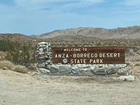
Fig. 20-5. View looking north at the Anza Borrego Desert State Park sign with northern Coyote Mountains in distance. |
Fig. 20-6. A kiosk at the Domelands Trailhead turnoff describes local paleontology of the Coyote Mountains area. |

Fig. 20-7. Unpaved road crosses Montero Wash Valley to the Domelands Trailhead near the fault zone. |
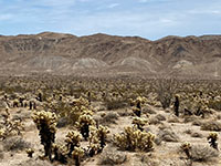
Fig. 20-8. Elsinore Fault stands out as a bedrock contrast along the mountain front south of Domelands area. |
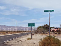
Fig. 20-9. Intersection of Shell Road and Highway S2 in Ocotillo, CA. Shell Road leads to the Fossil Canyon area. |
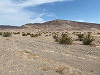
Fig. 20-10. Elsinore Fault runs along the southwestern front of the Coyote Mountains. View from Montero Wash. |
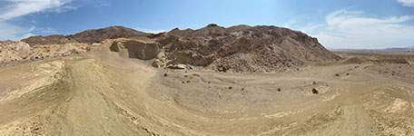
Fig. 20-11. Panoramic view of the young fault scarp of the Coyote Mountains section of the Elsinore Fault Zone near the mouth of Fossil Canyon. Nearly flat-lying Plio-Pleistocene sedimentary deposits are faulted adjacent to Mesozoic-age igneous and metamorphic rocks. |
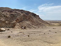
Fig. 20-12. A closer view of the vertical fresh fault scarp cutting across the the mountain front at Fossil Canyon.
|

Fig. 20-13. Displacement along Elsinore Fault: granitic basement adjacent to Quaternary alluvial beds. |
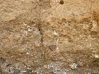
Fig. 20-14. White veins of gypsum filling fractures in fanglomerate near fault in Fossil Creek wash. |
Fig. 20-15. Pliocene age fossils clam hash exposed in sedimentary deposits in Fossil Canyon. |
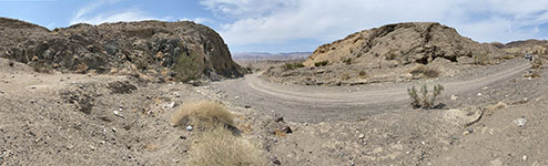
Fig. 20-16. Panoramic view of looking south toward the mouth of Ocotillo Canyon. Igneous gneiss and schist is on the left and flat to steeply dipping Pliocene sedimentary rocks are on the right side of the canyon. The two rock lithologies are exposed in an uplifted horst block along the Coyote Mountains section of the Elsinore Fault Zone.
|
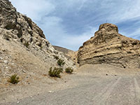
Fig. 20-17. Another persecutive view of the rocks exposed at the mouth of Ocotillo Canyon. Granite and schist on the left, fanglomerate on the right. |

Fig. 20-18. Sheared basement rock (Triassic? schist intruded by Cretaceous granite) exposed near the fault near the mouth of Ocotillo Canyon.
|
|
Laguna Salada Fault section
The southeasterly trend of the Elsinore Fault Zone continues south of Ocotillo, Ca near Interstate 8 as the Laguna Salada Fault Zone. Laguna Salada Fault Zone is in a mostly uninhabited area of Imperial County California and extends south near Laguna Salada (an ephemeral, dry lake bed in northern Baja California, Mexico). The fault zone is associated with a major Mw7.2 earthquake that occurred on Easter (4 April, 2010) that caused considerable shaking and building damage in both San Diego and Imperial Counties, as well as in Baja California. Amazingly, no fatalities were reported.
|
Laguna Salada Fault Zone (Modified from SCEDC summary)
- TYPE OF FAULT MOTION: A mix of right-lateral strike slip, normal, and oblique slip faulting (Muller and Rockwell, 1995, Rhymer, 2010)
- ORIENTATION: N40°W (for section); Dip:
55–70° SW.
- LENGTH: 44 miles (70 km)
- LOCATION: Imperial County into Baja California, within the California portion of the Basin and Range Province/California Desert region.
- NEAREST COMMUNITIES: Ocotillo and Plaster City, CA; Progresso, Baja California
- MOST RECENT SURFACE RUPTURE: Mw 7.2 earthquake on 4 April, 2010 Baja California Earthquake (occurred on Easter)
- INTERVAL BETWEEN MAJOR RUPTURES: unknown; possibly 1.2 ka reported by Rhymer (2010)
- PROBABLE MAGNITUDES: Mw6.5 - 7.5
- SLIP RATE: roughly between 2-5 mm/yr (?) (2–3 mm/yr dextral and vertical deformation rate reported by Mueller and Rockwell, 1995).
- GEOMORPHIC EXPRESSION: Scarps on alluvium and bedrock, beheaded streams, deflected and offset drainages. Displacement of both Holocene and Quaternary alluvium and fan deposits.
- QFFDUS ID: Laguna Salada section (126g)
|
Study Area 21 - Laguna Salada Fault section
The Yuha Basin area is an area affected a large, surface-rupture earthquakes associated with the Laguna Salad Fault (and associated faults). : Mw~7.2 in 23 February 1892 and another Mw 7.2 on 4 April 2010. |
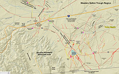
Fig. 21-1. Faults, roads/features map. |
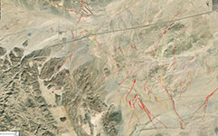
Fig. 21-2. Faults/satellite map |
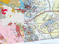
Fig. 21-3. Geologic map |
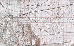
Fig. 21-4. Topo map |
|
Geologic map: western part: Todd (2004); eastern part: Rogers (1965).
Places to check out (north to south):
Yuha Desert Region: The Yuha Desert is the lowlands east of the Peninsular Ranges, south of Anza Borrego State Park (along the Interstate 8 corridor to the Colorado River extending south across the U.S./Mexico border). The landscape is dry, barren country
with low rocky tablelands and badlands cut by alluvial washes and some dune areas. The bedrock consists of Pliocene-age continental and fossiliferous shallow marine sedimentary formations.
Juan Bautista de Anza National Historic Trail: This remote unpaved loop road has both historical and geological significance (Figures 21-5 to 21-13). The historical significance of the trail is recorded on the bronze plate on De Anza Overlook Historic Marker (Figure 21-7); the text is quoted below:
"De Anza Overlook"
"Juan Bautista De Anza led two groups of Spanish explorers and settlers across this portion of the Colorado Desert from Northern Mexico to San Francisco Bay. During each tortuous passage, the Spanish camped below here in Yuha Wash. The Passage in 1774, which explored and pioneered the first overland route into Upper California, consisted of only a small group of soldiers and two missionaries, Fathers Carces and Diaz.
A second trip in 1776 brought settlers to the coast of California. Spain felt that its tenuous hod on the New World was threatened by Russian settlements to the north. The Spanish missions were struggling to survive and needed a reliable supply route to ensure military, political and religious success.
This expedition contained 240 people, including Captain De Anza, 38 soldiers, 15 muleteers, 136 colonists, several Indian guides, and Father Pedro Font, as chronicler. There were over 800 head of livestock which included pack mules, horses, and cattle. The settlers became founders of what would become San Francisco.
The route discovered by De Anza was abandoned in the 1780s because of Quechan Indian hostilities. Portions of the route were used during the 1800s as part of the Gila and Overland Trails. Finally, it was also used by gold seekers and several stage lines."
"Monument erected by the Bureau of Land Management
in cooperation with the Imperial County Pioneers Historical Society, dedicated January 1990"
|
The geologic significance of the historic trail is that it is located on an escarpment of gently to steeply dipping strata that has been pushed up by movement along a strand of the Laguna Salada Fault Zone. Late Quaternary-age alluvial gravel cap the top of the 150-foot-high escarpment (a questa), resting unconformably on dipping Pliocene strata exposed nearby in the wash basin to the east. The fossiliferous character of the sedimentary beds in the Yuha Basin area was noted by the Font's Diary in December of 1775 with speculation that a sea beach had reached this area in the past. Pedro Font (1734-1781) was a member of the Spanish expedition, and his diary describes the itinerary, natural resources of the country, the Indians encountered, and stories of the journey. Geologic mapping of recent fault surface ruptures in the area after the 2010 Laguna Salada Earthquake are shown on Figure 21-1.
Yuha Well: Another historic marker located in El Centro, CA (east of study area) describes another historic location known as Yuha Well. Yuha Well is located along Yuha Wash about 2 miles east of De Anza Overlook in the middle of the barren landscape shown in Figure 21-10. The well is associated with a natural seep along the trace of fault that crosses Yuha Wash.
"Yuha Well"
"Known as Santa Rosa de Las Lajas (Flat Rocks), This site was used on March 8, 1774 by the Anza exploring expedition, opening the land route from Sonora, Mexico, to Alta California. On December 11 to 15, 1775 the three divisions of Anza's colonizing expedition used this first good watering spot beyond the Colorado River on the way from Sonora to San Francisco."
"CA Registered Historic Landmark No. 1008" |
|
Crucification Thorn Area: West side of Highway 98 near the southern end of the Juan Bautista de Anza National Historic Trail route. The Crucification Thorn area is host to a small playa (dry lake bed) that is a sag pond within the Laguna Salada Fault Zone (Figures 21-14 and 21-15). An abundance of small fault ruptures were noted in the area after the Mw 7.2 on 4 April 2010 Laguna Salada earthquake (Figure 21-16). Crucifixion thorn is the name applied to at least three similar thorny species of desert plants native to the Mojave and Sonoran Deserts. The species Castela emory is species in this area around the sag pond-playa. This area as famous for its abundance of spring wildflowers after wet winter seasons.
Sunrise Butte: According to a National Park Service display at this site along Highway 98, this small hill was originally named this small peak Cerro del Impossible (Impossible Hill) for how difficult a time the Spanish explorers for the Juan Bautista de Anza expedition in January 1774 had getting to this landmark location. The hill then became known as Mount Signal. However, the official USGS name for the hill is Sunrise Butte.
Sunrise Butte is located along a recently active strand of the Laguna Salada Fault Zone. The peak of the butte is a small horst between two strands of the fault (Figures 21-17 to 21-22). The hill is on top of a questa (escarpment) consisting of dipping sedimentary strata of Pliocene age along the fault zone. The dipping layers are well exposed on the east side of the escarpment; the hilltop is capped with Quaternary alluvial gravel deposits.
|
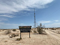
Fig. 21-5. Entrance sign to the Juan Bautista de Anza National Historic Trail south of Ocotillo, CA. |
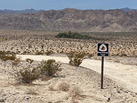
Fig. 21-6. A small oasis in the desert north of the historic Juan Bautista de Anza National Historic Trail/ |

Fig. 21-7. Historic marker for the Juan Bautista de Anza erected to commemorate the historic expedition of 1774. |
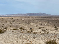
Fig. 21-8. View looking north at the southern end of the Coyote Mountains from near the historic marker..
|
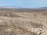
Fig. 21-9. View looking north from the marker area. |
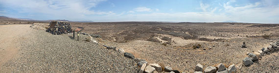
Fig. 21-10. Panoramic view looking east at the Yuha Basin area from near the historic marker along the Juan Bautista de Anza NHT. |
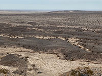
Fig. 21-11. Dark surface gravel overlies steeply dipping Pliocene beds east of the historic marker. |

Fig. 21-12. Panoramic view looking south along the Juan Bautista de Anza National Historic Trail with the Crucification Thorn Area in the distance on the right.
|
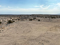
Fig. 21-13. View looking south along the escarpment of westward-dipping strata south of the historic marker.
|
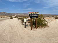
Fig. 21-14. Swales in the road to the Crucification Thorn Area reveal locations of fault strands of the Laguna Salada section. |
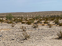
Fig. 21-15. A sag pond (playa) along a strand of the Laguna Salada fault section in the Crucification Thorn Area.
|
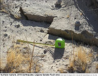
Fig. 21-16. Surface rupture from the 2010 earthquake on the Laguna Salada Fault section (Rymer, 2010).
|
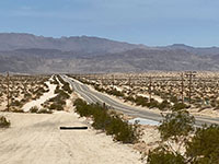
Fig. 21-17. View east of Sunrise Butte toward the Crucification Thorn area that shows swales in Highway 98 associated with fault strands. |
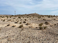
Fig. 21-18. View looking north at fault-bounded Sunrise Butte along CA Highway 98 several miles north of the US/Mexican border.
|
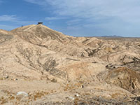
Fig. 21-19. The notch in the slope below the summit is mapped as a fault line as part of the Laguna Salada Fault section. |
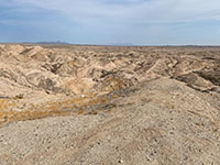
Fig. 21-20. Steeply dipping Pliocene-age coastal and shallow marine strata on east side of Sunset Butte in Yuha Basin region. |
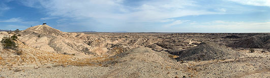
Fig. 21-21. Panoramic view looking north near Sunrise Butte toward folded Pliocene and Quaternary age strata along strands of the Laguna Salada Fault Zone near CA Highway 98.
|
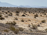
Fig. 21-22. View looking south from Sunset Butte toward the Laguna Salada basin region in northern Mexico.
|
|
Selected Resources
Note! The information in this preliminary website was compiled from previously published data summaries released by the US Geological Survey, California Geological Survey, and other organizations. It should be noted that since August 7, 2021 when this website was put online some of the links may have changed or been remove, archived, or superseded. At the time this preliminary version was released, all web links were working properly. This website is not intended for technical decision making, but is for educational purposes only, focusing on interpretation of landscape evolution along fault zones. There are many other reports and studies related to the Elsinore Fault Zone, however, if they are not free online, they are not included here. There may be newer, or more detailed technical reports available that are not presented here. |
The links to references below were all active as of 6/22/2021.
Geologic Map of California: California Department of Conservation, California Geological Survey and U.S. Geological Survey. (link)
California Geological Survey, 2021, Alquist-Priolo Earthquake Fault Zones (California Department of Conservation website). (link; map link)
Chester, T, (2013), Field Guide To the Santa Rosa Plateau website. (link)
Chester, T., (2021), Geology of Temecula Canyon: San Diego State Univ. College of Science, Field Stations Program website (link).
City of Lake Elsinore, 2008, Downtown Main Street Historic Buildings (map, 1 p.) (link)
City of Temecula, 2021, History of Temecula (website). (link)
County of San Diego Parks and Recreation, 2021, Agua Caliente County Park (website). (link),
County of San Diego Parks and Recreation, 2021,Welcome to Aqua Caliente Regional Park (2 page brochure). (link)
County of San Diego, Parks and Recreation, 2021, Volcan Mountain Wilderness Preserve (website with map brochure). (link)
Daviess, S.M. and Bramlett, M.M, 1953, The Alberhill and other clay deposits of Temescal Canyon, Riverside County, California: U.S. Geological Survey Open-File Report 53-52. 10 p. (link)
Dorsey,, R.J., 2005, Stratigraphy, Tectonics, and Basin Evolution in the Anza Borrego Desert Region: Geology, 15 July 2005 (reprint, 29 p.). (link)
Dorsey, R.J, Axen, G.J., Peryam, T.C., and Kairouz, M.E., 2012,
Initiation of the Southern Elsinore Fault at ∼1.2 Ma: Evidence from the Fish Creek–Vallecito Basin, southern California: Tectonics, V. 31, Issue 2, April 2012, 21 p. (link)
Engel, R., 1933, Geology of the Santa Ana Mountains and the Elsinore trough: Pasadena, California Institute of Technology, Ph.D. dissertation.
Engel, R., 1959, Geology of the Lake Elsinore quadrangle: California Division of Mines and Geology Bulletin 146, 154 p., 7 pls., scale 1:62,500.
English, W.A., 1926, Geology and oil resources of the Puente Hills region, southern California: U.S. Geological Survey Bulletin 768, 110 p. (link)
Erdelsky, P.J., 2020, Topographic Maps of San Diego County, California (index map with links to 7.5 USGS quadrangle map sheets). (link)
Gans, L.O. and Sylvester, A.G., 2016, San Diego County Road S2 - Ocotillo to Warner Springs [from Roadside Geology of Southern California]. (link)
Hough, S.E. and Elliot, A, 2004, Revisiting the 23 February 1892 Laguna Salada earthquake: Bulletin of the Seismological Society of America, v.94, no. 4, p 1571-1578.
Hull, A.G., and Nicholson, C., 1992, Seismotectonics of the northern Elsinore fault zone, southern California: Bulletin of the Seismological Society of America, v. 82, p. 800-818. (link)
Jennings, C.W., 1994, Fault activity map of California and adjacent areas, with locations of recent volcanic eruptions: California Division of Mines and Geology Geologic Data Map 6, 92 p., 2 pls., scale 1:750,000. (pamphlet link)
Kennedy, M.P., 2000a, Preliminary Geologic Map of the Pala 7.5’ Quadrangle, San Diego County, CA: A Digital Database (Version 10). California Geological Survey. 1 Sheet, scale 1:24,000. (link) [left side of Map 10 area]
Kennedy, M.P., 2000b, Preliminary Geologic Map of the Pechanga 7.5’ Quadrangle, Riverside County, CA: A Digital Database. California Geological Survey. 1 Sheet, scale 1:24,000. (map link) (Pamphlet link)
Kennedy, M.P., 2014, Preliminary Geologic Map of the Boucher Hill 7.5’ Quadrangle, San Diego County, CA: A Digital Database (Version 1.2). California Geological Survey. 1 Sheet, scale 1:24,000. (link)
Kennedy, M.P., 1977, Recency and character of faulting along the Elsinore fault zone in southern Riverside County: California Division of Mines and Geology Special Report 131, 12 p.
Kennedy, M.P., Morton, D.M., 2003, Preliminary Geologic Map of the Murrieta 7.5' Quadrangle, Riverside County, California: U. S. Geological Survey Open-File Report 03-189, 1 sheet. (link)
Lamar, D.L., and Swanson, S.C., 1981, Study of seismic activity by selective trenching along the Elsinore fault zone, southern California: Technical report to U.S. Geological Survey, Final Technical Report 81-4 (see also U.S. Geological Survey Open-File Report 81-882), Reston, Virginia, December 1981, 50 p. (link)
Lawson, A.C., chairman, 1908, The California earthquake of April 18, 1906—Report of the State Earthquake Investigation Commission: Washington, D.C., Carnegie Institution of Washington Publication 87, 451 p. (link)
Loera, D.M. (2003) Geology of the Western Santa Rosa Plateau Ecological Reserve: Department of Geological Sciences, California State University, Fullerton, bachelors thesis
58 p. (link)
Magistrale, H., and Rockwell, T., 1996, The central and southern Elsinore fault zone, southern California: Bulletin of the Seismological Society of America, v. 86, p. 1793-1803. (link)
Miller, R.V., Shumway, D.O., and Hill, R.L., 1991, Mineral land classification of the Temescal Valley area, Riverside County, California: California Department of Conservation, Division of Mines and Geology Special Report 165, 101 p. (link)
Morton, D.M., 2004, Preliminary Digital Geologic Mop of the 30' X 60' Santa Ana Quadrangle, version 2.0. U.S. Geological Survey
Open-File Report 99-172, 55 p. (link)
Morton, D.M, Miller, F.K, Cossette, P.M., and Bovard, K.R., 2006, Geologic Map of the San Bernardino and Santa Ana 30' x 60' quadrangles, California. U.S. Geological Survey Open-File Report 2006-1217, 4 map sheets, with geologic report, 199 p. (with or without photos). (link)
Mueller, K.J., and Rockwell, T.K., 1995, Late Quaternary activity of the Laguna Salada fault in northern Baja California, Mexico: Geological Society of America Bulletin, v. 107, p. 8-18. (link)
National Park Service, 2021, Juan Bautista de Anza National Historic Trail, AZ, CA: website (link).
Rockwell, T.K., 1989, Behavior of individual fault segments along the Elsinore-Laguna Salada fault zone, southern California and northern Baja California—Implications for the characteristic earthquake model, in Schwartz, D.P., and Sibson, R.H., eds., Proceedings of Conference XLV—Fault segmentation and controls of rupture initiation and termination: U.S. Geological Survey Open-File Report 89-315, p. 288-308. (link)
Rockwell, T., 1990, Holocene activity of the Elsinore fault in the Coyote Mountains, southern California, in Rockwell, T., ed., Western Salton trough soils and neotectonics: Friends of the Pleistocene, Field Trip - 1990, Guidebook, p. 30-42.
Rockwell, T.K., Gath, E.M., and Gonzalez, T., 1992, Sense and rate of slip on the Whittier fault zone, eastern Los Angeles basin, California [abs.]: Association of Engineering Geologists, 35th Annual meeting, Proceedings, p. 679.
Rogers, T.H. (compiler), 1965, Santa Ana Sheet: Geologic Map of California, (map scale 1:250,000), in Geologic Atlas of California (printed 1979).
Rymer, M.J., Treiman, J.A., Kendrick, K.J., Lienkaemper, J.J., Weldon, R.J., Bilham, R., Wei, M., Fielding, E.J., Hernandez, J.L., Olson, B.P.E., Irvine, P.J., Knepprath, N., Sickler, R.R., Tong, .X., and Siem, M.E., 2011, Triggered surface slips in southern California associated with the 2010 El Mayor-Cucapah, Baja California, Mexico, earthquake: U.S. Geological Survey Open-File Report 2010–1333 and California Geological Survey Special Report 221, 62 p. (link)
San Dieguito River Park (website with trail guides/maps to Volcan Mountain Wilderness Preserve and Santa Ysabel Preserve East). (link)
SCEDC (Southern California Earthquake Data Center), 2021. Earthquake Information: Elsinore Fault Zone (website summary). (link)
Sleeter, B.M., Calzia, J.P., and Walter, S.R., 2012, Earthquakes and faults in southern California (1970–2010): U.S. Geological Survey Scientific Investigations Map 3222, scale 1:450,000. (link)
Snibbe, K., 2018, The longest stagecoach line through California [Butterfield Overland Stage Route]: Orange County Register, (13 September 2018). (link)
Tan, S.S. and Kennedy, M.P., 2000, Preliminary Geologic Map of the Temecula 7.5’ Quadrangle, Riverside County, CA: A Digital Database. California Geological Survey. 1 Sheet, scale 1:24,000. (map link)(pamphlet link).
Treiman, J.A., and Lundberg, M., compilers, 1998, Elsinore fault zone, Whittier section, Fault number 126a, in Quaternary Fault and Fold Database of the United States: U.S. Geological Survey website. (link)
Treiman, J.A., compiler, 1998, Elsinore fault zone, Chino section, Fault number 126b, in Quaternary Fault and Fold Database of the United States: U.S. Geological Survey website. (link)
Treiman, J.A., compiler, 1998, Elsinore fault zone, Glen Ivy section, Fault number 126c, in Quaternary Fault and Fold Database of the United States: U.S. Geological Survey website. (link)
Treiman, J.A., compiler, 1998, Elsinore fault zone, Temecula section, Fault number 126d, in Quaternary Fault and Fold Database of the United States: U.S. Geological Survey website. (link)
Treiman, J.A., compiler, 1998, Elsinore fault zone, Julian section, Fault number 126e, in Quaternary Fault and Fold Database of the United States: U.S. Geological Survey website. (link)
Treiman, J.A., compiler, 1998, Elsinore fault zone, Coyote Mountain section, Fault number 126f, in Quaternary Fault and Fold Database of the United States: U.S. Geological Survey website. (link)
Treiman, J.A., compiler, 1998, Elsinore fault zone, Laguna Salada section, Fault number 126g, in Quaternary Fault and Fold Database of the United States: U.S. Geological Survey website. (link)
Todd, V.R., 2004, Preliminary Geologic Map of the El Cajon 30' x 60' Quadrangle, Southern California, Version 1.0: U.S. Geological Survey Open-File Report 2004-1361, (link), map scale 1:100,000 (link), correlation of units (link), pamphlet, 31 p. (link)
Todd, V.R., 1994, Geologic map of the Julian 7.5' quadrangle, San Diego County, California. U.S. Geological Survey Open-File Report 94-16, (1 sheet with pamphlet). (link)
Todd, V.R., 1978, Geologic map of the Monument Peak Quadrangle, San Diego, CA: U.S. Geological Survey Open-File Report
78-697, (1 sheet with pamphlet) (link)
Todd, V.R., 1977, Geologic map of the Agua Caliente Springs Quadrangle, San Diego, CA: U.S. Geological Survey Open-File Report
77-742, (1 sheet with pamphlet) (link)
U.S. Geological Survey, 1901, Elsinore quadrangle, California (30 minute quadrangle): Scale 1:250,000
[Surveyed in 1897-1898, reprinted in 1909]. (link)
U.S. Geological Survey, 2008, Index of preliminary image maps of the 2007 fires in Southern California (index to Open-File Reports 2008–1029 through 2008–1083, one sheet. (link)
U.S. Geological Survey, 2021, The National Map viewer app (link) - this mapping application was used to make many of the maps on this website.
U.S. Geological Survey, 2021, Historical Topographic Maps - Preserving the Past (includes topoView app). (link)
Turner, S.L., 2006, Geology of the Eastern Santa Rosa Plateau Ecological Reserve: Department of Geological Sciences, California State University, Fullerton, bachelors thesis
59 p. (link)
Vedder, J. G. and Wallace, R. E., 1970, Map showing recently active breaks along the San Andreas and related faults between Cholame Valley and Tejon Pass, California: U.S. Geological Survey Miscellaneous Investigation Series Map I-574; scale 1:24,000. (link)
Vista Irrigation District, 2021, Our History (website). (link)
Volcan Mountain Foundation, 2021, Trails, Maps & VMF's Volcan Mountain Nature Center (link)
Wallace, R. E. (editor), 1990, The San Andreas Fault System, California: USGS Professional Paper 1515, 283 p. (link)
Waring, G. A., 1915, Springs of California. U.S. Geological Survey Water-Supply Paper 338, 432 p. (link)
Warner Springs Ranch Resort, 2021, Warner Springs Ranch History (website) (link)
Winkler, C., and Kidwell, S., 1996, Field Conference: Stratigraphy of a Marine Rift Basin: (Abbott, P.L. and Cooper, J.D., eds, Neogene of the Western Salton Trough, California: The Pacific Section American Association of Petroleum Geologists, Volume 73. (link)
Working Group on California Earthquake Probabilities, 1995, Seismic hazards in southern California—Probable earthquakes, 1994 to 2024: Bulletin of the Seismological Society of America, v. 85, no. 2, p. 379-439. (link)
|
|

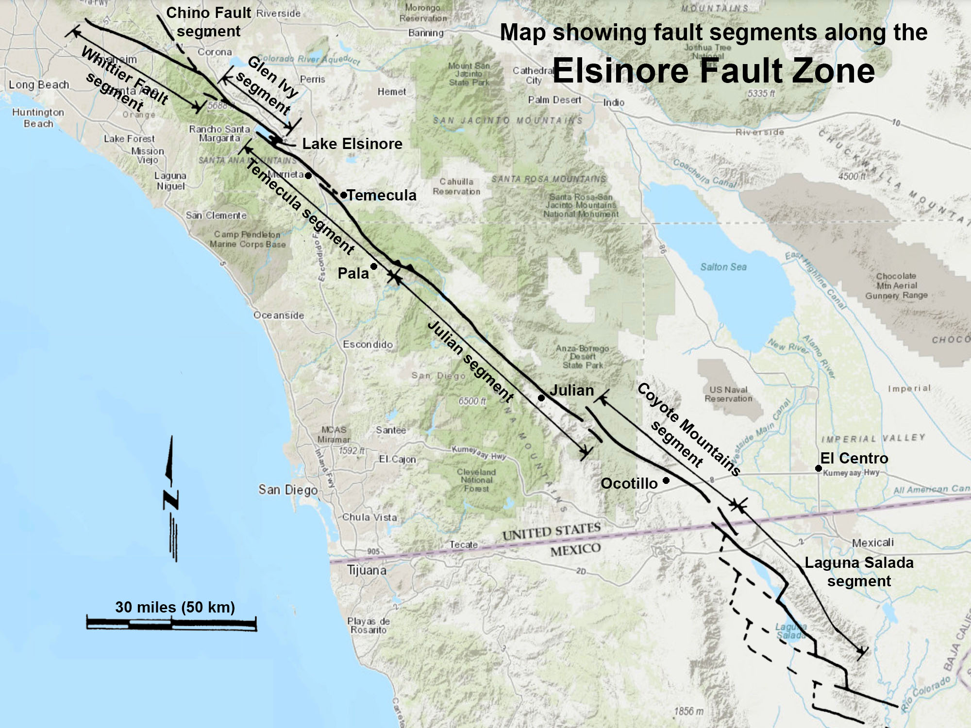
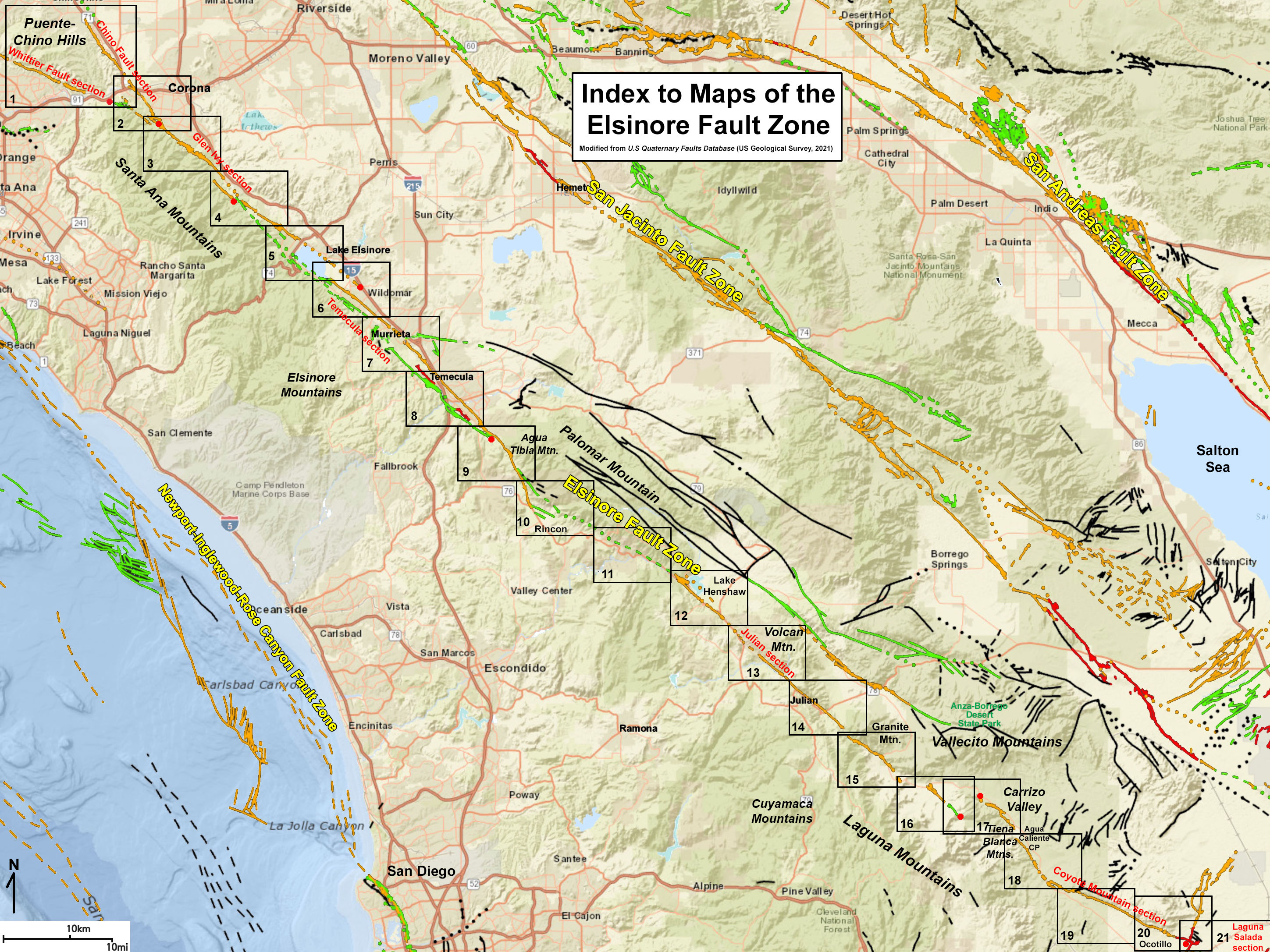
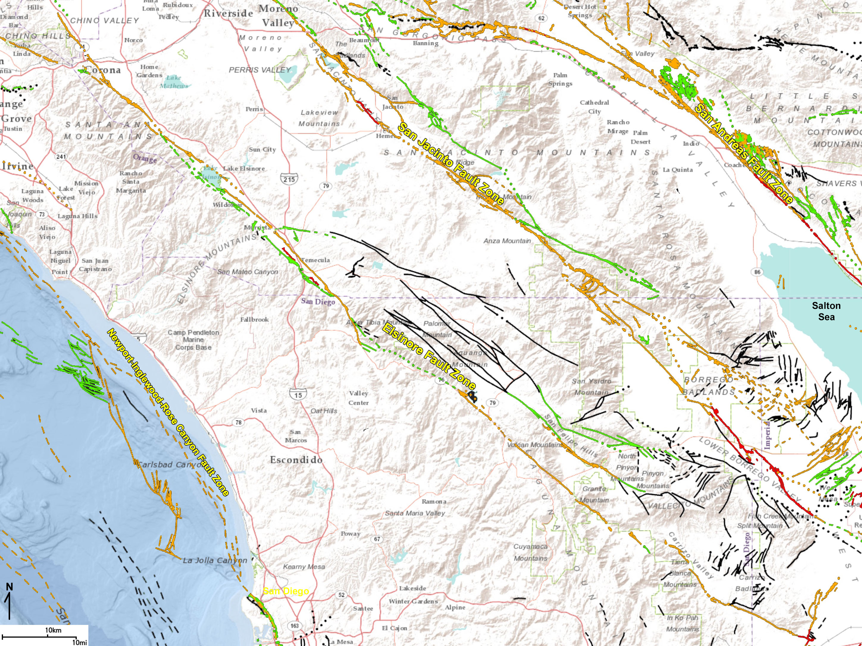
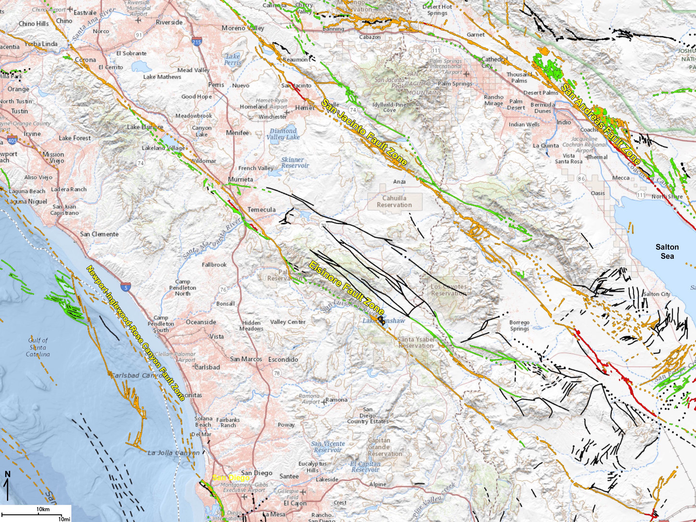
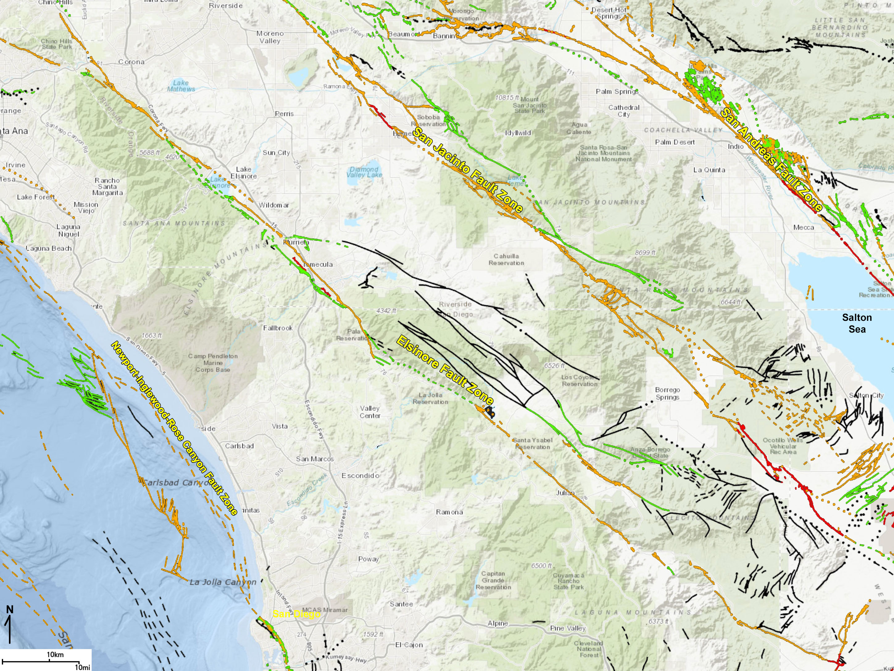

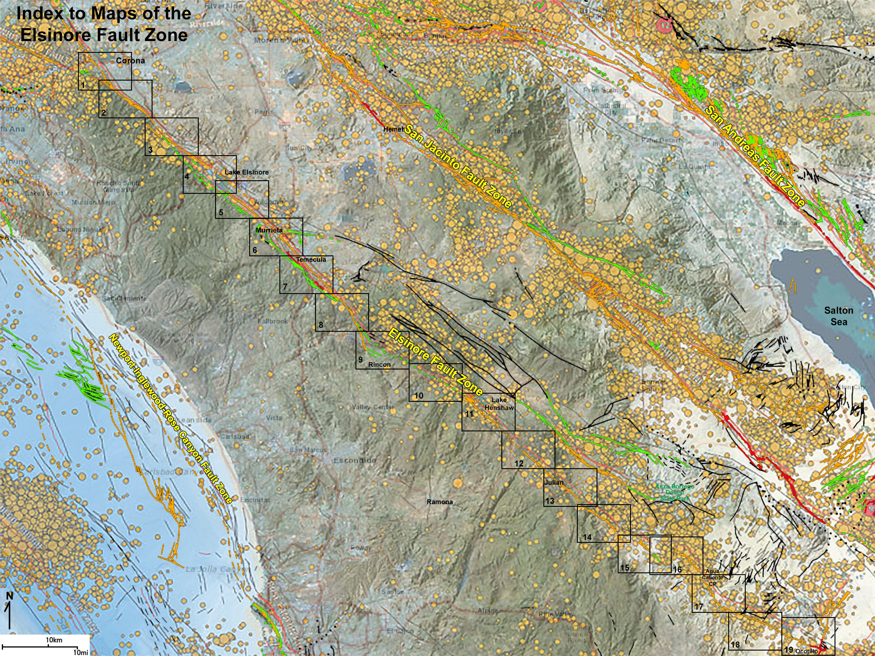

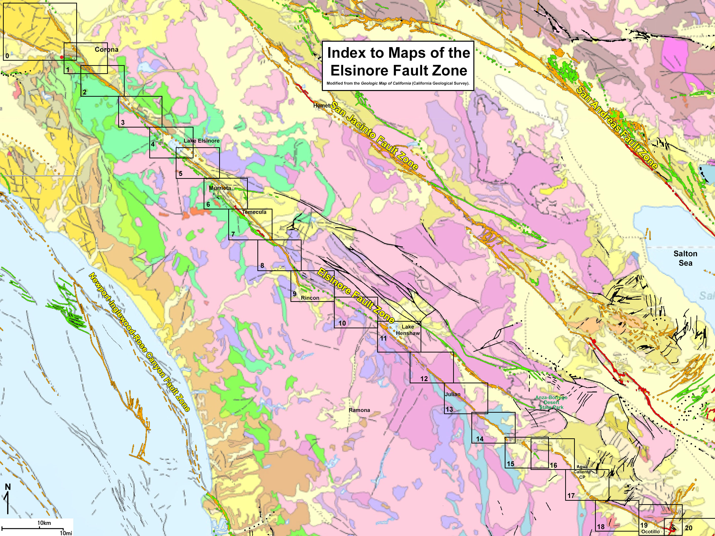
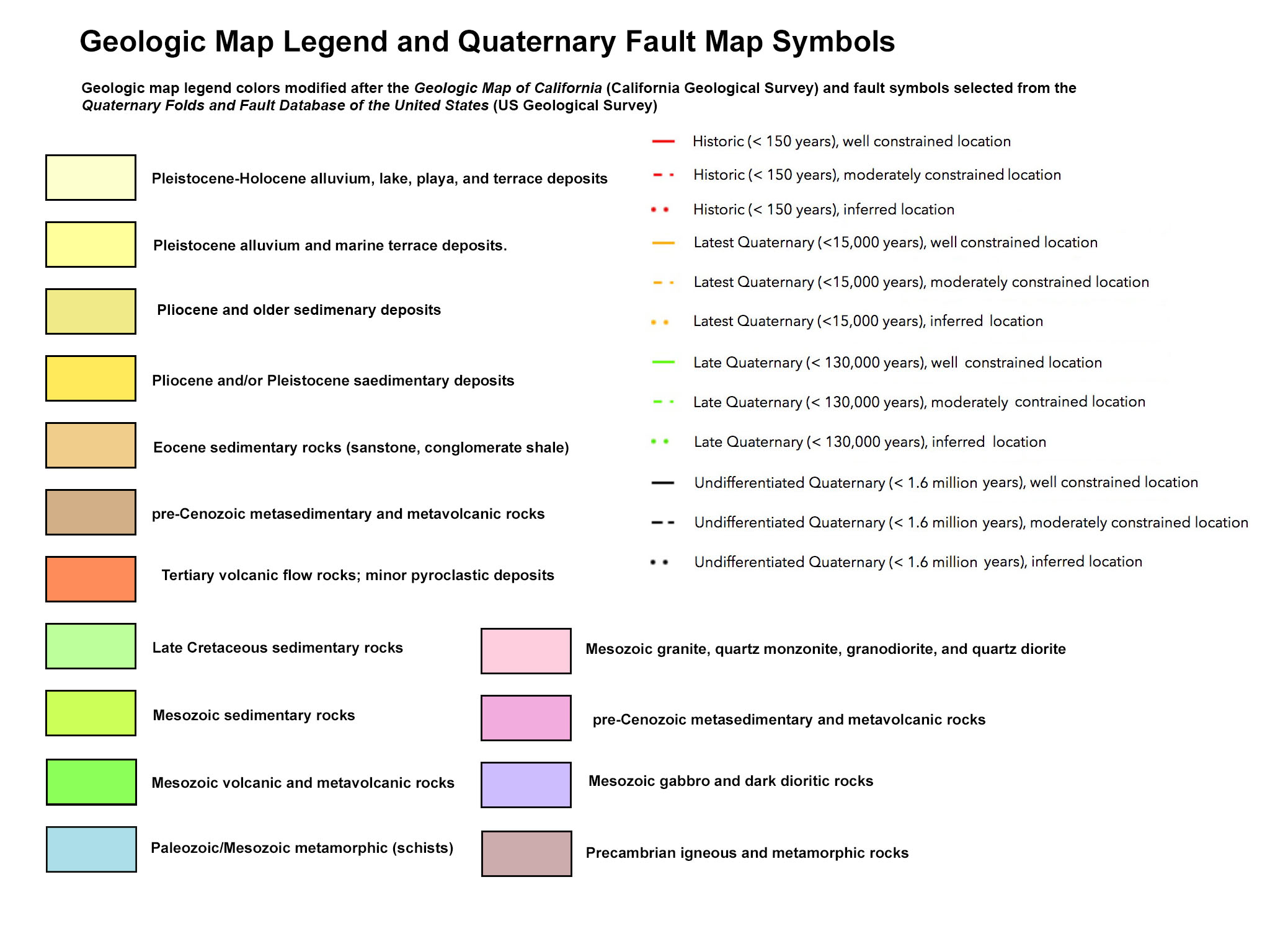
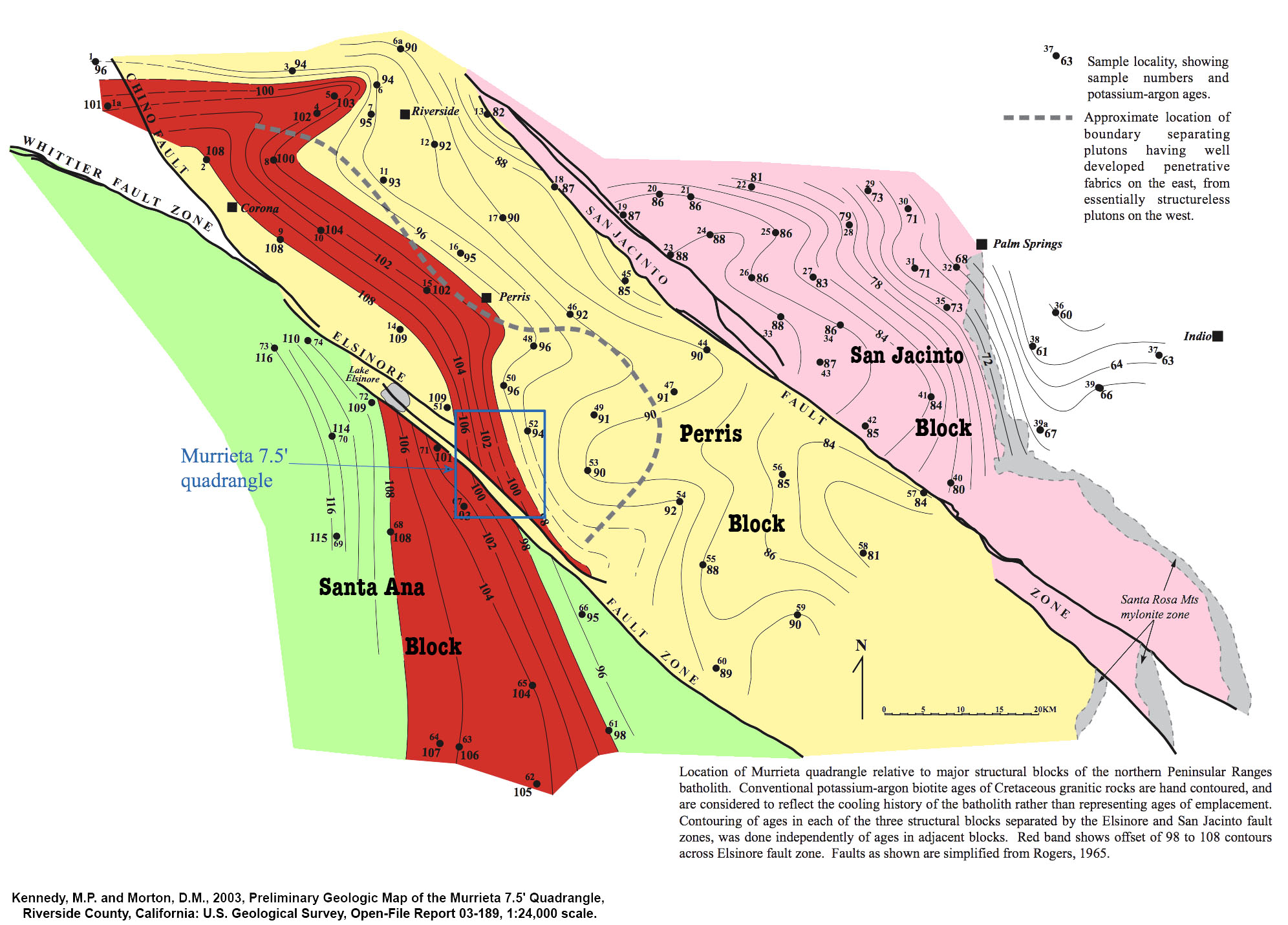
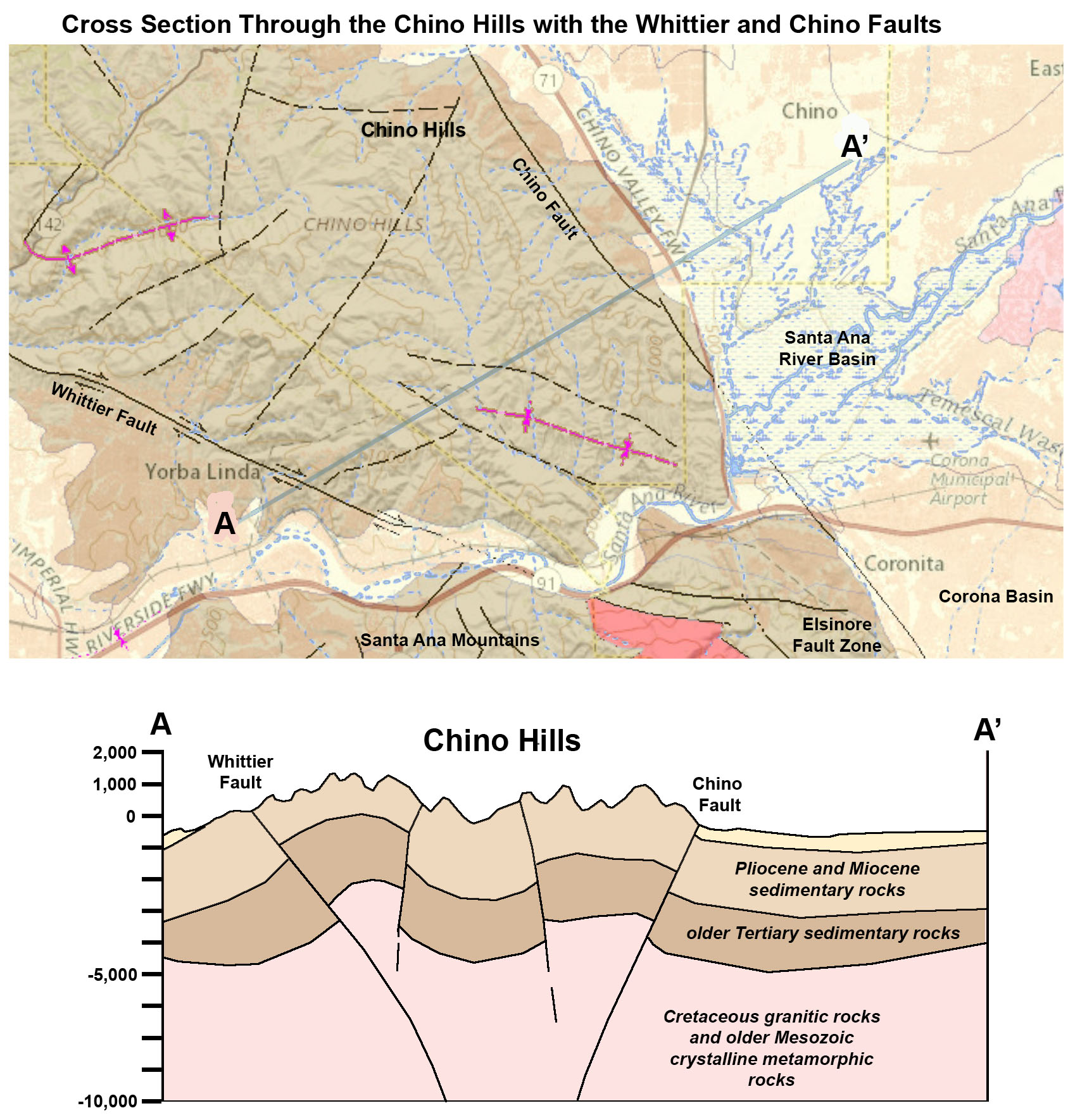
 Fig. 14. Hypothetical cross section through the Elsinore Trough showing the faults of the Elsinore Fault Zone.