 |
Geologic Map of Northern San Diego County |
Geology of the Oceanside Quadrangle (1:100,000 scale)
Switch to Geographic Index Map
| Click on individual 7.5 minute quadrangle maps for a larger view. |
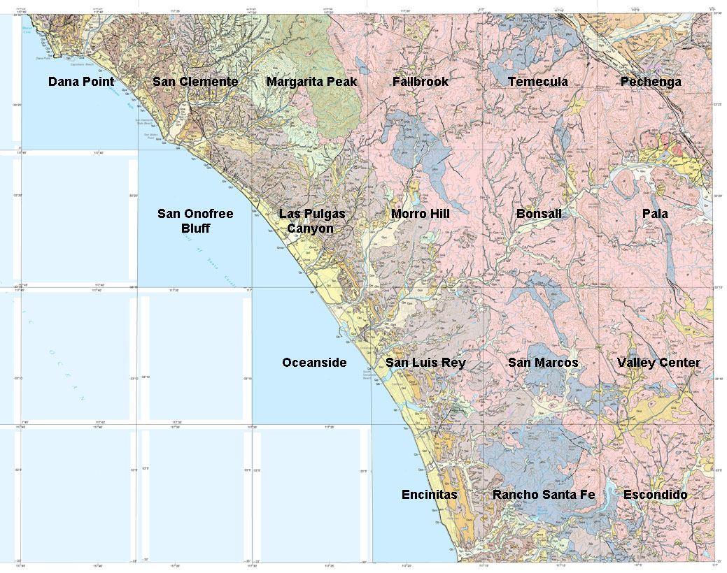 |
| This map has been modified from "Geologic map of the Oceanside 30'x 60' Quadrangle, California." California Geological Survey, Regional Geologic Map No. 2, 1:100,000 scale.) The original geologic map has been split into individual 7.5 minute quadranges for easier viewing. Click on individual 1:24,000 quadangle maps for a larger view. Note that topographic map contours and some roads appear overlain on the geology. |
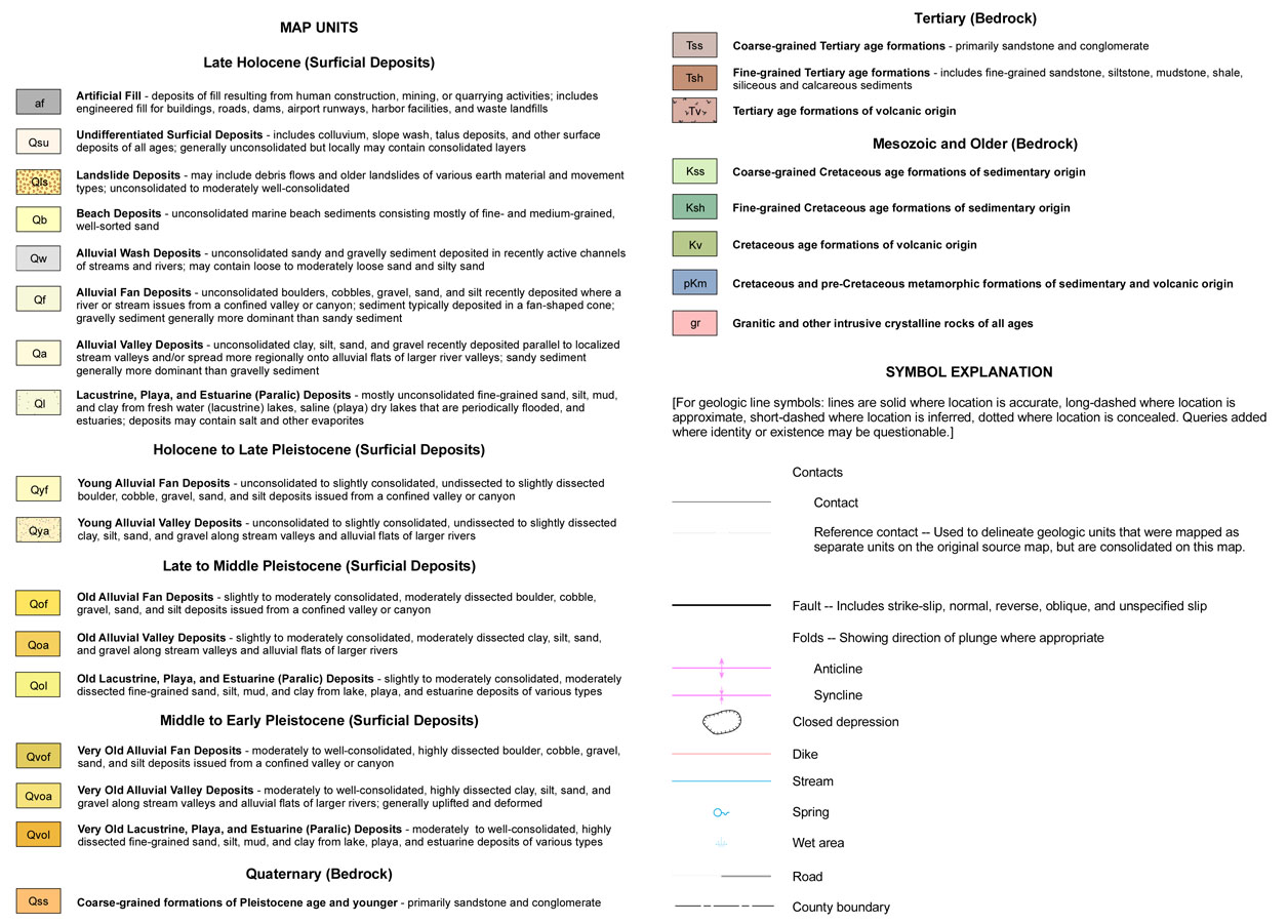
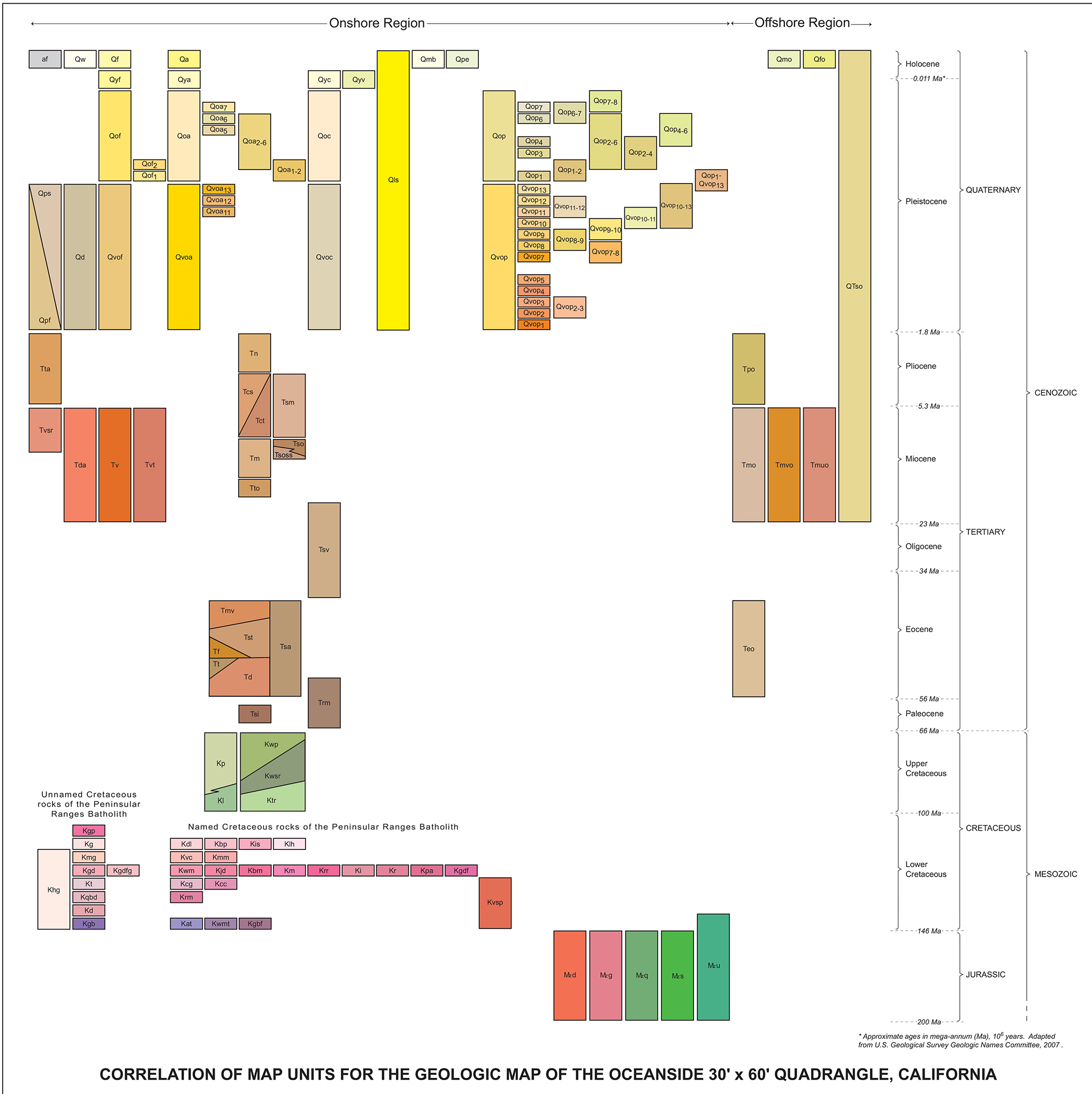
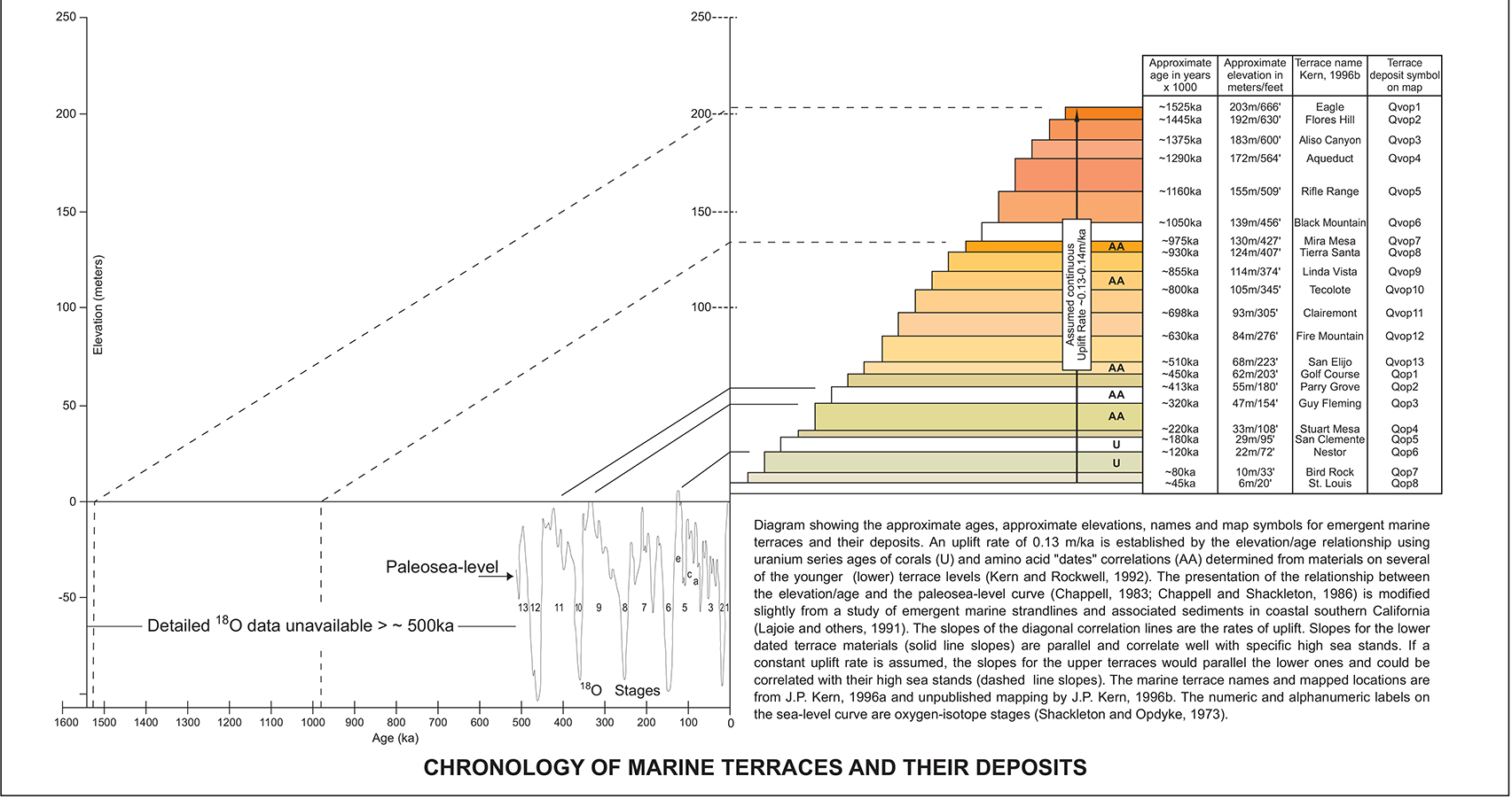
Map InformationMap Units (color and symbol index of geologic formations and features illustrated on the map)Correlation of Map Units (names of rock units linked to abbreviated map symbols arranged by geologic age). Correlation of Map Units (Detailed names of rock units linked to abbreviated map symbols arranged by geologic age). Age of Marine Terraces (Coastal landform and sedimentary deposits associated with the rise and fall of sea level and regional uplift during the Ice Ages.) Map Explanation (a general description provided from the original map) Map Scale reference (1:100,000 scale) Topographic maps (USGS index to 1:24,000 scale maps) Click here to see the original source geologic map and explanation pamphlet (large .pdf files). |
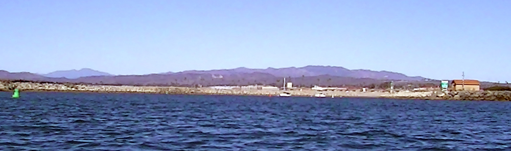 |
Figure 1. View looking east from Oceanside Harbor. Four geologic regions are represented. |
| https://gotbooks.miracosta.edu/fieldtrips/oceanside_maps/index..html | 4/17/2017 |