|
Lake Hodges Recreation Area - Natural History |
|
A1
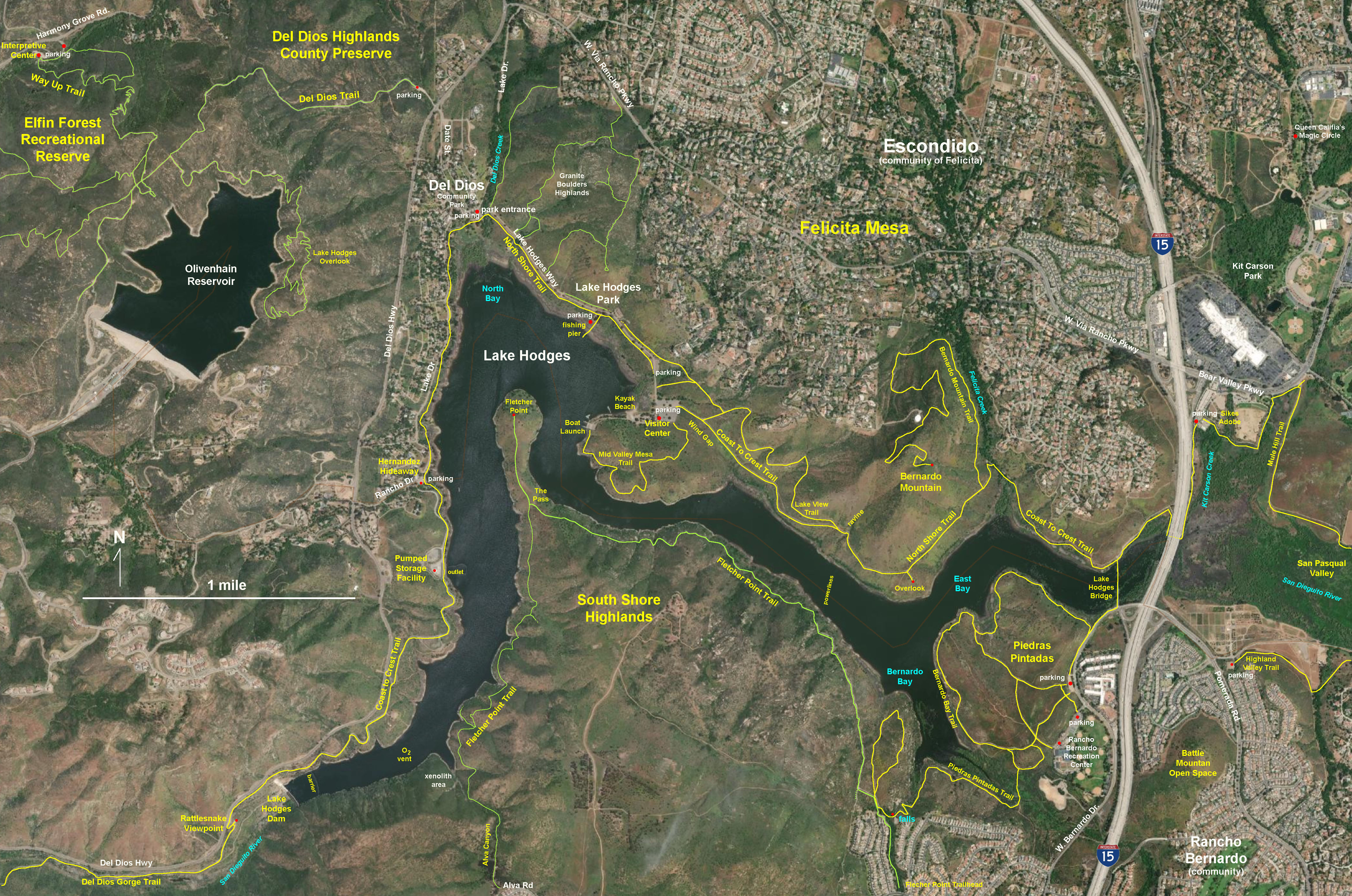
| Lake Hodges is located in the canyons of the San Dieguito River watershed between the cities of Escondido and Rancho Santa Fe in northern San Diego County. Figure 1 is a satellite map that shows feature locations and trail names used in discussions related to the regional geography, geology and ecology of this extensive recreational park and open space area.
Lake Hodges Park is part of the larger San Dieguito River Park watershed resource lands protection system. The Coast To Crest Trail runs along the north shore of the lake. The park's Visitor Center, picnic areas, boat launch, and event parking areas are located on Lake Hodges Way, a road that connects to Lake Drive in Del Dios, a community on the west shore of Lake Hodges. The Lake Hodges Park road and parking areas, the Visitor Center, and boating access to the reservoir are only open on Wednesdays, Saturdays and Sundays, and is closed December through January (during bird nesting season).
San Dieguito River Park Trail hours: Open: 6 A.M. Daily, Close: 6 P.M. Oct. 1 - March 31; 7:30 P.M. April 1 - Sept. 30. Night time trail use is prohibited. Trails may be closed after stormy weather or during high-risk wildfire warning periods. For more information see the Lake Hodges website (City of San Diego).
|
Click on images for a larger view. |

Fig. 1. Satellite map showing trails and landscape features of the Lake Hodges Recreation Area and vicinity. |
|
This is the companion to this website that shows views, features and location information along the trails in the San Diego River Parks area.
|
A2
|
Figure 2 is a panoramic view looking south from a high point on the Fletcher Point Peninsula that shows many of the landscape features discussed below. The community of Del Dios is located between the western shore of the lake and the massive cliffs and slopes of the Del Dios Highlands. Lake Hodges Dam was constructed in Del Dios Gorge. |
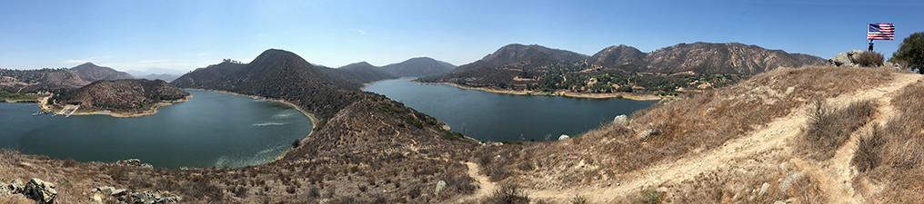
| Fig. 2. Panoramic view from the Blue Stone Chair on Fletcher Point Peninsula. Lake Hodges Dam is to the right with the Del Dios Highlands (to the west). Lake Hodges Boat Launch area is next to the Mid Valley Mesa in the foreground on the left (to the east). The Gap is a dry valley near the park's Visitor Center between the Mid Valley Mesa and he higher Felicita Mesa. Bernardo Mountain rises beyond Felicita Mesa overlooking the San Pasqual Valley near Interstate 15 in Escondido (to the distant left). Wind spilling over The Pass on the peninsula creates a Wind Vortex Area on the left side of the peninsula (see the white splotches on the water). The peninsula connect to the South Shore Highlands. The Fletcher Point Trail splits at The Pass on the peninsula. The eastern part of trail runs along the southwest shore of the lake and connects to the Piedras Pintadas and Bernardo Bay area. The the other section runs south along the southwest shore of the lake to Alva Canyon where it ascends up to the trailhead in Rancho Bernardo. The US Stars and Stripes show the dominant wind direction on the high point of Fletcher Point. |
A2
Lake Hodges Dam
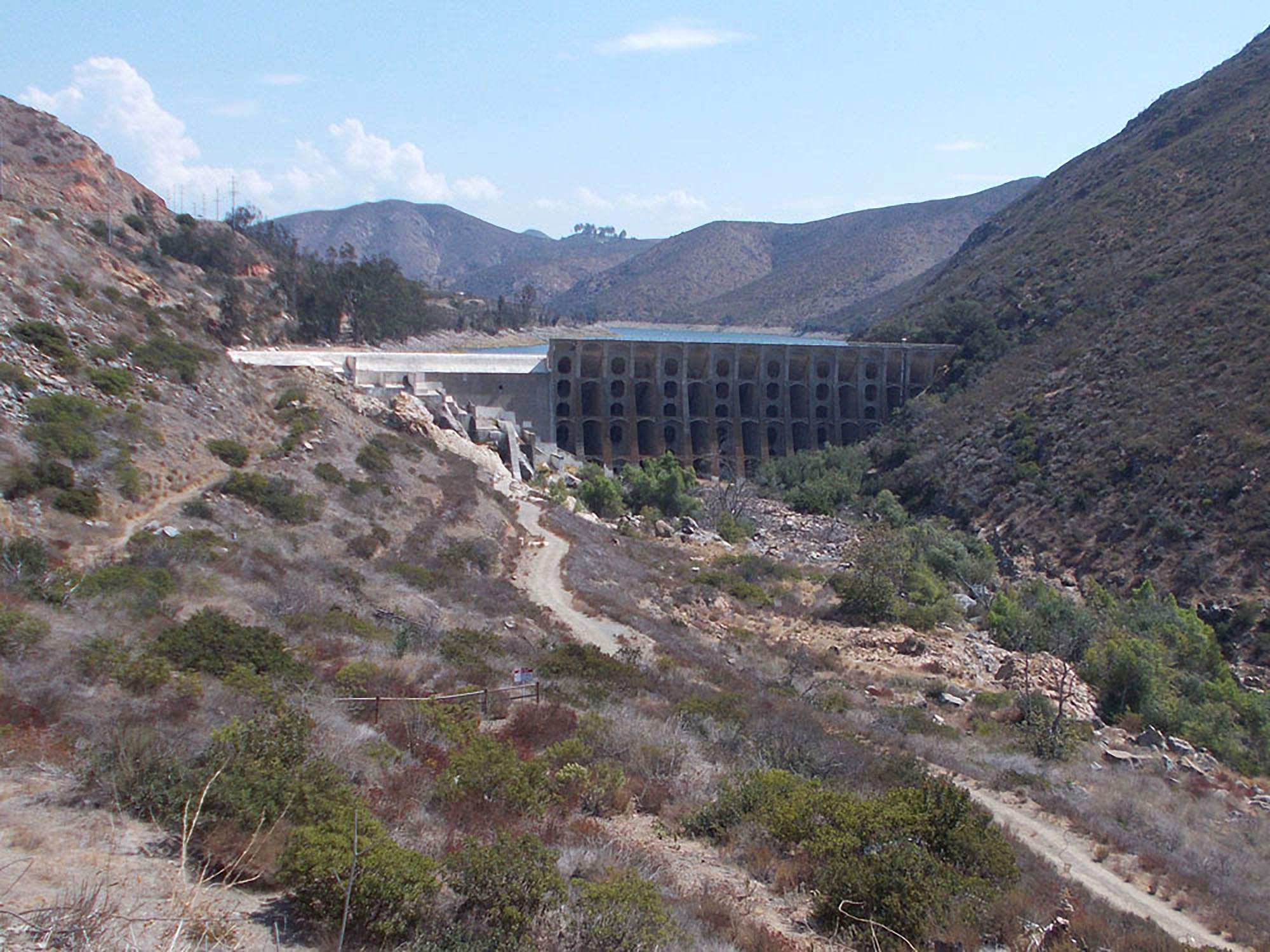
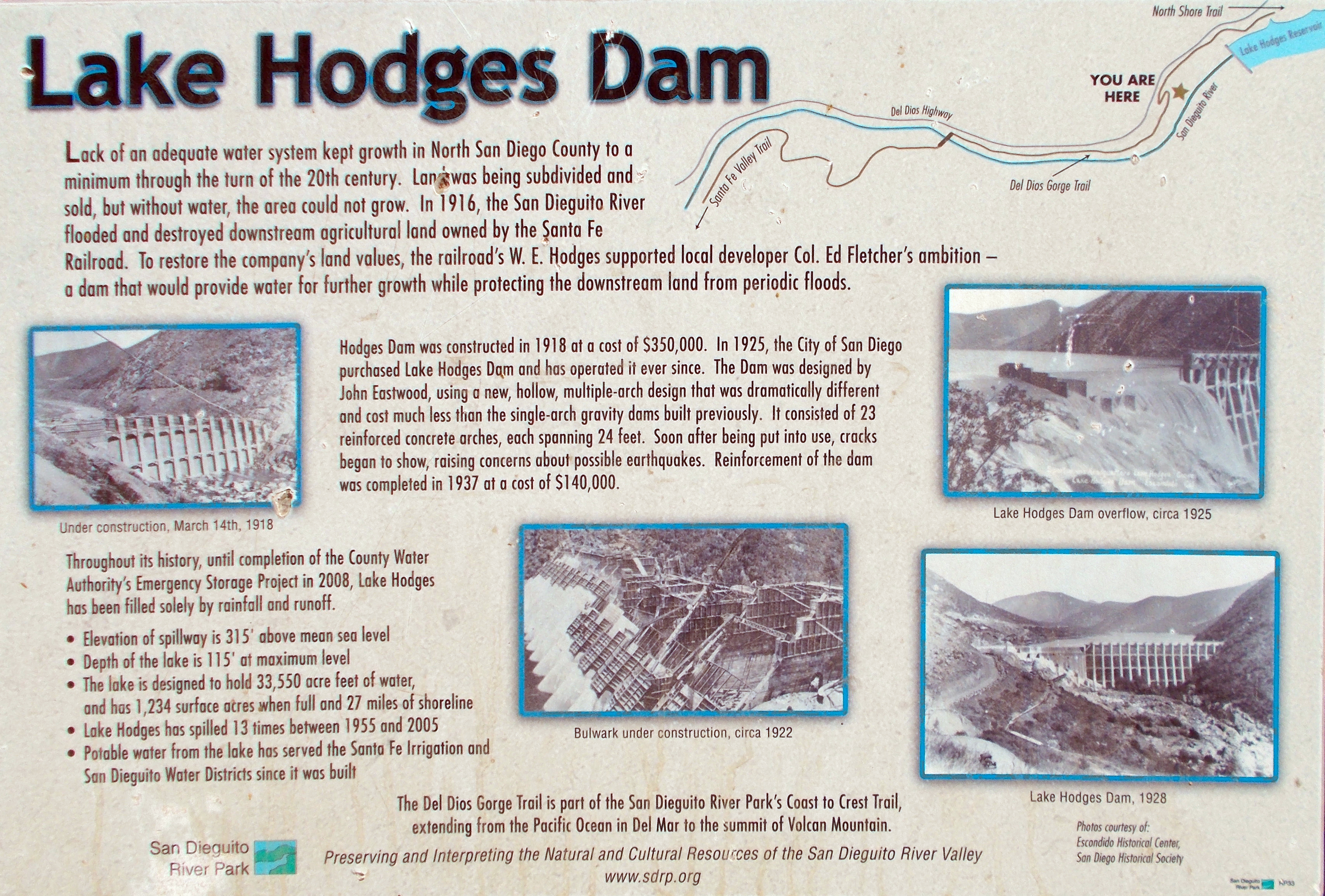
Figure 3 is a view of Lake Hodges Dam from the Rattlesnake Viewpoint along the Coast To Crest Trail that parallels the Del Dios Highway through Del Dios Gorge. Lake Hodges Dam was constructed in Del Dios Gorge in 1916 to provide flood protection and water supply for lands being developed by the Santa Fe Railroad (Figure 3). The dam was purchased in 1925 by the City of San Diego and has been operated by city ever since (as described in Figure 4). The dam went through as second phase of construction and renovation in 1937 to reinforce the dam from potential earthquake damage.
Lake Hodges spillway is at 315 feet above sea level. It's maximum depth was 115 feet at maximum level. In 2019, the maximum water level of the reservoir has been reset to 295 feet to ensure the safety of the aging dam. The reservoir was designed to hold 33,550 acre-feet of water (about 10 billion gallons). The land surrounding the reservoir is now part of Lake Hodges Recreation Area, a part of the San Dieguito River Parks watershed protection lands. The Coast To Crest runs along the north shore of the reservoir (Figure 5).
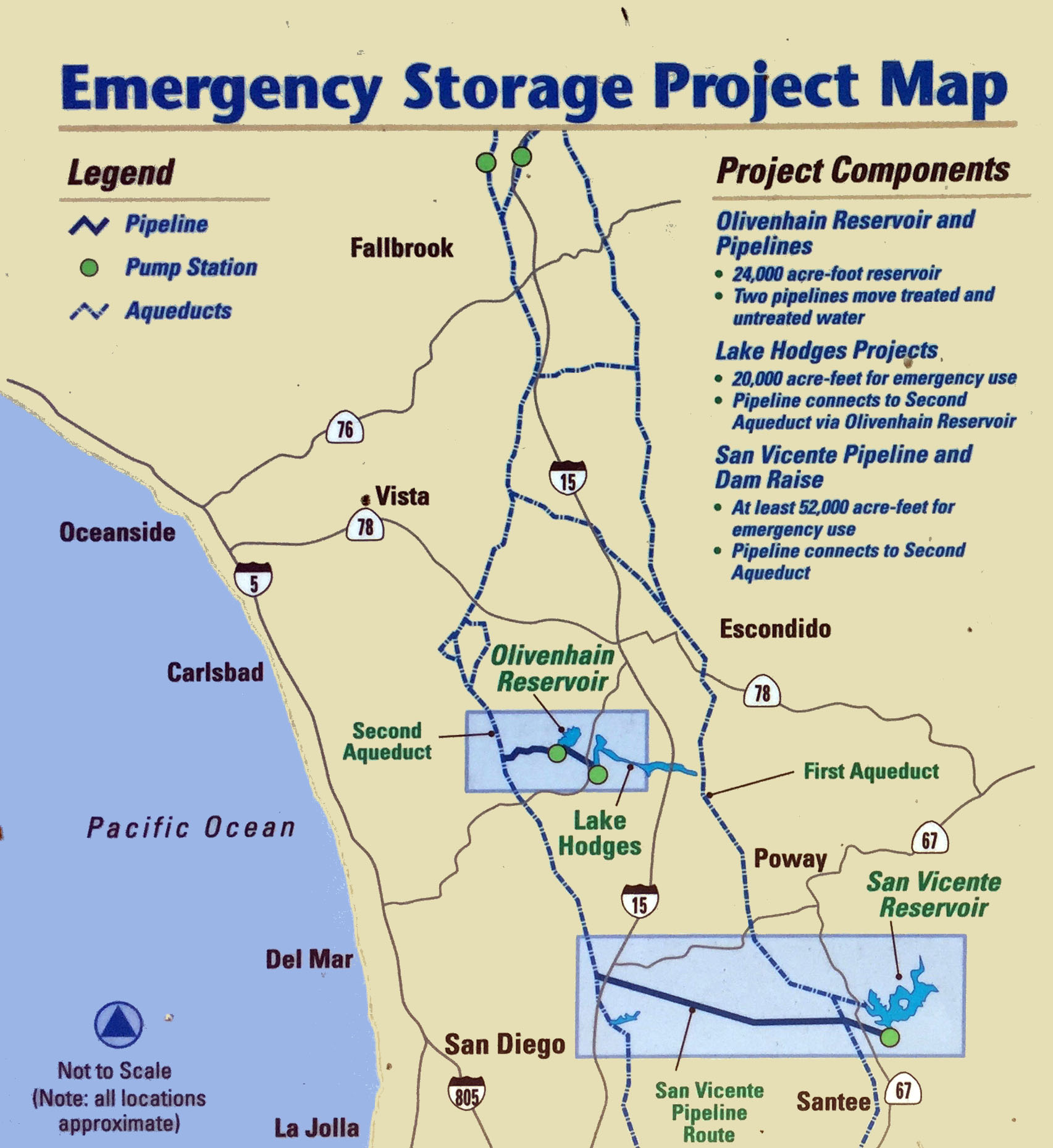
Lake Hodges is now connected to Olivenhain Reservoir located in the highlands of nearby Elfin Forest Recreational Reserve (Figure 6). Olivenhain Reservoir was completed in 2003. Olivenhain Reservoir has a storage capacity of 24,000 acre-feet (about 8 billion acre feet). Not only is the added storage capacity available for emergency usage, but the pumping and water power electrical generation system can be utilized to offset peak energy demands. Water is pumped uphill form the Lake Hodges Pumped Storage Facility during low energy demand periods (Figure 7) and is discharged back into the lake at peak demand times. In addition, air is now pumped into the reservoir as part of the Hodges Reservoir Hypolimnetic Oxygenation System. You can see the what is the equivalent of a huge fish tank bubbler creating upwelling bubbles in a cordoned of part of the lake near Alva Canyon (Figure 8). The capacity of water supply demands was expanded in 2008 when Lake Hodges and Olivenhain Reservoir were added to the regional Emergency Storage Project (Figure 9).
|

Fig. 3. Lake Hodges Dam from Del Dios Gorge Trail. |
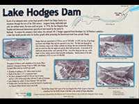
Fig. 4. Park sign describing the construction of the dam. |
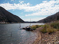
Fig. 5. Dam view from shore along Coast To Crest Trail. |
 Fig. 9.
Map of the Emergency Storage Project. The San Diego County Water Authority initiated expanded use of the reservoir for regional emergency water storage in 2008. The lake is now linked to the SoCal regional network of aqueducts and pipelines. Fig. 9.
Map of the Emergency Storage Project. The San Diego County Water Authority initiated expanded use of the reservoir for regional emergency water storage in 2008. The lake is now linked to the SoCal regional network of aqueducts and pipelines. |
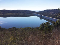
Fig. 6. Olivenhain Reservoir Dam in Elfin Forest reserve |
Fig. 7. View of Lake Hodges Pumped Storage Facility. |
Fig. 8. View of the outflow area in lower Lake Hodges. |
|
A3
Geologic Overview
The geology of the Lake Hodges area is simple in its overview, but complex in its details. On the geologic maps and discussions are three groups of rocks in the area are described with symbols:
- pKm—old volcanic and volcanoclastic rocks, some have undergone metamorphic alteration (mostly of Jurassic age [or pre-Cretaceous age]),
- gr—younger intrusive igneous rocks that intruded into the older rocks (mostly of Cretaceous age [labeled gr]), and
- Q—surficial deposits of Quaternary age: includes young alluvium (Qya), old alluvium (Qoa), landslide deposits (Qls), and undifferentiated surficial deposits (Qsu).
Soil and loose surficial sediments are not shown on geologic maps.
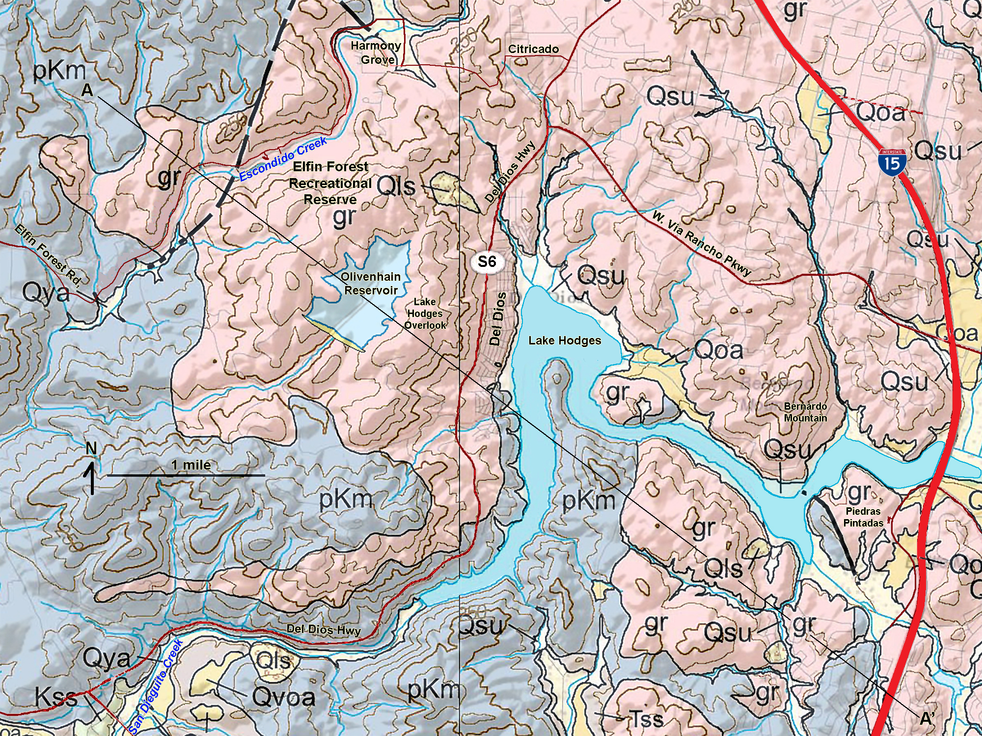
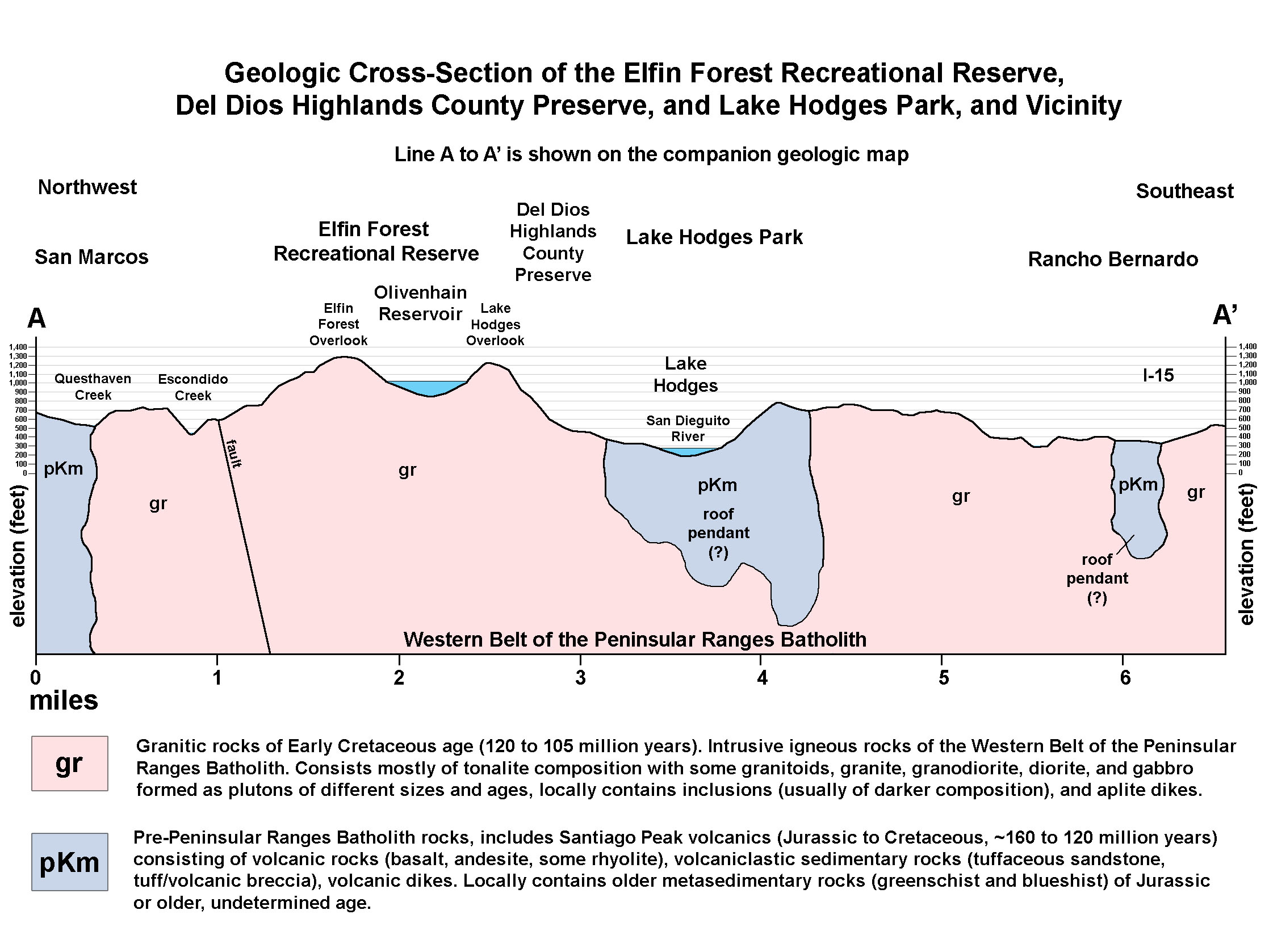
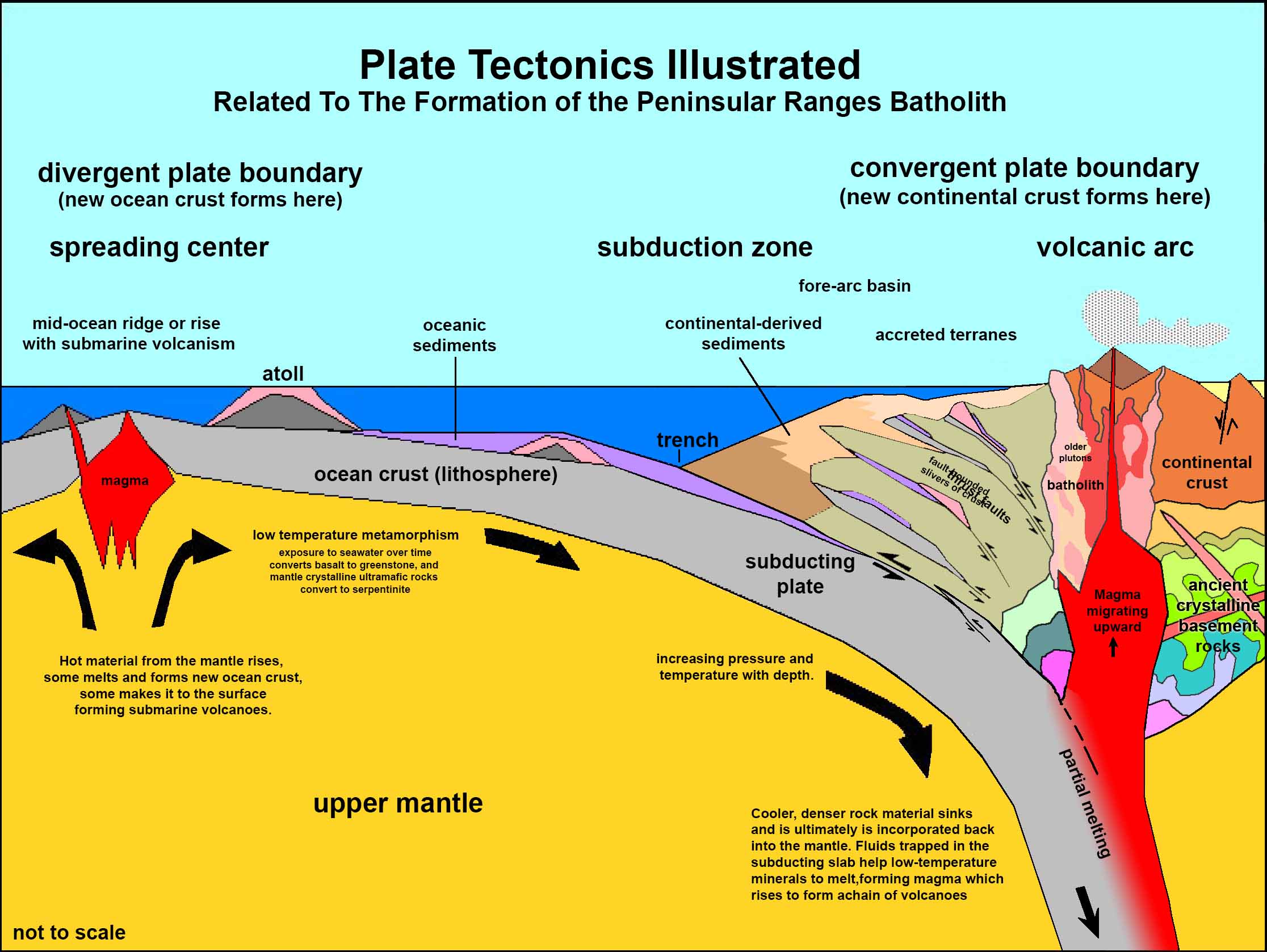
Figure 10 is a satellite map that goes with a geologic map (Figure 11). Figure 12 is a geologic cross section that is an interpretation of the subsurface along a line labeled A to A' on the geologic map. The pale mauve-colored areas (labeled as pKm) on Figures 4 and 5 represent areas dominantly under by the metavolcanic rocks. The pink areas areas (labeled as gr) are dominantly underlain by granitic rocks. These rocks form in a volcanic arc setting as illustrated in the generalized plate tectonics model shown on the right in Figure 13. Aspect of these rocks are discussed and illustrated below.
The landscape around Lake Hodges is part of the Peninsular Ranges—a group of coastal mountain ranges that stretch from the tip of Baja California northward into Southern California. Both the pKm and gr rocks are part of the Peninsular Ranges Batholith, a southern extension of what was once part of the more extensive Sierra Nevada Mountains batholith. The Peninsular Ranges are part of a geologic province known as the Salinian Block—a massive block of continental crust that broke away from the North American continental plate with the formation of the San Andreas Fault system and the opening of Gulf of California. |
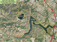
Fig. 10. Satellite map of Elfin Forest and Lake Hodges area. |
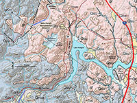
Fig. 11. Geologic map of Elfin Forest and Lake Hodges area. |
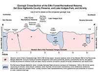
Fig. 12. Geologic cross section of line A-A' on geologic map. |
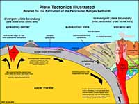 Fig. 13. Plate tectonics model for how local rocks formed. Fig. 13. Plate tectonics model for how local rocks formed. |
|
A4
Metavolcanic Rocks (pkm)
Pre-Cretaceous age metavolcanic rocks (pKm) are exposed in
several parts of the Lake Hodges area. Their distribution is partially responsible for the shape of the local landscape. The largest belt of pKm rocks is along the shore from the Fletcher Point Peninsula extending southward to the Del Dios Gorge area below the dam. A smaller belt is exposed in the Piedras Pintadas area along Bernardo Bay (see Figures 11 and 12). Basically, Lake Hodges itself fills the canyon that was preferentially eroded into the pKm rocks. These rock arguably could be described as more susceptible to weathering and erosion that the younger, and possibly more durable granitic rocks (gr).
Studies of the pKm rocks suggest that they are associated with an ancient volcanic island arc system, similar to what we see with Tonga, Japan, Aleutian Islands, or the Antilles volcanic island chains today (Figure 13). This volcanic arc existed long ago, during the Jurassic Period when an volcanic island arc system formed offshore of the North American continent. This volcanic arc system was active between about 160 and 120 million years ago. Magmatic intrusions cut through even more ancient rocks of undetermined age associated with ancient seafloor rocks. Ancient volcanoes formed, erupting lava and ash that spread into the adjacent ocean basin, burying and deforming older seafloor rocks in the region. With deep burial, these rocks have endured varying degrees of metamorphism (slight to intense alteration). The rocks of the pKm group are assigned the name Santiago Peak volcanics, named after a mountain in the Peninsular Ranges near Los Angeles.
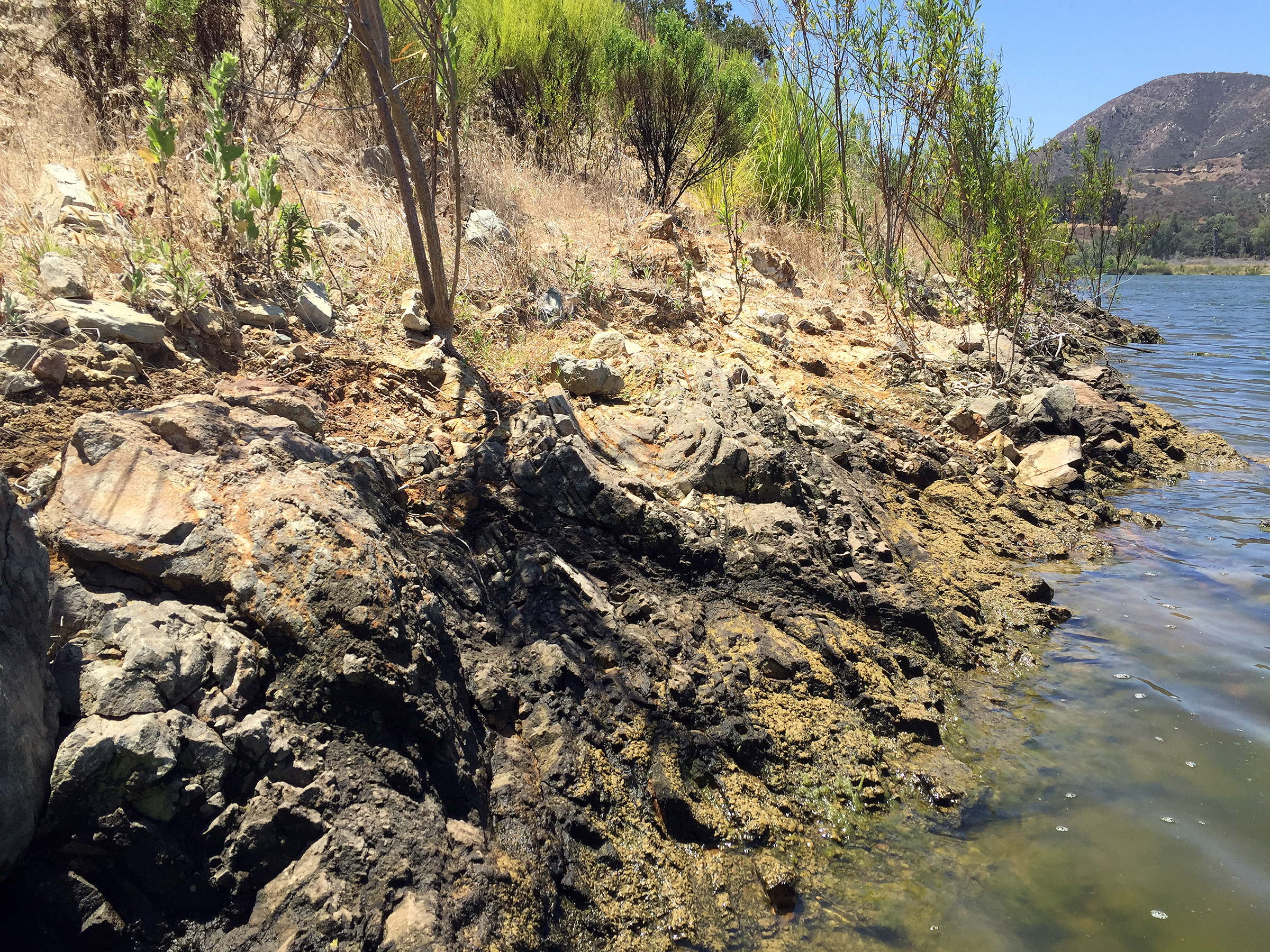
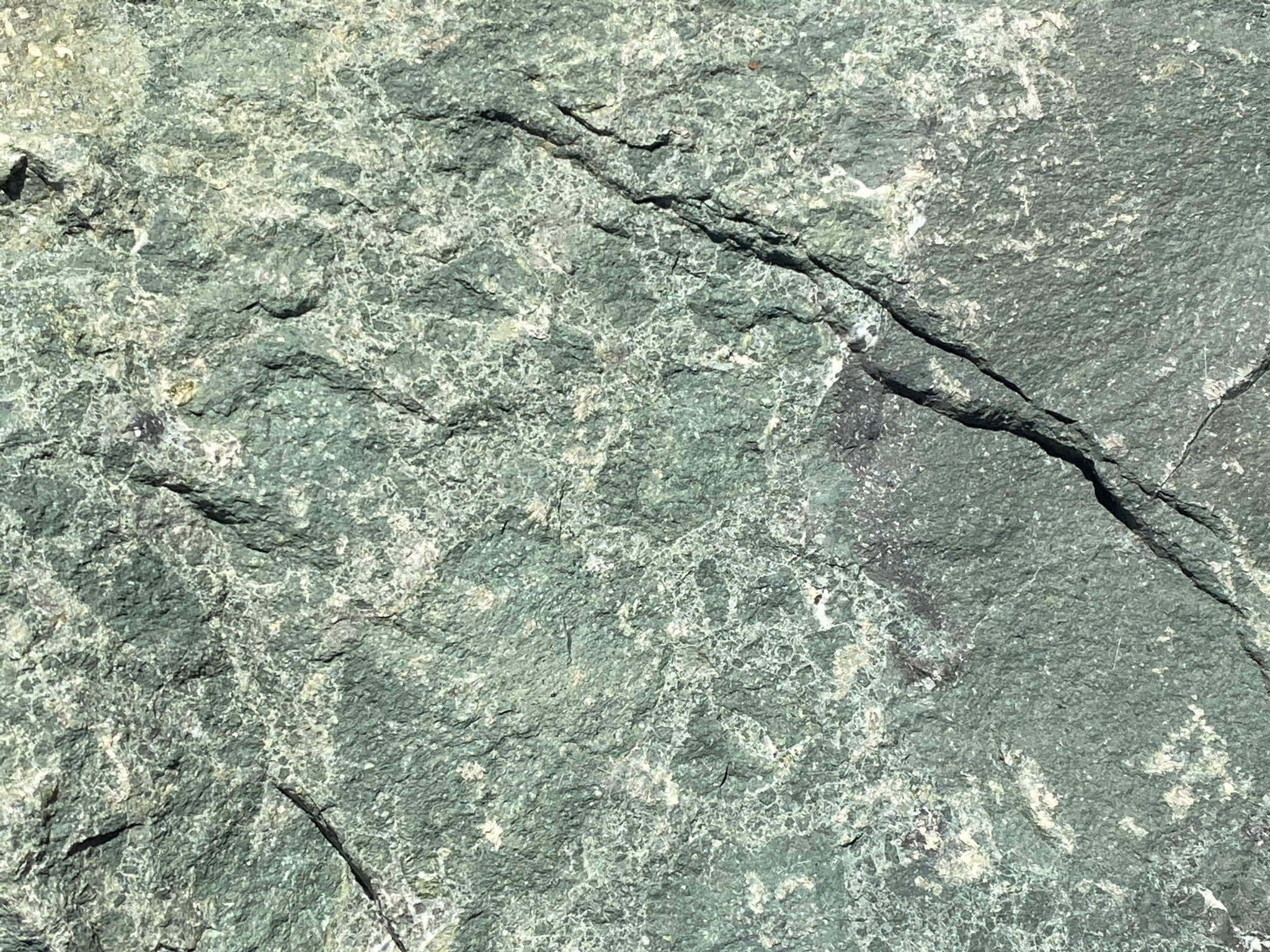
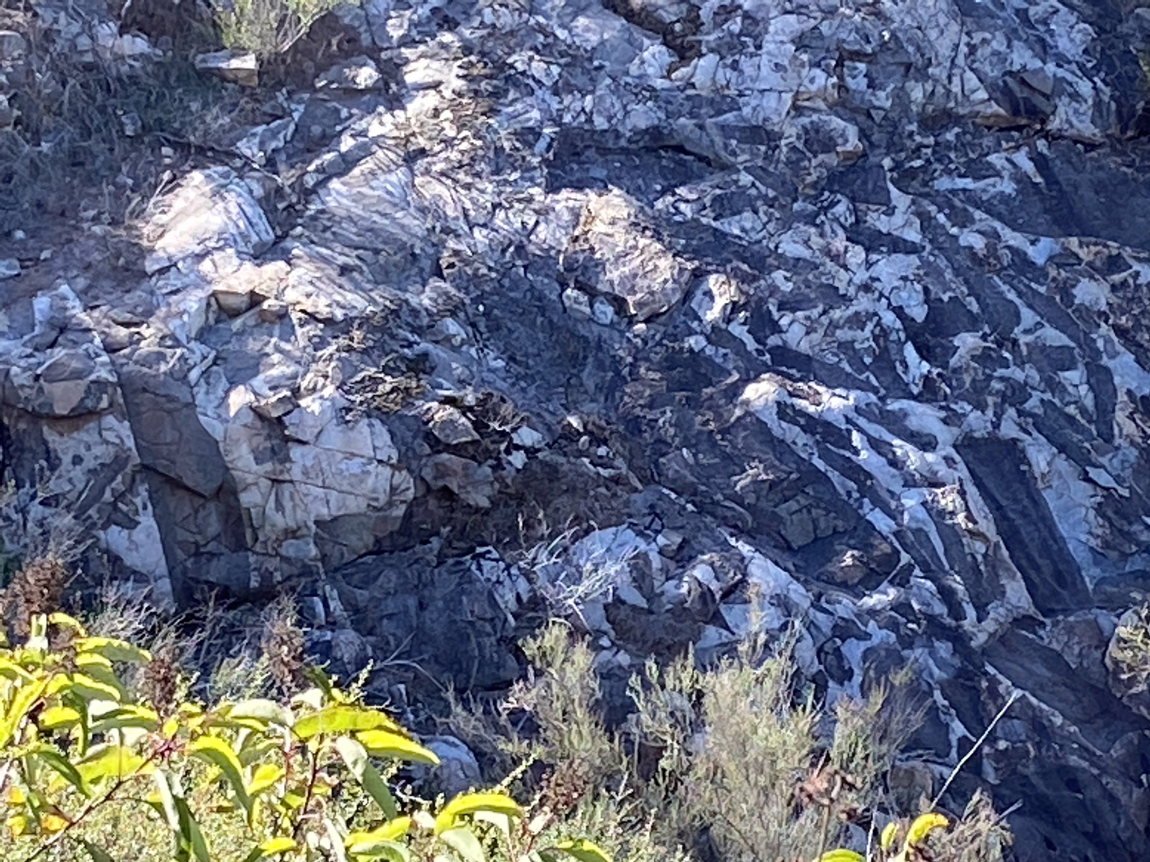
The composition of the lava rock are mostly basalt to andesite (fine-grained, black to medium gray in color). In some locations, the rock is a volcanic tuff made up of volcanic fragments welded together by heat. In some places, the rock is a tuffaceous sandstone that was deposited as sedimentary ash beds on the seafloor. Weathered exposure of the rocks are visible along the cliffs and shoreline from Fletcher Point Peninsula along the south shore to Lake Hodges Dam.
Figure 14 show the massive, high cliffs dominated by pKm metavolcanic rocks exposed along the inaccessible eastern lake shore near Lake Hodges Dam.
Figure 15 shows a typical outcrop of the massive, gray metavolcanic rock exposed on the eastern slope of Fletcher Point.
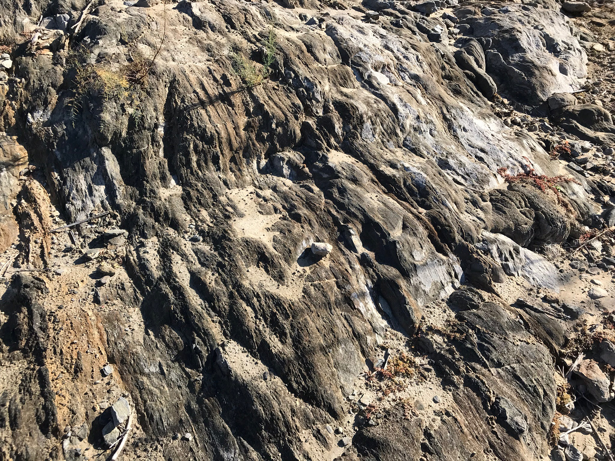
Figure 16 shows a location nearby where a vertical volcanic dike cuts through older volcanic rocks along the eastern shoreline on Fletcher Point.
Figure 17 shows hydrothermal vein deposit cutting through the older darker, weathered bedrock rock exposed along the western side of Fletcher Point.
Figure 18 shows jumbled blocks of basalt, possibly associated with an ancient lava flow. This is on the west side of Fletcher Point.
Figures 19 and 20 are views of stratified sedimentary beds of tuffaceous sandstone (volcanic ash beds) on the west side of Fletcher Point.
Note that these shoreline outcrops (Figures 14 to 20) areas are really only accessible by boat.
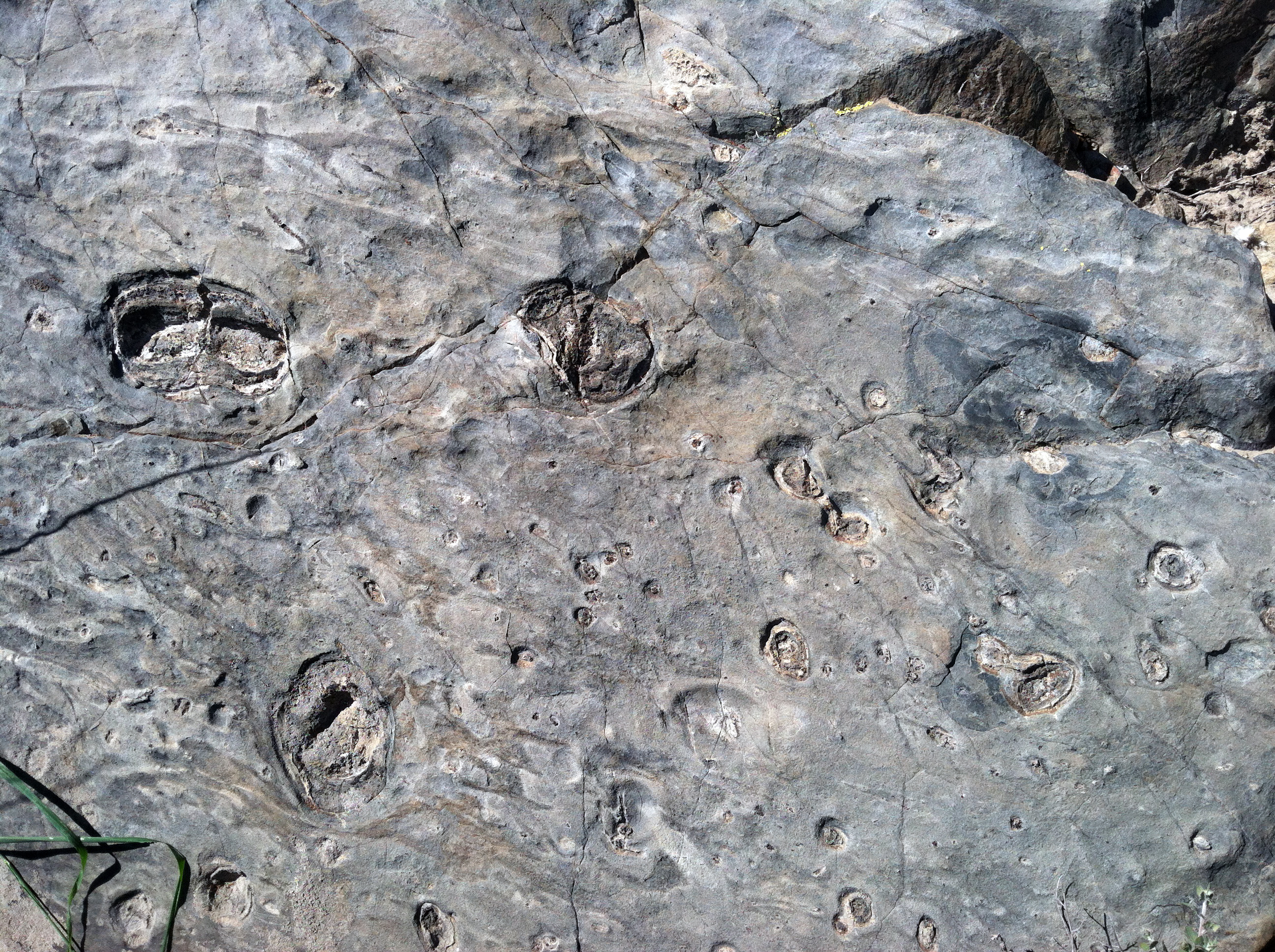
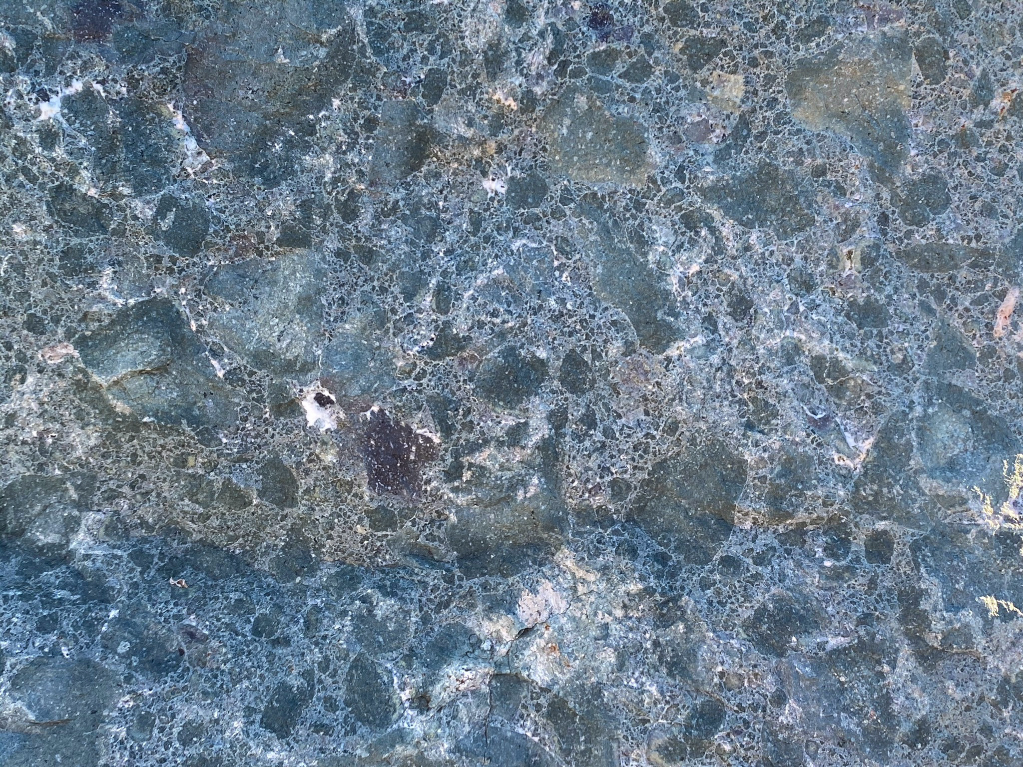
Figure 21 is an exposure of blueschist that contains oval and round vugs partially filled with the green metamorphic mineral, epidote. This rock has been heavily metamorphosed compared to other rocks, and may be part of a large block of more ancient rock, probably ancient seafloor rock that predates the Santiago Peak volcanics. This rock is exposed near the top of Fletcher Point on a feature resembling a blue-stone chair (discussed below).
|
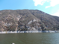
Fig. 14. Massive cliff of pKm rocks east of Hodges Dam. |
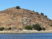
Fig. 15. Massive gray pKm outcrops on Fletcher Point |
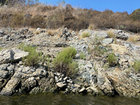
Fig. 16. A vertical igneous dike on Fletcher Point shore. |
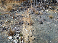
Fig. 17. Weathered dike on Fletcher Point shore. |
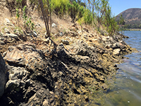
Fig. 18. Syncline and faulted strata on Fletcher Point shore. |
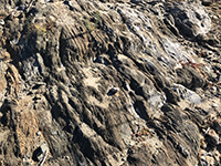
Fig. 19. Tuffaceous sandstone along Fletcher Point shore. |
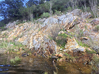
Fig. 20. Layered tuffaceous sandstone on Fletcher Point. |

Fig. 21. Blue schist with epidote vugs on Fletcher Point. |
|
A5
Examples of Metavolcanic Rocks in the Lake Hodges Area
Metavolcanic rocks of the pKm group are generally poorly exposed. In most locations they
have have degraded at the surface to regolith and soil (exceptions are illustrated above in Figures 14 to 21). However, boulders with freshly broken surfaces derived from local pKm sources can be found along trails and boulder barriers around parking areas. Volcanic rocks have an aphanitic texture which means that their crystal grains are typically too small to be seen without magnification. As a result, volcanic rocks are typically classified by color (Figure 22). They are also classified by texture characteristic related to their origin. The term metavolcanic means that rocks of volcanic origin have undergone some degree of metamorphism. The most obvious manifestation of this is the lack of gas bubbles preserved in the rocks. Volcanic material that has erupted on the surface typically has an abundance of gas bubbles or pore spaces between tephra grains. |
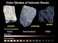
Fig. 22. Color shades of volcanic rocks. |
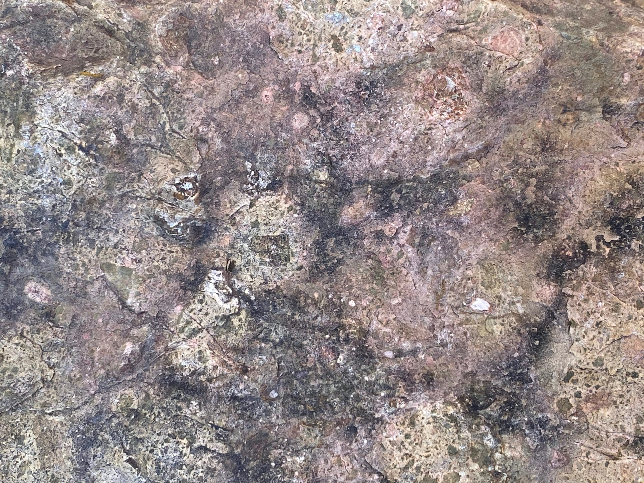
Figures 23 illustrates the volcanic rock basalt. Basalt gets its dark color from an abundance of mafic minerals (minerals rich in iron and magnesium, such as amphibole, pyroxene, biotite, magnetite, and others). The basalt lava cooled very quickly preventing visible crystals from forming. The lack of bubbles suggest that the rock cooled under a lot of pressure, possibly on the seafloor.
Figure 24 illustrates andesite, perhaps the most abundant type of volcanic rock in the region. Andesite gets its name from the Andes volcanic mountains in South America. It is more neutral gray in color because it is intermediate in composition, containing both mafic and felsic minerals (felsic meaning rich in aluminum and silica, such as feldspars, quartz, and muscovite).
Figure 25 illustrates an andesite porphyry. Porphyry is a textural term for an igneous rocks that contain large-grained crystals dispersed in a fine-grained volcanic matrix or groundmass (basalt, andesite, or rhyolite). The larger crystals are called phenocrysts. and usually consist of crystals of feldspars or other minerals that began to crystallize and grow in size before their host magma migrated and cooled quickly, closer to the surface.
Figure 26 is an unusual volcanic rock consisting of what look like blobs of rhyolite tuff that were ejected from a volcanic vent, then sank back into a pool of dark lava. The blobs are golf ball to baseball in size and are made up of many smaller pieces of volcanic rock, cemented together in a pink lava rock.
Figures 27 and 28 illustrate rock called a rock called tuff. Tuff is a volcanic rock consisting of smaller fragments of different kinds of volcanic detritus that has been fused together by heat and compaction. The two rocks illustrated are dominantly andesite in composition. The angular fragments were blasted out of a volcanic eruption. Some of the grains may also be phenocrysts that are mixed in with the material.
Figures 29 and 30 illustrate a rock called greenstone breccia. Breccia means it is simply made up of angular rock fragments. Greenstone is a metavolcanic rock that forms from the chemical alteration of volcanic rocks partly with a mafic composition (basalt or andesite). The likely cause of alteration is long-term exposure to seawater trapped in the rock, overtime converting some of the igneous minerals to green metamorphic minerals, such as epidote or chlorite. |
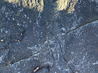
Fig. 23. Basalt |
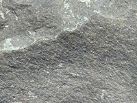
Fig. 24. Andesite. |
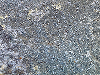
Fig. 25. Andesite porphyry |

Fig. 26. Rhyolite tephra blobs |
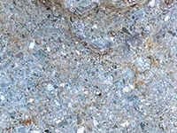
Fig. 27. Andesite tuff |
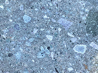
Fig. 28. Andesite tuff |
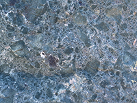
Fig. 29. Greenstone breccia |
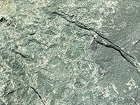
Fig. 30. Greenstone breccia |
|
A6
Granitic Rocks (gr)
A second, much larger phase of igneous intrusion and volcanism that resulted in the formation of the Peninsular Ranges Batholith in Early Cretaceous time (about 120 to 90 million years ago). During this period, the massive volcanic arc system was crushed onto (accreted) onto the western margin of continental North America. The younger igneous intrusive igneous rock (gr) cut through and displace the older Jurassic rocks (pKm). From a satellite view, these were massive intrusive bodies (plutons) that crystallized slowly at depth, giving them a more crystalline character. The 90 million years of erosion that follow has exposed granitic rocks that were once deeply buried beneath the ancient volcanic arc.
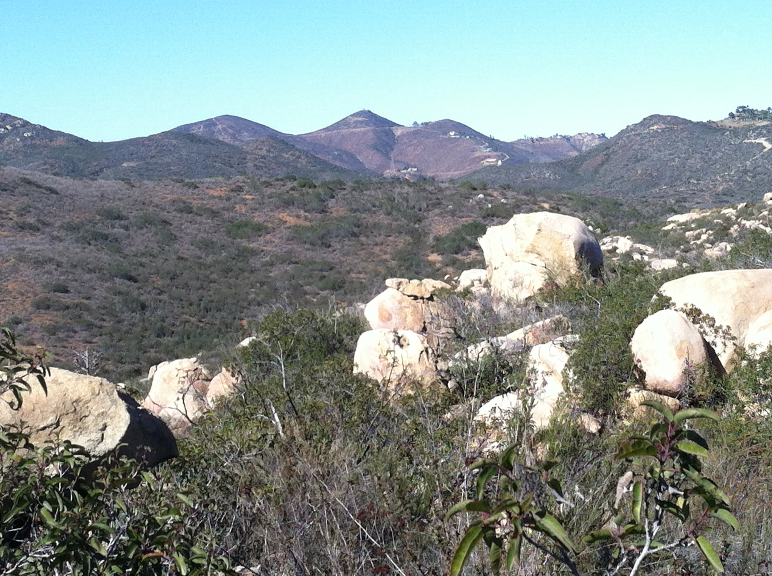
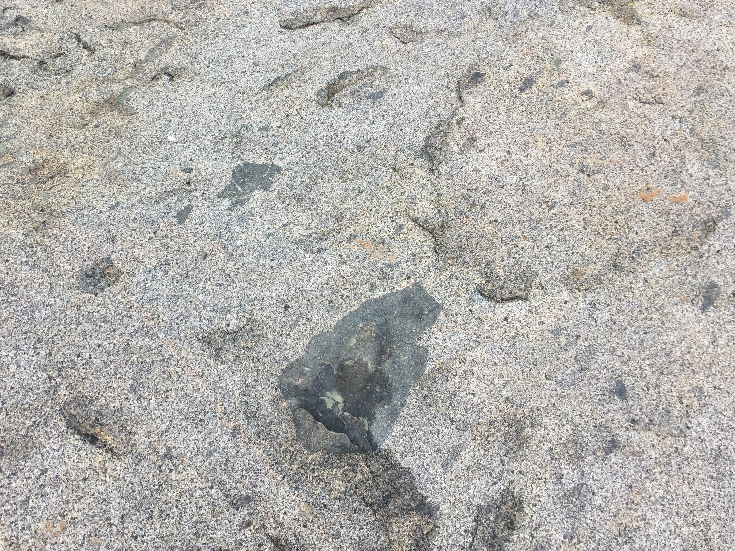
Granitic rock of Early Cretaceous age are easy to spot on the mountainsides and shoreline slopes through the Lake Hodges area. They occur are a belts of white- or light-colored granitic outcrops and boulders exposed on the landscape (Figures 23 and 24). Some of these are smaller, separate or isolated plutons that intrude into older plutonic bodies or the pKm host rocks (country rocks). Some of them display inclusions (xenoliths) of pKm materials, mostly basalt (Figure 25). These inclusion can be very large along the margins of the plutons, such as in the vicinity of Alva Canyon (Figure 26).
|
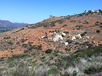
Fig. 31. Granitic rocks along the Upper Trail near The Gap. |
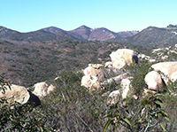
Fig. 32. View from the Granite Boulders Highlands Trail. |
Fig. 33. Small basalt inclusion (xenoliths) in tonalite. |

Fig. 34. Very large basalt xenoliths in Alva Canyon. |
|
A7
Granitic Rocks Around Lake Hodges Roads and Trails
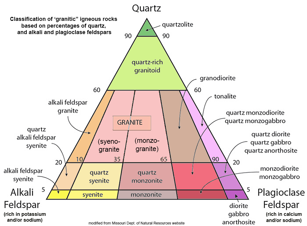
The term granitic is a general term to describe light-colored intrusive igneous rocks with a crystalline texture. Figure 35 illustrates a commonly used classification of granitic rocks. Note that granite is one type of granitic rock, and there is essentially no true granite in the Lake Hodges region. The local granitic rocks in the Lake Hodges area fit into the composition ranges of diorite, tonalite, granodiorite, or gabbro (based on mineral composition percentages).
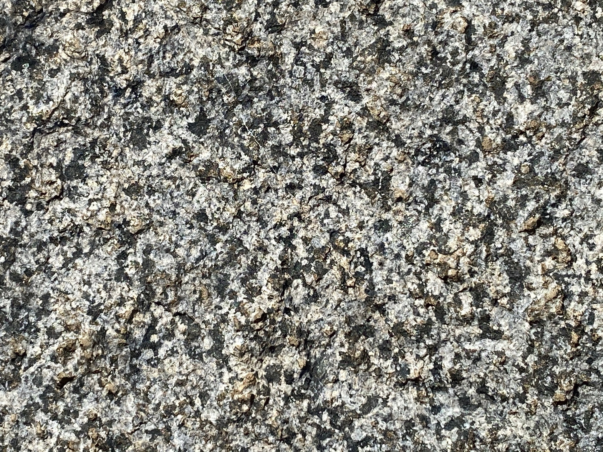
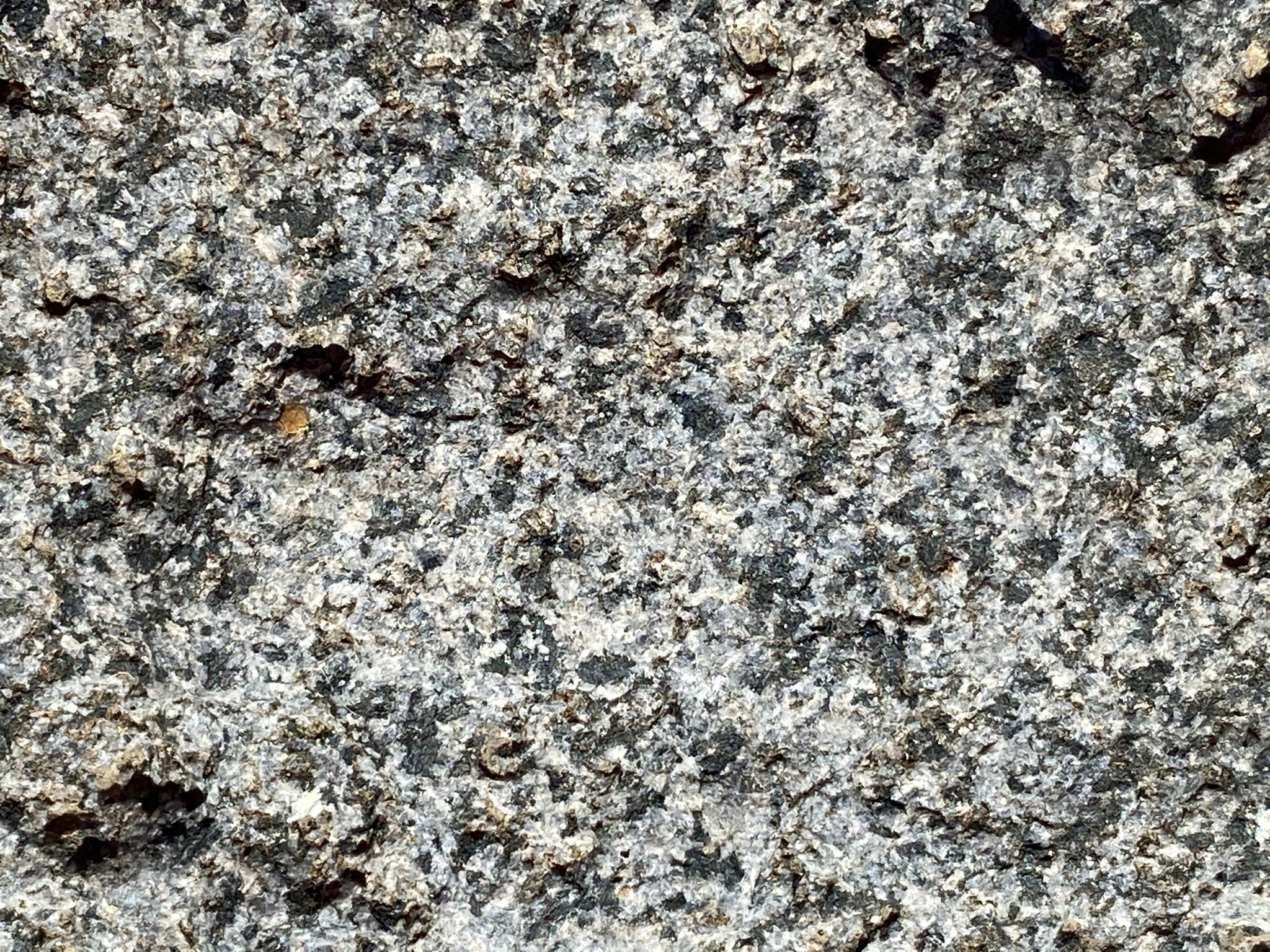
Tonalite is perhaps most common where exposed (Figures 36 and 37). Dark mafic minerals give the rock a salt-and-pepper appearance. The samples below are mostly gaged by the percentage of quartz (gray, glassy crystals), with most of the white minerals are mostly plagioclase feldspar. The dark mafic minerals are mostly amphibole, magnetite, and biotite.
Figure 38 is gabbro. It is darker than tonalite because is has a higher mafic mineral content.
Figure 39 shows the surface of a tonalite boulder cut by an aplite vein. Aplite is mostly white feldspar that forms in veins during late-stage cooling and shrinkage fracturing of a plutonic magma body. |
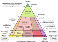
Fig. 35. Classification of granitic igneous rocks based on percentages of quartz, and alkali and plagioclase feldspars. Mafic minerals are not included in this general classification. |
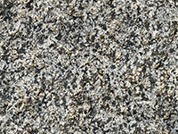
Fig.36. Tonalite |
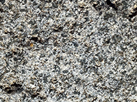
Fig. 37. Tonalite (zoomed) |
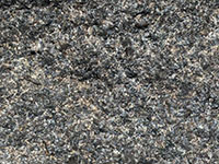
Fig. 38. Gabbro |
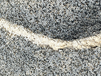
Fig. 39. Aplite vein in tonalite |
|
A8
Landscape Evolution (Late Cretaceous Period to Present)
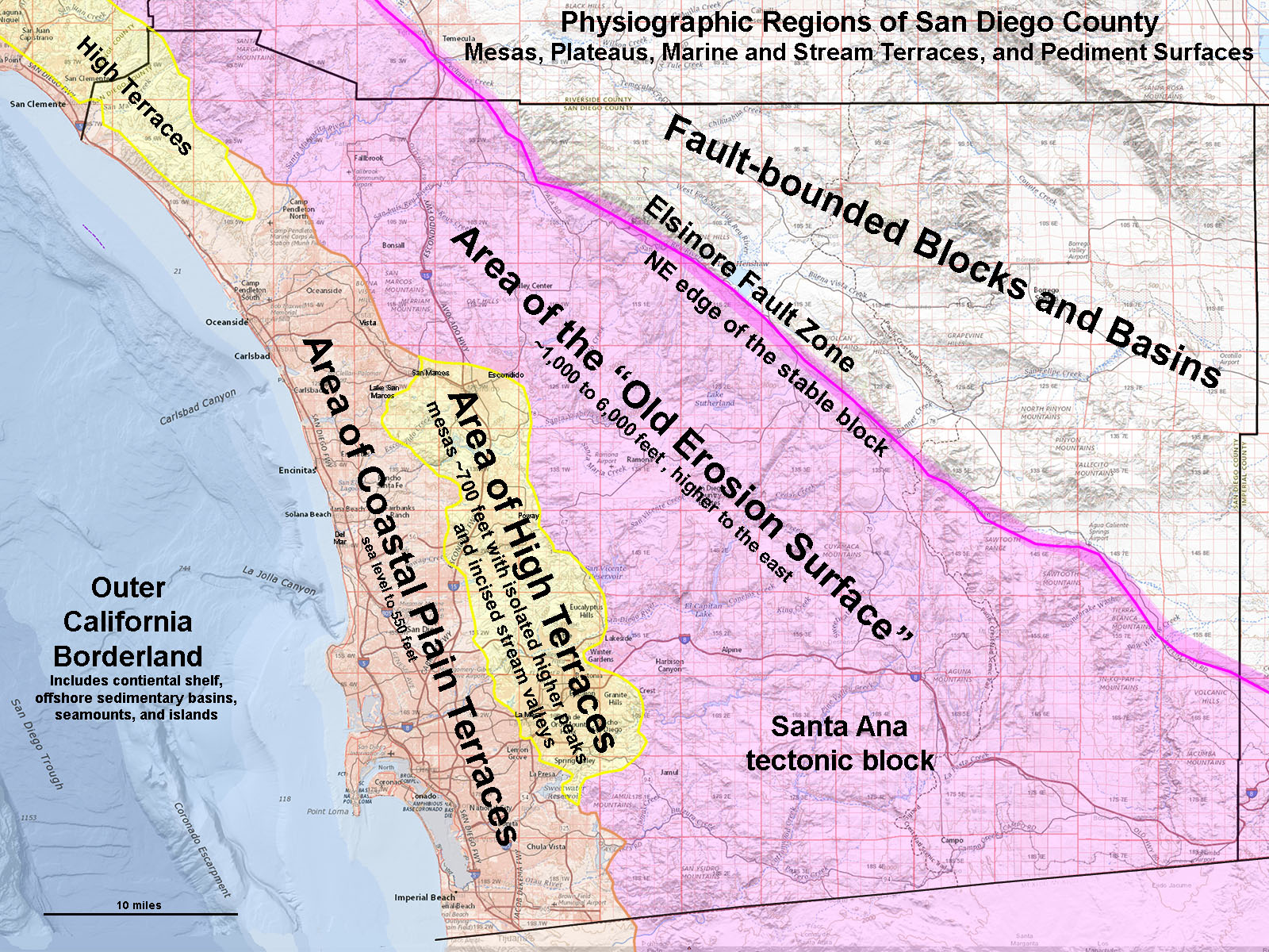
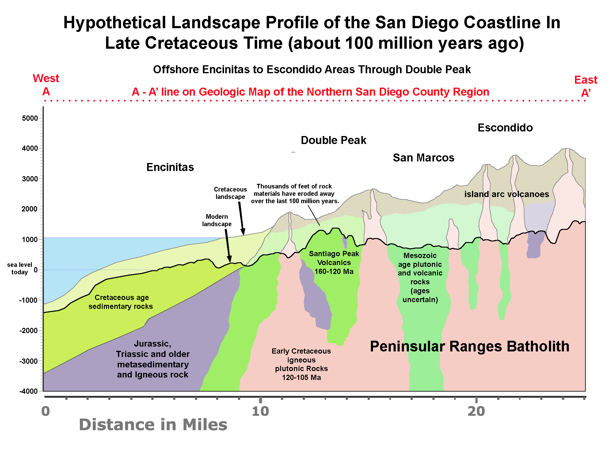
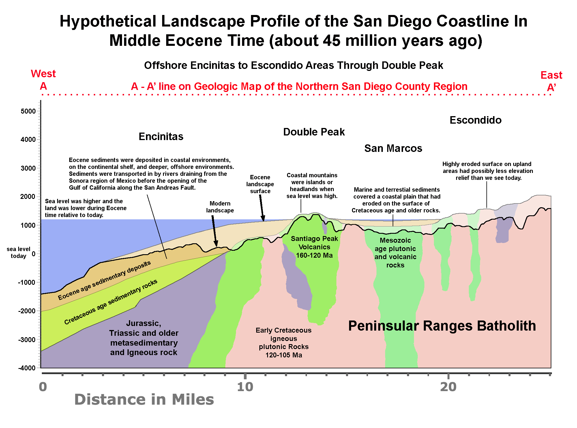
Figure 40 is a map showing the four physiographic regions of San Diego County. The Lake Hodges and surrounding highlands are in the region known as the Area of High Terraces. To the east are the mountainous highlands of the Old Erosion Surface and to the west is the Area of Coastal Plain Terraces. Figures 41 to 43 show how the landscape slowly evolved over time. After the volcanism ended in Cretaceous time, erosion began to wear down the landscape, eventually to a low coastal plain (Figure 41). By Eocene time, coastal erosion had cut the shoreline eastward over the Area of High Terraces, and a blanket of coastal and marine sedimentary deposit covered much of the landscape (Figure 42). This was a time when both sea level was higher and the land was lower. Then, starting about 30 million years ago the San Andreas Fault and other regional faults began to break apart the western margin of North America (starting about 30 million years ago). Gradually over time the coastal region of San Diego has slowly risen nearly 1,000 feet above sea level. The Area of High Terraces is characterized by moderately high plateaus, mesas, and ridgelines cut by deep stream valleys (Figure 43). In many areas, the upland mesa-tops and ridgelines we see today were once the broad bottom lands of stream valleys and bays surrounded by low hills along the coastline. As the land rose, streams down cut into their valleys, forming the canyons and gorges we see today. |
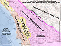
Fig. 40. Map of Coastal Plain Terraces, High Terraces, and Old Erosion Surface regions |
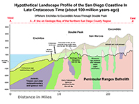
Fig. 41. Hypothetical coastal cross section of the North County in Cretaceous time. |

Fig. 42. Hypothetical coastal cross section of the North County in Eocene time. |
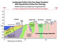
Fig. 43. Hypothetical coastal cross section of the North County with elevation profile. |
|
A9
Antecedent and Subsequent Stream Drainages in the Lake Hodges Area
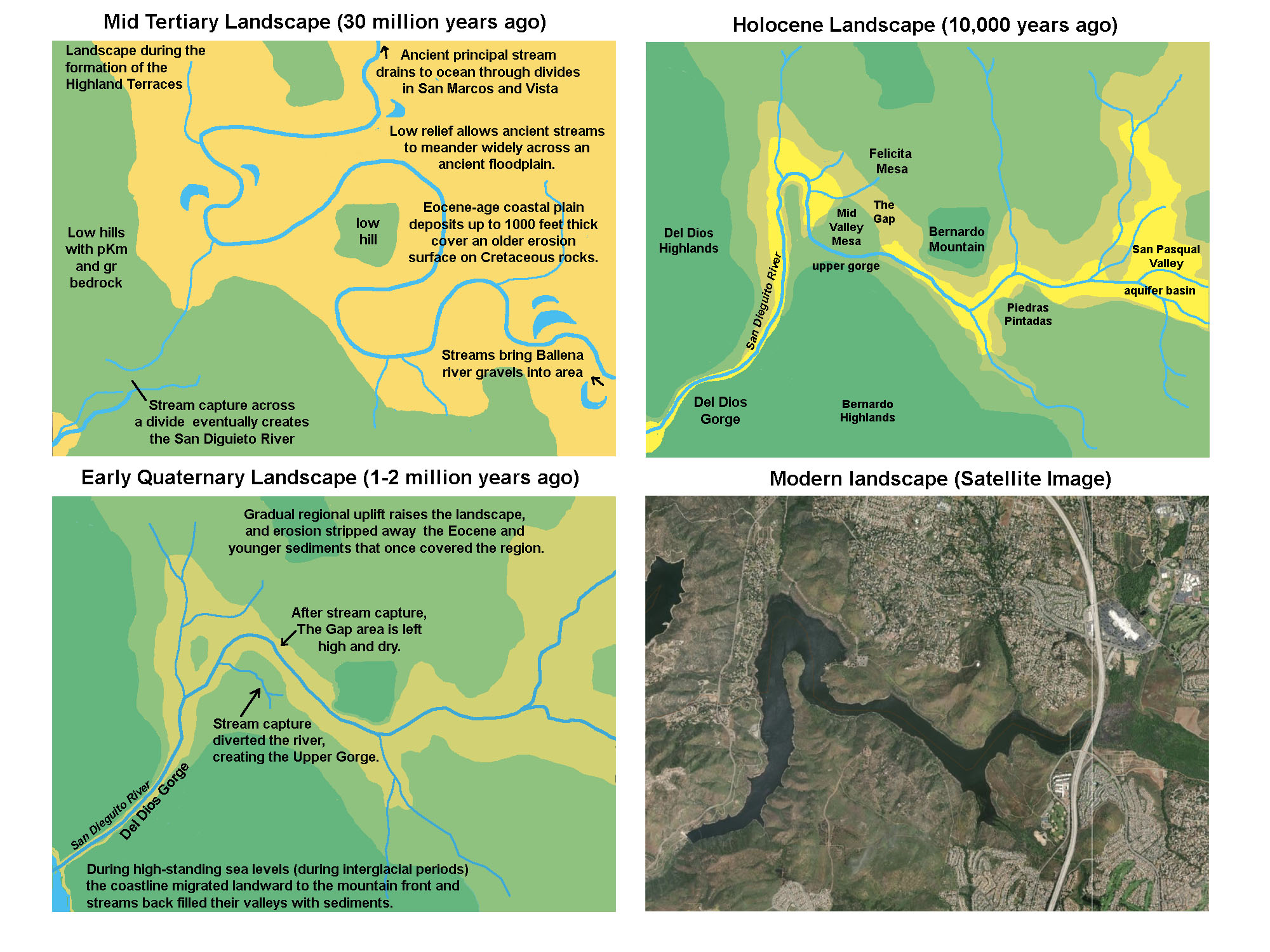
The San Dieguito River drainage in the Lake Hodges area displays characteristics of both antecedent and subsequent stream drainage development. An antecedent stream is a stream that maintains its original course despite the changes in underlying rock topography as it erodes the landscape downward. A subsequent stream is a stream whose course has been determined by selective erosion along weak strata and fractures, and shifting drainages via stream capture. Figure 44 shows how the San Dieguito River drainage pattern may have evolved over time. The San Dieguito River probably started by stream capture through a divide that redirected stream and sediment flow from an older upland drainage basin. The upland basin probably experience multiple stages of back-filling with sediments which allowed the stream path to shift across a broad floodplain before cutting downward to carve a new canyon in a different location. When sea level fell, stream gradients increased, and the rivers and streams carved downward into their canyons. The Gap is an example of a wind gap (an elevated canyon that no longer carries water). The San Diego River had shifted course to its current path in the Upper Gorge on the south side of Mid Valley Mesa. |
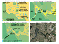
Fig. 44. Formation of the San Dieguito River drainage since Eocene time with both antecedent and subsequent stream drainage features. |
A10
Quaternary Surficial Deposits
Surficial deposits of Quaternary age include unconsolidated sediments in a variety of forms. On the geologic map (Figure including: young alluvium, stream deposits (Qya), old alluvium, including elevated stream terrace deposits (Qoa), landslide deposits (Qls), and undifferentiated surficial deposits (Qsu). Note that Soil, regolith, and loose surficial sediments (colluvium) , caliche deposits, and materials moved around by human activity are not show on the geologic map.
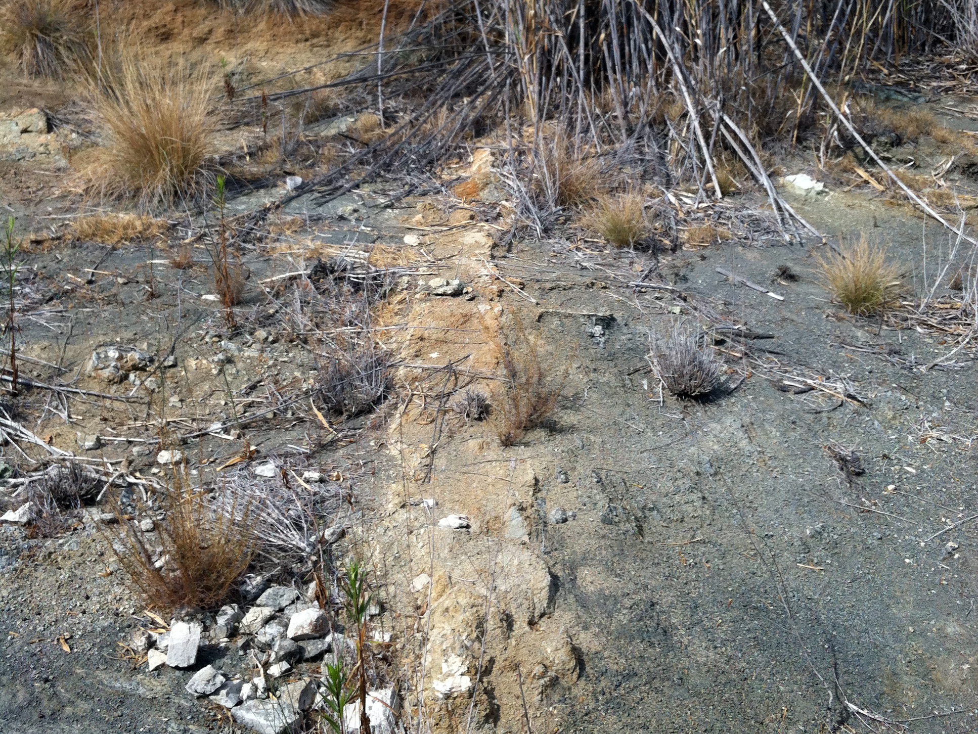
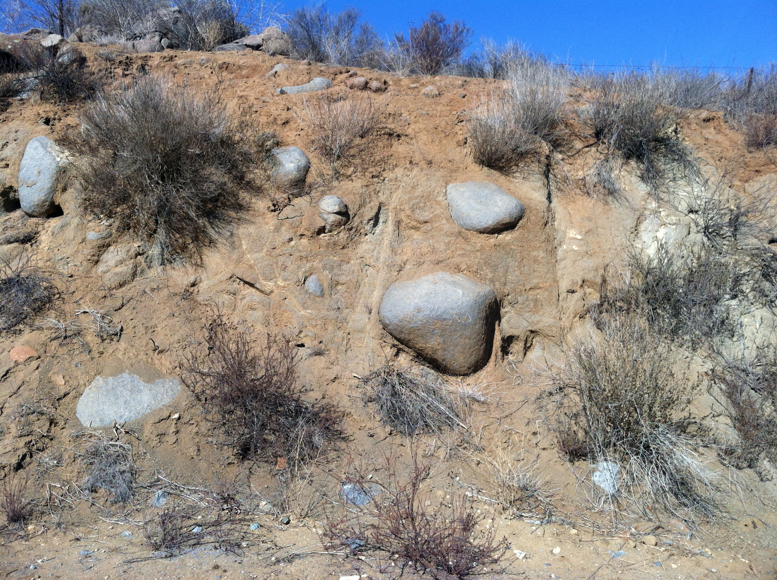
Regolith is a layer of unconsolidated rocky material covering bedrock. If organic matter mixes in, it becomes soil. Regolith and soil form from the gradual breakdown of bedrock by weathering and erosion processes. Figure 45 is an excellent example of a weathering profile exposed in a cut along a trail (near Lake Hodges Bridge). It is easy to see where water has seeped into fractures and degraded with the rock (in this case, granitic rock). Fractured blocks of bedrock weather from the outside inward, degrading sharp edges fastest. Over time, all that is left of the block is the rounded core. When erosion strips away the decayed rock, spheroidally rounded boulders are left behind to accumulate on the landscape. This cut is near the north end of the Lake Hodges pedestrian bridge.
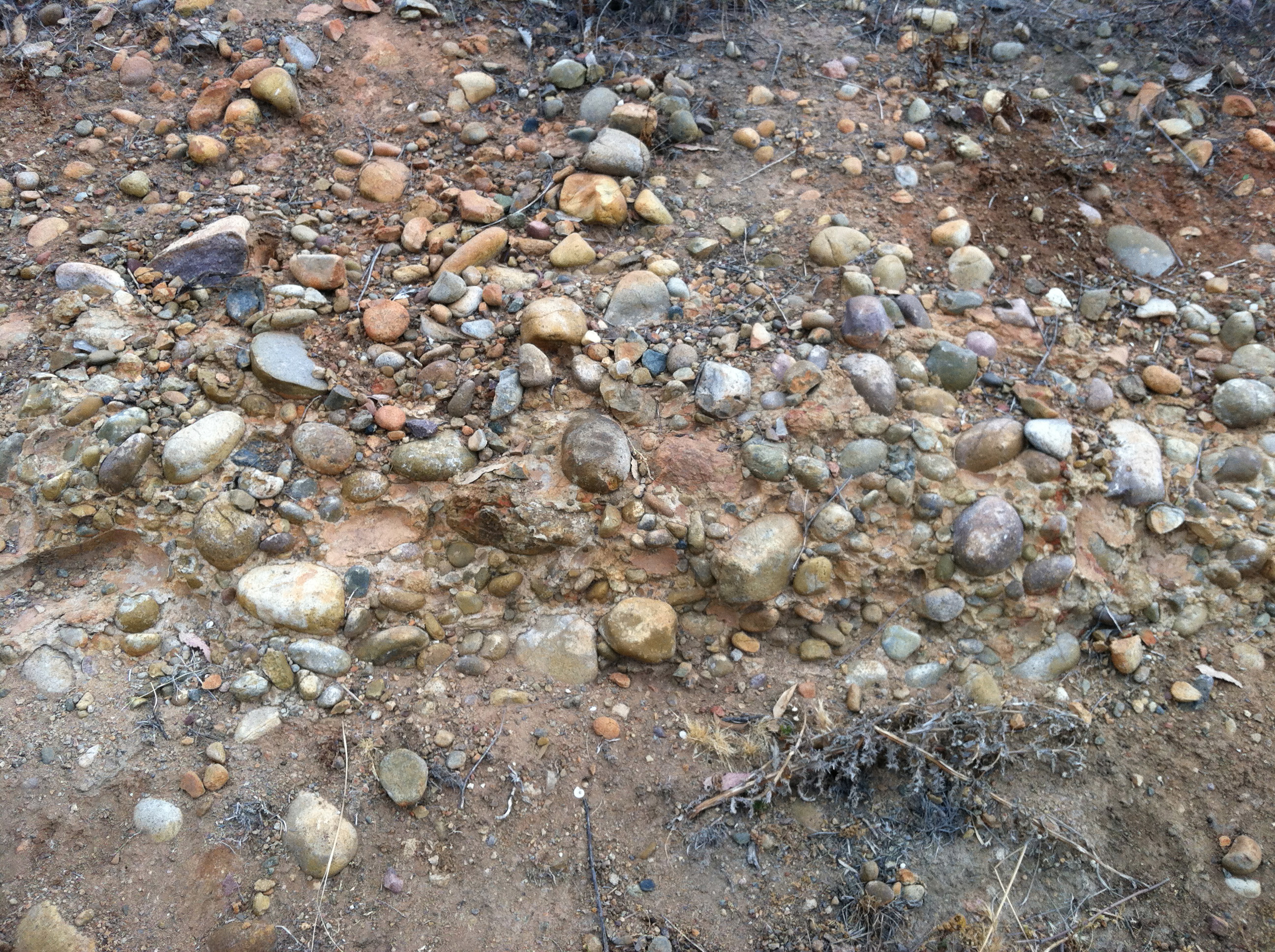
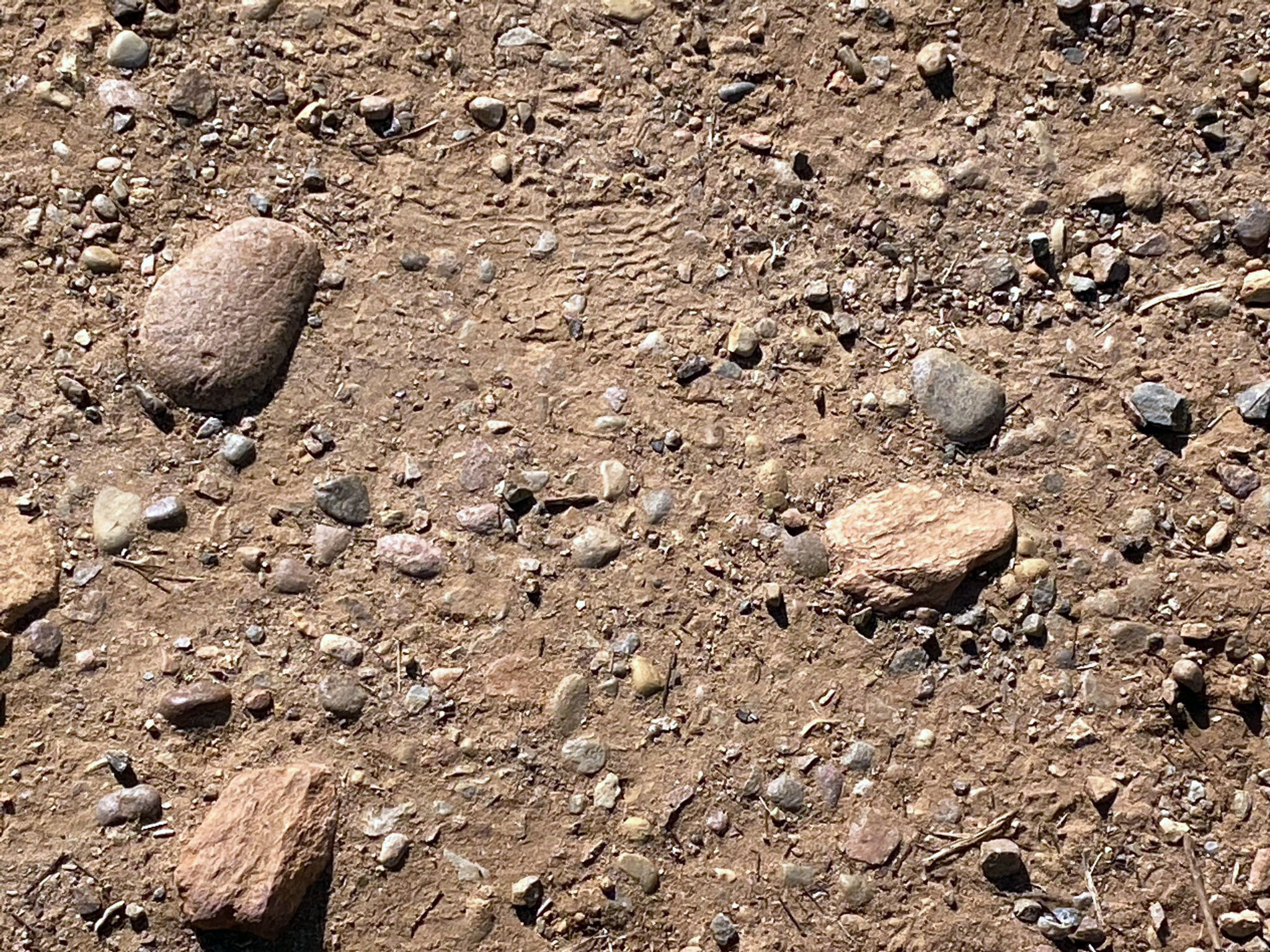
Figure 46 is an example of very old alluvium (Qoa). This is a view of an ancient stream gravel bar—an elevated stream terrace that now being exposed by shoreline erosion near the east end of the Wind Gap near the Visitor Center. Similar deposits are exposed on other location where elevated stream terrace deposits have survived erosion. For example, Figure 47 shows old alluvial gravel exposed in the the North Bernardo Bay Trail. Rounded clasts can be found practically anywhere in lower elevations around the Lake Hodges area. Some of these gravel clasts are residual (left over) from when marine beach terrace and coastal plain sediments covered the region back in Eocene time (see Figure 42). The source of some of the gravel clasts came from rivers draining highlands in the Sonora region of Mexico before the formation of the San Andreas Fault system and the opening of the Gulf of California about 30 million years ago.
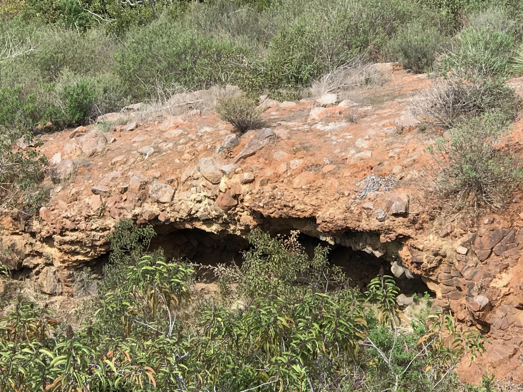
Figure 48 shows a shallow cave along the Lake View Trail east of The Gap. The roof of the cave consists of gravel fragments tightly cemented with calcium carbonate, forming an an erosionally resistant layer called caliche. |

Fig. 45. Spheroidal weathering creates rounded boulders. |

Fig. 46. Very old alluvial gravels exposed on shoreline. |
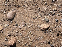
Fig. 47. Old alluvial gravel exposed along trails. |

Fig. 48. A layer of caliche cements rock fragments |
|
A11
Hour-Glass Canyons and Landslides
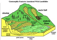
Most mountainous areas in California are susceptible to landslides (Figure 49). A debris flow is a moving mass of loose rock, mud, sand, soil, water and air that travels down a slope under the influence of gravity. Areas that have experience wildfire are particularly susceptible to debris flows when rain falls on barren, ash-covered slopes. As material moves down slope, it picks up more material, speed and momentum, the the slurry of mud, rock and water can travel quite far from their source areas.
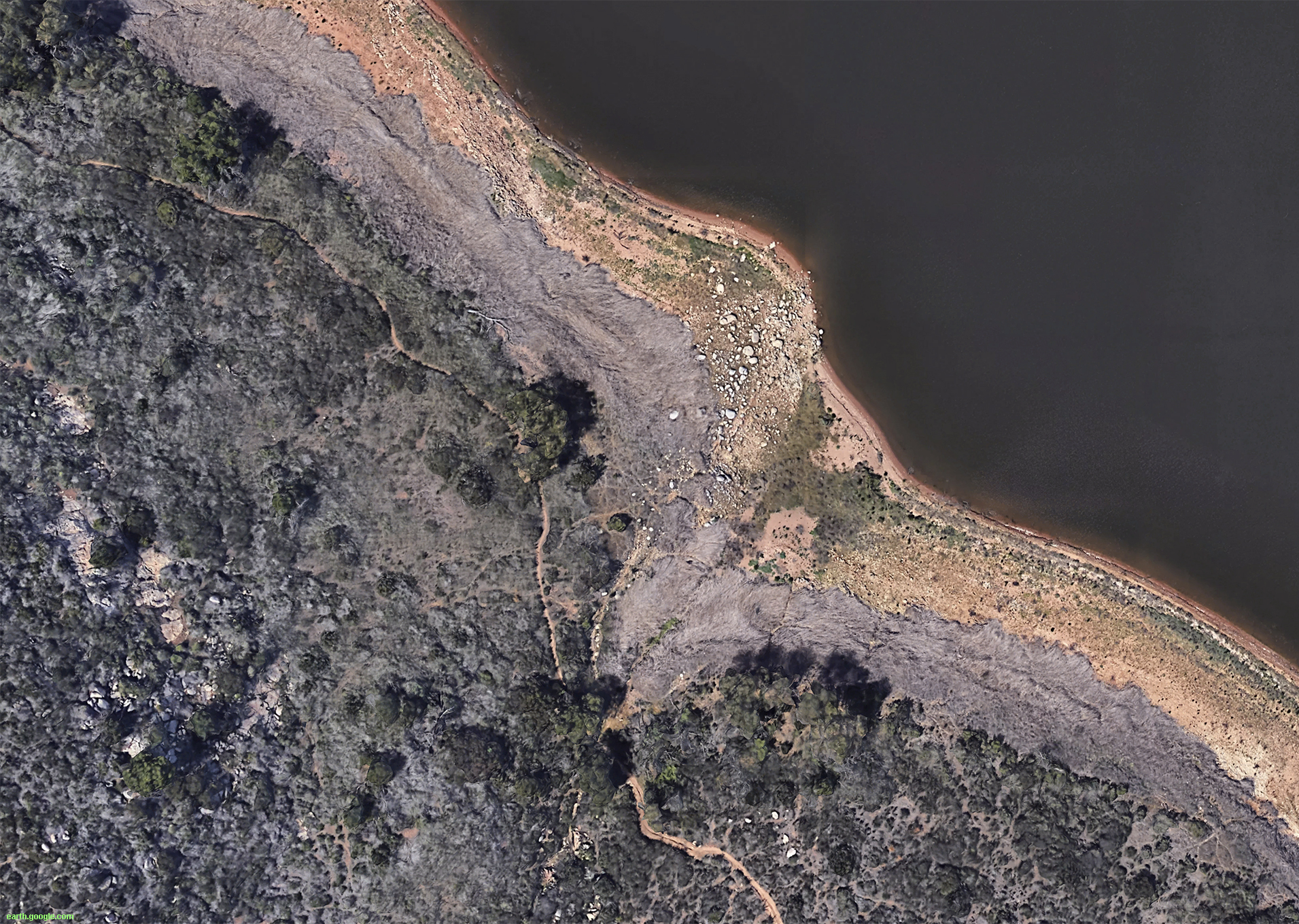
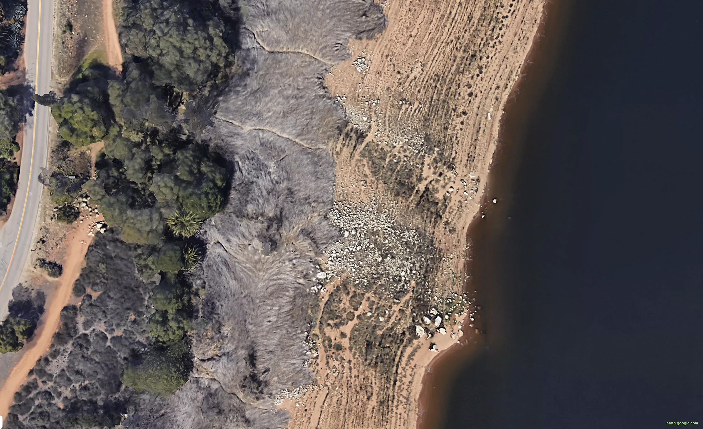
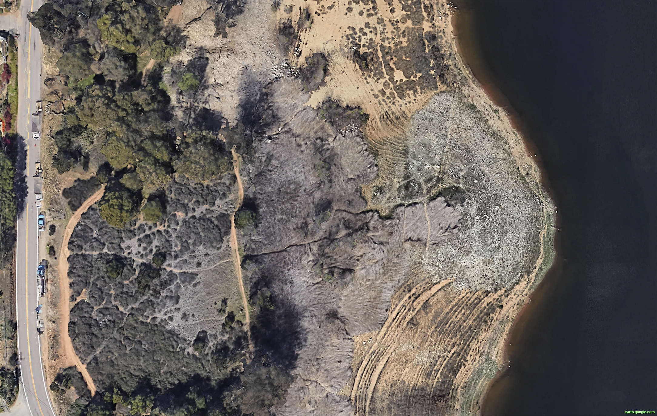
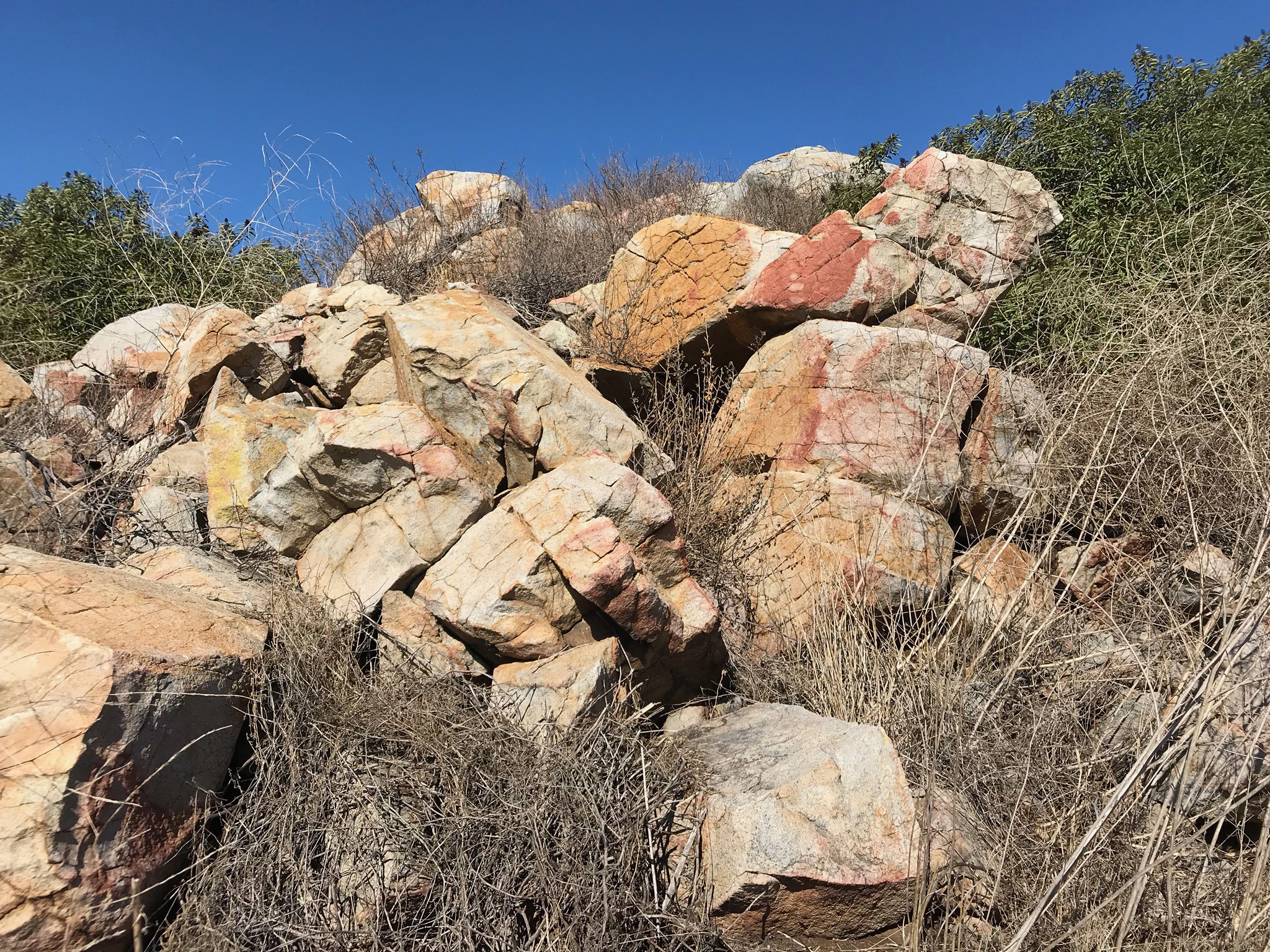
Debris flow deposits accumulate as alluvial fans at the mouths of hour-glass canyons. Figures 50 to 52 are examples of hour-glass canyons along the south shore of Lake Hodges. . Canyons along the sides of a mountain front or deep valley typically have an hour-glass shape. The headwater area is typically a broad, bowl-shaped area where precipitation collects. The runoff carrying sediment carves a narrow ravine at the lower part of the canyon. Below the mouth of the canyon, the sediments spread out building up an alluvial fan. Alluvial fans are built up from debris flow deposits. Figure 53 is an aerial view of the alluvial fan at the mouth of the canyon shown in Figure 52.
Figure 54 show some hour-glass canyons along the mountain front of the Del Dios Highlands on the north side of Lake Hodges. Figures 55 and 56 show accumulations of debris flow deposits exposed along the shoreline of Lake Hodges in the Del Dios area.
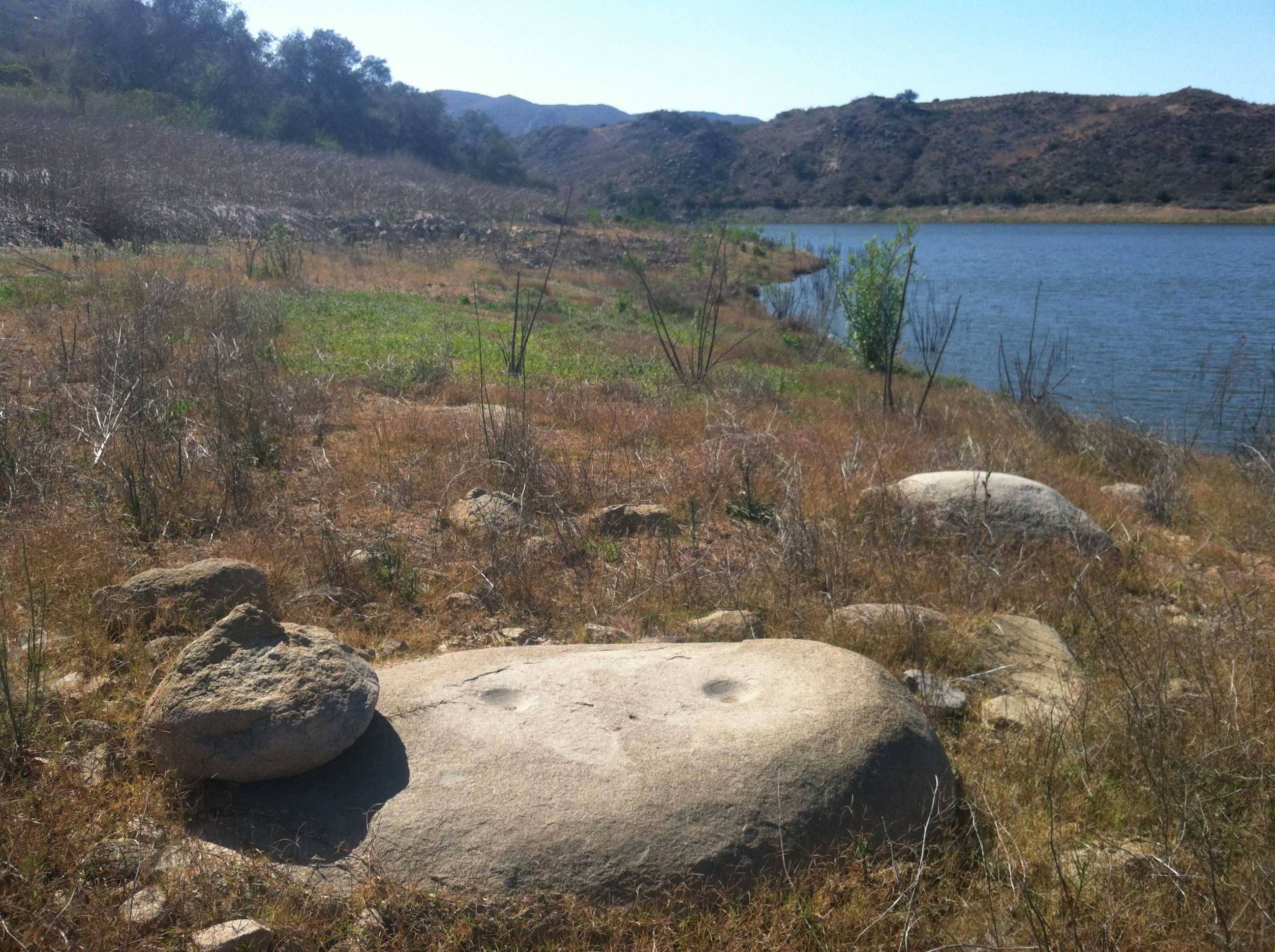
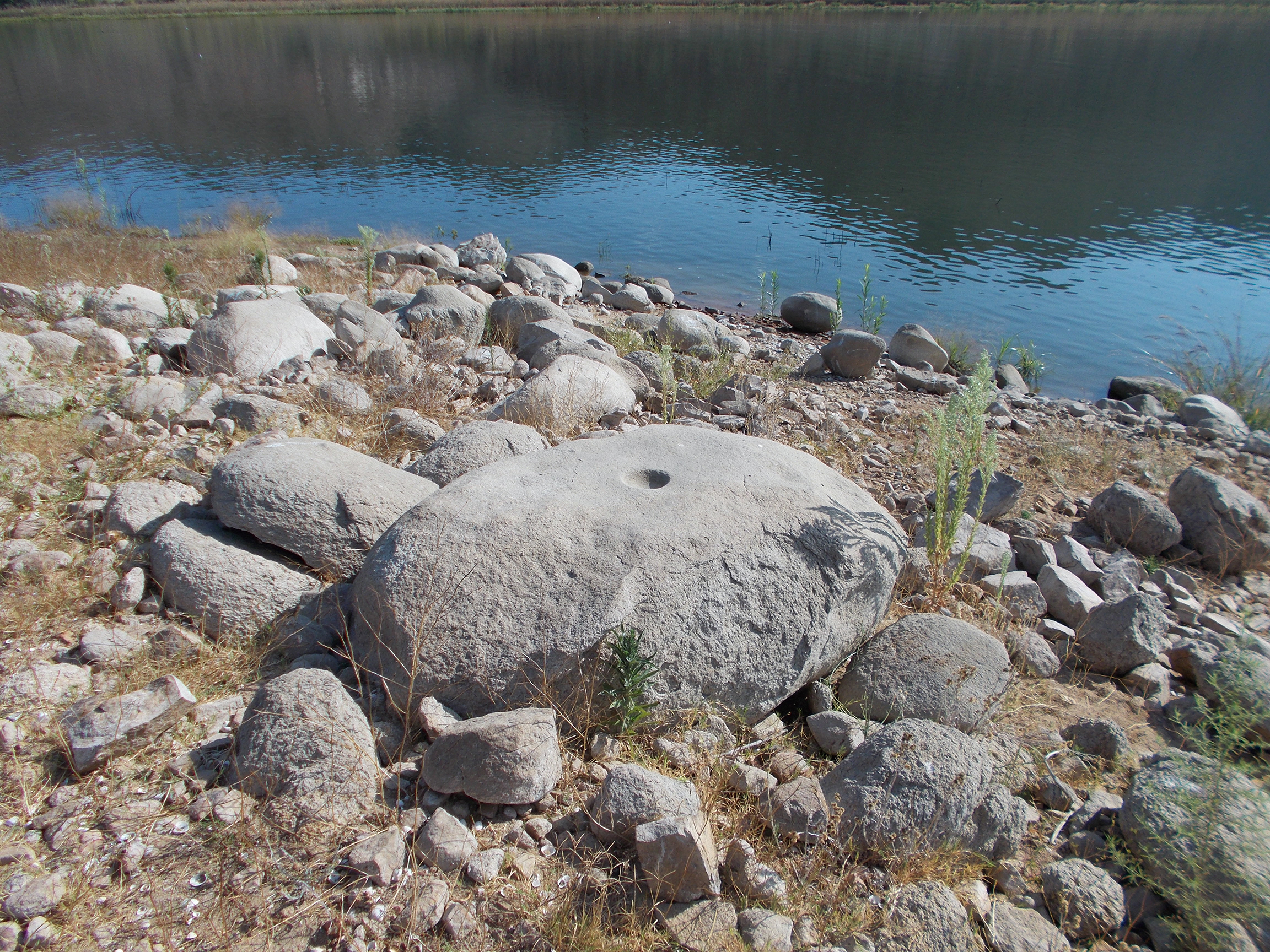
Note that some of these landslide are prehistoric in age. Figures 57 to 60 show some large boulders in ancient debris flow deposits where prehistoric peoples carved mortars for grinding nuts and seeds. These rocks are exposed along the shoreline.
|
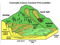
Fig. 49. Different kinds of landslides. |
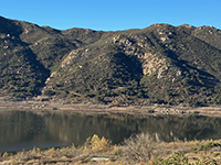
Fig. 50. Hour-glass canyons along the south shore. |
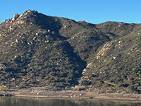
Fig. 51. Zoom view of an hour-glass canyon. |
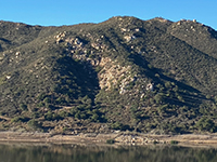
Fig. 52. Debris flow deposits below the hour-glass canyon. |
Fig. 53. Prehistoric debris flow on the south shore. |
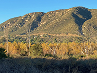
Fig. 54. Hour-glass canyons on the Del Dios Highlands. |

Fig. 55. Prehistoric debris flow on Del Dios shoreline. |
Fig. 56. Debris flow fan on the Del Dios shoreline. |

Fig. 57. Mortars on a boulder along the south shore. |
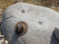
Fig. 58. Hat for scale for mortars on the boulder. |
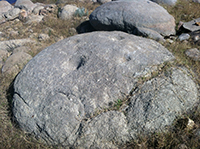
Fig. 59. Several mortars on a weathered boulder. |
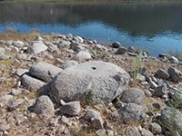
Fig. 60. Boulder with mortar on a debris flow deposit. |
|
A12
Wildfires
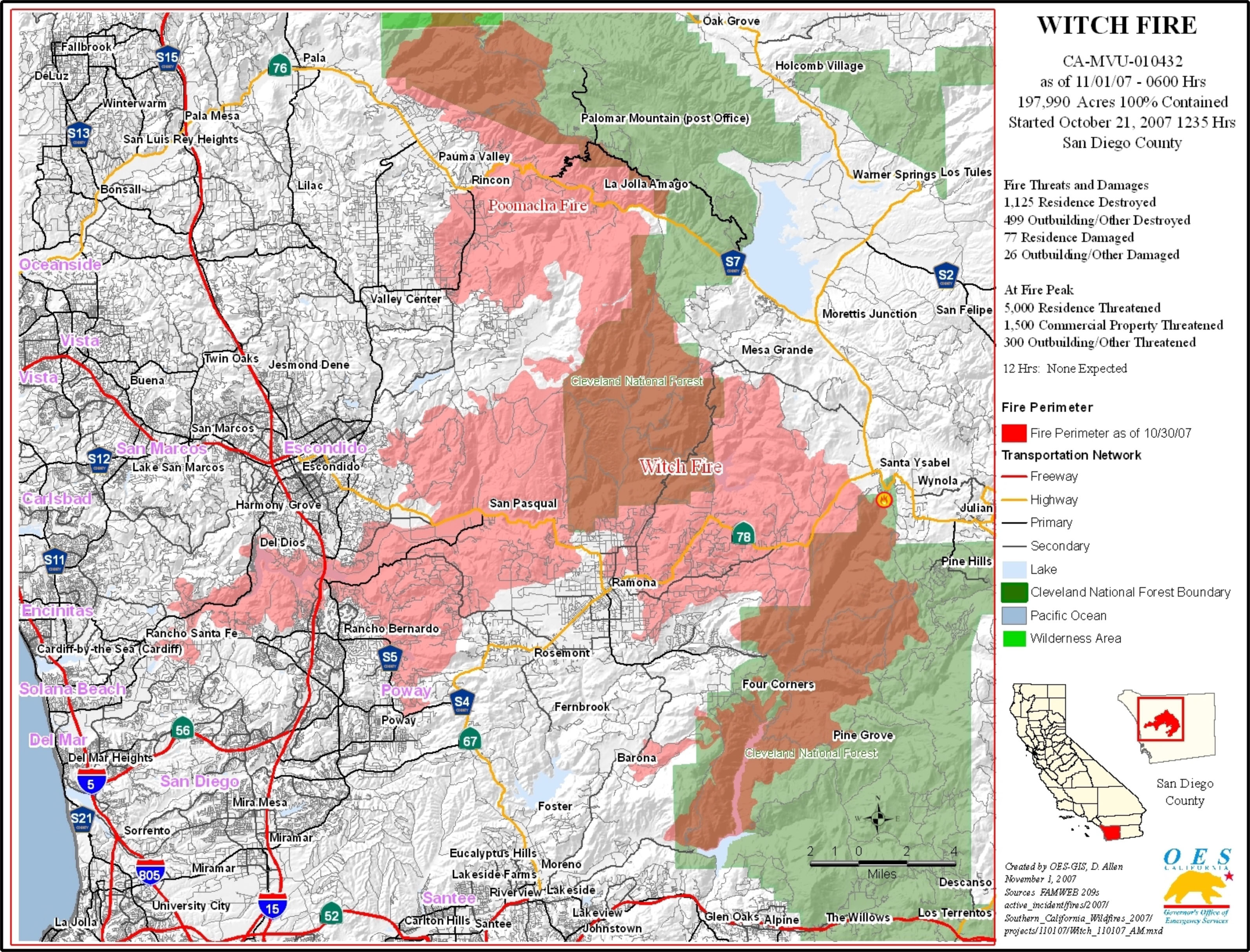
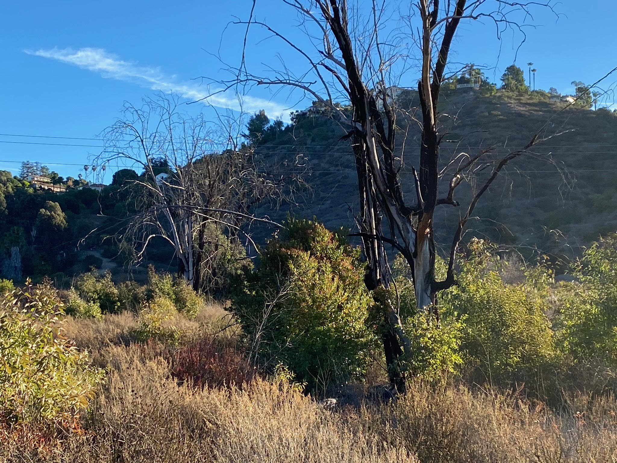
The 2007 Witch Creek Fire scorched much of the Coastal Highlands region of northern San Diego County, including more than 50,000 acres within the San Dieguito River Park (Figure 61). Nearly the entire Lake Hodges area burned; only small patches (refugia) escaped burning. The fire severely damaged coastal sage scrub, woodland, and chaparral plant communities. Fortunately, many plant species are adapted to wildfire and are gradually recovering. Unfortunately, once native habitats are destroyed, invasive plant species, particularly non-native grasses and Bull thistle, can take over, preventing native shrubs from regenerating quickly enough. Smaller fires occurred in the Lake Hodges area in 2013, 2018, and 2019. Evidence of the Witch Creek Fire is still evident throughout the landscape (Figures 62 and 63). However, it is also remarkable how many areas have recovered, assisted by human intervention and plantings by conservation-minded organizations.
Wildfires also impact the physical environment. Besides removing vegetation cover, wildfire scorches the thin soil of the semiarid landscape, removing most of the organic components of the soil. The fire also scorches the minerals in the soil and exposed rocks. Limonite [FeO(OH) ∙ nH2O] is a weathering product of rocks that contain iron and has a orange-tan color (essentially rust); it gives dirt its orange-brown color. When it is heated, the limonite releases its water component and converts to hematite [Fe2O3], a bright red mineral. In areas that have experienced intense fire, the soil is often baked to a red color. The same is true for weathered rock surfaces. You can see places where the limonite has been baked to a reddish color (Figure 64). High heat blast water trapped in the pores in the rock, converting it to steam that can split chips off the surface of boulders and outcrops. Clays that hold water also loose their moisture. The ash left behind after a fire are the mineral content absorbed by plant growth, mostly composed of oxides of calcium, sodium, potassium, and traces of other metals and compounds. |
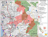
Fig. 61. Map of the 2007 Witch Creek Fire burn area. |
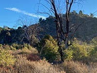
Fig. 62. A scorched tree along the Coast to Crest Trail. |
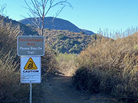
Fig. 63. Fire damage sign along Mid Valley Mesa Trail. |

Fig. 64. Fire-scorched rocks on the Mid Valley Mesa. |
|
A12
Plant Communities and Habitats
Figure 61 illustrates the distribution plant communities across San Diego San Diego County. A seasonal Mediterranean climate (temperature and precipitation), elevation, slope orientation, and wildfire and drought adaptations are controlling factors affecting the distribution of plant communities.
The hillsides and valleys around Lake Hodges are dominated by a coastal sage scrub plant community (Figures 66 to 68). Coastal sage scrub consists mostly of low growing, aromatic and generally soft-leaved shrubs. The coastal sage scrub dominates south and west facing slopes below about 1000 feet in elevation. Dominant species include California sage, Black sage, Bladder-pod sage, Flat-topped buckwheat, Saw-toothed goldenbush, and San Diego Sunflower. However, there are many more:
see a comprehensive list of plants species for San Diego County Coastal Sage Scrub (calflora.org website with over 400 flowering plants listed, most with flower pictures). Some plants species do well after wildfires clear a landscape, California poppies (Figure 69) and and California sunflower (Figure 70).
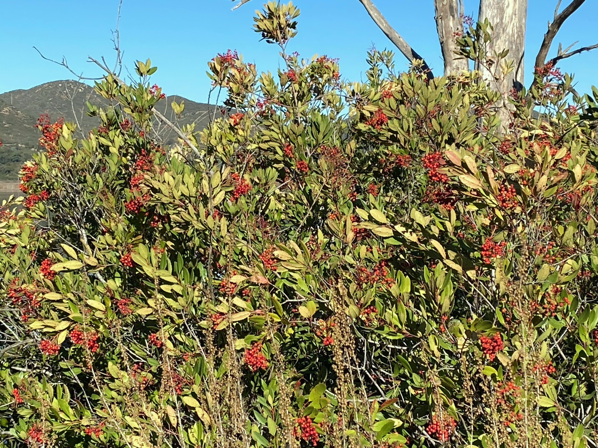
Mixed chaparral plant communities occur on the higher north- and east-facing slopes that tend to remain cooler and retains moisture longer. A general way to recognize these plant communities: coastal sage scrub species are shorter than a human, whereas chaparral species is taller than a human. However, many species occur in both habitats, including California lilac and Toyon (Figures 71 and 72).
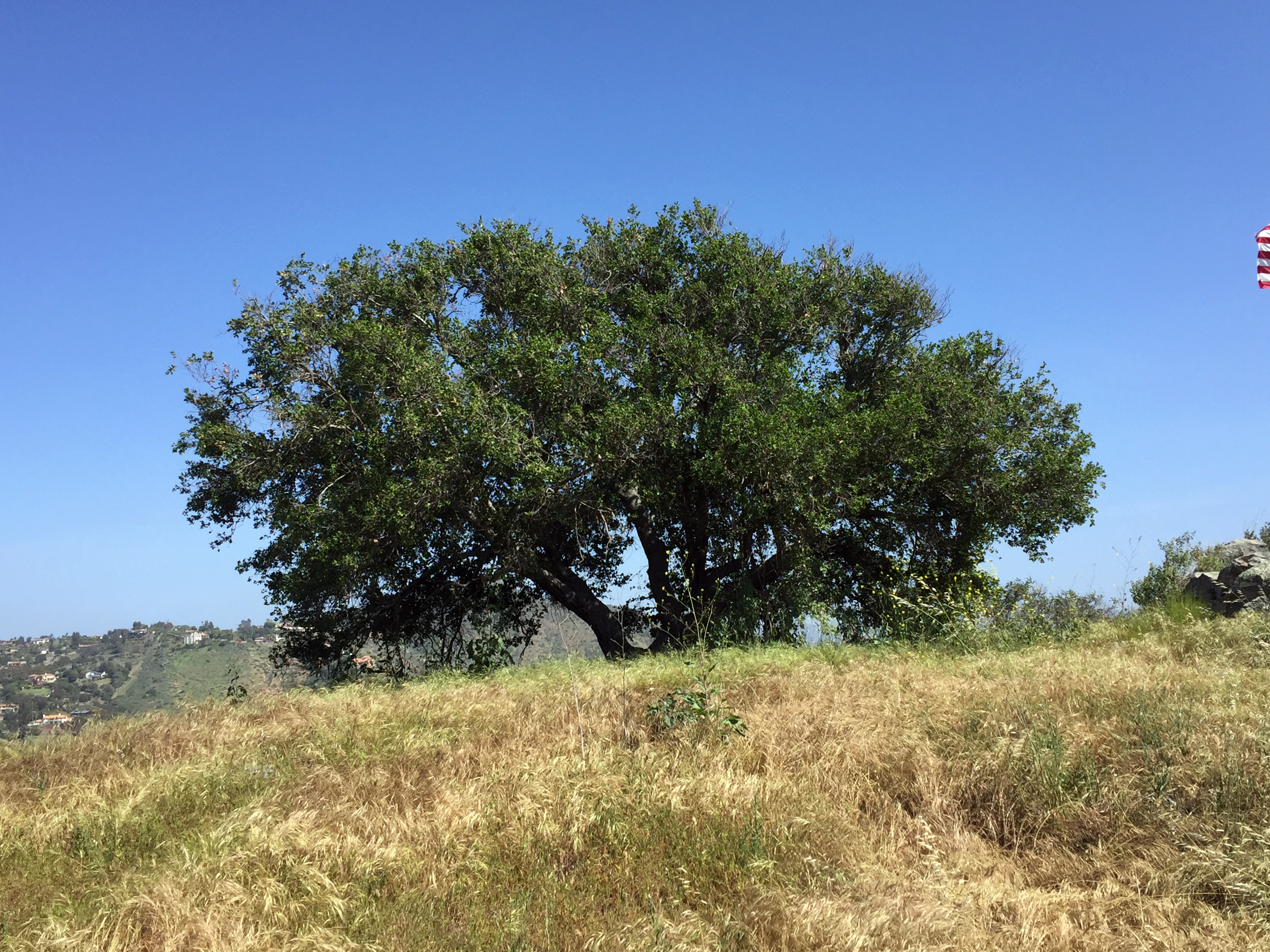
Oak woodlands occurs locally on cooler north facing slopes and along ravines (Figures 73 and 74). Five species of southern California oaks included Coast live oak, Interior live oak, California black oak, Canyon live oak, and California scrub oak. Oak woodlands often border with open grasslands unfortunately non-native grasses have mostly taken over what were habitat for native grasses.
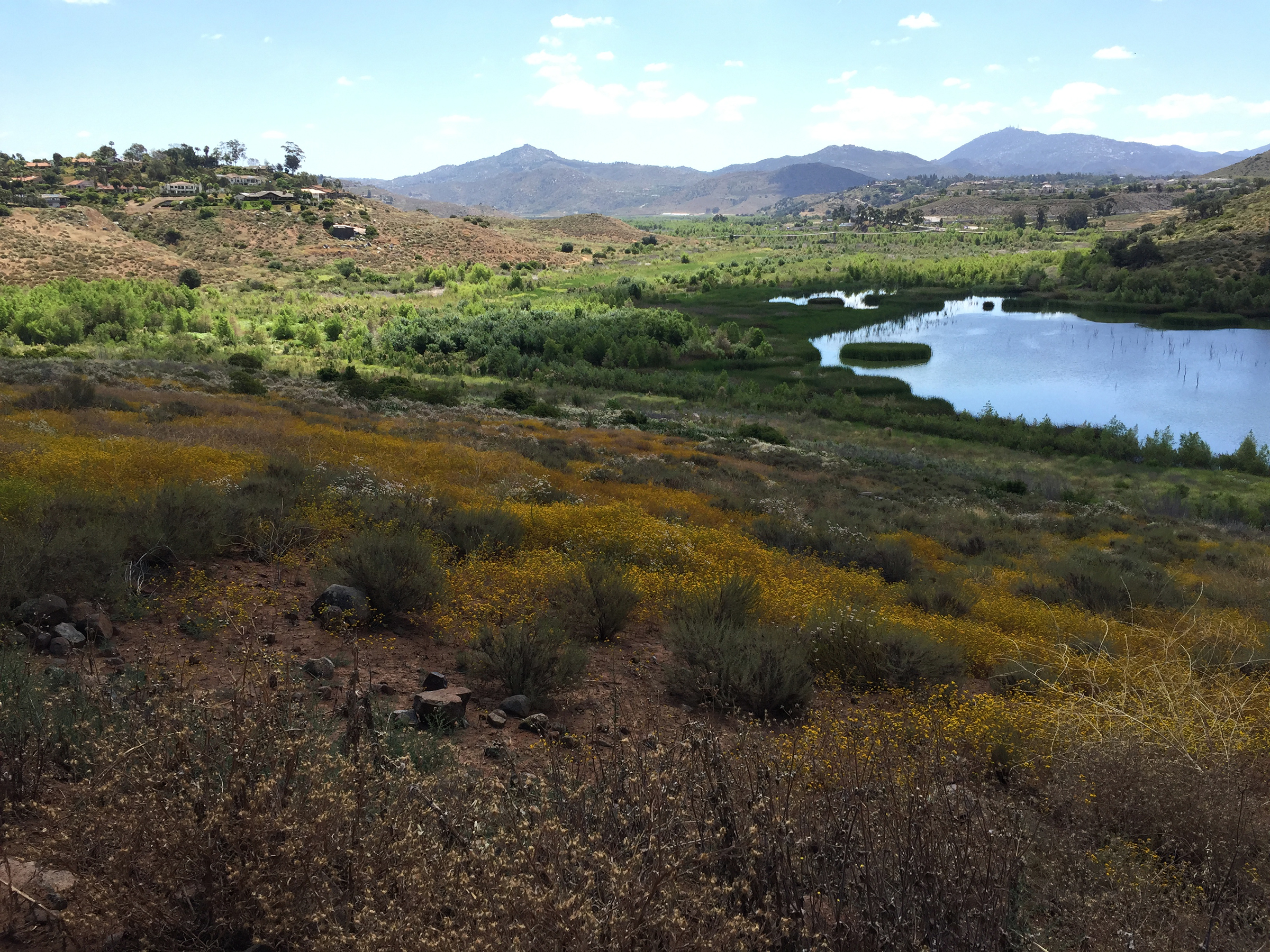
Riparian habitat occurs along stream valley areas and along the artificial shoreline habitat along or within the bathtub ring around Lake Hodges (Figures 75 to 77). Dominant plants in the riparian settings include oaks, sycamores, and willows. Freshwater marsh habitat locally occurs where principle streams drain into the river floodplain at the east end of the lake near the Interstate 15 bridges area. However, the lowering of the maximum lake level by 20 feet in 2019 will ultimately displace or change the character of the shoreline community.
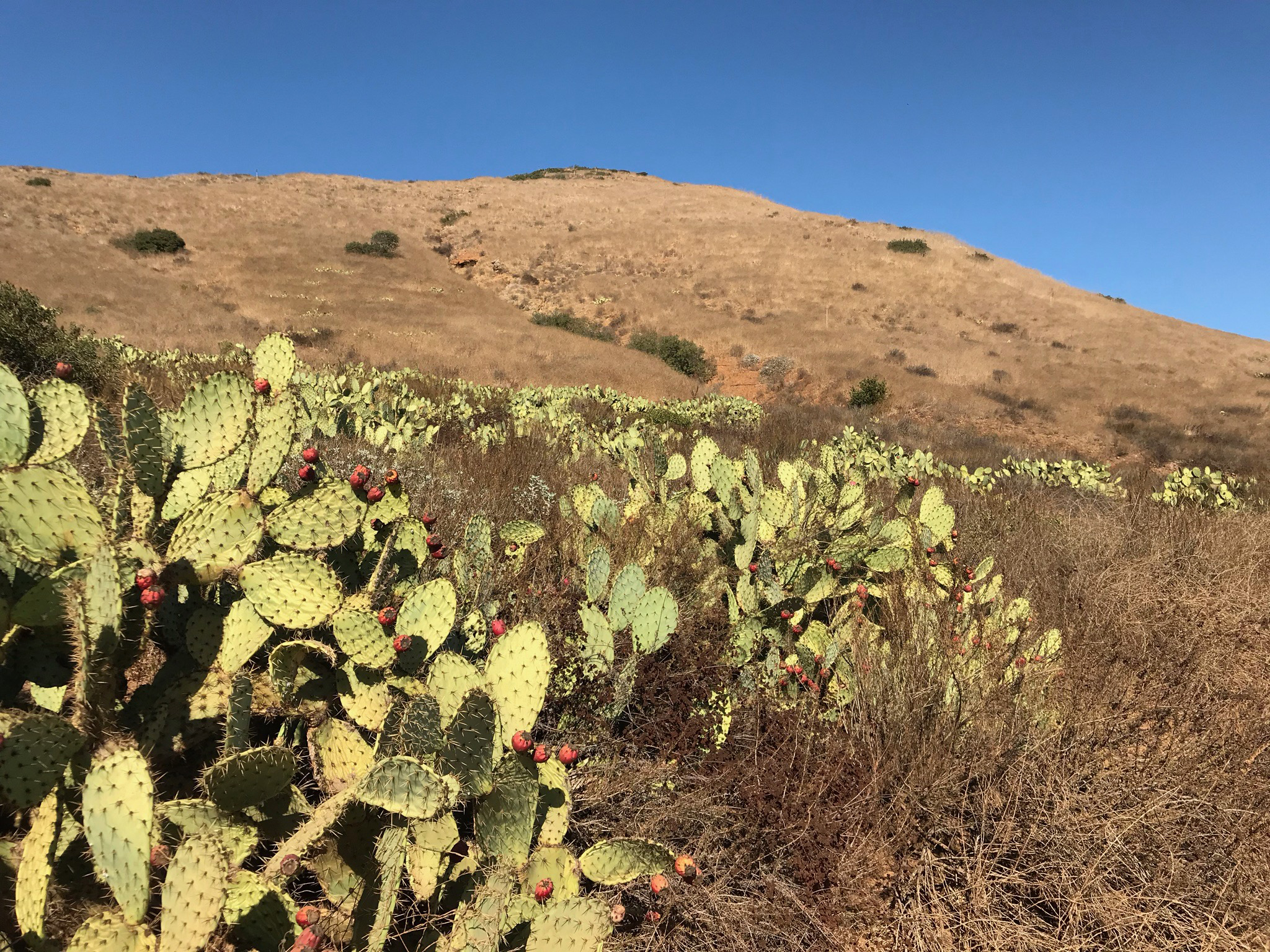
Lake Hodges habitat collection would best be described as desert transition. Prickly pear cactus and Mexican yucca occur dominate some of the dryer slope areas (Figures 78 and 79). The large cactus gardens along the north shore were replanted habitat restoration project.
Figure 80 illustrates a perhaps most unusual micro-environment plant community that is only found around some larger rocky outcrop areas. Plants with very ancient lineages dating back to the early Paleozoic Era including lichens, mosses, lycophytes, and ferns have adapted to the relatively harsh conditions with limited moisture and little or no soil.
A sign along the Coast To Crest Trail describes San Diego County as a biodiversity hotspot. "San Diego County lies at the southern end of the California Floristic Province. Although the county makes up only 2.7% of California's land area, it contains almost 34% of the plant species recored in state. San Diego County is also home to 744 species of mammals, and almost 500 species of birds, over 80 species of reptiles, and 15 species of amphibians."
See Plants of the San Dieguito River Valley (San Diego River Parks pamphlet).
|
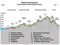
Fig. 65. Plant communities in San Diego County. |
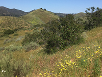
Fig. 66. Coastal sage scrub habitat on Fletcher Point. |
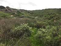
Fig. 67. Coastal sage scrub on Mid Valley Mesa. |
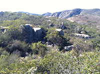
Fig. 68. Mixed coastal sage scrub and chaparral.
|
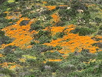
Fig. 69. California poppies blooming on Mid Valley Mesa. |
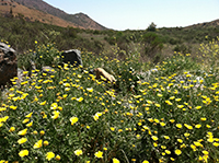
Fig. 70. California sunflowers (Encelia californica). |
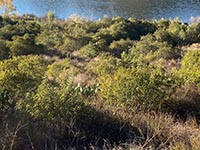
Fig. 71. Toyon shrub habitat on the North Shore. |
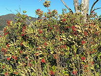
Fig. 72. Toyon - Christmas Berries in winter. |
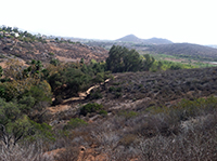
Fig. 73. Oak woodland along Felicita Creek valley. |
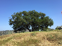
Fig. 74. Coastal oak with grasslands. |
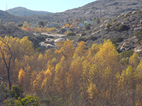
Fig. 75. Riparian habitat, mostly willow and sycamore. |
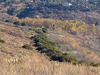
Fig. 76. Riparian and shoreline habitats near Felicita Creek. |

Fig. 77. Coastal sage scrub and shoreline habitats. |

Fig. 78. Prickly pear cactus along the North Shore Trail. |
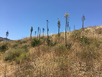
Fig. 79. Mexican yucca patch along the North Shore Trail. |
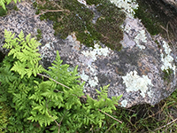
Fig. 80. Mosses, lichens and ferns (Paleozoic plants). |
|
A30
| https://gotbooks.miracosta.edu/fieldtrips/Lake_Hodges/index.html |
1/8/2021 |
|