
The San Dieguito River Watershed |
| The San Dieguito Watershed is one of dozen watersheds that drain upland regions of San Diego County (Figure 1). The black lines on the map show the divides (upland boundaries) between the watershed. Figure 2 is a more detailed map showing the divide boundaries of the San Dieguito Watershed with named features used in the discussions below. The distance form the high point on Volcan Mountain (to the east) to the mouth of the San Dieguito River in Del Mar is about 60 miles (100 km). Much of the land in the San Dieguito Watershed region is open space (undeveloped land now preserved for watershed protection). Some of the land is Indian Reservation lands, most of the rest is ranches and rural home properties. The town of Ramona is the largest town inland, whereas the coastal area is largely developed coastal communities of Rancho Santa Fe, Del Mar, and Solana Beach. The water supply within the San Dieguito Watershed is shared by multiple water districts in the region overseen by the San Diego County Water Authority. The watershed has 4 reservoirs serving in water supply storage capacity: Lake Sutherland, Lake Hodges, Lake Ramona, and Lake Poway. |
Click on images for a larger view! |
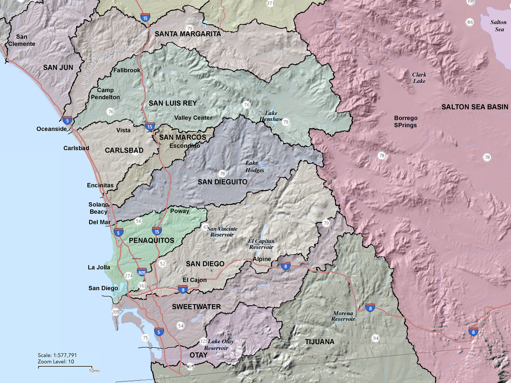 Fig. 1. Watersheds of the San Diego region. |
Headwaters RegionThe headwaters of the watershed are in the vicinity of Volcan Mountain (elevation 5,719 feet). It is one of the high peaks along the crest of the Peninsular Ranges that run roughly north to south through central San Diego County. Small ravines drain westward from the vicinity of Volcan Mountain and merge to become a mountain stream named Santa Ysabel Creek. The stream is fed by winter seasonal rains and snow melt, but flows year round—fed by springs along the stream bed. It is interesting to note that the upper part of the stream drains along the rift valley of the Elsinore Fault, one of the more active earthquake faults in the region (Figure 3). The fault crosses the road in the vicinity of the Volcan Mountain trailhead (Figure 4) and continues east through the Julian area and eastward down the canyon along Highway 78 into the Anza Borego region (Figure 5). |
 Fig. 2. Map of the San Dieguito River Watershed (click on map for a larger view). |
Lake SutherlandSanta Ysabel Creek drains westward through the highlands and flows into Lake Sutherland, the 9th largest reservoir in San Diego County (Figure 6). The reservoir is maintained and operated by the City of San Diego's Public Utilities Department. Construction of Sutherland Dam began in 1927, but the dam was not completed until 1954. When full, the reservoir covers 556.8 surface acres, has a maximum water depth of 145 feet, with 5.25 miles of shoreline. |
Fig. 3. 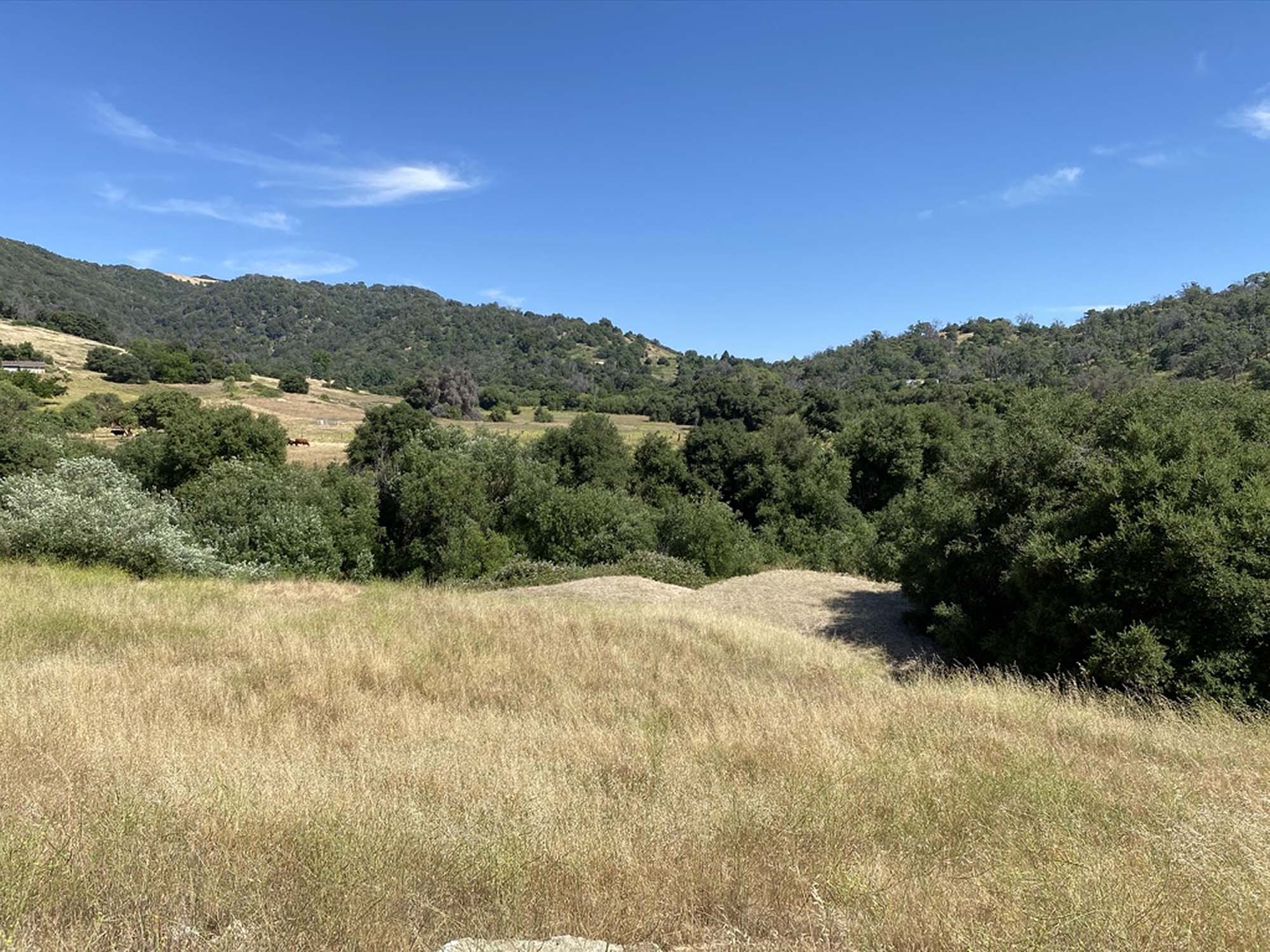 Headwaters of Santa Ysabel Creek in Elsinore Fault valley |
Fig. 4.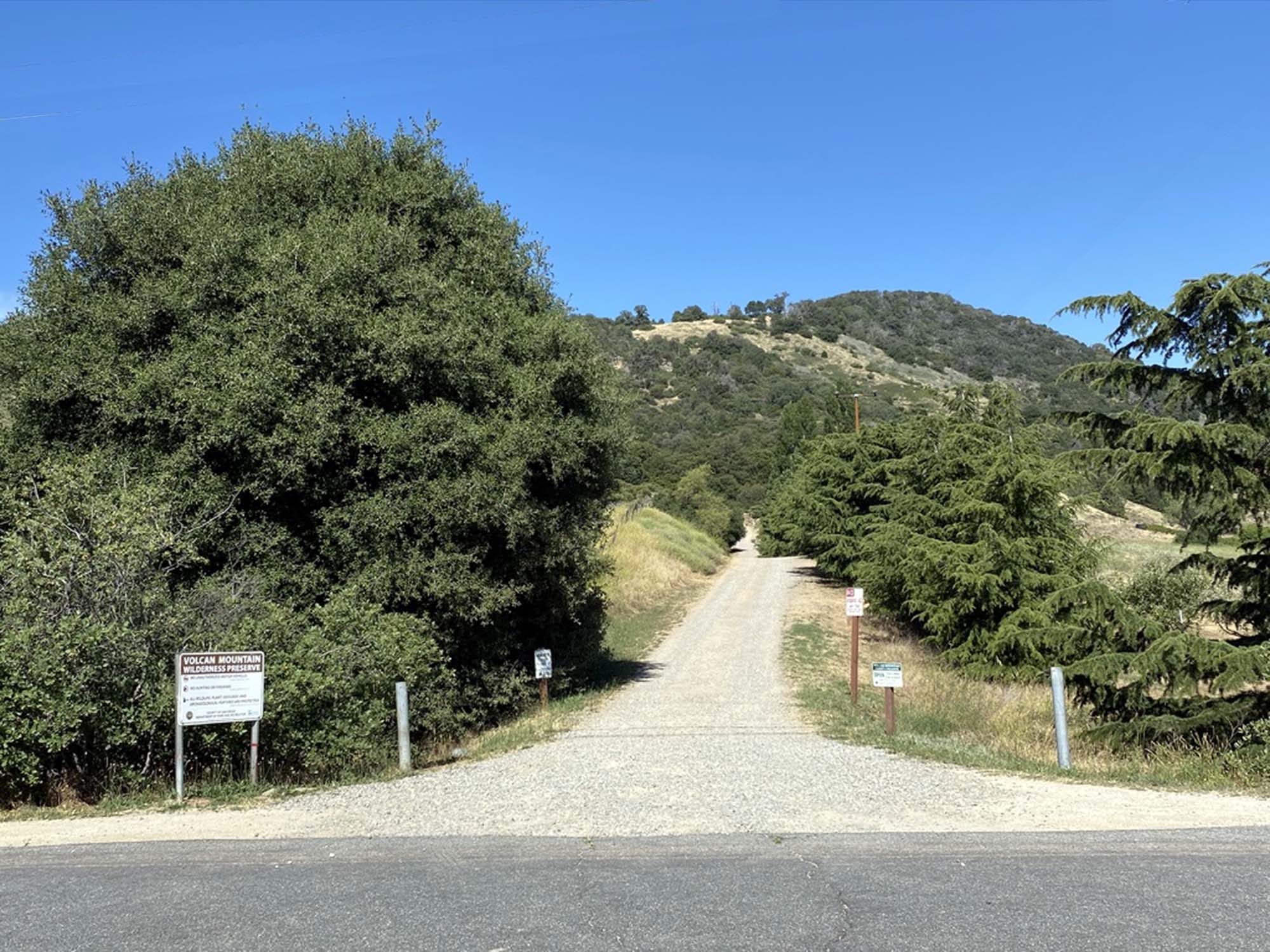 Trailhead to Volcan Mountain Preserve near Julian, CA |
Fig. 5.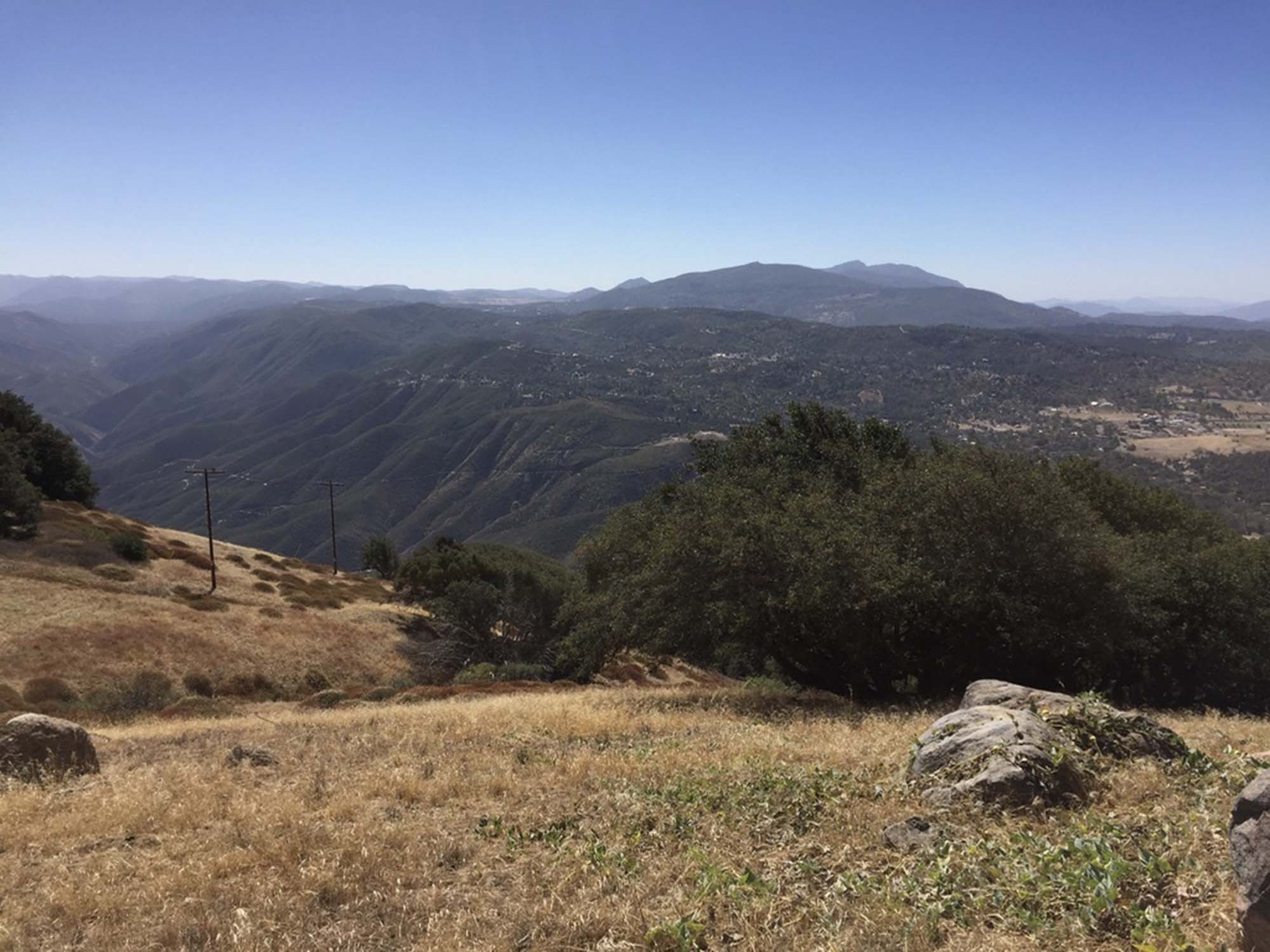 View looking south from near the top of Volcan Mountain View looking south from near the top of Volcan Mountain |
Fig. 6.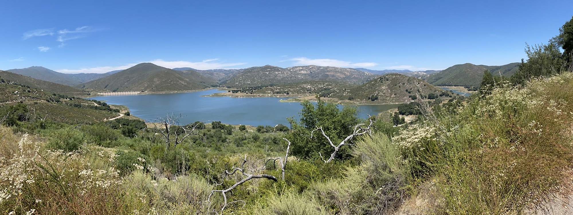 Lake Sutherland (reservoir) in upper Black Canyon of the upper Santa Ysabel Creek drainage basin. Lake Sutherland (reservoir) in upper Black Canyon of the upper Santa Ysabel Creek drainage basin. |
Upland Mountains, Canyons, and ValleysBelow Sutherland Dam, Santa Ysabel Creek drains through a mountainous wilderness region, flowing westward through Black Canyon (near Ramona). Below Black Canyon, Santa Ysabel Creek merges with Temescal Creek in Pamo Valley (Figures 7 and 8). Santa Ysabel Creek then flows through Clevenger Canyon before flowing into the wide upland basin of San Pasqual Valley (Figure 9). In the San Pasqual Valley, Santa Ysabel Creek merges with Santa Maria Creek to become the San Dieguito River (Figure 10). Santa Maria Creek drains in from the Ramona Valley area (Figure 11). |
Fig. 7. 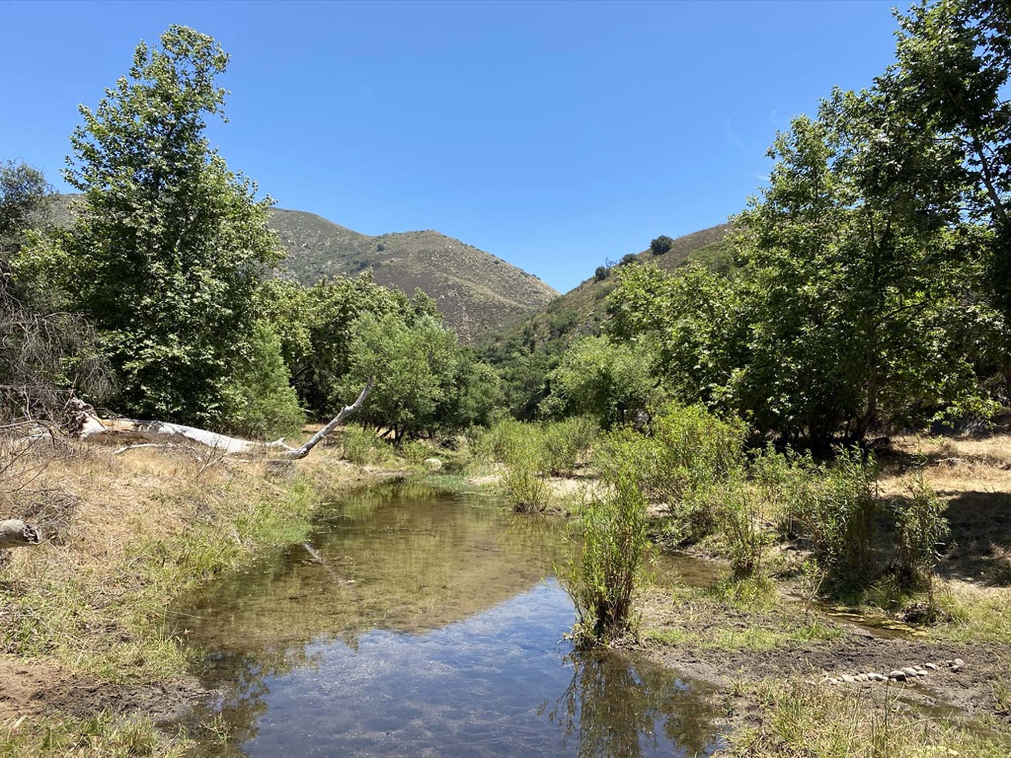 Santa Ysabel Creek in Pamo Valley near Ramona, low flow in summer. |
Fig. 8.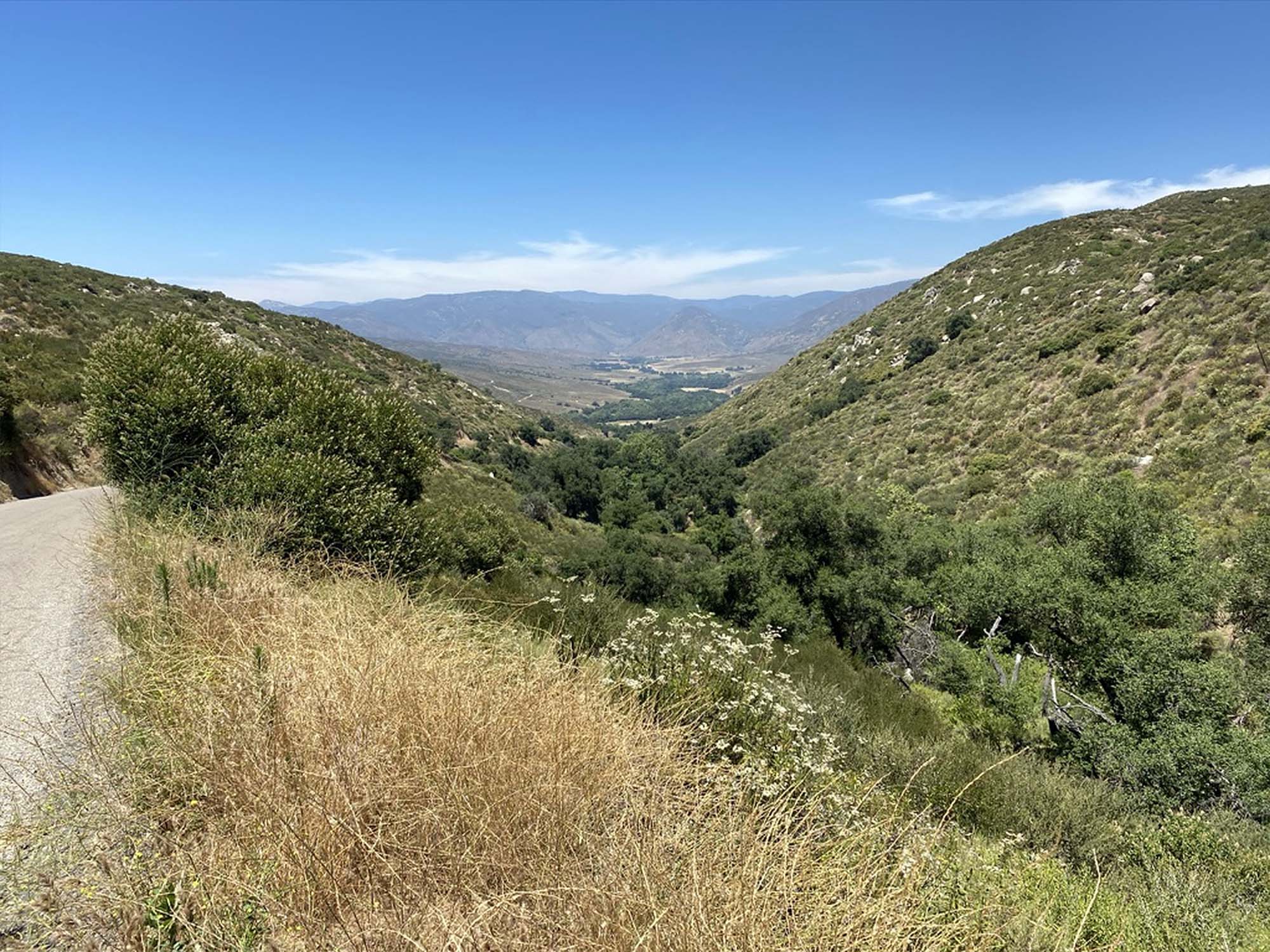 View looking north along the linear (fault) valley of Temescal Creek near Pamo. |
Fig. 9.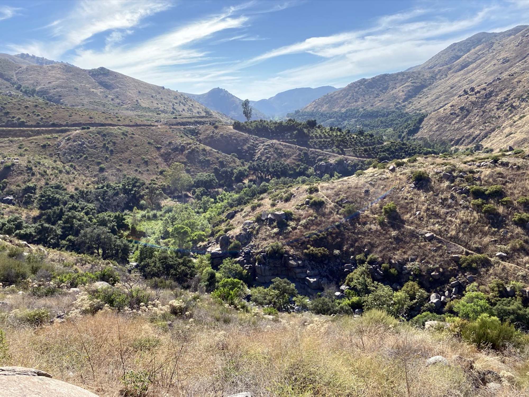 Santa Ysabel Creek in Clevenger Canyon east of San Pasqual Valley. |
Fig. 10. 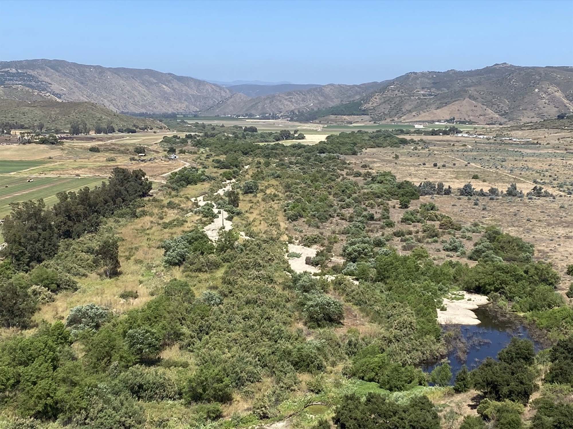 Confluence of Santa Maria and Santa Ysabel Creeks in San Pasqual Valley. |
Fig. 11. Santa Maria Creek flows through Ramona Valley (water well in middle of image). |
The San Pasqual ValleyThe San Pasqual Valley is located southeast of Escondido and east of Interstate 15 in the valley upstream of Lake Hodges. The valley is famous for its historic San Pasqual Battlefield that involved a battle between Mexican and American forces in 1846, leading the the succession of California from Mexico. It is also home to the San Diego Zoo Safari Park, and the San Diego Archaeological Center. The valley is also host to a variety of agriculture and residential use.The San Pasqual Valley Groundwater Basin is an alluvial aquifer that underlies the valley (Figure 12). It consists a blanket of sand and gravel sediments that serves as a underground reservoir that is increasingly utilized for water supply. Studies suggest that alluvial sediments fill the basin to depths between 120 to 200 feet and these overlie a regolith of deeply weathered rocks of granitic origin. The capacity to capture, store, and release groundwater is being studied. |
Fig 12. 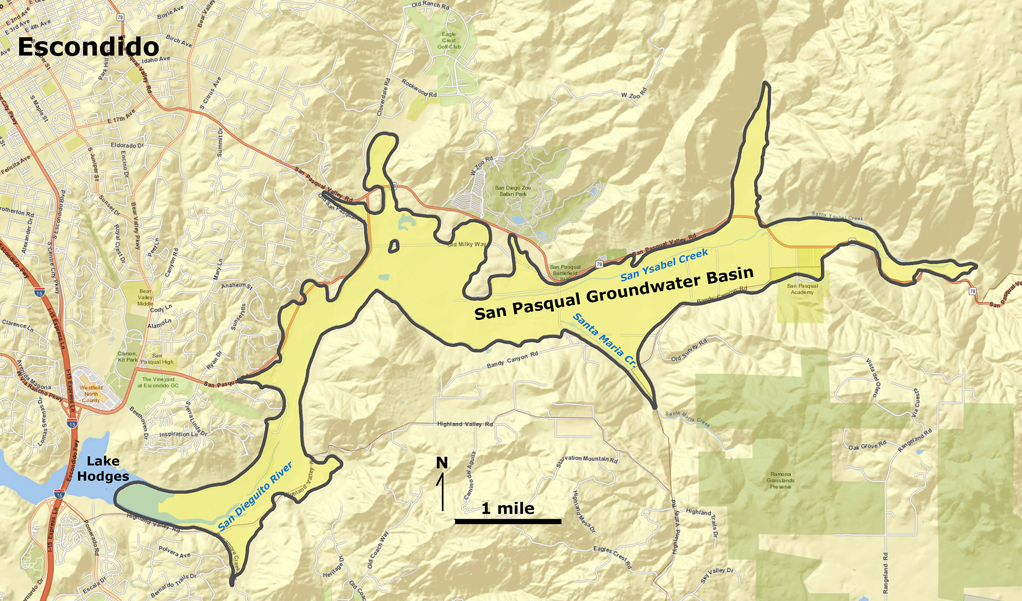 Map of the San Pasqual groundwater basin area east of Lake Hodges near Escondido. |
During rainy periods, Santa Ysabel and Santa Maria Creek flow into San Pasqual Valley, but they are influent streams, loosing most of their surface water in the dry season to the porous sandy sediments that fill the groundwater basin (Figure 13). Groundwater is pumped for agricultural and residential water use. Some of it flows directly from the ground into Lake Hodges. Upward flowing groundwater locally produce quicksand along the shoreline!Lake Ramona and Lake PowaySanta Maria Creek drains from the upland region between Ramona and Poway in the vicinity of Woodson Mountain (a prominent landmark mountain peak in the region, Figure 15). Two small city reservoirs, Lake Ramona and Lake Poway, were constructed on the headwater valleys of Santa Maria Creek. Lake Ramona was constructed in Highland Valley north of Woodson Mountain in the 1980s. Lake Poway was constructed in Warren Canyon in 1972. Both reservoirs were constructed to stabilize the local water supply to the growing residential population and agricultural needs. |
Fig. 13. 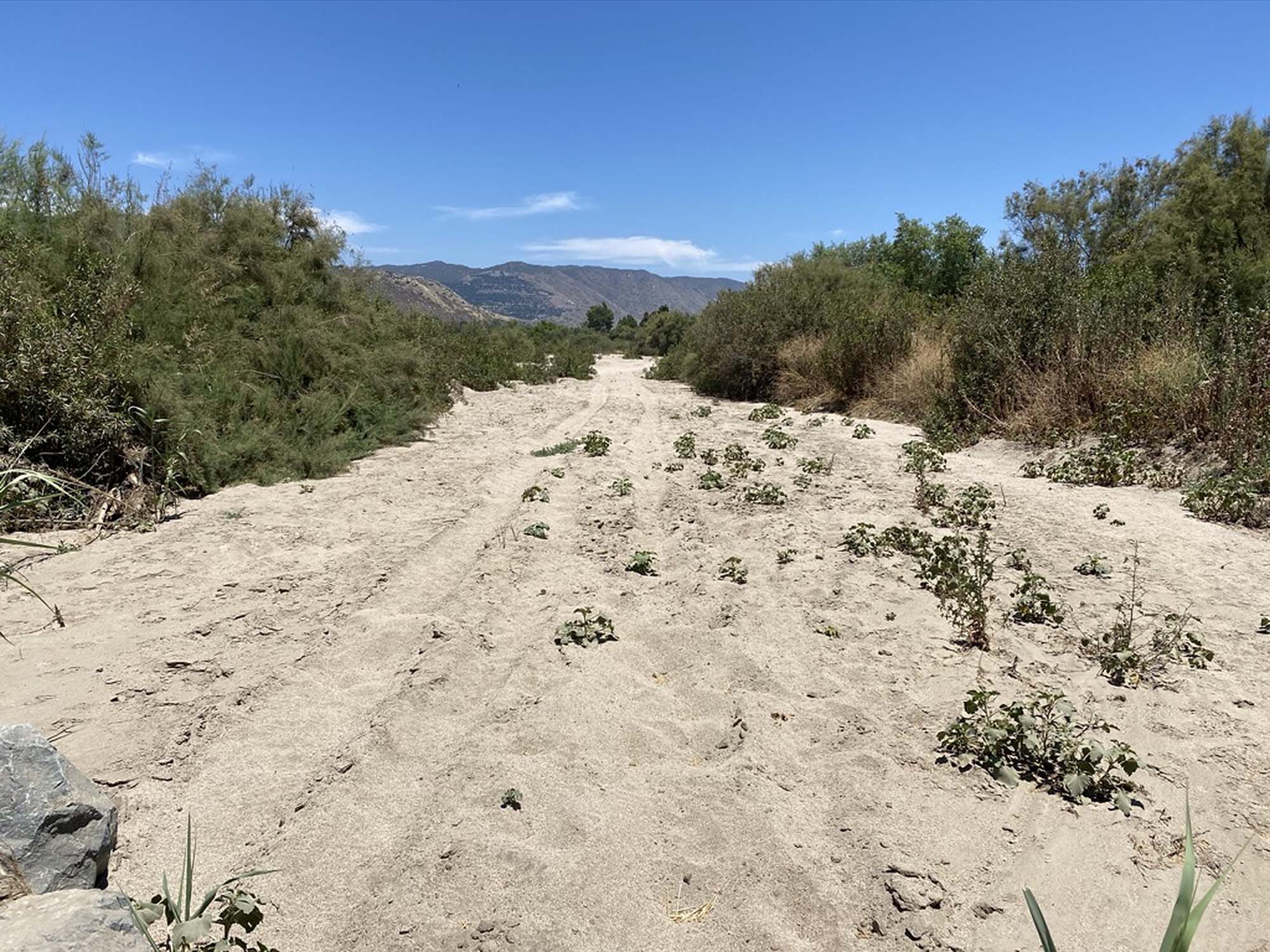 The stream channel of Santa Ysabel Creek in San Pasqual Valley in summer is dry sand. |
Fig. 14. Santa Maria Creek recharges the groundwater basin beneath San Pasqual Valley. |
Fig. 15.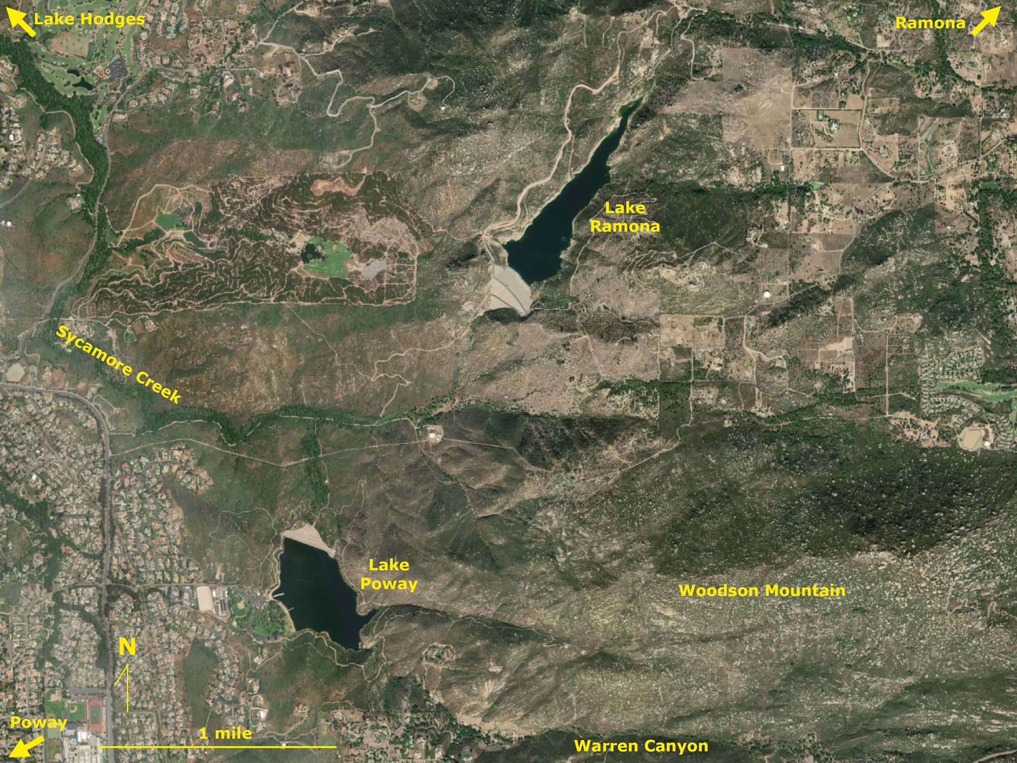 Lake Ramona and Lake Poway near Woodson Mountain in the headwaters of Santa Maria Cr. |
Fig. 16. 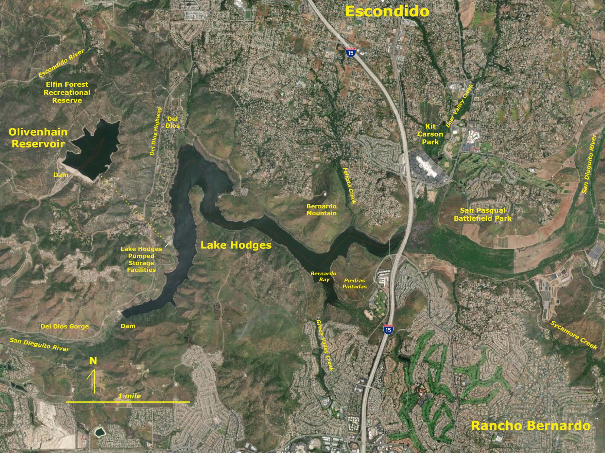 Map of Lake Hodges and Olivenhain Reservoir southwest of Escondido. |
Fig. 17. 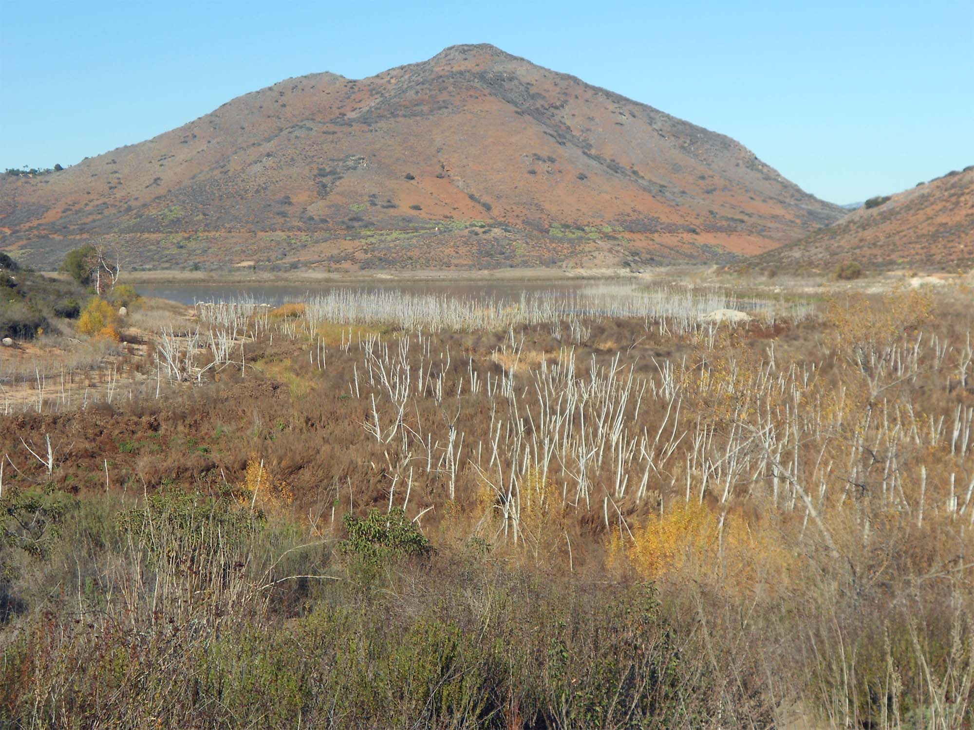 Wetlands at east end of Lake Hodges with Bernardo Mountain. |
Lake Hodges and Olivenhain ReservoirLake Hodges is located at the west end of the San Pasqual Valley where the San Dieguito River narrows before entering the Del Dios Gorge (Figure 16). The extent of the lake changes with the level of the lake. When filled to capacity, the lake extends east into marshlands east of Interstate 15. Figure 17 shows a drowned forest/wetlands exposed by a low water level in the reservoir. Felicita Creek drains into Lake Hodges from the valley east of the high peak of Bernardo Mountain (Figure 17 and 18). Green Valley Creek drains into Bernardo Bay in Lake Hodges from the opposite side of the valley (Figure 19). Prehistoric native peoples utilized this area probably taking advantage of a perennial water supply from springs draining from the aquifer at the west end of the San Pasqual Valley Groundwater Basin. Some of prehistoric cultural sites are within the Piedras Pintadas Interpretive Trail area.Lake Hodges is maintained and operated by the City of San Diego's Public Utilities Department. The reservoir currently serves the San Dieguito Water District and Santa Fe Irrigation District as well as the City San Diego (Figures 20 and 21). Lake Hodges dam was completed in 1918 (Figures 21). The dam is 131 feet high and 729 feet wide. When full, Lake Hodges reservoir covers 1,234 surface acres with 27 miles of shoreline. |
Fig. 18.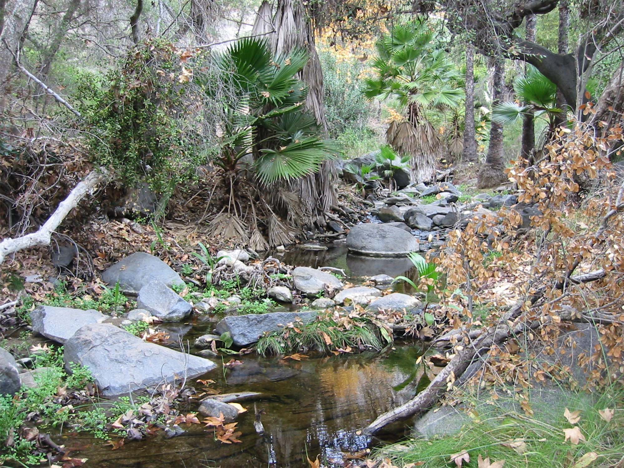 Felicita Creek drains into Lake Hodges on the east side of Bernardo Mountain. Felicita Creek drains into Lake Hodges on the east side of Bernardo Mountain. |
Fig. 19.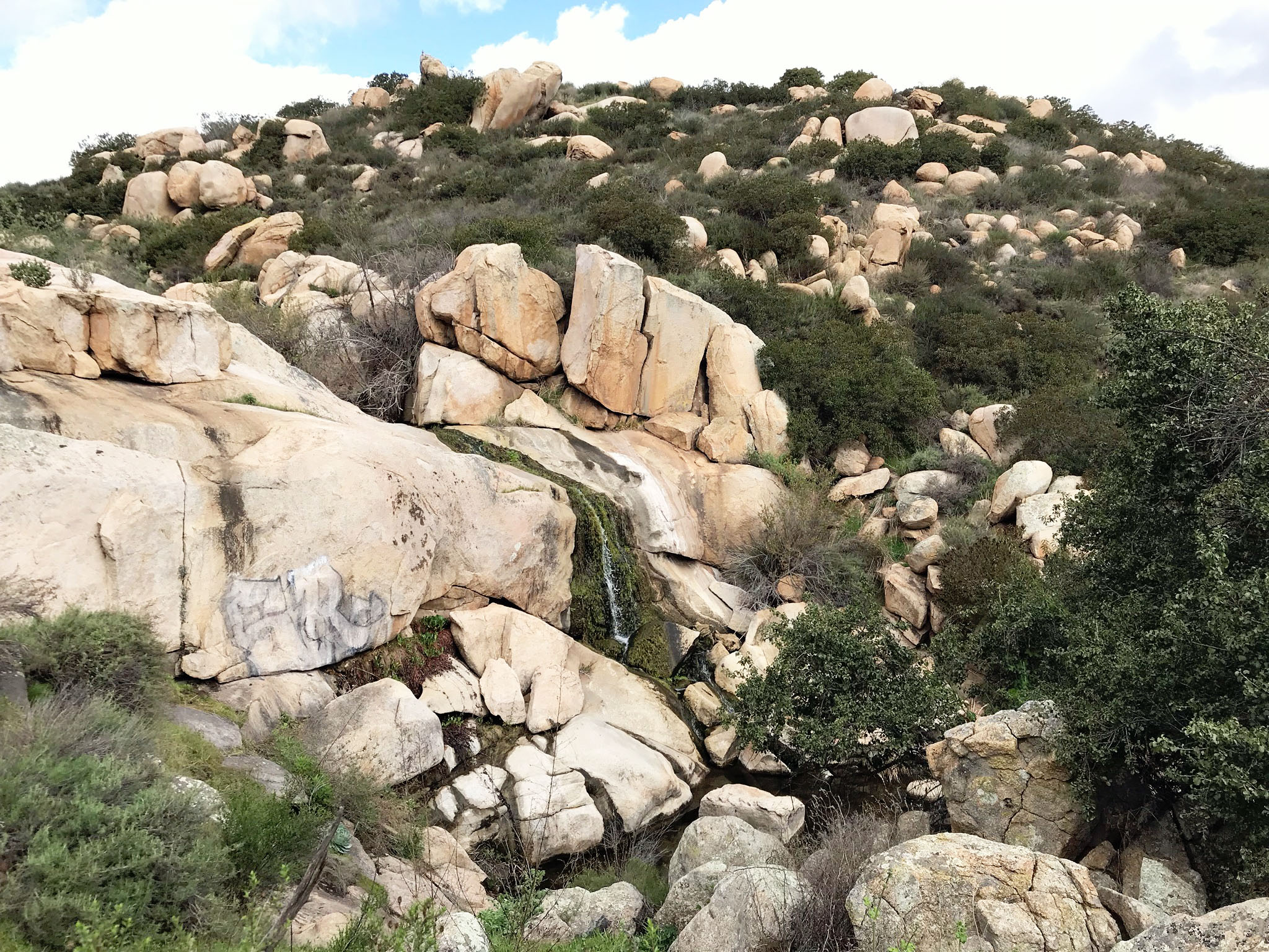 Green Valley Creek Falls along the Piedras Pintadas Interpretive Trail. |
Fig. 20.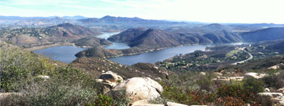 View looking east from the Lake Hodges Overlook in the Elfin Forest Recreational Reserve. The San Pasqual Valley and Woodson Mountain in distance; the dam is to the right. |
Fig. 21.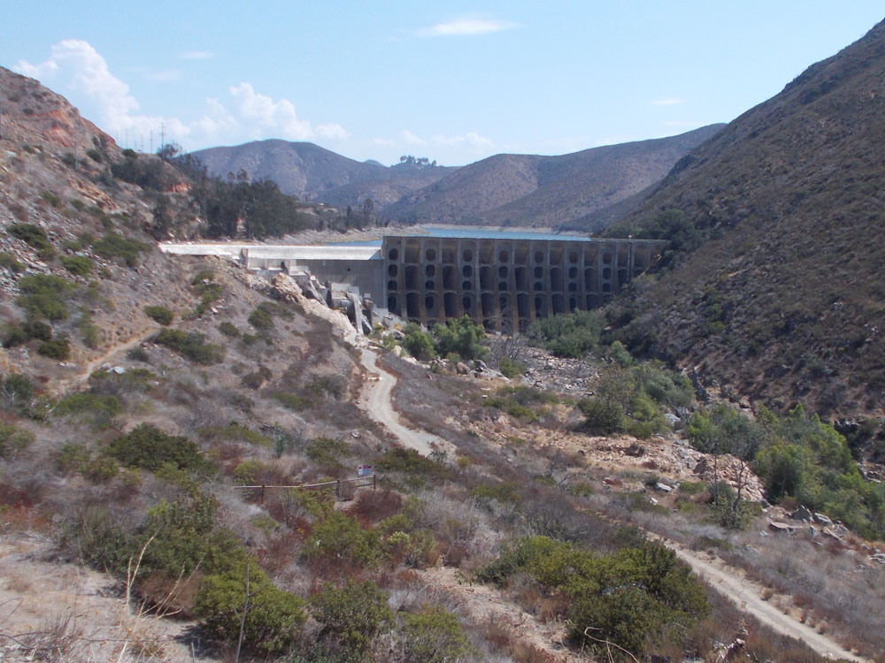 Lake Hodges Dam and reservoir on the San Dieguito River in Del Dios Gorge. |
Olivenhain ReservoirOlivenhain Reservoir is located in the highlands of the Elfin Forest Recreational Reserve (Figure 22). Although technically not a part of the San Dieguito Watershed region it receives its water via a pumping/hydroelectric station—Lake Hodges Pumped Storage Facilities on the western shore of Lake Hodges (Figure 23). Construction of the dam and reservoir was completed in 2003. Although Olivenhain Reservoir appears smaller in size than Lake Hodges, because of its depth it has nearly twice the water storage capacity. Water is pumped up to the reservoir when electricity demand is low, but the flow is reversed allowing electricity to be generated to supplement regional electricity demand during peak hours. |
Fig. 22. 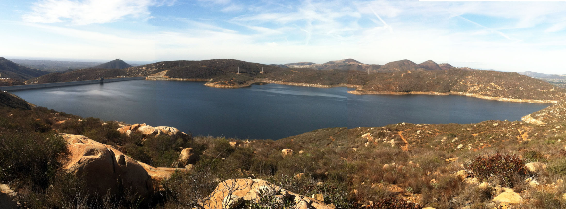 Olivenhain Reservoir in mountain valley above Lake Hodges. Water is pumped up to the reservoir and the released to generate electricity during peak demand periods. |
Fig. 23.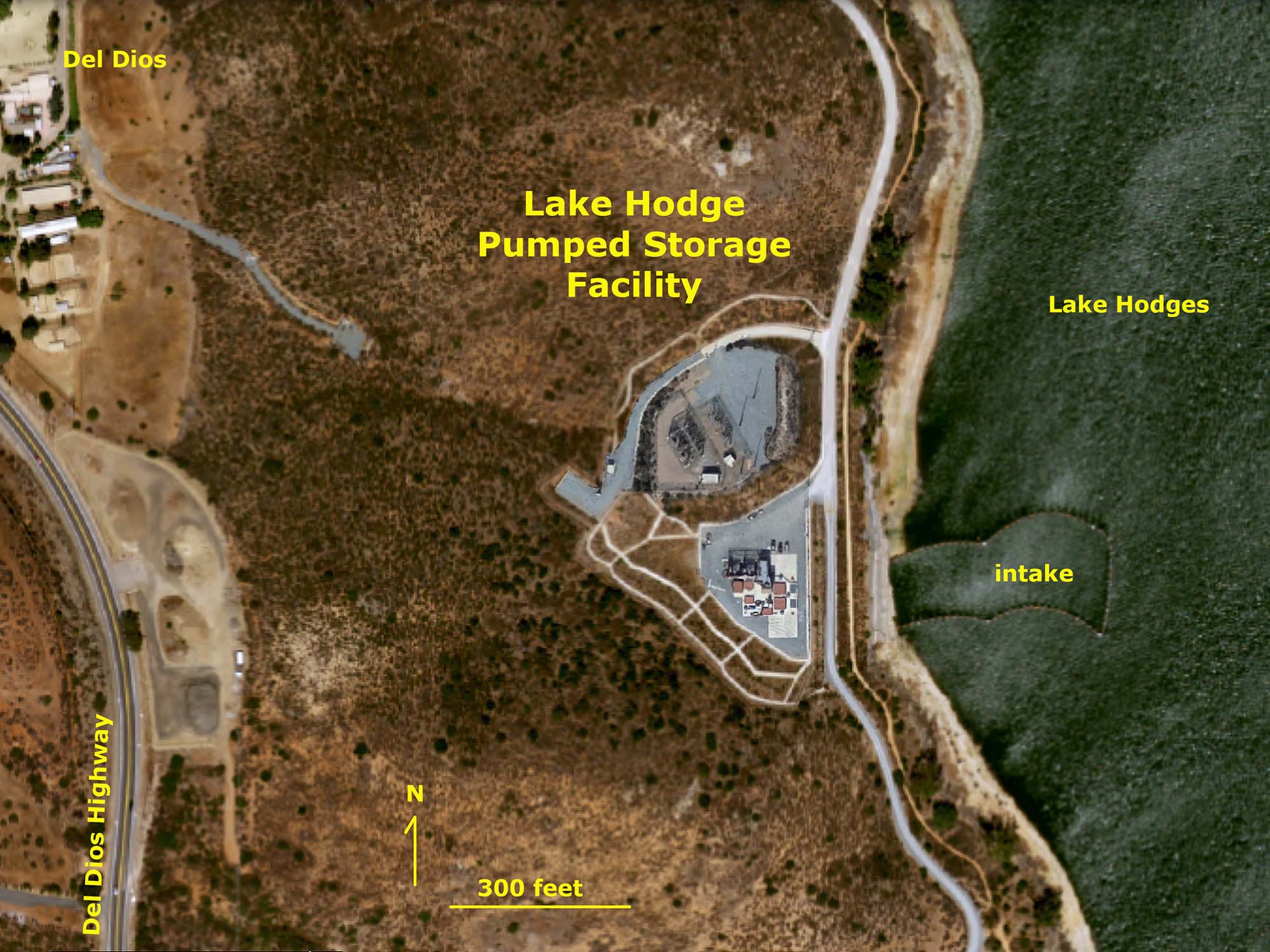 Lake Hodges Pumped Storage Facility on the shore of Lake Hodges in Del Dios |
Fig. 24. 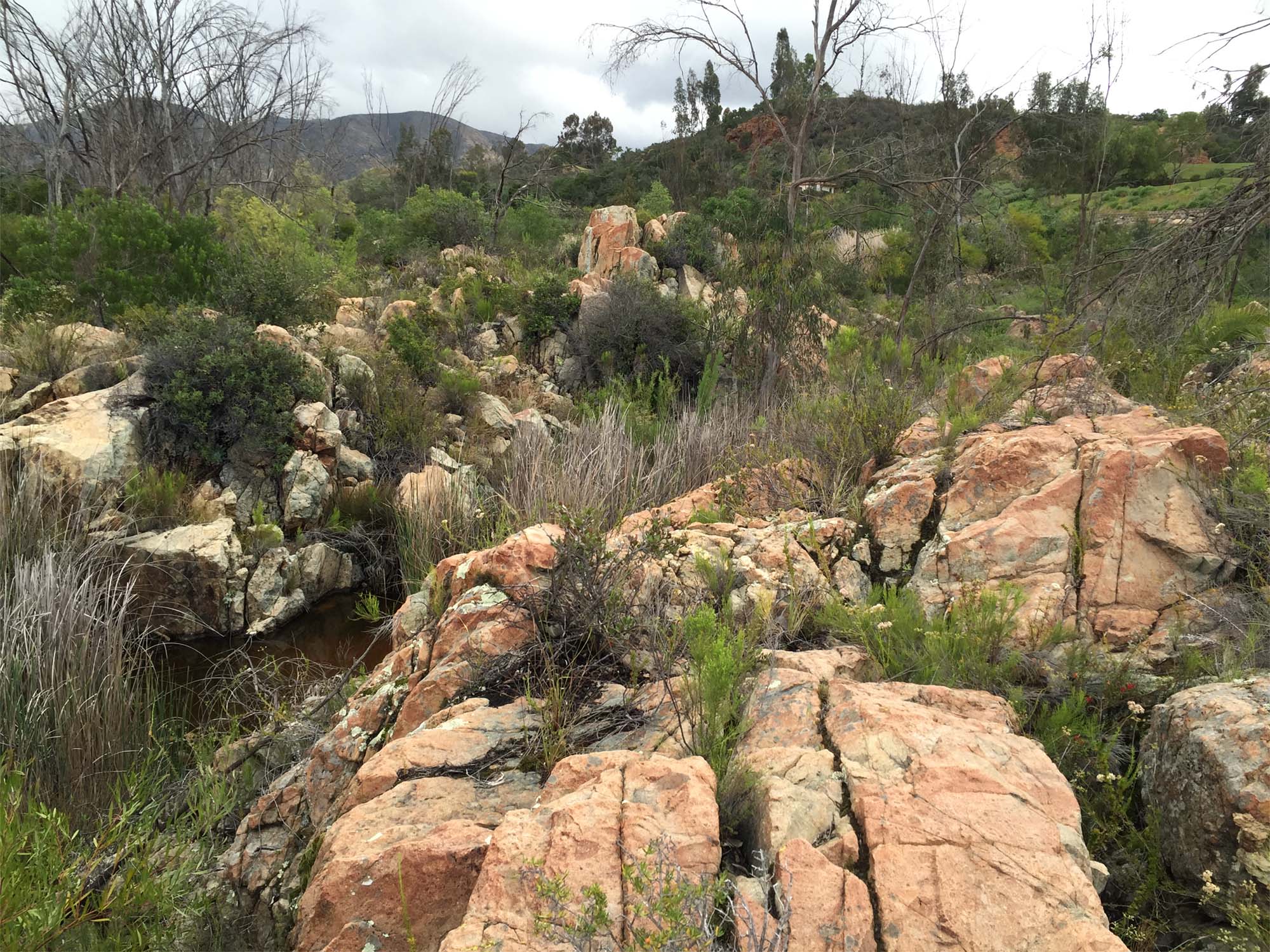 Barren bedrock along San Dieguito river channel in Del Dios Gorge below dam. |
Fig. 25.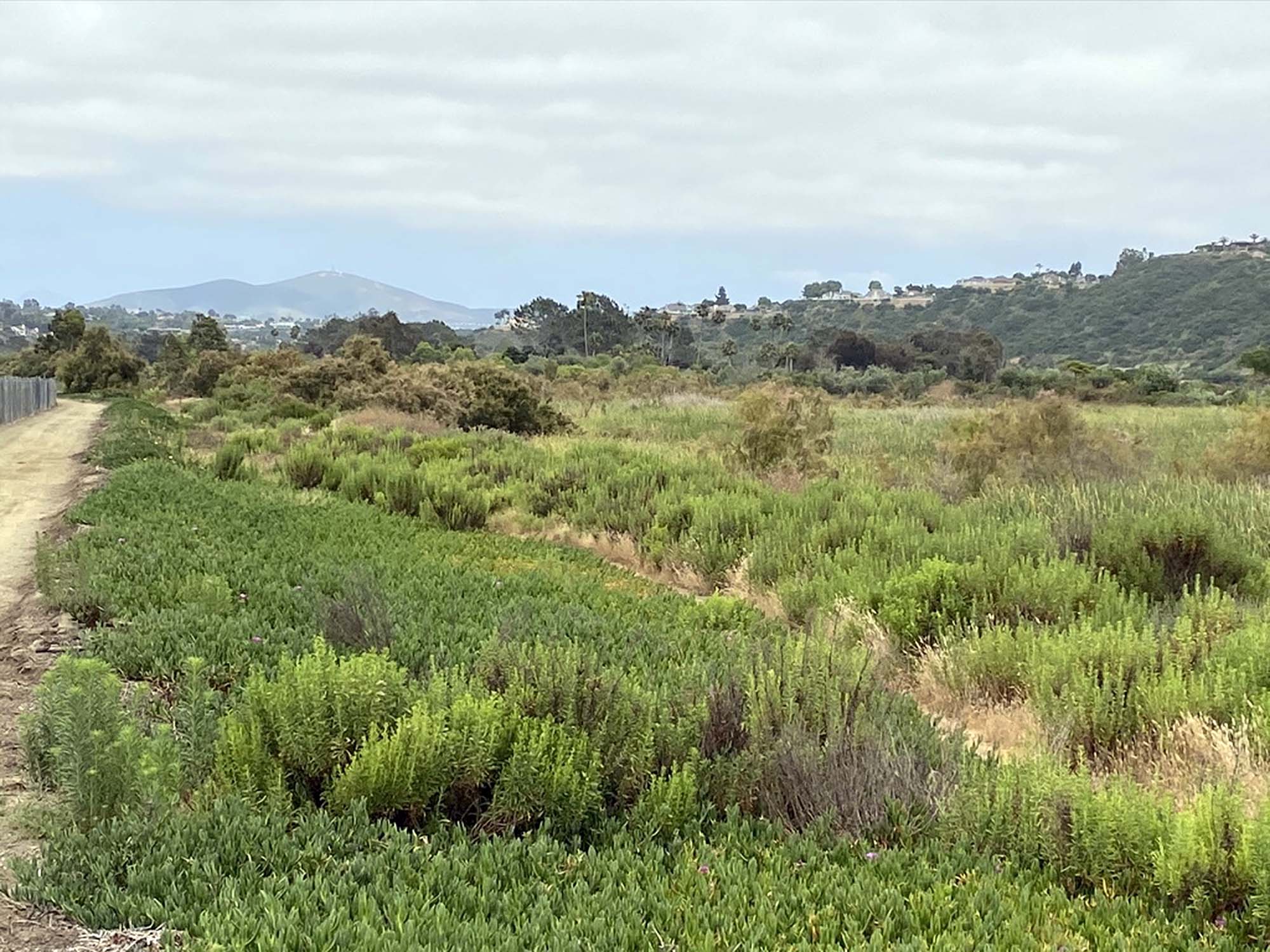 The San Dieguito River flows into a freshwater marsh in the lowland valley near the coast. The San Dieguito River flows into a freshwater marsh in the lowland valley near the coast. |
Lower Drainage Basin, Lagoon, and River MouthConstruction of Lake Hodges Dam was completed in 1918 by the San Dieguito Mutual Water Company with financing by the Santa Fe Railroad Company. The railroad had the dam constructed on the San Dieguito River to promote the development of lands owned by the railroad—primarily in Rancho Santa Fe. One hundred years later, the impact of the construction of the dam can be seen on the environment. Prior to construction of the dam, seasonal floodwaters on the San Dieguito River would transport sediments downstream to the riparian habitats, lagoon, and beaches in Del Mar and Solana Beach. The stream bed in Del Dios Gorge is now rocky and barren of sand and gravel (Figure 24). The dam has shut off the sand supply to the lower drainage basin.About 4 miles from the coastline, the San Dieguito River drains into broad freshwater marshlands in the lower coastal valley (Figure 25). At the peak of the last ice age (about 20,000 years ago) sea level was nearly 400 feet lower than it is today and the river gorge extended into the region that is now submerged offshore. As sea level rose at the end of the ice age, the lower valley flooded and gradually filled with sediments, both from the San Dieguito River and sand carried into the lagoon from the coast by daily tides and storm surges. About 3 miles from the coast the San Dieguito River transitions from freshwater to brackish/salt water as it flows into the lagoon. Plant habitats transition from freshwater to salt-water tolerant species. The lagoon and saltwater marsh receives inflowing seawater during high tides and storm surges (Figures 26 and 27). The sediments that filled the valley beneath the lagoon and lower valley are host to a brackish-to-salt-water filled aquifer that is currently being evaluated and tested for a salty groundwater desalination project to potentially supply additional water supply to the region (Figure 28). The lagoon area has been heavily modified over the past century with earthen dikes and levees constructed to manage water flow. In retrospect, in some cases these features have created more problems than they were intended to solve. Lands that were once tidal marshes have been filled in to allow developments, such as in the vicinity of the Del Mar Fair Grounds and Racetrack. Saltwater areas that became freshwater are now breeding grounds for mosquitoes. Construction of the Railroad fill, Coast Highway, and Interstate 5 causeways have stopped the natural migration of tidal channel—now restricted to bridge overpass locations and leveed channels (Figure 29). The natural tidal delta at the mouth of San Dieguito River is highly restricted by coastal development (Figures 29 and 30). The original baymouth bar is how densely developed along the Coast Highway. The beaches at Del Mar Dog Beach and vicinity are now depleted of their natural sand supply. They now have to be artificially replenished by expensive dredging and sand-slurry pumping operations. And yes, sea level is continuing to rise! |
Fig. 26. 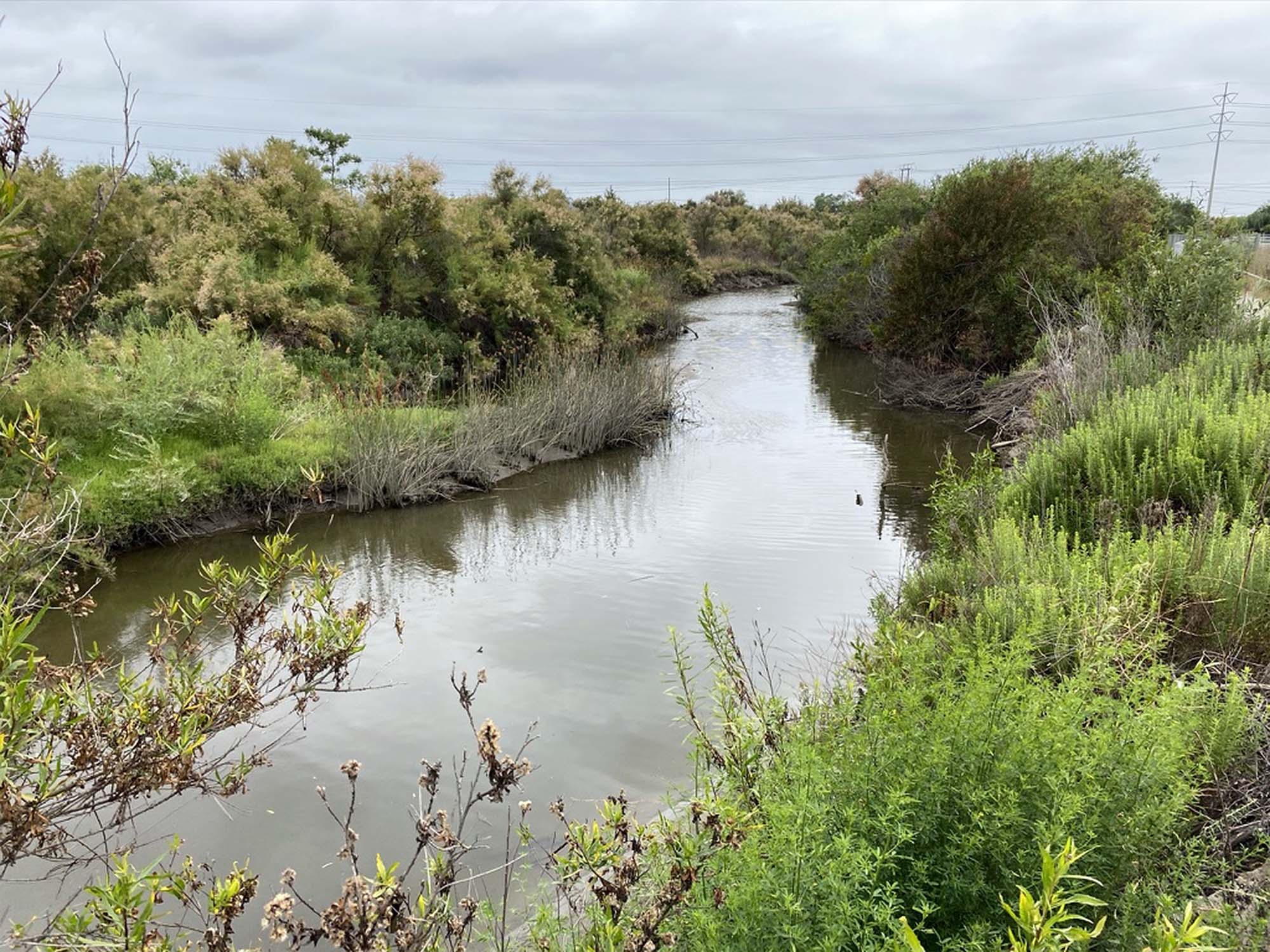 Transition from freshwater marsh to saltwater marsh |
Fig. 27. Salt marsh and tidal flats of the San Dieguito Lagoon area Salt marsh and tidal flats of the San Dieguito Lagoon area |
Fig. 28.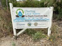 Sign about a salty groundwater desalination project. |
Fig. 29.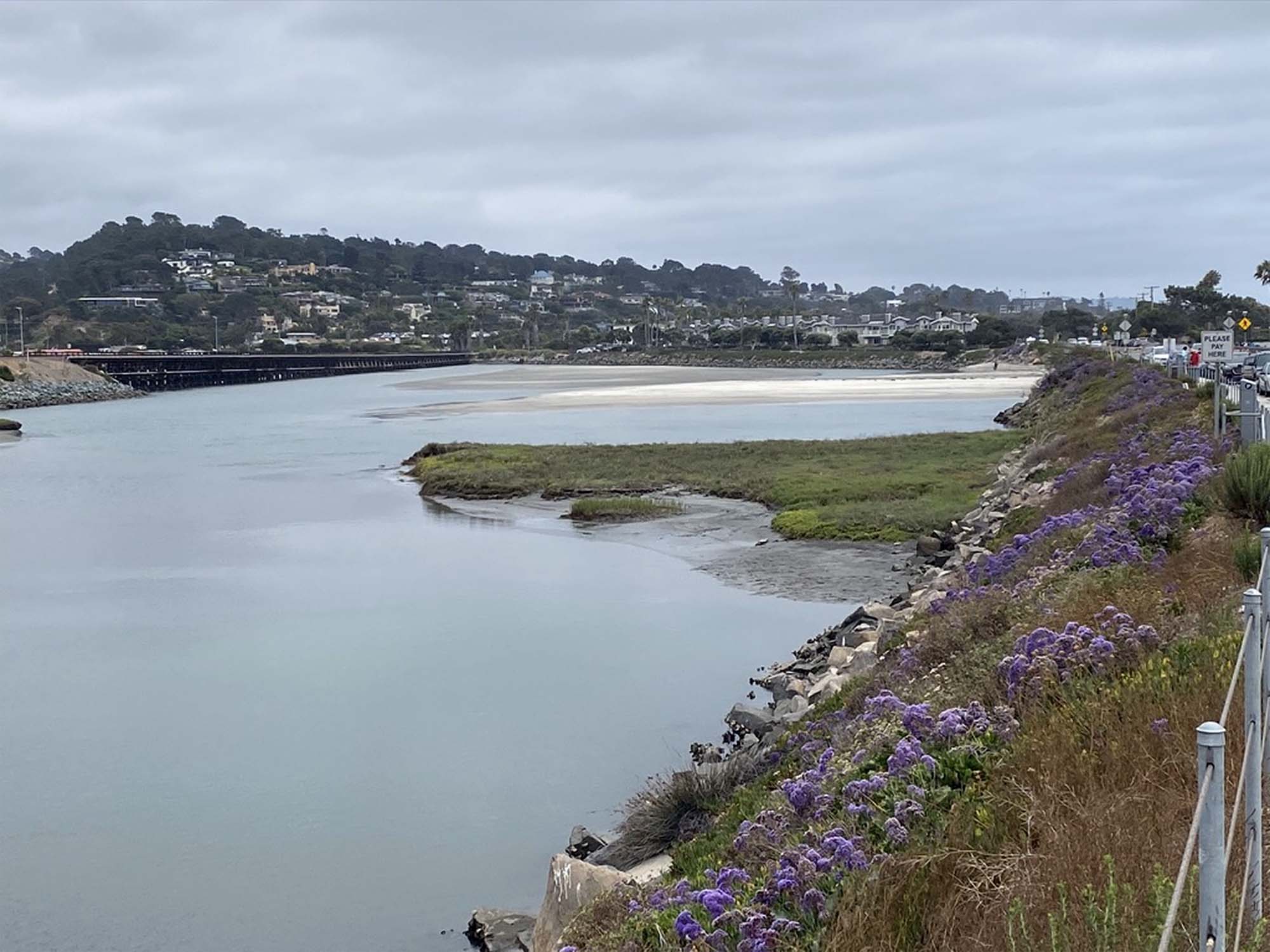 Flood tidal delta between Coast Highway and RR tracks |
Fig. 30.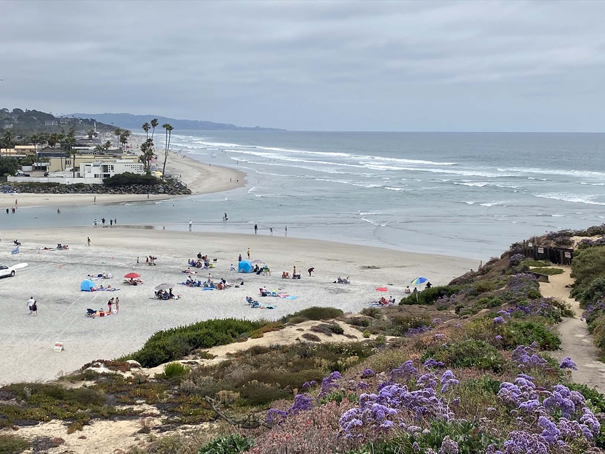 Mouth of San Dieguito River at the Del Mar Dog Beach |
Continue to the next page (Water Conservation).A) Where Does San Diego Get Its Water?B) The Colorado River Drainage Basin C) California's Interconnected Water System D) San Diego County's Natural Water Supply E) The San Dieguito River Watershed F) Water Conservation G) Assignment Tasks & Questions |
| https://gotbooks.miracosta.edu/earth_science/water/San_Dieguito_River_watershed.html | 6/29/2020 |