
California's Interconnected Water System |
California's State Water Project (SWP)California's State Water Project (SWP) was constructed in the 1960s and 1970s. It's system of interconnected reservoirs, canals, aqueducts, pipelines was designed to supply water to more than 27 million people and 750,000 acres of farmland. However today, with almost 40 million residents, California is the most populous state in the United States. California's largest consumer of water is its extensive agriculture industries in the Central Valley and Imperial Valleys. It is now referred to as the California Water System.The California Water System is the world's largest, most productive, and most politically controversial water system in North America and possibly in the world (Figure 2). The political battles involve water rights to the distribution of water for agriculture, urban/municipal usage, and conservation of watersheds to preserve natural ecosystems. Roughly 3/4 of the California's population of about 40 million people rely on water from the California Water System. |
Click on images for a larger view! |
Fig. 1.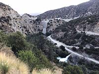 Morris Reservoir Dam in San Gabriel Mountains |
California's Water SupplyData on California's water supply is constantly changing due to variability of weather (and climate). Figure 3 is a map of the average annual precipitation in California. Most of the precipitation falls in northern California (north of Sacramento), but nearly 80% of it is consumed in the southern half of the state.The majority of water consumed in California comes from watersheds (rivers and streams). Roughly 40% comes from sources in California, whereas 60% comes from the Colorado River. These percentages vary considerably year to year. California's water supply comes from two sources: surface water and groundwater. Estimates vary, but roughly 30% of the water consumed comes from groundwater supply, but this amount increases during times of drought. Surface waters are held in reservoirs and diverted into canals and pipelines. Some stream runoff is used to recharge groundwater, however, in many areas groundwater is being pumped faster than the source aquifer can be recharged, resulting in groundwater mining. |
Fig. 2. Map of the California's major components of its water distribution system. |
Fig. 3. Average annual precipitations map of California with rivers, streams, and aqueducts.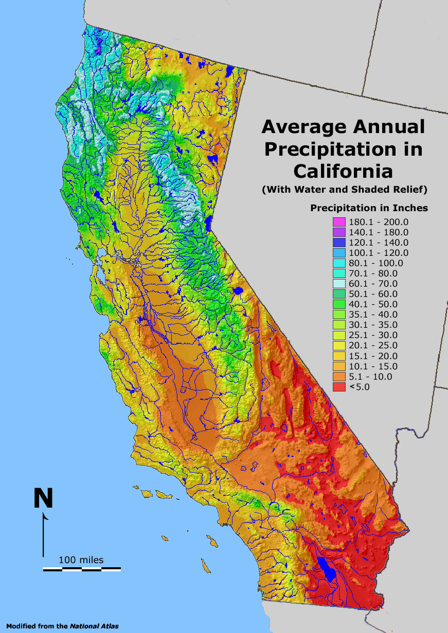 |
Reservoirs and Groundwater Basins |
Fig. 4. Map of groundwater basins in California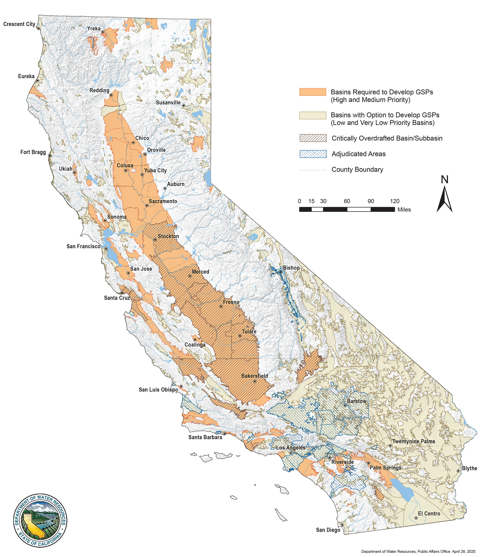 |
| Water flows downhill under the influence of gravity until it meets a barrier; that barrier can be on the surface or underground. Natural lakes can form in places such as where fault motion, volcanic activity, or glaciers create natural depressions that hold surface water. However, most lakes in California are man made. There are nearly 1,500 named dams with 1.300 named reservoirs in the state of California. Whereas a reservoir dam is obvious to see, it isn't easy to see the vast reservoirs that exist underground. Alluvium-filled basins are found in river valleys and between mountain ranges throughout California. Many of these are considered groundwater basins (Figure 4). It is estimated that as many as 515 groundwater basins contribute as much as 38% of California's total water supply. Groundwater basins have advantages and disadvantages over surface reservoirs. One advantage is they can store vast quantities of water without loosing water to evaporation. The problems are that groundwater in some of the desert basins are high in salt concentrations. Also, water pumped into groundwater reservoirs may not be so easy to recover later. Groundwater mining: Unfortunately, groundwater extraction can exceed natural and man made efforts to recharge groundwater basins. The loss of groundwater has resulted subsidence of the land surface and can cause settling problems impacting buildings and infrastructure. Land subsidence from groundwater extraction has impacted many parts of the Central Valley, San Francisco Bay Area, and the Los Angeles Basin regions. |
The California Water System IllustratedThe vast majority of the water consumed in California that isn't taken from the Colorado River is water from the snow melt and precipitation falling on the Sierra Nevada Mountains and Coast Ranges of Northern California (Figure 5). Most of the rivers draining from these regions have been dammed, and their water discharge is closely managed or largely diverted into the network of canals, aqueducts, and pipelines that supply water to California's municipalities and for agriculture. Figures 6 to 10 illustrate some of these massive man-made infrastructure features.Politics and Water in CaliforniaIt can't be understate just how much politics can play when it comes to water resources here in California (and to practically anywhere in the world today with a limited water supply). Managing water is extremely expensive. Just in California, it is estimated that water management agencies spend more than $30 billion every year on water—that is equivalent to about $2,350 per household.The California Department of Water Resources (DWR) and the California State Water Resources Control Board (SWRCB) are the two state government organizations that conduct water research and propose legislation related to water use, infrastructure, and conservation for the state. Figure 11 shows the Hetch Hetchy Valley in Yosemite National Park before and after construction of Hetch Hetchy Reservoir. With widespread environmental destruction in the Sierra Nevada caused by the Gold Rush and logging, conservations fought to preserve what they could, and Yosemite National Park established in 1890. However, the political feud for water and resources did not stop. The Sierra Club was established in 1892 (both as a social and political action organization). However, after a long battle, preservationists lost a fight, and on December 19, 1913, President Woodrow Wilson signed a bill authorizing the Hetch-Hetchy Project. The project's goal of providing safe, clean drinking water to the San Francisco Bay Area. The public outcry led to increased public awareness about protecting scenic and sacred lands. This effort helped establish the National Park Service in 1916. |
||
Fig. 5 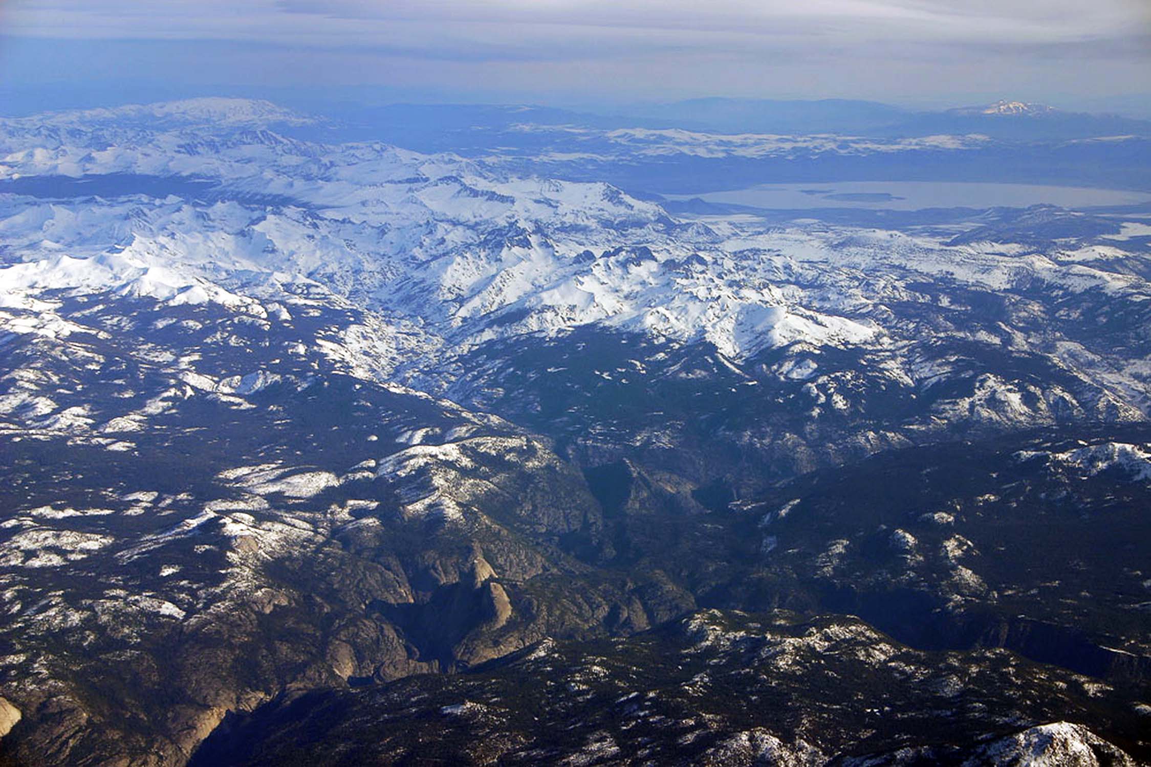 Precipitation (mostly snow) and runoff from the Sierra Nevada Range varies considerably from one year to the next. This airliner view is near Yosemite NP. |
Fig. 6. 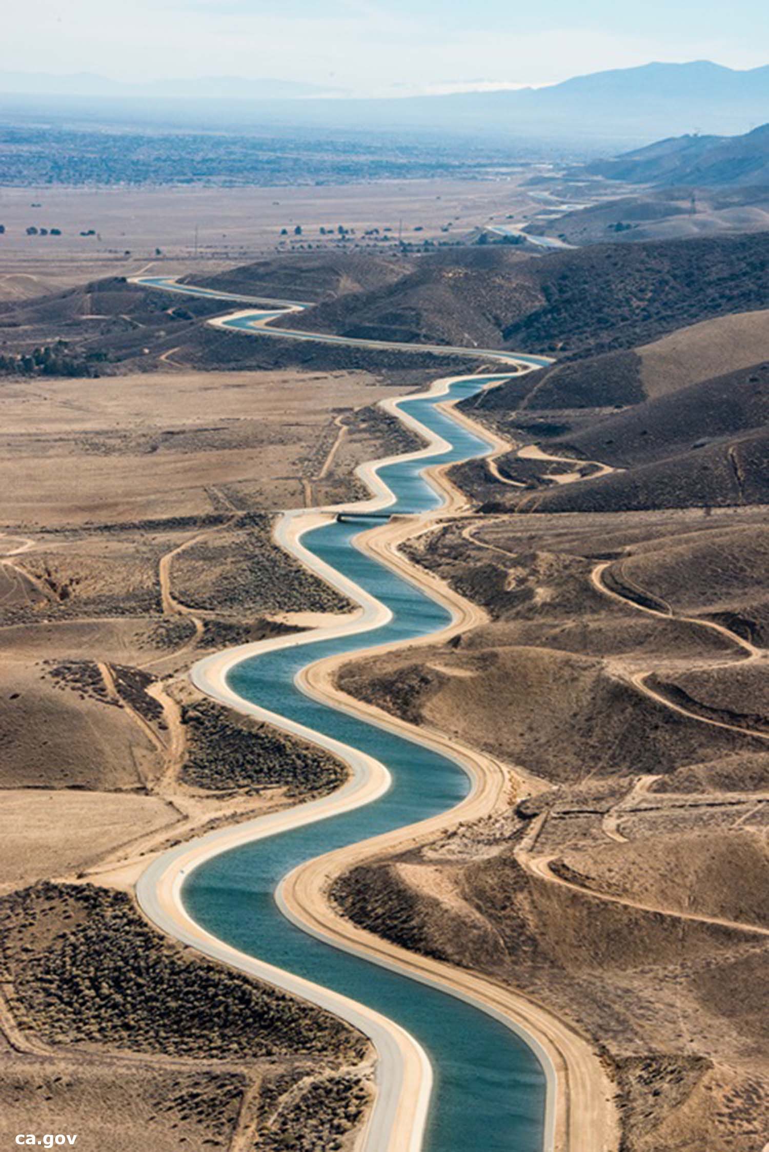 California Aqueduct winds along the foothills near Palmdale. |
Fig. 7. 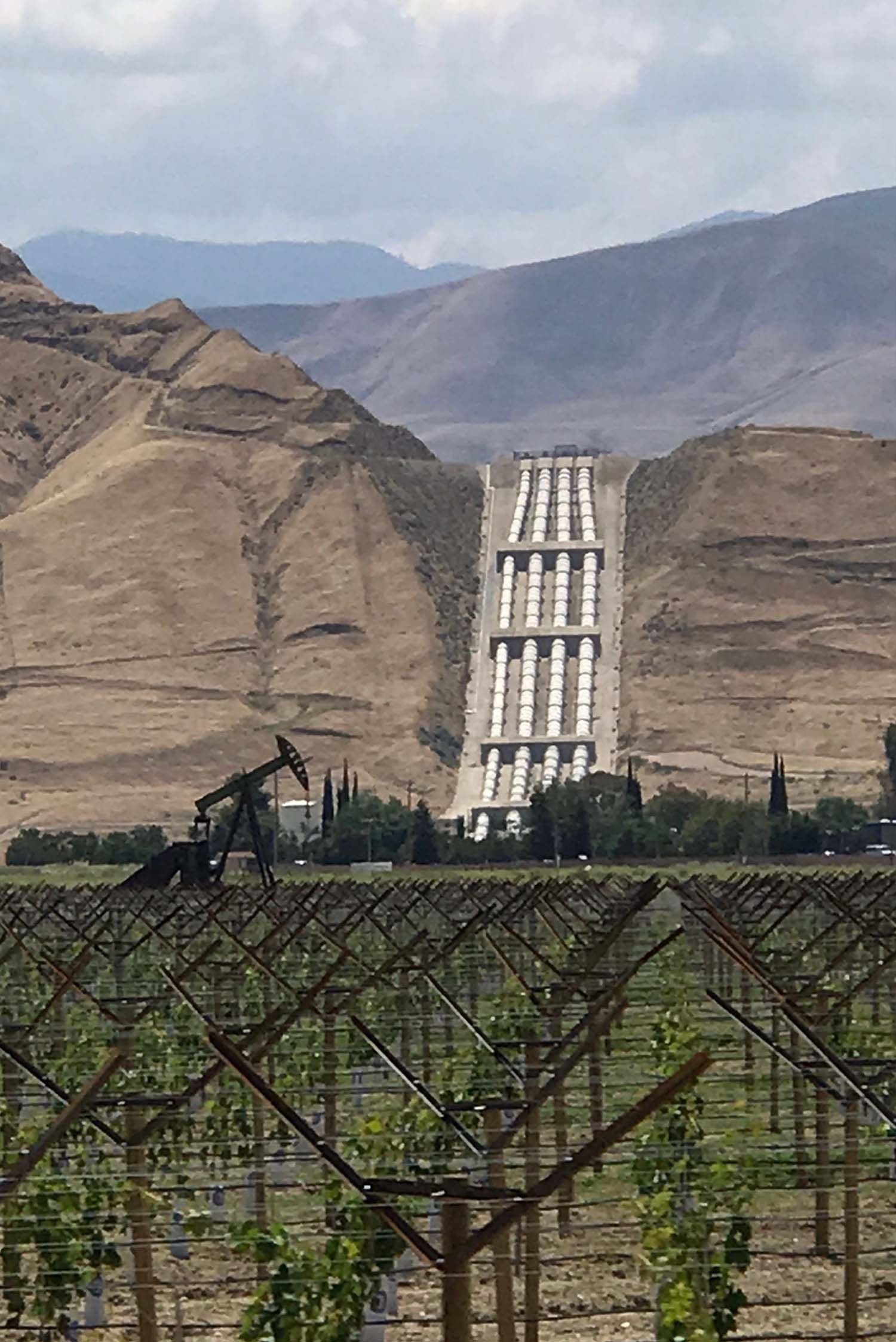 Water from the California Aqueduct gets pumped to Los Angeles. |
Fig. 8. 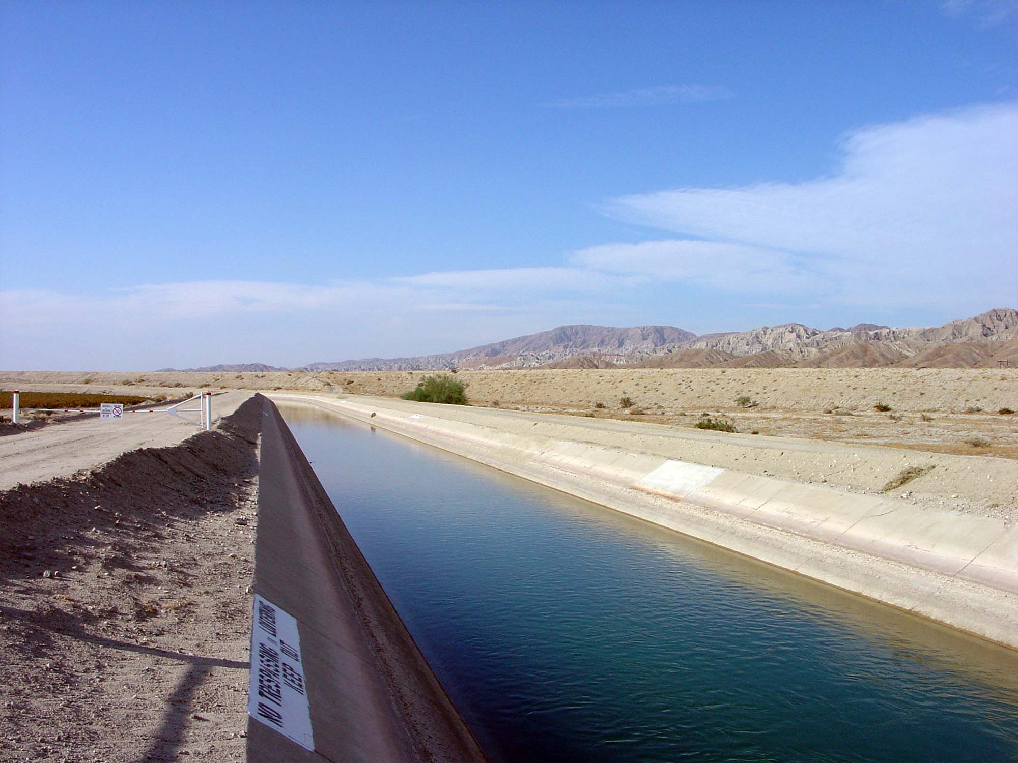 Coachella Canal on east side of Imperial Valley, CA |
Fig. 9.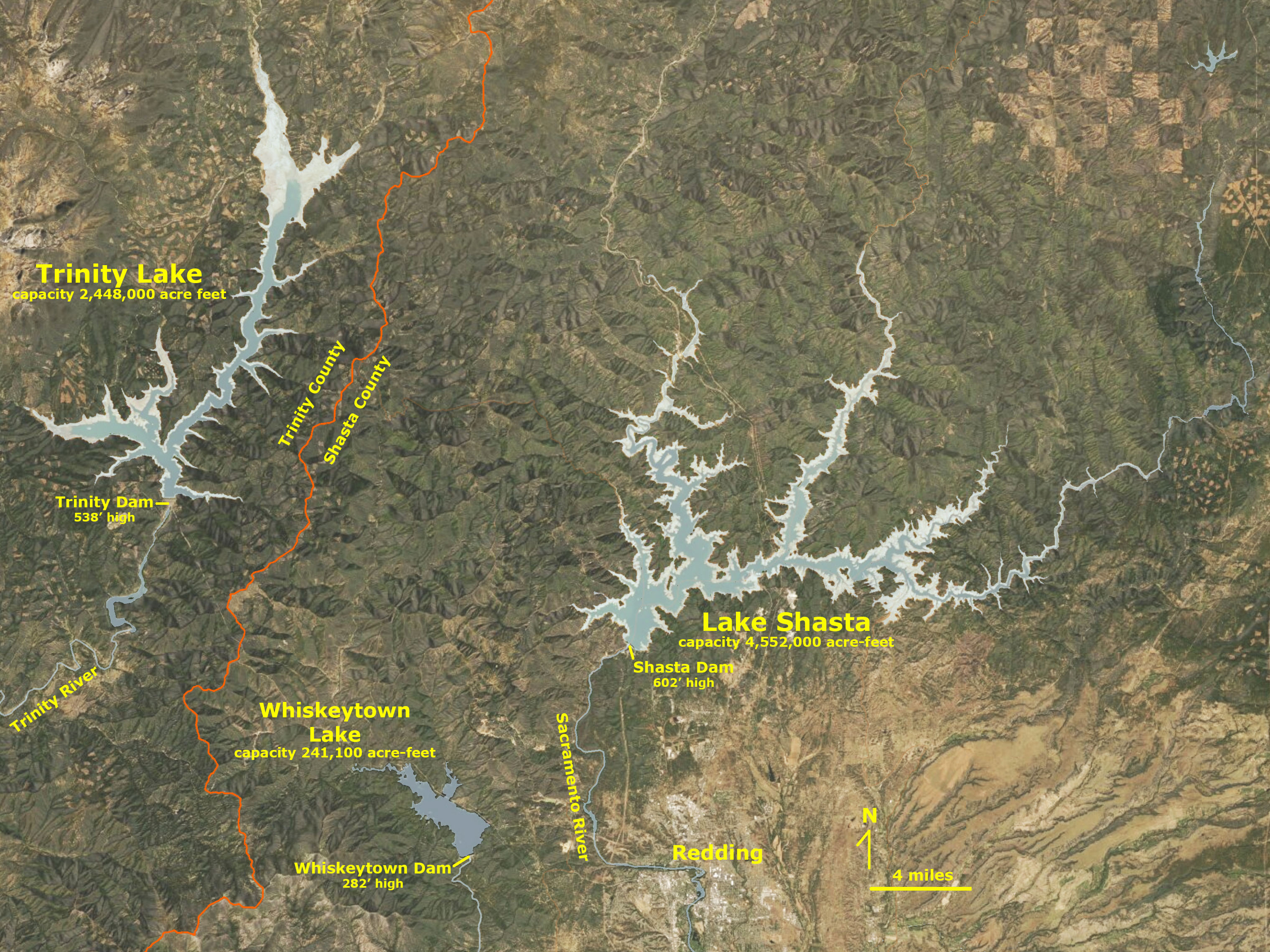 Shasta Lake (largest reservoir) and Trinity Lake (3rd largest) Shasta Lake (largest reservoir) and Trinity Lake (3rd largest) |
Fig. 10. San Luis Reservoir, dam, and fore bay and CA Aqueduct |
Fig. 11. |
Continue to the next page (a look at San Diego County's natural water supply).A) Where Does San Diego Get Its Water?B) The Colorado River Drainage Basin C) California's Interconnected Water System D) San Diego County's Natural Water Supply E) The San Dieguito River Watershed F) Water Conservation G) Assignment Tasks & Questions |
| https://gotbooks.miracosta.edu/earth_science//California_Water_Systems.html | 6/29/2020 |