
The Colorado River Drainage Basin |
The Colorado River - The Major Source of Water For the Southwestern United StatesEstimates vary, but without dams or diversions, the Colorado River in its natural state would dump about 16.5 million acre-feet of water into the Gulf of California each year. However, the last time the Colorado River reached the ocean was in 1998.Prior to the voyage led by explorer John Wesley Powell in 1869 very little was known about the Colorado River and its tributaries. However, over the past century the Colorado River and its tributaries have become perhaps the most managed water-supply system in the world—providing the majority of water to seven southwestern states and parts of Mexico near the Gulf of California (Figures 2 and 3). Historically, the demand for Colorado River water has fueled contentious political debates between between states over water rights. The Federal government has had to step in numerous times to settle disputes, and these debates are likely to continue as western populations continue to grow and climate change continues its current trend to diminish precipitation and snow melt water supply throughout the Colorado River drainage basin region. |
Click on images for a larger view! |
Fig. 1.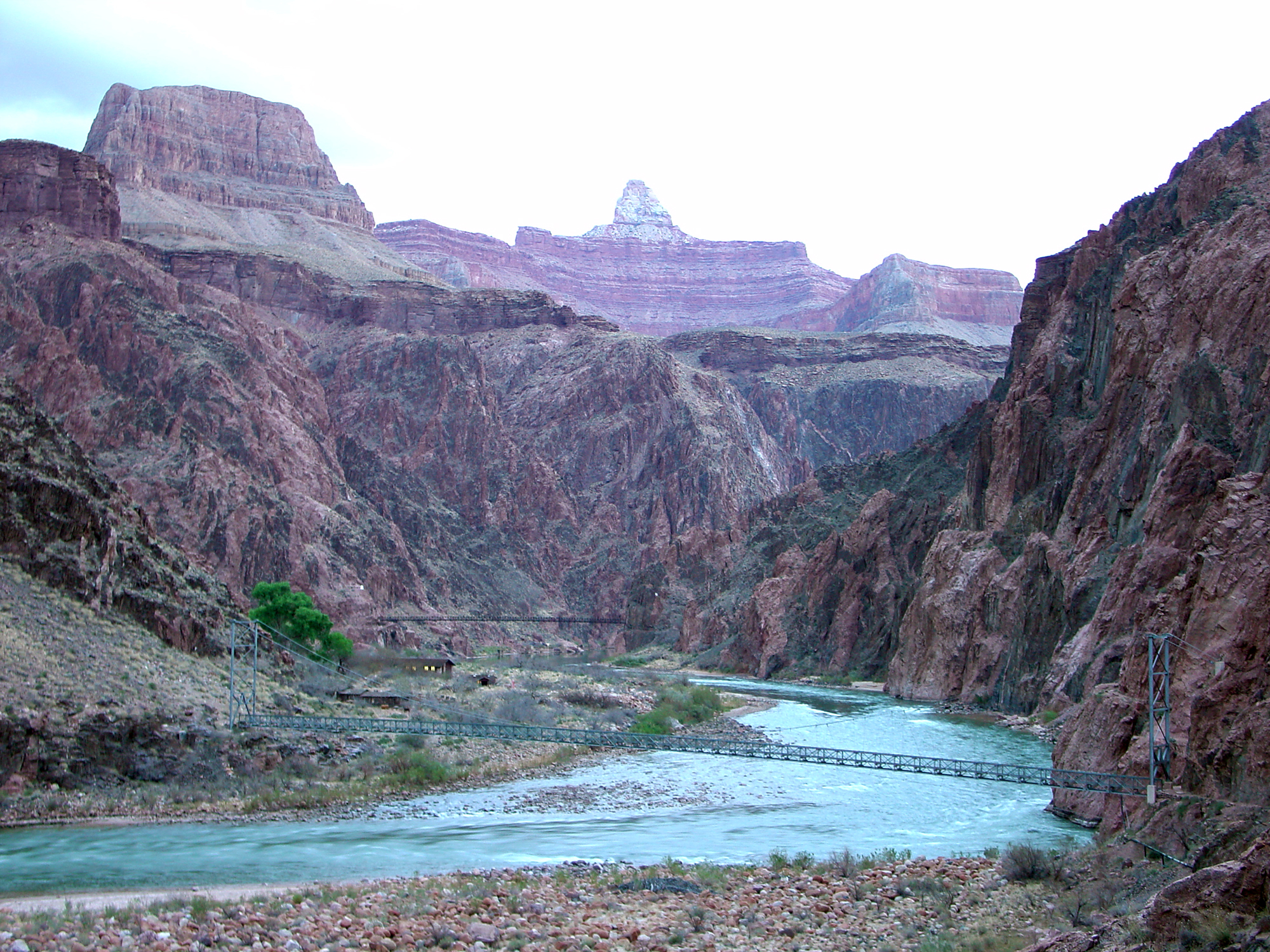 Colorado River in the Grand Canyon at Phantom Ranch |
A Prelude To Water WarsThe U.S. Bureau of Reclamation (USBR) was established in 1902 with the mission to construct and maintain dams, power plants, and canals in 17 western states. Since then, the USBR has constructed more than 600 dams and reservoirs and is the largest wholesaler of water in the country.Whereas the lost battle to save Hetch Hetchy Valley in Yosemite National Park in California may have started the conservation movement in the western United States, an even larger political battle ensued over Colorado River water. Although the Laguna Dam was the first dam on the Colorado River (completed in 1909 to divert water to the Yuma Project in southern Arizona), it was the construction Hoover Dam that really first got the world's attention. |
 Fig. 2. Map of the Colorado River Basin showing river tributaries, dams, and the boundary between the Upper Basin and the Lower Basin. |
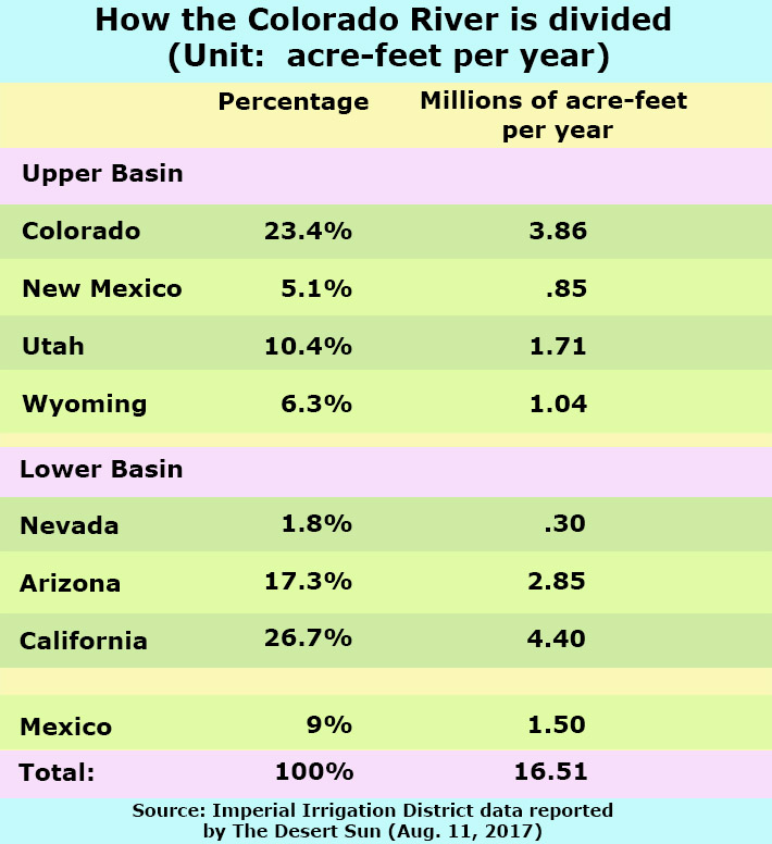 Fig. 3. Annual water allotment for 7 states and Mexico from the Colorado River. |
| As the population of the western state continued to expand, concerns about States' water rights led to negotiations hosted by the federal government. The Colorado River Compact of 1922 determined how seven western states politically divided the Colorado River region into the Upper Colorado River Basin and the Lower Colorado River Basin (Figure 2). The division point is at Lees Ferry, a point along the Colorado River about 30 river miles south of the Utah-Arizona boundary, just downstream of Glen Canyon Dam. Figure 3 shows how Colorado River water is currently alloted to the seven states and Mexico. Hoover Dam (originally called Boulder Dam) was first proposed to Congress in 1922, but construction of the dam didn't begin until 1931 when it was promoted and justified largely as a public-works project during the Great Depression era. Arizona once actually declared war against California over Colorado River water! It is an interesting story. Backed by the political forces in California, the U.S. Bureau of Reclamation began construction of Parker Dam in 1934 in support of diverting water to the California Aqueduct. Provoked by California's perceived aggression, the governor of Arizona, Benjamin Moeur, declared Marshall Law and dispatched 100 National Guard troops to stop construction of the dam. Hot weather and logistical fiascoes ensued, and no shots ended up being fired. However, construction of the dam was delayed for a year. This event forced the federal government to get even more involved in settling water disputes between states. The controversy surrounding dam construction on the Colorado River and its tributaries intensified with the establishment of the Colorado River Storage Project (CRSP) managed by the U.S. Bureau of Reclamation. CRSP had the mission to build a massive system of six reservoirs throughout the Upper Colorado River Basin. The Sierra Club and other conservation organizations successfully stopped construction of a dam in Dinosaur National Monument, but lost the fight to prevent construction of Flaming Gorge Dam. Likewise, efforts to stop construction of a dam in the Grand Canyon and another below the Confluence of the Green and Colorado Rivers were successful, but efforts failed to prevent construction of Glen Canyon Dam. However, it helped lead to the establishment of Canyonlands National Park and expansion of the boundaries of Grand Canyon National Park. |
||
Colorado River Basin Image Tour |
| The gallery of text and images below illustrates the landscape, scenic features, and infrastructure along the Colorado River and its tributaries between the headwaters region in Colorado and Wyoming to where it drains (or used to drain) onto the Colorado River Delta in Mexico at the north end of the Gulf of California. Many part of the Colorado River are associated with national parks, monuments, and national recreation areas (Figure 4). |
The Upper BasinHeadwaters of the Colorado RiverThe Headwaters of the Colorado River start along the Continental Divide in the Front Range of the Rocky Mountains of Colorado (Figure 5). Colorado is host to 58 mountain peaks that reach over 14,000 feet in elevation. The height of Colorado's mountain ranges ensures that large amounts of precipitation (mostly snow) accumulates in the high country, feeding an abundance of streams that coalesce into the main drainage, the Colorado River. The Colorado River official source is La Pourde Pass Lake located in Rocky Mountain National Park (see map Figure 7).There are numerous dams with reservoirs on the Colorado River's tributaries in the High Country. Lake Granby is on the Colorado River, and Dillon Reservoir is on the Blue River that merges with the Colorado River near Kremmling, Colorado (Figure 7).The largest is Blue Mesa Reservoir on the Gunnison River that merges with the Colorado River near Grand Junction, Colorado. The Gunnison River is one of the principal tributaries of the Colorado River. Downstream of Grand Junction, the Colorado River leaves the Rocky Mountains and enters the canyonlands of the Colorado Plateau. Near the Utah border, the Colorado River enters Westwater Canyon (Figures 8 and 9). As the river drains southward it flows past Arches National Park before passing through Moab, Utah. Downstream of Moab, the river enters Cataract Canyon in Canyonlands National Park where it merges with the river's principal tributary, the Green River. |
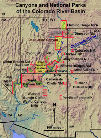 Fig. 4. Map of national parks in the region. |
|
| Click on locations on the map (Figure 4) to open up websites with more detail of rational parks. | ||
Fig. 5  Headwaters region in Rocky Mountain National Park, CO |
Fig. 6 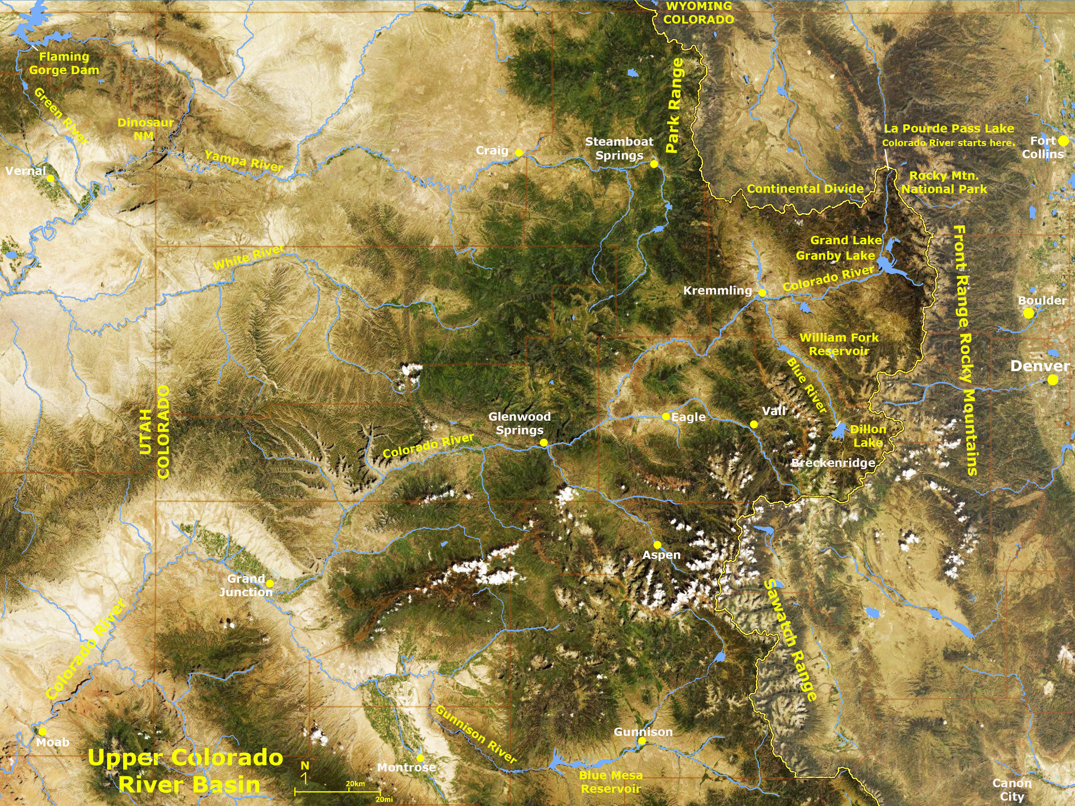 Headwaters region of the Colorado River (satellite view) |
Fig. 7 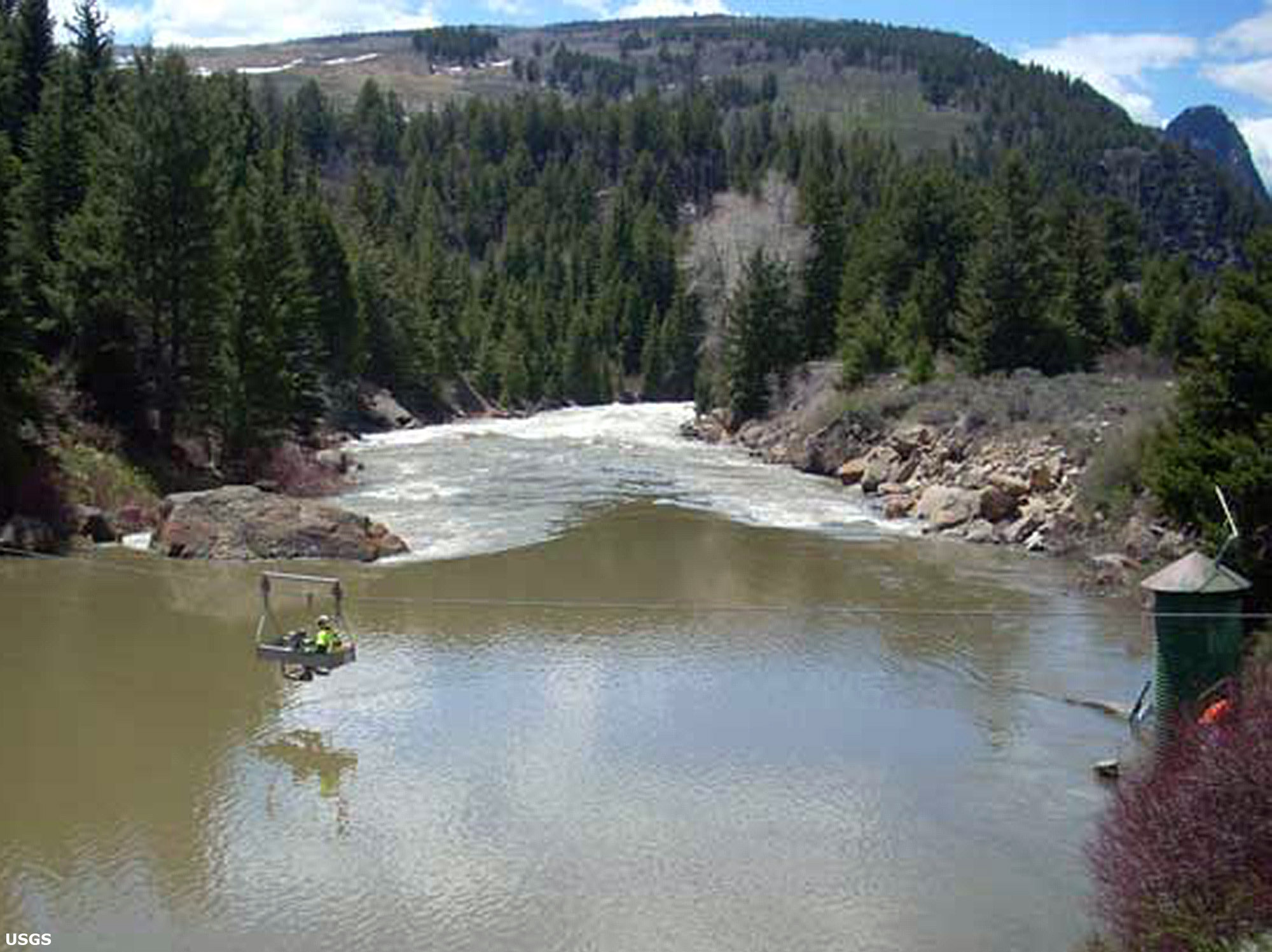 Colorado River near Kremmling, Colorado |
Fig. 8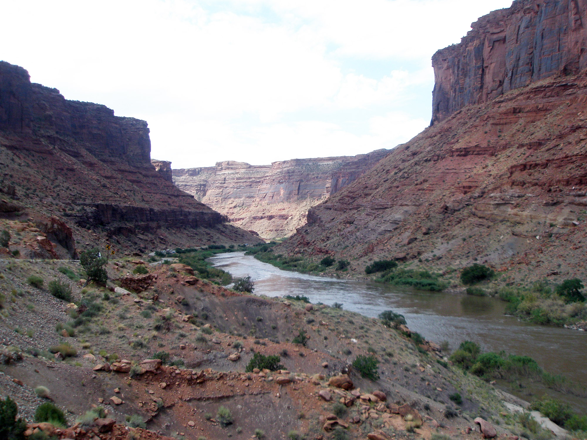 Colorado River in Westwater Canyon above Moab Utah |
Fig. 9 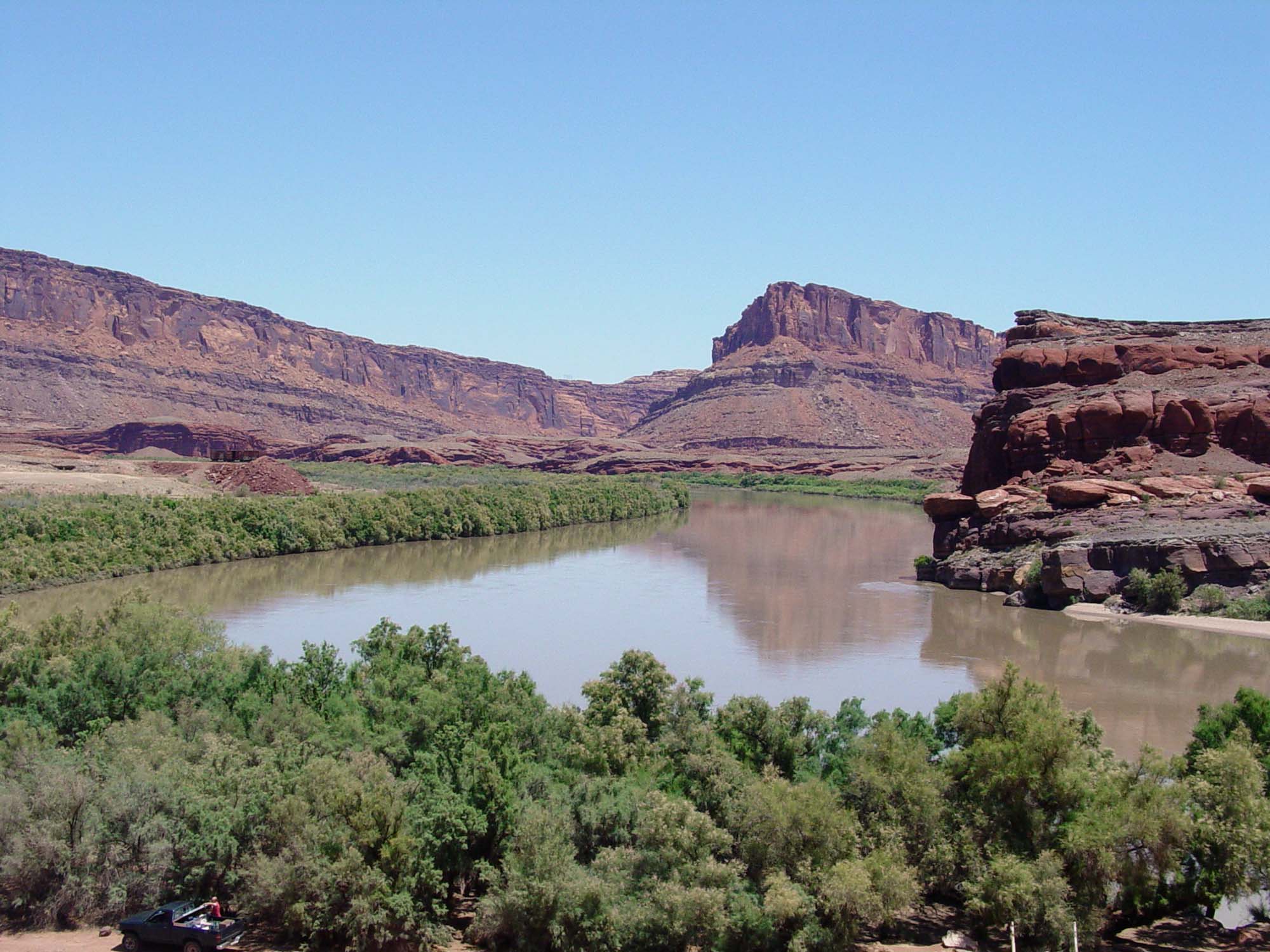 Colorado River below Moab above Cataract Canyon |
The Green River - Colorado River's Principal TributaryThe Green River is the largest (principal) tributary of the Colorado River. The headwaters of the Green River are in the Wind River Mountains of Wyoming. As one of largest and highest mountain ranges in the state, it receives abundant precipitation, mostly as snow in the winter months. During the ice ages, large alpine glaciers created large moraine-dammed lakes along the flanks of the mountain range. These lakes are the source of many of the headwater tributaries of the Green River (see map in Figure 10). The Green River flows southward through the Green River Basin (a mostly arid high grasslands region) before it cuts through the eastern flank of the Uinta Mountains along the Utah-Wyoming border. Flaming Gorge Dam, 502 foot-high thin-arch concrete dam was completed in 1962 (see Figure 11; Flaming Gorge Reservoir is visible in the northwest corner of Figure 6; it is within Flaming Gorge National Recreation Area). South of the dam the Green River flows through Red Canyon in the Uinta Mountains and Dinosaur National Park before entering the Colorado Plateau canyon country of the eastern Utah (see Figure 6). As it flows southward it passes through Desolation, Gray, Labyrinth, and Stillwater Canyons. Plateau where it merges with the Colorado River in Canyonlands National Park (Figure 13). Figure 14 is an aerial view the confluence of the Green and Colorado Rivers. Note that in this image the Green River (on the left) appears reddish, whereas the Colorado River (on the right) appears greenish! This is because red sediments were eroded into the Green River from storm waters in its upper drainage basin when this photo was taken. South of the confluence, the Colorado River flows through Cataract Canyon and into eventually into Lake Powell. |
Fig. 10 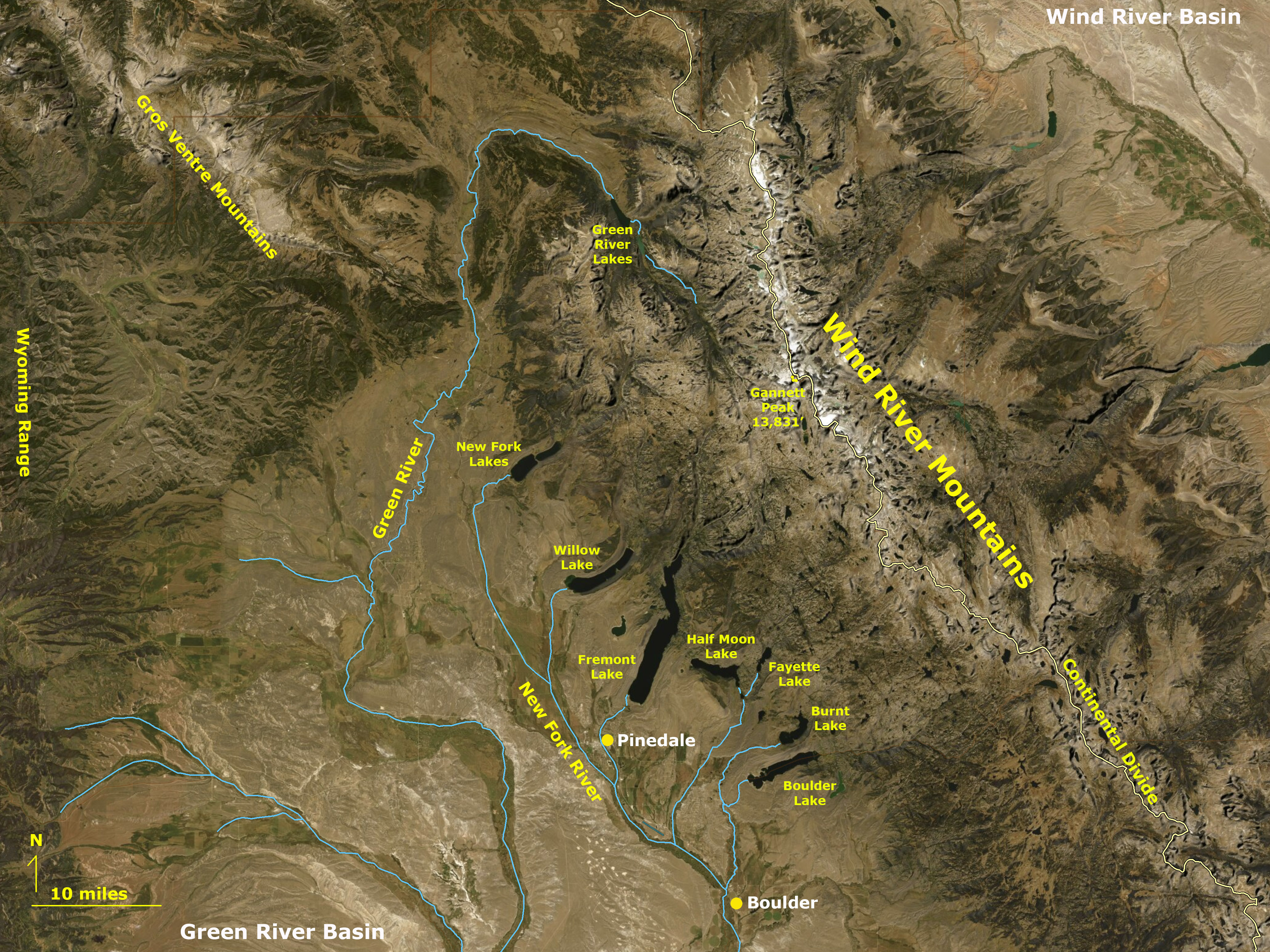 Green River Lakes, Wyoming, headwaters of the Green River |
Fig. 11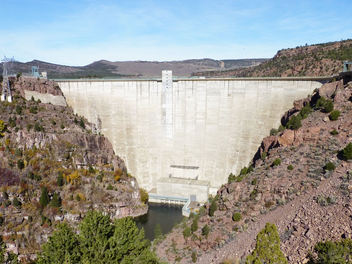 Flaming Gorge Dam on the Green River (northern Utah) |
Fig. 12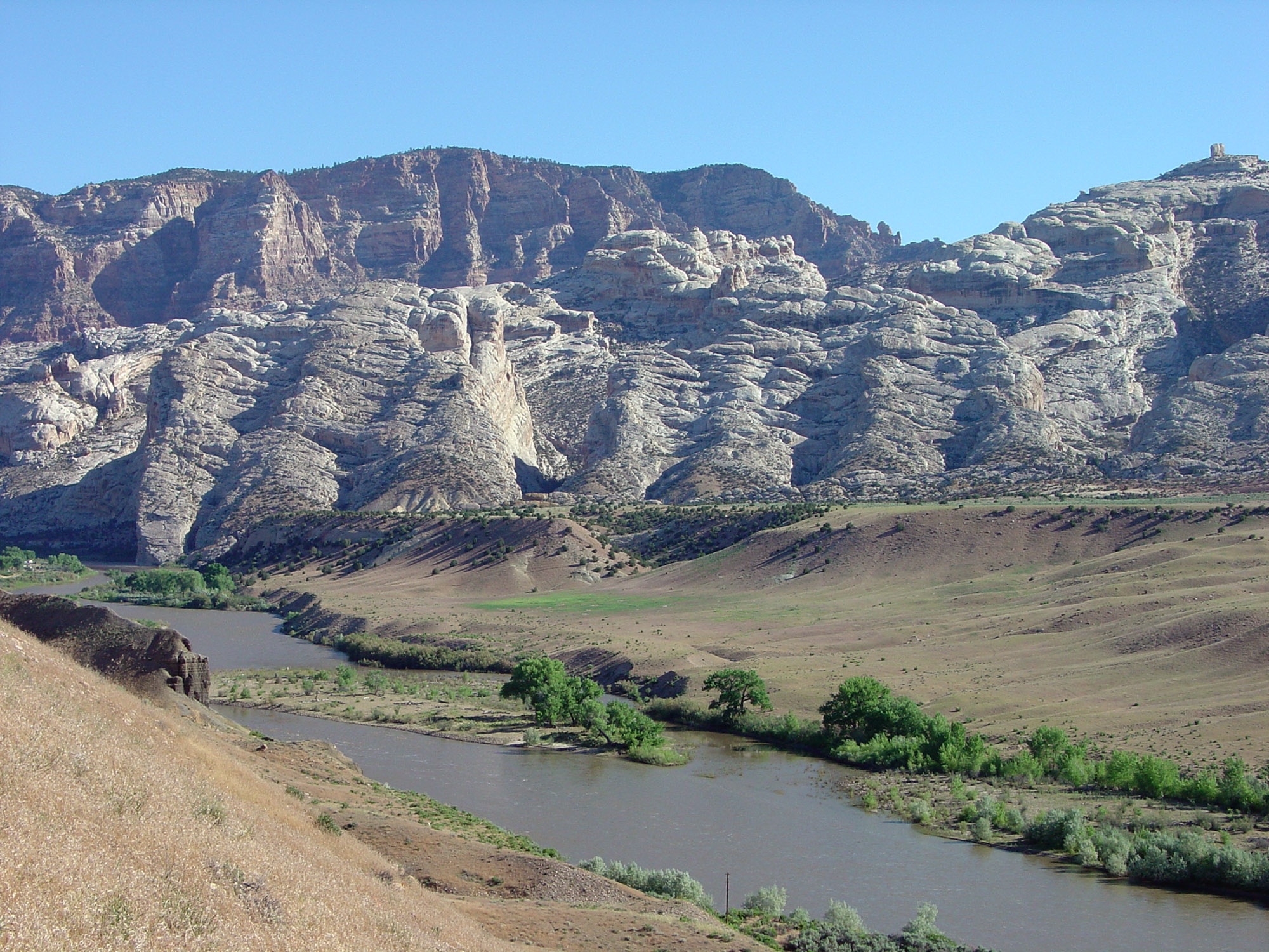 Green River in Dinosaur National Monument, Utah. |
Fig. 13 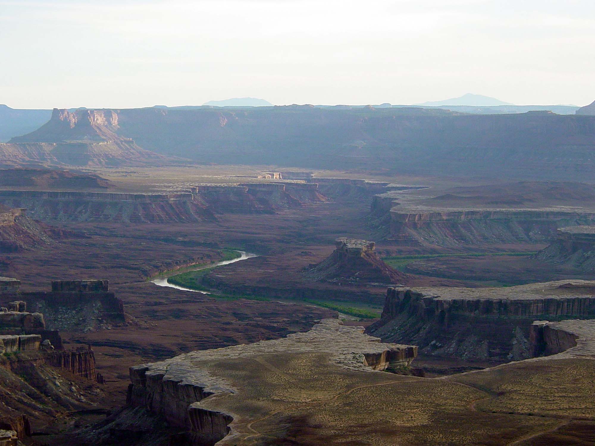 Green River in Canyonlands National Park, Utah |
Fig. 14 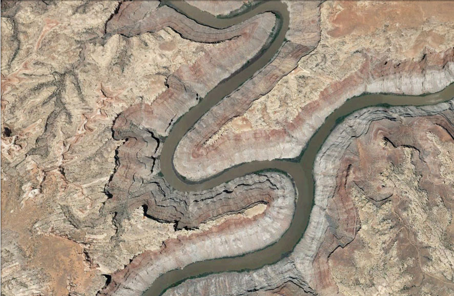 Confluence of the Green and Colorado Rivers, central Utah |
Colorado River on the Southern Colorado PlateauFigure 15 is a satellite map of the southern Colorado Plateau region and shows the path of the Colorado River through Canyon Country from near the Utah/Colorado border to the Arizona/Nevada border. The San Juan River is the second principal tributary that flows into the Colorado River (Figure 16). The headwaters of the San Juan River drains from the San Juan Mountains region of southwestern Colorado into the Colorado Plateau region of northwestern New Mexico and southeastern Utah before draining into Lake Powell. Along its journey, the San Juan River has carved a series of entrenched meanders creating a sinuous canyon called the Goosenecks of the San Juan (Figure 17). Lake Powell Reservoir has flooded the confluence of the San Juan and Colorado Rivers. Downstream of this confluence "was" Glen Canyon. Glen Canyon is now mostly submerged beneath Lake Powell (Figure 18). The maximum water level in Lake Powell was contested in court to prevent it from flooding Rainbow Bridge, a sacred landscape feature to regional Indian tribes and also a national monument; It is now located on the shoreline of Lake Powell (Figure 19). |
Fig. 15 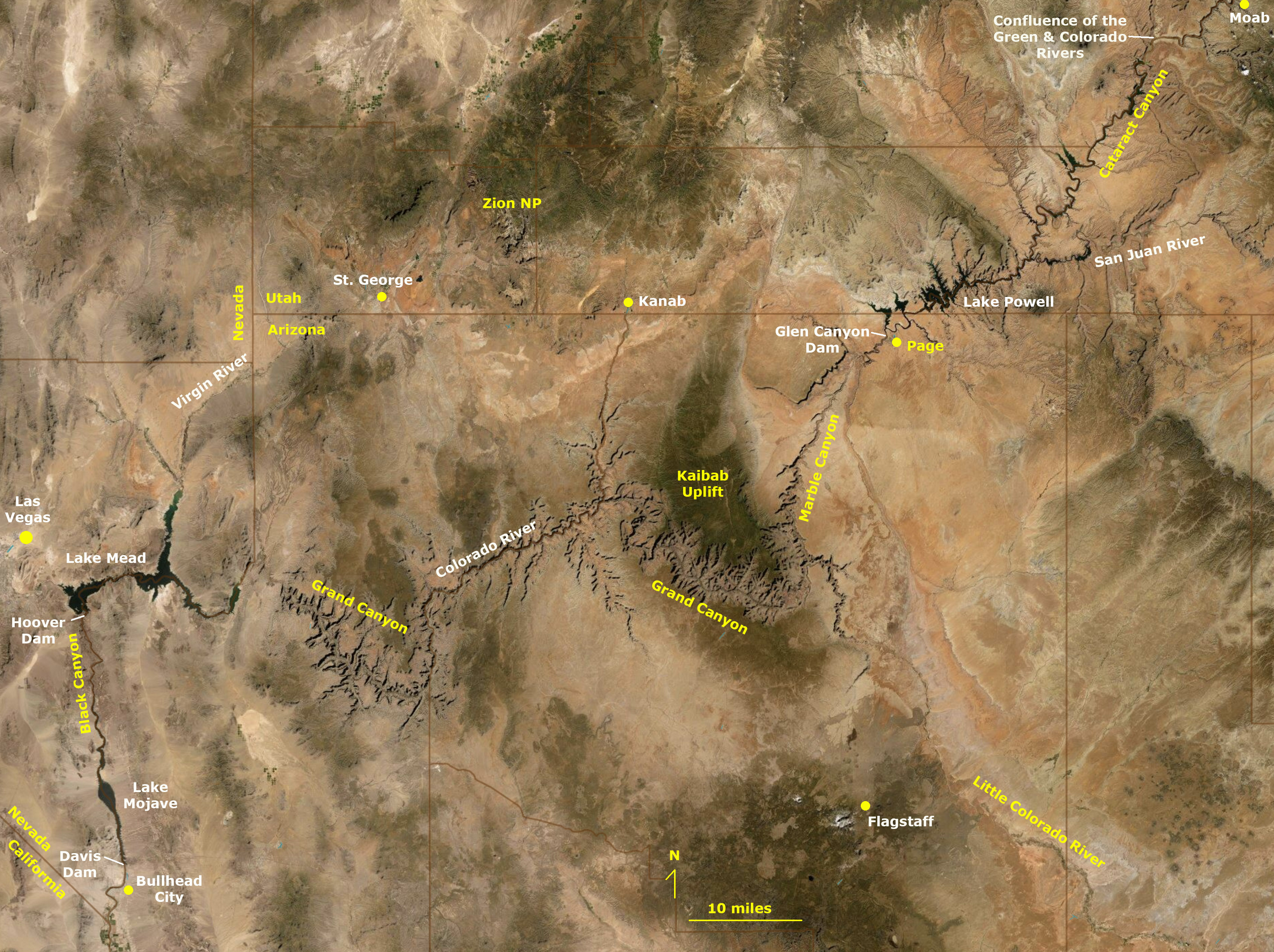 Colorado River canyons of Utah, Arizona, & Nevada |
Fig. 16 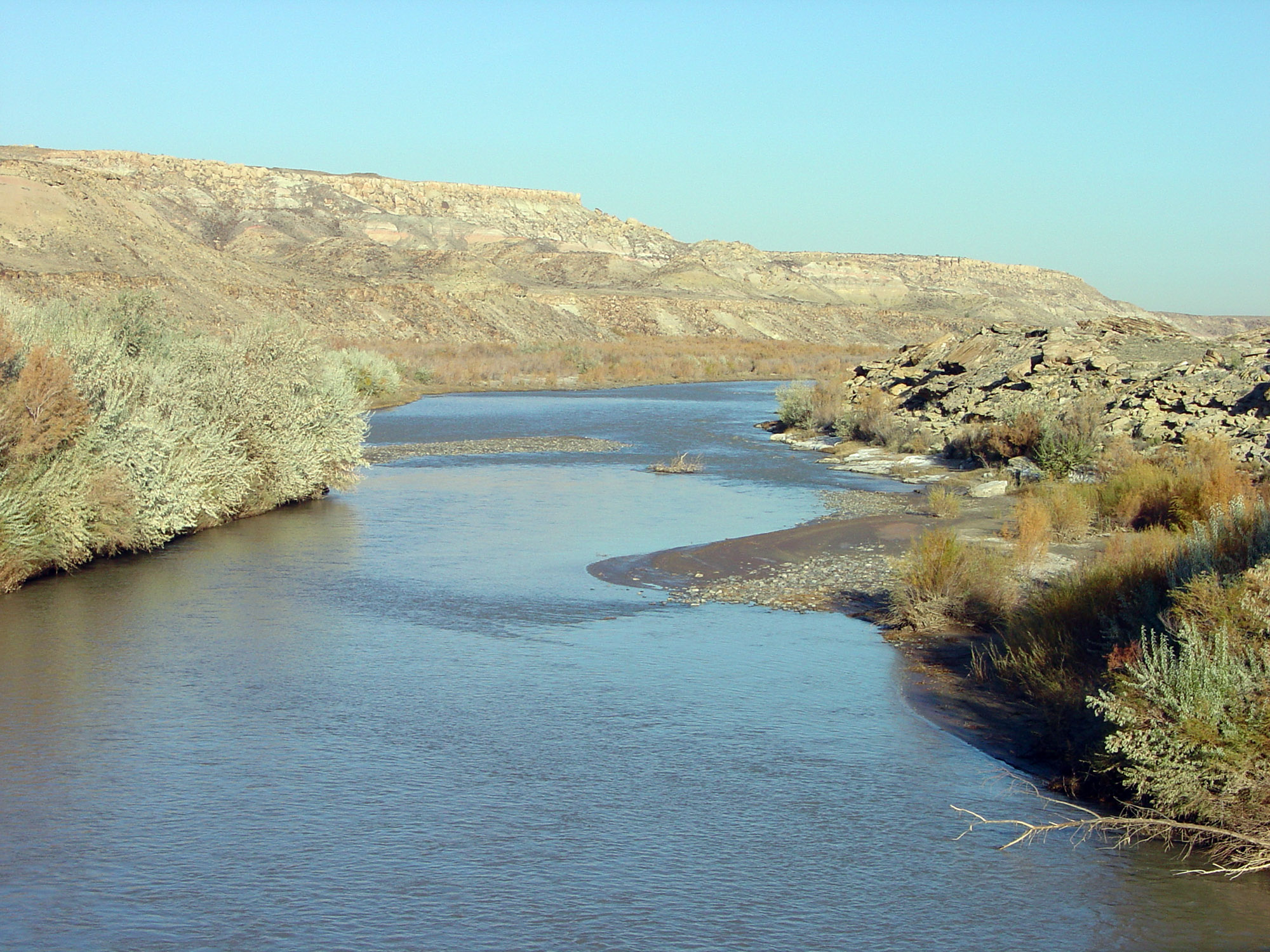 San Juan River near Bluff, southeast Utah |
Fig. 17 |
Fig. 18  Lake Powell near Utah/Arizona border |
Fig. 19  Rainbow Bridge along the south shore of Lake Powell. |

The Lower BasinLees Ferry, The Political Divide Between the Upper and Lower Colorado River BasinsGlen Canyon Dam was completed in 1963 creating what became the world's largest man-made lake (Figure 20). Glen Canyon Dam is a 710-foot high dam build by the U.S. Bureau of Reclamation. Lake Powell was opened in 1966 but the 27,000,000 acre-feet reservoir did not fill to capacity until 1980. A large amount of the water soaked into the porous sandstones layers along the canyon. Lake Powell was named after explorer John Wesley Powell whose crew first traversed the Green and Colorado Rivers in 1869. (He later became 1st director of the U.S. Geological Survey; click here to see stereographic photography conducted by the Powell Survey in 1870-71.) The operation of Glen Canyon Dam is intended to ensure the equitable distribution of water between states of the Upper Colorado River Basin (Colorado, New Mexico, Utah, and Wyoming) and the Lower Colorado River Basin (Arizona, California, Nevada, and Mexico)(see Figure 2). The boundary between the Upper and Lower basin is at Lees Ferry, Arizona (Figure 21).Lake Powell is within Glen Canyon National Recreation Area. Part of Glen Canyon is preserved (exposed) downstream of Glen Canyon Dam (Figure 20). Glen Canyon extends downstream to Lees Ferry Crossing located at a natural break in the canyon walls where the Paria River enters the Colorado River. Downstream of Lees Ferry, the Colorado River enters Marble Canyon (bordered on the east by the Navajo Indian Reservation and Grand Canyon National Park to the west; Figures 22 and 23). Marble Canyon extends downstream to the confluence of the Little Colorado River that marks the beginning of the Grand Canyon (Figure 24). Note the blue color of the water in the Little Colorado River. This is due to the high concentration of dissolve mineral salts in the river water. |
Fig. 20 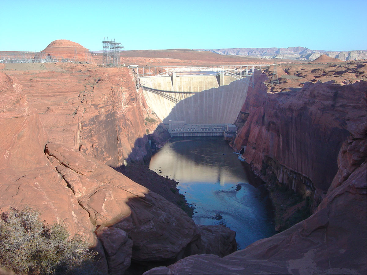 Glen Canyon Dam (Arizona) below Lake Powell |
Fig. 21 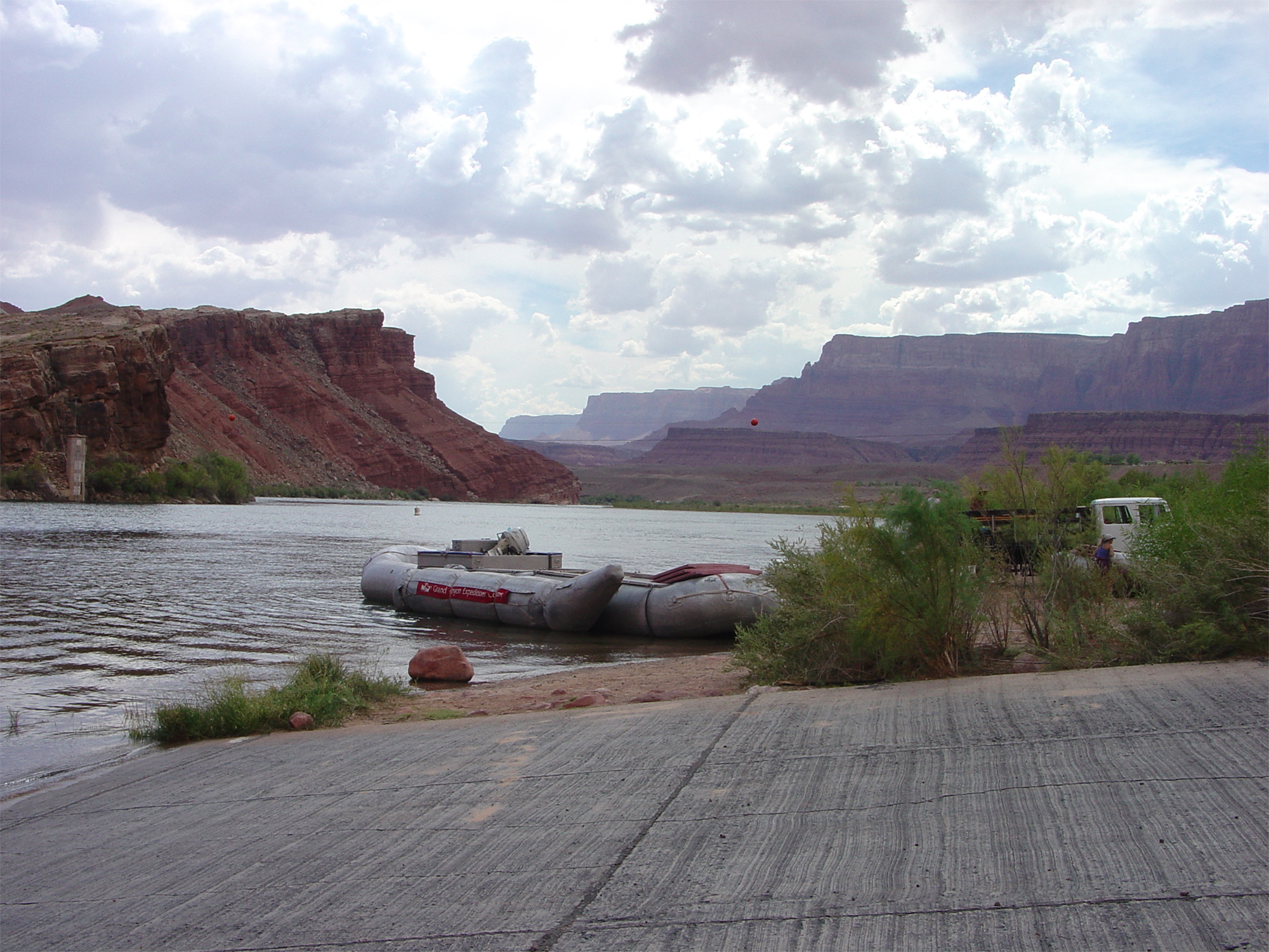 Lees Ferry Crossing on the Colorado River, Arizona |
Fig. 22 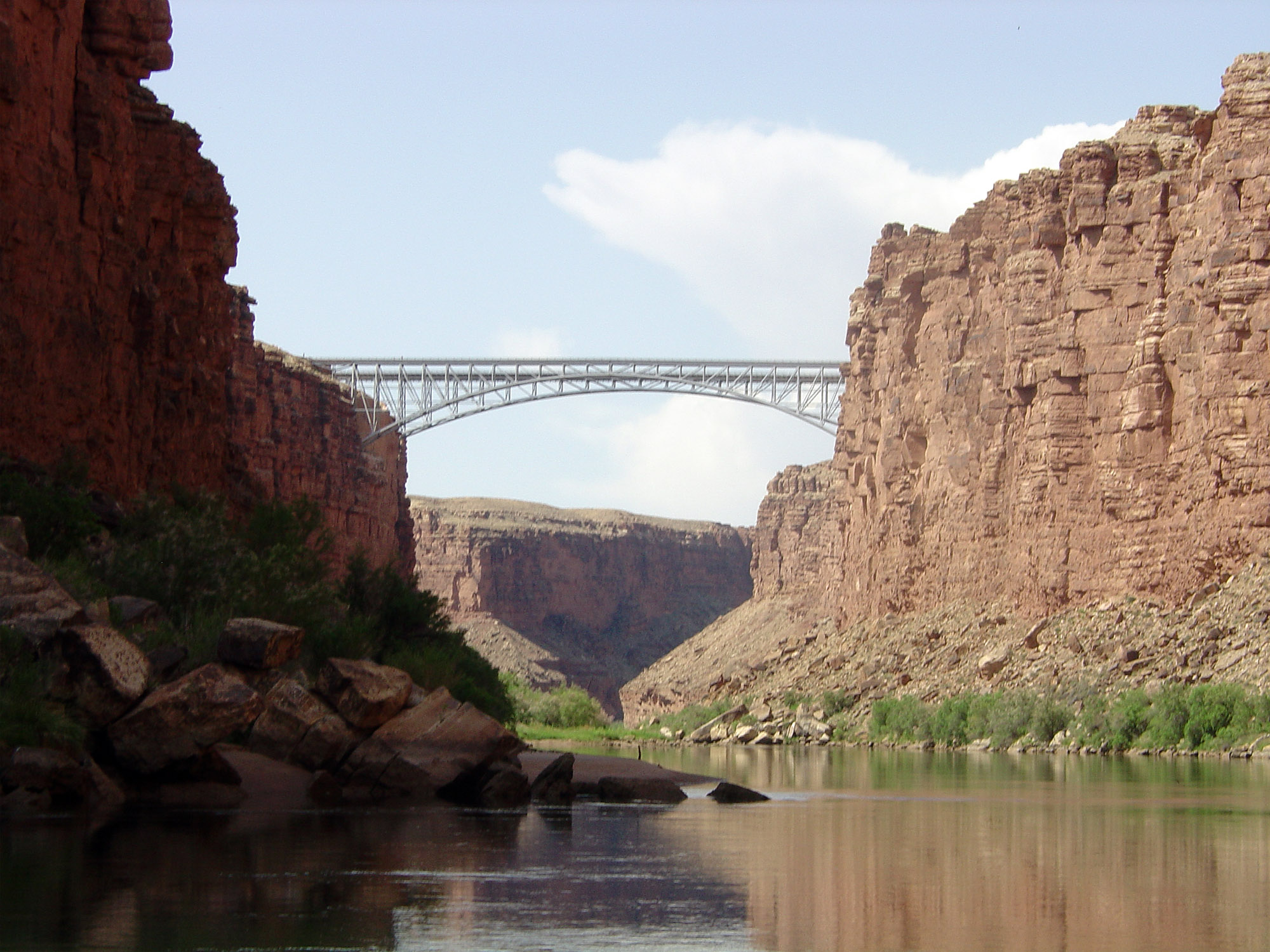 Navajo Bridge below Lees Ferry in Marble Canyon |
Fig. 23 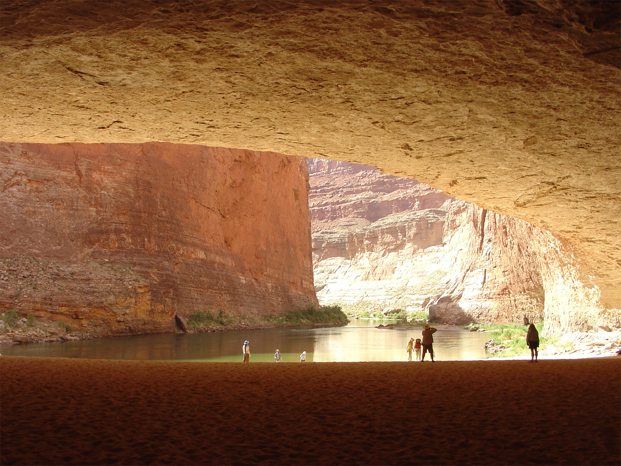 Redwall Cavern along the river in Marble Canyon |
Fig. 24  Little Colorado River near confluence with Colorado R. |
The Grand Canyon of the Colorado RiverColorado means red in Spanish. The Colorado River, which has had many names (Indian and Spanish), was called the Grand River (in English), and then officially named the Colorado River in 1913. John Wesley Powell used the name Grand River in the description of his river journey, and hence the name Grand Canyon (and Grand Canyon National Park). The Grand Canyon cuts through the Kaibab Uplift (a great folded arch of strata (see Figure 15). The deep canyon exposes nearly a mile thick sequence of Paleozoic age sedimentary rocks above even older Precambrian-age sedimentary rocks (Figure 25). The oldest rocks are Precambrian-age igneous and metamorphic crystalline rocks are exposed in the Inner Gorge portion of the canyon (most notably seen in the vicinity of the river crossings at Phantom Ranch; Figures 26 to 28). At the western end of the Grand Canyon there are a number of volcanoes that spilled lava flows into the canyon during the recent ice ages. Geologists have studied these volcanic flows and determined that they may have blocked the flow of the Colorado River with natural dams that rivals the modern man-made dams. Remnants of these ancient flows are preserved along the walls of the lower Grand Canyon. Figure 99 shows Lava Falls, the largest rapid in the Grand Canyon that is associated with one of these ancient lava flows. |
Fig. 25 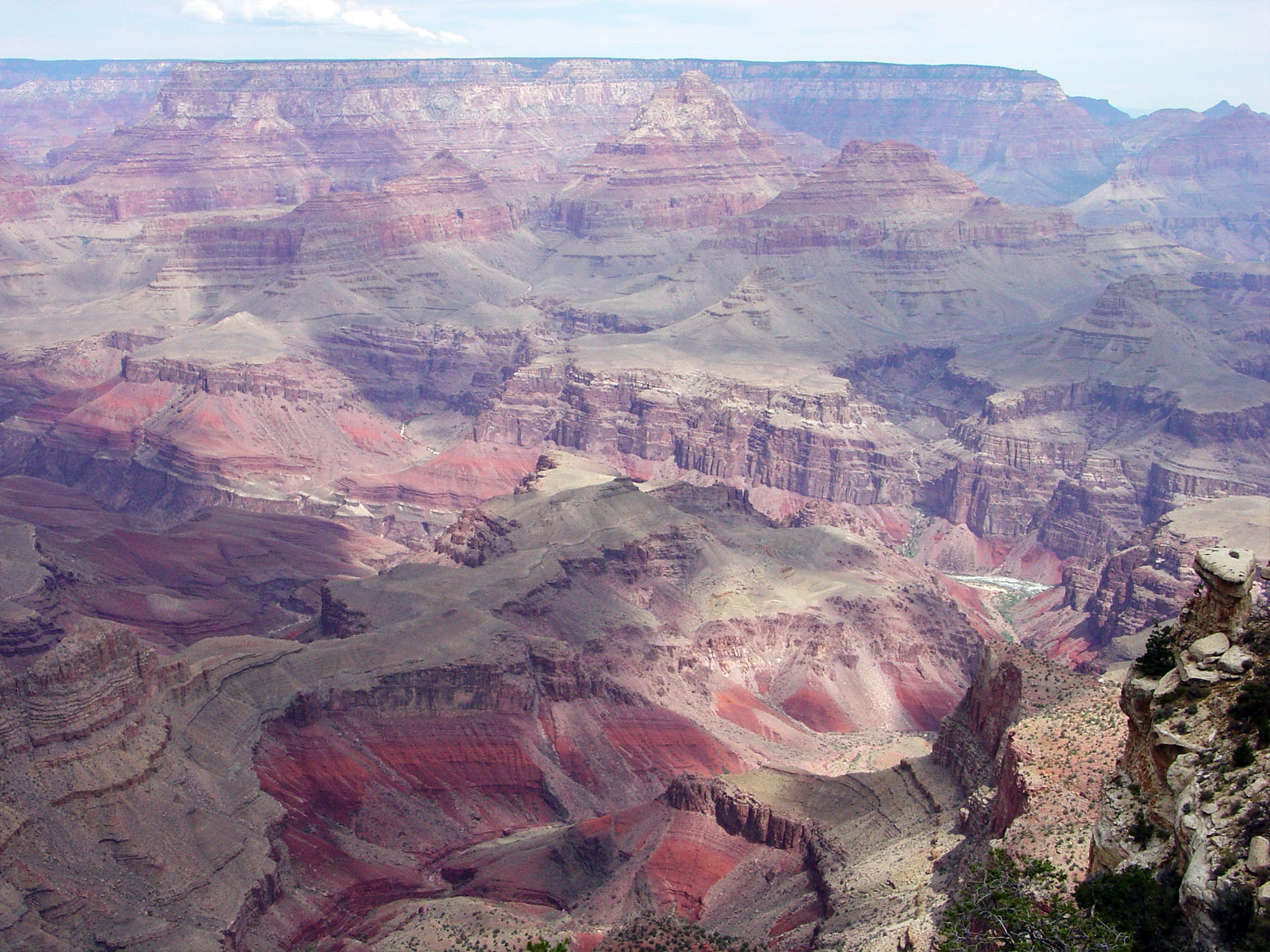 Colorado River at the eastern end of the Grand Canyon |
Fig. 26 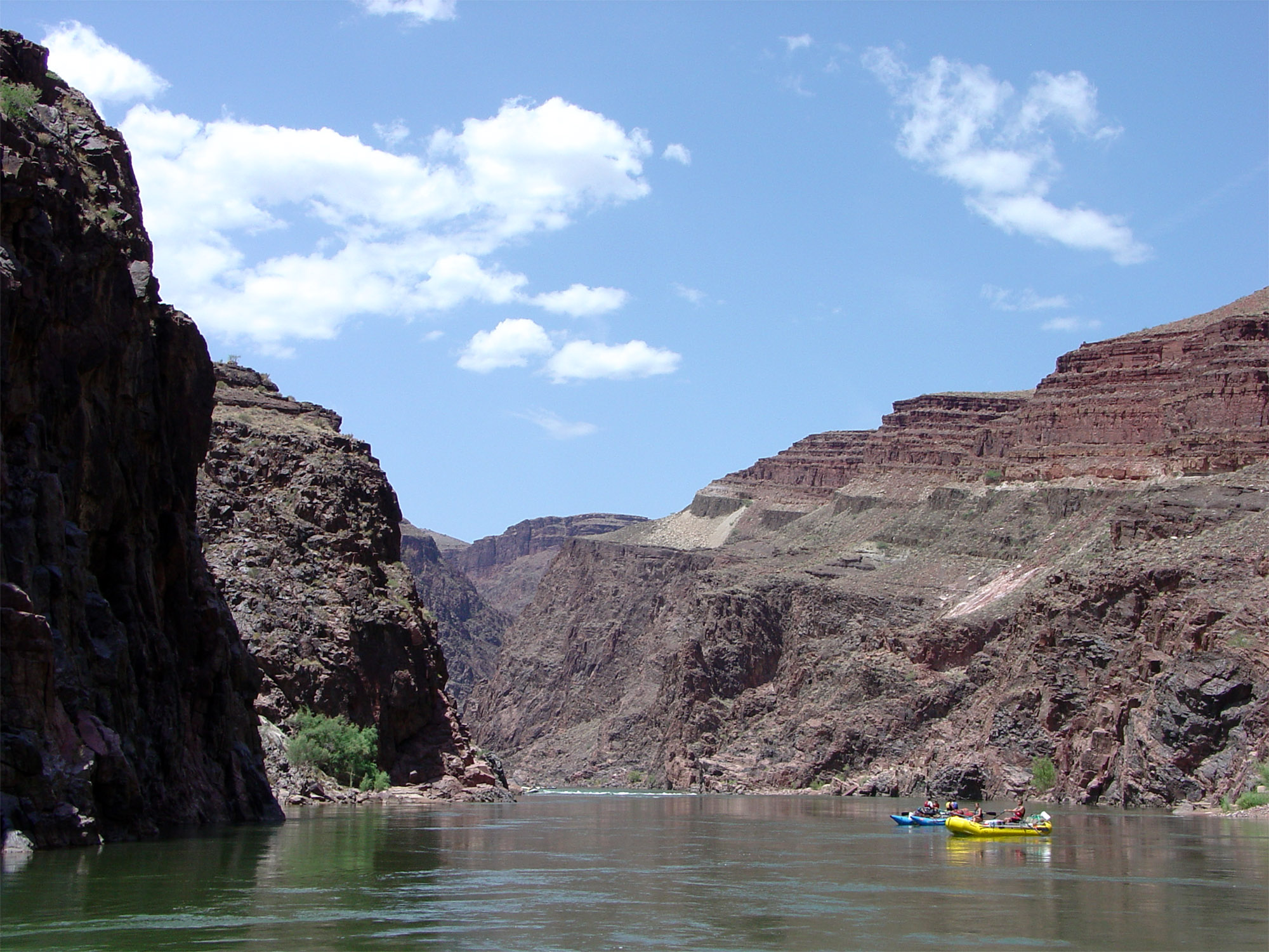 Colorado River entering Inner Gorge of the Grand Canyon |
Fig. 27 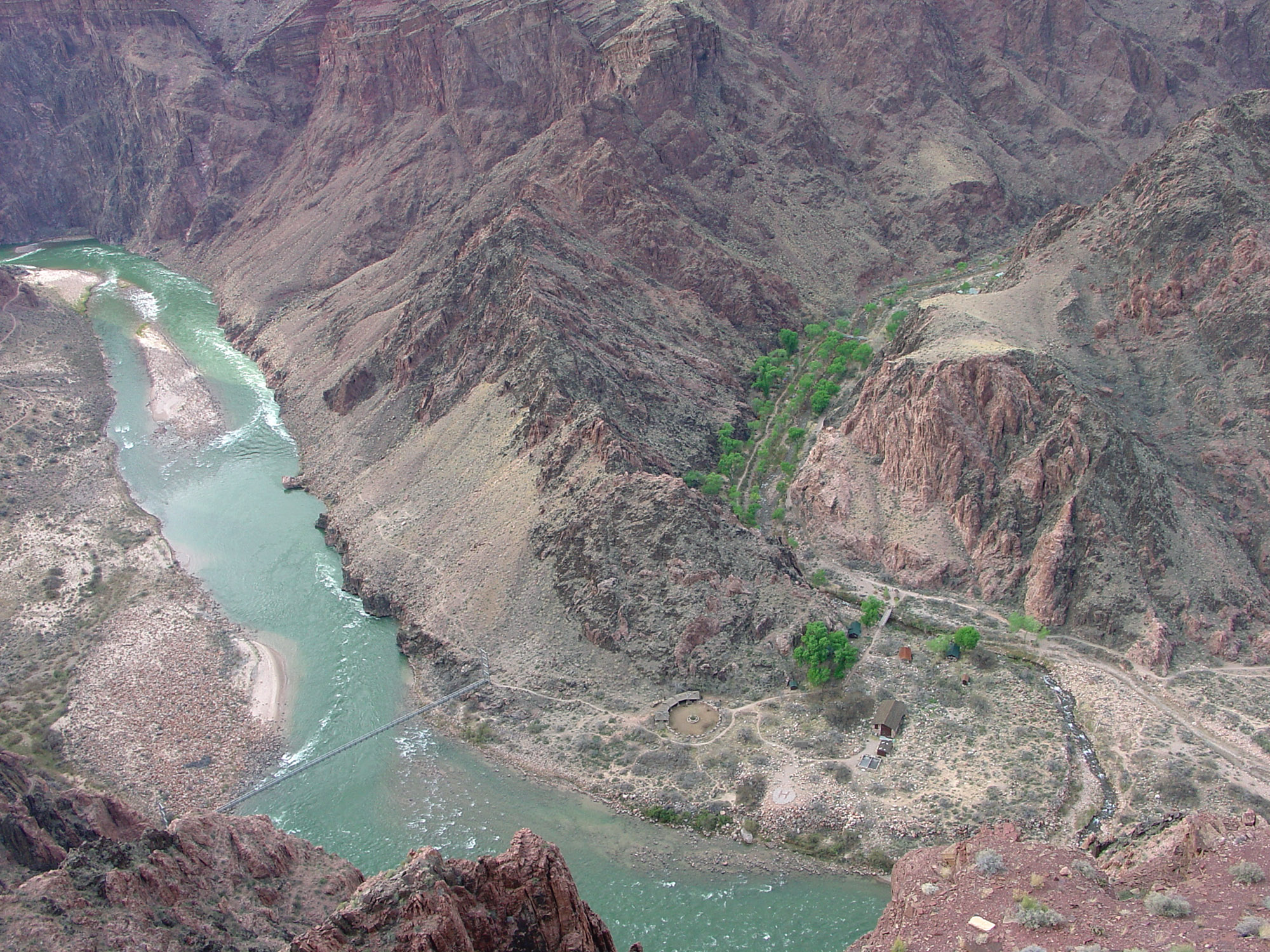 Colorado River at Phantom Ranch, Grand Canyon NP, AZ |
Fig. 28 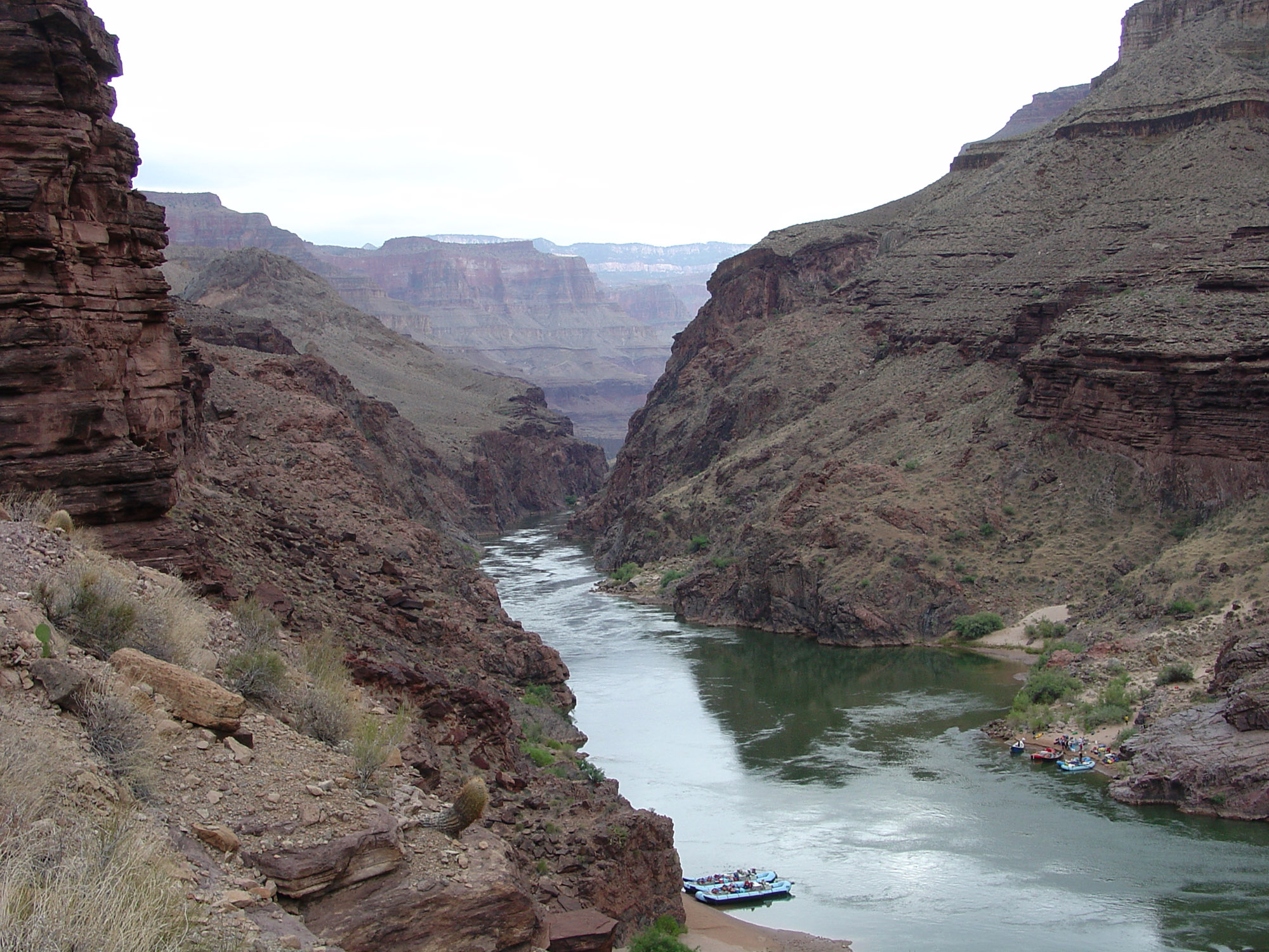 Lower Inner Gorge of the Grand Canyon |
Fig. 29 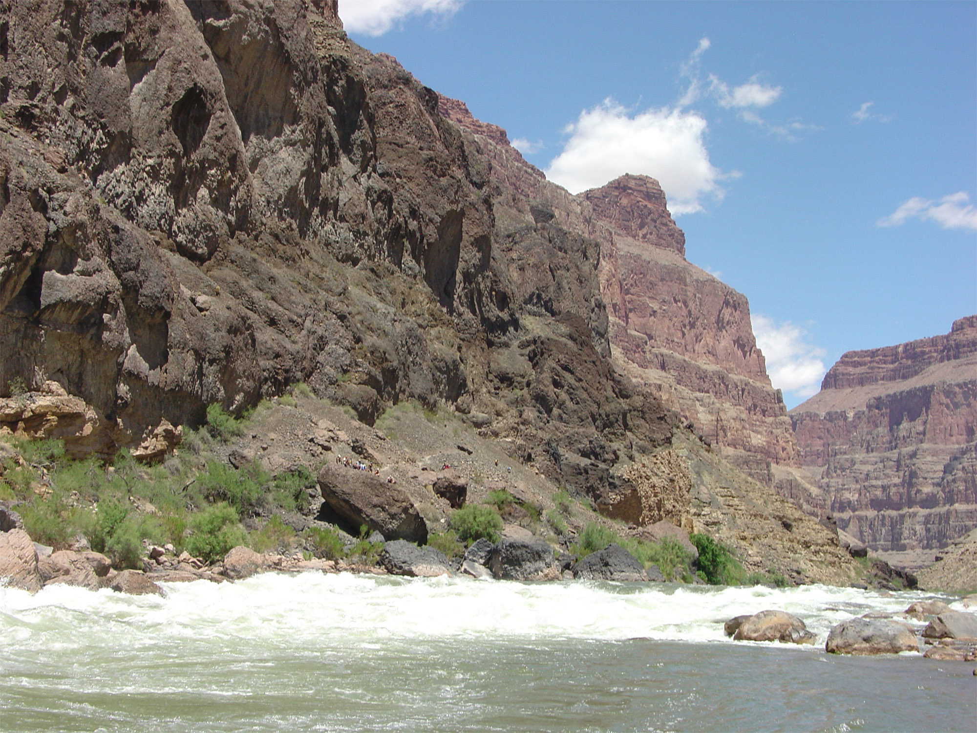 Lava Falls, largest rapid in the lower Grand Canyon |
Lake Mead National Recreation Area (Colorado River Between Arizona and Nevada)The Colorado River drains into Lake Mead at the western end of the Grand Canyon (Figure 30; note the "bathtub ring" created by the withdraw of water from the reservoir). The geology and landscape changes in this region as the Colorado River crosses the transition from the Colorado Plateau Province to the Basin and Range Province of Nevada and Arizona. Lake Mead fills the valleys of the Colorado and Virgin Rivers (see Figure 15). The headwaters of the Virgin River are in the mountainous region along the western edge of the Colorado Plateau in southern Utah (in the vicinity of Bryce Canyon and Zion National Parks; Figure 31). Lake Mead (reservoir) was created by the construction of Boulder Dam in Black Canyon near Las Vegas (Figures 32 to 34). Boulder Dam was the first high dam (726.4 feet) on the Colorado River and was constructed during the Great Depression between 1931 and 1936. It was the largest dam in the world when it was completed. Its purpose was to "create Depression-Era jobs," provide regional electric power, and to regulate water flow in the Lower Colorado River Basin. Boulder Dam was later renamed Hoover Dam in 1947. Lake Mead and Lake Mojave (discussed below) are both within the Lake Mead National Recreation Area. |
Fig. 30 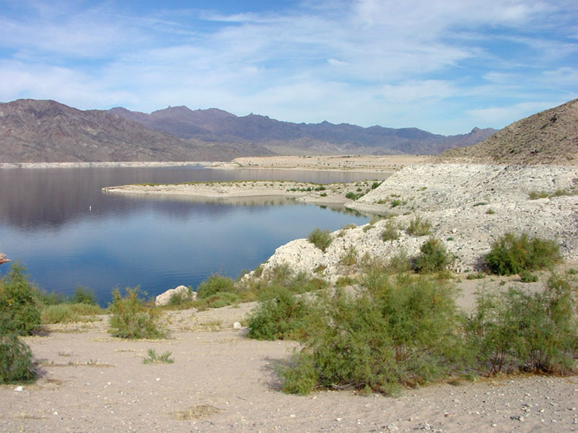 Lake Mead bathtub ring near lower end of Grand Canyon |
Fig. 31  Virgin River Narrows in Zion National Park, Utah |
Fig. 32 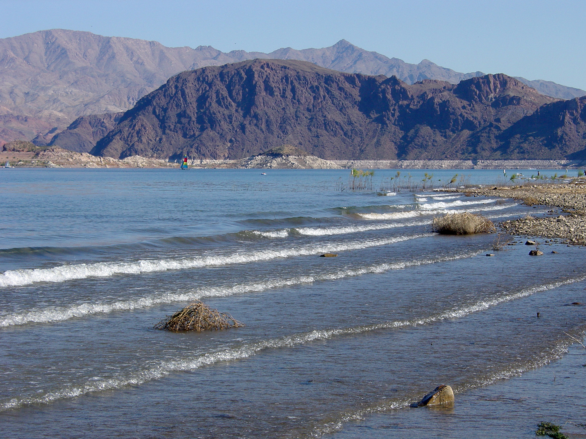 Lake Mead near Henderson, Nevada (and Black Canyon) |
Fig. 33 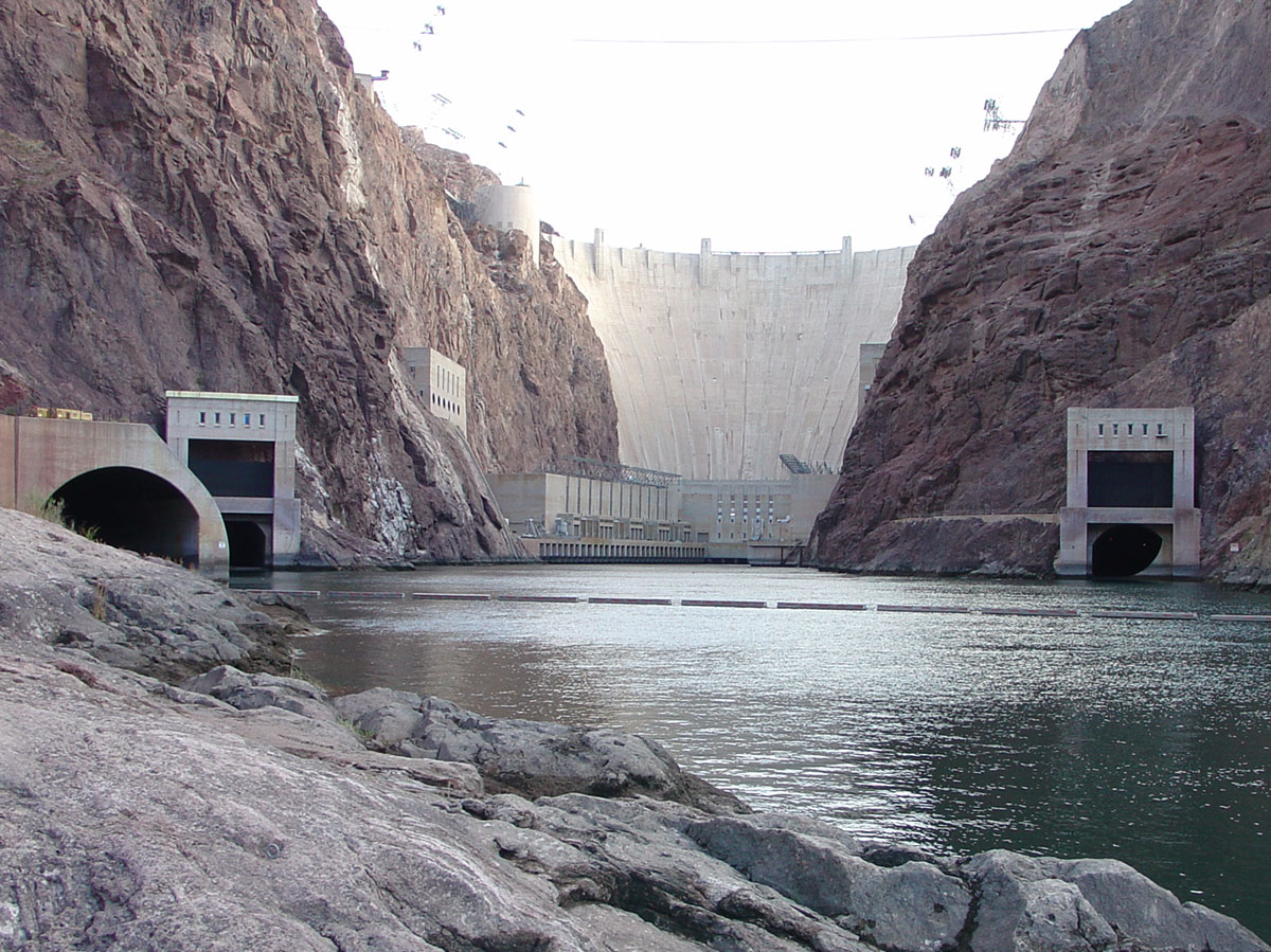 Hoover Dam (Boulder Dam) south of Las Vegas, Nevada |
Fig. 34 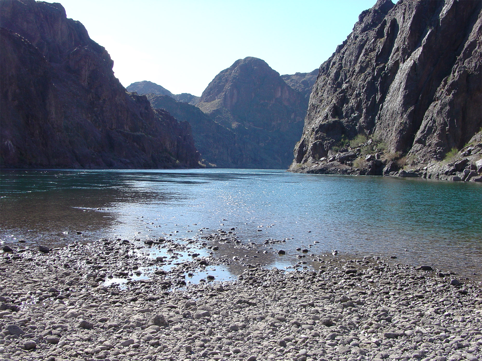 Colorado River in Black Canyon below Hoover Dam |
The Lower Colorado River RegionThe Colorado River flows into Lake Mojave starting in the lower reaches of Black Canyon (Figure 35). Black Canyon got its name from the massive cliffs of black volcanic rocks (basalt). Black Canyon is the last of the deep canyons along the Colorado River. Lake Mojave is impounded by Davis Dam which was completed in 1951 (Figures 36 and 67). The purpose of this 200-foot high dam is to generate hydroelectric power and to re-regulate the flow of Colorado River water below Hoover Dam.Bullhead City is a popular recreation area portion of the near the intersection of California, Nevada, and Arizona downstream of Davis Dam along the Colorado River (numerous casinos line the riverfront on the Nevada side of the river). South of Needles California, the valley of the Colorado River floodplain broadens. The "Needles" gets its name from the dark eroded remnants of ancient volcanoes along the river valley (Figure 38). Much of the floodplain is now preserved as the Havasu National Wildlife Area. Figure 99 is a satellite map of the Lower Colorado River region between Lake Havasu and the Gulf of California. This is a desert region of North America that contributes practically little water to the Colorado River. This is where the major water diversion projects built to distribute water to southern Arizona and Southern California begin. |
Fig. 35 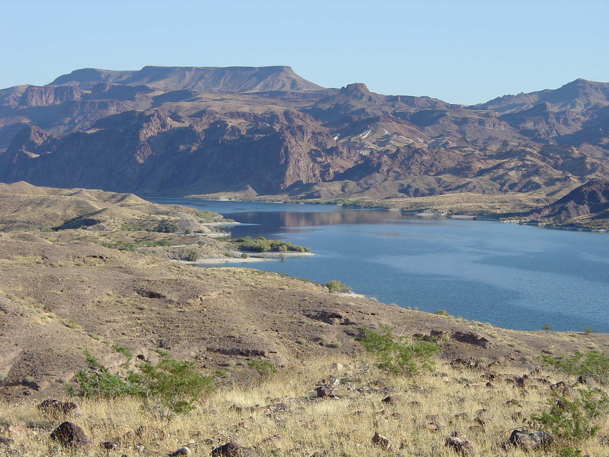 Lake Mojave below Black Canyon |
Fig. 36 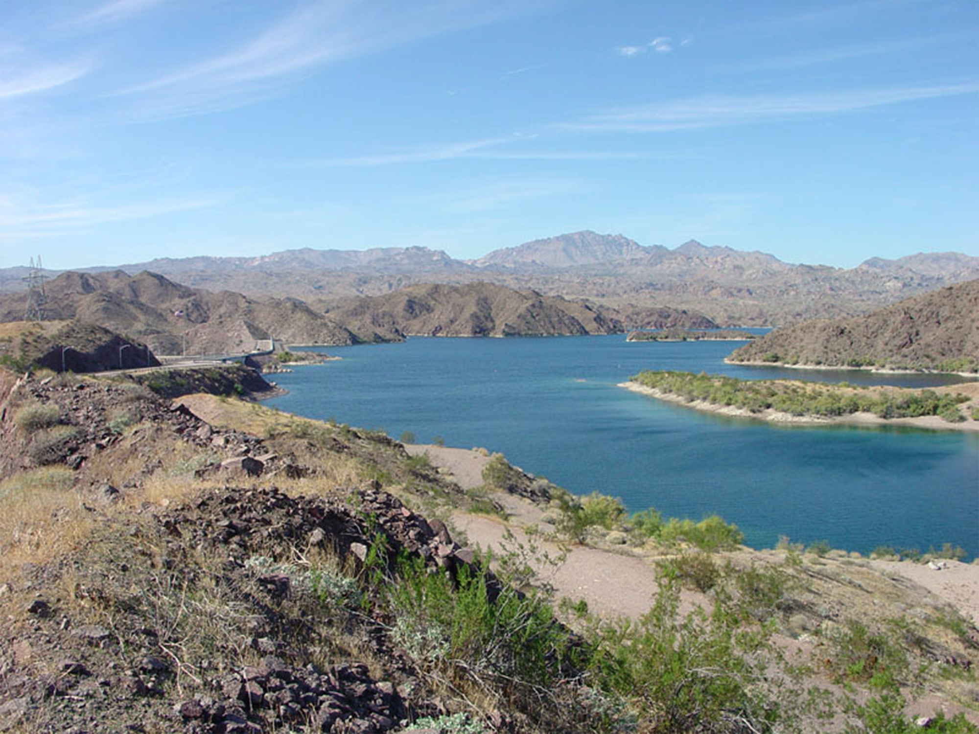 Lake Mojave above Davis Dam from Arizona side. Lake Mojave above Davis Dam from Arizona side. |
Fig. 37 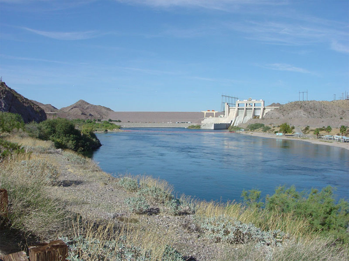 Davis Dam from below Lake Mojave from California side. |
Fig. 38  Unrestrained Colorado River near Needles, California |
Fig. 39 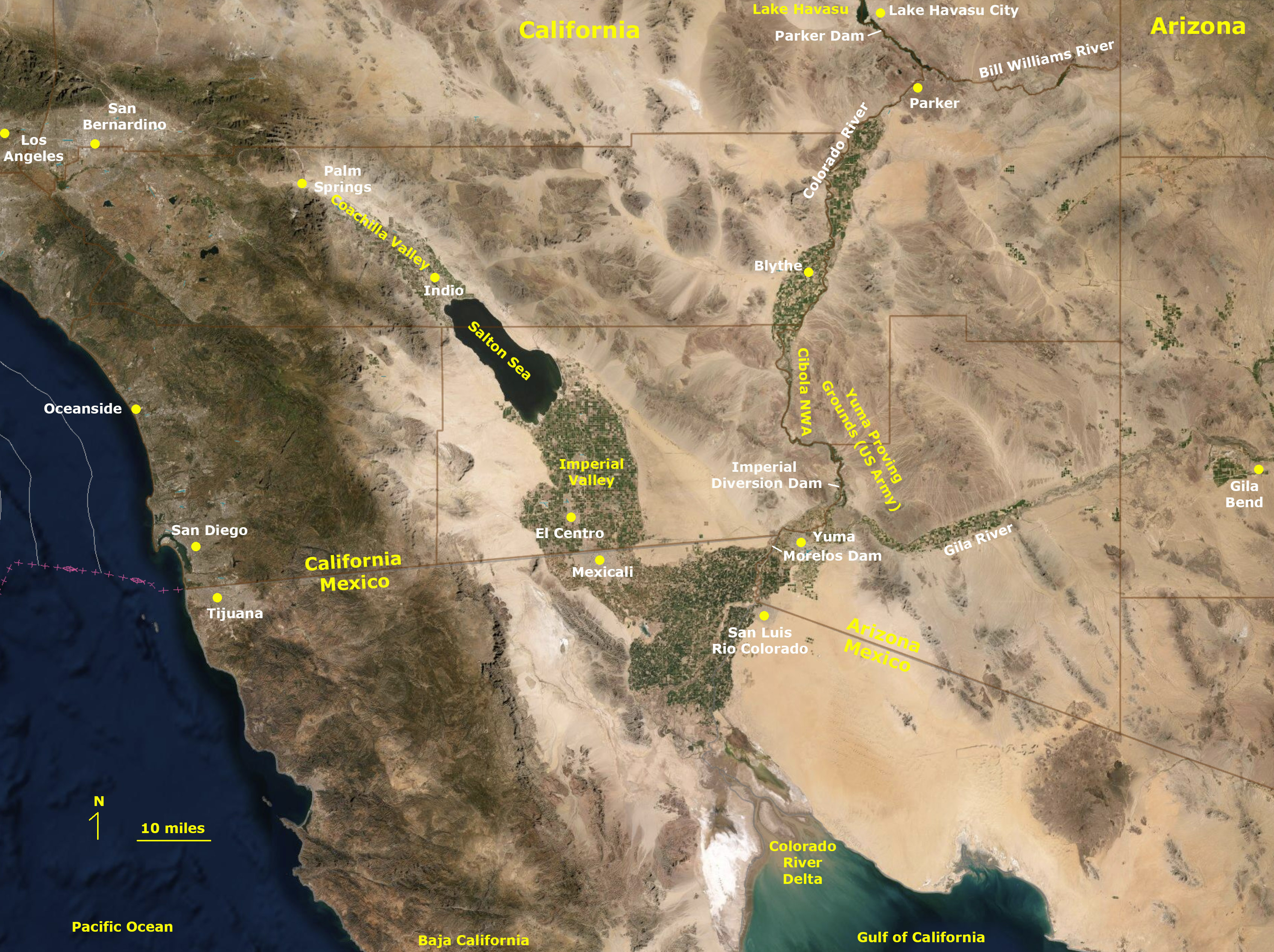 Lower Colorado River and Delta |
Diversion Dams On The Lower Colorado RiverLake Havasu is a popular recreation destination; Havasu City is on the Arizona side of the lake (Colorado River). Lake Havasu (reservoir) is impounded by Parker Dam (Figures 40 and 41). Parker Dam was completed in 1938 and is 320 feet high. It was constructed to generate hydroelectric power and to create the reservoir. The dam was constructed in a narrow canyon between the Buckskin Mountains of Arizona and the Whipple Mountains of California.The California River Aqueduct begins a Lake Havasu at Parker Dam. South of Parker, Arizona (below Parker Dam) the unrestrained Colorado River flows past Blythe, California and then flows through the large Cibola National Wildlife Refuge (Figure 42). The Cibola National Wildlife Refuge is adjacent to the U.S. Army Yuma Proving Grounds (on the Arizona side; it is one of the largest military reservations in the world and remains mostly wilderness). Below the wildlife refuge, the Colorado River flows into Imperial Reservoir impounded by the Imperial Diversion Dam near Yuma, Arizona (Figure 43). About 90% of the Colorado River Water is diverted at the Imperial Diversion Dam. The Dam was completed in 1938 and was designed for desilting and diversion of the Colorado River water into canals: the All-American Canal diverts water into the Imperial Valley of California, the Gila River and Yuma Project Aqueduct diverts water to southern Arizona. The Morelos Dam is the last dam on the Colorado River and is located where the Colorado River runs between California and Mexico (Figure 44). The dam was built for the 1944 United States Mexico Treaty and completed in 1950 (Mexico now maintains the dam). The dam diverts water to the croplands in the Mexicali Valley in Mexico. The Colorado River basically ends at the Morelos Dam, although water releases have been attempted to restore the Colorado River floodplain and delta. However, the last time Colorado River water flowed into the ocean in the Gulf of California was in 1998. |
Fig. 40 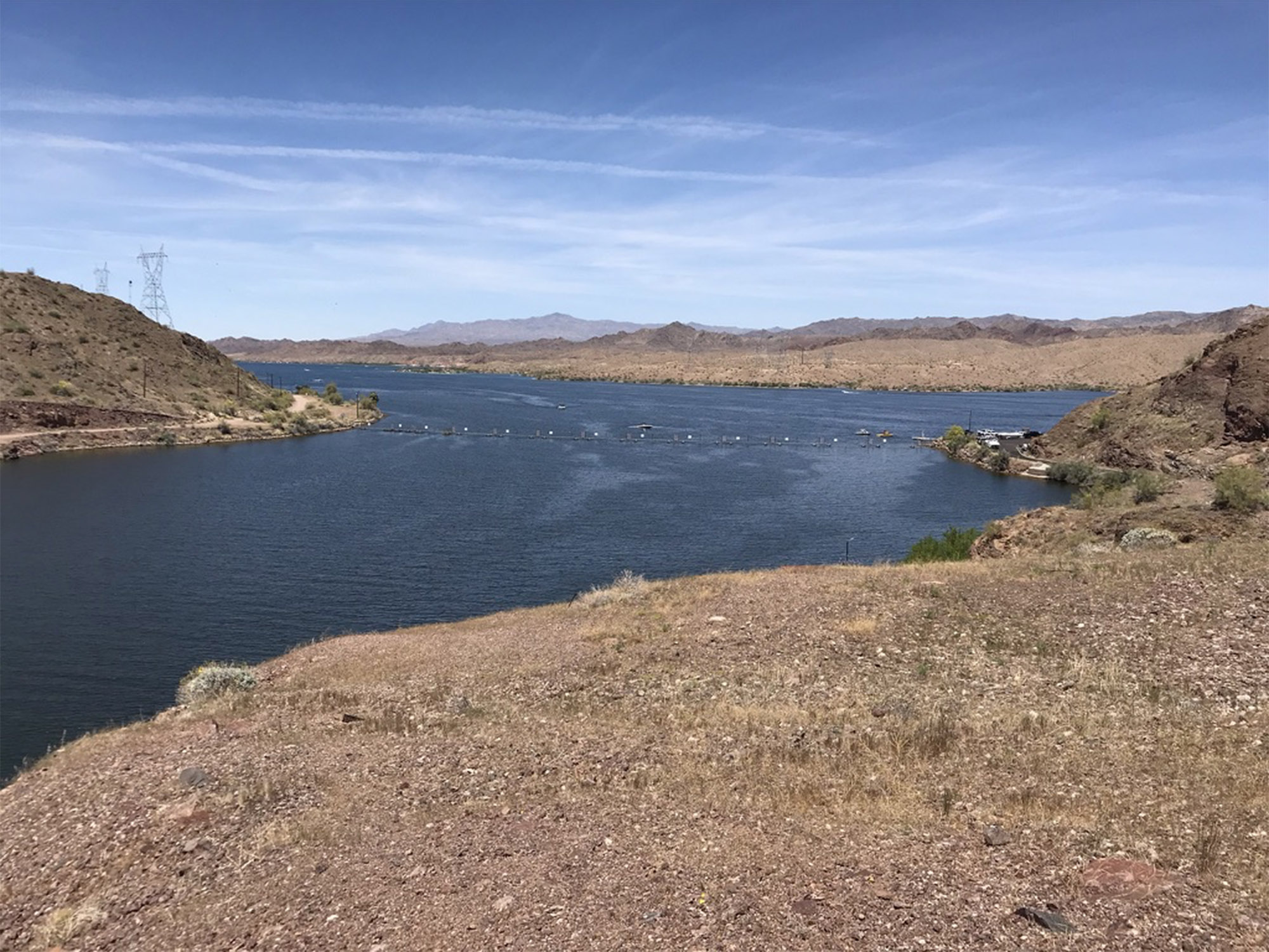 Lake Havasu above Parker Dam (AZ and CA) |
Fig. 41 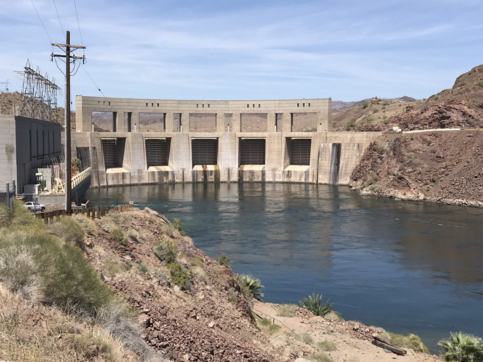 Parker Dam (near Parker, Arizona) |
Fig.
42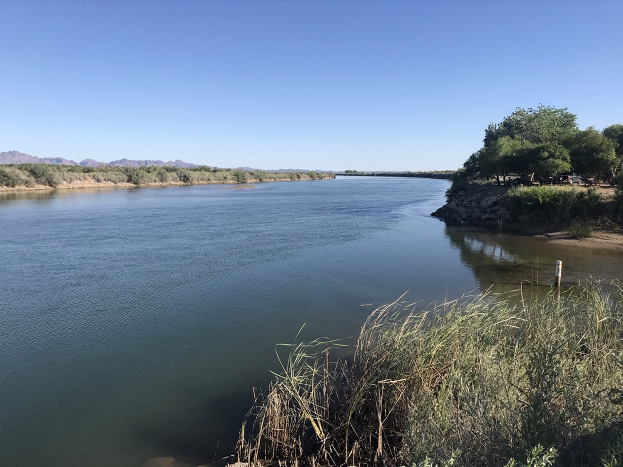 Colorado River in Cibola WLR south of Blythe, CA |
Fig. 43  Imperial Diversion Dam near Yuma, Arizona |
Fig. 44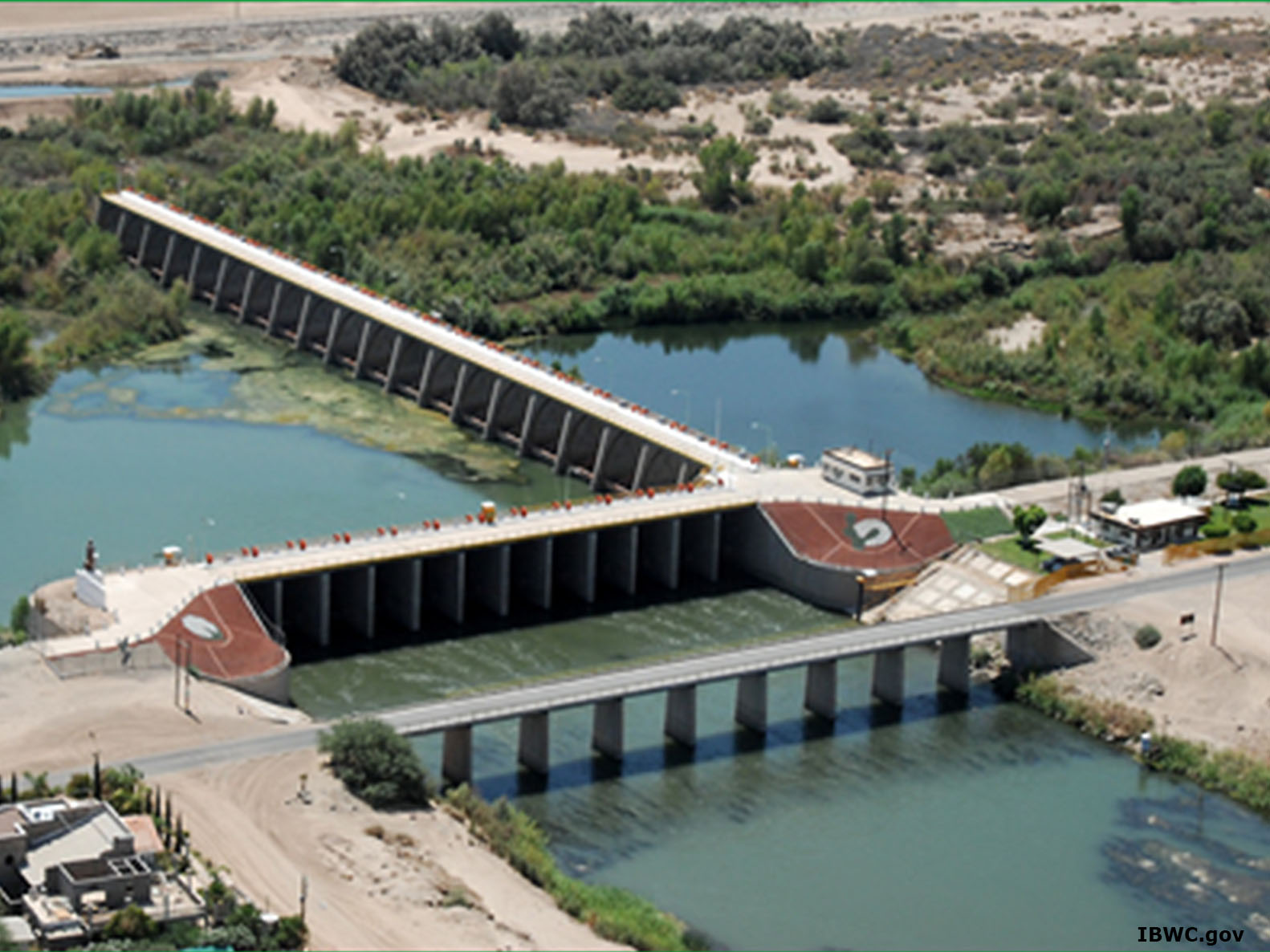 Morelos Dam on the U.S./Mexico border |
The Modern Salton Sea Formed By Accident... |
|
| The Salton Sea has an interesting history. It is located in the Salton Trough—the rift valley of the San Andreas Fault (Figure 45). For millions of years, lakes have formed and disappeared in this basin (evaporated) as the climate has changed and the Colorado River occasionally naturally diverted, draining into the Salton Trough instead of the Gulf of California. The last natural diversion occurred around 700 AD forming Ancient Lake Cahuilla. That lake was as much as 314 feet deep and was much larger than the modern Salton Sea. It completely disappeared by about 1300 AD. A smaller natural cycle of lake formation occurred again around 1600-1700 AD. In 1905, engineers working for the California Development Company mistakenly created a cut in the banks in a diversion canal from the Colorado River. The resulting water flow overwhelmed their operations and the entire flow of the Colorado River poured into the Salton Trough for two years before the water diversion ended. The result was the formation of the modern Salton Sea (the largest lake in California). For many years back in the 1950s developers created resorts that for a while attracted more visitors than Yosemite National Park. For a time it supported abundant populations of fish and birds, but as the lake evaporated, it became increasingly salty and polluted. Agricultural runoff from the All-American Canal drains into the Salton Sea. Harmful algal blooms, salt, and pollution killed off the fish population,creating a horribly smelly environmental calamity—its shoreline communities have largely been abandoned. |
Fig. 45  Airliner view looking north at the Salton Sea in Southern California's Imperial Valley. |
Continue to the next page (A look at California's Water Project).A) Where Does San Diego Get Its Water?B) The Colorado River Drainage Basin C) California's Interconnected Water System D) San Diego County's Natural Water Supply E) The San Dieguito River Watershed F) Water Conservation G) Assignment Tasks & Questions |
| https://gotbooks.miracosta.edu/earth_science/assignments/water_resources.html | 6/29/2020 |