
San Diego County's Natural Water Supply |
Every Landscape Is Associated With A WatershedA watershed is an area surrounded with a ridge (or divide) of land that separates water flowing to different rivers, streams, basins, lakes, or oceans. Each watershed has unique characteristics including:
|
Click on images for a larger view! |
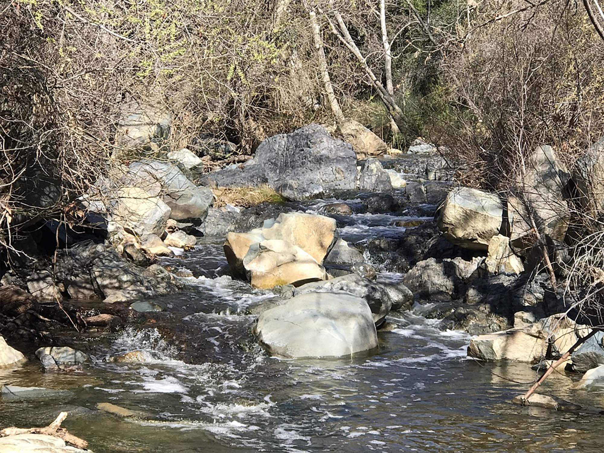 Fig. 1. Escondido River flows through Elfin Forest Reserve. |
| San Diego County has 11 westward-draining watersheds (Figure 2). East of the county elevation divide along the crest of the Peninsular Ranges, the water drains eastward toward the Imperial Valley and Salton Sea. Project Clean Water is an organization that provides a web-based portal to water quality and resource information for the San Diego County, South Orange County and South Riverside County. Below are links to some of their watershed management area descriptions. Santa Margarita San Luis Rey Carlsbad San Dieguito Los Peñasquitos Mission Bay/La Jolla San Diego River San Diego Bay Tijuana |
Fig. 2.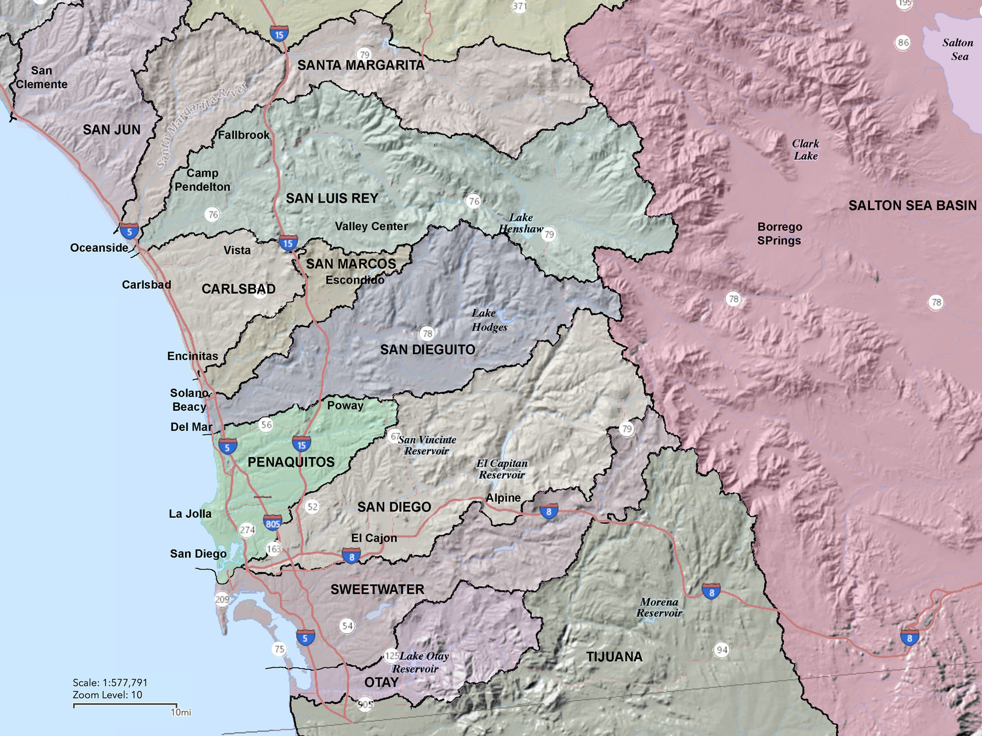 Watersheds map of the San Diego County region |
Who Manages Your Water?The total "potable" (drinkable) water consumed in San Diego County for year 2018 was about 452,090.2 acre-feet. This water was distributed through 24 water districts under guidance by the San Diego County Water Authority. |
|
What And Where Is Your Water District?The San Diego County Water Authority oversees the distribution to member agencies (cities, water districts, and irrigation districts). In turn, these organizations distribute water to their communities, manage watershed areas (surface & groundwater supplies), and treat or recycle wastewater, etc.1. Carlsbad Municipal Water District 2. City of Del Mar 3. City of Escondido Water Division 4. Fallbrook Public Utility District 5. Helix Water District 6. Lakeside Water District 7. City of National City (Sweetwater Authority) 8. City of Oceanside, Water Division 9. Olivenhein Municipal Water District 10. City of Otay 11. Padre Dam Municipal Water District 12. Marine Corps Base Camp Pendleton 13. City of Poway 14. Rainbow Municipal Water District 15. Ramona Municipal Water District 16. Rincon Del Diablo Municipal Water District 17. City of San Diego 18. Encinitas - San Dieguito Water District 19. Santa Fe Irrigation District 20. South Bay Irrigation District (Sweetwater) 21. Vallecitos Water District 22. Valley Center Municipal Water District 23. Vista Irrigation District 24. Yuima Municipal Water District County of San Diego (East County region) |
Fig. 3. Water Districts in San Diego County.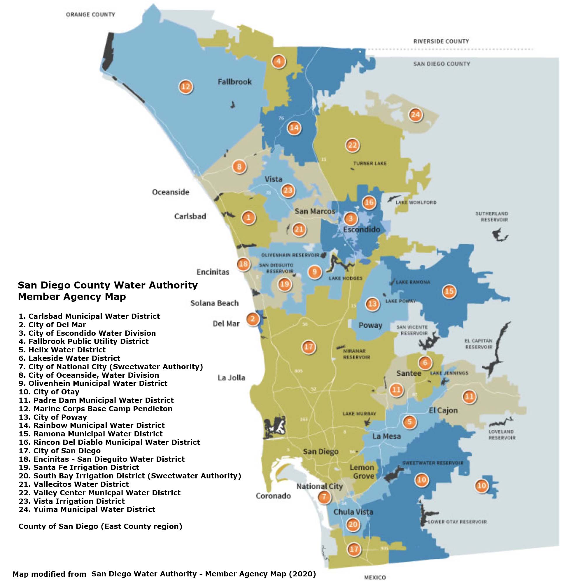 |
Source: San Diego County Water Authority |
|
| Note: One of the most useful experiences you might ever get is to take a tour of the water district facilities for your community. You might ask them for a job while you are at it! |
|
Reservoirs of San Diego County
|
Fig. 4. Map showing the location of the 12 largest water storage reservoirs in San Diego County. |
|
These reservoirs are associated with different water districts that have their own rules about public access. Over time, public access to reservoirs have been growing increasingly restrictive, mainly for reasons for security, water quality safety, and habitat protection. For instance, the spread of invasive species by boaters, such as the zebra mussel, has been used to justify access restrictions. None of the reservoirs are associated with natural lakes. However, some of the reservoirs are located in valleys or canyons associated with the regional fault system. For Example, Lake Henshaw is located in the rift valley of the Elsinore Fault (Figure 6). |
San Diego's 10 largest Reservoirs |
|||
Fig. 5.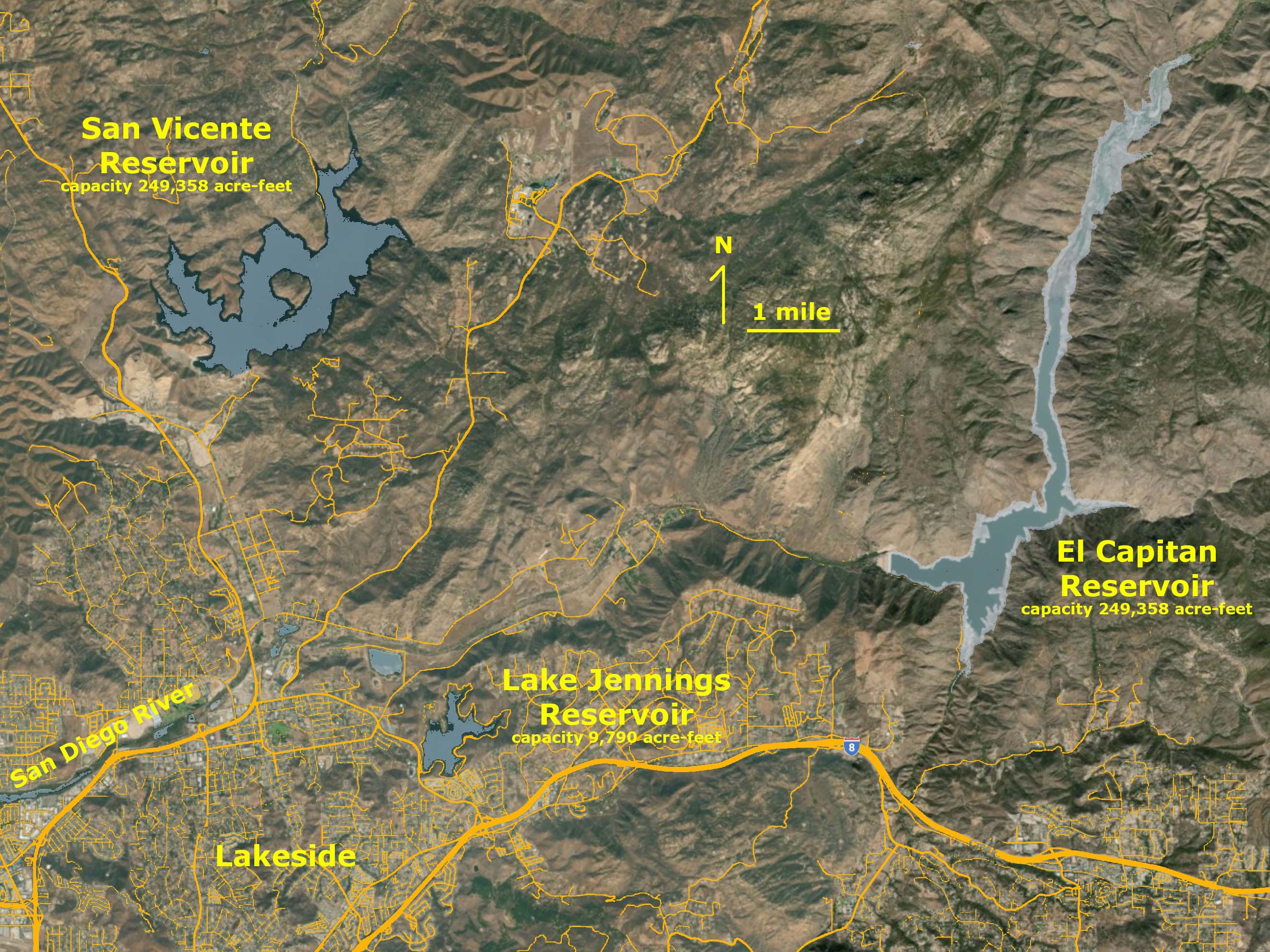 San Vicente (1) and El Capitan (2) Reservoirs: San Diego's two largest reservoirs. |
Fig. 6.  Lake Henshaw (3rd largest) in the San Felipe Valley located in central northern San Diego County between Palomar Mountain to the west and the Volcan Mountains to the east. |
Fig. 77.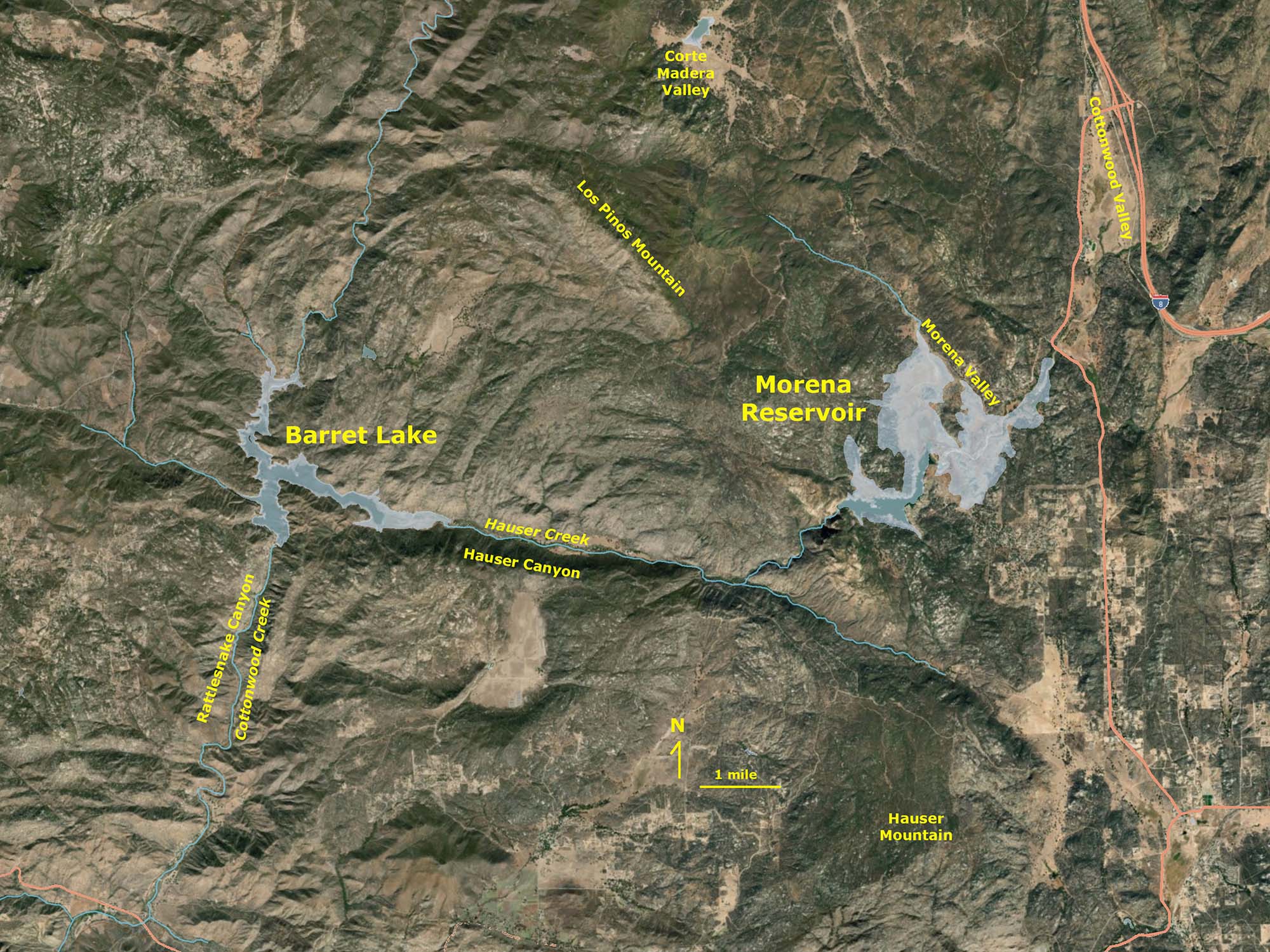 Lake Molena (4) and Lake Barrett (6) Reservoirs east of San Diego. Lake Molena (4) and Lake Barrett (6) Reservoirs east of San Diego. |
Fig. 8.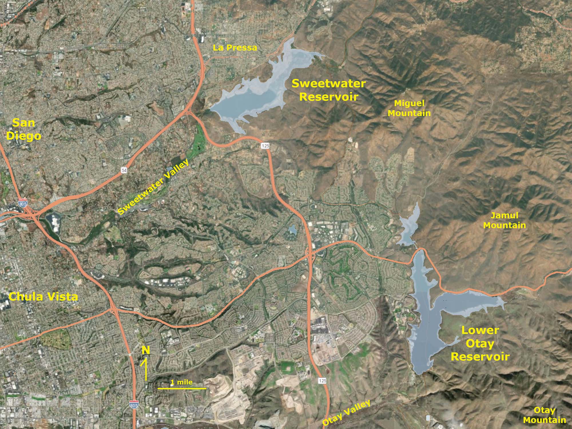 Lower Otay (5) and Sweetwater (8) Reservoirs east of San Diego. |
Fig. 9.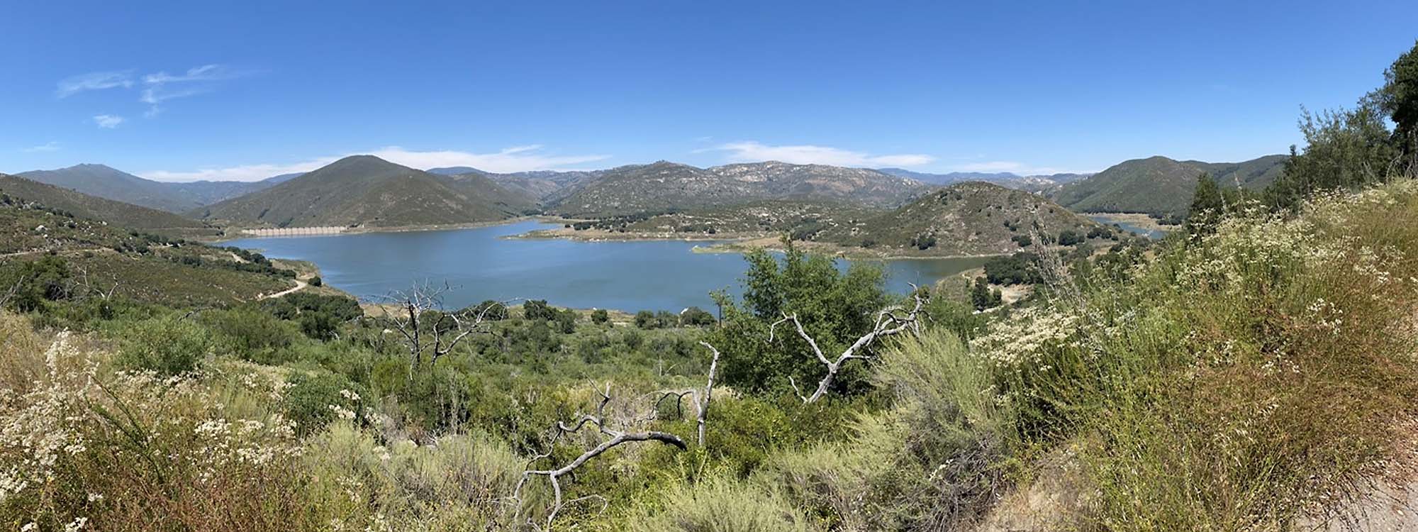 Lake Sutherland (7) Reservoir near Ramona. |
Fig. 10.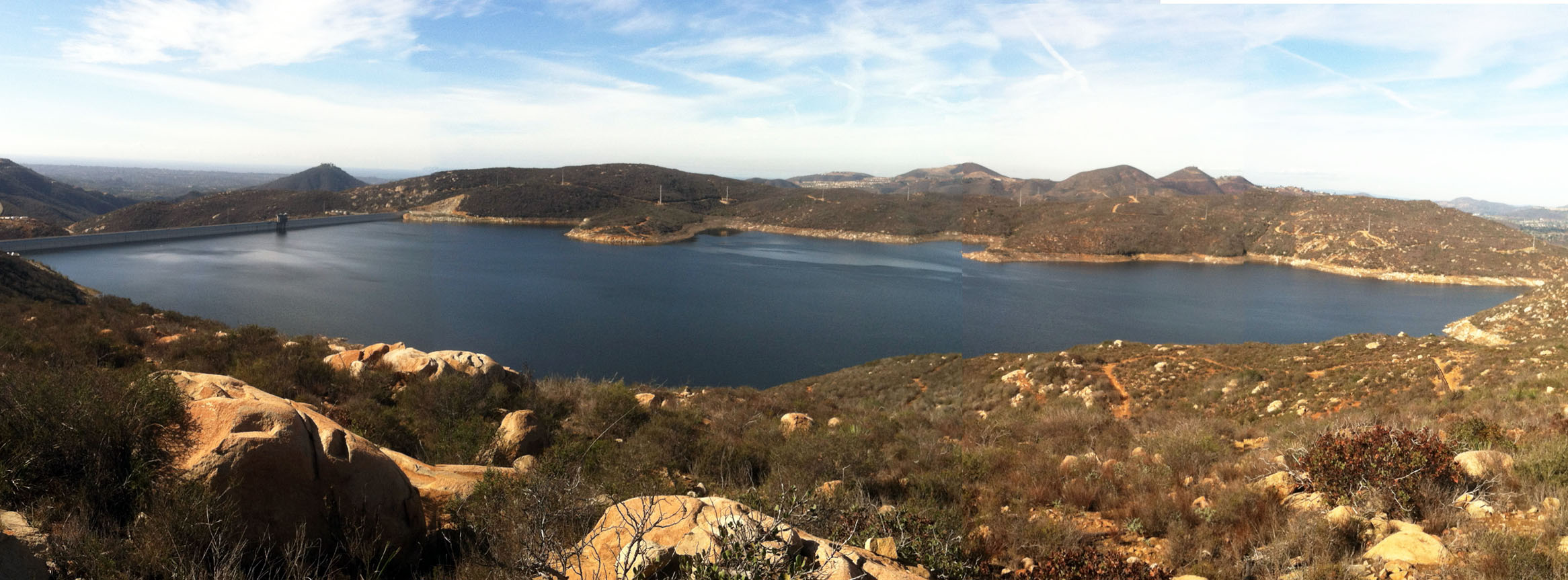 Olivenhain Reservoir (9) in mountain valley above Lake Hodges near Escondido. |
Fig. 11.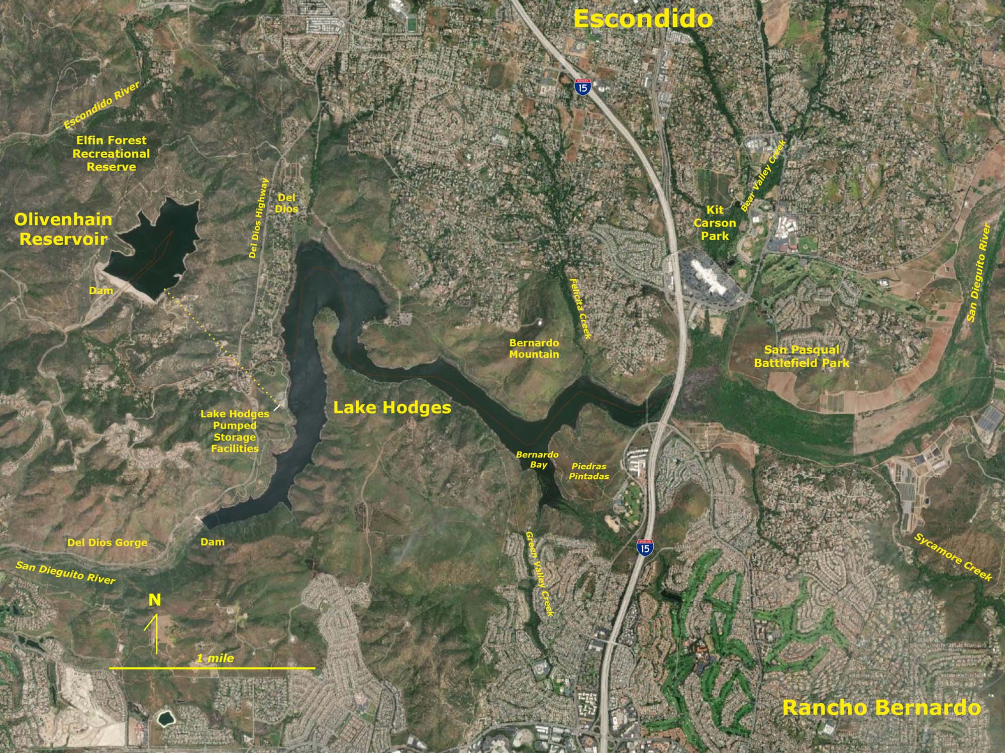 Lake Hodges (10) and Olivenhain (9) Reservoir |
Where Else Does San Diego Get Its Water Locally?Think about all this water being imported into San Diego, and how much of it is being used to water landscapes. The amount of water being imported is more than all the largest natural rivers and stream in the county combined! It is no wonder that streams that otherwise would dry up during the dry season are now perennials streams. There are many new seeps in the sea cliffs along the coast as well. There is the equivalent of a whole new river flowing into San Diego County!Actually only a small percentage of the water supply in San Diego currently comes from wells (groundwater resources). Groundwater drains form upland regions drains into local streams. Reservoirs may trap this water, but leakage from reservoirs also adds to groundwater. There is probably much more groundwater flowing directly into the ocean than from surface runoff from San Diego's rivers and streams. Seawater desalination and salty groundwater reclamation are now contributing about 10% of San Diego's drinking water supply, and that amount is expected to grow as new projects come online. Cities throughout San Diego County are now "recycling" water - treating sewage and urban runoff so it can be used for irrigation in parks, schools, golf courses, landscaping along roads and highways, and local agriculture projects. In the future, a large amount of drinking water will come from recycled water. This technology is supplying drinking water in many other parts of the world, and will no doubt be a significant source of California's drinking water in the future. Other water saving will come through increased conservation practices (of which there are many!). |
Water Treatment, Storage, and Distribution InfrastructurePerhaps the most important (and expensive) parts of the water delivery system is all the infrastructure necessary to purify, fluoridate, store, and distribute water to all the residents within a water district.According to a 10-News report in 2018, the City of San Diego water system extends over 400 square miles and moves about 172 million gallons of water per day (527.6 acre feet). Within this network there are 49 water pumping stations, 29 treated water storage facilities, three water treatment plants, and more than 3,300 miles of pipeline. All this infrastructure needs maintenance and eventual replacement. Some of the pipes are 100 years old. Water lines connect to more than a million households. Fire hydrants are spaced about 300 feet apart (but no more the 600 feet apart) in residential and commercially zoned areas. |
Fig. 12. 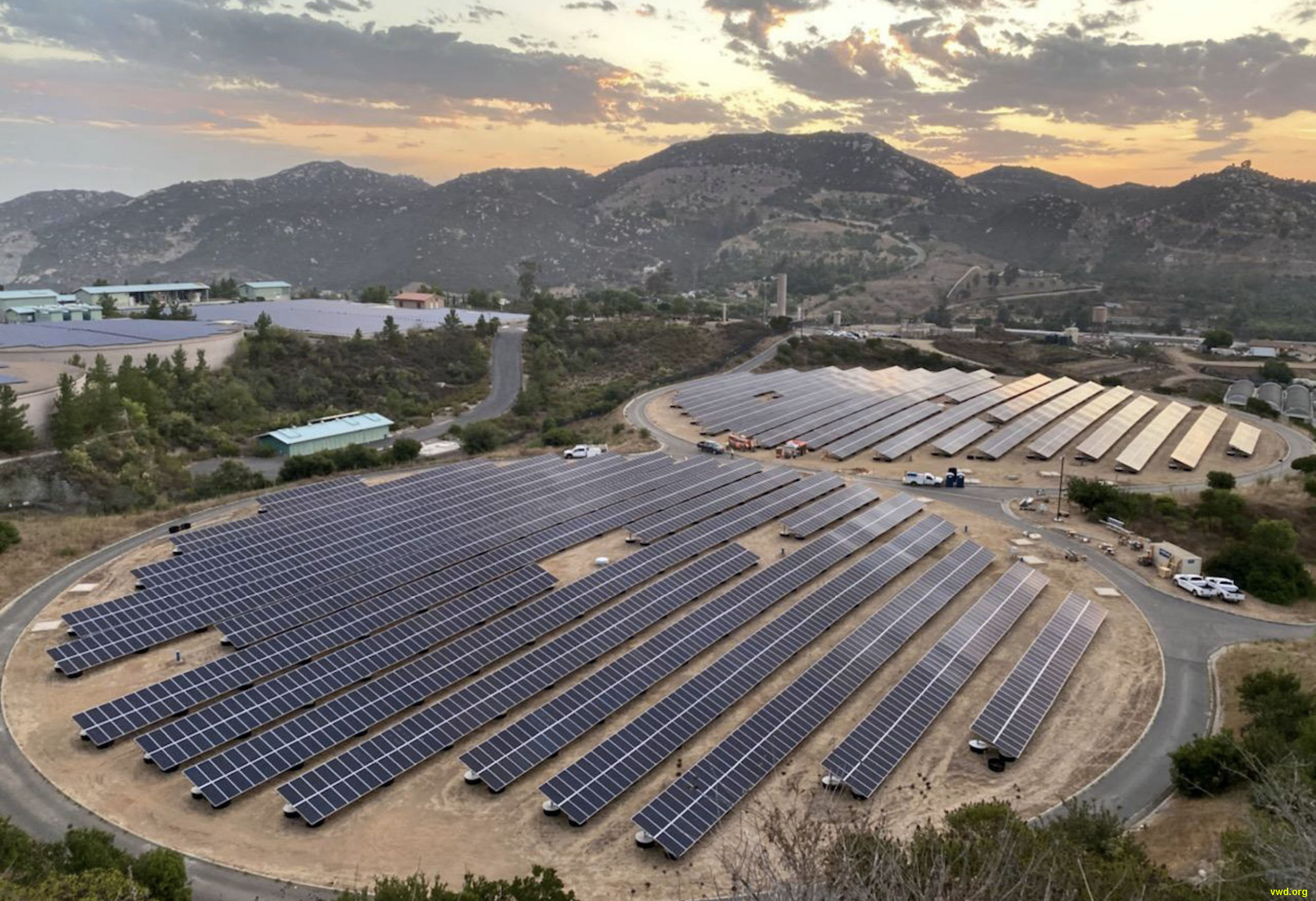 Twin Oaks Water Treatment Plant is underground in the foothills near San Marcos completed in 2018 is one of the world's largest. Twin Oaks Water Treatment Plant is underground in the foothills near San Marcos completed in 2018 is one of the world's largest. |
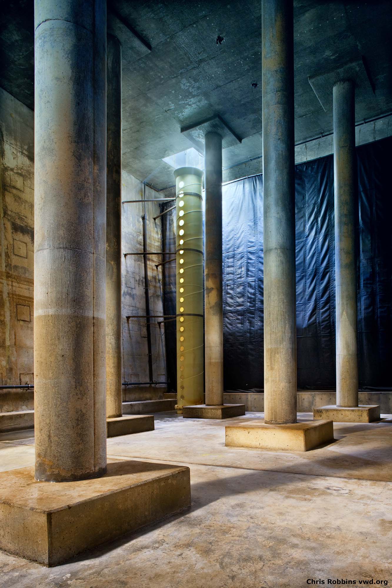
Fig. 13. |
Fig. 14.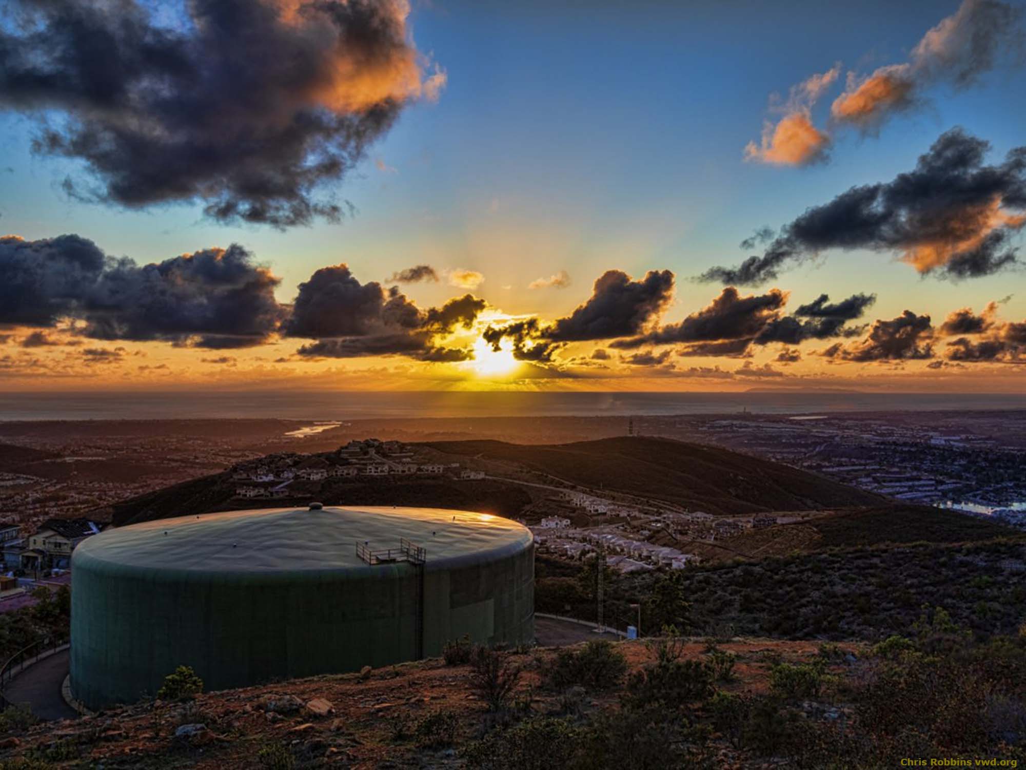 Water storage tank like this one on top of Double Peak in San Marcos are used to maintain daily water supply. |
Continue to the next page (a tour of the San Dieguito River Watershed).A) Where Does San Diego Get Its Water?B) The Colorado River Drainage Basin C) California's Interconnected Water System D) San Diego County's Natural Water Supply E) The San Dieguito River Watershed F) Water Conservation G) Assignment Tasks & Questions |
| https://gotbooks.miracosta.edu/earth_science/water/San_Diego_water_supply.html | 6/29/2020 |