|
Del Dios Highland County Preserve |
|
A1
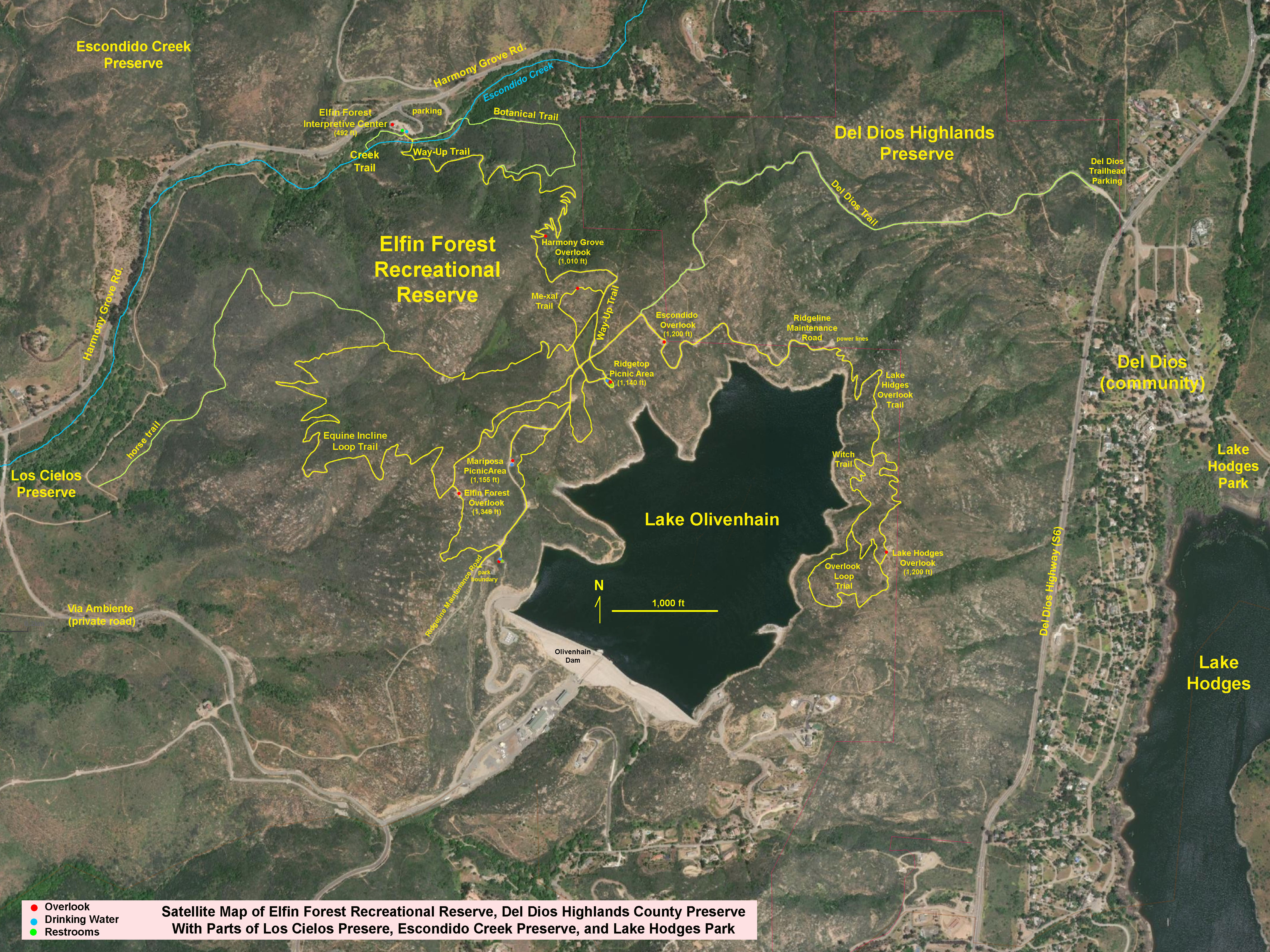
| The Del Dios Highlands County Preserve is part of a large open space/watershed protection region in the mountainous coastal highlands of northern San Diego County west of Escondido, California (Figure 1). The Del Dios Highlands preserve encompasses 774 acres adjacent to the Del Dios Highway between Escondido and Rancho Santa Fe. The preserve borders the Elfin Forest Recreational Reserve to the west, and the Lake Hodges Park is nearby to the east (Figure 2).
The Del Dios trailhead parking area is located at 9860 Del Dios Highway, Escondido, CA 92025 (Figures 3). The 1.5 mile Del Dios Trail connects with the trail system in the highlands of the Elfin Forest Recreational Reserve (Figures 4, 5, and 6). The trail is a moderately strenuous hike starting at 450 feet elevation at the trailhead and climbs to about 1,250 where the trail intersects the Maintenance Road in the Elfin Forest reserve near to the Escondido Overlook area. The Del Dios Trail is open for day-use hiking, horseback riding, and mountain biking.
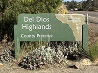
The Del Dios Highlands County Preserve is administer by the County of San Diego Parks and Recreation. The preserve is par to the county's Multiple Species Conservation Program in partnership with the Escondido Creek Conservancy and the San Dieguito River Park Joint Powers Authority.
|
Click on images for a larger view. |
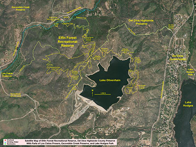
Fig. 1. Satellite map of the Elfin Forest Recreational Reserve.
|
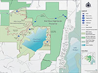
Fig. 2. Map of the Del Dios County Highlands Preserve. |

Fig. 3. Del Dios Highlands County Park sign. |
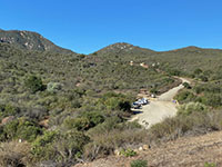
Fig. 4. View showing the Del Dios Trail parking area. |
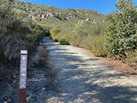
Fig. 5. View at the .5 mile marker on the Del Dios Trail. |
|
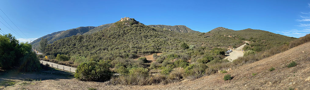
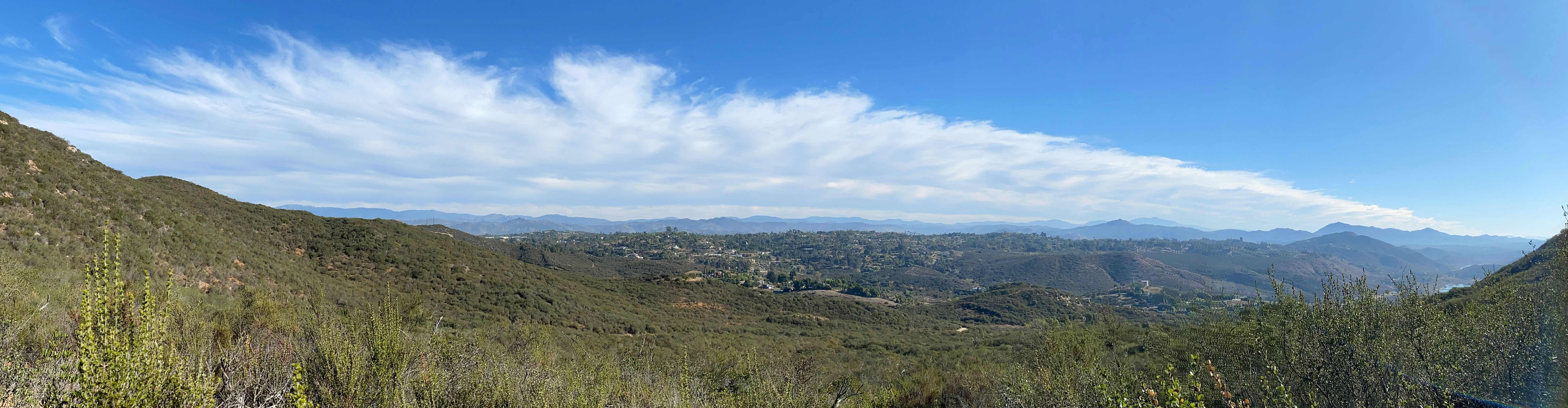
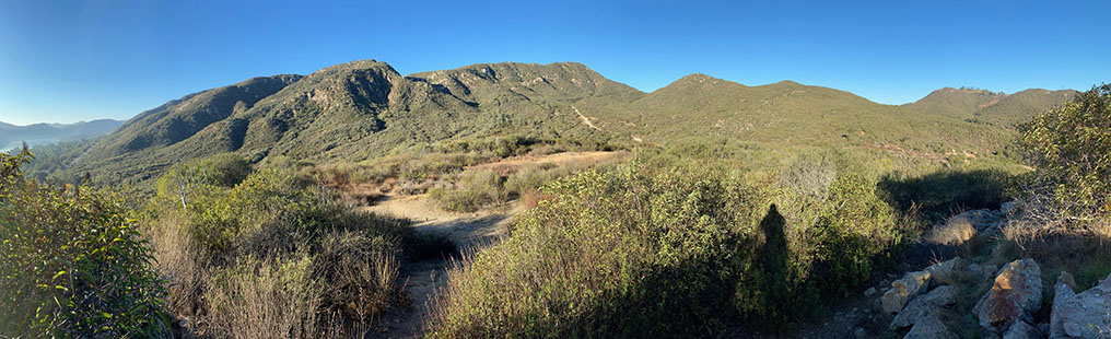
| Fig. 6. Panoramic view of the Del Dios Highlands Preserve from near the entrance to the Del Dios Trailhead parking area. |
A2
Views of the Highlands along the Del Dios Trail
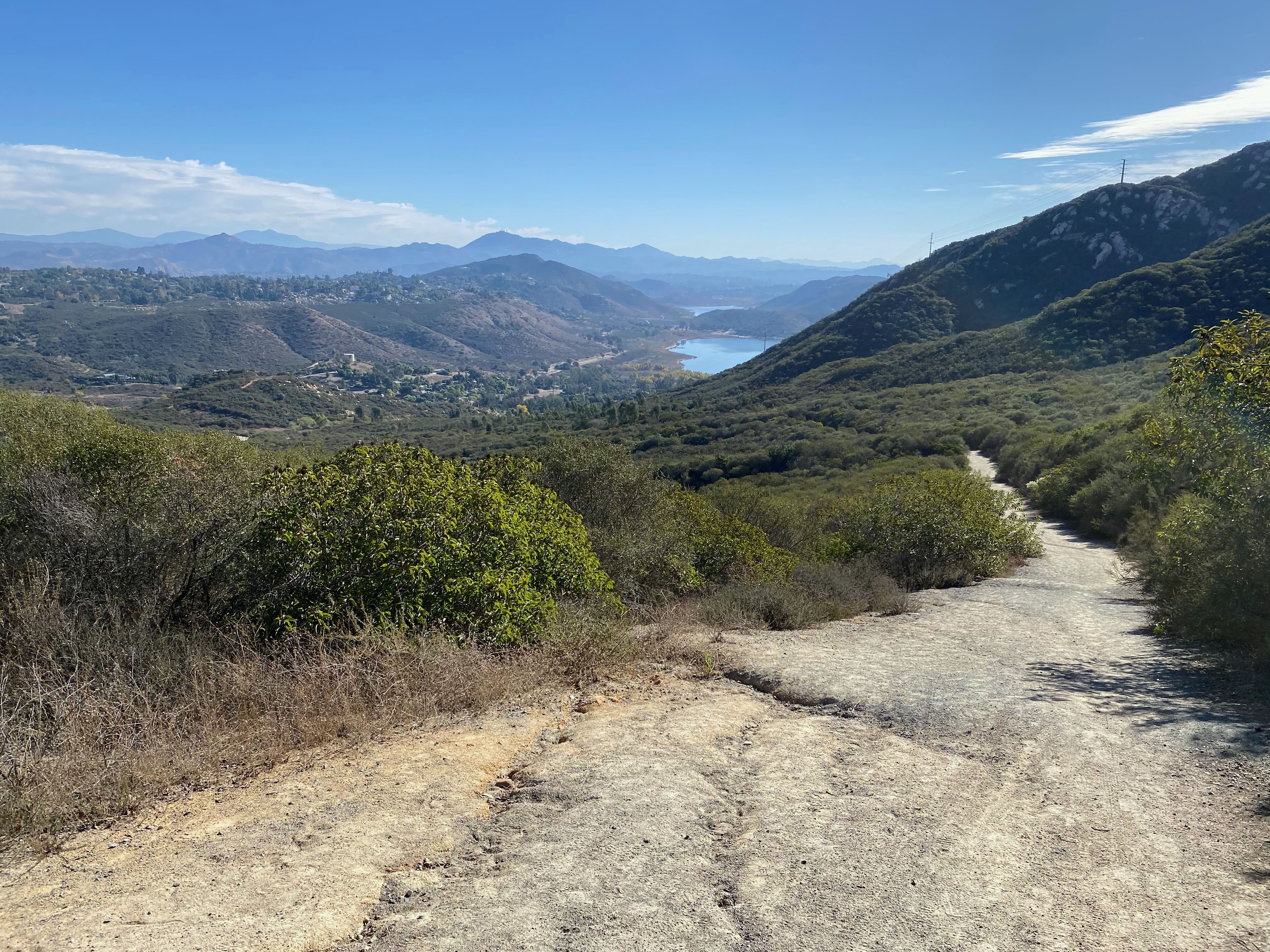
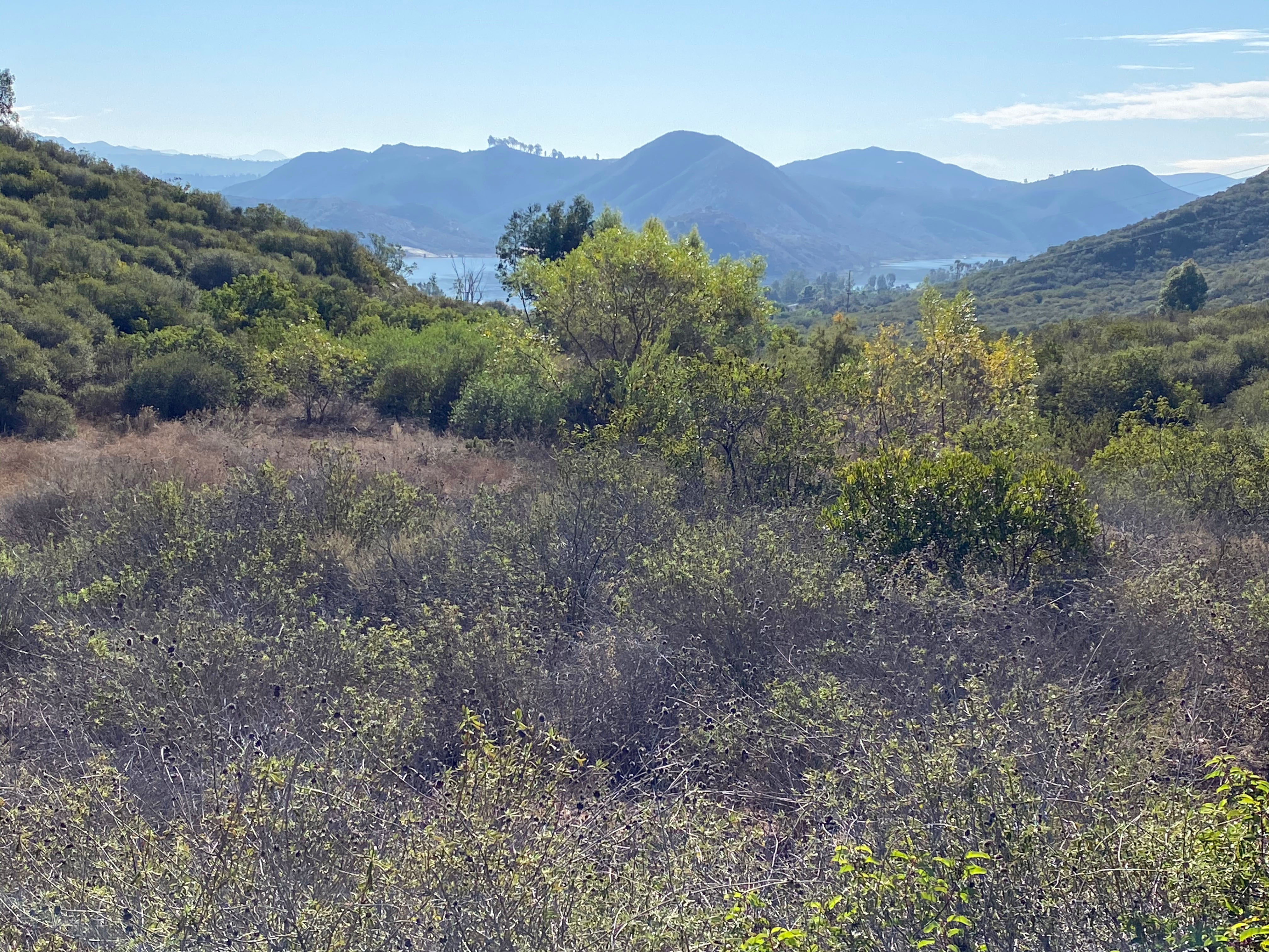
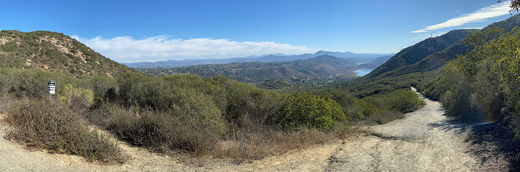
The hike up the Del Dios Trail is definitely moderately strenuous, but the scenery grows more spectacular every step of the way. The first mile climbs gradually along a seasonally dry creek valley that drains into Lake Hodges (Figure 7). In a little more than a mile, the trail crosses a pass in the divide between the San Dieguito River watershed to the south and the Escondido Creek watershed to the north (Figure 8).
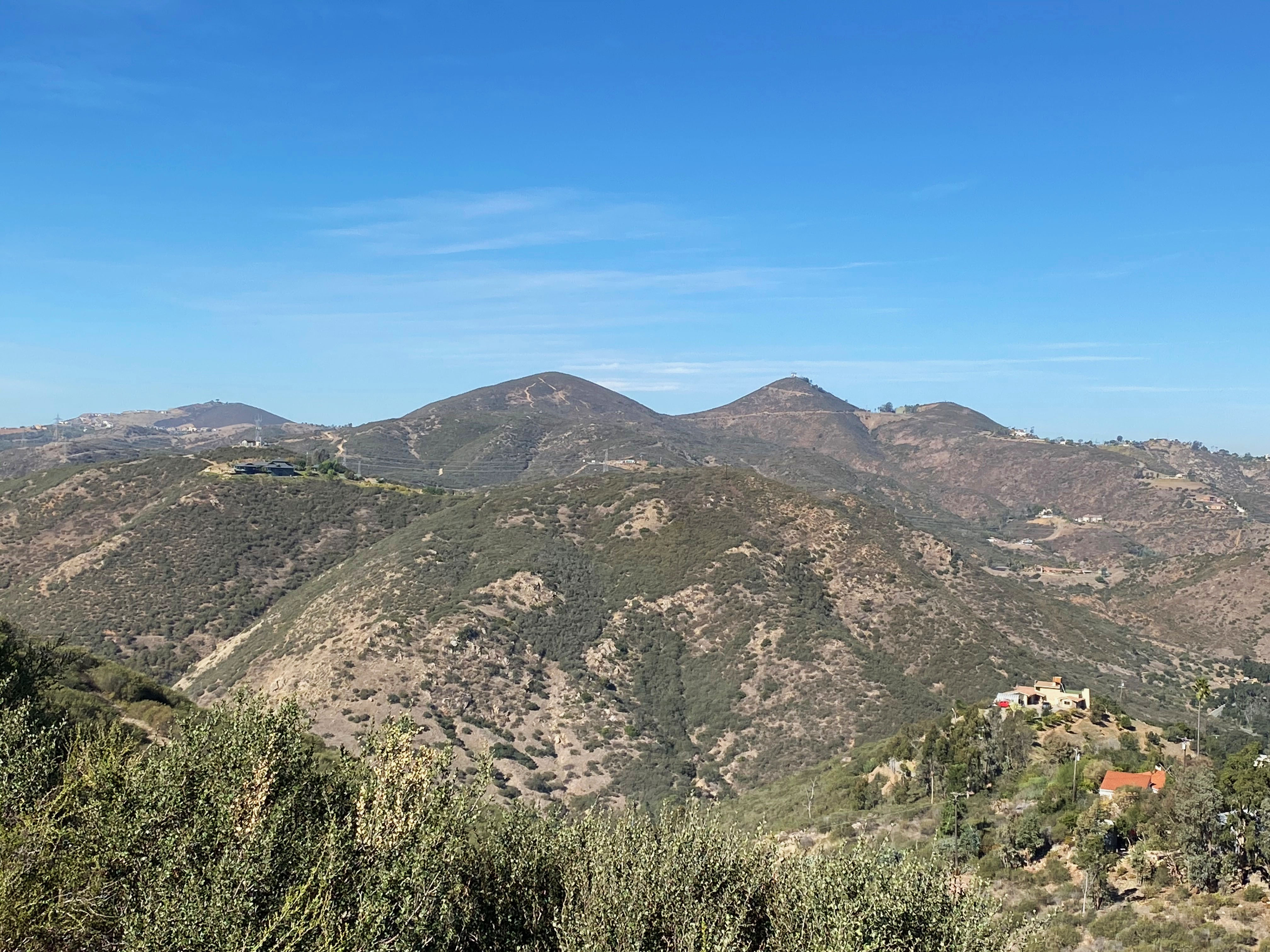
Hikers can enjoy exception views of the highlands across the Escondido Creek's canyon (San Elijo Gorge) with views of the Double Peak, Franks Peak, and Mt. Whitney areas (Figure 9).
Figure 10 shows a view of the mesa-like highlands of the Elfin Forest Recreation Reserve overlooking lower San Elijo Gorge of Escondido Creek. The Way Up Trail starting at the Elfin Forest Interpretive Center is visible on the mountainside. |

Fig. 7. View looking east at mile 1 on the Del Dios Trail. |
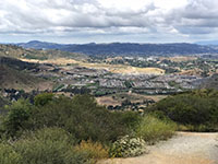
Fig. 8. View of foothills with a Harmony Grove community. |
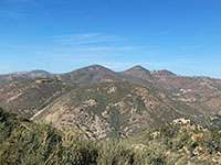
Fig. 9. Double Peak, Franks Peak, and Mt. Whitney. |
Fig. 10. San Elijo Gorge along Escondido Creek |
|
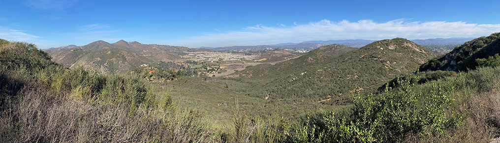
| Fig. 11. Panoramic view of the Harmony Grove (community) in the Escondido Creek valley in the east end of San Elijo Gorge. The high peaks of in the San Elijo Hills area of San Marcos are to the left. This view is near the pass along the trail mentioned above at about mile 1.3 on the Del Dios Trail. |
A3

| Fig. 12. A restored version of a panorama photo on display at the Escondido Overlook located near the intersection of the Del Dios Trail that shows many of the named mountain peaks visible in the distance to the north and east on a clear day. Elevations have been revised to include current USGS elevation data. |
A4
Lake Hodges (in Del Dios Gorge) in the San Dieguito River Watershed
The Lake Hodges Overlook is the destination that many hikers seek when hiking up the Del Dios Trail into the Elfin Forest Recreational Reserve. The complete round-trip hike is strenuous—over 6 miles with over 800 feet of elevation gain! However, the views for the ridgeline at the Lake Hodges Overlook of the region are spectacular. Lake Hodges floods the upper part of the Del Dios Gorge in the San Dieguito River watershed. Figure 13 is a view looking across Lake Hodges to the community of Del Dios on the lake's north shore. Beyond the forested community, the steep, rocky mountain slopes extending up the ridgeline are part of the Del Dios Highlands County Preserve. The high point on the ridgeline is the Lake Hodges Overlook. Figure 14 (below) is a panoramic view taken from the Lake Hodges Overlook in opposite direction from the view in Figure 13. |
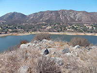
Fig. 13. Del Dios ridgeline from Lake Hodges peninsula |
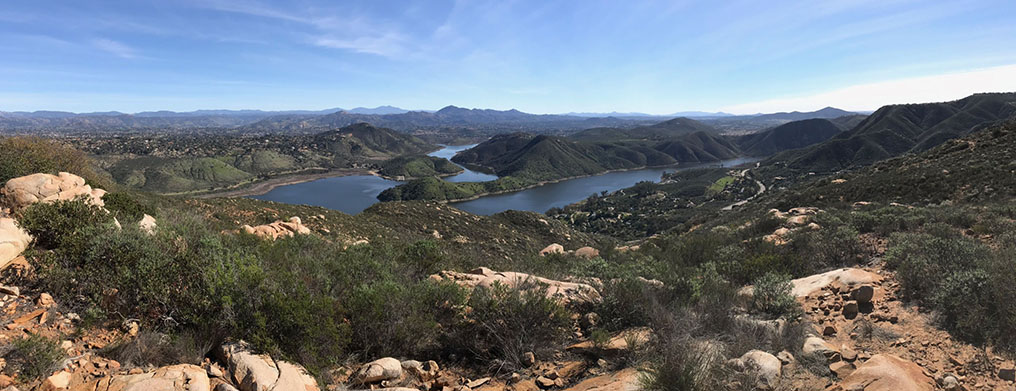
| Fig. 14. Panoramic view to the east from the Lake Hodges Overlook in the Elfin Forest Recreational Reserve. The Del Dios Highland Preserve encompasses the mountain slopes between the Lake Hodges Overlook ridgeline down to the Del Dios Highway (partly visible to the right of Lake Hodges in the valley). the high peak at the center of the view beyond Lake Hodges is Woodson Mountain. The even more distant peaks to the left of Woodson Mountain are the high peaks of the Cuyamaca Mountains just south of Julian, CA. Black Mountain (peak) is to the right. |
A5
Side Trails On The Lower Mountainside
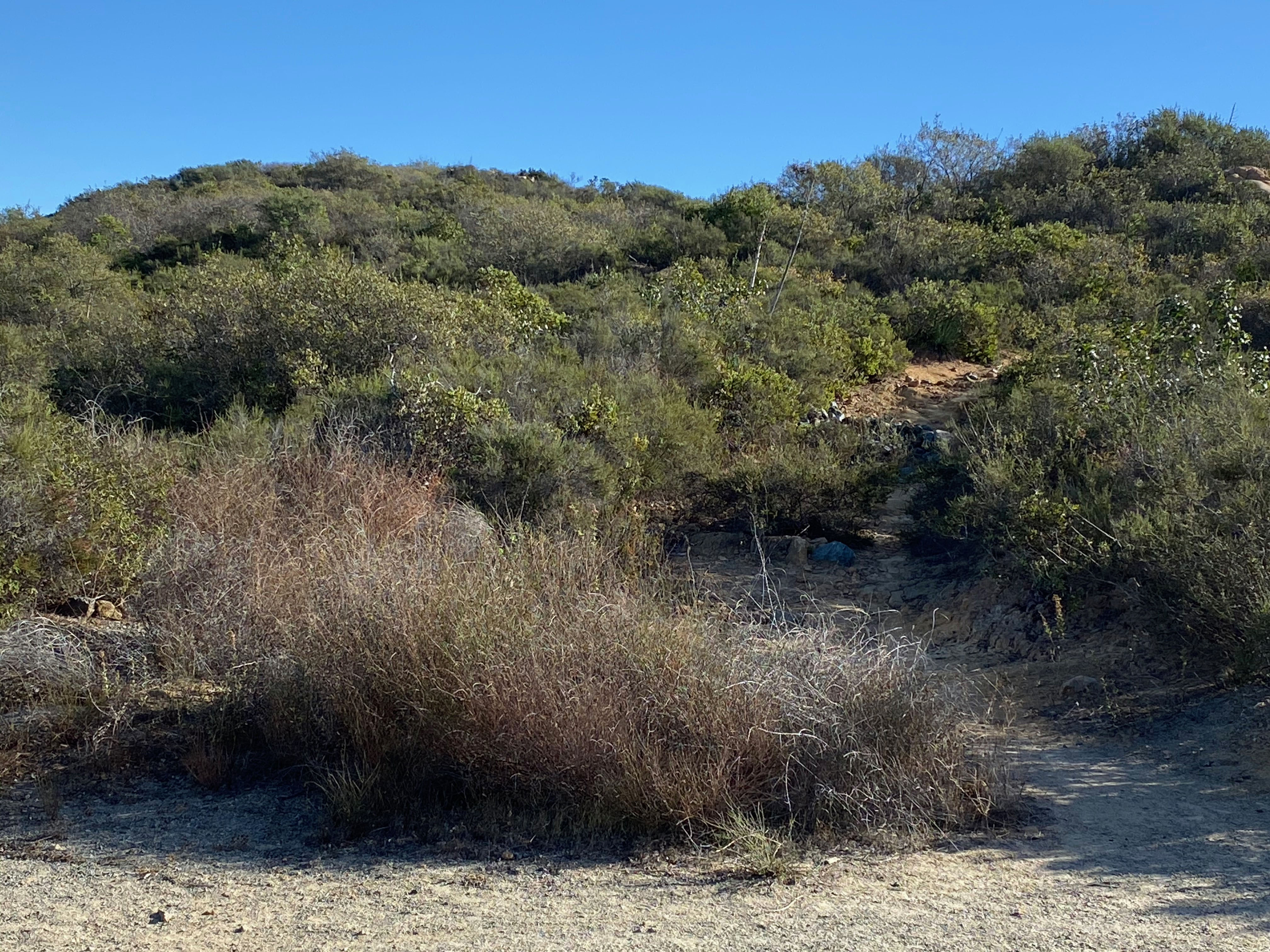
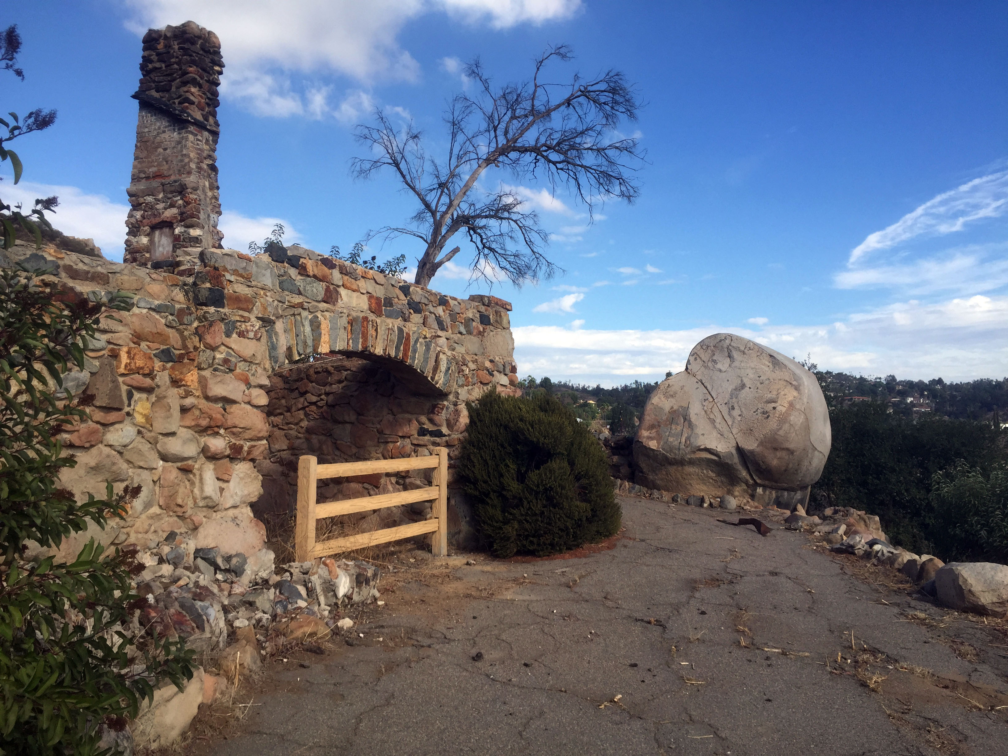
There are two trails worth exploring on the lower mountainside near the parking area (shown on map Figure 15). A undeveloped loop trail leads off of from the lower end of the parking area at the Del Dios Trailhead. This trail leads over to the ruins of an old home that burned to the ground in the 2007 Witch Fire. This trail intersects the creek trail that follows a drainage through the lower valley that connects to the main trail (the Del Dios Trail). For a shorter 1 mile hike to see the local geology it is best to hike up the Del Dios Trail and find the side trail entrance (located near so display signs, Figure 16). On the way, take the short side trail that leads to the hilltop overlook shown in Figure 17. |
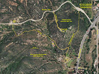
Fig. 15. Satellite map of an undeveloped loop trail map. |
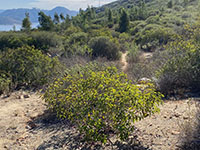
Fig. 16. The side trail off the Del Dios Trail is easy to miss. |
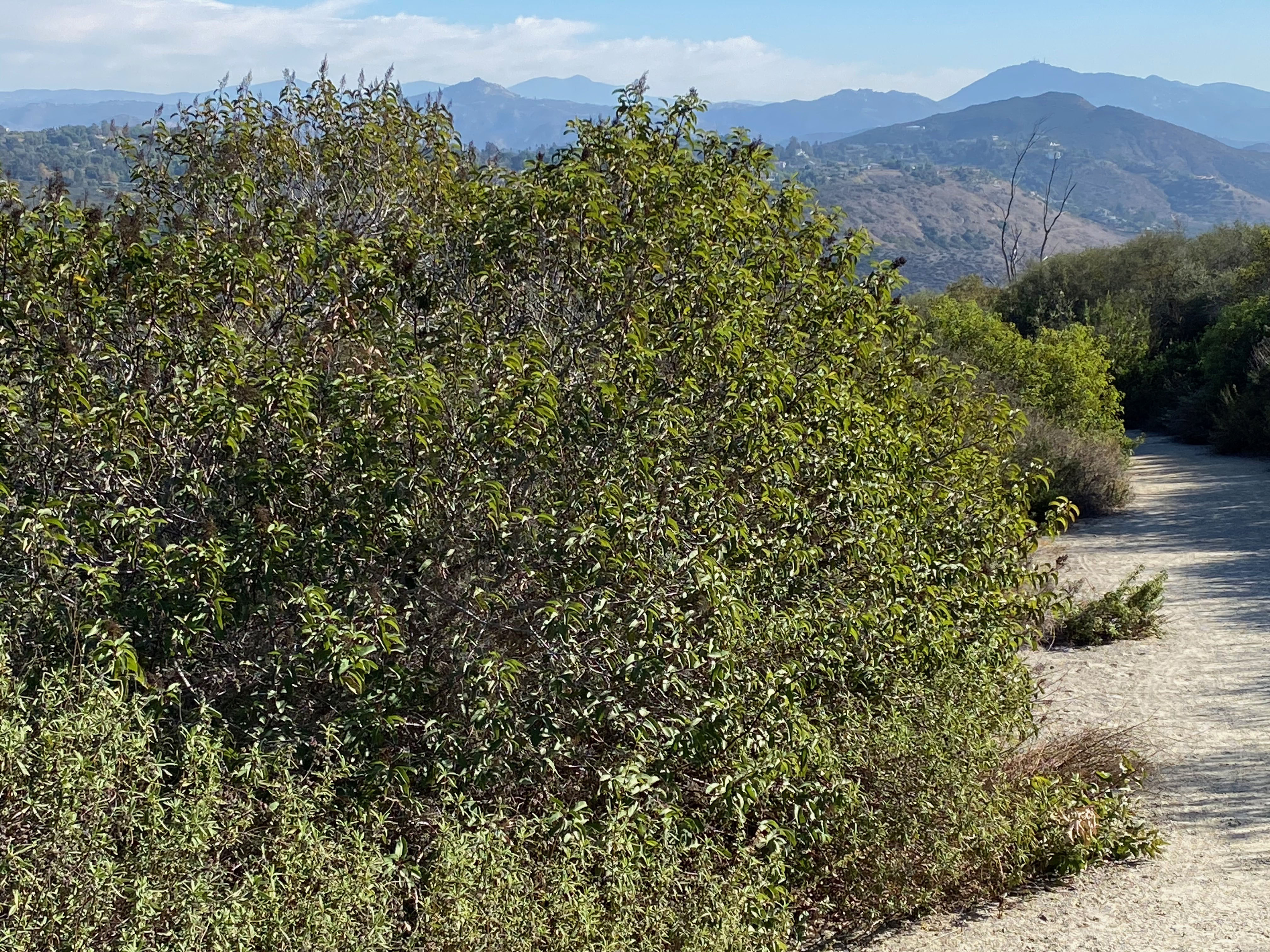
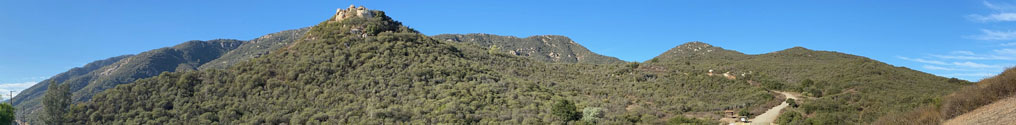
| Fig. 17. This panoramic view of the Del Dios Highlands is from a hilltop overlook area at the end of an undeveloped trail (shown as the overlook trail on map Figure 15). At the end of this short trail you can climb onto the top of a rocky outcrop to get a view of the Del Dios Highlands and Lake Hodges Park areas. The rocky hilltop in the foreground of Figure 6 is the location of the overlook. You can see the Del Dios Trail ascending the mountain in the distance. |
A6
Geologic Features In the Del Dios Highlands Area
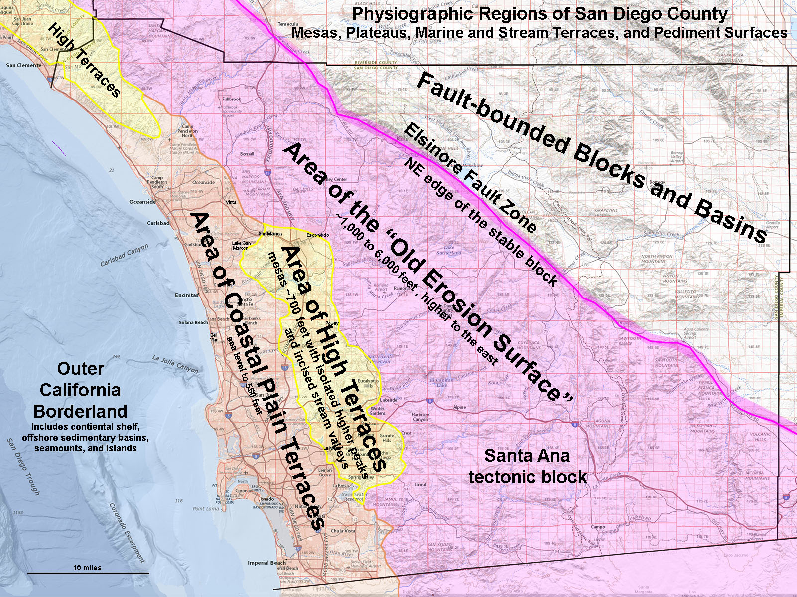
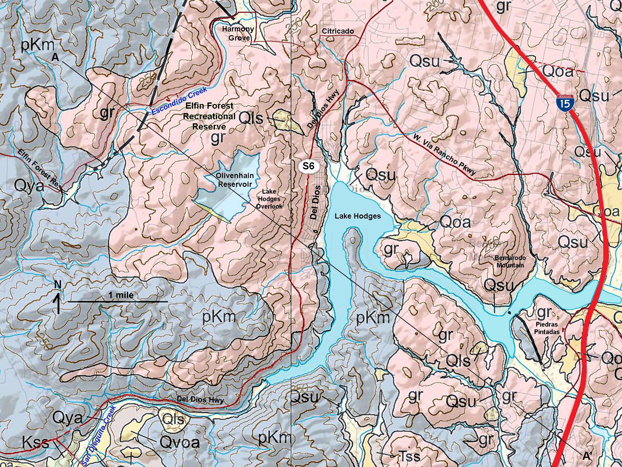
The geology of the Del Dios Highlands area shares similar characteristics to the Elfin Forest, Franks Peak, and Lake Hodges areas—they are all within the Area of High Terraces physiographic region of San Diego County (Figure 18). Figure 19 is a satellite map that shows the coastal mountains region around the Elfin Forest Recreational Reserve and Lake Hodges. Figure 20 is a geologic map of the same region that highlights the two dominant rock types in the region.
- pKm: the pale blue areas on the map are underlain by rocks for pre-Cretaceous metavolcanic rocks.
- gr: the pink areas on the map are Cretaceous granitic rocks. These rocks are discussed below.
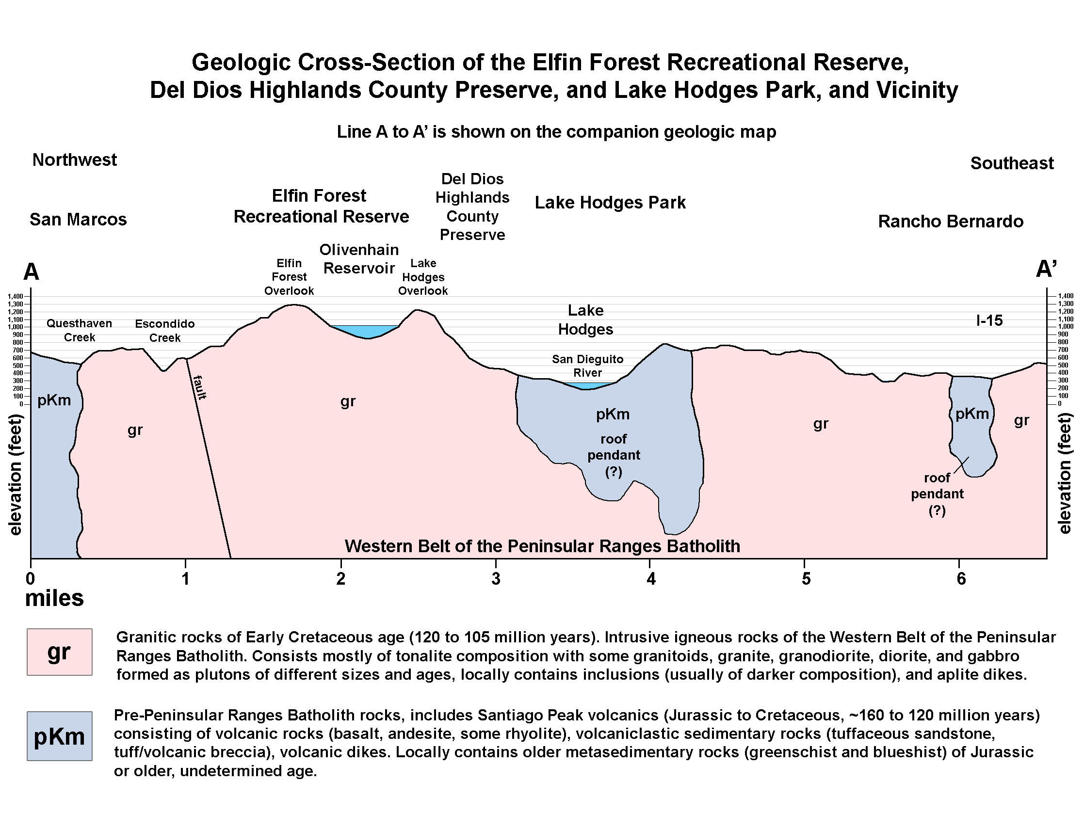
Figure 21 is a generalized geologic cross section along a line labeled A-A' on the geologic map. |
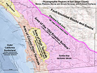 Fig. 18. Map of Coastal Plain Terraces, High Terraces, and Old Erosion Surface regions. Fig. 18. Map of Coastal Plain Terraces, High Terraces, and Old Erosion Surface regions.
|
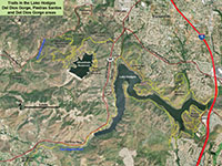
Fig. 19. Satellite map around the Del Dios Preserve area |
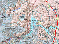
Fig. 20. Geologic map of the satellite map area. |
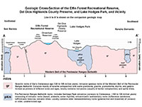
Fig. 21. Geologic cross section a A-A' on the geologic map. |
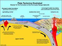
Fig. 22. Plate tectonics model for how local rocks formed. |
|
A7
Plate Tectonic Setting
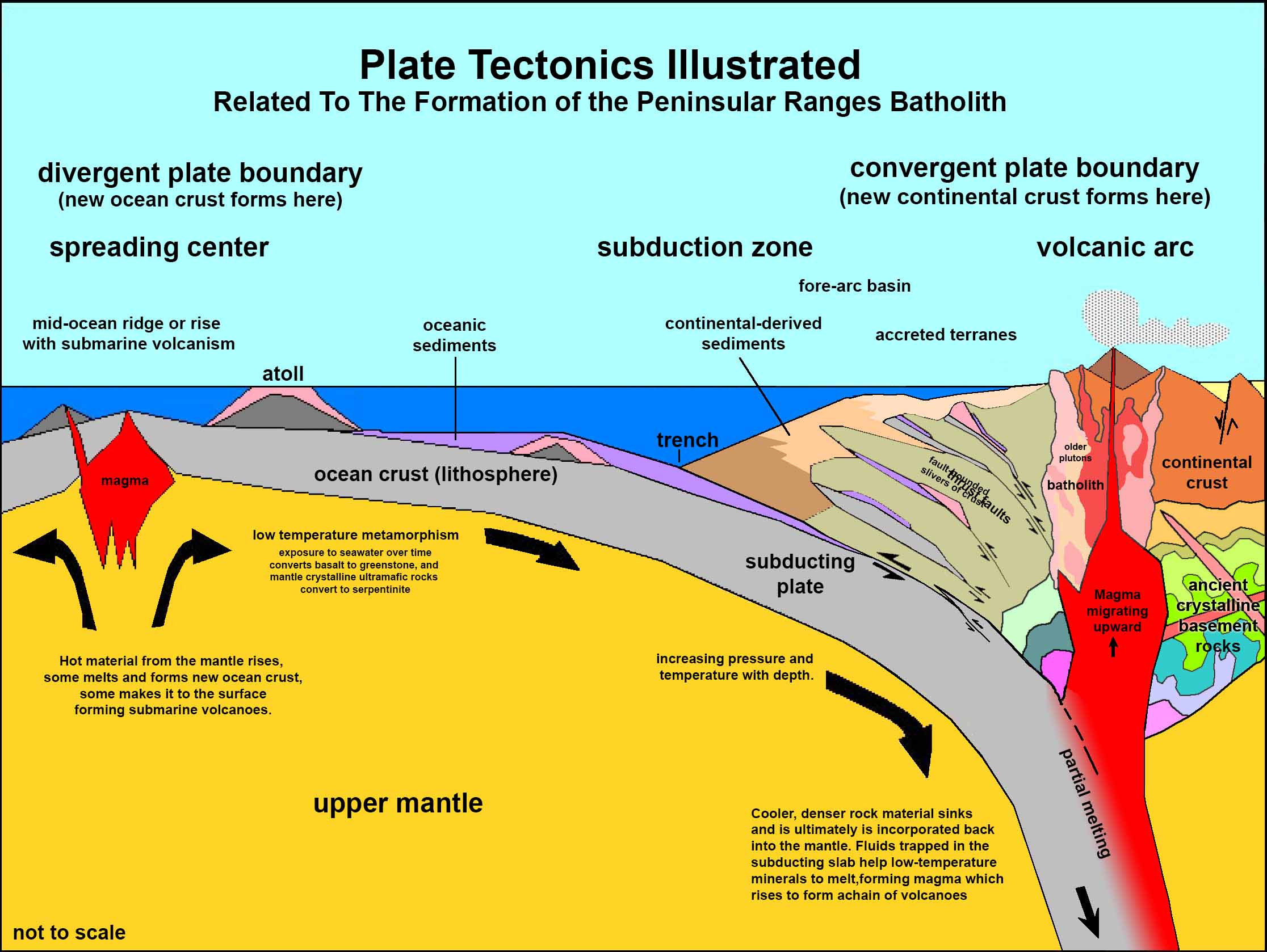
Figure 22 is a plate tectonics model that generally illustrates the geologic setting how the rocks in the San Diego Peninsular Ranges formed (including the Del Dios Highlands region). Long ago, during the Jurassic Period there was an volcanic island arc system located offshore of the North American continent, probably similar to how Japan, Philippines, and other volcanic island chains are off the coast Asia today. This volcanic arc system was active between about 160 and 120 million years ago. Ancient volcanoes formed, erupting lava and ash that spread into the adjacent ocean basin, burying and deforming older seafloor rocks in the region. This resulted in the formation of the pKm rocks shown as areas mapped in pale bluish color in Figures 20 and 21.
This was followed by a second much larger phase of igneous intrusion and volcanism that resulted in the formation of the Peninsular Ranges Batholith in Cretaceous tome (about 120 to 93 million years ago). During this period, the massive volcanic arc system was crushed onto (accreted) onto the western margin of continental North America. The younger Cretaceous igneous rocks (gr) intruded through the older Jurassic rocks (pKm). |
A8
Metavolcanic (pKm) Rocks
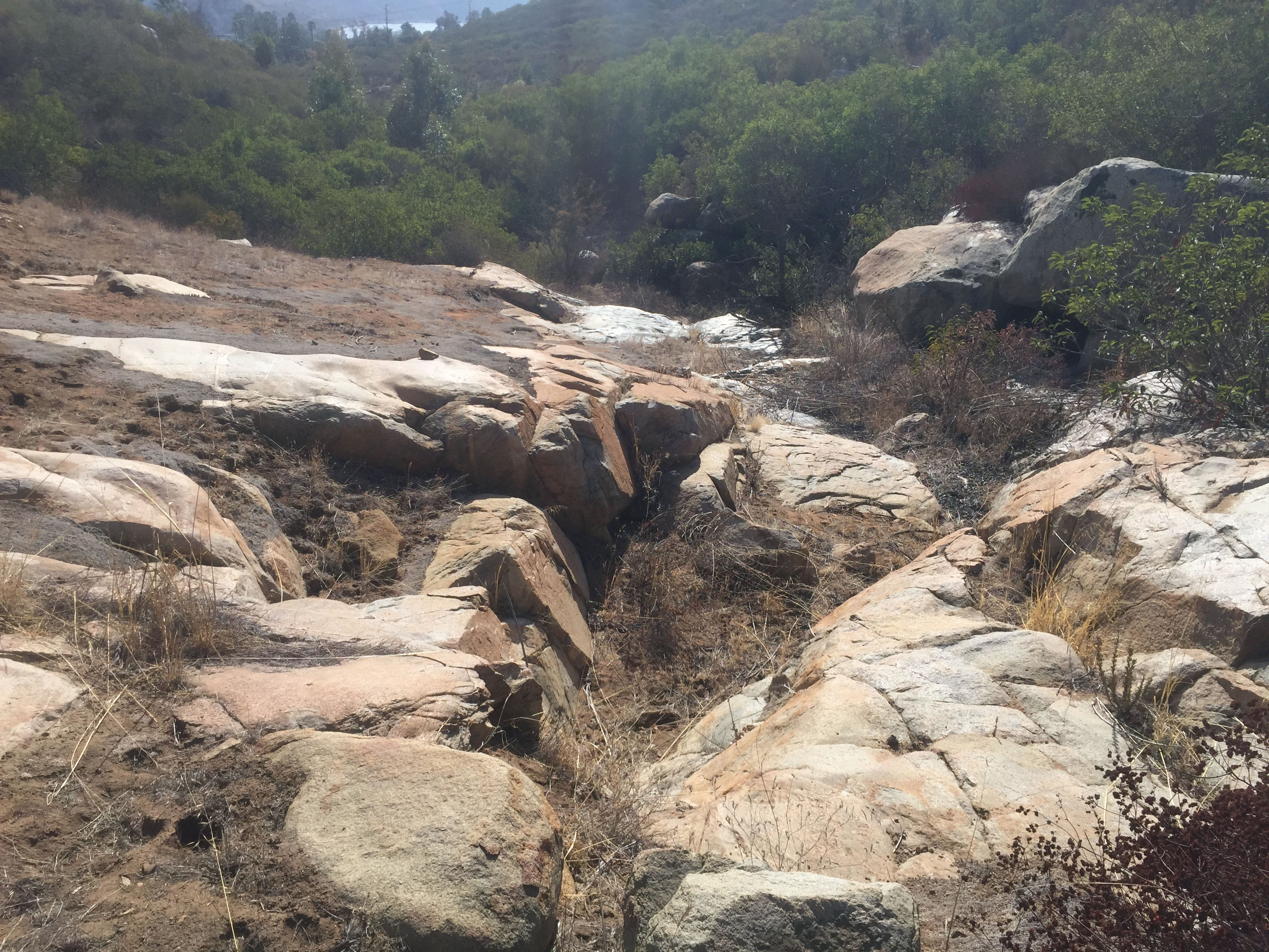
Metavolcanic rocks are only exposed in small patches along the lower slopes of the mountainside (not on the main Del Dios Trail). One place to see them is near the end of the overlook trail (shown in Figure 15). Large blocks of foliated gneiss are exposed in the overlook area (Figure 23). Another place to see them exposed is in the falls area along the narrow creek trail (also shown in Figure 15). Outcrops of both gr (granitic rock) and pKm (metavolcanic rocks) are exposed is in a small dry falls area along a creek bed (Figures 24 and 25). The location is shown as falls on the map, Figure 15). The small stream only flows during wet periods. (Please be cautious, this is prime rattlesnake habitat along these trails!) |
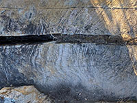
Fig. 23. Foliated gneiss/schist |
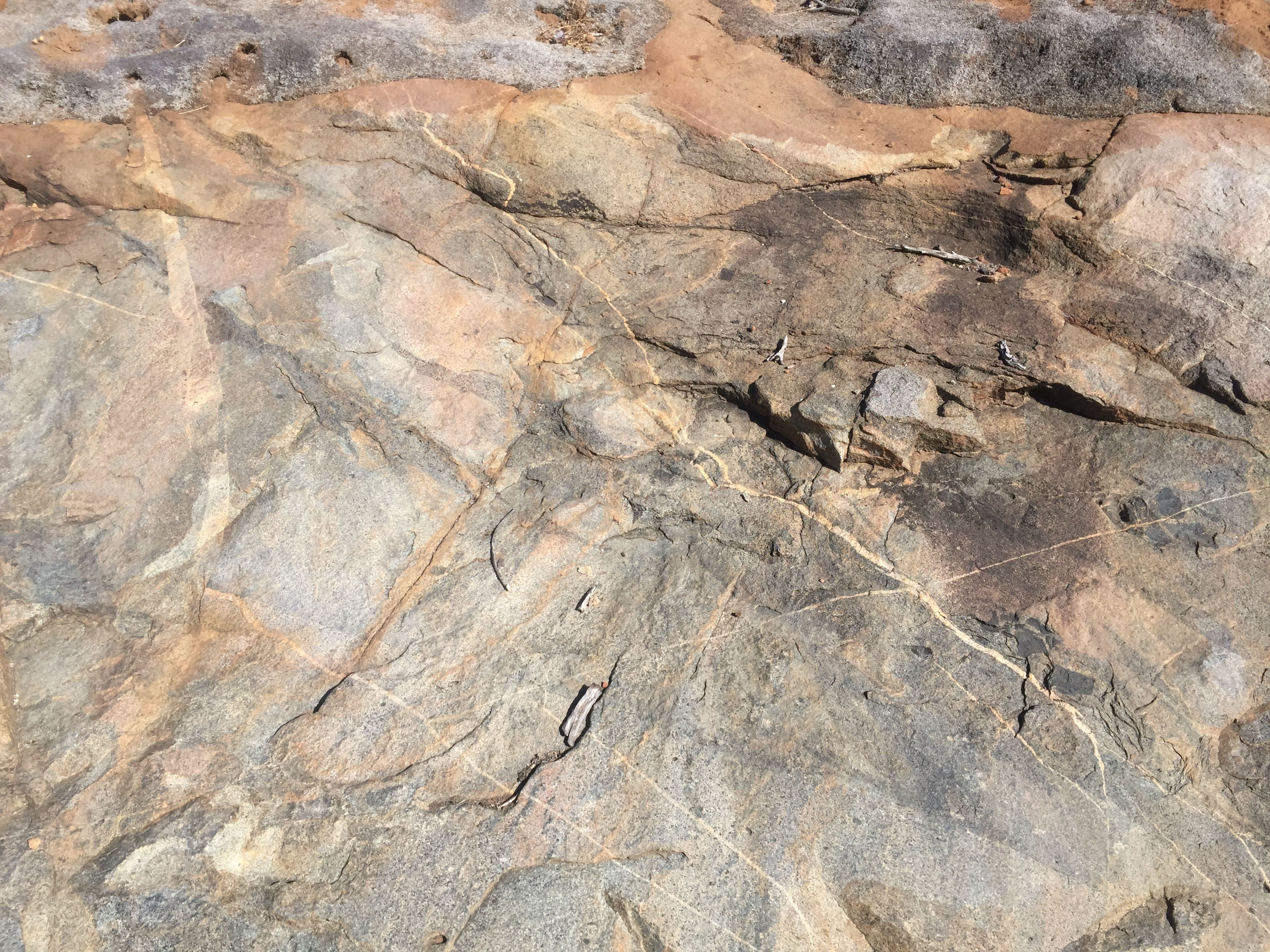
| Figures 26 shows a complex rock surfaces that displays a variety volcanic rocks of different composition compressed together and cut by thin white quartz veins. Figure 27 shows a gray basalt rock (or meta-basalt) that is also cut by numerous quartz veins. These rocks are migmatite—a rock composed of two intermingled but distinguishable components, typically a granitic rock within a metamorphic host rock. These rocks are the original country rock that bordered the massive intrusion associated with the younger gr (granitic rocks). The are possibly part of a roof pendant or sidewall to the intrusive body of the Cretaceous-age plutons associated with Peninsular Ranges Batholith (see roof pendants illustrated in Figure 18). |
A9
Granitic (gr) Rocks
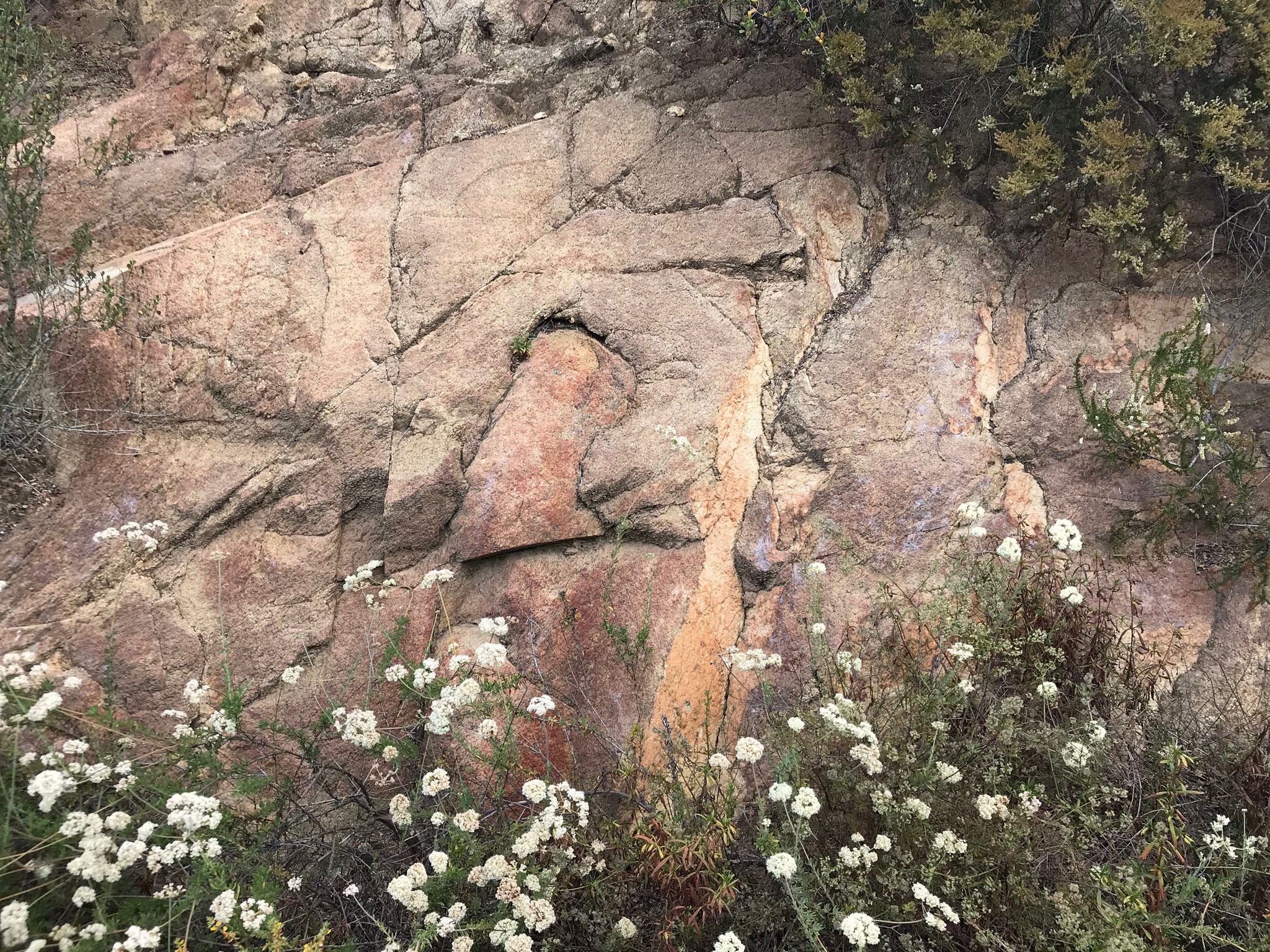
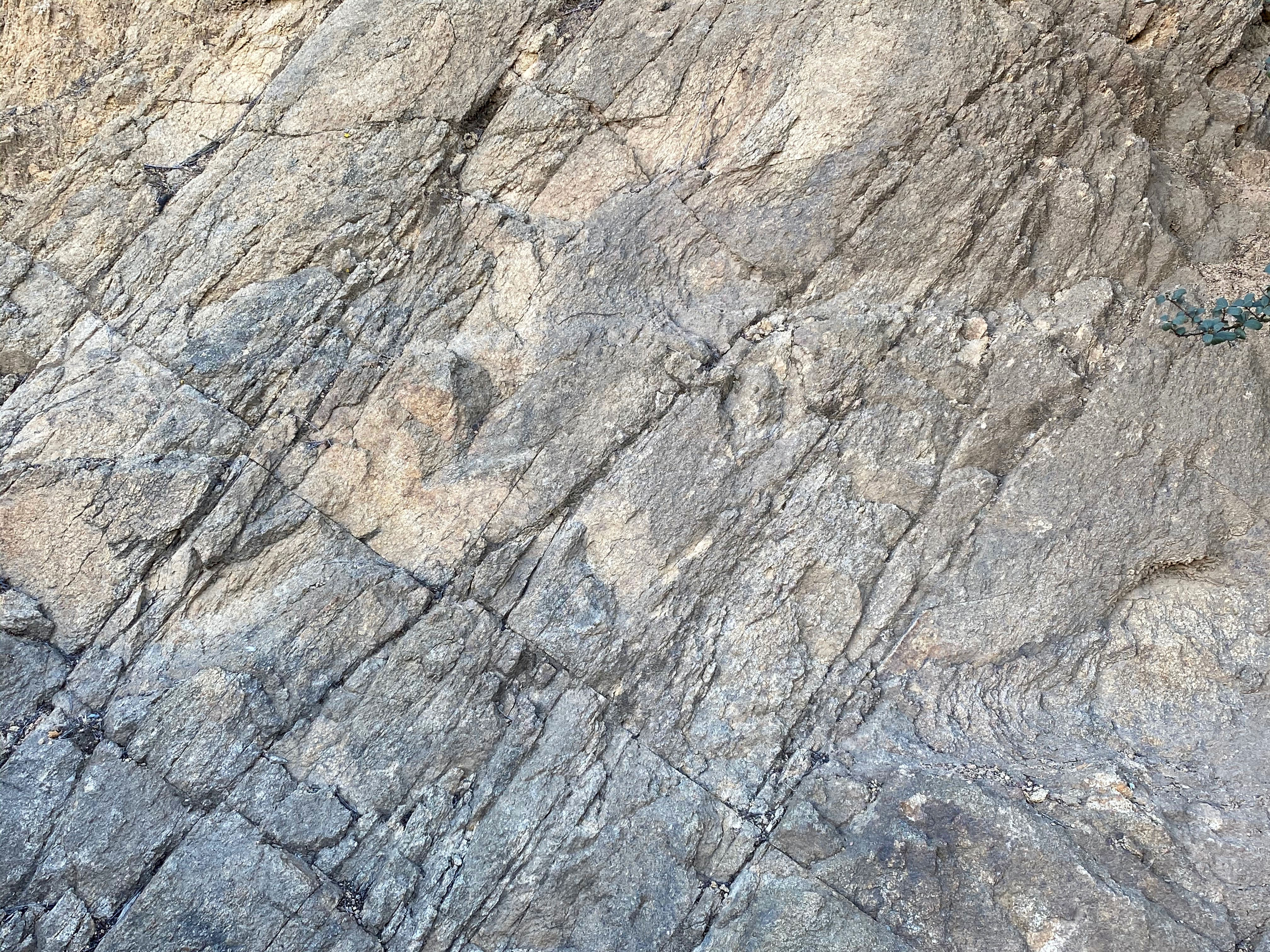
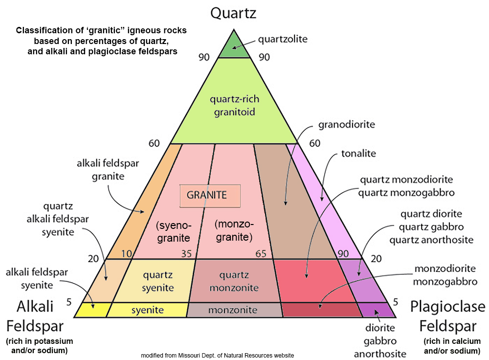
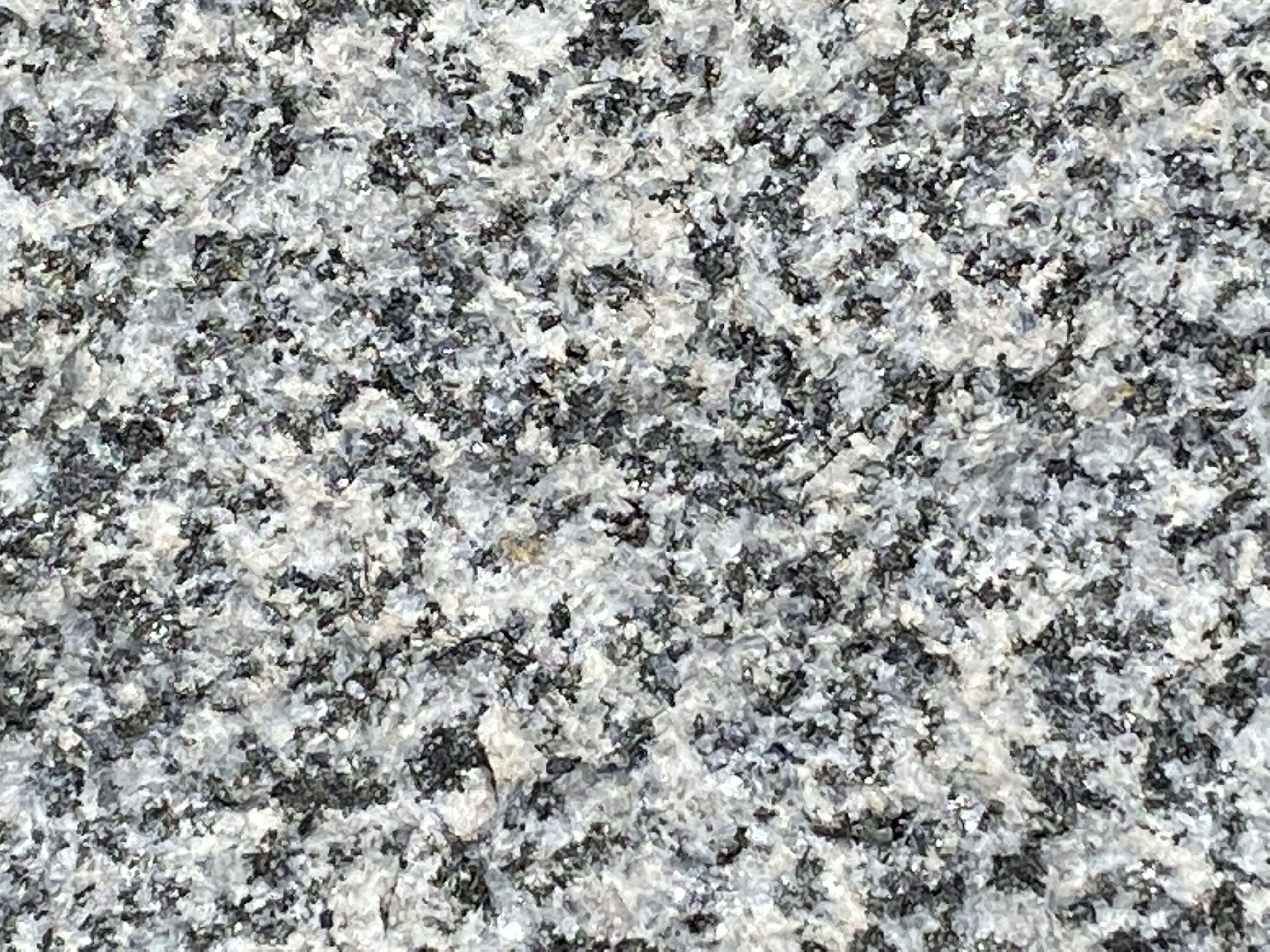
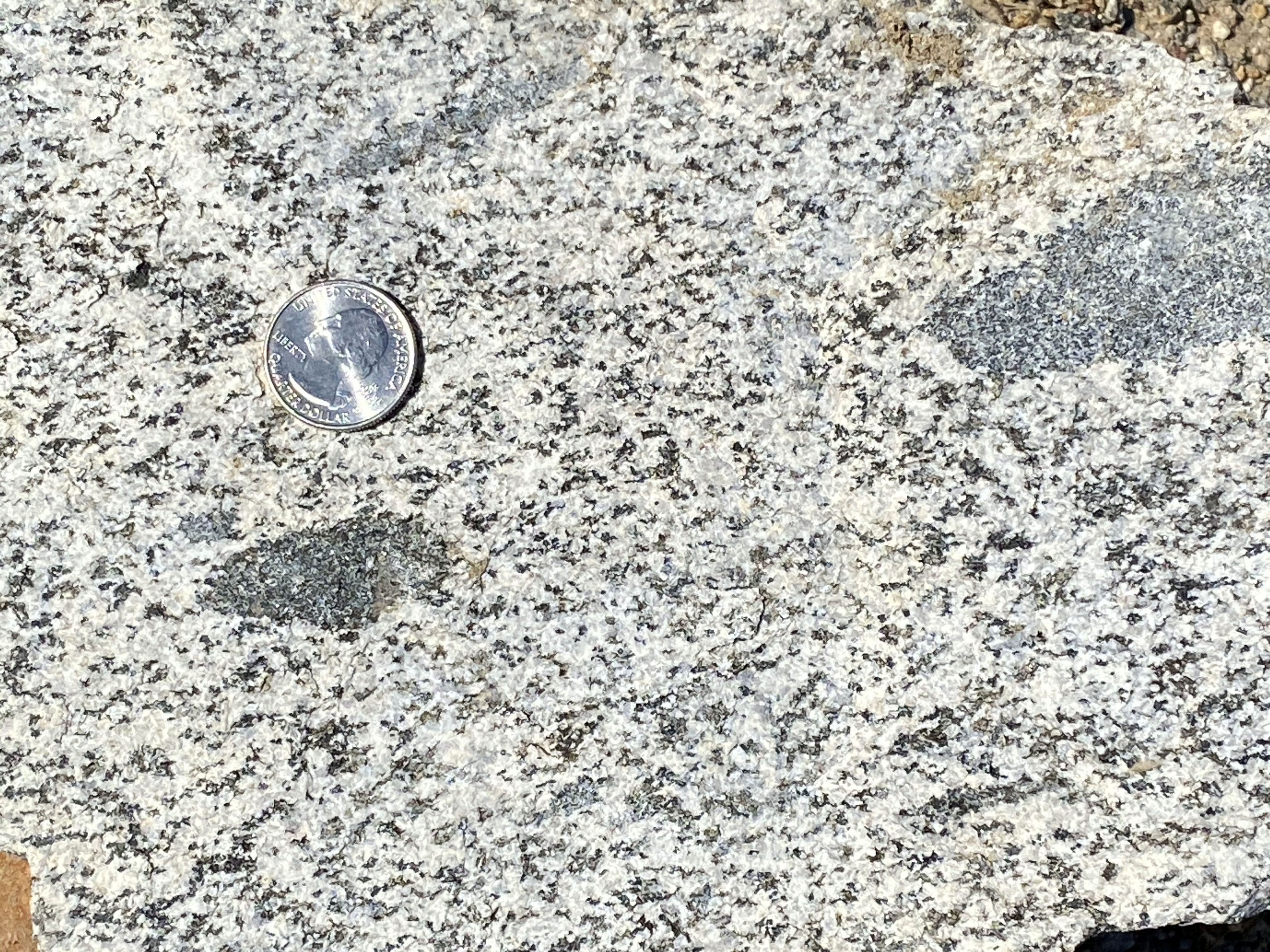
The gr (granitic rocks) dominate the highlands throughout the preserve. The pKm (metavolcanic rocks) only occurs in the lower valley near Lake Hodges. The gr rocks produce the large rocky outcrops on the Del Dios Highlands. They also crop out in the cuts along the Del Dios Trail higher on the mountainside. In some locations the outcrops of gr are massive, homogeneous blocks with mostly smooth, unbroken surfaces (Figure 28). Elsewhere the granitic rock is highly fractured with criss-crossing fracture patterns (Figure 29). Figure 30 is a classification diagram showing types of granitic rocks based on percentages of quartz and types of feldspars. The dominant local rock type is tonalite (or quartz diorite)(Figure 31). The rock has a crystalline granite-like texture composed of a mix of white feldspar, glassy-gray quartz, and dark mafic minerals (mostly amphibole and magnetite). Figure 32 shows a fresh (unweathered) rock face of a block of tonalite with dark inclusions of basalt (a dark volcanic rock). The basalt inclusions, also called xenoliths (Greek for foreign rocks), are fragments of the older host rock (the pKm rocks) that were intruded by the magma that formed the younger gr rocks. |
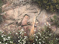
Fig. 28. Granitic rocks (gr) are the dominant bedrock in the highlands area. This exposure is in a cut along the Del Dios Trail. |
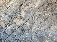
Fig. 29. Fractured granitic bedrock. |
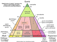
Fig. 30. Classification of granitic igneous rocks. |

Fig. 31. Zoomed in view of tonalite (or quartz diorite). |
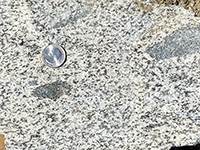
Fig. 32. Tonalite with gabbro inclusions. |
|
A10
Highlands Weathering and Erosion
From a geologic history perspective, the Del Dios Trail hike has some remarkable features beyond its bedrock geology. From a hikers perspective, it takes about 8,000 steps to climb 800 feet from the parking area to the top of the Del Dios Trail. On a geologic time scale, in Miocene time (at least 20 million years ago) valley floor was at the level of the High Terraces (Figure 18). Since then, the land has slowly risen and rivers and streams have carved their canyons downward about 800 feet to the current levels of the modern stream valleys. Simple math suggests that to erode the ancient elevated surface down 800 feet averages out to about 1 foot every 25,000 years. However, erosion rates don't occur at an even pace everywhere. There may be period for thousands of years when little down-cutting erosion takes place. During these times valleys tend to grow wider as stream carve the sides of the valleys. Then, sea level fall may fall or earthquakes may raise the landscape, and streams will start carving downward into their valleys again. Climate change takes place as well, causing landscapes to shift from forests to chaparral, to desert, and back again. Meanwhile, plant communities are constantly changing and evolving. In some places, evidence of these changes are preserved in the rocks, sediments, and soils scattered across the landscape.
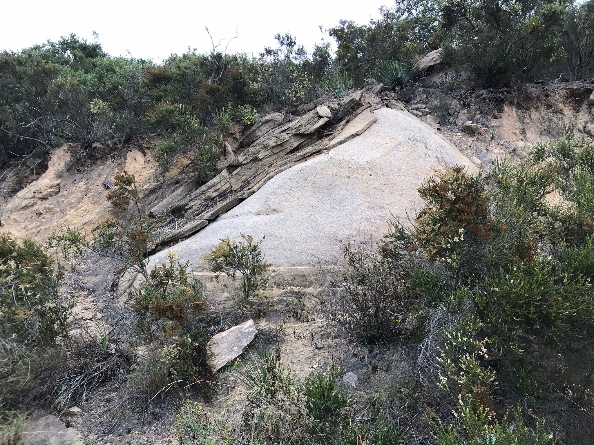
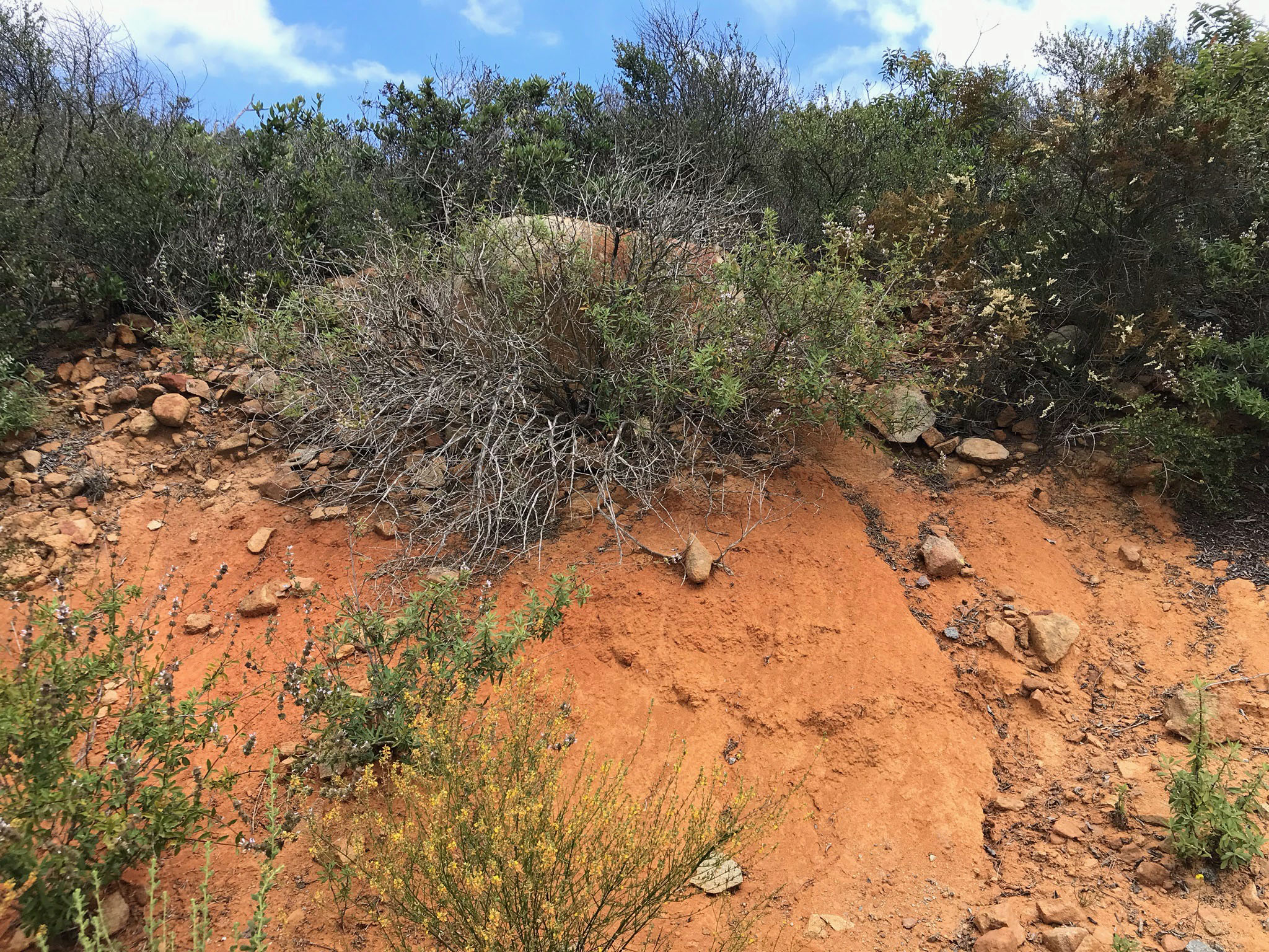
Figure 31 shows an interesting outcrop along the Del Dios Trail (at about mile 1.3). The image shows a large, rounded boulder that is gradually weathering out of the hillside (now exposed in a cut along the trail). The top of the boulder has multiple layers of rock that is slowly sheeting away. Sheeting is caused by the release of internal pressure stored from when the granitic rock formed deep below the surface. Expansion and contraction is enhanced by the heat and cooling cycles (daily and seasonally), as well as by wetting and drying cycles. These mechanical weathering process combines with chemical weathering processes to eventually break down the mineral grains in the rocks to form sediments and soil. Figure 32 shows a deeply weathered soil profile where the granitic rock has broken down into a red regolith or subsoil that crumbles easily in your hand. With long-term exposure to groundwater, the iron-rich minerals in the original rock has degraded into limonite (an iron hydroxide mineral, essential like rust on an old car).
Ancient Terrace Gravels
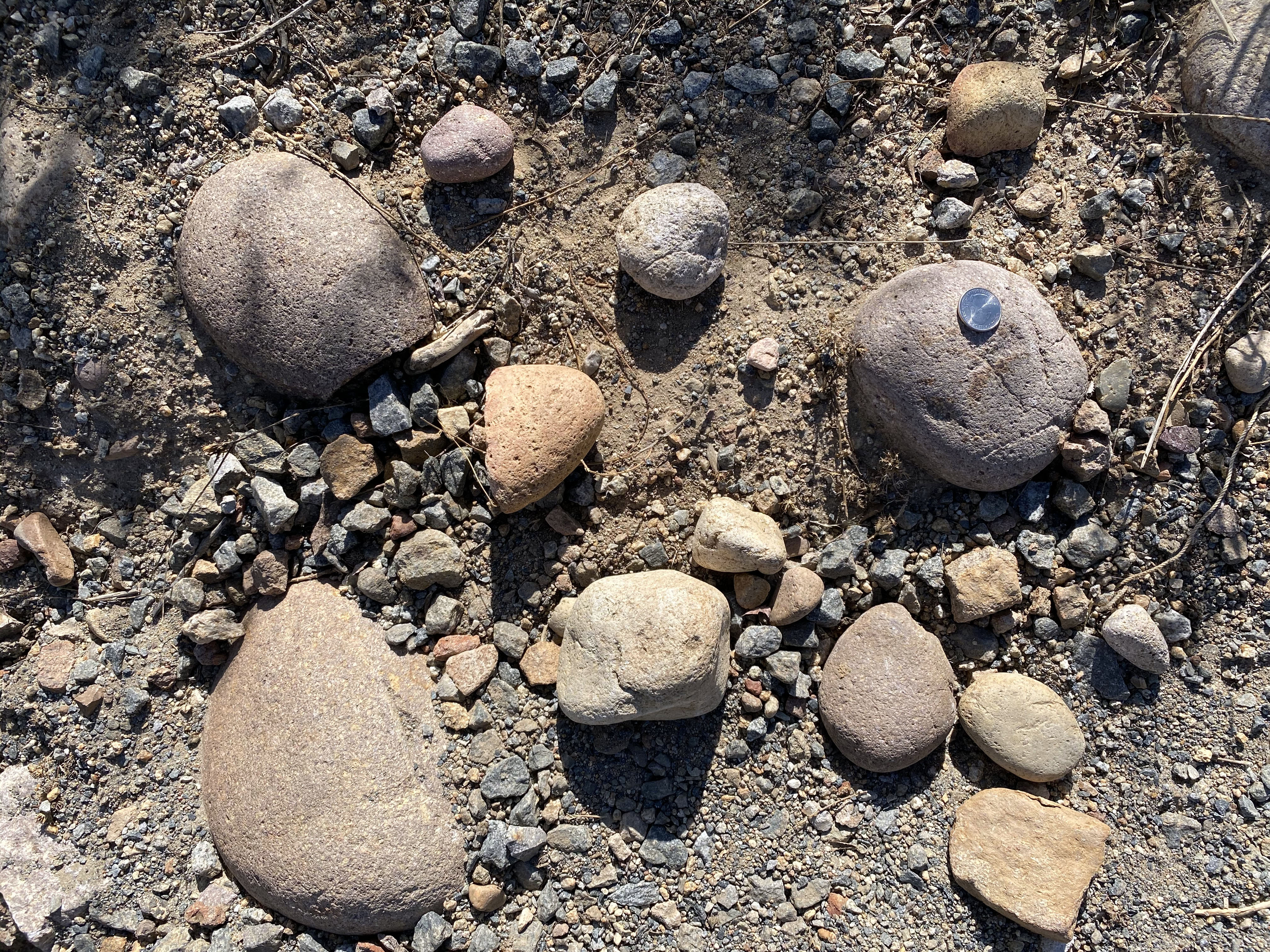
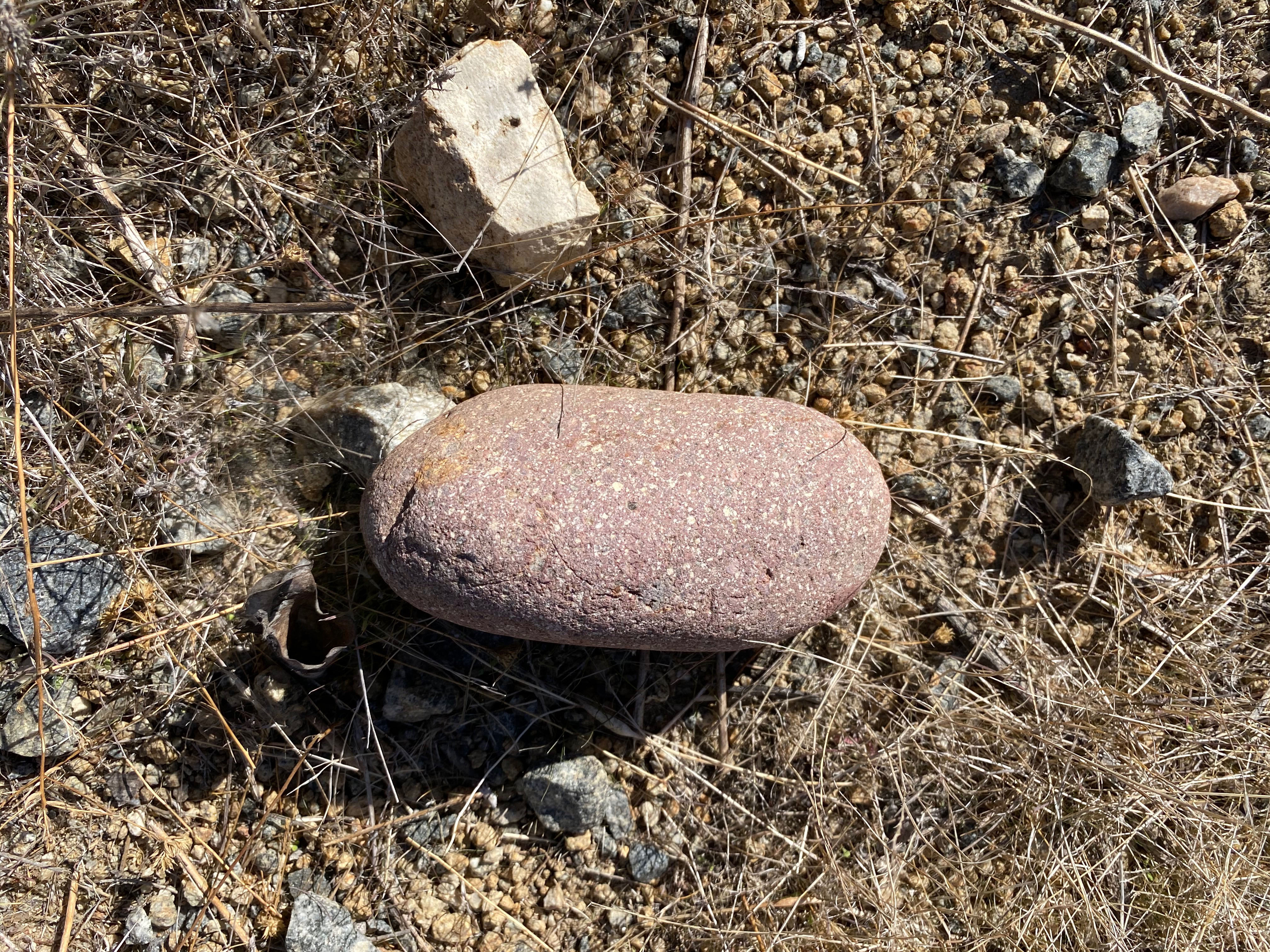
Figure 33 shows a mix of rounded stream or beach cobbles eroding out of the soil along the Del Dios Trail. These cobbles and gravel clasts do not have the same rock and mineral content of the local bedrock. They were washed into the Highland Terraces region long ago where they accumulated in gravel bars or beach-berm deposits similar to what we see forming along the coastline today. These are remnants of ancient alluvial deposits locally preserved on the hillsides and mesa tops. Figure 34 is a cobble of red andesite porphyry, a volcanic rock not from any source here in San Diego County. Red cobbles like this one are common in the conglomerate deposits of Eocene age sedimentary rock formations that crop out in Poway area and down to the coastline near La Jolla. These gravels are remnants of the ancient Ballena River system that drained for the volcanic highlands of Sonora, Mexico to the coastline in San Diego during Eocene time (about 50 to 40 million years ago). That ancient river systems vanished when the Gulf of California began to form. Baja California (with the Peninsular Ranges) split away from mainland Mexico as the San Andreas Fault system began to form about 30 million years ago. These gravels were originally deposited in floodplains or coastal settings near sea level. They are now eroding from deposits nearly 900 to 1,000 feet high on the mountainsides. Gravel clast like these can be found in many locations throughout the Area of Highlands Terraces (see Figure 18). |

Fig. 33. Boulder displaying sheeting on weathered surface. |
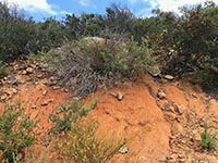
Fig. 34. Degraded granite turns into red, sandy soil. |
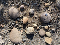
Fig. 35. Highlands Terrace gravels along Del Dios trail. |
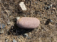
Fig. 36. A red porphyry cobble originally from Mexico? |
|
A11
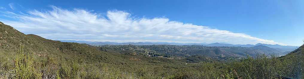
Fig. 37. Panoramic view looking east at a Highlands Terrace—a remnant of an ancient floodplain surface that is now a ridgeline/mesa in the Felicita community of western Escondido. West Via Rancho Parkway basically follows the ridgeline above the San Dieguito River valley (now Lake Hodges). The terrace gravels along the Del Dios Trail (illustrated in Figures 35 and 36) are found at the same elevations as this ridgeline at an elevation between 800 to 900 feet feet.
Beyond the Felicita ridgeline/mesa, the character of the Old Erosion Surface region can be seen as the generally level gray skyline of distant mountains of the Peninsular ranges (see Figure 18). The Old Erosion Surface is now an erosionally dissected plateau region. Back in Eocene to Miocene time (about 40 to 20 million years ago), this region was a low, coastal plain with broad valleys, low hills, and shallow coastal embayments. Since then, the land has risen as streams carved into their valleys. Today, this region in San Diego County has 24 peaks over 5,000 feet, but only two over 6,500 feet: Hot Springs Mountain (6,533 feet), and Cuyamaca Peak (6,512 feet). The higher peaks that rise above these ancient erosion surfaces can be considered monadnocks. Monadnocks are isolated hills or ridges, or erosion-resistant rock rising above a peneplain (old erosion surface). |
A12
| Fig. 38. Panoramic view of the Del Dios Highland with a higher view of the Felicita ridgeline/mesa shown in the image above. The peak of Bernardo Mountain rises beyond the end of the ridgeline, overlooking Lake Hodges. Woodson Mountain is in the distance beyond Bernardo Mountain. Both Bernardo Mountain and Woodson Mountain could be considered monadnocks. |
A13
Plant Communities in the Del Dios Highlands
The preserve is host to a mix of coastal sage scrub and mixed-chaparral plant communities. However, the mixed-chaparral plant communities dominate the higher mountainsides in the Del Dios Highlands.
Coastal sage scrub communities occur along the coastal region into the mountain to elevations up to about 1,500 feet. This drought-tolerant plant community is dominated by plants that grow up to about waist height. Common plants include black sage, bush sunflower, California buckwheat, lemon-berry, and many others.
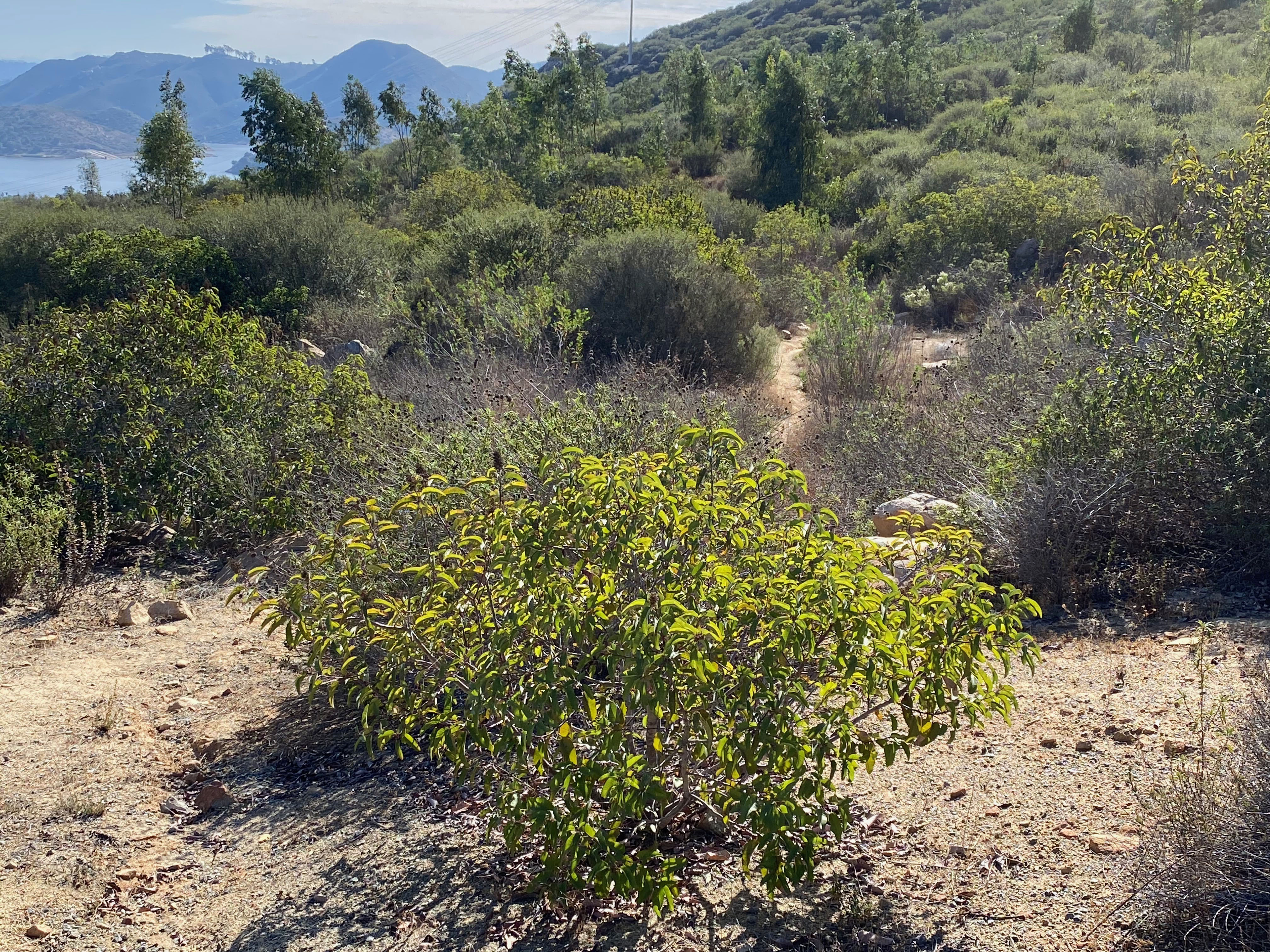
The mixed-chaparral plant communities dominate the higher mountainsides in the Del Dios Highlands (Figure 39). The plant community is dominated by very-drought resistant, heat-tolerant, shrubby species that mostly grow taller than head height but rarely over 20 feet. Chamise, toyon, and manzanita are examples of chaparral shrub species (Figures 40 to 42). South-facing slopes tend to have shorter and more widely spaced plants than the cooler-shadier, and moister north facing slopes. Manzanita tends to prefer the later.
Native plants are adapted to the extreme water supply conditions of coastal San Diego's semi-arid Mediterranean climate: long, dry summers, intermittent wet periods in the winter season, occasional coastal fog (sometimes salty), lots of sunshine, and windy, dry air (Santa Ana winds). Many of these plants have drought survival mechanisms including producing deep roots, evergreen leaves that trap and hold moisture, and the ability to regrow quickly after wildfire. |

Fig. 39. Mixed-chaparral |
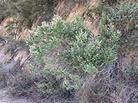
Fig. 40. Chamise blooming |

Fig. 41. Toyon |
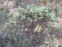
Fig. 42. Manzanita |
|
A14
Wildfire
Native human populations have been utilizing the coastal region since before the end of the last ice age. It could be argued that human activities contributed to the gradual evolution of the modern plant communities—adapted to occasional wildfire.
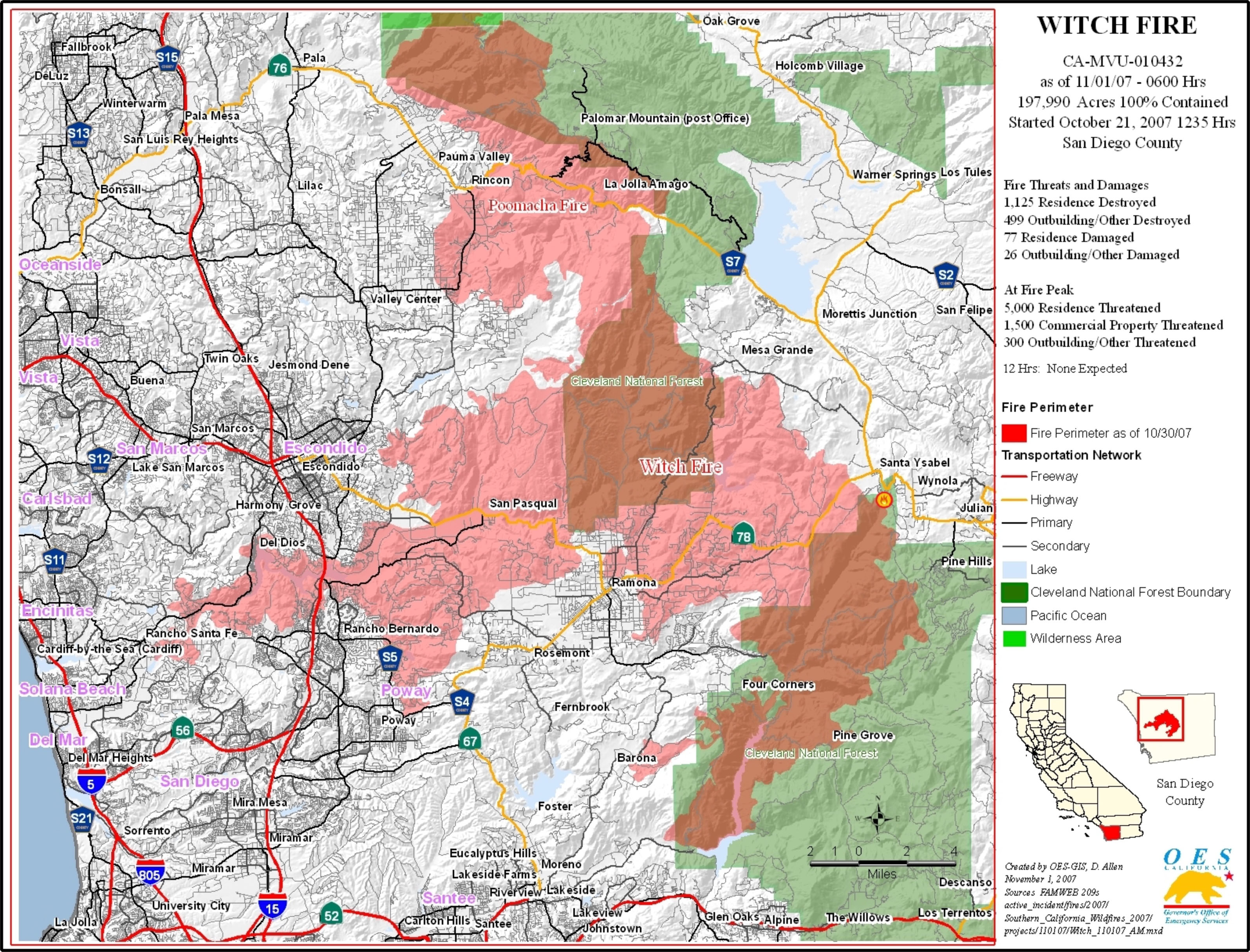
The problem with our modern society spreading into wild lands has led to attempts at fire suppression. As a result, the dead, dry plant materials builds up, making the fire risk worse. Wildfires today are probably more extensive and devastating than in the prehistoric past (example, the 2007 Witch Fire, Figures 43 to 45). |
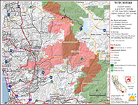
Fig. 43. The 2007 Witch Fire burned throughout much of the Coastal Highlands area in northern San Diego County (pink area on the map). |
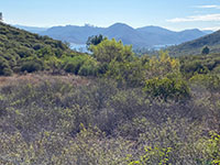
Fig. 44. Coastal sage scrub and chaparral habitats gradually returning after the 2007 Witch Fire. Fire-charred stumps can still be seen.
|
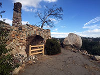
Fig. 45. Ruins of a historic home destroyed by the 2007 Witch Fire is now part of the Del Dios Highlands County Preserve.
|
A15
Protecting Archaeological Resources
The San Dieguito River in Del Dios Gorge (now Lake Hodges) has probably always been a perennial water supply. The stream valleys throughout San Diego County have been host to ancestral native populations for many thousands of years, and evidence of their presence can be seen in many places. Artifacts including potsherds, chipping flakes, shaped stone tools for chopping and cutting, spear and arrowhead points, manos (round or oval hand stones for grinding or pounding), and shell midden materials are locally preserved in the soil around their prehistoric campsites and gathering places. Please note that these materials should not be collected (they loose their significance once improperly removed). Perhaps the most enduring legacy are the mortar holes that were used to grind seeds and acorns that can be spotted on outcrops and boulders, such as Figure 46. These mortars were perhaps used for many generations as clans migrated from their summer to winter seasonal destinations. Note that all archaeological resources are protected by laws for conservation and study for future generations.
The San Diego Archaeological Center has exquisite collection of artifacts; many have been salvaged from construction sites as cities and infrastructure expanded in the region. The Archaeological Center is located 16666 San Pasqual Valley Road, Escondido, CA 92027 (east of Lake Hodges, along Highway 78).
|
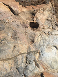
Fig. 46. Mortar holes carved in pKm bedrock. |
| https://gotbooks.miracosta.edu/fieldtrips/Del_Dios_Highlands/index.html |
12/18/2020 |
|