| Switch to: |
 |
Powell's First Expedition (1869) was a rush to survive. They left the Confluence of the Green and Colorado Rivers on July 21st, and completed the voyage on August 30th below the mouth of the Grand Canyon. On the Second Expedition (1871), Powell chose to halt the river exploration through the winter. They buried one of their boats and some supplies near the mouth of the Dirty Devil River on September 30th. They then took the two remaining boats overloaded with 10 men downstream to the Crossing of the Fathers where Spanish explorers Fathers Escalante and Dominguez had discovered nearly 100 years earlier. (The crossing was between Navajo Mountain and Navajo Creek; it is now flooded by Lake Powell.) On September 6th, they meet a supply team at the crossing. At that point Powell once again left the Second Expedition and headed for Salt Lake City to visit his wife and new child. Powell then went back to east to Washington DC to negotiate funding for additional fieldwork. |
|
Before Powell left he appointed his brother-in-law, "Prof." Almon H. Thompson, to continue leading the voyage down the canyon to the mouth of the Paria River where the ailing crew ended the 1871 portion of the second river voyage. Thompson and the rest of the party spent the winter in Kanab, Utah where most of the men spent time mapping the region north of the Grand Canyon. On May 30th, 1872, Prof. Thompson started an expedition to seek passage to the mouth of the Dirty Devil River (a mission that other explorers had attempted the year before, but failed). The Thompson Expedition included a newly-hired photographer, James Fennemore from Salt Lake City. In route to find the Dirty Devil, Thompson's party passed through the region between what is now known as Bryce Canyon and Capitol Reef National Parks in Utah. The expedition resolved many questions about geography north of the Colorado River. Along the way, Thompson named the Escalante River and the Henry Mountains, the last named river and mountain range in the United States. On July 22nd they found the mouth of the Dirty Devil River. Shortly afterward, Jack Hillers, James Fennemore, Frederick Dellenbaugh, and Will Johnson set off down the river in the boat (the Cañonita) cached near the mouth of the river the previous fall. Their mission was to continue photographing the canyon before joining the other boat crews downstream. The photographs on this website include the trip through Cataract and Glen Canyon, including the pictures by Beaman in 1871, and those by Fennemore and Hillers in 1872. |
|
 |
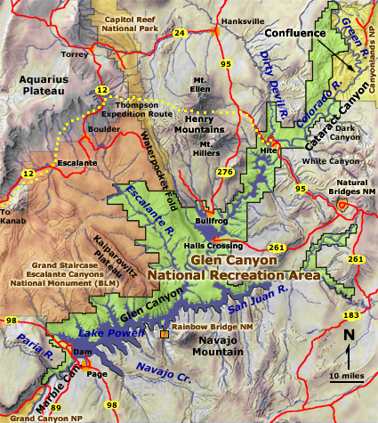
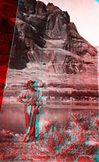
Clem Powell reading while sitting on a boulder in Cataract Canyon, Colorado
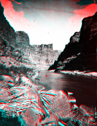
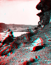
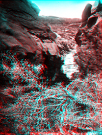
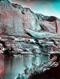
River. Arizona. Downstream of the Confluence with the Green River, the gradient of the Colorado increases, and the result is what Powell aptly named, Cataract Canyon. Cataract Canyon extends downstream for almost 50 miles with a drop of over 400 feet. Cataract Canyon extends to Mille Crag Bend, about 5 miles upstream of the mouth of the Dirty Devil River (which is located near Hite Crossing on Lake Powell). Cataract Canyon follows a system of fractures that trend toward the southwest (an ancient fracture system called the "Colorado Lineament" that extends from Arizona to Minnesota). As the river has carved downward the landscape along the river has raised, forming a series of anticlinal folds along the path of the river. The arching along the river path is probably the result of salt flowing gradually upward under the canyon due to the release of overburden pressure as the river carves downward. The salt beds are hundreds to thousands of feet below the surface in the lower Paradox Formation (Pennsylvanian age). The oldest rocks exposed in the region in parts of Cataract Canyon include gypsum, sandstone, and shale of the uppermost beds of the Paradox Formation. Gypsum of the Paradox Formation is exposed near the mouth of Gypsum Canyon (about 21 miles downstream of the Confluence). |
 |
Colorado River in Cataract Canyon, Colorado River. Utah. USGS Earth Science Photographic Archive digital file: hjk00753 By comparison to Powell's First Expedition (1869), the Second Expedition during September 1871 experienced low water conditions. Although the rapids during low water were not as fearsome in intensity as during the First Expedition, the Second Expedition party still had to spend additional time negotiating the boats through portages around rocks in the river. |
 |
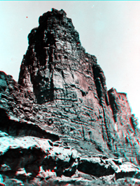
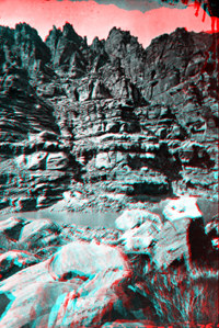
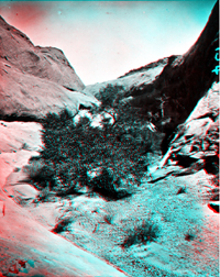
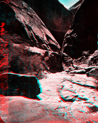
Side canyon in Cataract Canyon, Colorado River. Utah. USGS Earth Science Photographic Archive digital file: hjk00759 Felix L. Mutschler (1969) describes this Powell Survey photograph as a view looking up Clearwater Canyon. Clearwater Canyon enters Cataract Canyon from the north about 26 miles downstream of the Confluence of the Green and Colorado rivers. Powell's Second Expedition visited the canyon in September 26-27, 1871. The skyline of the canyon consists of Cedar Mesa Sandstone (Early Permian), the lower part of the canyon is Hermosa Formation (Pennsylvanian). |
 |
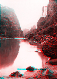
Colorado River in Cataract Canyon. Utah. September 26, 1871. USGS Earth Science Photographic Archive digital file: hjk00758 This view of the Colorado River in lower Cataract Canyon is probably near the Second Expedition's campsite near Clearwater Creek in a section of Cataract Canyon just north of Dark Canyon. Note the abundance of driftwood trapped in the rocks during high water in the foreground. Today, Lake Powell has inundated the canyon for 30 miles upstream from the mouth of the Dirty Devil River (near Hite) to near this vicinity during the highest standing water during years of heavy spring runoff. Initial dam specifications set the high-water level at 3,710 feet, but it was lowered slightly to help prevent inundation of Rainbow Bridge National Monument. |
 |
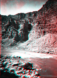
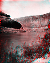
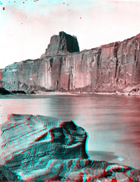
Glen Canyon. Cliff near mouth of Fremont River [Dirty Devil River], Colorado
River. Utah. Powell's crew in 1869 named the "Dirty Devil River" out of spite because the consistency of the stream at the time of their passage was closer to mud than water. One of the problems the expeditions faced was the search for potable water, particularly during rainy periods when the whole river system was running brown with sediment. Powell later attempted to assign a more formal name, the Fremont River (in honor of western explorer John C. Fremont), but the name has never stood up to the popularity of the name assigned in frustration and remembrance by the men that survived the expeditions. (The name Fremont River is applied to an upstream tributary of the Dirty Devil River that flows through Capitol Reef National Park to Hanksville, Utah.) This picture was taken by Hillers and/or Fennemore at the time they prepared to continue downstream in the boat, the Cañonita, that had been cached near the mouth of the river from the previous year (in 1871). |
 |
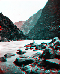
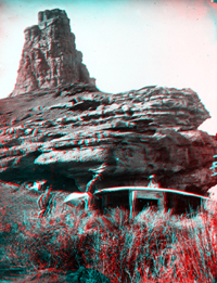
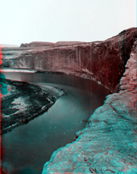
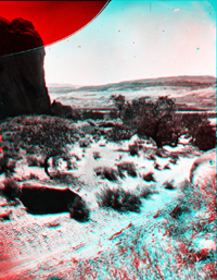
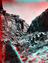
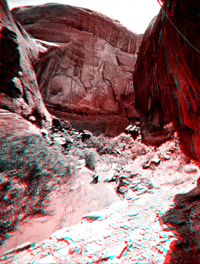
Mille Crag Bend, foot of Cataract Canyon and beginning of Narrow Canyon,
Colorado River. Utah. (Negative broken). USGS Earth Science Photographic Archive digital file: hjk00764 Mille Crag Bend is located about 4 miles downstream of the mouth of Dark Canyon (about 50 miles downstream from the Confluence of the Green and Colorado rivers). The river gradually begins to rise in the stratigraphic section again into rocks of Triassic age, and the river settles into a more gradual gradient. |
 |
|
 |
Colorado River, on right bank a little below mouth of Fremont River [Dirty
Devil River]. Repairing a boat [the Cañonita] which was left
in 1871 at mouth of the river. Left to right: W. Johnson, F. S. Dellenbaugh,
and Jack Hillers. Utah. 1872. Photo by James Fennemore. USGS Earth Science Photographic Archive digital file: hjk00778 On the First Expedition (1869), Powell named the region downstream of the Dirty Devil River, Glen Canyon -- named for the abundance of coves, alcoves, and grottos along the canyon and side streams. The gradient of the river lessened downstream of the Dirty Devil River, giving a much-need reprieve to the trials experienced in Cataract Canyon and later in the Grand Canyon. Before being flooded by the reservoir, the passage of Glen Canyon extended about 150 miles downstream to Lees Ferry. |
 |
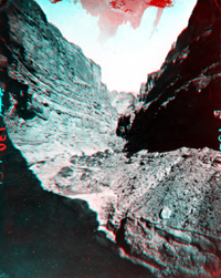
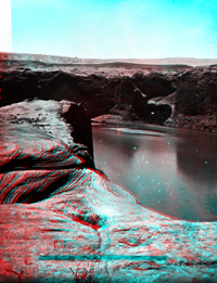
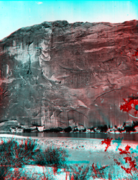
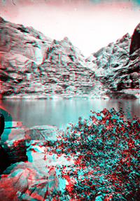
Glen Canyon, Colorado. Arizona or Utah. Downstream of the Dirty Devil River, the Colorado River canyon gradually crosses into younger sedimentary rock formations. From Narrow Canyon, cliffs of Cedar Mesa Sandstone (Permian) gradually dip down and disappear below to stream (lake) level. Up section, dark brown cliffs of even-bedded Moenkopi Formation (Triassic) give way to the slope-forming shales of the Chinle Formation (mid-to-late Triassic) and the cliff-forming Glen Canyon Group (latest Triassic to Early Jurassic age). The lower part of the Glen Canyon Group consists of nearly 300 feet of red Wingate Sandstone. The Wingate is overlain by several hundred feet of orange to buff-colored sandstone of the Kayenta Formation that, in turn, is overlain by the massive gray-white cliffs of Navajo Sandstone that approaches 800 feet in thickness. The Glen Canyon Group crops out along the shores of Lake Powell for most of the 150 mile length of the canyon (although the flooding by the reservoir has made the travel distance much shorter). Wingate and Navajo sandstones form the cliff walls at Glen Canyon Dam near Page, Arizona. Glen Canyon continues downstream of the dam to Lees Ferry where the Colorado River erosion has carved a broad valley in the softer shales of Chinle Formation. Downstream from Lees Ferry the canyon descends into hard Paleozoic-age rocks of Marble Canyon exposed on the eastern flank of the Kaibab Uplift. |
 |
John F. Steward of Powell's party in Glen Canyon. Utah. (Negative broken). USGS Earth Science Photographic Archive digital file: hjk00566 The original photograph caption attributed this picture to E. O. Beaman. It must have been taken in early October 1871. |
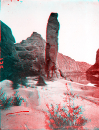 |
Colorado River, Glen Canyon, Sentinel Rock. Mouth of Sentinel Creek,
between the Crossing of the Fathers and the Paria, right bank. 1871. Photo
by E. O. Beaman. USGS Earth Science Photographic Archive digital file: hjk00770 This was the last picture taken by E. O. Beaman before he ran out of photographic glass plates on the 1871 portion of the Second Expedition. Beaman and Powell disagreed about how to profit from the photography of the mission. Beaman left in January of 1872, so Powell hired a young Salt Lake City photographer as his replacement named James Fennemore as his replacement. Although Fennemore was a skilled photographer, he wasn't prepared for the rigorous work needed to conduct field photography (the camera and supplies were both heavy and awkward to carry in rugged terrain). However, with the help of Jack Hillers, he accompanied the Thompson Expedition (Spring 1872) to find the mouth of the Dirty Devil River (the boundary between Cataract Canyon and Glen Canyon on the Colorado River. However, Fennemore became too sick to continue after the voyage down the river. Powell then used Jack Hillers as his official photographer for the rest of the Powell Survey. |
 |
Glen Canyon, Colorado River. 1872. Photo by James Fennemore. SGS Photo Archive digital file: hjk0806a This photograph (and the ones that follow) were taken by James Fennemore and/or Jack Hillers during their trip downstream through Glen Canyon in July, 1972 in the boat, the Cañonita, they had recovered from being cached near the mouth of the Dirty Devil River. |
 |
Glen Canyon, Colorado River. USGS Earth Science Photographic Archive digital file: hjk00735 This view is probably looking north across the slick-rock caprock of Navajo Sandstone in the vicinity west of Halls Crossing. To the northwest, low dark hills of middle and upper Jurassic-age formations crop out along the eastern side of the Waterpocket Fold. Beyond (barely visible on the left horizon) is the jagged white hogback of Navajo Sandstone exposed along the crest of the Waterpocket Fold in Capitol Reef National Park. The region extending to the horizon on the right is in the vicinity of the Circle Cliffs extending upward to the high escarpment of the Aquarius Plateau-Boulder Mountain area, nearly 50 miles away. |
 |
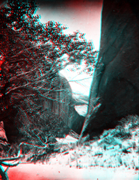
"Music Temple," a side ravine in Glen Canyon. Photo by James
Fennemore.
|
 |
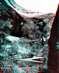
Side ravine in Glen Canyon. Most of the side ravines are now flooded by the reservoir. A mixed pinyon, juniper, and shrub oak community grew in the canyon bottoms. |
 |
Side ravine in Glen Canyon. USGS Earth Science Photographic Archive digital file: hjk00800
|
 |
Looking out of a glen. Glen Canyon. (Negative broken). USGS Earth Science Photographic Archive digital file: hjk00803 This broad section of the valley is probably near Halls Crossing, now one of the wider sections of Lake Powell. |
 |
High water in Glen Canyon, Colorado River. 1872. USGS Earth Science Photographic Archive digital file: hjk00808 Cliffs of Glen Canyon Group, probably Kayenta and Navajo Sandstone in the mid section region of the canyon. |
 |
Massive wall in Glen Canyon, Colorado River. 1872. USGS Earth Science Photographic Archive digital file: hjk00812 |
 |
Glen Canyon. Utah or Arizona. USGS Earth Science Photographic Archive digital file: hjk00824 |
 |
A side ravine in Glen Canyon, Colorado River. Photo by James Fennemore.
USGS Earth Science Photographic Archive digital file: hjk00827 |
 |
Glen Canyon. USGS Earth Science Photographic Archive digital file: hjk00828 |
 |
Colorado River in Glen Canyon. 1872. USGS Earth Science Photographic Archive digital file: hjk00833 |
 |
Glen Canyon, Colorado River. USGS Earth Science Photographic Archive digital file: hjk00835 |
 |
One of the glens in Glen Canyon, Colorado River. (Negative cracked).
USGS Earth Science Photographic Archive digital file: hjk00840 |
 |
Glen Canyon, Colorado River. The crew of the Cañonita met Major Powell and other members
of the Second Expedition near the mouth of the Paria River where they
recovered the other two boats from the previous fall (the Emma Dean
and the Nellie Powell). Again with limited supplies, the Second
Powell Expedition departed in late August and proceeded downstream to
continue the mapping and photographing of the Grand Canyon. |