Glen Canyon, Colorado. Arizona or Utah.
USGS Earth Science Photographic Archive digital file: hjk00543
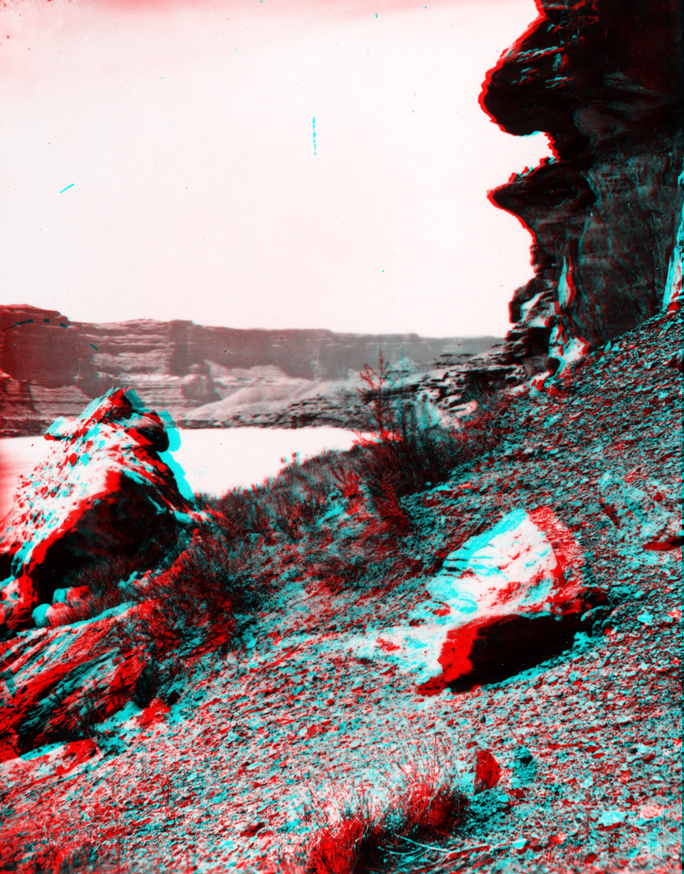
Downstream of the Dirty Devil River, the Colorado River canyon gradually crosses into younger sedimentary rock formations. From Narrow Canyon, cliffs of Cedar Mesa Sandstone (Permian) gradually dip down and disappear below to stream (lake) level. Up section, dark brown cliffs of even-bedded Moenkopi Formation (Triassic) give way to the slope-forming shales of the Chinle Formation (mid-to-late Triassic) and the cliff-forming Glen Canyon Group (latest Triassic to Early Jurassic age). The lower part of the Glen Canyon Group consists of nearly 300 feet of red Wingate Sandstone. The Wingate is overlain by several hundred feet of orange to buff-colored sandstone of the Kayenta Formation that, in turn, is overlain by the massive, crossbedded, gray-white cliffs of Navajo Sandstone that approaches 800 feet in thickness. The Glen Canyon Group crops out along the shores of Lake Powell for most of the 150 mile length of the canyon (although the flooding by the reservoir has made the travel distance much shorter). Wingate and Navajo sandstones form the cliff walls at Glen Canyon Dam near Page, Arizona. Glen Canyon continues downstream of the dam to Lees Ferry where the Colorado River erosion has carved a broad valley in the softer shales of Chinle Formation. Downstream from Lees Ferry the canyon descends into hard Paleozoic-age rocks of Marble Canyon exposed on the eastern flank of the Kaibab Uplift.