
San Andreas Fault in San Benito County, California - San Juan Bautista to St. Francis Retreat |
| Field-trip overview: This field trip is a tour to look at selected locations along the San Andreas Fault where offset of natural and manmade features are visible. This field trip focuses on locations along the fault zone in San Benito County between the town of San Juan Bautista and the St. Francis Retreat Center—the Retreat Center is located about 3 miles south of town. Fractures and bends in old pavement reveal the trace of the actively creeping San Andreas Fault where roads cross the fault zone along a route ending at the Retreat Center. Landscape features associated with the fault zone around the Retreat Center include linear stream drainages, sag ponds, pressure ridges. Both bedrock geology and landscape features reveal the character of the San Andreas Fault on a variety of scales. Directions: From US Highway 101 take exit 345 for the CA Highway 156 (San Juan Bautista/Hollister). Follow CA Highway 156 East for 3.4 miles to the first stop light on The Alameda (Windmill Shopping Area and San Juan Elementary School are on the left). [See the San Andreas Fault walking tour for San Juan Bautista] Turn right (south) on The Alameda (away from downtown San Juan). Proceed 0.1 mile and turn left on the Old Hollister-San Juan Road and proceed 0.2 miles to Stop 1 where the San Andreas Fault crosses the road west of the entrance to the Mission Farm RV Park (on the left). Continue east on Old Hollister-San Juan Road to Mission Vineyard Road. Turn right (south) on Mission Vineyard Road. Proceed 0.3 mile to Stop 2 where the fault crosses Mission Vineyard Road. Continue south for 0.1 mile to an intersection at a sharp bend in Mission Vineyard Road. Turn left (south) on the private road (Mission Vineyard Road extension) with a sign pointing in the direction of the St. Francis Retreat. In 0.1 the old road surface gets very rough where it crosses the San Andreas Fault zone (Stop 3). Continue south for 0.1 mile and bear right on the St. Francis Retreat Road. Proceed about 0.1 mile to Stop 4 where the St. Francis Retreat Road crosses the San Andreas Fault zone (with more broken pavement and a long history of repairs). Continue about 1 mile to the entrance to the St. Francis Retreat (Stop 5). Proceed to the visitor parking area at the St. Francis Retreat Center (Stop 6). The rest of the field trip is best done on foot (or on bike) to Stops 7 and 8 (see map). Geologic Setting: In the San Juan Bautista region ,the San Andreas Fault is a dividing line between rocks of contrasting origin. On the west side of the fault, the bedrock in Gavilan Mountains consists of a great crustal block of crystalline metamorphic and igneous rocks that originally formed in the southern California region. The granitic intrusive bodies exposed in the range formed in the Cretaceous Period (about 100 to 80 million years ago) when a great volcanic arc (similar to modern Japan or the Aleutian Island Chain) existed along the west coast of the North American continent. Over millions of years they have been carried northward by motion along the San Andreas Fault system for distances over hundreds of miles to their present location. |
Click on images for a larger view. | |
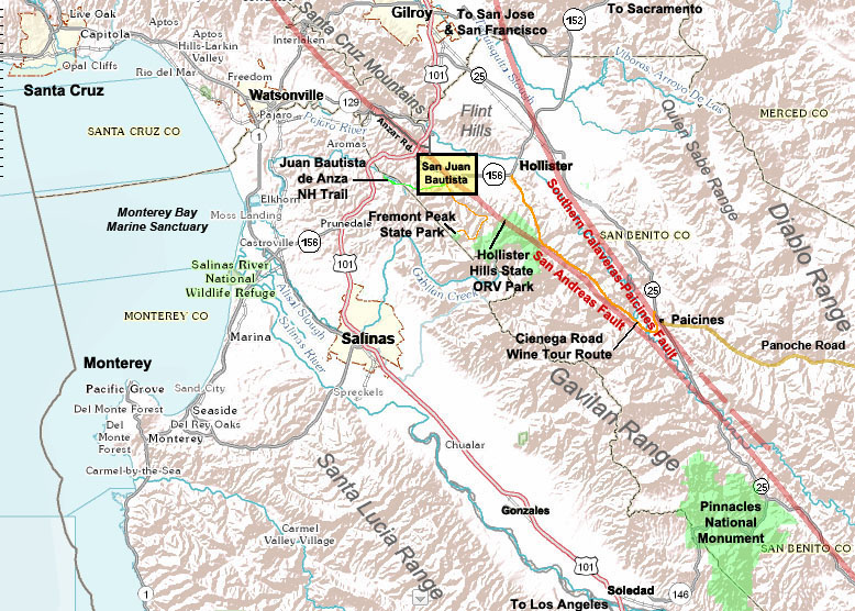 Regional map showing field trip field area. |
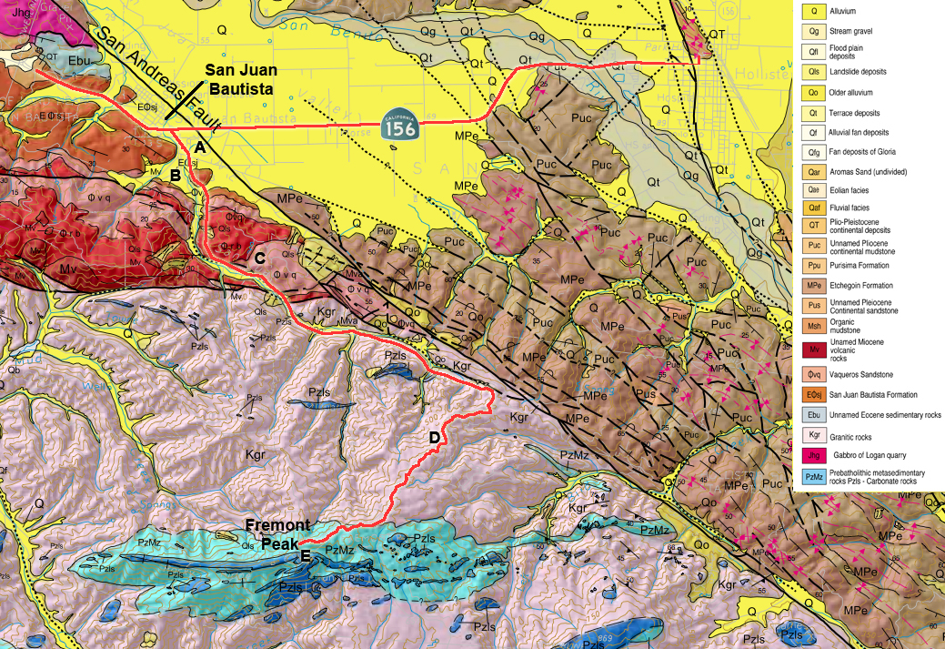 Geologic Map of the San Juan Bautista region1 |
|
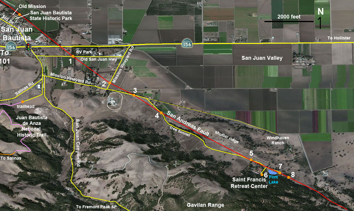 Map of the San Andreas Fault between San Juan Bautista and St. Francis Retreat showing selected field trip stop locations (Stops 1-8). |
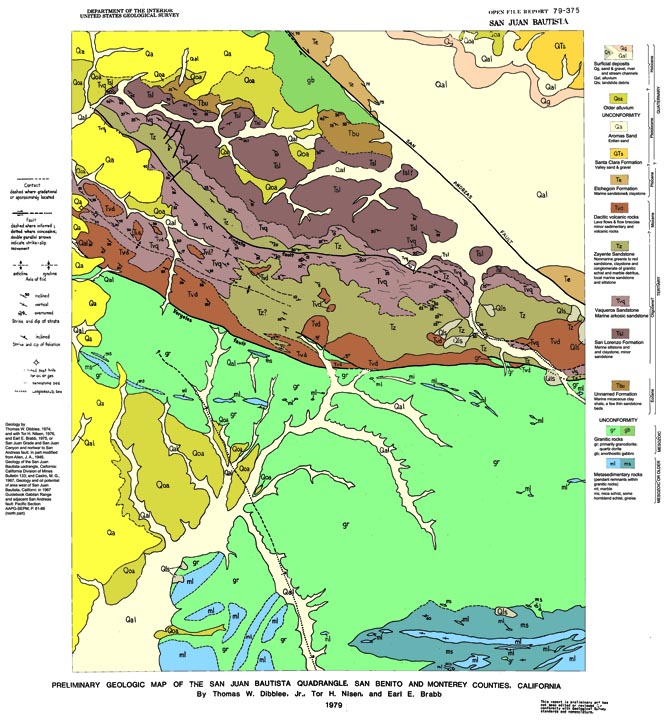 San Juan Bautista 15 minute quadrangle geologic map2 |
|
 Stop 1. San Andreas Fault zone near Mission Farms RV Park on the Old San Juan-Hollister Highway. |
 Stop 2. San Andreas Fault rupture on Mission Vineyard Road |
|
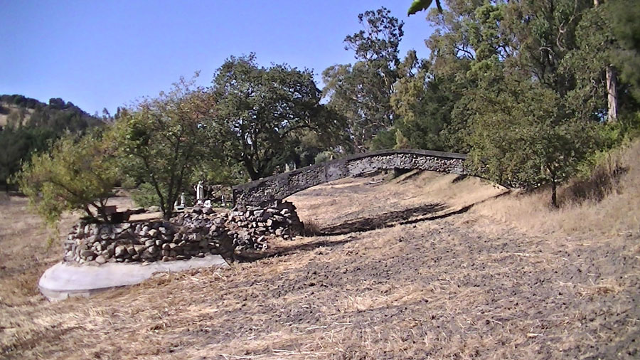
 Stop 3. View looking south along the San Andreas Fault where it crosses the private access road and enters a linear valley in the vicinity of the St. Francis Retreat. |
||
| ST. FRANCIS RETREAT http://www.stfrancisretreat.com 549 Mission vineyard Road San Juan Bautista, CA 95045 (831) 623-4234 |
Along the long journey northward, the crystalline basement rocks of Gavilan Range were buried beneath a cover of younger late Tertiary-age volcanic and sedimentary deposits. These are now exposed along the northern end of the mountain range near San Juan Bautista—these rocks are now exposed as steeply dipping layers that are partially exposed in the foothills along San Juan Canyon and Salinas Roads (to the west of St. Francis Retreat). The basement rocks consist of granitic rocks (tonalite, gabbro, diorite and granite) and metamorphic rocks (gneiss, schists and marble) exposed higher in the core of the Gavilan Range—these rock crop out along San Juan Canyon Road to Fremont Peak [see field-trip discussion]. Earthquake data shows that the plane of the San Andreas Fault dips at a steep angle (about 70°) to the west down to depths of about 20 kilometers beneath the Gavilan Range. The bedrock on the east side of the fault in the San Juan Bautista area consists of relatively young sedimentary formations (Late Miocene to Pliocene age). These rock formations rest unconformably on old ocean crust (Franciscan Basement Complex of Jurassic and Cretaceous age). The Franciscan rocks are not exposed in the San Juan Bautista area (they are deeply buried), but they crop out in the Santa Cruz Mountains (to the north) and in the Diablo Range (south and east)—in regions east of the San Andreas Fault. However, these younger sedimentary formations underly the hilly landscape beneath the Hollister Hills and in the shutter ridges on the east side of the San Andreas Fault in the vicinity of the St. Francis Retreat. Although the San Andreas Fault is a strike-slip fault, there is a vertical- or oblique-slip component to the movement of the San Andreas fault in the vicinity—the Gavilan Range is rising whereas the San Juan Valley is sinking. The bedrock in the vicinity of the San Andreas Fault zone is heavily broken up by millions of years of earthquakes and tectonic shearing motion. As a result, the rocks near the surface along the fault zone are deeply fractured and weathered, and are more prone to erosion that the lesser impacted bedrock beyond the fault zone. As a result, the landscape associated with San Andreas Fault tends to appear as a linear valley that cross through numerous offset drainages that drain through the foothills of the Gavilan Range. This linear "structural and erosional" valley is well defined in the region south of the St. Francis Retreat along what is called the Cinega Valley (to the south)and along a valley north of San Juan Bautista that follows a linear valley along Anzar Road. |
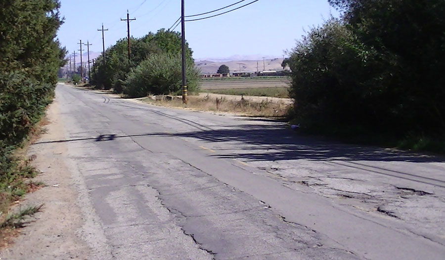
 Stop 4. Three poles mark San Andreas Fault along St. Frances Retreat Road. This view is look west across a gently sloping surface that is an old alluvial fan formed where San Juan Canyon Creek drains into the San Juan Valley. |
Stop 4. View looking south across San Andreas Fault zone on St. Francis Retreat Road. The road pavement is patched and broken and in generally bad condition where it crosses the creeping fault zone. |
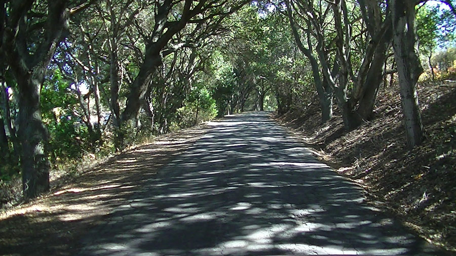 St. Francis Retreat Road runs through a "tunnel of trees" on its way to the Retreat Center. The road follows a linear stream valley as it ascends a long hill. |
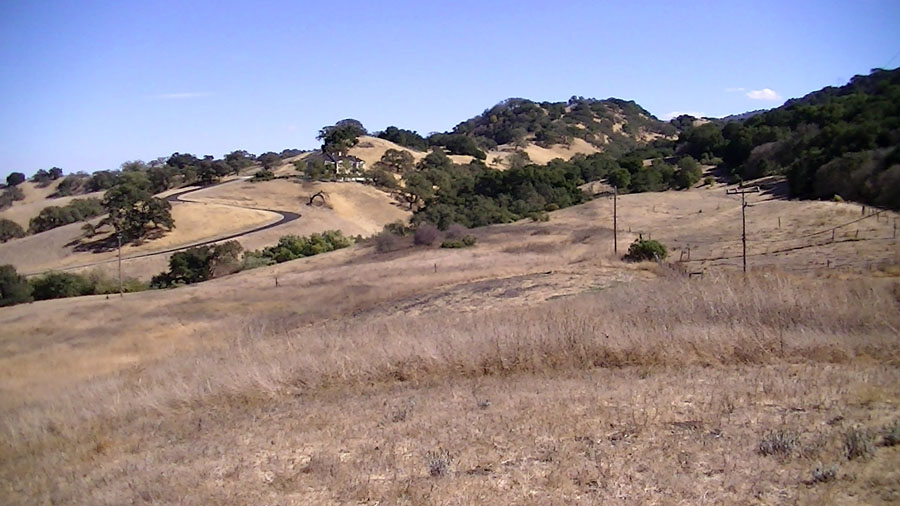
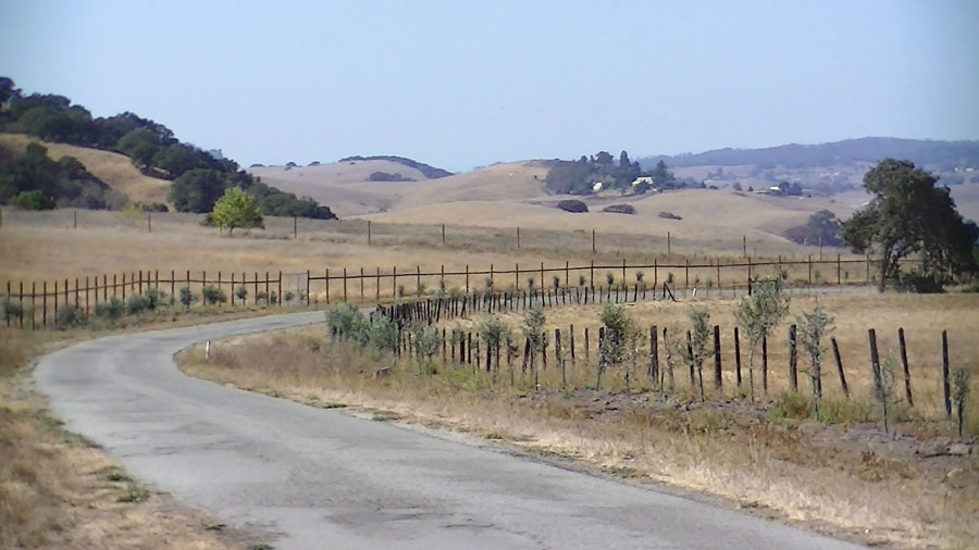 View looking west along the St. Francis Retreat Road toward rolling country of an upland plateau between the Gavilan Range and Santa Cruz Mountains. View looking west along the St. Francis Retreat Road toward rolling country of an upland plateau between the Gavilan Range and Santa Cruz Mountains. |
|
| See a map of regional earthquake faults and earthquake epicenters in the San Francisco Bay region—click here to download a large .pdf map file from the U.S Geological Survey). |
||
| MISSION FARM RV PARK, INC. 400 San Juan-Hollister Road, San Juan Bautista, CA 95045 (831) 623-4456 |
||
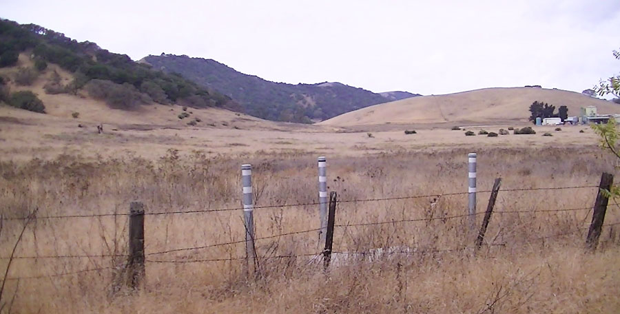
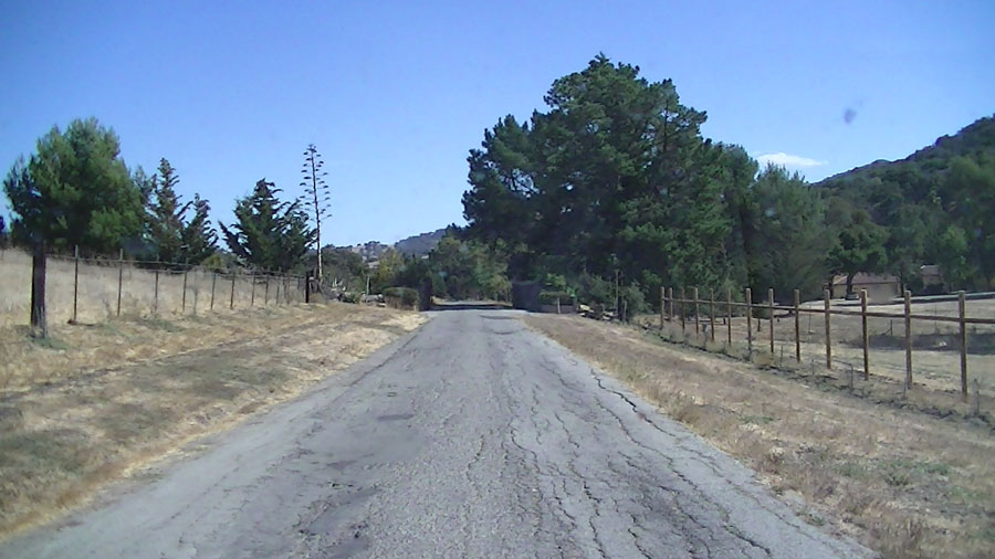
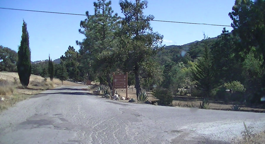
Stop DescriptionsStop 1—San Andreas Fault near Mission Farms RV Park: An actively creeping strand of the San Andreas Fault cuts across the Old San Juan-Hollister Highway in a location a couple hundred feet west of the entrance to the Mission Farms RV Park. The RV park is within a scenic, shady grove of redwoods that are visible from along the Old Highway (also a good place for groups to camp!). The fault zone crosses in the vicinity of the west end of the grove (on the left [north] side of the road, and in the gap between two fields on the right side). In the vicinity of the fault zone, the road surface is heavily damage by creeping motion of the fault (in the range a few millimeters to a centimeter per year). The pavement is a patchwork of repair attempts that cross cut by new and reforming fractures caused by fault creep. The location of the fault is marked by an ancient earthquake research monument located in the forest next to the road (north side).Stop 2—San Andreas Fault on Mission Vineyard Road: The creeping strand of the San Andreas Fault crosses Mission Vineyard Road. A small rise in the road is visible where the west side of the fault has risen slightly by creeping motion. The faultline is revealed by a series of small in-echilon fractures have formed where creeping motion of the fault has broken the pavement. An earthquake strain measurement station is located next to the field along the side of the road near where the fault crosses the road near Mansmith's BBQ store and residence. Stop 3—San Andreas Fault on Mission Vineyard Road extenstion: The creeping San Andreas Fault has severely damaged the pavement along a tree-lined section of the private road leading to the St. Francis Retreat and ranches south of the bend in Mission Vineyard Road. The best way to experience this section of the fault is to drive the speed limit across this section of road. The location of the fault is revealed by "strong earthquake-like shaking" (about a M5.7) as the vehicle crosses the rough, lumpy, twisted, and broken pavement in the fault zone! Stop 4—San Andreas Fault on the St. Francis Retreat Road: Another section of creep-related road damage is visible where the San Andreas Fault crosses the access road to St. Francis Retreat. The fault zone crosses just south of a gate to an agricultural field on the left (east) side of the road. Three closely spaced metal pipe marker poles used for long-term fault-creep measurements are located in the grassy pasture on the right (west) side of the road in the vicinity of the fault zone. Stop 5—San Andreas Fault near the entrance to the St. Francis Retreat: Near the entrance to the Retreat the road basically straddles the active creeping trace of the fault. The road pavement is broken into a long series of cracks that basically run parallel with the path of the road. The brick structure on either side of the road show breaks caused by the shearing motion of the fault creep. The pavement on the road is broken all along the fault zone throughout the Retreat Center. Stop 6—St. Francis Retreat Center parking area: Groups wanting to visit the St. Francis Retreat Center should call ahead to be sure there is no conflict with scheduled group events taking place at the center. The St. Francis Retreat has a long history, both as a private residence before being developed as a retreat center. [The St Francis Retreat offers affordable meeting space and lodging for religious, educational, and non-profit groups organizing their own events.] The grounds around the Retreat Center are both very scenic and geologically very interesting. Rocks used in the construction of walls around the facilities are composed of locally quarried rock that crop out on the forested hillsides above the Retreat Center (west of the fault). The bedrock on the west side of the fault locally consists of an unusual volcanic rock, a dacite or rhyolite porphyry (pinkish, white to gray with red iron weathering stains). The volcanic rock rests unconformably on an ancient weathered surface on the older granitic basement rocks that make up the core of the Gavilan Range. The volcanic rocks probably formed from volcanic eruptions that took place as the San Andreas Fault was propogating through the region about 12 to 20 million years ago. A good place to examine these volcanic rocks is in the walls around the parking area (and along trails in the hillsides above (west) of the Retreat Center. Stop 7-San Andreas Fault at Station VII: A path around Flint Lake leads to 12 "Stations of the Cross". Stop 7 is located at Station VII where the San Andreas Fault cuts through the pavement near a residence on the Retreat Center grounds. Flint Lake (named after two Flint brothers that owned the property before it was sold to the Franciscans in 1947) [see IHistory of the St. Francis Retreat Center]. Flint Lake is a natural sag pond that was usually water filled before the 1906 earthquake. Since then, the lake drains in the dry seasons. Along the east side of the lake bas8h is the fault scarp of the San Andreas Fault. A stone bridge along the lake shore is in the creeping fault zone. So... what is the future of the bridge? The San Andreas Fault runs along the east side of the residence near Station VII ("Stations of the Cross" is a Catholic religious service tradition). Motion along the fault has sheared the ground beneath a stone stairway leading to the Retreat Center residence near Station VII. The "Twisted Stairway" leading to the residence entrance shows many breaks and offset fractures offsets caused by the slow fault creep over the years since it was constructed. Stop 8 is located along the driveway that leads down a hill into another sag area along the San Andreas Fault south of the residence near Station VII. The pavement in the old driveway displays numerous cracks cause by the ongoing shearing action of the creeping fault. The San Andreas Faut trace continues south across the landscape following a series of visible linear scarps and drainages. A gap in the shutter ridge on the east side of the fault (near the Twisted Stair) allows for a good view of eastern San Juan Valley and the Quien Sabe Range east of Hollister. The St. Francis Retreat Center also has a trail system that winds for couple miles through the hillsides above the buildings and residents. The trails run through mature oak forests with some grassy meadows that permit higher views of the valley. The hillslope is dotted with numerous blocks of volcanic rock weathering out of the loose colluvium and soil on the hillsides—the same rock used in the walls around the Retreat Center grounds. |
 The upper section of the St. Francis Retreat Road runs through the San Andreas Fault Zone. Fault creep is gradually tearing the road apart. |
 Stop 5: One creeping fault strand in the San Andreas Fault zone runs through the entrance gate and driveway area to the St. Francis Retreat. |
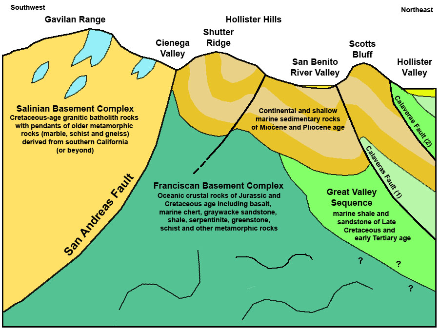 Cross section of the San Andreas and Calaveras Fault zones between the Gavilan Range and Hollister Valley showing bedrock units. |
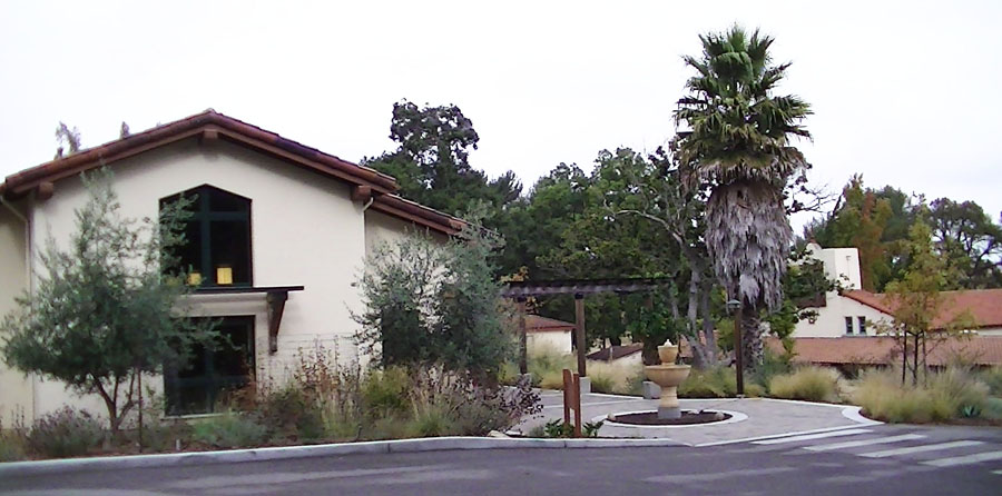 St. Francis Retreat Center includes meeting rooms, lodging for groups, cafeteria, a chapel, and a quiet and scenic setting. St. Francis Retreat Center includes meeting rooms, lodging for groups, cafeteria, a chapel, and a quiet and scenic setting. |
|
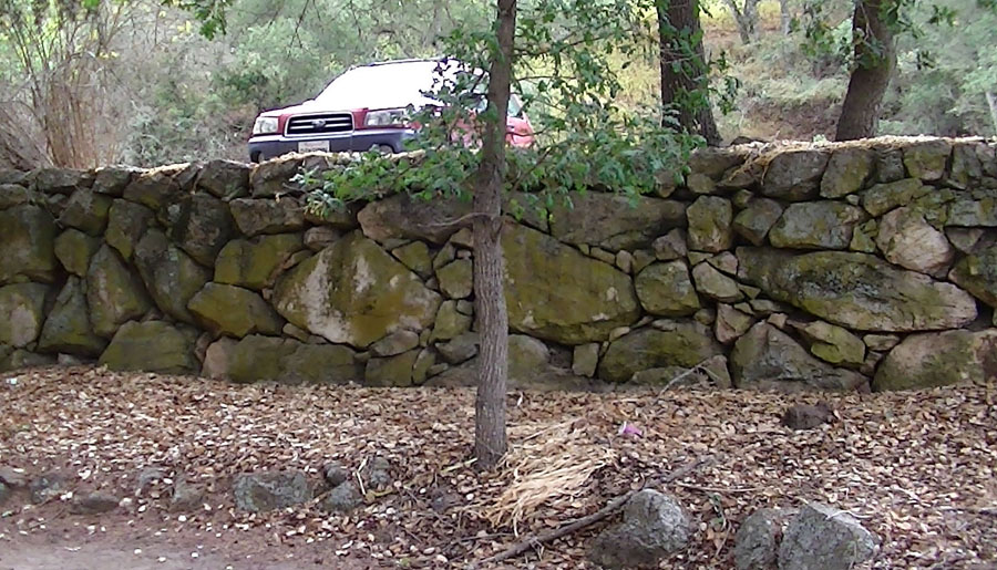 Walls around the Retreat parking area consist of weathered igneous (volcanic) rock—a rhyolite or dacite porphyry of late Miocene age. |
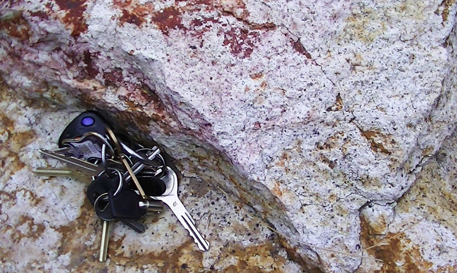 Close-up view of the rhyolite porphyry. The rock was mined locally from the hillside south of the Retreat Center. |
|
 Flint Lake is a sag pond along the fault zone that no longer holds water very well after the 1906 earthquake |
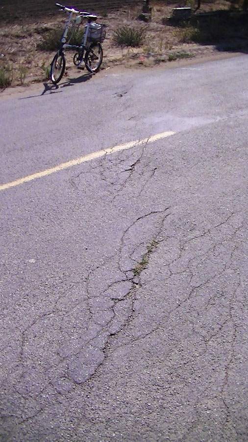
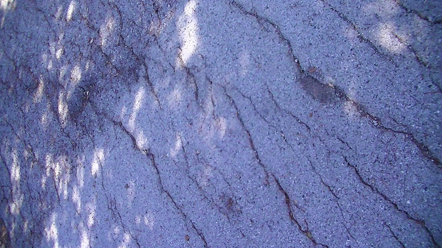 Fractures in asphalt caused by creep along the San Andreas Fault at the St. Francis Retreat |
|
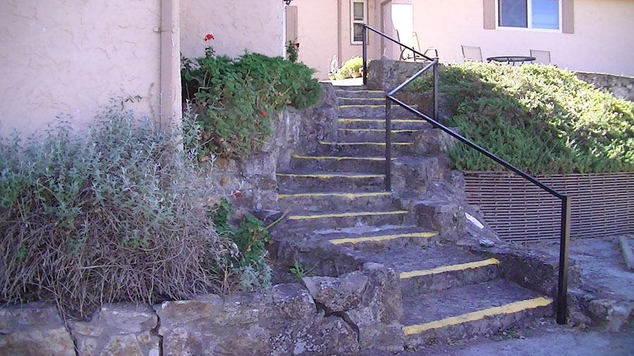 The twisted stair on a building being impacted by fault creep |
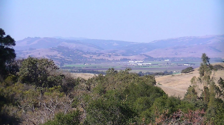
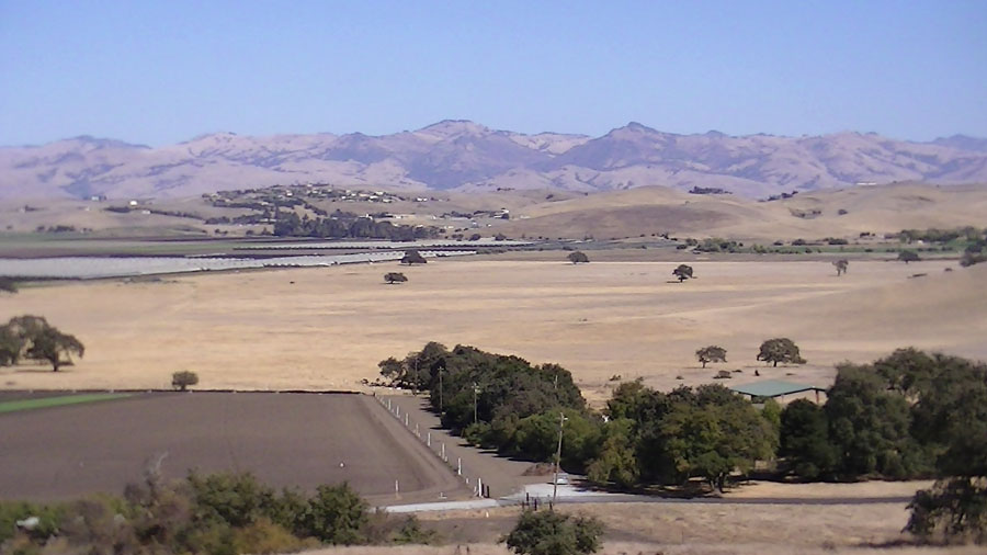 View east across the San Juan Valley toward Hollister and the Quien Sabe Range |
|
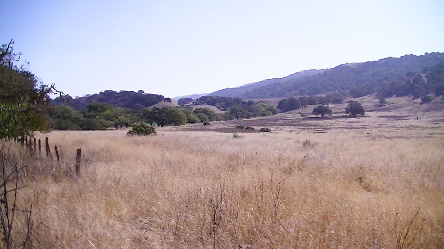
 Sag area and fault controlled valley in the San Andreas Fault Zone south of the St. Francis Retreat |
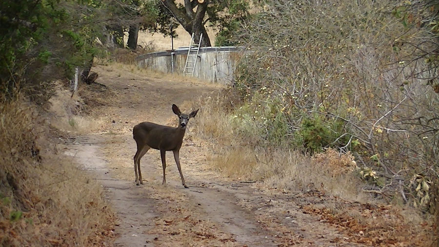 Deer along a trail at the St. Francis Retreat |
|
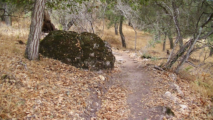 Large boulder of rhyolite porphyry along the Loop Trail on the hillslopes above the Retreat. |
 Zoomed-in view looking north along the San Andreas Fault where it crosses San Juan Valley into the Santa Cruz Mountains in the distance. |
|
| Visit sanjuanbautistaca.com to learn more about the San Juan Bautista area. | ||
| Selected Refences 2Dibblee, Thomas, W, 1979, Preliminary Geologic Map of the San Juan Bautista Quadrangle: U.S. Geological Survey Open-File Report 79-375, scale 1:24,000. 1Wagner, D.L., Green, H.G., Saucedo, G.J., and Pridmore, C.L., 2002, Geologic map of the Monterey 30'x60' Quadrangle and adjacent areas, California. California Geological Survey, Regional Geologic Map No. 1, 1:100000 scale: http://www.quake.ca.gov/gmaps/RGM/monterey/monterey.html |
10/15/2012