
Field Trip to the Fremont Peak State Park, |
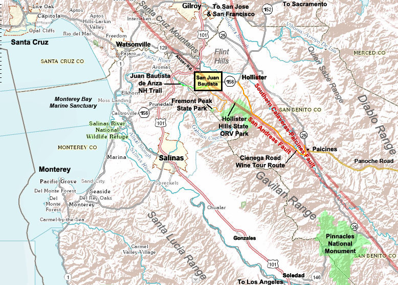
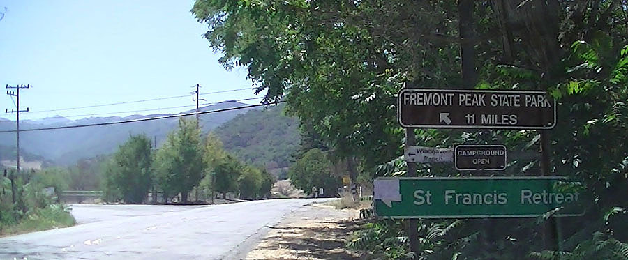
| Field-trip overview: A field trip to Fremont Peak State Park includes spectacular views of the Central Coast region of California near Monterey Bay. Fremont Peak is the highest peak at the north end of the Gavilan Range. The drive from San Juan Bautista to Fremont Peak State Park is an 11-mile drive up San Juan Canyon Road. Features along the way include the trailhead to the Juan Bautista de Anza National Historic Trail (which follows the Old State Road). Rocks exposed along San Juan Canyon Road include sandstone, weathered granite (saprolite) and marble and schist (in Fremont Peak State Park). A stop along San Juan Canyon Road provides a sweeping view of the San Andreas Fault in the Hollister Hills State Recreational Vehicle Park. A half-mile loop trail leads from a parking area to the mountaintop at Fremont Peak. Camping is available at the park. Directions: From US Highway 101 take CA Highway 156 East (via the ramp to San Juan Bautista/Hollister. Follow CA Highway 156 east for 3.4 miles to the first stoplight at the Alameda (the Windmill Market is near the intersection with the Alameda in San Juan Bautista). Turn right at the light on The Alameda. Continue south on The Alameda to a four way intersection follow the sign to Fremont Peak State Park via San Juan Canyon Road. (See Stops A-C below. Stops are illustrated on the geologic map.) Be cautious driving up the narrow and winding road; some of the turns have poor visibility. Stop D is an about six miles up the canyon at a pull off on the right that provides as sweeping view of the Hollister Hills State Recreational Vehicle Park. Follow San Juan Canyon Road for 11 miles to the mountaintop destination: Fremont Peak State Park (Stop E). |
Click on images for a larger view. | |
 |
 |
|
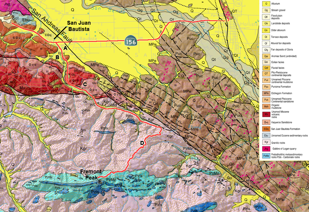
| Regional map showing Fremont Peak State Park | Geologic Map of the Fremont Peak region1 | |
 |
 |
|
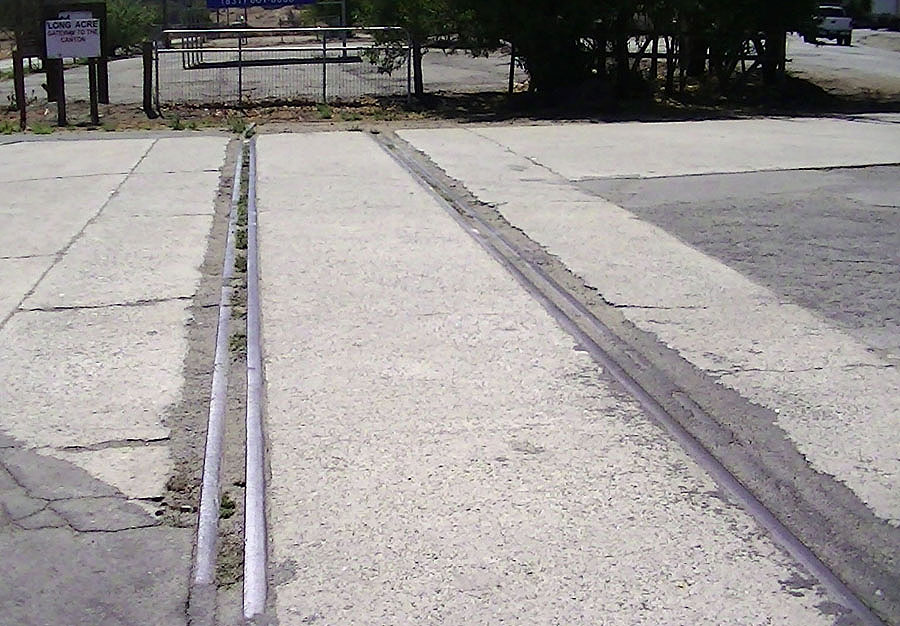
| 4-way intersection of Mission Vineyard Road, San Juan Canyon Road, Old State Road (Anza Trail) and the Salinas Road near San Juan | ||
| Last rails to Cement Plant cross San Juan Canyon Rd. | ||
 |
 |
|
| Old Stage Road trailhead | Old mine dump tailings pile | |
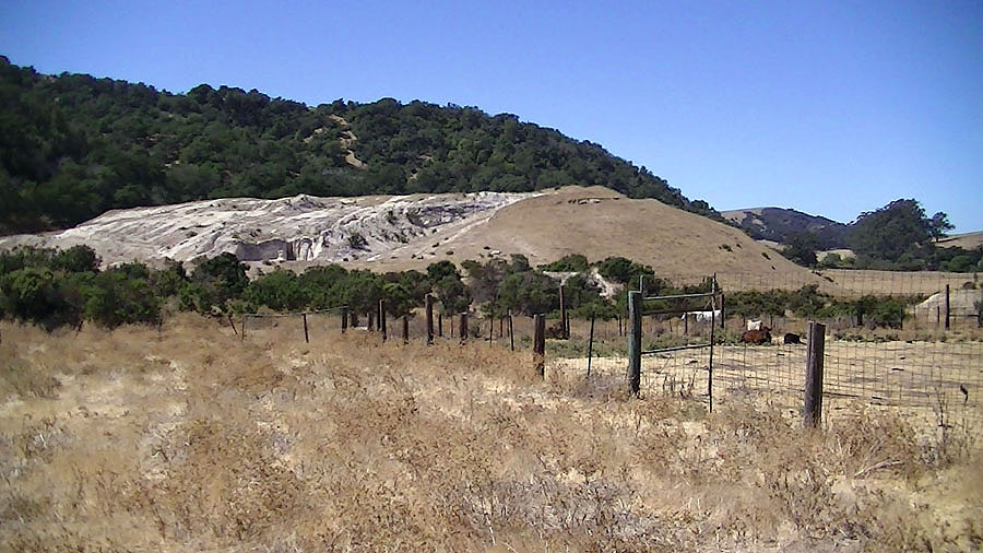
| Road-trip to Fremont Peak State Park The park headquarters for Fremont Peak are located on Second Street near the Plaza at San Juan Bautista State Historic Park near downtown San Juan Bautista. From San Juan Bautista, plan a few hours minimum to drive to Fremont Peak, do a mile hike around the mountain peak, and plan to have a picnic is the campground area before you return to San Juan Bautista. Stop A—Intersection of San Juan Canyon Road: Drive south on the Alameda from downtown San Juan Bautista across CA Highway 156 and proceed 0.3 miles to Stop A at the intersection of several roads: Mission Vineyard Road (to the left), Fremont Peak Road (middle road to left) and Salinas Road (straight and to right). Note that the trailhead access road to the Juan Bautista de Anza National Historic Trail—a hiking/horseback riding trail that follows the unpaved historic Old Stage Road between Salinas and San Juan Bautista. Also note the section of railroad tracks in the intersection of the four roads. The San Juan Pacific Railway began operation in 1907 and provided rail service from the San Juan Portland Cement Plant to the Southern Pacific at Chittenden. The San Juan Pacific Railway operated a seven mile line, the Mission Route, starting near to San Juan Bautista. Stop B—Cement Plant mine tailings: Follow San Juan Canyon Road. Be cautious when stopping on the road to examine views. Near the mouth of San Juan Canyon is a large mine tailings pile that was associated with a large cement plant that operated in the lower San Juan Canyon from around 1903 to closure near the end of World War II. The Flint Ranch deposit, a principal source of supply, lies along the tops of the steep hills above San Juan Canyon. In the Gavilan Peak deposits, the limestone shows all degrees of silicification. At several places near the top of the peak, deposits of white, high-grade barite have been found in the limestone and proved large enough to repay mining. The Gavilan limestone is older than the granitic rock and has been changed to highly crystalline marble. The color ranges from dark blue to nearly pure white. The Flint Ranch deposit (abandoned quarry) is located up a side canyon the Pioneer Park (owned by the local Church of Jesus Christ of Latter Day Saints). Stop C—Vaqueros Sandstone outcrops: A brief stop might be possible if no traffic is visible along San Juan Canyon Road. Large, scenic outcrops of Vaqueros Sandstone (or Vaqueros Formation) are visible on the left (north) side of San Juan Canyon about a half mile north of the intersection (Stop A). The Vaqueros Sandstone is Upper Oligocene and Lower Miocene in age. The massive sandstone units of Vaqueros Formation are cliff- and ledge-forming units throughout the Coast Ranges of Central California. The rock formation consists mostly of medium-grained sandstone with zones of shale and conglomerate. Locally abundant marine shell fossils suggest the sediment was deposited in a relatively shallow shelf environment. Vaqueros Sandstone crops out in the Santa Cruz Mountains at Castle Rock State Park and near Gilroy at Chitactac-Adams County Park. It crops out in many locations all the way down the coast to the Santa Barbara region. In the San Juan Bautista region, Vaqueros Sandstone crops out along the Salinas Road, and the form outcrops along Rocks Road and Highway 101 south of the large eucalyptus grove south of the intersection of CA Highway 156 (made famous by the 1957 Alfred Hitchcock movie "Vertigo"). |
 |
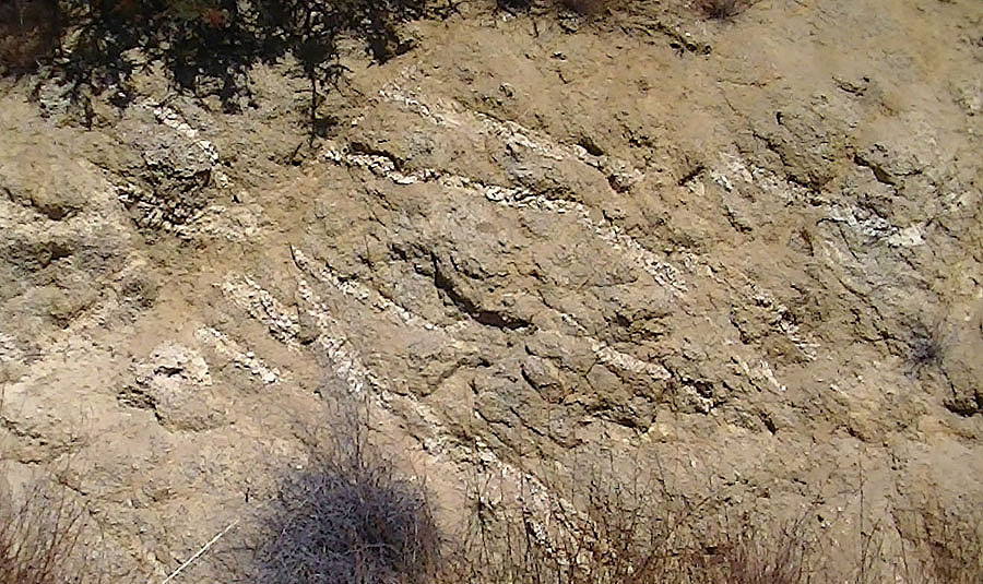
| Outcrops of dipping strata of the Vaqueros Sandstone (Oligocene-Miocene) along San Juan Canyon Road | |
 |
|
| A friendly reminder | |
 |
|
| San Juan Canyon Road on granite ridge | |
 |
|
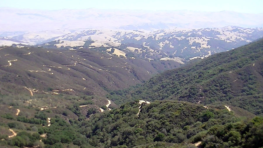
| Hollister Valley and Quien Sabe Range in distance |
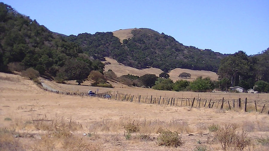
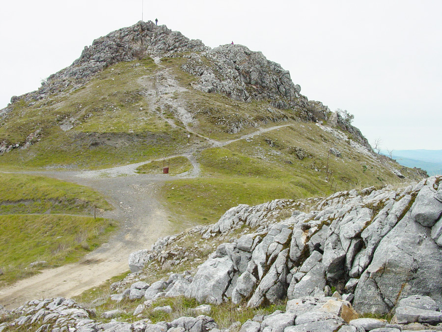
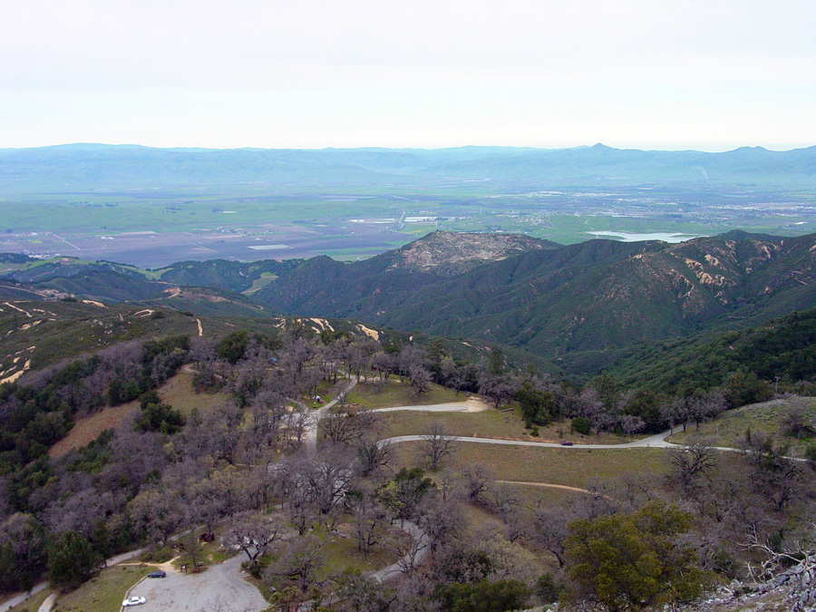
| Stop D—Hollister Hills overlook: San Juan Canyon Road follows a linear drainage until it rises to a ridge line. Along the lower part of the canyon Vaqueros sandstone crops out in road cuts. Near the ridge line the character of the bedrock changes (along with the character of the soil and the vegetation it supports. The road crosses the Vergeles Fault, a splay fault of the San Andreas Fault that cuts through the western foothills of the Gavilan Range. On the north side of the fault is Vaqueros Sandstone; on the north side is Cretaceous-age granitic rocks. As the road rises out of the canyon the vegetation changes to chaparral community of plants that thrive on the well-drained sandy soil and weathered bedrock. Notice the deeply weathered character of the granite on the right side of the road. In many places the uniformly coarse-grained granite that locally displays quartz- and feldspar-rich veins and pegmatite intrusions. Continue about a mile up the canyon and pull off on the right at a prominent pull off (large enough for a dozen cars). Examine scenic vistas on either side of the road. To the east side of the road is the Hollister Hills State Recreational Vehicle Park. The motorcycle trails in the canyon east of the road cut through granite terrane throughout the hillslopes covered with chaparral. In the distance lower in the canyon the vegetation changes into grassland with scattered oak forest. The change in vegetation marks the location of the San Andreas Fault where it cuts through the foothills (Hollister Hills) of the Gavilan Range. The view extends across Hollister Valley to the Quien Sabe Range southward into the San Benito River valley south of Hollister. To the west side of the road is a view that extends northward over a ridge that bears the scar of an abandoned quarry where marble and silicified rock was mined for the manufacture of cement at the former cement plant near San Juan Bautista. Loma Prieta Peak in the southern Santa Cruz Mountains is in the distance. Stop E—Fremont Peak State Park: As the San Juan Canyon Road continues it ascent to the mountain peak it enters upland forest with abundant oak and bay laurel trees. In the spring the Fremont Peak upland region usually provides a spectacular wildflower display. Fremont Peak is the highest peak at the north end of the Gavilan Range (gavilan means hawk in Spanish). Near the entrance to Fremont Peak State Park the road crosses a geologic boundary between the Cretaceous granitic rocks to older bedrock consisting of marble, gneiss and schist of undermined age (due to a lack of identifiable fossils). Despite having been heavily metamorphosed, some of the rocks do preserve bedding structures—thinly laminated layers in the rock resembles rocks of late Proterozoic to Cambrian age in the Death Valley and Mojave region of southern California. Fremont Peak State Park encompasses a portion of the high mountain peak and includes a campground, group area, and an astronomical observatory. On moonless nights astronomy groups frequently gather on the mountaintop park for star gazing. In a parking area near the observatory there are often dozens of telescopes are set up and shared for public viewing. A kiosk to pay for a $6 day-use pass is located in the parking lot near the campground entrance. A trailhead parking area is located a short distance farther up the mountain. Both a paved road (maintenance vehicles only) and a hiking trail lead to the mountain top. It is recommended to follow the hiking trail up and return down the steeper paved road. The combined trail provides a counterclockwise loop around the mountain top. |
 |
| Igneous veins in weathered granite along road | |
 |
|
| Pegmatite dike in weathered granite along road | |
 |
|
| Old cement quarry mine in San Juan Canyon and Santa Cruz Mountains in distance | |
 |
|
| Change in vegetation shows location of San Andreas Fault in Hollister Hills SVRP |
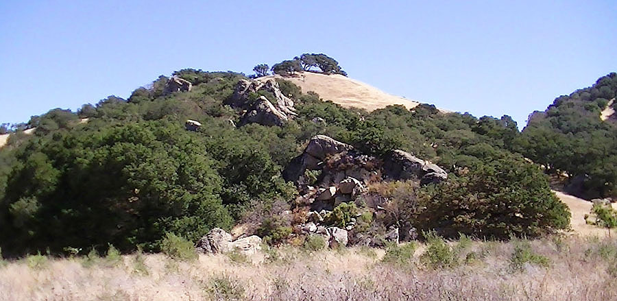
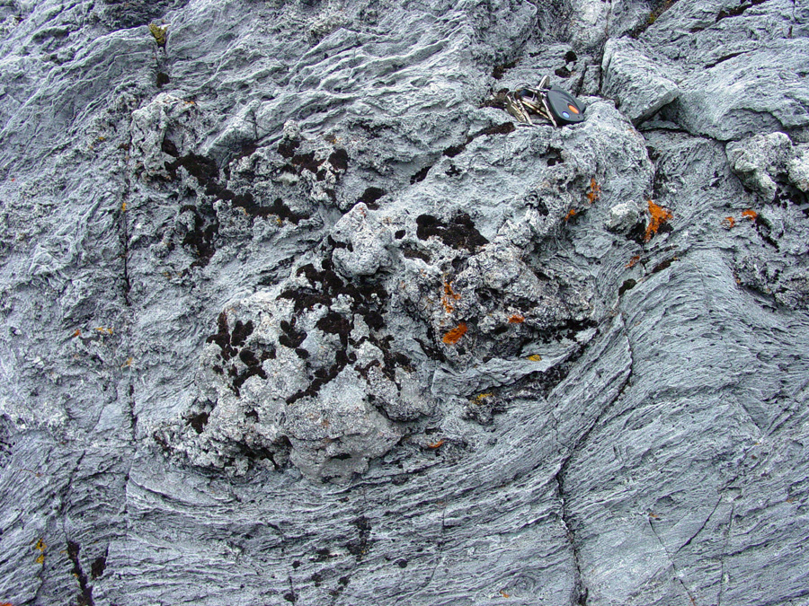
Loop Trail Walk to Fremont Peak The structure of the pendant block that forms the ridge line at Fremont Peak is revealed by the steeply northward dipping bands of layers of marble exposed on the south side of the ridge. Close examination of some of the marble outcrops show that in many places bedding plains are preserved, having escaped complete destruction in metamorphic phase in the formation of the marble and schist. Some of the marble outcrops display stromatolite-like texture (stromatolites are flat-layered, lumpy or mound-shaped accumulations of calcareous sediment associated with the growth of lime-secreting cyanobacteria. The possible occurrence of stromatolites and the apparent lack of shell fossils suggest that the original sediments may be latest Precambrian (Proterozoic) to Cambrian age before shell fossils became abundant in the fossil record. |
 |
| Fremont Peak with outcrops of marble | |
 |
|
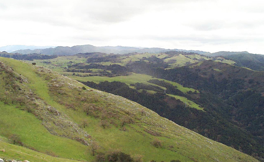
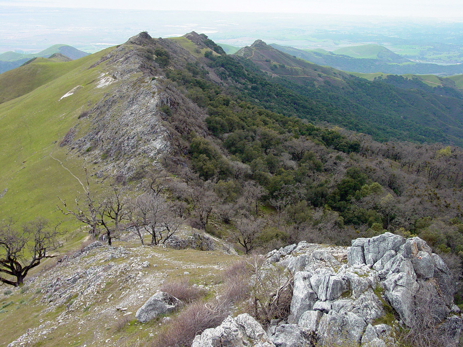
| Crest of Gavilan Range south of Fremont Peak | |
 |
|
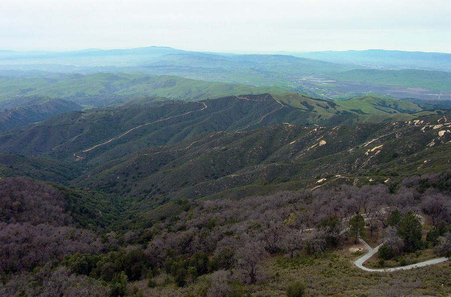
| Looking northeast over Fremont Peak Campground | |
 |
|
| Looking north toward Loma Prieta Peak from the peak | |
 |
|
| Marble forms a resistant ridge west of Fremont Peak | |
 |
|
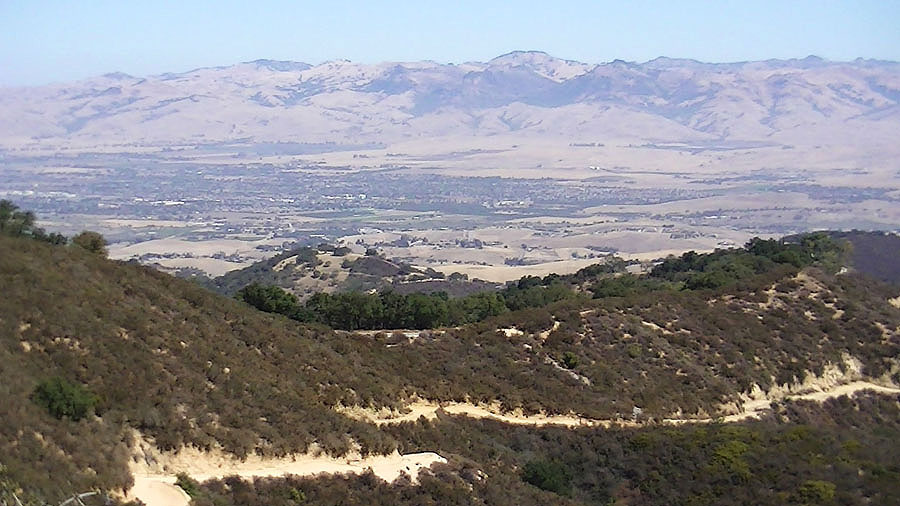
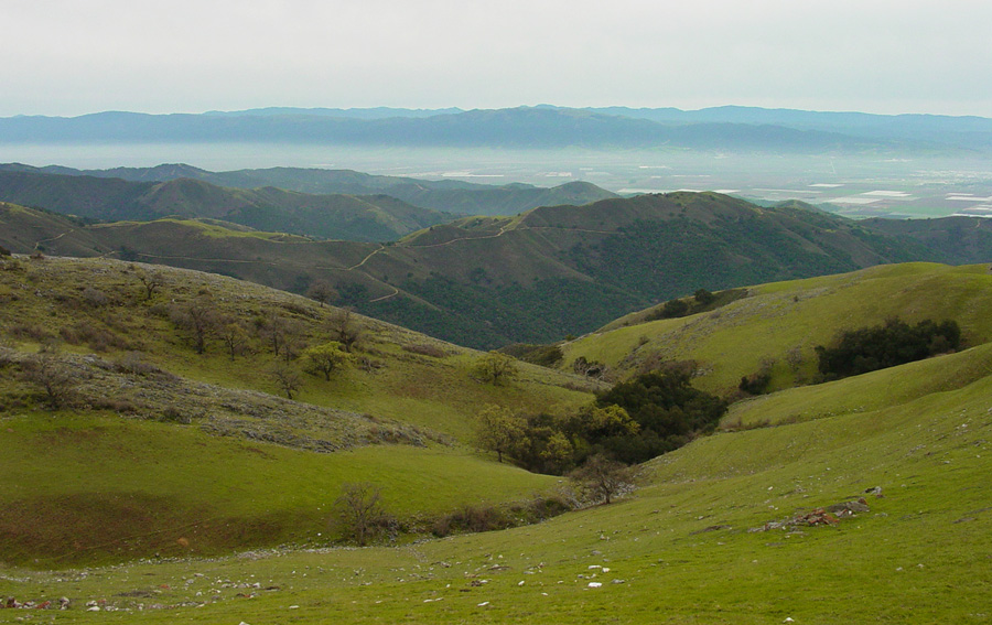
| Salinas Valley south west of Fremont Peak | |
 |
|
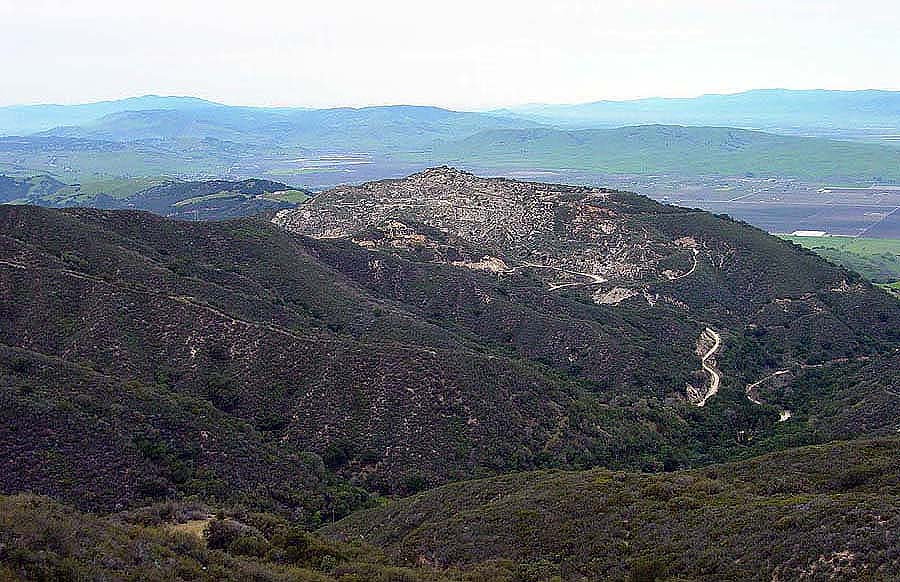
| Old barite mine on Fremont Peak | |
 |
|
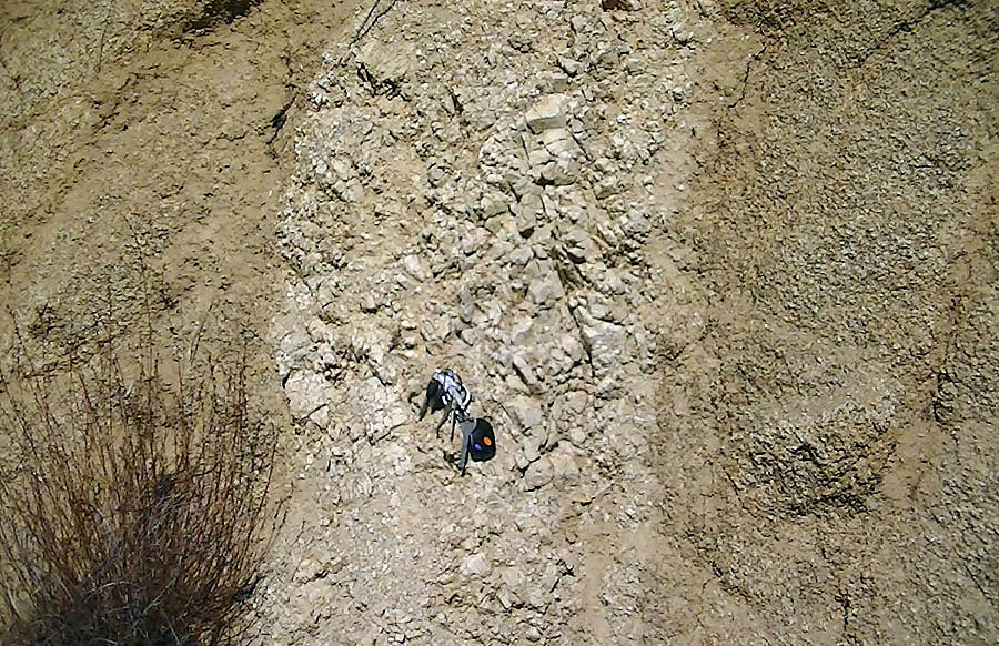
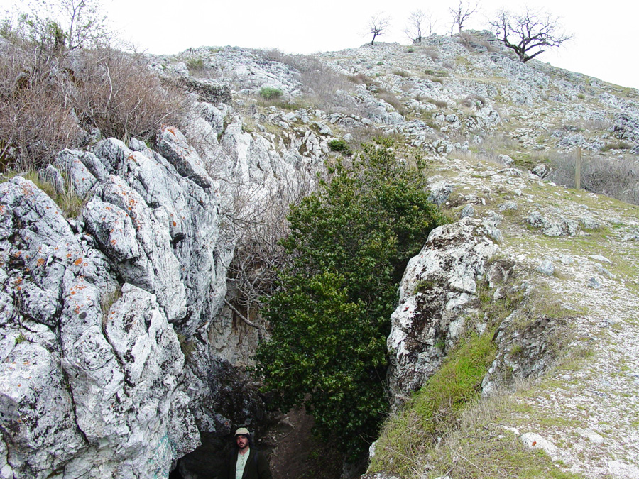
| Possible stromatolites preserved in marble bedrock |