
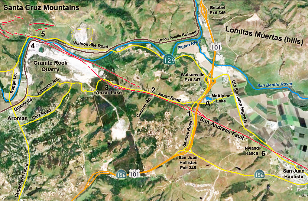
San Andreas Fault in northern San Benito County, California - Aromas to San Juan Bautista |
| Field-trip overview: This field trip is a driving tour to look at selected locations along the San Andreas Fault where offset of natural and manmade features are visible. This web page shows locations along the fault zone in northwestern San Benito County in the vicinity of San Juan Bautista and Aromas (see the walking tour for the historic district in San Juan as a separate trip description). Exceptional features are visible along Anzar Road, Searles Road, and the Old San Juan Highway. Sites are also described along a loop route that encompasses the Granite Rock Quarry and sites along the Highway 129 (Watsonville Road) in the vicinity of Pajaro Gap/Chittenden near Aromas. Directions: From US Highway 101 take exit 347 for the CA Highway 129 (Watsonville Road). If traveling south on Highway 101, turn right at the stop sign end of the highway ramp and IMMEDIATELY get in the left lane to turn left onto Searles Road (which is the "frontage road" on the west side of Highway 101). Follow Searles Road south for 0.7 mile to the intersection of Anzar Road. This is a good meeting location for groups traveling in separate vehicles to meet. There is ample parking and light traffic on these roads. From the intersection of Searles Road and Anzar Road proceeded to optional Stop A—McAlpine Lake RV Park) or proceed to Stop 1—San Andreas Fault zone on Searles Road. |
Click on images for a larger view. | ||
 |
 |
||
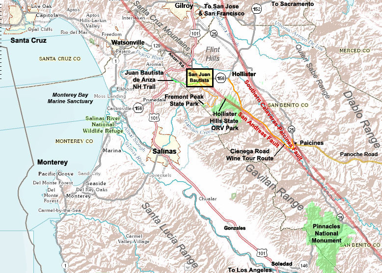
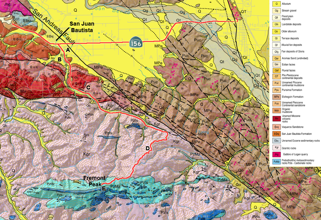
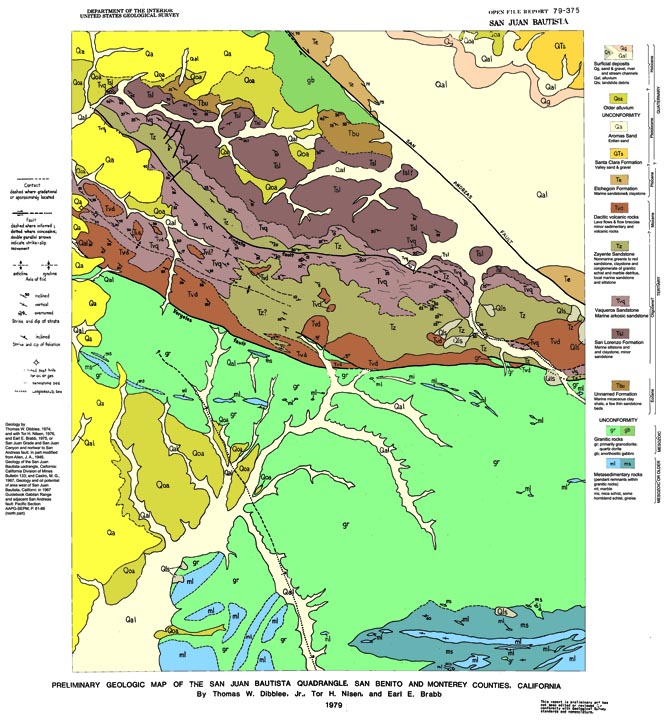
| Regional map showing trip field area | Geologic Map of the field trip region1 | ||
 |
 |
||
| Map of the San Andreas Fault between Aromas and San Juan Bautista, CA | |||
| San Juan Bautista 15 minute quadrangle geologic map | |||
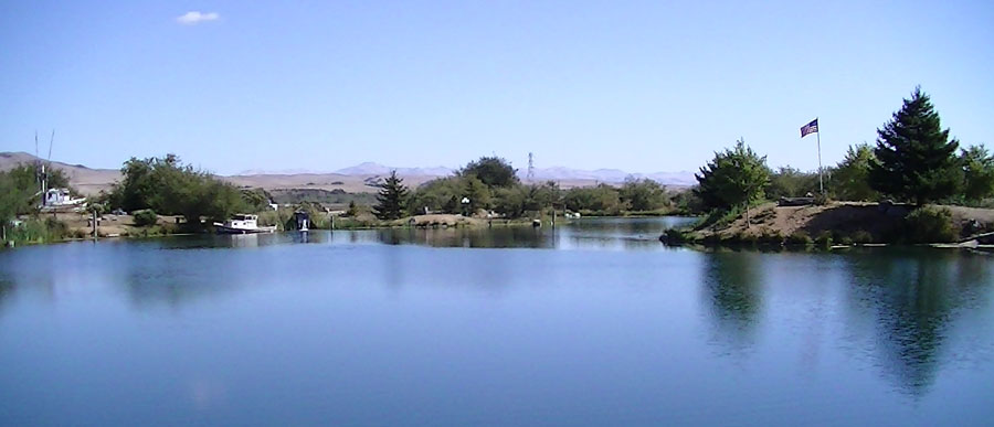
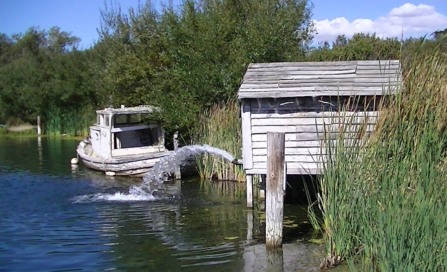
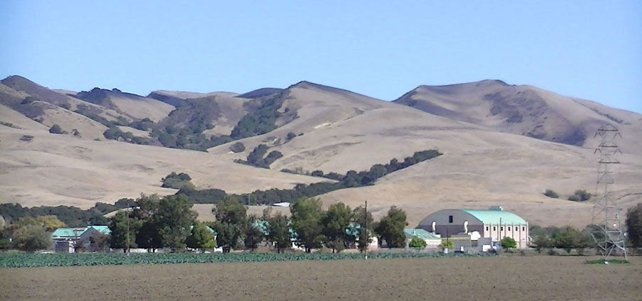
| Stop A—McAlpine Lake & Park (Optional): McAlpine Lake RV Park is recommended as a stop because it is an excellent place for groups to camp in a safe and geologically interesting setting. McAlpine Lake offers both RV and tent camping, has a store, restrooms with showers, and an outdoor amphitheater for group discussions. The park include a 6 acre lake—40-foot-deep holding 90 million gallons of artesian spring water—(stocked for fishing) with a scenic walking trail around the lake. Large boulders of local rock are abundantly placed along the path (gabbro, marble, and a host of rock types . Perhaps most interesting is the source of water for the lake. It is filled by a well flowing under artesian water pressure with a shore-side fountain that pours into the lake. The water comes from a confined aquifer deep below the park. The well penetrated zones of "granite" (either bedrock or alluvial fan gravels) mud (ancient lake muds) before penetrating a porous gravel zone (stream gravels) that is the source of the water.At the east end of the lake area is a good location to examine the San Juan Valley—a very flat valley that was once the location of Ancient Lake San Juan—a lake that flooded the valley near the end of the last Pleistocene ice age and the early Holocene Epoch (when humans first appeared in the region). The lake formed probably as a result of periods of increased rainfall combined with blockage of the Pajaro River in the Chittenden area along Highway 129 where the river crosses the San Andreas Fault. Uplift associated with earthquakes (or tectonic folding) and/or landslides may have blocked the river, allowing the lake to form in the San Juan Valley. The east end of the lake is also a good place to view the Lomitas Muertas—the hills on the north side of the San Juan Valley. The Lomitas Muertas are being pushed up along the Sargent Fault which cuts through the north flank of the hills. On the south side of the hills steeply dipping sedimentary rock layers are exposed forming a series of chevron-shaped patterns along hogback ridges. The rock layers are of late Tertiary age (late Miocene and Pliocene) of both marine and non-marine origin. The dip beneath the San Juan Valley (basin). These rocks are not exposed on the south side of the valley near McAlpine Lake. The hills on the south side of Anzar Road consist of granitic rock pushed up along the San Andreas Fault. The sedimentary layers are probably truncated against the granite at depth along a surface associated with the San Andreas Fault zone. Low along the San Benito River valley are a series of elevated river terraces that have been uplifted along the flank of the hills. These terraces possibly reflect the large-scale climate changes associated with past wetter ice ages and dry interglacial periods. Global climate changes caused sea level to rise and fall, causing regional streams to back fill the valley to sediments when sea level was high.
|
 |
||
| McAlpine Lake and Park on Anzar Road located near US Highway 101 | |||
 |
|||
| An artesian well provides water to McAlpine Lake from a deep confined aquifer | |||
 |
|||
| Chevron-shaped hogback ridges of Late Miocene and Pliocene sedimentary rocks exposed on the flanks of Lomitas Muertas (hills) beyond Anzar High School and the San Juan Valley | |||
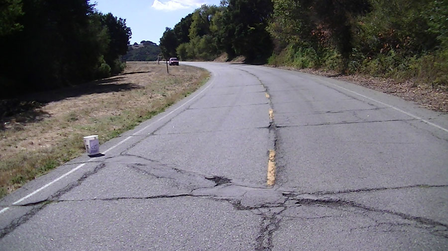
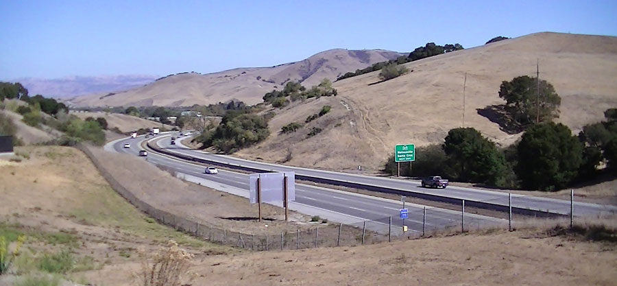
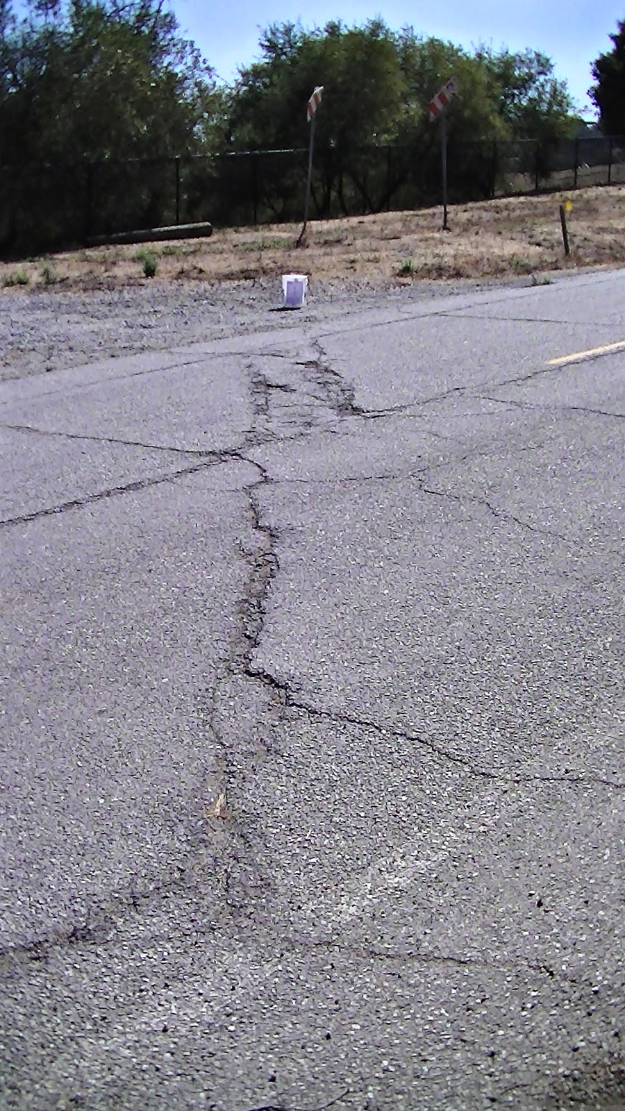
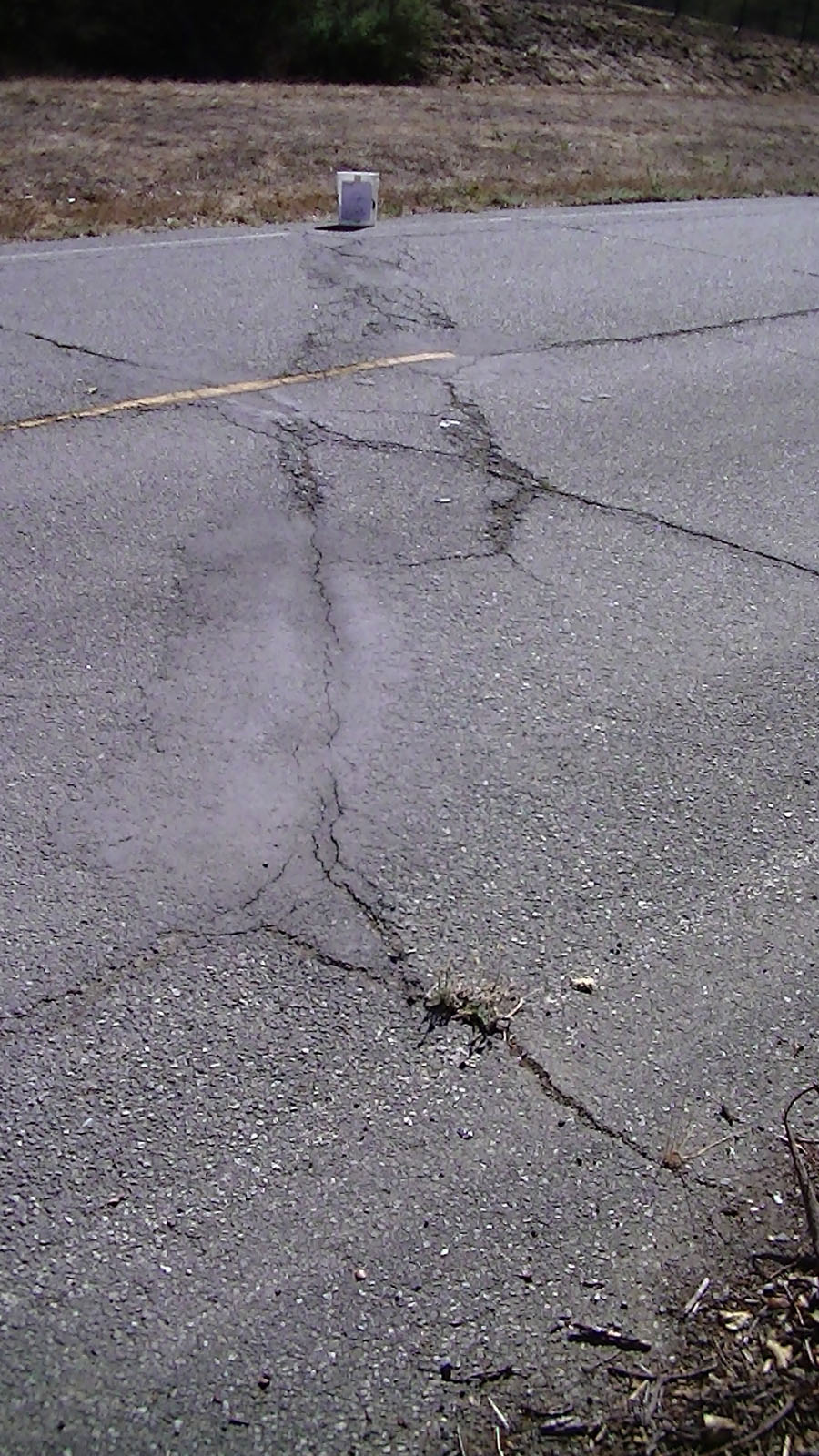
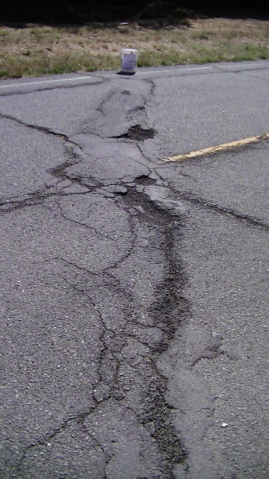
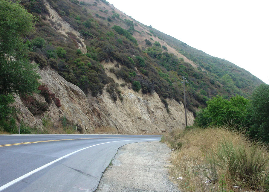
| Stop 1—San Andreas Fault Zone on Searles Road: Earthquake fault movement measurement studies have been conducted for years along the San Andreas Fault in the vicinity of Searles Road. Searles Road crosses the San Andreas Fault zone where it is locally represented in three actively creeping fault strands expressed by shear zones in the old asphalt surface of the road. Be cautious will driving and parking. It is best for cars to drive uphill (south) on Searles Road and vehicles should cautiously turn around at pull off and park in the wide berm space on the north side of the road (do not block the driveway for a private residence with a black chain-link fence). The north strand of the fault zone is located on the south side of the driveway. Two signs indicating the presence of a buried gas line is near the south fracture zone. Note that the road will probably be resurfaced sometime in the future. However, as of October 2012 the active faultline fractures are very visible in the pavement—they stand out as complex diagonal fracture in contrast to the more uniform heat expansion joints that cut perpendicular across the road at relatively even spacing. The three strands cross the road in a northwesterly direction about 50 paces apart. These three active strands are within a wider zone of impact. An inactive fault strand is covered (below the surface) closer to Anzar Road. It is near Searles-Anzar Road intersection where the bedrock changes—on the west side of the fault the bedrock consists of Salinian granitic basement rock (locally mapped as Jurassic gabbro of Logan Quarry). The bedrock on the west side of the fault consists of young sedimentary rocks (Miocene- and Pliocene-age Etchegoin Formation and younger unnamed sediments of continental origin) underlying the hillsides on the north side of Anzar Road. |
 |
 |
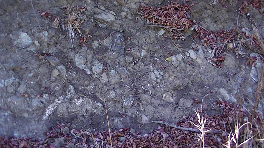 |
| View looking south along Searles Road where it crosses 3 actively creeping fault strands within the greater San Andreas Fault zone—north, middle and south. The car in distance is parked uphill at the south end of fault zone. | View of Highway 101 where it crosses the San Andreas Fault. The green 101N sign "Watsonville Exit" is on the North American side of the fault, the gray (backside) sign on 101S "San Juan Bautista Exit" is on the Pacific side of the fault zone. | Fault gouge (granitic basement rock broken up by fault motion) exposed in a cut along Searles Road near the south fracture zone. The zone of shear-fractured granitic rock extends beyond the area of active creeping fault strands. | |
 |
 |
 |
|
| San Andreas Fault of Searles Road, south fracture zone. GPS location: N36° 52.388', W121° 34.388' |
San Andreas Fault of Searles Road, middle fracture zone. GPS location: N36° 52.418', W121° 34.388' |
San Andreas Fault of Searles Road, north fracture zone. GPS location: GPS N36° 52.450', W121° 34.380' |
| Geology stops along Anzar Road. Directions: Follow Anzar Road west from the intersection with Searles Road for about 3 miles to see a linear fault valley, a great landslide, and a large sag pond (Anzar Lake). These two stops are best characterized as "rolling stops"—meaning "drive by and maybe stop for a picture if the road is clear." Geology: Anzar Road basically follows the San Andreas Fault Zone. The road follows a structurally controlled fault valley for several miles. Heading west, Salinian granitic basement rock (locally mapped as Jurassic gabbro of Logan Quarry) is exposed in the forest-covered, cliffy hillside on the left (south) side of the road. In contrast, Miocene- and Pliocene-age sediments underlie the grassy slopes on the right (north) side of the road. An small abandoned quarry in the gabbro is visible in the hillside southwest of the intersection Anzar and Cannon Road. While driving west on Anzar Road, note how the road rises on a small hill on the approach to the intersection of Cannon Road. The road passes over the toe of a great landslide. |
||
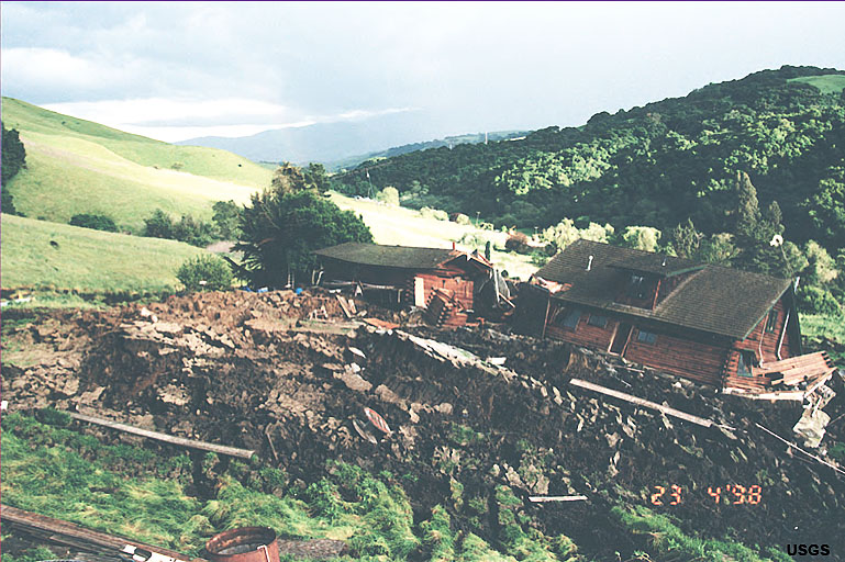
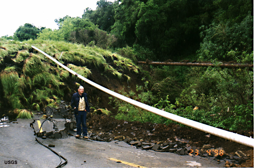
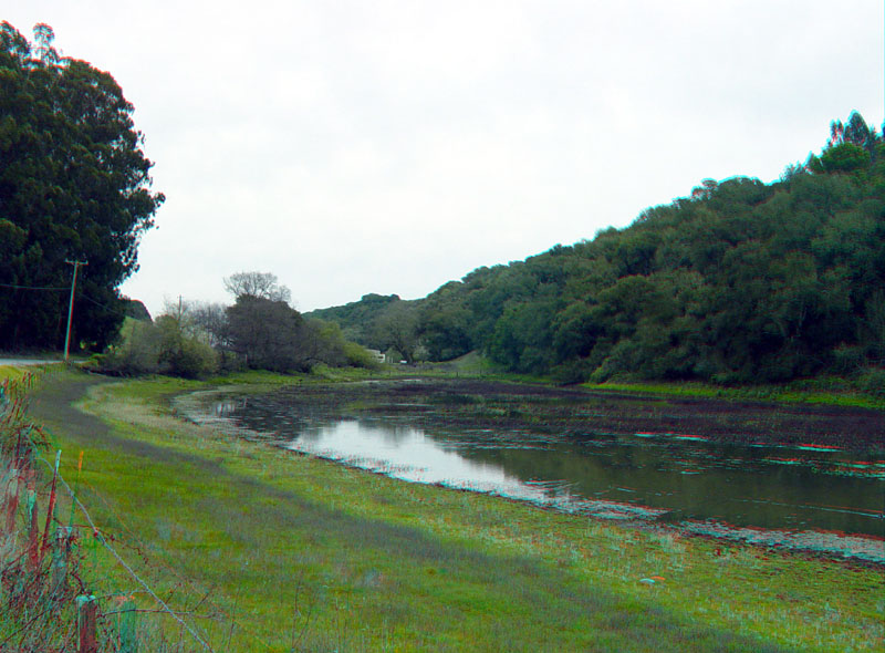
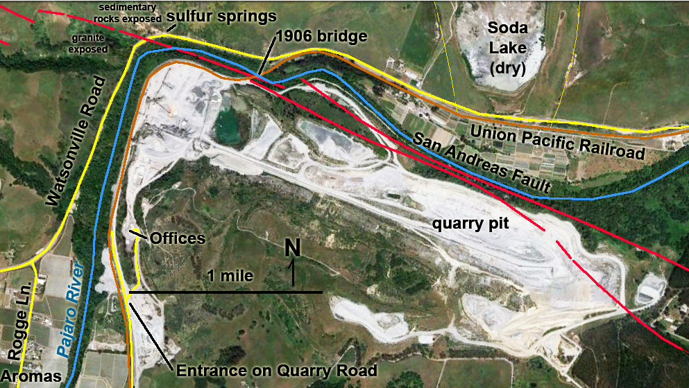
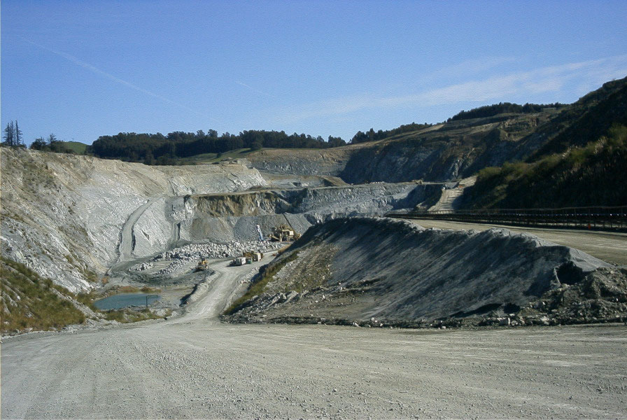
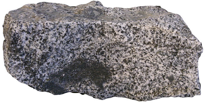
| Stop 2—Anzar Road landslide of April 22, 1998 One of the costliest landslides in California's history happened near the end of the notoriously wet "El Niño" winter of 1998. The poorly consolidated sedimentary deposits were heavily saturated with water from heavy winter rains. A great landslide moved downslope and covered Anzar Road. The massive deep-seated slump and landslide destroyed a home and took out two PG&E gas pipelines. As many as 60,000 customers in the Santa Cruz and Monterey Counties were without gas for three days (closing many businesses) with additional the long term costs associated with repairs to the pipelines and the road. In all, the direct and direct costs associated with the landslide was in the range of possibly several tens of millions of dollars. (2Highland and Schuster, [2000]) Today little remains as evidence of the great landslide. The hillslopes underlain by the soft sedimentary rocks east of the fault are prone to landsliding throughout the region. Note: please be cautious while stopping for photographs on Anzar Road. The road is lightly traveled and visibility along the road is general good, but the road is narrow. Stop 3—Anzar Lake, a sag pond on the San Andreas Fault Proceed west on Anzar Road past the Cannon Road intersection. About a mile ahead on the left is Anzar Lake. The lake is really a wetland that has a small perennial pond in the middle of a structurally confined drainage basin —one of the largest sag ponds along the San Andreas Fault in the region. There is no stream drainage linked to the basin and the lake expands to cover many acres in wet seasons. The lake's scenic setting is enhanced by the mature grove of eucalyptus trees that surround the south and west side of the lake. A couple field trip options: You can either turn around where it is safest at the (intersection of Anzar and Forest Road near the west end of the Anzar Lake), or continue west on Anzar Road to Granite Rock Quarry near Aromas. Stop 4—Granite Rock Quarry West of Anzar Lake, Anzar Road winds through the eucalyptus forest and goes under a huge aggregate-moving conveyer-belt system managed by the quarry. A short distance past the conveyer belt line Anzar Road ends at the intersection of Carr Road (to the left) and Aromitas Road (to the right). Carr Road leads to Carpenteria Road—turn right to head into the town of Aromas. Follow Carpenteria Road through town and turn right on Quarry Road to get to the Granite Rock Quarry. Alternative, if the weather is right, follow Aromitas Road north (downhill) for a scenic shortcut to the entrance access road to the Granite Rock Quarry. Each year, the Granite Rock (Inc.) quarry is open to the public for special events when tours of the quarry are offered. Check the Granite Rock website for more information (www.graniterock.com/). Granite Rock employs a number of geologists and mining engineers. The quarry is in a massive body of intrusive igneous rock in a fault-bounded block composed of Jurassic age "gabbro of Logan quarry" (3Ross, 1970). Logan is the name of the first quarry operation in the Pajaro River canyon area closer to the town site of Chittenden. The Logan gabbro is part of a massive igneous batholith complex that split away from southern California. Other blocks of similar gabbro occur along the San Andreas Fault zone in locations named "Gold Hill" (near Parkfield) and "Eagle Rest Peak" (between Bakersfield and Los Angeles). The Logan gabbro body has moved northward along the west side of the San Andreas Fault system nearly 200 miles from its location of origin in the greater southern California batholith complex. The bedrock on the west side of the San Andreas Fault where the quarry is located consists of massive crystalline igneous and metamorphic rock. A branch of the fault cuts through the large pit quarry area in the active mine pit. A fault trace is visible in the southern sidewalls of the quarry that cuts through the gabbro. A long history of natural tectonic fracturing has made the durable crystalline rock ideal for mining—the rock is already broken up for easy crushing and sorting into different grade of aggregate (commercial sand, gravel, and boulders). The rock mined in the quarry consists of the crystalline intrusive igneous rock—hornblende quartz gabbro (consisting of feldspars [labradorite to bytownite plagioclase], hornblende, quartz, with minor amounts of biotite, pyroxene, apatite, magnetite, and pyrite). Within the bedrock are zones of gneiss—a layered coarse-grained anorthositic gabbro (containing feldspars [labradorite to bytownite plagioclase], hornblende, and pyroxene)(Ross, 1970). |
 |
|
| Home damaged by the 1998 Anzar Road Landslide | ||
 |
||
| Damaged Anzar Road and pipeline from 1998 landslide | ||
 |
||
| Anzar Lake along Anzar Road is a sag pond along the San Andreas Fault | ||
 |
||
| Map of Granite Rock Quarry | ||
 |
||
| Granite Rock Quarry | ||
 |
||
| Block of Logan gabbro | ||
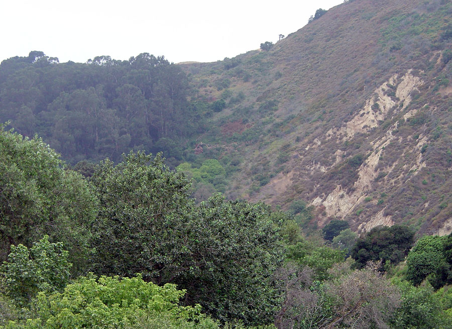
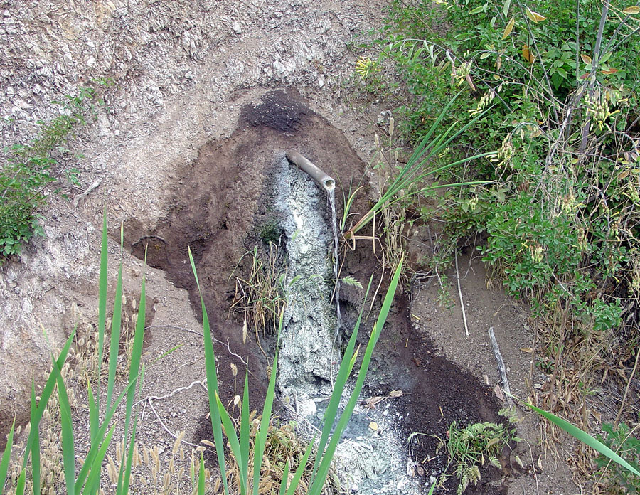
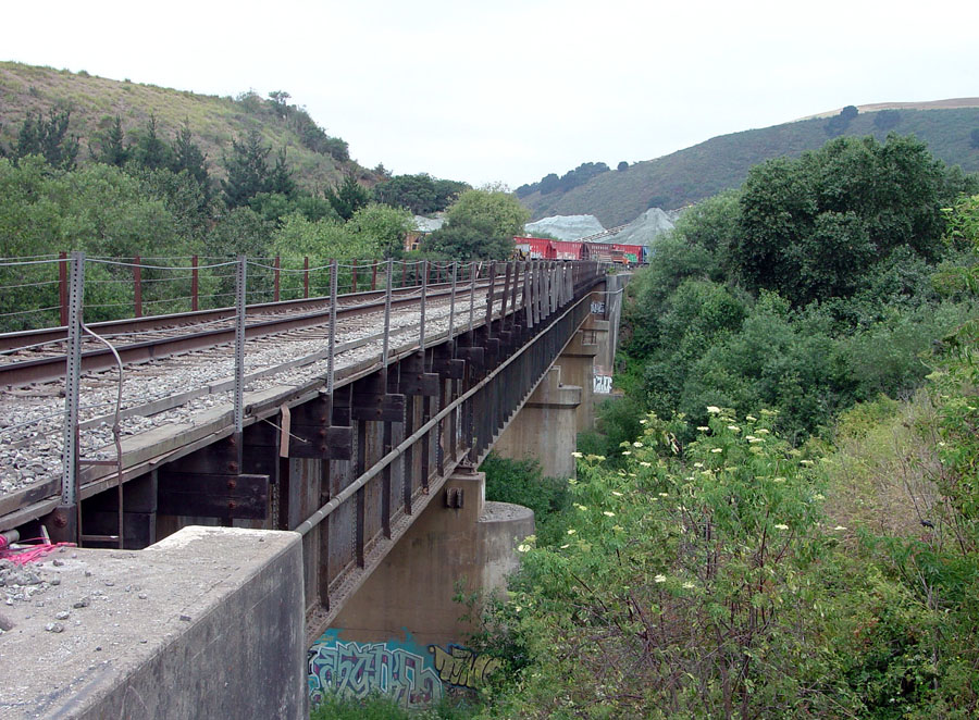
Stop 5—"Aromas" from the San Andreas Fault Zone on CA Highway 12): The San Andreas Fault crosses Highway 129 near the Granite Rock quarry in a deepest section of the Pajaro River canyon (called "Pajaro Gap"). The scenery is impressive and the fault zone is well exposed. However, Highway 129 is too busy and dangerous to consider for a class field-trip stop! Instead, be prepared to look out the window as you drive. The fault crosses at the bend in a road. Weathered granitic rock (gabbro) crop out on the west side of the fault near road level. On the east side of the fault are massive outcrops of layered Late Tertiary sedimentary rocks that are increasingly folded near the fault zone. Perhaps the a interesting aspect of the location is the strong smell of sulfur emanating from the fault zone (particularly during periods atmospheric low-pressure when gases are forced out of the ground). You know you are near the fault when you smell sulfurous gases as you drive by! The sulfurous smell is responsible for the name of the town of "Aromas." Before the 1906 earthquake there were many sulfur springs in the area, but most of the springs vanished after the earthquake. The Union Pacific Railroad used Pajaro Gap to build the coastal route between the Salinas Valley and the San Francisco Bay area. The rail line follows the Pajaro River from Watsonville to Gilroy. A railroad bridge over the Pajaro River crosses near the trace of the San Andreas Fault. The bridge was severely damaged in the 1906 earthquake. |
 |
 |
| San Andreas Fault zone is revealed by vegetation contrasts on the hillslope on the north side of Highway 129 | Late Tertiary Sedimentary rocks on the east side of the San Andreas Fault along Highway 129 | |
 |
 |
|
| Sulfur springs in San Andreas Fault Zone along Highway 129 | Railroad bridge over the Pajaro River damaged by the 1906 earthquake |
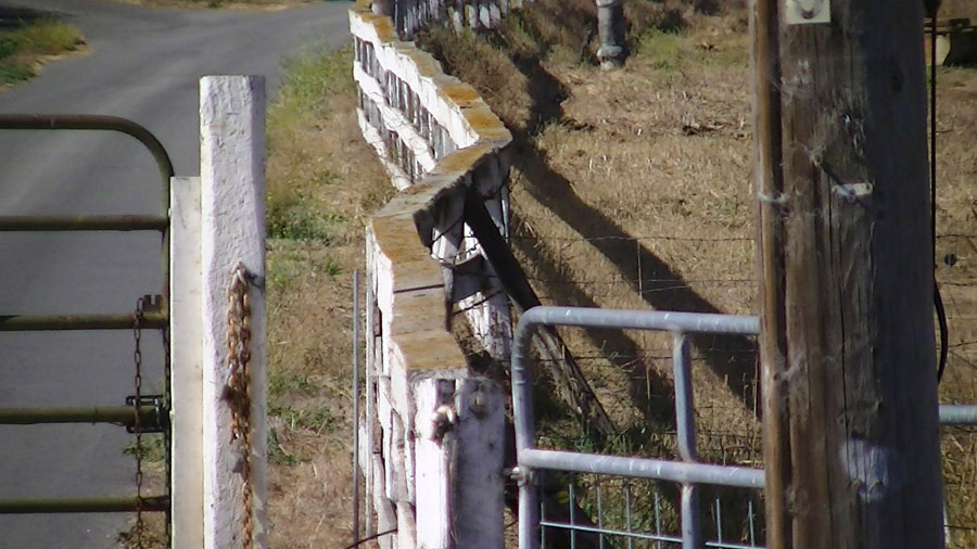
| Stop 6—Offset fence lines on the San Andreas Fault on Nyland Ranch: | |||
| Creeping fault movement along the San Andreas Fault is revealed by three offset fence lines that cross the fault in fields on Nyland Ranch on the Old San Juan Highway (between Anzar Road and San Juan Bautista). A new bike lane being added to the San Juan Highway makes it easy and safe to pull over an look at the offset fences (be aware of bikes!). One fence is located across the road (west side) from the intersection of Prescott Road and Old San Juan Highway. The other two fences are nearby on either side of the entrance road to Nyland Ranch. |  |
 |
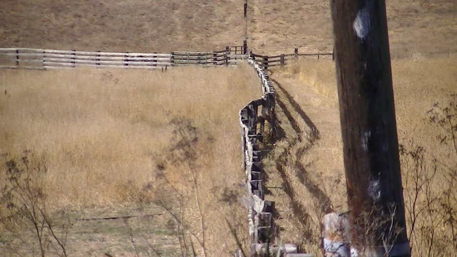 |
| Offset left fence along the entrance to Nyland Ranch on Old San Juan Highway. | Offset right fence along the entrance to Nyland Ranch on Old San Juan Highway. | Offset fence across from Prescott Road intersection with Old San Juan Highway. | |
| 2Highland, L.M., and Schuster, R.L., [2000], Significant Landslide Events in the United States: U.S. Geological Survey website: http://landslides.usgs.gov/docs/faq/significantls_508.pdf 3Ross, D.C., 1970, Quartz gabbro and anorthositic gabbro: Markers of offset along the San Andreas fault in the California Coast Ranges: Geological Society of America Bulletin, v. 81, p. 3647-3662. 1Wagner, D.L., Green, H.G., Saucedo, G.J., and Pridmore, C.L., 2002, Geologic map of the Monterey 30'x60' Quadrangle and adjacent areas, California. California Geological Survey, Regional Geologic Map No. 1, 1:100000 scale: http://www.quake.ca.gov/gmaps/RGM/monterey/monterey.html |
9/11/2012