San Andreas Fault in the Cienega Valley
Wine Tour Route in San Benito County, California |
|
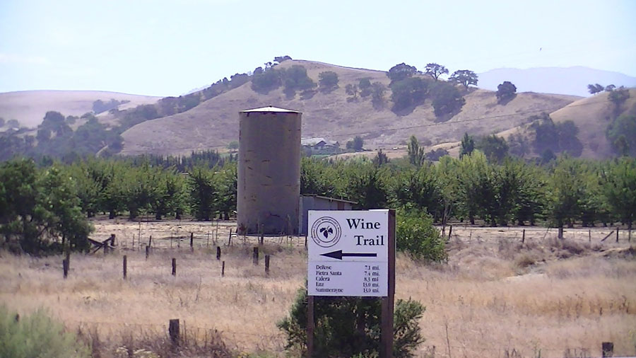
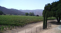
Field-trip overview: This field trip is a tour of the fault system in central San Benito County. The tour is a 40 mile loop route that follows Cienega Road south from Hollister through the Hollister Hills into the valley of the San Benito River south of Hollister. Most of the tour stop description are sites along the San Andreas Fault in the Cienega Valley, a linear valley in the Hollister Hills along the northeastern flank of the Gavilan Range near Hollister, California. Stops along the loop route include overlooks along Cienega Road, a visit to the fault zone in the Hollister Hills State Recreational Vehicle Park, optional stops at the DeRose, Pietra Santa, and Calera Wineries, and optional stops along south Cienega Road, along Highway 25 in Tres Pinos, and a San Benito River gravel bar at the intersection of Union and Cienega Roads. This field trip follows a route designated a "Geology of Wines Tour" in San Benito County.
Directions from Highway 101: This field trip starts at the intersection of Union Road and Cienega Road in San Benito County. The intersection is close to the towns of Hollister and San Juan Bautista. To get to the Union/Cienega roads intersection follow US Highway 101 to the CA Highway 156 East exit for San Juan Bautista. Follow Highway 156 east for 7 miles (past San Juan Bautista) to the second stop light for Union Road.
Turn right (east) on Union Road. Follow Union Road for 3.6 miles.
Parking for Stop A is located on the west side of Union Road opposite from the T-intersection with Cienega Road. The field trip follows Cienega Road south into the Hollister Hills State Vehicular Recreation Park (HH SRVP) and then continues along Cienega Road; stop descriptions are listed below.
Directions from Downtown Hollister: Many field trips stop in Hollister to examine the Calaveras Fault. Groups traveling in multiple cars might consider using the Public Parking Garage—the entrance is located on 5th Street between San Benito Street and Monterey Street. From downtown Hollister, follow San Benito Street (Highway 25) south for 1.7 miles until it intersects Union Road. Turn right on Union Road. Cross the bridge over the San Benito River. Parking for Stop A is on the right on the south side of the bridge opposite from the intersection of Cienega Road.
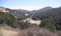
Geologic setting: The San Andreas Fault runs down the Cienega Valley, a linear valley controlled by the structural geometry of the fault zone. Bedrock on the western side of the fault consists of ancient granite, marble, and schist that form the core of the Gavilan Range. Bedrock on the east side of the fault consists of comparatively geologically young sedimentary rock formations near the surface and oceanic crustal rocks at depth. The sedimentary rocks underlie the rolling foothill country between the Cienega Valley and the San Benito River Valley near Hollister—the Hollister Hills. As the fault has slipped through time it has controlled the path of streams draining from the Gavilan Range. As stream drainages were stretched as they traversed the fault zone, the drainages were cut off by stream capture. The linear Cienega Valley encompasses the drainages of Bird Creek (in the vicinity of HH SRVP), Grass Valley, and part of the San Benito River Valley. Fault Creep is evident in the offset of manmade structures that were built on the creeping strands of the San Andreas Fault, with perhaps the most famous at the DeRose Winery—California's oldest winery whose processing building was built directly straddling the San Andreas Fault.
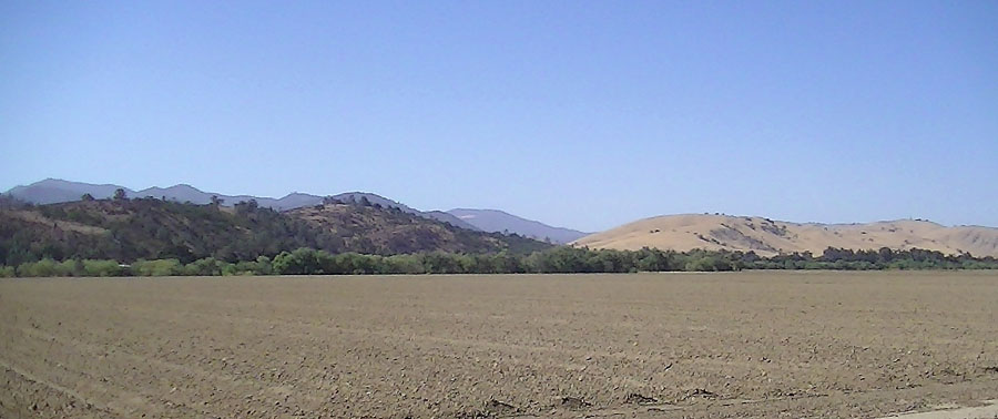
To the south, the Cienega Valley—the San Andreas Fault-controlled linear valley—merges with the San Benito River Valley in a region where the other major faults in the region converge. The San Andreas Fault zone runs along the west side of the San Benito River valley, the Calaveras Fault zone runs down the center of the valley, and the Tres Pinos Fault zone runs along the east side of the valley in the foothills on the east side of CA Highway 25 in the vicinity of Paicines northward to Hollister. During the late Pleistocene Epoch, the San Benito River used to flow northward along the Calaveras Fault into the Hollister Valley. The combined effects of fault motion and erosion have caused stream capture resulting in the unusual geometry of the canyons and elevated stream terraces along Tres Pinos Creek and the San Benito River between Tres Pinos and Hollister.
Field-Trip Stop Destinations |
Click on images for a larger view. |
| |
 |
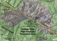
| Map showing Cienega Valley Loop Tour Route |
 |
| San Benito County wineries and vineyards map. |
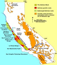 |
| Salinian basement rocks |
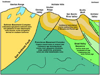 |
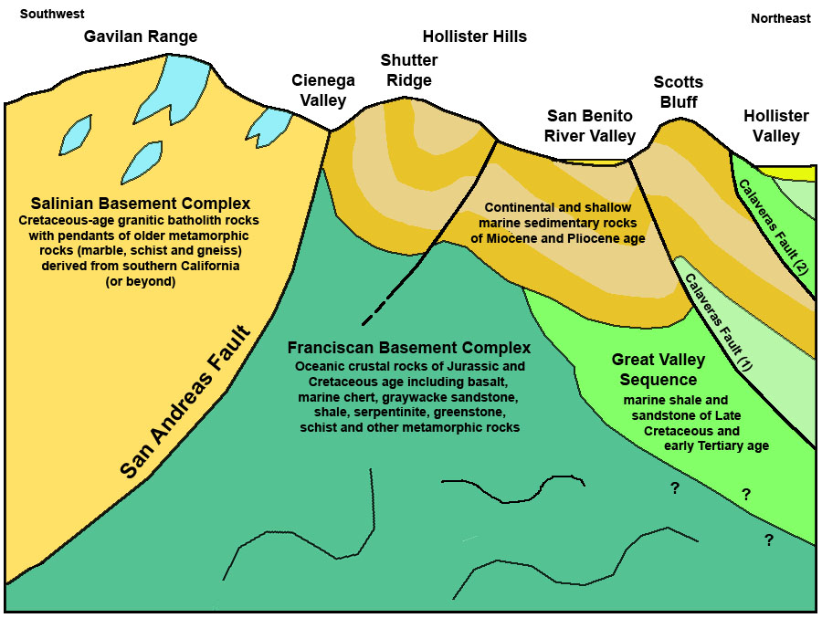
| Cross section of the San Andreas and Calaveras Fault zones between the Gavilan Range and Hollister Valley showing bedrock units. |
Stop
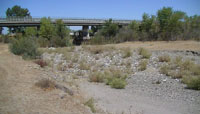
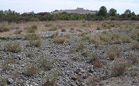
A—San Benito River Bridge at intersection of Union and Cienega Roads:
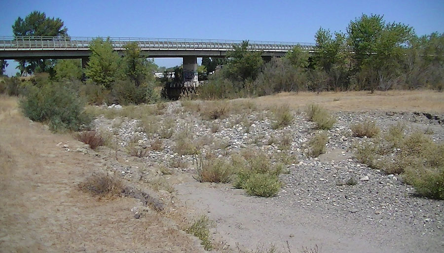
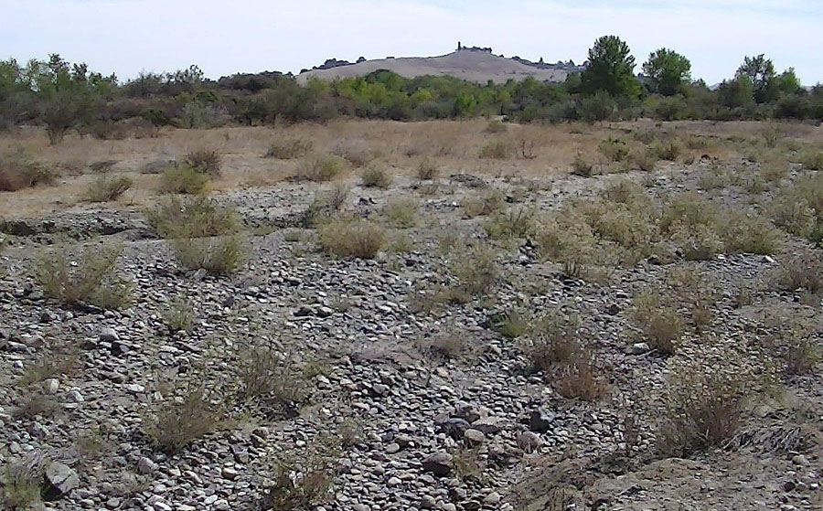
The Union Road bridge over the San Benito River is a good place to begin the Cienega Road Loop field trip. If time allows, it is worth a look at the gravel bars along the river bed. A small parking area is located near a gated trailhead on the west side of the bridge, and a trail leads down under the bridge to an unmaintained trail system along the river. The bridge actually straddles one of the active strands of the Calaveras Fault—the bridge itself is slightly warped by the gradual creep along the fault. There is no direct evidence of the fault in the river bed, however, the gravel in this section of the river is coarser that gravel beds downstream which suggests that the river may have been constricted by movement of the fault in the past (producing rapids where larger boulders accumulate).
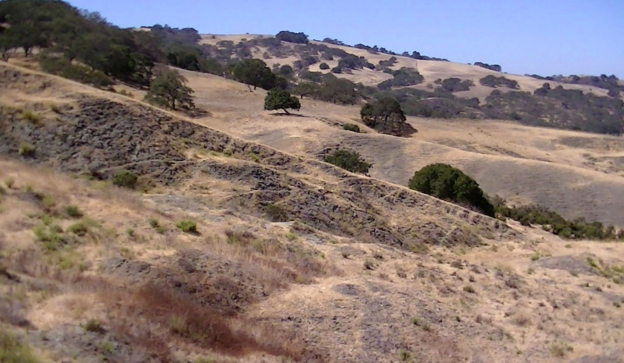
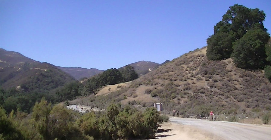
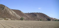
Stop B—Pull offs along Cienega Road near massive landslide area (slumps): Follow Cienega Road south into the Hollister Hills country. The winding road ascends from the San Benito River valley to a pass before descending into the Cienega Valley. On the right (west) side of the road are some unpaved pull offs about 2.5 to 3 miles from the intersection of Union Road. Be cautious of traffic when pulling off to the side of the road! The highest pull off before the pass offers the best view of a large landslide complex on the slopes on the west side of the road. Large landslide scarps, and uneven, disrupted landscape on the surface of large slumps are visible throughout the landscape. Cracks in Cienega Road suggest that the ground beneath the road is also unstable. The slumps show evidence movement typically in the spring after wet winters.
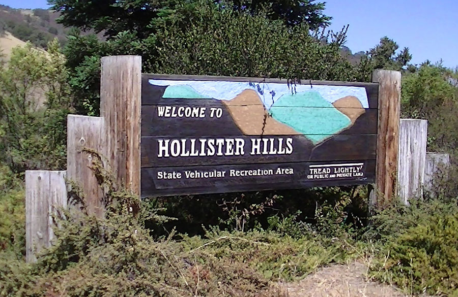
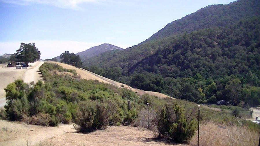
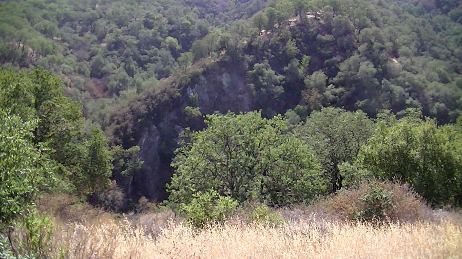
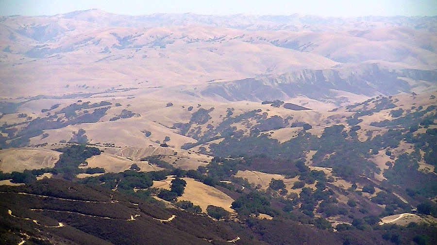
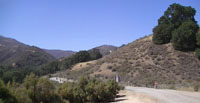
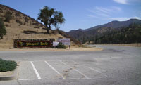
Stop C—Hollister Hills State Recreational Vehicle Park: Depending on weather conditions and crowds at ORV events, Hollister Hills SRVP is a good destination to see landscape features associated with the San Andreas Fault. The entrance intersection to the park is about 200 feet from the main branch of the San Andreas Fault which runs through the field on the south side of Cienega Road. Inside the park, the fault runs along the south side of Radio Ridge and roughly runs along the hillside at the west end of Radio Ridge over a low pass before it descends toward San Juan Bautista. It is recommended to stop in the picnic/camping area on Radio Ridge for a view of the Cienega Valley. Bird Creek descends from the high country in the Gavilan Range where it intersects the San Andreas Fault. Bird Creek then follows the fault zone before bending left into a canyon that cuts through the shutter ridge on the east side of the fault. Cienega Valley is a "structurally controlled" linear valley that follows the San Andreas Fault zone. As the fault moved through time (about an meter per century) stream beds have gradually been stretched in a "dogleg" like fashion, and stream capture has happened many times as one stream drainage gets stretched into the next.
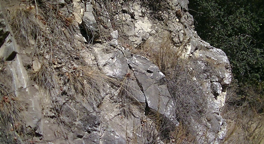
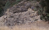
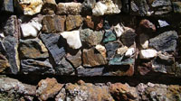
Rocks on the west side of the San Andreas Fault are crystalline igneous and metamorphic rock. Igneous rock content is coarse "granitic" rock (ranging from granite, granodiorite, diorite, tonalite, and gabbro in composition). Metamorphic rocks include marble, slate, schist, gneiss, and quartzite-ancient crustal rocks of probable late Precambrian to Paleozoic age—similar to rock exposed in mountain ranges in the eastern Mojave Desert region. These rocks are collectively part of the Salinian Basement Complex that forms the bedrock core of the Gavilan Range and part of other mountain regions in the Central Coast region. These rocks originally formed in the vicinity of southern California and were carried northward by gradual plate tectonic motion along region fault system to their current locations.
Rocks on the east side of the San Andreas Fault consist of comparatively young sedimentary rock formations (Miocene to Pliocene age) that crop out along the shutter ridge and in the Hollister Hills—the hillsides extending north into the Hollister Valley. The bedrock consists mostly of sandstone, mudstone, and shale that locally contains an abundance of shallow marine shell fossils. Other zones contain fossil wood, plant remains, and rare bone material. These sedimentary deposits accumulated as the San Andreas and other faults propagated through the region. These sedimentary rocks rest unconformably on older sedimentary rocks (Great Valley Sequence) and the older Franciscan Basement Complex (oceanic crustal rocks). |
 |
 |
| Stop A: San Benito River bridge straddles a strand of the active Calaveras Fault. |
Ridgemark Ridge and San Benito River gravel bar. The ridge is bounded by faults. |
 |
 |
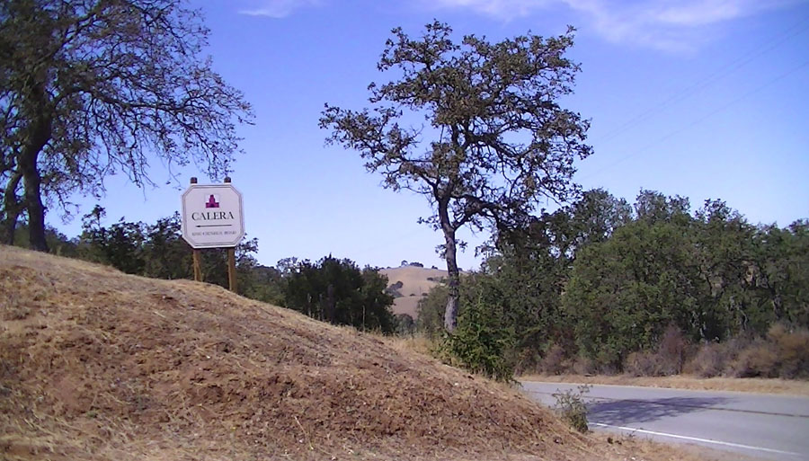
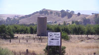
| Wine Tour sign at corner of Cienega and Union roads |
Stop B: Landslide area along Cienega Road. |
 |
 |
| Map of Hollister Hills SRVP |
| Stop C: Hollister Hills SRVP |
 |
 |
| View west along Radio Ridge in Hollister Hills SRVP
|
View east along Radio Ridge in Hollister Hills SRVP
|
 |
 |
| Fractured marble along Bird Creek in Hollister Hills SRVP |
Granite outcrop along Bird Creek in Hollister Hills SRVP |
 |
 |
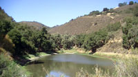
| Pond along San Andreas Fault in Hollister Hills SRVP |
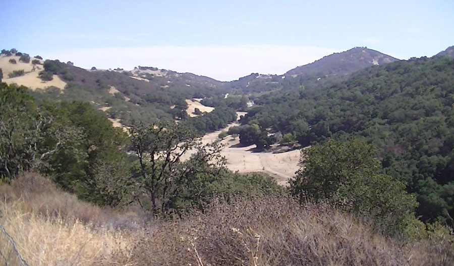
View along Cienega Road in the Cienega Valley—the linear structural valley along the San Andreas Fault valley |
Stop D—DeRose Winery on the San Andreas Fault: South of the Hollister Hills SRVP Cienega Road follows a linear valley along the San Andreas Fault zone—the Cienega Valley. This linear landscape feature crosses through portions of a number of several stream valleys draining between the Gavilan Range and the San Benito River to the northeast.
The DeRose Winery is the oldest winery in California. It is also one of the most famous destinations along the San Andreas Fault. The winery was established in 1854 by French immigrant Theophile Vaché who sold his wine in San Juan Bautista.
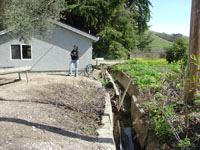
The winery changed has changed ownership over the years and for a time was the Almaden Winery. Ironically, the old winery building was built directly on an active creeping strand of the San Andreas Fault. The creeping fault has been slowly splitting the winery building, evidence of the creep motion is evident in the form of fractures and offset walls inside and outside the building. A plaque commemorating the San Andreas Fault as a national geologic landmark was mounted on a wall inside the winery building by the National Park Service.
On the south side of the winery building a cement-line drainage control channel was built sometime about 1900. The cement drainage structure has been broken and offset by creep along the San Andreas Fault. The drainage ditch displays about a meter of right-lateral displacement.
Stop E—Pietra Santa Winery: The drive next to the DeRose Winery leads uphill into a bowl-shaped valley in the north flank of the Gavilan Range. The valley is filled with wine grape vineyards establish by . The winery is a scenic destination for wine tasting a picnic lunch stop. Cuts in the hillsides around the valley exposed weathered granite and soil. Along the road to the Pietra Santa Winery is a restored private residence that was originally designed by architect Frank Lloyd Wright.
|
 |
| Stop D: Offset cement drainage ditch on San Andreas Fault at the Derose Winery |
 |
| Stop E: Pietra Santa Winery in an upland valley in the Gavilan Range |
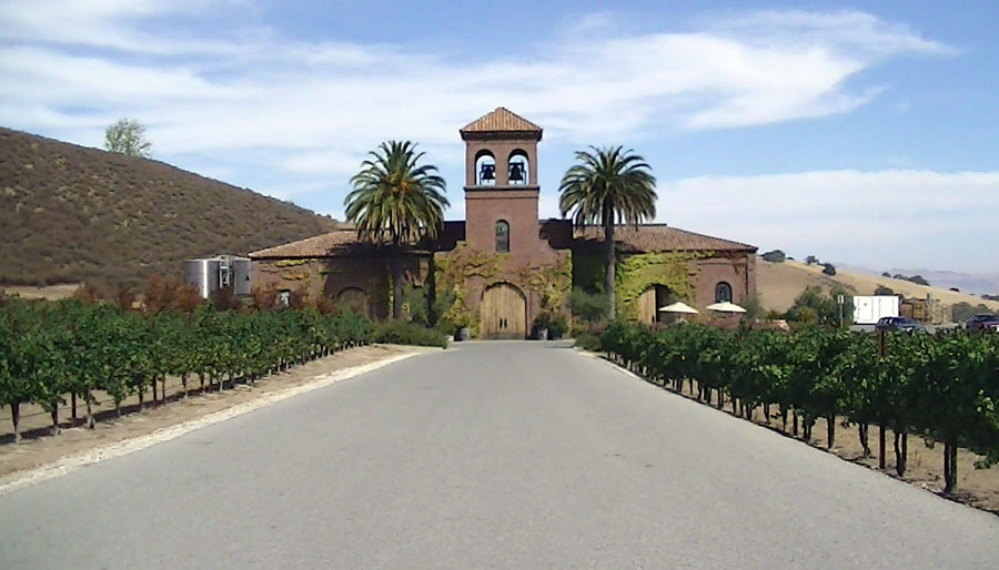
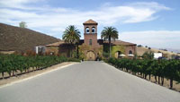
Stop F—Calera Winery: The Calera Winery is a creatively designed facility which takes advantage of gravity flow to move grape juice through the wine making processes. The winery's history began with the mission to find a perfect grape growing environment in California that had both a perfect climate and a calcium-carbonate-rich soil. The natural marble bedrock occurring in pockets through the Gavilan Range provided the perfect setting for vintner/owner Josh Jensen to establish the Calera Winery. Groups are encouraged to contact the winery in advance for a tour of the winery facilities. The winery grounds offers a spectacular view of the Cienega Valley, the shutter ridge on the northwest side of the San Andreas Fault, and of Scotts Bluff, a beautiful barren ridge in the distance overlooking the San Benito River valley. Scotts Bluff is bounded on both sides by fault strands of the Calaveras Fault system.
Stop G—Grass Valley: South of Calera Winery the "structurally formed" Cienega Valley intersects the "erosionally formed" Grass Valley. Grass Valley is a broad drainage valley that extends for several miles back into the heart of the Gavilan Range. The "grass" that once covered the valley is now to extensive vineyards. A brief stop at the entrance to Grass Valley Road is a good location to view the vineyards and to examine rocky sediments (alluvium and colluvium) exposed in road cuts in the vicinity of the fault zone. Lime Kiln Road intersects Cienega Road farther south along Grass Valley and is named after historic lime kilns used to process marble mined in the Gavilan Range.
Stop H—Thousand Trails RV Park entrance: Between the Calera Winery and the Thousand Trails RV Park, Cienega Road basically follows the San Andreas Fault zone and actually crosses actively creeping strands of the fault in several places. Cracks caused by fault creep are visible in the pavement. One location where it is possible to pull over an safely look at the fault is near the sign at the entrance to the RV Park on Cienega Road. |
 |
 |
| Entrance to Calera Winery along Cienega Road |
Shutter ridge along San Andreas Fault |
 |
 |
| Vineyards in Grass Valley |
Colluvium along fault zone |
 |
 |
| Scotts Bluff along San Benito River Valley |
Cracks in pavement by fault creep at Thousand Trails |
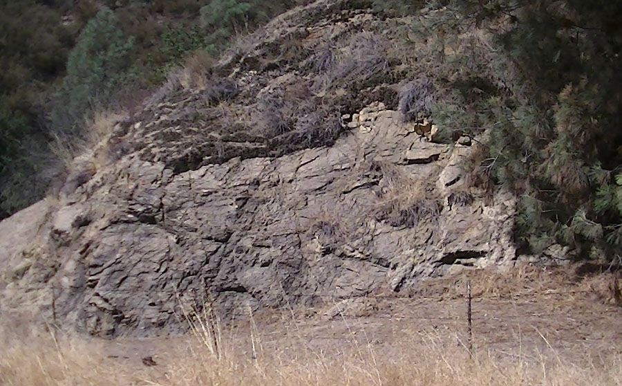
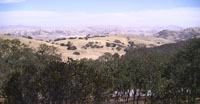
About a mile south of the Thousand Trails RV Park, the Cienega Valley merges with the greater San Benito River Valley. South of Paicines, numerous active fault strands (including the Calaveras-Paicines Fault and Tres Pinos Fault) converge to become the greater San Andreas Fault zone. The fault system generally follows the San Benito River south past Pinnacles National Park and beyond to Parkfield and southern California. Fractures in the asphalt reveal locations where the creeping fault line crosses Cienega Road. Near the southernmost point on Cienega Road is a hogback ridge consisting of steeply dipping sedimentary rock formations typical of bedrock on the east side of the San Andreas Fault. From this point, Cienega turns northward to intersect Highway 25 (Airline Highway) at the town of Paicines.
Stop I—Paicines: In the vicinity of Paicines, the San Benito River Valley is a broad floodplain used extensively for agricultural activity. A low line of hills in the center of the valley (about a mile east of Highway 25) is a pushed-up shutter ridge that highlights the location of the Calaveras Fault. Paicines is located at the intersection of Highway 25 with the Panoche Road—a road that follows Tres Pinos Creek east and eventually into the Panoche Valley about 30 miles to the east. The Panoche Road historically was the access road to the Central Valley region and the historic mercury mines at New Idria.
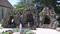
Stop J—Tres Pinos: The small town of Tres Pinos was established at the end of a historic railroad line (later replaced by Highway 25). A special stop on this tour is the Tres Pinos Church where beautifully crafted monuments around the church grounds have been constructed from rock materials collected in San Benito County. Rocks used in the construction include garnet-bearing schist, serpentinite, quartz crystal, copper ore, fossil wood, chert, and many other rock and mineral samples.
|
 |
 |
| Fractured granite along Lime Kiln Road |
Hogbacks of steeply dipping late Tertiary |
 |
 |
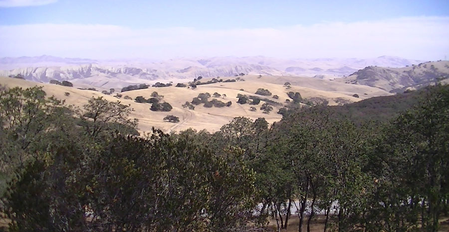
| Cienega Valley intersects the large San Benito River Valley |
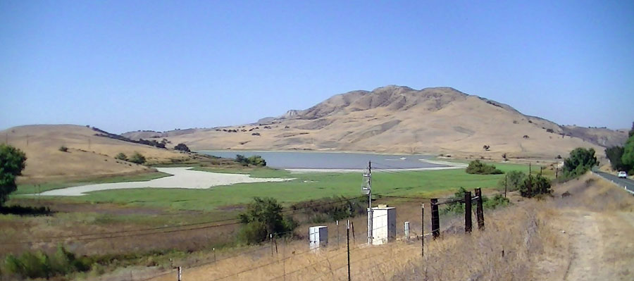
Paicines Reservoir along Highway 25 near Scotts Bluff |
 |
 |
| "Grottos" constructed of serpentinite at Tres Pinos Church. |
Rock and mineral samples in the stone monuments at Tres Pinos Church. |
| Evolving Landscapes and Drainages: The landscape along Highway 25 between Paicines, Tres Pinos, and south Hollister reveals a long history of fault movements that have impacted the paths of stream drainages. Tres Pinos Creek probably originally drained into the San Benito River near Paicines, but movement along the Calaveras Fault and diversion of the drainage by stream capture has changed the landscape dramatically. Both the San Benito River and Tres Pinos Creek enter separate canyons north of Tres Pinos: Highway 25 follows Tres Pinos Creek Canyon and Southside Road follows the San Benito River Canyon. The two rivers converge into a single drainage again in the vicinity of Union Road and Southside Road about a mile upstream of Stop A. North of Tres Pinos, Highway 25 essentially follows a strand of the Calaveras Fault into south Hollister. The fault scarp of the Calaveras Fault runs through the golf coarse along the highway near the Ridgemark Country Club. In the vicinity of Ridgemark, Highway 25 runs through a "water gap"—a broad valley without an apparent stream drainage where the ancestral San Benito River drainage entered into an ancient lakebed that filled Hollister Valley that flooded intermittently throughout the glacial periods of the Pleistocene Epoch. |
|