Juan Bautista de Anza National Historic Trail,
Old Stage Road—San Juan Bautista to Salinas, CA |
|
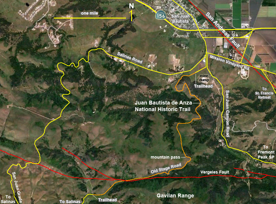
Field-trip overview: The historic Old Stage Road connects between Salinas and San Juan Bautista, California. This historic route used to link San Juan Bautista to the Salinas Valley—part of the El Camino Real that linked southern and northern California. The Stage Road was no longer maintained when the new Salinas Road (San Juan Grade Road on the Salinas end) was built in the early 1920's to accommodate automobile traffic. Today, a 4 mile (one way) section of the old unpaved road is now a hiking, biking, and horseback riding trail maintained by the National Park Service as part of the Juan Bautista de Anza National Historic Trail.
Starting at a trailhead near San Juan Bautista, the trail (Old Stage Road) climbs nearly 750 feet in about 2.5 miles to a mountain pass before descending into the valley in the foothills on the Salinas side along the Gavilan Range. Along the way are spectacular views or the region extending from Monterey Bay to the Hollister Region and mountainsides covered with grasslands, oak forests, and chaparral shrublands. The bedrock exposed along the trail on the San Juan side of the pass consist of old "Red Beds" [deposits] that have been uplifted, tilted, and offset by faults as the north end of Gavilan Range has risen. These alluvial fan deposits overlie bedrock consisting of massive sandstone of the Vaqueros Formation of Oligocene age. On the west side of the pass, ancient granitic and metavolcanic rocks crop out on the hillsides. Along the route downhill into the Salinas Valley, the trail crosses the Vegeles Fault, an active earthquake fault that splays off the main trace of the San Andreas Fault several miles to the east near the head of San Juan Canyon in Hollister Hills State Recreational Vehicle Park. The Vergeles Fault extends westward through the northern end of the Gavilan Range into the region around Prunedale and on northward into Santa Cruz County where it becomes the Zayente Fault.
Note that this hike is moderately strenuous and involves a long uphill walk, but the steepest section is in the lower part near the San Juan end. The upper part of the trail is a gentle grade. The scenery only gets better as you go, so the hike is worth it! Most people hike the first 2.5 miles to the pass and turn around, however, the last section of the trail is some of the best scenery. Groups might consider splitting up and parking at either ends of the trail and trading car keys when the meet along the trail, and then meet up after the hike for a meal in San Juan Bautista.
Directions: To get to the Azna Trailhead near San Juan Bautista, take US Highway 101 to exit 345 for the CA Highway 156 (San Juan Bautista/Hollister).
Follow CA Highway 156 East for 3.4 miles to the first stop light on The Alameda (Windmill Shopping Area and San Juan Elementary School are on the left). [See the San Andreas Fault walking tour for San Juan Bautista]
Turn right (south) at the stop light on onto The Alameda (away from downtown San Juan Bautista).
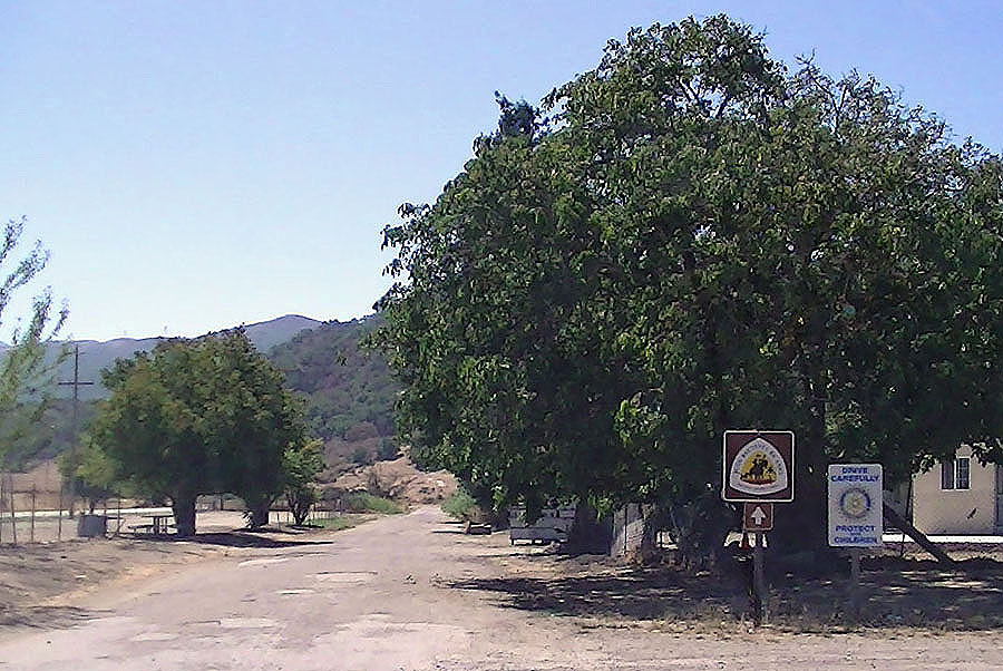
Proceed 0.3 mile to the 4-way intersection of The Alameda with Mission Vineyard Road, San Juan Canyon Road (to Fremont Peak State Park), and Salinas Road. Look very carefully ahead of you at the intersection for the small sign for the Juan Bautista de Anza National Historic Trail access road that intersects the Salinas Road very near the intersection (it is easy to miss!). A maintained gravel road leads about 0.3 mile to gate at the trailhead. Please park away from the gate so that vehicles have space to turn around.
History of the Trail: The Juan Bautista de Anza National Historic Trail stretches nearly 1200 miles between Nogales, Arizona to San Francisco, California. The National Historic Trail is a driving route (with some hiking sections) that generally follows the route of an expedition in 1775-1776 lead by Spanish Lt. Colonel Juan Bautista de Anza. Anza led more than 240 men, women and children on an overland journey across the frontier of New Spain to settle Alta California. A National Park Service website about the Juan Bautista de Anza National Historic Trail is http://www.nps.gov/juba/
Whereas the Anza Expedition cross the upland region between Salinas Valley to San Juan Valley on their way north, they probably did not follow the current hiking route along the Old Stage Road. The Old Stage Road was developed years later once the Mission was established in San Juan Bautista in 1797 and the town began to accumulate residents. The Old Stage Road was part of the historic El Camino Real, the "Kings Highway" that connected the 21 California Missions. As California grew, the Old Stage Road became part of the main route connecting Los Angeles to San Francisco. In it history, the Old Stage Road through the gap along the north flank of the Gavilan Range was a dangerous route with many robberies and atrocities reported. With the appearance of the automobile, the Old Stage Road route between Salinas and San Juan Bautista was abandoned after the construction of the San Juan Grade-Salinas Road in the 1920s. Although the new route was an improvement it was still a hazardous journey (as it still is) over the north end of the Gavilan Range. Highway 101 was build the 1960s to bypass the higher mountainous routes.
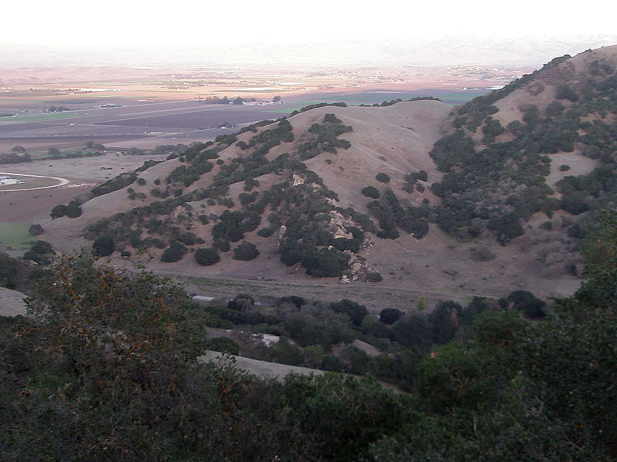
Geologic Setting: The Anza Trail crosses through the foothill country on the north end of the Gavilan Range. The core of the Gavilan Range (such as around Fremont Peak) consist of ancient crystalline metamorphic and metasedimentary rocks of undetermined age (possibly Proterozoic to early Paleozoic in age). These ancient rocks were intruded by massive igneous plutons that crystallized into granitic rocks during the Late Cretaceous Period (about 80 to 70 million years ago). A long period of erosion took place before marine waters flooded over the region in middle Miocene time. Heavily altered volcanic rocks and marine sedimentary rocks (sandstone and conglomerate) rest unconformably on an irregular surface on the ancient crystalline rocks. A thick sequence of these Oligocene and younger sedimentary rocks are exposed in the foothills region and display evidence of significant folding, uplift, and fracturing and displacement by faulting. The oldest of these sedimentary rock formations is called the Vaqueros Sandstone. Massive outcrops of Vaqueros Sandstone occur throughout the northern mountain front area along lower San Juan Canyon, along the Salinas Road (San Juan Grade), along Rocks Road, and along Highway 101 between Salinas and Prunedale exits.
The Anza Trail crosses the Vergeles Fault, an active earthquake fault that splays westward from the main trace of the San Andreas Fault near the head of San Juan Canyon. The fault cuts through the foothills into the northern Monterey County region; in Santa Cruz County, the Vergeles Fault becomes the Zayente Fault before merging back with the San Andreas Fault in the northern Santa Cruz Mountains. Many of the recent earthquakes in the San Juan Bautista region have occurred on the Vergeles Fault.
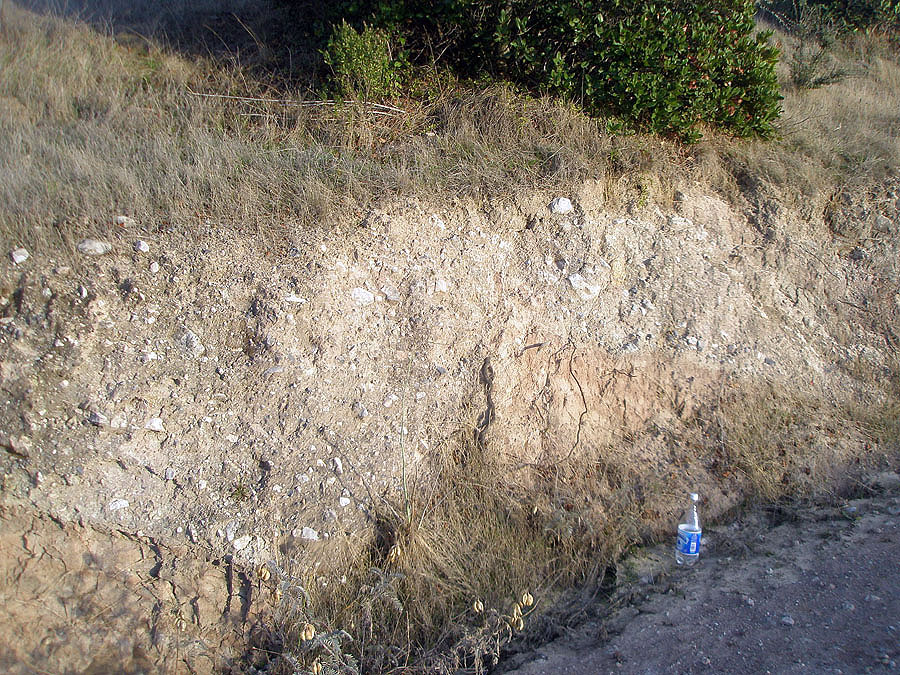
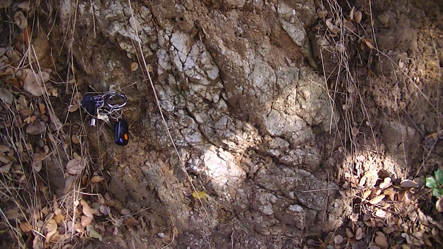
Old alluvial fan deposits (Red Beds) of Late Oligocene age are exposed in outcrops along the Anza Trail and along the Salinas Road (San Juan Grade). These ancient alluvial fan deposits consist mostly of sand, gravel, and angular blocks and boulders mostly of marble derived from the high core of the Gavilan Range around Fremont Peak. Ongoing faulting and uplift of the Gavilan Range have displaced these deposits in large rotated fault-bounded blocks and slumps. These deposits are now high in the mountains compared to the modern alluvial fan system along the mountain front, such as at the mouth of San Juan Canyon Creek near San Juan Bautista.
Geologic highlights along the Anza Trail (hiking east to west): 8 miles (out and back 4 miles between the two trailheads) may be too much for most people, but even a portion of the hike is worth the effort. The elevation of the San Juan trailhead is about 390 feet, the high point at the pass is at 1140 feet, and the elevation at the Salinas trailhead is 700 feet.
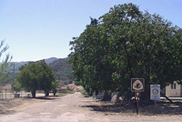
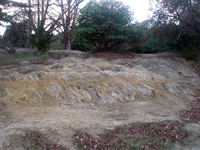
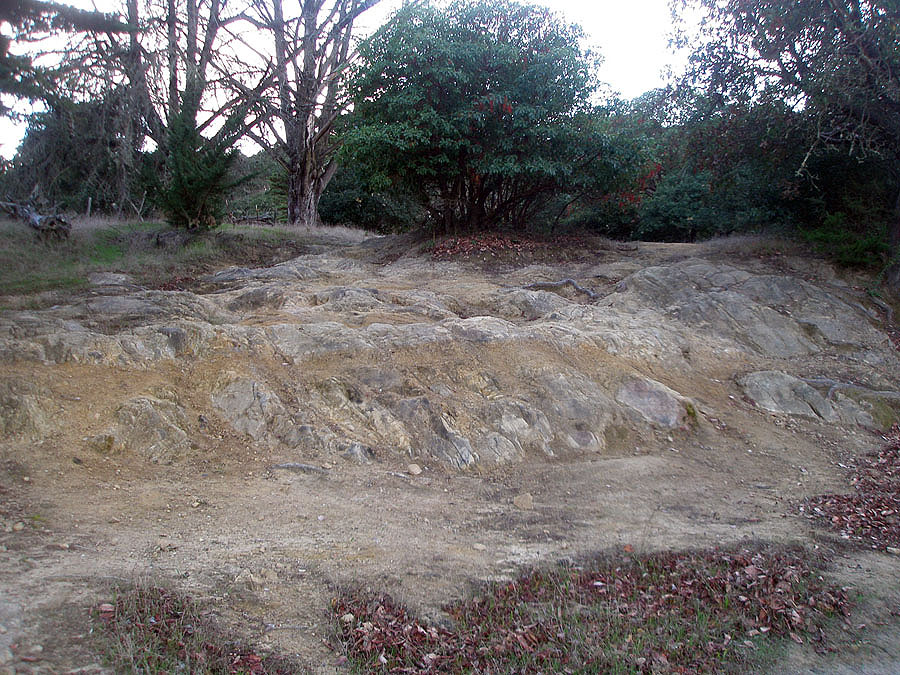
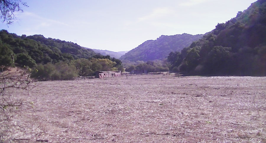
The trailhead near San Juan Bautista is a locked gate in the valley at the lower end of San Juan Canyon. A large grass-covered pile of mine tailings is located in the fields on the east side of the Old Stage Road near the trailhead parking area. This pile is all that remains of a large cement manufacturing plant that operated in this location starting around 1900 and closed operations in the 1970s. The mine tailings pile consists mostly of unused mix of crushed marble and granite extracted of a large open-pit mine in the vicinity of a Mormon Pioneer Camp in the foothills along San Juan Canyon (visible from the road to Fremont Peak State Park).
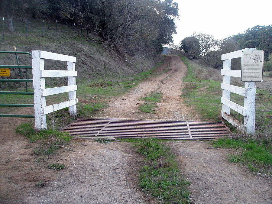
A tenth of a mile west of the trailhead, the trail crosses a first cattle guard and
begins a moderately steep ascent up the mountain front. This first mile of the hike is the most strenuous section—the trail climbs relatively steeply up about 500 feet to a second cattle guard. The trail is significantly less steep in the section between
the second cattle guard and the pass at 2.5 miles from the trailhead.
Along the first mile there are many cuts along the Old Stage road where rocks are exposed. These outcrops include exposures of heavily fractured bedrock consisting of sandstone (Vaqueros Sandstone of Oligocene age). The sandstone is unconformably overlain with beds of old alluvial fan deposits (interbedded layers of coarse conglomerate and sand). The alluvial fan material is dominated by gravel to boulder-sized blocks of marble derived from bedrock in the upland region around Fremont Peak. Interestingly, these alluvial fan deposits are of early Quaternary age and have been uplifted, folded, and offset by faulting as the northern end of the Gavilan Range continues to rise. In the outcrops along the Stage Road, the alluvial fan deposits appear have been rotated so that the bed dip into the mountainside rather than into the valley in the direction they were originally deposited when their host streams flowed into the valley. Whether these faults are of tectonic origin or associated with deep-seated slumps on the mountainside is uncertain.
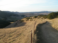
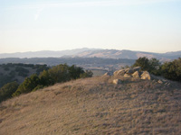
As the trail ascends higher and higher, the scenery also gets better and better. The Old Stage Road partly follows a ridge line that offers views of the region around the San Juan Bautista and the mountainous landscape of the northern Gavilan Range.
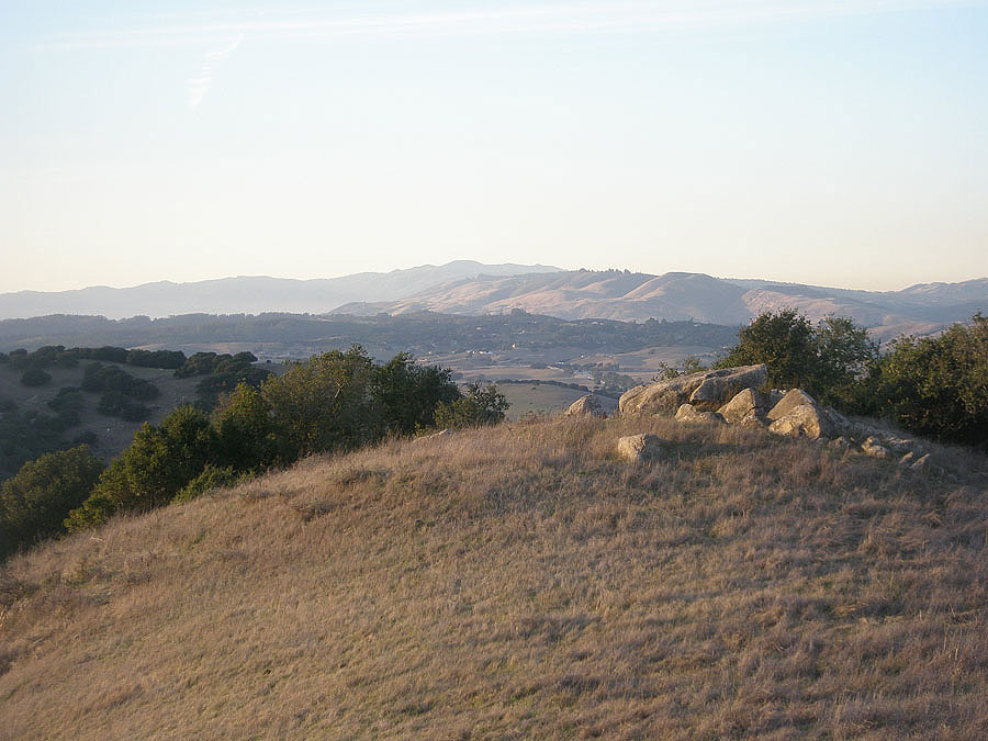
About 1.5 miles from the San Juan trailhead is a section of trail that cuts through a section of rugged massive outcrops of Vaqueros Sandstone. With ample shade from pine and cypress trees, the roadside outcrops make a good picnic stop. Beyond the outcrop area the road climbs gently to a pass. This upper section of the trail provides exceptional views of San Juan Canyon and uplands around Fremont Peak.
The Pass on the Old Stage Road
Most people starting on the San Juan side turn around at the pass located about 2.5 miles from the trailhead. West of the pass, the Old Stage Road descends gently into the foothills on the Salinas Valley side of the range. Note that the change in elevation is not as great on the west side—the trailhead on the Salinas side is about 300 feet higher than the San Juan side.
The scenery along the trail on the Salinas side of the pass is spectacular but different. The geology is also different on the west side of the pass. As the trail descends down a linear canyon, perhaps most notable are several groves of massive oak trees and several massive, barren rock outcrops on the mountainsides along the trail.
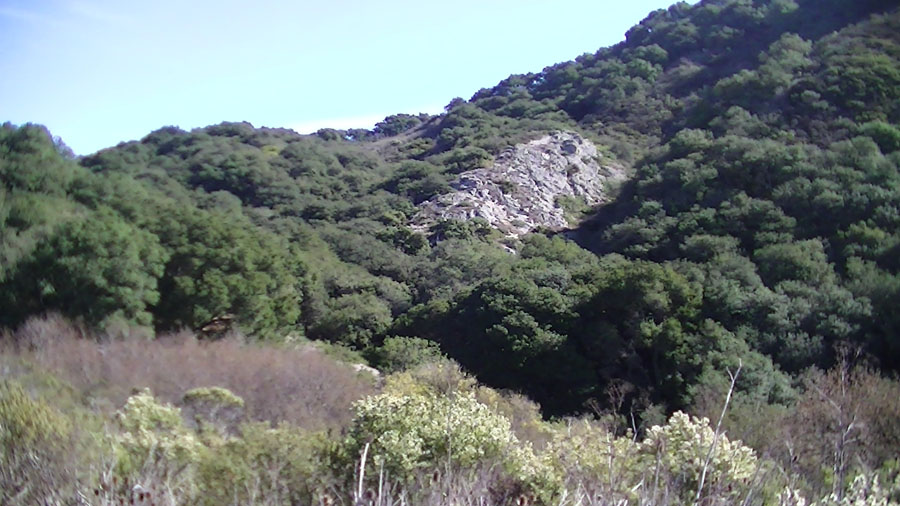
Massive outcrops of metavolcanic rock (deeply altered rhyolite and dacite porphyry) rise above the surrounding forests, grasslands, and chaparral that cover the hillsides. The Vaqueros Sandstone rests unconformably on top of this unusual metavolcanic rock, and this metavolcanic rock rests unconformably on a weathered surface of the older granite and metamorphic rock exposed in the core of the Gavilan Range. The metavolcanic rock may be Early Miocene in age. It is locally stratified and has the appearance of a lapili tuff (coarse volcanic air fall deposits); in other locations it is a massive porphyry (extrusive lava or welded tuff). In all locations it is deeply weathered or altered by exposure to groundwater before or during deposition of overlying Vaqueros Sandstone marine sandstone deposits.
One large outcrop is located on the mountainside near the west side of the pass. Rocks of similar composition are exposed along the Old State Road about a quarter mile west of the pass. Other similar outcrops are exposed on the mountainside on the north side of the road farther down the valley. Large blocks and boulders are scattered amongst the trees in many places—these rocks are remnants of massive rockfall's landslides that have occurred in the past.
The Vergeles Fault crosses the Vergeles Trail. The fault trace is not obvious on the trail, but it trace is revealed by a change in bedrock in the colluvium along the trail. The fault line is also revealed by vegetation changes related to the character of the bedrock on opposite sides of the fault. Grasslands dominate the slopes on the south side of the fault, whereas chaparral and scrub plants are more abundant on the north side. A forest of oaks generally follows the trace of the fault line where it crosses the slope on the north side of the trail. The slope of the trail also increases in the vicinity of fault line.
On the west side of the Vergeles Fault the valley broadens and the slope of the trail lessens to a gentle grade for the last half mile to the trailhead. Bedrock on the north side of the Vergeles Fault consists of deeply weathered granitic rock similar to rock exposed along the road to Fremont Peak. The granite weathers to a well-drained sandy soil that best suits grassland plant communities on the hillslopes. Patches of white-quartz pegmatite dikes locally stand out in the weathered granite and are exposed in scattered cuts along the trail near the Salinas trailhead.
Driving route along the Salinas Road-San Juan Grade connecting the two trailheads of the Anza Trail
Whereas the hiking section of the Anza Trail is a little more than 4 miles, the driving distance is about 13 miles between the two trailheads on opposite ends of the historic Old Stage Road. This section describes the geology along the driving route. Many of the same geologic and landscape features visible along the Anza Trail can be seen along the road—Salinas Road-San Juan Grade. Please note that although this is a very scenic drive, the road is too hazardous to safely conduct group fieldtrips stops to examine outcrops along the route—the road is too narrow and winding (with limited visibility). Also, there is little or no roadside parking except on the west side of the pass marking the boundary between San Benito and Monterey Counties. However, the scenery is spectacular along the drive.
|
Click on images for a larger view. |
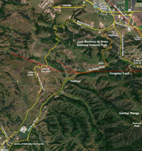
Map showing the Old Stage Road (Juan Bautista de Anza National Historic Trail) in the northern foothills of the Gavilan Range |
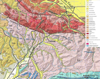
Geologic map1 showing the Old Stage Road (Juan Bautista de Anza National Historic Trail) in the foothills of the northern Gavilan Range, located between the towns of San Juan Bautista and Salinas, California |
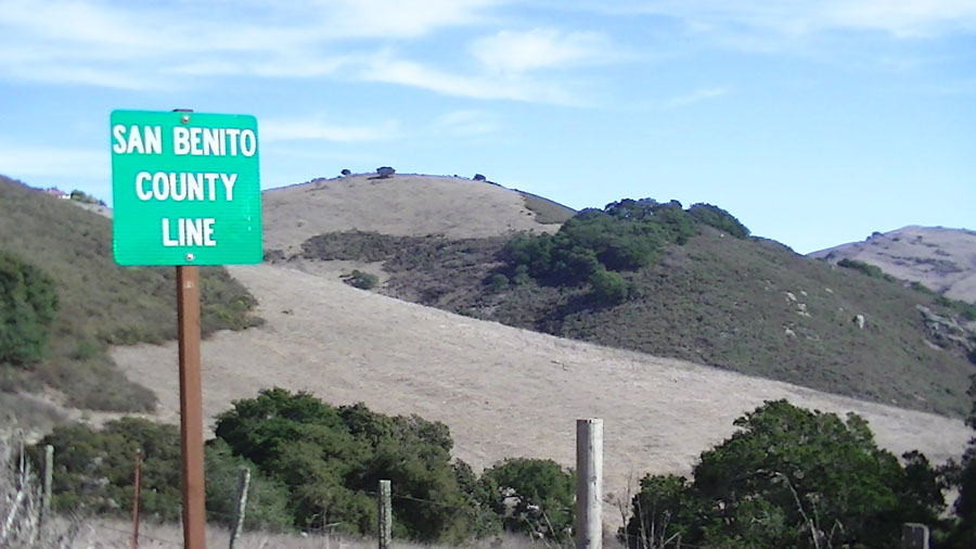
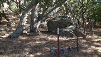
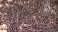
 Juan Bautista de Anza Trail sign along Old State Road route near the intersection of the Salinas Road Juan Bautista de Anza Trail sign along Old State Road route near the intersection of the Salinas Road
|

Juan Bautista de Anza
National Historic Trail
|

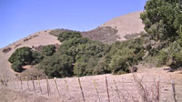
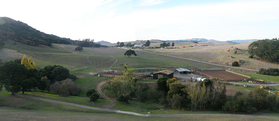
View looking toward the mountain range front near the trailhead parking area along the Old State Road, a part of the Juan Bautista de Anza National Historic Trail |
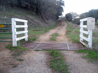
Cattle guard, gate, and mountain lion warning sign near the trailhead |

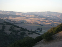
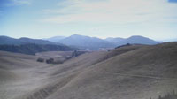
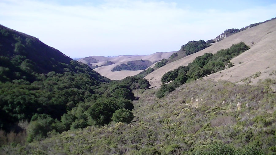
View along the strike valley on the northern flank of the Gavilan Range that follows the Salinas Road west from near San Juan Bautista |
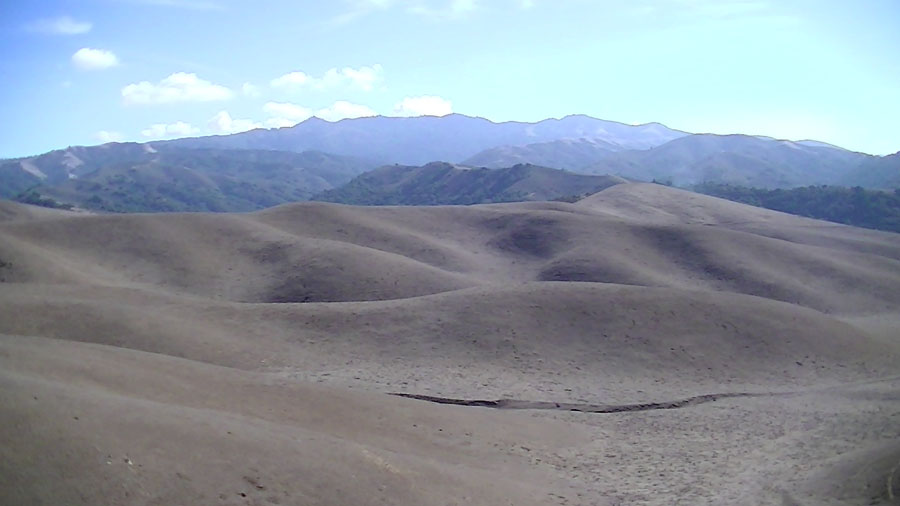
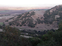
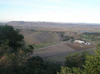
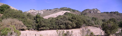
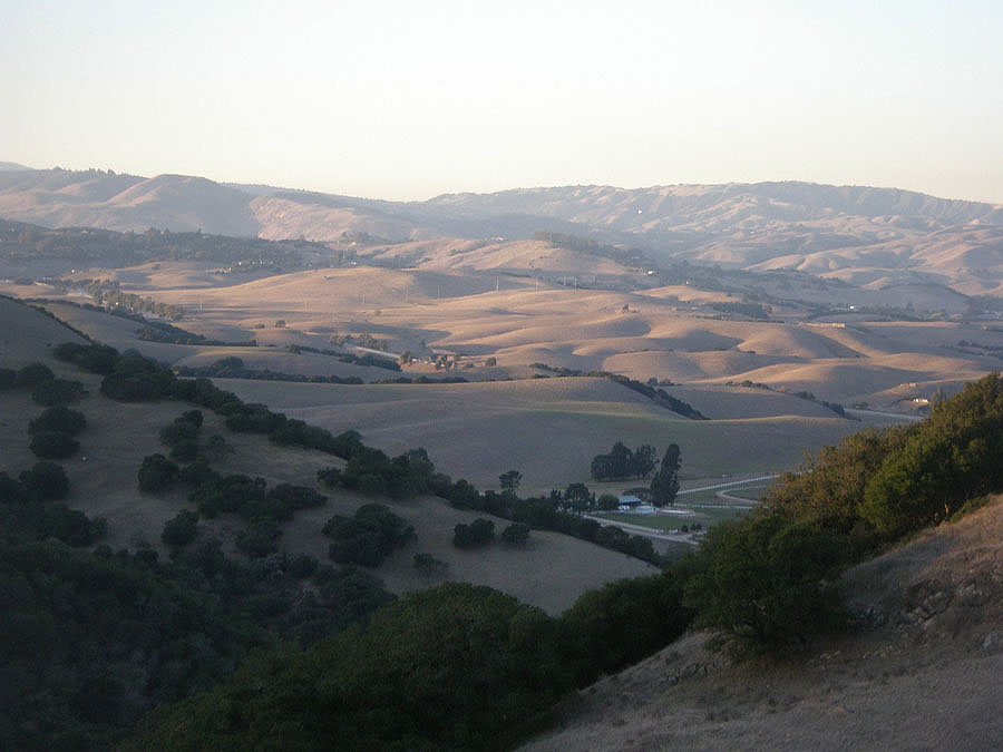
 A higher view along the Old Stage Road looking west toward the erosionally dissected plateau in the region between Prunedale and San Juan Bautista A higher view along the Old Stage Road looking west toward the erosionally dissected plateau in the region between Prunedale and San Juan Bautista |
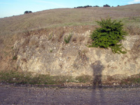
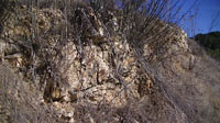
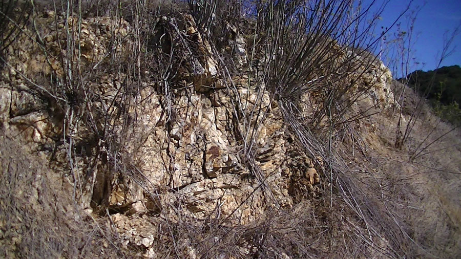
Trailside outcrop of Red Beds of Late Oligocene age consist mostly of marble derived from Fremont Peak |
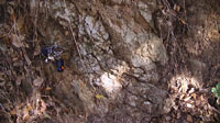
 A small fault cutting through Red Beds that have been tilled and uplifted along the mountain front A small fault cutting through Red Beds that have been tilled and uplifted along the mountain front |
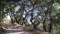
 View looking down hill to the west along the Old Stage Road (now a horseback riding and hiking trail only) View looking down hill to the west along the Old Stage Road (now a horseback riding and hiking trail only) |

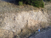
Tectonic fractures in the Vaqueros Sandstone exposed in the roadbed along the trail |
Outcrops of Vaqueros Sandstone exposed in a shady section along the trail make a good picnic stop |
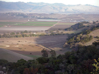
View looking east toward a hogback ridge of Vaqueros Sandstone exposed near the mouth of San Juan Canyon |
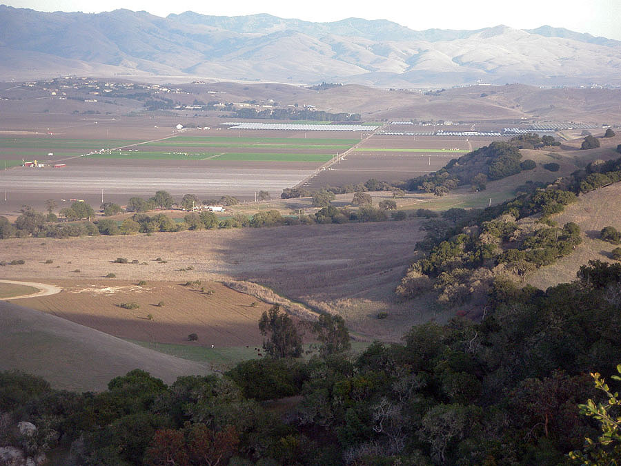
 View looking east along San Juan Canyon in the foothills of the Gavilan Range below Fremont Peak View looking east along San Juan Canyon in the foothills of the Gavilan Range below Fremont Peak |
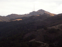
Zoomed-in view of upland regions around Fremont Peak as seen from the Old Stage Road |
 View looking northwest toward Pajaro Gap at the south end of the Santa Cruz Mountains in the distance View looking northwest toward Pajaro Gap at the south end of the Santa Cruz Mountains in the distance
|
View looking north across San Juan Valley toward the Lomerias Muertas (hills) on the north side of San Juan Valley |
View looking northwest toward Loma Prieta Peak in the distant Santa Cruz Mountains from near the pass |
View looking east across the San Juan Valley toward Hollister and the Quien Sabe Range in the distance |
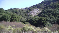
Metavolcanic rock outcrop on the west side of the pass on the Old Stage |
Metavolcanic rock exposed in a cut along the Old Stage Road |
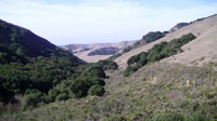
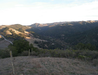
View looking west along the linear canyon where the Old Stage Road descends into the Salinas Valley |
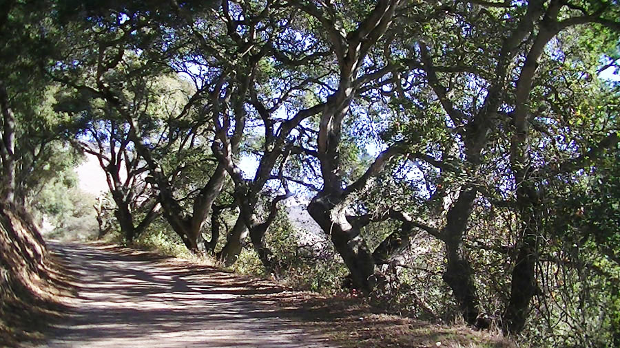
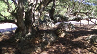 Massive, mature oaks on a rocky outcrop about a mile west of the pass. Massive, mature oaks on a rocky outcrop about a mile west of the pass.
|
 Willows line a section of the path near the creek along the Old Stage Road. Willows line a section of the path near the creek along the Old Stage Road.
|
 View looking west along the trace of the Vergeles Fault where it crosses through a notch on the ridge line. View looking west along the trace of the Vergeles Fault where it crosses through a notch on the ridge line.
|
Boulder near where the Vergeles Fault crosses the Anza Trail |
 Mature oak grove near where the Vergeles Fault crosses the Anza Trail Mature oak grove near where the Vergeles Fault crosses the Anza Trail |
Massive barren outcrops of metavolcanic rock on the mountainsides west of the Anza Trail. |

Alluvium-filled valley floor near the Salinas trailhead |
 Quartz-rich pegmatite dikes exposed in cuts along the trail Quartz-rich pegmatite dikes exposed in cuts along the trail |
 Weathered granite near the trailhead Weathered granite near the trailhead |
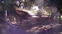 Gate at the Salinas Trailhead for the Old Stage Road Gate at the Salinas Trailhead for the Old Stage Road |
|
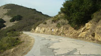
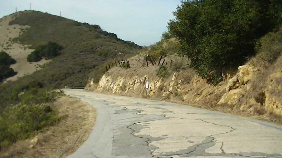
Driving west along Salinas Road from the San Juan Trailhead, the road follows the mountain front for several miles. Large outcrops of Vaqueros Sandstone crop out in many locations along the road and on the mountainside. The road begins it ascent up the mountain front, and road cuts reveal exposures of partly consolidated blocky alluvial fan deposits (red beds) of Late Oligocene) age. Farther along, a cut exposes the Vaqueros Sandstone (Oligocene). The red beds rest on an unconformable surface on top of the Vaqueros Sandstone.The road leaves the oak forest and chaparral and enters grasslands once it crosses the pass at mile 6.
South of the pass the Salinas Road becomes the San Juan Grade. A sign at the pass marks the boundary between Monterey and San Benito Counties (San Benito County split from Monterey County in 1874). The Vergeles Fault crosses the road in the vicinity of the county line. Outcrops of deeply weathered metavolcanic rock—a a chemically weathered igneous rock called a saprolite. Saprolites form in the lower zones of soil profiles and represent deep weathering of the bedrock surface.
These rocks crop out as barren rocky outcrops in the pastures on both sides of the road and are located on the north side of the fault.
There are several pull offs with limited parking along the road as it descends into Salinas Valley on the west side of the pass. The pull offs offer a spectacular view of the dome-like core of the Gavilan Range near Fremont Peak (to the south).
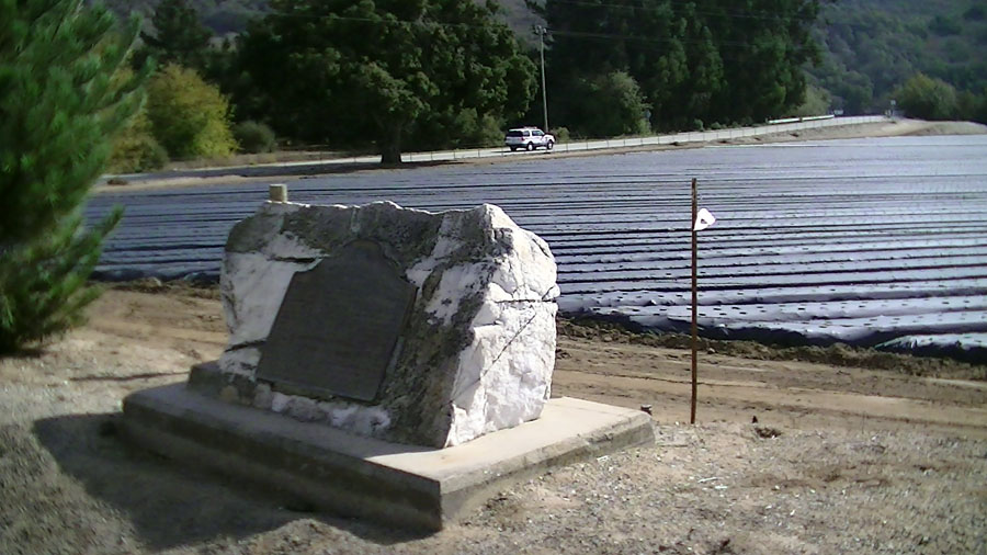
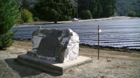
At mile 8, the San Juan Grade intersects Crazy Horse Canyon Road. A plaque near the corner states: "BATTLE OF NATIVIDAD, Combined American forces under Captains Charles D Burras (or Burroughs) and Bruford C. Thompson clashed with Comandante Manuel de Jesus Castro's Californians in this vicinity on November 6, 1846. Casualties on each side consisted of several men killed and wounded. The Americans saved a large herd of horses for Lt. Col. John C. Fremont who then later proceeded south to participate in the armistice at Cahuenca in January 1847. California Registered Historical Landmark no. 65."
Bear left on Crazy Horse Canyon Road, the bear left on the Old Stage Road. A trailhead gate to the Anza Trail (hiking section) is 4 miles from the intersection with Crazy Horse Canyon Road. |
Late Oligocene red bed (alluvial fan deposits) along the Salinas Road |
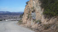
 Oligocene Vaqueros Sandstone outcrops in cuts along the Salinas Road. Oligocene Vaqueros Sandstone outcrops in cuts along the Salinas Road. |
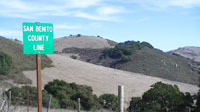
The Vergeles Fault crosses the road in the vicinity of the Monterey-San Benito County line |
View of the dome-like core of the Gavilan Range for a pull off about a mile west of the pass |
View of the western foothills region of the northern Gavilan Range from along the San Juan Grade (about 10 miles east of Salinas)
|
Commemorative historical marker for the 1846 "Battle of Natividad" at the intersection of San Juan Grade and Wildhorse Canyon Road
|

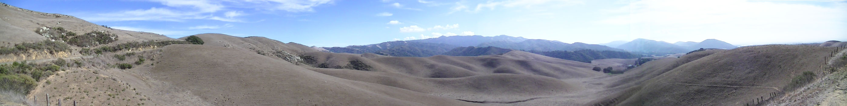
Panoramic view looking south toward the core of the Gavilan Range from a pull off west of the pass on the Salinas Road-San Juan Grade. The trailhead to the Anza Trail on the Salinas side is a seven miles drive to the right (south), San Juan Bautista is six mile drive to the left (north). |
Selected References
Dibblee, Thomas, W, 1979, Preliminary Geologic Map of the San Juan Bautista Quadrangle: U.S. Geological Survey Open-File Report 79-375, scale 1:24,000.
1Wagner, D.L., Green, H.G., Saucedo, G.J., and Pridmore, C.L., 2002, Geologic map of the Monterey 30'x60' Quadrangle and adjacent areas, California. California Geological Survey, Regional Geologic Map No. 1, 1:100000 scale: http://www.quake.ca.gov/gmaps/RGM/monterey/monterey.html
|
|

 Juan Bautista de Anza Trail sign along Old State Road route near the intersection of the Salinas Road
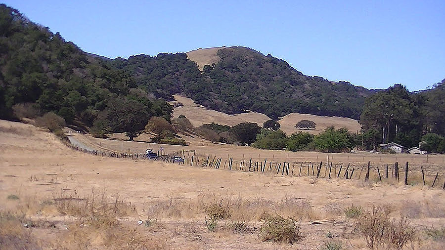
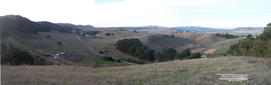 A higher view along the Old Stage Road looking west toward the erosionally dissected plateau in the region between Prunedale and San Juan Bautista
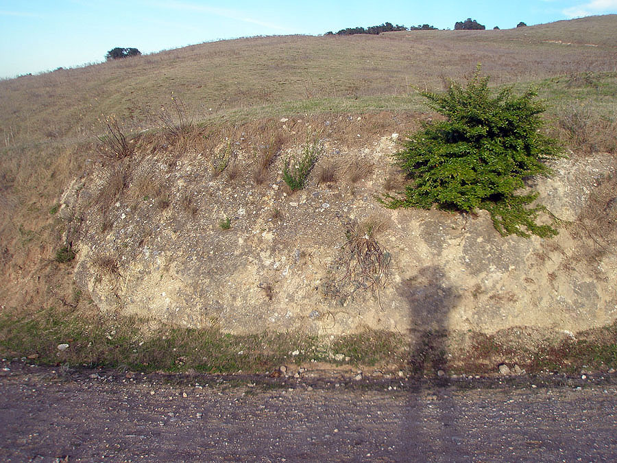
 A small fault cutting through Red Beds that have been tilled and uplifted along the mountain front
 View looking down hill to the west along the Old Stage Road (now a horseback riding and hiking trail only)
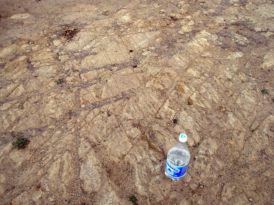
 View looking east along San Juan Canyon in the foothills of the Gavilan Range below Fremont Peak
 View looking northwest toward Pajaro Gap at the south end of the Santa Cruz Mountains in the distance
 Massive, mature oaks on a rocky outcrop about a mile west of the pass.
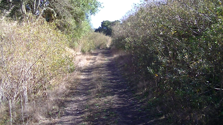 Willows line a section of the path near the creek along the Old Stage Road.
 View looking west along the trace of the Vergeles Fault where it crosses through a notch on the ridge line.
 Mature oak grove near where the Vergeles Fault crosses the Anza Trail
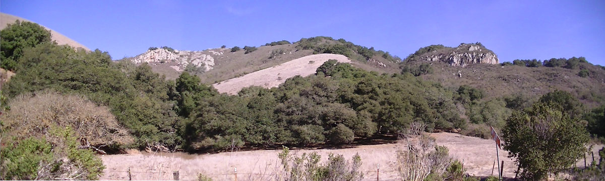
 Quartz-rich pegmatite dikes exposed in cuts along the trail
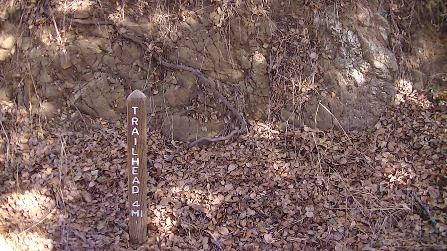 Weathered granite near the trailhead
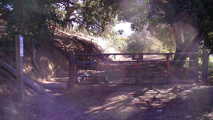 Gate at the Salinas Trailhead for the Old Stage Road
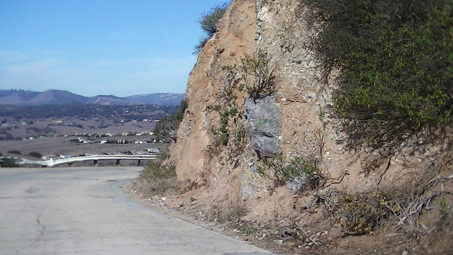
 Oligocene Vaqueros Sandstone outcrops in cuts along the Salinas Road.