Unkar Group of Grand Canyon Supergroup
Unkar Group* of Grand Canyon Supergroup
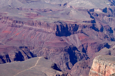
Unkar Group (of the Grand Canyon Supergroup) near Phantom Ranch consists of the Bass Formation, Hakatai Shale, and Shinumo Quartzite.
Precambrian*
Proterozoic, Middle*
Mesoproterozoic (1100 to 1200 million years old)
(age used by National Park Service;
Mathis and Bowman, 2005)
Southern Rocky Mountain region*
AZ(n)*
Type Locality:
Not designated; named for Unkar Valley, Grand Canyon area, AZ (Walcott,
1894).
Hotauta Conglomerate, Bass Limestone, Hakatai Shale, Shinumo Quartzite, Dox Sandstone
Named Unkar terrane of Grand Canyon group (or series) (Walcott, 1894). Assigned to Grand Canyon Series, divided into Hotauta Conglomerate, Bass Limestone, Hakatai Shale, Shinumo Quartzite, Dox Sandstone (Noble, 1914). Assigned to Grand Canyon Supergroup (Elston and Scott, 1976). Revised (Stevenson and Beus, 1982). Overview (Hendricks, 1989). Overview; Age modified (Elston, 1989). Paleomagnetics (Elston and Clough, 1993).
Grand Canyon Supergroup—As mapped by J.W. Sears (Huntoon and others, 1996).
Unkar Group (Middle Proterozoic)—Includes, in descending order, unnamed diabase sills and dikes, Cardenas Basalt, Dox Formation, Shinumo Quartzite, Hakatai Shale, and Bass Formation. The Cardenas and upper part of the Dox are not exposed in map area, but complete sections are present about 6 mi (9.5 km) east of map area. There, the Cardenas is about 900 ft (300 m) thick and the Dox is about 1,280 ft (390 m) thick.
Unnamed diabase sills and dikes—Black, medium- to coarse-grained, olivine-rich diabase. Contains plagioclase, olivine, clinopyroxene, magnetite-ilmenite, and biotite. Diabase sills and dikes intrude all rocks within Unkar Group below Cardenas Basalt. Chemical variation diagrams indicate a potential common parentage between dikes and sills and the overlying Cardenas, but direct physical connection has not been observed, although isochron ages are basically identical at 1,070±70 Ma (Hendricks and Stevenson, 1990). Sills range in thickness from about 65 ft (20 m) in Clear Creek at eastern edge of map area to more than 655 ft (200 m) near Bass Rapids in central part of map area. Dike widths range from 3 to 12 ft (1 to 4 m).
Dox Formation—Includes, in descending order, Ochoa Point, Comanche Point, Solomon Temple, and Escalante Creek Members as defined by Stevenson and Beus (1982). Of these, only part of the Escalante Creek is exposed in map area. Upper two-thirds or more of the Dox is removed by erosion and subsequently covered by Paleozoic rocks. The Escalante Creek is exposed in upper Bright Angel Creek and Shinumo Creek, eastern quarter of map area.
Escalante Creek Member—Gray, light-brown to dark-brown, cliff-forming, fine- to medium-grained sandstone and interbedded dark-brown to green, slopeforming shale and mudstone. Includes gray contorted sandstone beds in lower part similar to those in underlying Shinumo Quartzite and small-scale, tabularplanar cross-bedded and graded-bedding sets. Conformable contact with the underlying Shinumo marked at lowest shaley slope of the Dox. Incomplete exposure due to erosion of upper part. Exposed thickness about 200 ft (60 m).
Shinumo Quartzite—Red-brown, purple, and gray, cliff-forming sandstone. Includes four undivided informal members as defined by Daneker (1975). In descending order, they are upper, upper middle, lower middle, and lower sandstone members. Upper member consists of red-brown and purple, fine- to coarse-grained, well-sorted, highly contorted, gnarly bedded sandstone capped by nondisrupted, flat-bedded, gray sandstone. Upper middle member consists of rusty-red, fine- to coarse-grained, highly contorted, gnarly bedded sandstone. Lower middle member consists of purple “freckled” (reduction spots), fine-grained, well-sorted, lowangle cross-bedded sandstone with local contorted beds in upper part. Lower member consists of purplish-red, coarse-grained, flat-bedded, arkosic conglomeratic sandstone. All members cemented with silica, making sandstone as hard as metamorphic quartzite, but unit is not metamorphosed. Angular unconformity separates cliff of red-brown Shinumo Quartzite from underlying slope of red Hakatai Shale, marked at truncated beds of the Hakatai. The Shinumo increases in thickness from 1,132 ft (345 m) at eastern edge of map area to 1,540 ft (470 m) at Shinumo Creek, central part of map area.
Hakatai Shale—Orange-red, purple, and red mudstone, shale, and sandstone. Forms an upper cliff unit, a middle slope unit, and a lower slope unit. Upper cliff unit consists of pale-purple or lavender, fine- to coarse-grained, thin- to mediumbedded, cross-bedded sandstone. Forms gradational contact with underlying middle slope unit at distinct color change from purple to bright red. Middle slope unit is the most distinctive red-bed unit in the Grand Canyon, consisting of reddish-orange, thin-bedded, fine-grained mudstone, siltstone and sandy siltstone; includes nonred, spherical reduction spots (“freckles”) less than 10 cm in diameter. Gradational contact with underlying lower slope unit arbitrarily placed at red to purple color change. Lower slope unit consists of purple to reddish-purple, thin-bedded to laminated, fine-grained mudstone, siltstone, and sandy siltstone. Mudcracks, ripple marks, and tabular-planar cross-bedding are common in all units. Gradational contact with underlying Bass Formation in eastern part of map area; sharp but conformable contact in central part of map area. Overall thickness varies from about 445 ft (135 m) in eastern part of map area to nearly 985 ft (300 m) in Hakatai Canyon, central part of map area.
Bass Formation—Red-brown and reddish-gray, ledge-forming dolomite, silty sandstone, and conglomerate. Includes basal Hotauta Conglomerate Member as defined by Dalton (1972). Consists of fine- to coarse-grained, thin- to mediumbedded dolomite, fine- to coarse-grained, thin-bedded sandstone, silty sandstone, conglomerate, and breccia. Dolomite is most common lithology in Shinumo Creek area (central part of map area), becoming mostly sandstone, siltstone, and conglomerate in Bright Angel Canyon and eastern part of map area. Dolomite beds contain biscuit-shaped biohermal stromatolite fossils and red chert; sandstone beds contain ripple marks, desiccation cracks, and intraformational breccia and conglomerate. The Hotauta is considered part of the Bass in most map areas because of its lensing characteristics. The Bass, including the Hotauta, gradually thickens from southeast to northwest across map area from about 260 to 300 ft (80 to 91 m).
Hotauta Conglomerate Member—Red-brown and gray conglomerate of well-rounded to subangular pebbles and boulders of granite, gneiss, and schist derived from underlying Early Proterozoic igneous and metamorphic rocks. Clasts are cemented in red-brown, coarse-grained, gravelly sandstone matrix. Unconformable contact with underlying Early Proterozoic rocks called the “Greatest Angular Unconformity” (Noble, 1922), a hiatus lasting about 450 million years (Hendricks and Stevenson, 1990). Unit does not include diabase sills. Variable thickness 0–30 ft (0–10 m).
References
Walcott, C.D., 1894, Pre-Cambrian igneous rocks of the Unkar terrane, Grand Canyon of the Colorado, Arizona: U.S. Geological Survey Annual Report, 14, pt. 2, p. 503-519.
Noble, L.F., 1914, The Shinumo quadrangle, Grand Canyon district, Arizona: U.S. Geological Survey Bulletin, 549, 100 p., (incl. geologic map, scale 1:48,000).
Elston, D.P. and Scott, G.R., 1976, Unconformity at the Cardenas-Nankoweap contact (Precambrian), Grand Canyon Supergroup, northern Arizona: Geological Society of America Bulletin, v. 87, no. 12, p. 1763-1772.
Stevenson, G.M. and Beus, S.S., 1982, Stratigraphy and depositional setting of the upper Precambrian Dox Formation in Grand Canyon: Geological Society of America Bulletin, v. 93, no. 2, p. 163-173.
Hendricks, J.D., 1989, Petrology and chemistry of igneous rocks of Middle Proterozoic Unkar Group, Grand Canyon Supergroup, northern Arizona, IN Elston, D.P., Billingsley, G.H., and Young, R.A., editors, Geology of Grand Canyon, northern Arizona (with Colorado River guides); Lees Ferry to Pierce Ferry, Arizona; guidebook to field trips T115 and T315: International Geological Congress, 28th, Field Trip Guidebook, T115, T315, Washington, DC, 1989, p. 106-116.
Elston, D.P., 1989, Grand Canyon Supergroup, northern Arizona; stratigraphic summary and preliminary paleomagnetic correlations with parts of other North American Proterozoic successions, IN Jenney, J.P., and Reynolds, S.J., editors, Geologic evolution of Arizona: Arizona Geological Society Digest, v. 17, p. 259-272.
Hendricks, J.D., Stevenson, G.M., 1990, Grand Canyon Supergroup: Unkar Group. In: Beus, S.S., Morales, M., editors, Grand Canyon Geology, Oxford University Press, New York, p. 29-47.
Huntoon, P.W., 1990, Phanerozoic structural geology of the Grand Canyon, in Beus, S.S., and Morales, Michael, editors, Grand Canyon geology: Oxford and New York, Oxford University Press, and Flagstaff, Ariz., Museum of Northern Arizona Press , p. 261-310.
Elston, D.P. and Clough, G.A., 1993, Paleomagnetic poles from the Middle
Proterozoic Hazel Formation, Van Horn area, West Texas; rotations of a
Grenville-deformed terrane and correlations with Keweenawan events on
craton [abs.]: Geological Society of America Abstracts with Programs,
v. 25, no. 1, South-Central Section, 27th Annual Meeting, Fort Worth,
TX, March 15-16, 1993, p. 9.
Seeley, John M., and Keller, G. Randy, 2003, Delineation of subsurface
Proterozoic Unkar and Chuar Group sedimentary basins in northern Arizona
using gravity and magnetics., implications for hydrocarbon source potential:
AAPG Bulletin, v. 87, no. 8, p. 1299-1321.
Timmons, J Michael., Karlstrom, Karl E., Heizler, Matthew T., and Bowring, Samuel A., 2001, A synthesis from the Unkar Group of Grand Canyon, and inferences on late Mesoproterozoic intracratonic sedimentation and deformation in the Western U.S.: Geological Society of America, Abstracts with Programs, v. 33, no. 5, p. 20.