Bass Limestone
| Usage of Geologic Unit Name: Bass Limestone* of the Unkar Group of the Grand Canyon Supergroup |
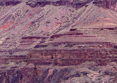 Bass Formation (mosthy limestone) is exposed along the Inner Gorge along the Bright Angel Trail near Grand Canyon's Phantom Ranch. |
|
| Age: Precambrian* Proterozoic, Middle* Mesoproterozoic (1100 to 1200 million years old) (age used by National Park Service; Mathis and Bowman, 2005) |
||
| Geologic Province: Southern Rocky Mountain region* |
||
Areal Extent: |
||
| Type Locality: Not designated. Named for Bass Canyon, Shinumo quad, Coconino Co, AZ (Noble, 1914). |
||
|
Unit Name History: |
||
| Description from Grand Canyon Area (from Billingsley, George H., 2000) Bass Formation—Red-brown and reddish-gray, ledge-forming dolomite, silty sandstone, and conglomerate. Includes basal Hotauta Conglomerate Member as defined by Dalton (1972). Consists of fine- to coarse-grained, thin- to mediumbedded dolomite, fine- to coarse-grained, thin-bedded sandstone, silty sandstone, conglomerate, and breccia. Dolomite is most common lithology in Shinumo Creek area (central part of map area), becoming mostly sandstone, siltstone, and conglomerate in Bright Angel Canyon and eastern part of map area. Dolomite beds contain biscuit-shaped biohermal stromatolite fossils and red chert; sandstone beds contain ripple marks, desiccation cracks, and intraformational breccia and conglomerate. The Hotauta is considered part of the Bass in most map areas because of its lensing characteristics. The Bass, including the Hotauta, gradually thickens from southeast to northwest across map area from about 260 to 300 ft (80 to 91 m). |
||
|
References Noble, L.F., 1914, The Shinumo quadrangle, Grand Canyon district, Arizona: U.S. Geological Survey Bulletin, 549, 100 p., (incl. geologic map, scale 1:48,000). Elston, D.P. and Scott, G.R., 1976, Unconformity at the Cardenas-Nankoweap contact (Precambrian), Grand Canyon Supergroup, northern Arizona: Geological Society of America Bulletin, v. 87, no. 12, p. 1763-1772. Elston, D.P., 1989, Grand Canyon Supergroup, northern Arizona;
stratigraphic summary and preliminary paleomagnetic correlations
with parts of other North American Proterozoic successions, IN Jenney,
J.P., and Reynolds, S.J., editors, Geologic evolution of Arizona: Arizona
Geological Society Digest, v. 17, p. 259-272. Flodin, Eric A, Aydin, Atilla, 2004, Evolution of a strike-slip
fault network, Valley of Fire State Turkington, A. V., 1998. Cavernous weathering in sandstone; lessons
to be learned from natural exposure: [Papers from the Stone weathering
and atmospheric pollution network Burchfiel, B. C., Cameron, C S., Royden, L. H. 1997, Geology of the Wilson Cliffs-Potosi Mountain area, southern Nevada International Geology Review, vol.39, no.9, p. 830-854. Timmons, J. Michael, Karlstrom, Karl E., Heizler, Matthew T., Bowring,
Samuel A., 2001, A synthesis from the Unkar Group of Grand Canyon,
and inferences on late Mesoproterozoic intracratonic sedimentation
and deformation in the Western U.S.: Geological Society of America,
Abstracts with Programs, vol.33, no.5, p. 20. Note that data on this page contains information that has been partly revised from bibliographic resources available at the time this report was compiled. The primary sources were the GeoRef Database and the National Geologic Map Database GEOLEX: http://ngmdb.usgs.gov/Geolex/geolex_qs.html. The URL is: https://gotbooks.miracosta.edu/gonp/coloradoplateau/lexicon/aztec.htm Last modified:8/10/2006 |
||
|
The URL is: https://gotbooks.miracosta.edu/gonp/coloradoplateau/lexicon/bass.htm Last modified: 1/7/2011 |