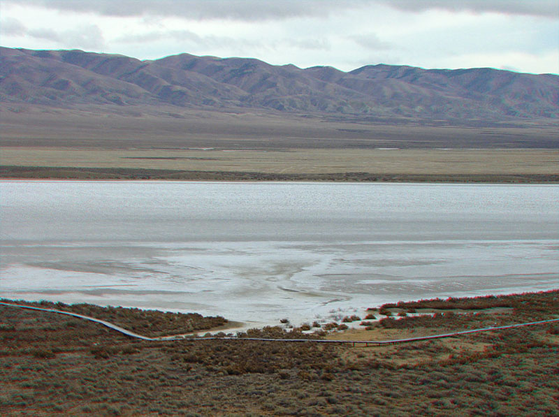
This view from Overlook Hill shows Soda Lake in the Carrizo Plain. In the foreground is a park boardwalk constructed to protect the sensitive saltbush habitat that borders the lake bed. Soda Dry Lake is a playa (an ephemeral lake) bound on the west by Barrett Creek and on the east by the Temblor Range (shown here in the distance) (U.S. Geological Survey, 2011). The lake bed receives water during wet winters and rare late summer storms. The modern saltpan covers about 3,000 acres. Rainfall in the Carrizo Plain averages about 5 to 8 inches per year (but is significantly greater in the surrounding high country). Rainwater that collects on the playa becomes temporary home to fairy and brine shrimp and supports migratory and nesting birds (Los Padres ForestWatch, Inc., 2004; BLM, Bakersfield Field Office, 2010).