USGS Earth Science Photographic Archive digital file: hjk00848 and hjk0848a
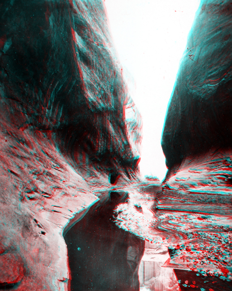
The Waterpocket Fold runs north-to-south through Capitol Reef National Park in central Utah. Numerous canyons cut through a great hogback ridge of Navajo Sandstone that runs down the fold. The Thompson party probably crossed these canyons midway through the fold (in the vicinity of Notom, Utah) before ascending a pass in the Henry Mountains, named after Powell's friend and supporter, Joseph Henry, director of the Smithsonian Institution. The expedition climbed a pass between two peaks: Mt. Ellen and Mt. Pennell. "Prof" Thompson named Mt. Ellen after his wife, Ellen Powell "Nellie" Thompson; Mt. Pennell was named after Joseph Pennell (an late 19th century American artist/illustrator). He also named a third peak, Mt. Hillers -- after Jack Hillers, the Powell Survey photographer and oarsman. The location of this narrow canyon is in the Waterpocket Fold and is probably along Pleasant Creek (also named Tantalus Creek) in Capitol Reef National Park.