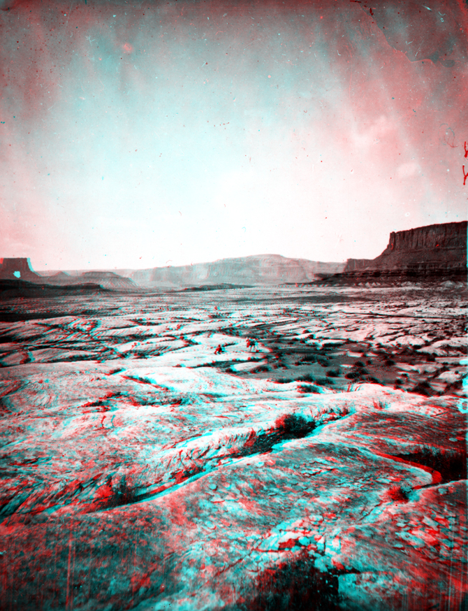
USGS Earth Science Photographic Archive digital file: hjk00736
Tump-in-kon-tu-weap is now known as The Maze and The Land of Standing Rocks (located in the region west of The Confluence in Canyonlands National Park). The characteristic caprock in this image taken in the Maze region is typical of the Cedar Mesa Sandstone, an extensive, shallow subtidal marine and beach sand deposit that accumulated along the margins of an inland seaway (The Paradox Sea) that flooded parts of the region during Pennsylvanian through Early Permian time. As much as 10,000 feet of interbedded salt, gypsum, and potash (potassium salt) accumulated in this restricted basin. Over time, plastic-like flow movement of these salt deposits have resulted in the folding and fracturing of the overlying younger sedimentary formations. This produced many of the unique geologic features in the Arches and Canyonlands national parks region (including the fissures, faults, grabens, anticlines, and other structural features. Click here to continue to the Cataract Canyon and Glen Canyon page.