USGS Earth Science Photographic Archive digital file: hjk00733
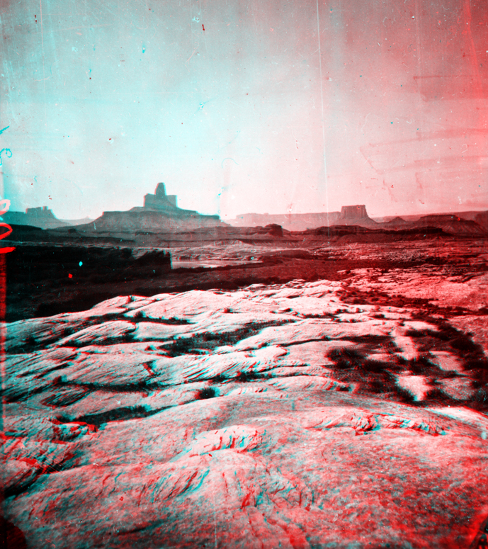
Butte-of-the-Cross is located on the west side of the Green River (near Bonita Bend and Anderson Bottom on the Green River along western edge of Canyonlands National Park). E. O. Beaman took this picture on September 18, 1871 from the top of a bluff of White Rim Sandstone of Late Permian age. The Butte-of-the-Cross, and other distant escarpments and mesas, consist of the complete Triassic stratigraphic section, ascending in order: Moenkopi Formation (cliff), Chinle Formation (slope), Wingate Formation (cliff), Kayenta Formation (cliff), and Navajo Sandstone.