
Regional Geology of North America |
Midcontinent Regions of the United States |
Click on images for a |
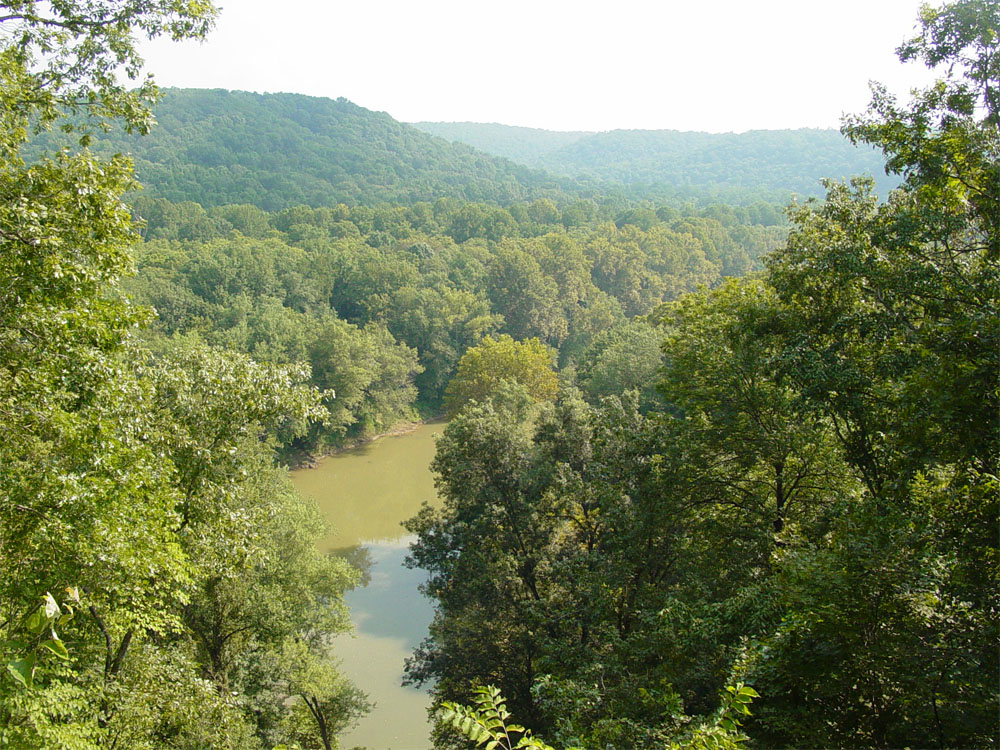
In contrast to the regions along the East Coast and the Rocky Mountains and western states, the physiographic features and geology of the midcontinent region is relatively simple by comparison. Physiographic subdivisions are based on subtle differences in geology and climate. Interior Low Plateaus ProvinceThe Interior Low Plateaus Province extends from the Greater Cincinnati metropolitan region in the Ohio River Valley southward to the Nashville Region of central Tennessee (Figure 52; for comparison, Figure 52A is a physiographic region map for the state of Kentucky). The province is characterized by low rolling hills and plains, and river valleys. Elevations in the region range from a low of 380 feet (along the Ohio River in Louisville, Kentucky) to about 800 to 1,200 feet in upland areas.The Interior Low Plateaus region was unglaciated during the Ice Ages. This in contrast to the glaciated regions that lie mostly north of the Ohio and Missouri Rivers in the greater Midwest region. The glaciated region is assigned to the Central Lowlands Province. The Ohio River roughly marks the southern boundary of the Laurentide continental glaciers (Figure 54). At the peak of the Ice Ages, large lakes, perhaps larger than the modern Great Lakes, existed south of the ice sheet, flooding the large portions of the Interior Lowlands. Lakes filled and spilled over divides, and great floods carved canyons that eventually became the path of the Ohio River. In geologic terms, the Interior Low Plateaus region consists a broad structural upwarp that roughly parallels the Appalachian Plateau region to the east. The region is underlain by nearly flat-lying sedimentary rocks of Ordovician to Mississippian age. Layers of Ordovician limestone and shale are exposed along the crest of two broad dome upwarps: the Cincinnati Arch (including parts of southwestern Ohio, Kentucky and southwestern Indiana) and the Nashville Dome in central Tennessee (Figure 55). The Cincinnati Arch is also called the Bluegrass region where Ordovician sedimentary rocks are exposed at the surface. The Bluegrass region named for a natural species of "bluegrass" in the region). The Inner Bluegrass is a sub region where Middle Ordovician-age rocks are exposed in the region around Lexington, Kentucky (Figure 53). A high phosphorus content in the Middle-Ordovician-age Lexington Limestone in the Inner Bluegrass region makes it ideal for agriculture, particularly raising thoroughbred horses, making is one of the most valuable (and expensive) agricultural regions of the world (Figure 56). Outside of the Bluegrass region are a series of low escarpment associated with sedimentary rocks of Devonian, Mississippian, and Pensylvanian ages. Mammoth Cave National Park is located in this region south of Louisville and east of Lexington, Kentucky. The parks extensive cavern system is associated with Mississipian limestone (Figure 57). |
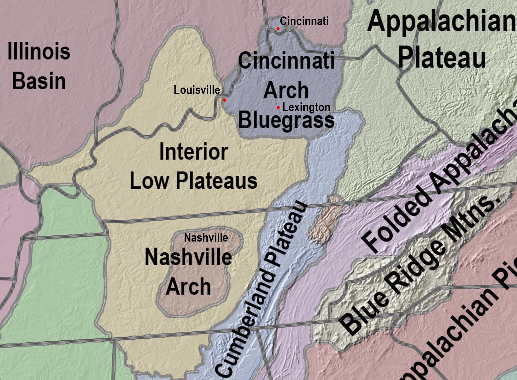 Fig. 52. Map showing the Interior Low Plateaus Province. 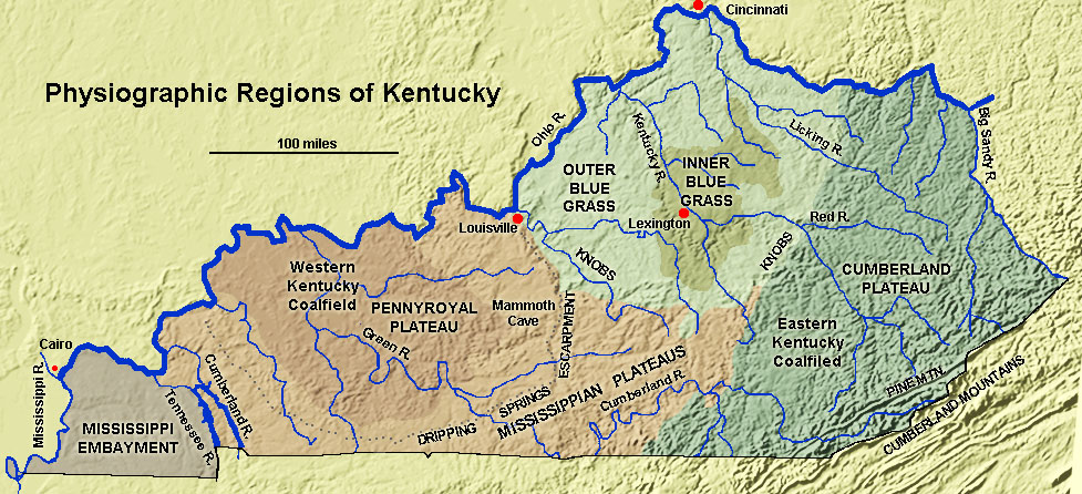 Fig. 52A. Physiographic Map of Kentucky. 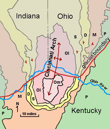 Fig. 53. Dome structure of the Cincinnati Arch region. |
|


| https://gotbooks.miracosta.edu/geology/regions/interior_lowlands.html 9/2/2022 |