Regional Geology of North America |
|
Central Lowlands Province |
Click on images for a
larger view. |
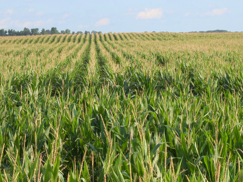
The Central Lowlands Province include the parts of majority of the Midwestern States: Illinois, Indiana, Iowa, Kansas, Kentucky, Michigan, Missouri, Ohio, Oklahoma, and Wisconsin. For most of the region, the landscape is a low mostly flat plain or low rolling hills cut by stream valleys. The region north of the Ohio and Missouri rivers was impacted by continental glaciers. The region is the also called the "Corn Belt" because nearly the entire region is utilized for agriculture. Most of the Central Lowlands north of the Ohio and Missouri Rivers were repeatedly covered by continental ice sheets (glaciatiations) during the Pleistocene Epoch. South of those rivers the land was mostly unglaciated.
The region is underlain by generally flat-lying sedimentary rocks with some anomalously larger structural basins that formed slowly and filled in with sediments throughout the Paleozoic Era. These include the Michigan Basin (encompassing most of the lower Michigan Peninsula between Lake Michigan and Lake Huron) is a geologic basin filled mostly with Silurian age rocks (exposed around the basin margins; blue of Figure 57). The Illinois Basin (in southwestern Indiana and southern Illinois and Western Kentucky, and the Forest City Basin (extending from southern Iowa, eastern Kansas, western Missouri, and into Oklahoma) and are host to coal-bearing beds of Pennsylvanian age (gray on Figure 57). Compared with structural basins elsewhere in the west, these basins are relatively shallow—filled with several thousands of feet of sedimentary deposits. The center of these basins are capped with with coal-bearing sedimentary deposits that form cliffy sandstone escarpments in belts around portions of the basins. The Pennsylvanian sandstone layers form escarpments overly a thick sequence of Mississippian-age limestone formations that underlie most of the entire region. Where the Mississippian age limestones are exposed cavern systems are common (purple areas Figure 57).
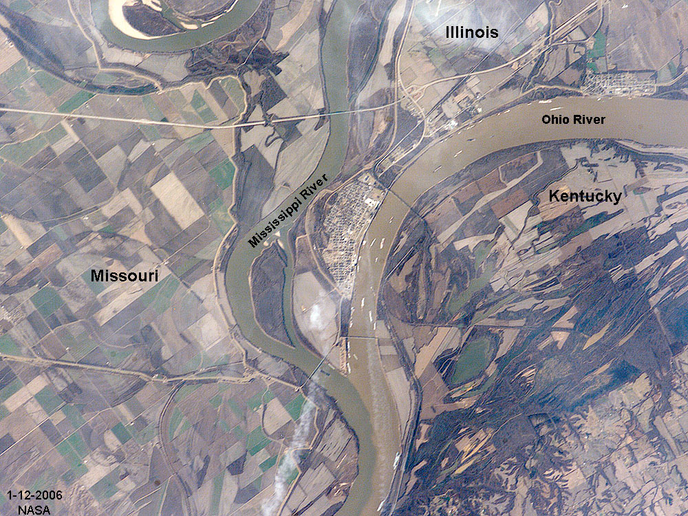
The region is drained by the principle tributaries: the Ohio River and the Missouri River merge with the Mississippi River near St. Louis, forming the principle river drainage of the mid continent (Figures 60, 61 and 62). The entire Central Lowlands region was covered with continental ice sheets at different times during the continental glaciations of the Pleistocene ice ages. The physiographic features associated with continental glaciation are still well preserved in parts of Wisconsin (Figures 62a, b, and c). Prior to the ice ages, rivers in the region may have drained northward toward Hudson Bay. The continental glaciers blocked the rivers, creating lakes that would fill and eventually breach into the next valley. The drainages consolidated into the Mississippi River system. The Mississippi Embayment region filled with sandy glacial outwash sediments, creating the extensive aquifer system in the lower Mississippi Valley. |

Fig. 56. Map showing the Central Lowlands physiographic region in the Midwest.
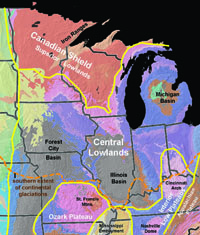 Fig. 57. Geologic map of the Central Lowlands retion.
 |
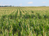
Fig. 58. An Indiana corn field represents a typical view of the landscape practically anywhere in the Central Lowlands Province of the Midwestern US. |
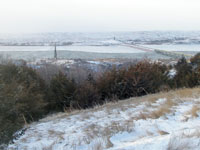
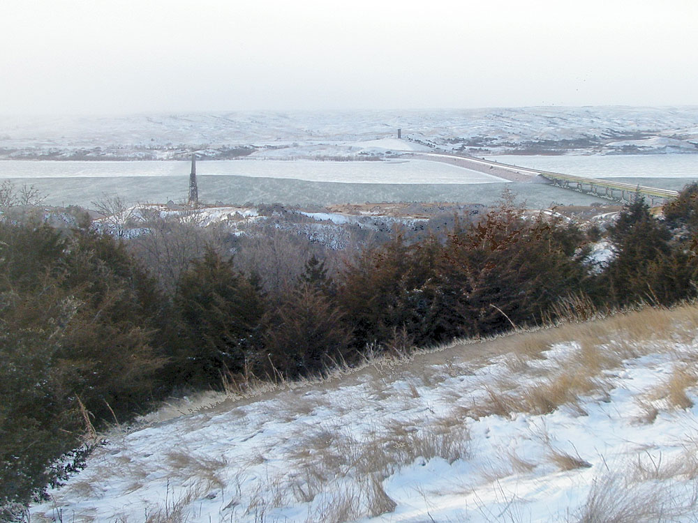
Fig. 59. View looking east from an escarpment along the western side of the Mississippi River looking toward the lowlands of southern Wisconsin. |
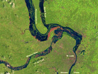
Fig. 60. Confluence of the Missouri, Illinois, and Mississippi Rivers near St. Louis as viewed from satellite during floods of 2008.
|
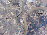
Fig. 61. Satellite view of the confluence of the Mississippi and Ohio Rivers near Cairo, Illinois. Note the sediment color contrast of the two rivers. |
|
| https://gotbooks.miracosta.edu/geology/regions/central_lowlands.html 9/3/2022 |

|
 |
|
|
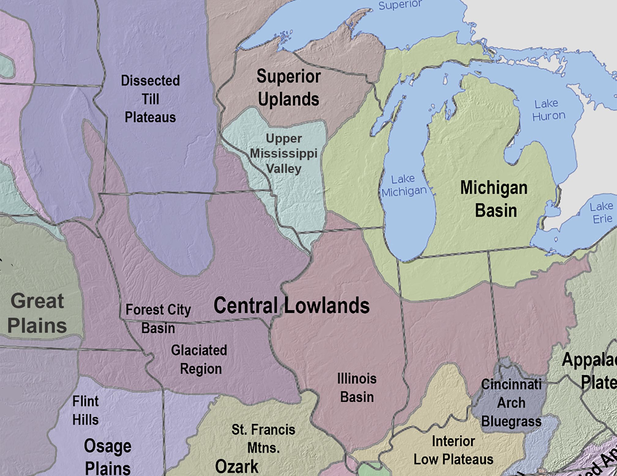
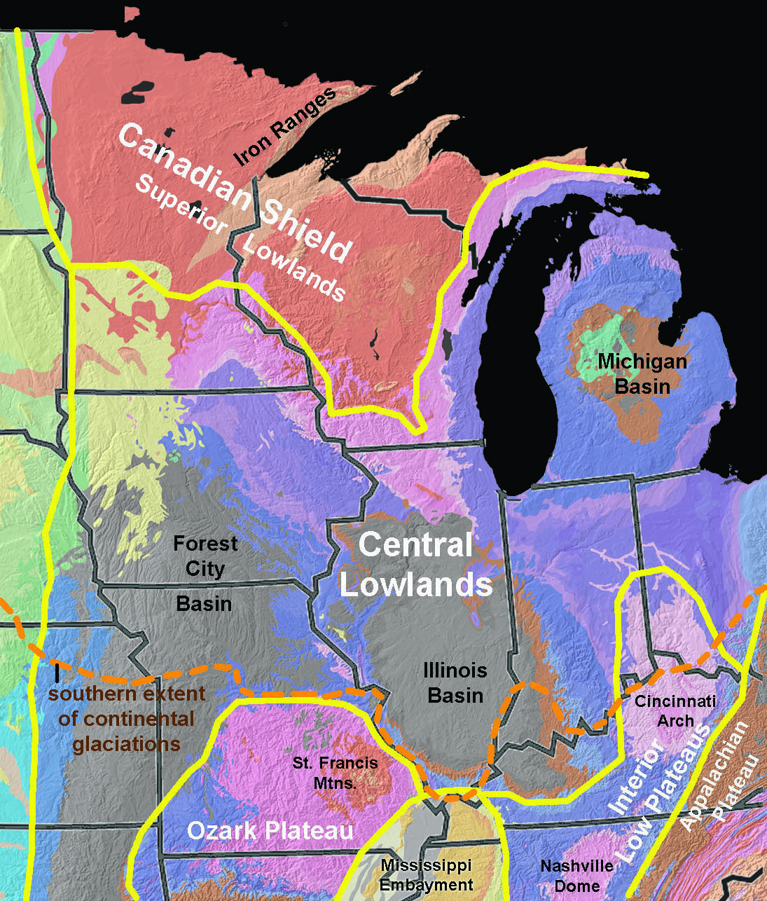 Fig. 57. Geologic map of the Central Lowlands retion.