Regional Geology of North America |
|
Central Great Plains |
Click on images for a
larger view. |
In the High Plains regions (northern Texas to Nebraska) roughly corresponds to the outcrop belt of the Ogallala Formation, and a piedmont region on the east side of the Rocky Mountains (Figure 83). The Ogallala Formation overlies and rests unconformably on an eroded surface of rocks of Permian to Cretaceous age. The Ogallala Formation is composed of alluvial plain sediments that were deposited in stages in Miocene through Pliocene time. Rivers crossing the region are now downcutting through this alluvial plain, producing several step-like terraces visible along river valleys in the region.
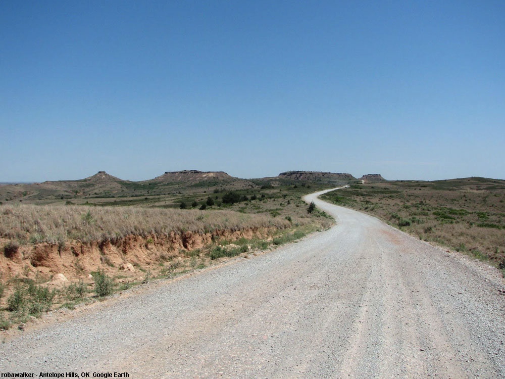
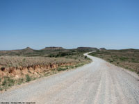
The Antelope Hills are a National Registered Landmark located in along a series of bends in the Canadian River on the Oklahoma Panhandle (Figure 84). They are a series of low erosional buttes that rise about 200 feet above the surrounding plain and consist of eroded remnants of the upper Ogallala Formation.The highest peak is 2,585 ft. The buttes were a major landmark used by the Plains Indians, Spanish explorers, and early settlers on route to California. |
 |
 |
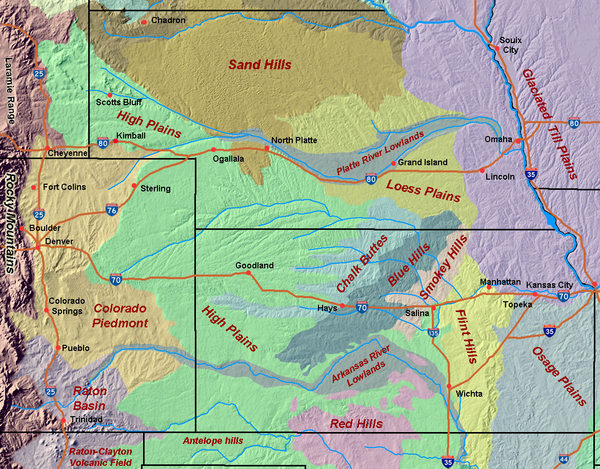
| Fig. 83. Physiographic regions in the central and northern Great Plains of Oklahoma, Kansas, Nebraska, Eastern Colorado, and southern South Dakota. |
Fig. 84. Antelope Hills in the Oklahoma Panhandle are an erosional remnant of the upper Ogallala Formation of Pliocene age. |
Great Plains of Kansas to Eastern Colorado
For many folks, the drive across the Great Plains on Interstate 70 (From Kansas, City, Missouri to eastern Colorado) seems "remarkably unremarkable." The east side of Kansas is partially forested rolling hill country of the Osage Plains (or "Osage Cuestas") near the Missouri River to open prairie (now mostly croplands for corn, soybeans, etc.) near Topeka. West of Topeka, the Flint Hills of eastern central Kansas is a region of low hills and escarpments of Permian-age limestone and siliceous chert (or flint)(Figure 85). Settlers found that the thin soils and cherty gravel on top of the rocky escarpments make the region less-than idea for farming, and better suited for cattle range. The highest elevation in the Flint Hills is 1,680 feet.
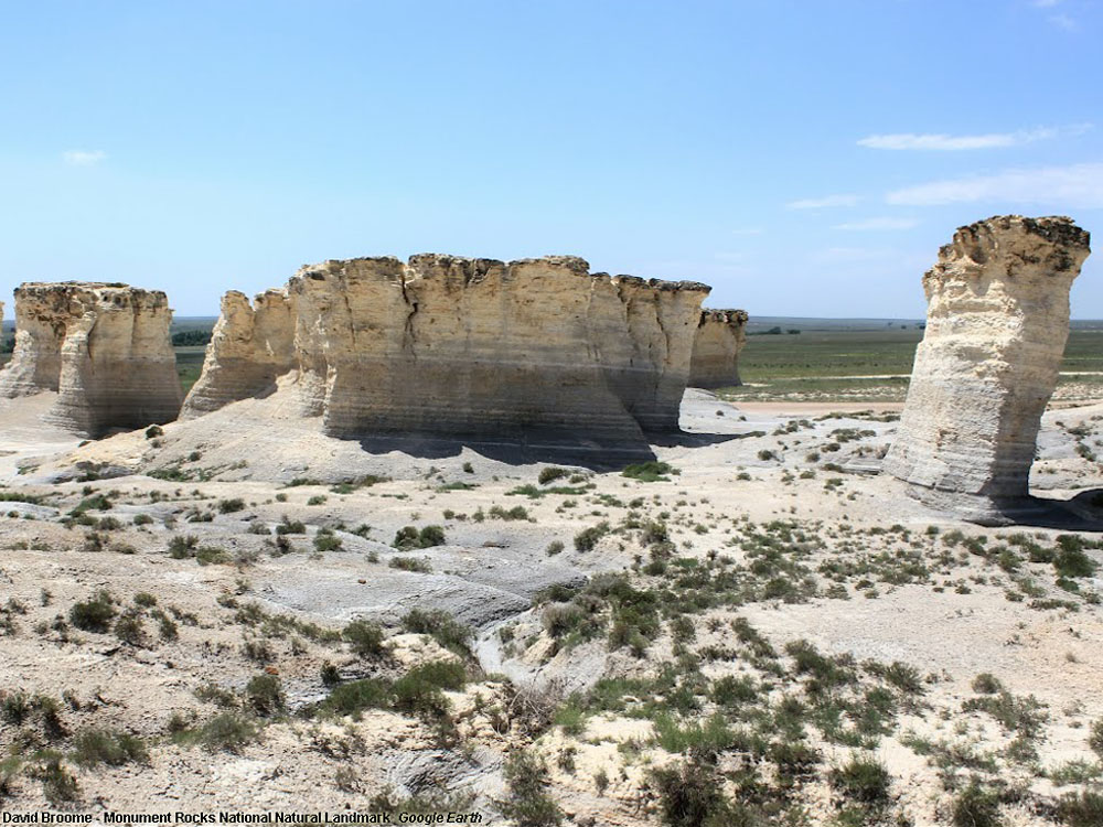
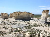
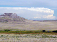
West of the Flint hills the Great Plains landscape grows increasing flat and drier. The corn-soybean agriculture transitions to range land and dry-land farming of wheat and other grains, and sunflowers (the State Flower of Kansas). In the region between Salina and Hays, Kansas, I-70 crosses a region of low rolling hills and escarpments. The Smoky Hills, Blue Hills, and Chalky Buttes each correspond to belts of Cretaceous age rock formations (originally deposited in the Western Interior Seaway)(Figure 86). Monument Rocks National Natural Landmark is an exposure of the Cretaceous-age chalk beds capped by Ogallala Formation (Figure 87).
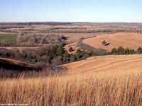
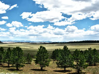
Traveling west from Salina, Kansas the landscape slowly rises—elevations: Salina (1,227 feet), Hays (2,021), Goodland (3,681 feet), and Limon, Colorado (5,377 feet). Between Limon, Colorado and the Front Range of the Rocky Mountains is the Colorado Piedmont, a region characterized by rolling grasslands, patchy pine forests, and cottonwood groves along stream valleys east of the Rocky Mountains (Figure 88).
|
| |
 |
 |
 |
 |
| |
Fig. 85. The Flint Hills of eastern Kansas is characterized by low escarpments and ridges covered with thin, cherty gravel soils. |
Fig. 86. A wind farm in the Smoky Hills region of central Kansas. Large wind turbine fields are a fast growing industry on the Great Plains. |
Fig. 87. Monument Rocks National Natural Landmark, western Kansas, are eroding remnants of Cretaceous chalk capped with Ogallala Formation. |
Fig. 88. Rolling hill country of the Colorado Piedmont near Limon, Colorado provides a view of the Colorado Front Range in the distance. |
|
Great Plains of Nebraska and Southeastern Wyoming
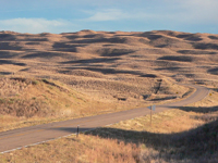
The drive west across Nebraska on Interstate 80 is perhaps even more "remarkably unremarkable" than the drive of I-70 across Kansas. The eastern part of Nebraska is mostly crop farming (corn, soybeans, etc), the western part of the state is mostly rangeland and dry-land farming (wheat and other grains). The region east of the Missouri River is glaciated terrane— rolling plains and low hills underlain by glacial till and loess deposits (loess is fine-silty dust eroded from barren lands and outwash plains south of the continental glaciers)(see Figure 83). Central and northern Nebraska is blanked with loess deposits. The Loess Plains grade westward into the Sand Hills region which, at the end of the last ice age was a dune field (Figure 89). The dunes of Sand Hills are currently stabilized by a fragile cover of grasses.
The elevation of the Great Plains along Interstate 80 steadily rises to the west across Kansas into eastern Wyoming—Omaha (1,089 feet), Lincoln (,1176 feet), Grand Island (1,860 feet), North Platte (2,802 feet), Ogallala (3,222 feet), Kimball (4,715 feet), and Laramie, Wyoming (6,063 feet). West of Kimball, Nebraska is a landscape feature called the "Gang Plank." The Gang Plank is an un-eroded portion of the Ogallala Formation that laps up onto the crest of the granite core of the Laramie Mountains in eastern Wyoming. The gentle grade of the Gang Plank allowed for only easy passage for the Transcontinental Railroad over the front range of the Rocky Mountains. Interstate 80 also crosses along the Gang Plank.
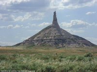
The northwestern portion of Nebraska is characterized by mesas, bluffs, and buttes eroded into older sedimentary rock formations of the White River Group (ages Eocene to Miocene). These formations are composed of alluvial plain deposit that blanketed the region after the rise of the Black Hills in South Dakota and mountain ranges farther west in Wyoming. Chimney Rock is a important landmark used by pioneer travelers along the Oregon Trail—it is part of Scotts Bluff National Monument (Figures 90 and 91). Bone beds preserved in layers of the White River Groups are also exposed in Agate Fossil Beds National Monument in northwestern Nebraska (Figure 92). |
 |
 |
 |
 |
| Fig. 89. Sand Hills of Nebraska are a large, stabilized dune field covered by grasses. The Sand Hills cover large parts the northwestern Nebraska into South Dakota. |
Fig. 90. Chimney Rock is a historic natural landmark along the Oregon Trail in Western Nebraska; it consists of Oligocene and Miocene-age sedimentary rocks. |
Fig. 91. Beds of the White River Group (Oligocene) and Arikareee Formation (Miocene) crop out at Scotts Bluff National Monument, northwest Nebraska. |
Fig. 92. Agate Fossil Beds National Monument preserves fossiliferous outcrops of the White River Formation exposed in northwestern Nebraska. |
|
| https://gotbooks.miracosta.edu/geology/regions/central_high_plains.html 1/20/2017 |

|
 |
|
|