41. Interstate-280 Road Cuts
Some of the most spectacular exposures of the traprocks occur along I-280 northwest of Newark, New Jersey. The drive west on crosses the ridges of the 1st, 2nd, and 3rd Watchung Mountains. The stratigraphic profile along 1-280 is essentially the same as along 1-80 (see Figure 88 on the Newark Basin page). The exposures along I-280 are newer and therefore easier the see (with extreme caution). Perhaps the most spectacular road cut in the Newark Basin is the cut through the massive columnar-jointed basalt, the Orange Mountain Basalt, of the 1st Watchung, just west of Orange, New Jersey (Figure 95). Unfortunately, it is both illegal and extremely dangerous to stop along the interstate. The police constantly patrol this highway, and will ticket individual violating the no stopping, standing, or parking rules along the roadway. However, these outcrops can be observed in relative safety from a side road along the interstate.
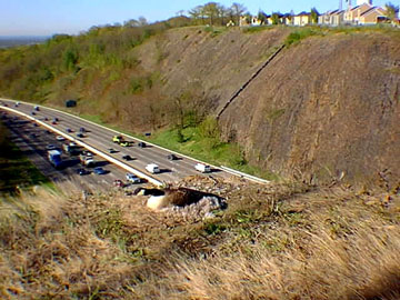 |
| Figure 95. A Canada goose sits on a nest built on the edge of a I-280 highway road cut through the columnar-jointed basalt of 1st Watchung Mountain just west of Orange, New Jersey. |
Driving westward along Interstate 280 the highway crosses the valley west of Newark, underlain by the red mudrock and sandstone of the Passaic Formation. When the highway begins to ascend the grade rising to the ridge top of the 1st Watchung (Orange Mountain) avoid all temptations to pull over or stare at the beautiful exposures along the chasm carved for the highway. Rather, at the top of the hill get off at Exit 8B. At the end of the off ramp turn right on Prospect Avenue (Route 577). Within a few hundred feet from the intersection turn right onto Eagle Ridge Drive, a small road that returns eastward along the top of the highway cut, and park at one of the pull offs on the right. Be sure to not disturb the private residents that are set back from the road on the right. Walk along the fence that runs along the top of the highway cut. A worn path follows the top of the cut to several overlooks that provide an exceptional view of the cut on the south side of the interstate.
The cliffs consist of a single massive lava flow that cooled and cracked into columnar joints. The unusual feature of this flow are the complexity of the columnar joints. In some locations, the joints tend to radiate away from a central core. These patterns were generated by an uneven cooling pattern in the flow, possibly a result of degassing structures or uneven mixing of the lava as it cooled. One area of complexity in the middle of the outcrop displays offset along a small normal fault. This fault may have formed from seismic activity that occurred about the time that the flows were still cooling. Also note the abundance of boulders (glacial erratics) scattered in the woods along the hilltop. Be extremely careful at the top of the highway cut. Freeze-thaw cycles may have loosened rocks. Stay away from cliff edges, and obey all local official rules. The area was not posted in 1998, but as everywhere, rules regarding access permission can change.
| Return to Mesozoic Basins Province. |