Seip Mound State Memorial Park, Ohio
(Hopewell Culture National Historical Park)
 |
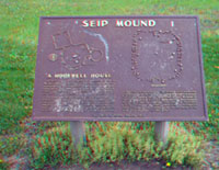
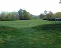
Seip Mound State Memorial Park is located in fields of the floodplain of Paint Creek, a tributary of the Scioto River and located about 25 miles east of Chillicothe, Ohio on U.S. Highway 50. Native Americans belonging to the Hopewell tradition constructed this mound sometime between 100 B.C. – A.D. 400. Seip Mound State Memorial Park is one of six noncontiguous sites that make up the Hopewell Culture National Historical Park. The other five sites in the Chillicothe area include Hopeton Earthworks, Hopewell Mound Group, High Banks Works, Spruce Hill Earthworks, and the Mound City Group. |
|
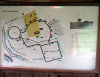
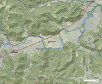
Map of Seip Mound State Memorial Park, Ohio: Click here or on the map to see a larger view. Click here to see a map of showing the five site locations of Hopewell Culture National Historical Park. |
|
| Click on any image for a larger view, or click here to start an image tour. | |