Miamisburg Mound State Memorial Park, Ohio
 |
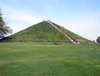
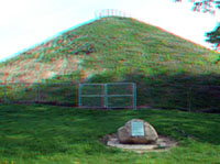
Miamisburg Mound State Memorial Park is located on bluffs along the east side of the Great Miami River valley in Miamisburg, Ohio. The Miamisburg mound is the largest Indian mound in Ohio, and the second largest in the United States. The conical mound is 68 feet tall. Historic excavations revealed that it is a burial mound, but may have served other purposes to the mound building communites of Hopewell cultural connection nearly 2000 years ago in the Ohio region. |
|
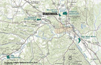
Map of Miamisburg Mound State Memorial Park: Click here or on the map to see a larger view. Click here to see a larger scale map of Ohio showing the location of Miamisburg Mound. |
|
| Click on any image for a larger view, or click here to start an image tour. | |