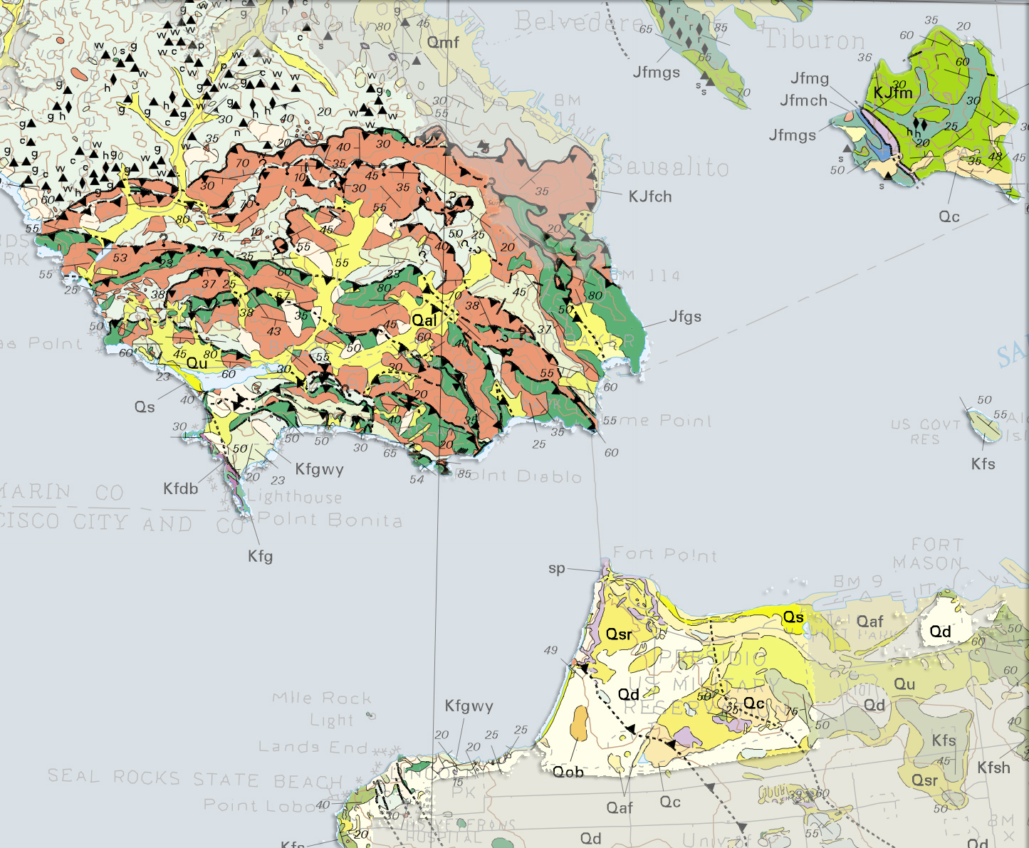
Blake, Jr., M. C., Graymer, R .W., and Jones, D .L. 2000, Geologic Map and Map Database of Parts of Marin, San Francisco, Alameda, Contra Costa, and Sonoma Counties, California. U.S. Geological Survey, Miscellaneous Field Studies Map MF 2337; http://pubs.usgs.gov/mf/2000/2337/
Qaf - artificial fill
Qal - Quaternary alluvium
Qc - Coma Formation (Quaternary)
Qd - dunes
Qmf - fill over marine march
Qob - older beach deposits
Qs - beach sand
Qsr - slope debris and ravine fill
Qu - undifferentiated surface deposits
Jfm - Franciscan complex (Jurassic) mélange
Jfmg - Franciscan complex (Jurassic) mélange, graywacke
Jfmch - Franciscan complex (Jurassic) mélange, chert
Permanente terrane
Kfdb - Franciscan complex (Cretaceous) diabase
Kfg - Franciscan complex (Cretaceous) graywacke
Alcatraz terrane
Kfs - Franciscan complex (Cretaceous) sandstone
Marin Headlands terrane
Jfgs - Franciscan complex (Jurassic) graywacke sandstone
Kfgwy - Franciscan complex (Cretaceous) graywacke
KJfch - Franciscan complex (Jurassic and Cretaceous) chert
sp - Coast Range ophiolite (includes serpentinite)