|
|
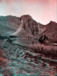 |
Click here to see a collection of historic images of Flaming Gorge and Red Canyon of the Green River taken by the Powell Expedition of 1872. Website images include both standard photograph and 3D views (as anaglyphs - requiring red-and-cyan 3D viewing glasses). This view shows the mouth of Flaming Gorge. Today Flaming Gorge Reservoir floods most of the Green River valley in this area.
|
|
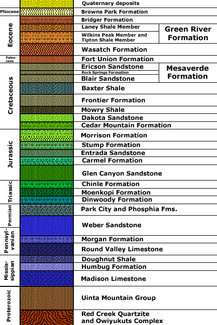
Generalized stratigraphy after: Sprinkel, D.A., 2000, Geology of Flaming
Gorge National Recreational Area, Utah-Wyoming: In Geology of Utah's
Parks and Monuments, Sprinkel, D.A., Chidsey, T. C., and Anderson,
P. B., editors, Utah Geological Association Publication 28., p. 277-299. Stratigraphic unit information is modified from the USGS GeoLex (Lexicon of Geology): http://ngmdb.usgs.gov/Geolex/geolex_qs.html. Information about the Geologic Time Scale is available at: https://gotbooks.miracosta.edu/gonp/coloradoplateau/timescale.htm. |