
 |
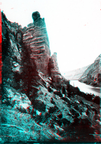 |
Click here to see a collection of historic images of Desolation Canyon, Labyrinth Canyon, and Stillwater Canyon (on the Green River) taken by the Powell Expedition of 1872. Website images include both standard photograph and 3D views (as anaglyphs - requiring red-and-cyan 3D viewing glasses). This view shows cliffs of the Wasatch Formation cropping out along the Green River in Desolation Canyon. To learn more about access to Desolation Canyon check out the Bureau of Land Management's website at: http://www.blm.gov/utah/price/riverinf.htm. |
|
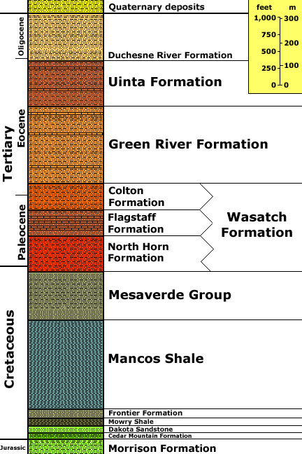
Generalized stratigraphy after Hintze, L. F., 1988, Geologic History of Utah; A Field Guide to Utah's Rocks: Brigham Young University Geology Studies Special Publication 7, p. 156 [Uinta Basin chart 41]. Stratigraphic unit information is modified from the USGS GeoLex (Lexicon of Geology): http://ngmdb.usgs.gov/Geolex/geolex_qs.html. Information about the Geologic Time Scale is available at: https://gotbooks.miracosta.edu/gonp/coloradoplateau/timescale.htm. |