| |
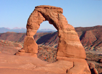 |
Click here to see a geologic image tour of Arches National Park. Website images include both standard photograph and 3D views (as anaglyphs - requiring red-and-cyan 3D viewing glasses). This image shows Delicate Arch in the Entrada Sandstone. Morrison Formation crops out in the Salt Valley Wash in the distance. To learn more about Arches National Park check out the National Park Service website at: http://www.nps.gov/arch. |
|
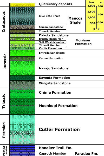
Generalized stratigraphy after Doelling, Helmut H., 2000, Geology of Arches National Park, Grand
County, Utah: In Geology of Utah's Parks and Monuments, Sprinkel,
D.A., Chidsey, T. C., and Anderson, P. B., editors, Utah Geological Association
Publication 28., p. 11-36.
Stratigraphic unit information is modified from the USGS GeoLex (Lexicon of Geology): http://ngmdb.usgs.gov/Geolex/geolex_qs.html. Information about the Geologic Time Scale is available at: https://gotbooks.miracosta.edu/gonp/coloradoplateau/timescale.htm. |