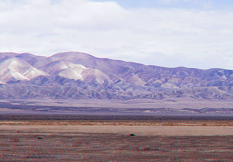
This view is looking east from Painted Rock toward the Temblor Range. The trace of the San Andreas Fault and northern Elkhorn Hills escarpment are midway across the right side of the image about halfway across the valley.
The Temblor Range and surrounding region contains extensive outcrops of the Monterey Formation (Miocene age, about 20 to 9 million years ago) (Dibblee, 1972 and 1973). Rocks from the Monterey formation consist mostly of siliceous shales and porcellanite (silica derived from fossil plankton in an intermediate to deep-water marine setting). Fossils and sediments from the Monterey Formation show that the Carrizo Plain region was a marine basin with shallow to intermediate depths (marine waters covered the southern San Joaquin Valley region). Marine sediments younger than about 9 million years are not preserved in the park area, but they occur throughout the Kettleman Hills region (about 60 miles north of the park) where the Etchegoin Formation contains marine fossils to about 4 million years old (Pliocene Epoch) (Woodring and others, 1940). Fossils of the Etchegoin Formation are supporting evidence that the Coast Ranges and the Temblor Range are young, having been uplifted mostly during the Pleistocene Epoch (or Quaternary Period) in the past couple million years. Much of that ongoing uplift is associated with tectonics associated with the San Andreas Fault and other fault systems in the region.