USGS Earth Science Photographic Archive digital file: hjk00585
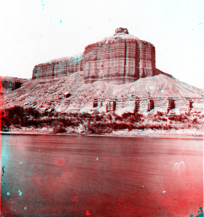
The confluence of San Rafael Creek and the Green River is about 15 miles south of the town of Green River, Utah and about 20 miles north of Canyonlands National Park. It marks the boundary between Gray Canyon (to the north) and Labyrinth Canyon (to the south which extends into the park.) Traveling downstream from Green River, Utah, the river cuts into increasingly older rock. Dellenbaugh Butte (named after Frederick Dellenbaugh, an artist-crew member from the First Expedition) consists of Jurassic sedimentary formations. Starting at river level, Quaternary and recent alluvium and aeolian deposits form a 20-foot high terrace along the river bank. Sandstone of the Entrada Formation crops out just above this lower alluvial bench. Talus covers the Curtis Formation. The even-bedded section above the talus slope is Summerville Formation. The small cap on the butte consists of sandstone of the Salt Wash Member of the lower Morrison Formation. These formations preserve evidence that coastal floodplains, mudflats, dunes, and beaches existed along the margin of a shallow seaway during Jurassic time.