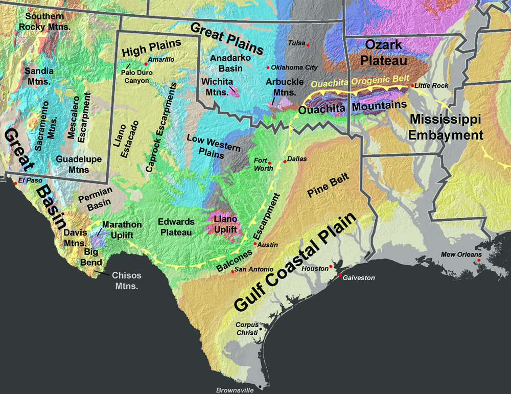
The south-central interior of the United States (between the Central Lowlands and the Coastal Plain) includes the Ozarks region of parts of Missouri, Arkansas, and northeastern Oklahoma. This region is a dominantly forested and hilly that gradually transitions to the open grasslands of the Great Plains to the west and the pinelands to the south in east Texas. A series of escarpments, plateaus, and uplifts extend across the central and west Texas between the Coastal Plain and the southern High Plains of the "panhandle" regions of Texas and Oklahoma.
The regional geologic history is influenced by the Ouachita Orogenic Belt, a regional mountain belt similar in age and origin to the Appalachian Mountains (Figure 62). The Ouachita Orogenic Belt is only physically expressed on the surface in the region in the Ouachita Mountains and the Marathon Mountains in West Texas. Elsewhere, the Ouachita Orogenic Belt is hidden, buried beneath younger sedimentary cover of the Mississippi Embayments, the Gulf Coastal Plain, and plains of Central and West Texas. Two other mountain regions include the Arbuckle Mountains and Wichita Mountains of southern and western Oklahoma.
|
 |