
Regional Geology of North America |
Ozark Plateau Province |
Click on images for a |
|
The Ozark Plateau Province is encompasses portions of Missouri, Arkansas, and eastern Oklahoma. The Ozarks region is characterized by erosionally dissected plateaus with steep valley walls and narrow river bottoms. The region is mostly covered with shrub-oak forests. The Ozarks is subdivided into four general regions based on elevations and bedrock characteristics (Figure 63).
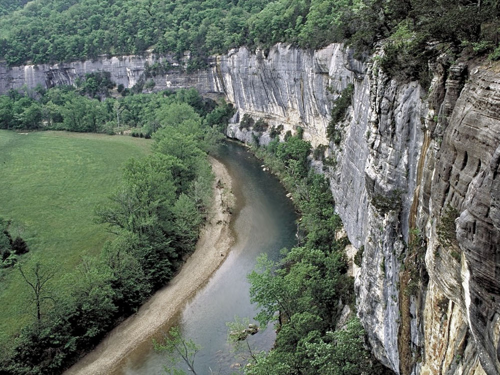
The St. Francis Mountains of Missouri is a region where crystalline basement rocks are locally exposed through the sedimentary cover of the greater Mid continent region. These rocks are Precambrian age (about 1.5 billion years) and consist of a mix of granitic and metamorphic rocks. The St. Francis Mountains are within the large Ozark Plateau region. All the other rocks in the Ozarks region are sedimentary formations of Ordovician to Pennsylvanian in age. The sedimentary rock layers dip very gradually to the south and thicken towards the Ouachita Mountains to the south. The Salem Plateau region extends south of the St. Francis Mountains into northern Arkansas. Sedimentary rocks of marine origin make up the bedrock of the Salem Plateau, consisting mostly of Ordovician-age dolostone, with some limestone and sandstone. The Salem Plateau region ranges from about 800 to 1,400 feet in elevation. The Springfield Plateau region of rolling hill country that exists where a belt of Mississippian-age limestone (the Boone Formation) crops out across northern Arkansas. The Boone Formation contains nodular chert beds and the limestone is host to karst erosional characteristics, having caves, caverns, and sinkholes. Highest portions of the plateau region reach about 1,800 feet in elevation. The Buffalo National River is a scenic preserve in the region (Figure 64). The Boston Mountains Plateau region have surficial rocks of Early Pennsylvanian age, composed mostly of sandstones and shales. The highest parts of the erosionally-dissected plateau has elevations in the range of 2,200 to 2,500 feet. |
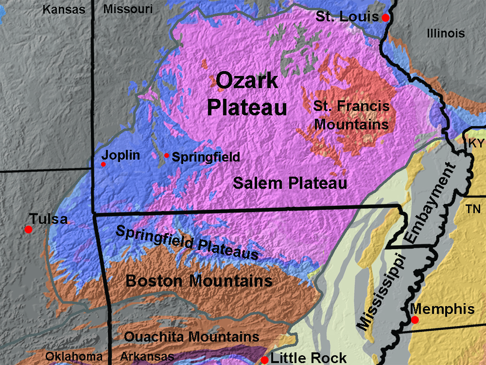 Fig. 63. Geologic map of the Ozarks Plateau Province of Missouri, Arkansas, and eastern Oklahoma. Fig. 63. Geologic map of the Ozarks Plateau Province of Missouri, Arkansas, and eastern Oklahoma. |
 |
|
| Fig. 64. Limestone cliffs along the Buffalo River in Arkansas, a national scenic river, illustrated the character of the erosion incised Ozark Plateau. |
| https://gotbooks.miracosta.edu/geology/regions/ozark_plateau.html 1/20/2017 |