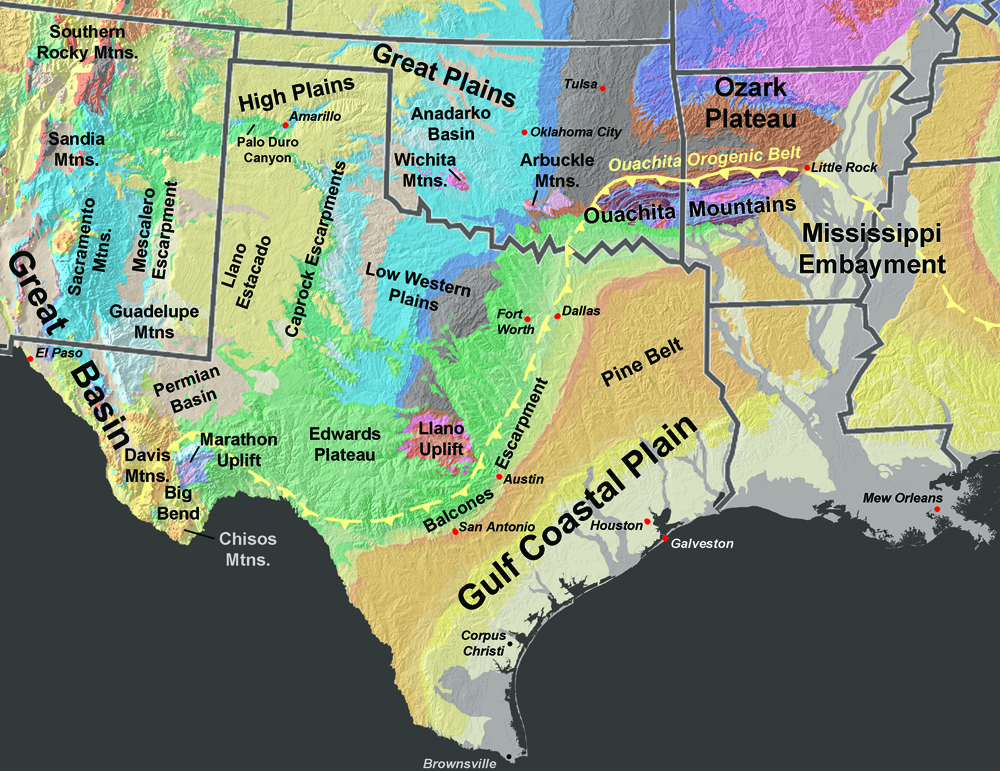
Ouachita Mountains Province
The Ouachita Mountains are a mountain range that runs generally east to west across southwestern Arkansas into southeastern Oklahoma (Figures 62 and 63). The Ouachita Mountain consist of a belt of folded and thrust-faulted sedimentary rocks ranging in Ordovician to Pennsylvanian age, similar in age and character to the Valley and Ridge Province region. The Ouachita Mountains are only an small portion of the greater Ouachita Orogenic Belt, a region geologically similar in age and origin of the Southern Appalachians. Most of rocks of the Ouachita Orogenic Belt are covered by younger sediments of the Mississippi Embayment, the Gulf Coastal Plain, and Great Plains regions of Central and West Texas (see Figure 62).
Current thought is that the Ouachita Orogenic Belt started forming about 300 million years ago (Pennsylvanian time) when the North American and South American continental plates collided as all the continents gradually assembled together to form the supercontinent Pangaea. Sedimentary deposits from an ancestral ocean basin in the Gulf region were thrust northward and upward onto the southern margin of the southern North American continental margin. At one time, the Ouachita Mountains possible rivaled the current elevations of the Rocky Mountains. The ancient mountains shed large quantities of sediments that filled basins and covered lowlands across the Great Plains region. Today, the highest peak in the Ouachita Mountains is Mt. Magazine in Arkansas, elevation 2,753 feet.
Bedrock of the Ouachita Mountains are notably unique in that they do not preserve evidence of igneous intrusions, volcanism, or regional metamorphism. Sedimentary rocks in the Ouachita Mountains range from Cambrian to Pennsylvanian age, mostly marine shales, sandstone, and chert. The region is famous for very hard, fine-grained, siliceous sedimentary rock called novaculite (the State Rock of Arkansas)(Figure 67). Novaculite was used as whetstones for sharpening tools, and was used extensively by prehistoric indians for arrowheads, spear points, and tools.
Arbuckle Mountains (Oklahoma)
The Arbuckle Mountains are ancient mountain range located in south-central Oklahoma. The Arbuckle Mountains also formed about the same time as the Ouachita Orogeny, but along a failed structural rift separate from, and perpendicular to, the orogenic belt (called the Southern Oklahoma Aulacogen). In addition, the Arbuckle are composed of rocks that are both older and different composition. The exposed rocks are composed of granite of Precambrian age (about 1.4 billion years). These are overlain by Cambrian-age volcanic rocks and are flanked by early Paleozoic sedimentary rock formations that were structural deformed uplifted to near vertical orientation. These rocks are, in turn, overlain by younger conglomeratic sediments of Pennsylvanian and Permian age that rest unconformably on the older deformed rocks. The highest peak in the Arbuckle Mountains is 1,412 feet.
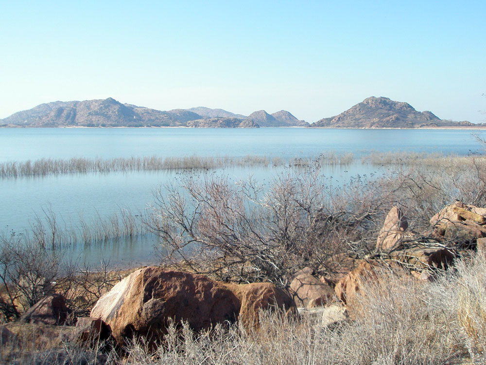
Wichita Mountains (Oklahoma)
The Wichita Mountains are another small mountain range located in southwestern Oklahoma (Figure 68). The Wichita Mountains also formed about the same time as the Arbuckle Mountains and along the same east-to-west structural trend. Rocks exposed in the Wichita Mountains consist of 540 million year old granite which were exposed to weathering and erosion in Permian time. The granitic peaks rise as much as 1,000 feet above the surrounding rolling grasslands.
|


