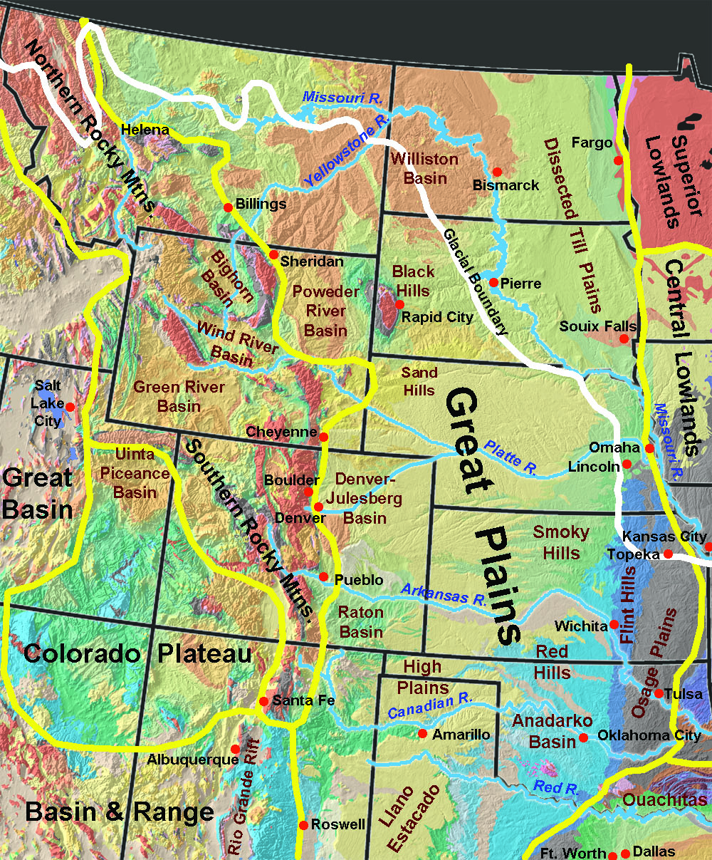
| The Great Plains is the largest province in North America, extending from the Northwest Territory in Canada southward to the Texas-Mexico border, and from the Mississippi River Valley to the Front Ranges of the Rocky Mountains (Figure 70). The Great Plains is a “steppe” region, highlighted as tall-grass prairies and corn-belt agriculture in the east to more arid short-grass prairies and open-range lands to the west. The region is characterized by flat lands to low rolling hill country. The Great Plains have a dry continental climate with abundant sunshine, frequent winds, and moderate precipitation. Average annual precipitation ranges from 33 inches in the east to 12 inches in the west. The eastern side of the plains are transitional to shrub-oak dominated forests. Cottonwood and willow riparian forests dominate river valleys draining eastward across the region from the Rocky Mountains.
A drive westward across the Great Plains illustrates the subtle changing character of the Great Plains. To the east, Missouri River flood plain near Kansas City, Missouri is about 700 feet in elevation. 600 miles to the west, elevations range from 5,000 to 6,000 feet along the Front Range near Denver, Colorado (“Mile High” City). The region is a very gentle incline, shaped by the geologic history of the region.
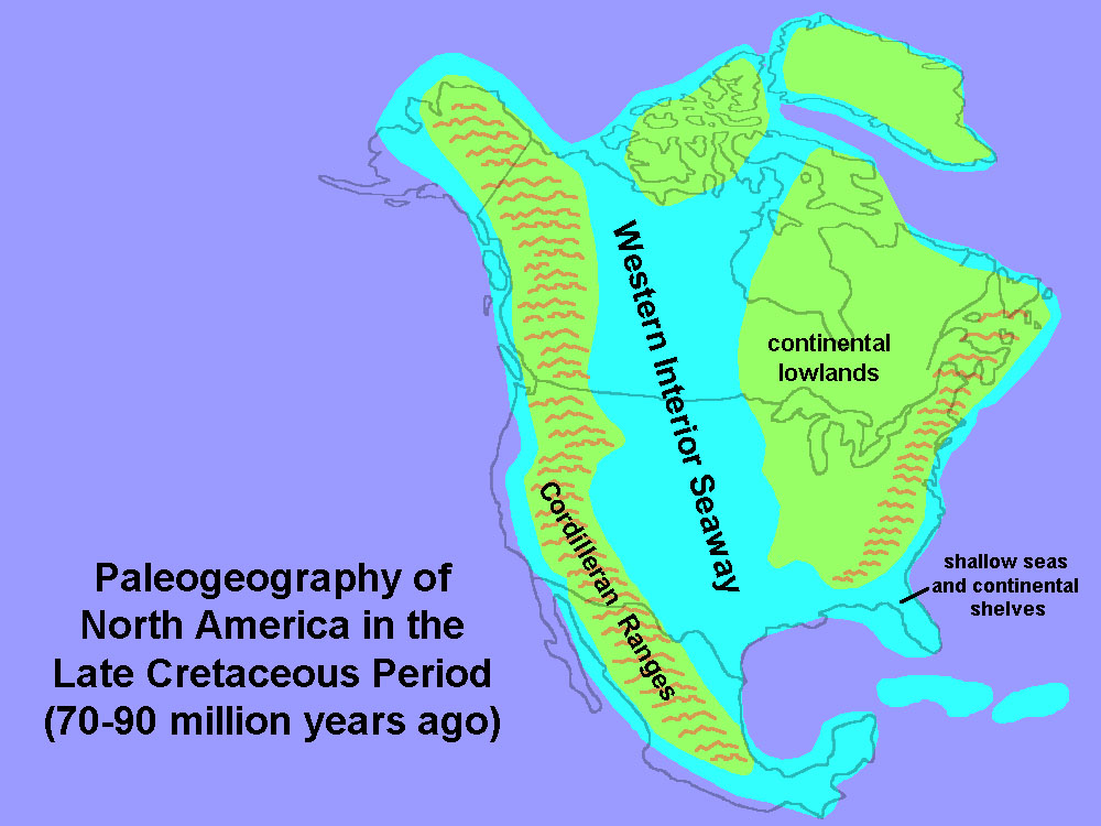
During the Late Cretaceous time, the entire Great Plains region was covered by the Western Interior Seaway (Figure 71). As the Rocky Mountain began to rise and shed sediments, the shallow seaway gradually transitioned to coastal swamplands and lowland plains. Sedimentary rocks of Late Cretaceous age (mostly shale, limestone, and sandstone) underlie the Great Plains and their outcrop belts roughly define the boundaries of the Great Plains. With time, both the Rocky Mountains and western plains region began to rise, and river systems draining from the Rocky Mountains accumulated a great, coalescing series of alluvial fans that eventually spread across the entire region by Miocene time. The ancient alluvial plain deposits are preserved as the Ogallala Formation (Miocene age), the principal groundwater aquifer underlying a large part of the western Great Plains region (Figure 72). Since Miocene time, the region has continued to steadily rise, and rivers have began to slowly incise into their valleys, producing a series of low plateaus and escarpments across the region.
The continental glaciers covered a large portion of the northern Great Plains region during the Quaternary Period. In the United States, most of North Dakota, eastern South Dakota, and portions of Montana and Kansas were covered intermittently with ice sheets (see Figure 70). South of the ice sheet were outwash plains which released silt and dust to the wind. Large portions of the Great Plains and Midwestern states were blanketed with loess (glacial dust deposits), and some grew into great dune fields covering large regions that are now covered with prairie grasses (example, the Sand Hills region of western Nebraska).
|