Geology banner

Field Trip to the Calaveras Fault in Coyote-Harvey Bear County Park

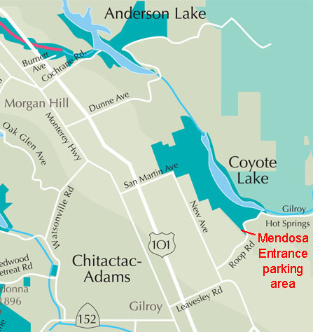
Field-trip overview: This field trip is to examine the landscape and geology along the Calaveras Fault in the vicinity of Coyote-Harvey Bear County Park in the foothills of the western Diablo Range near Gilroy, California. This trip involves about a 2.5 mile starting at the Mendoza Entrance parking area. The hike is a moderately easy loop walk along the valley along the Calaveras Fault and around the hilltop—the southern end of Coyote Ridge. The hike provides opportunity to examine volcanic rocks formed about 2-3 million years ago that erupted and flowed along the ancestral valley of the Calaveras fault.

Directions: To get to Stop 1, take the Leavesley Exit off of highway 101 east 2 miles, turn left (north) on New Avenue.

Proceed 0.5 mile and turn right (east) on Roop Road.

Follow Roop Road 3 miles into the foothills and turn left into the Mendoza Entrance Parking area. Parking at this site is free.
Map to Coyote-Harvey Bear County Park
Coyote-Harvey Bear County Park map  
Map showing the location of the Mendoza Entrance parking area near Gilroy
Geologic map of the Santa Clara Valley region near Morgan Hill and Gilroy 
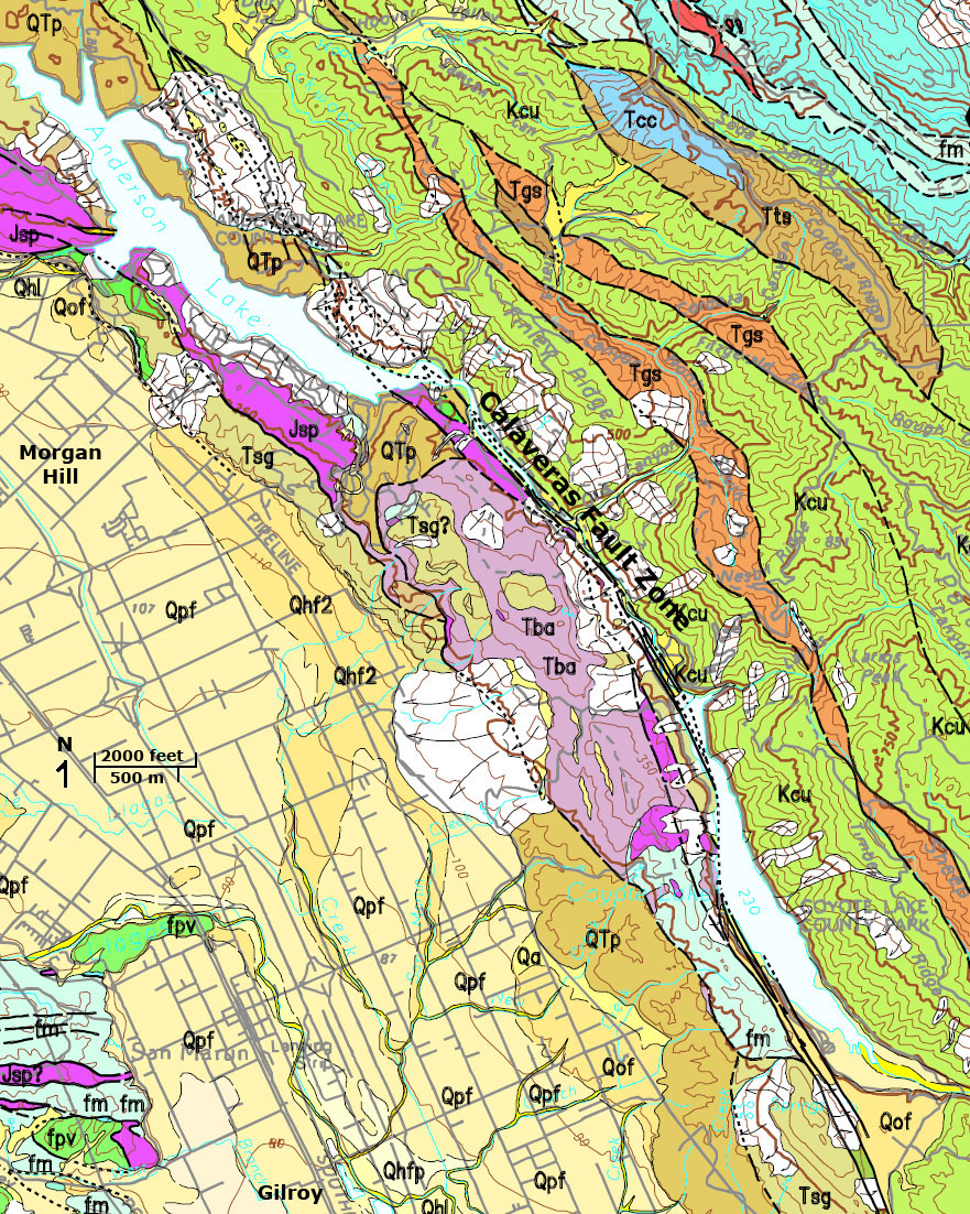
Geologic map of the Calaveras Fault in the Diablo Range and Santa Clara Valley in the vicinity of Morgan Hill and Gilroy, California (U.S. Geological Survey2)
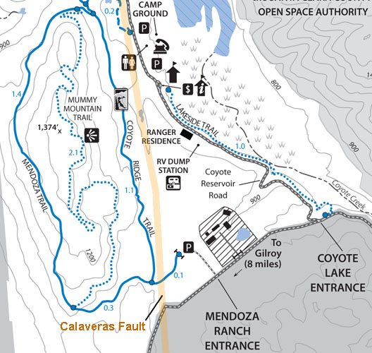
Map showing the route of the Coyote Ridge and Mendoza loop trail route Click on small images for a larger view.
 

Geologic Setting: The Mendoza Trailhead provides access to a landscape evolving along the trace of the Calaveras Fault in the western foothills of the Diablo Range. Because the landscape has not been modified by human activity, it still preserves many of the natural landscape features associated with active strike-slip fault zones. The Calaveras Fault in the vicinity of the Mendoza Trailhead is one of the fastest aseismic creeping fault sections in the San Francisco Bay area.1

Rocks east of the Calaveras Fault near Coyote Reservoir consist of ancient oceanic crust and marine sediments that formed or accumulated in the Pacific Ocean basin during the late Mesozoic (Cretaceous Period) and early Tertiary Period (Paleocene and Eocene Epochs). Rocks on the west side of the Calaveras Fault are youngerbasalt lava flows and extrusive volcanic rocks of Pliocene age interbedded with river gravel deposits that accumulated in an ancestral valley. These volcanic rocks and sedimentary rocks have has uplifted and exposed in Coyote Ridgea shutter ridge along the east side of the valley associated with the modern Calaveras Fault.

Coyote Ridge and Mendoza Loop Trail Geology Walk: The Mendoza Parking Area is located on a rolling plateau-like surface within the greater valley between the highlands of the Diablo Range to the east (around Henry Coe State Park) and the linear Coyote Ridge to the west. Walk past the gate and follow the trail west into the active rift valley of the Calaveras Fault. There are few rock exposures in the grassy uplands, but boulders and cobbles exposed in the fields represent the bedrock below the soil. Note that physical outcrops of these rocks are exposed in construction cuts near Coyote Dam.

Walk east 0.1 mile to the intersection of the Coyote Ridge and Mendoza trails. This short section of trail crosses the Calaveras Fault. Follow the Coyote Ridge Trail to the right. The trace of the Calaveras Fault becomes obvious as a linear track or ravine that runs north-south on the downhill (east) side of the Coyote Ridge Trail. In wet months, depressions form by movement of the fault are filled with water, highlighting the trace of the fault zone.

The walk north along the Coyote Ridge trail is a steady climb to the ridgeline. Along the trail are numerous outcrops and boulder fields consisting of volcanic rock, mostly frothy lava of basalt composition or agglomerate made up of volcanic tuff breccia. Among the blocky volcanic rocks are rounded boulders of rocks carried my ancestral streams that flowed across the area before uplift of Coyote Ridge. Along the way note the outcrops of volcanic rocks amongst the forest along the ridgeline. Also note that there are many sag areas (they fill with water during the wet season) that are either associated with large slumps and landsides or splay faults associated with the larger fault system.

A mile north of the trail intersection is another intersection of the Coyote Ridge and Mendoza Trails. If temperature and trail conditions are good, consider walking back via the Mendoza Trail. The Mendoza Trail provides exceptional views of the Santa Clara Valley between Morgan Hill and Gilroy. Additional outcrops of volcanic rocks and alluvial gravels are exposed along the Mendoza Trail. The total loop walk is about 2.5 miles.

Sag pond along the Calaveras Fault
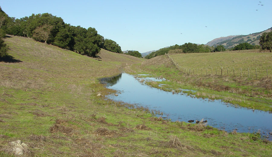
Sag pond along the trace of the Calaveras Fault
Coyote Ridge with view of Coyote Lake
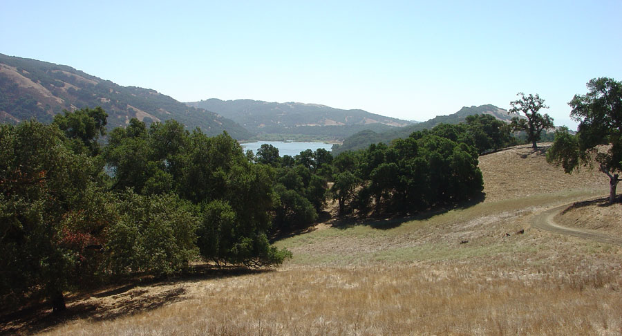
View of Coyote Reservoir from Coyote Ridge
El Toro Peak above Morgan Hill
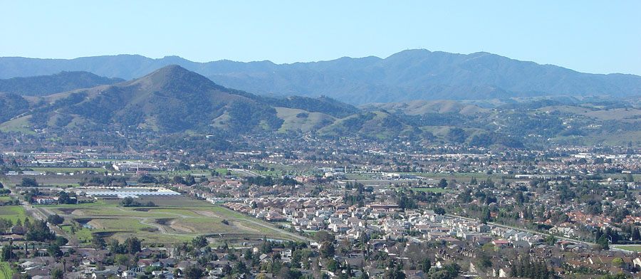
View of Morgan Hill from Coyote Ridge.
 
 
Santa Clara County Parks information
http://www.parkhere.org/portal/site/parks

Park Trails Hotline: (408) 355-2200, press 7, then press 2 for trail closure information.
For general open/close information, please call (408) 225-2147.

1Forrest McFarland, pers. comm, 2010, member of a USGS/SFSU regional fault creep measurement team.

2Wentworth, C.M., Blake, M.C., Jr., McLaughlin, R.J., and Graymer, R.W., 1998, Preliminary Geologic Map of the San Jose 30 X 60 Minute Quadrangle, California: A Digital Database: U.S. Geological Survey Open-File Report 98-795, map and technical report are available online at: http://pubs.usgs.gov/of/1998/of98-795/

Bryant, W.A., and Cluett, S.E., compilers, 1999, Fault number 54c, Calaveras fault zone,Calaveras section, in Quaternary fault and fold database of the United States: U.S. Geological Survey website, http://earthquakes.usgs.gov/regional/qfaults, accessed 09/07/2012 12:51 PM.
https://gotbooks.miracosta.edu/fieldtrips/Central_Coast/coyote_mendoza.html
9/5/2012