 |
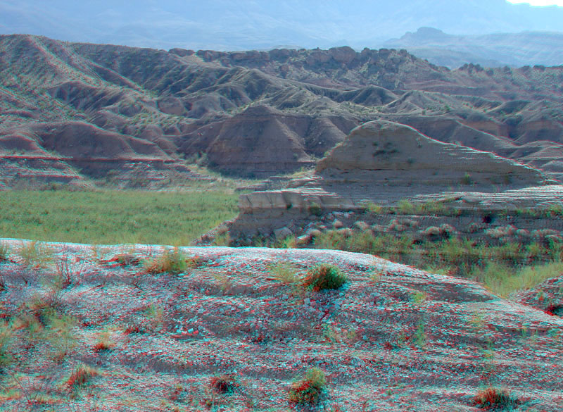
This view shows the Muddy Creek Formation exposed in badlands around the end of Pierce Ferry Road. The white ridge in the foreground and on the low bluff to the center right of the image is a volcanic ash bed within the "Rocks of the Grand Wash Trough" (alluvial sediments that a low area in a structural basin that formed along the eastern side of the Grand Wash Cliffs in Late Miocene to Pliocene time). The alluvial deposits predate the formation of the modern Colorado River passage through the Grand Canyon. (Bohannan, 1984; Faulds and others, 2008). |