|
|
|
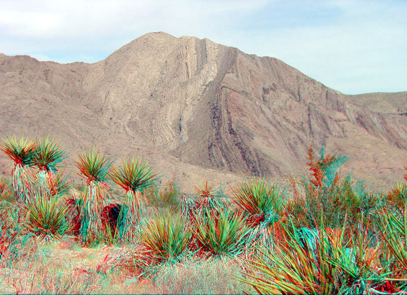
This zoomed-in view is looking northwest toward Wheeler Ridge from along the Pierce Ferry Road (about 1 mile east along the unpaved section east of the intersection with the South Cover access road). Very steeply dipping strata of Paleozoic age crops out on the mountainside north of the road. Mojave yucca (Yucca schidigera) are in the foreground (USDA, [2010f]. |
|
The URL is: https://gotbooks.miracosta.edu/gonp/lame/html/lame4082.htm Last modified: 9/22/2010 |