 |
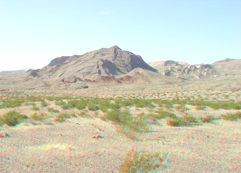
This view is looking west from along the Northshore Road near milepost 17. The mountain in the distance is a great anticlinal fold broken by faults on its west side. More erosionally resistant sedimentary rocks of late Paleozoic age make up the core of the mountain whereas younger, softer sedimentary strata of the Horse Spring Formation crop out around the flanks of the structure. Creosote bush dominates the landscape along Callville Wash are in the foreground. This mountainous ridge is located in the southeastern end of the Gale Hills (Tingley and others, 2001; Beard and others, 2007). |